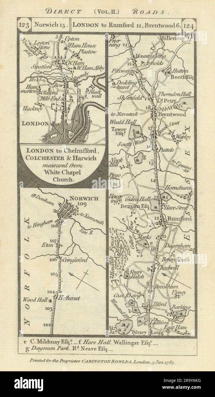
Norwich. West Ham-Romford-Brentwood-Billericay road strip map PATERSON 1785
RFID:Image ID:2R9Y6KG
Image details
Contributor:
Antiqua Print Gallery / Alamy Stock PhotoImage ID:
2R9Y6KGFile size:
29.7 MB (1.6 MB Compressed download)Releases:
Model - no | Property - noDo I need a release?Dimensions:
2451 x 4231 px | 20.8 x 35.8 cm | 8.2 x 14.1 inches | 300dpiDate taken:
1785Location:
EssexMore information:
This image could have imperfections as it’s either historical or reportage.
[London to Newmarket, Thetford & Norwich, measured from White Chapel Church] : Norwich // London to Chelmsford Colchester & Harwich measured from White Chapel Church : London - West Ham - Leytonstone - Ilford - Romford - Brentwood - Billericay. Essex. Artist/engraver/cartographer: Daniel Paterson. Provenance: "Paterson's British Itinerary"; By Daniel Paterson, Esq., Printed and sold for by Proprietor, Carington Bowles, 69 St. Paul's Churchyard, London. Type: Antique copperplate road strip map.