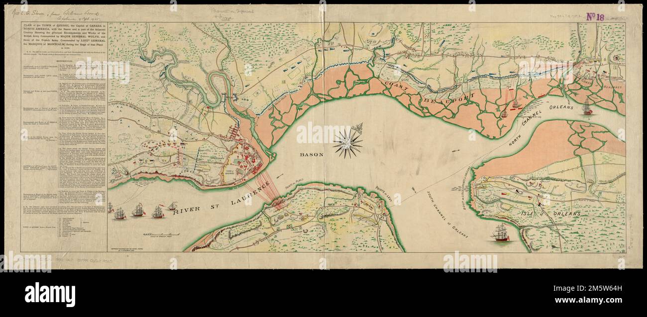
Plan of the town of Quebec, the capital of Canada in North America, with the Bason and a part of the adjacent country shewing the principal encampments and works of the British army commanded by Major General Wolfe, and those of the French army commanded by Lieut General the Marquis of Montcalm, during the siege of that place in 1759. Map from: The fight for Canada / William Charles Henry Wood, 1904. Shows ships, works and encampments. Oriented with north towards the upper right. Relief shown by hachures. Includes references.... , Canada , Quebec ,province , Québec
RMID:Image ID:2M5W64H
Image details
Contributor:
LM/BT / Alamy Stock PhotoImage ID:
2M5W64HFile size:
102.3 MB (4.9 MB Compressed download)Releases:
Model - no | Property - noDo I need a release?Dimensions:
9203 x 3885 px | 77.9 x 32.9 cm | 30.7 x 13 inches | 300dpiMore information:
This image is a public domain image, which means either that copyright has expired in the image or the copyright holder has waived their copyright. Alamy charges you a fee for access to the high resolution copy of the image.
This image could have imperfections as it’s either historical or reportage.