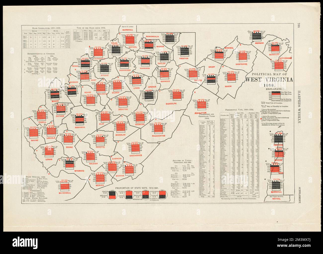
Political map of West Virginia 1888 , Voting, West Virginia, Maps Norman B. Leventhal Map Center Collection
RMID:Image ID:2M3MX7J
Image details
Contributor:
piemags/DCM / Alamy Stock PhotoImage ID:
2M3MX7JFile size:
41.2 MB (1.8 MB Compressed download)Releases:
Model - no | Property - noDo I need a release?Dimensions:
4480 x 3213 px | 37.9 x 27.2 cm | 14.9 x 10.7 inches | 300dpiMore information:
This image is a public domain image, which means either that copyright has expired in the image or the copyright holder has waived their copyright. Alamy charges you a fee for access to the high resolution copy of the image.
This image could have imperfections as it’s either historical or reportage.