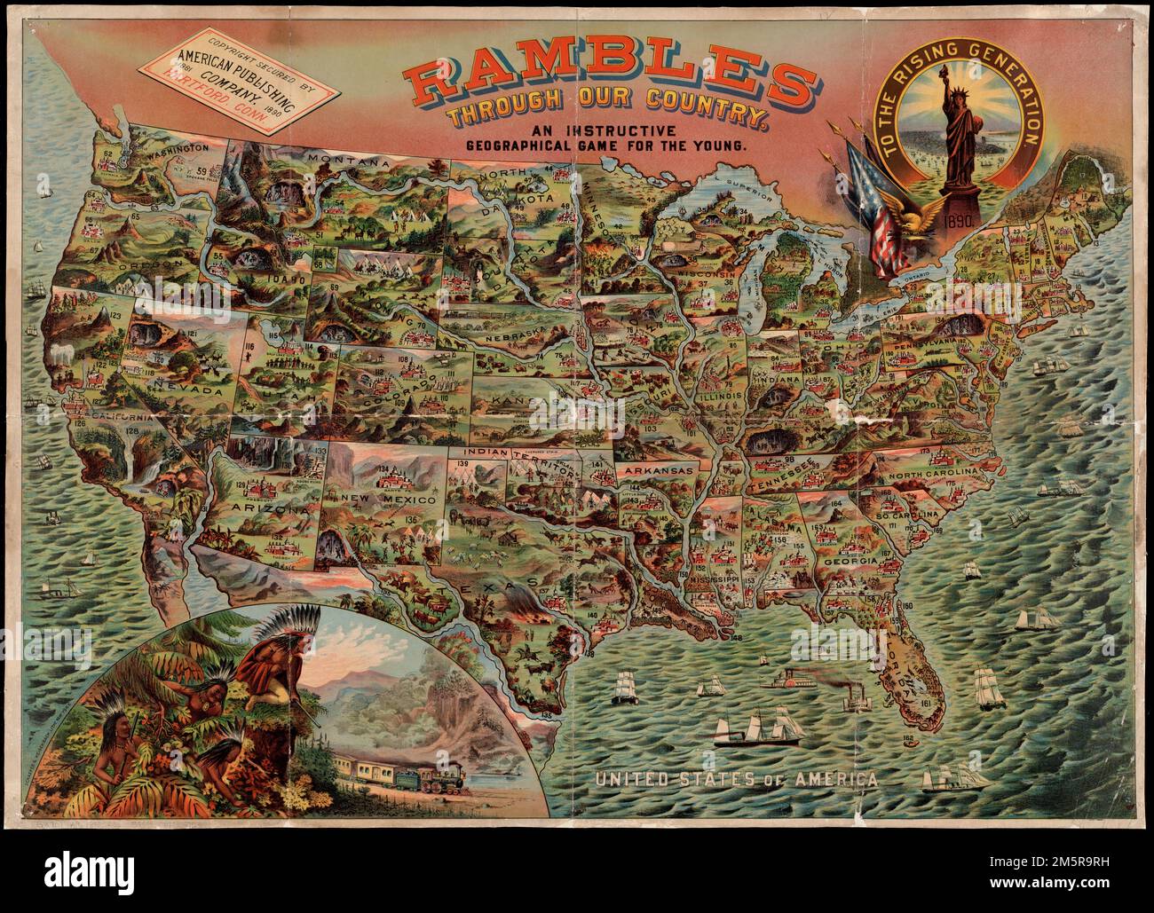
Rambles through our country : an instructive geographical game for the young. Pictorial map to be used as a game board. To accompany booklet with same title. Boston Public Library holds map only.. Educational games were a popular way of teaching geography, map reading and history to children in the 19th century. Displayed here is an example from 1890, in which players had to complete a "grand tour" across a colorful and detailed map of the United States. Play began in Hartford, Connecticut, where the game was published, and finished in New York City. There are 200 stops on the tour. Each playe
Image details
Contributor:
LM/BT / Alamy Stock PhotoImage ID:
2M5R9RHFile size:
236.9 MB (17.6 MB Compressed download)Releases:
Model - no | Property - noDo I need a release?Dimensions:
10702 x 7736 px | 90.6 x 65.5 cm | 35.7 x 25.8 inches | 300dpiMore information:
This image is a public domain image, which means either that copyright has expired in the image or the copyright holder has waived their copyright. Alamy charges you a fee for access to the high resolution copy of the image.
This image could have imperfections as it’s either historical or reportage.
Rambles through our country : an instructive geographical game for the young. Pictorial map to be used as a game board. To accompany booklet with same title. Boston Public Library holds map only.. Educational games were a popular way of teaching geography, map reading and history to children in the 19th century. Displayed here is an example from 1890, in which players had to complete a "grand tour" across a colorful and detailed map of the United States. Play began in Hartford, Connecticut, where the game was published, and finished in New York City. There are 200 stops on the tour. Each player spun a numbered wheel in order to advance. At each stop, the player read aloud a description of that location from a corresponding booklet... , United States