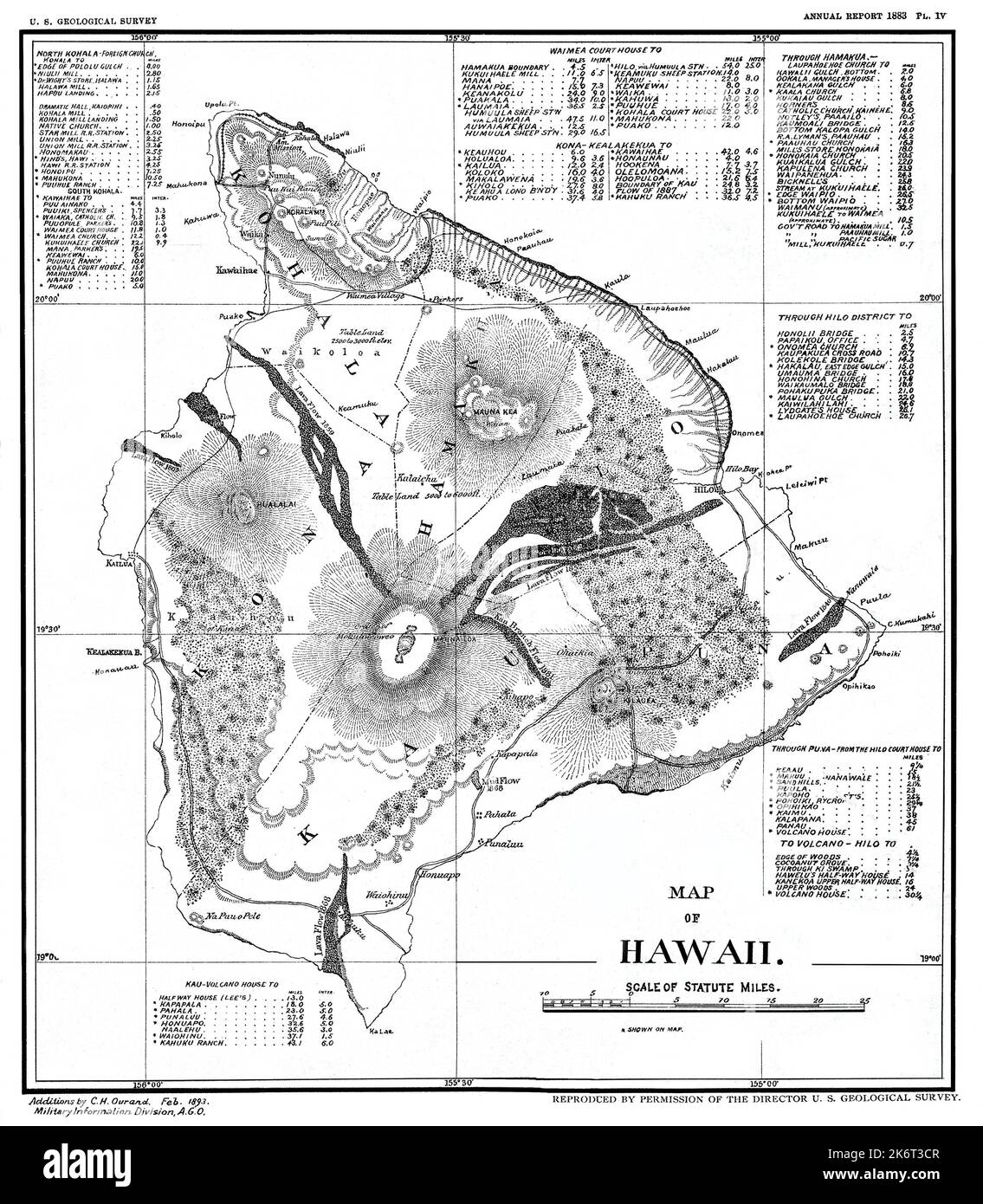
Restored reproduction of map of the island of Hawaii for 1893 U. S. Geological Survey. Shows lava flows between 1803 -1882. Includes several distance tables.
Image details
Contributor:
Phil Cardamone / Alamy Stock PhotoImage ID:
2K6T3CRFile size:
29.5 MB (2.1 MB Compressed download)Releases:
Model - no | Property - noDo I need a release?Dimensions:
3000 x 3435 px | 25.4 x 29.1 cm | 10 x 11.5 inches | 300dpiDate taken:
10 October 2018More information:
This image is a public domain image, which means either that copyright has expired in the image or the copyright holder has waived their copyright. Alamy charges you a fee for access to the high resolution copy of the image.
This image could have imperfections as it’s either historical or reportage.
I have selected interesting, old 19th and early 20th century graphic images for digital restoration and editing. The images were then adjusted and brightened to make the images suitable for display and other purposes. The resulting image brings out many details and landmarks, making this map a great historical reference and conversation piece. © 2022 for this restored reproduction