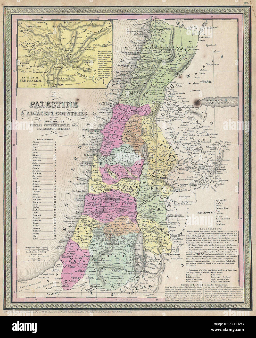
1853, Mitchell Map of Palestine, Israel and the Holy Land
RMID:Image ID:KCDHW3
Image details
Contributor:
Penta Springs Limited / Alamy Stock PhotoImage ID:
KCDHW3File size:
66.4 MB (8.6 MB Compressed download)Releases:
Model - no | Property - noDo I need a release?Dimensions:
4340 x 5347 px | 36.7 x 45.3 cm | 14.5 x 17.8 inches | 300dpiDate taken:
27 January 2017Photographer:
ArtokoloroMore information:
This image could have imperfections as it’s either historical or reportage.
1853, Mitchell Map of Palestine, Israel and the Holy Land