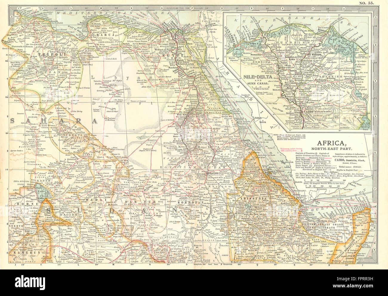
AFRICA:Egypt Ethiopia Sudan Nile Delta.w/ 18/19C battlefields/dates, 1903 map
RFID:Image ID:FPRR3H
Image details
Contributor:
Antiqua Print Gallery / Alamy Stock PhotoImage ID:
FPRR3HFile size:
44.1 MB (5.4 MB Compressed download)Releases:
Model - no | Property - noDo I need a release?Dimensions:
4707 x 3273 px | 39.9 x 27.7 cm | 15.7 x 10.9 inches | 300dpiDate taken:
1903Location:
AfricaMore information:
This image could have imperfections as it’s either historical or reportage.
'Africa, North-Eastern part: Abyssinia, Egypt, British Somali Coast Protectorate, Tripoli; Inset map of Nile-Delta and Suez Canal (inset)'. Artist/engraver/cartographer: Unsigned. Provenance: "Encyclopaedia Britannica" 10th edition Maps; published by Adam & Charles. Black, Edinburgh, London. Type: Colour antique lithographic map. The sites of important battles and their dates are marked on this map for the following conflicts: First Barbary War, Anglo-Egyptian War, French Revolutionary War, Napoleonic Wars, Mahdist Wars, Siege of Khartoum, Italo-Ethiopian War