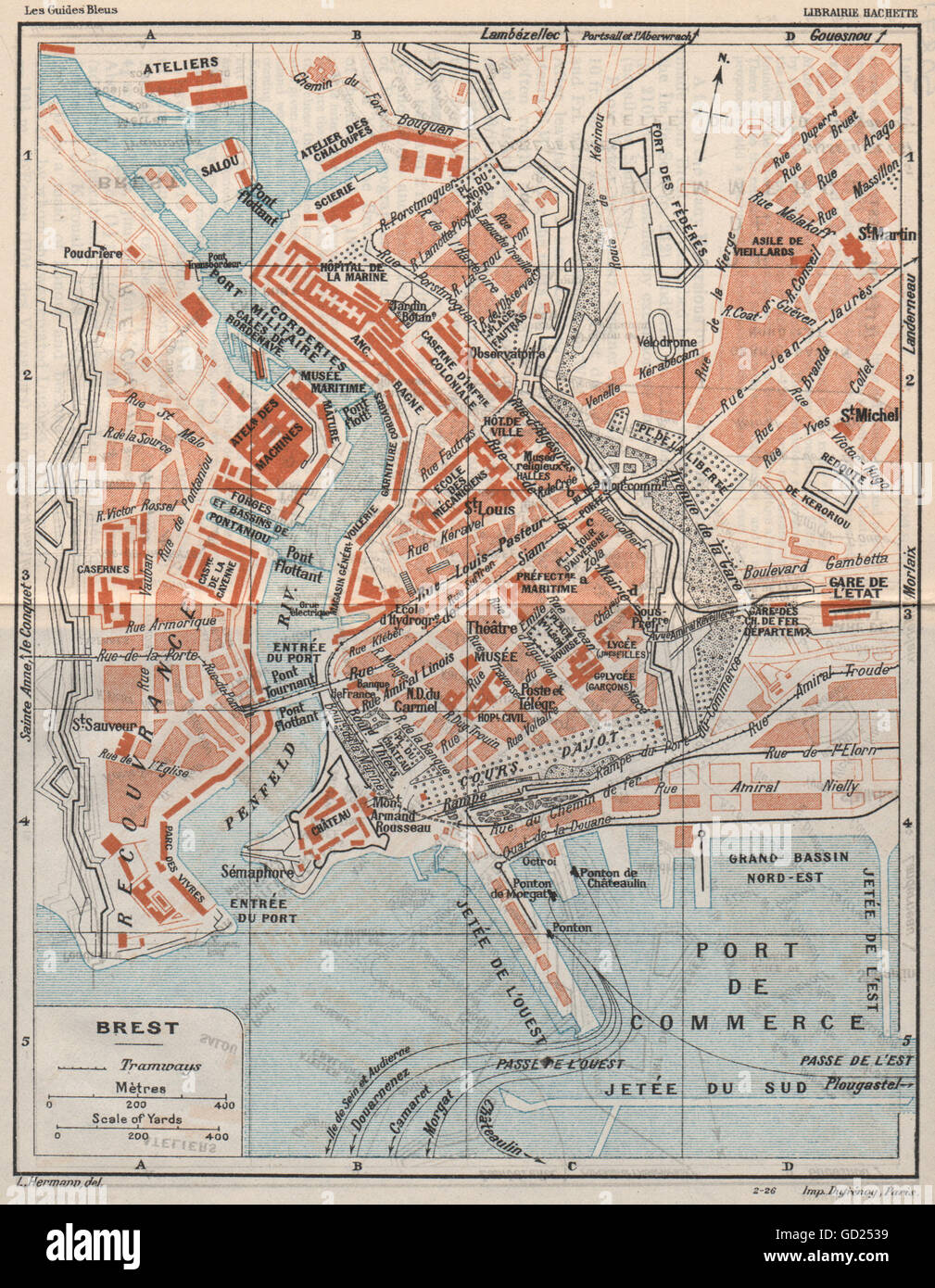
BREST. Vintage town city map plan. Finistère, 1926
RFID:Image ID:GD2539
Image details
Contributor:
Antiqua Print Gallery / Alamy Stock PhotoImage ID:
GD2539File size:
11.2 MB (1.1 MB Compressed download)Releases:
Model - no | Property - noDo I need a release?Dimensions:
1745 x 2247 px | 29.5 x 38 cm | 11.6 x 15 inches | 150dpiDate taken:
1926Location:
FinistèreMore information:
This image could have imperfections as it’s either historical or reportage.
'Brest'. Artist/engraver/cartographer: L. Hermann, Delt. Provenance: "The Blue Guides Muirhead's North-Western France"; Edited by Findlay Muirhead and Marcel Monmarché, Published by Macmillan & Co. Ltd., London. Type: Vintage colour map.