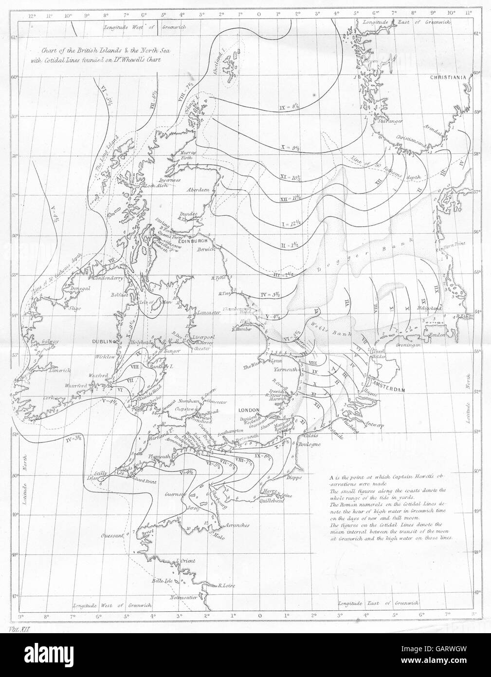
BRITISH ISLES:Tides.Cotidal lines.North Sea.English Channel.Whewell, 1880 map
RFID:Image ID:GARWGW
Image details
Contributor:
Antiqua Print Gallery / Alamy Stock PhotoImage ID:
GARWGWFile size:
19 MB (864.8 KB Compressed download)Releases:
Model - no | Property - noDo I need a release?Dimensions:
2274 x 2928 px | 19.3 x 24.8 cm | 7.6 x 9.8 inches | 300dpiDate taken:
1880Location:
UKMore information:
This image could have imperfections as it’s either historical or reportage.
'Tides. Chart of the British islands & the North Sea wirh Cotidal lines founded on Dr Whewell's chart'. Artist/engraver/cartographer: Unsigned. Provenance: "The National Encyclopaedia : A Dictionary of Universal Knowledge"; by writers of Eminence in Literature, Published by William Mackenzie, London. Type: Antique engraved map.