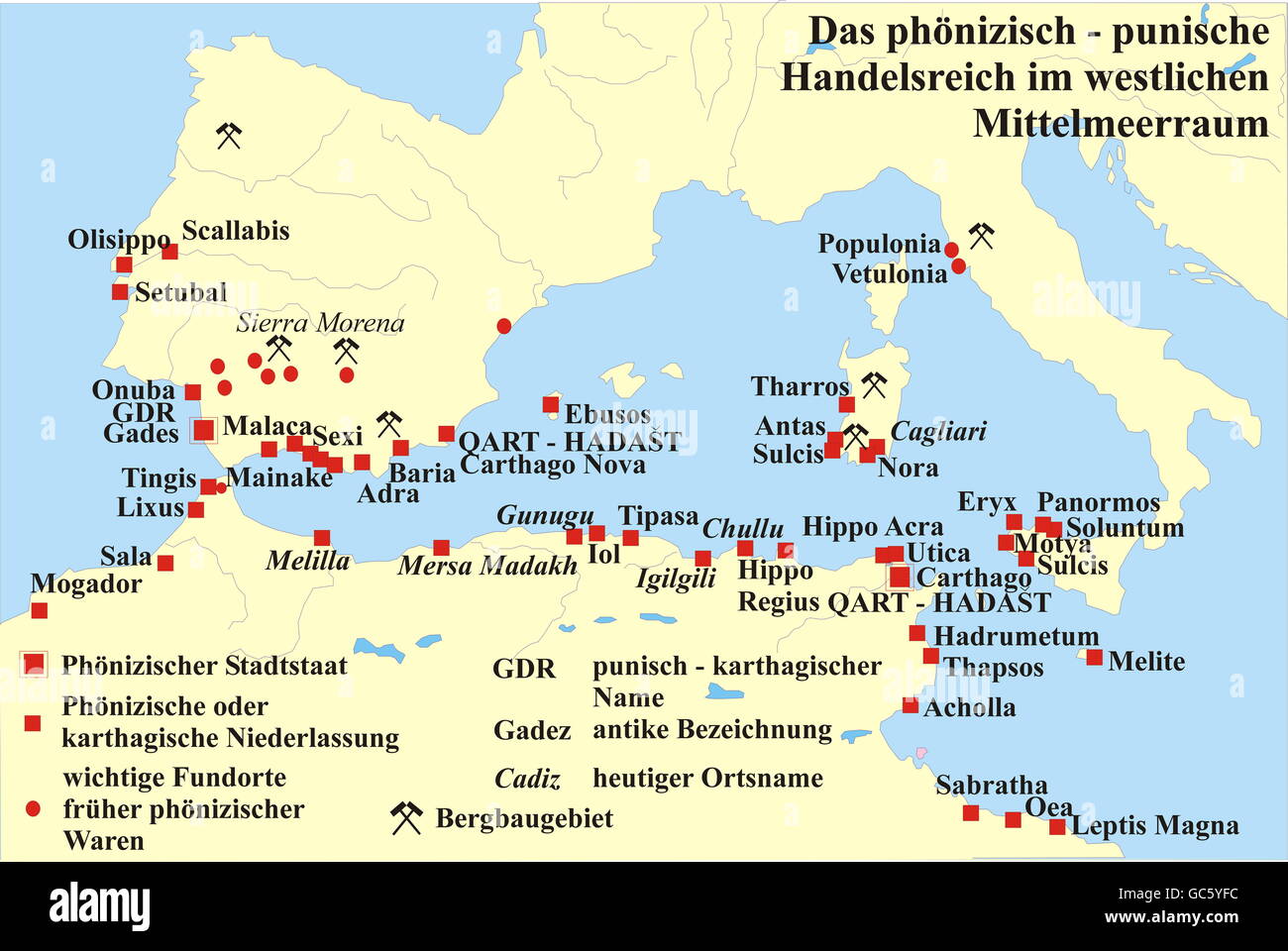
cartography, historical maps, Ancient World, Phoenician - Punic trade empire in the Western Mediterranean Sea, 9th - 3rd century BC, Carthage, trade, commercial settlements, settlement, North Africa, Europe, Tunisia, Algeria, Morocco, Spain, Portugal, Italy, Sardinia, Sicily, Balearics, Balearic Islands, mining, Etruscan, Etruscans, map, historic, ancient world, Additional-Rights-Clearences-Not Available

RMID:Image ID:GC5YFC
Image details
Contributor:
INTERFOTO / Alamy Stock PhotoImage ID:
GC5YFCFile size:
54.1 MB (1.1 MB Compressed download)Releases:
Model - no | Property - noDo I need a release?Dimensions:
5315 x 3557 px | 45 x 30.1 cm | 17.7 x 11.9 inches | 300dpiPhotographer:
INTERFOTO / HistoryMore information:
This image could have imperfections as it’s either historical or reportage.
Additional-Rights-Clearences-Not Available