CLAPHAM: Streatham,Dulwich,Tooting,Mitcham,Croydon,Brixton,Stockwell, 1786 map
Image details
Contributor:
Antiqua Print Gallery / Alamy Stock PhotoImage ID:
FY2PWBFile size:
6.3 MB (413.5 KB Compressed download)Releases:
Model - no | Property - noDo I need a release?Dimensions:
1159 x 1909 px | 19.6 x 32.3 cm | 7.7 x 12.7 inches | 150dpiDate taken:
1786Location:
LondonMore information:
This image could have imperfections as it’s either historical or reportage.
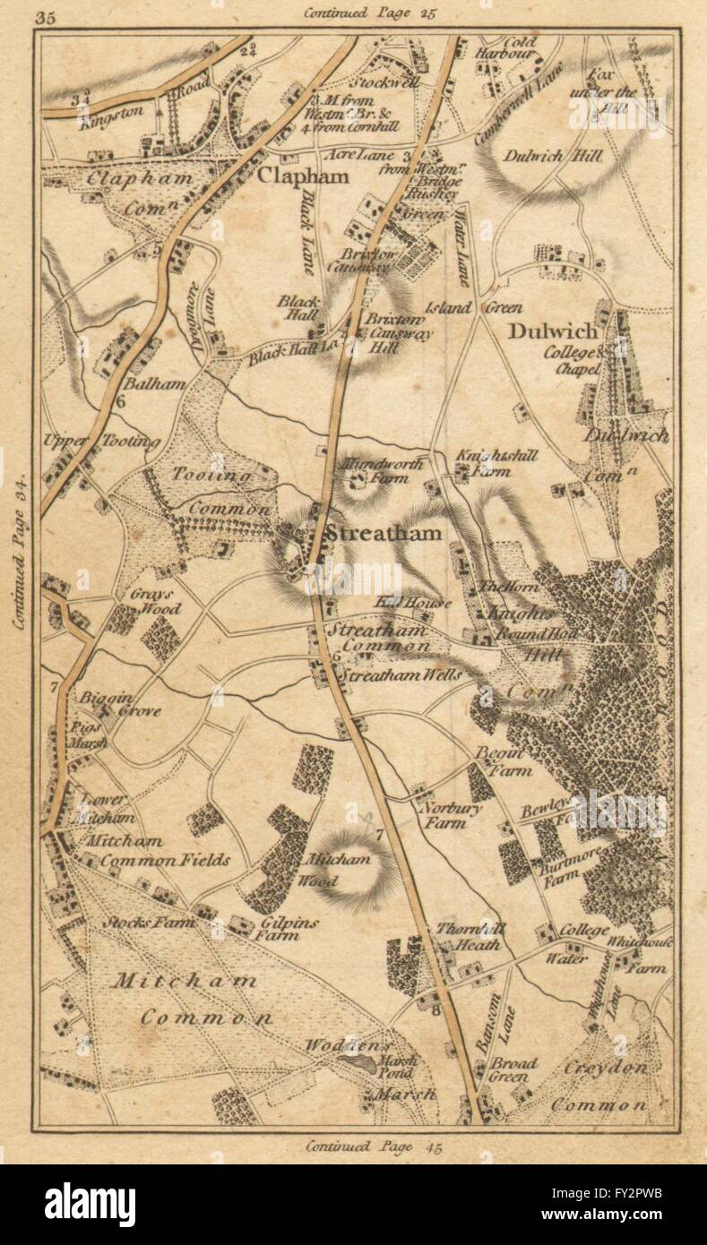
'[Map section 35] This antique map section contains all or part of the following modern suburbs/towns/villages: Clapham, Streatham, Dulwich, Tooting, Mitcham, Croydon Common, Brixton, Stockwell, Tulse Hill, Herne Hill, West Norwood, Tooting Bec, Streatham Vale, Norbury, Thornton Heath, Selhurst'. Artist/engraver/cartographer: J Cary. Provenance: "Carys actual survey of the country fifteen miles round London."; On a scale of one inch to a mile. Wherein the roads, rivers, woods and commons as well as every market town, village &c. are distinguished; and every seat shewn with the name of the possessor. London: printed for J. Cary, engraver, map and print seller, no 188 Strand. Published as the Act directs, June 20 1786. Type: Antique hand coloured engraved map. Scale one inch to a mile. [Map section 35. Continuation to the north on map section 25. Continuation to the south on map section 45. Continuation to the west on map section 34. Continuation to the east on map section 36]