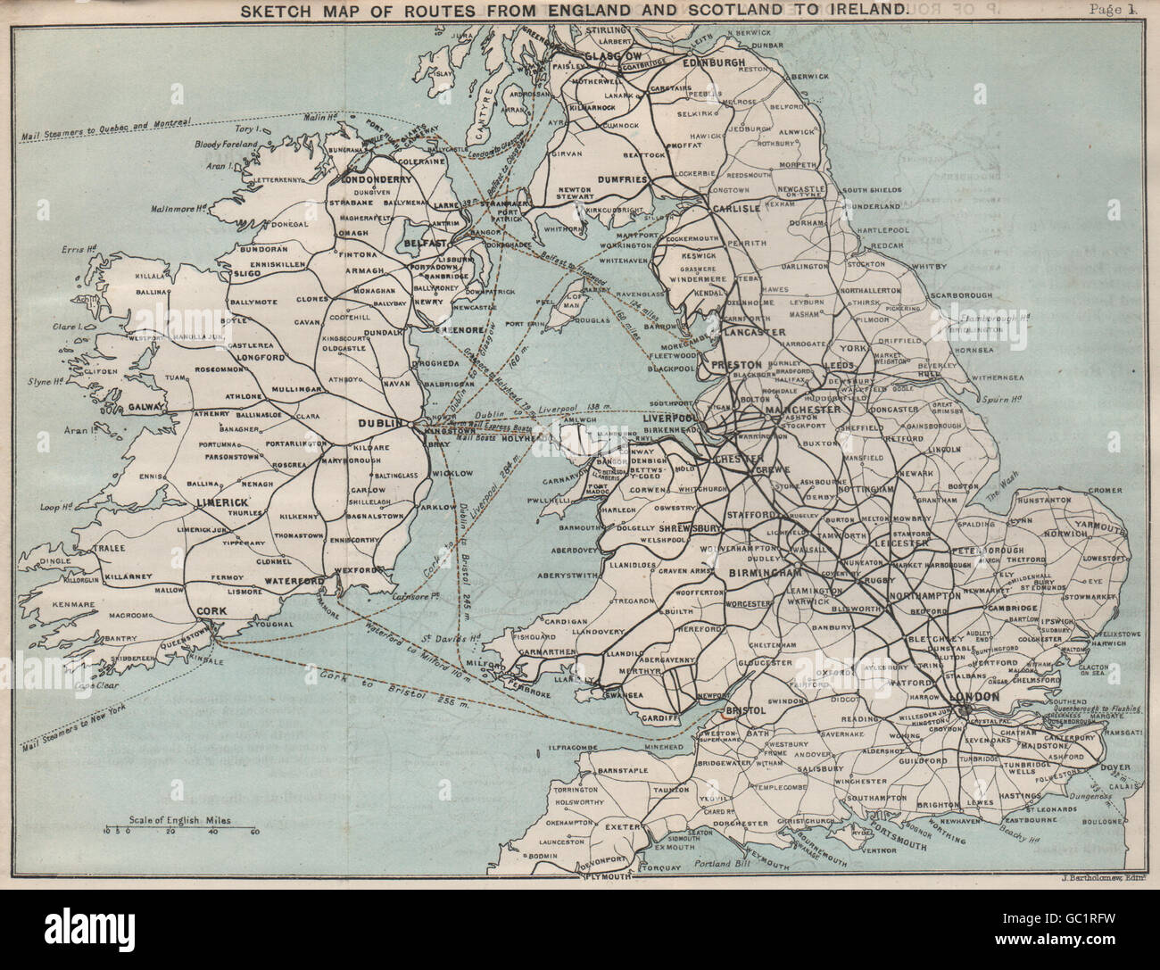
Ferry/shipping routes from England and Scotland to Ireland. BARTHOLOMEW 1887 map
RFID:Image ID:GC1RFW
Image details
Contributor:
Antiqua Print Gallery / Alamy Stock PhotoImage ID:
GC1RFWFile size:
12.4 MB (927.5 KB Compressed download)Releases:
Model - no | Property - noDo I need a release?Dimensions:
2372 x 1820 px | 40.2 x 30.8 cm | 15.8 x 12.1 inches | 150dpiDate taken:
1887Location:
British IslesMore information:
This image could have imperfections as it’s either historical or reportage.
'Sketch map of Routes from England and Scotland to Ireland'. Artist/engraver/cartographer: John Bartholomew. Provenance: "Ireland (Part I.) Northern Counties including Dublin and Neighbourhood"; by M.J.B. Baddeley, Published by Dulau & Co., London: 1st Edition. Type: Antique colour travel map.