···
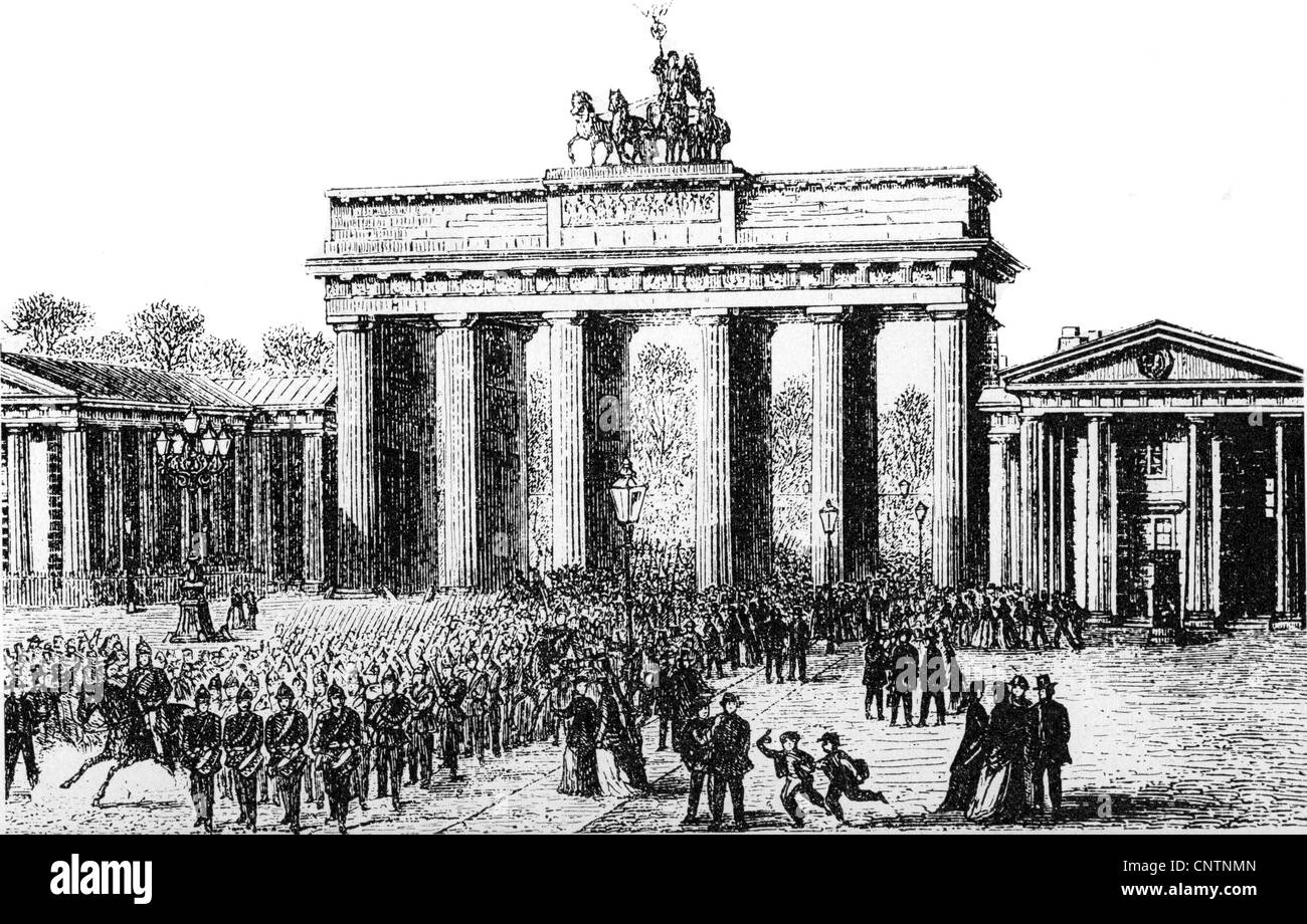
geography / travel, Germany, Berlin, Brandenburg Gate, built 1788 - 1791 by Carl Gotthard Langhans, wood engraving, late 19th century, scene: soldiers return from the changing of the guard at the castle, military, Prussia, ceremony, ceremonies, 18th century, gate, gates, soldier, soldiers, Central Europe, Europe, building, buildings, architecture, historic, historical, people, Additional-Rights-Clearences-Not Available Image details File size:
51.6 MB (3.5 MB Compressed download)
Open your image file to the full size using image processing software.
Dimensions:
5313 x 3395 px | 45 x 28.7 cm | 17.7 x 11.3 inches | 300dpi
More information:
This image could have imperfections as it’s either historical or reportage.
Additional-Rights-Clearences-Not Available
Search stock photos by tags
Similar stock images geography / travel, Germany, Berlin, Brandenburg Gate, west side, wood engraving, 1840, Additional-Rights-Clearences-Not Available Stock Photo https://www.alamy.com/image-license-details/?v=1 https://www.alamy.com/stock-photo-geography-travel-germany-berlin-brandenburg-gate-west-side-wood-engraving-96414832.html RM FGT22T – geography / travel, Germany, Berlin, Brandenburg Gate, west side, wood engraving, 1840, Additional-Rights-Clearences-Not Available Bernau bei Berlin, Germany, Brandenburg, N 52 40' 47'', E 13 35' 13'', map, Timeless Map published in 2021. Travelers, explorers and adventurers like Florence Nightingale, David Livingstone, Ernest Shackleton, Lewis and Clark and Sherlock Holmes relied on maps to plan travels to the world's most remote corners, Timeless Maps is mapping most locations on the globe, showing the achievement of great dreams Stock Photo https://www.alamy.com/image-license-details/?v=1 https://www.alamy.com/bernau-bei-berlin-germany-brandenburg-n-52-40-47-e-13-35-13-map-timeless-map-published-in-2021-travelers-explorers-and-adventurers-like-florence-nightingale-david-livingstone-ernest-shackleton-lewis-and-clark-and-sherlock-holmes-relied-on-maps-to-plan-travels-to-the-worlds-most-remote-corners-timeless-maps-is-mapping-most-locations-on-the-globe-showing-the-achievement-of-great-dreams-image439371653.html RM 2GER30N – Bernau bei Berlin, Germany, Brandenburg, N 52 40' 47'', E 13 35' 13'', map, Timeless Map published in 2021. Travelers, explorers and adventurers like Florence Nightingale, David Livingstone, Ernest Shackleton, Lewis and Clark and Sherlock Holmes relied on maps to plan travels to the world's most remote corners, Timeless Maps is mapping most locations on the globe, showing the achievement of great dreams geography / travel, Germany, Berlin, Brandenburg Gate, south west side, wood engraving, 1888, Additional-Rights-Clearences-Not Available Stock Photo https://www.alamy.com/image-license-details/?v=1 https://www.alamy.com/stock-photo-geography-travel-germany-berlin-brandenburg-gate-south-west-side-wood-96414833.html RM FGT22W – geography / travel, Germany, Berlin, Brandenburg Gate, south west side, wood engraving, 1888, Additional-Rights-Clearences-Not Available 1834 Carey Map of Prussia Germany Poland Berlin Brandenburg Europe Stock Photo https://www.alamy.com/image-license-details/?v=1 https://www.alamy.com/1834-carey-map-of-prussia-germany-poland-berlin-brandenburg-europe-image339559577.html RF 2AMC7KN – 1834 Carey Map of Prussia Germany Poland Berlin Brandenburg Europe geography / travel, Germany, Berlin, Brandenburg Gate, view from west, steel engraving, 1st half 19th century, Additional-Rights-Clearences-Not Available Stock Photo https://www.alamy.com/image-license-details/?v=1 https://www.alamy.com/stock-photo-geography-travel-germany-berlin-brandenburg-gate-view-from-west-steel-47979144.html RM CP1HTT – geography / travel, Germany, Berlin, Brandenburg Gate, view from west, steel engraving, 1st half 19th century, Additional-Rights-Clearences-Not Available Brandenburg, a state in northeastern Germany, political map with capital and largest city Potsdam, borders, and largest cities. Stock Photo https://www.alamy.com/image-license-details/?v=1 https://www.alamy.com/brandenburg-a-state-in-northeastern-germany-political-map-with-capital-and-largest-city-potsdam-borders-and-largest-cities-image620222616.html RF 2Y11G7M – Brandenburg, a state in northeastern Germany, political map with capital and largest city Potsdam, borders, and largest cities. Brandenburg, a state in northeastern Germany, gray political map with capital and largest city Potsdam, borders and largest cities. Stock Photo https://www.alamy.com/image-license-details/?v=1 https://www.alamy.com/brandenburg-a-state-in-northeastern-germany-gray-political-map-with-capital-and-largest-city-potsdam-borders-and-largest-cities-image621304178.html RF 2Y2PRPX – Brandenburg, a state in northeastern Germany, gray political map with capital and largest city Potsdam, borders and largest cities. geography / travel, Germany, Berlin, Brandenburger Tor (Brandenburg Gate), built 1733 - 1808 by Karl Gotthard Langhans, watercolour by Friedrich August Calau, circa 1830, Additional-Rights-Clearences-Not Available Stock Photo https://www.alamy.com/image-license-details/?v=1 https://www.alamy.com/stock-photo-geography-travel-germany-berlin-brandenburger-tor-brandenburg-gate-47972976.html RM CP1A0G – geography / travel, Germany, Berlin, Brandenburger Tor (Brandenburg Gate), built 1733 - 1808 by Karl Gotthard Langhans, watercolour by Friedrich August Calau, circa 1830, Additional-Rights-Clearences-Not Available Germany, officially Federal Republic of Germany, gray political map. Country in Central Europe with capital Berlin. Stock Photo https://www.alamy.com/image-license-details/?v=1 https://www.alamy.com/germany-officially-federal-republic-of-germany-gray-political-map-country-in-central-europe-with-capital-berlin-image604390642.html RF 2X38AC2 – Germany, officially Federal Republic of Germany, gray political map. Country in Central Europe with capital Berlin. geography / travel, Germany, Berlin, buildings, Zeughaus (old arsenal), built: 1695 - 1705, architect: Francois Blondel, illustration from 'Denkmaeler der Kunst' (Monuments of Art), by Wilhelm Luebke and Carl von Luetzow, 3rd edition, Stuttgart 1879, volume 2, steel engraving by H. Gugeler, after drawing by Wilhelm Riefstahl, chapter architecture, plate L, Central Europe, architecture, 17th/18th century, baroque, building, historic, historical, Brandenburg, Prussia, Prussian, Denkmaler, Denkmäler, Lübke, Lubke, Lützow, Lutzow, Additional-Rights-Clearance-Info-Not-Available Stock Photo https://www.alamy.com/image-license-details/?v=1 https://www.alamy.com/geography-travel-germany-berlin-buildings-zeughaus-old-arsenal-built-1695-1705-architect-francois-blondel-illustration-from-denkmaeler-der-kunst-monuments-of-art-by-wilhelm-luebke-and-carl-von-luetzow-3rd-edition-stuttgart-1879-volume-2-steel-engraving-by-h-gugeler-after-drawing-by-wilhelm-riefstahl-chapter-architecture-plate-l-central-europe-architecture-17th18th-century-baroque-building-historic-historical-brandenburg-prussia-prussian-denkmaler-denkmler-lbke-lubke-ltzow-lutzow-additional-rights-clearance-info-not-available-image241367912.html RM T0K76G – geography / travel, Germany, Berlin, buildings, Zeughaus (old arsenal), built: 1695 - 1705, architect: Francois Blondel, illustration from 'Denkmaeler der Kunst' (Monuments of Art), by Wilhelm Luebke and Carl von Luetzow, 3rd edition, Stuttgart 1879, volume 2, steel engraving by H. Gugeler, after drawing by Wilhelm Riefstahl, chapter architecture, plate L, Central Europe, architecture, 17th/18th century, baroque, building, historic, historical, Brandenburg, Prussia, Prussian, Denkmaler, Denkmäler, Lübke, Lubke, Lützow, Lutzow, Additional-Rights-Clearance-Info-Not-Available Germany, officially the Federal Republic of Germany, political map. Country in Central Europe with capital Berlin. Consisting of 16 constituent states. Stock Photo https://www.alamy.com/image-license-details/?v=1 https://www.alamy.com/germany-officially-the-federal-republic-of-germany-political-map-country-in-central-europe-with-capital-berlin-consisting-of-16-constituent-states-image602444382.html RF 2X03KXP – Germany, officially the Federal Republic of Germany, political map. Country in Central Europe with capital Berlin. Consisting of 16 constituent states. geography / travel, Germany, Berlin, Koepenick Castle, exterior view, copper engraving, early 17th century, Hohenzollern, Brandenburg, historic, historical, Kopenick, Köpenick, people, Stock Photo https://www.alamy.com/image-license-details/?v=1 https://www.alamy.com/stock-photo-geography-travel-germany-berlin-koepenick-castle-exterior-view-copper-20727029.html RM B5M5F1 – geography / travel, Germany, Berlin, Koepenick Castle, exterior view, copper engraving, early 17th century, Hohenzollern, Brandenburg, historic, historical, Kopenick, Köpenick, people, 