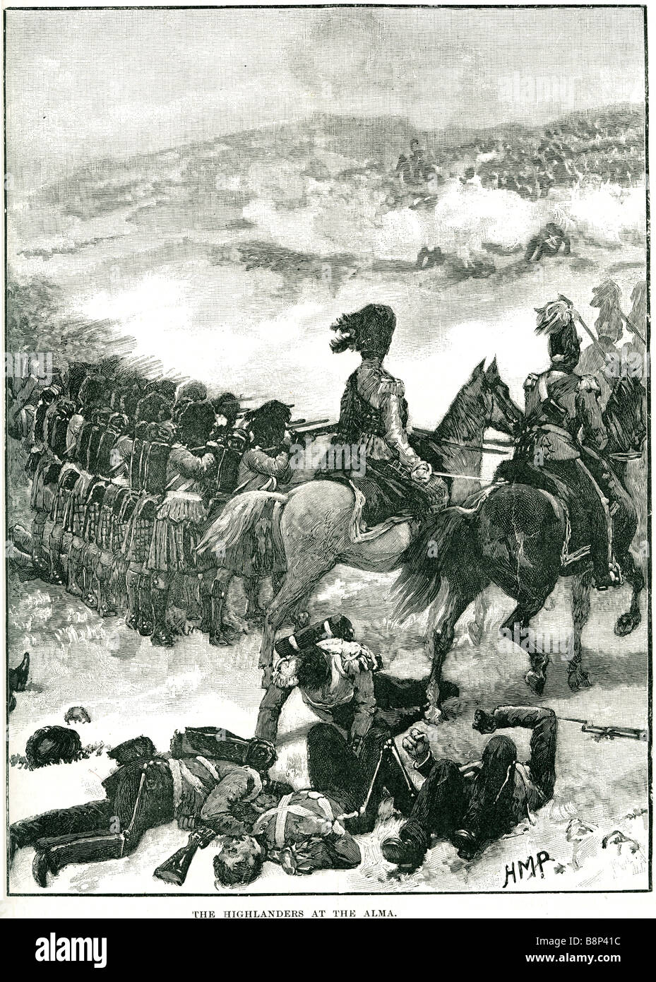
highlanders the Battle of the Alma 1854 Crimean War River Anglo-French force General St. Arnaud Lord Raglan General Menshikov's
Image details
Contributor:
19th era / Alamy Stock PhotoImage ID:
B8P41CFile size:
53.2 MB (7.8 MB Compressed download)Releases:
Model - no | Property - noDo I need a release?Dimensions:
3645 x 5099 px | 30.9 x 43.2 cm | 12.2 x 17 inches | 300dpiMore information:
Battle of the Alma (20 September 1854), which is usually considered the first battle of the Crimean War (1853–1856), took place in the vicinity of the River Alma in the Crimea. An Anglo-French force under General St. Arnaud and Lord Raglan defeated General Menshikov's Russian army, which lost around 6, 000 troops. The Anglo-French forces landed on the western coast of the Crimean peninsula some 35 miles (56 km) north of Sevastopol, on the 13 September 1854, at Calamita Bay ("Calamity Bay"). Although disorganised and weakened by disease (mostly cholera and dysentery), the lack of opposition these landings met allowed a beachhead of four miles (6 km) inland to be made. Six days later the two armies headed south. The march involved crossing three rivers. It was at the second of these, the River Alma, that the Russians decided to stand. Although the Russian Army was numerically inferior to the combined Anglo-French army, they occupied a natural defensive position. The British and French bivouacked on the northern bank, where the ground sloped gently down to the river. Running along the Russian southern bank of the river were precipitous cliffs, 350 feet (107 m) high, continuing inland from the river's mouth for almost two miles (3 km) where they met a less steep, but equally high hill known as Telegraph Hill across the river from the village of Bourliouk. To its east lay Kourgane Hill, a natural strongpoint with fields of fire covering most approaches, and the key to the whole position. Two redoubts had been constructed to protect Kourgane Hill from infantry assault; the Lesser Redoubt on the eastern slope and the Greater Redoubt on the west. The road to Sevastopol ran between Telegraph and Kourgane Hill, covered by Russian batteries sited on the hills and in the narrow valley between them.