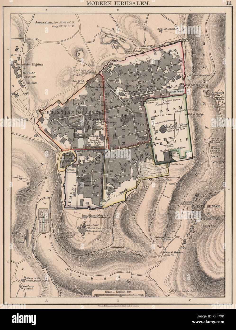
JERUSALEM.City plan showing Christian Armenian Jewish & Muslim quarters 1906 map
RFID:Image ID:GJF7XK
Image details
Contributor:
Antiqua Print Gallery / Alamy Stock PhotoImage ID:
GJF7XKFile size:
21.5 MB (2.3 MB Compressed download)Releases:
Model - no | Property - noDo I need a release?Dimensions:
2401 x 3133 px | 20.3 x 26.5 cm | 8 x 10.4 inches | 300dpiDate taken:
1906Location:
PalestineMore information:
This image could have imperfections as it’s either historical or reportage.
'Modern Jerusalem'. Artist/engraver/cartographer: W. & A.K. Johnston, Limited Edinburgh & London. Provenance: "The Victoria Regina Atlas"; Published by W & A.K. Johnston, Ltd, Edinburgh & London: 2nd Edition. Type: Antique colour map.