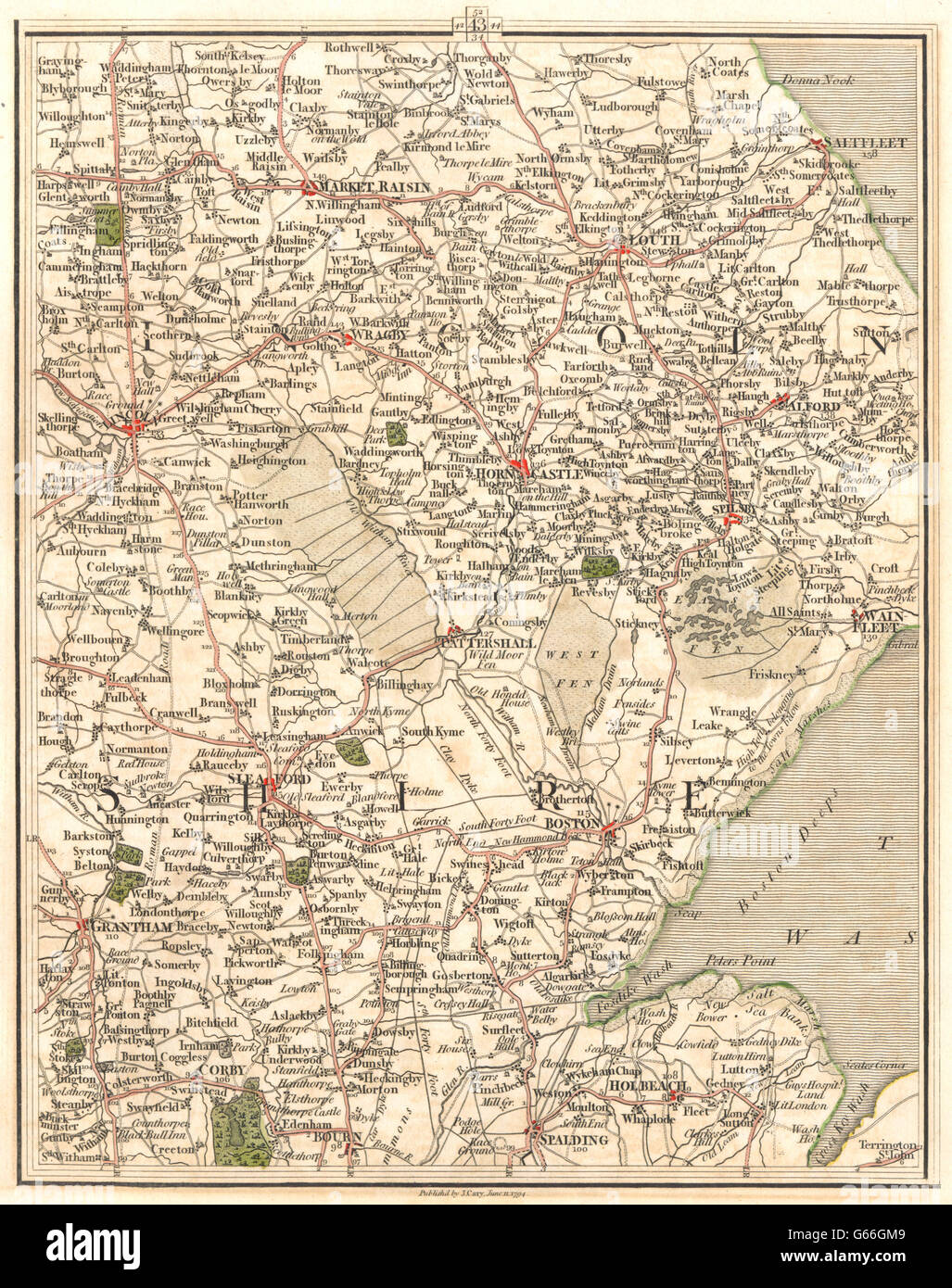
LINCOLNSHIRE:Fens Lincoln Grantham Boston Spalding Louth Sleaford.CARY, 1794 map
Image details
Contributor:
Antiqua Print Gallery / Alamy Stock PhotoImage ID:
G66GM9File size:
22.6 MB (2 MB Compressed download)Releases:
Model - no | Property - noDo I need a release?Dimensions:
2500 x 3164 px | 21.2 x 26.8 cm | 8.3 x 10.5 inches | 300dpiDate taken:
1794Location:
LincolnshireMore information:
This image could have imperfections as it’s either historical or reportage.
'[no title]'. Artist/engraver/cartographer: J Cary. Provenance: "Cary's New Map of England and Wales, with part of Scotland"; Published by J. Cary, London. Type: Antique engraved map with original hand colouring. This antique map (section 43) includes all or part of the following places: Lincolnshire; Market Raisin, Saltfleet, Wragby, Louth, Lincoln, Horn Castle, Alford, Spilsby, Tattershall, Wainfleet, Sleaford, Grantham, Boston, Corby, Bourn, Spalding, Holbeach. Adjacent map sections are offered for sale separately: The map section to the North of this map is section number section 52. The map section to the South of this map is section number section 34. The map section to the East of this map is section number section 44. The map section to the West of this map is section number section 42.