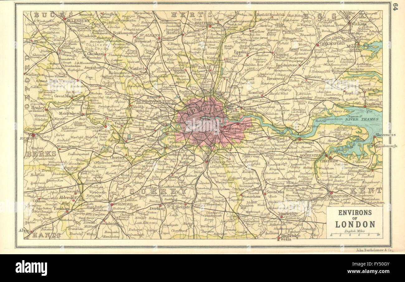
LONDON & HOME COUNTIES: Railways & roads. BARTHOLOMEW, 1917 vintage map
RFID:Image ID:FY50GY
Image details
Contributor:
Antiqua Print Gallery / Alamy Stock PhotoImage ID:
FY50GYFile size:
11.9 MB (1.1 MB Compressed download)Releases:
Model - no | Property - noDo I need a release?Dimensions:
2576 x 1614 px | 21.8 x 13.7 cm | 8.6 x 5.4 inches | 300dpiDate taken:
1917Location:
LondonMore information:
This image could have imperfections as it’s either historical or reportage.
'Environs of London'. Artist/engraver/cartographer: John Bartholomew. Provenance: "Handy Reference Atlas of London and Suburbs"; by J. G. Bartholomew; Published by John Bartholomew & Son Ltd, Edinburgh. Third edition. Type: Vintage colour map.