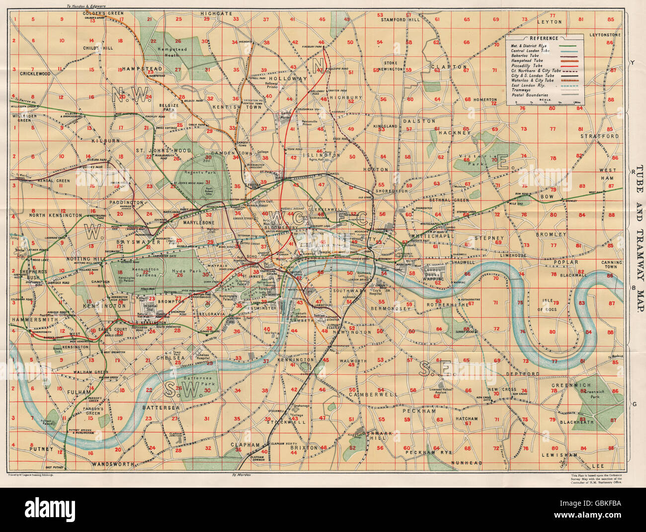
LONDON TUBE & TRAMWAY MAP. Underground. Postal districts. Vintage map plan 1930
RFID:Image ID:GBKFBA
Image details
Contributor:
Antiqua Print Gallery / Alamy Stock PhotoImage ID:
GBKFBAFile size:
54.5 MB (3.7 MB Compressed download)Releases:
Model - no | Property - noDo I need a release?Dimensions:
5027 x 3792 px | 42.6 x 32.1 cm | 16.8 x 12.6 inches | 300dpiDate taken:
1930Location:
LondonMore information:
This image could have imperfections as it’s either historical or reportage.
'Tube and Tramway Map'. Artist/engraver/cartographer: Based on the Ordnance Survey map. Printed by Maglagan & Cumming. Provenance: "The Blue Guides England", Edited by Findlay Muirhead, MacMillan & Co. Ltd., London: 3rd Edition. Type: Vintage colour map.