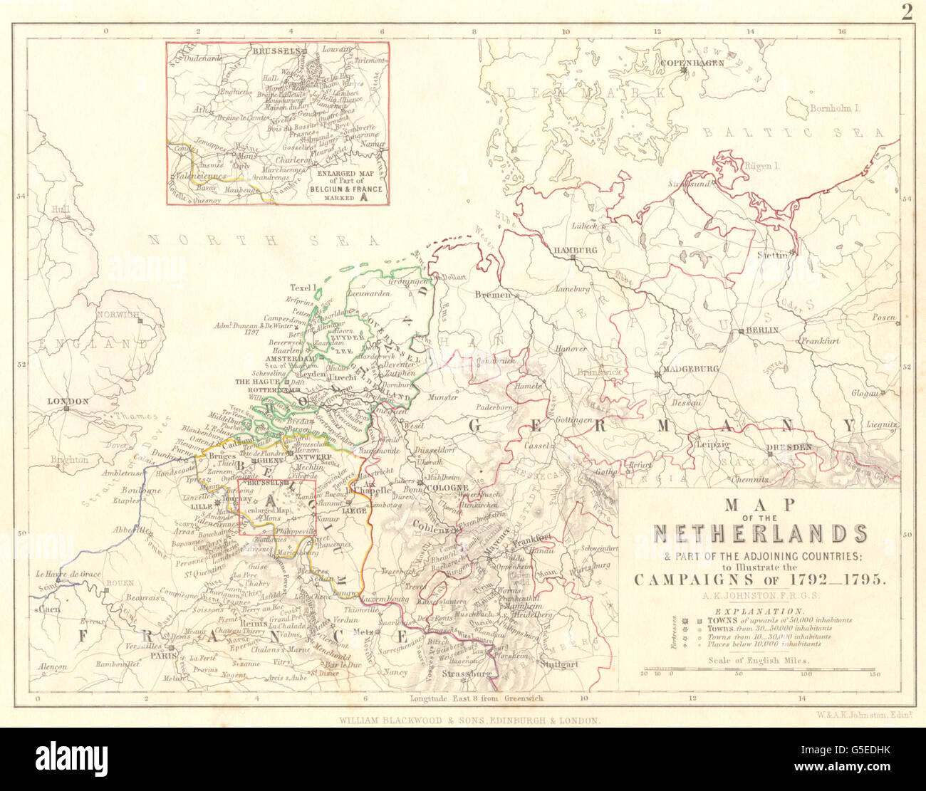
NETHERLANDS: Map & countries; campaigns of 1792- 1795; Belgium & France 1848
RFID:Image ID:G5EDHK
Image details
Contributor:
Antiqua Print Gallery / Alamy Stock PhotoImage ID:
G5EDHKFile size:
13.4 MB (736.1 KB Compressed download)Releases:
Model - no | Property - noDo I need a release?Dimensions:
2439 x 1917 px | 41.3 x 32.5 cm | 16.3 x 12.8 inches | 150dpiDate taken:
1848Location:
NetherlandsMore information:
This image could have imperfections as it’s either historical or reportage.
'Map of the Netherlands & part of the adjoining countries; to illustrate the campaigns of 1792-1795; Inset map of Enlarged Map of Belgium & France'. Artist/engraver/cartographer: Unsigned. Provenance: "Atlas Alison's history of Europe" by Alexander Keith Johnston, Published by William Blackwood and Sons, Edinburgh & London. Type: Antique hand-coloured engraved map.