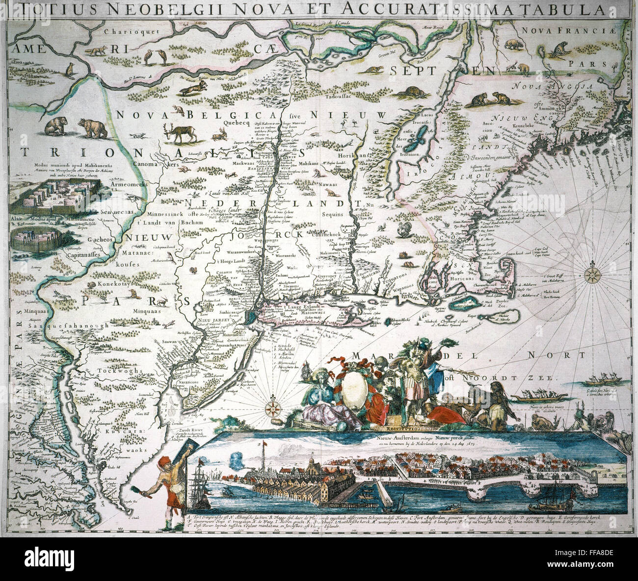
NEW NETHERLAND MAP. /nHugo Allard's "New and Exact Map of All New Netherland" from Chesapeake Bay to Penobscot Bay, with an inset view of New Amsterdam, 1673.
RMID:Image ID:FFA8DE
Image details
Contributor:
GRANGER - Historical Picture Archive / Alamy Stock PhotoImage ID:
FFA8DEFile size:
25.3 MB (2.6 MB Compressed download)Releases:
Model - no | Property - noDo I need a release?Dimensions:
3240 x 2731 px | 27.4 x 23.1 cm | 10.8 x 9.1 inches | 300dpiPhotographer:
Granger, NYC.More information:
This image could have imperfections as it’s either historical or reportage.