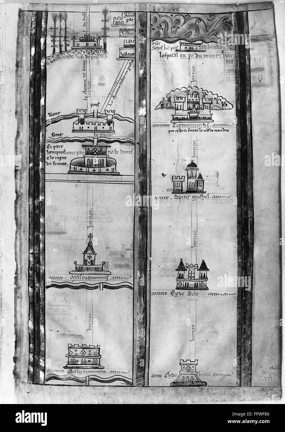
PILGRIMS' MAP, c1250. /nDetail of an English map of the pilgrimage route from London to Jerusalem, drawn, c1250, by Matthew Paris, historian and monk at St. Alban's Abbey.
RMID:Image ID:FFWF86
Image details
Contributor:
GRANGER - Historical Picture Archive / Alamy Stock PhotoImage ID:
FFWF86File size:
21.2 MB (1,012.7 KB Compressed download)Releases:
Model - no | Property - noDo I need a release?Dimensions:
2290 x 3240 px | 19.4 x 27.4 cm | 7.6 x 10.8 inches | 300dpiPhotographer:
Granger, NYC.More information:
This image could have imperfections as it’s either historical or reportage.