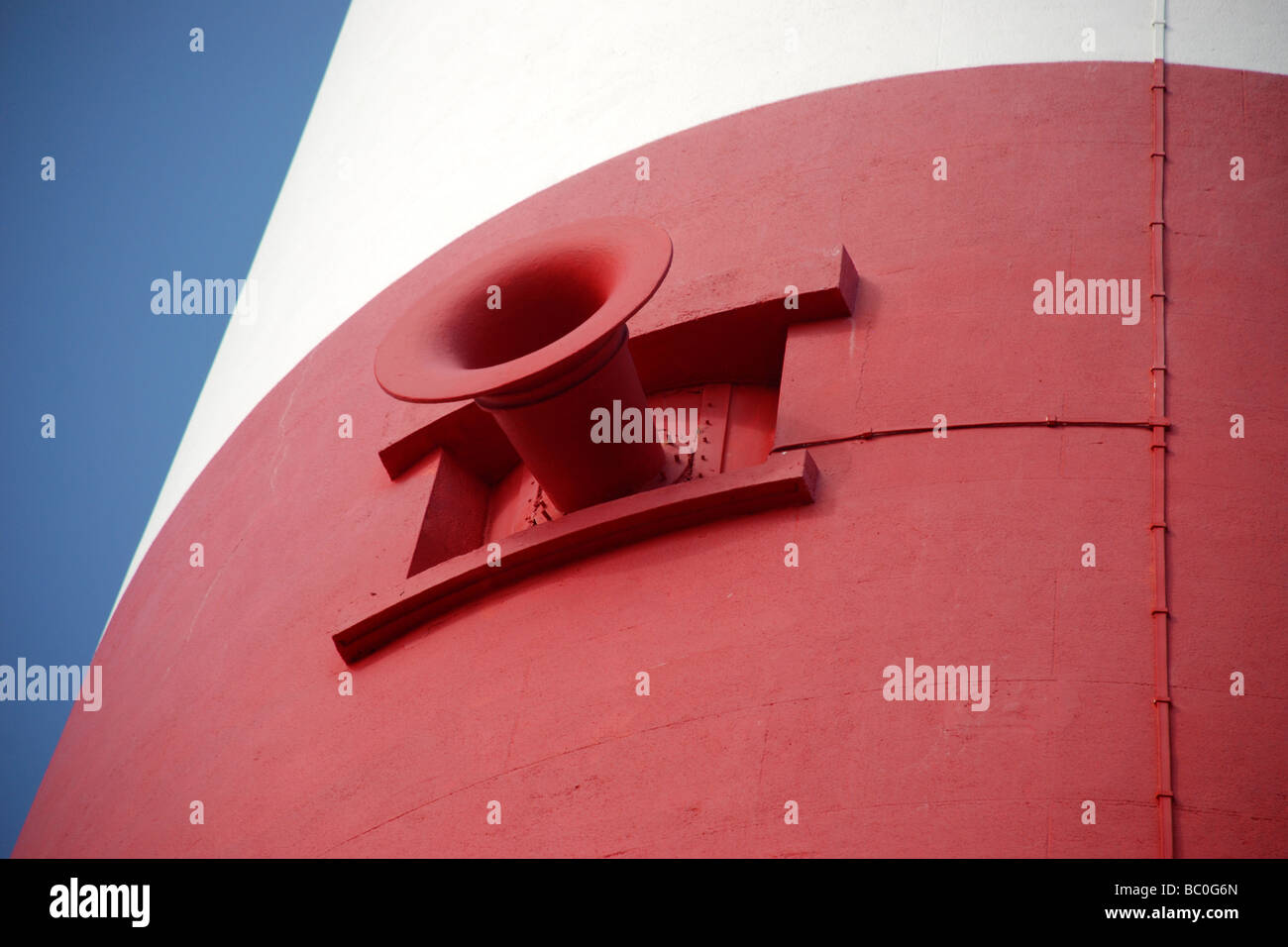
Portland Bill Lighthouse Fog Horn
Image details
Contributor:
Seescanner / Alamy Stock PhotoImage ID:
BC0G6NFile size:
50.3 MB (1.4 MB Compressed download)Releases:
Model - no | Property - noDo I need a release?Dimensions:
5137 x 3425 px | 43.5 x 29 cm | 17.1 x 11.4 inches | 300dpiDate taken:
19 June 2009Location:
Portland Bill Dorset UKMore information:
Portland Bill Lighthouse http://www.trinityhouse.co.uk/interactive/gallery/portland_bill.html Position 50° 30'.82 N 02° 27'.30 W Portland Bill Portland Bill and Chesil Beach are the graveyards of many vessels that failed to reach Weymouth or Portland Roads. The Portland Race is caused by the meeting of the tides between the Bill and the Shambles sandbank about 3 miles SE. Strong currents break the sea so fiercely that from the shore a continuous disturbance can be seen. Portland Bill Lighthouse guides vessels heading for Portland and Weymouth through these hazardous waters as well as acting as a waymark for ships navigating the English Channel. The Shambles sandbank is marked by a red sector light. Established 1716 Height Of Tower 41 Metres Height Of Light Above Mean High Water 43 Metres Automated 1996 Lamp 1 Kw Mbi Optic 4 Panel 1St Order Catadioptric Fixed Lens Character White Group Flashing 4 Times Every 20 Seconds Intensity 635, 000 Candela Range Of Light 25 nautical miles Fog Signal Character 3.5 Second Blast Every 30 Seconds