···
State of New Hampshire, United States, Relief Map Image details File size:
49.8 MB (1.5 MB Compressed download)
Open your image file to the full size using image processing software.
Dimensions:
3511 x 4961 px | 29.7 x 42 cm | 11.7 x 16.5 inches | 300dpi
More information:
This image could have imperfections as it’s either historical or reportage.
Relief map of the State of New Hampshire, United States. This image was compiled from data acquired by LANDSAT 5 & 7 satellites combined with elevation data.
Search stock photos by tags
Similar stock images Silver Cascade in spring, White Mountain National Forest, Crawford Notch State Park, Carroll Co., NH Stock Photo https://www.alamy.com/licenses-and-pricing/?v=1 https://www.alamy.com/silver-cascade-in-spring-white-mountain-national-forest-crawford-notch-state-park-carroll-co-nh-image328066835.html RF 2A1MMGK – Silver Cascade in spring, White Mountain National Forest, Crawford Notch State Park, Carroll Co., NH Franconia Notch State Park, New Hampshire, New England, United States of America, North America Stock Photo https://www.alamy.com/licenses-and-pricing/?v=1 https://www.alamy.com/stock-photo-franconia-notch-state-park-new-hampshire-new-england-united-states-50645295.html RM CXB2GF – Franconia Notch State Park, New Hampshire, New England, United States of America, North America Official flag of the state of New Hampshire. United States of America. Stock Photo https://www.alamy.com/licenses-and-pricing/?v=1 https://www.alamy.com/official-flag-of-the-state-of-new-hampshire-united-states-of-america-image333127024.html RF 2A9Y6WM – Official flag of the state of New Hampshire. United States of America. New Hampshire State House, Concord, New Hampshire, USA. New Hampshire State House is the nation's oldest state house, built in 1816 - 1819. Stock Photo https://www.alamy.com/licenses-and-pricing/?v=1 https://www.alamy.com/new-hampshire-state-house-concord-new-hampshire-usa-new-hampshire-state-house-is-the-nations-oldest-state-house-built-in-1816-1819-image385391843.html RF 2DB036B – New Hampshire State House, Concord, New Hampshire, USA. New Hampshire State House is the nation's oldest state house, built in 1816 - 1819. Franconia Notch State Park, New Hampshire, New England, United States of America, North America Stock Photo https://www.alamy.com/licenses-and-pricing/?v=1 https://www.alamy.com/stock-photo-franconia-notch-state-park-new-hampshire-new-england-united-states-50708119.html RM CXDXM7 – Franconia Notch State Park, New Hampshire, New England, United States of America, North America The New Hampshire state flag waving along with the national flag of the United States of America Stock Photo https://www.alamy.com/licenses-and-pricing/?v=1 https://www.alamy.com/the-new-hampshire-state-flag-waving-along-with-the-national-flag-of-the-united-states-of-america-image483614823.html RF 2K2PFHY – The New Hampshire state flag waving along with the national flag of the United States of America New Hampshire State House, Concord, New Hampshire, USA. New Hampshire State House is the nation's oldest state house, built in 1816 - 1819. Stock Photo https://www.alamy.com/licenses-and-pricing/?v=1 https://www.alamy.com/new-hampshire-state-house-concord-new-hampshire-usa-new-hampshire-state-house-is-the-nations-oldest-state-house-built-in-1816-1819-image385392158.html RF 2DB03HJ – New Hampshire State House, Concord, New Hampshire, USA. New Hampshire State House is the nation's oldest state house, built in 1816 - 1819. Franconia Notch State Park, New Hampshire, New England, United States of America, North America Stock Photo https://www.alamy.com/licenses-and-pricing/?v=1 https://www.alamy.com/stock-photo-franconia-notch-state-park-new-hampshire-new-england-united-states-50708131.html RM CXDXMK – Franconia Notch State Park, New Hampshire, New England, United States of America, North America The New Hampshire state flag waving along with the national flag of the United States of America Stock Photo https://www.alamy.com/licenses-and-pricing/?v=1 https://www.alamy.com/the-new-hampshire-state-flag-waving-along-with-the-national-flag-of-the-united-states-of-america-image477535408.html RF 2JMWH80 – The New Hampshire state flag waving along with the national flag of the United States of America New Hampshire State House, Concord, New Hampshire, USA. New Hampshire State House is the nation's oldest state house, built in 1816 - 1819. Stock Photo https://www.alamy.com/licenses-and-pricing/?v=1 https://www.alamy.com/new-hampshire-state-house-concord-new-hampshire-usa-new-hampshire-state-house-is-the-nations-oldest-state-house-built-in-1816-1819-image385392578.html RF 2DB044J – New Hampshire State House, Concord, New Hampshire, USA. New Hampshire State House is the nation's oldest state house, built in 1816 - 1819. Franconia Notch State Park, New Hampshire, New England, United States of America, North America Stock Photo https://www.alamy.com/licenses-and-pricing/?v=1 https://www.alamy.com/stock-photo-franconia-notch-state-park-new-hampshire-new-england-united-states-50708107.html RM CXDXKR – Franconia Notch State Park, New Hampshire, New England, United States of America, North America Central Park Sheep Meadow with full autumn colors. Midtown Manhattan skyscrapers in early morning light. New York City Stock Photo https://www.alamy.com/licenses-and-pricing/?v=1 https://www.alamy.com/stock-photo-central-park-sheep-meadow-with-full-autumn-colors-midtown-manhattan-123807423.html RM H5BWHK – Central Park Sheep Meadow with full autumn colors. Midtown Manhattan skyscrapers in early morning light. New York City New Hampshire State House, Concord, New Hampshire, USA. New Hampshire State House is the nation's oldest state house, built in 1816 - 1819. Stock Photo https://www.alamy.com/licenses-and-pricing/?v=1 https://www.alamy.com/new-hampshire-state-house-concord-new-hampshire-usa-new-hampshire-state-house-is-the-nations-oldest-state-house-built-in-1816-1819-image385391708.html RF 2DB031G – New Hampshire State House, Concord, New Hampshire, USA. New Hampshire State House is the nation's oldest state house, built in 1816 - 1819. 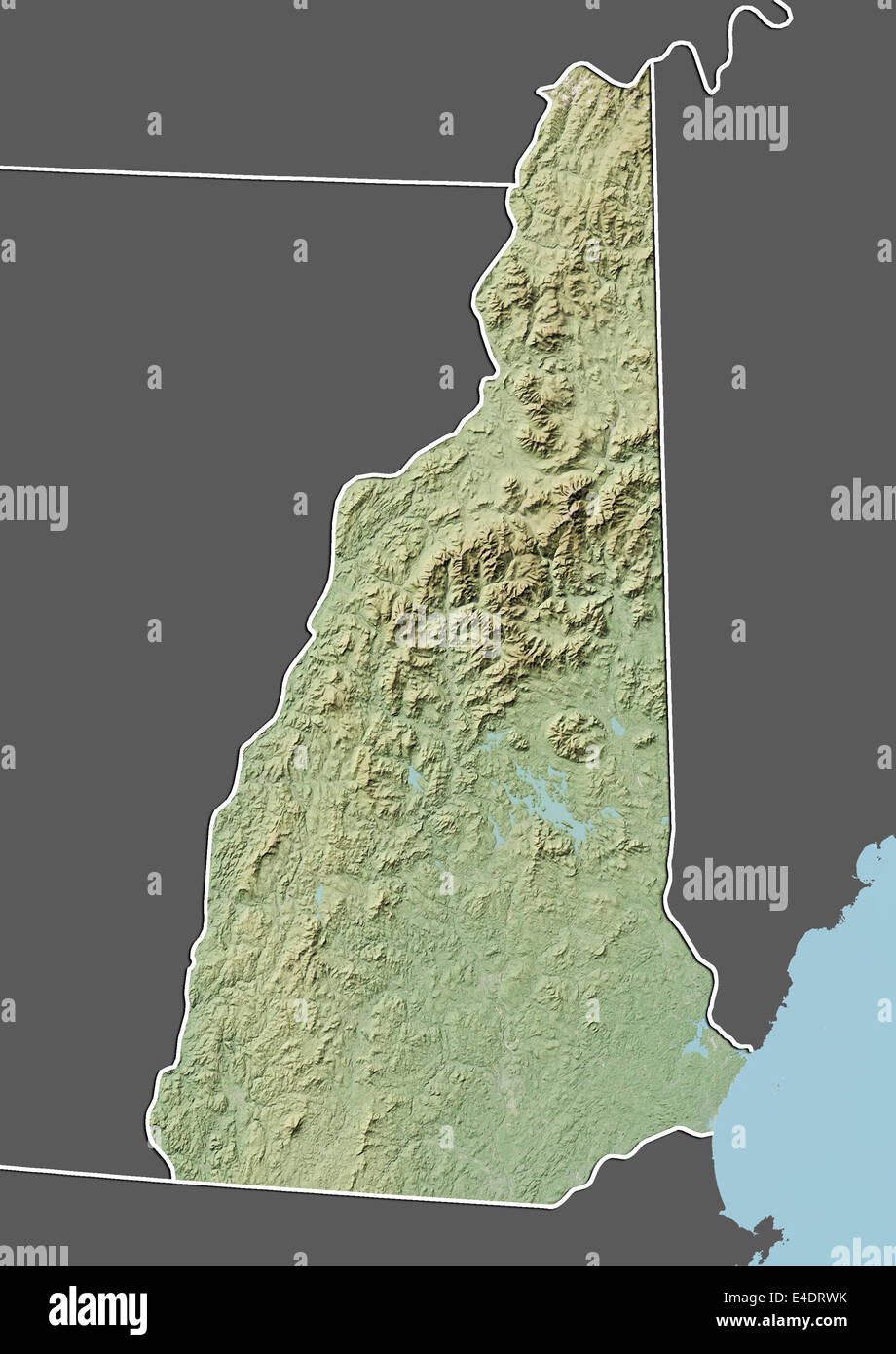