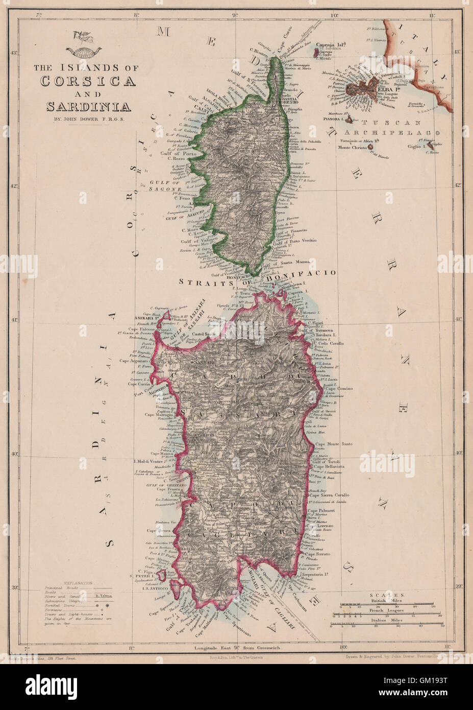
'The Islands of Corsica & Sardinia'. Elba. JOHN DOWER. Dispatch Atlas, 1863 map
RFID:Image ID:GM193T
Image details
Contributor:
Antiqua Print Gallery / Alamy Stock PhotoImage ID:
GM193TFile size:
56.2 MB (3.4 MB Compressed download)Releases:
Model - no | Property - noDo I need a release?Dimensions:
3745 x 5249 px | 31.7 x 44.4 cm | 12.5 x 17.5 inches | 300dpiDate taken:
1863Location:
MediterraneanMore information:
This image could have imperfections as it’s either historical or reportage.
'The Islands of Corsica and Sardinia'. Artist/engraver/cartographer: Drawn & Engraved by John Dower. Provenance: "Cassell's Complete Atlas" (a.k.a. "The Weekly Dispatch Atlas"), Published by Cassell, Petter and Galpin, London. Type: Antique map with original outline colour. The map shows submarine telegraph cables, fortified towns, Fortresses and lighthouses.