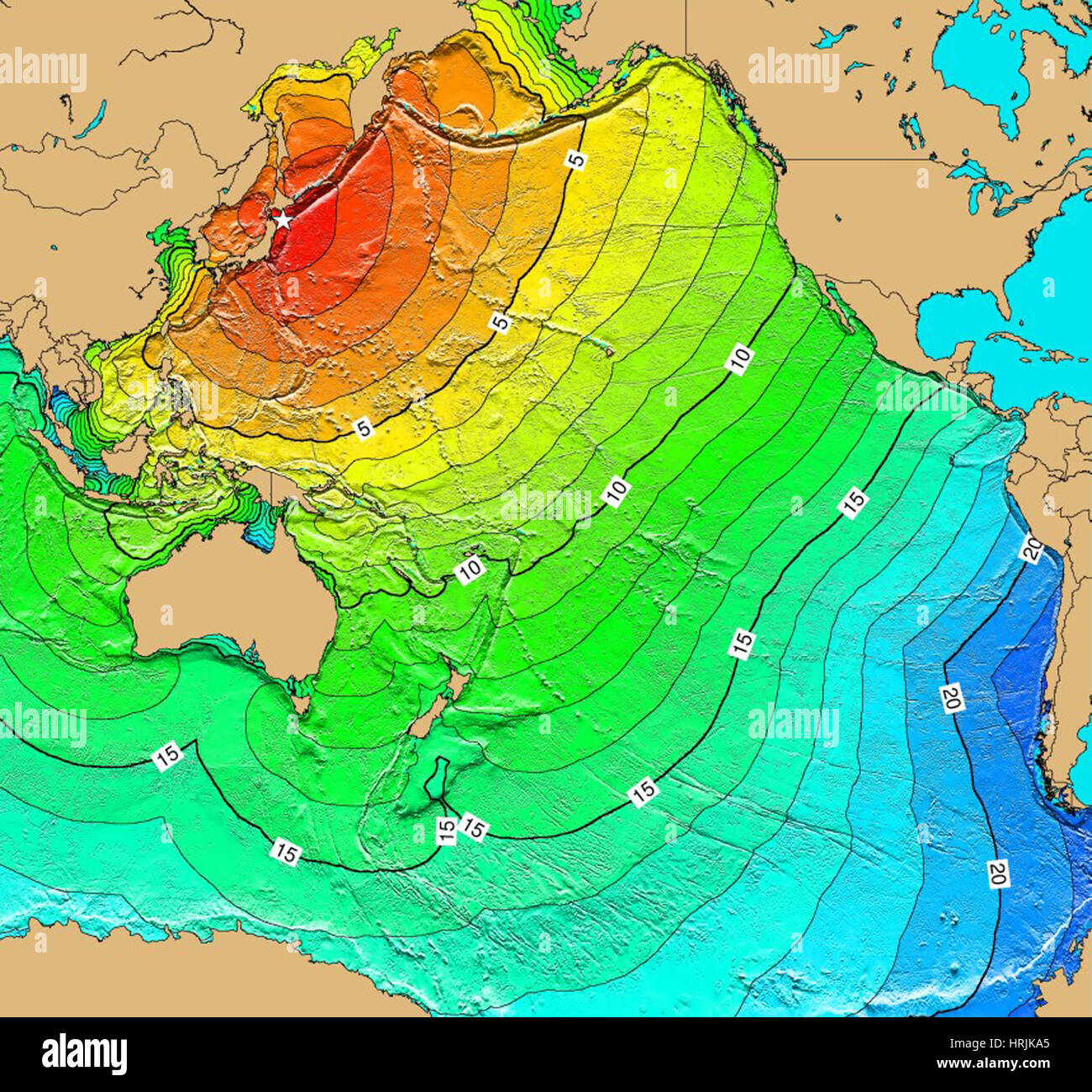
Tsunami Map, Honshu Earthquake, 1968

Image details
Contributor:
Science History Images / Alamy Stock PhotoImage ID:
HRJKA5File size:
40.5 MB (2.2 MB Compressed download)Releases:
Model - no | Property - noDo I need a release?Dimensions:
3900 x 3632 px | 33 x 30.8 cm | 13 x 12.1 inches | 300dpiPhotographer:
Photo ResearchersMore information:
This image could have imperfections as it’s either historical or reportage.
A magnitude 8.2 Mw earthquake on May 16, 1968 off the coast of Honshu Island caused destruction in Japan and generated a tsunami that was observed by tide gauges in Japan and throughout the Pacific Basin. As a result of the earthquake and tsunami, 52 people died and 329 people were injured; 676 homes were completely destroyed and 2, 994 homes were partially destroyed; 13 homes burned down and 529 homes were flooded; 97 ships were washed away and 30 were sunk. In addition, roads, bridges and protective dikes were destroyed. Map generated using Tsunami Travel Time (TTT) software: calculates first-arrival travel times on a grid for a tsunami generated at an earthquake epicenter. Map contours: 1 hour intervals: red 1-4 hour arrival times, yellow: 5-6 hour arrival times, green: 7-14 hour arrival times, blue: 15-21 hour arrival times. Maps were generated from earthquake epicenters in the NGDC Global Historical Tsunami Database using NGDC 2 Minute Gridded Global Relief Data bathymetry. Maps do not provide the height or the strength of the wave, only the arrival times.