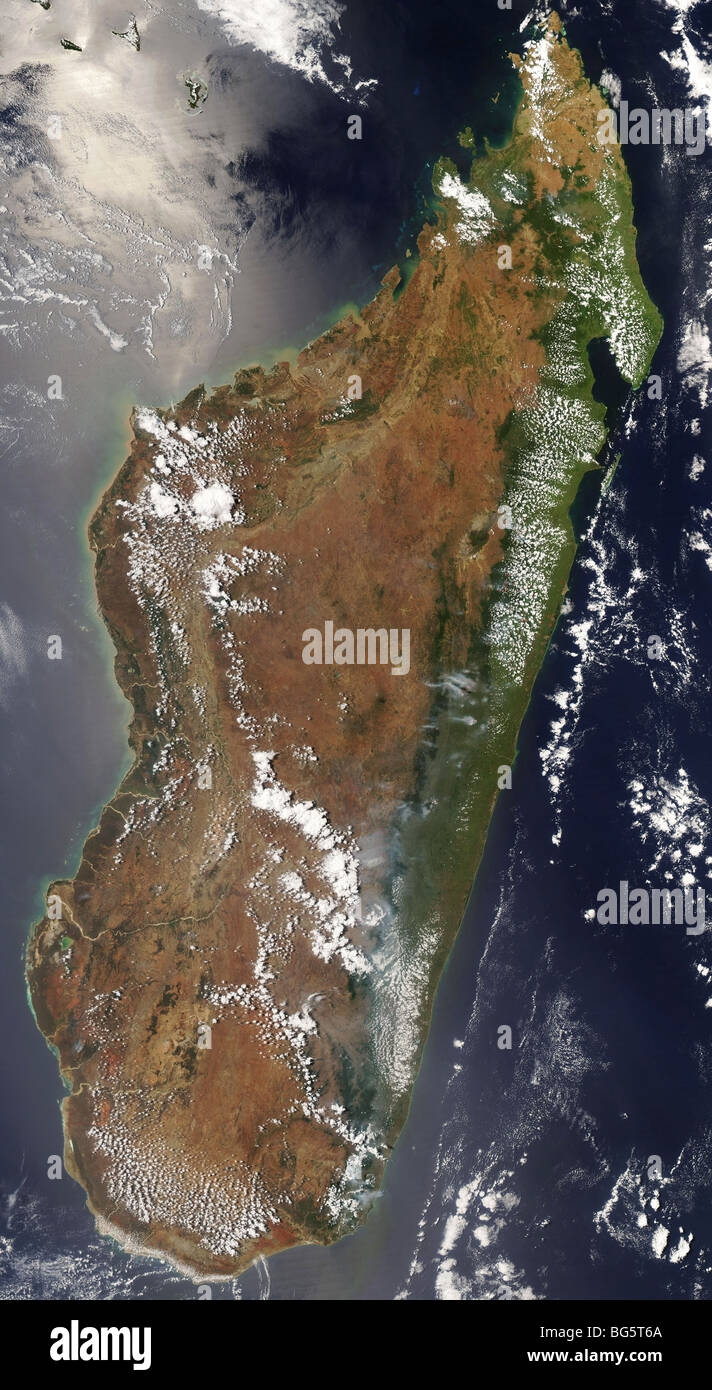
View of Madagascar from space
Image details
Contributor:
B.A.E. Inc. / Alamy Stock PhotoImage ID:
BG5T6AFile size:
60.3 MB (3.1 MB Compressed download)Releases:
Model - no | Property - noDo I need a release?Dimensions:
3400 x 6200 px | 28.8 x 52.5 cm | 11.3 x 20.7 inches | 300dpiMore information:
Madagascar as seen from space Madagascar on October 19, 2008. The Moderate Resolution Imaging Spectroradiometer (MODIS) on NASA’s Aqua satellite captured this natural-color image of the island that afternoon. The image shows the mountainous areas around the capital city, Antananarivo. The image shows the dramatic change in landscape from the coast to the island’s highland interior. Light green areas along the coastal plain are a mixture of forest and agricultural land. Dense forests appear deep green. The grassland and savanna ecosystems of the high plateau of the island’s interior appear in shades of dull green, tan, and reddish-brown. Image credit: NASA's MODIS Rapid Response Team Text credit: Rebecca Lindsey, NASA's Earth Observatory