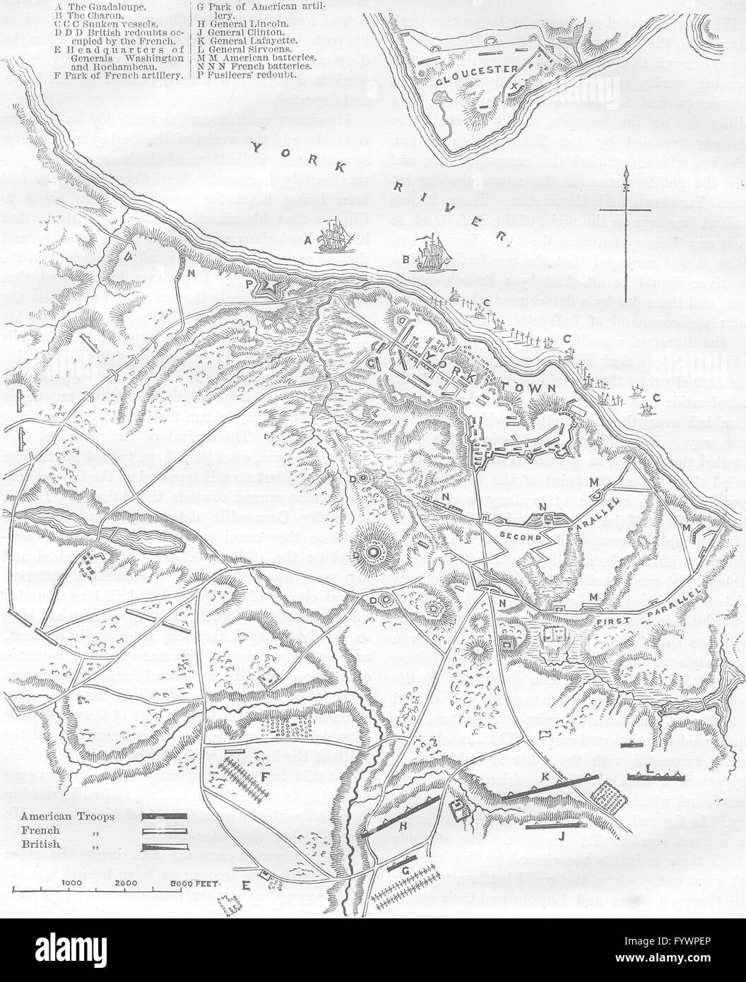
VIRGINIA: Plan of Yorktown, c1880 antique map
RFID:Image ID:FYWPEP
Image details
Contributor:
Antiqua Print Gallery / Alamy Stock PhotoImage ID:
FYWPEPFile size:
10.6 MB (704.1 KB Compressed download)Releases:
Model - no | Property - noDo I need a release?Dimensions:
1737 x 2137 px | 29.4 x 36.2 cm | 11.6 x 14.2 inches | 150dpiDate taken:
1880Location:
Virginia West VirginiaMore information:
This image could have imperfections as it’s either historical or reportage.
'Plan of the siege of Yorktown'. Artist/engraver/cartographer: Unsigned. Provenance: "Cassell’s History of the United States by Edmund Ollier". Type: Antique wood engraved print.