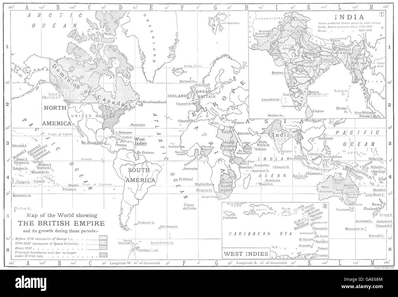
WORLD: Growth of the British Empire; Inset India; West Indies, 1910 old map
RFID:Image ID:GAE68M
Image details
Contributor:
Antiqua Print Gallery / Alamy Stock PhotoImage ID:
GAE68MFile size:
19.2 MB (843.7 KB Compressed download)Releases:
Model - no | Property - noDo I need a release?Dimensions:
3141 x 2133 px | 26.6 x 18.1 cm | 10.5 x 7.1 inches | 300dpiDate taken:
1910Location:
WorldMore information:
This image could have imperfections as it’s either historical or reportage.
'Map of the World showing the British Empire; Inset maps of India; West Indies '. Artist/engraver/cartographer: Walker, sc. Provenance: "The Encyclopaedia Britannica" Published by Cambridge at the University press, London: Eleventh Edition. Type: Antique map .