Quick filters:
1650 map Stock Photos and Images
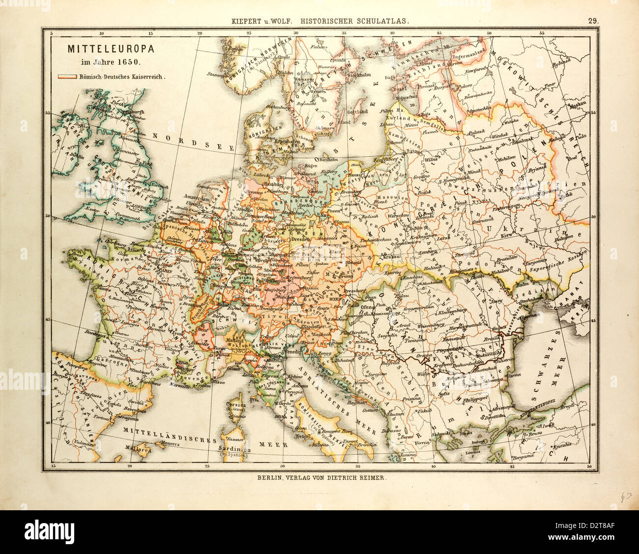 MAP OF CENTRAL EUROPE IN 1650 Stock Photohttps://www.alamy.com/image-license-details/?v=1https://www.alamy.com/stock-photo-map-of-central-europe-in-1650-53393831.html
RMD2T8AF–MAP OF CENTRAL EUROPE IN 1650
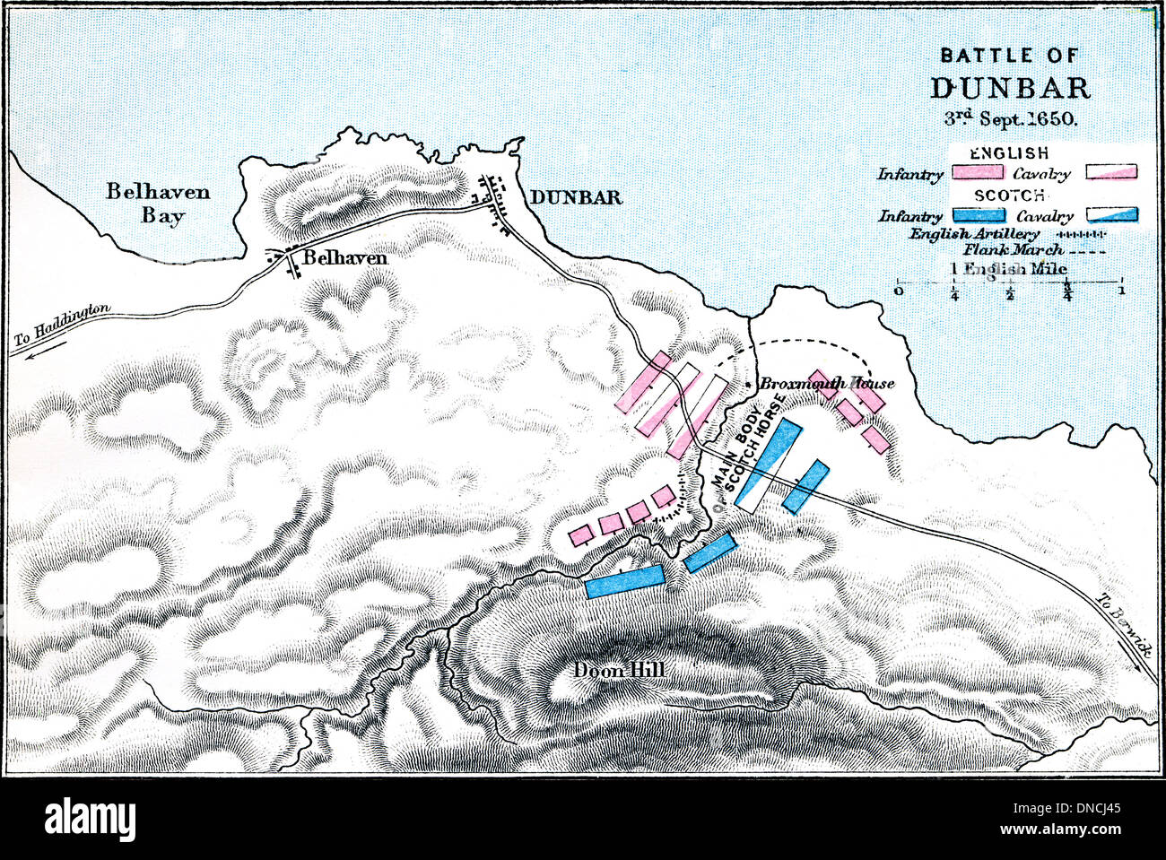 Battle of Dunbar, 3rd September 1650. Map of Battle plan. Published 1899. Stock Photohttps://www.alamy.com/image-license-details/?v=1https://www.alamy.com/battle-of-dunbar-3rd-september-1650-map-of-battle-plan-published-1899-image64816533.html
RMDNCJ45–Battle of Dunbar, 3rd September 1650. Map of Battle plan. Published 1899.
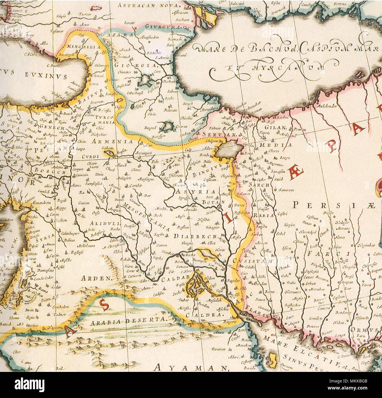 Map of Mesopotamia 1650 Stock Photohttps://www.alamy.com/image-license-details/?v=1https://www.alamy.com/map-of-mesopotamia-1650-image184208315.html
RMMKKBGB–Map of Mesopotamia 1650
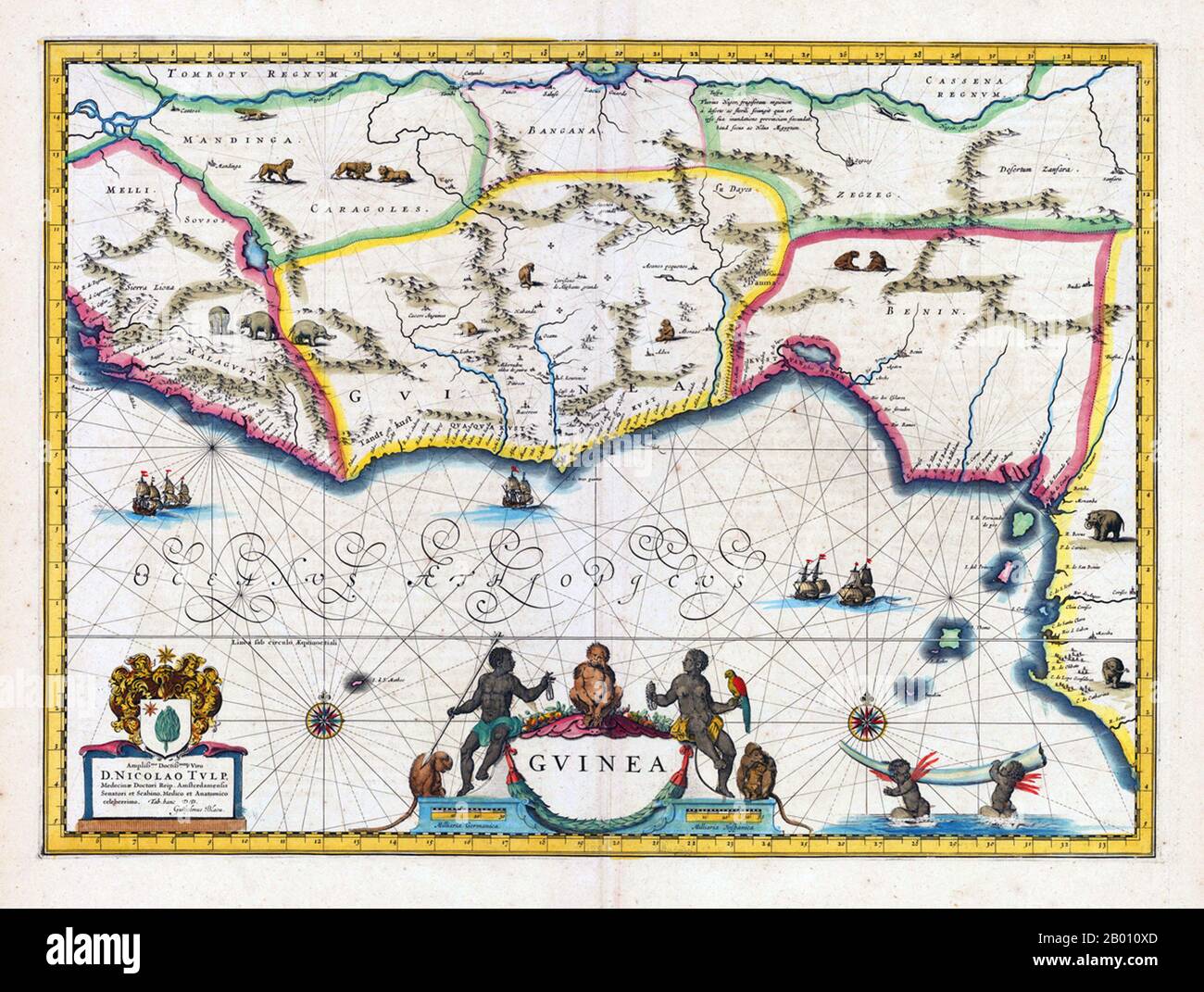 Africa: Map of Guinea and surrounding regions. The Benin Kingdom is indicated in the east. Map by Willem Blaeu (1571-1638) & Joan Bleau (1596-1673), Amsterdam, 1640-1650. Stock Photohttps://www.alamy.com/image-license-details/?v=1https://www.alamy.com/africa-map-of-guinea-and-surrounding-regions-the-benin-kingdom-is-indicated-in-the-east-map-by-willem-blaeu-1571-1638-joan-bleau-1596-1673-amsterdam-1640-1650-image344230053.html
RM2B010XD–Africa: Map of Guinea and surrounding regions. The Benin Kingdom is indicated in the east. Map by Willem Blaeu (1571-1638) & Joan Bleau (1596-1673), Amsterdam, 1640-1650.
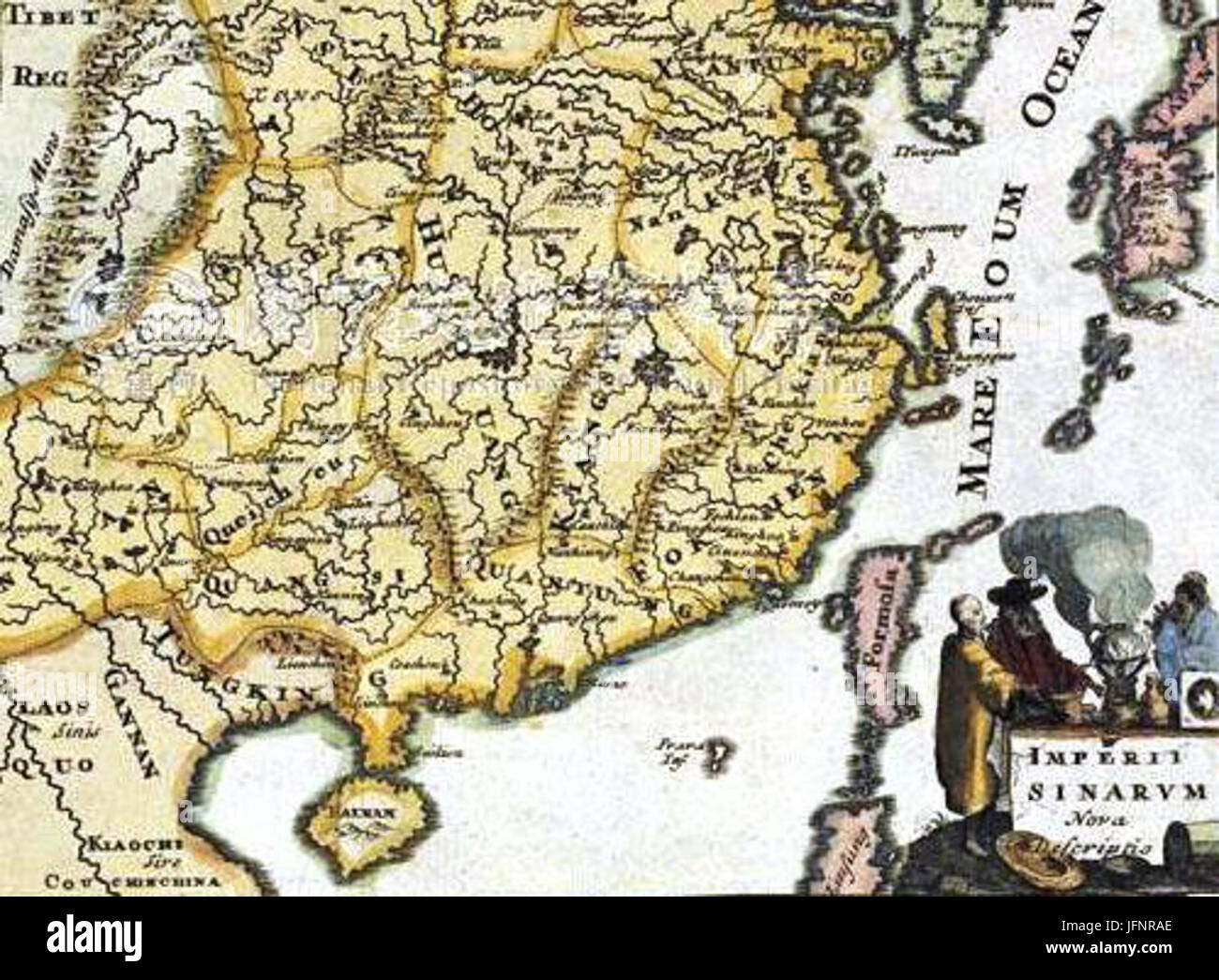 1650 Map of Formosa 28Taiwan29 Philippines Tibet Japan Korea and China by Italian E7BEA9E5A4A7E588A9E4BABAE68980E7B9AAE7A68FE788BEE691A9E6B299-E887BAE781A3 E88F 0008 Stock Photohttps://www.alamy.com/image-license-details/?v=1https://www.alamy.com/stock-photo-1650-map-of-formosa-28taiwan29-philippines-tibet-japan-korea-and-china-147382102.html
RMJFNRAE–1650 Map of Formosa 28Taiwan29 Philippines Tibet Japan Korea and China by Italian E7BEA9E5A4A7E588A9E4BABAE68980E7B9AAE7A68FE788BEE691A9E6B299-E887BAE781A3 E88F 0008
 A colored plan of the Lago di Como and the Lago di Chiavena drawn about 1650. Map information: Title: A colored plan of the Lago di Como and the Lago di Chiavena; drawn about 1650. 77.29. Date of publication: About 1650. Item type: Ms. 9 f. 3 in. x 1 f. 7 in. Former owner: George III, King of Great Britain, 1738-1820 Stock Photohttps://www.alamy.com/image-license-details/?v=1https://www.alamy.com/a-colored-plan-of-the-lago-di-como-and-the-lago-di-chiavena-drawn-about-1650-map-information-title-a-colored-plan-of-the-lago-di-como-and-the-lago-di-chiavena-drawn-about-1650-7729-date-of-publication-about-1650-item-type-ms-9-f-3-in-x-1-f-7-in-former-owner-george-iii-king-of-great-britain-1738-1820-image401713703.html
RM2E9FHWY–A colored plan of the Lago di Como and the Lago di Chiavena drawn about 1650. Map information: Title: A colored plan of the Lago di Como and the Lago di Chiavena; drawn about 1650. 77.29. Date of publication: About 1650. Item type: Ms. 9 f. 3 in. x 1 f. 7 in. Former owner: George III, King of Great Britain, 1738-1820
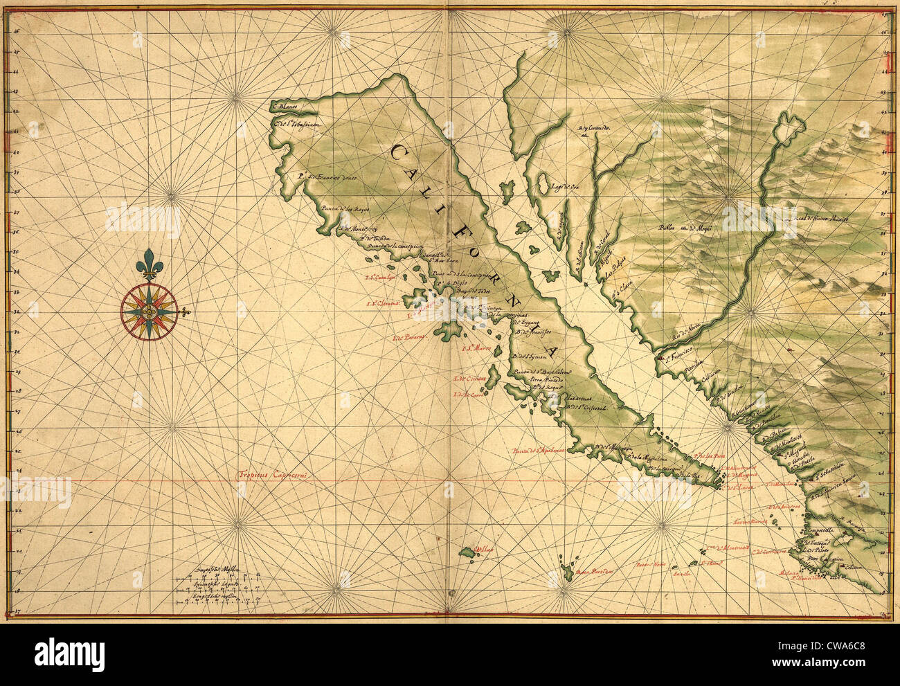 1650 map of Baja California and northwest Mexico, showing California as an island Stock Photohttps://www.alamy.com/image-license-details/?v=1https://www.alamy.com/stock-photo-1650-map-of-baja-california-and-northwest-mexico-showing-california-50011704.html
RMCWA6C8–1650 map of Baja California and northwest Mexico, showing California as an island
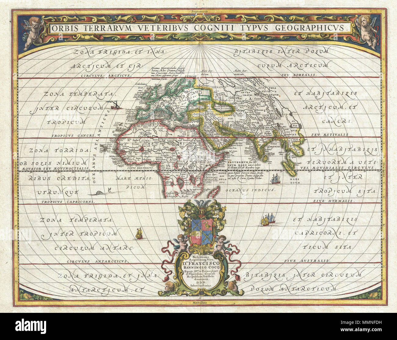 . English: An exceptional 1650 map of the world as it was known to the ancients by Jan Janssonius. Such maps, which filled in contemporary geography with ancient place names, were popular in the post-Renaissance period. Scholars digging through rediscovered Greek and Roman texts needed a geographical reference point for the numerous place names that peppered these works. Such maps began appearing in 16t century. This particular example is a significant reworking of an earlier chart by A. Ortelius. It covers Europe, western Asia, and Northern Africa as well as significant, though blank, portio Stock Photohttps://www.alamy.com/image-license-details/?v=1https://www.alamy.com/english-an-exceptional-1650-map-of-the-world-as-it-was-known-to-the-ancients-by-jan-janssonius-such-maps-which-filled-in-contemporary-geography-with-ancient-place-names-were-popular-in-the-post-renaissance-period-scholars-digging-through-rediscovered-greek-and-roman-texts-needed-a-geographical-reference-point-for-the-numerous-place-names-that-peppered-these-works-such-maps-began-appearing-in-16t-century-this-particular-example-is-a-significant-reworking-of-an-earlier-chart-by-a-ortelius-it-covers-europe-western-asia-and-northern-africa-as-well-as-significant-though-blank-portio-image184869933.html
RMMMNFDH–. English: An exceptional 1650 map of the world as it was known to the ancients by Jan Janssonius. Such maps, which filled in contemporary geography with ancient place names, were popular in the post-Renaissance period. Scholars digging through rediscovered Greek and Roman texts needed a geographical reference point for the numerous place names that peppered these works. Such maps began appearing in 16t century. This particular example is a significant reworking of an earlier chart by A. Ortelius. It covers Europe, western Asia, and Northern Africa as well as significant, though blank, portio
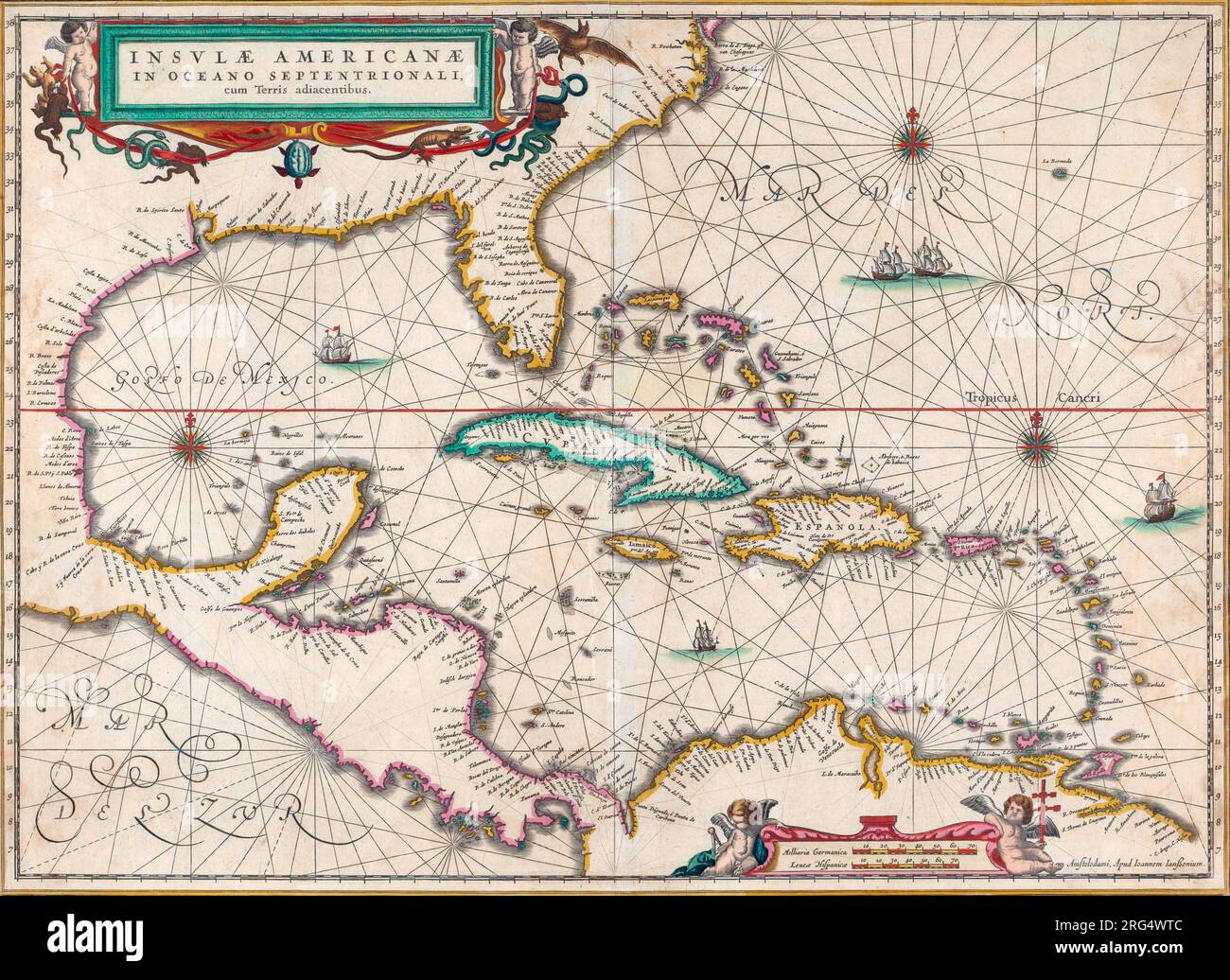 Map of Central America and the Caribbean islands. Published by Johannes Janssonius, Amsterdam, circa 1650. Stock Photohttps://www.alamy.com/image-license-details/?v=1https://www.alamy.com/map-of-central-america-and-the-caribbean-islands-published-by-johannes-janssonius-amsterdam-circa-1650-image560674364.html
RM2RG4WTC–Map of Central America and the Caribbean islands. Published by Johannes Janssonius, Amsterdam, circa 1650.
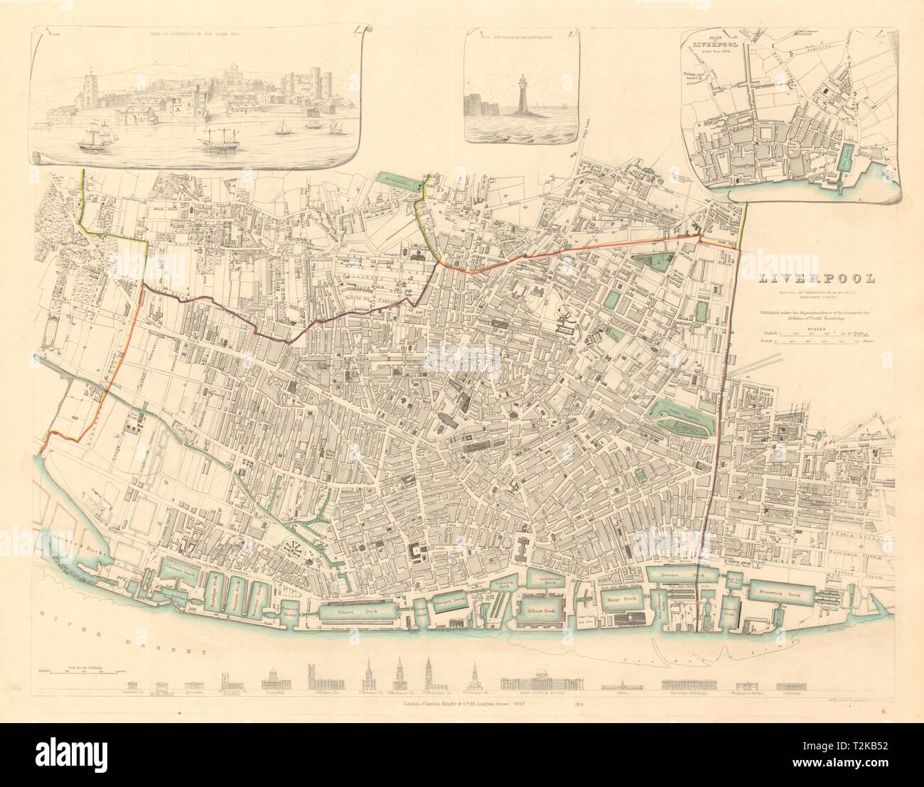 LIVERPOOL antique town city map. Inset 1650 view/1729 plan. Buildings. SDUK 1847 Stock Photohttps://www.alamy.com/image-license-details/?v=1https://www.alamy.com/liverpool-antique-town-city-map-inset-1650-view1729-plan-buildings-sduk-1847-image242600318.html
RFT2KB52–LIVERPOOL antique town city map. Inset 1650 view/1729 plan. Buildings. SDUK 1847
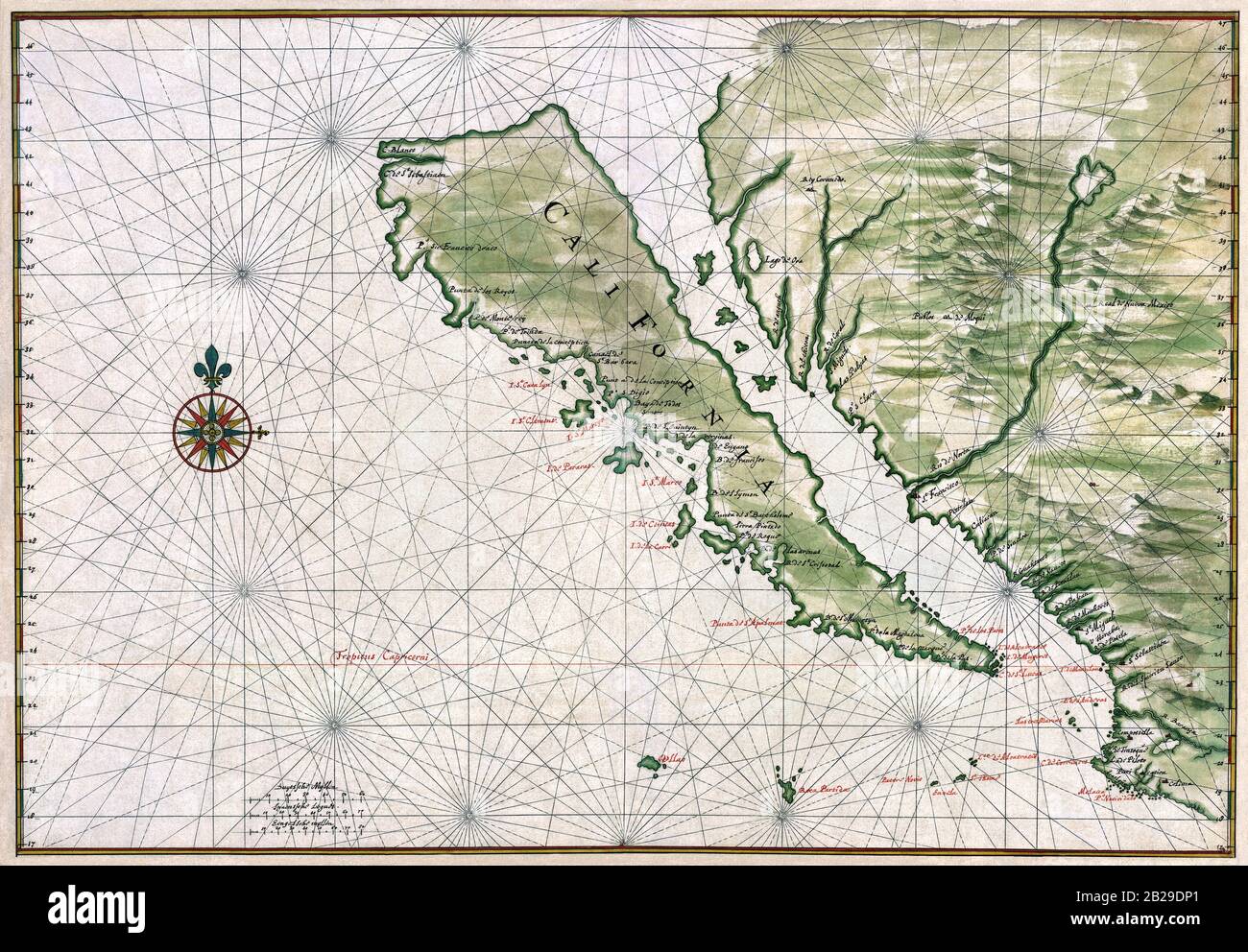 Map of California as an island. Ink and watercolor with pictorial relief - Johannes Vingboons, circa 1650 Stock Photohttps://www.alamy.com/image-license-details/?v=1https://www.alamy.com/map-of-california-as-an-island-ink-and-watercolor-with-pictorial-relief-johannes-vingboons-circa-1650-image345645049.html
RM2B29DP1–Map of California as an island. Ink and watercolor with pictorial relief - Johannes Vingboons, circa 1650
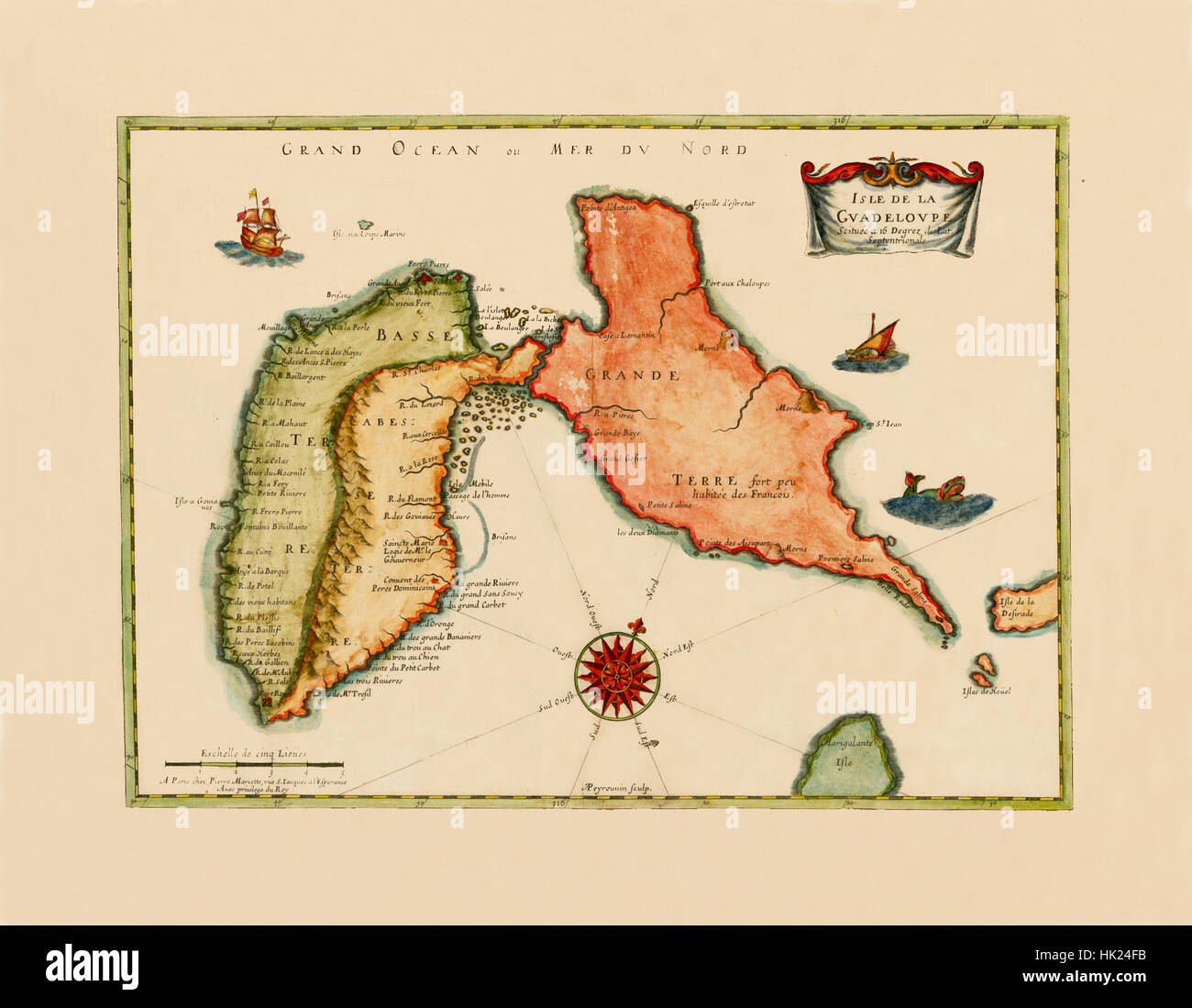 Map Of Guadeloupe 1650 Stock Photohttps://www.alamy.com/image-license-details/?v=1https://www.alamy.com/stock-photo-map-of-guadeloupe-1650-132198511.html
RFHK24FB–Map Of Guadeloupe 1650
 Johannes Vingboons, California Map, 1650 Stock Photohttps://www.alamy.com/image-license-details/?v=1https://www.alamy.com/johannes-vingboons-california-map-1650-image245867006.html
RMT805TE–Johannes Vingboons, California Map, 1650
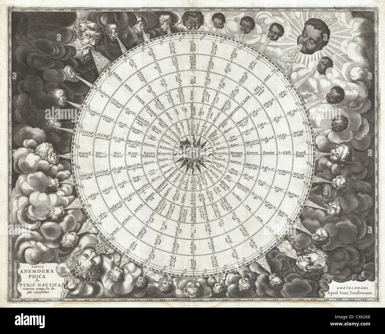 1650 Jansson Wind Rose, Anemographic Chart, or Map of the Winds Stock Photohttps://www.alamy.com/image-license-details/?v=1https://www.alamy.com/stock-photo-1650-jansson-wind-rose-anemographic-chart-or-map-of-the-winds-50535248.html
RMCX6268–1650 Jansson Wind Rose, Anemographic Chart, or Map of the Winds
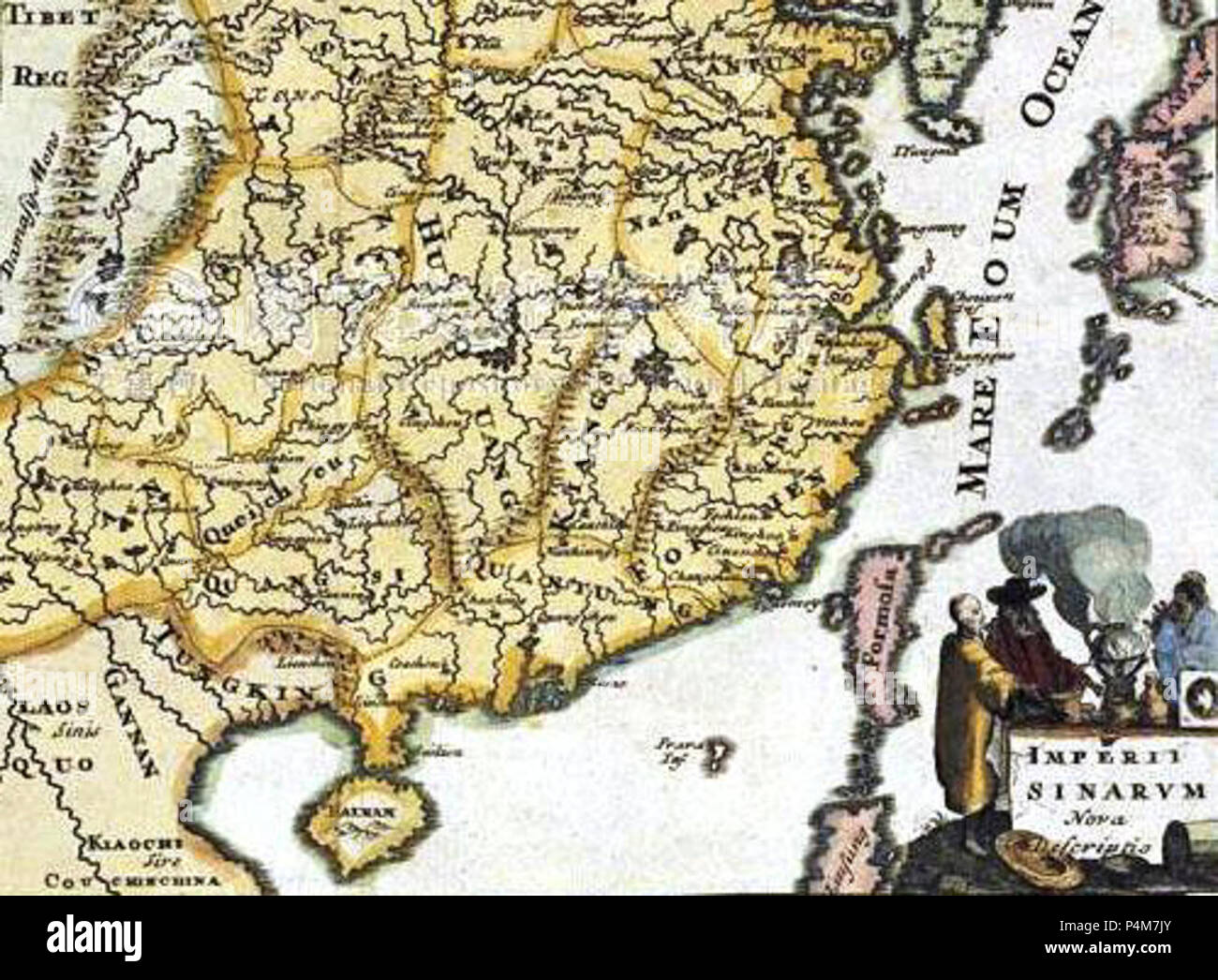 1650 Map of Formosa (Taiwan) Philippines Tibet Japan Korea and China by Italian 義大利人所繪福爾摩沙-襸 0094. Stock Photohttps://www.alamy.com/image-license-details/?v=1https://www.alamy.com/1650-map-of-formosa-taiwan-philippines-tibet-japan-korea-and-china-by-italian-0094-image209428099.html
RMP4M7JY–1650 Map of Formosa (Taiwan) Philippines Tibet Japan Korea and China by Italian 義大利人所繪福爾摩沙-襸 0094.
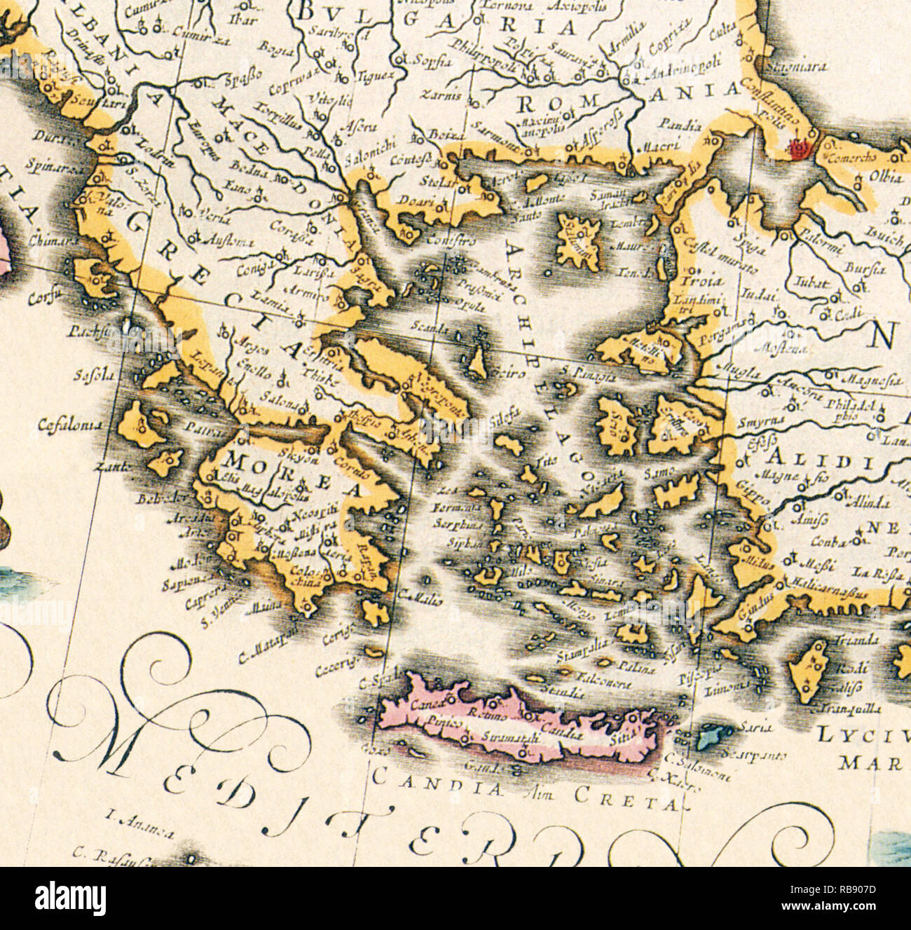 Map of Greece 1650 Stock Photohttps://www.alamy.com/image-license-details/?v=1https://www.alamy.com/map-of-greece-1650-image230693777.html
RMRB907D–Map of Greece 1650
 CARTE DES ANTILLES.1650 Stock Photohttps://www.alamy.com/image-license-details/?v=1https://www.alamy.com/carte-des-antilles1650-image255440659.html
RFTRG94K–CARTE DES ANTILLES.1650
 Courchevel 1650, Savoy, France, Auvergne-Rhône-Alpes, N 45 25' 0'', E 6 39' 2'', map, Timeless Map published in 2021. Travelers, explorers and adventurers like Florence Nightingale, David Livingstone, Ernest Shackleton, Lewis and Clark and Sherlock Holmes relied on maps to plan travels to the world's most remote corners, Timeless Maps is mapping most locations on the globe, showing the achievement of great dreams Stock Photohttps://www.alamy.com/image-license-details/?v=1https://www.alamy.com/courchevel-1650-savoy-france-auvergne-rhne-alpes-n-45-25-0-e-6-39-2-map-timeless-map-published-in-2021-travelers-explorers-and-adventurers-like-florence-nightingale-david-livingstone-ernest-shackleton-lewis-and-clark-and-sherlock-holmes-relied-on-maps-to-plan-travels-to-the-worlds-most-remote-corners-timeless-maps-is-mapping-most-locations-on-the-globe-showing-the-achievement-of-great-dreams-image445298637.html
RM2GTD2XN–Courchevel 1650, Savoy, France, Auvergne-Rhône-Alpes, N 45 25' 0'', E 6 39' 2'', map, Timeless Map published in 2021. Travelers, explorers and adventurers like Florence Nightingale, David Livingstone, Ernest Shackleton, Lewis and Clark and Sherlock Holmes relied on maps to plan travels to the world's most remote corners, Timeless Maps is mapping most locations on the globe, showing the achievement of great dreams
 Couple reading map near Lammersdorfer Huette (1650 m), Lammersdorf near Millstatt, Carinthia, Austria Stock Photohttps://www.alamy.com/image-license-details/?v=1https://www.alamy.com/stock-photo-couple-reading-map-near-lammersdorfer-huette-1650-m-lammersdorf-near-27702086.html
RMBH1X86–Couple reading map near Lammersdorfer Huette (1650 m), Lammersdorf near Millstatt, Carinthia, Austria
 Map of the blockade of Amsterdam by the troops of William II, 1650, The blockade of Amsterdam, by the troops of William the Second, Prince of Orange, from the 30th of July to the 4th of August 1650 (title on object ), Map of the blockade of Amsterdam by the troops of Prince William II, from July 20 to August 4, 1650. Map of Amsterdam with the surrounding area, Haarlem on the right, Muiden and Weesp on the left. The different campsites of the troops are indicated on the map. On the left on the Zuiderzee near Pampus several ships are indicated by name., print, print maker: anonymous, after Stock Photohttps://www.alamy.com/image-license-details/?v=1https://www.alamy.com/map-of-the-blockade-of-amsterdam-by-the-troops-of-william-ii-1650-the-blockade-of-amsterdam-by-the-troops-of-william-the-second-prince-of-orange-from-the-30th-of-july-to-the-4th-of-august-1650-title-on-object-map-of-the-blockade-of-amsterdam-by-the-troops-of-prince-william-ii-from-july-20-to-august-4-1650-map-of-amsterdam-with-the-surrounding-area-haarlem-on-the-right-muiden-and-weesp-on-the-left-the-different-campsites-of-the-troops-are-indicated-on-the-map-on-the-left-on-the-zuiderzee-near-pampus-several-ships-are-indicated-by-name-print-print-maker-anonymous-after-image606627873.html
RM2X6X815–Map of the blockade of Amsterdam by the troops of William II, 1650, The blockade of Amsterdam, by the troops of William the Second, Prince of Orange, from the 30th of July to the 4th of August 1650 (title on object ), Map of the blockade of Amsterdam by the troops of Prince William II, from July 20 to August 4, 1650. Map of Amsterdam with the surrounding area, Haarlem on the right, Muiden and Weesp on the left. The different campsites of the troops are indicated on the map. On the left on the Zuiderzee near Pampus several ships are indicated by name., print, print maker: anonymous, after
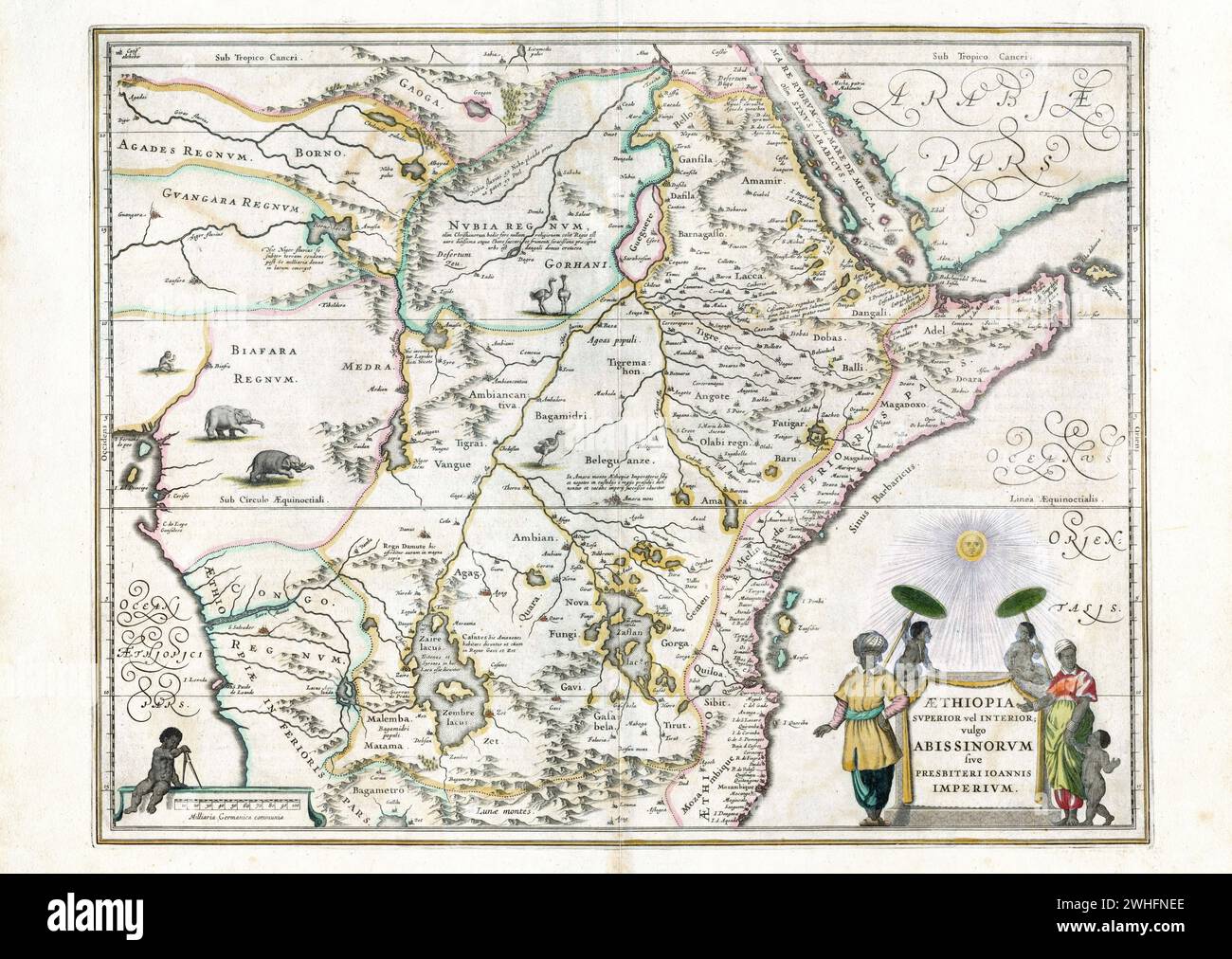 Map of Ethiopia, Willem and Johannes Joan Blaeu, ca 1650 *** Map of Ethiopia, Willem and Johannes Joan Blaeu, ca 1650 Stock Photohttps://www.alamy.com/image-license-details/?v=1https://www.alamy.com/map-of-ethiopia-willem-and-johannes-joan-blaeu-ca-1650-map-of-ethiopia-willem-and-johannes-joan-blaeu-ca-1650-image595947814.html
RM2WHFNEE–Map of Ethiopia, Willem and Johannes Joan Blaeu, ca 1650 *** Map of Ethiopia, Willem and Johannes Joan Blaeu, ca 1650
 Map of Greece 1650 Stock Photohttps://www.alamy.com/image-license-details/?v=1https://www.alamy.com/map-of-greece-1650-image184208310.html
RMMKKBG6–Map of Greece 1650
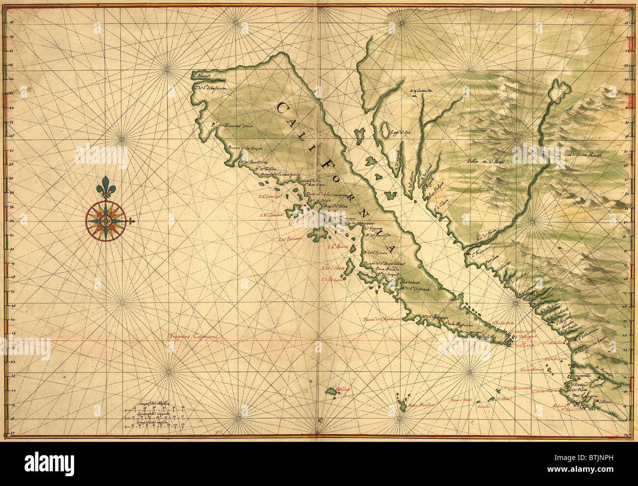 1650 map of Baja California and northwest Mexico, showing California as an island Stock Photohttps://www.alamy.com/image-license-details/?v=1https://www.alamy.com/stock-photo-1650-map-of-baja-california-and-northwest-mexico-showing-california-32374345.html
RMBTJNPH–1650 map of Baja California and northwest Mexico, showing California as an island
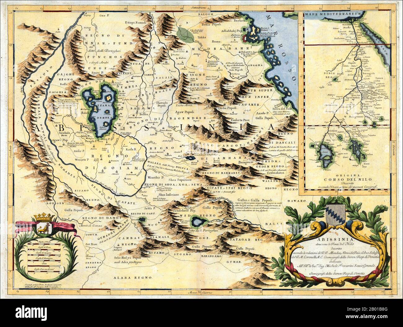 Northeast Africa: Map of the Nile from its source in Abyssinia to the Mediterranean, by Vincenzo Maria Coronelli (16 August 1650 - 9 December 1718), 1690. A Venetian cartographer, Coronelli cites his sources for this Nile map, including the Portuguese Jesuits Pedro Páez and Jerónimo Lobo, and contrasts his work with an inset showing the “original” (that is, outdated) course of the Nile as presented by past geographers, who followed the Ptolemaic tradition of two source lakes. Stock Photohttps://www.alamy.com/image-license-details/?v=1https://www.alamy.com/northeast-africa-map-of-the-nile-from-its-source-in-abyssinia-to-the-mediterranean-by-vincenzo-maria-coronelli-16-august-1650-9-december-1718-1690-a-venetian-cartographer-coronelli-cites-his-sources-for-this-nile-map-including-the-portuguese-jesuits-pedro-pez-and-jernimo-lobo-and-contrasts-his-work-with-an-inset-showing-the-original-that-is-outdated-course-of-the-nile-as-presented-by-past-geographers-who-followed-the-ptolemaic-tradition-of-two-source-lakes-image344238176.html
RM2B01B8G–Northeast Africa: Map of the Nile from its source in Abyssinia to the Mediterranean, by Vincenzo Maria Coronelli (16 August 1650 - 9 December 1718), 1690. A Venetian cartographer, Coronelli cites his sources for this Nile map, including the Portuguese Jesuits Pedro Páez and Jerónimo Lobo, and contrasts his work with an inset showing the “original” (that is, outdated) course of the Nile as presented by past geographers, who followed the Ptolemaic tradition of two source lakes.
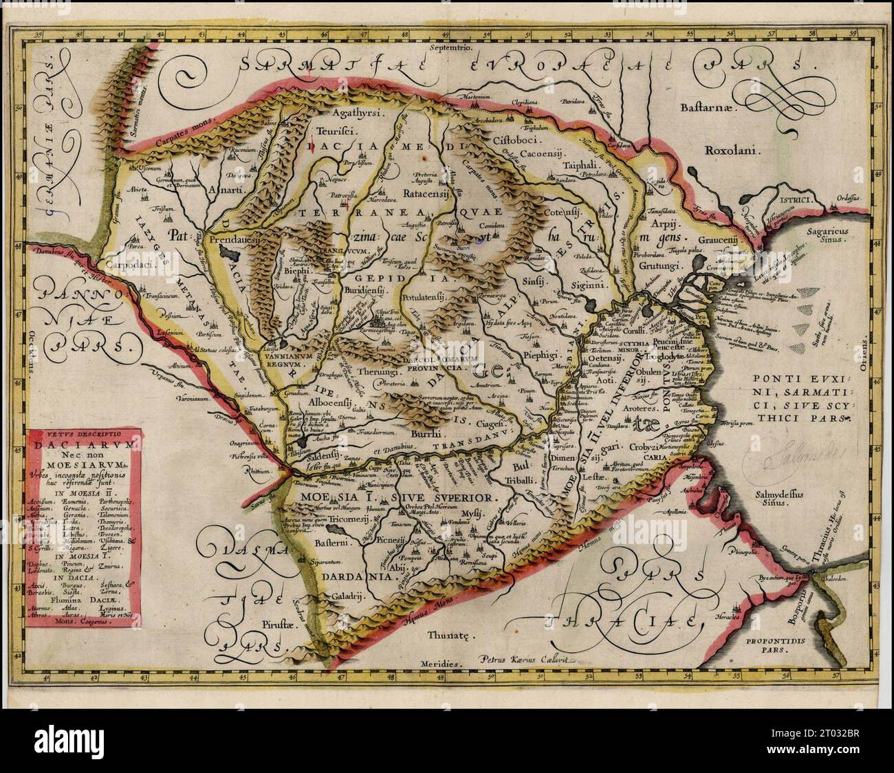 ca. 1650 map of Romania Stock Photohttps://www.alamy.com/image-license-details/?v=1https://www.alamy.com/ca-1650-map-of-romania-image568009899.html
RM2T032BR–ca. 1650 map of Romania
 The Baronial hall of Chethams Music School, Manchester, United Kingdom, built in the fifteenth century, with the Hyde Cross in the foreground. The building currently includes the library. The cross appeared on a 1650 map of Manchester as a Latin cross on a pedestal and stood at a nearby road junction until the 1840's. Chetham's teaches pupils and students between the ages of 8 and 18. Chetham's Library is the oldest free public reference library in the English-speaking world. Stock Photohttps://www.alamy.com/image-license-details/?v=1https://www.alamy.com/the-baronial-hall-of-chethams-music-school-manchester-united-kingdom-built-in-the-fifteenth-century-with-the-hyde-cross-in-the-foreground-the-building-currently-includes-the-library-the-cross-appeared-on-a-1650-map-of-manchester-as-a-latin-cross-on-a-pedestal-and-stood-at-a-nearby-road-junction-until-the-1840s-chethams-teaches-pupils-and-students-between-the-ages-of-8-and-18-chethams-library-is-the-oldest-free-public-reference-library-in-the-english-speaking-world-image477809306.html
RM2JNA2J2–The Baronial hall of Chethams Music School, Manchester, United Kingdom, built in the fifteenth century, with the Hyde Cross in the foreground. The building currently includes the library. The cross appeared on a 1650 map of Manchester as a Latin cross on a pedestal and stood at a nearby road junction until the 1840's. Chetham's teaches pupils and students between the ages of 8 and 18. Chetham's Library is the oldest free public reference library in the English-speaking world.
 . English: An extremely rare and altogether fascinating 1650 map of Jerusalem by Thomas Fuller. Depicts the old walled city of Jerusalem during the reign of the Biblical King Solomon, ca. 961-922 BC. On the whole this is a highly imaginative map of the city and likely bears no significant resemblance to the Jerusalem of Solomon. Solomon's Temple appears at the right center with a tall bell tower and a highly Renaissance European design aesthetic. At the center, roughly where the Church of Holy Sepulture is located today, is Solomon's menagerie. The Baths of Bethesda, in which an angel swims, Stock Photohttps://www.alamy.com/image-license-details/?v=1https://www.alamy.com/english-an-extremely-rare-and-altogether-fascinating-1650-map-of-jerusalem-by-thomas-fuller-depicts-the-old-walled-city-of-jerusalem-during-the-reign-of-the-biblical-king-solomon-ca-961-922-bc-on-the-whole-this-is-a-highly-imaginative-map-of-the-city-and-likely-bears-no-significant-resemblance-to-the-jerusalem-of-solomon-solomons-temple-appears-at-the-right-center-with-a-tall-bell-tower-and-a-highly-renaissance-european-design-aesthetic-at-the-center-roughly-where-the-church-of-holy-sepulture-is-located-today-is-solomons-menagerie-the-baths-of-bethesda-in-which-an-angel-swims-image184869935.html
RMMMNFDK–. English: An extremely rare and altogether fascinating 1650 map of Jerusalem by Thomas Fuller. Depicts the old walled city of Jerusalem during the reign of the Biblical King Solomon, ca. 961-922 BC. On the whole this is a highly imaginative map of the city and likely bears no significant resemblance to the Jerusalem of Solomon. Solomon's Temple appears at the right center with a tall bell tower and a highly Renaissance European design aesthetic. At the center, roughly where the Church of Holy Sepulture is located today, is Solomon's menagerie. The Baths of Bethesda, in which an angel swims,
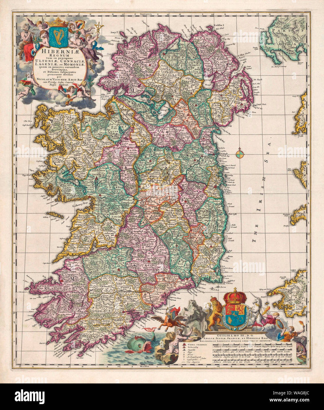 Map of Ireland circa 1650-1675 by Dutch engraver, cartographer and publisher Nicolaes Visscher 1 Stock Photohttps://www.alamy.com/image-license-details/?v=1https://www.alamy.com/map-of-ireland-circa-1650-1675-by-dutch-engraver-cartographer-and-publisher-nicolaes-visscher-1-image264660100.html
RMWAG8JC–Map of Ireland circa 1650-1675 by Dutch engraver, cartographer and publisher Nicolaes Visscher 1
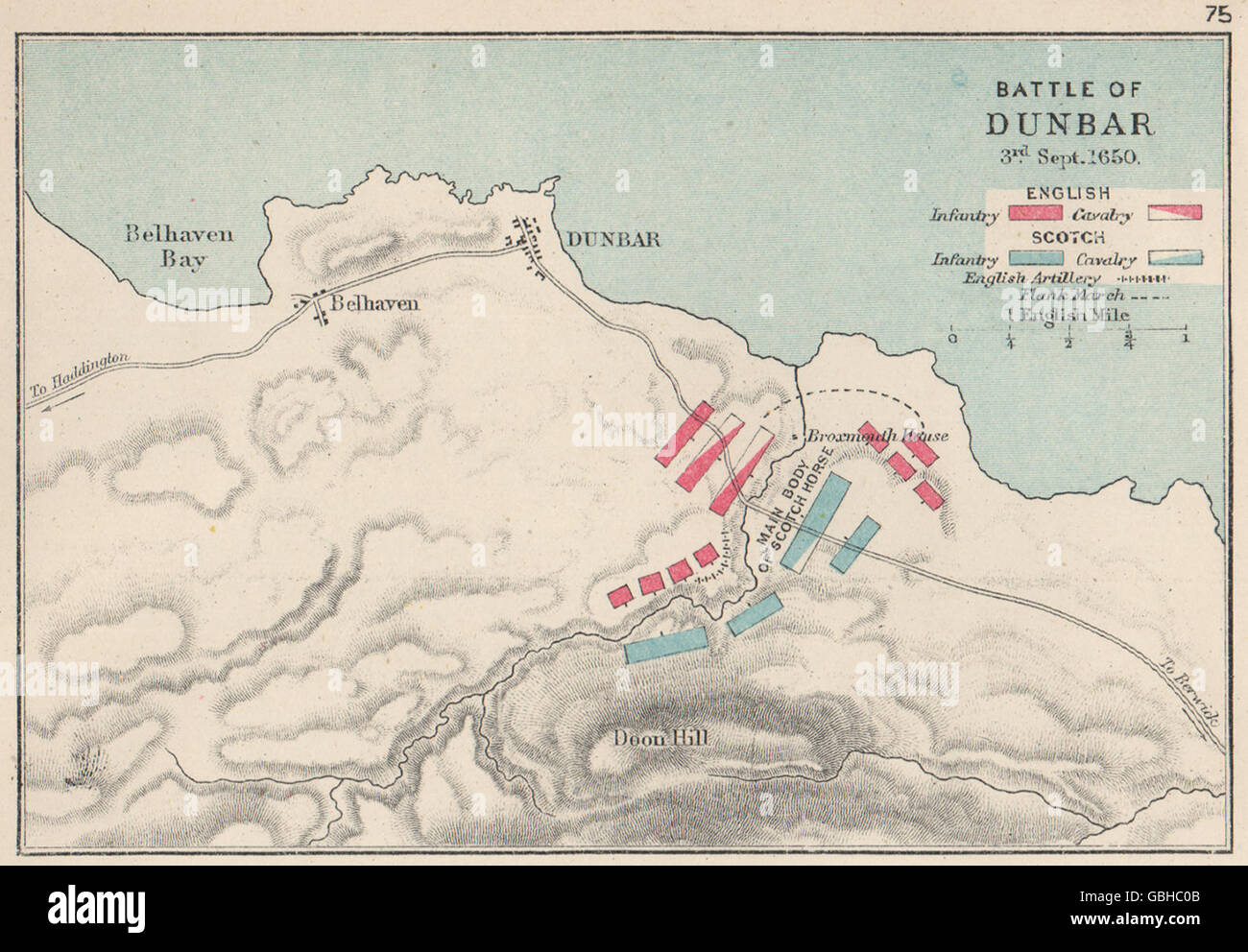 3RD ENGLISH CIVIL WAR: Battle of Dunbar 1650. English v Scots. SMALL, 1907 map Stock Photohttps://www.alamy.com/image-license-details/?v=1https://www.alamy.com/stock-photo-3rd-english-civil-war-battle-of-dunbar-1650-english-v-scots-small-110406027.html
RFGBHC0B–3RD ENGLISH CIVIL WAR: Battle of Dunbar 1650. English v Scots. SMALL, 1907 map
 Map of the Blockade of Amsterdam by the troops of Willem II, 1650, 1728 - 1730 print Map of the Blockade of Amsterdam by the troops of Prince William II, from 20 July to 4 August 1650. Map of Amsterdam with the surrounding area, right Haarlem, Left Muiden and Weesp. The different army places of the troops are indicated on the map. Left on the Zuiderzee near Pampus different ships with name indicated. Northern Netherlands paper etching maps of separate countries or regions Amsterdam. North Holland Stock Photohttps://www.alamy.com/image-license-details/?v=1https://www.alamy.com/map-of-the-blockade-of-amsterdam-by-the-troops-of-willem-ii-1650-1728-1730-print-map-of-the-blockade-of-amsterdam-by-the-troops-of-prince-william-ii-from-20-july-to-4-august-1650-map-of-amsterdam-with-the-surrounding-area-right-haarlem-left-muiden-and-weesp-the-different-army-places-of-the-troops-are-indicated-on-the-map-left-on-the-zuiderzee-near-pampus-different-ships-with-name-indicated-northern-netherlands-paper-etching-maps-of-separate-countries-or-regions-amsterdam-north-holland-image595220041.html
RM2WGAH6H–Map of the Blockade of Amsterdam by the troops of Willem II, 1650, 1728 - 1730 print Map of the Blockade of Amsterdam by the troops of Prince William II, from 20 July to 4 August 1650. Map of Amsterdam with the surrounding area, right Haarlem, Left Muiden and Weesp. The different army places of the troops are indicated on the map. Left on the Zuiderzee near Pampus different ships with name indicated. Northern Netherlands paper etching maps of separate countries or regions Amsterdam. North Holland
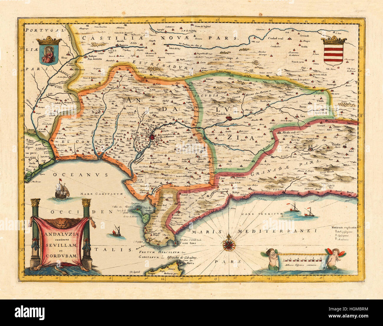 Map Of Andalusia 1650 Stock Photohttps://www.alamy.com/image-license-details/?v=1https://www.alamy.com/stock-photo-map-of-andalusia-1650-130755400.html
RFHGMBRM–Map Of Andalusia 1650
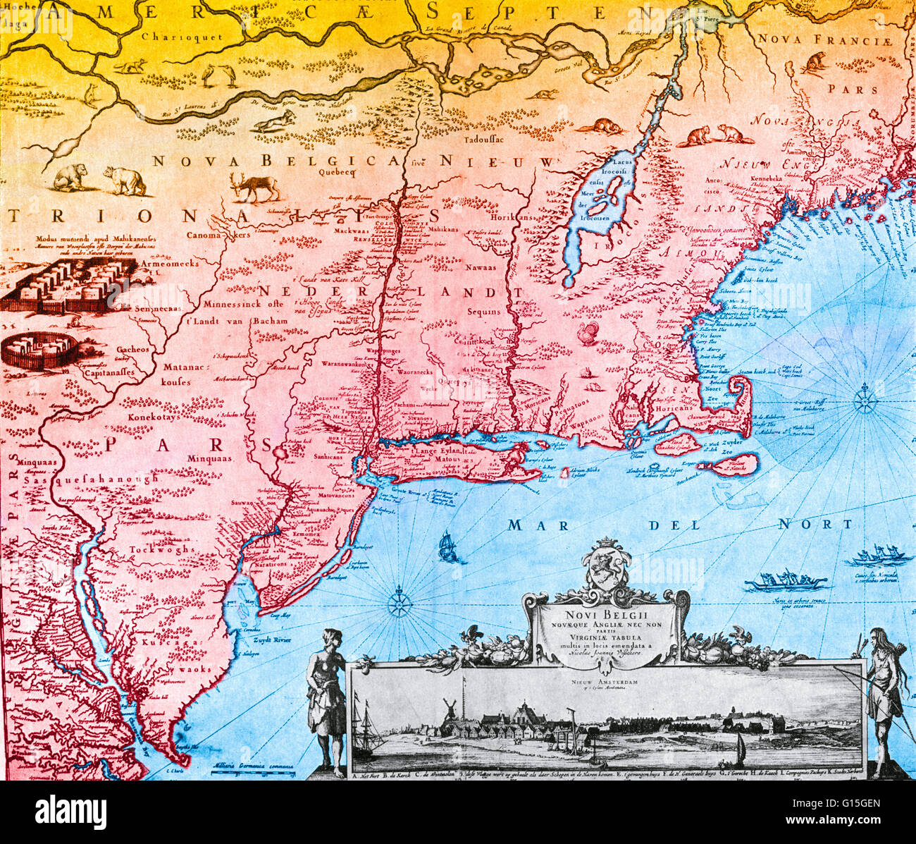 The Jansson-Visscher map of New Netherland with and illustration of New Amsterdam in the lower right corner. First published in 1650. Stock Photohttps://www.alamy.com/image-license-details/?v=1https://www.alamy.com/stock-photo-the-jansson-visscher-map-of-new-netherland-with-and-illustration-of-103999581.html
RMG15GEN–The Jansson-Visscher map of New Netherland with and illustration of New Amsterdam in the lower right corner. First published in 1650.
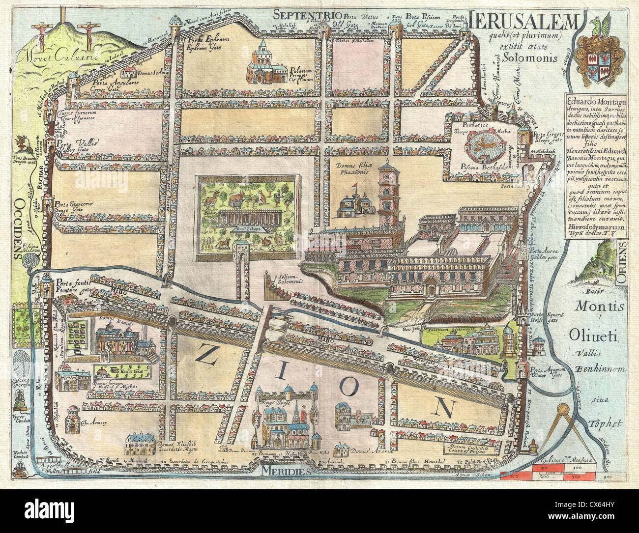 1650 Fuller Map of Jerusalem ( Israel, Palestine, Holy Land) Stock Photohttps://www.alamy.com/image-license-details/?v=1https://www.alamy.com/stock-photo-1650-fuller-map-of-jerusalem-israel-palestine-holy-land-50537143.html
RMCX64HY–1650 Fuller Map of Jerusalem ( Israel, Palestine, Holy Land)
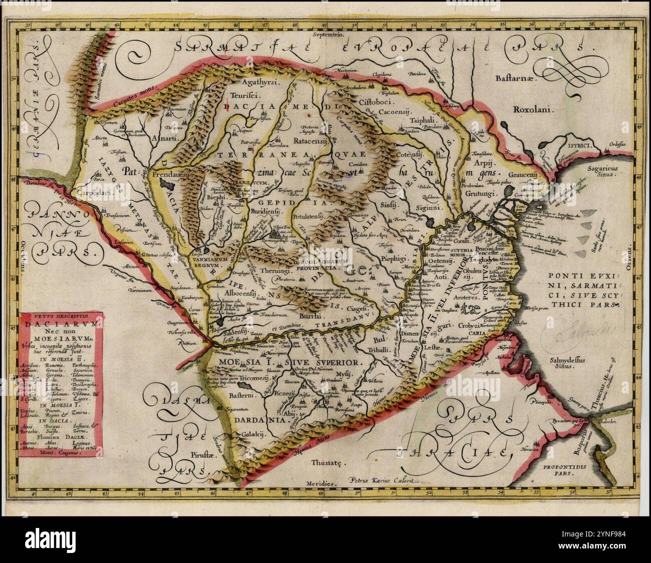 Ca. 1650 map of Romania. Stock Photohttps://www.alamy.com/image-license-details/?v=1https://www.alamy.com/ca-1650-map-of-romania-image632817588.html
RM2YNF984–Ca. 1650 map of Romania.
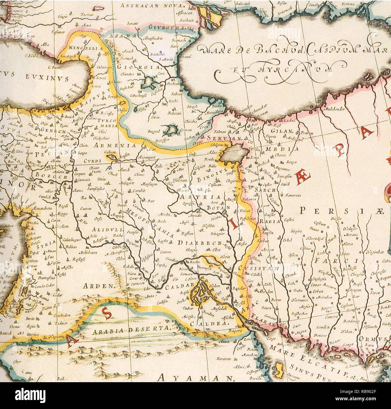 Map of Mesopotamia 1650 Stock Photohttps://www.alamy.com/image-license-details/?v=1https://www.alamy.com/map-of-mesopotamia-1650-image230693639.html
RMRB902F–Map of Mesopotamia 1650
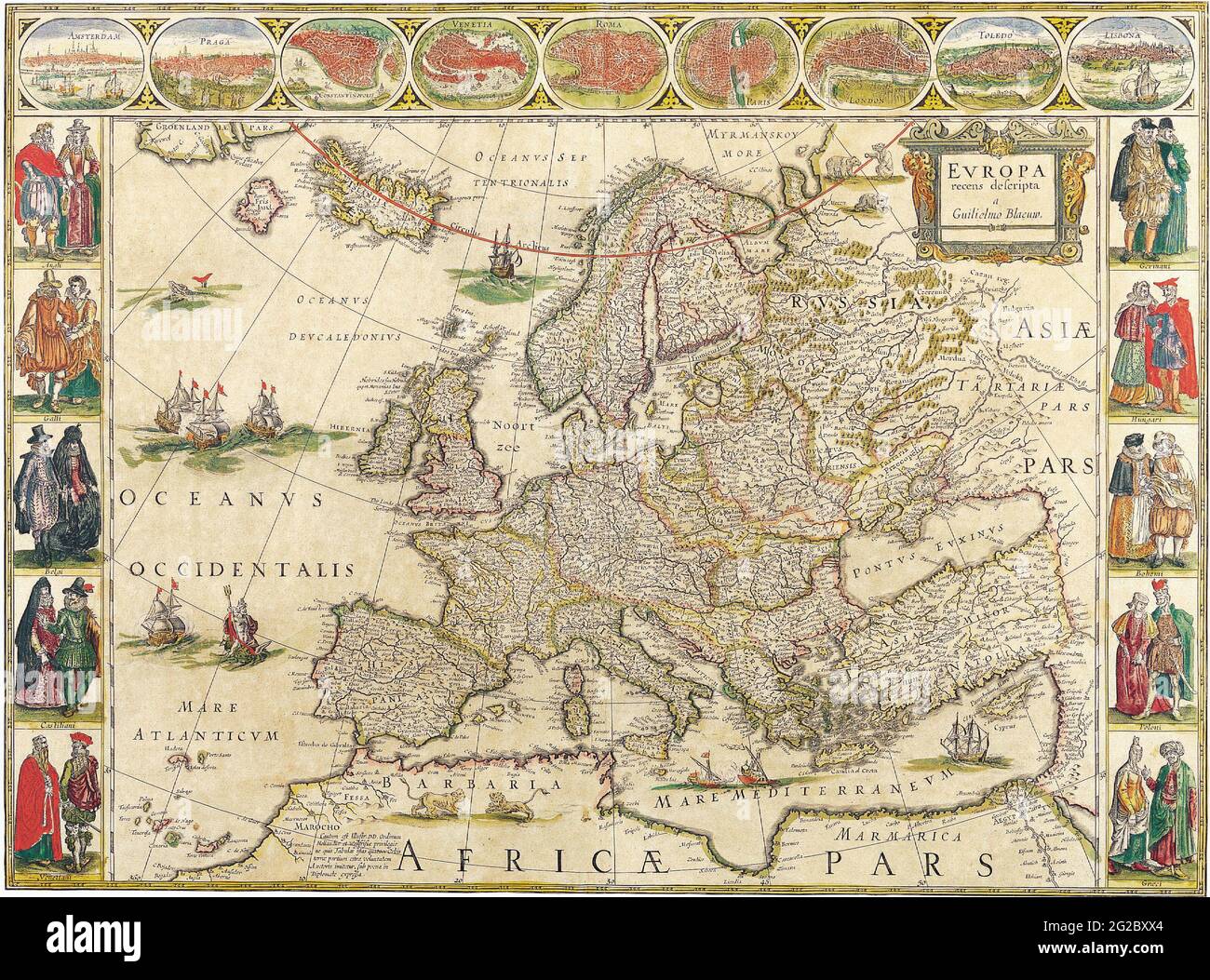 Old Europe Map, Vintage Europe Map, Retro Europe Map, Old Map of Europe, Antique Maps of the World Map of Europe Willem Blaeu c 1650 Stock Photohttps://www.alamy.com/image-license-details/?v=1https://www.alamy.com/old-europe-map-vintage-europe-map-retro-europe-map-old-map-of-europe-antique-maps-of-the-world-map-of-europe-willem-blaeu-c-1650-image431751100.html
RF2G2BXX4–Old Europe Map, Vintage Europe Map, Retro Europe Map, Old Map of Europe, Antique Maps of the World Map of Europe Willem Blaeu c 1650
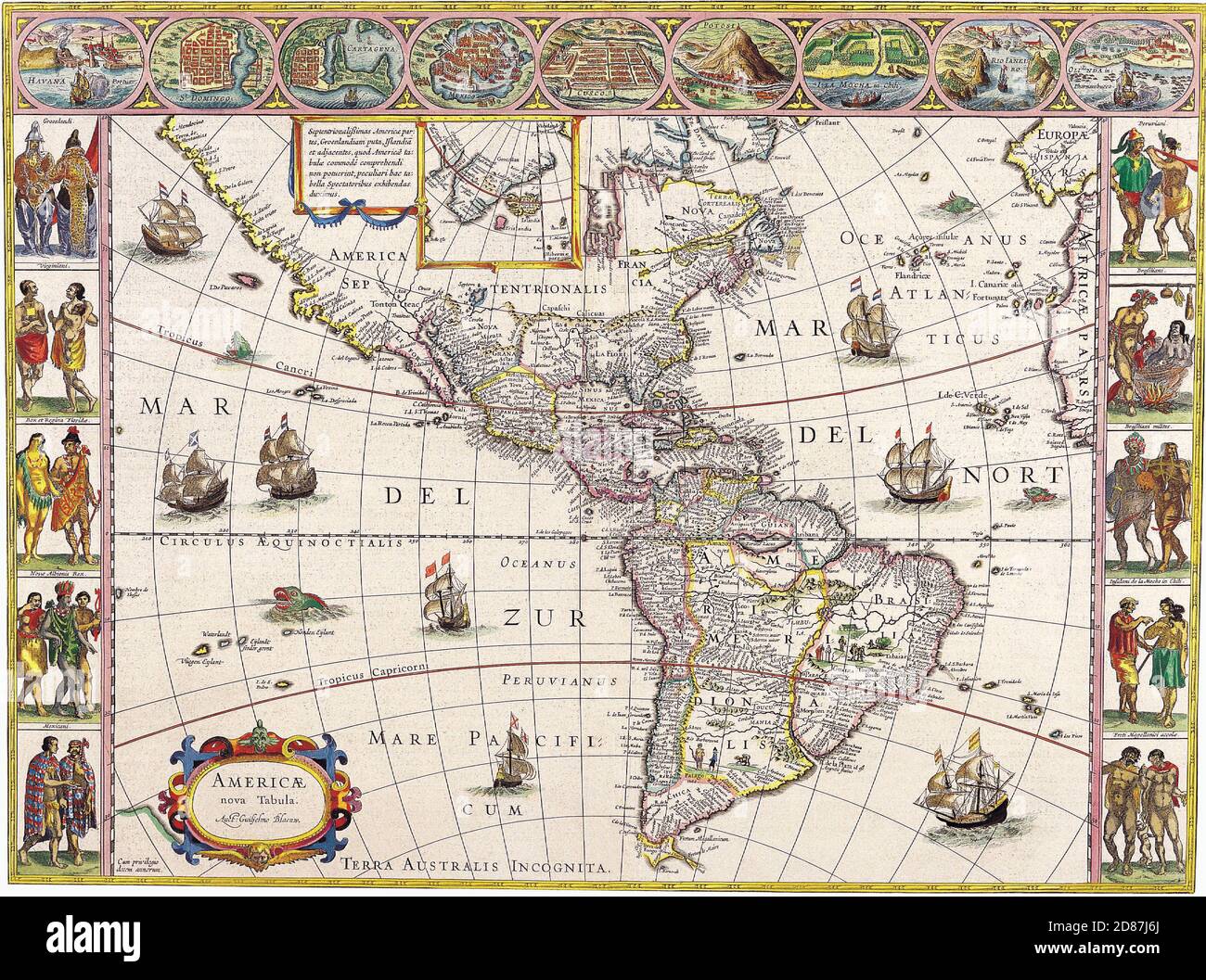 Antique Maps of the World The Americas Willem Blaeu c 1650 Stock Photohttps://www.alamy.com/image-license-details/?v=1https://www.alamy.com/antique-maps-of-the-world-the-americas-willem-blaeu-c-1650-image383713306.html
RM2D87J6J–Antique Maps of the World The Americas Willem Blaeu c 1650
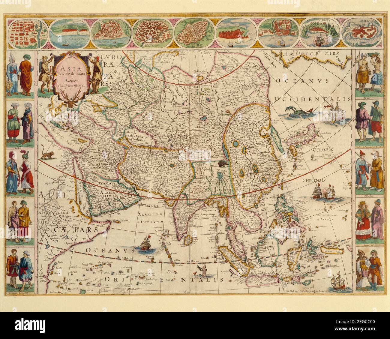 Artwork. Historical map. Asia noviter delineata Auctore Guiljelmo Blaeuw by W. Blaeu. Atlas edition circa 1650. Stock Photohttps://www.alamy.com/image-license-details/?v=1https://www.alamy.com/artwork-historical-map-asia-noviter-delineata-auctore-guiljelmo-blaeuw-by-w-blaeu-atlas-edition-circa-1650-image405945792.html
RM2EGCC00–Artwork. Historical map. Asia noviter delineata Auctore Guiljelmo Blaeuw by W. Blaeu. Atlas edition circa 1650.
 Map of the blockade of Amsterdam by the troops of William II, 1650, The blockade of Amsterdam, by the troops of William the Second, Prince of Orange, from the 30th of July to the 4th of August 1650 (title on object ), Plan d'Amsterdam Et des Environs, avec la disposition des Troupes du Prince d'Orange Guillaume II, pour surprendre la Ville depuis le 30.e Juilet jusqu'au 4e. Aout 1650 (title on object), Map of the blockade of Amsterdam by the troops of Prince William II, from July 20 to August 4, 1650. Map of Amsterdam with the surrounding area, Haarlem on the right, Muiden and Weesp on the Stock Photohttps://www.alamy.com/image-license-details/?v=1https://www.alamy.com/map-of-the-blockade-of-amsterdam-by-the-troops-of-william-ii-1650-the-blockade-of-amsterdam-by-the-troops-of-william-the-second-prince-of-orange-from-the-30th-of-july-to-the-4th-of-august-1650-title-on-object-plan-damsterdam-et-des-environs-avec-la-disposition-des-troupes-du-prince-dorange-guillaume-ii-pour-surprendre-la-ville-depuis-le-30e-juilet-jusquau-4e-aout-1650-title-on-object-map-of-the-blockade-of-amsterdam-by-the-troops-of-prince-william-ii-from-july-20-to-august-4-1650-map-of-amsterdam-with-the-surrounding-area-haarlem-on-the-right-muiden-and-weesp-on-the-image606627874.html
RM2X6X816–Map of the blockade of Amsterdam by the troops of William II, 1650, The blockade of Amsterdam, by the troops of William the Second, Prince of Orange, from the 30th of July to the 4th of August 1650 (title on object ), Plan d'Amsterdam Et des Environs, avec la disposition des Troupes du Prince d'Orange Guillaume II, pour surprendre la Ville depuis le 30.e Juilet jusqu'au 4e. Aout 1650 (title on object), Map of the blockade of Amsterdam by the troops of Prince William II, from July 20 to August 4, 1650. Map of Amsterdam with the surrounding area, Haarlem on the right, Muiden and Weesp on the
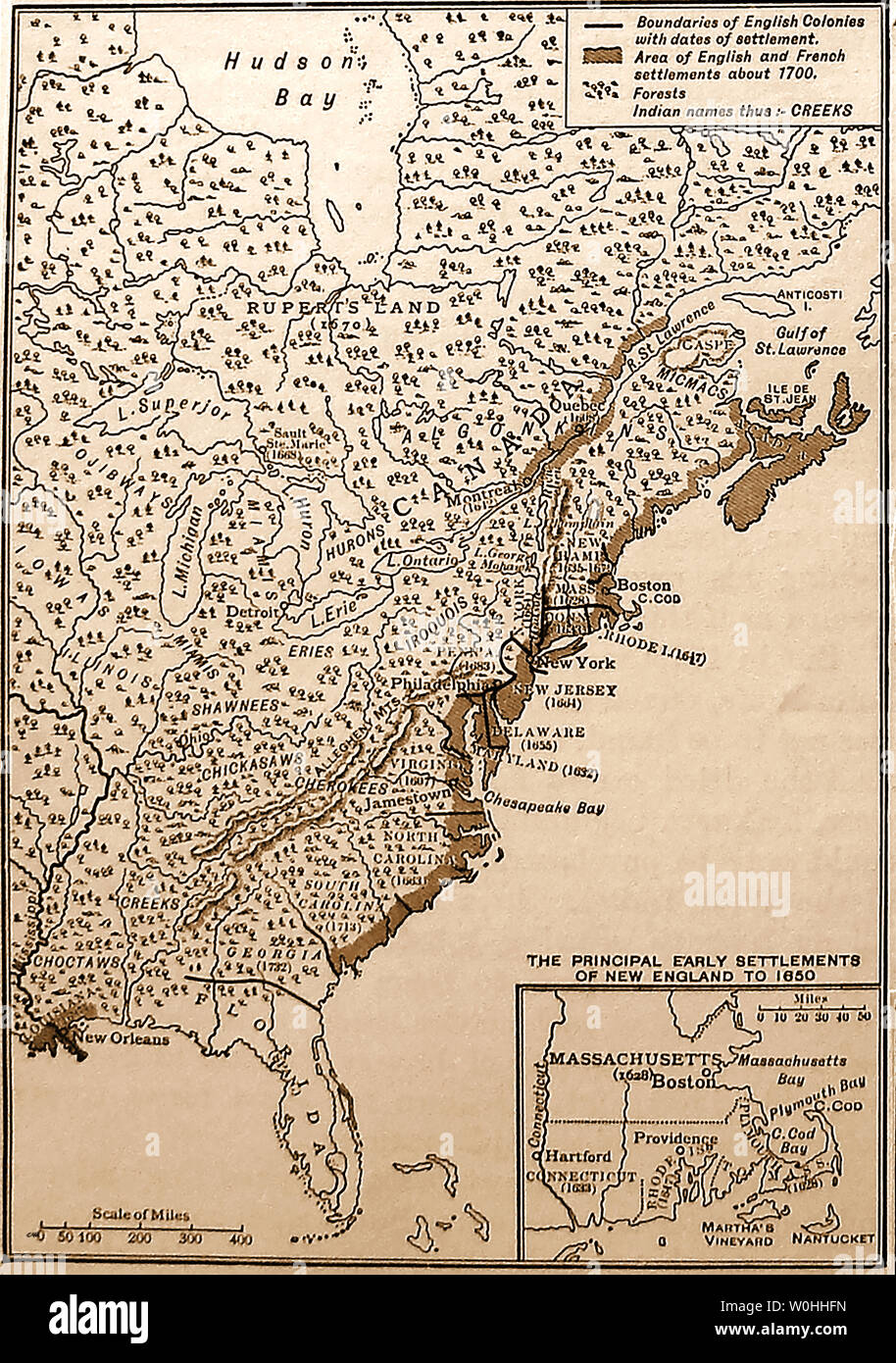 A 1930's schoolbook map showing the French and English settlements in North America and Canada 1650 and 1700 Stock Photohttps://www.alamy.com/image-license-details/?v=1https://www.alamy.com/a-1930s-schoolbook-map-showing-the-french-and-english-settlements-in-north-america-and-canada-1650-and-1700-image258542473.html
RMW0HHFN–A 1930's schoolbook map showing the French and English settlements in North America and Canada 1650 and 1700
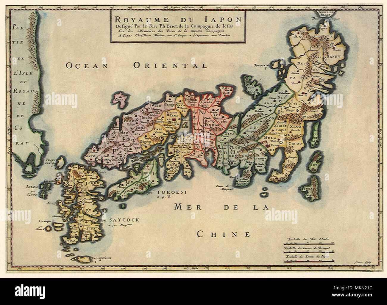 Political Map of Japan 1650 Stock Photohttps://www.alamy.com/image-license-details/?v=1https://www.alamy.com/political-map-of-japan-1650-image184244744.html
RMMKN21C–Political Map of Japan 1650
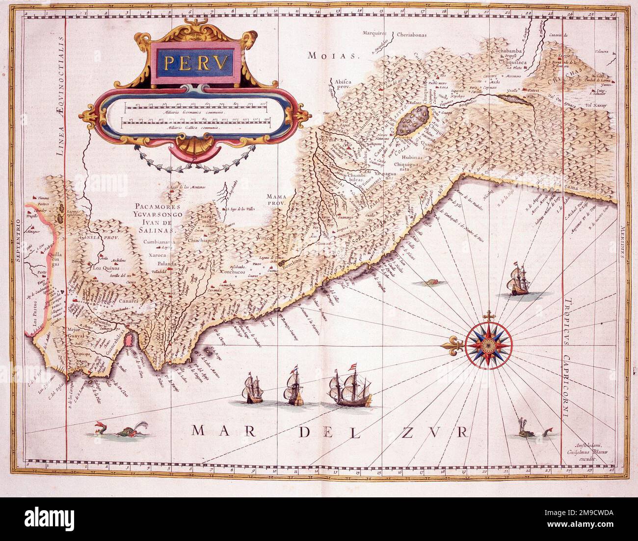 17th century Map of Peru Stock Photohttps://www.alamy.com/image-license-details/?v=1https://www.alamy.com/17th-century-map-of-peru-image504915974.html
RM2M9CWDA–17th century Map of Peru
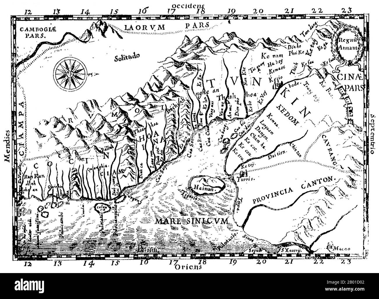 Vietnam: A map of Tonkin by Alexandre de Rhodes (15 March 1593 - 5 November 1660), 1651. One of the earliest Western maps showing details of northern and central Vietnam, it appeared in Father Alexander de Rhodes' 'Histoire du royaume de Tunquin', published in Rome in 1650. This map is from the French edition, published a year later in Lyon. Oriented with the north to the right, 'Regnu Annam' shows the extent of seventeenth-century Vietnam, at the time divided between two rival dynasties. Remnants of the Cham kingdom, eventually destroyed by the Vietnamese, still existed in the south. Stock Photohttps://www.alamy.com/image-license-details/?v=1https://www.alamy.com/vietnam-a-map-of-tonkin-by-alexandre-de-rhodes-15-march-1593-5-november-1660-1651-one-of-the-earliest-western-maps-showing-details-of-northern-and-central-vietnam-it-appeared-in-father-alexander-de-rhodes-histoire-du-royaume-de-tunquin-published-in-rome-in-1650-this-map-is-from-the-french-edition-published-a-year-later-in-lyon-oriented-with-the-north-to-the-right-regnu-annam-shows-the-extent-of-seventeenth-century-vietnam-at-the-time-divided-between-two-rival-dynasties-remnants-of-the-cham-kingdom-eventually-destroyed-by-the-vietnamese-still-existed-in-the-south-image344239506.html
RM2B01D02–Vietnam: A map of Tonkin by Alexandre de Rhodes (15 March 1593 - 5 November 1660), 1651. One of the earliest Western maps showing details of northern and central Vietnam, it appeared in Father Alexander de Rhodes' 'Histoire du royaume de Tunquin', published in Rome in 1650. This map is from the French edition, published a year later in Lyon. Oriented with the north to the right, 'Regnu Annam' shows the extent of seventeenth-century Vietnam, at the time divided between two rival dynasties. Remnants of the Cham kingdom, eventually destroyed by the Vietnamese, still existed in the south.
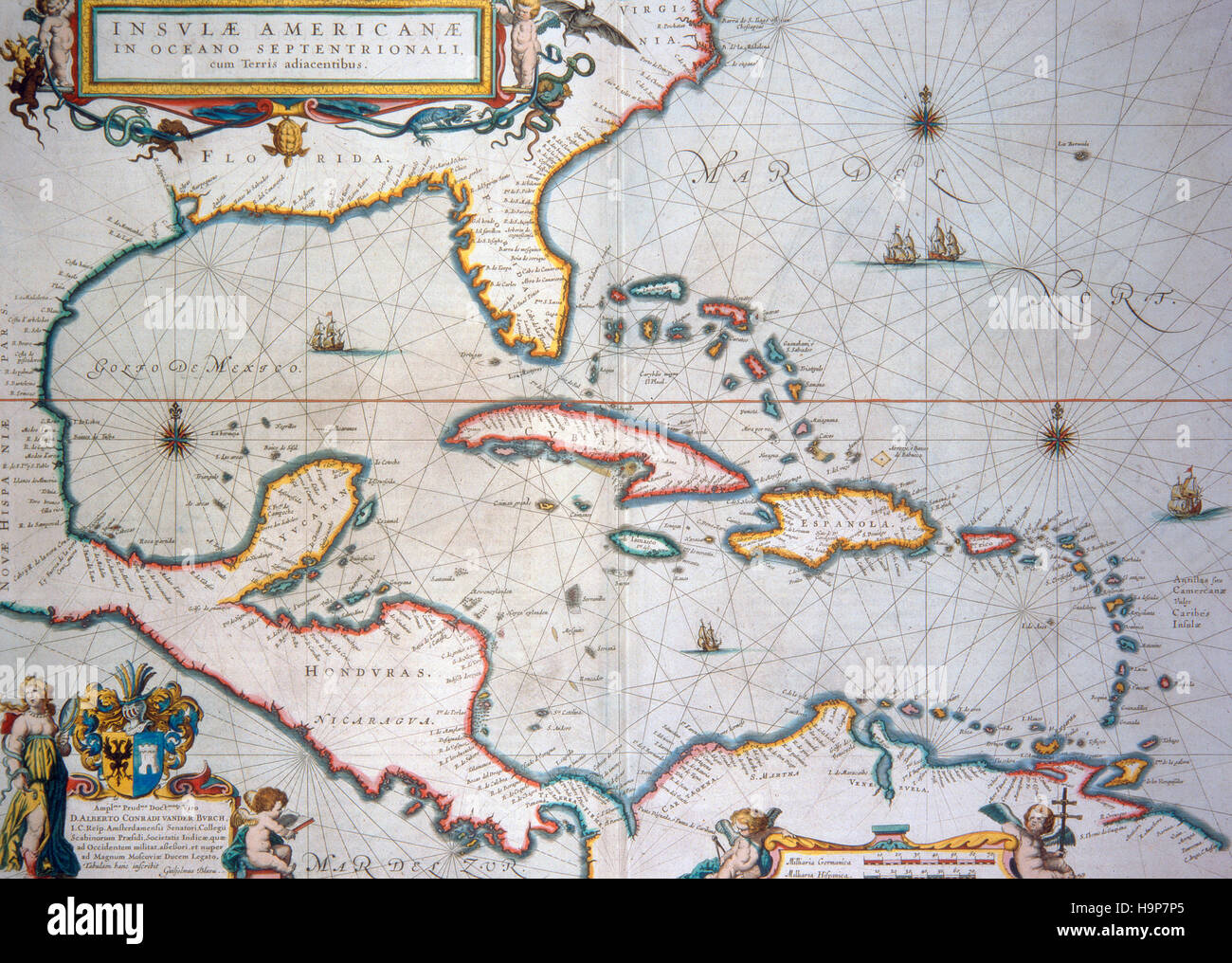 Blaeu , map of caribbean 1650 Stock Photohttps://www.alamy.com/image-license-details/?v=1https://www.alamy.com/stock-photo-blaeu-map-of-caribbean-1650-126493533.html
RMH9P7P5–Blaeu , map of caribbean 1650
 The Baronial hall of Chethams Music School, Manchester, United Kingdom, built in the fifteenth century, with the Hyde Cross in the foreground on the left. The building currently includes the library. The cross appeared on a 1650 map of Manchester as a Latin cross on a pedestal and stood at a nearby road junction until the 1840's. Chetham's teaches pupils and students between the ages of 8 and 18. Chetham's Library is the oldest free public reference library in the English-speaking world. Stock Photohttps://www.alamy.com/image-license-details/?v=1https://www.alamy.com/the-baronial-hall-of-chethams-music-school-manchester-united-kingdom-built-in-the-fifteenth-century-with-the-hyde-cross-in-the-foreground-on-the-left-the-building-currently-includes-the-library-the-cross-appeared-on-a-1650-map-of-manchester-as-a-latin-cross-on-a-pedestal-and-stood-at-a-nearby-road-junction-until-the-1840s-chethams-teaches-pupils-and-students-between-the-ages-of-8-and-18-chethams-library-is-the-oldest-free-public-reference-library-in-the-english-speaking-world-image477810369.html
RM2JNA401–The Baronial hall of Chethams Music School, Manchester, United Kingdom, built in the fifteenth century, with the Hyde Cross in the foreground on the left. The building currently includes the library. The cross appeared on a 1650 map of Manchester as a Latin cross on a pedestal and stood at a nearby road junction until the 1840's. Chetham's teaches pupils and students between the ages of 8 and 18. Chetham's Library is the oldest free public reference library in the English-speaking world.
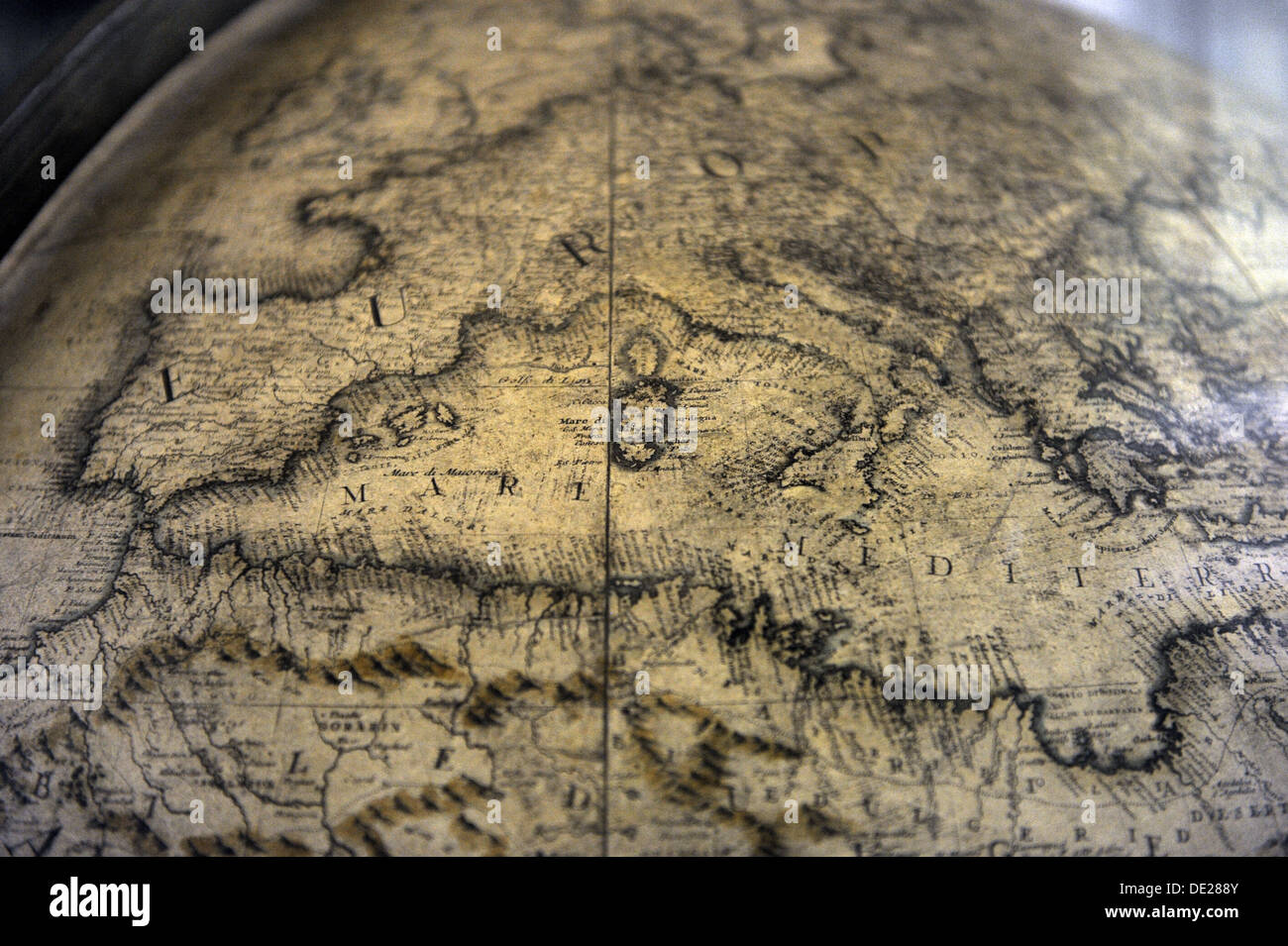 Terrestrial globe by cosmographer Vicenzo Coronelli (1650-1718). The Science and Technology Museum Leonardo da Vinci. Milan. Stock Photohttps://www.alamy.com/image-license-details/?v=1https://www.alamy.com/terrestrial-globe-by-cosmographer-vicenzo-coronelli-1650-1718-the-image60286715.html
RMDE288Y–Terrestrial globe by cosmographer Vicenzo Coronelli (1650-1718). The Science and Technology Museum Leonardo da Vinci. Milan.
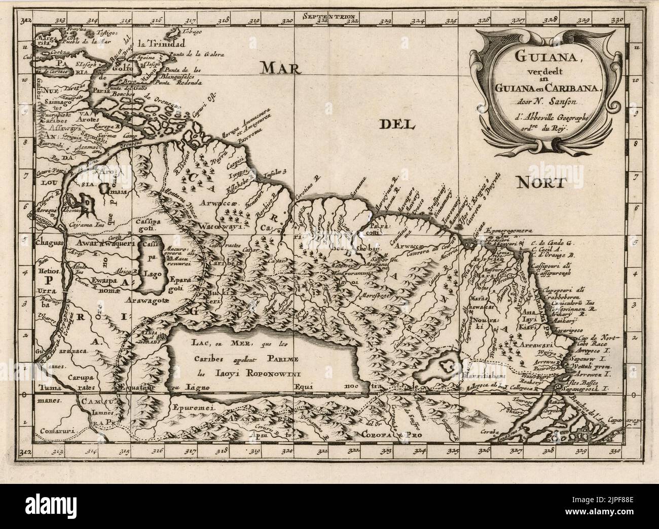 Vintage 17th century (1650) Dutch map titled Guiana and Caribana showing part of the northern coast of South America and the Caribbean coast. Mythical Lake Parime is also shown. Stock Photohttps://www.alamy.com/image-license-details/?v=1https://www.alamy.com/vintage-17th-century-1650-dutch-map-titled-guiana-and-caribana-showing-part-of-the-northern-coast-of-south-america-and-the-caribbean-coast-mythical-lake-parime-is-also-shown-image478538158.html
RM2JPF88E–Vintage 17th century (1650) Dutch map titled Guiana and Caribana showing part of the northern coast of South America and the Caribbean coast. Mythical Lake Parime is also shown.
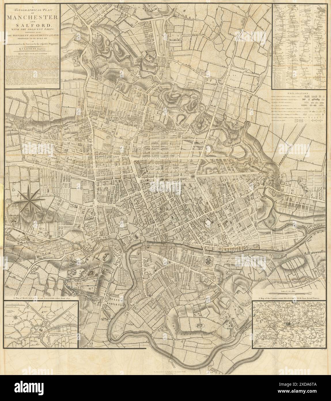 A Topographical plan of Manchester & Salford 92x105cm LAURENT/STOCKDALE 1793 map Stock Photohttps://www.alamy.com/image-license-details/?v=1https://www.alamy.com/a-topographical-plan-of-manchester-salford-92x105cm-laurentstockdale-1793-map-image610578314.html
RF2XDA6TA–A Topographical plan of Manchester & Salford 92x105cm LAURENT/STOCKDALE 1793 map
 Map of the Blockade of Amsterdam by the troops of Willem II, 1650, 1728 - 1730 print Map of the Blockade of Amsterdam by the troops of Prince William II, from 20 July to 4 August 1650. Map of Amsterdam with the surrounding area, right Haarlem, Left Muiden and Weesp. The different army places of the troops are indicated on the map. Left on the Zuiderzee near Pampus different ships with name indicated. Bottom left a cartouche with the French title. Northern Netherlands paper etching maps of separate countries or regions Amsterdam. North Holland Stock Photohttps://www.alamy.com/image-license-details/?v=1https://www.alamy.com/map-of-the-blockade-of-amsterdam-by-the-troops-of-willem-ii-1650-1728-1730-print-map-of-the-blockade-of-amsterdam-by-the-troops-of-prince-william-ii-from-20-july-to-4-august-1650-map-of-amsterdam-with-the-surrounding-area-right-haarlem-left-muiden-and-weesp-the-different-army-places-of-the-troops-are-indicated-on-the-map-left-on-the-zuiderzee-near-pampus-different-ships-with-name-indicated-bottom-left-a-cartouche-with-the-french-title-northern-netherlands-paper-etching-maps-of-separate-countries-or-regions-amsterdam-north-holland-image595207058.html
RM2WGA0JX–Map of the Blockade of Amsterdam by the troops of Willem II, 1650, 1728 - 1730 print Map of the Blockade of Amsterdam by the troops of Prince William II, from 20 July to 4 August 1650. Map of Amsterdam with the surrounding area, right Haarlem, Left Muiden and Weesp. The different army places of the troops are indicated on the map. Left on the Zuiderzee near Pampus different ships with name indicated. Bottom left a cartouche with the French title. Northern Netherlands paper etching maps of separate countries or regions Amsterdam. North Holland
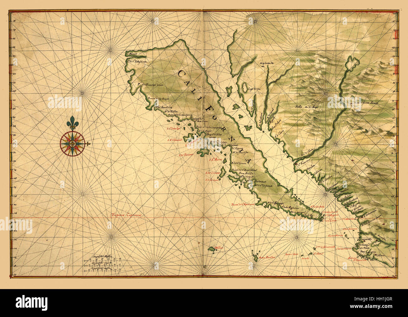 Map Of California 1650 Stock Photohttps://www.alamy.com/image-license-details/?v=1https://www.alamy.com/stock-photo-map-of-california-1650-130958263.html
RFHH1JGR–Map Of California 1650
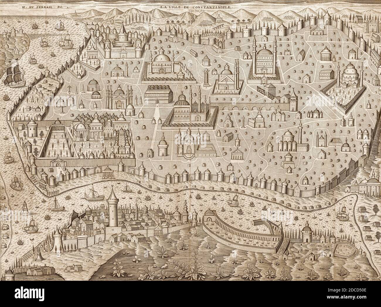 View of Istanbul, 1650 Stock Photohttps://www.alamy.com/image-license-details/?v=1https://www.alamy.com/view-of-istanbul-1650-image386293278.html
RF2DCD50E–View of Istanbul, 1650
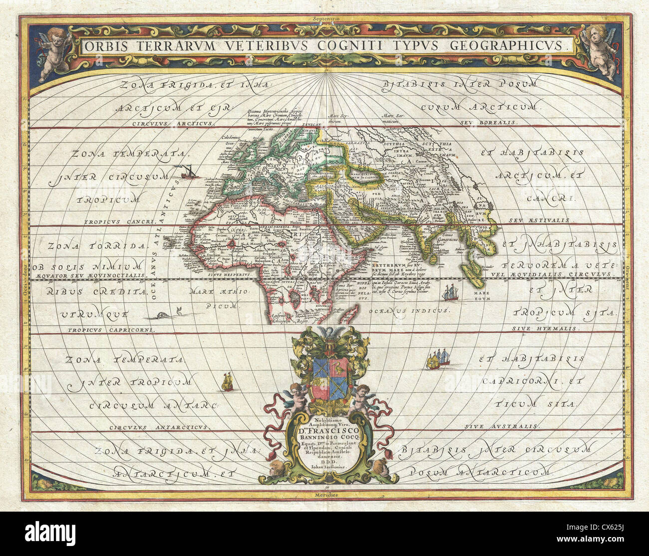 1650 Jansson Map of the Ancient World Stock Photohttps://www.alamy.com/image-license-details/?v=1https://www.alamy.com/stock-photo-1650-jansson-map-of-the-ancient-world-50535230.html
RMCX625J–1650 Jansson Map of the Ancient World
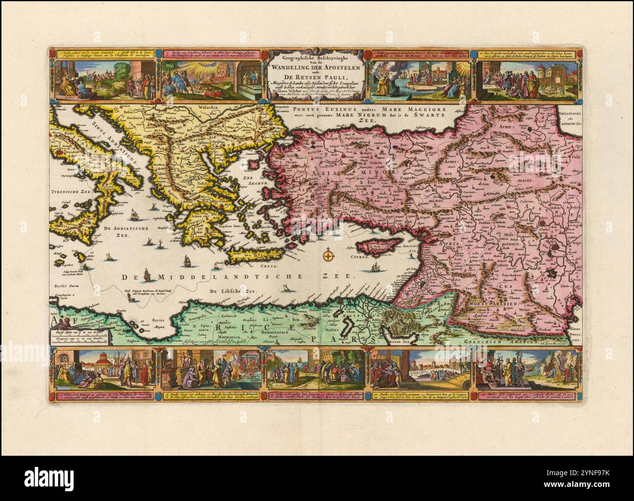 Ca. 1650 map of the Eastern Mediterranean illustrating the travels of St. Paul. Stock Photohttps://www.alamy.com/image-license-details/?v=1https://www.alamy.com/ca-1650-map-of-the-eastern-mediterranean-illustrating-the-travels-of-st-paul-image632817575.html
RM2YNF97K–Ca. 1650 map of the Eastern Mediterranean illustrating the travels of St. Paul.
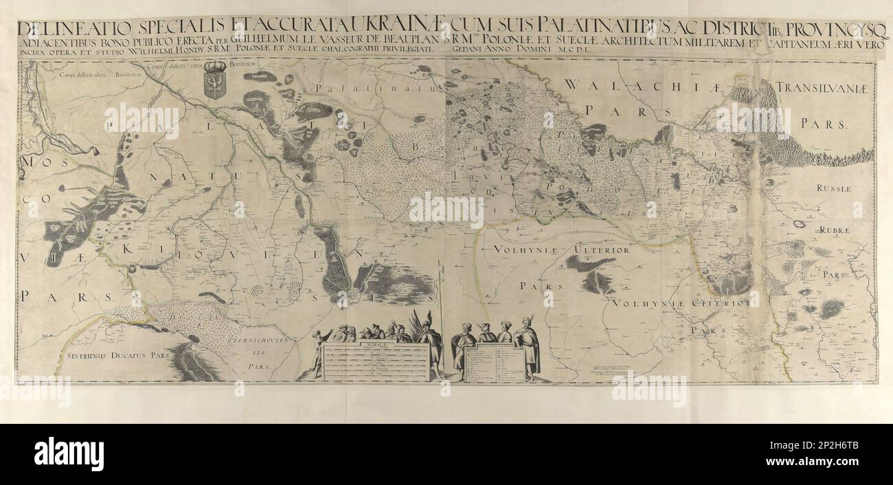 Map of Ukraine, 1650. Private Collection. Stock Photohttps://www.alamy.com/image-license-details/?v=1https://www.alamy.com/map-of-ukraine-1650-private-collection-image535129291.html
RM2P2H6TB–Map of Ukraine, 1650. Private Collection.
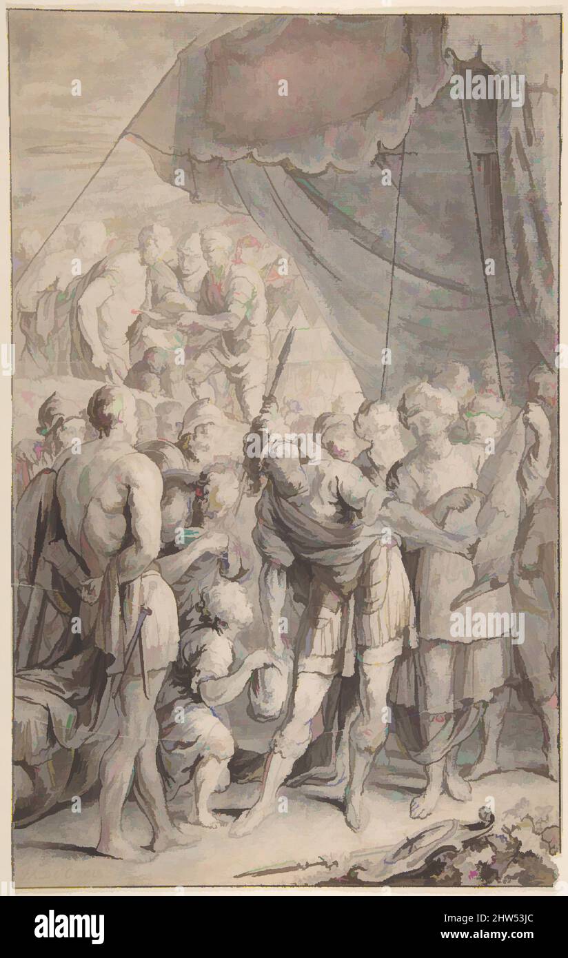 Art inspired by Design for a Title Page: A General and His Army Looking at a Map., late 17th century, Pen and brown ink, brush and brown and wash over black chalk, white gouache. Incised., 15 3/8 x 9 41/64 in. (39.1 x 24.5 cm), Drawings, Jan Antoine Coxie (Flemish, 1650–1720 Milan, Classic works modernized by Artotop with a splash of modernity. Shapes, color and value, eye-catching visual impact on art. Emotions through freedom of artworks in a contemporary way. A timeless message pursuing a wildly creative new direction. Artists turning to the digital medium and creating the Artotop NFT Stock Photohttps://www.alamy.com/image-license-details/?v=1https://www.alamy.com/art-inspired-by-design-for-a-title-page-a-general-and-his-army-looking-at-a-map-late-17th-century-pen-and-brown-ink-brush-and-brown-and-wash-over-black-chalk-white-gouache-incised-15-38-x-9-4164-in-391-x-245-cm-drawings-jan-antoine-coxie-flemish-16501720-milan-classic-works-modernized-by-artotop-with-a-splash-of-modernity-shapes-color-and-value-eye-catching-visual-impact-on-art-emotions-through-freedom-of-artworks-in-a-contemporary-way-a-timeless-message-pursuing-a-wildly-creative-new-direction-artists-turning-to-the-digital-medium-and-creating-the-artotop-nft-image462948596.html
RF2HW53JC–Art inspired by Design for a Title Page: A General and His Army Looking at a Map., late 17th century, Pen and brown ink, brush and brown and wash over black chalk, white gouache. Incised., 15 3/8 x 9 41/64 in. (39.1 x 24.5 cm), Drawings, Jan Antoine Coxie (Flemish, 1650–1720 Milan, Classic works modernized by Artotop with a splash of modernity. Shapes, color and value, eye-catching visual impact on art. Emotions through freedom of artworks in a contemporary way. A timeless message pursuing a wildly creative new direction. Artists turning to the digital medium and creating the Artotop NFT
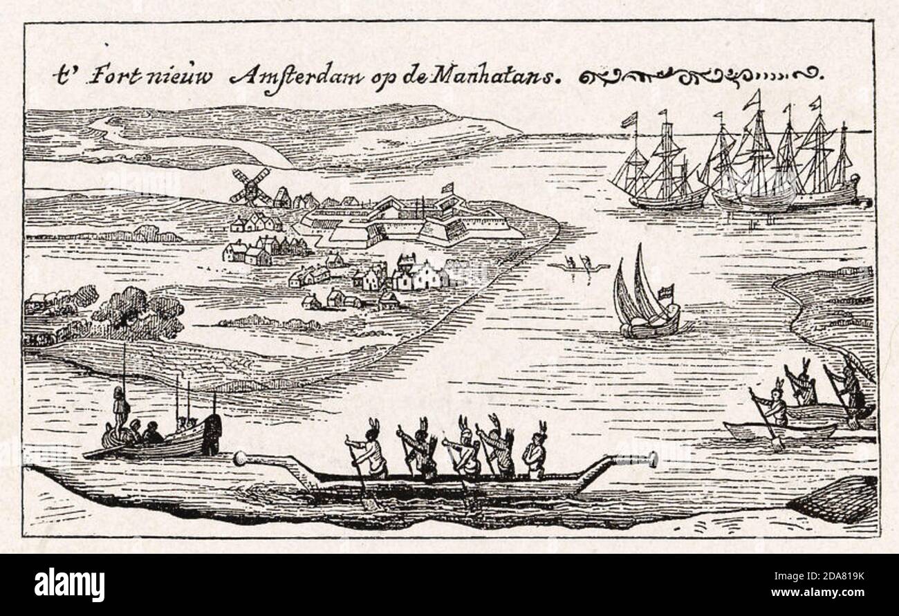 NEW AMSTERDAM Dutch settlement (now New York) about 1650 Stock Photohttps://www.alamy.com/image-license-details/?v=1https://www.alamy.com/new-amsterdam-dutch-settlement-now-new-york-about-1650-image384951327.html
RM2DA819K–NEW AMSTERDAM Dutch settlement (now New York) about 1650
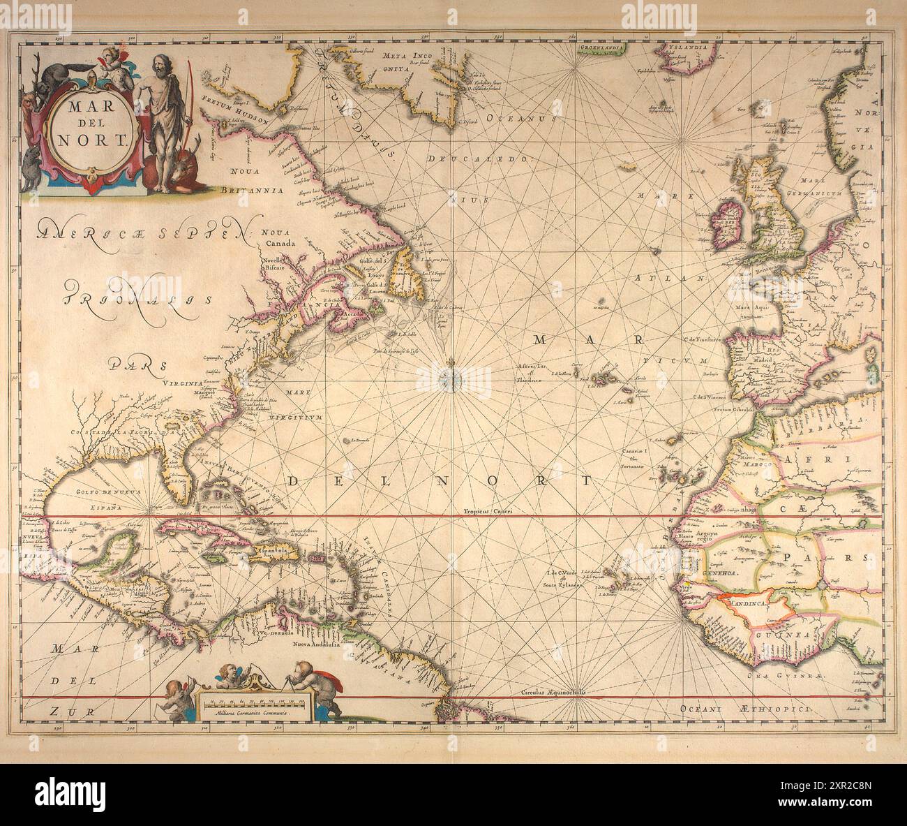 Vintage Map of the Atlantic Sea entitled 'Mar del Nort' by Jan Jansson 1650 Stock Photohttps://www.alamy.com/image-license-details/?v=1https://www.alamy.com/vintage-map-of-the-atlantic-sea-entitled-mar-del-nort-by-jan-jansson-1650-image616553525.html
RM2XR2C8N–Vintage Map of the Atlantic Sea entitled 'Mar del Nort' by Jan Jansson 1650
 Map of Manchester and Salford about 1650, UK Stock Photohttps://www.alamy.com/image-license-details/?v=1https://www.alamy.com/stock-photo-map-of-manchester-and-salford-about-1650-uk-77458014.html
RMEE0EDJ–Map of Manchester and Salford about 1650, UK
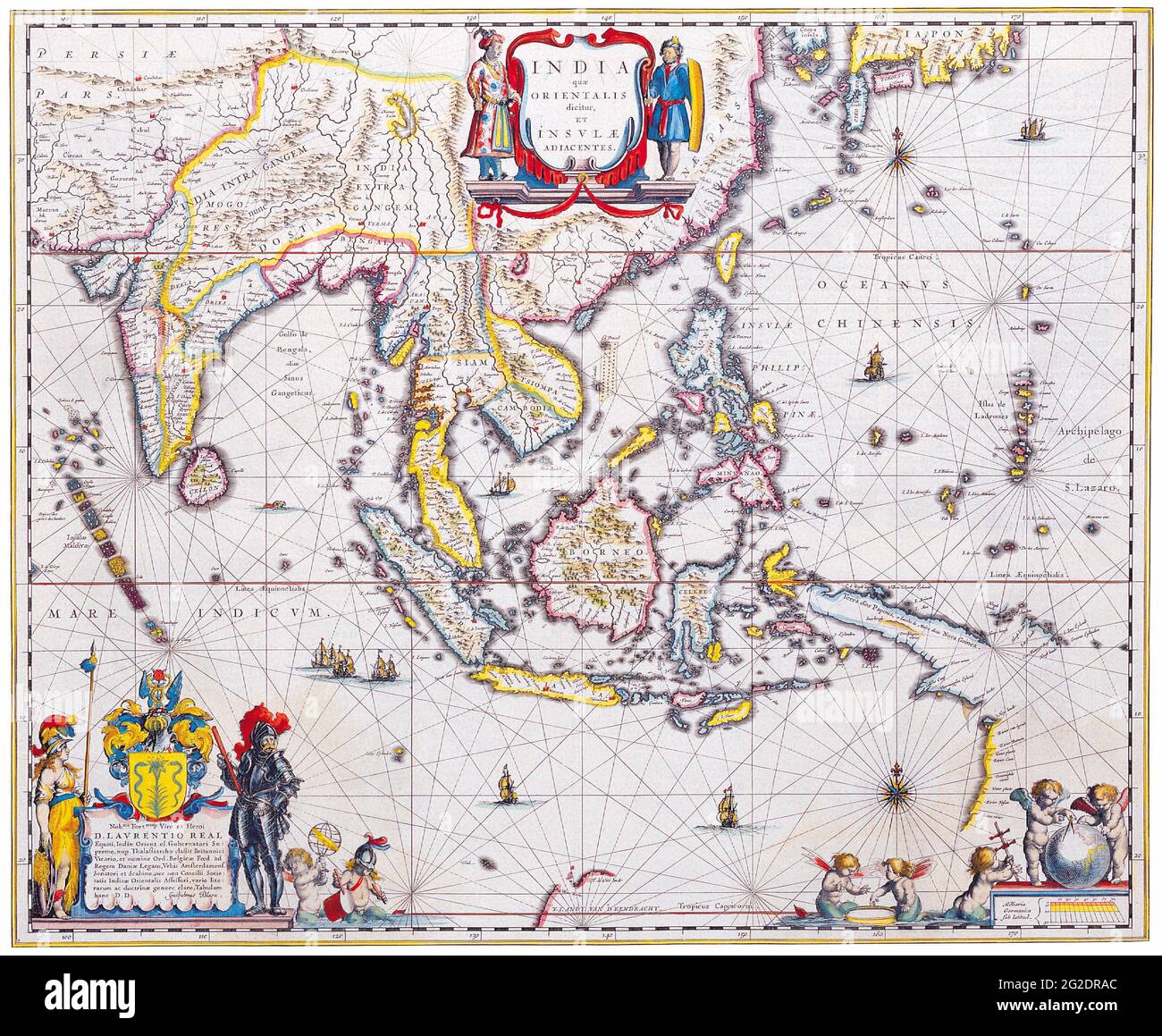 Old Map of Asia, Retro Asia Map, Vintage Asia Map, Antique Asia Map, Antique Maps of the World, Map of South East Asia, Willem Blaeu, c 1650 Stock Photohttps://www.alamy.com/image-license-details/?v=1https://www.alamy.com/old-map-of-asia-retro-asia-map-vintage-asia-map-antique-asia-map-antique-maps-of-the-world-map-of-south-east-asia-willem-blaeu-c-1650-image431792212.html
RF2G2DRAC–Old Map of Asia, Retro Asia Map, Vintage Asia Map, Antique Asia Map, Antique Maps of the World, Map of South East Asia, Willem Blaeu, c 1650
 Design for a Title Page: A General and His Army Looking at a Map. Artist: Jan Antoine Coxie (Flemish, 1650-1720 Milan). Dimensions: 15 3/8 x 9 41/64 in. (39.1 x 24.5 cm). Date: late 17th century. Museum: Metropolitan Museum of Art, New York, USA. Stock Photohttps://www.alamy.com/image-license-details/?v=1https://www.alamy.com/design-for-a-title-page-a-general-and-his-army-looking-at-a-map-artist-jan-antoine-coxie-flemish-1650-1720-milan-dimensions-15-38-x-9-4164-in-391-x-245-cm-date-late-17th-century-museum-metropolitan-museum-of-art-new-york-usa-image213374062.html
RMPB40P6–Design for a Title Page: A General and His Army Looking at a Map. Artist: Jan Antoine Coxie (Flemish, 1650-1720 Milan). Dimensions: 15 3/8 x 9 41/64 in. (39.1 x 24.5 cm). Date: late 17th century. Museum: Metropolitan Museum of Art, New York, USA.
 17th century Map of Paraguay Stock Photohttps://www.alamy.com/image-license-details/?v=1https://www.alamy.com/17th-century-map-of-paraguay-image504915976.html
RM2M9CWDC–17th century Map of Paraguay
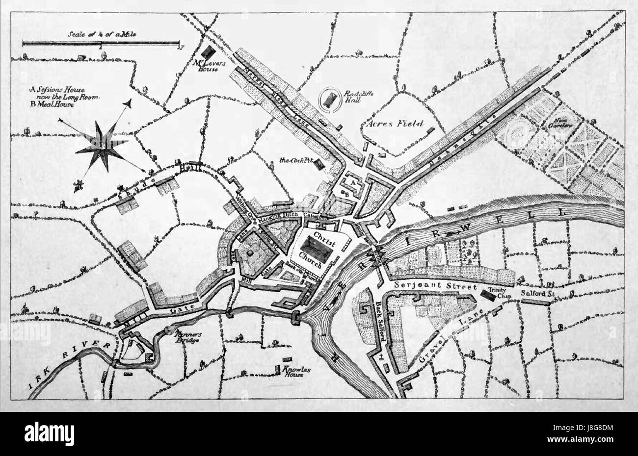 Map of manchester circa 1650 Stock Photohttps://www.alamy.com/image-license-details/?v=1https://www.alamy.com/stock-photo-map-of-manchester-circa-1650-142958080.html
RMJ8G8DM–Map of manchester circa 1650
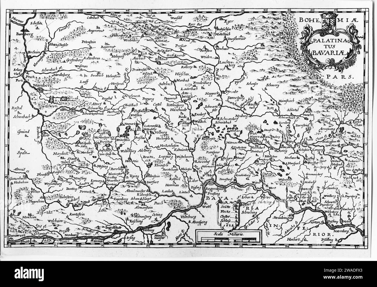 Map of Upper Bavaria and Lower Bavaria, copperplate engraving by Matthaeus Merian, around 1650 Stock Photohttps://www.alamy.com/image-license-details/?v=1https://www.alamy.com/map-of-upper-bavaria-and-lower-bavaria-copperplate-engraving-by-matthaeus-merian-around-1650-image591596939.html
RF2WADFX3–Map of Upper Bavaria and Lower Bavaria, copperplate engraving by Matthaeus Merian, around 1650
 Antique books, including leather bound books, in the library at Chethams Music School, Manchester, UK, which was built in the fifteenth century. Chetham's teaches pupils and students between the ages of 8 and 18. The Baronial hall of Chethams Music School, Manchester, United Kingdom, built in the fifteenth century, with the Hyde Cross in the foreground on the left. The building currently includes the library. The cross appeared on a 1650 map of Manchester as a Latin cross on a pedestal and stood at a nearby road junction until the 1840's. Stock Photohttps://www.alamy.com/image-license-details/?v=1https://www.alamy.com/antique-books-including-leather-bound-books-in-the-library-at-chethams-music-school-manchester-uk-which-was-built-in-the-fifteenth-century-chethams-teaches-pupils-and-students-between-the-ages-of-8-and-18-the-baronial-hall-of-chethams-music-school-manchester-united-kingdom-built-in-the-fifteenth-century-with-the-hyde-cross-in-the-foreground-on-the-left-the-building-currently-includes-the-library-the-cross-appeared-on-a-1650-map-of-manchester-as-a-latin-cross-on-a-pedestal-and-stood-at-a-nearby-road-junction-until-the-1840s-image477809324.html
RM2JNA2JM–Antique books, including leather bound books, in the library at Chethams Music School, Manchester, UK, which was built in the fifteenth century. Chetham's teaches pupils and students between the ages of 8 and 18. The Baronial hall of Chethams Music School, Manchester, United Kingdom, built in the fifteenth century, with the Hyde Cross in the foreground on the left. The building currently includes the library. The cross appeared on a 1650 map of Manchester as a Latin cross on a pedestal and stood at a nearby road junction until the 1840's.
 . English: Map of Ghent by Coronelli . 9 March 2012. Vincenzo Maria (Padre) Coronelli (1650-1718) 343 Map of Ghent by Coronelli Stock Photohttps://www.alamy.com/image-license-details/?v=1https://www.alamy.com/english-map-of-ghent-by-coronelli-9-march-2012-vincenzo-maria-padre-coronelli-1650-1718-343-map-of-ghent-by-coronelli-image189120970.html
RMMYK5MA–. English: Map of Ghent by Coronelli . 9 March 2012. Vincenzo Maria (Padre) Coronelli (1650-1718) 343 Map of Ghent by Coronelli
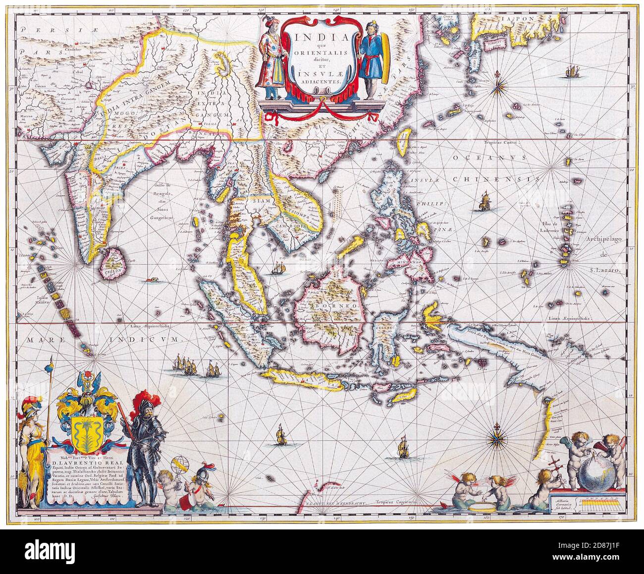 Antique Maps of the World. Map of South East Asia Willem Blaeu. C 1650. Stock Photohttps://www.alamy.com/image-license-details/?v=1https://www.alamy.com/antique-maps-of-the-world-map-of-south-east-asia-willem-blaeu-c-1650-image383713163.html
RM2D87J1F–Antique Maps of the World. Map of South East Asia Willem Blaeu. C 1650.
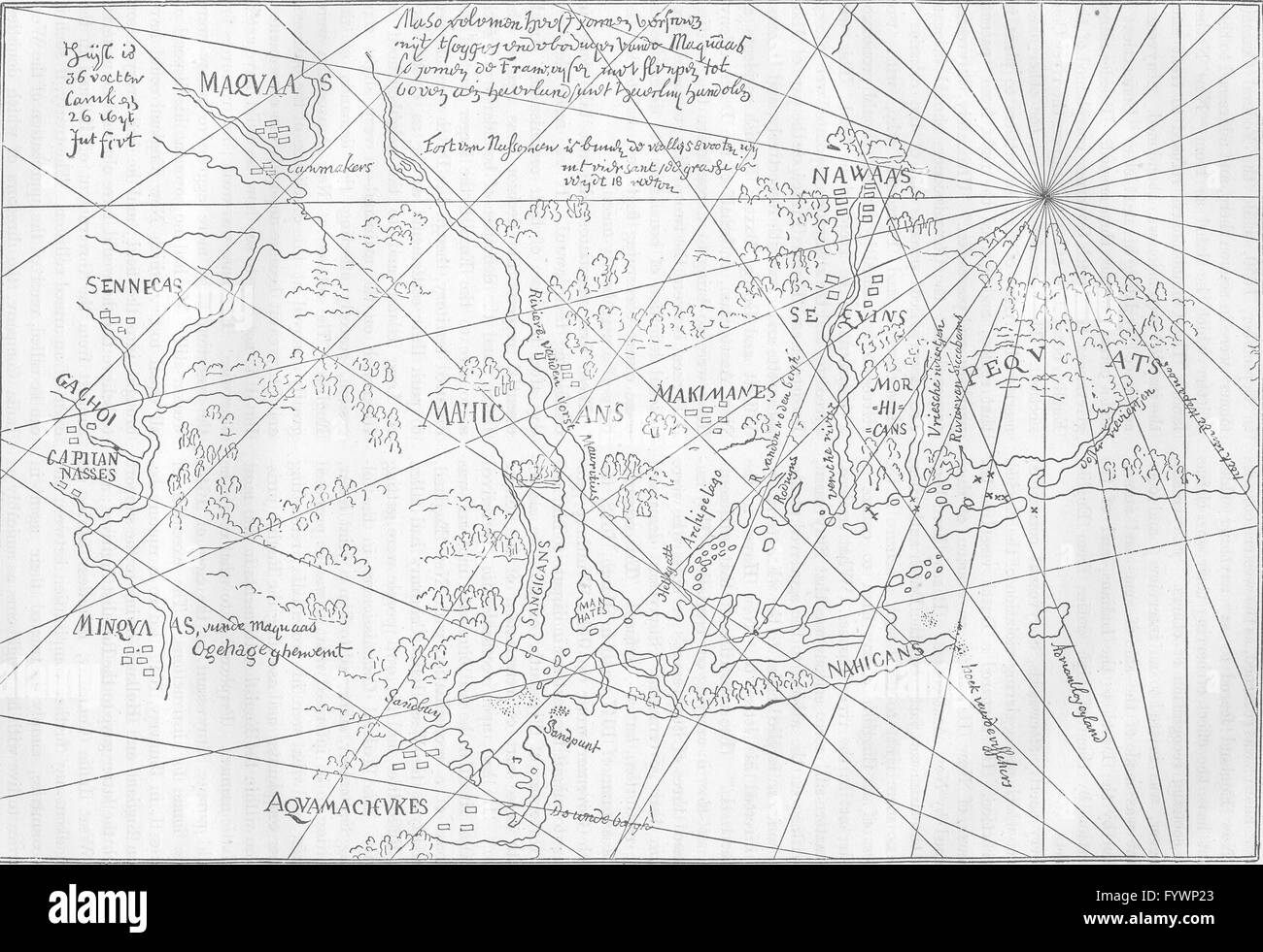 NEW ENGLAND: Earliest New Netherlands map(Hague), c1880 Stock Photohttps://www.alamy.com/image-license-details/?v=1https://www.alamy.com/stock-photo-new-england-earliest-new-netherlands-maphague-c1880-103213659.html
RFFYWP23–NEW ENGLAND: Earliest New Netherlands map(Hague), c1880
![A chart of the South Sea. Appears in the author's Atlas maritimus, or A book of charts. London : John Seller, [1672?] Cataloging, conservation, and digitization made possible in part by The National Endowment for the Humanities: Exploring the human endeavor.. Map of the Pacific Ocean, being the first English map of the Pacific Ocean, loosely based on Jansson's 1650 map of the Pacific but much updated with additional coverage of the Gulf Coast and the southeastern coast of the United States. California is depicted as an island off the coast of Nova Granada and Nova Hispania but the Americas are Stock Photo A chart of the South Sea. Appears in the author's Atlas maritimus, or A book of charts. London : John Seller, [1672?] Cataloging, conservation, and digitization made possible in part by The National Endowment for the Humanities: Exploring the human endeavor.. Map of the Pacific Ocean, being the first English map of the Pacific Ocean, loosely based on Jansson's 1650 map of the Pacific but much updated with additional coverage of the Gulf Coast and the southeastern coast of the United States. California is depicted as an island off the coast of Nova Granada and Nova Hispania but the Americas are Stock Photo](https://c8.alamy.com/comp/2M5TYND/a-chart-of-the-south-sea-appears-in-the-authors-atlas-maritimus-or-a-book-of-charts-london-john-seller-1672-cataloging-conservation-and-digitization-made-possible-in-part-by-the-national-endowment-for-the-humanities-exploring-the-human-endeavor-map-of-the-pacific-ocean-being-the-first-english-map-of-the-pacific-ocean-loosely-based-on-janssons-1650-map-of-the-pacific-but-much-updated-with-additional-coverage-of-the-gulf-coast-and-the-southeastern-coast-of-the-united-states-california-is-depicted-as-an-island-off-the-coast-of-nova-granada-and-nova-hispania-but-the-americas-are-2M5TYND.jpg) A chart of the South Sea. Appears in the author's Atlas maritimus, or A book of charts. London : John Seller, [1672?] Cataloging, conservation, and digitization made possible in part by The National Endowment for the Humanities: Exploring the human endeavor.. Map of the Pacific Ocean, being the first English map of the Pacific Ocean, loosely based on Jansson's 1650 map of the Pacific but much updated with additional coverage of the Gulf Coast and the southeastern coast of the United States. California is depicted as an island off the coast of Nova Granada and Nova Hispania but the Americas are Stock Photohttps://www.alamy.com/image-license-details/?v=1https://www.alamy.com/a-chart-of-the-south-sea-appears-in-the-authors-atlas-maritimus-or-a-book-of-charts-london-john-seller-1672-cataloging-conservation-and-digitization-made-possible-in-part-by-the-national-endowment-for-the-humanities-exploring-the-human-endeavor-map-of-the-pacific-ocean-being-the-first-english-map-of-the-pacific-ocean-loosely-based-on-janssons-1650-map-of-the-pacific-but-much-updated-with-additional-coverage-of-the-gulf-coast-and-the-southeastern-coast-of-the-united-states-california-is-depicted-as-an-island-off-the-coast-of-nova-granada-and-nova-hispania-but-the-americas-are-image502722569.html
A chart of the South Sea. Appears in the author's Atlas maritimus, or A book of charts. London : John Seller, [1672?] Cataloging, conservation, and digitization made possible in part by The National Endowment for the Humanities: Exploring the human endeavor.. Map of the Pacific Ocean, being the first English map of the Pacific Ocean, loosely based on Jansson's 1650 map of the Pacific but much updated with additional coverage of the Gulf Coast and the southeastern coast of the United States. California is depicted as an island off the coast of Nova Granada and Nova Hispania but the Americas are Stock Photohttps://www.alamy.com/image-license-details/?v=1https://www.alamy.com/a-chart-of-the-south-sea-appears-in-the-authors-atlas-maritimus-or-a-book-of-charts-london-john-seller-1672-cataloging-conservation-and-digitization-made-possible-in-part-by-the-national-endowment-for-the-humanities-exploring-the-human-endeavor-map-of-the-pacific-ocean-being-the-first-english-map-of-the-pacific-ocean-loosely-based-on-janssons-1650-map-of-the-pacific-but-much-updated-with-additional-coverage-of-the-gulf-coast-and-the-southeastern-coast-of-the-united-states-california-is-depicted-as-an-island-off-the-coast-of-nova-granada-and-nova-hispania-but-the-americas-are-image502722569.htmlRM2M5TYND–A chart of the South Sea. Appears in the author's Atlas maritimus, or A book of charts. London : John Seller, [1672?] Cataloging, conservation, and digitization made possible in part by The National Endowment for the Humanities: Exploring the human endeavor.. Map of the Pacific Ocean, being the first English map of the Pacific Ocean, loosely based on Jansson's 1650 map of the Pacific but much updated with additional coverage of the Gulf Coast and the southeastern coast of the United States. California is depicted as an island off the coast of Nova Granada and Nova Hispania but the Americas are
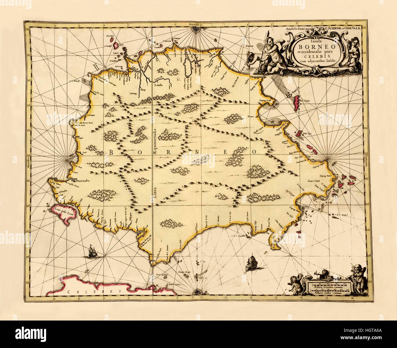 Map Of Borneo 1650 Stock Photohttps://www.alamy.com/image-license-details/?v=1https://www.alamy.com/stock-photo-map-of-borneo-1650-130841938.html
RFHGTA6A–Map Of Borneo 1650
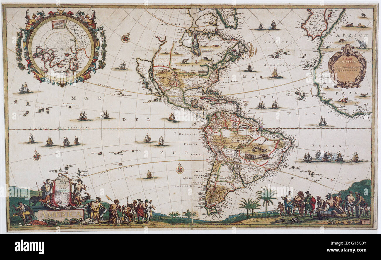 A 17th century map of the America's by Jan Mathisz. The map is a black and white line engraving filled in with period color. Stock Photohttps://www.alamy.com/image-license-details/?v=1https://www.alamy.com/stock-photo-a-17th-century-map-of-the-americas-by-jan-mathisz-the-map-is-a-black-103999195.html
RMG15G0Y–A 17th century map of the America's by Jan Mathisz. The map is a black and white line engraving filled in with period color.
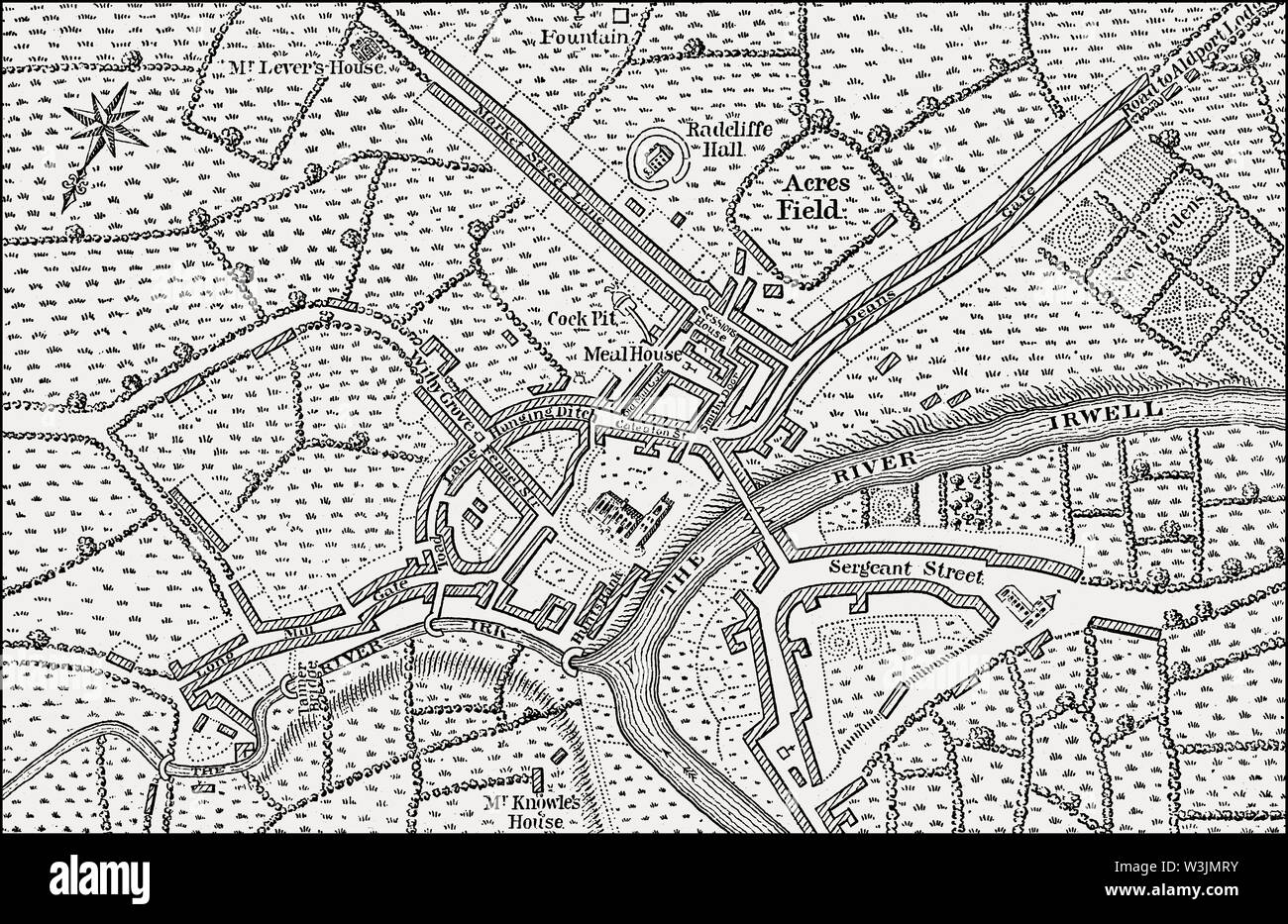 Map of Manchester and Salford, 1650 Stock Photohttps://www.alamy.com/image-license-details/?v=1https://www.alamy.com/map-of-manchester-and-salford-1650-image260410975.html
RMW3JMRY–Map of Manchester and Salford, 1650
![Virginiae partis australis, et Floridae partis orientalis, interjacentiumq[ue] regionum nova descriptio. 1650 by Blaeu, Willem Janszoon, 1571-1638 Stock Photo Virginiae partis australis, et Floridae partis orientalis, interjacentiumq[ue] regionum nova descriptio. 1650 by Blaeu, Willem Janszoon, 1571-1638 Stock Photo](https://c8.alamy.com/comp/2YP16TC/virginiae-partis-australis-et-floridae-partis-orientalis-interjacentiumq-ue-regionum-nova-descriptio-1650-by-blaeu-willem-janszoon-1571-1638-2YP16TC.jpg) Virginiae partis australis, et Floridae partis orientalis, interjacentiumq[ue] regionum nova descriptio. 1650 by Blaeu, Willem Janszoon, 1571-1638 Stock Photohttps://www.alamy.com/image-license-details/?v=1https://www.alamy.com/virginiae-partis-australis-et-floridae-partis-orientalis-interjacentiumq-ue-regionum-nova-descriptio-1650-by-blaeu-willem-janszoon-1571-1638-image633123020.html
Virginiae partis australis, et Floridae partis orientalis, interjacentiumq[ue] regionum nova descriptio. 1650 by Blaeu, Willem Janszoon, 1571-1638 Stock Photohttps://www.alamy.com/image-license-details/?v=1https://www.alamy.com/virginiae-partis-australis-et-floridae-partis-orientalis-interjacentiumq-ue-regionum-nova-descriptio-1650-by-blaeu-willem-janszoon-1571-1638-image633123020.htmlRM2YP16TC–Virginiae partis australis, et Floridae partis orientalis, interjacentiumq[ue] regionum nova descriptio. 1650 by Blaeu, Willem Janszoon, 1571-1638
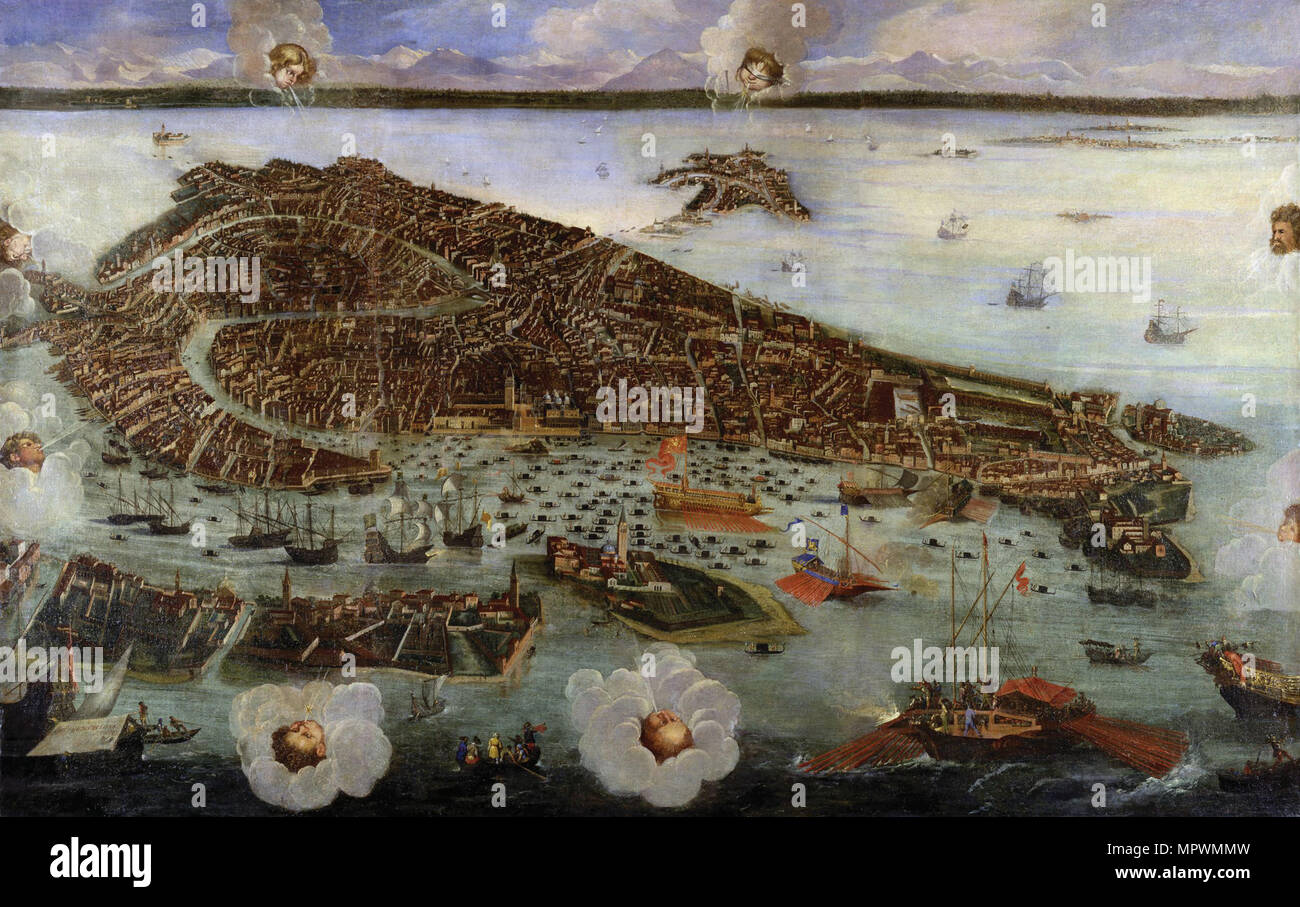 Perspective Map of Venice, c. 1650. Stock Photohttps://www.alamy.com/image-license-details/?v=1https://www.alamy.com/perspective-map-of-venice-c-1650-image186191177.html
RMMPWMMW–Perspective Map of Venice, c. 1650.
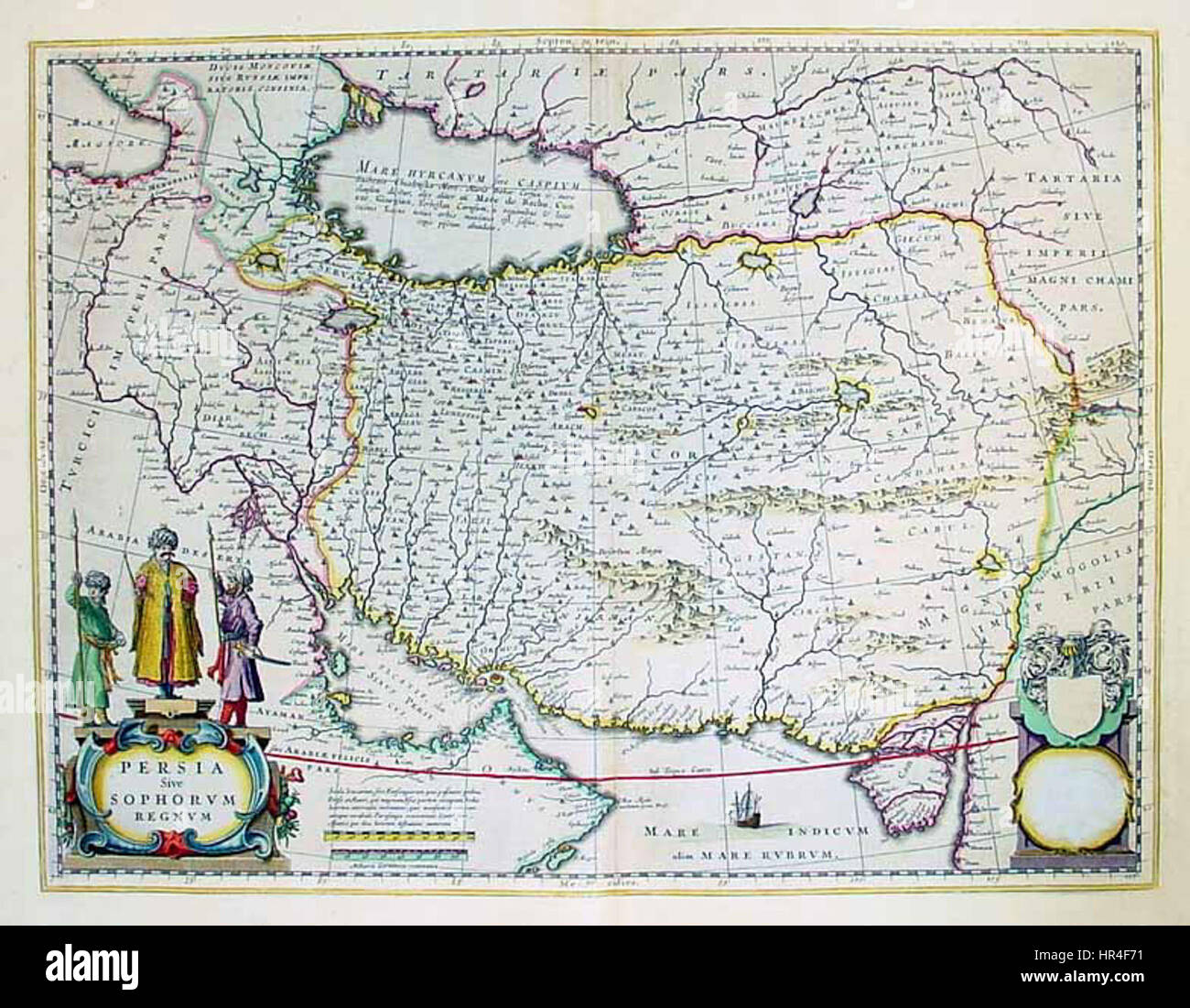 Persian Empire map 1650 Stock Photohttps://www.alamy.com/image-license-details/?v=1https://www.alamy.com/stock-photo-persian-empire-map-1650-134709429.html
RMHR4F71–Persian Empire map 1650
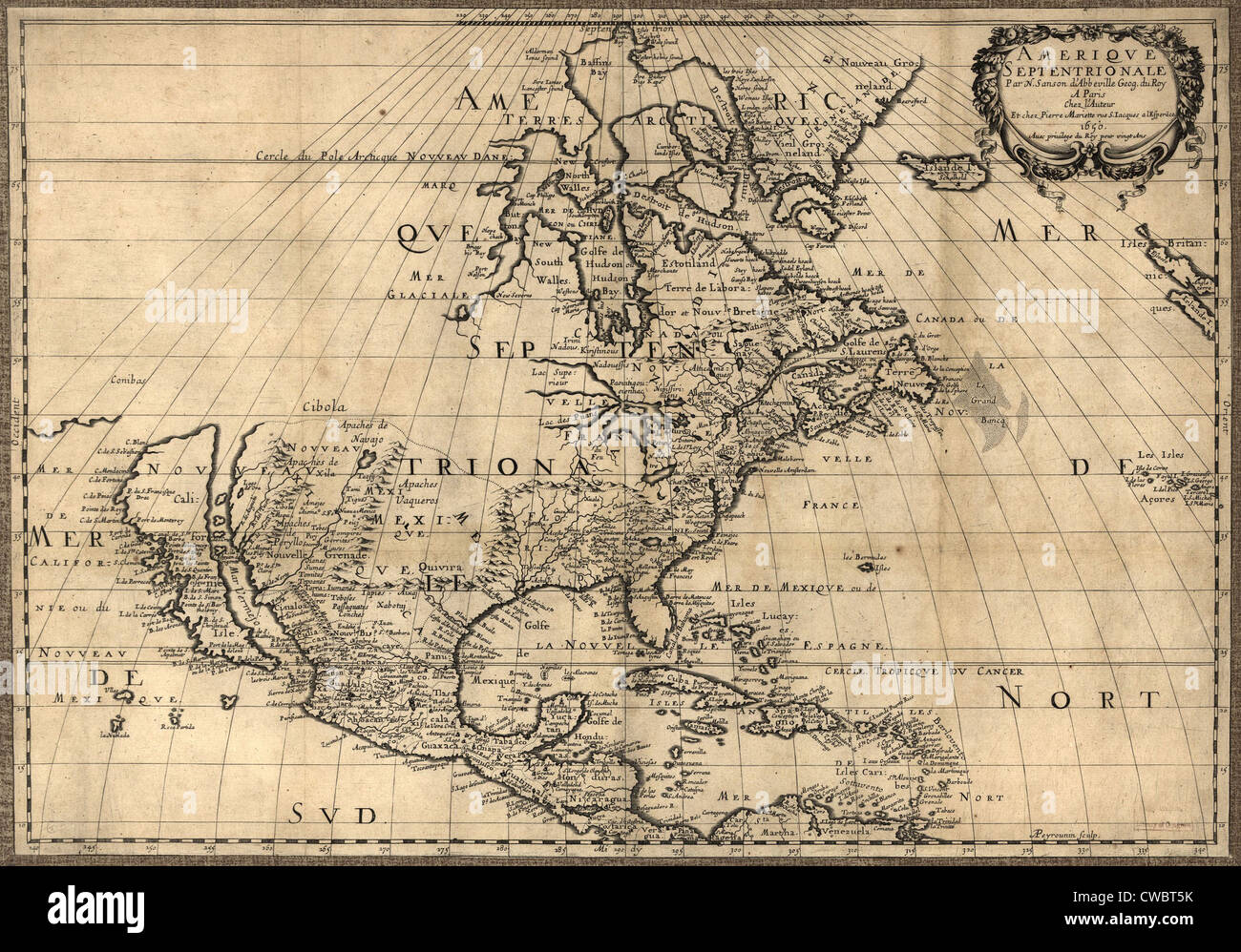 Map of North America continent showing extent of exploration in 1650. California is shown as an Island and the Pacific Stock Photohttps://www.alamy.com/image-license-details/?v=1https://www.alamy.com/stock-photo-map-of-north-america-continent-showing-extent-of-exploration-in-1650-50047583.html
RMCWBT5K–Map of North America continent showing extent of exploration in 1650. California is shown as an Island and the Pacific
 1650 Vintage illustrated Map Plan of the City of Toulouse, France by Basset. 17th Century Stock Photohttps://www.alamy.com/image-license-details/?v=1https://www.alamy.com/1650-vintage-illustrated-map-plan-of-the-city-of-toulouse-france-by-basset-17th-century-image625239446.html
RM2Y96386–1650 Vintage illustrated Map Plan of the City of Toulouse, France by Basset. 17th Century
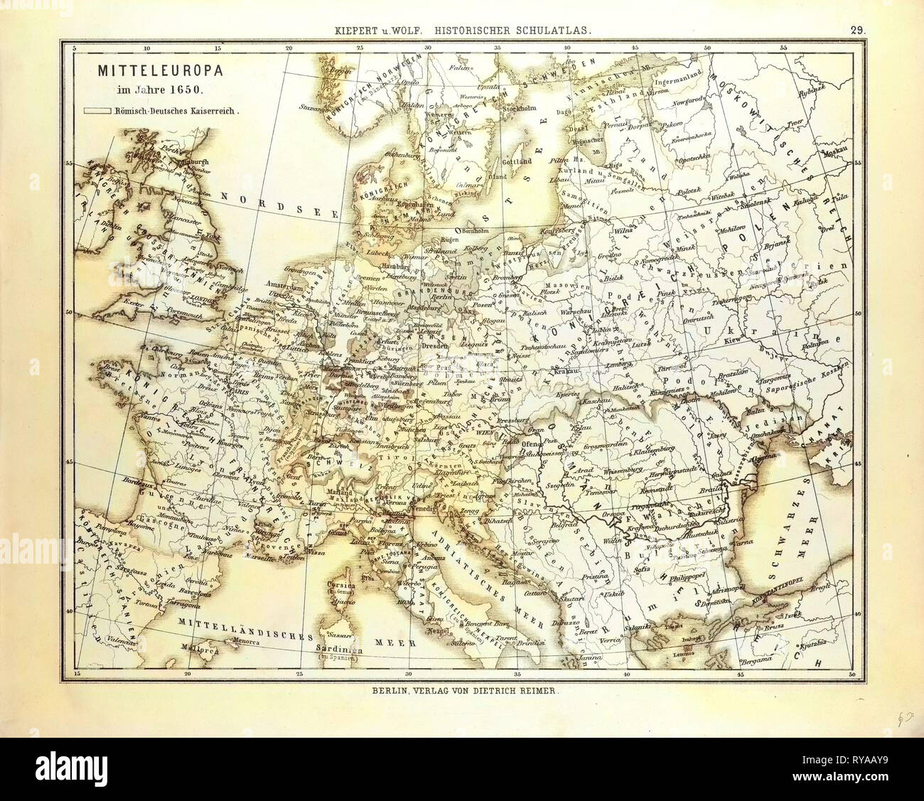 Map of Central Europe in 1650 Stock Photohttps://www.alamy.com/image-license-details/?v=1https://www.alamy.com/map-of-central-europe-in-1650-image240558621.html
RMRYAAY9–Map of Central Europe in 1650
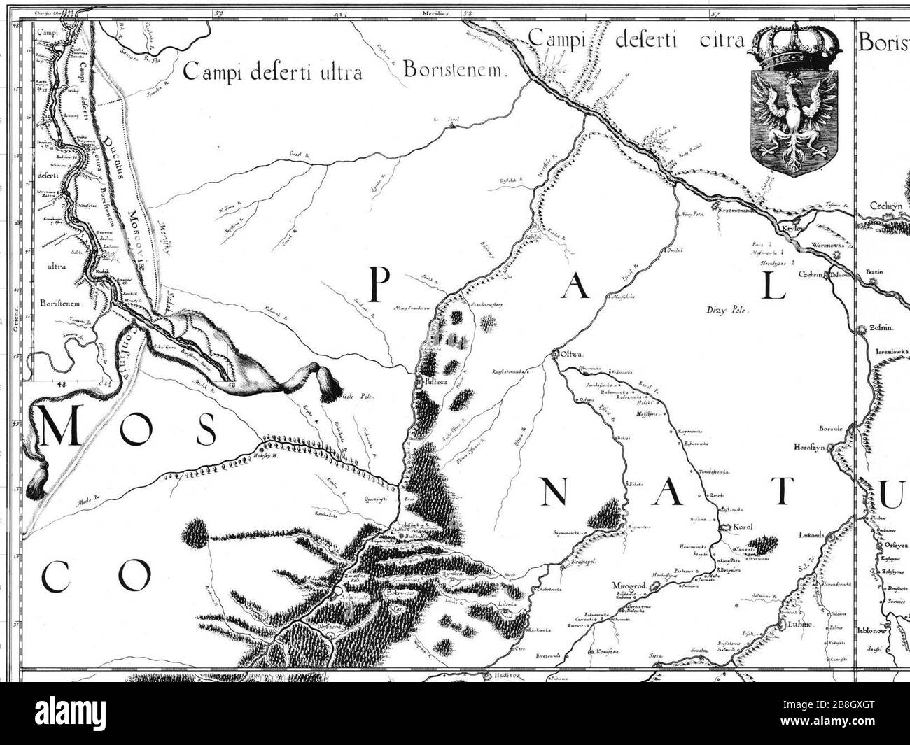 Govtva map ua 1650 Boplan. Stock Photohttps://www.alamy.com/image-license-details/?v=1https://www.alamy.com/govtva-map-ua-1650-boplan-image349496696.html
RM2B8GXGT–Govtva map ua 1650 Boplan.
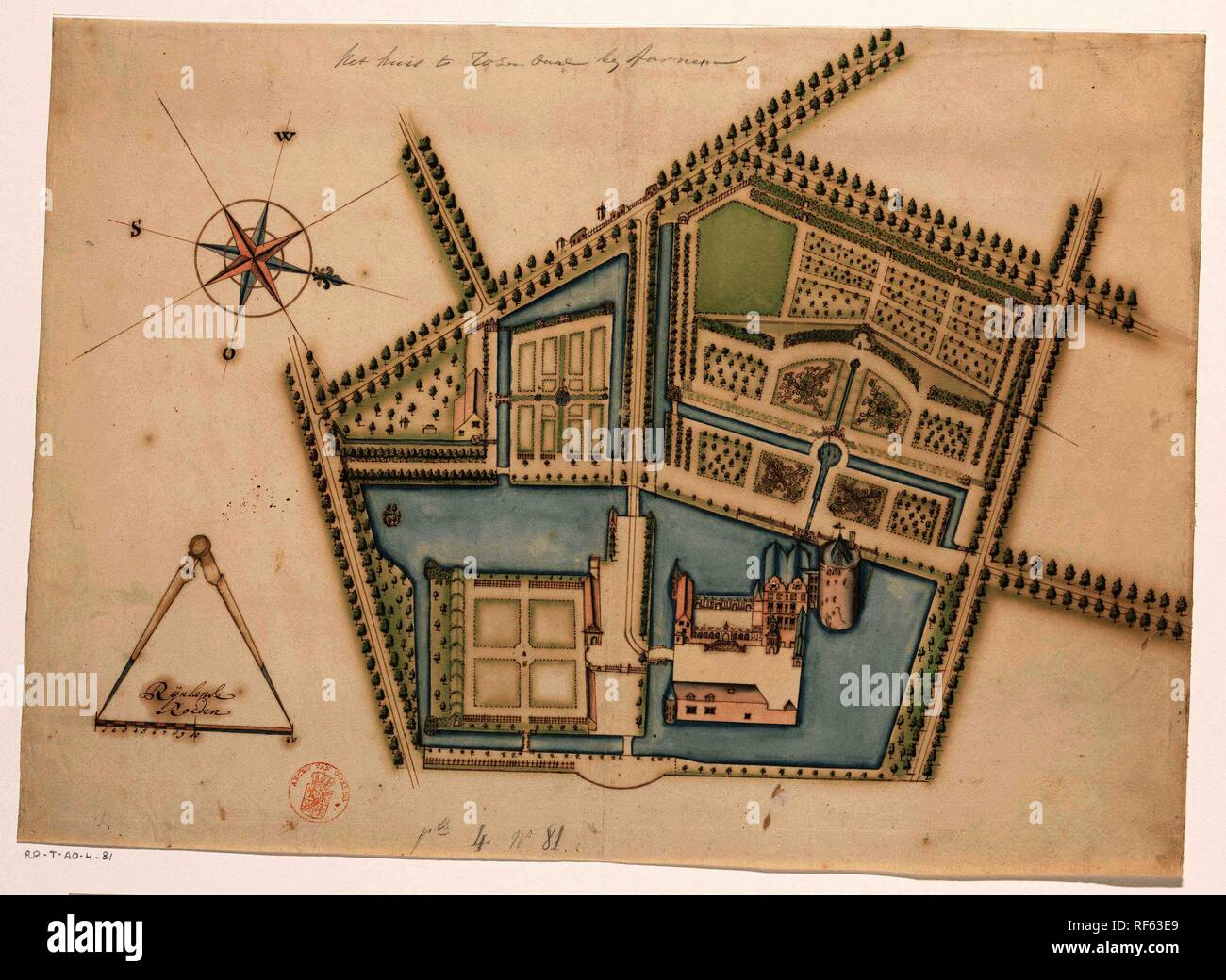 Map of Castle Rosendael. Draughtsman: anonymous. Dating: c. 1650 - before 1722. Measurements: h 387 mm × w 535 mm. Museum: Rijksmuseum, Amsterdam. Stock Photohttps://www.alamy.com/image-license-details/?v=1https://www.alamy.com/map-of-castle-rosendael-draughtsman-anonymous-dating-c-1650-before-1722-measurements-h-387-mm-w-535-mm-museum-rijksmuseum-amsterdam-image233089089.html
RMRF63E9–Map of Castle Rosendael. Draughtsman: anonymous. Dating: c. 1650 - before 1722. Measurements: h 387 mm × w 535 mm. Museum: Rijksmuseum, Amsterdam.
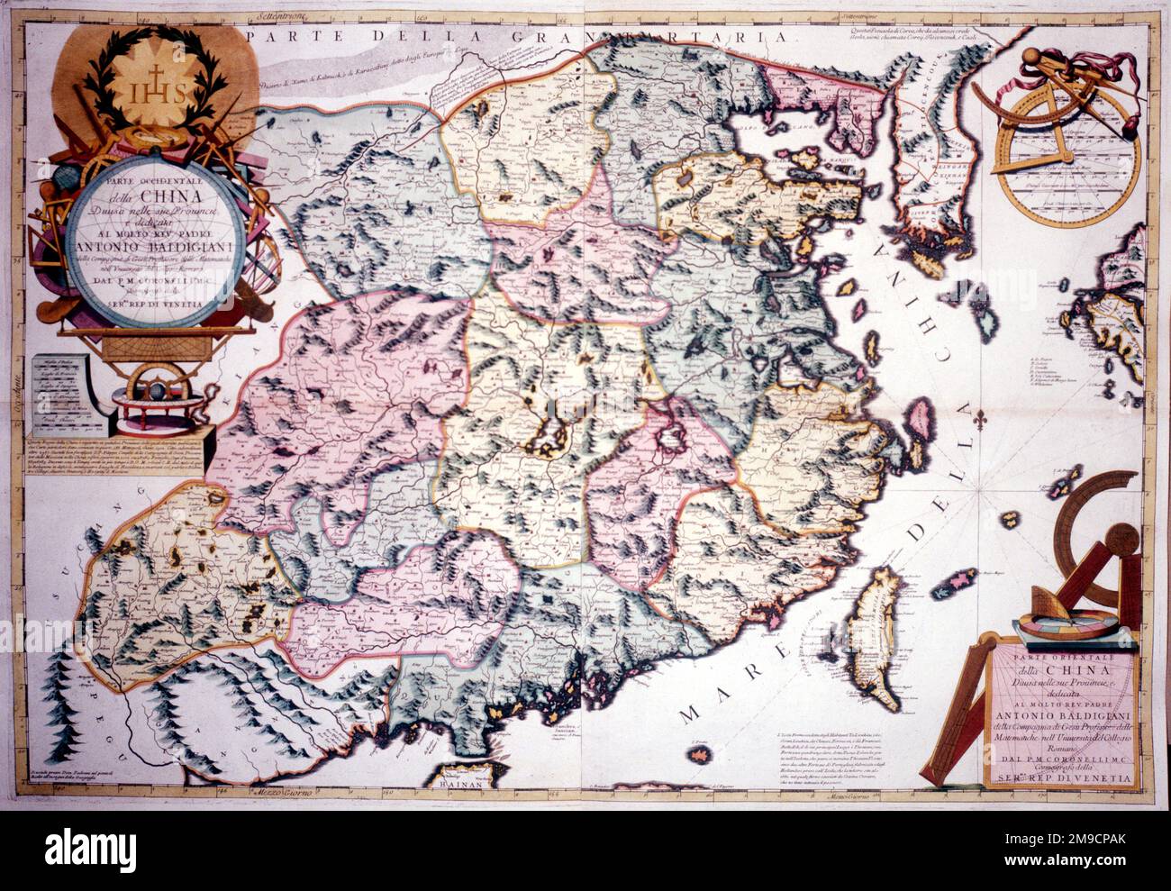 Map of China, c. 17th century Stock Photohttps://www.alamy.com/image-license-details/?v=1https://www.alamy.com/map-of-china-c-17th-century-image504913547.html
RM2M9CPAK–Map of China, c. 17th century
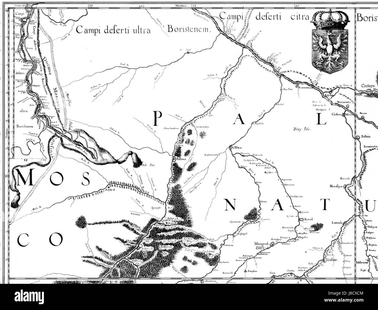 Govtva map ua 1650 Boplan Stock Photohttps://www.alamy.com/image-license-details/?v=1https://www.alamy.com/stock-photo-govtva-map-ua-1650-boplan-142884356.html
RMJ8CXCM–Govtva map ua 1650 Boplan
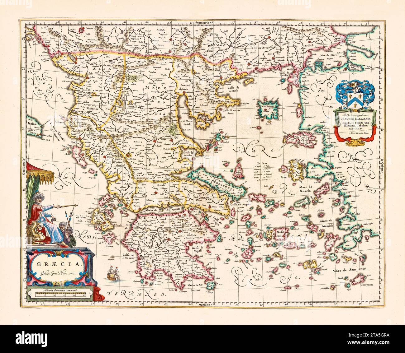 Old map if Greece. By Blaeu, publ. in Amsterdam, ca. 1650 Stock Photohttps://www.alamy.com/image-license-details/?v=1https://www.alamy.com/old-map-if-greece-by-blaeu-publ-in-amsterdam-ca-1650-image574211662.html
RF2TA5GRA–Old map if Greece. By Blaeu, publ. in Amsterdam, ca. 1650
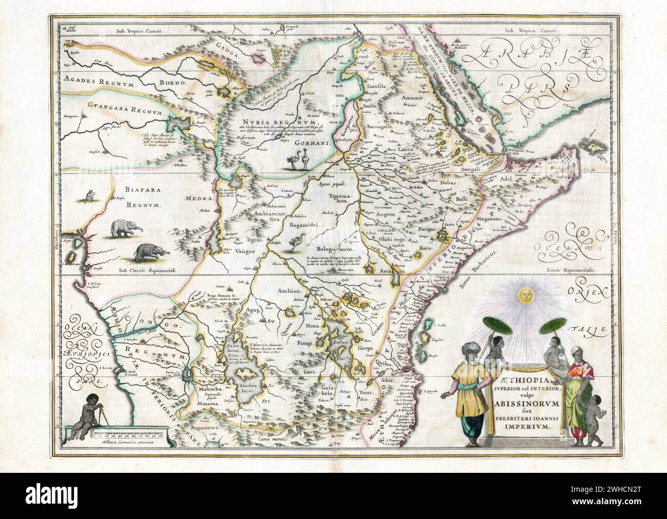 Map of Ethiopia, Willem and Johannes Joan Blaeu, ca 1650 Stock Photohttps://www.alamy.com/image-license-details/?v=1https://www.alamy.com/map-of-ethiopia-willem-and-johannes-joan-blaeu-ca-1650-image595881632.html
RM2WHCN2T–Map of Ethiopia, Willem and Johannes Joan Blaeu, ca 1650
 . English: Map of Ghent by Coronelli . 9 March 2012. Vincenzo Maria (Padre) Coronelli (1650-1718) 392 Map of Ghent by Coronelli Stock Photohttps://www.alamy.com/image-license-details/?v=1https://www.alamy.com/english-map-of-ghent-by-coronelli-9-march-2012-vincenzo-maria-padre-coronelli-1650-1718-392-map-of-ghent-by-coronelli-image187841527.html
RMMWGWNY–. English: Map of Ghent by Coronelli . 9 March 2012. Vincenzo Maria (Padre) Coronelli (1650-1718) 392 Map of Ghent by Coronelli
 Casa Del 1650, Agrigento, IT, Italy, Sicily, N 37 18' 47'', N 13 34' 19'', map, Cartascapes Map published in 2024. Explore Cartascapes, a map revealing Earth's diverse landscapes, cultures, and ecosystems. Journey through time and space, discovering the interconnectedness of our planet's past, present, and future. Stock Photohttps://www.alamy.com/image-license-details/?v=1https://www.alamy.com/casa-del-1650-agrigento-it-italy-sicily-n-37-18-47-n-13-34-19-map-cartascapes-map-published-in-2024-explore-cartascapes-a-map-revealing-earths-diverse-landscapes-cultures-and-ecosystems-journey-through-time-and-space-discovering-the-interconnectedness-of-our-planets-past-present-and-future-image614652916.html
RM2XKYT1T–Casa Del 1650, Agrigento, IT, Italy, Sicily, N 37 18' 47'', N 13 34' 19'', map, Cartascapes Map published in 2024. Explore Cartascapes, a map revealing Earth's diverse landscapes, cultures, and ecosystems. Journey through time and space, discovering the interconnectedness of our planet's past, present, and future.
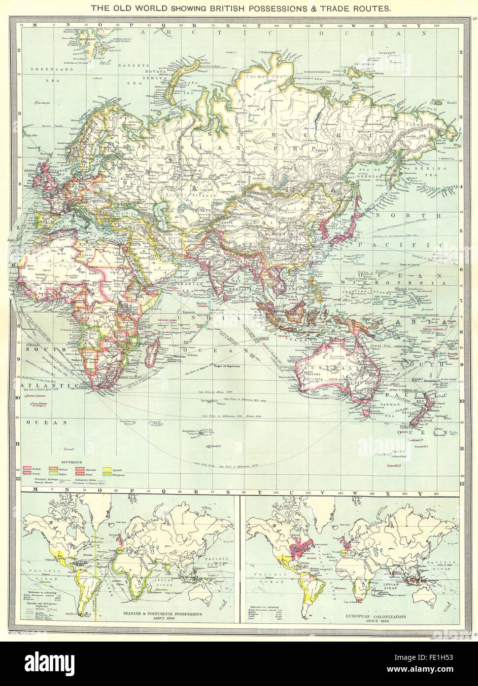 OLD WORLD: British Spanish Portuguese empires trade routes 1500 1650, 1907 map Stock Photohttps://www.alamy.com/image-license-details/?v=1https://www.alamy.com/stock-photo-old-world-british-spanish-portuguese-empires-trade-routes-1500-1650-94692447.html
RFFE1H53–OLD WORLD: British Spanish Portuguese empires trade routes 1500 1650, 1907 map
 Map of the Blockade of Amsterdam by the troops of Willem II, 1650, 1728 - 1730 print Map of the Blockade of Amsterdam by the troops of Prince William II, from 20 July to 4 August 1650. Map of Amsterdam with the surrounding area, right Haarlem, Left Muiden and Weesp. The different army places of the troops are indicated on the map. Left on the Zuiderzee near Pampus different ships with name indicated. At the top right marked: Tom: II. Page: 511. Northern Netherlands paper etching maps of separate countries or regions Amsterdam. North Holland Stock Photohttps://www.alamy.com/image-license-details/?v=1https://www.alamy.com/map-of-the-blockade-of-amsterdam-by-the-troops-of-willem-ii-1650-1728-1730-print-map-of-the-blockade-of-amsterdam-by-the-troops-of-prince-william-ii-from-20-july-to-4-august-1650-map-of-amsterdam-with-the-surrounding-area-right-haarlem-left-muiden-and-weesp-the-different-army-places-of-the-troops-are-indicated-on-the-map-left-on-the-zuiderzee-near-pampus-different-ships-with-name-indicated-at-the-top-right-marked-tom-ii-page-511-northern-netherlands-paper-etching-maps-of-separate-countries-or-regions-amsterdam-north-holland-image595200874.html
RM2WG9MP2–Map of the Blockade of Amsterdam by the troops of Willem II, 1650, 1728 - 1730 print Map of the Blockade of Amsterdam by the troops of Prince William II, from 20 July to 4 August 1650. Map of Amsterdam with the surrounding area, right Haarlem, Left Muiden and Weesp. The different army places of the troops are indicated on the map. Left on the Zuiderzee near Pampus different ships with name indicated. At the top right marked: Tom: II. Page: 511. Northern Netherlands paper etching maps of separate countries or regions Amsterdam. North Holland
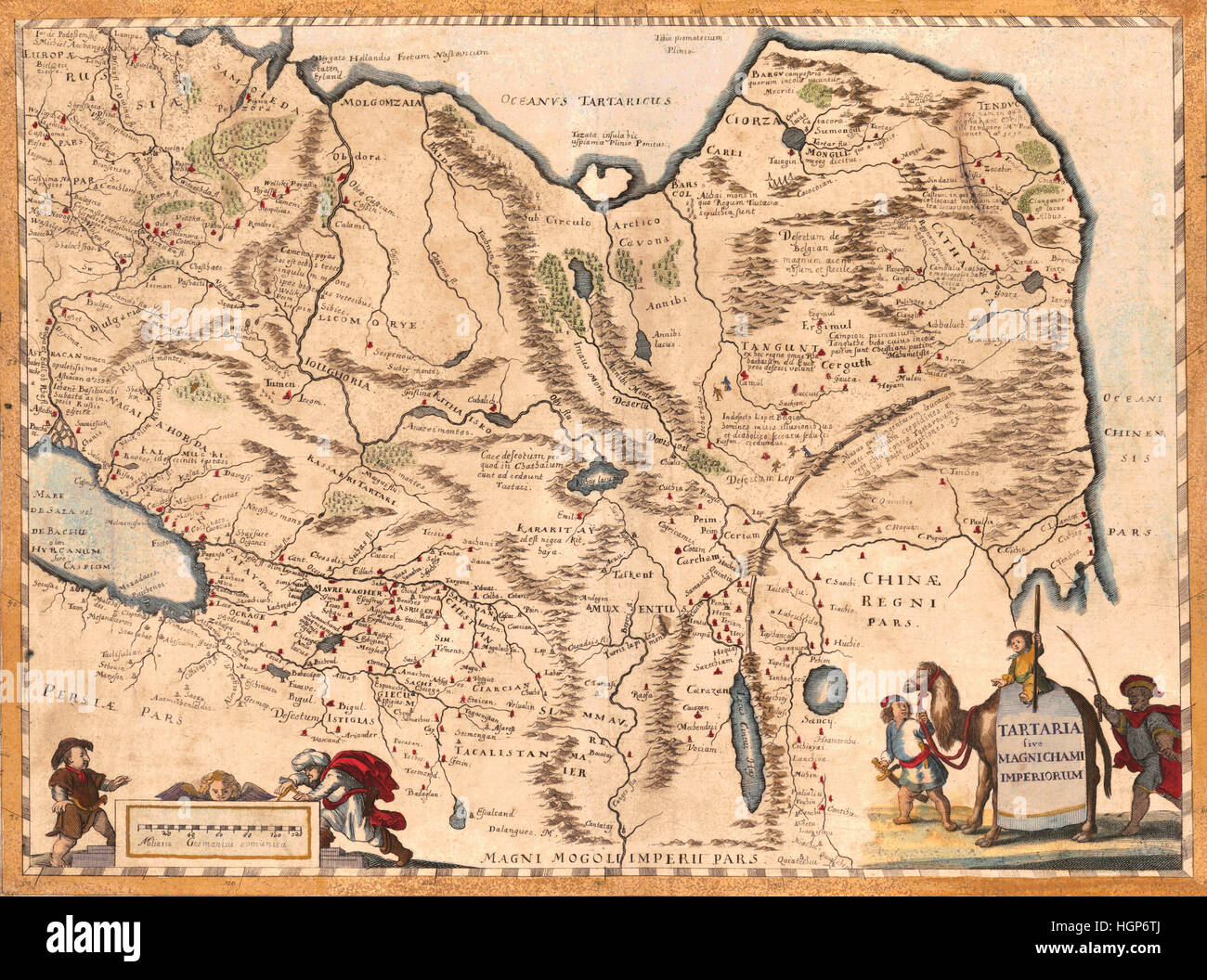 Map Of Asia 1650 Stock Photohttps://www.alamy.com/image-license-details/?v=1https://www.alamy.com/stock-photo-map-of-asia-1650-130795410.html
RFHGP6TJ–Map Of Asia 1650
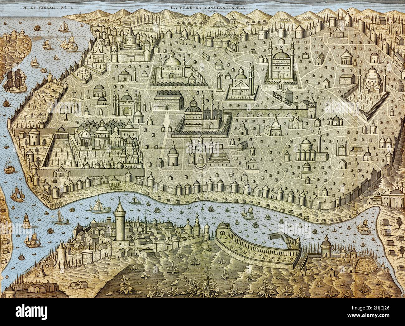 Colorized, bird's-eye view of Istanbul from the 1650s, showing buildings such as Topkapi Palace, Hagia Sophia, The Blue Mosque, Sehzade Mosque, Bayezid II Mosque, Fatih Mosque, Sokullu Mehmet Pasha Mosque, Suleymaniye Mosque, Beyazit Tower. Colorization of an illustration by Jaspar Isaac, c. 1650s. Stock Photohttps://www.alamy.com/image-license-details/?v=1https://www.alamy.com/colorized-birds-eye-view-of-istanbul-from-the-1650s-showing-buildings-such-as-topkapi-palace-hagia-sophia-the-blue-mosque-sehzade-mosque-bayezid-ii-mosque-fatih-mosque-sokullu-mehmet-pasha-mosque-suleymaniye-mosque-beyazit-tower-colorization-of-an-illustration-by-jaspar-isaac-c-1650s-image458810974.html
RM2HJCJ26–Colorized, bird's-eye view of Istanbul from the 1650s, showing buildings such as Topkapi Palace, Hagia Sophia, The Blue Mosque, Sehzade Mosque, Bayezid II Mosque, Fatih Mosque, Sokullu Mehmet Pasha Mosque, Suleymaniye Mosque, Beyazit Tower. Colorization of an illustration by Jaspar Isaac, c. 1650s.
![A map of the island of Bua. [Map of the] Isle de Bua. [Venice], [1650]. Source: Maps K.Top.113.44. Language: French. Stock Photo A map of the island of Bua. [Map of the] Isle de Bua. [Venice], [1650]. Source: Maps K.Top.113.44. Language: French. Stock Photo](https://c8.alamy.com/comp/R5CK11/a-map-of-the-island-of-bua-map-of-the-isle-de-bua-venice-1650-source-maps-ktop11344-language-french-R5CK11.jpg) A map of the island of Bua. [Map of the] Isle de Bua. [Venice], [1650]. Source: Maps K.Top.113.44. Language: French. Stock Photohttps://www.alamy.com/image-license-details/?v=1https://www.alamy.com/a-map-of-the-island-of-bua-map-of-the-isle-de-bua-venice-1650-source-maps-ktop11344-language-french-image227086413.html
A map of the island of Bua. [Map of the] Isle de Bua. [Venice], [1650]. Source: Maps K.Top.113.44. Language: French. Stock Photohttps://www.alamy.com/image-license-details/?v=1https://www.alamy.com/a-map-of-the-island-of-bua-map-of-the-isle-de-bua-venice-1650-source-maps-ktop11344-language-french-image227086413.htmlRMR5CK11–A map of the island of Bua. [Map of the] Isle de Bua. [Venice], [1650]. Source: Maps K.Top.113.44. Language: French.
 Kaart van de heerlijkheid Achttienhoven Map of glory Achttienhoven South Holland. Manufacturer : printmaker: anonymous date: 1650 - 1750 Material: paper Technique: engra (printing process) / etch dimensions: plate edge: h 279 mm × W 426 mm Subject: maps of separate countries or regions where: Eighteen Hove Stock Photohttps://www.alamy.com/image-license-details/?v=1https://www.alamy.com/kaart-van-de-heerlijkheid-achttienhoven-map-of-glory-achttienhoven-south-holland-manufacturer-printmaker-anonymous-date-1650-1750-material-paper-technique-engra-printing-process-etch-dimensions-plate-edge-h-279-mm-w-426-mm-subject-maps-of-separate-countries-or-regions-where-eighteen-hove-image348480973.html
RM2B6XK11–Kaart van de heerlijkheid Achttienhoven Map of glory Achttienhoven South Holland. Manufacturer : printmaker: anonymous date: 1650 - 1750 Material: paper Technique: engra (printing process) / etch dimensions: plate edge: h 279 mm × W 426 mm Subject: maps of separate countries or regions where: Eighteen Hove
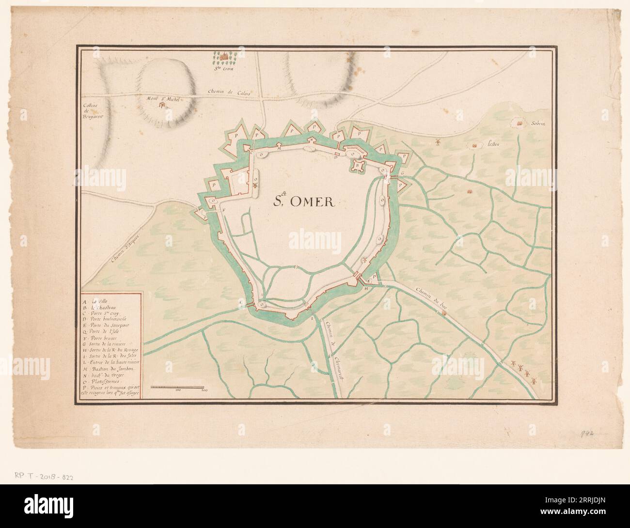 Map of Sint-Omaars, 1650-1700. Stock Photohttps://www.alamy.com/image-license-details/?v=1https://www.alamy.com/map-of-sint-omaars-1650-1700-image565274717.html
RM2RRJDJN–Map of Sint-Omaars, 1650-1700.
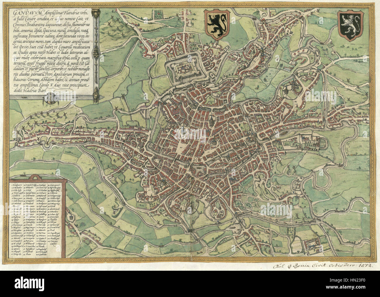 Map of Ghent by Braun and Hogenberg, 1650 Stock Photohttps://www.alamy.com/image-license-details/?v=1https://www.alamy.com/stock-photo-map-of-ghent-by-braun-and-hogenberg-1650-133427028.html
RMHN23F0–Map of Ghent by Braun and Hogenberg, 1650
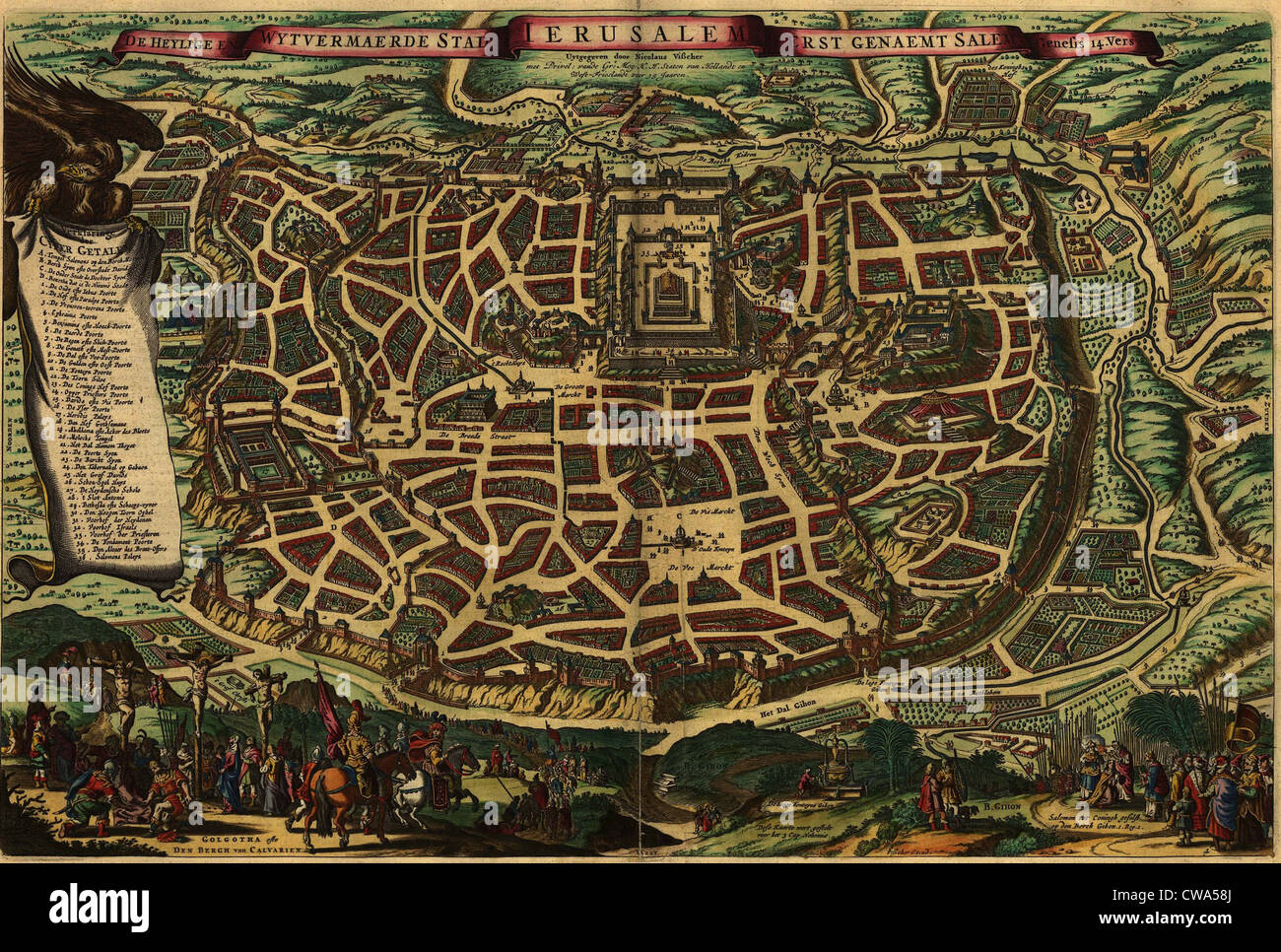 Imagined map from 1650, depicting Jerusalem as it existed in the Roman era. Lower section shows Christ's crucifixion and the Stock Photohttps://www.alamy.com/image-license-details/?v=1https://www.alamy.com/stock-photo-imagined-map-from-1650-depicting-jerusalem-as-it-existed-in-the-roman-50010818.html
RMCWA58J–Imagined map from 1650, depicting Jerusalem as it existed in the Roman era. Lower section shows Christ's crucifixion and the
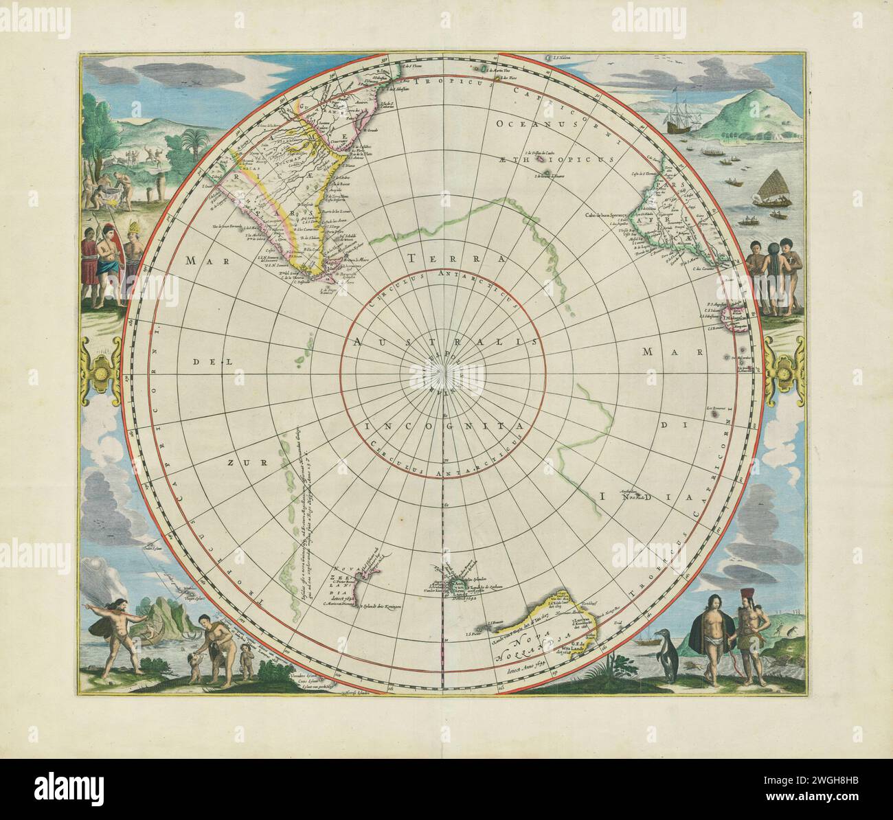 Vintage Illustrated atlas map page showing the Antarctic region. Published by Johannes Janssonius (also called Jansson), produced circa. 1650. Stock Photohttps://www.alamy.com/image-license-details/?v=1https://www.alamy.com/vintage-illustrated-atlas-map-page-showing-the-antarctic-region-published-by-johannes-janssonius-also-called-jansson-produced-circa-1650-image595366951.html
RM2WGH8HB–Vintage Illustrated atlas map page showing the Antarctic region. Published by Johannes Janssonius (also called Jansson), produced circa. 1650.
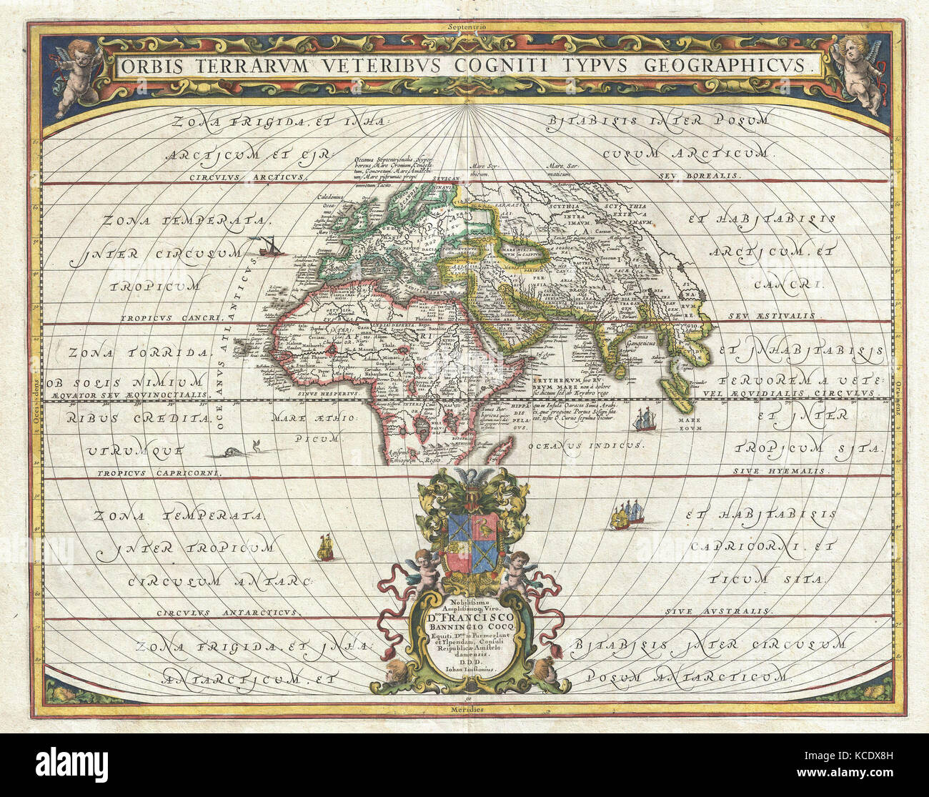 1650, Jansson Map of the Ancient World Stock Photohttps://www.alamy.com/image-license-details/?v=1https://www.alamy.com/stock-image-1650-jansson-map-of-the-ancient-world-162575185.html
RMKCDX8H–1650, Jansson Map of the Ancient World
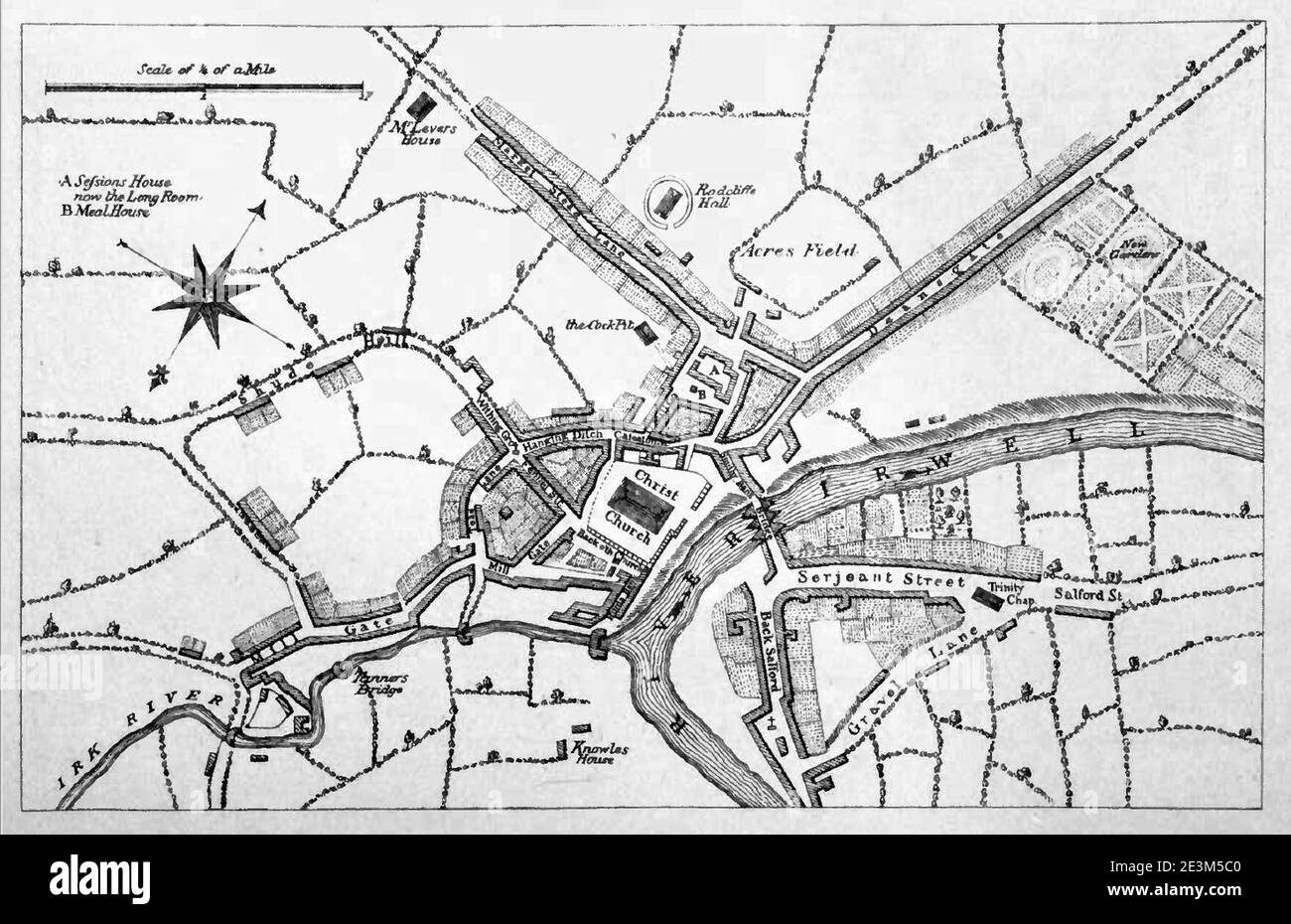 Map of manchester circa 1650. Stock Photohttps://www.alamy.com/image-license-details/?v=1https://www.alamy.com/map-of-manchester-circa-1650-image398125728.html
RM2E3M5C0–Map of manchester circa 1650.
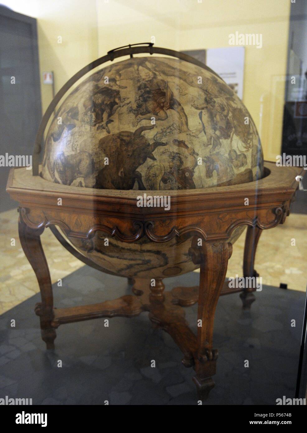 Terrestrial globe by cosmographer Vicenzo Coronelli (1650-1718). The Science and Technology Museum Leonardo da Vinci. Milan. Italy. Stock Photohttps://www.alamy.com/image-license-details/?v=1https://www.alamy.com/terrestrial-globe-by-cosmographer-vicenzo-coronelli-1650-1718-the-science-and-technology-museum-leonardo-da-vinci-milan-italy-image209735019.html
RMP5674B–Terrestrial globe by cosmographer Vicenzo Coronelli (1650-1718). The Science and Technology Museum Leonardo da Vinci. Milan. Italy.
 Map of North America continent showing extent of exploration in 1650. California is shown as an Island and the Pacific Northwest and Alaska are unknown. Stock Photohttps://www.alamy.com/image-license-details/?v=1https://www.alamy.com/stock-photo-map-of-north-america-continent-showing-extent-of-exploration-in-1650-32392404.html
RMBTKGRG–Map of North America continent showing extent of exploration in 1650. California is shown as an Island and the Pacific Northwest and Alaska are unknown.
