1790s us map Stock Photos and Images
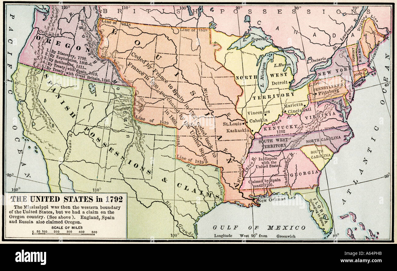 Map of the United States in 1792 showing colonial claims on Oregon Territory after the American Revolutionary War. Color lithograph Stock Photohttps://www.alamy.com/image-license-details/?v=1https://www.alamy.com/map-of-the-united-states-in-1792-showing-colonial-claims-on-oregon-image6548634.html
RMA64PHB–Map of the United States in 1792 showing colonial claims on Oregon Territory after the American Revolutionary War. Color lithograph
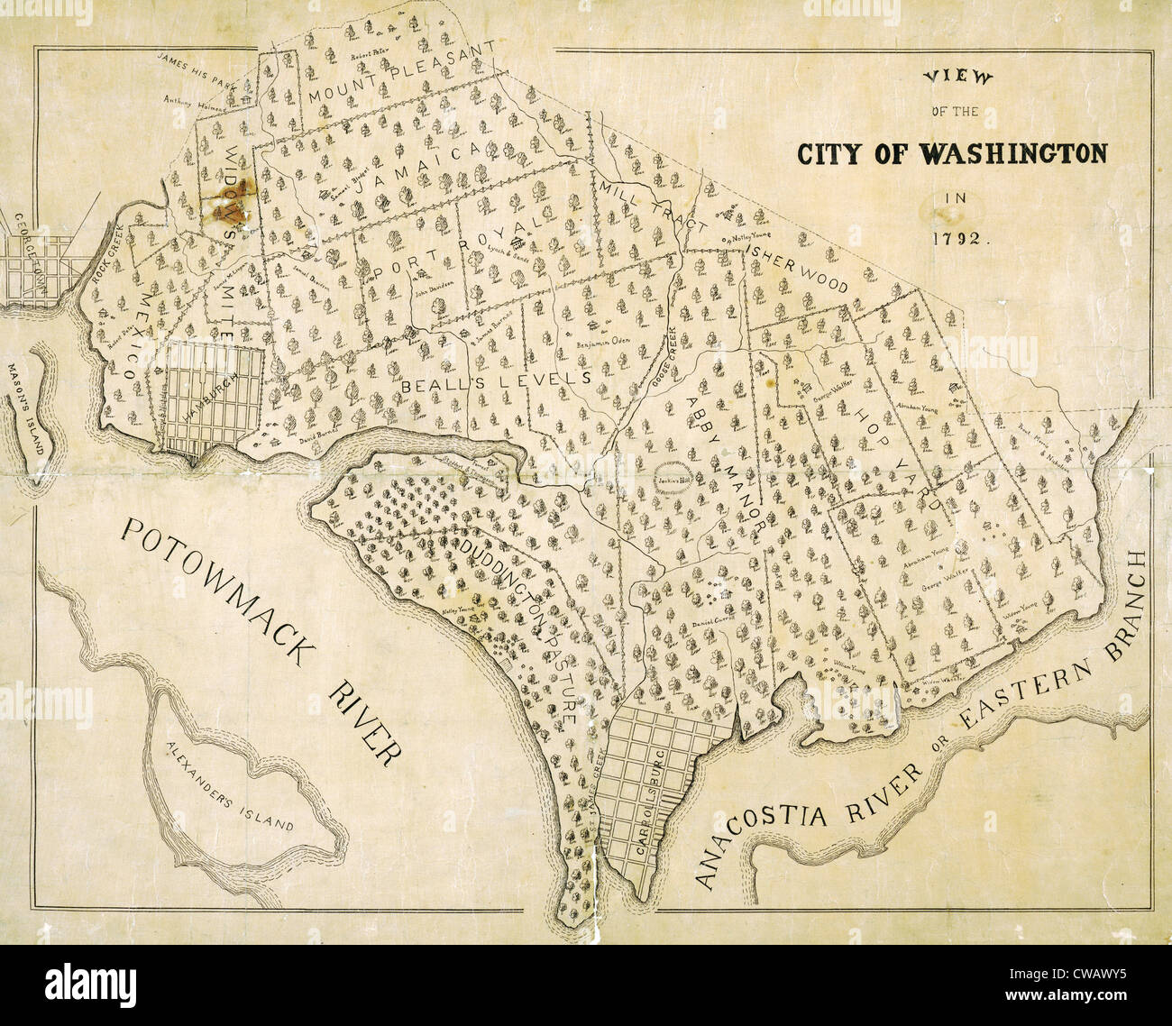 Washington, D.C. Map showing the original plantation land that would become the District of Columbia. 1792 Stock Photohttps://www.alamy.com/image-license-details/?v=1https://www.alamy.com/stock-photo-washington-dc-map-showing-the-original-plantation-land-that-would-50027017.html
RMCWAWY5–Washington, D.C. Map showing the original plantation land that would become the District of Columbia. 1792
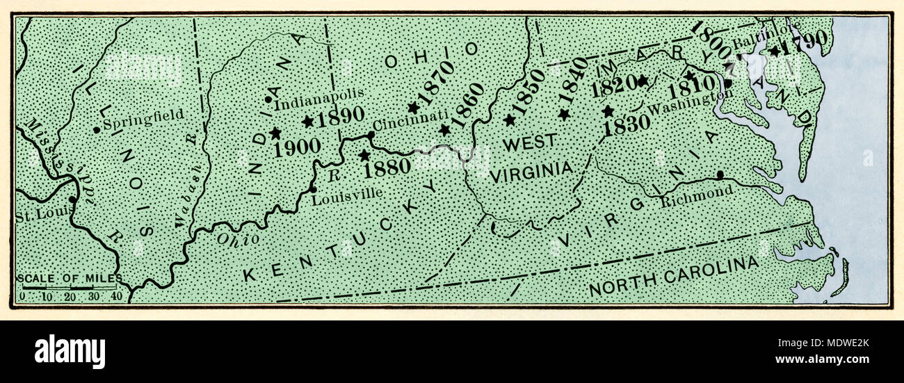 Map showing center of US population moving westward along the National Road, 1790-1900. Digitally colored woodcut Stock Photohttps://www.alamy.com/image-license-details/?v=1https://www.alamy.com/map-showing-center-of-us-population-moving-westward-along-the-national-road-1790-1900-digitally-colored-woodcut-image180654059.html
RMMDWE2K–Map showing center of US population moving westward along the National Road, 1790-1900. Digitally colored woodcut
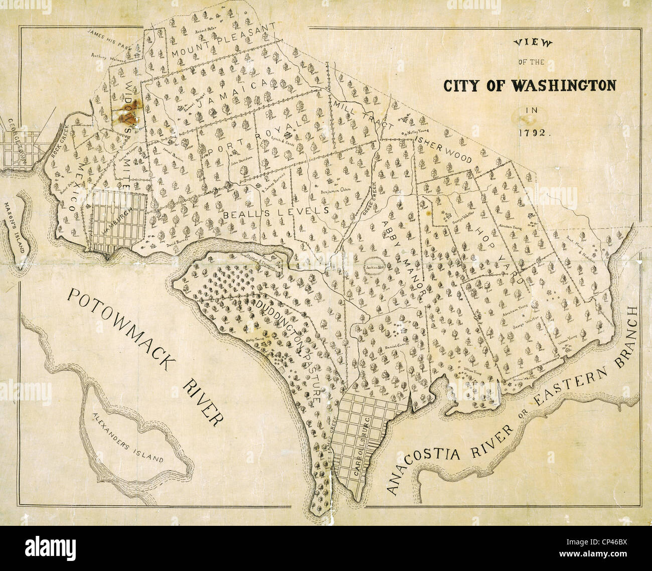 Washington, D.C. Map showing the original plantation land that would become the District of Columbia. 1792 Stock Photohttps://www.alamy.com/image-license-details/?v=1https://www.alamy.com/stock-photo-washington-dc-map-showing-the-original-plantation-land-that-would-48036014.html
RMCP46BX–Washington, D.C. Map showing the original plantation land that would become the District of Columbia. 1792
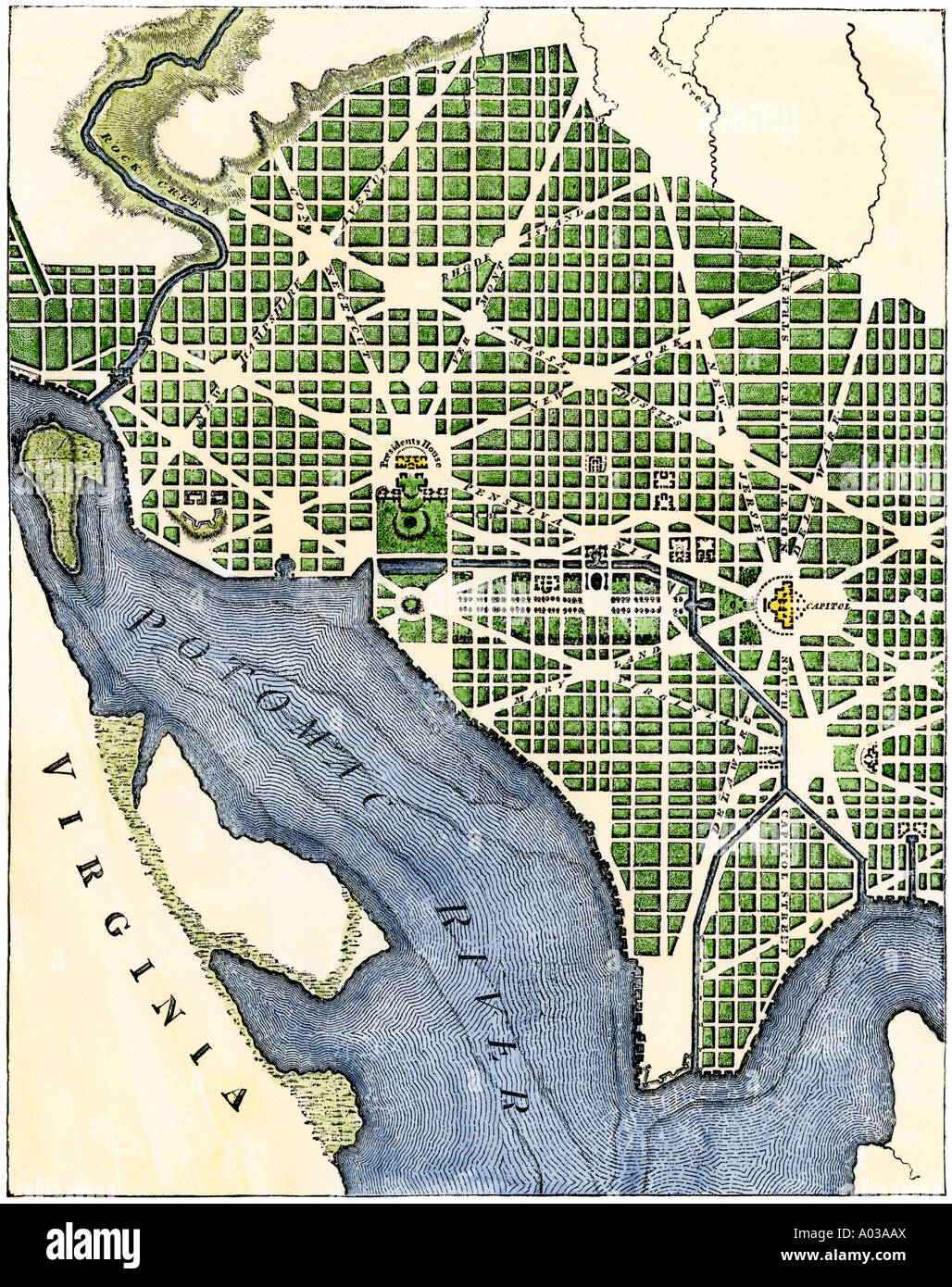 Washington DC as originally laid out from an engraving of 1793. Hand-colored woodcut Stock Photohttps://www.alamy.com/image-license-details/?v=1https://www.alamy.com/washington-dc-as-originally-laid-out-from-an-engraving-of-1793-hand-image9866209.html
RMA03AAX–Washington DC as originally laid out from an engraving of 1793. Hand-colored woodcut
 Map of General Harmar's defeat by the Miami and Shawnee at Fort Wayne, Indiana, 1791. Hand-colored woodcut Stock Photohttps://www.alamy.com/image-license-details/?v=1https://www.alamy.com/stock-photo-map-of-general-harmars-defeat-by-the-miami-and-shawnee-at-fort-wayne-29601883.html
RMBM4DE3–Map of General Harmar's defeat by the Miami and Shawnee at Fort Wayne, Indiana, 1791. Hand-colored woodcut
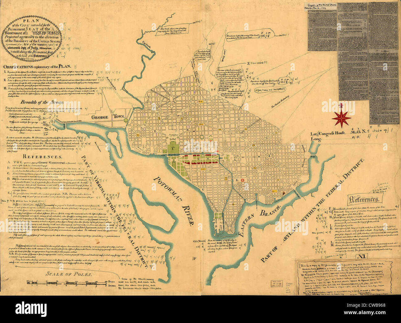 Washington, D.C. Map showing the original plan of what would become the District of Columbia. By Peter Charles L'Enfant. 1791 Stock Photohttps://www.alamy.com/image-license-details/?v=1https://www.alamy.com/stock-photo-washington-dc-map-showing-the-original-plan-of-what-would-become-the-50035840.html
RMCWB968–Washington, D.C. Map showing the original plan of what would become the District of Columbia. By Peter Charles L'Enfant. 1791
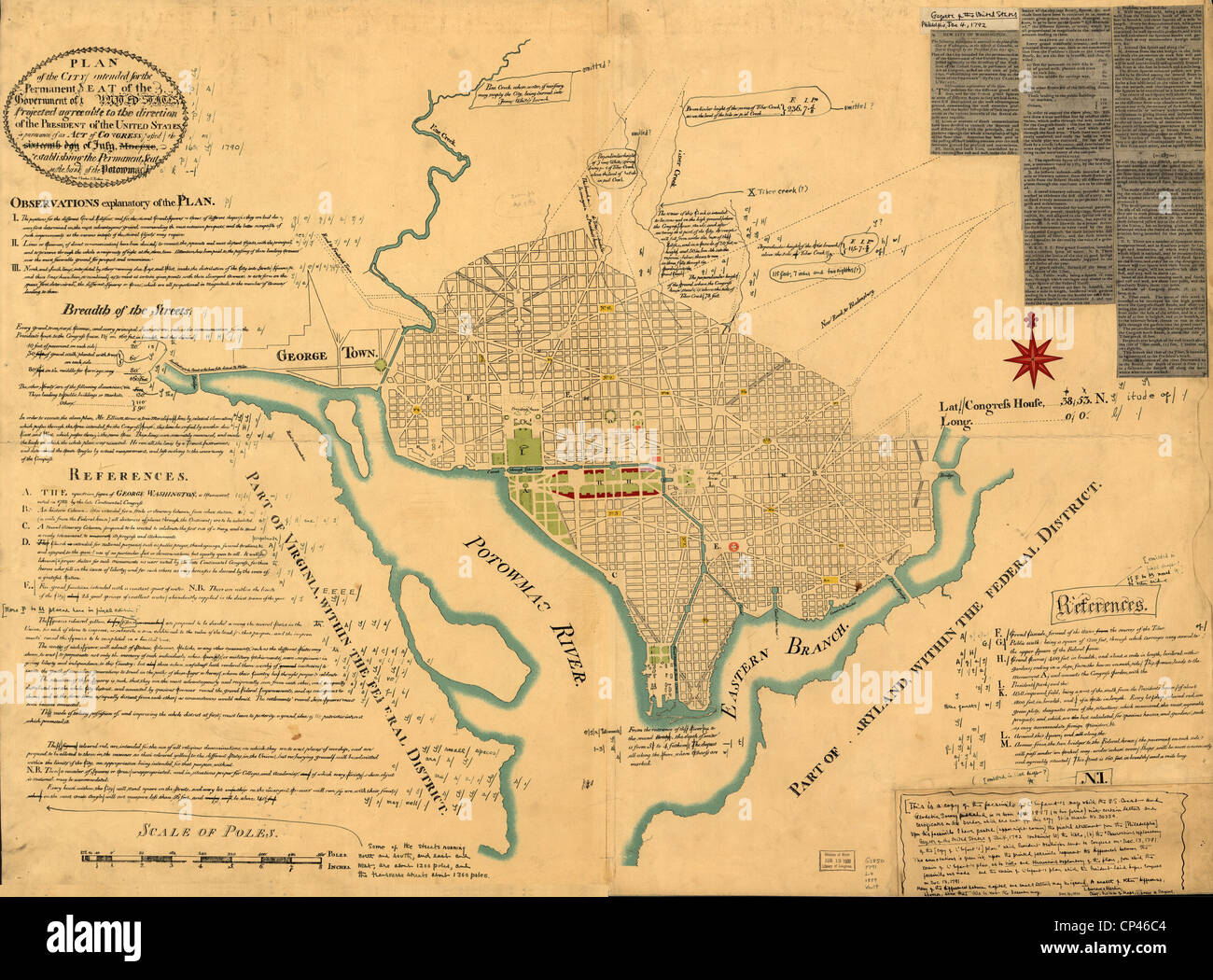 Washington, D.C. Map showing the original plan of what would become the District of Columbia. By Peter Charles L'Enfant. 1791 Stock Photohttps://www.alamy.com/image-license-details/?v=1https://www.alamy.com/stock-photo-washington-dc-map-showing-the-original-plan-of-what-would-become-the-48036020.html
RMCP46C4–Washington, D.C. Map showing the original plan of what would become the District of Columbia. By Peter Charles L'Enfant. 1791