1799 cary map of swabia Stock Photos and Images
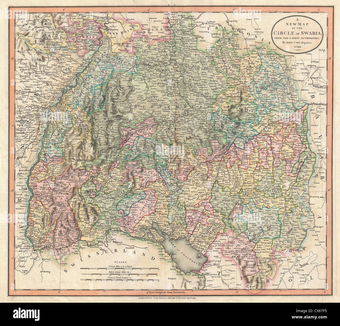 1799 Cary Map of Swabia, Germany Stock Photohttps://www.alamy.com/image-license-details/?v=1https://www.alamy.com/stock-photo-1799-cary-map-of-swabia-germany-50539417.html
RMCX67F5–1799 Cary Map of Swabia, Germany
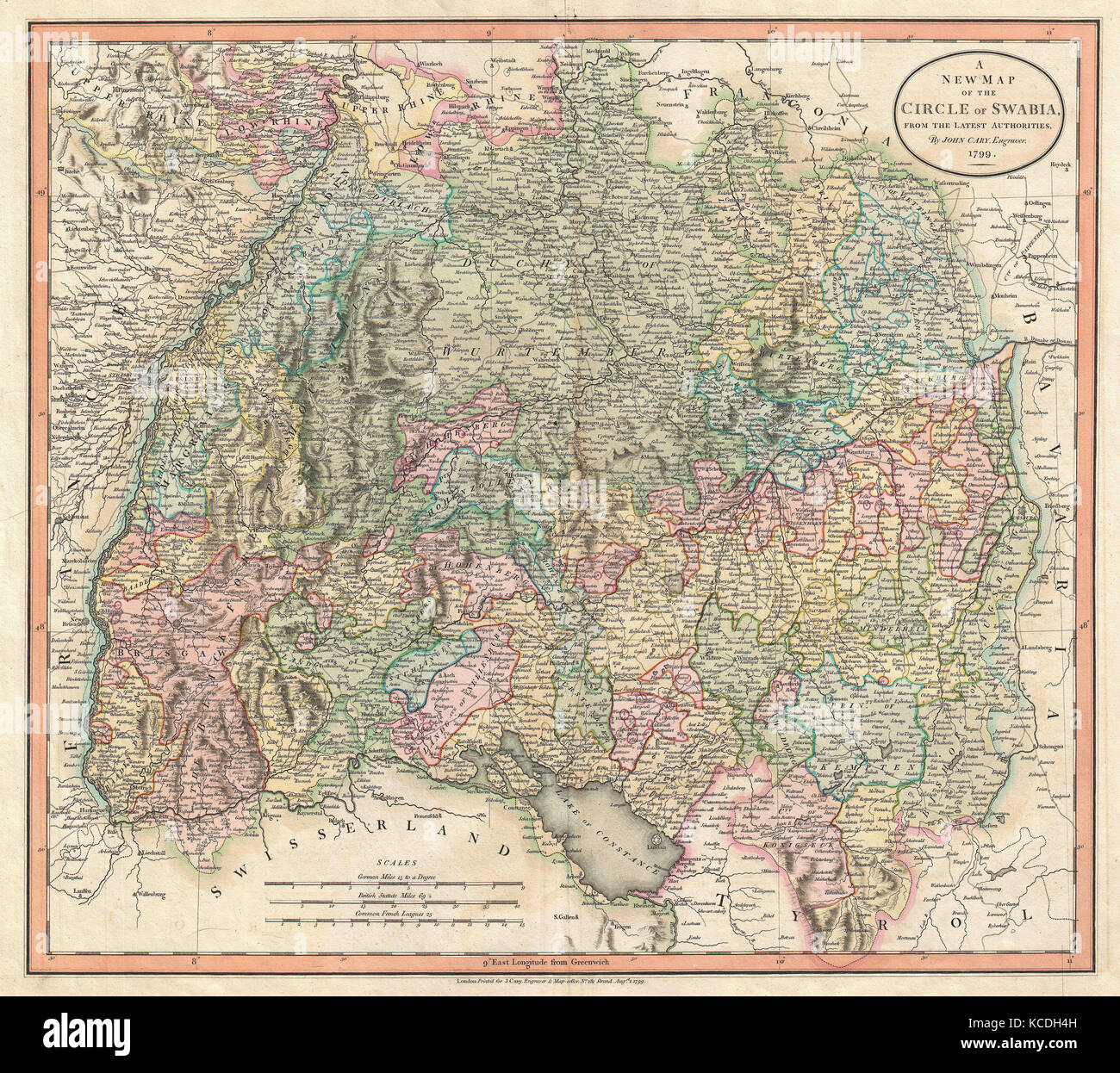 1799, Cary Map of Swabia, Germany, John Cary, 1754 – 1835, was an English cartographer Stock Photohttps://www.alamy.com/image-license-details/?v=1https://www.alamy.com/stock-image-1799-cary-map-of-swabia-germany-john-cary-1754-1835-was-an-english-162568017.html
RMKCDH4H–1799, Cary Map of Swabia, Germany, John Cary, 1754 – 1835, was an English cartographer
 1799 Cary Map of Swabia, Germany - Geographicus - Swabia-cary-1799. Stock Photohttps://www.alamy.com/image-license-details/?v=1https://www.alamy.com/1799-cary-map-of-swabia-germany-geographicus-swabia-cary-1799-image209806251.html
RMP59E0B–1799 Cary Map of Swabia, Germany - Geographicus - Swabia-cary-1799.
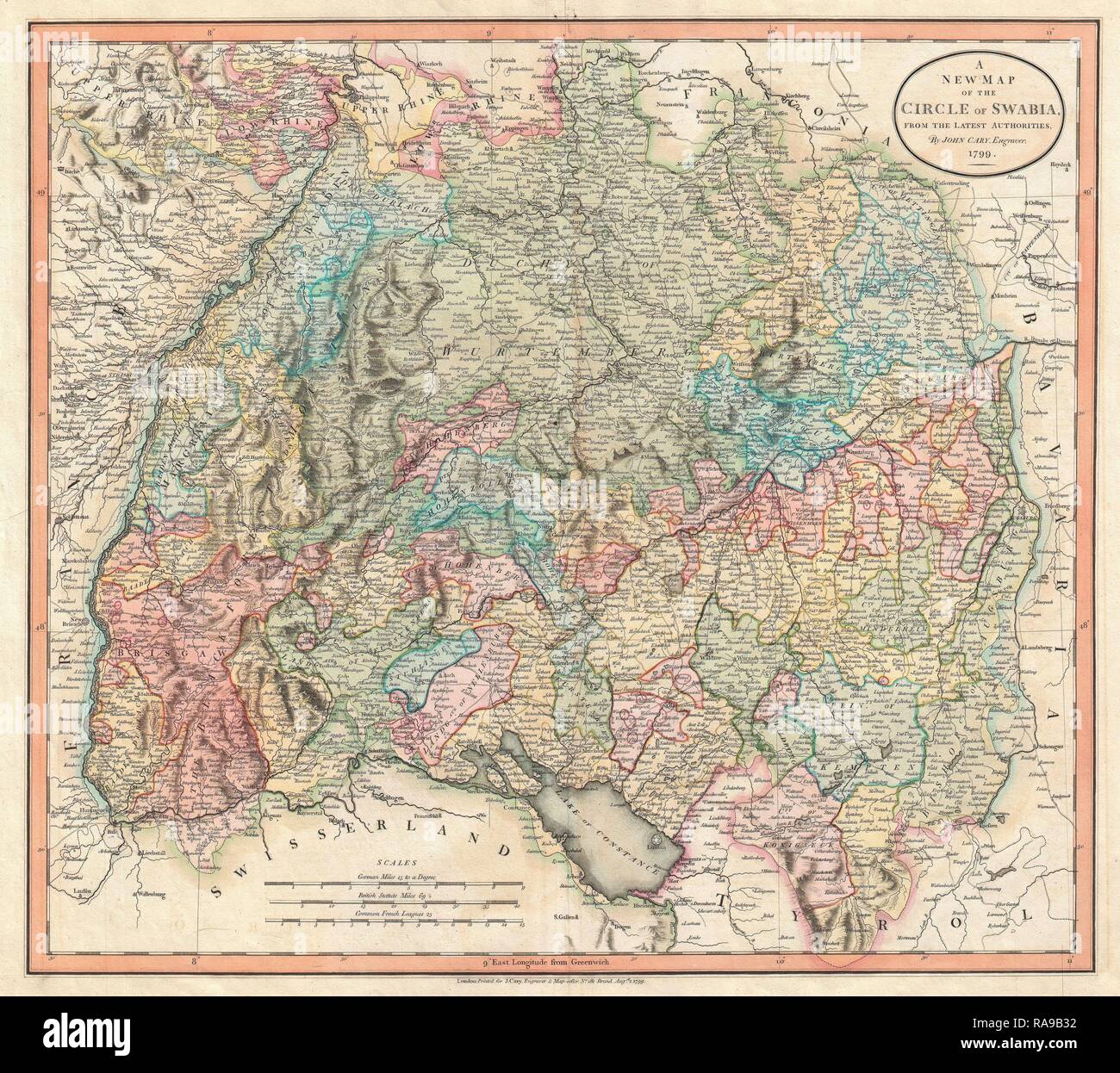 1799, Cary Map of Swabia, Germany, John Cary, 1754 – 1835, was an English cartographer, John Cary, 1754 – 1835 reimagined Stock Photohttps://www.alamy.com/image-license-details/?v=1https://www.alamy.com/1799-cary-map-of-swabia-germany-john-cary-1754-1835-was-an-english-cartographer-john-cary-1754-1835-reimagined-image230087622.html
RFRA9B32–1799, Cary Map of Swabia, Germany, John Cary, 1754 – 1835, was an English cartographer, John Cary, 1754 – 1835 reimagined
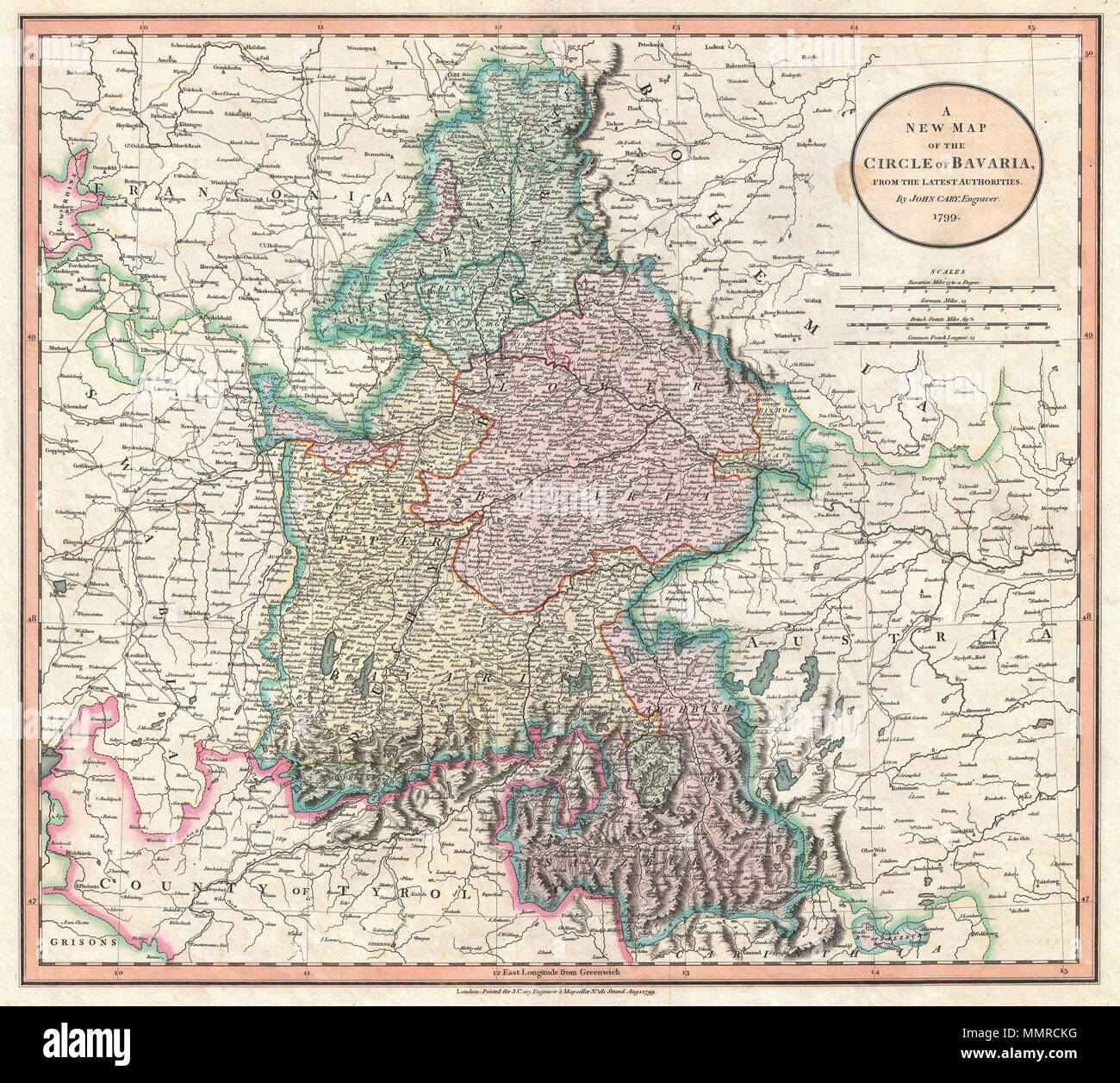 . English: John Cary’s 1799 map of the Circle of Bavaria, Germany. Covers the Duchy of Bavaria and the Archbishopric of Salzburg as well as parts of Franconia, Swabia, Tyrol, Bohemia and Austria. Prepared in 1799 by John Cary for issue in his 1808 New Universal Atlas. A New Map of the Circle of Bavaria, from the Latest Authorities.. 1799 (dated). 1799 Cary Map of Bavaria and Salzburg, Germany ( Munich ) - Geographicus - Bavaria-cary-1799 Stock Photohttps://www.alamy.com/image-license-details/?v=1https://www.alamy.com/english-john-carys-1799-map-of-the-circle-of-bavaria-germany-covers-the-duchy-of-bavaria-and-the-archbishopric-of-salzburg-as-well-as-parts-of-franconia-swabia-tyrol-bohemia-and-austria-prepared-in-1799-by-john-cary-for-issue-in-his-1808-new-universal-atlas-a-new-map-of-the-circle-of-bavaria-from-the-latest-authorities-1799-dated-1799-cary-map-of-bavaria-and-salzburg-germany-munich-geographicus-bavaria-cary-1799-image184911652.html
RMMMRCKG–. English: John Cary’s 1799 map of the Circle of Bavaria, Germany. Covers the Duchy of Bavaria and the Archbishopric of Salzburg as well as parts of Franconia, Swabia, Tyrol, Bohemia and Austria. Prepared in 1799 by John Cary for issue in his 1808 New Universal Atlas. A New Map of the Circle of Bavaria, from the Latest Authorities.. 1799 (dated). 1799 Cary Map of Bavaria and Salzburg, Germany ( Munich ) - Geographicus - Bavaria-cary-1799
 1799 Cary Map of Swabia, Germany - Geographicus - Swabia-cary-1799 Stock Photohttps://www.alamy.com/image-license-details/?v=1https://www.alamy.com/stock-photo-1799-cary-map-of-swabia-germany-geographicus-swabia-cary-1799-132574108.html
RMHKK7HG–1799 Cary Map of Swabia, Germany - Geographicus - Swabia-cary-1799
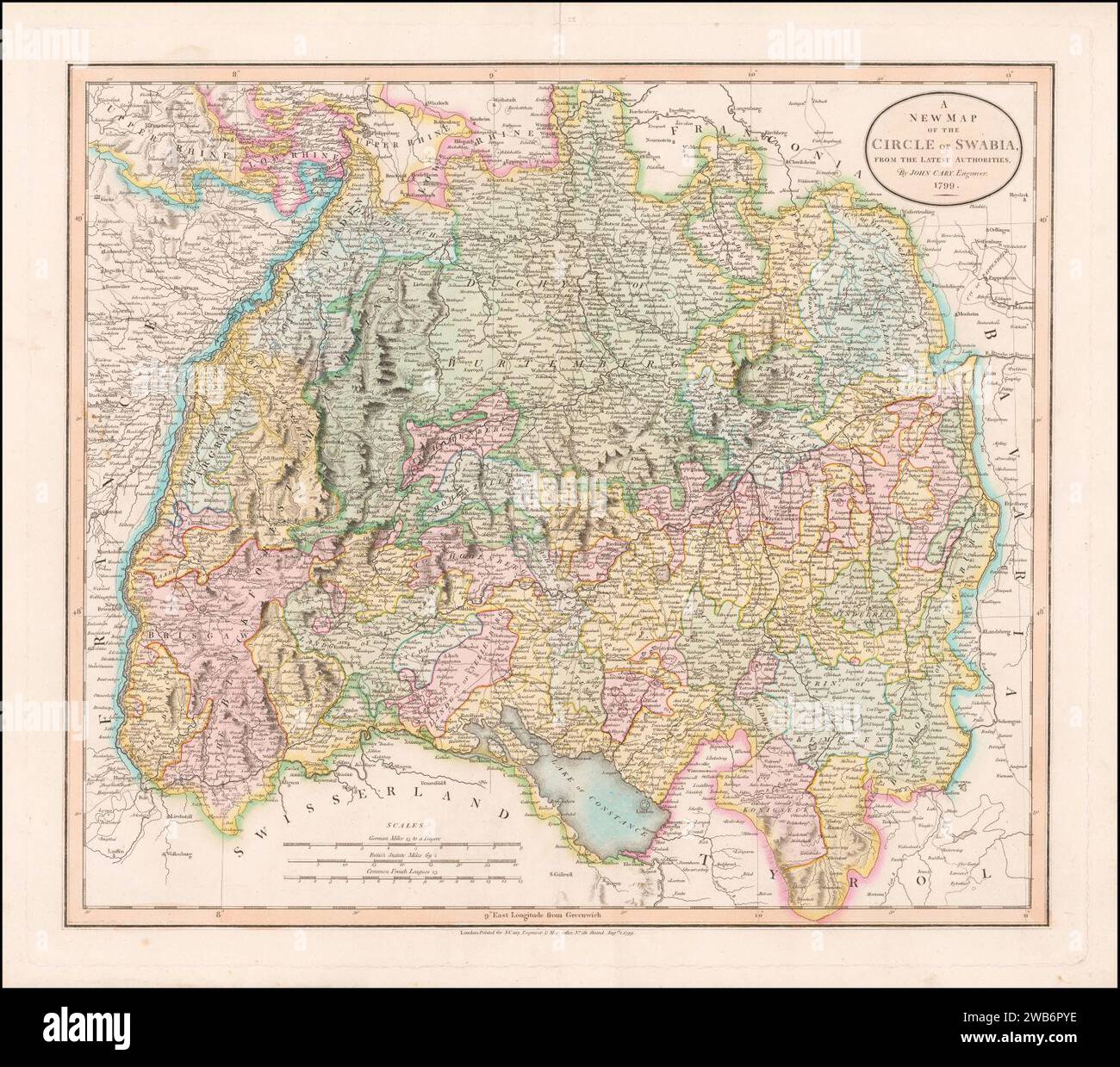 1799 map of Swabia by John Cary. Stock Photohttps://www.alamy.com/image-license-details/?v=1https://www.alamy.com/1799-map-of-swabia-by-john-cary-image592063458.html
RM2WB6PYE–1799 map of Swabia by John Cary.
 . English: An extremely attractive example of John Cary’s 1799 map of Franconia, Germany. Covers from Upper Saxony south to Swabia, west to the Lower Rhine and west to the Bavaria. Includes the important mediaeval and renaissance center of Nuremburg. Today Franconia is a historic district and has been consolidated with Bavaria. Highly detailed with color coding according to region. Shows forests, cities, palaces, forts, roads and rivers. All in all, one of the most interesting and attractive atlas maps Franconia to appear in first years of the 19th century. Prepared in 1799 by John Cary for i Stock Photohttps://www.alamy.com/image-license-details/?v=1https://www.alamy.com/english-an-extremely-attractive-example-of-john-carys-1799-map-of-franconia-germany-covers-from-upper-saxony-south-to-swabia-west-to-the-lower-rhine-and-west-to-the-bavaria-includes-the-important-mediaeval-and-renaissance-center-of-nuremburg-today-franconia-is-a-historic-district-and-has-been-consolidated-with-bavaria-highly-detailed-with-color-coding-according-to-region-shows-forests-cities-palaces-forts-roads-and-rivers-all-in-all-one-of-the-most-interesting-and-attractive-atlas-maps-franconia-to-appear-in-first-years-of-the-19th-century-prepared-in-1799-by-john-cary-for-i-image184911666.html
RMMMRCM2–. English: An extremely attractive example of John Cary’s 1799 map of Franconia, Germany. Covers from Upper Saxony south to Swabia, west to the Lower Rhine and west to the Bavaria. Includes the important mediaeval and renaissance center of Nuremburg. Today Franconia is a historic district and has been consolidated with Bavaria. Highly detailed with color coding according to region. Shows forests, cities, palaces, forts, roads and rivers. All in all, one of the most interesting and attractive atlas maps Franconia to appear in first years of the 19th century. Prepared in 1799 by John Cary for i
 . English: An extremely attractive example of John Cary’s 1799 map of the Upper and Lower Rhine, Germany. Covers Westphalia south to France and Swabia. Bordered on the west by the Netherlands and on the east by Franconia. Includes the important cities of Cologne (Koln) and Frankfurt. Highly detailed with color coding according to region. Shows forests, cities, palaces, forts, roads and rivers. All in all, one of the most interesting and attractive atlas maps of the Rhinelands to appear in first years of the 19th century. Prepared in 1799 by John Cary for issue in his magnificent 1808 New Univ Stock Photohttps://www.alamy.com/image-license-details/?v=1https://www.alamy.com/english-an-extremely-attractive-example-of-john-carys-1799-map-of-the-upper-and-lower-rhine-germany-covers-westphalia-south-to-france-and-swabia-bordered-on-the-west-by-the-netherlands-and-on-the-east-by-franconia-includes-the-important-cities-of-cologne-koln-and-frankfurt-highly-detailed-with-color-coding-according-to-region-shows-forests-cities-palaces-forts-roads-and-rivers-all-in-all-one-of-the-most-interesting-and-attractive-atlas-maps-of-the-rhinelands-to-appear-in-first-years-of-the-19th-century-prepared-in-1799-by-john-cary-for-issue-in-his-magnificent-1808-new-univ-image184911794.html
RMMMRCTJ–. English: An extremely attractive example of John Cary’s 1799 map of the Upper and Lower Rhine, Germany. Covers Westphalia south to France and Swabia. Bordered on the west by the Netherlands and on the east by Franconia. Includes the important cities of Cologne (Koln) and Frankfurt. Highly detailed with color coding according to region. Shows forests, cities, palaces, forts, roads and rivers. All in all, one of the most interesting and attractive atlas maps of the Rhinelands to appear in first years of the 19th century. Prepared in 1799 by John Cary for issue in his magnificent 1808 New Univ
 . English: An extremely attractive example of John Cary’s 1799 map of the Swabia region of Germany. Covers from the Upper Rhine region south as far as Switzerland, Lake Constance and Tyrol. Extends eastward as far as Bavaria and westward as far as France. Includes the Black Forest region and the Duchy of Wurtenburg (Stuttgart). Highly detailed with color coding according to region. Shows forests, cities, palaces, forts, roads and rivers. All in all, one of the most interesting and attractive atlas maps Swabia to appear in first years of the 19th century. Prepared in 1799 by John Cary for issu Stock Photohttps://www.alamy.com/image-license-details/?v=1https://www.alamy.com/english-an-extremely-attractive-example-of-john-carys-1799-map-of-the-swabia-region-of-germany-covers-from-the-upper-rhine-region-south-as-far-as-switzerland-lake-constance-and-tyrol-extends-eastward-as-far-as-bavaria-and-westward-as-far-as-france-includes-the-black-forest-region-and-the-duchy-of-wurtenburg-stuttgart-highly-detailed-with-color-coding-according-to-region-shows-forests-cities-palaces-forts-roads-and-rivers-all-in-all-one-of-the-most-interesting-and-attractive-atlas-maps-swabia-to-appear-in-first-years-of-the-19th-century-prepared-in-1799-by-john-cary-for-issu-image184911764.html
RMMMRCRG–. English: An extremely attractive example of John Cary’s 1799 map of the Swabia region of Germany. Covers from the Upper Rhine region south as far as Switzerland, Lake Constance and Tyrol. Extends eastward as far as Bavaria and westward as far as France. Includes the Black Forest region and the Duchy of Wurtenburg (Stuttgart). Highly detailed with color coding according to region. Shows forests, cities, palaces, forts, roads and rivers. All in all, one of the most interesting and attractive atlas maps Swabia to appear in first years of the 19th century. Prepared in 1799 by John Cary for issu