Quick filters:
1885 map Stock Photos and Images
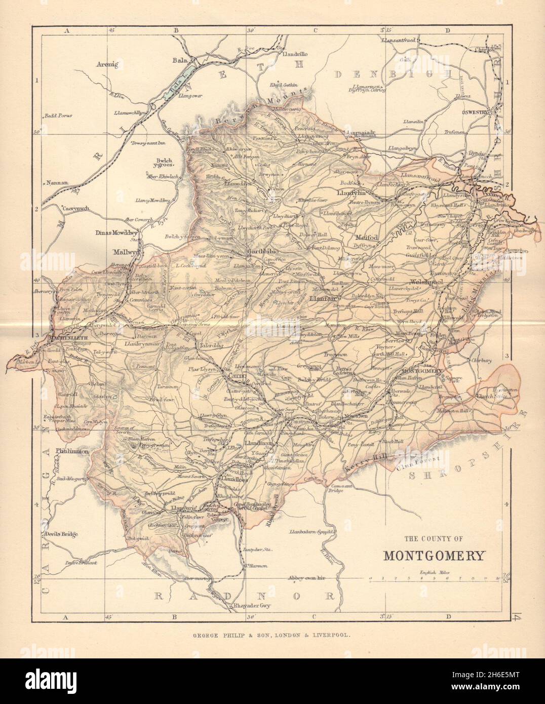 MONTGOMERYSHIRE 'County of Montgomery' Welshpool Wales BARTHOLOMEW 1885 map Stock Photohttps://www.alamy.com/image-license-details/?v=1https://www.alamy.com/montgomeryshire-county-of-montgomery-welshpool-wales-bartholomew-1885-map-image451469336.html
RF2H6E5MT–MONTGOMERYSHIRE 'County of Montgomery' Welshpool Wales BARTHOLOMEW 1885 map
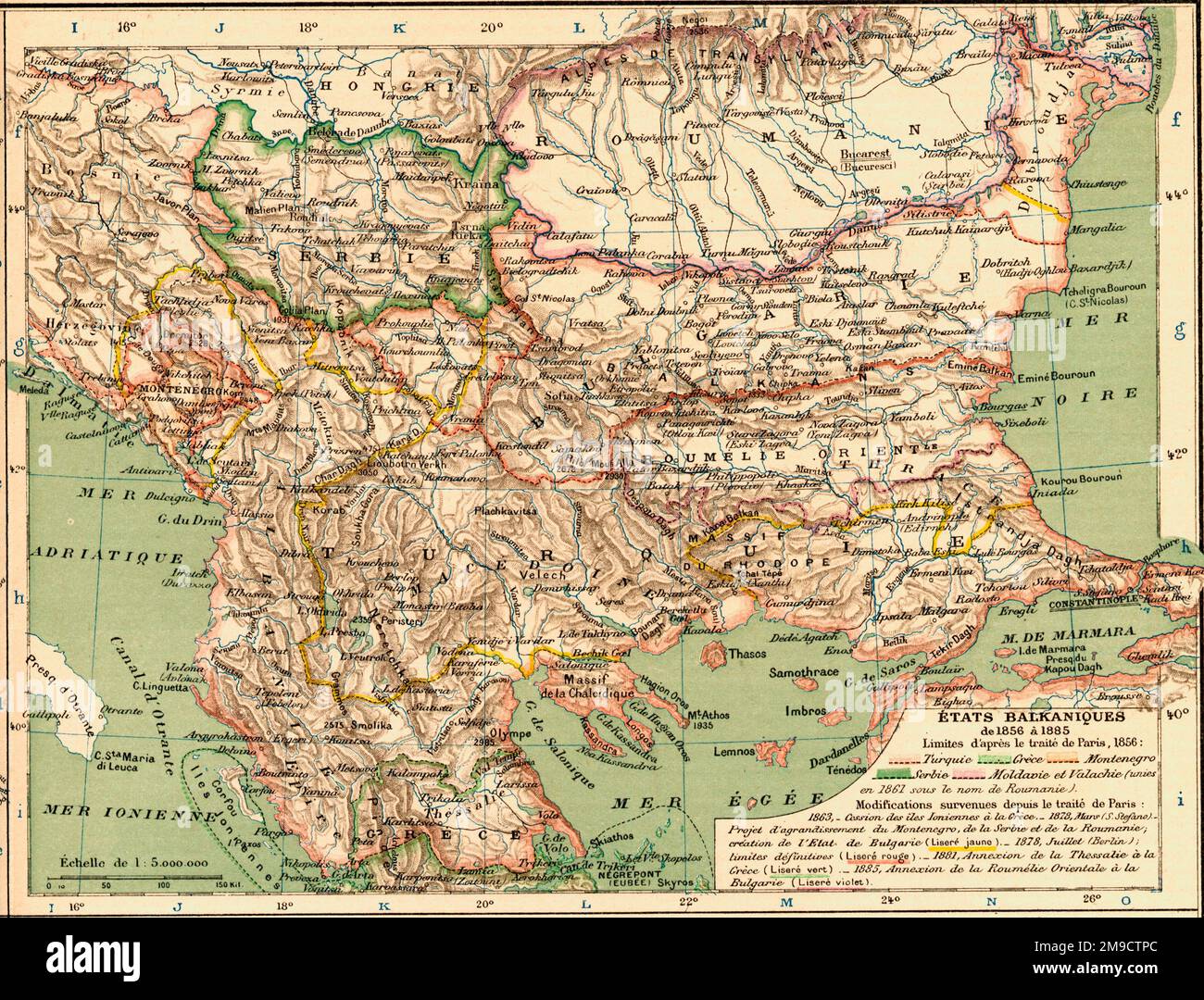 Map of the Balkan States 1856-1885 Stock Photohttps://www.alamy.com/image-license-details/?v=1https://www.alamy.com/map-of-the-balkan-states-1856-1885-image504915444.html
RM2M9CTPC–Map of the Balkan States 1856-1885
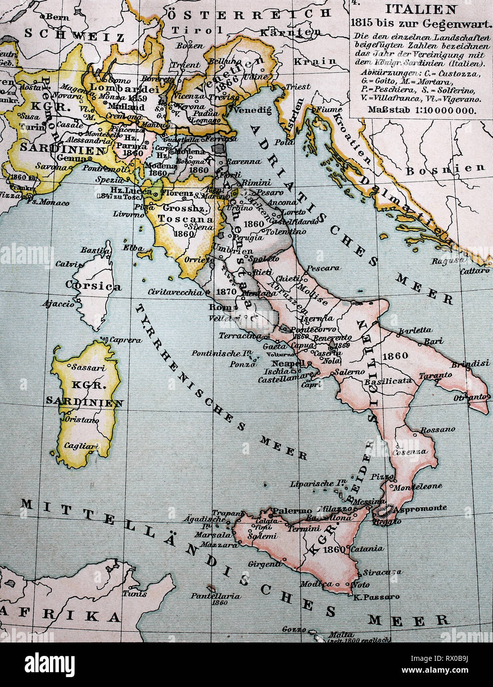 Landkarte von Italien zwischen 1815 bis 1885 / Map of Italy between 1815 and 1885 Stock Photohttps://www.alamy.com/image-license-details/?v=1https://www.alamy.com/landkarte-von-italien-zwischen-1815-bis-1885-map-of-italy-between-1815-and-1885-image239724734.html
RFRX0B9J–Landkarte von Italien zwischen 1815 bis 1885 / Map of Italy between 1815 and 1885
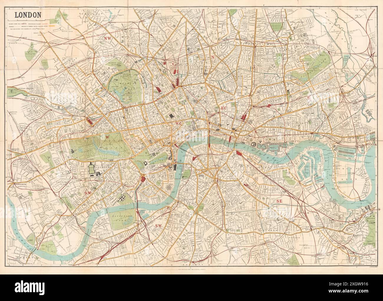 Map of London published by W.H. Smith & Son's showing central London circa 1885. Stock Photohttps://www.alamy.com/image-license-details/?v=1https://www.alamy.com/map-of-london-published-by-wh-smith-sons-showing-central-london-circa-1885-image612753266.html
RM2XGW916–Map of London published by W.H. Smith & Son's showing central London circa 1885.
 Kaiser Wilhelms Land Ost Neu Guinea 1884 1885 map Stock Photohttps://www.alamy.com/image-license-details/?v=1https://www.alamy.com/stock-photo-kaiser-wilhelms-land-ost-neu-guinea-1884-1885-map-140060490.html
RMJ3T8GA–Kaiser Wilhelms Land Ost Neu Guinea 1884 1885 map
 . Hawaiian Government Survey, W.D. Alexander. Surveyor-General. Maui, Hawaiian Islands. English: This very large, rare, and extraordinary 1885 map of the island of Maui, Hawaii, was prepared for the 1906 Report of the Governor of the Territory of Hawaii to the Secretary of the Interior. Covers the entire island in stupendous detail. Though the cartographic work that produced this map was started in 1885, during the Hawaiian Monarchy, the map itself, and the report that contained it, was issued following the U.S. Government’s 1898 annexation of the Hawaiian Republic. The Report was an attempt Stock Photohttps://www.alamy.com/image-license-details/?v=1https://www.alamy.com/hawaiian-government-survey-wd-alexander-surveyor-general-maui-hawaiian-islands-english-this-very-large-rare-and-extraordinary-1885-map-of-the-island-of-maui-hawaii-was-prepared-for-the-1906-report-of-the-governor-of-the-territory-of-hawaii-to-the-secretary-of-the-interior-covers-the-entire-island-in-stupendous-detail-though-the-cartographic-work-that-produced-this-map-was-started-in-1885-during-the-hawaiian-monarchy-the-map-itself-and-the-report-that-contained-it-was-issued-following-the-us-governments-1898-annexation-of-the-hawaiian-republic-the-report-was-an-attempt-image187622676.html
RMMW6XHT–. Hawaiian Government Survey, W.D. Alexander. Surveyor-General. Maui, Hawaiian Islands. English: This very large, rare, and extraordinary 1885 map of the island of Maui, Hawaii, was prepared for the 1906 Report of the Governor of the Territory of Hawaii to the Secretary of the Interior. Covers the entire island in stupendous detail. Though the cartographic work that produced this map was started in 1885, during the Hawaiian Monarchy, the map itself, and the report that contained it, was issued following the U.S. Government’s 1898 annexation of the Hawaiian Republic. The Report was an attempt
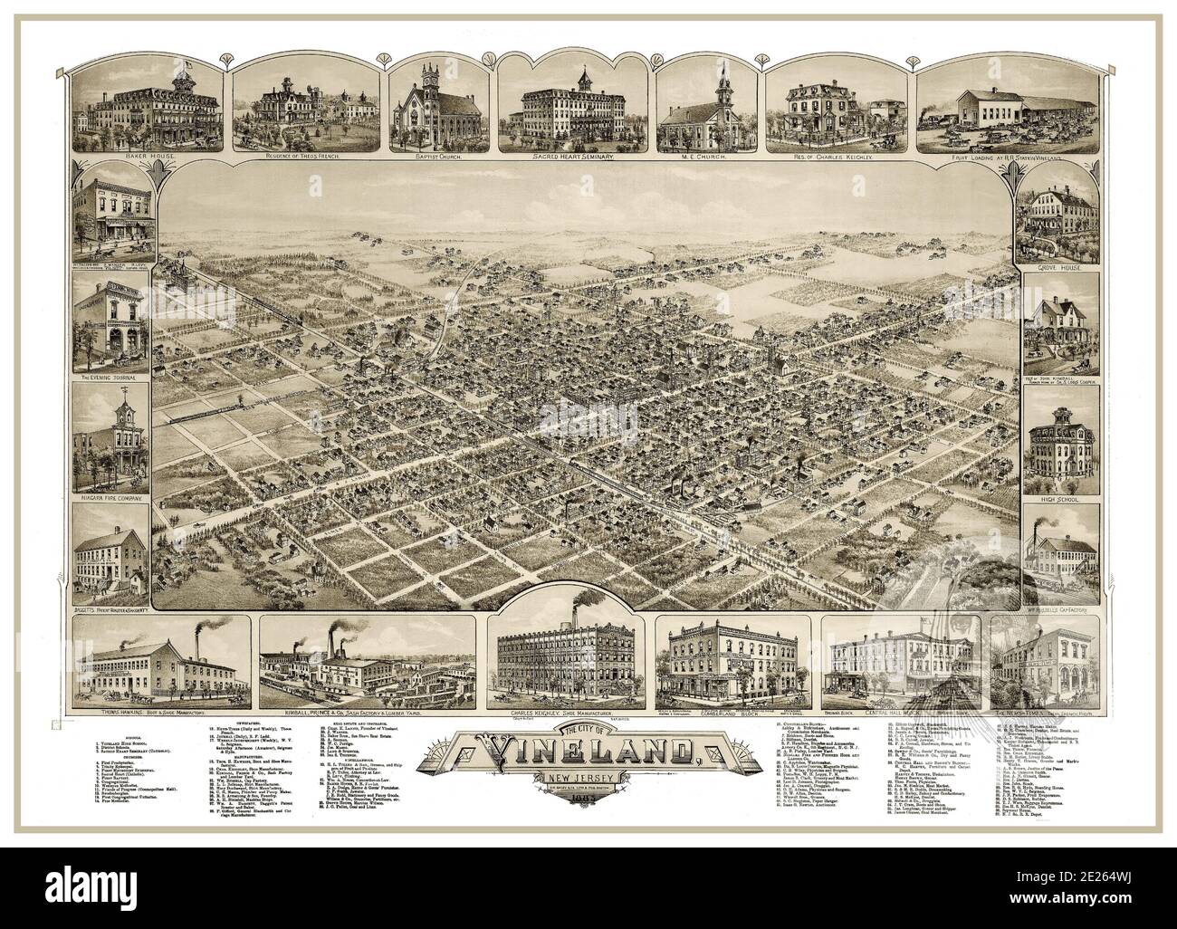 VINELAND MAP 1880’s Vintage historic Lithograph The City of Vineland New Jersey USA 1885 Bird's Eye View with city attractions featured around. New Jersey USA Stock Photohttps://www.alamy.com/image-license-details/?v=1https://www.alamy.com/vineland-map-1880s-vintage-historic-lithograph-the-city-of-vineland-new-jersey-usa-1885-birds-eye-view-with-city-attractions-featured-around-new-jersey-usa-image397203342.html
RM2E264WJ–VINELAND MAP 1880’s Vintage historic Lithograph The City of Vineland New Jersey USA 1885 Bird's Eye View with city attractions featured around. New Jersey USA
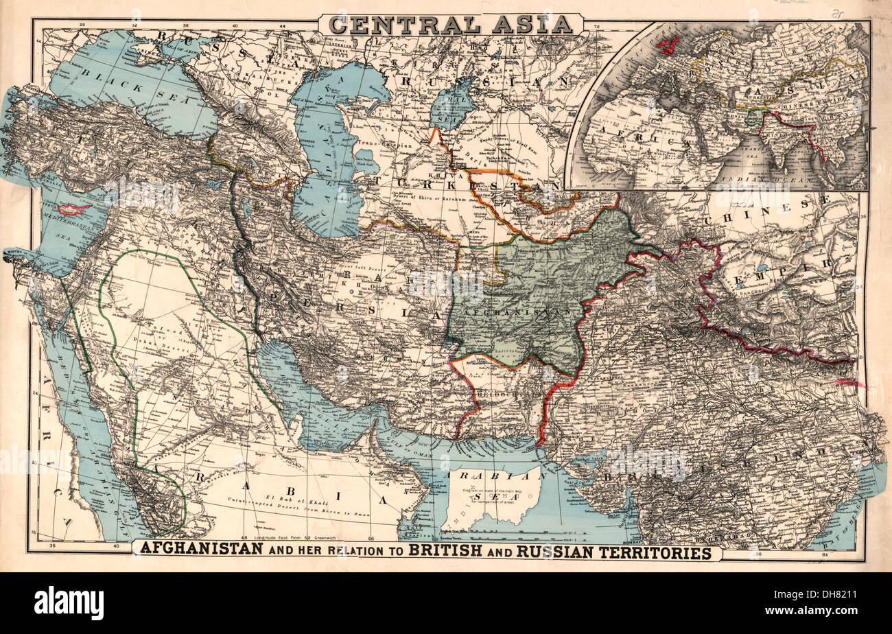 Map of Central Asia - 1885 Stock Photohttps://www.alamy.com/image-license-details/?v=1https://www.alamy.com/map-of-central-asia-1885-image62257469.html
RMDH8211–Map of Central Asia - 1885
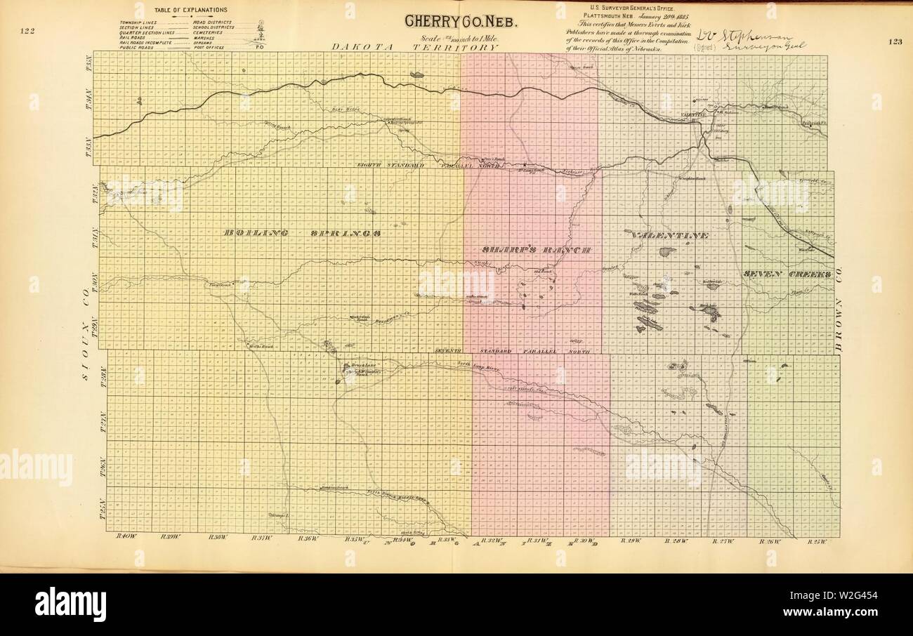 Cherry County Nebraska 1885 map 2719114. Stock Photohttps://www.alamy.com/image-license-details/?v=1https://www.alamy.com/cherry-county-nebraska-1885-map-2719114-image259739344.html
RMW2G454–Cherry County Nebraska 1885 map 2719114.
 FINSEN(1885) Map of Iceland Stock Photohttps://www.alamy.com/image-license-details/?v=1https://www.alamy.com/stock-photo-finsen1885-map-of-iceland-79767458.html
RMEHNM5P–FINSEN(1885) Map of Iceland
 Map, cartographic, Documents, 1885 Stock Photohttps://www.alamy.com/image-license-details/?v=1https://www.alamy.com/map-cartographic-documents-1885-image376511939.html
RM2CTFGPY–Map, cartographic, Documents, 1885
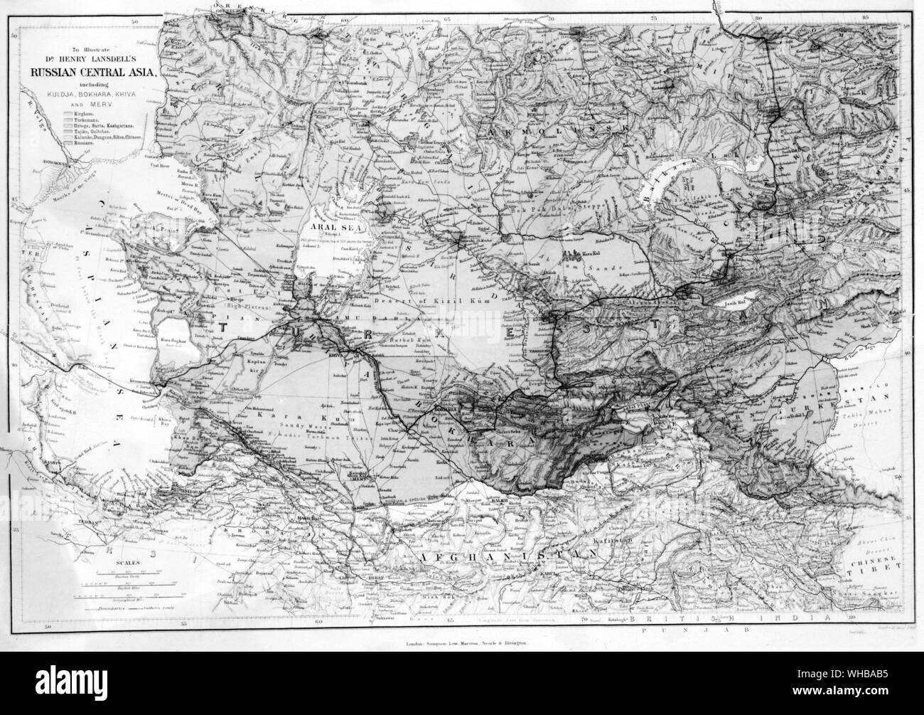 Map : Russian Central Asia. 1885 Stock Photohttps://www.alamy.com/image-license-details/?v=1https://www.alamy.com/map-russian-central-asia-1885-image268854297.html
RMWHBAB5–Map : Russian Central Asia. 1885
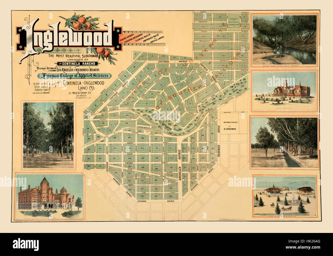 Map Of Inglewood 1885 Stock Photohttps://www.alamy.com/image-license-details/?v=1https://www.alamy.com/stock-photo-map-of-inglewood-1885-132199944.html
RFHK26AG–Map Of Inglewood 1885
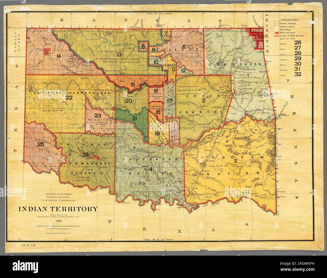 Map of Indian Territory (Oklahoma), 1885. Map produced by the Department of the Interior, General Land Office. Land designated as Indian Territory. Map shows distribution of land designated for Native Americans before general settlement of the area. Stock Photohttps://www.alamy.com/image-license-details/?v=1https://www.alamy.com/map-of-indian-territory-oklahoma-1885-map-produced-by-the-department-of-the-interior-general-land-office-land-designated-as-indian-territory-map-shows-distribution-of-land-designated-for-native-americans-before-general-settlement-of-the-area-image337286057.html
RF2AGMKPH–Map of Indian Territory (Oklahoma), 1885. Map produced by the Department of the Interior, General Land Office. Land designated as Indian Territory. Map shows distribution of land designated for Native Americans before general settlement of the area.
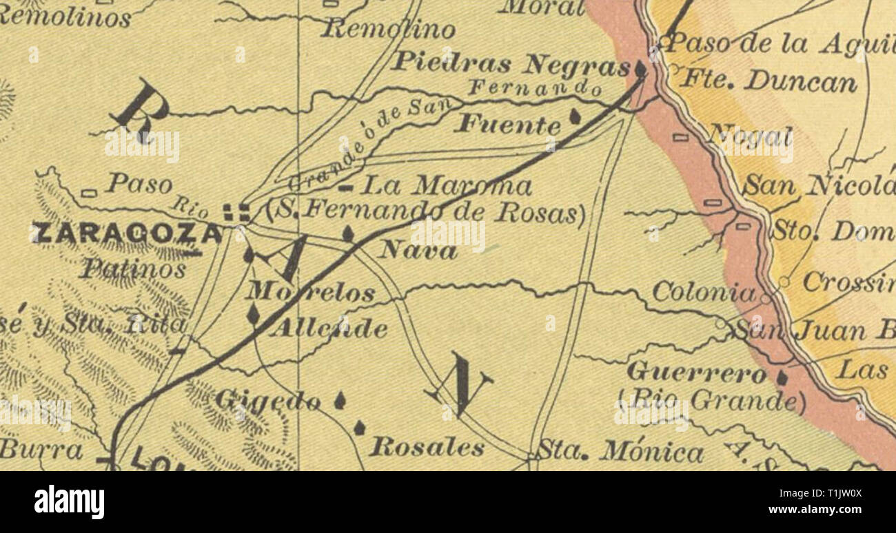 1885 map of Zaragoza, Coahuila, México. Notice in parenthesis (S. Fernando de Rosas) Stock Photohttps://www.alamy.com/image-license-details/?v=1https://www.alamy.com/1885-map-of-zaragoza-coahuila-mxico-notice-in-parenthesis-s-fernando-de-rosas-image241974570.html
RMT1JW0X–1885 map of Zaragoza, Coahuila, México. Notice in parenthesis (S. Fernando de Rosas)
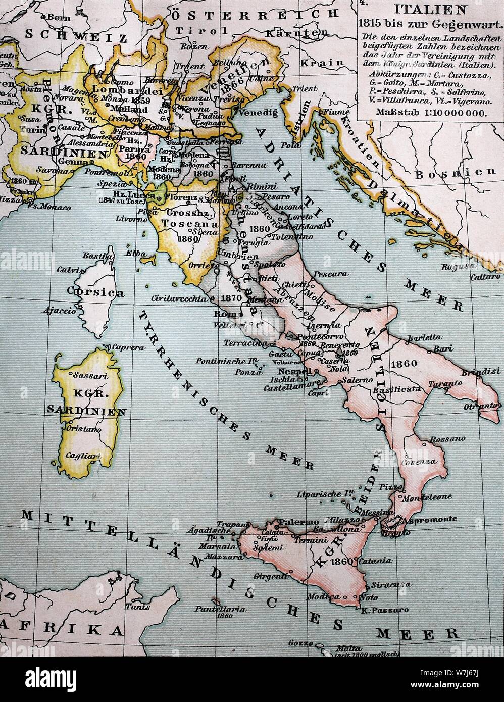 Map of Italy between 1815 and 1885, historical illustration, Italy Stock Photohttps://www.alamy.com/image-license-details/?v=1https://www.alamy.com/map-of-italy-between-1815-and-1885-historical-illustration-italy-image262858166.html
RMW7J67J–Map of Italy between 1815 and 1885, historical illustration, Italy
 Nicholas II and General Obruchev looking over a 'War Map' with 'Russia' on one side, 'England' on the other, and 'Afghanistan' between them; beneath the table, having come through a trap door, is 'the Herald's Special Correspondent'. Dated 1885 Stock Photohttps://www.alamy.com/image-license-details/?v=1https://www.alamy.com/stock-photo-nicholas-ii-and-general-obruchev-looking-over-a-war-map-with-russia-84969675.html
RMEX6KK7–Nicholas II and General Obruchev looking over a 'War Map' with 'Russia' on one side, 'England' on the other, and 'Afghanistan' between them; beneath the table, having come through a trap door, is 'the Herald's Special Correspondent'. Dated 1885
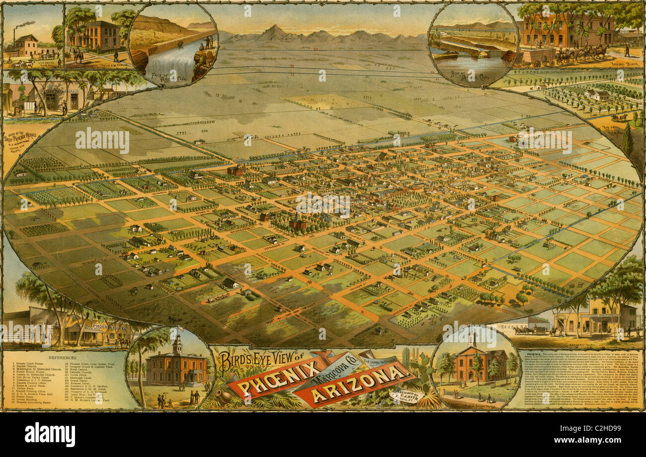 Birds eye view map of Phoenix, Arizona 1885 Stock Photohttps://www.alamy.com/image-license-details/?v=1https://www.alamy.com/stock-photo-birds-eye-view-map-of-phoenix-arizona-1885-36033685.html
RMC2HD99–Birds eye view map of Phoenix, Arizona 1885
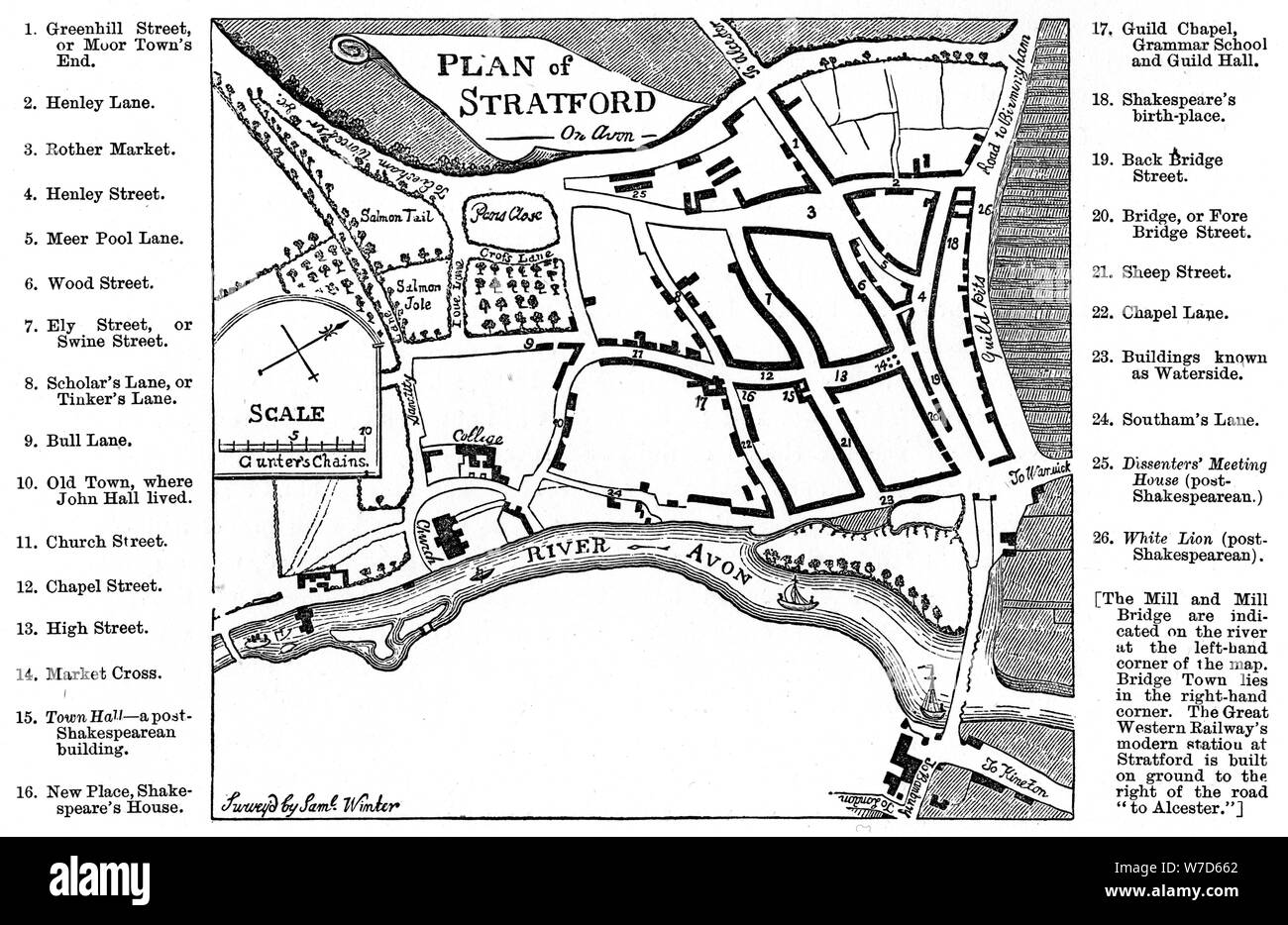 Map of Stratford-upon-Avon, Warwickshire, 1759 (1885).Artist: Edward Hull Stock Photohttps://www.alamy.com/image-license-details/?v=1https://www.alamy.com/map-of-stratford-upon-avon-warwickshire-1759-1885artist-edward-hull-image262748362.html
RMW7D662–Map of Stratford-upon-Avon, Warwickshire, 1759 (1885).Artist: Edward Hull
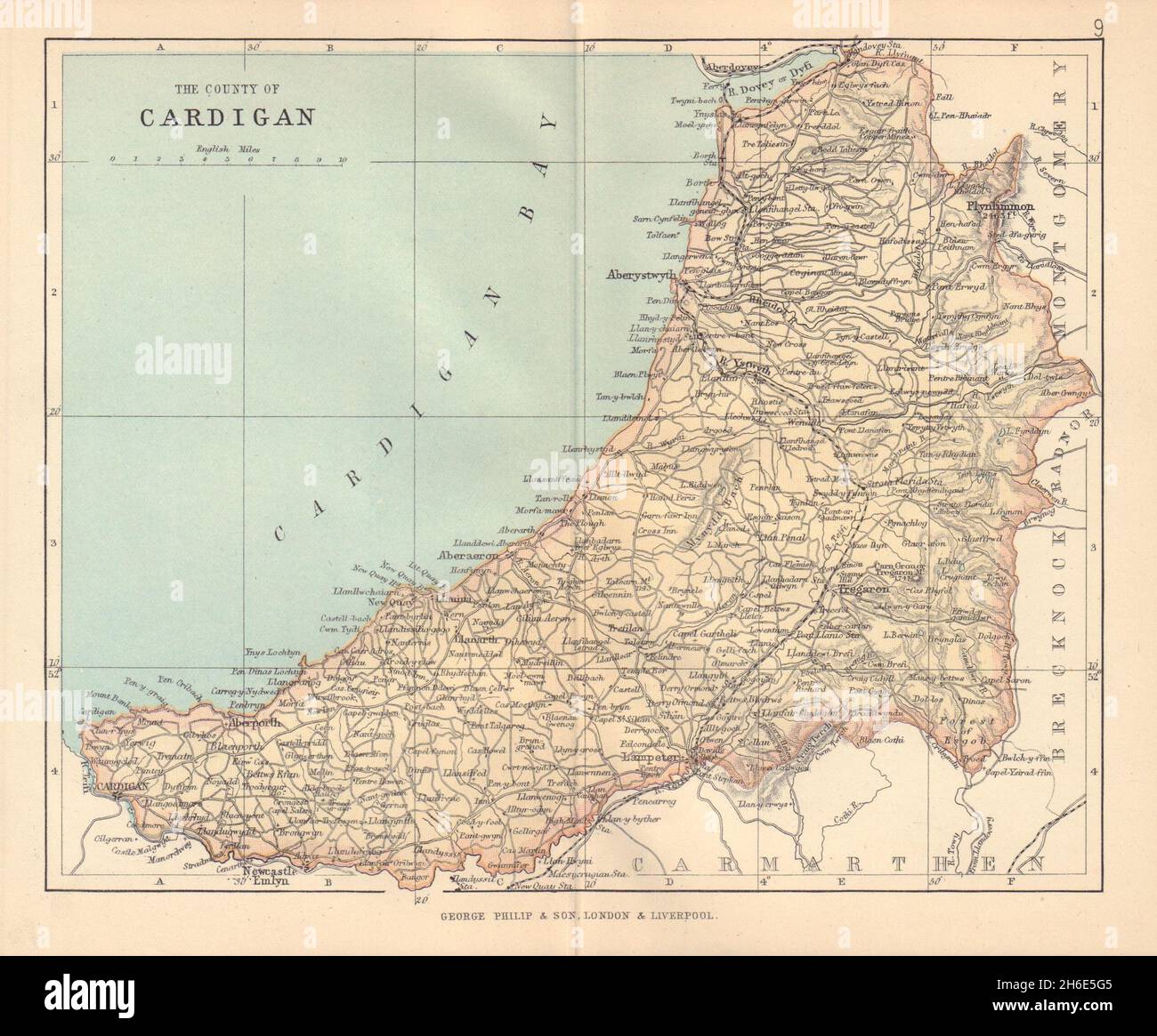 CARDIGANSHIRE 'The County of Cardigan' Aberystwyth Wales BARTHOLOMEW 1885 map Stock Photohttps://www.alamy.com/image-license-details/?v=1https://www.alamy.com/cardiganshire-the-county-of-cardigan-aberystwyth-wales-bartholomew-1885-map-image451469205.html
RF2H6E5G5–CARDIGANSHIRE 'The County of Cardigan' Aberystwyth Wales BARTHOLOMEW 1885 map
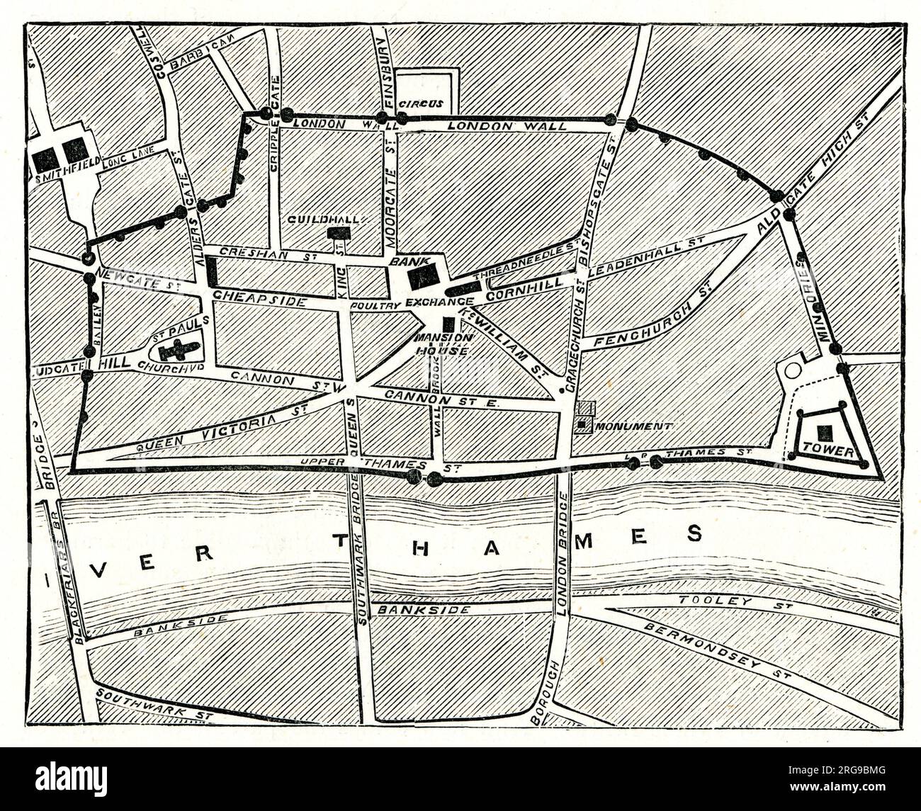 Outline of Old Roman Wall, shown on Map of London 1885 Stock Photohttps://www.alamy.com/image-license-details/?v=1https://www.alamy.com/outline-of-old-roman-wall-shown-on-map-of-london-1885-image560773040.html
RM2RG9BMG–Outline of Old Roman Wall, shown on Map of London 1885
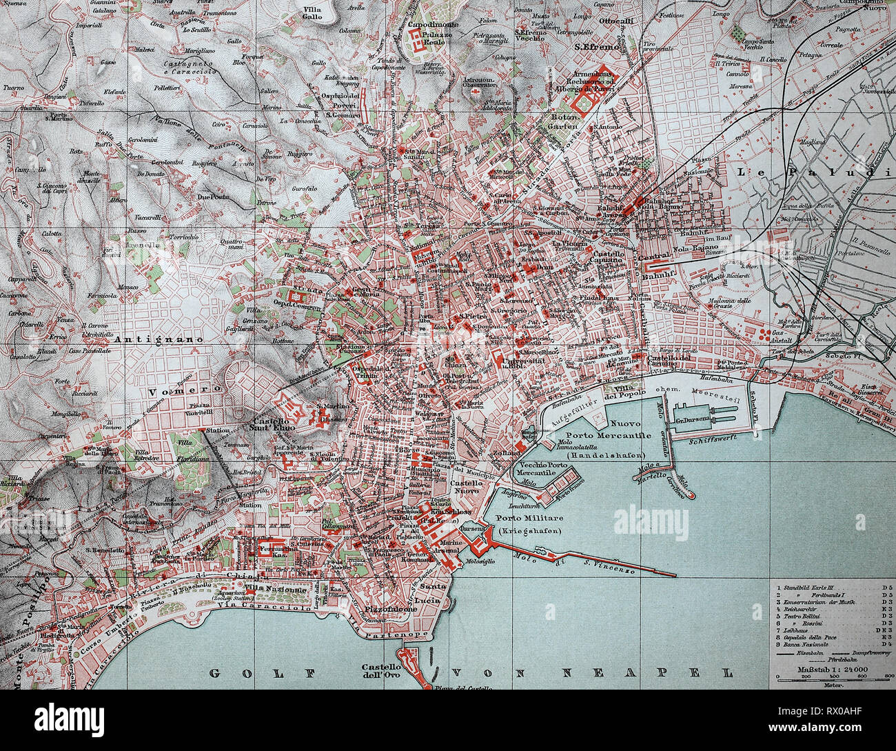 Stadtplan von Neapel, Napoli, Italien, aus dem Jahre 1885 / Map of Naples, Napoli, Italy, from 1885 Stock Photohttps://www.alamy.com/image-license-details/?v=1https://www.alamy.com/stadtplan-von-neapel-napoli-italien-aus-dem-jahre-1885-map-of-naples-napoli-italy-from-1885-image239724171.html
RFRX0AHF–Stadtplan von Neapel, Napoli, Italien, aus dem Jahre 1885 / Map of Naples, Napoli, Italy, from 1885
 Map of Ancient Egypt, Illustration, Cyclopaedia of Universal History, Volume 1, The Ancient World, by John Clark Ridpath, the Jones Brothers Publishing Company, 1885 Stock Photohttps://www.alamy.com/image-license-details/?v=1https://www.alamy.com/map-of-ancient-egypt-illustration-cyclopaedia-of-universal-history-volume-1-the-ancient-world-by-john-clark-ridpath-the-jones-brothers-publishing-company-1885-image215469758.html
RMPEFDTE–Map of Ancient Egypt, Illustration, Cyclopaedia of Universal History, Volume 1, The Ancient World, by John Clark Ridpath, the Jones Brothers Publishing Company, 1885
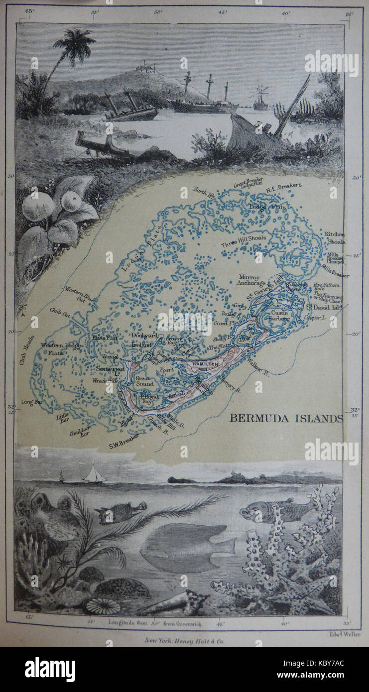 1885 Map of Bermuda and its reefs by Anna Brassey Stock Photohttps://www.alamy.com/image-license-details/?v=1https://www.alamy.com/stock-image-1885-map-of-bermuda-and-its-reefs-by-anna-brassey-162253012.html
RMKBY7AC–1885 Map of Bermuda and its reefs by Anna Brassey
 . Hawaiian Government Survey, W.D. Alexander. Surveyor-General. Maui, Hawaiian Islands. English: This very large, rare, and extraordinary 1885 map of the island of Maui, Hawaii, was prepared for the 1906 Report of the Governor of the Territory of Hawaii to the Secretary of the Interior. Covers the entire island in stupendous detail. Though the cartographic work that produced this map was started in 1885, during the Hawaiian Monarchy, the map itself, and the report that contained it, was issued following the U.S. Government’s 1898 annexation of the Hawaiian Republic. The Report was an attempt Stock Photohttps://www.alamy.com/image-license-details/?v=1https://www.alamy.com/hawaiian-government-survey-wd-alexander-surveyor-general-maui-hawaiian-islands-english-this-very-large-rare-and-extraordinary-1885-map-of-the-island-of-maui-hawaii-was-prepared-for-the-1906-report-of-the-governor-of-the-territory-of-hawaii-to-the-secretary-of-the-interior-covers-the-entire-island-in-stupendous-detail-though-the-cartographic-work-that-produced-this-map-was-started-in-1885-during-the-hawaiian-monarchy-the-map-itself-and-the-report-that-contained-it-was-issued-following-the-us-governments-1898-annexation-of-the-hawaiian-republic-the-report-was-an-attempt-image188135254.html
RMMX28C6–. Hawaiian Government Survey, W.D. Alexander. Surveyor-General. Maui, Hawaiian Islands. English: This very large, rare, and extraordinary 1885 map of the island of Maui, Hawaii, was prepared for the 1906 Report of the Governor of the Territory of Hawaii to the Secretary of the Interior. Covers the entire island in stupendous detail. Though the cartographic work that produced this map was started in 1885, during the Hawaiian Monarchy, the map itself, and the report that contained it, was issued following the U.S. Government’s 1898 annexation of the Hawaiian Republic. The Report was an attempt
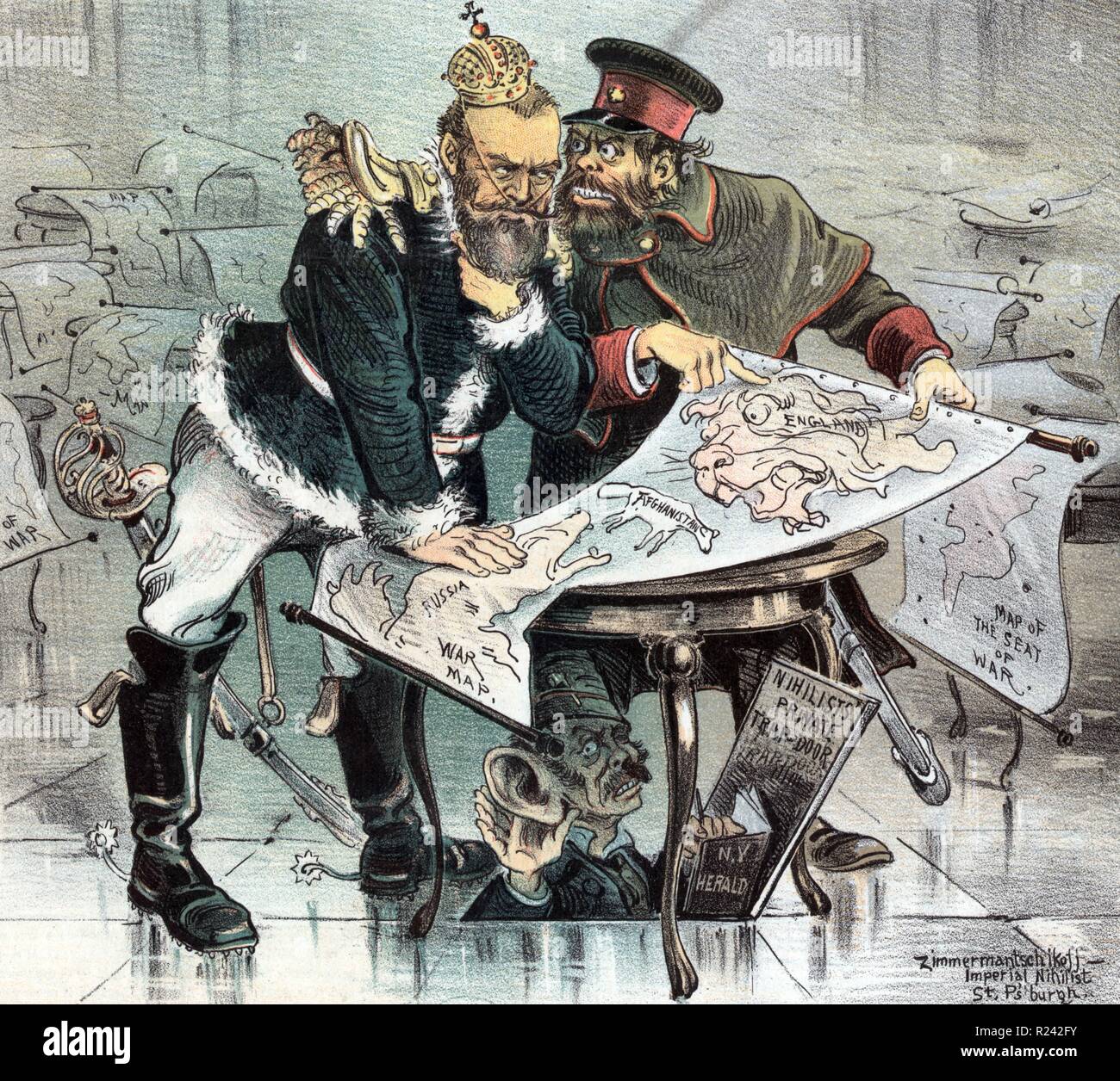 Nicholas II and General Obruchev looking over a 'War Map' with 'Russia' on one side, 'England' on the other, and 'Afghanistan' between them; beneath the table, having come through a trap door, is 'the Herald's Special Correspondent'. Dated 1885 Stock Photohttps://www.alamy.com/image-license-details/?v=1https://www.alamy.com/nicholas-ii-and-general-obruchev-looking-over-a-war-map-with-russia-on-one-side-england-on-the-other-and-afghanistan-between-them-beneath-the-table-having-come-through-a-trap-door-is-the-heralds-special-correspondent-dated-1885-image225053919.html
RMR242FY–Nicholas II and General Obruchev looking over a 'War Map' with 'Russia' on one side, 'England' on the other, and 'Afghanistan' between them; beneath the table, having come through a trap door, is 'the Herald's Special Correspondent'. Dated 1885
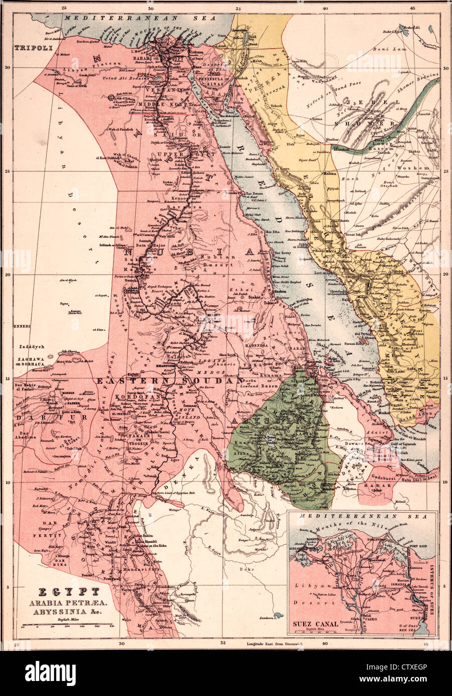 Egypt, Arabia Petræa, Abyssinia Map, circa 1885 Stock Photohttps://www.alamy.com/image-license-details/?v=1https://www.alamy.com/stock-photo-egypt-arabia-petra-abyssinia-map-circa-1885-49754678.html
RMCTXEGP–Egypt, Arabia Petræa, Abyssinia Map, circa 1885
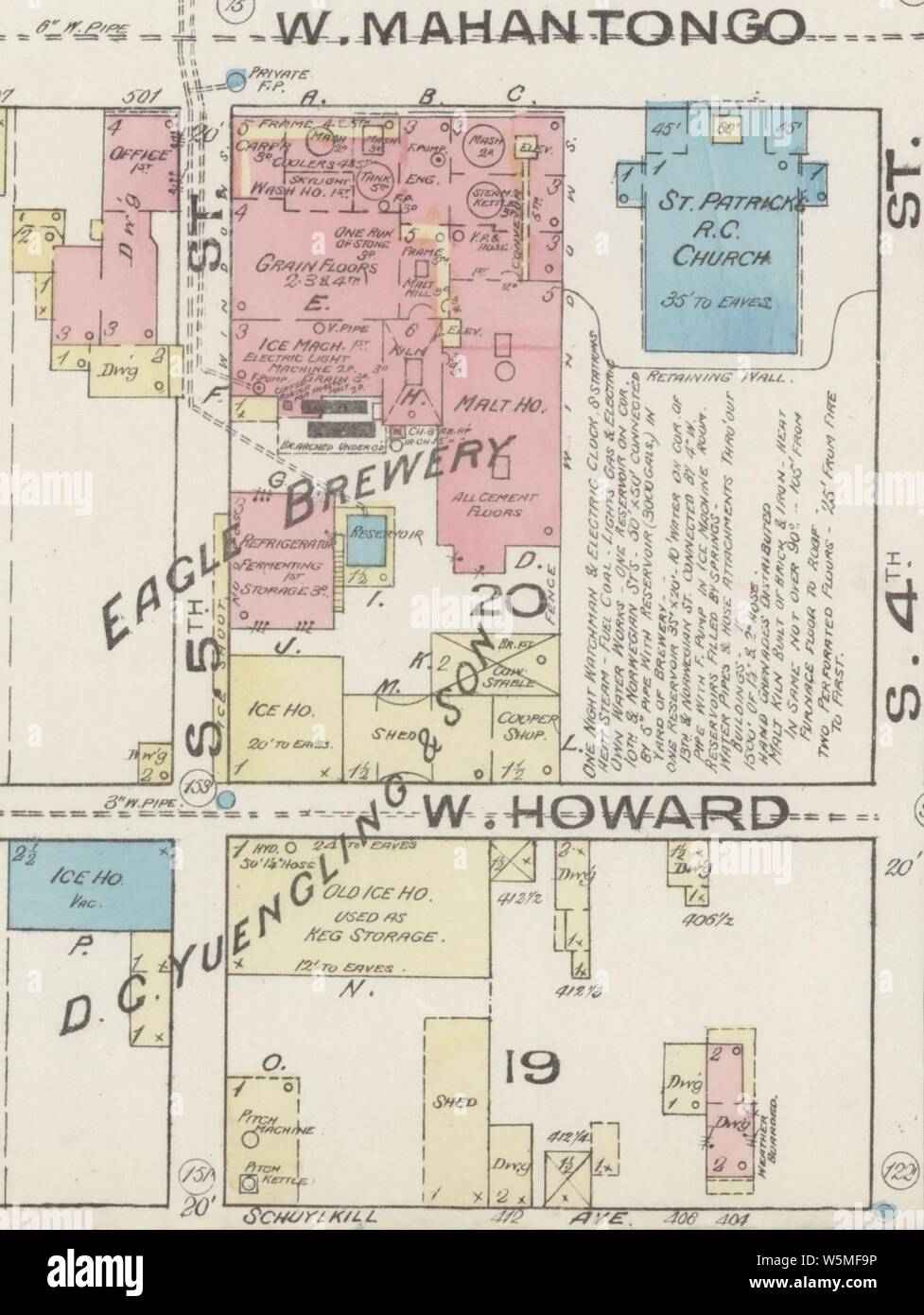 D. G. YUENGLING & SON EAGLE BREWERY in June 1885 map detail, Sanborn Fire Insurance Map from Pottsville, Schuylkill County, Pennsylvania. Stock Photohttps://www.alamy.com/image-license-details/?v=1https://www.alamy.com/d-g-yuengling-son-eagle-brewery-in-june-1885-map-detail-sanborn-fire-insurance-map-from-pottsville-schuylkill-county-pennsylvania-image261679874.html
RMW5MF9P–D. G. YUENGLING & SON EAGLE BREWERY in June 1885 map detail, Sanborn Fire Insurance Map from Pottsville, Schuylkill County, Pennsylvania.
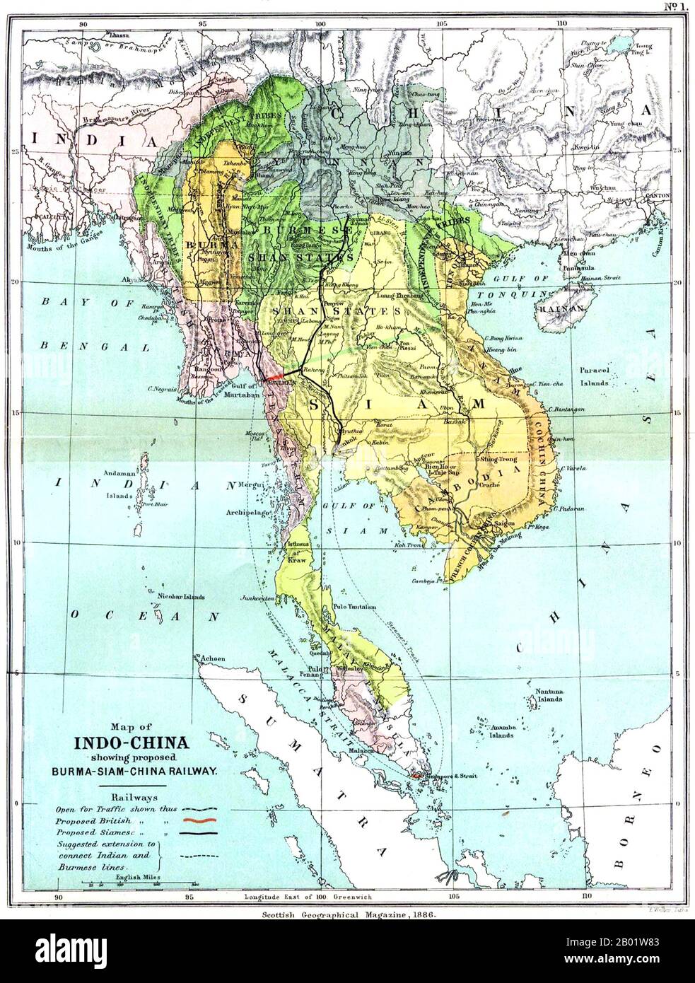 Southeast Asia: A UK (Scottish Geographical Magazine) map of Greater Indochina and the Malay Peninsula, 1886. A detailed and remarkably accurate map of Burma, Siam, Vietnam, Cambodia and Malaya dating from 1886 and showing the rectangle of independent Burma around Mandalay - which was losing its independence to Great Britain in 1885-1886 when the map was published. The Burmese Shan States are shown as under Burmese influence (shortly to be replaced by that of Great Britain). Stock Photohttps://www.alamy.com/image-license-details/?v=1https://www.alamy.com/southeast-asia-a-uk-scottish-geographical-magazine-map-of-greater-indochina-and-the-malay-peninsula-1886-a-detailed-and-remarkably-accurate-map-of-burma-siam-vietnam-cambodia-and-malaya-dating-from-1886-and-showing-the-rectangle-of-independent-burma-around-mandalay-which-was-losing-its-independence-to-great-britain-in-1885-1886-when-the-map-was-published-the-burmese-shan-states-are-shown-as-under-burmese-influence-shortly-to-be-replaced-by-that-of-great-britain-image344249139.html
RM2B01W83–Southeast Asia: A UK (Scottish Geographical Magazine) map of Greater Indochina and the Malay Peninsula, 1886. A detailed and remarkably accurate map of Burma, Siam, Vietnam, Cambodia and Malaya dating from 1886 and showing the rectangle of independent Burma around Mandalay - which was losing its independence to Great Britain in 1885-1886 when the map was published. The Burmese Shan States are shown as under Burmese influence (shortly to be replaced by that of Great Britain).
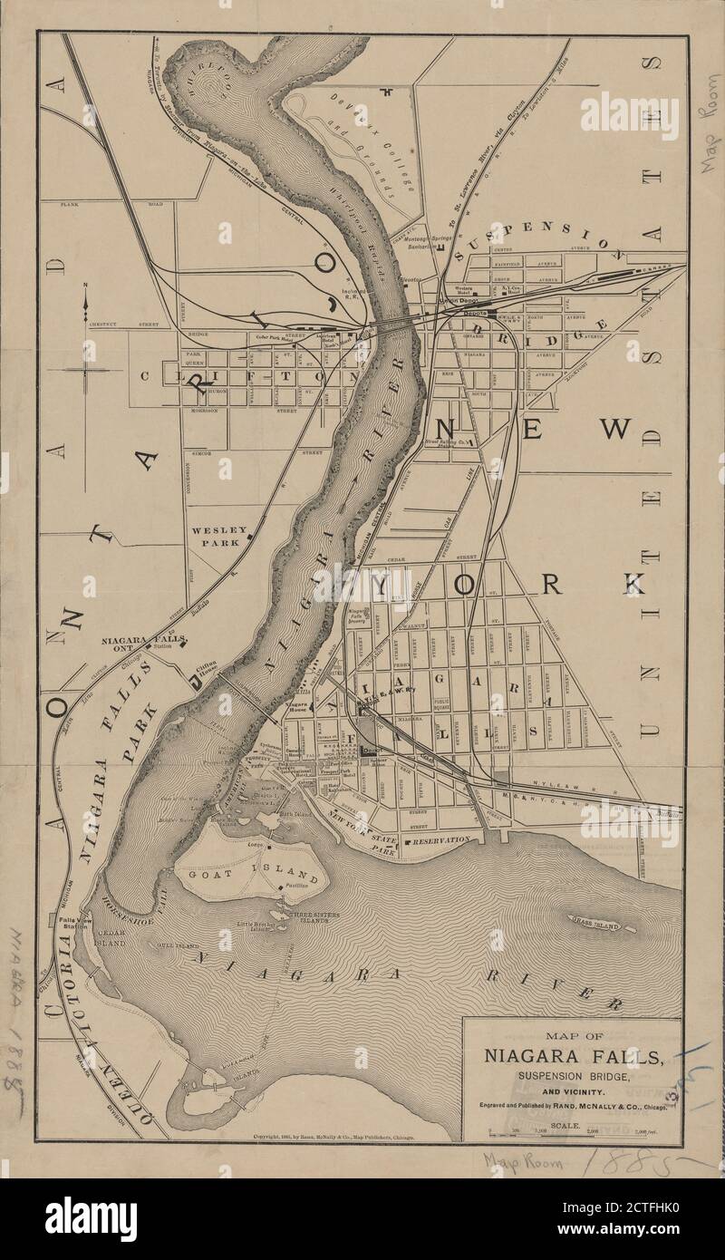 Map of Niagara Falls, suspension bridge, and vicinity, cartographic, Maps, 1885 Stock Photohttps://www.alamy.com/image-license-details/?v=1https://www.alamy.com/map-of-niagara-falls-suspension-bridge-and-vicinity-cartographic-maps-1885-image376512612.html
RM2CTFHK0–Map of Niagara Falls, suspension bridge, and vicinity, cartographic, Maps, 1885
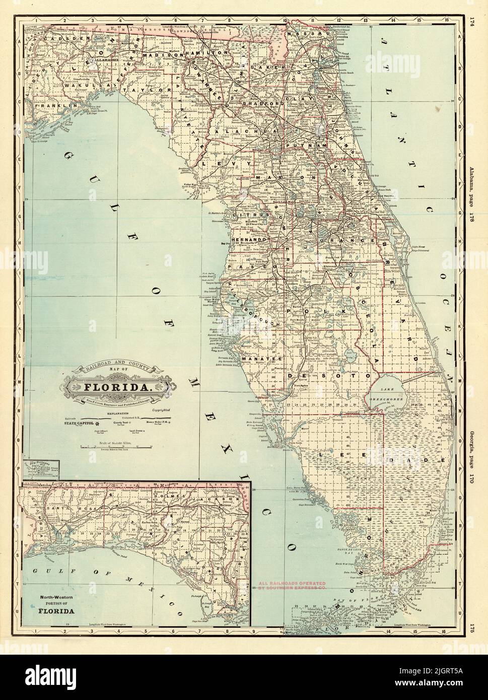 Railroad and County Map of Florida, 1885, by George Franklin Cram Stock Photohttps://www.alamy.com/image-license-details/?v=1https://www.alamy.com/railroad-and-county-map-of-florida-1885-by-george-franklin-cram-image475038294.html
RF2JGRT5A–Railroad and County Map of Florida, 1885, by George Franklin Cram
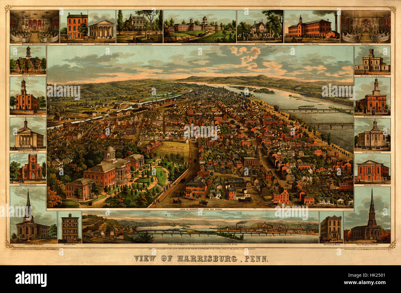 Harrisburg Panorama 1885 Stock Photohttps://www.alamy.com/image-license-details/?v=1https://www.alamy.com/stock-photo-harrisburg-panorama-1885-132198865.html
RFHK2501–Harrisburg Panorama 1885
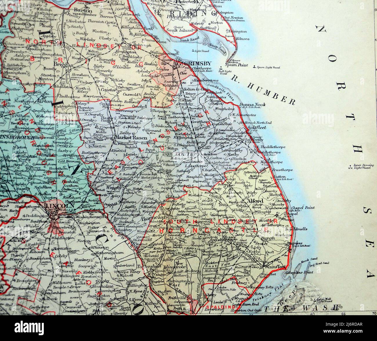 Antique map of Grimsby, Market Rasen, Alford, Lincoln and area and the coast next to the North Sea in United Kingdom, British Isles. From the book: 'Stanford's Parliamentary County Atlas and Handbook of England and Wales' Published 1885 Stock Photohttps://www.alamy.com/image-license-details/?v=1https://www.alamy.com/antique-map-of-grimsby-market-rasen-alford-lincoln-and-area-and-the-coast-next-to-the-north-sea-in-united-kingdom-british-isles-from-the-book-stanfords-parliamentary-county-atlas-and-handbook-of-england-and-wales-published-1885-image468883263.html
RM2J6RDAR–Antique map of Grimsby, Market Rasen, Alford, Lincoln and area and the coast next to the North Sea in United Kingdom, British Isles. From the book: 'Stanford's Parliamentary County Atlas and Handbook of England and Wales' Published 1885
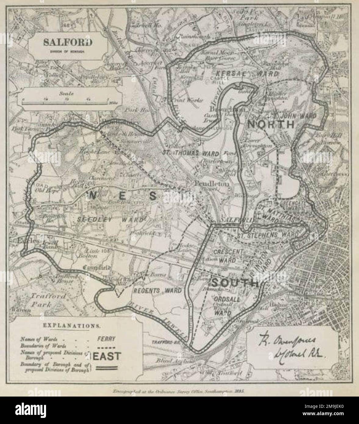 1885 map of Salford Parliamentary Borough Stock Photohttps://www.alamy.com/image-license-details/?v=1https://www.alamy.com/1885-map-of-salford-parliamentary-borough-image505039220.html
RM2M9JEK0–1885 map of Salford Parliamentary Borough
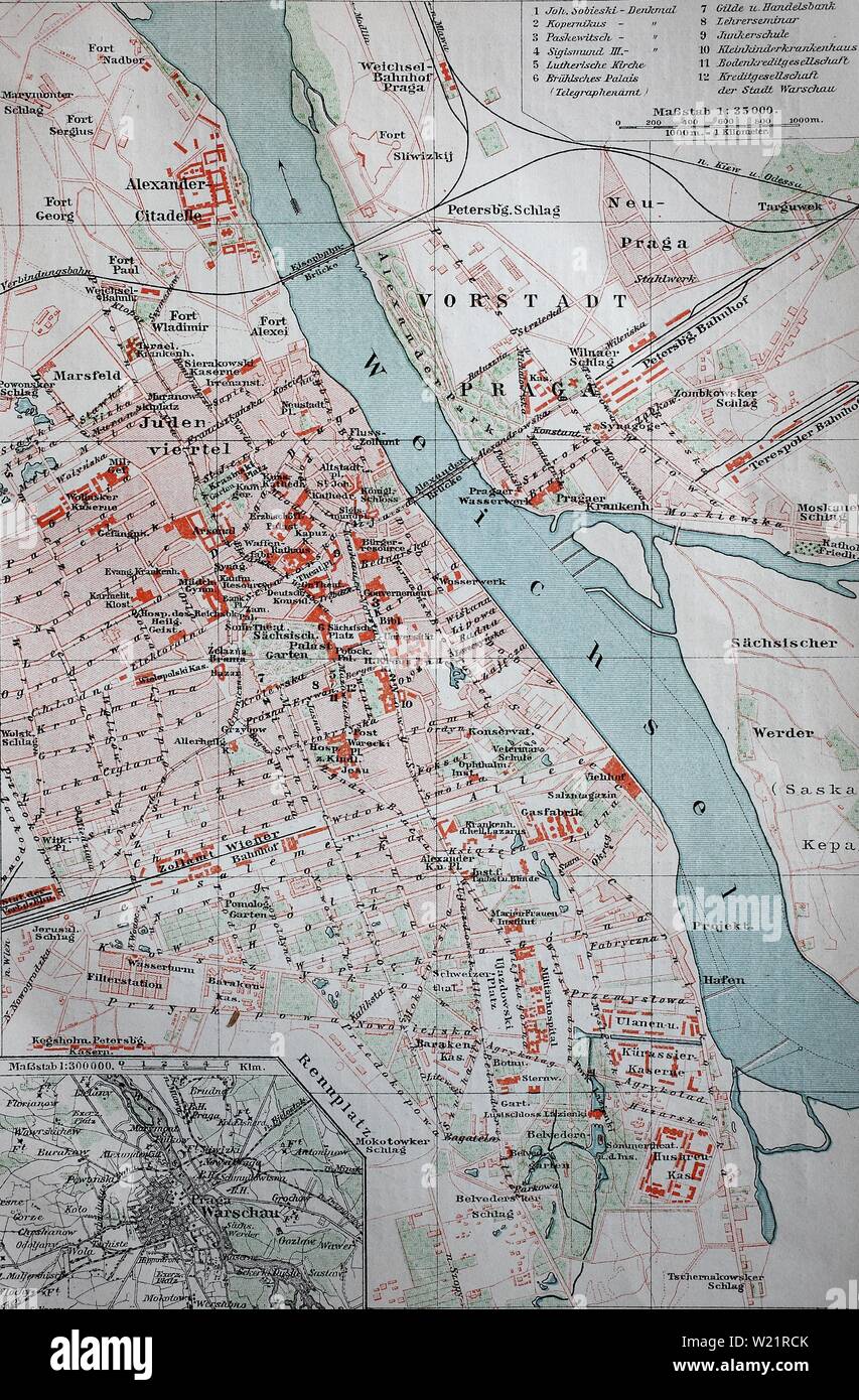 City map of Warsaw, from 1885, historical illustration, Poland Stock Photohttps://www.alamy.com/image-license-details/?v=1https://www.alamy.com/city-map-of-warsaw-from-1885-historical-illustration-poland-image259425171.html
RMW21RCK–City map of Warsaw, from 1885, historical illustration, Poland
 Black and white photograph of World War II (1939-1945) showing the lightning offensive led by US General George S. Patton (1885-1945); a map of the movement of Patton's forces going through Brittany and moving East at the same time. Stock Photohttps://www.alamy.com/image-license-details/?v=1https://www.alamy.com/black-and-white-photograph-of-world-war-ii-1939-1945-showing-the-lightning-offensive-led-by-us-general-george-s-patton-1885-1945-a-map-of-the-movement-of-pattons-forces-going-through-brittany-and-moving-east-at-the-same-time-image377042147.html
RM2CWBN2Y–Black and white photograph of World War II (1939-1945) showing the lightning offensive led by US General George S. Patton (1885-1945); a map of the movement of Patton's forces going through Brittany and moving East at the same time.
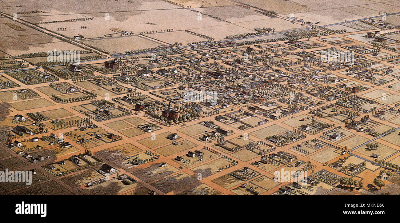 Bird's Eye View of Phoenix, Maricopa County 1885 Stock Photohttps://www.alamy.com/image-license-details/?v=1https://www.alamy.com/birds-eye-view-of-phoenix-maricopa-county-1885-image184253468.html
RMMKND50–Bird's Eye View of Phoenix, Maricopa County 1885
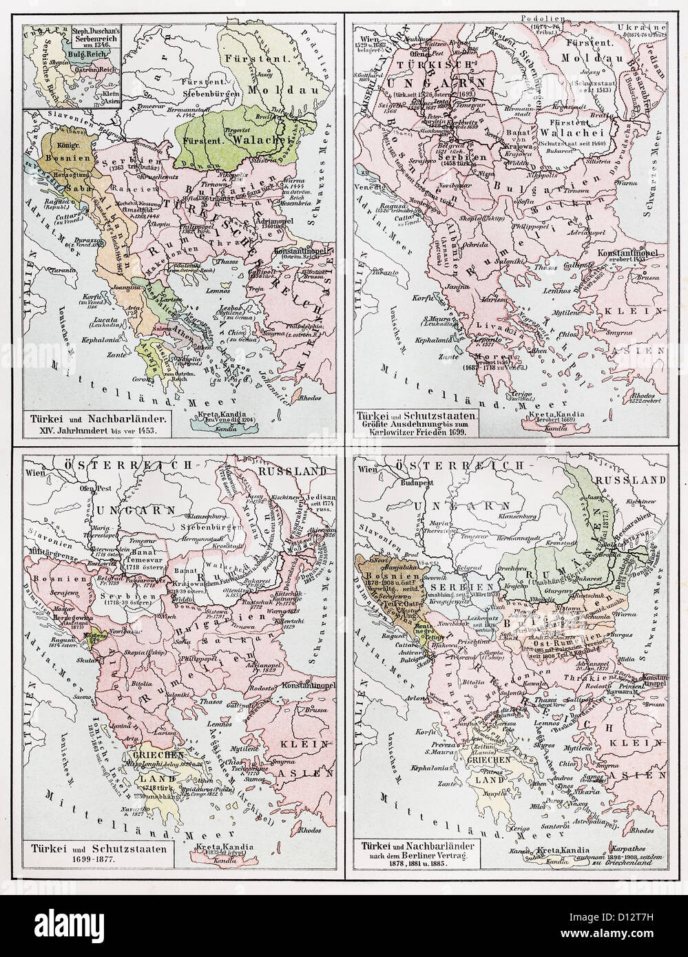 Vintage map representing the Turkish Empire European territories between 1453 and 1885 Stock Photohttps://www.alamy.com/image-license-details/?v=1https://www.alamy.com/stock-photo-vintage-map-representing-the-turkish-empire-european-territories-between-52308693.html
RFD12T7H–Vintage map representing the Turkish Empire European territories between 1453 and 1885
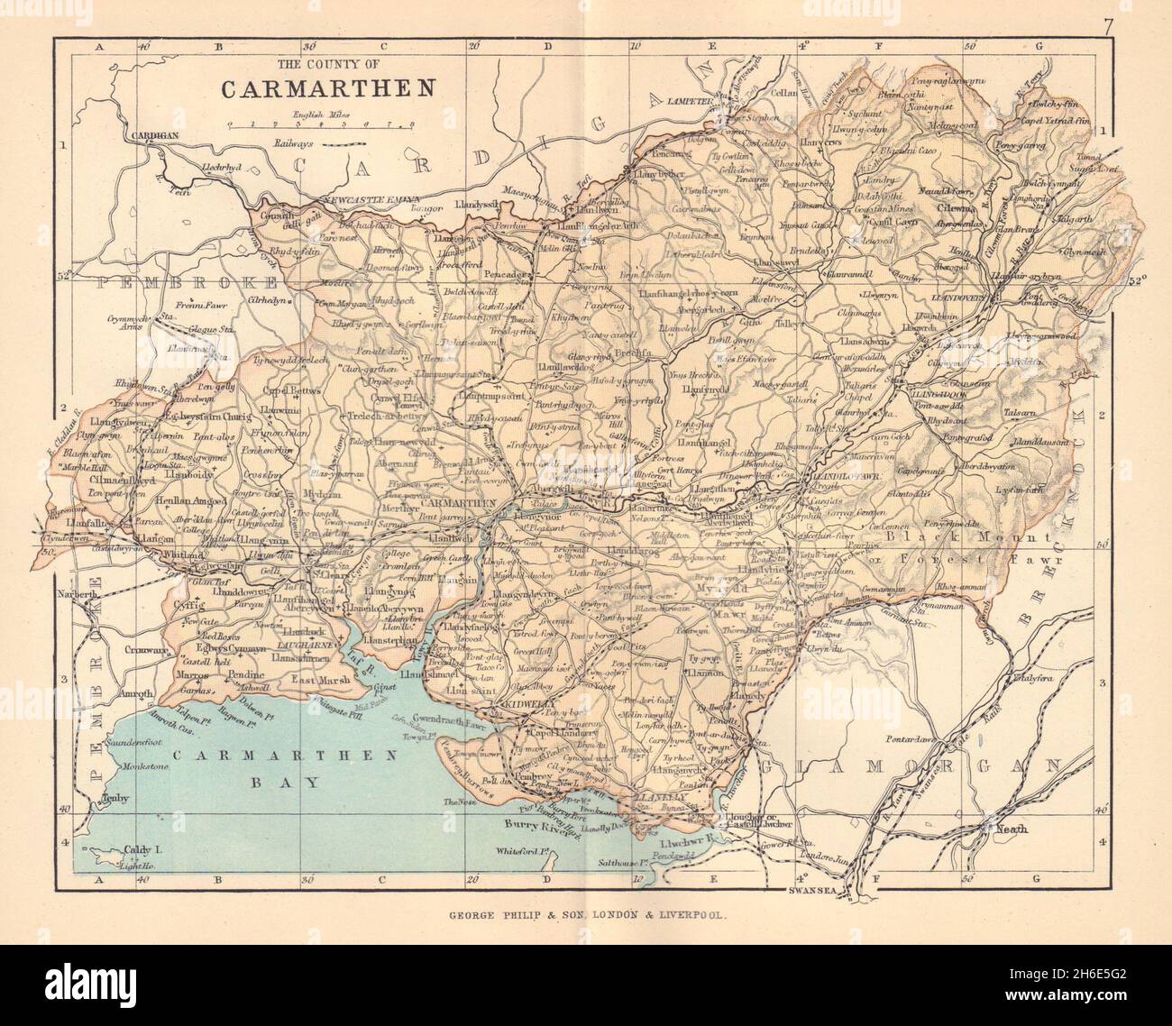 CARMARTHENSHIRE 'The County of Carmarthen' Llanelli Wales BARTHOLOMEW 1885 map Stock Photohttps://www.alamy.com/image-license-details/?v=1https://www.alamy.com/carmarthenshire-the-county-of-carmarthen-llanelli-wales-bartholomew-1885-map-image451469202.html
RF2H6E5G2–CARMARTHENSHIRE 'The County of Carmarthen' Llanelli Wales BARTHOLOMEW 1885 map
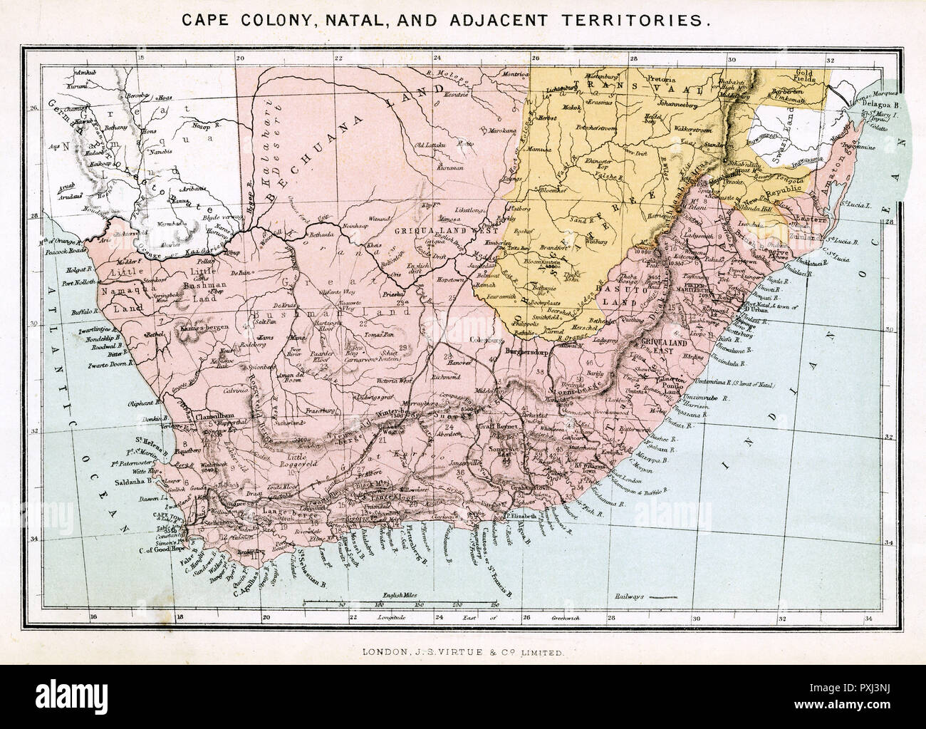 Map of Southern Africa Stock Photohttps://www.alamy.com/image-license-details/?v=1https://www.alamy.com/map-of-southern-africa-image222903566.html
RMPXJ3NJ–Map of Southern Africa
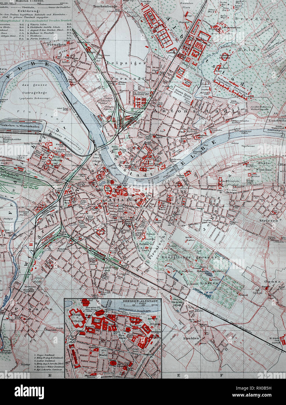 Ein Stadtplan von Dresden, Deutschland, im Jahre 1885 / a map of dresden, germany, in 1885 Stock Photohttps://www.alamy.com/image-license-details/?v=1https://www.alamy.com/ein-stadtplan-von-dresden-deutschland-im-jahre-1885-a-map-of-dresden-germany-in-1885-image239724621.html
RFRX0B5H–Ein Stadtplan von Dresden, Deutschland, im Jahre 1885 / a map of dresden, germany, in 1885
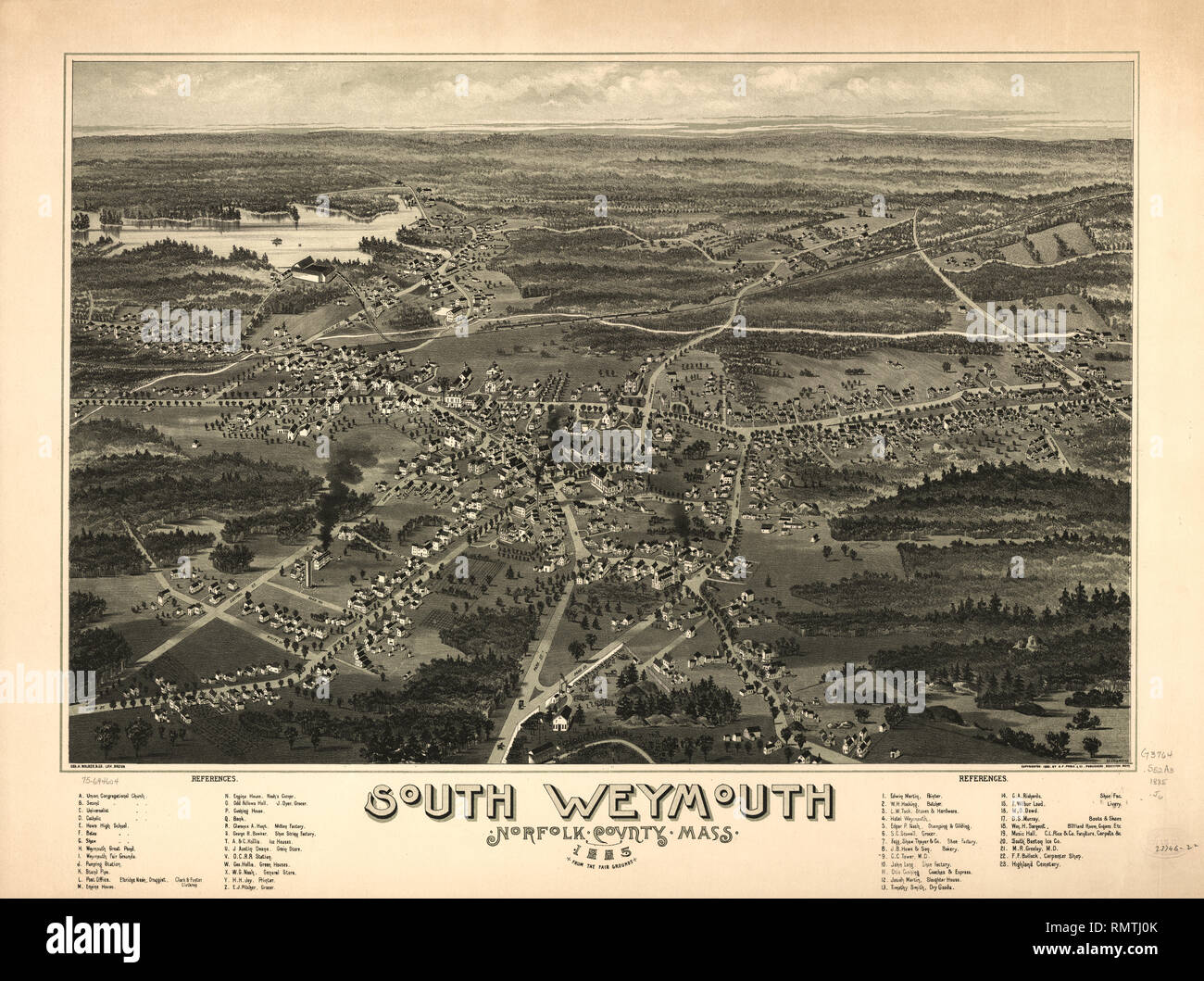 South Weymouth, Norfolk County, Massachusetts, Artist, C.E. Jorgensen, Geo. H. Walker & Son Lith., Boston, Published by A.P. Poole & Co., Brockton, Mass., 1885 Stock Photohttps://www.alamy.com/image-license-details/?v=1https://www.alamy.com/south-weymouth-norfolk-county-massachusetts-artist-ce-jorgensen-geo-h-walker-son-lith-boston-published-by-ap-poole-co-brockton-mass-1885-image236568883.html
RMRMTJ0K–South Weymouth, Norfolk County, Massachusetts, Artist, C.E. Jorgensen, Geo. H. Walker & Son Lith., Boston, Published by A.P. Poole & Co., Brockton, Mass., 1885
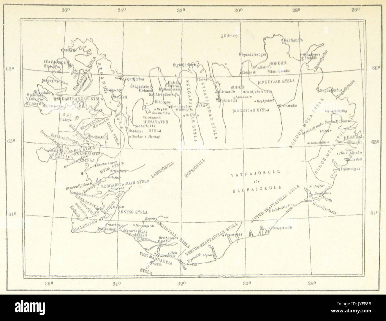 FINSEN(1885) Map of Iceland Stock Photohttps://www.alamy.com/image-license-details/?v=1https://www.alamy.com/finsen1885-map-of-iceland-image154625419.html
RMJYFP8B–FINSEN(1885) Map of Iceland
 . Hawaiian Government Survey, W.D. Alexander. Surveyor-General. Maui, Hawaiian Islands. English: This very large, rare, and extraordinary 1885 map of the island of Maui, Hawaii, was prepared for the 1906 Report of the Governor of the Territory of Hawaii to the Secretary of the Interior. Covers the entire island in stupendous detail. Though the cartographic work that produced this map was started in 1885, during the Hawaiian Monarchy, the map itself, and the report that contained it, was issued following the U.S. Government’s 1898 annexation of the Hawaiian Republic. The Report was an attempt Stock Photohttps://www.alamy.com/image-license-details/?v=1https://www.alamy.com/hawaiian-government-survey-wd-alexander-surveyor-general-maui-hawaiian-islands-english-this-very-large-rare-and-extraordinary-1885-map-of-the-island-of-maui-hawaii-was-prepared-for-the-1906-report-of-the-governor-of-the-territory-of-hawaii-to-the-secretary-of-the-interior-covers-the-entire-island-in-stupendous-detail-though-the-cartographic-work-that-produced-this-map-was-started-in-1885-during-the-hawaiian-monarchy-the-map-itself-and-the-report-that-contained-it-was-issued-following-the-us-governments-1898-annexation-of-the-hawaiian-republic-the-report-was-an-attempt-image188898661.html
RMMY924N–. Hawaiian Government Survey, W.D. Alexander. Surveyor-General. Maui, Hawaiian Islands. English: This very large, rare, and extraordinary 1885 map of the island of Maui, Hawaii, was prepared for the 1906 Report of the Governor of the Territory of Hawaii to the Secretary of the Interior. Covers the entire island in stupendous detail. Though the cartographic work that produced this map was started in 1885, during the Hawaiian Monarchy, the map itself, and the report that contained it, was issued following the U.S. Government’s 1898 annexation of the Hawaiian Republic. The Report was an attempt
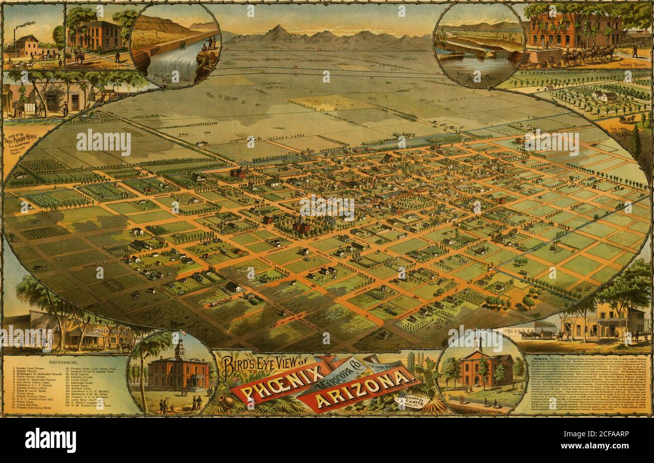 Birds eye view map of Phoenix, Arizona 1885 Stock Photohttps://www.alamy.com/image-license-details/?v=1https://www.alamy.com/birds-eye-view-map-of-phoenix-arizona-1885-image370865594.html
RM2CFAARP–Birds eye view map of Phoenix, Arizona 1885
 Channel to Hong Kong and Macao, circa 1885 Stock Photohttps://www.alamy.com/image-license-details/?v=1https://www.alamy.com/channel-to-hong-kong-and-macao-circa-1885-image266715389.html
RMWDWX5H–Channel to Hong Kong and Macao, circa 1885
 Kaiser Wilhelms-Land Ost Neu Guinea 1884-1885 map. Stock Photohttps://www.alamy.com/image-license-details/?v=1https://www.alamy.com/kaiser-wilhelms-land-ost-neu-guinea-1884-1885-map-image384195909.html
RM2D91HPD–Kaiser Wilhelms-Land Ost Neu Guinea 1884-1885 map.
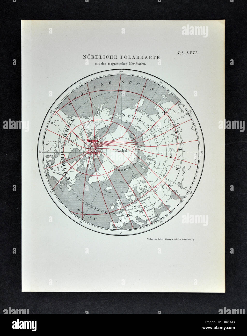 1894 Muller Map of the Arctic South Pole showing the Magnetic Isoclinic Lines in 1885 Stock Photohttps://www.alamy.com/image-license-details/?v=1https://www.alamy.com/1894-muller-map-of-the-arctic-south-pole-showing-the-magnetic-isoclinic-lines-in-1885-image241517251.html
RFT0X1M3–1894 Muller Map of the Arctic South Pole showing the Magnetic Isoclinic Lines in 1885
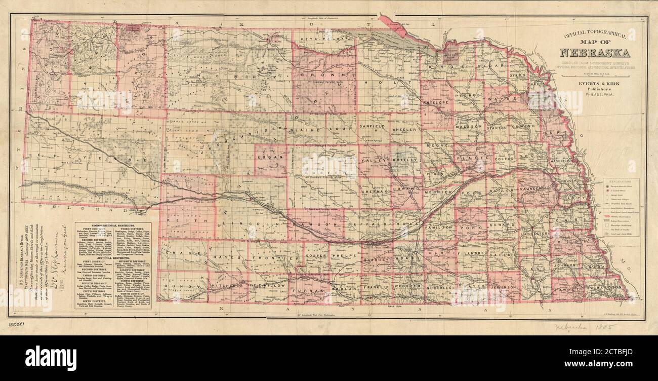 Official topographical map of Nebraska , cartographic, Maps, 1885, Kaefring, J. H Stock Photohttps://www.alamy.com/image-license-details/?v=1https://www.alamy.com/official-topographical-map-of-nebraska-cartographic-maps-1885-kaefring-j-h-image376423221.html
RM2CTBFJD–Official topographical map of Nebraska , cartographic, Maps, 1885, Kaefring, J. H
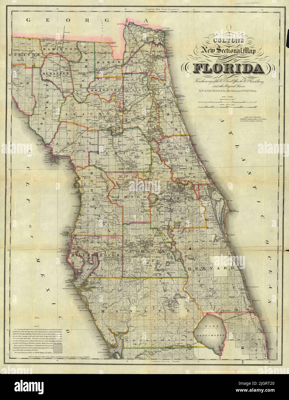 Sectional Map of the Eastern Portion of Florida, 1885, by G. W. and C. B. Colton Stock Photohttps://www.alamy.com/image-license-details/?v=1https://www.alamy.com/sectional-map-of-the-eastern-portion-of-florida-1885-by-g-w-and-c-b-colton-image475038200.html
RF2JGRT20–Sectional Map of the Eastern Portion of Florida, 1885, by G. W. and C. B. Colton
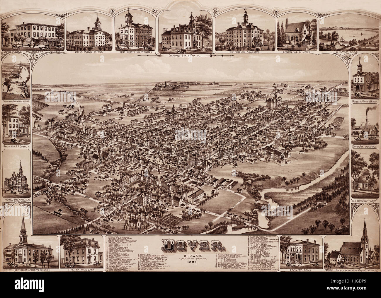 Map Of Dover 1885 Stock Photohttps://www.alamy.com/image-license-details/?v=1https://www.alamy.com/stock-photo-map-of-dover-1885-131898433.html
RFHJGDP9–Map Of Dover 1885
 Antique map of Cumbria and Lake District and area, including Kendal, with Ingleton and Yorkshire on the right, in United Kingdom, British Isles, From the book: 'Stanford's Parliamentary County Atlas and Handbook of England and Wales' Published 1885 Stock Photohttps://www.alamy.com/image-license-details/?v=1https://www.alamy.com/antique-map-of-cumbria-and-lake-district-and-area-including-kendal-with-ingleton-and-yorkshire-on-the-right-in-united-kingdom-british-isles-from-the-book-stanfords-parliamentary-county-atlas-and-handbook-of-england-and-wales-published-1885-image468883214.html
RM2J6RD92–Antique map of Cumbria and Lake District and area, including Kendal, with Ingleton and Yorkshire on the right, in United Kingdom, British Isles, From the book: 'Stanford's Parliamentary County Atlas and Handbook of England and Wales' Published 1885
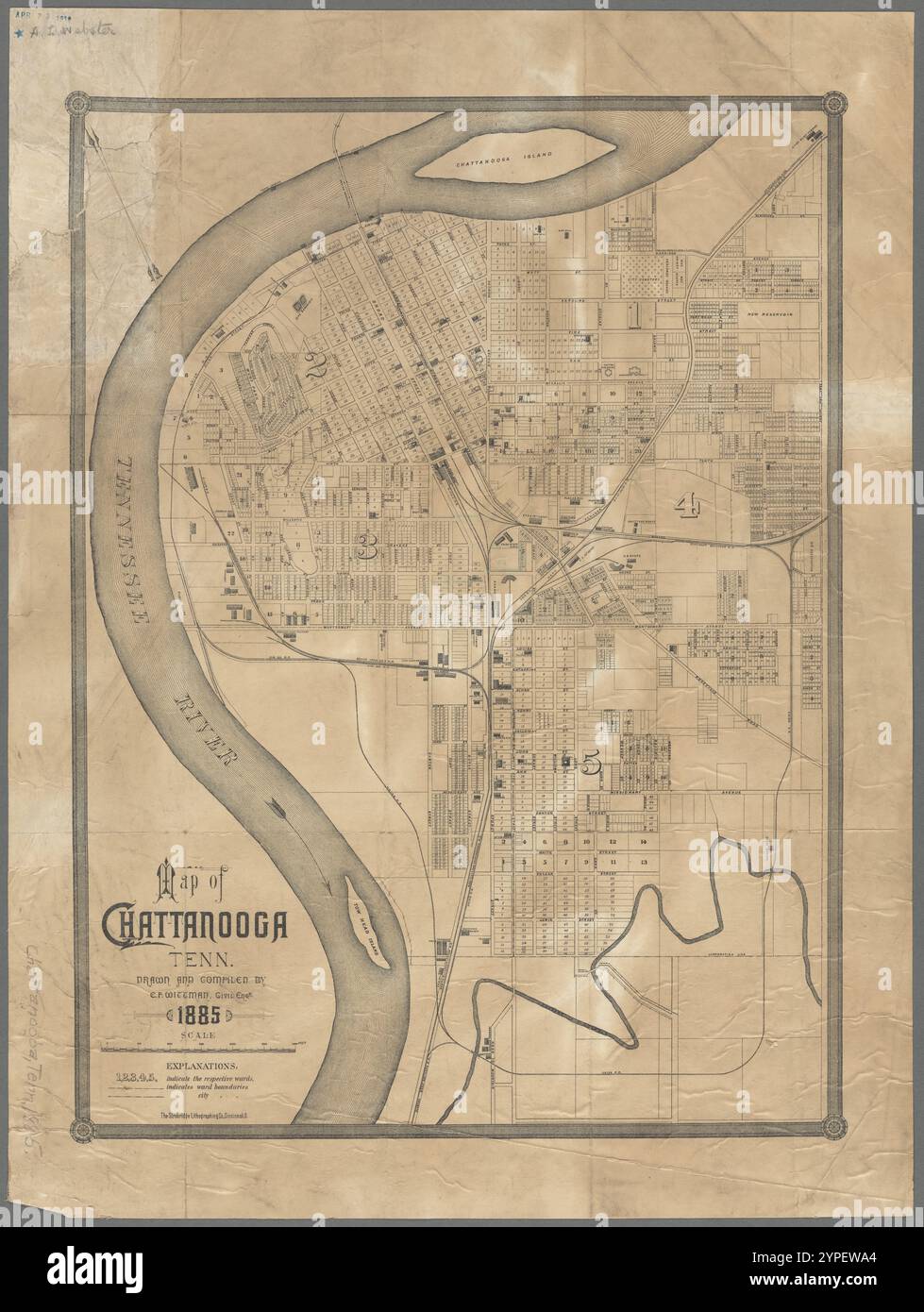 Map of Chattanooga, Tenn. 1885 Stock Photohttps://www.alamy.com/image-license-details/?v=1https://www.alamy.com/map-of-chattanooga-tenn-1885-image633422892.html
RM2YPEWA4–Map of Chattanooga, Tenn. 1885
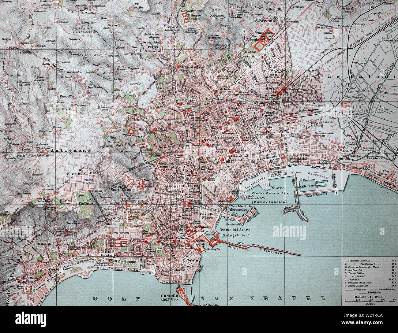 City map of Naples, Naples, from 1885, historical illustration, Italy Stock Photohttps://www.alamy.com/image-license-details/?v=1https://www.alamy.com/city-map-of-naples-naples-from-1885-historical-illustration-italy-image259425162.html
RMW21RCA–City map of Naples, Naples, from 1885, historical illustration, Italy
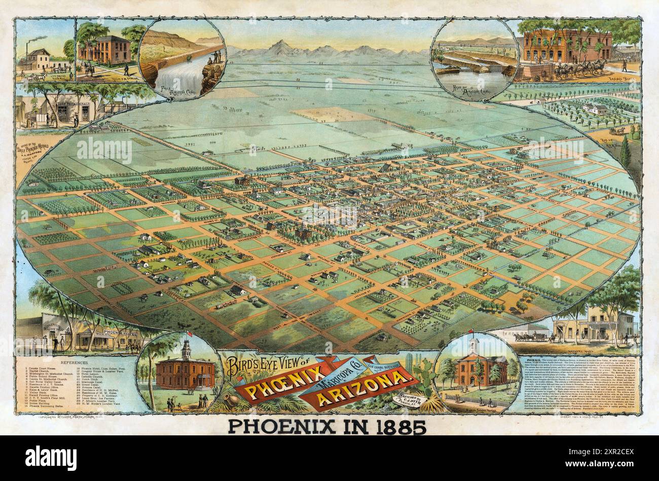 Vintage Pictorial Map of the city of Phoenix, Arizona, 1885. Stock Photohttps://www.alamy.com/image-license-details/?v=1https://www.alamy.com/vintage-pictorial-map-of-the-city-of-phoenix-arizona-1885-image616553698.html
RM2XR2CEX–Vintage Pictorial Map of the city of Phoenix, Arizona, 1885.
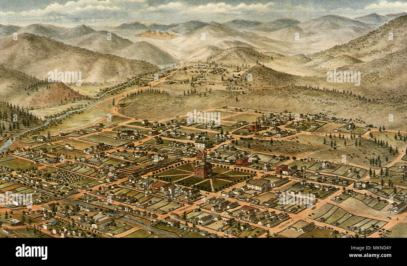 Bird's Eye View of Prescott, Arizona Territory 1885 Stock Photohttps://www.alamy.com/image-license-details/?v=1https://www.alamy.com/birds-eye-view-of-prescott-arizona-territory-1885-image184253467.html
RMMKND4Y–Bird's Eye View of Prescott, Arizona Territory 1885
 Art inspired by Gold Foil on Wrist, Middle Kingdom, Dynasty 12, early–to Senwosret II, ca. 1981–1885 B.C., From Egypt, Memphite Region, Lisht North, cemetery east of Senwosret (758) (?), Pit 696 not on map, 1907–08, Gold foil, L. 4.3 cm (1 11/16 in, Classic works modernized by Artotop with a splash of modernity. Shapes, color and value, eye-catching visual impact on art. Emotions through freedom of artworks in a contemporary way. A timeless message pursuing a wildly creative new direction. Artists turning to the digital medium and creating the Artotop NFT Stock Photohttps://www.alamy.com/image-license-details/?v=1https://www.alamy.com/art-inspired-by-gold-foil-on-wrist-middle-kingdom-dynasty-12-earlyto-senwosret-ii-ca-19811885-bc-from-egypt-memphite-region-lisht-north-cemetery-east-of-senwosret-758-pit-696-not-on-map-190708-gold-foil-l-43-cm-1-1116-in-classic-works-modernized-by-artotop-with-a-splash-of-modernity-shapes-color-and-value-eye-catching-visual-impact-on-art-emotions-through-freedom-of-artworks-in-a-contemporary-way-a-timeless-message-pursuing-a-wildly-creative-new-direction-artists-turning-to-the-digital-medium-and-creating-the-artotop-nft-image462858642.html
RF2HW10WP–Art inspired by Gold Foil on Wrist, Middle Kingdom, Dynasty 12, early–to Senwosret II, ca. 1981–1885 B.C., From Egypt, Memphite Region, Lisht North, cemetery east of Senwosret (758) (?), Pit 696 not on map, 1907–08, Gold foil, L. 4.3 cm (1 11/16 in, Classic works modernized by Artotop with a splash of modernity. Shapes, color and value, eye-catching visual impact on art. Emotions through freedom of artworks in a contemporary way. A timeless message pursuing a wildly creative new direction. Artists turning to the digital medium and creating the Artotop NFT
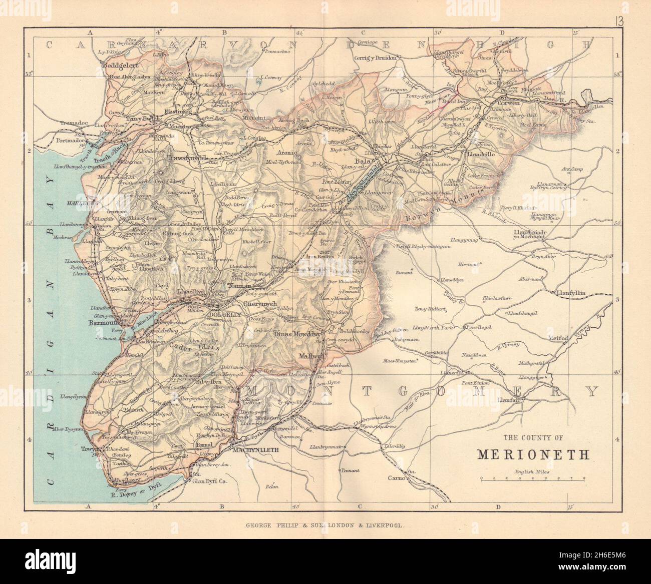 MERIONETHSHIRE 'County of Merioneth' Barmouth Tywyn Wales BARTHOLOMEW 1885 map Stock Photohttps://www.alamy.com/image-license-details/?v=1https://www.alamy.com/merionethshire-county-of-merioneth-barmouth-tywyn-wales-bartholomew-1885-map-image451469318.html
RF2H6E5M6–MERIONETHSHIRE 'County of Merioneth' Barmouth Tywyn Wales BARTHOLOMEW 1885 map
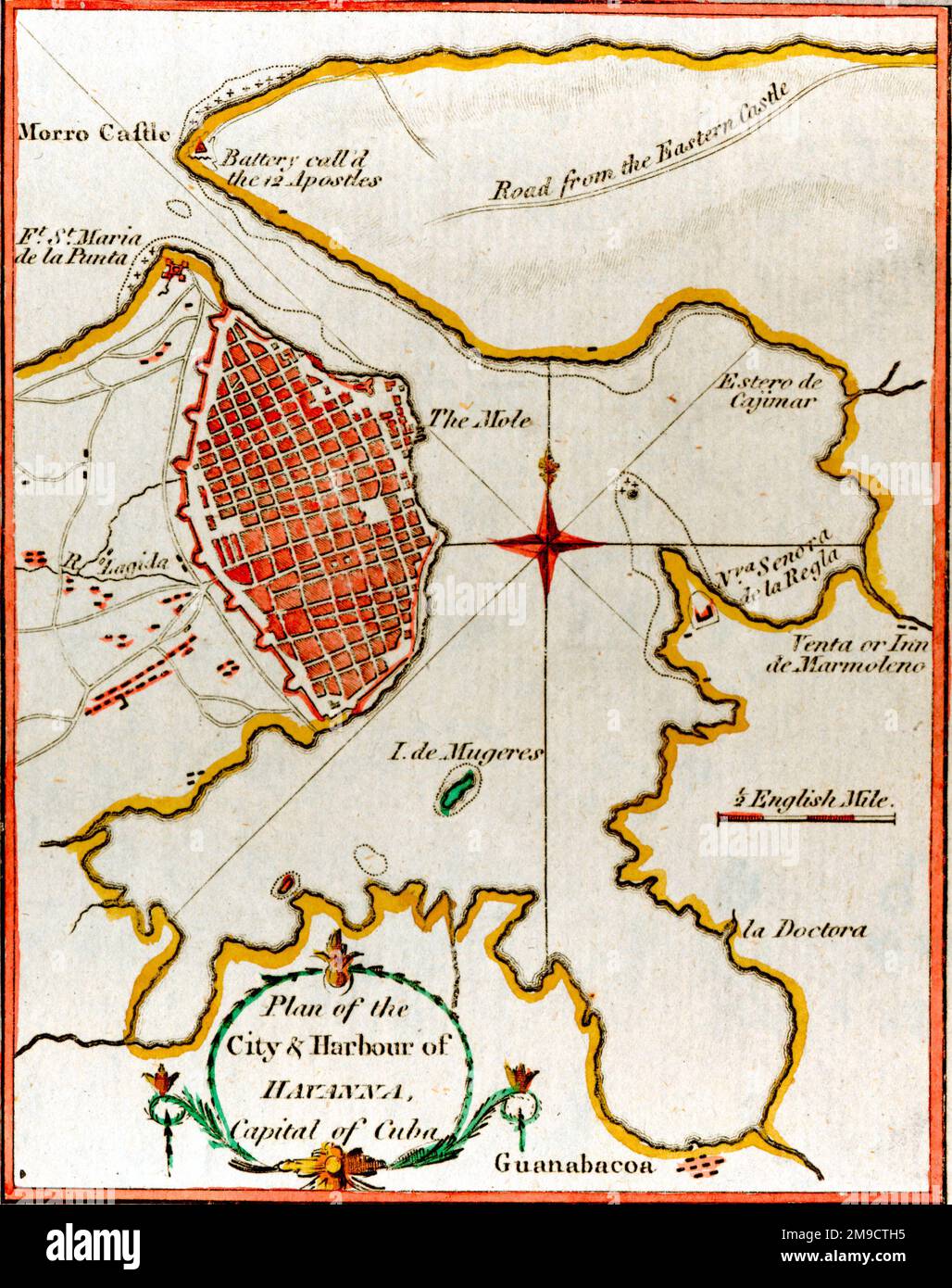 19th century Map of the Harbour of Havana, Cuba Stock Photohttps://www.alamy.com/image-license-details/?v=1https://www.alamy.com/19th-century-map-of-the-harbour-of-havana-cuba-image504915297.html
RM2M9CTH5–19th century Map of the Harbour of Havana, Cuba
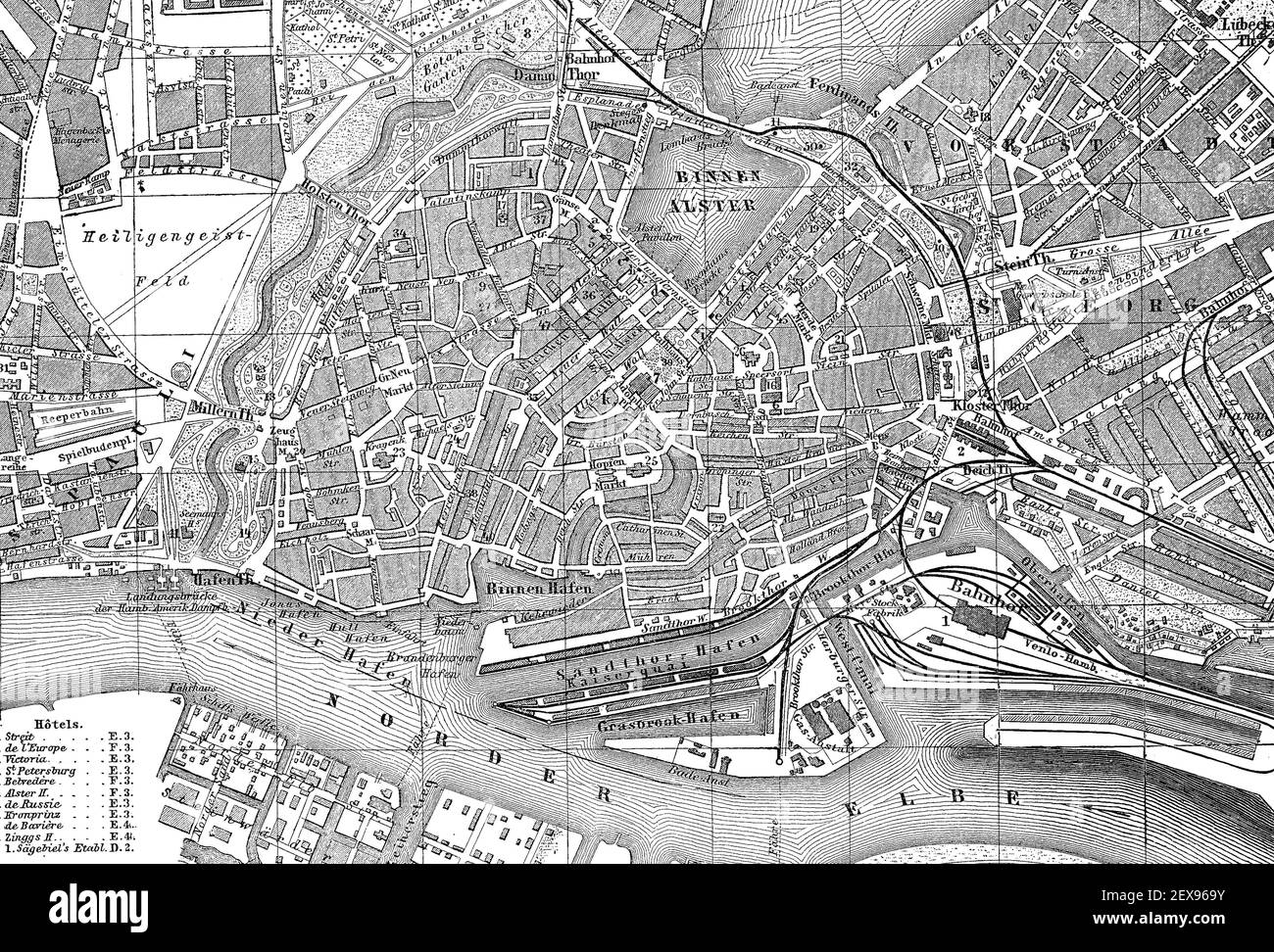 City map of Hamburg, Germany, in 1885 / Stadtplan von Hamburg, Deutschland, im Jahre 1885, Historisch, historical, digital improved reproduction of an original from the 19th century / digitale Reproduktion einer Originalvorlage aus dem 19. Jahrhundert, Stock Photohttps://www.alamy.com/image-license-details/?v=1https://www.alamy.com/city-map-of-hamburg-germany-in-1885-stadtplan-von-hamburg-deutschland-im-jahre-1885-historisch-historical-digital-improved-reproduction-of-an-original-from-the-19th-century-digitale-reproduktion-einer-originalvorlage-aus-dem-19-jahrhundert-image412022071.html
RF2EX969Y–City map of Hamburg, Germany, in 1885 / Stadtplan von Hamburg, Deutschland, im Jahre 1885, Historisch, historical, digital improved reproduction of an original from the 19th century / digitale Reproduktion einer Originalvorlage aus dem 19. Jahrhundert,
 Ulysses S. Grant August 6, 1885. Stock Photohttps://www.alamy.com/image-license-details/?v=1https://www.alamy.com/stock-photo-ulysses-s-grant-august-6-1885-130568360.html
RMHGBW7M–Ulysses S. Grant August 6, 1885.
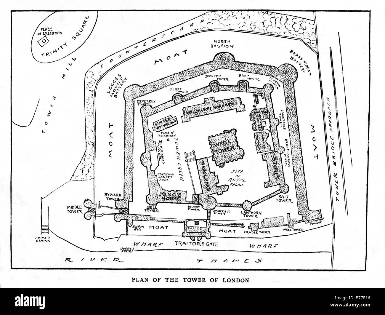 Tower of London 1885 plan of the layout of the London landmark as it was in Victorian times Stock Photohttps://www.alamy.com/image-license-details/?v=1https://www.alamy.com/stock-photo-tower-of-london-1885-plan-of-the-layout-of-the-london-landmark-as-21677634.html
RMB77E16–Tower of London 1885 plan of the layout of the London landmark as it was in Victorian times
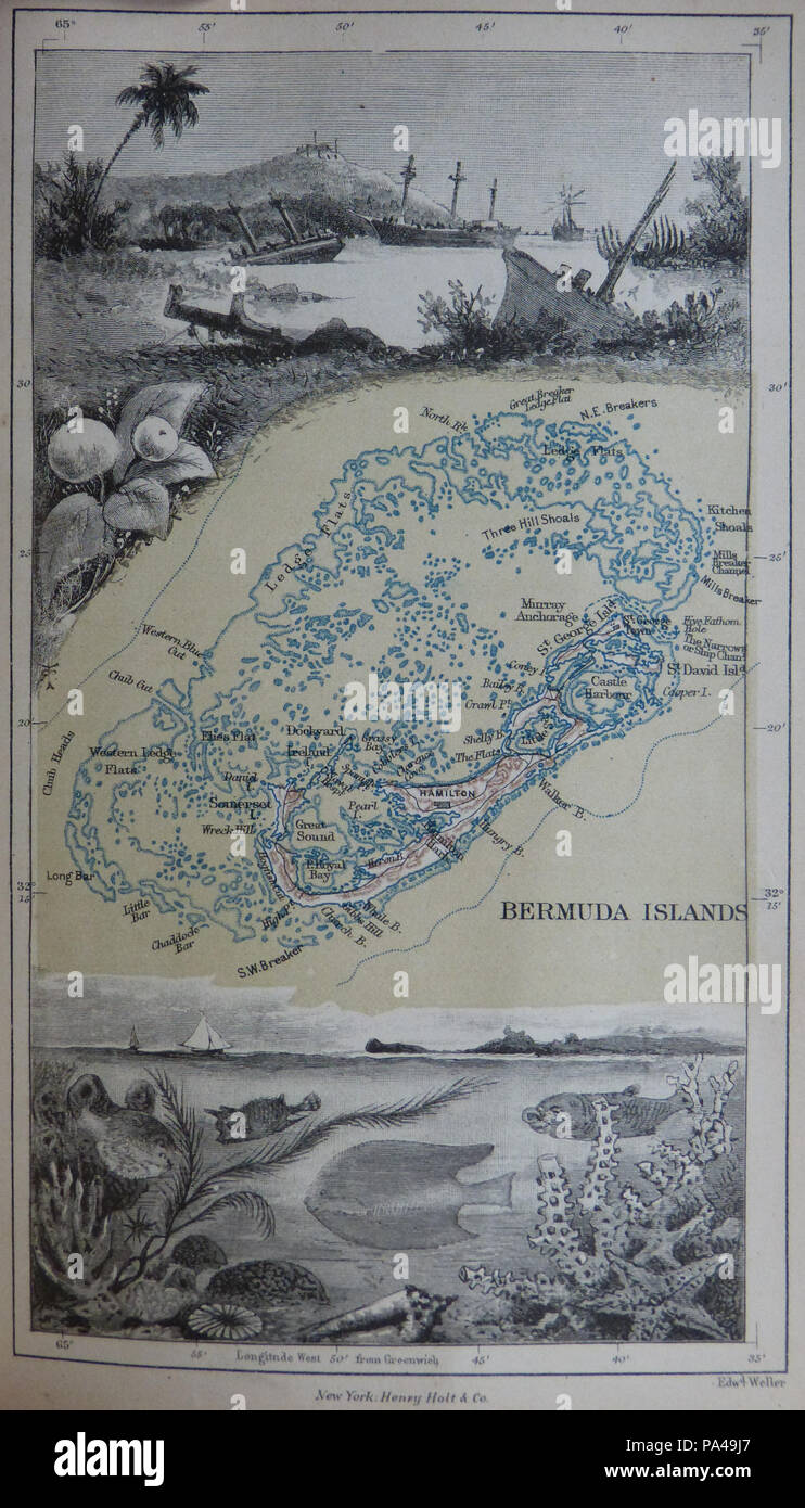 21 1885 Map of Bermuda and its reefs by Anna Brassey Stock Photohttps://www.alamy.com/image-license-details/?v=1https://www.alamy.com/21-1885-map-of-bermuda-and-its-reefs-by-anna-brassey-image212766351.html
RMPA49J7–21 1885 Map of Bermuda and its reefs by Anna Brassey
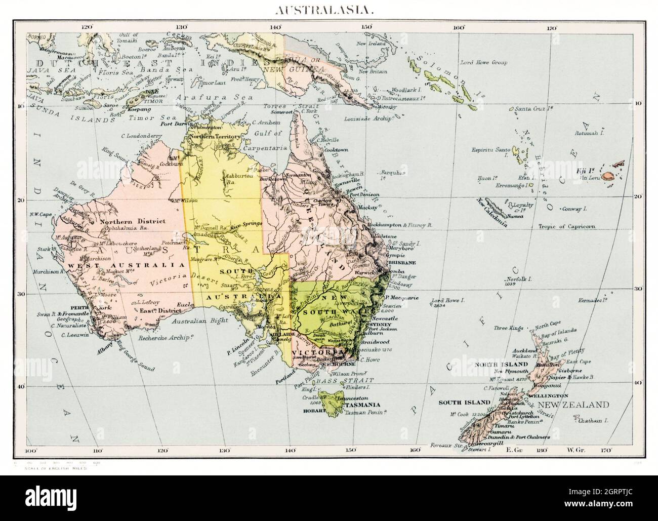 Orient Line Guide. Chapters for travellers by sea and by land (1885) by William John Loftie. Map of Australia / Australasia. Stock Photohttps://www.alamy.com/image-license-details/?v=1https://www.alamy.com/orient-line-guide-chapters-for-travellers-by-sea-and-by-land-1885-by-william-john-loftie-map-of-australia-australasia-image444898564.html
RM2GRPTJC–Orient Line Guide. Chapters for travellers by sea and by land (1885) by William John Loftie. Map of Australia / Australasia.
 The city of New Orleans, and the Mississippi River Lake Pontchartrain in distance. 1885 Stock Photohttps://www.alamy.com/image-license-details/?v=1https://www.alamy.com/stock-photo-the-city-of-new-orleans-and-the-mississippi-river-lake-pontchartrain-77825207.html
RMEEH6RK–The city of New Orleans, and the Mississippi River Lake Pontchartrain in distance. 1885
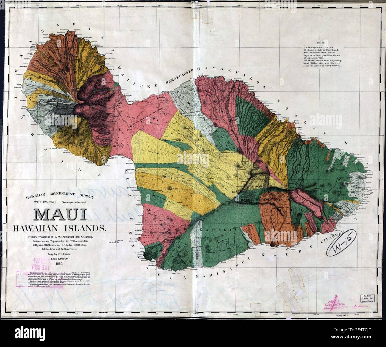 Maui 1885 map by Dodge. Stock Photohttps://www.alamy.com/image-license-details/?v=1https://www.alamy.com/maui-1885-map-by-dodge-image398833860.html
RM2E4TCJC–Maui 1885 map by Dodge.
 1894 Muller Map of the Arctic South Pole showing the Magnetic Isoclinic Lines in 1885 Stock Photohttps://www.alamy.com/image-license-details/?v=1https://www.alamy.com/1894-muller-map-of-the-arctic-south-pole-showing-the-magnetic-isoclinic-lines-in-1885-image241517246.html
RFT0X1KX–1894 Muller Map of the Arctic South Pole showing the Magnetic Isoclinic Lines in 1885
 1885, De Witt Alexander Wall Map of Maui, Hawaii Stock Photohttps://www.alamy.com/image-license-details/?v=1https://www.alamy.com/stock-image-1885-de-witt-alexander-wall-map-of-maui-hawaii-162575050.html
RMKCDX3P–1885, De Witt Alexander Wall Map of Maui, Hawaii
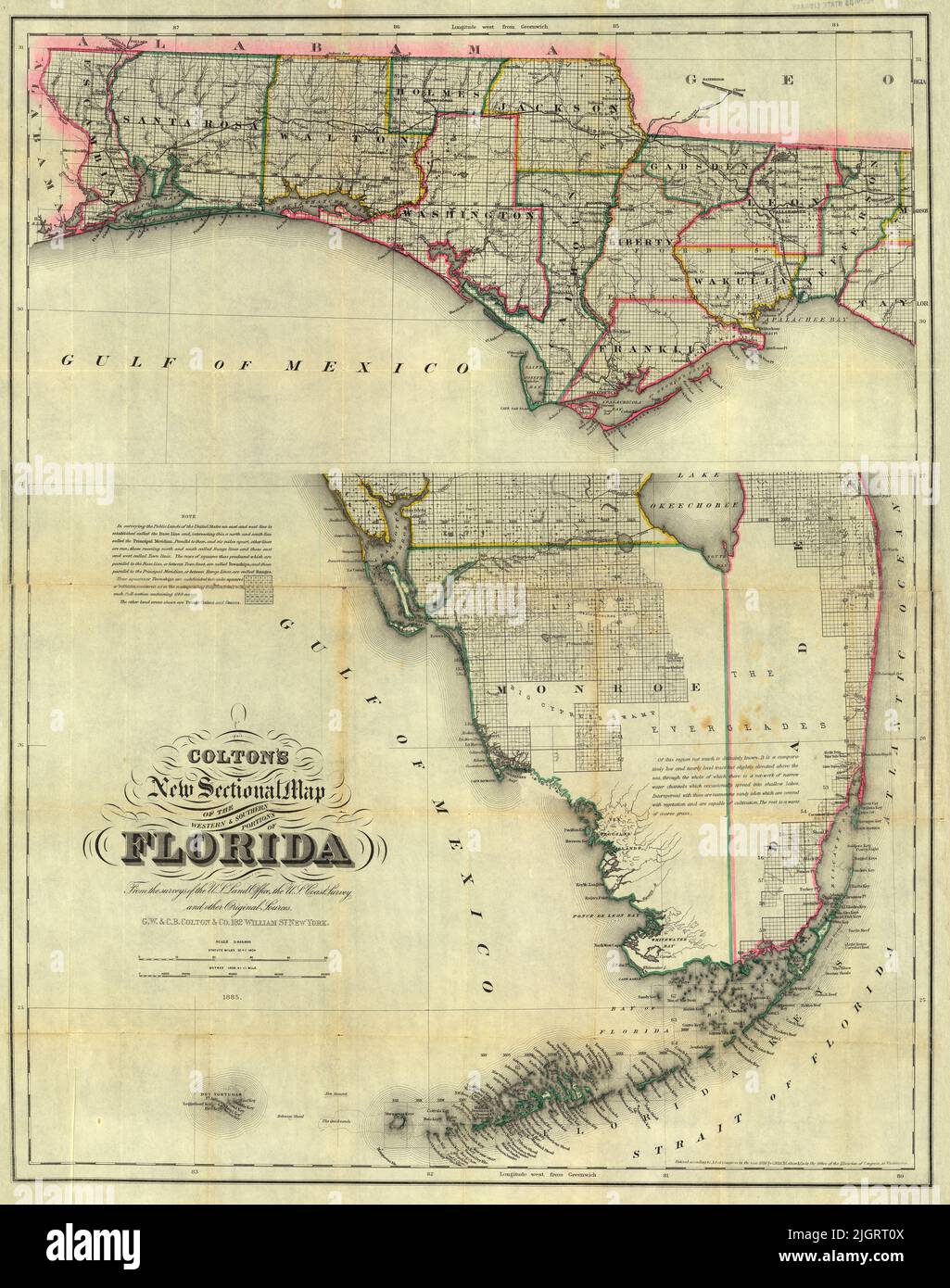 Sectional Map of the Western and Southern Portions of Florida, 1885, by G. W. and C. B. Colton Stock Photohttps://www.alamy.com/image-license-details/?v=1https://www.alamy.com/sectional-map-of-the-western-and-southern-portions-of-florida-1885-by-g-w-and-c-b-colton-image475038170.html
RF2JGRT0X–Sectional Map of the Western and Southern Portions of Florida, 1885, by G. W. and C. B. Colton
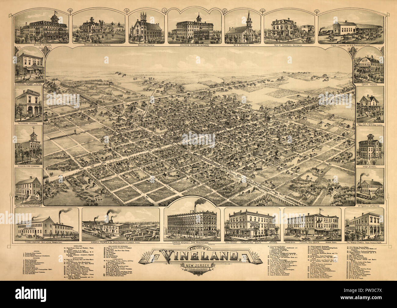 Map Of Vineland 1885 Stock Photohttps://www.alamy.com/image-license-details/?v=1https://www.alamy.com/map-of-vineland-1885-image221966302.html
RFPW3C7X–Map Of Vineland 1885
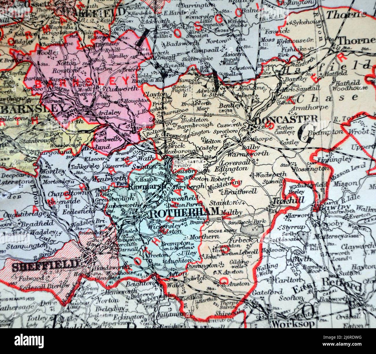 Antique map of Doncaster and area in United Kingdom, British Isles, From the book: 'Stanford's Parliamentary County Atlas and Handbook of England and Wales' Published 1885 Stock Photohttps://www.alamy.com/image-license-details/?v=1https://www.alamy.com/antique-map-of-doncaster-and-area-in-united-kingdom-british-isles-from-the-book-stanfords-parliamentary-county-atlas-and-handbook-of-england-and-wales-published-1885-image468883676.html
RM2J6RDWG–Antique map of Doncaster and area in United Kingdom, British Isles, From the book: 'Stanford's Parliamentary County Atlas and Handbook of England and Wales' Published 1885
 Map of Long Island 1885 Stock Photohttps://www.alamy.com/image-license-details/?v=1https://www.alamy.com/map-of-long-island-1885-image633233410.html
RM2YP67JX–Map of Long Island 1885
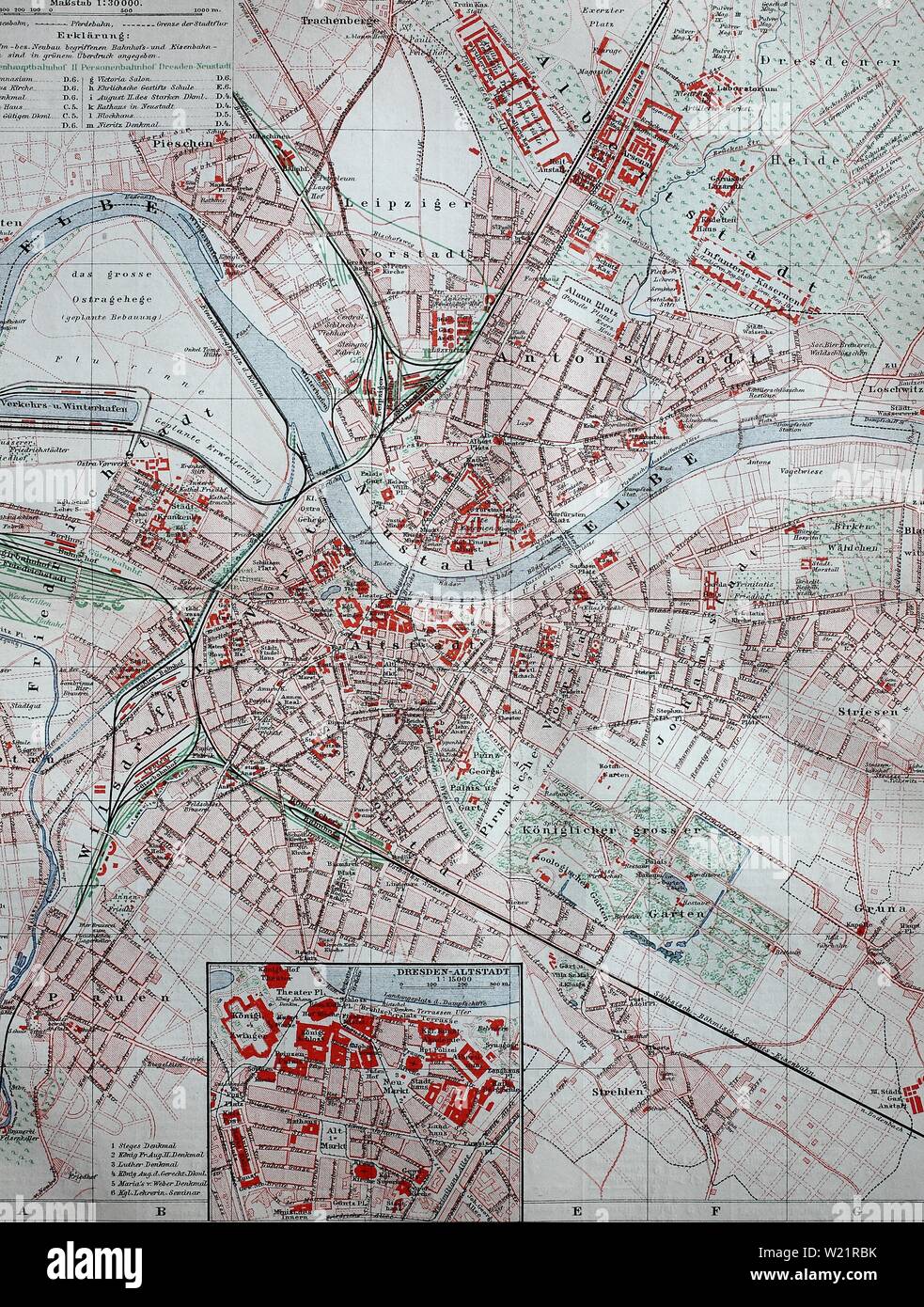 A city map of Dresden in 1885, historical illustration, Germany Stock Photohttps://www.alamy.com/image-license-details/?v=1https://www.alamy.com/a-city-map-of-dresden-in-1885-historical-illustration-germany-image259425143.html
RMW21RBK–A city map of Dresden in 1885, historical illustration, Germany
 Vintage Geographic Map for the city of Bergen, Norway, 1885 Stock Photohttps://www.alamy.com/image-license-details/?v=1https://www.alamy.com/vintage-geographic-map-for-the-city-of-bergen-norway-1885-image601551803.html
RM2WXK1CY–Vintage Geographic Map for the city of Bergen, Norway, 1885
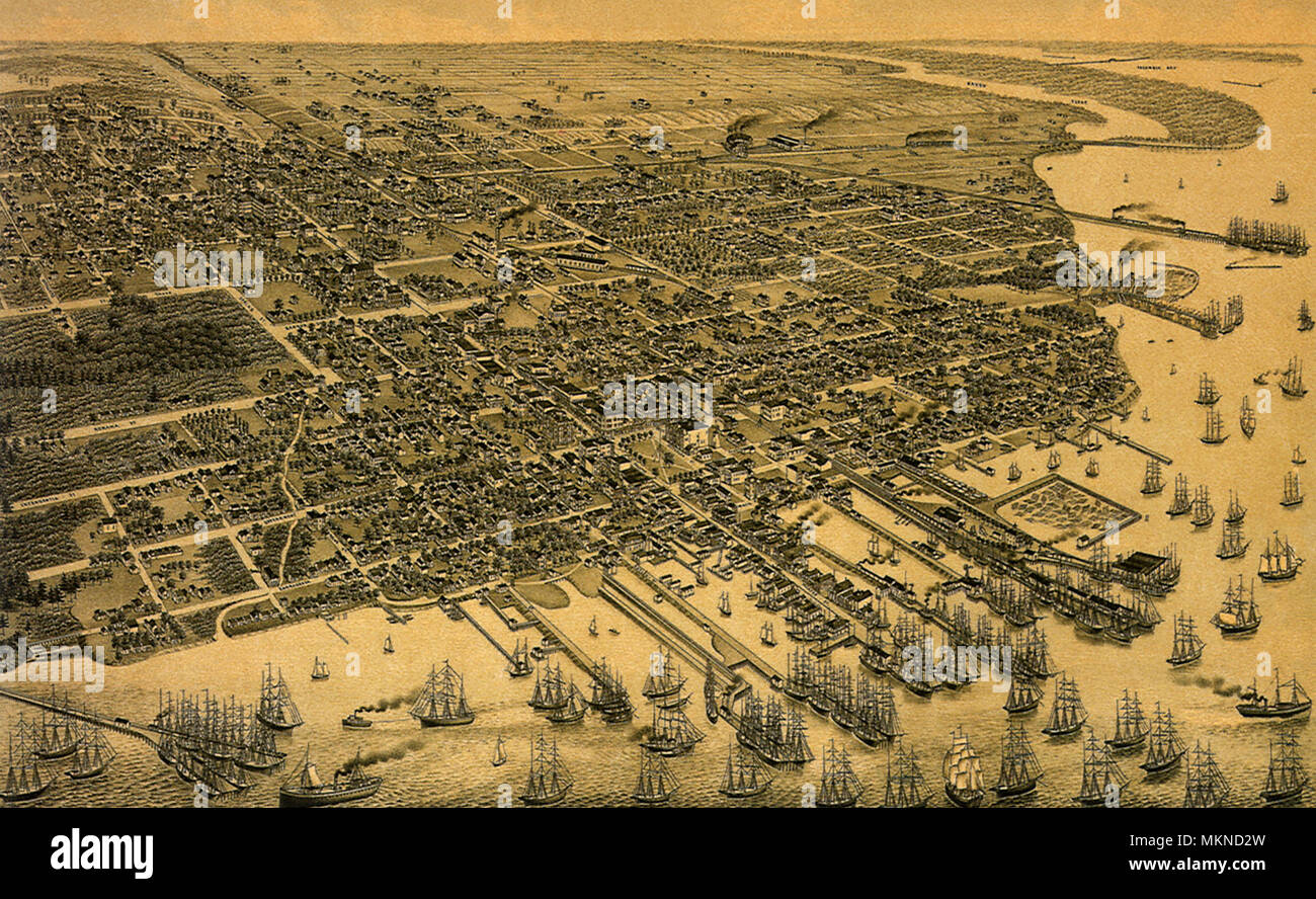 Pensacola, Florida County Seat of Escambia County 1885 Stock Photohttps://www.alamy.com/image-license-details/?v=1https://www.alamy.com/pensacola-florida-county-seat-of-escambia-county-1885-image184253409.html
RMMKND2W–Pensacola, Florida County Seat of Escambia County 1885
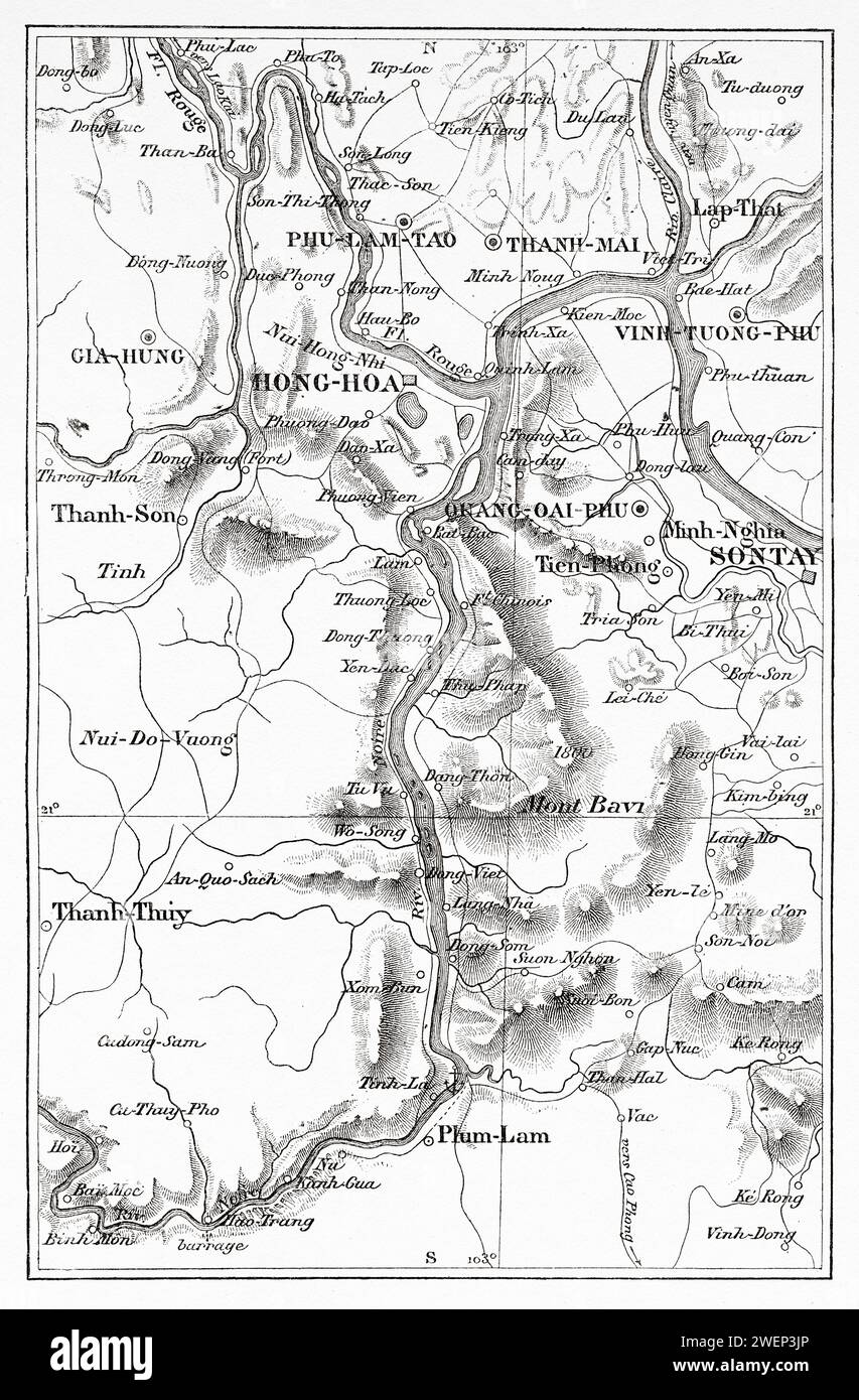 Map of the Than-mai region and the Black River, Vietnam, Indochina, Asia. Thirty months in Tonkin 1885 by Doctor Charles Edouard Hocquard (1853 - 1911) Stock Photohttps://www.alamy.com/image-license-details/?v=1https://www.alamy.com/map-of-the-than-mai-region-and-the-black-river-vietnam-indochina-asia-thirty-months-in-tonkin-1885-by-doctor-charles-edouard-hocquard-1853-1911-image594243518.html
RM2WEP3JP–Map of the Than-mai region and the Black River, Vietnam, Indochina, Asia. Thirty months in Tonkin 1885 by Doctor Charles Edouard Hocquard (1853 - 1911)
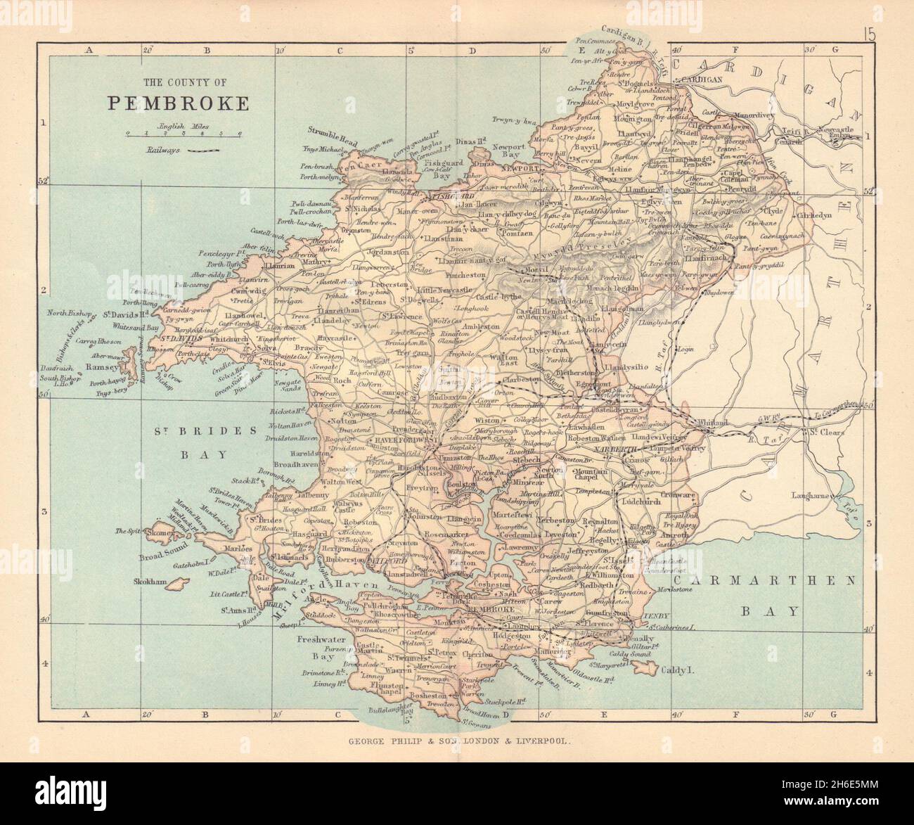 PEMBROKESHIRE County of Pembroke Haverfordwest Tenby Wales BARTHOLOMEW 1885 map Stock Photohttps://www.alamy.com/image-license-details/?v=1https://www.alamy.com/pembrokeshire-county-of-pembroke-haverfordwest-tenby-wales-bartholomew-1885-map-image451469332.html
RF2H6E5MM–PEMBROKESHIRE County of Pembroke Haverfordwest Tenby Wales BARTHOLOMEW 1885 map
 19th century Map of the Harbour of Havana, Cuba Stock Photohttps://www.alamy.com/image-license-details/?v=1https://www.alamy.com/19th-century-map-of-the-harbour-of-havana-cuba-image504915314.html
RM2M9CTHP–19th century Map of the Harbour of Havana, Cuba
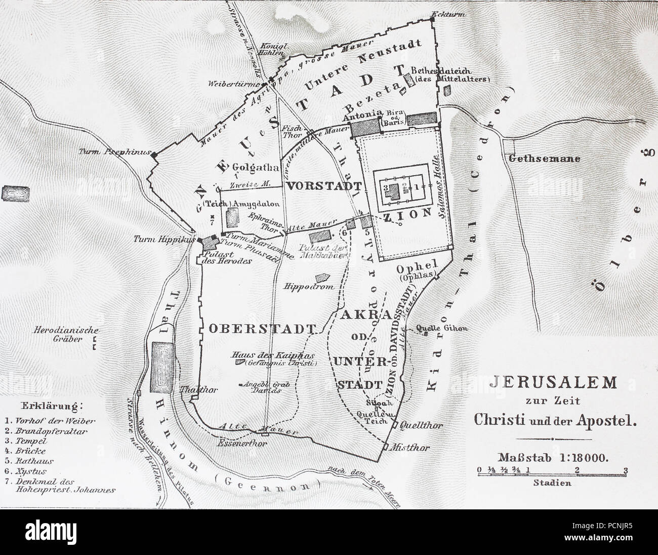 map of Jerusalem at the time of Jesus Christ, digital improved reproduction of an historical image from the year 1885 Stock Photohttps://www.alamy.com/image-license-details/?v=1https://www.alamy.com/map-of-jerusalem-at-the-time-of-jesus-christ-digital-improved-reproduction-of-an-historical-image-from-the-year-1885-image214376041.html
RFPCNJR5–map of Jerusalem at the time of Jesus Christ, digital improved reproduction of an historical image from the year 1885
 Portuguese East Africa and German East Africa Map 1885 with markings of missions from the book ' The history of the Universities' Mission to Central Africa, 1859-1898 ' by Anne Elizabeth Mary Anderson Morshead, Universities' Mission to Central Africa 1899 Stock Photohttps://www.alamy.com/image-license-details/?v=1https://www.alamy.com/portuguese-east-africa-and-german-east-africa-map-1885-with-markings-of-missions-from-the-book-the-history-of-the-universities-mission-to-central-africa-1859-1898-by-anne-elizabeth-mary-anderson-morshead-universities-mission-to-central-africa-1899-image456333969.html
RF2HEBPHN–Portuguese East Africa and German East Africa Map 1885 with markings of missions from the book ' The history of the Universities' Mission to Central Africa, 1859-1898 ' by Anne Elizabeth Mary Anderson Morshead, Universities' Mission to Central Africa 1899
 Finest in the World 1885 Stock Photohttps://www.alamy.com/image-license-details/?v=1https://www.alamy.com/finest-in-the-world-1885-image402624214.html
RM2EB1386–Finest in the World 1885
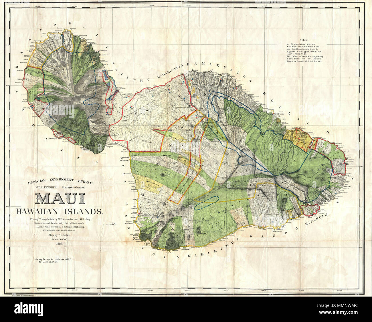 . English: This very large, rare, and extraordinary 1885 map of the island of Maui, Hawaii, was prepared for the 1906 Report of the Governor of the Territory of Hawaii to the Secretary of the Interior. Covers the entire island in stupendous detail. Though the cartographic work that produced this map was started in 1885, during the Hawaiian Monarchy, the map itself, and the report that contained it, was issued following the U.S. Government’s 1898 annexation of the Hawaiian Republic. The Report was an attempt to assess and examine the newly created Hawaiian Territory’s potential for proper admi Stock Photohttps://www.alamy.com/image-license-details/?v=1https://www.alamy.com/english-this-very-large-rare-and-extraordinary-1885-map-of-the-island-of-maui-hawaii-was-prepared-for-the-1906-report-of-the-governor-of-the-territory-of-hawaii-to-the-secretary-of-the-interior-covers-the-entire-island-in-stupendous-detail-though-the-cartographic-work-that-produced-this-map-was-started-in-1885-during-the-hawaiian-monarchy-the-map-itself-and-the-report-that-contained-it-was-issued-following-the-us-governments-1898-annexation-of-the-hawaiian-republic-the-report-was-an-attempt-to-assess-and-examine-the-newly-created-hawaiian-territorys-potential-for-proper-admi-image184877964.html
RMMMNWMC–. English: This very large, rare, and extraordinary 1885 map of the island of Maui, Hawaii, was prepared for the 1906 Report of the Governor of the Territory of Hawaii to the Secretary of the Interior. Covers the entire island in stupendous detail. Though the cartographic work that produced this map was started in 1885, during the Hawaiian Monarchy, the map itself, and the report that contained it, was issued following the U.S. Government’s 1898 annexation of the Hawaiian Republic. The Report was an attempt to assess and examine the newly created Hawaiian Territory’s potential for proper admi
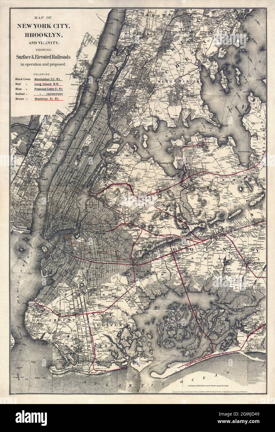 Map of New York City, Brooklyn, and vicinity showing surface & elevated railroads in operation and proposed. By G.W. & C.B. Colton & Co. 1885. Stock Photohttps://www.alamy.com/image-license-details/?v=1https://www.alamy.com/map-of-new-york-city-brooklyn-and-vicinity-showing-surface-elevated-railroads-in-operation-and-proposed-by-gw-cb-colton-co-1885-image446031049.html
RM2GWJD49–Map of New York City, Brooklyn, and vicinity showing surface & elevated railroads in operation and proposed. By G.W. & C.B. Colton & Co. 1885.
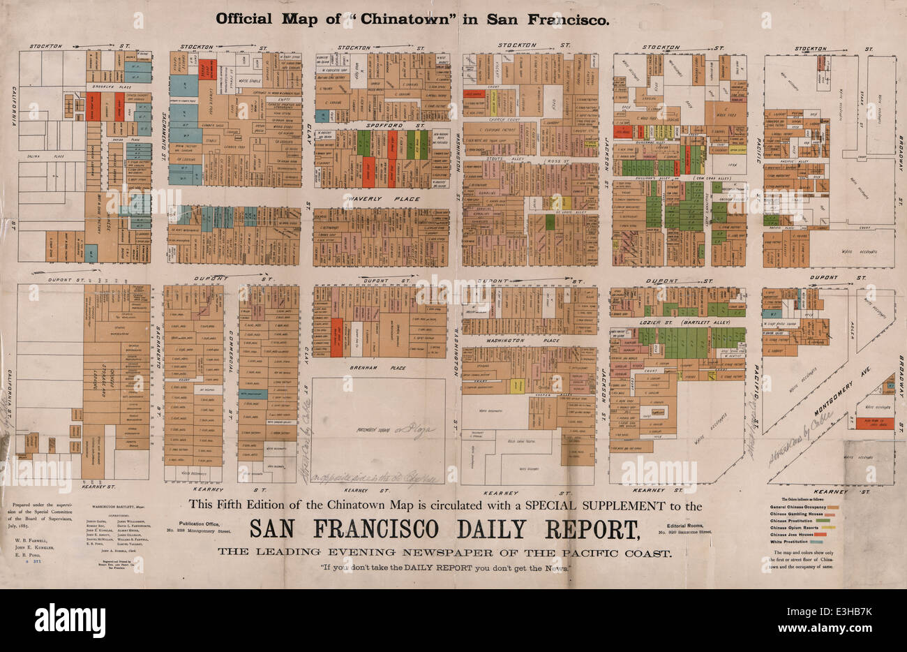 Official map of 'Chinatown' in San Francisco, 1885 Stock Photohttps://www.alamy.com/image-license-details/?v=1https://www.alamy.com/stock-photo-official-map-of-chinatown-in-san-francisco-1885-71067463.html
RME3HB7K–Official map of 'Chinatown' in San Francisco, 1885
 Matthias Uhl Brewery with 5,000 barrel per year capacity in April 1885 map detail, from- Sanborn Fire Insurance Map from Bethlehem, Northampton And Lehigh Counties, Pennsylvania. Stock Photohttps://www.alamy.com/image-license-details/?v=1https://www.alamy.com/matthias-uhl-brewery-with-5000-barrel-per-year-capacity-in-april-1885-map-detail-from-sanborn-fire-insurance-map-from-bethlehem-northampton-and-lehigh-counties-pennsylvania-image398833222.html
RM2E4TBRJ–Matthias Uhl Brewery with 5,000 barrel per year capacity in April 1885 map detail, from- Sanborn Fire Insurance Map from Bethlehem, Northampton And Lehigh Counties, Pennsylvania.
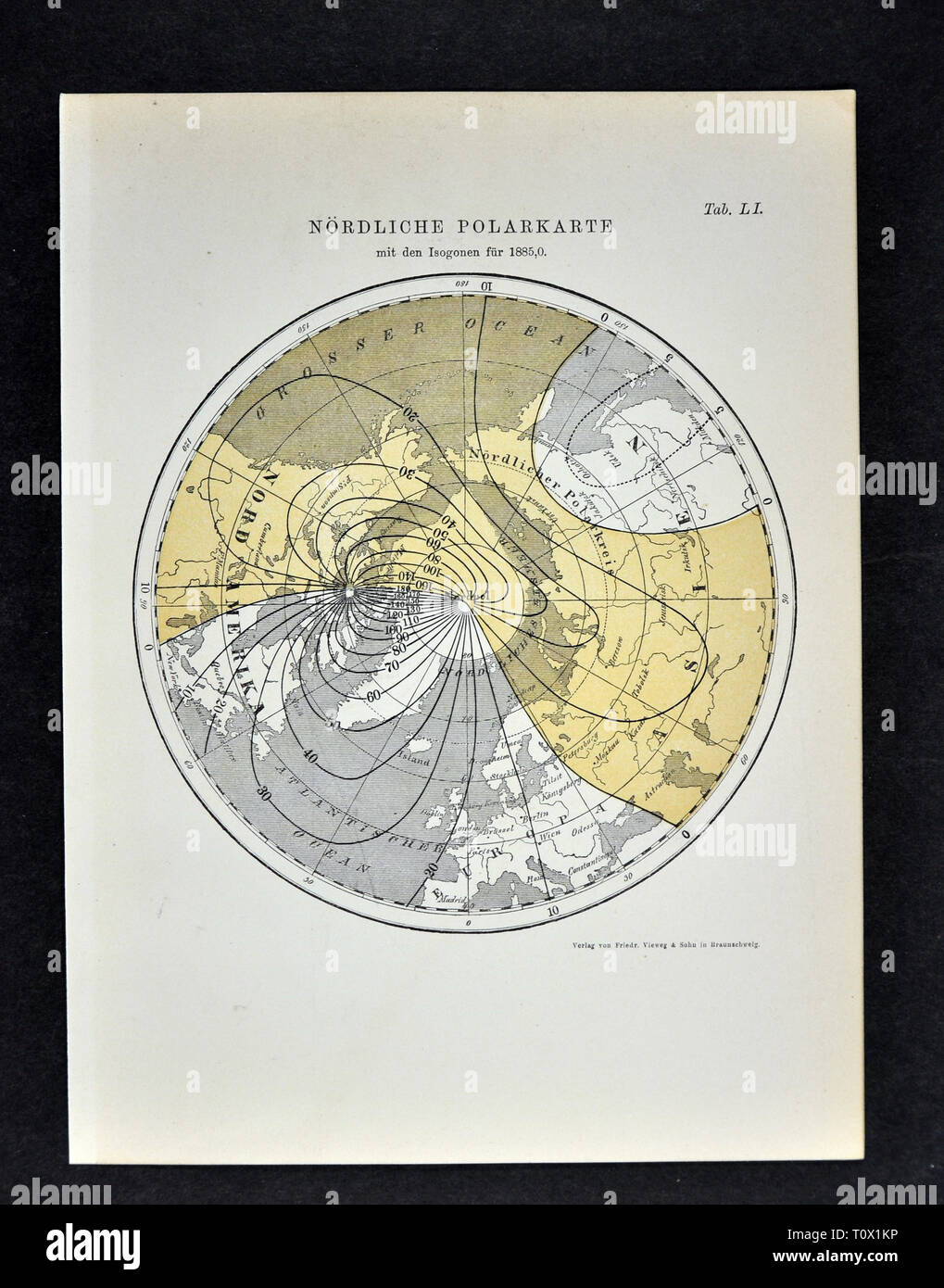 1894 Muller Map of the Arctic South Pole showing the Magnetic Isogonic Lines in the Year 1885 Stock Photohttps://www.alamy.com/image-license-details/?v=1https://www.alamy.com/1894-muller-map-of-the-arctic-south-pole-showing-the-magnetic-isogonic-lines-in-the-year-1885-image241517242.html
RFT0X1KP–1894 Muller Map of the Arctic South Pole showing the Magnetic Isogonic Lines in the Year 1885
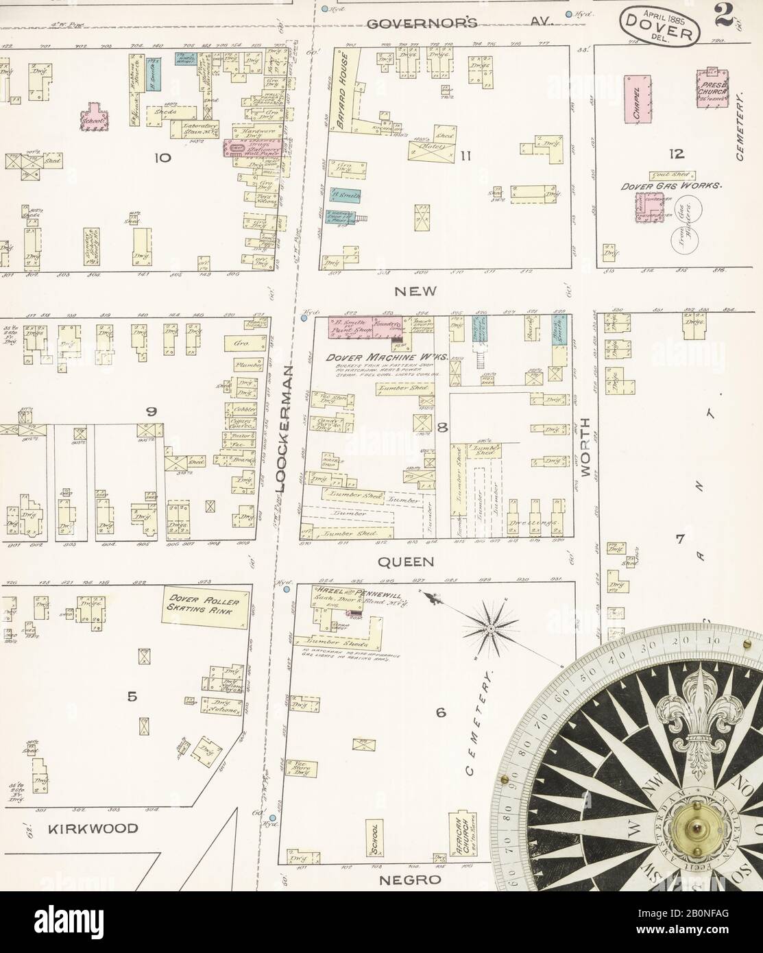 Image 2 of Sanborn Fire Insurance Map from Dover, Kent County, Delaware. Apr 1885. 4 Sheet(s), America, street map with a Nineteenth Century compass Stock Photohttps://www.alamy.com/image-license-details/?v=1https://www.alamy.com/image-2-of-sanborn-fire-insurance-map-from-dover-kent-county-delaware-apr-1885-4-sheets-america-street-map-with-a-nineteenth-century-compass-image344680408.html
RM2B0NFAG–Image 2 of Sanborn Fire Insurance Map from Dover, Kent County, Delaware. Apr 1885. 4 Sheet(s), America, street map with a Nineteenth Century compass
 Map of Florida Showing the Location of Three Leading Winter Resort Hotels, 1885, by J. M. Lee, Leve and Alden Stock Photohttps://www.alamy.com/image-license-details/?v=1https://www.alamy.com/map-of-florida-showing-the-location-of-three-leading-winter-resort-hotels-1885-by-j-m-lee-leve-and-alden-image475040403.html
RF2JGRXTK–Map of Florida Showing the Location of Three Leading Winter Resort Hotels, 1885, by J. M. Lee, Leve and Alden
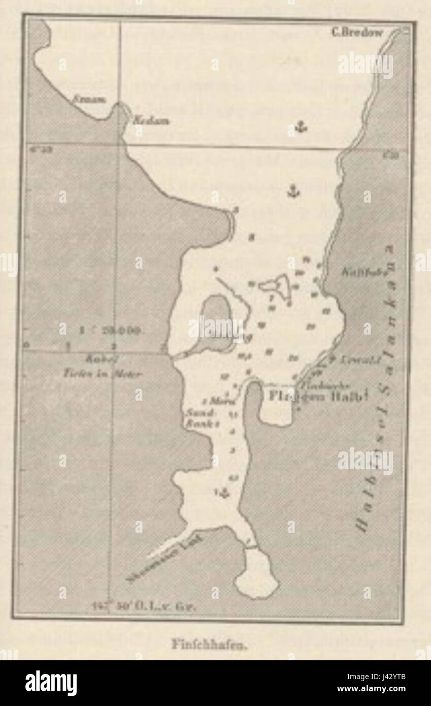 Map of Finschhafen Papua New Guinea 1884 1885 Stock Photohttps://www.alamy.com/image-license-details/?v=1https://www.alamy.com/stock-photo-map-of-finschhafen-papua-new-guinea-1884-1885-140207323.html
RMJ42YTB–Map of Finschhafen Papua New Guinea 1884 1885
 Antique map of York and area in United Kingdom, British Isles, From the book: 'Stanford's Parliamentary County Atlas and Handbook of England and Wales' Published 1885 Stock Photohttps://www.alamy.com/image-license-details/?v=1https://www.alamy.com/antique-map-of-york-and-area-in-united-kingdom-british-isles-from-the-book-stanfords-parliamentary-county-atlas-and-handbook-of-england-and-wales-published-1885-image468883607.html
RM2J6RDR3–Antique map of York and area in United Kingdom, British Isles, From the book: 'Stanford's Parliamentary County Atlas and Handbook of England and Wales' Published 1885
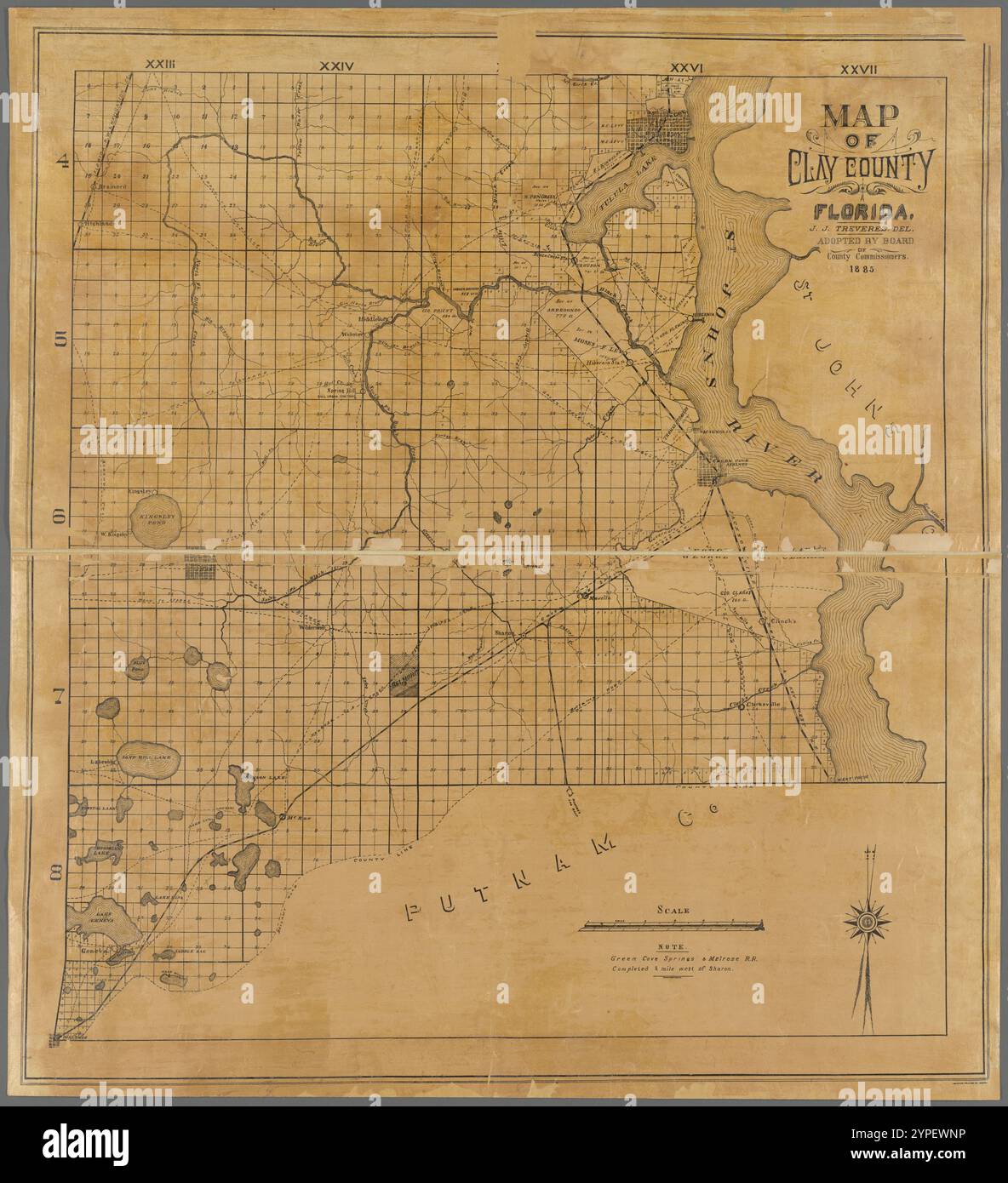 Map of Clay County, Florida 1885 Stock Photohttps://www.alamy.com/image-license-details/?v=1https://www.alamy.com/map-of-clay-county-florida-1885-image633423218.html
RM2YPEWNP–Map of Clay County, Florida 1885
 Map of Italy in the Longobard Period around 650, 1885, historical illustration, Italy Stock Photohttps://www.alamy.com/image-license-details/?v=1https://www.alamy.com/map-of-italy-in-the-longobard-period-around-650-1885-historical-illustration-italy-image259425169.html
RMW21RCH–Map of Italy in the Longobard Period around 650, 1885, historical illustration, Italy
 Vintage Illustrated map. The Congo State and the Free Trade Area, Habenicht Hermann, circa 1885 Stock Photohttps://www.alamy.com/image-license-details/?v=1https://www.alamy.com/vintage-illustrated-map-the-congo-state-and-the-free-trade-area-habenicht-hermann-circa-1885-image617253521.html
RM2XT694H–Vintage Illustrated map. The Congo State and the Free Trade Area, Habenicht Hermann, circa 1885
 (1885) p127 Map of the Cruise from St. Pierre to Georgetown Stock Photohttps://www.alamy.com/image-license-details/?v=1https://www.alamy.com/stock-photo-1885-p127-map-of-the-cruise-from-st-pierre-to-georgetown-74419216.html
RME922D4–(1885) p127 Map of the Cruise from St. Pierre to Georgetown
 Map of areas covered by Albert Tissandier in Utah and Arizona. United States. Drawing by Albert Tissandier. Voyage of Exploration in Utah and Arizona, Kanab and the Kaibab Plateau in 1885. Le Tour du Monde 1886 Stock Photohttps://www.alamy.com/image-license-details/?v=1https://www.alamy.com/map-of-areas-covered-by-albert-tissandier-in-utah-and-arizona-united-states-drawing-by-albert-tissandier-voyage-of-exploration-in-utah-and-arizona-kanab-and-the-kaibab-plateau-in-1885-le-tour-du-monde-1886-image606413762.html
RM2X6GEXA–Map of areas covered by Albert Tissandier in Utah and Arizona. United States. Drawing by Albert Tissandier. Voyage of Exploration in Utah and Arizona, Kanab and the Kaibab Plateau in 1885. Le Tour du Monde 1886
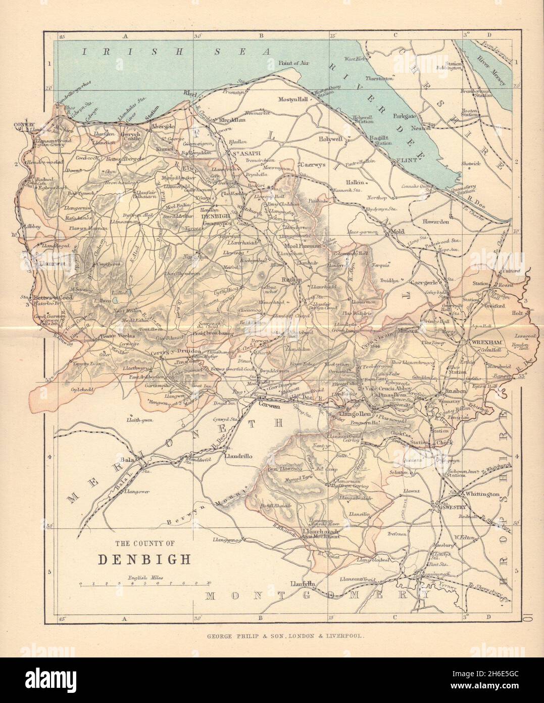 DENBIGHSHIRE 'The County of Denbigh' Wrexham Rhyl Wales BARTHOLOMEW 1885 map Stock Photohttps://www.alamy.com/image-license-details/?v=1https://www.alamy.com/denbighshire-the-county-of-denbigh-wrexham-rhyl-wales-bartholomew-1885-map-image451469212.html
RF2H6E5GC–DENBIGHSHIRE 'The County of Denbigh' Wrexham Rhyl Wales BARTHOLOMEW 1885 map
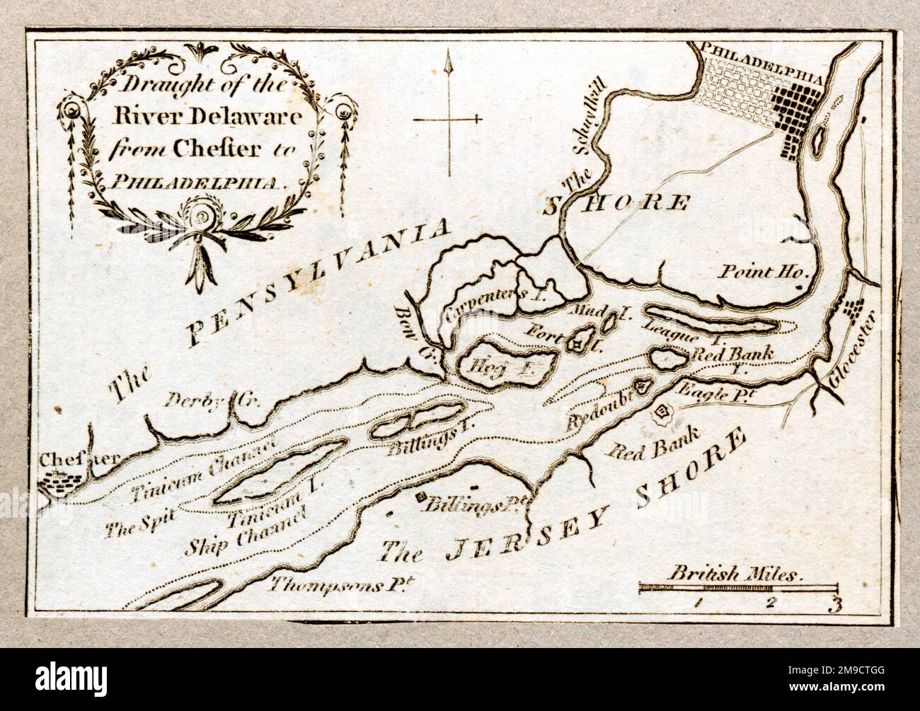 Map Of The Draught Of The River Delaware From Chester To Philadelphia Stock Photohttps://www.alamy.com/image-license-details/?v=1https://www.alamy.com/map-of-the-draught-of-the-river-delaware-from-chester-to-philadelphia-image504915280.html
RM2M9CTGG–Map Of The Draught Of The River Delaware From Chester To Philadelphia
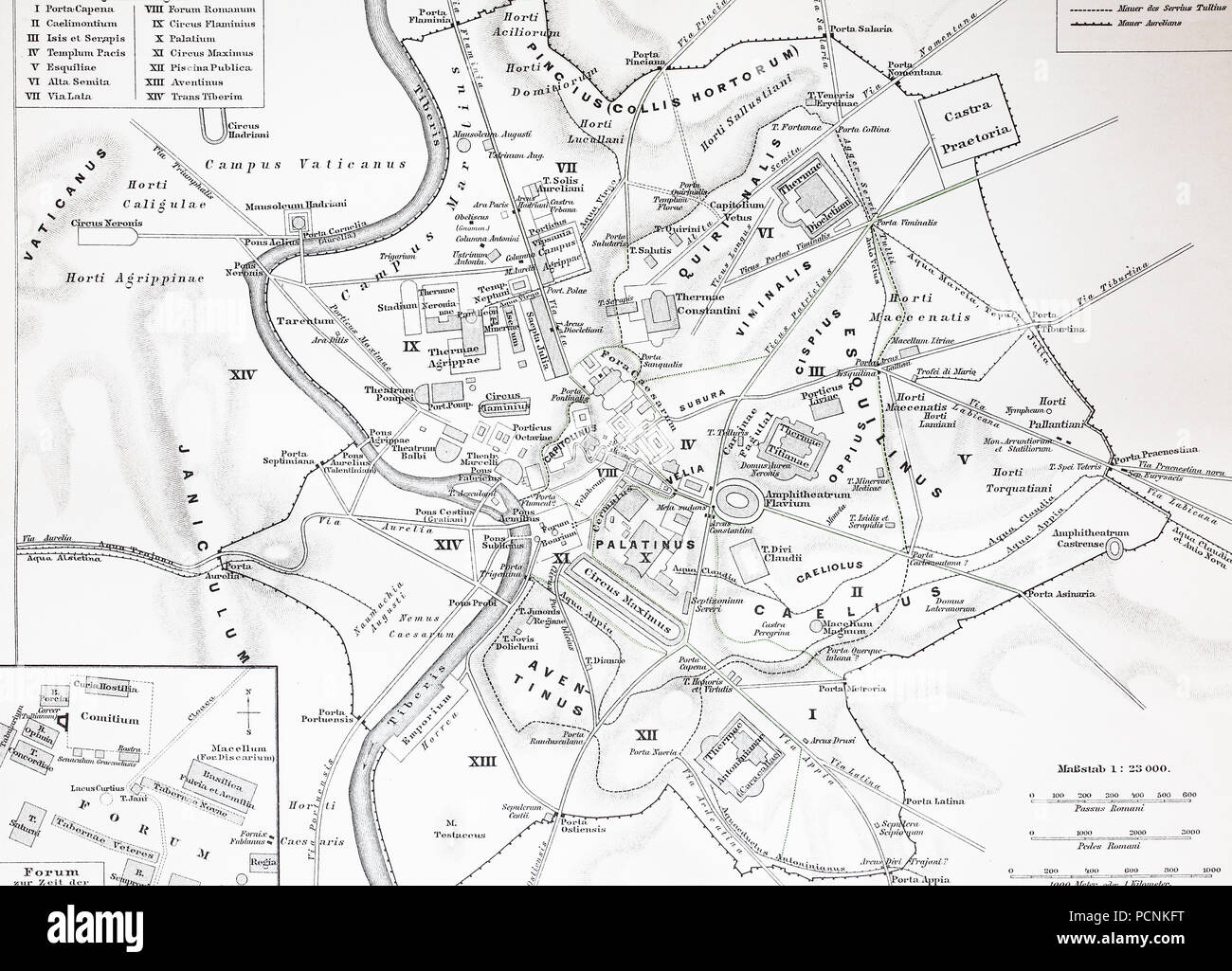 map of the historical Rome, Italy, digital improved reproduction of an historical image from the year 1885 Stock Photohttps://www.alamy.com/image-license-details/?v=1https://www.alamy.com/map-of-the-historical-rome-italy-digital-improved-reproduction-of-an-historical-image-from-the-year-1885-image214376620.html
RFPCNKFT–map of the historical Rome, Italy, digital improved reproduction of an historical image from the year 1885
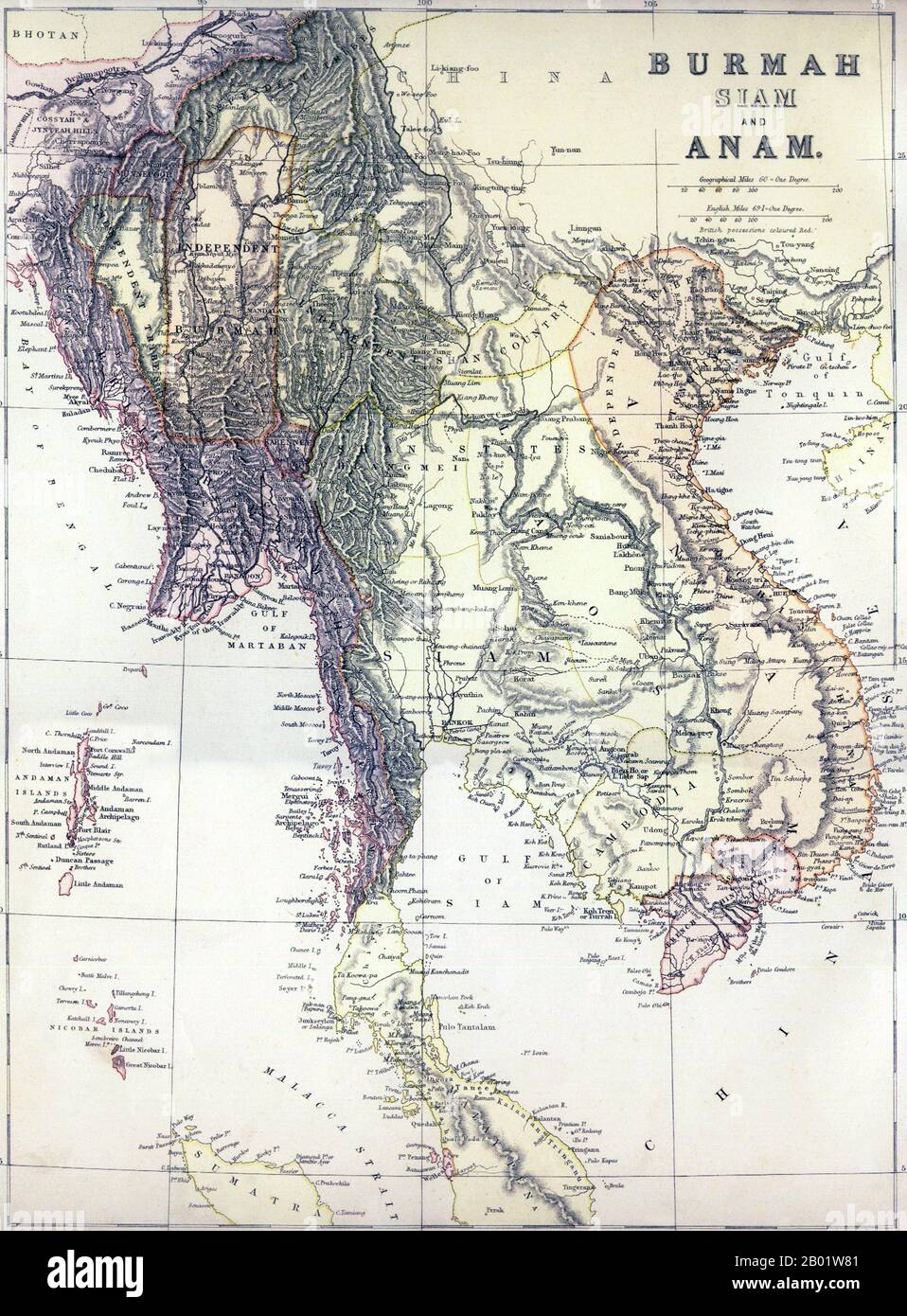 Southeast Asia: 'Burmah, Siam and Anam'. Map of Greater Indochina and the western part of the Malay-Indonesian Archipelago, 1886. A political map of mainland Southeast Asia including Burma, Thailand, Laos, Cambodia and Vietnam, as well as peninsular Malaysia, the Andaman and Nicobar Islands, and part of Sumatra Published, apparently, just before the 3rd Anglo-Burmese War (1885-1886) which would extinguish Burmese independence, it shows 'Independent Burma' in an approximate rectangle around Mandalay. To the east lies the 'Independent Shan Country' encompassing the Burmese Shan States. Stock Photohttps://www.alamy.com/image-license-details/?v=1https://www.alamy.com/southeast-asia-burmah-siam-and-anam-map-of-greater-indochina-and-the-western-part-of-the-malay-indonesian-archipelago-1886-a-political-map-of-mainland-southeast-asia-including-burma-thailand-laos-cambodia-and-vietnam-as-well-as-peninsular-malaysia-the-andaman-and-nicobar-islands-and-part-of-sumatra-published-apparently-just-before-the-3rd-anglo-burmese-war-1885-1886-which-would-extinguish-burmese-independence-it-shows-independent-burma-in-an-approximate-rectangle-around-mandalay-to-the-east-lies-the-independent-shan-country-encompassing-the-burmese-shan-states-image344249137.html
RM2B01W81–Southeast Asia: 'Burmah, Siam and Anam'. Map of Greater Indochina and the western part of the Malay-Indonesian Archipelago, 1886. A political map of mainland Southeast Asia including Burma, Thailand, Laos, Cambodia and Vietnam, as well as peninsular Malaysia, the Andaman and Nicobar Islands, and part of Sumatra Published, apparently, just before the 3rd Anglo-Burmese War (1885-1886) which would extinguish Burmese independence, it shows 'Independent Burma' in an approximate rectangle around Mandalay. To the east lies the 'Independent Shan Country' encompassing the Burmese Shan States.
