Quick filters:
1900s maps Stock Photos and Images
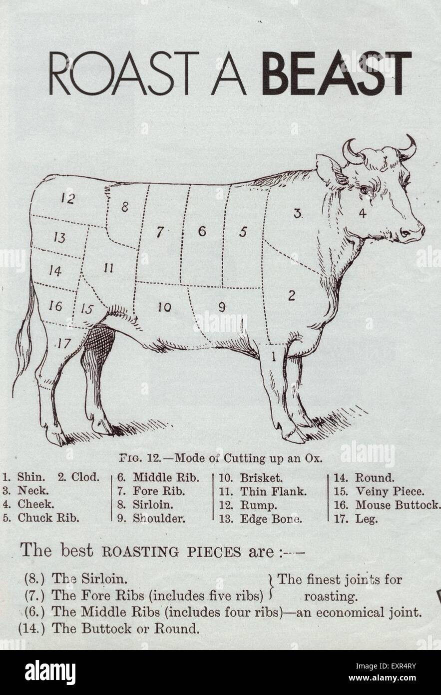 1900s UK Beef Cuts Book Plate Stock Photohttps://www.alamy.com/image-license-details/?v=1https://www.alamy.com/stock-photo-1900s-uk-beef-cuts-book-plate-85331231.html
RMEXR4RY–1900s UK Beef Cuts Book Plate
![[ 1900s Japan - Map of 5th National Industrial Exhibition in Osaka ] — Map of the 5th Domestic Industrial Exhibition (第五回内国勧業博覧会) held in Osaka in 1903 (Meiji 36). 20th century vintage map. Stock Photo [ 1900s Japan - Map of 5th National Industrial Exhibition in Osaka ] — Map of the 5th Domestic Industrial Exhibition (第五回内国勧業博覧会) held in Osaka in 1903 (Meiji 36). 20th century vintage map. Stock Photo](https://c8.alamy.com/comp/WB6BJ4/1900s-japan-map-of-5th-national-industrial-exhibition-in-osaka-map-of-the-5th-domestic-industrial-exhibition-held-in-osaka-in-1903-meiji-36-20th-century-vintage-map-WB6BJ4.jpg) [ 1900s Japan - Map of 5th National Industrial Exhibition in Osaka ] — Map of the 5th Domestic Industrial Exhibition (第五回内国勧業博覧会) held in Osaka in 1903 (Meiji 36). 20th century vintage map. Stock Photohttps://www.alamy.com/image-license-details/?v=1https://www.alamy.com/1900s-japan-map-of-5th-national-industrial-exhibition-in-osaka-map-of-the-5th-domestic-industrial-exhibition-held-in-osaka-in-1903-meiji-36-20th-century-vintage-map-image265057580.html
[ 1900s Japan - Map of 5th National Industrial Exhibition in Osaka ] — Map of the 5th Domestic Industrial Exhibition (第五回内国勧業博覧会) held in Osaka in 1903 (Meiji 36). 20th century vintage map. Stock Photohttps://www.alamy.com/image-license-details/?v=1https://www.alamy.com/1900s-japan-map-of-5th-national-industrial-exhibition-in-osaka-map-of-the-5th-domestic-industrial-exhibition-held-in-osaka-in-1903-meiji-36-20th-century-vintage-map-image265057580.htmlRMWB6BJ4–[ 1900s Japan - Map of 5th National Industrial Exhibition in Osaka ] — Map of the 5th Domestic Industrial Exhibition (第五回内国勧業博覧会) held in Osaka in 1903 (Meiji 36). 20th century vintage map.
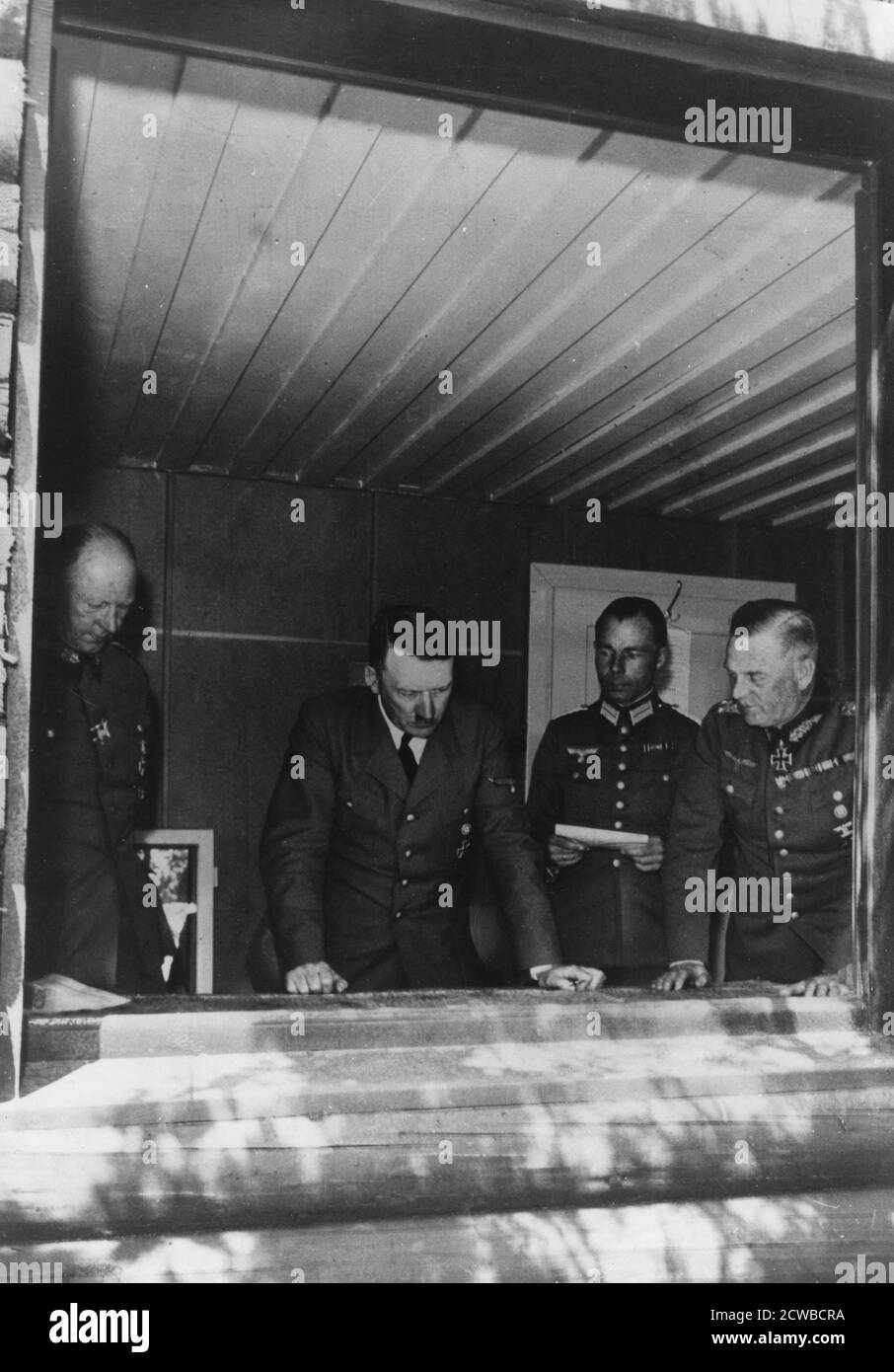 Adolf Hitler during the invasion of France, World War II, 1940. Hitler is shown studying maps at his headquarters flanked by General Alfred Jodl, Chief of Operations Staff, Major Deile and General Wilhelm Keitel. The photographer is unknown. Stock Photohttps://www.alamy.com/image-license-details/?v=1https://www.alamy.com/adolf-hitler-during-the-invasion-of-france-world-war-ii-1940-hitler-is-shown-studying-maps-at-his-headquarters-flanked-by-general-alfred-jodl-chief-of-operations-staff-major-deile-and-general-wilhelm-keitel-the-photographer-is-unknown-image377035662.html
RM2CWBCRA–Adolf Hitler during the invasion of France, World War II, 1940. Hitler is shown studying maps at his headquarters flanked by General Alfred Jodl, Chief of Operations Staff, Major Deile and General Wilhelm Keitel. The photographer is unknown.
RM2BKR98P–[ 1900s Japan - Map of Kanagawa Prefecture ] — Map of Kanagawa Prefecture, printed on Jul 28, 1907 (Meiji 40). At 300 dpi, the largest size available for this map is 84.5MB, with the longest side being 6,277 pixels (53 cm or 21 inches). Please ask us about pricing if you require this large size. 20th century vintage map.
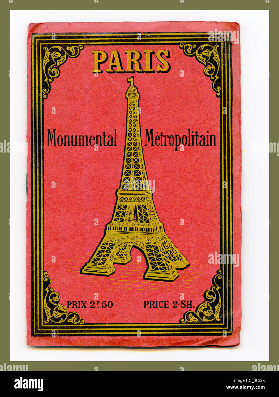
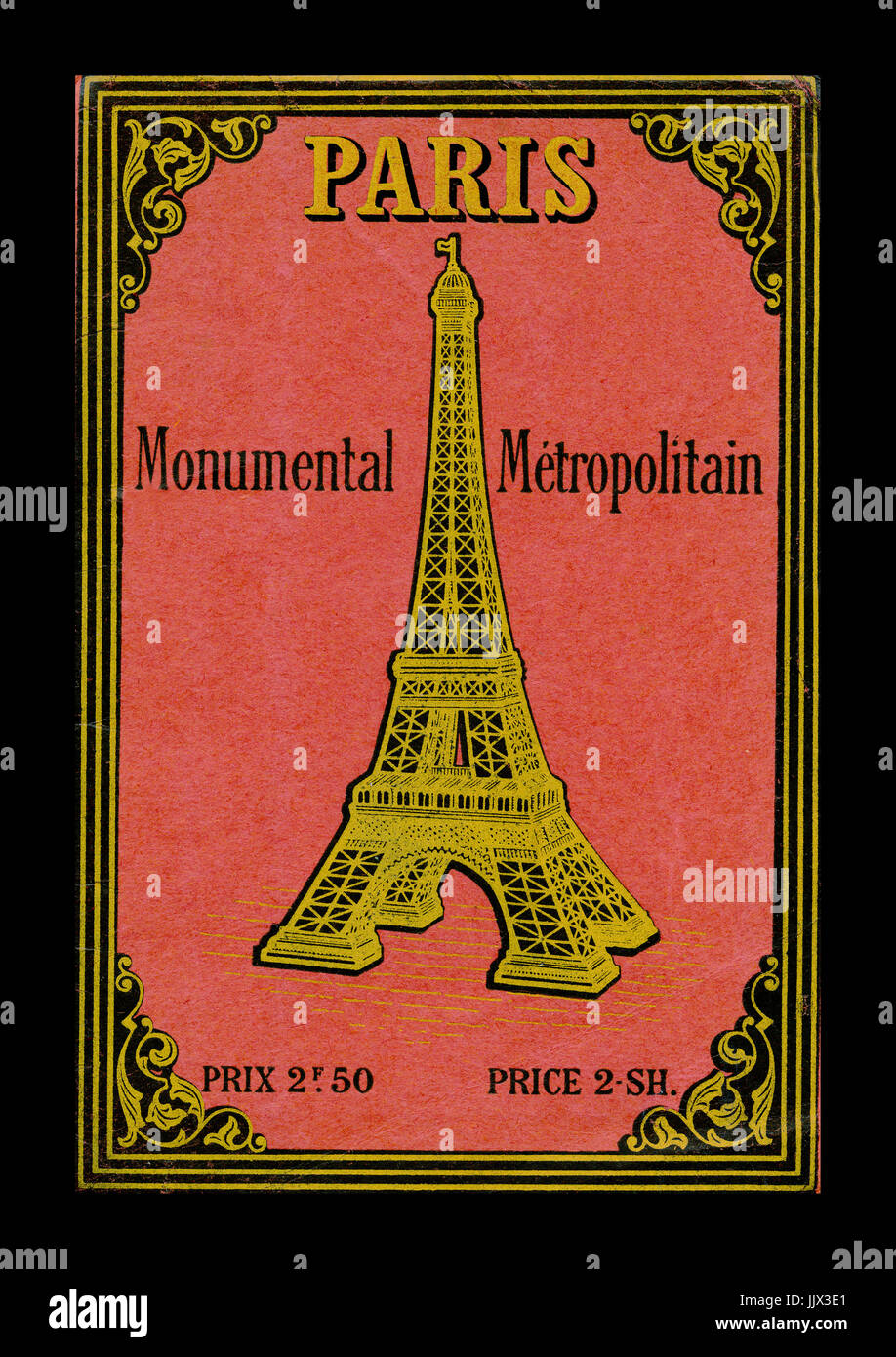 PARIS 1900’s EIFFEL TOWER VINTAGE MONUMENTS MONUMENTAL METROPOLITAN GUIDE MAP Vintage rare 1900's Retro Art Nouveau Monumental Map of Paris France Stock Photohttps://www.alamy.com/image-license-details/?v=1https://www.alamy.com/stock-photo-paris-1900s-eiffel-tower-vintage-monuments-monumental-metropolitan-149320249.html
RMJJX3E1–PARIS 1900’s EIFFEL TOWER VINTAGE MONUMENTS MONUMENTAL METROPOLITAN GUIDE MAP Vintage rare 1900's Retro Art Nouveau Monumental Map of Paris France
![[ 1905s Japan - Map of the Russo-Japanese War ] — Woodblock print map of the Russo-Japanese War (木版刷日露戦闘局面新地図), published in 1905 (Meiji 38). The war took place from 1904 through 1905 and transformed the balance of power in East Asia in favor of Japan. Original dimensions: 79x106 cm. Stock Photo [ 1905s Japan - Map of the Russo-Japanese War ] — Woodblock print map of the Russo-Japanese War (木版刷日露戦闘局面新地図), published in 1905 (Meiji 38). The war took place from 1904 through 1905 and transformed the balance of power in East Asia in favor of Japan. Original dimensions: 79x106 cm. Stock Photo](https://c8.alamy.com/comp/2BMYP0W/1905s-japan-map-of-the-russo-japanese-war-woodblock-print-map-of-the-russo-japanese-war-published-in-1905-meiji-38-the-war-took-place-from-1904-through-1905-and-transformed-the-balance-of-power-in-east-asia-in-favor-of-japan-original-dimensions-79x106-cm-2BMYP0W.jpg) [ 1905s Japan - Map of the Russo-Japanese War ] — Woodblock print map of the Russo-Japanese War (木版刷日露戦闘局面新地図), published in 1905 (Meiji 38). The war took place from 1904 through 1905 and transformed the balance of power in East Asia in favor of Japan. Original dimensions: 79x106 cm. Stock Photohttps://www.alamy.com/image-license-details/?v=1https://www.alamy.com/1905s-japan-map-of-the-russo-japanese-war-woodblock-print-map-of-the-russo-japanese-war-published-in-1905-meiji-38-the-war-took-place-from-1904-through-1905-and-transformed-the-balance-of-power-in-east-asia-in-favor-of-japan-original-dimensions-79x106-cm-image357110457.html
[ 1905s Japan - Map of the Russo-Japanese War ] — Woodblock print map of the Russo-Japanese War (木版刷日露戦闘局面新地図), published in 1905 (Meiji 38). The war took place from 1904 through 1905 and transformed the balance of power in East Asia in favor of Japan. Original dimensions: 79x106 cm. Stock Photohttps://www.alamy.com/image-license-details/?v=1https://www.alamy.com/1905s-japan-map-of-the-russo-japanese-war-woodblock-print-map-of-the-russo-japanese-war-published-in-1905-meiji-38-the-war-took-place-from-1904-through-1905-and-transformed-the-balance-of-power-in-east-asia-in-favor-of-japan-original-dimensions-79x106-cm-image357110457.htmlRM2BMYP0W–[ 1905s Japan - Map of the Russo-Japanese War ] — Woodblock print map of the Russo-Japanese War (木版刷日露戦闘局面新地図), published in 1905 (Meiji 38). The war took place from 1904 through 1905 and transformed the balance of power in East Asia in favor of Japan. Original dimensions: 79x106 cm.
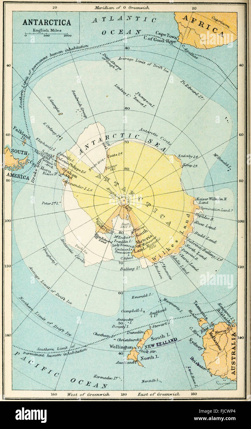 Map of Antarctica, circa 1900 Stock Photohttps://www.alamy.com/image-license-details/?v=1https://www.alamy.com/stock-photo-map-of-antarctica-circa-1900-97399292.html
RMFJCWP4–Map of Antarctica, circa 1900
![[ 1900s Japan - Japanese Rickshaws ] — Rickshaw in front of the Yokohama German Club (established in 1863) on Honcho-dori in Yokohama, Kanagawa Prefecture. On the far right is the Yokohama Post Office. Honcho-dori is also called Honmachi-dori in some sources. Maps of the time, however, use Honcho-dori. 20th century vintage postcard. Stock Photo [ 1900s Japan - Japanese Rickshaws ] — Rickshaw in front of the Yokohama German Club (established in 1863) on Honcho-dori in Yokohama, Kanagawa Prefecture. On the far right is the Yokohama Post Office. Honcho-dori is also called Honmachi-dori in some sources. Maps of the time, however, use Honcho-dori. 20th century vintage postcard. Stock Photo](https://c8.alamy.com/comp/WATMH8/1900s-japan-japanese-rickshaws-rickshaw-in-front-of-the-yokohama-german-club-established-in-1863-on-honcho-dori-in-yokohama-kanagawa-prefecture-on-the-far-right-is-the-yokohama-post-office-honcho-dori-is-also-called-honmachi-dori-in-some-sources-maps-of-the-time-however-use-honcho-dori-20th-century-vintage-postcard-WATMH8.jpg) [ 1900s Japan - Japanese Rickshaws ] — Rickshaw in front of the Yokohama German Club (established in 1863) on Honcho-dori in Yokohama, Kanagawa Prefecture. On the far right is the Yokohama Post Office. Honcho-dori is also called Honmachi-dori in some sources. Maps of the time, however, use Honcho-dori. 20th century vintage postcard. Stock Photohttps://www.alamy.com/image-license-details/?v=1https://www.alamy.com/1900s-japan-japanese-rickshaws-rickshaw-in-front-of-the-yokohama-german-club-established-in-1863-on-honcho-dori-in-yokohama-kanagawa-prefecture-on-the-far-right-is-the-yokohama-post-office-honcho-dori-is-also-called-honmachi-dori-in-some-sources-maps-of-the-time-however-use-honcho-dori-20th-century-vintage-postcard-image264845092.html
[ 1900s Japan - Japanese Rickshaws ] — Rickshaw in front of the Yokohama German Club (established in 1863) on Honcho-dori in Yokohama, Kanagawa Prefecture. On the far right is the Yokohama Post Office. Honcho-dori is also called Honmachi-dori in some sources. Maps of the time, however, use Honcho-dori. 20th century vintage postcard. Stock Photohttps://www.alamy.com/image-license-details/?v=1https://www.alamy.com/1900s-japan-japanese-rickshaws-rickshaw-in-front-of-the-yokohama-german-club-established-in-1863-on-honcho-dori-in-yokohama-kanagawa-prefecture-on-the-far-right-is-the-yokohama-post-office-honcho-dori-is-also-called-honmachi-dori-in-some-sources-maps-of-the-time-however-use-honcho-dori-20th-century-vintage-postcard-image264845092.htmlRMWATMH8–[ 1900s Japan - Japanese Rickshaws ] — Rickshaw in front of the Yokohama German Club (established in 1863) on Honcho-dori in Yokohama, Kanagawa Prefecture. On the far right is the Yokohama Post Office. Honcho-dori is also called Honmachi-dori in some sources. Maps of the time, however, use Honcho-dori. 20th century vintage postcard.
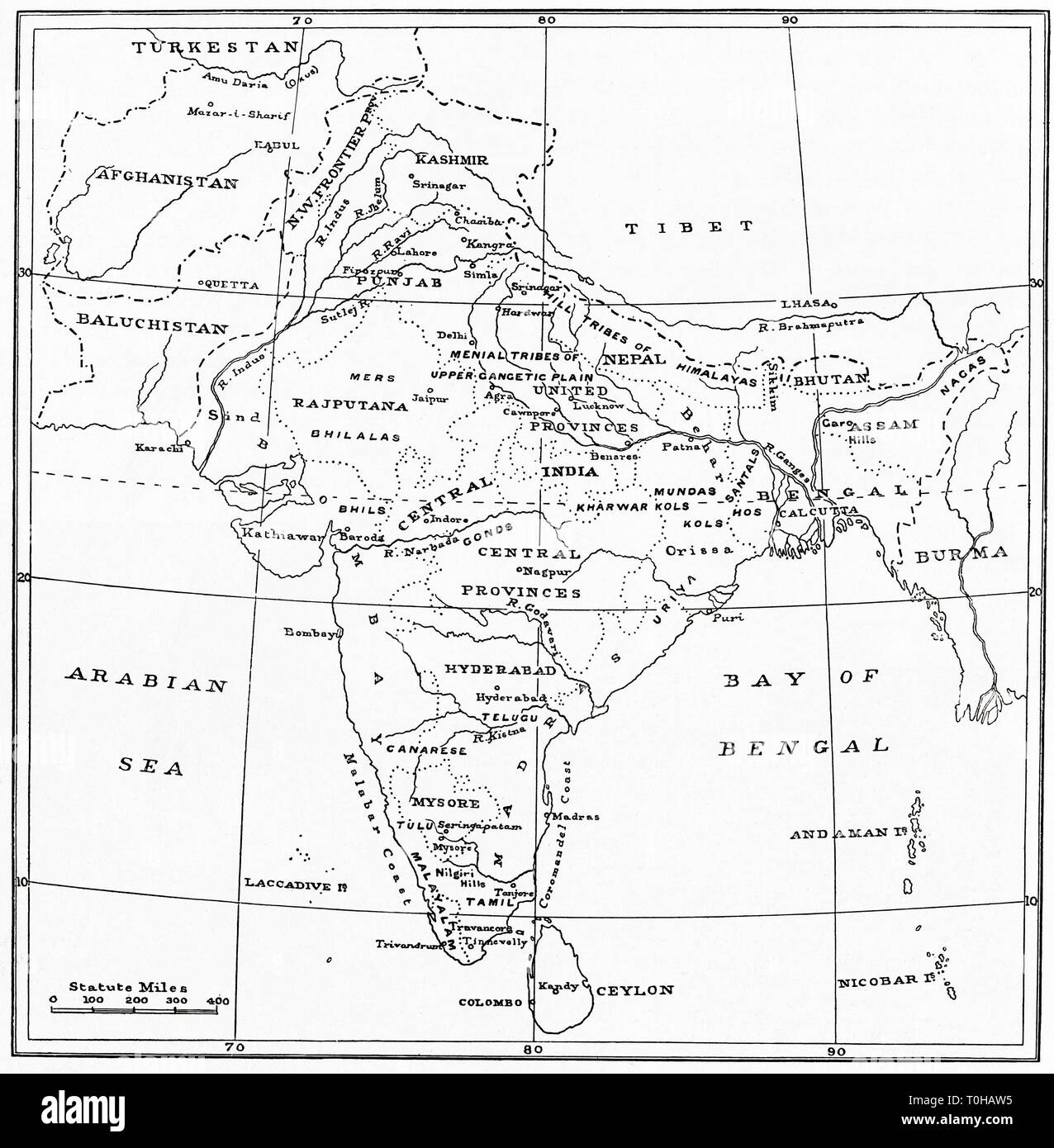 map of India Stock Photohttps://www.alamy.com/image-license-details/?v=1https://www.alamy.com/map-of-india-image241326881.html
RMT0HAW5–map of India
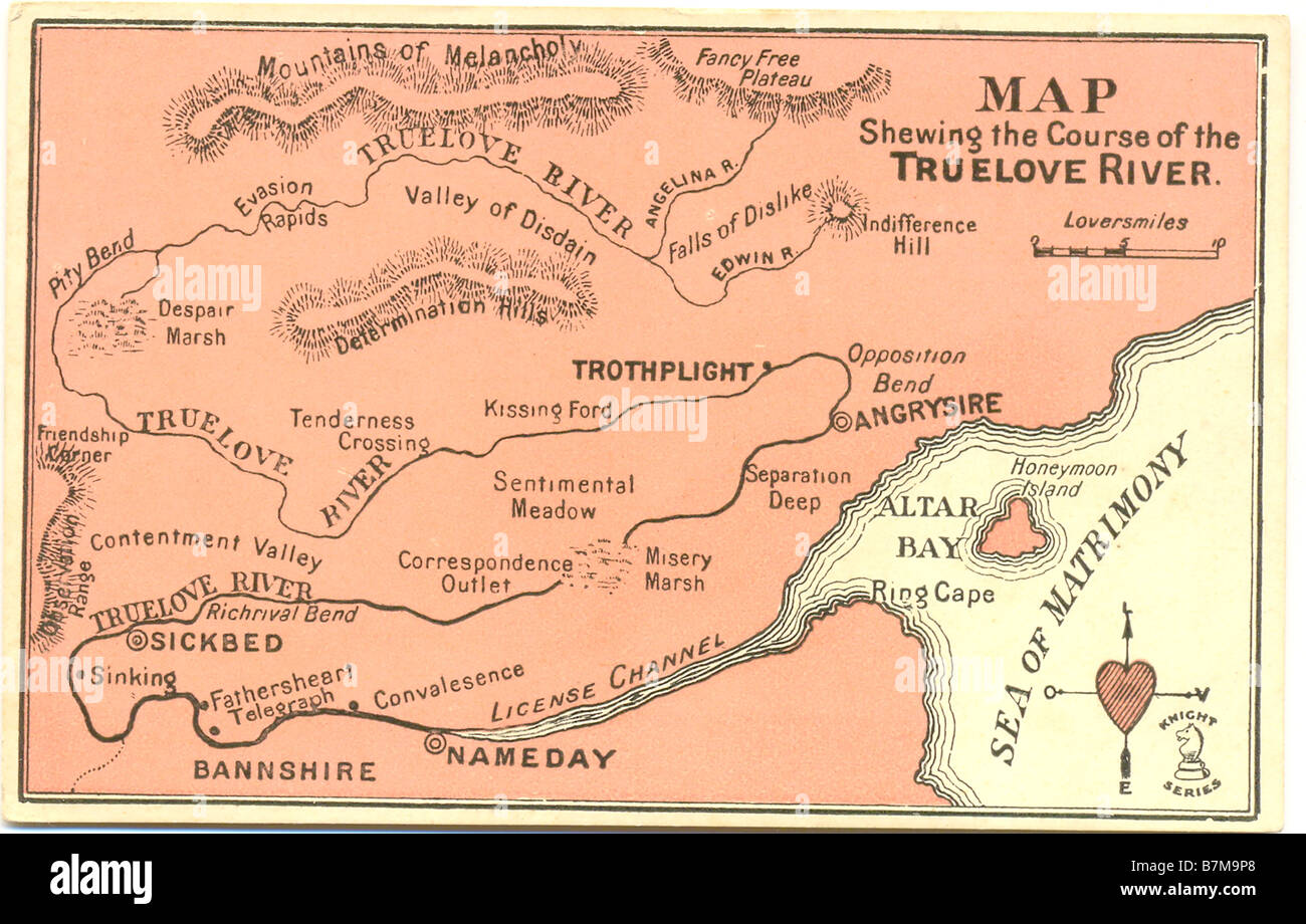 Valentine picture postcard of a map 'Shewing the Course of the Truelove River' circa 1905 Stock Photohttps://www.alamy.com/image-license-details/?v=1https://www.alamy.com/stock-photo-valentine-picture-postcard-of-a-map-shewing-the-course-of-the-truelove-21959680.html
RFB7M9P8–Valentine picture postcard of a map 'Shewing the Course of the Truelove River' circa 1905
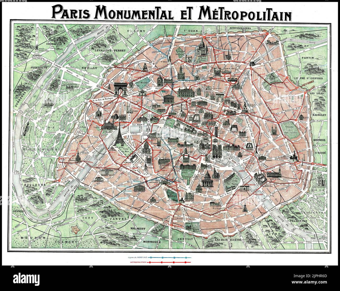 MAP 1930's Paris Monumental et Metropolitain.c. 1932 tourist pocket map of Paris, France. Covers old walled city of Paris and the immediate vicinity. Important buildings are shown in profile, including the Eiffel Tower. Shows both the train and Metro lines throughout the city. subway system and the map's overall style and construction in 1930s Attached to original red paper booklet. Printed by Robelin. Date 1932 Stock Photohttps://www.alamy.com/image-license-details/?v=1https://www.alamy.com/map-1930s-paris-monumental-et-metropolitainc-1932-tourist-pocket-map-of-paris-france-covers-old-walled-city-of-paris-and-the-immediate-vicinity-important-buildings-are-shown-in-profile-including-the-eiffel-tower-shows-both-the-train-and-metro-lines-throughout-the-city-subway-system-and-the-maps-overall-style-and-construction-in-1930s-attached-to-original-red-paper-booklet-printed-by-robelin-date-1932-image478593765.html
RM2JPHR6D–MAP 1930's Paris Monumental et Metropolitain.c. 1932 tourist pocket map of Paris, France. Covers old walled city of Paris and the immediate vicinity. Important buildings are shown in profile, including the Eiffel Tower. Shows both the train and Metro lines throughout the city. subway system and the map's overall style and construction in 1930s Attached to original red paper booklet. Printed by Robelin. Date 1932
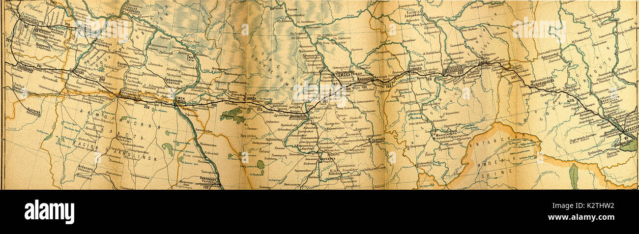 Russia early 1900s Large Trans Siberian Drawn of Railroad Transiberiana Chelabinsk - Baikal Stock Photohttps://www.alamy.com/image-license-details/?v=1https://www.alamy.com/russia-early-1900s-large-trans-siberian-drawn-of-railroad-transiberiana-image156663502.html
RMK2THW2–Russia early 1900s Large Trans Siberian Drawn of Railroad Transiberiana Chelabinsk - Baikal
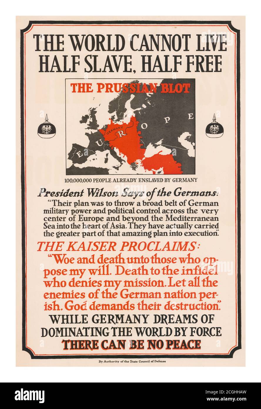 Vintage 1900’s Propaganda Poster ‘The World Cannot Live Half Slave, Half Free. The Prussian Blot’: 100,000,000 People Already Enslaved By Germany. This poster was published by the American State Council of Defense. It displays a pointed threat from the Kaiser and a quote from Wilson about the reach of German ambition. (Wilson's statement is from a speech he gave on Flag Day, June 14, 1917.) Poster displays a map of Europe and Turkey with a large red swath denoting the 'Prussian Blot.' Text includes quotations from President Wilson and Kaiser Wilhelm. Stock Photohttps://www.alamy.com/image-license-details/?v=1https://www.alamy.com/vintage-1900s-propaganda-poster-the-world-cannot-live-half-slave-half-free-the-prussian-blot-100000000-people-already-enslaved-by-germany-this-poster-was-published-by-the-american-state-council-of-defense-it-displays-a-pointed-threat-from-the-kaiser-and-a-quote-from-wilson-about-the-reach-of-german-ambition-wilsons-statement-is-from-a-speech-he-gave-on-flag-day-june-14-1917-poster-displays-a-map-of-europe-and-turkey-with-a-large-red-swath-denoting-the-prussian-blot-text-includes-quotations-from-president-wilson-and-kaiser-wilhelm-image371639041.html
RM2CGHHAW–Vintage 1900’s Propaganda Poster ‘The World Cannot Live Half Slave, Half Free. The Prussian Blot’: 100,000,000 People Already Enslaved By Germany. This poster was published by the American State Council of Defense. It displays a pointed threat from the Kaiser and a quote from Wilson about the reach of German ambition. (Wilson's statement is from a speech he gave on Flag Day, June 14, 1917.) Poster displays a map of Europe and Turkey with a large red swath denoting the 'Prussian Blot.' Text includes quotations from President Wilson and Kaiser Wilhelm.
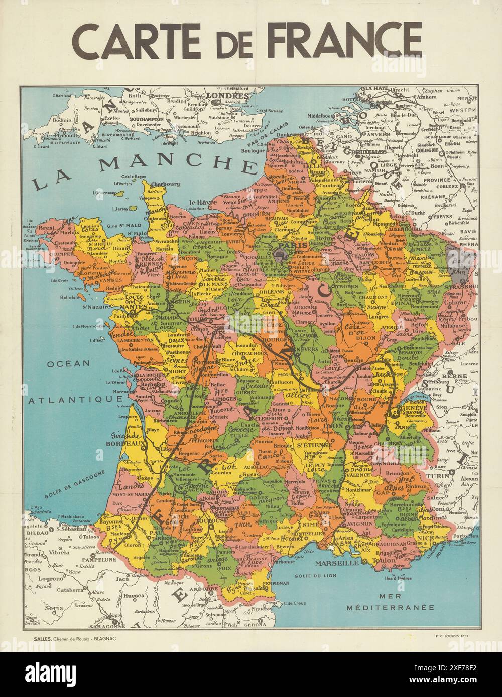 Color french-language map of France, pre-1939 Stock Photohttps://www.alamy.com/image-license-details/?v=1https://www.alamy.com/color-french-language-map-of-france-pre-1939-image611743078.html
RM2XF78F2–Color french-language map of France, pre-1939
 Pictorial key to the view from the roof of the Bodleian Library (Radcliffe Camera), Oxford, showing the principal buildings and the landscape as they appear from the eight divishions formed by the buttresses that support the dome. Stock Photohttps://www.alamy.com/image-license-details/?v=1https://www.alamy.com/stock-photo-pictorial-key-to-the-view-from-the-roof-of-the-bodleian-library-radcliffe-97619134.html
RMFJPX5J–Pictorial key to the view from the roof of the Bodleian Library (Radcliffe Camera), Oxford, showing the principal buildings and the landscape as they appear from the eight divishions formed by the buttresses that support the dome.
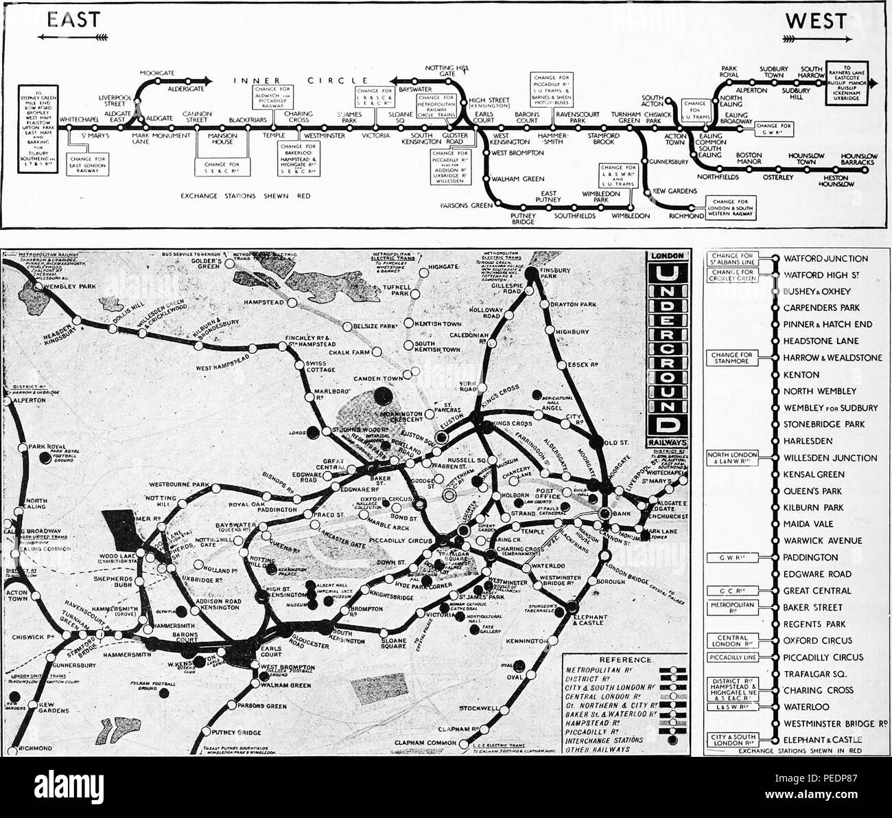 Black and white maps of the London Underground, with the entire underground rail system depicted in the lower register and an 'Inner Circle' line map in the upper register, 1919. Courtesy Internet Archive. () Stock Photohttps://www.alamy.com/image-license-details/?v=1https://www.alamy.com/black-and-white-maps-of-the-london-underground-with-the-entire-underground-rail-system-depicted-in-the-lower-register-and-an-inner-circle-line-map-in-the-upper-register-1919-courtesy-internet-archive-image215432455.html
RMPEDP87–Black and white maps of the London Underground, with the entire underground rail system depicted in the lower register and an 'Inner Circle' line map in the upper register, 1919. Courtesy Internet Archive. ()
 Stock Photohttps://www.alamy.com/image-license-details/?v=1https://www.alamy.com/stock-photo--149264302.html
RMJJRG3X–
 Maps of American Operations in France WW I Stock Photohttps://www.alamy.com/image-license-details/?v=1https://www.alamy.com/maps-of-american-operations-in-france-ww-i-image212184755.html
RMP95RPY–Maps of American Operations in France WW I
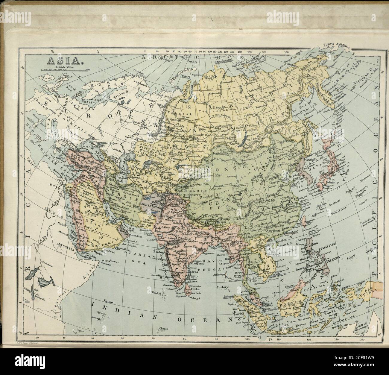 Sandycove Atlas Plate 14 Asia Stock Photohttps://www.alamy.com/image-license-details/?v=1https://www.alamy.com/sandycove-atlas-plate-14-asia-image371143957.html
RM2CFR1W9–Sandycove Atlas Plate 14 Asia
 1900s UK Bovril Magazine Advert Stock Photohttps://www.alamy.com/image-license-details/?v=1https://www.alamy.com/stock-photo-1900s-uk-bovril-magazine-advert-85331117.html
RMEXR4KW–1900s UK Bovril Magazine Advert
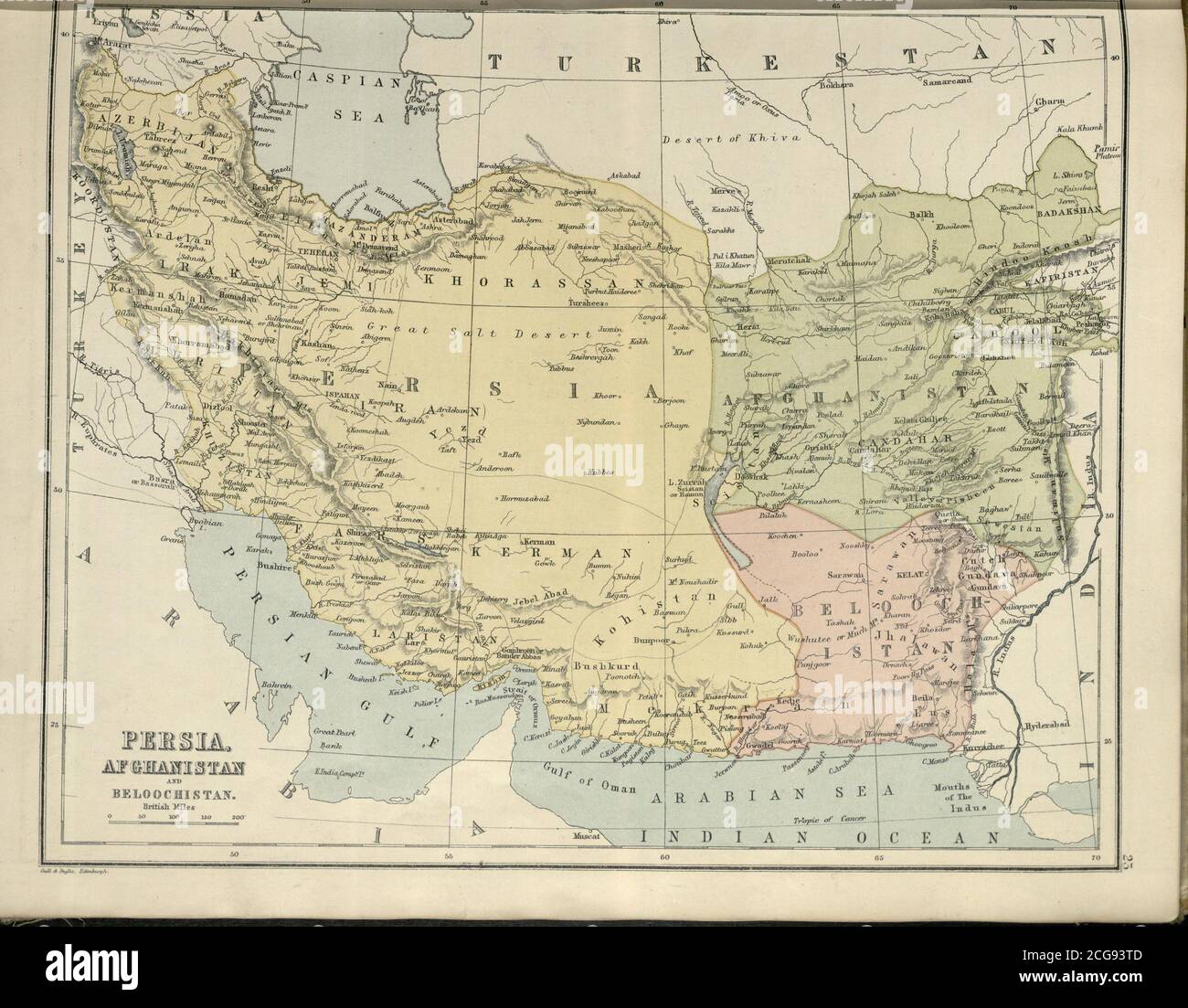 Sandycove Atlas Plate 23 Persia Afghanistan Stock Photohttps://www.alamy.com/image-license-details/?v=1https://www.alamy.com/sandycove-atlas-plate-23-persia-afghanistan-image371452829.html
RM2CG93TD–Sandycove Atlas Plate 23 Persia Afghanistan
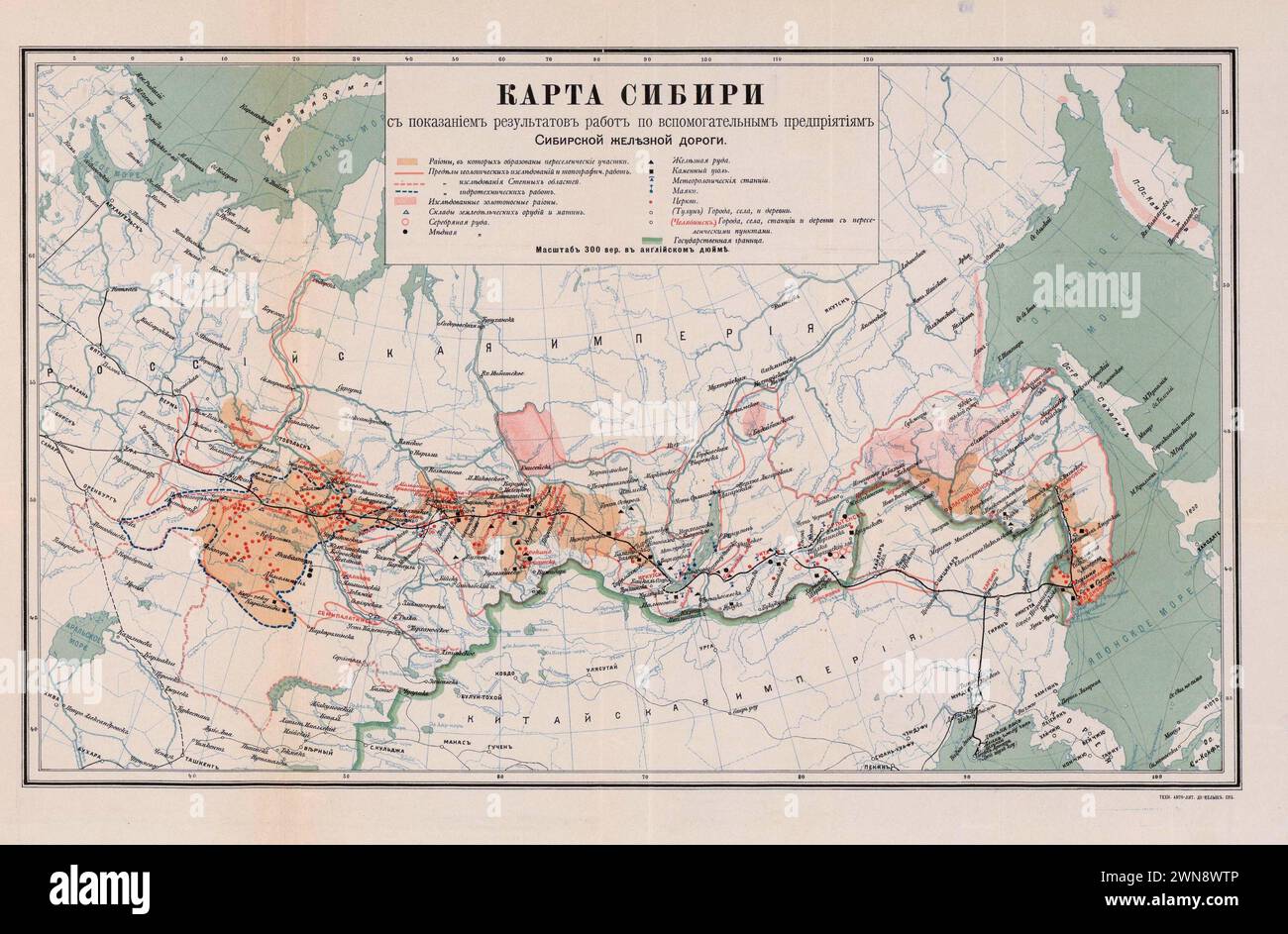 Vintage Russian Map Showing the Trans-Siberian Railroad. 1903 Stock Photohttps://www.alamy.com/image-license-details/?v=1https://www.alamy.com/vintage-russian-map-showing-the-trans-siberian-railroad-1903-image598256198.html
RM2WN8WTP–Vintage Russian Map Showing the Trans-Siberian Railroad. 1903
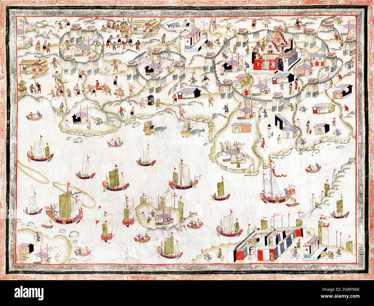 清 佚名 台南地區荷蘭城堡 Forts Zeelandia and Provintia and the City of Tainan (ca. 1900s) by anonymous. Stock Photohttps://www.alamy.com/image-license-details/?v=1https://www.alamy.com/forts-zeelandia-and-provintia-and-the-city-of-tainan-ca-1900s-by-anonymous-image444899803.html
RM2GRPX6K–清 佚名 台南地區荷蘭城堡 Forts Zeelandia and Provintia and the City of Tainan (ca. 1900s) by anonymous.
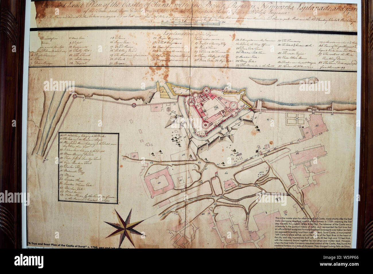 Old Fort plan Surat Gujarat India Asia Stock Photohttps://www.alamy.com/image-license-details/?v=1https://www.alamy.com/old-fort-plan-surat-gujarat-india-asia-image261729166.html
RMW5PP66–Old Fort plan Surat Gujarat India Asia
 . 1895 Sino-Japanese War Report . English: This is a rarely seen Japanese atlas created in the early 1900s to illustrate the first Sino-Japanese War. The First Sino-Japanese War (1 August 1894 – 17 April 1895) was fought between Qing Dynasty China and Meiji Japan over the control of Korea and Taiwan (Formosa). This rarely seen atlas contains 25 maps illustrating various parts of Korea, Shandong and Taiwan. Maps are highly detailed offering both political and topographical information. These maps describe many of the War’s most important battles and battlefields. Only for of these maps are det Stock Photohttps://www.alamy.com/image-license-details/?v=1https://www.alamy.com/1895-sino-japanese-war-report-english-this-is-a-rarely-seen-japanese-atlas-created-in-the-early-1900s-to-illustrate-the-first-sino-japanese-war-the-first-sino-japanese-war-1-august-1894-17-april-1895-was-fought-between-qing-dynasty-china-and-meiji-japan-over-the-control-of-korea-and-taiwan-formosa-this-rarely-seen-atlas-contains-25-maps-illustrating-various-parts-of-korea-shandong-and-taiwan-maps-are-highly-detailed-offering-both-political-and-topographical-information-these-maps-describe-many-of-the-wars-most-important-battles-and-battlefields-only-for-of-these-maps-are-det-image188136020.html
RMMX29BG–. 1895 Sino-Japanese War Report . English: This is a rarely seen Japanese atlas created in the early 1900s to illustrate the first Sino-Japanese War. The First Sino-Japanese War (1 August 1894 – 17 April 1895) was fought between Qing Dynasty China and Meiji Japan over the control of Korea and Taiwan (Formosa). This rarely seen atlas contains 25 maps illustrating various parts of Korea, Shandong and Taiwan. Maps are highly detailed offering both political and topographical information. These maps describe many of the War’s most important battles and battlefields. Only for of these maps are det
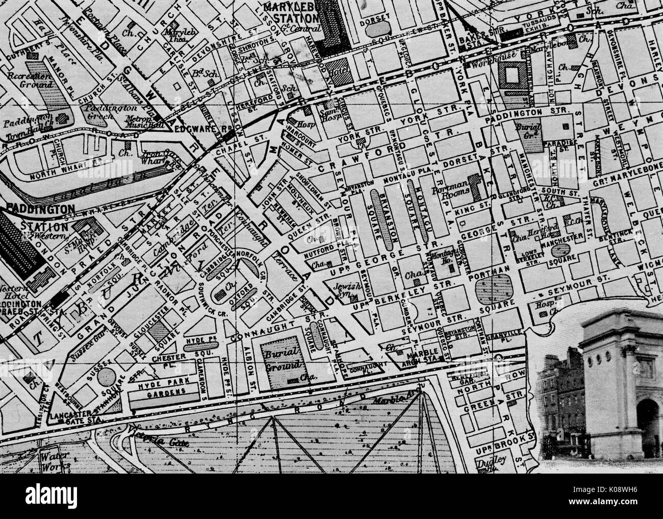 Map of the St Marylebone area, London. Date: circa 1900 Stock Photohttps://www.alamy.com/image-license-details/?v=1https://www.alamy.com/map-of-the-st-marylebone-area-london-date-circa-1900-image155089010.html
RMK08WH6–Map of the St Marylebone area, London. Date: circa 1900
![[ 1900s Japan - Japanese Post Office in Yokohama ] — The Post Office on Honcho-dori in Yokohama, Kanagawa Prefecture. It was designed by Nanajiro Sadate (左立七次郎) in 1889 (Meiji 22) and made of brick. A bicyclist is visible on the street. Honcho-dori is also called Honmachi-dori in some sources. Maps of the time, however, use Honcho-dori. 20th century vintage postcard. Stock Photo [ 1900s Japan - Japanese Post Office in Yokohama ] — The Post Office on Honcho-dori in Yokohama, Kanagawa Prefecture. It was designed by Nanajiro Sadate (左立七次郎) in 1889 (Meiji 22) and made of brick. A bicyclist is visible on the street. Honcho-dori is also called Honmachi-dori in some sources. Maps of the time, however, use Honcho-dori. 20th century vintage postcard. Stock Photo](https://c8.alamy.com/comp/WATNWR/1900s-japan-japanese-post-office-in-yokohama-the-post-office-on-honcho-dori-in-yokohama-kanagawa-prefecture-it-was-designed-by-nanajiro-sadate-in-1889-meiji-22-and-made-of-brick-a-bicyclist-is-visible-on-the-street-honcho-dori-is-also-called-honmachi-dori-in-some-sources-maps-of-the-time-however-use-honcho-dori-20th-century-vintage-postcard-WATNWR.jpg) [ 1900s Japan - Japanese Post Office in Yokohama ] — The Post Office on Honcho-dori in Yokohama, Kanagawa Prefecture. It was designed by Nanajiro Sadate (左立七次郎) in 1889 (Meiji 22) and made of brick. A bicyclist is visible on the street. Honcho-dori is also called Honmachi-dori in some sources. Maps of the time, however, use Honcho-dori. 20th century vintage postcard. Stock Photohttps://www.alamy.com/image-license-details/?v=1https://www.alamy.com/1900s-japan-japanese-post-office-in-yokohama-the-post-office-on-honcho-dori-in-yokohama-kanagawa-prefecture-it-was-designed-by-nanajiro-sadate-in-1889-meiji-22-and-made-of-brick-a-bicyclist-is-visible-on-the-street-honcho-dori-is-also-called-honmachi-dori-in-some-sources-maps-of-the-time-however-use-honcho-dori-20th-century-vintage-postcard-image264846115.html
[ 1900s Japan - Japanese Post Office in Yokohama ] — The Post Office on Honcho-dori in Yokohama, Kanagawa Prefecture. It was designed by Nanajiro Sadate (左立七次郎) in 1889 (Meiji 22) and made of brick. A bicyclist is visible on the street. Honcho-dori is also called Honmachi-dori in some sources. Maps of the time, however, use Honcho-dori. 20th century vintage postcard. Stock Photohttps://www.alamy.com/image-license-details/?v=1https://www.alamy.com/1900s-japan-japanese-post-office-in-yokohama-the-post-office-on-honcho-dori-in-yokohama-kanagawa-prefecture-it-was-designed-by-nanajiro-sadate-in-1889-meiji-22-and-made-of-brick-a-bicyclist-is-visible-on-the-street-honcho-dori-is-also-called-honmachi-dori-in-some-sources-maps-of-the-time-however-use-honcho-dori-20th-century-vintage-postcard-image264846115.htmlRMWATNWR–[ 1900s Japan - Japanese Post Office in Yokohama ] — The Post Office on Honcho-dori in Yokohama, Kanagawa Prefecture. It was designed by Nanajiro Sadate (左立七次郎) in 1889 (Meiji 22) and made of brick. A bicyclist is visible on the street. Honcho-dori is also called Honmachi-dori in some sources. Maps of the time, however, use Honcho-dori. 20th century vintage postcard.
 PARIS HISTORIC OLD GUIDE MAP MONUMENTS Vintage rare 1900's Retro Art Nouveau Monumental Map of Paris on old wooden desk top Stock Photohttps://www.alamy.com/image-license-details/?v=1https://www.alamy.com/stock-photo-paris-historic-old-guide-map-monuments-vintage-rare-1900s-retro-art-138023300.html
RMJ0FE3G–PARIS HISTORIC OLD GUIDE MAP MONUMENTS Vintage rare 1900's Retro Art Nouveau Monumental Map of Paris on old wooden desk top
![[ 1900s Japan - Map of Japan ] — Beautifully colored German map of Japan and Korea published in Meyers (Grosses) Konversations-Lexikon 6.Auflage. This sixth edition of the innovative German encyclopedia was published between 1902-1908 and 1920. 20th century vintage map. Stock Photo [ 1900s Japan - Map of Japan ] — Beautifully colored German map of Japan and Korea published in Meyers (Grosses) Konversations-Lexikon 6.Auflage. This sixth edition of the innovative German encyclopedia was published between 1902-1908 and 1920. 20th century vintage map. Stock Photo](https://c8.alamy.com/comp/WB4MR5/1900s-japan-map-of-japan-beautifully-colored-german-map-of-japan-and-korea-published-in-meyers-grosses-konversations-lexikon-6auflage-this-sixth-edition-of-the-innovative-german-encyclopedia-was-published-between-1902-1908-and-1920-20th-century-vintage-map-WB4MR5.jpg) [ 1900s Japan - Map of Japan ] — Beautifully colored German map of Japan and Korea published in Meyers (Grosses) Konversations-Lexikon 6.Auflage. This sixth edition of the innovative German encyclopedia was published between 1902-1908 and 1920. 20th century vintage map. Stock Photohttps://www.alamy.com/image-license-details/?v=1https://www.alamy.com/1900s-japan-map-of-japan-beautifully-colored-german-map-of-japan-and-korea-published-in-meyers-grosses-konversations-lexikon-6auflage-this-sixth-edition-of-the-innovative-german-encyclopedia-was-published-between-1902-1908-and-1920-20th-century-vintage-map-image265020873.html
[ 1900s Japan - Map of Japan ] — Beautifully colored German map of Japan and Korea published in Meyers (Grosses) Konversations-Lexikon 6.Auflage. This sixth edition of the innovative German encyclopedia was published between 1902-1908 and 1920. 20th century vintage map. Stock Photohttps://www.alamy.com/image-license-details/?v=1https://www.alamy.com/1900s-japan-map-of-japan-beautifully-colored-german-map-of-japan-and-korea-published-in-meyers-grosses-konversations-lexikon-6auflage-this-sixth-edition-of-the-innovative-german-encyclopedia-was-published-between-1902-1908-and-1920-20th-century-vintage-map-image265020873.htmlRMWB4MR5–[ 1900s Japan - Map of Japan ] — Beautifully colored German map of Japan and Korea published in Meyers (Grosses) Konversations-Lexikon 6.Auflage. This sixth edition of the innovative German encyclopedia was published between 1902-1908 and 1920. 20th century vintage map.
 PARIS Vintage 1900's Retro Monumental Map of Paris priced in old French Francs at 2f.50 with old magnifying glass on old wooden desk top Stock Photohttps://www.alamy.com/image-license-details/?v=1https://www.alamy.com/stock-photo-paris-vintage-1900s-retro-monumental-map-of-paris-priced-in-old-french-138022987.html
RMJ0FDMB–PARIS Vintage 1900's Retro Monumental Map of Paris priced in old French Francs at 2f.50 with old magnifying glass on old wooden desk top
![[ 1900s Japan - Main Shopping Street in Yokohama ] — A man pulls a rickshaw in front of shops in Honcho-dori in Yokohama, Kanagawa Prefecture. In the back the Bluff at Yamate can be seen. Honcho-dori is also called Honmachi-dori in some sources. Maps of the time, however, use Honcho-dori. 20th century vintage postcard. Stock Photo [ 1900s Japan - Main Shopping Street in Yokohama ] — A man pulls a rickshaw in front of shops in Honcho-dori in Yokohama, Kanagawa Prefecture. In the back the Bluff at Yamate can be seen. Honcho-dori is also called Honmachi-dori in some sources. Maps of the time, however, use Honcho-dori. 20th century vintage postcard. Stock Photo](https://c8.alamy.com/comp/W5XKGE/1900s-japan-main-shopping-street-in-yokohama-a-man-pulls-a-rickshaw-in-front-of-shops-in-honcho-dori-in-yokohama-kanagawa-prefecture-in-the-back-the-bluff-at-yamate-can-be-seen-honcho-dori-is-also-called-honmachi-dori-in-some-sources-maps-of-the-time-however-use-honcho-dori-20th-century-vintage-postcard-W5XKGE.jpg) [ 1900s Japan - Main Shopping Street in Yokohama ] — A man pulls a rickshaw in front of shops in Honcho-dori in Yokohama, Kanagawa Prefecture. In the back the Bluff at Yamate can be seen. Honcho-dori is also called Honmachi-dori in some sources. Maps of the time, however, use Honcho-dori. 20th century vintage postcard. Stock Photohttps://www.alamy.com/image-license-details/?v=1https://www.alamy.com/1900s-japan-main-shopping-street-in-yokohama-a-man-pulls-a-rickshaw-in-front-of-shops-in-honcho-dori-in-yokohama-kanagawa-prefecture-in-the-back-the-bluff-at-yamate-can-be-seen-honcho-dori-is-also-called-honmachi-dori-in-some-sources-maps-of-the-time-however-use-honcho-dori-20th-century-vintage-postcard-image261814910.html
[ 1900s Japan - Main Shopping Street in Yokohama ] — A man pulls a rickshaw in front of shops in Honcho-dori in Yokohama, Kanagawa Prefecture. In the back the Bluff at Yamate can be seen. Honcho-dori is also called Honmachi-dori in some sources. Maps of the time, however, use Honcho-dori. 20th century vintage postcard. Stock Photohttps://www.alamy.com/image-license-details/?v=1https://www.alamy.com/1900s-japan-main-shopping-street-in-yokohama-a-man-pulls-a-rickshaw-in-front-of-shops-in-honcho-dori-in-yokohama-kanagawa-prefecture-in-the-back-the-bluff-at-yamate-can-be-seen-honcho-dori-is-also-called-honmachi-dori-in-some-sources-maps-of-the-time-however-use-honcho-dori-20th-century-vintage-postcard-image261814910.htmlRMW5XKGE–[ 1900s Japan - Main Shopping Street in Yokohama ] — A man pulls a rickshaw in front of shops in Honcho-dori in Yokohama, Kanagawa Prefecture. In the back the Bluff at Yamate can be seen. Honcho-dori is also called Honmachi-dori in some sources. Maps of the time, however, use Honcho-dori. 20th century vintage postcard.
RF2J8RNA1–Madison Square 1909 The iconography of Manhattan Island, 1498-1909 compiled from original sources and illustrated by photo-intaglio reproductions of important maps, plans, views, and documents in public and private collections - Volume 3 by Isaac Newton Phelps Stokes, Publisher New York : Robert H. Dodd 1918
 Vintage maps of England and Wales Annual Temperature and Mean Annual Rainfall 1900s. Stock Photohttps://www.alamy.com/image-license-details/?v=1https://www.alamy.com/vintage-maps-of-england-and-wales-annual-temperature-and-mean-annual-rainfall-1900s-image385257694.html
RF2DAP03A–Vintage maps of England and Wales Annual Temperature and Mean Annual Rainfall 1900s.
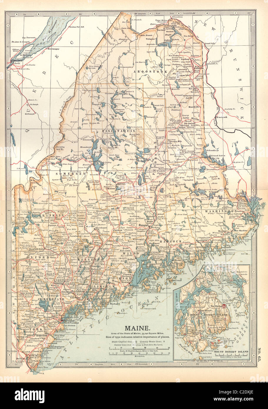 Map of Maine Stock Photohttps://www.alamy.com/image-license-details/?v=1https://www.alamy.com/stock-photo-map-of-maine-35956326.html
RMC2DXJE–Map of Maine
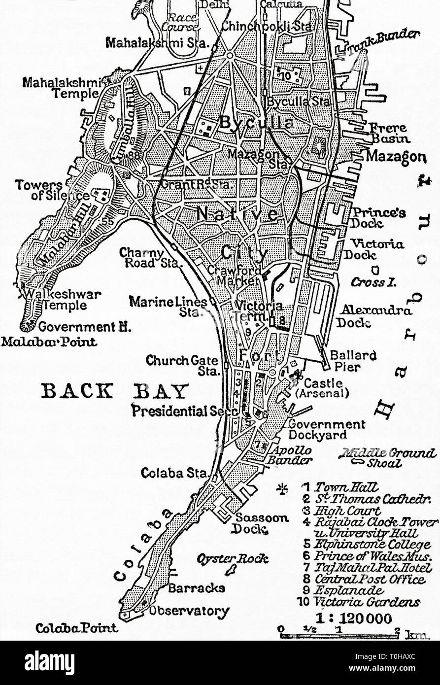 Map of Bombay, India, c 1920 Stock Photohttps://www.alamy.com/image-license-details/?v=1https://www.alamy.com/map-of-bombay-india-c-1920-image241326916.html
RMT0HAXC–Map of Bombay, India, c 1920
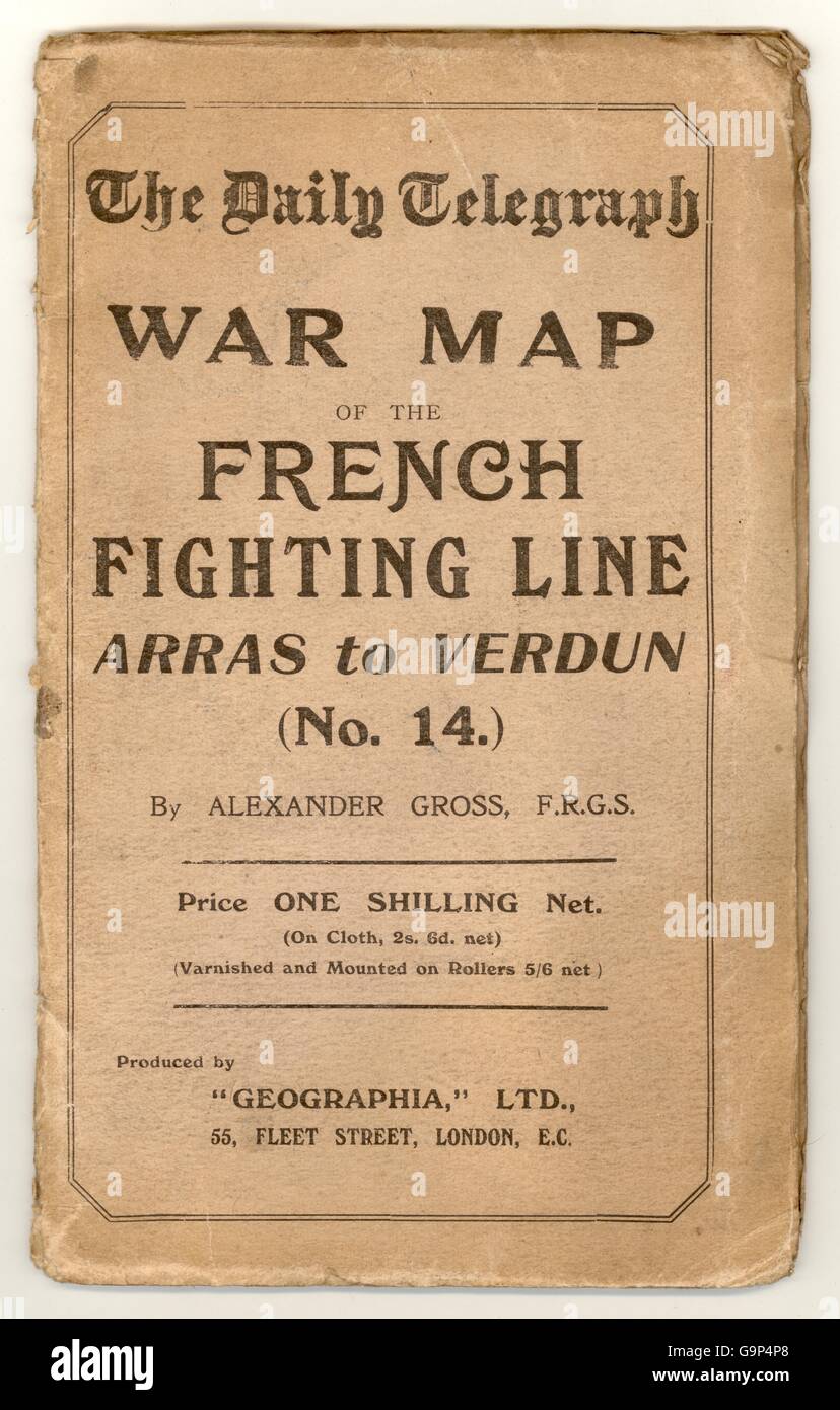 (WWi) World War 1 War Map of the French Fighting Line - Arras to Verdun. The Western Front. Published by the Daily Telegraph. circa. 1916 Stock Photohttps://www.alamy.com/image-license-details/?v=1https://www.alamy.com/stock-photo-wwi-world-war-1-war-map-of-the-french-fighting-line-arras-to-verdun-109280816.html
RMG9P4P8–(WWi) World War 1 War Map of the French Fighting Line - Arras to Verdun. The Western Front. Published by the Daily Telegraph. circa. 1916
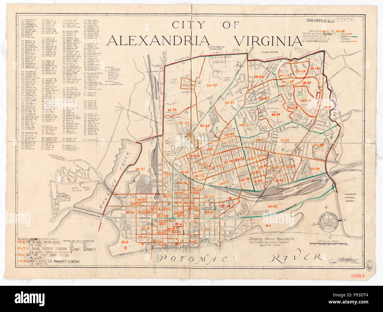 1950 Census Enumeration District Maps - Virginia (VA) - Alexandria City Stock Photohttps://www.alamy.com/image-license-details/?v=1https://www.alamy.com/1950-census-enumeration-district-maps-virginia-va-alexandria-city-image212133044.html
RMP93DT4–1950 Census Enumeration District Maps - Virginia (VA) - Alexandria City
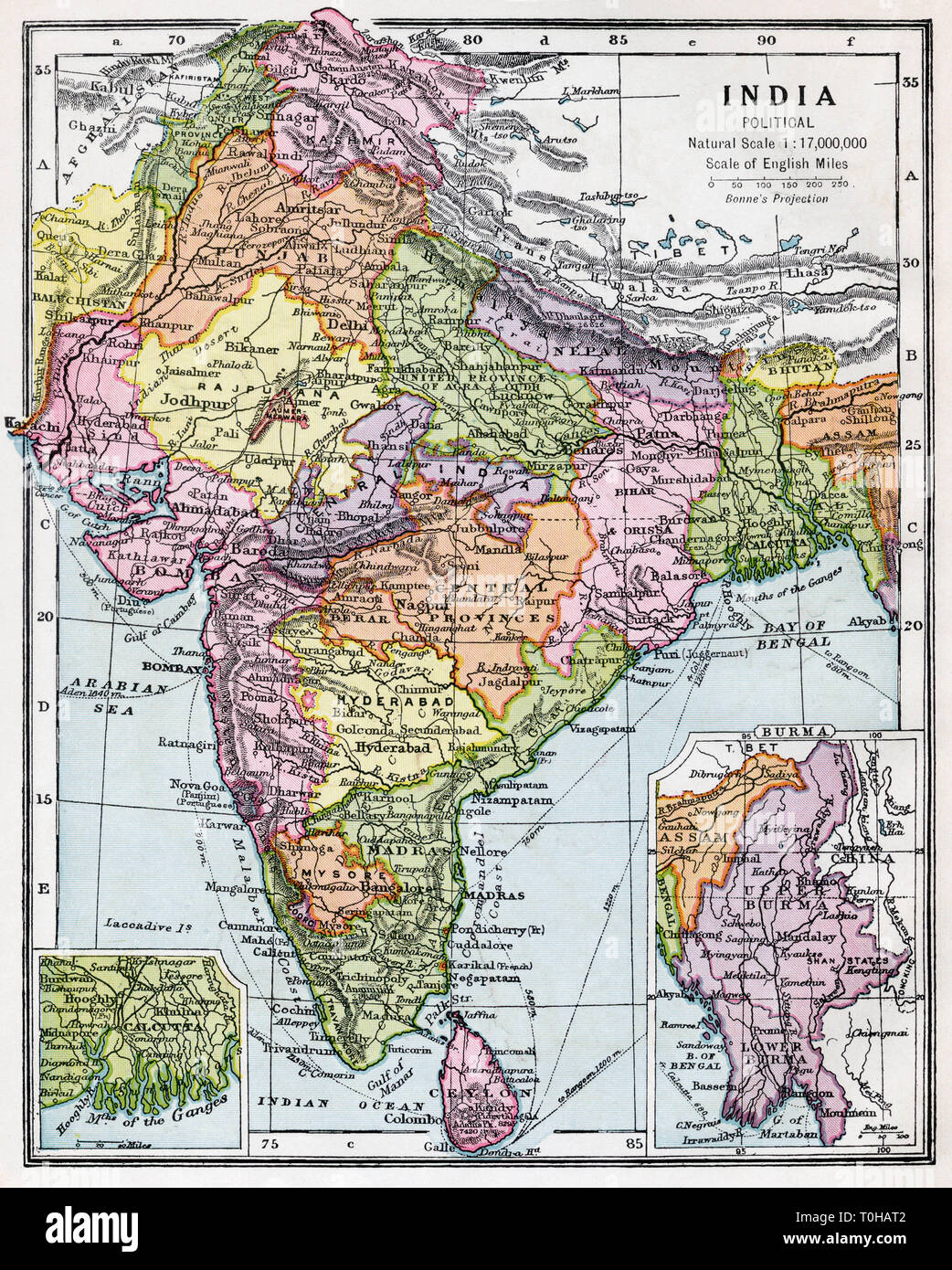 Indian political map of India, published circa 1930 Stock Photohttps://www.alamy.com/image-license-details/?v=1https://www.alamy.com/indian-political-map-of-india-published-circa-1930-image241326850.html
RMT0HAT2–Indian political map of India, published circa 1930
![[ 1900s Japan - Shodoshima Pilgrimage Map ] — Woodblock print map of the 88 temple pilgrimage on the island of Shodoshima in the Seto Inland Sea. The island is part of Kagawa Prefecture. The pilgrimage has strong connections with Kobo Daishi (also known as Kukai), the founder of Shingon Buddhism. The pilgrimage route is around 160 kilometers in length and circles the island. The map was published by Take Okada on March 20, 1901 (Meiji 34). 20th century vintage map. Stock Photo [ 1900s Japan - Shodoshima Pilgrimage Map ] — Woodblock print map of the 88 temple pilgrimage on the island of Shodoshima in the Seto Inland Sea. The island is part of Kagawa Prefecture. The pilgrimage has strong connections with Kobo Daishi (also known as Kukai), the founder of Shingon Buddhism. The pilgrimage route is around 160 kilometers in length and circles the island. The map was published by Take Okada on March 20, 1901 (Meiji 34). 20th century vintage map. Stock Photo](https://c8.alamy.com/comp/2C078XX/1900s-japan-shodoshima-pilgrimage-map-woodblock-print-map-of-the-88-temple-pilgrimage-on-the-island-of-shodoshima-in-the-seto-inland-sea-the-island-is-part-of-kagawa-prefecture-the-pilgrimage-has-strong-connections-with-kobo-daishi-also-known-as-kukai-the-founder-of-shingon-buddhism-the-pilgrimage-route-is-around-160-kilometers-in-length-and-circles-the-island-the-map-was-published-by-take-okada-on-march-20-1901-meiji-34-20th-century-vintage-map-2C078XX.jpg) [ 1900s Japan - Shodoshima Pilgrimage Map ] — Woodblock print map of the 88 temple pilgrimage on the island of Shodoshima in the Seto Inland Sea. The island is part of Kagawa Prefecture. The pilgrimage has strong connections with Kobo Daishi (also known as Kukai), the founder of Shingon Buddhism. The pilgrimage route is around 160 kilometers in length and circles the island. The map was published by Take Okada on March 20, 1901 (Meiji 34). 20th century vintage map. Stock Photohttps://www.alamy.com/image-license-details/?v=1https://www.alamy.com/1900s-japan-shodoshima-pilgrimage-map-woodblock-print-map-of-the-88-temple-pilgrimage-on-the-island-of-shodoshima-in-the-seto-inland-sea-the-island-is-part-of-kagawa-prefecture-the-pilgrimage-has-strong-connections-with-kobo-daishi-also-known-as-kukai-the-founder-of-shingon-buddhism-the-pilgrimage-route-is-around-160-kilometers-in-length-and-circles-the-island-the-map-was-published-by-take-okada-on-march-20-1901-meiji-34-20th-century-vintage-map-image361578418.html
[ 1900s Japan - Shodoshima Pilgrimage Map ] — Woodblock print map of the 88 temple pilgrimage on the island of Shodoshima in the Seto Inland Sea. The island is part of Kagawa Prefecture. The pilgrimage has strong connections with Kobo Daishi (also known as Kukai), the founder of Shingon Buddhism. The pilgrimage route is around 160 kilometers in length and circles the island. The map was published by Take Okada on March 20, 1901 (Meiji 34). 20th century vintage map. Stock Photohttps://www.alamy.com/image-license-details/?v=1https://www.alamy.com/1900s-japan-shodoshima-pilgrimage-map-woodblock-print-map-of-the-88-temple-pilgrimage-on-the-island-of-shodoshima-in-the-seto-inland-sea-the-island-is-part-of-kagawa-prefecture-the-pilgrimage-has-strong-connections-with-kobo-daishi-also-known-as-kukai-the-founder-of-shingon-buddhism-the-pilgrimage-route-is-around-160-kilometers-in-length-and-circles-the-island-the-map-was-published-by-take-okada-on-march-20-1901-meiji-34-20th-century-vintage-map-image361578418.htmlRM2C078XX–[ 1900s Japan - Shodoshima Pilgrimage Map ] — Woodblock print map of the 88 temple pilgrimage on the island of Shodoshima in the Seto Inland Sea. The island is part of Kagawa Prefecture. The pilgrimage has strong connections with Kobo Daishi (also known as Kukai), the founder of Shingon Buddhism. The pilgrimage route is around 160 kilometers in length and circles the island. The map was published by Take Okada on March 20, 1901 (Meiji 34). 20th century vintage map.
 Sandycove Atlas Plate 15 Switzerland Stock Photohttps://www.alamy.com/image-license-details/?v=1https://www.alamy.com/sandycove-atlas-plate-15-switzerland-image371452233.html
RM2CG9335–Sandycove Atlas Plate 15 Switzerland
 Vintage Map of Cape Government Railways of South Africa, 1901, Showing all the Rail lines of the country. Litho by W.A.Richards and Sons. Stock Photohttps://www.alamy.com/image-license-details/?v=1https://www.alamy.com/vintage-map-of-cape-government-railways-of-south-africa-1901-showing-all-the-rail-lines-of-the-country-litho-by-warichards-and-sons-image598256180.html
RM2WN8WT4–Vintage Map of Cape Government Railways of South Africa, 1901, Showing all the Rail lines of the country. Litho by W.A.Richards and Sons.
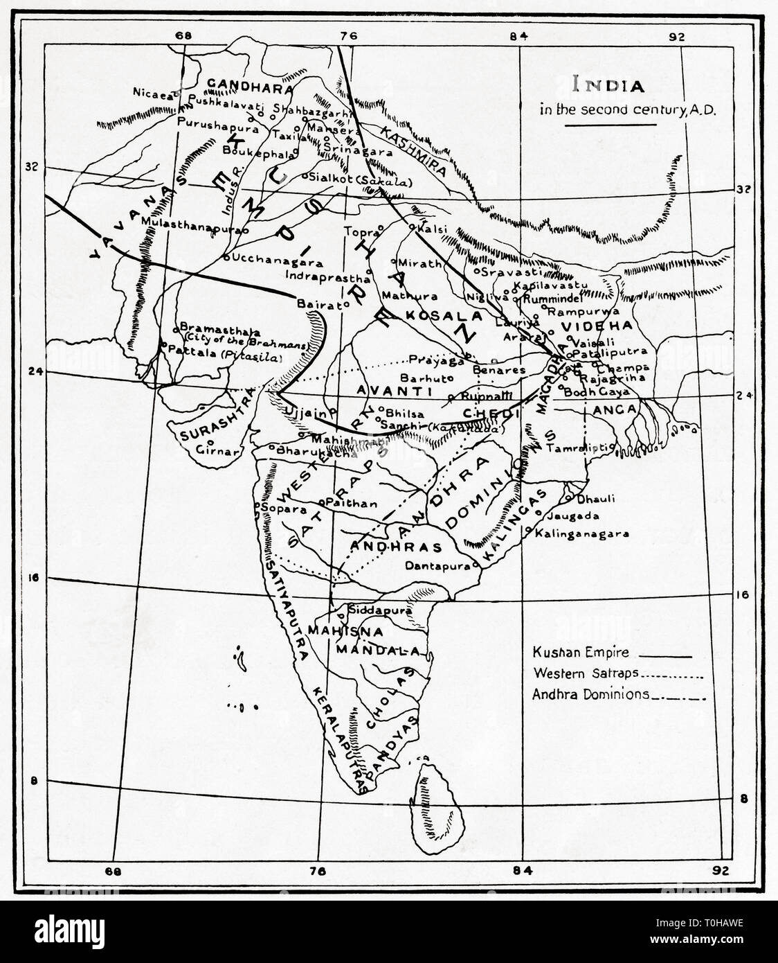 Map of India in the second century AD Stock Photohttps://www.alamy.com/image-license-details/?v=1https://www.alamy.com/map-of-india-in-the-second-century-ad-image241326890.html
RMT0HAWE–Map of India in the second century AD
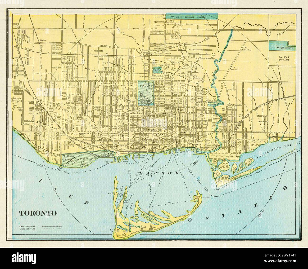 Vintage city of Toronto street map. Detailed city plan of Toronto, published by George Cram, circa 1900s Stock Photohttps://www.alamy.com/image-license-details/?v=1https://www.alamy.com/vintage-city-of-toronto-street-map-detailed-city-plan-of-toronto-published-by-george-cram-circa-1900s-image601787537.html
RM2WY1P41–Vintage city of Toronto street map. Detailed city plan of Toronto, published by George Cram, circa 1900s
 . English: This is a rarely seen Japanese atlas created in the early 1900s to illustrate the first Sino-Japanese War. The First Sino-Japanese War (1 August 1894 – 17 April 1895) was fought between Qing Dynasty China and Meiji Japan over the control of Korea and Taiwan (Formosa). This rarely seen atlas contains 25 maps illustrating various parts of Korea, Shandong and Taiwan. Maps are highly detailed offering both political and topographical information. These maps describe many of the War’s most important battles and battlefields. Only for of these maps are detailed above, these are (1) Korea Stock Photohttps://www.alamy.com/image-license-details/?v=1https://www.alamy.com/english-this-is-a-rarely-seen-japanese-atlas-created-in-the-early-1900s-to-illustrate-the-first-sino-japanese-war-the-first-sino-japanese-war-1-august-1894-17-april-1895-was-fought-between-qing-dynasty-china-and-meiji-japan-over-the-control-of-korea-and-taiwan-formosa-this-rarely-seen-atlas-contains-25-maps-illustrating-various-parts-of-korea-shandong-and-taiwan-maps-are-highly-detailed-offering-both-political-and-topographical-information-these-maps-describe-many-of-the-wars-most-important-battles-and-battlefields-only-for-of-these-maps-are-detailed-above-these-are-1-korea-image184878202.html
RMMMNX0X–. English: This is a rarely seen Japanese atlas created in the early 1900s to illustrate the first Sino-Japanese War. The First Sino-Japanese War (1 August 1894 – 17 April 1895) was fought between Qing Dynasty China and Meiji Japan over the control of Korea and Taiwan (Formosa). This rarely seen atlas contains 25 maps illustrating various parts of Korea, Shandong and Taiwan. Maps are highly detailed offering both political and topographical information. These maps describe many of the War’s most important battles and battlefields. Only for of these maps are detailed above, these are (1) Korea
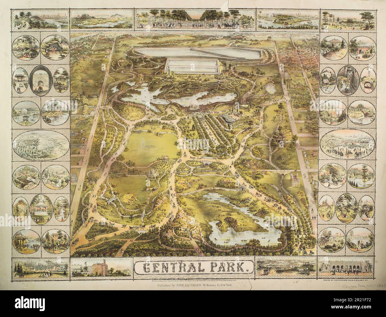 Vintage 19th century illustrated map of Central Park ca. 1863 in New York City, USA. Published by John Bachmann. Stock Photohttps://www.alamy.com/image-license-details/?v=1https://www.alamy.com/vintage-19th-century-illustrated-map-of-central-park-ca-1863-in-new-york-city-usa-published-by-john-bachmann-image551994998.html
RM2R21F72–Vintage 19th century illustrated map of Central Park ca. 1863 in New York City, USA. Published by John Bachmann.
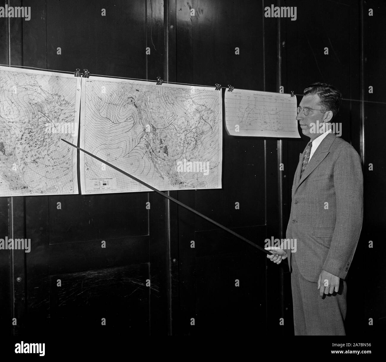 Man pointing to weather maps ca. 1936 Stock Photohttps://www.alamy.com/image-license-details/?v=1https://www.alamy.com/man-pointing-to-weather-maps-ca-1936-image331557666.html
RM2A7BN56–Man pointing to weather maps ca. 1936
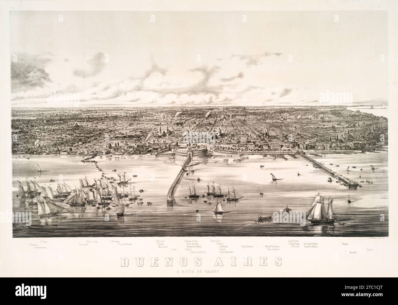 Bird's eye view, panoramic view map of Buenos Aires, Argentina, South America ca. 1860 Stock Photohttps://www.alamy.com/image-license-details/?v=1https://www.alamy.com/birds-eye-view-panoramic-view-map-of-buenos-aires-argentina-south-america-ca-1860-image575349904.html
RM2TC1CJT–Bird's eye view, panoramic view map of Buenos Aires, Argentina, South America ca. 1860
 Vintage map of Palestine during the monarchy. Published G. W and C. B. Colton & Co., circa 1895 Cartographer: Woolworth (George Woolworth) cartographer. Stock Photohttps://www.alamy.com/image-license-details/?v=1https://www.alamy.com/vintage-map-of-palestine-during-the-monarchy-published-g-w-and-c-b-colton-co-circa-1895-cartographer-woolworth-george-woolworth-cartographer-image595366968.html
RM2WGH8J0–Vintage map of Palestine during the monarchy. Published G. W and C. B. Colton & Co., circa 1895 Cartographer: Woolworth (George Woolworth) cartographer.
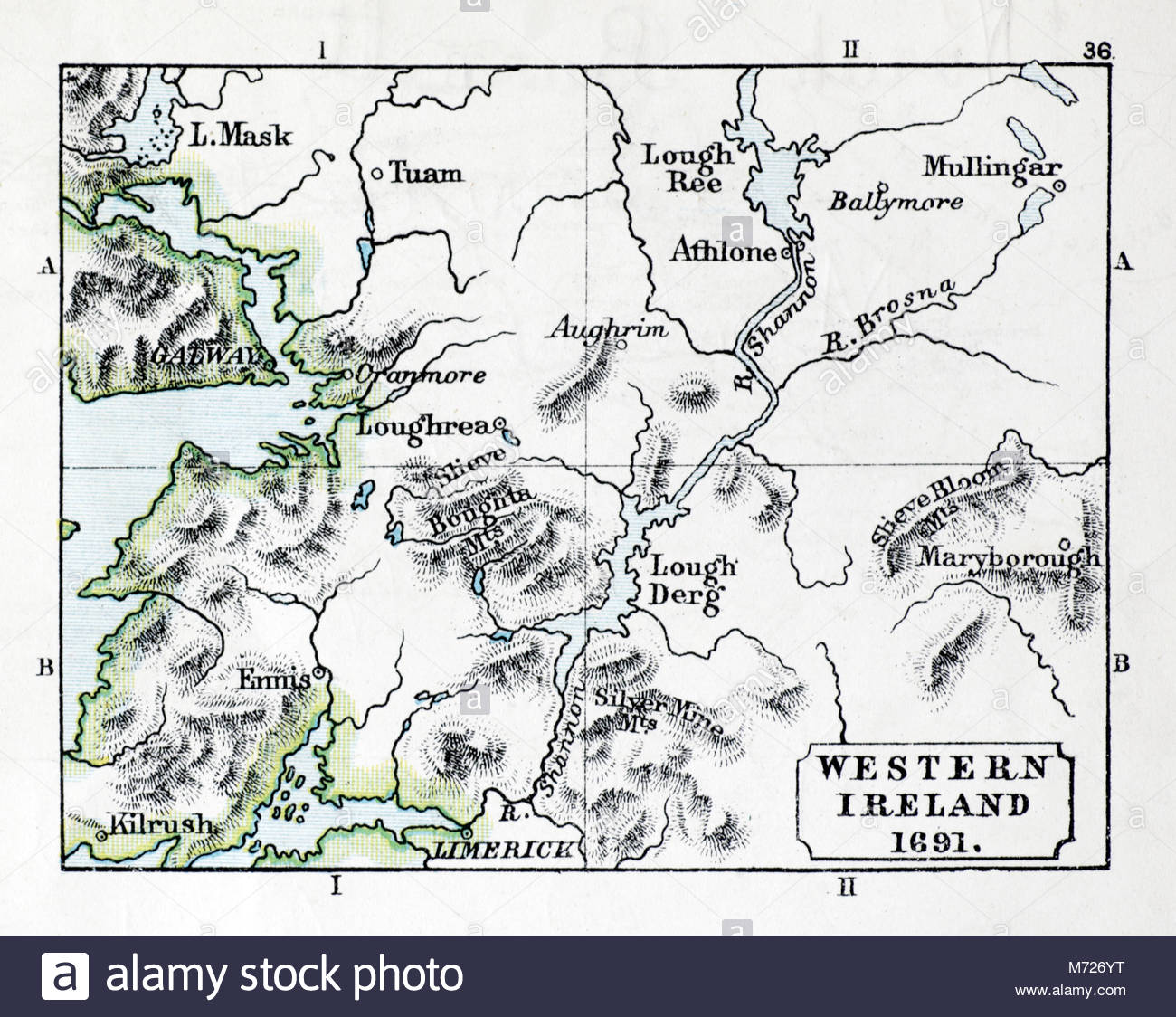 Map of Western Ireland 1691, from a print circa 1900 Stock Photohttps://www.alamy.com/image-license-details/?v=1https://www.alamy.com/stock-photo-map-of-western-ireland-1691-from-a-print-circa-1900-176455660.html
RMM726YT–Map of Western Ireland 1691, from a print circa 1900
 Map of the New York world's fair and approaches (ca. 1939-1940) from The Lionel Pincus and Princess Firyal Map Division. Stock Photohttps://www.alamy.com/image-license-details/?v=1https://www.alamy.com/map-of-the-new-york-worlds-fair-and-approaches-ca-1939-1940-from-the-lionel-pincus-and-princess-firyal-map-division-image450904449.html
RM2H5GD69–Map of the New York world's fair and approaches (ca. 1939-1940) from The Lionel Pincus and Princess Firyal Map Division.
RF2J8RNA4–Columbia University 1909 The iconography of Manhattan Island, 1498-1909 compiled from original sources and illustrated by photo-intaglio reproductions of important maps, plans, views, and documents in public and private collections - Volume 3 by Isaac Newton Phelps Stokes, Publisher New York : Robert H. Dodd 1918
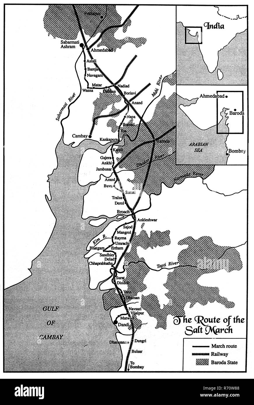 Mahatma Gandhi salt march route, Salt Agitation, Dandi March, India, 1930, old vintage 1900s picture Stock Photohttps://www.alamy.com/image-license-details/?v=1https://www.alamy.com/mahatma-gandhi-salt-march-route-salt-agitation-dandi-march-india-1930-old-vintage-1900s-picture-image228057208.html
RMR70W88–Mahatma Gandhi salt march route, Salt Agitation, Dandi March, India, 1930, old vintage 1900s picture
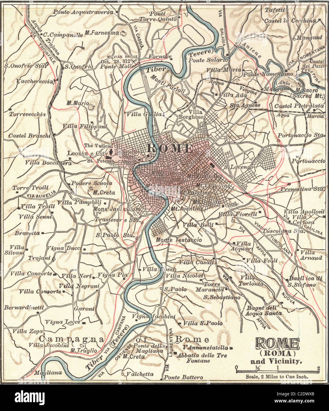 Map of Rome Stock Photohttps://www.alamy.com/image-license-details/?v=1https://www.alamy.com/stock-photo-map-of-rome-35955763.html
RMC2DWXB–Map of Rome
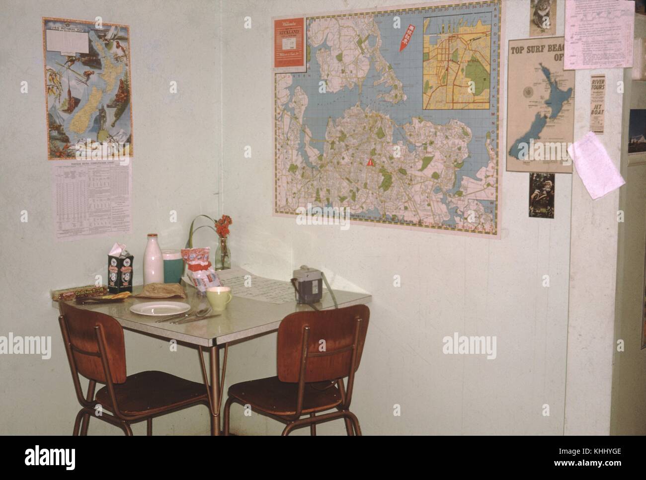 A photograph of a small dining area inside of a hostel, a small table is situated in a corner with two chairs, the walls are decorated with several local maps for the guests to review and plan their trips, Christchurch, New Zealand, 1961. Stock Photohttps://www.alamy.com/image-license-details/?v=1https://www.alamy.com/stock-image-a-photograph-of-a-small-dining-area-inside-of-a-hostel-a-small-table-165737278.html
RMKHHYGE–A photograph of a small dining area inside of a hostel, a small table is situated in a corner with two chairs, the walls are decorated with several local maps for the guests to review and plan their trips, Christchurch, New Zealand, 1961.
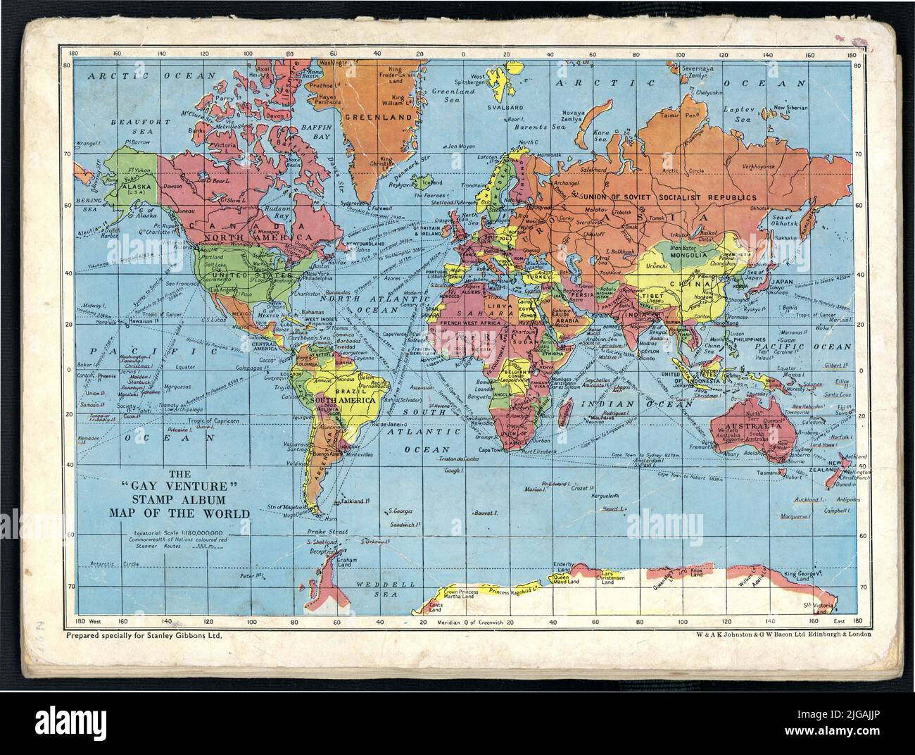 Original tattered, shabby well used 1950's era colour world map - on the reverse of The Gay Venture stamp album, with an educational map of the world, second edition, printed in London, U.K. Stock Photohttps://www.alamy.com/image-license-details/?v=1https://www.alamy.com/original-tattered-shabby-well-used-1950s-era-colour-world-map-on-the-reverse-of-the-gay-venture-stamp-album-with-an-educational-map-of-the-world-second-edition-printed-in-london-uk-image474748590.html
RM2JGAJJP–Original tattered, shabby well used 1950's era colour world map - on the reverse of The Gay Venture stamp album, with an educational map of the world, second edition, printed in London, U.K.
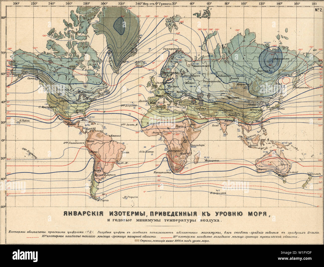 Earth Climatology Maps Map of the January isotherms given to the level of the sea New table atlas A.F. Marcks St. Petersburg, 1910 Stock Photohttps://www.alamy.com/image-license-details/?v=1https://www.alamy.com/earth-climatology-maps-map-of-the-january-isotherms-given-to-the-level-of-the-sea-new-table-atlas-af-marcks-st-petersburg-1910-image259121003.html
RMW1FYDF–Earth Climatology Maps Map of the January isotherms given to the level of the sea New table atlas A.F. Marcks St. Petersburg, 1910
 Map of Panama, Includes inset of the profile of the Panama Canal, 1904. The Americana Company (publisher). Vintage Archive Map. Stock Photohttps://www.alamy.com/image-license-details/?v=1https://www.alamy.com/map-of-panama-includes-inset-of-the-profile-of-the-panama-canal-1904-the-americana-company-publisher-vintage-archive-map-image637401364.html
RM2S103XC–Map of Panama, Includes inset of the profile of the Panama Canal, 1904. The Americana Company (publisher). Vintage Archive Map.
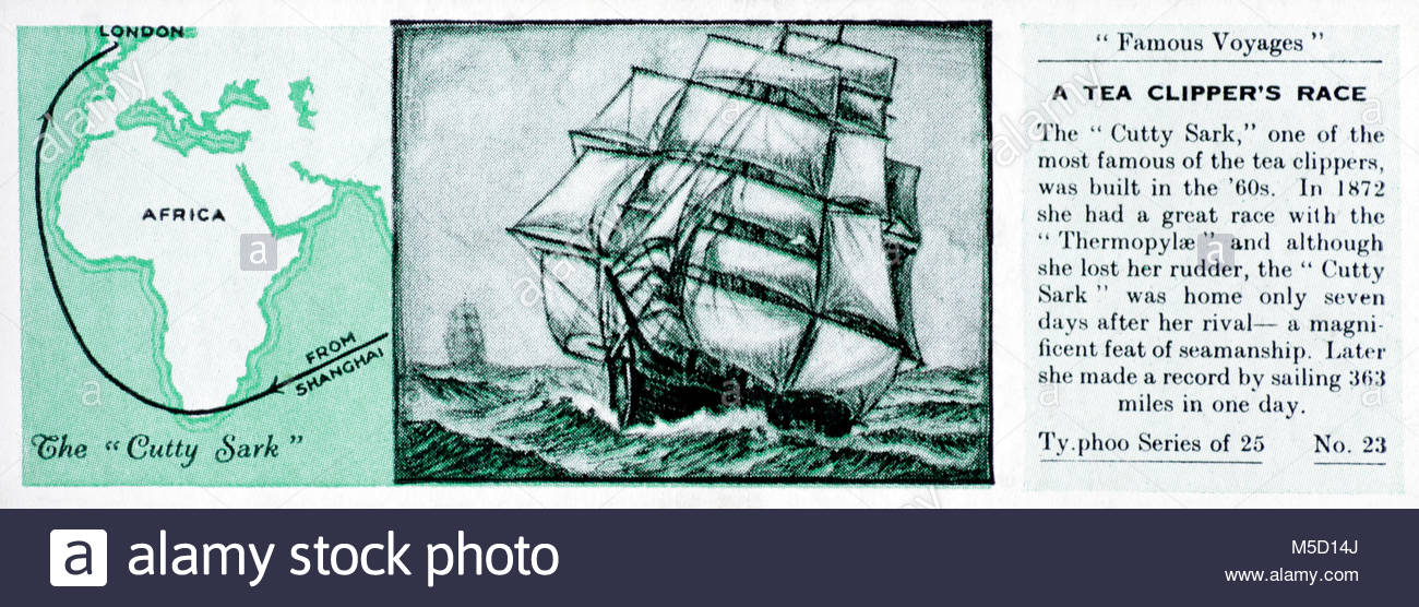 Famous Voyages - A Tea Clipper's Race, Cutty Sark and Thermopylae 1872 Stock Photohttps://www.alamy.com/image-license-details/?v=1https://www.alamy.com/stock-photo-famous-voyages-a-tea-clippers-race-cutty-sark-and-thermopylae-1872-175463250.html
RMM5D14J–Famous Voyages - A Tea Clipper's Race, Cutty Sark and Thermopylae 1872
 Sandycove Atlas Plate 22 Palestine Further Asia Stock Photohttps://www.alamy.com/image-license-details/?v=1https://www.alamy.com/sandycove-atlas-plate-22-palestine-further-asia-image371452786.html
RM2CG93PX–Sandycove Atlas Plate 22 Palestine Further Asia
 Plan of the city of Strasbourg according to the official development plan. 1904 Stock Photohttps://www.alamy.com/image-license-details/?v=1https://www.alamy.com/plan-of-the-city-of-strasbourg-according-to-the-official-development-plan-1904-image615245779.html
RM2XMXT7F–Plan of the city of Strasbourg according to the official development plan. 1904
 New York Subway Stock Photohttps://www.alamy.com/image-license-details/?v=1https://www.alamy.com/new-york-subway-image65994865.html
RMDRA93D–New York Subway
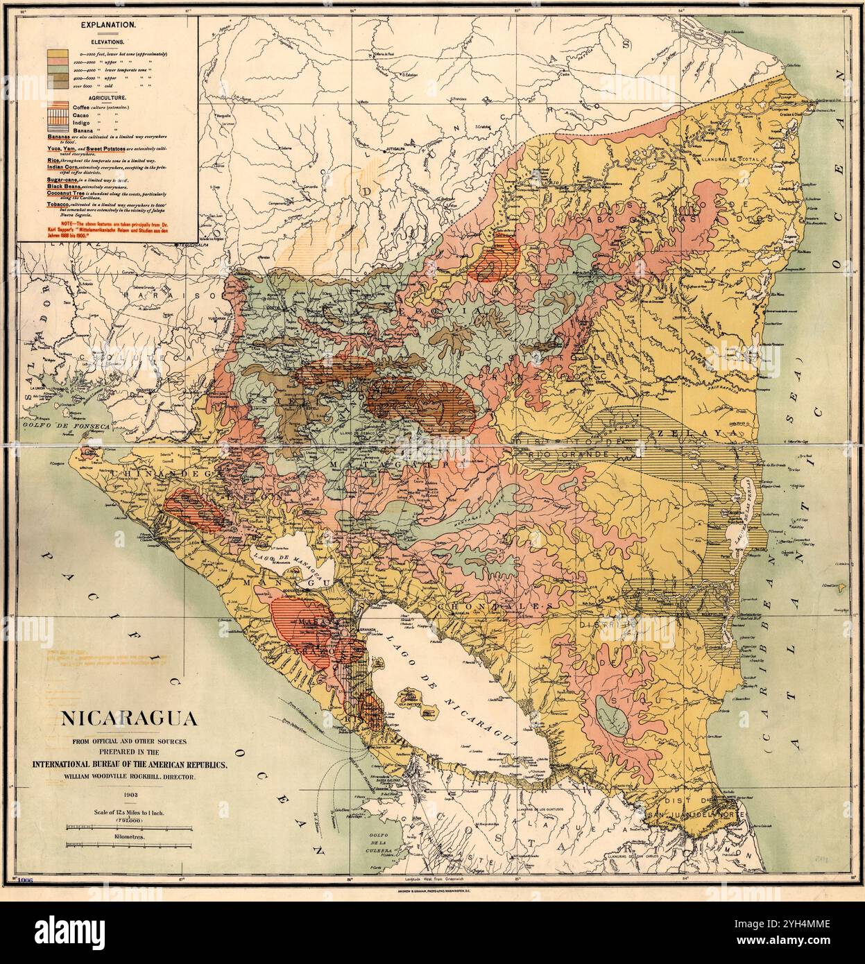 Vintage Geographic map of Nicaragua, 1903 Stock Photohttps://www.alamy.com/image-license-details/?v=1https://www.alamy.com/vintage-geographic-map-of-nicaragua-1903-image630126462.html
RM2YH4MME–Vintage Geographic map of Nicaragua, 1903
 . 1895 Sino-Japanese War Report . English: This is a rarely seen Japanese atlas created in the early 1900s to illustrate the first Sino-Japanese War. The First Sino-Japanese War (1 August 1894 – 17 April 1895) was fought between Qing Dynasty China and Meiji Japan over the control of Korea and Taiwan (Formosa). This rarely seen atlas contains 25 maps illustrating various parts of Korea, Shandong and Taiwan. Maps are highly detailed offering both political and topographical information. These maps describe many of the War’s most important battles and battlefields. Only for of these maps are det Stock Photohttps://www.alamy.com/image-license-details/?v=1https://www.alamy.com/1895-sino-japanese-war-report-english-this-is-a-rarely-seen-japanese-atlas-created-in-the-early-1900s-to-illustrate-the-first-sino-japanese-war-the-first-sino-japanese-war-1-august-1894-17-april-1895-was-fought-between-qing-dynasty-china-and-meiji-japan-over-the-control-of-korea-and-taiwan-formosa-this-rarely-seen-atlas-contains-25-maps-illustrating-various-parts-of-korea-shandong-and-taiwan-maps-are-highly-detailed-offering-both-political-and-topographical-information-these-maps-describe-many-of-the-wars-most-important-battles-and-battlefields-only-for-of-these-maps-are-det-image188899162.html
RMMY92PJ–. 1895 Sino-Japanese War Report . English: This is a rarely seen Japanese atlas created in the early 1900s to illustrate the first Sino-Japanese War. The First Sino-Japanese War (1 August 1894 – 17 April 1895) was fought between Qing Dynasty China and Meiji Japan over the control of Korea and Taiwan (Formosa). This rarely seen atlas contains 25 maps illustrating various parts of Korea, Shandong and Taiwan. Maps are highly detailed offering both political and topographical information. These maps describe many of the War’s most important battles and battlefields. Only for of these maps are det
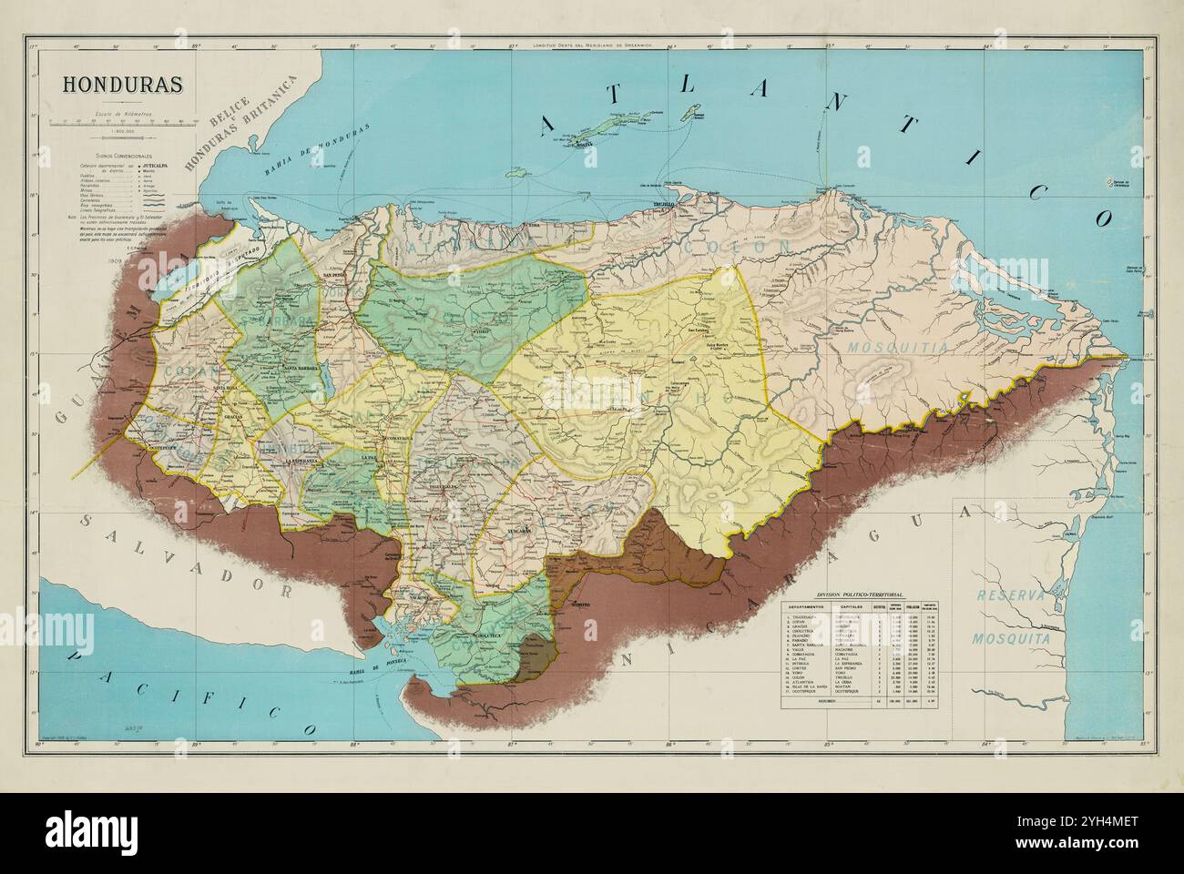 Vintage Archive map of Honduras, 1909 Stock Photohttps://www.alamy.com/image-license-details/?v=1https://www.alamy.com/vintage-archive-map-of-honduras-1909-image630126304.html
RM2YH4MET–Vintage Archive map of Honduras, 1909
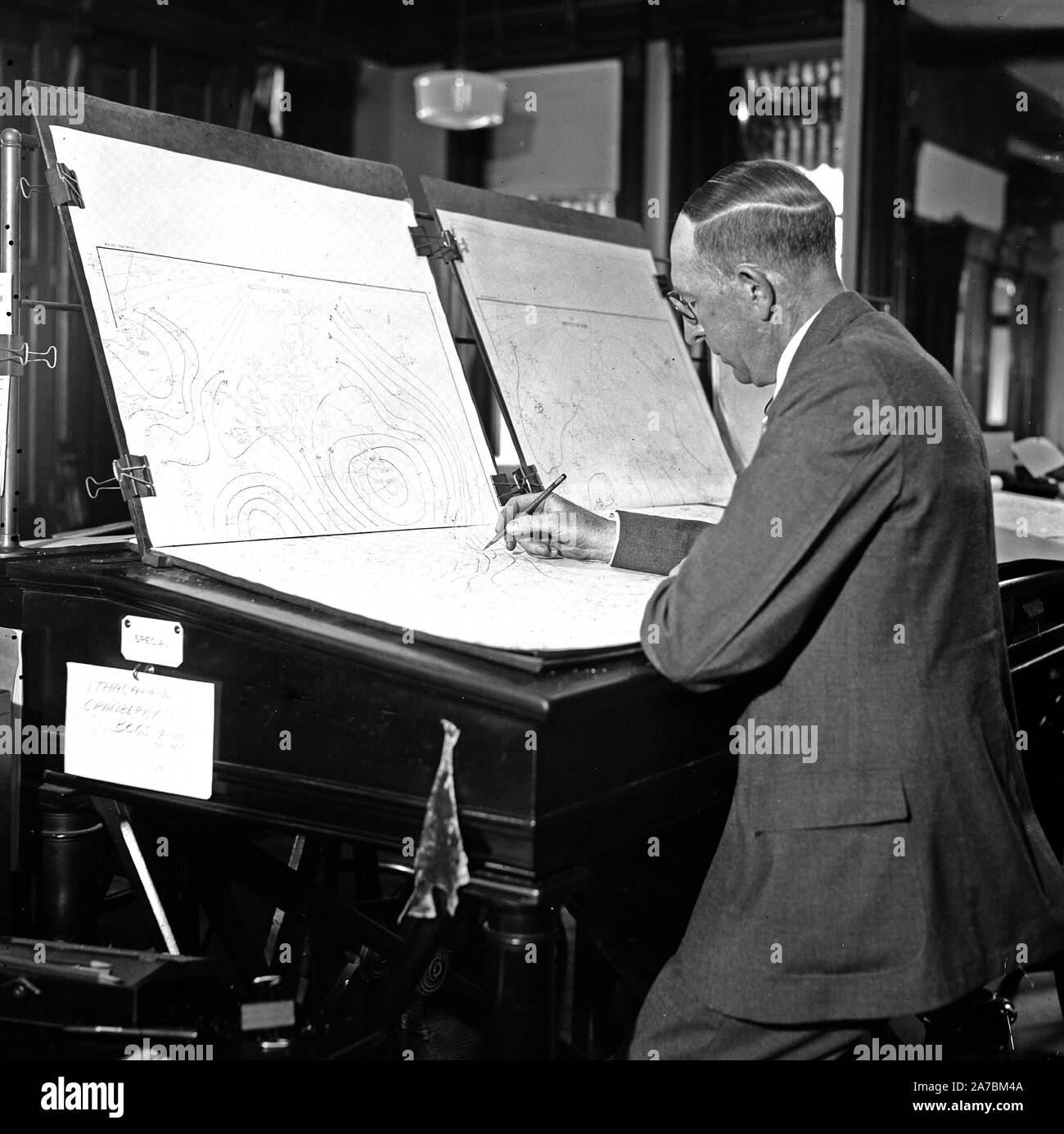 Man creating weather maps ca. 1936 Stock Photohttps://www.alamy.com/image-license-details/?v=1https://www.alamy.com/man-creating-weather-maps-ca-1936-image331556858.html
RM2A7BM4A–Man creating weather maps ca. 1936
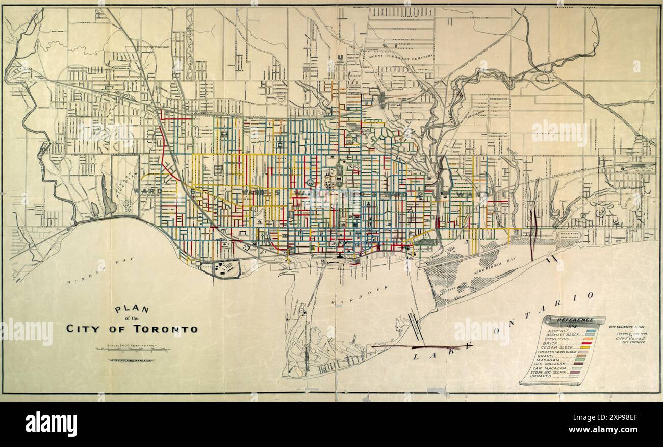 Vintage Street Map. Plan of City of Toronto, 1908 Stock Photohttps://www.alamy.com/image-license-details/?v=1https://www.alamy.com/vintage-street-map-plan-of-city-of-toronto-1908-image616089559.html
RM2XP98EF–Vintage Street Map. Plan of City of Toronto, 1908
 Railway map, Devonport & Plymouth Stock Photohttps://www.alamy.com/image-license-details/?v=1https://www.alamy.com/railway-map-devonport-plymouth-image256556898.html
RMTWB4XA–Railway map, Devonport & Plymouth
 Vintage Historical Map. Map of the Colony of Hong Kong, by Waterloo and Sons, 1900 Stock Photohttps://www.alamy.com/image-license-details/?v=1https://www.alamy.com/vintage-historical-map-map-of-the-colony-of-hong-kong-by-waterloo-and-sons-1900-image604641842.html
RM2X3KPRE–Vintage Historical Map. Map of the Colony of Hong Kong, by Waterloo and Sons, 1900
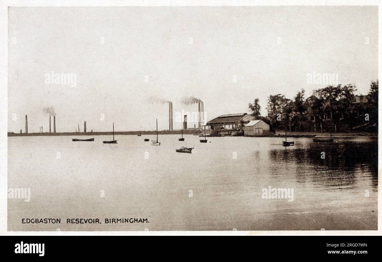 Panoramic view of Edgbaston Reservoir, Birmingham. Originally known as Rotton Park Reservoir and referred to in some early maps as Rock Pool Reservoir, is a canal feeder reservoir in Birmingham, England, maintained by the Canal & River Trust. It is situated close to Birmingham City Centre and is a Site of Importance for Nature Conservation. Stock Photohttps://www.alamy.com/image-license-details/?v=1https://www.alamy.com/panoramic-view-of-edgbaston-reservoir-birmingham-originally-known-as-rotton-park-reservoir-and-referred-to-in-some-early-maps-as-rock-pool-reservoir-is-a-canal-feeder-reservoir-in-birmingham-england-maintained-by-the-canal-river-trust-it-is-situated-close-to-birmingham-city-centre-and-is-a-site-of-importance-for-nature-conservation-image560857857.html
RM2RGD7WN–Panoramic view of Edgbaston Reservoir, Birmingham. Originally known as Rotton Park Reservoir and referred to in some early maps as Rock Pool Reservoir, is a canal feeder reservoir in Birmingham, England, maintained by the Canal & River Trust. It is situated close to Birmingham City Centre and is a Site of Importance for Nature Conservation.
RF2J8RNA0–Wall Street looking West from a Platform erected over William Street 1909 The iconography of Manhattan Island, 1498-1909 compiled from original sources and illustrated by photo-intaglio reproductions of important maps, plans, views, and documents in public and private collections - Volume 3 by Isaac Newton Phelps Stokes, Publisher New York : Robert H. Dodd 1918
 Vintage Map: 'Map of seat of war in South Africa' . Second Boer War. Published GW Steevens, circa 1900 . Illustrating From Cape Town to Ladysmith. Stock Photohttps://www.alamy.com/image-license-details/?v=1https://www.alamy.com/vintage-map-map-of-seat-of-war-in-south-africa-second-boer-war-published-gw-steevens-circa-1900-illustrating-from-cape-town-to-ladysmith-image597973932.html
RM2WMT1RT–Vintage Map: 'Map of seat of war in South Africa' . Second Boer War. Published GW Steevens, circa 1900 . Illustrating From Cape Town to Ladysmith.
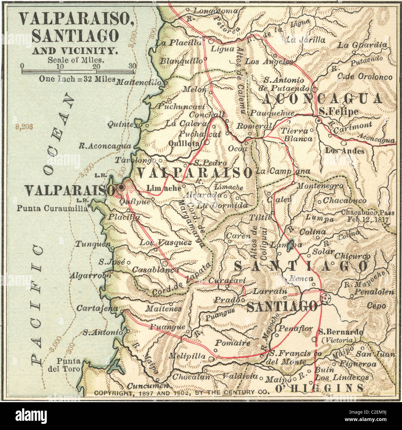 Map of Valparaiso and Santiago Stock Photohttps://www.alamy.com/image-license-details/?v=1https://www.alamy.com/stock-photo-map-of-valparaiso-and-santiago-35973326.html
RMC2EM9J–Map of Valparaiso and Santiago
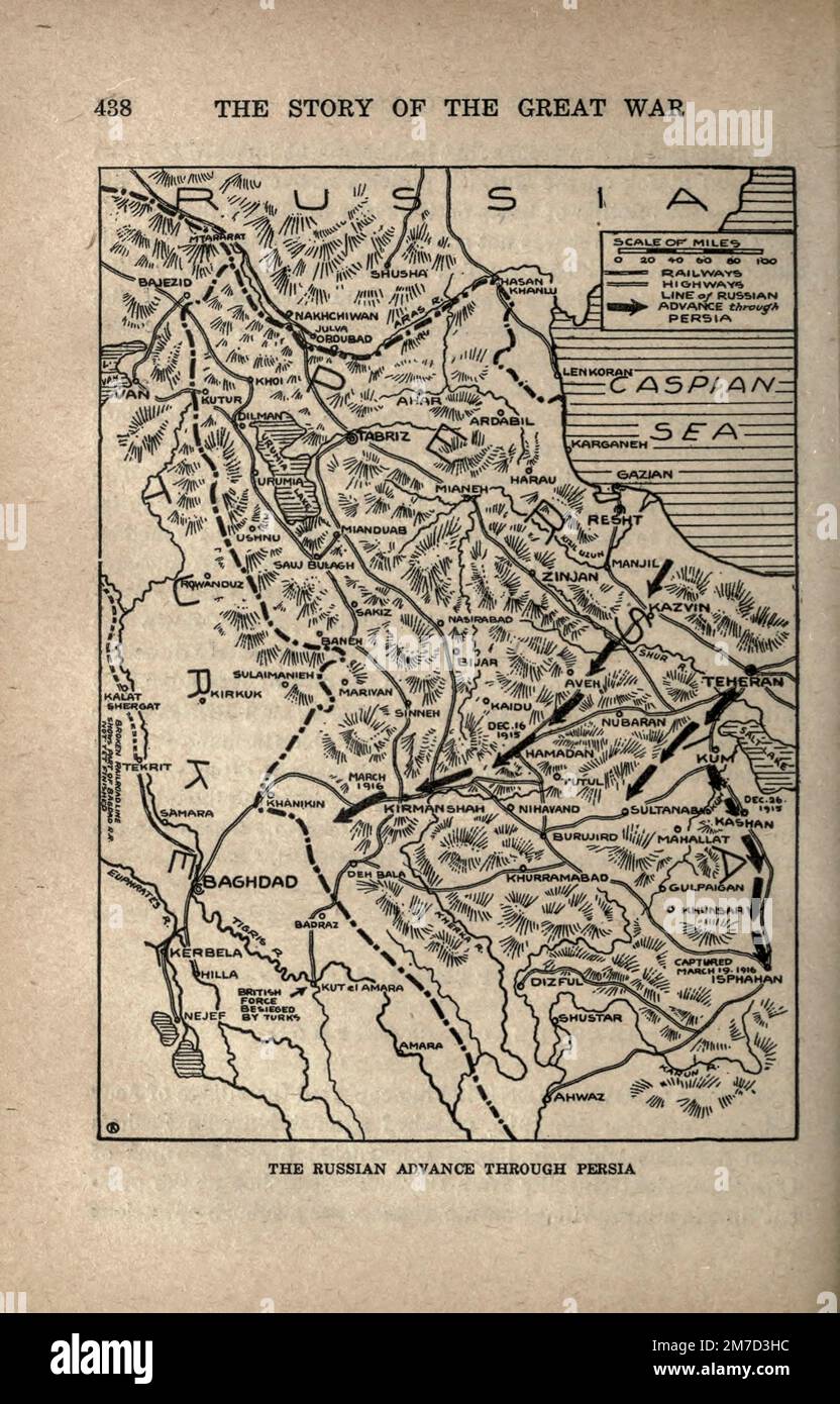 Russian Advance Through Persia map from the book The story of the great war; the complete historical records of events to date DIPLOMATIC AND STATE PAPERS by Reynolds, Francis Joseph, 1867-1937; Churchill, Allen Leon; Miller, Francis Trevelyan, 1877-1959; Wood, Leonard, 1860-1927; Knight, Austin Melvin, 1854-1927; Palmer, Frederick, 1873-1958; Simonds, Frank Herbert, 1878-; Ruhl, Arthur Brown, 1876- Volume IV Published 1916 Stock Photohttps://www.alamy.com/image-license-details/?v=1https://www.alamy.com/russian-advance-through-persia-map-from-the-book-the-story-of-the-great-war-the-complete-historical-records-of-events-to-date-diplomatic-and-state-papers-by-reynolds-francis-joseph-1867-1937-churchill-allen-leon-miller-francis-trevelyan-1877-1959-wood-leonard-1860-1927-knight-austin-melvin-1854-1927-palmer-frederick-1873-1958-simonds-frank-herbert-1878-ruhl-arthur-brown-1876-volume-iv-published-1916-image503691480.html
RF2M7D3HC–Russian Advance Through Persia map from the book The story of the great war; the complete historical records of events to date DIPLOMATIC AND STATE PAPERS by Reynolds, Francis Joseph, 1867-1937; Churchill, Allen Leon; Miller, Francis Trevelyan, 1877-1959; Wood, Leonard, 1860-1927; Knight, Austin Melvin, 1854-1927; Palmer, Frederick, 1873-1958; Simonds, Frank Herbert, 1878-; Ruhl, Arthur Brown, 1876- Volume IV Published 1916
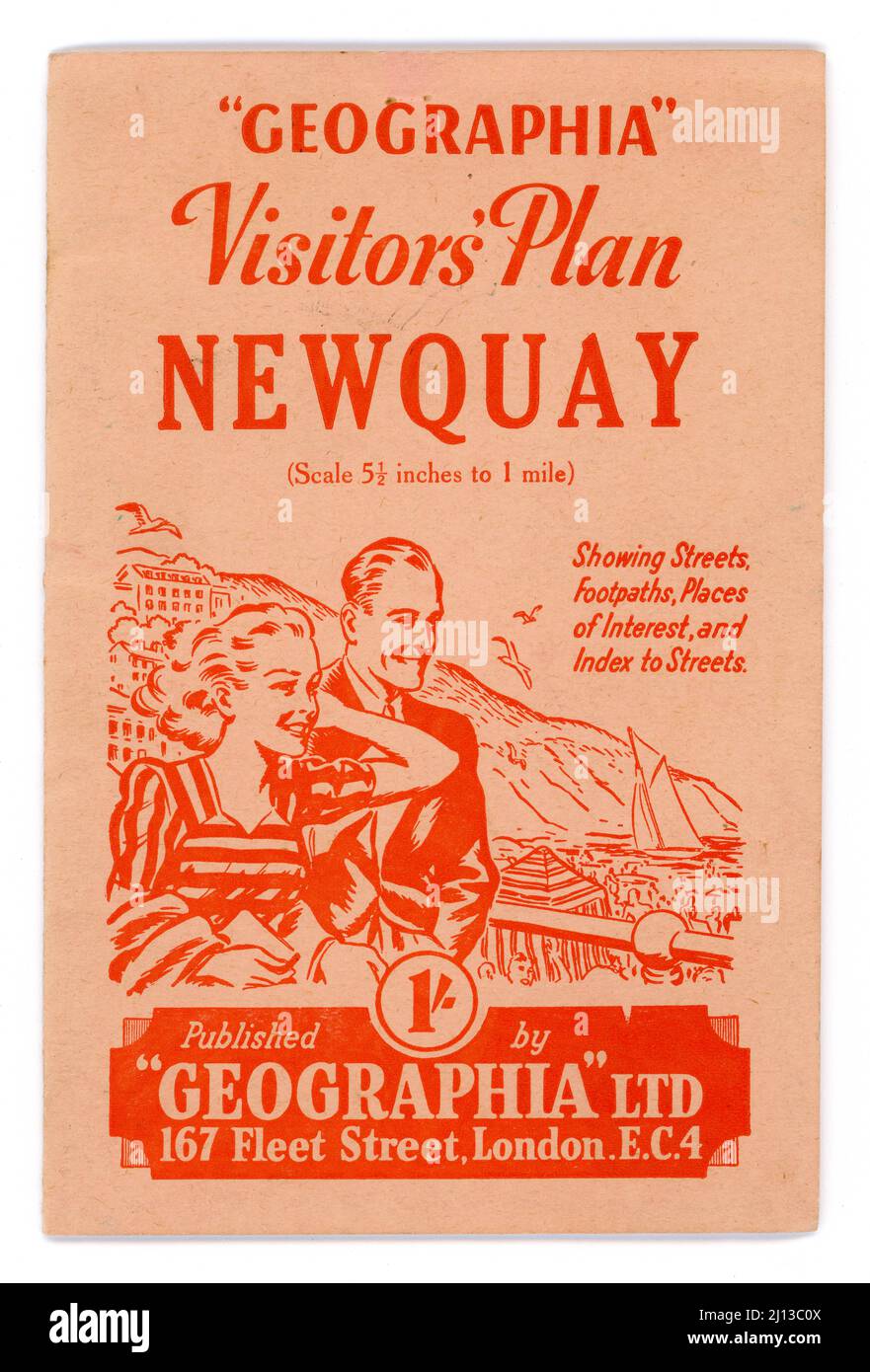 Original retro 1940's Geographia series tourist guide - Visitors Plan Newquay. Town plan. Published by Geographia Ltd. 167 Fleet Street, London, EC4. The illustration shows a happy couple out enjoying themselves in Newquay, Cornwall, U.K. circa 1945 / 1946 Stock Photohttps://www.alamy.com/image-license-details/?v=1https://www.alamy.com/original-retro-1940s-geographia-series-tourist-guide-visitors-plan-newquay-town-plan-published-by-geographia-ltd-167-fleet-street-london-ec4-the-illustration-shows-a-happy-couple-out-enjoying-themselves-in-newquay-cornwall-uk-circa-1945-1946-image465369882.html
RM2J13C0X–Original retro 1940's Geographia series tourist guide - Visitors Plan Newquay. Town plan. Published by Geographia Ltd. 167 Fleet Street, London, EC4. The illustration shows a happy couple out enjoying themselves in Newquay, Cornwall, U.K. circa 1945 / 1946
 A photograph of a card game at a hostel, a group of men and women are seated at a large wooden table while playing together in a dimly lit room, maps and information can be seen in the background, Christchurch, New Zealand, 1961. Stock Photohttps://www.alamy.com/image-license-details/?v=1https://www.alamy.com/stock-image-a-photograph-of-a-card-game-at-a-hostel-a-group-of-men-and-women-are-165737281.html
RMKHHYGH–A photograph of a card game at a hostel, a group of men and women are seated at a large wooden table while playing together in a dimly lit room, maps and information can be seen in the background, Christchurch, New Zealand, 1961.
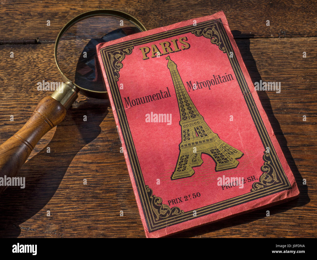 PARIS MAP Vintage art nouveau1900's Retro Monumental Travel Guide Map of Paris with antique magnifying glass on old wooden desk top Stock Photohttps://www.alamy.com/image-license-details/?v=1https://www.alamy.com/stock-photo-paris-map-vintage-art-nouveau1900s-retro-monumental-travel-guide-map-138023014.html
RMJ0FDNA–PARIS MAP Vintage art nouveau1900's Retro Monumental Travel Guide Map of Paris with antique magnifying glass on old wooden desk top
RF2JF69W1–NEW YORK SKYLINE FROM GOVERNOR’S ISLAND, 1925 From the book The iconography of Manhattan Island, 1498-1909 compiled from original sources and illustrated by photo-intaglio reproductions of important maps, plans, views, and documents in public and private collections - Volume 6
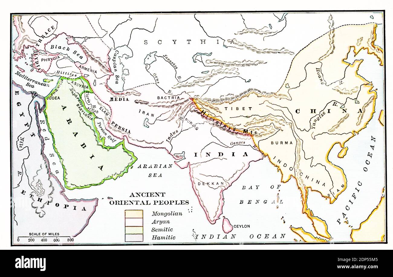 Ancient Oriental Peoples. According to the legend on this early 1900s map: Orange - Mongolian; pink-Aryan; green-Semitic; purple-Hamitic. Stock Photohttps://www.alamy.com/image-license-details/?v=1https://www.alamy.com/ancient-oriental-peoples-according-to-the-legend-on-this-early-1900s-map-orange-mongolian-pink-aryan-green-semitic-purple-hamitic-image392264773.html
RF2DP55M5–Ancient Oriental Peoples. According to the legend on this early 1900s map: Orange - Mongolian; pink-Aryan; green-Semitic; purple-Hamitic.
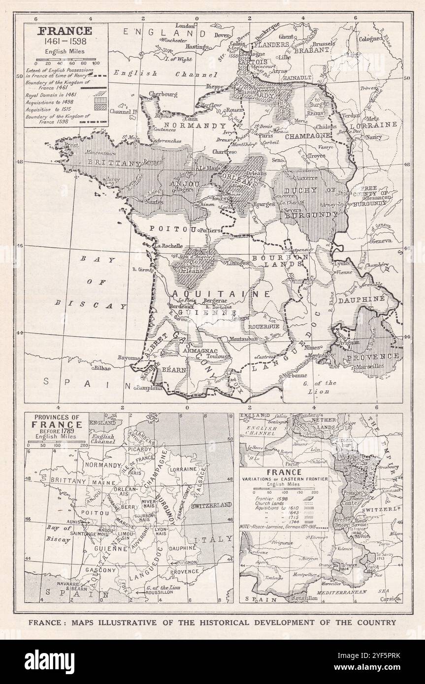 Vintage maps of France illustrating the historical development of the country. Stock Photohttps://www.alamy.com/image-license-details/?v=1https://www.alamy.com/vintage-maps-of-france-illustrating-the-historical-development-of-the-country-image628920759.html
RF2YF5PRK–Vintage maps of France illustrating the historical development of the country.
 Free Maps Free Parking at roadside souvenir stand Stock Photohttps://www.alamy.com/image-license-details/?v=1https://www.alamy.com/free-maps-free-parking-at-roadside-souvenir-stand-image85888.html
RMA14F80–Free Maps Free Parking at roadside souvenir stand
 Vintage map of Norway showing January and July Isotherms 1900s. Stock Photohttps://www.alamy.com/image-license-details/?v=1https://www.alamy.com/vintage-map-of-norway-showing-january-and-july-isotherms-1900s-image350651554.html
RF2BADFHP–Vintage map of Norway showing January and July Isotherms 1900s.
 . 1895 Sino-Japanese War Report . English: This is a rarely seen Japanese atlas created in the early 1900s to illustrate the first Sino-Japanese War. The First Sino-Japanese War (1 August 1894 – 17 April 1895) was fought between Qing Dynasty China and Meiji Japan over the control of Korea and Taiwan (Formosa). This rarely seen atlas contains 25 maps illustrating various parts of Korea, Shandong and Taiwan. Maps are highly detailed offering both political and topographical information. These maps describe many of the War’s most important battles and battlefields. Only for of these maps are det Stock Photohttps://www.alamy.com/image-license-details/?v=1https://www.alamy.com/1895-sino-japanese-war-report-english-this-is-a-rarely-seen-japanese-atlas-created-in-the-early-1900s-to-illustrate-the-first-sino-japanese-war-the-first-sino-japanese-war-1-august-1894-17-april-1895-was-fought-between-qing-dynasty-china-and-meiji-japan-over-the-control-of-korea-and-taiwan-formosa-this-rarely-seen-atlas-contains-25-maps-illustrating-various-parts-of-korea-shandong-and-taiwan-maps-are-highly-detailed-offering-both-political-and-topographical-information-these-maps-describe-many-of-the-wars-most-important-battles-and-battlefields-only-for-of-these-maps-are-det-image187631009.html
RMMW797D–. 1895 Sino-Japanese War Report . English: This is a rarely seen Japanese atlas created in the early 1900s to illustrate the first Sino-Japanese War. The First Sino-Japanese War (1 August 1894 – 17 April 1895) was fought between Qing Dynasty China and Meiji Japan over the control of Korea and Taiwan (Formosa). This rarely seen atlas contains 25 maps illustrating various parts of Korea, Shandong and Taiwan. Maps are highly detailed offering both political and topographical information. These maps describe many of the War’s most important battles and battlefields. Only for of these maps are det
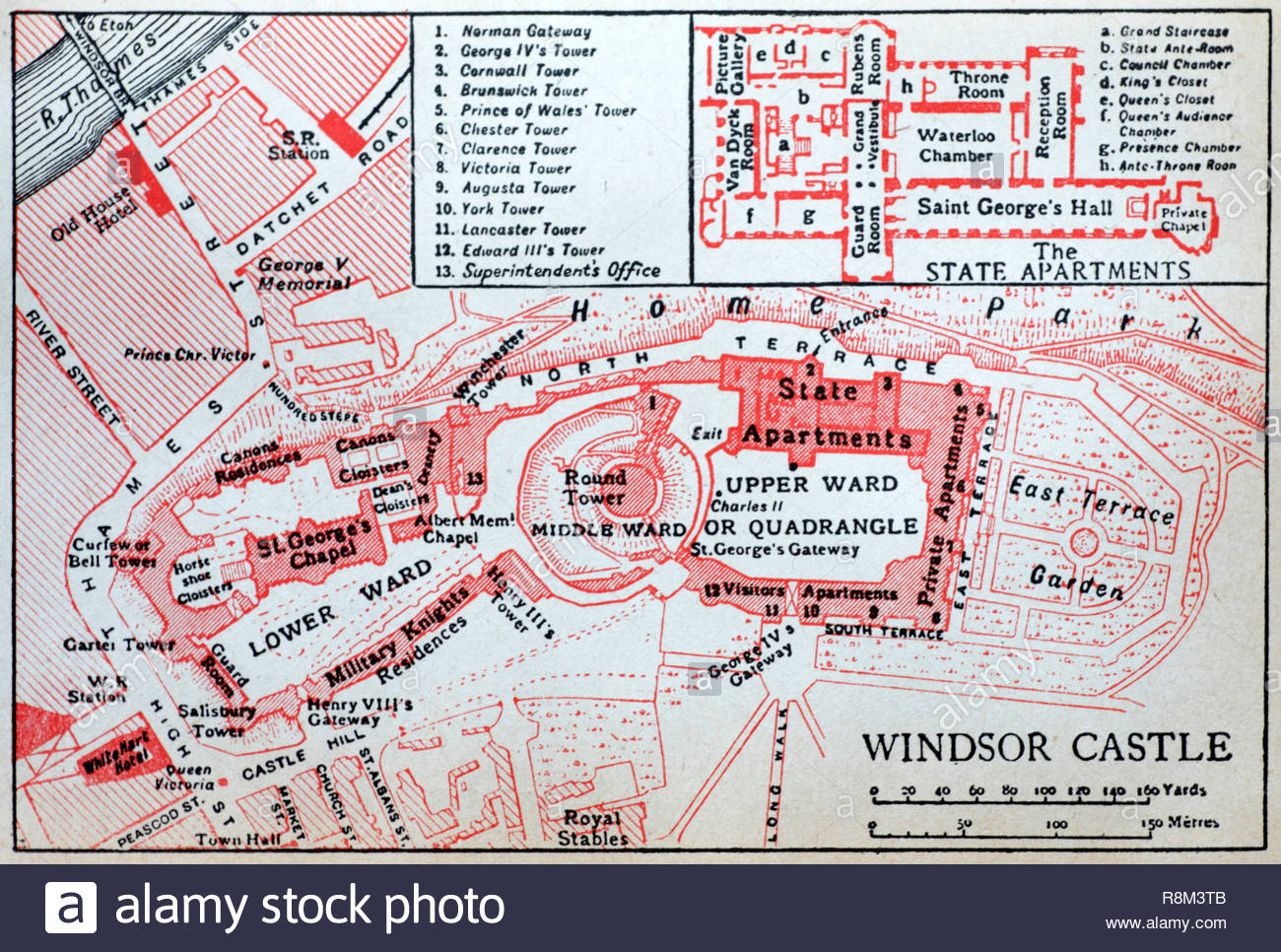 Windsor Castle floor plan, illustration from early 1900s Stock Photohttps://www.alamy.com/image-license-details/?v=1https://www.alamy.com/windsor-castle-floor-plan-illustration-from-early-1900s-image229094107.html
RMR8M3TB–Windsor Castle floor plan, illustration from early 1900s
 Man pointing to weather maps ca. 1936 Stock Photohttps://www.alamy.com/image-license-details/?v=1https://www.alamy.com/man-pointing-to-weather-maps-ca-1936-image259774827.html
RMW2HNCB–Man pointing to weather maps ca. 1936
 Malcolm's Motor & Cyclists' Guide Ten maps for all southern routes 1912 Stock Photohttps://www.alamy.com/image-license-details/?v=1https://www.alamy.com/malcolms-motor-cyclists-guide-ten-maps-for-all-southern-routes-1912-image357185311.html
RF2BN35E7–Malcolm's Motor & Cyclists' Guide Ten maps for all southern routes 1912
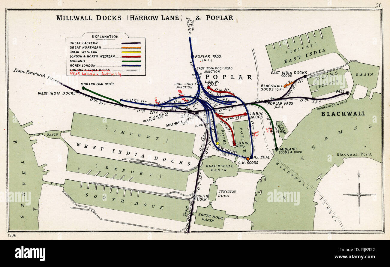 Map, Millwall Docks (Harrow Lane) and Poplar, East London Stock Photohttps://www.alamy.com/image-license-details/?v=1https://www.alamy.com/map-millwall-docks-harrow-lane-and-poplar-east-london-image235047262.html
RMRJB952–Map, Millwall Docks (Harrow Lane) and Poplar, East London
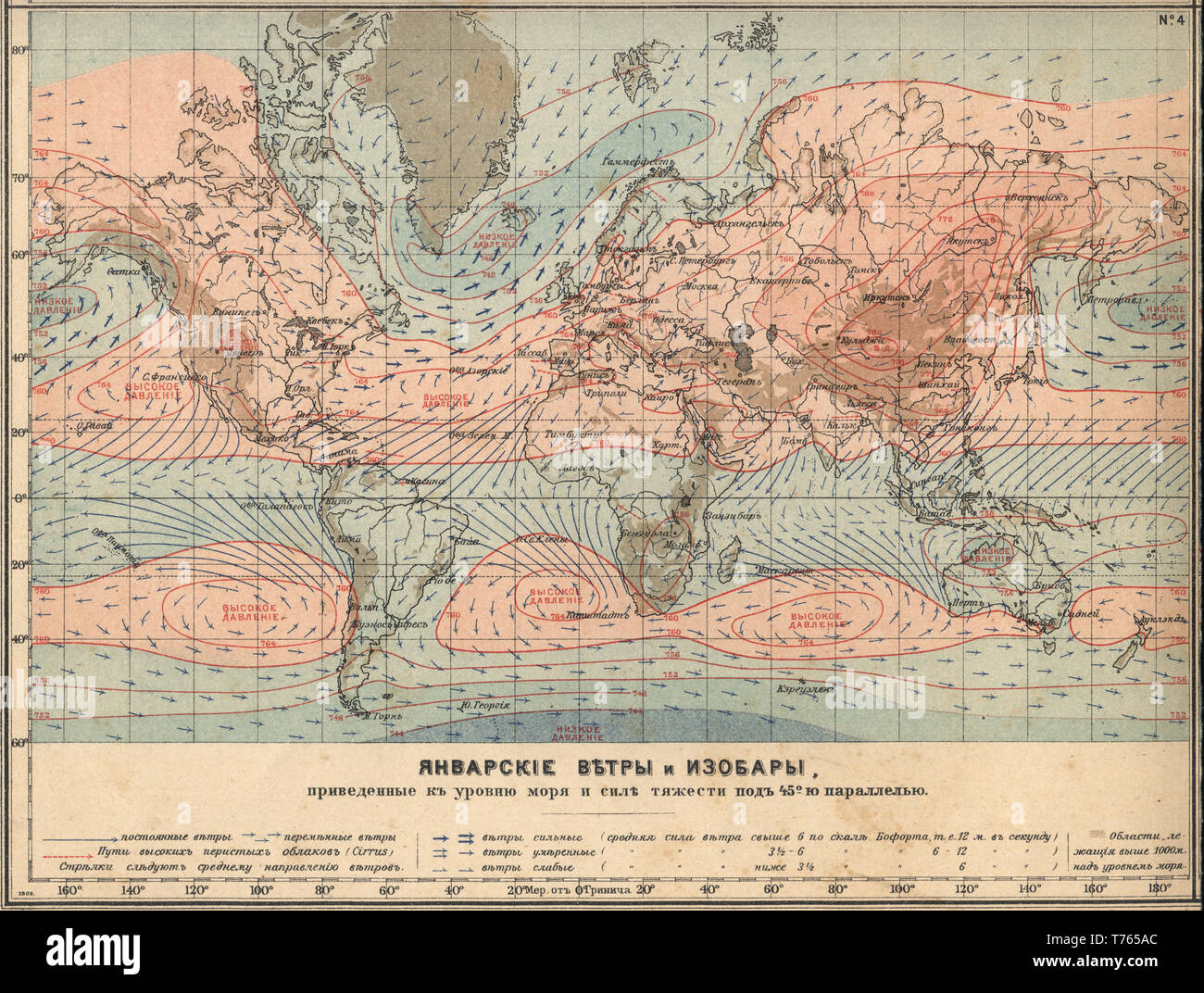 Earth Climatology Maps January winds and isobars New table atlas A.F. Marcks St. Petersburg, 1910 Stock Photohttps://www.alamy.com/image-license-details/?v=1https://www.alamy.com/earth-climatology-maps-january-winds-and-isobars-new-table-atlas-af-marcks-st-petersburg-1910-image245383668.html
RMT765AC–Earth Climatology Maps January winds and isobars New table atlas A.F. Marcks St. Petersburg, 1910
 From Urania's Mirror: Gloria Frederici, Andromeda, and Triangula, 1825 'Gloria Frederici, Andromeda and Triangula', plate 5 in Urania's Mirror, a set of celestial maps accompanied by A familiar treatise on astronomy ... by Jehoshaphat Aspin. London : 1825 (etched by Sidney Hall). (Originally posted 18 August 2008.) Stock Photohttps://www.alamy.com/image-license-details/?v=1https://www.alamy.com/from-uranias-mirror-gloria-frederici-andromeda-and-triangula-1825-gloria-frederici-andromeda-and-triangula-plate-5-in-uranias-mirror-a-set-of-celestial-maps-accompanied-by-a-familiar-treatise-on-astronomy-by-jehoshaphat-aspin-london-1825-etched-by-sidney-hall-originally-posted-18-august-2008-image567170619.html
RF2RXMRWF–From Urania's Mirror: Gloria Frederici, Andromeda, and Triangula, 1825 'Gloria Frederici, Andromeda and Triangula', plate 5 in Urania's Mirror, a set of celestial maps accompanied by A familiar treatise on astronomy ... by Jehoshaphat Aspin. London : 1825 (etched by Sidney Hall). (Originally posted 18 August 2008.)
 Mark Hole Cottage, The Cliffs, Cheddar, Sedgemoor, Somerset, 1907. Looking across the mill pond near Cox's Mill towards Mark Hole Cottage and Lion Rock on the hillside above. The land on the hillside was under cultivation, probably for strawberry growing. Strawberries are still grown on the slopes of Cheddar today and this south facing hillside would have been ideal for growing the soft fruit. The cottages at the bottom of the hill are marked on maps as Mark Hole Cottage but in 1985 were first designated as a listed building known as Cheddar Pottery. Stock Photohttps://www.alamy.com/image-license-details/?v=1https://www.alamy.com/mark-hole-cottage-the-cliffs-cheddar-sedgemoor-somerset-1907-looking-across-the-mill-pond-near-coxs-mill-towards-mark-hole-cottage-and-lion-rock-on-the-hillside-above-the-land-on-the-hillside-was-under-cultivation-probably-for-strawberry-growing-strawberries-are-still-grown-on-the-slopes-of-cheddar-today-and-this-south-facing-hillside-would-have-been-ideal-for-growing-the-soft-fruit-the-cottages-at-the-bottom-of-the-hill-are-marked-on-maps-as-mark-hole-cottage-but-in-1985-were-first-designated-as-a-listed-building-known-as-cheddar-pottery-image506096649.html
RM2MBAKC9–Mark Hole Cottage, The Cliffs, Cheddar, Sedgemoor, Somerset, 1907. Looking across the mill pond near Cox's Mill towards Mark Hole Cottage and Lion Rock on the hillside above. The land on the hillside was under cultivation, probably for strawberry growing. Strawberries are still grown on the slopes of Cheddar today and this south facing hillside would have been ideal for growing the soft fruit. The cottages at the bottom of the hill are marked on maps as Mark Hole Cottage but in 1985 were first designated as a listed building known as Cheddar Pottery.
 Robert Frearson's map of the city of Adelaide : showing 1905 and giving names of sections in suburbs Stock Photohttps://www.alamy.com/image-license-details/?v=1https://www.alamy.com/robert-frearsons-map-of-the-city-of-adelaide-showing-1905-and-giving-names-of-sections-in-suburbs-image635496645.html
RM2YWWACN–Robert Frearson's map of the city of Adelaide : showing 1905 and giving names of sections in suburbs
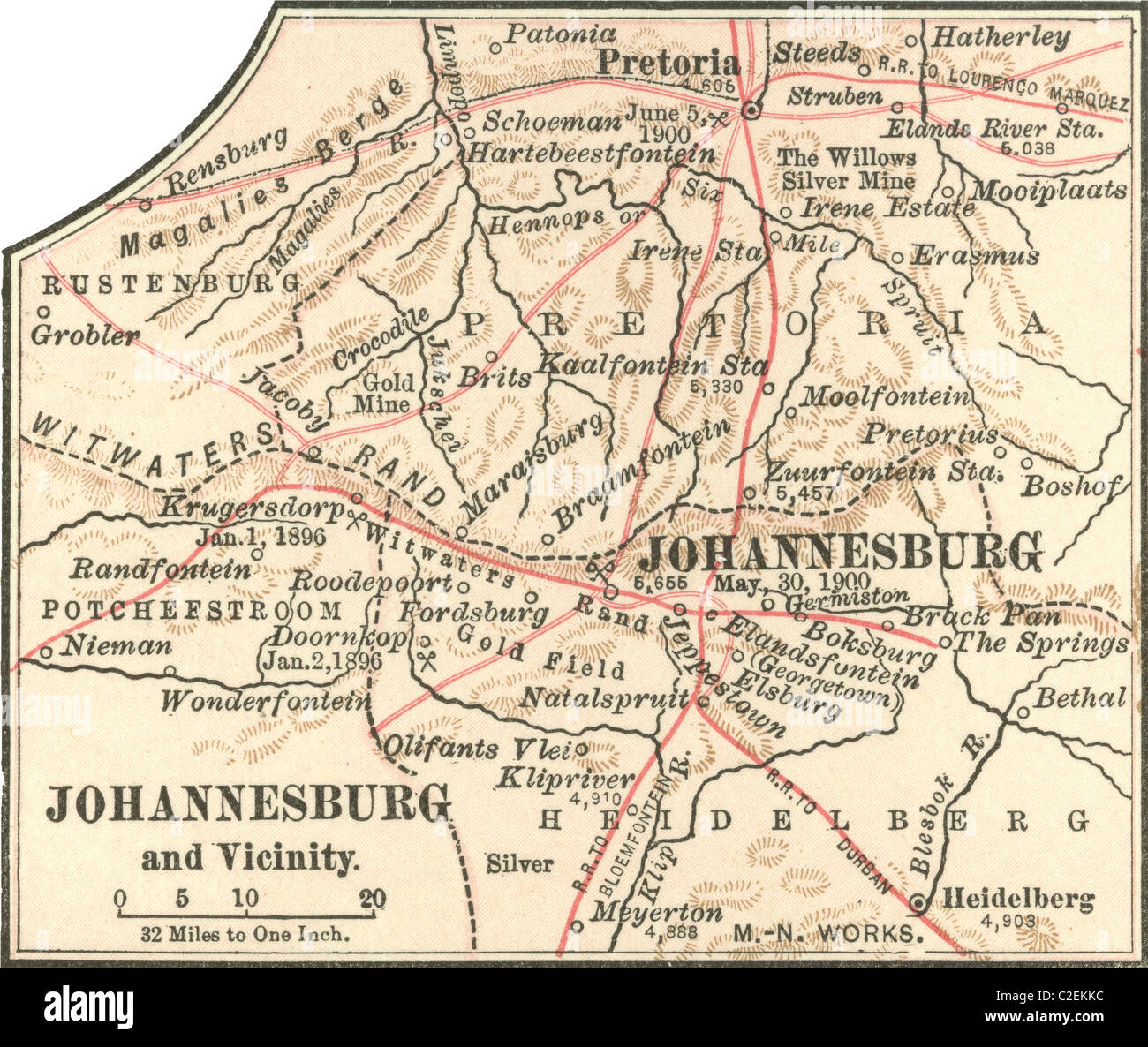 Map of Johannesburg Stock Photohttps://www.alamy.com/image-license-details/?v=1https://www.alamy.com/stock-photo-map-of-johannesburg-35972816.html
RMC2EKKC–Map of Johannesburg
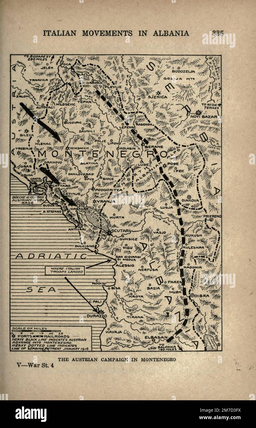 The Austrian Campaign in Montenegro map from the book The story of the great war; the complete historical records of events to date DIPLOMATIC AND STATE PAPERS by Reynolds, Francis Joseph, 1867-1937; Churchill, Allen Leon; Miller, Francis Trevelyan, 1877-1959; Wood, Leonard, 1860-1927; Knight, Austin Melvin, 1854-1927; Palmer, Frederick, 1873-1958; Simonds, Frank Herbert, 1878-; Ruhl, Arthur Brown, 1876- Volume IV Published 1916 Stock Photohttps://www.alamy.com/image-license-details/?v=1https://www.alamy.com/the-austrian-campaign-in-montenegro-map-from-the-book-the-story-of-the-great-war-the-complete-historical-records-of-events-to-date-diplomatic-and-state-papers-by-reynolds-francis-joseph-1867-1937-churchill-allen-leon-miller-francis-trevelyan-1877-1959-wood-leonard-1860-1927-knight-austin-melvin-1854-1927-palmer-frederick-1873-1958-simonds-frank-herbert-1878-ruhl-arthur-brown-1876-volume-iv-published-1916-image503691438.html
RF2M7D3FX–The Austrian Campaign in Montenegro map from the book The story of the great war; the complete historical records of events to date DIPLOMATIC AND STATE PAPERS by Reynolds, Francis Joseph, 1867-1937; Churchill, Allen Leon; Miller, Francis Trevelyan, 1877-1959; Wood, Leonard, 1860-1927; Knight, Austin Melvin, 1854-1927; Palmer, Frederick, 1873-1958; Simonds, Frank Herbert, 1878-; Ruhl, Arthur Brown, 1876- Volume IV Published 1916
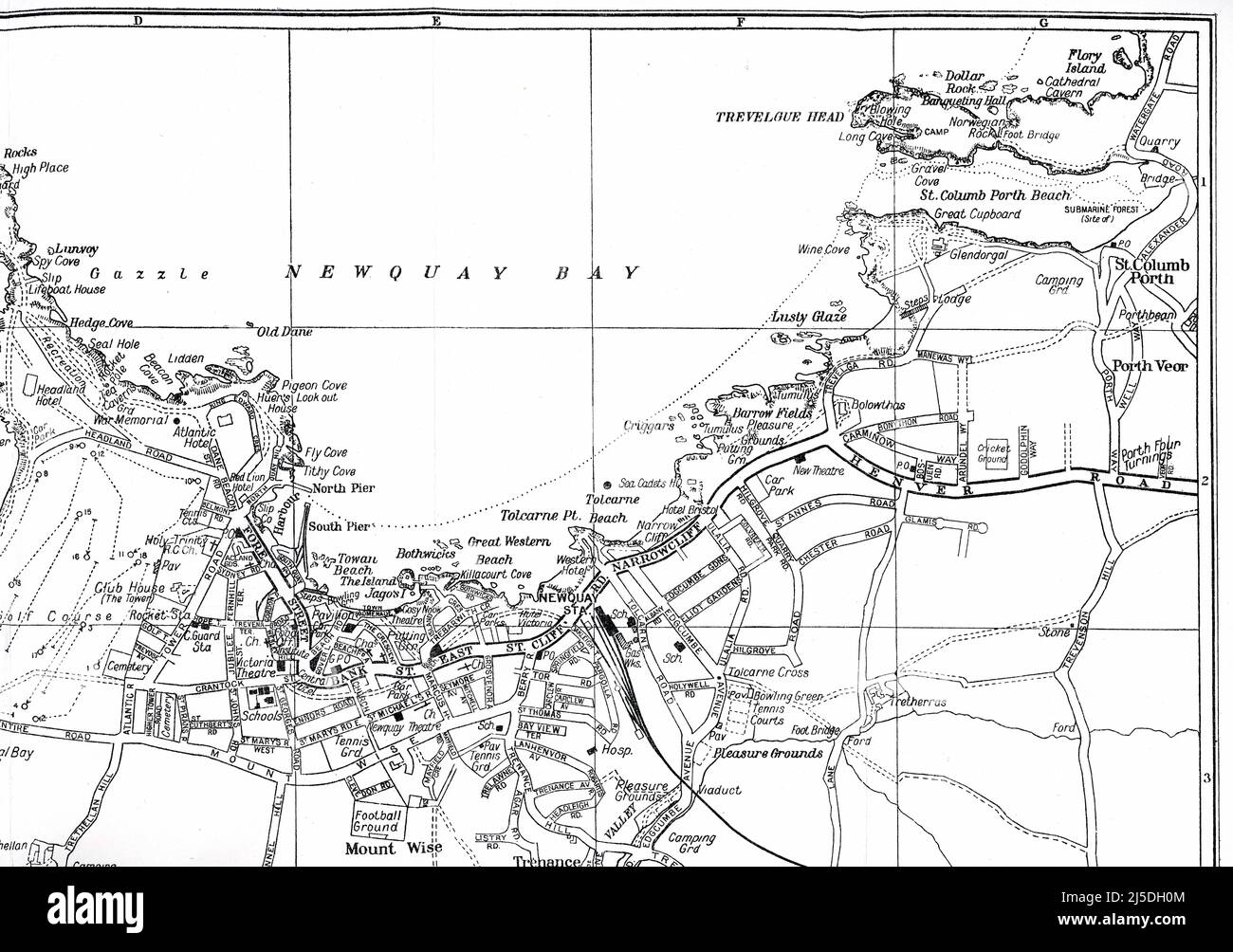 21-VE1431 Inside map - Geographia Visitors' street plan for Newquay town, Published by Geographia Ltd. 167 Fleet Street, London, - circa 1945, 1946 Stock Photohttps://www.alamy.com/image-license-details/?v=1https://www.alamy.com/21-ve1431-inside-map-geographia-visitors-street-plan-for-newquay-town-published-by-geographia-ltd-167-fleet-street-london-circa-1945-1946-image468051940.html
RM2J5DH0M–21-VE1431 Inside map - Geographia Visitors' street plan for Newquay town, Published by Geographia Ltd. 167 Fleet Street, London, - circa 1945, 1946
 Click On Vintage French cigarette paper - Abadie, 1900s Stock Photohttps://www.alamy.com/image-license-details/?v=1https://www.alamy.com/click-on-vintage-french-cigarette-paper-abadie-1900s-image439102799.html
RF2GEAT2R–Click On Vintage French cigarette paper - Abadie, 1900s
RF2TD310Y–New York City skyline from Governor's Island, 1925. From the book 'The iconography of Manhattan Island, 1498-1909 compiled from original sources and illustrated by photo-intaglio reproductions of important maps, plans, views, and documents in public and private collections - Volume 6'.
 Four Zone Maps (Colored) from the book The story of the great war; the complete historical records of events to date DIPLOMATIC AND STATE PAPERS by Reynolds, Francis Joseph, 1867-1937; Churchill, Allen Leon; Miller, Francis Trevelyan, 1877-1959; Wood, Leonard, 1860-1927; Knight, Austin Melvin, 1854-1927; Palmer, Frederick, 1873-1958; Simonds, Frank Herbert, 1878-; Ruhl, Arthur Brown, 1876- Volume V Published 1916 Stock Photohttps://www.alamy.com/image-license-details/?v=1https://www.alamy.com/four-zone-maps-colored-from-the-book-the-story-of-the-great-war-the-complete-historical-records-of-events-to-date-diplomatic-and-state-papers-by-reynolds-francis-joseph-1867-1937-churchill-allen-leon-miller-francis-trevelyan-1877-1959-wood-leonard-1860-1927-knight-austin-melvin-1854-1927-palmer-frederick-1873-1958-simonds-frank-herbert-1878-ruhl-arthur-brown-1876-volume-v-published-1916-image505985180.html
RF2MB5H78–Four Zone Maps (Colored) from the book The story of the great war; the complete historical records of events to date DIPLOMATIC AND STATE PAPERS by Reynolds, Francis Joseph, 1867-1937; Churchill, Allen Leon; Miller, Francis Trevelyan, 1877-1959; Wood, Leonard, 1860-1927; Knight, Austin Melvin, 1854-1927; Palmer, Frederick, 1873-1958; Simonds, Frank Herbert, 1878-; Ruhl, Arthur Brown, 1876- Volume V Published 1916
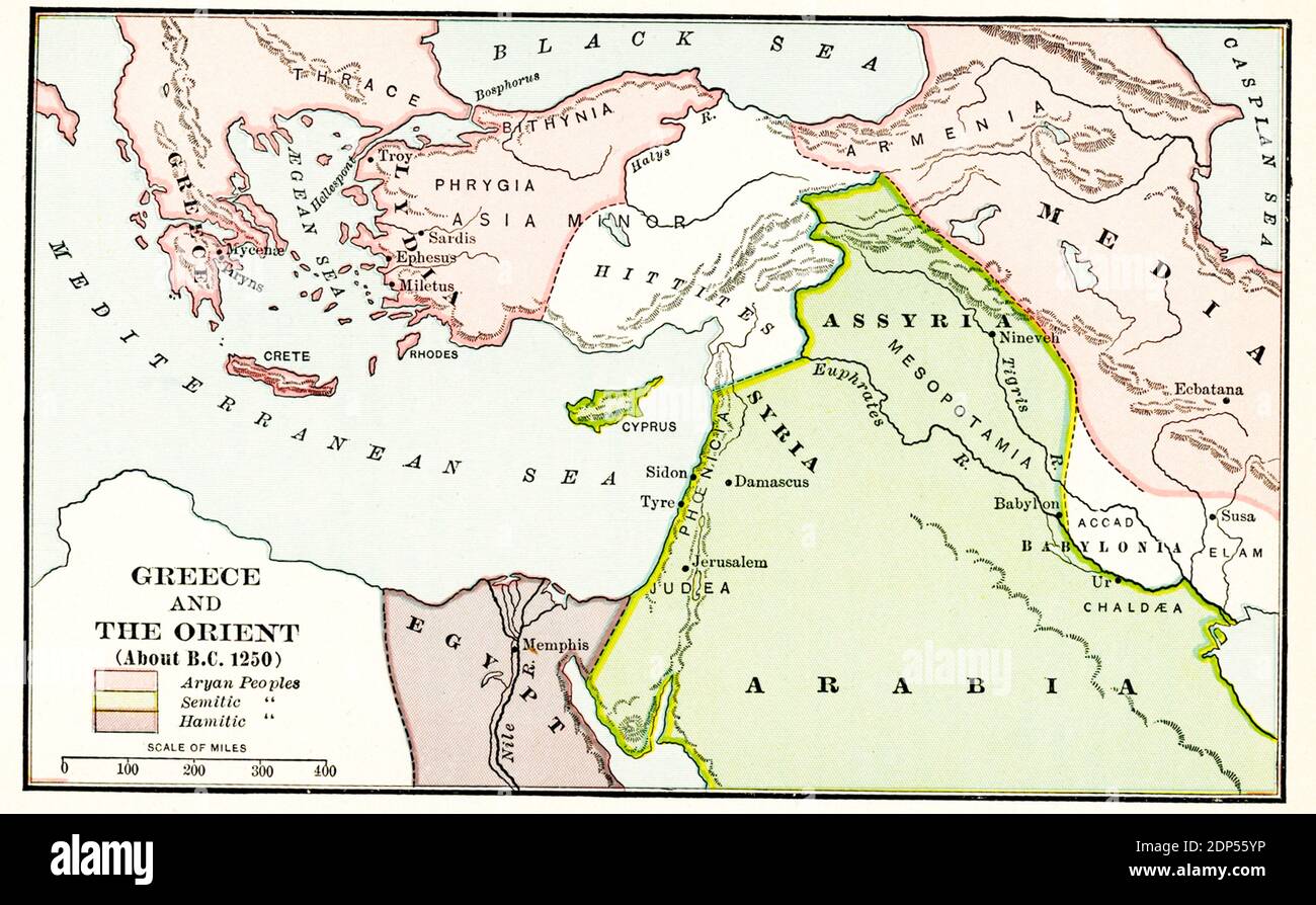 Greece and the Orient about B.C. 1250. The legend for this early 1900s map reads: Pink-Aryan peoples; green- Semitic peoples; Purple - Hamitic peoples Stock Photohttps://www.alamy.com/image-license-details/?v=1https://www.alamy.com/greece-and-the-orient-about-bc-1250-the-legend-for-this-early-1900s-map-reads-pink-aryan-peoples-green-semitic-peoples-purple-hamitic-peoples-image392264986.html
RF2DP55YP–Greece and the Orient about B.C. 1250. The legend for this early 1900s map reads: Pink-Aryan peoples; green- Semitic peoples; Purple - Hamitic peoples
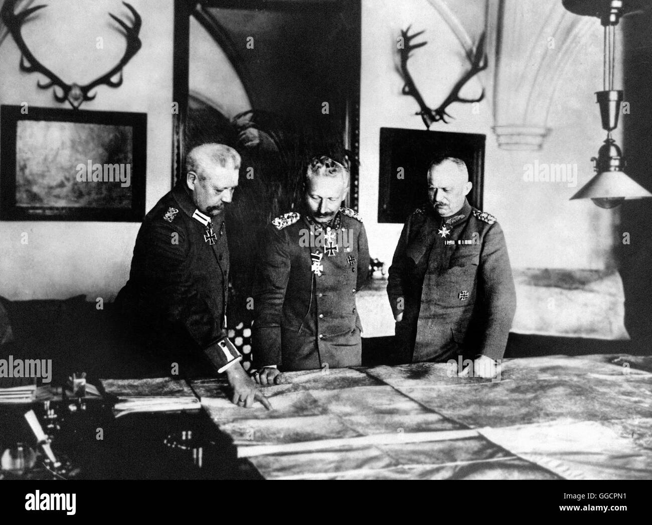 Generalfeldmarschall Paul von Hindenburg, Kaiser Wilhelm II, and General Erich Ludendorff. Photo c.1917 Stock Photohttps://www.alamy.com/image-license-details/?v=1https://www.alamy.com/stock-photo-generalfeldmarschall-paul-von-hindenburg-kaiser-wilhelm-ii-and-general-113377965.html
RMGGCPN1–Generalfeldmarschall Paul von Hindenburg, Kaiser Wilhelm II, and General Erich Ludendorff. Photo c.1917
 Map of Atlantic Ocean floor from Geographic das Atlantischen Ozeans published in 1925 by German oceanographer Gerhard Schott. The map shows all major features and topography. Stock Photohttps://www.alamy.com/image-license-details/?v=1https://www.alamy.com/map-of-atlantic-ocean-floor-from-geographic-das-atlantischen-ozeans-image66245471.html
RMDRNMNK–Map of Atlantic Ocean floor from Geographic das Atlantischen Ozeans published in 1925 by German oceanographer Gerhard Schott. The map shows all major features and topography.
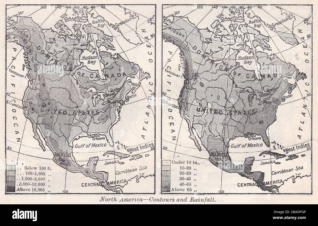 Vintage map of North America showing Contours and Rainfall 1900s. Stock Photohttps://www.alamy.com/image-license-details/?v=1https://www.alamy.com/vintage-map-of-north-america-showing-contours-and-rainfall-1900s-image350651526.html
RF2BADFGP–Vintage map of North America showing Contours and Rainfall 1900s.