Quick filters:
1938 maps Stock Photos and Images
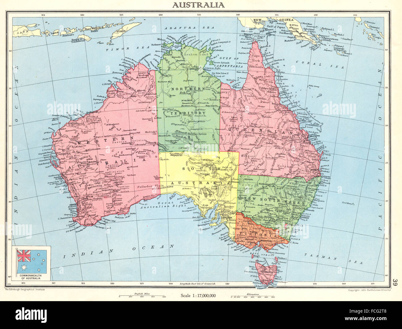 AUSTRALIA: Commonwealth of Australia, 1938 vintage map Stock Photohttps://www.alamy.com/image-license-details/?v=1https://www.alamy.com/stock-photo-australia-commonwealth-of-australia-1938-vintage-map-93781192.html
RFFCG2T8–AUSTRALIA: Commonwealth of Australia, 1938 vintage map
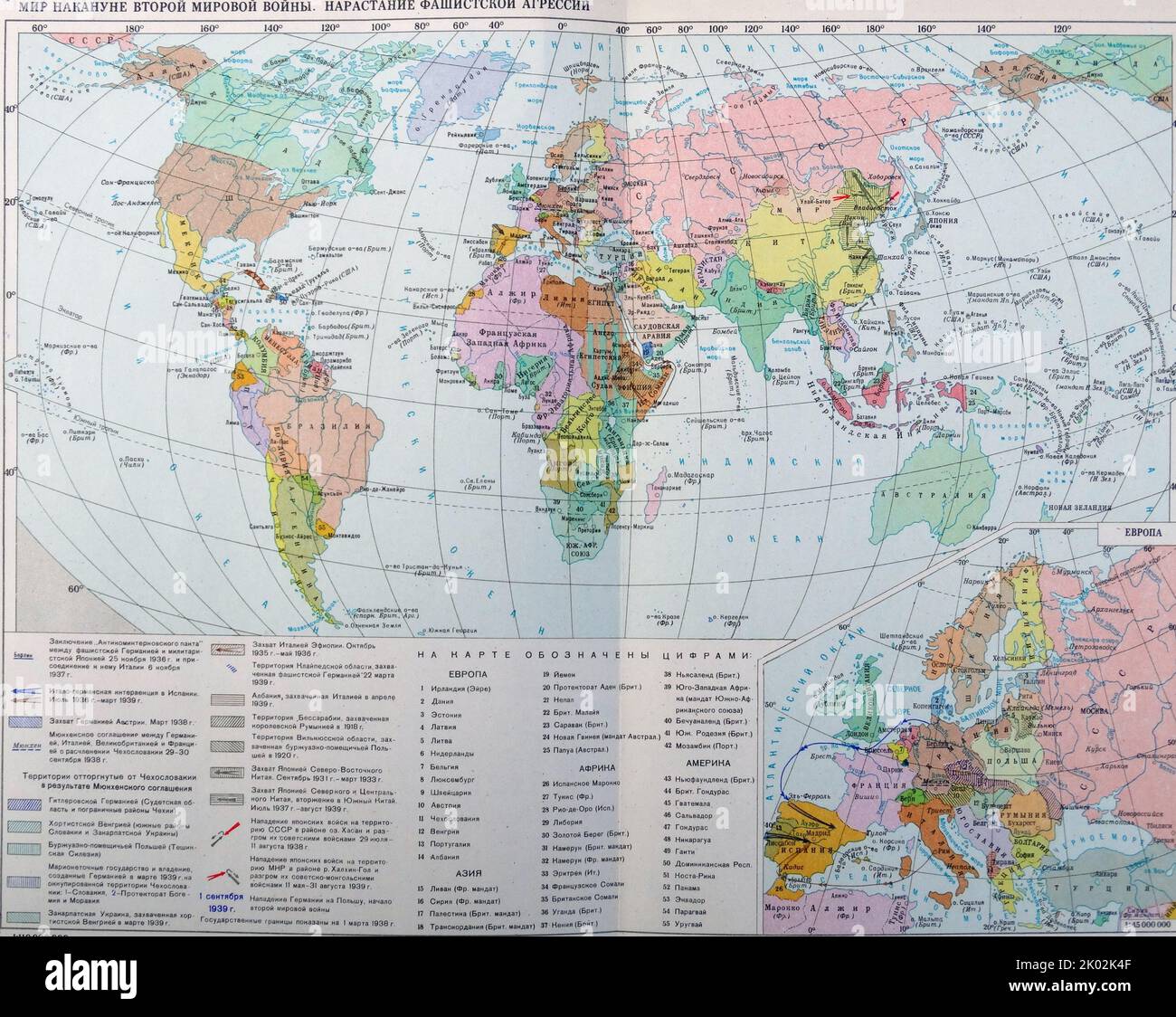 Soviet Russian world map 1938 Stock Photohttps://www.alamy.com/image-license-details/?v=1https://www.alamy.com/soviet-russian-world-map-1938-image481949231.html
RM2K02K4F–Soviet Russian world map 1938
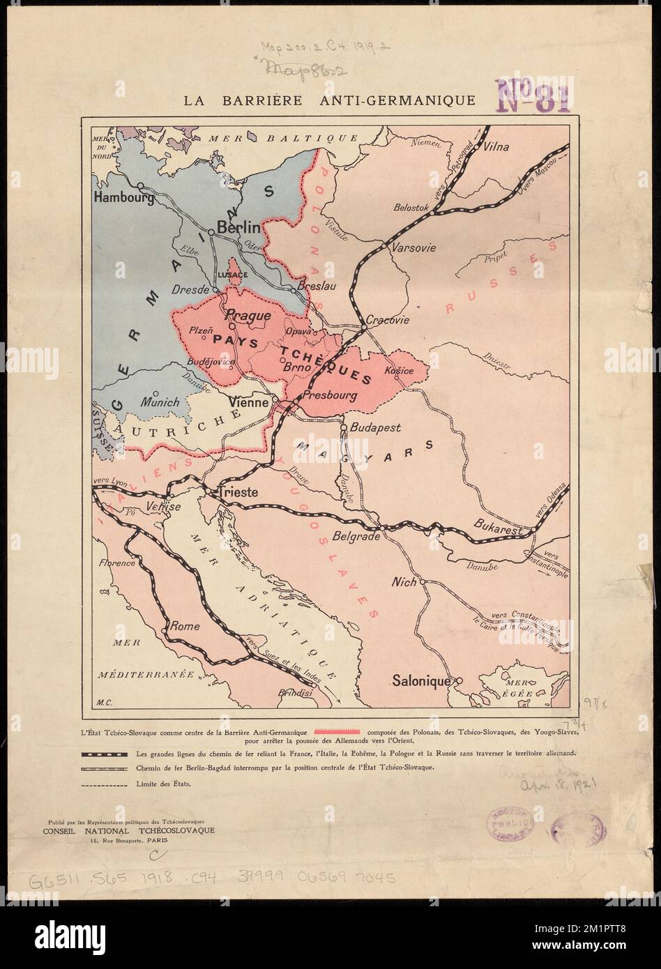 La Barrière anti-Germanique , Pangermanism, Maps, World War, 1914-1918, Territorial questions, Maps, Czechoslovakia, History, 1918-1938, Maps, Europe, Eastern, Maps Norman B. Leventhal Map Center Collection Stock Photohttps://www.alamy.com/image-license-details/?v=1https://www.alamy.com/la-barriere-anti-germanique-pangermanism-maps-world-war-1914-1918-territorial-questions-maps-czechoslovakia-history-1918-1938-maps-europe-eastern-maps-norman-b-leventhal-map-center-collection-image500217768.html
RM2M1PTT8–La Barrière anti-Germanique , Pangermanism, Maps, World War, 1914-1918, Territorial questions, Maps, Czechoslovakia, History, 1918-1938, Maps, Europe, Eastern, Maps Norman B. Leventhal Map Center Collection
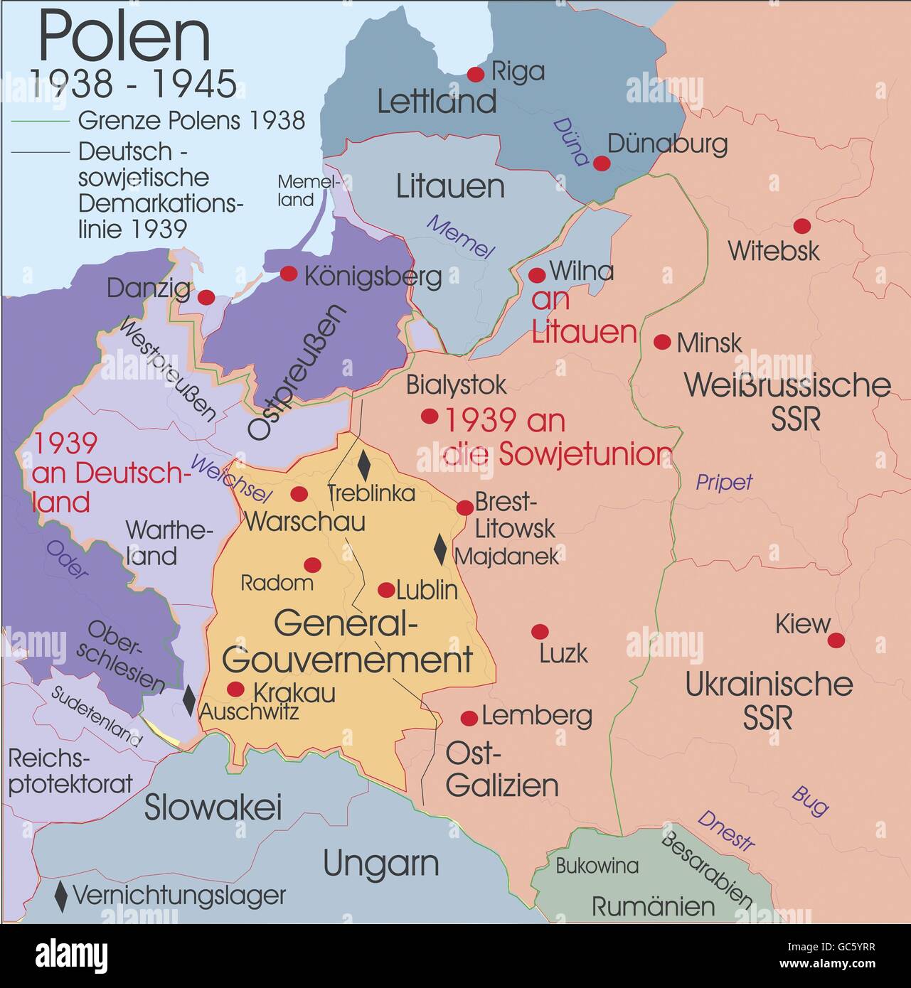 cartography, historical maps, modern times, Poland, 1938 - 1945, Additional-Rights-Clearences-Not Available Stock Photohttps://www.alamy.com/image-license-details/?v=1https://www.alamy.com/stock-photo-cartography-historical-maps-modern-times-poland-1938-1945-additional-110769675.html
RMGC5YRR–cartography, historical maps, modern times, Poland, 1938 - 1945, Additional-Rights-Clearences-Not Available
 Paul Hartmann in 'Revolutionshochzeit', 1938 Stock Photohttps://www.alamy.com/image-license-details/?v=1https://www.alamy.com/stock-photo-paul-hartmann-in-revolutionshochzeit-1938-48397225.html
RMCPMK49–Paul Hartmann in 'Revolutionshochzeit', 1938
 H.V. Kaltenborn at the CBS microphone, ca. 1938-1940 as Europe moved toward war. During the Munich Crisis, in Sept. 1938, he slept in the CBS studio and reported day and night from until the day after the signing of the Four Power Agreement on Sept. 29th. He played himself in two movies, MR. SMITH GOES TO WASHINGTON (1939) and THE DAY THE EARTH STOOD STILL (1951). T. (CSU 2015 9 674) Stock Photohttps://www.alamy.com/image-license-details/?v=1https://www.alamy.com/stock-photo-hv-kaltenborn-at-the-cbs-microphone-ca-1938-1940-as-europe-moved-toward-87522809.html
RMF2B06H–H.V. Kaltenborn at the CBS microphone, ca. 1938-1940 as Europe moved toward war. During the Munich Crisis, in Sept. 1938, he slept in the CBS studio and reported day and night from until the day after the signing of the Four Power Agreement on Sept. 29th. He played himself in two movies, MR. SMITH GOES TO WASHINGTON (1939) and THE DAY THE EARTH STOOD STILL (1951). T. (CSU 2015 9 674)
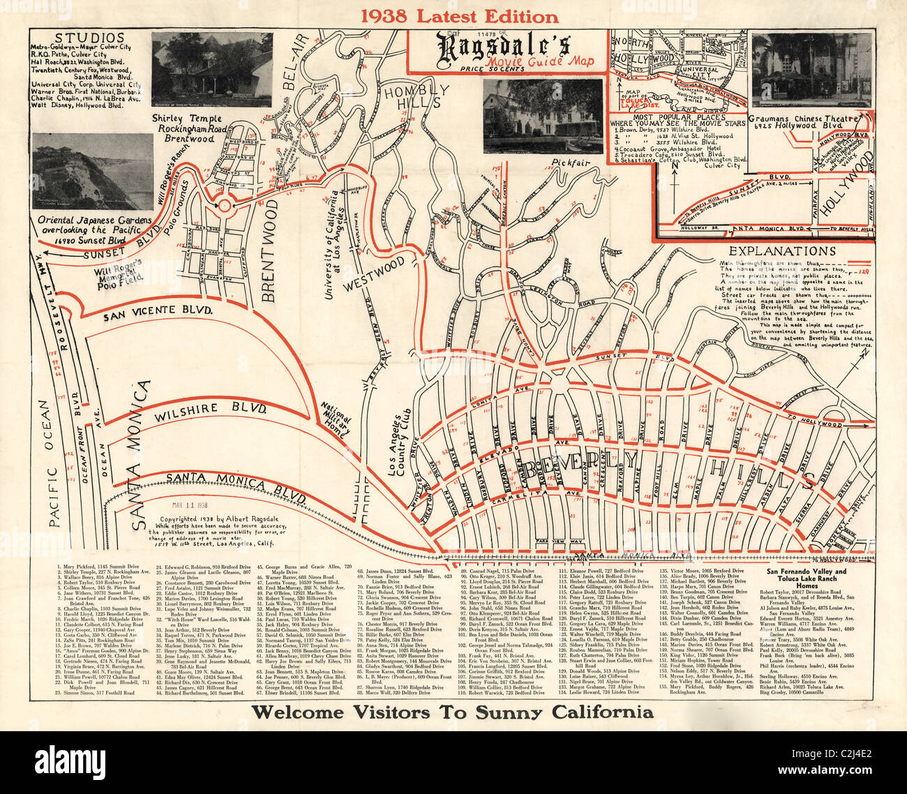 Movie Guide Map for Hollywood - 1938 Stock Photohttps://www.alamy.com/image-license-details/?v=1https://www.alamy.com/stock-photo-movie-guide-map-for-hollywood-1938-36048714.html
RMC2J4E2–Movie Guide Map for Hollywood - 1938
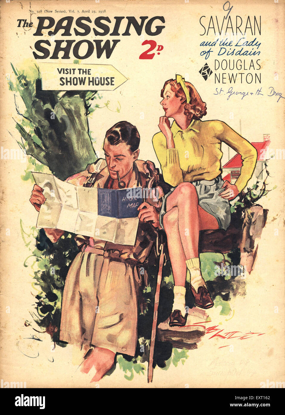 1930s UK The Passing Show Magazine Cover Stock Photohttps://www.alamy.com/image-license-details/?v=1https://www.alamy.com/stock-photo-1930s-uk-the-passing-show-magazine-cover-85350330.html
RMEXT162–1930s UK The Passing Show Magazine Cover
 English: Page from L'Illustration's Atlas de la France et de ses colonies (1938) showing maps of the five non-contiguous établissements (settlements) forming French India. The top right inset shows the établissement of Pondichéry (English: Pondicherry) with its separate exclaves (now Puducherry District). The bottom left inset shows the établissement of Karikal (now Karaikal District). The smaller insets show the établissements of Chandernagor (now Chandannagar, a suburb of Calcutta), Yanaon (now Yanam District) and Mahé (now Mahe District), as well as a map of the capital city of Pondichéry a Stock Photohttps://www.alamy.com/image-license-details/?v=1https://www.alamy.com/english-page-from-lillustrations-atlas-de-la-france-et-de-ses-colonies-1938-showing-maps-of-the-five-non-contiguous-tablissements-settlements-forming-french-india-the-top-right-inset-shows-the-tablissement-of-pondichry-english-pondicherry-with-its-separate-exclaves-now-puducherry-district-the-bottom-left-inset-shows-the-tablissement-of-karikal-now-karaikal-district-the-smaller-insets-show-the-tablissements-of-chandernagor-now-chandannagar-a-suburb-of-calcutta-yanaon-now-yanam-district-and-mah-now-mahe-district-as-well-as-a-map-of-the-capital-city-of-pondichry-a-image211368769.html
RMP7TK0H–English: Page from L'Illustration's Atlas de la France et de ses colonies (1938) showing maps of the five non-contiguous établissements (settlements) forming French India. The top right inset shows the établissement of Pondichéry (English: Pondicherry) with its separate exclaves (now Puducherry District). The bottom left inset shows the établissement of Karikal (now Karaikal District). The smaller insets show the établissements of Chandernagor (now Chandannagar, a suburb of Calcutta), Yanaon (now Yanam District) and Mahé (now Mahe District), as well as a map of the capital city of Pondichéry a
 In Herr Hitler's mountain retreat at Berchtesgaden where discussions of world wide improt take place Part of the Great Hall, showing the 17th century Flemish tapestry, the grand piano, a globe, and a marble topped table for maps and plans, beside a 27ft wide window commanding magnificent views of the Bavarian Alps March 1938 Stock Photohttps://www.alamy.com/image-license-details/?v=1https://www.alamy.com/in-herr-hitlers-mountain-retreat-at-berchtesgaden-where-discussions-of-world-wide-improt-take-place-part-of-the-great-hall-showing-the-17th-century-flemish-tapestry-the-grand-piano-a-globe-and-a-marble-topped-table-for-maps-and-plans-beside-a-27ft-wide-window-commanding-magnificent-views-of-the-bavarian-alps-march-1938-image623740886.html
RM2Y6NRT6–In Herr Hitler's mountain retreat at Berchtesgaden where discussions of world wide improt take place Part of the Great Hall, showing the 17th century Flemish tapestry, the grand piano, a globe, and a marble topped table for maps and plans, beside a 27ft wide window commanding magnificent views of the Bavarian Alps March 1938
 Pictural Map of Lazio , Italy Colorful small map with vignettes of structures, nature, activities, products, crops, etc. Towns and cities labeled. Gilt used on most maps. from the book ' Italia ' by De Agostini, Giovanni; Nicouline, Vsevolod Petrovic Publication date 1938 Publisher Societa Anonima Editrice 'Italgeo', Milano artwork by Vsevolod Petrovic Nicouline Stock Photohttps://www.alamy.com/image-license-details/?v=1https://www.alamy.com/pictural-map-of-lazio-italy-colorful-small-map-with-vignettes-of-structures-nature-activities-products-crops-etc-towns-and-cities-labeled-gilt-used-on-most-maps-from-the-book-italia-by-de-agostini-giovanni-nicouline-vsevolod-petrovic-publication-date-1938-publisher-societa-anonima-editrice-italgeo-milano-artwork-by-vsevolod-petrovic-nicouline-image474662678.html
RF2JG6N2E–Pictural Map of Lazio , Italy Colorful small map with vignettes of structures, nature, activities, products, crops, etc. Towns and cities labeled. Gilt used on most maps. from the book ' Italia ' by De Agostini, Giovanni; Nicouline, Vsevolod Petrovic Publication date 1938 Publisher Societa Anonima Editrice 'Italgeo', Milano artwork by Vsevolod Petrovic Nicouline
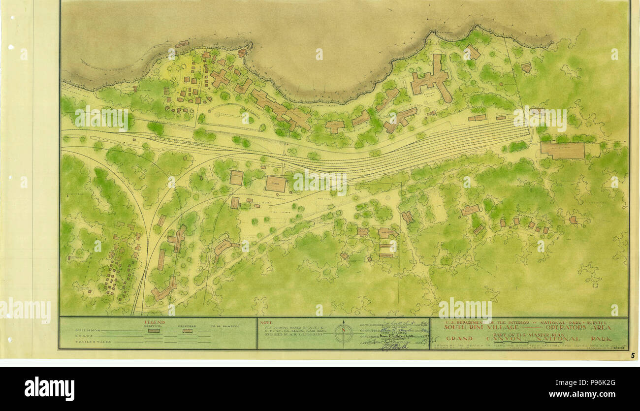 South Rim Village -- Operators Area Grand Canyon 1938 Stock Photohttps://www.alamy.com/image-license-details/?v=1https://www.alamy.com/south-rim-village-operators-area-grand-canyon-1938-image212203000.html
RMP96K2G–South Rim Village -- Operators Area Grand Canyon 1938
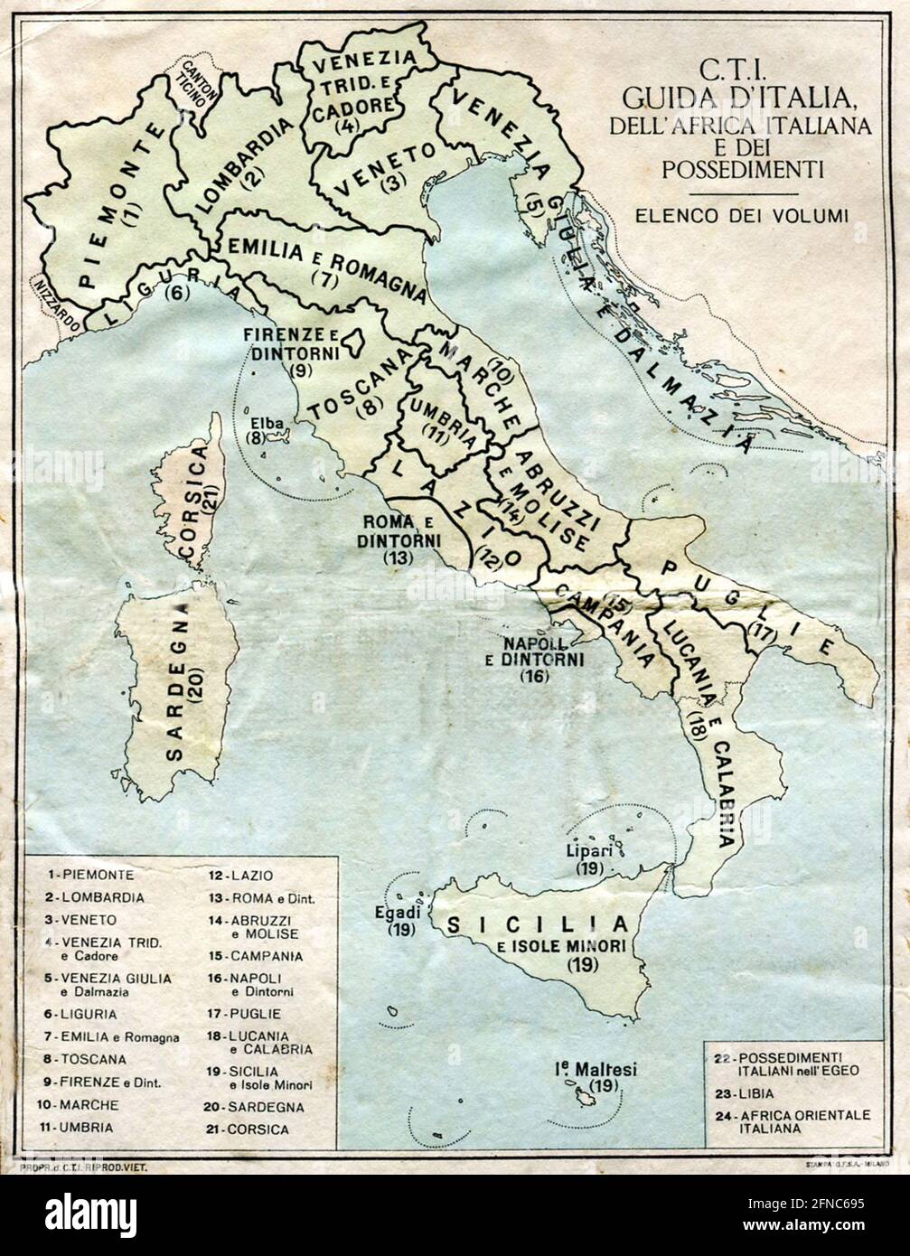 Ancient map of Italy (image from Italian Eastern Africa guide book 1938 edition) Stock Photohttps://www.alamy.com/image-license-details/?v=1https://www.alamy.com/ancient-map-of-italy-image-from-italian-eastern-africa-guide-book-1938-edition-image426224993.html
RF2FNC695–Ancient map of Italy (image from Italian Eastern Africa guide book 1938 edition)
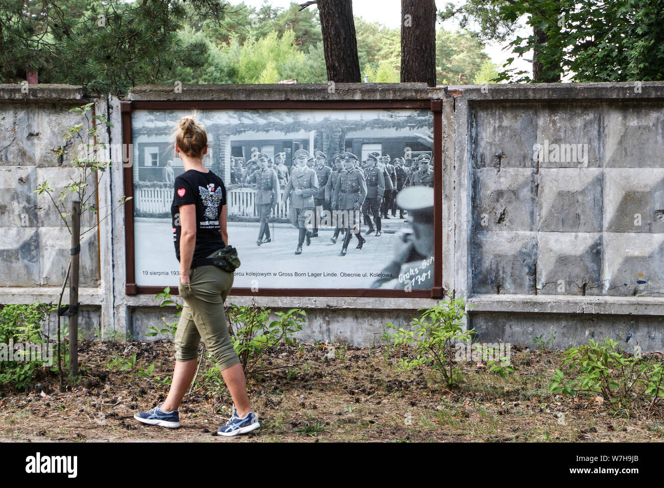 Borne Sulinowo, Poland. 3rd, August 2019 Pictures from the 1930 to present times showing complicated history of the city displayed on the city walls is seen in Borne Sulinowo, Poland on 3 August 2019 Borne Sulinowo former Gross Born was from 1933 the German Nazis large military base, and Artillery School of the Wehrmacht, officially opened by Adolf Hitler in 1938. Between 1945 and 1992 it was a secret Soviet military base, erased from all Polish maps and it was not transferred to Polish jurisdiction until 1992. In official documents were called forest areas and remained a secret for almost 50 Stock Photohttps://www.alamy.com/image-license-details/?v=1https://www.alamy.com/borne-sulinowo-poland-3rd-august-2019-pictures-from-the-1930-to-present-times-showing-complicated-history-of-the-city-displayed-on-the-city-walls-is-seen-in-borne-sulinowo-poland-on-3-august-2019-borne-sulinowo-former-gross-born-was-from-1933-the-german-nazis-large-military-base-and-artillery-school-of-the-wehrmacht-officially-opened-by-adolf-hitler-in-1938-between-1945-and-1992-it-was-a-secret-soviet-military-base-erased-from-all-polish-maps-and-it-was-not-transferred-to-polish-jurisdiction-until-1992-in-official-documents-were-called-forest-areas-and-remained-a-secret-for-almost-50-image262838867.html
RMW7H9JB–Borne Sulinowo, Poland. 3rd, August 2019 Pictures from the 1930 to present times showing complicated history of the city displayed on the city walls is seen in Borne Sulinowo, Poland on 3 August 2019 Borne Sulinowo former Gross Born was from 1933 the German Nazis large military base, and Artillery School of the Wehrmacht, officially opened by Adolf Hitler in 1938. Between 1945 and 1992 it was a secret Soviet military base, erased from all Polish maps and it was not transferred to Polish jurisdiction until 1992. In official documents were called forest areas and remained a secret for almost 50
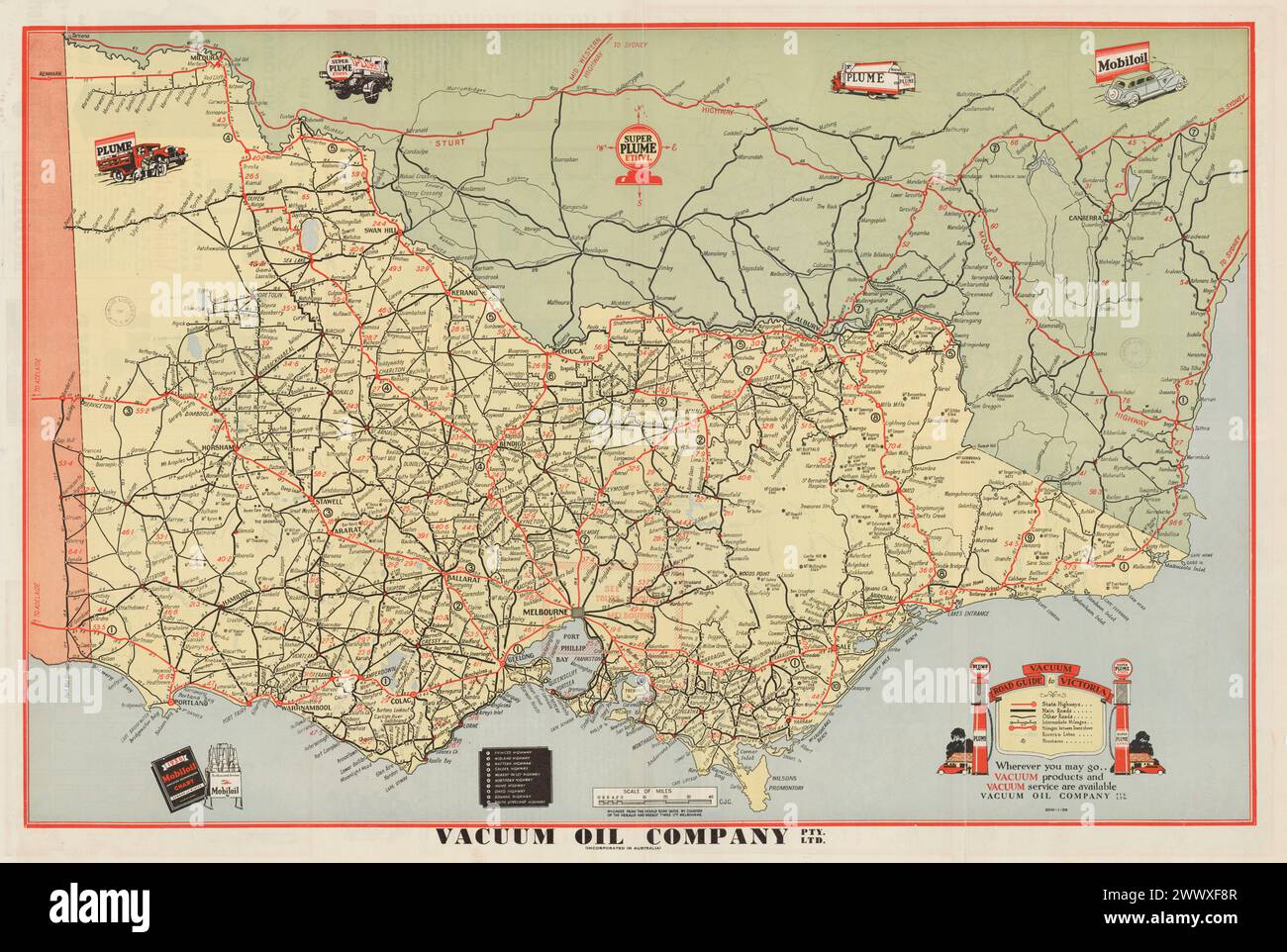 Vintage Tourist Map. Vacuum road map of Victoria, Australia with interstate routes. 1938 Stock Photohttps://www.alamy.com/image-license-details/?v=1https://www.alamy.com/vintage-tourist-map-vacuum-road-map-of-victoria-australia-with-interstate-routes-1938-image601101671.html
RM2WWXF8R–Vintage Tourist Map. Vacuum road map of Victoria, Australia with interstate routes. 1938
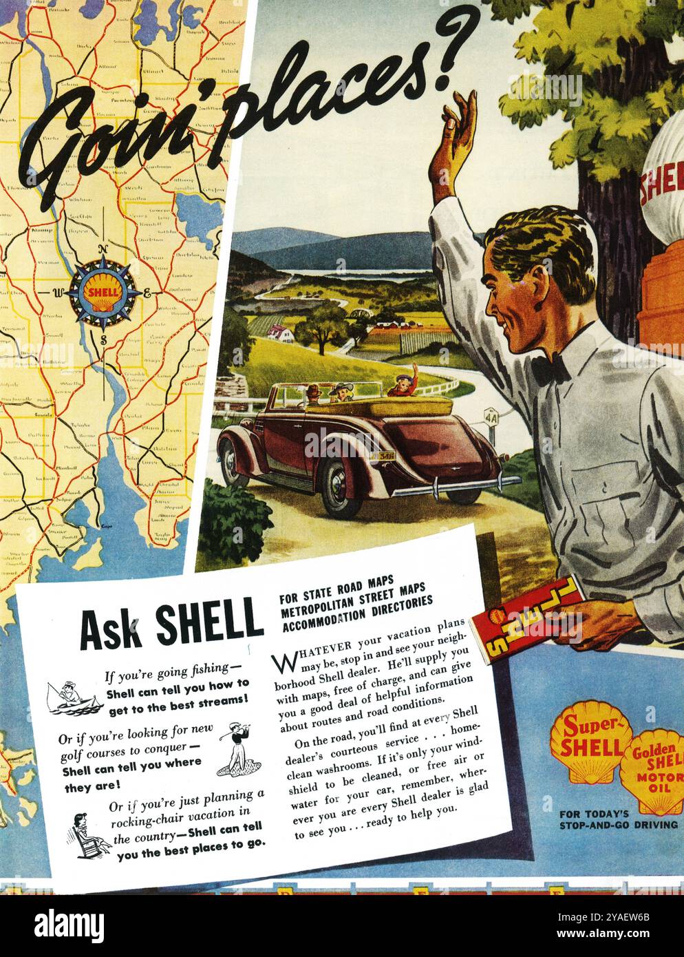 1938 Shell Ad - Road Map -. 'Going Places? Ask Shell' Stock Photohttps://www.alamy.com/image-license-details/?v=1https://www.alamy.com/1938-shell-ad-road-map-going-places-ask-shell-image626046915.html
RM2YAEW6B–1938 Shell Ad - Road Map -. 'Going Places? Ask Shell'
 Illustrated map of Italy. Towns and cities labelled. From 'Italia' by Giovanni De Agostini, artwork by Vsevolod Petrovic Nicouline. Publication date 1938. Stock Photohttps://www.alamy.com/image-license-details/?v=1https://www.alamy.com/illustrated-map-of-italy-towns-and-cities-labelled-from-italia-by-giovanni-de-agostini-artwork-by-vsevolod-petrovic-nicouline-publication-date-1938-image575999355.html
RF2TD311F–Illustrated map of Italy. Towns and cities labelled. From 'Italia' by Giovanni De Agostini, artwork by Vsevolod Petrovic Nicouline. Publication date 1938.
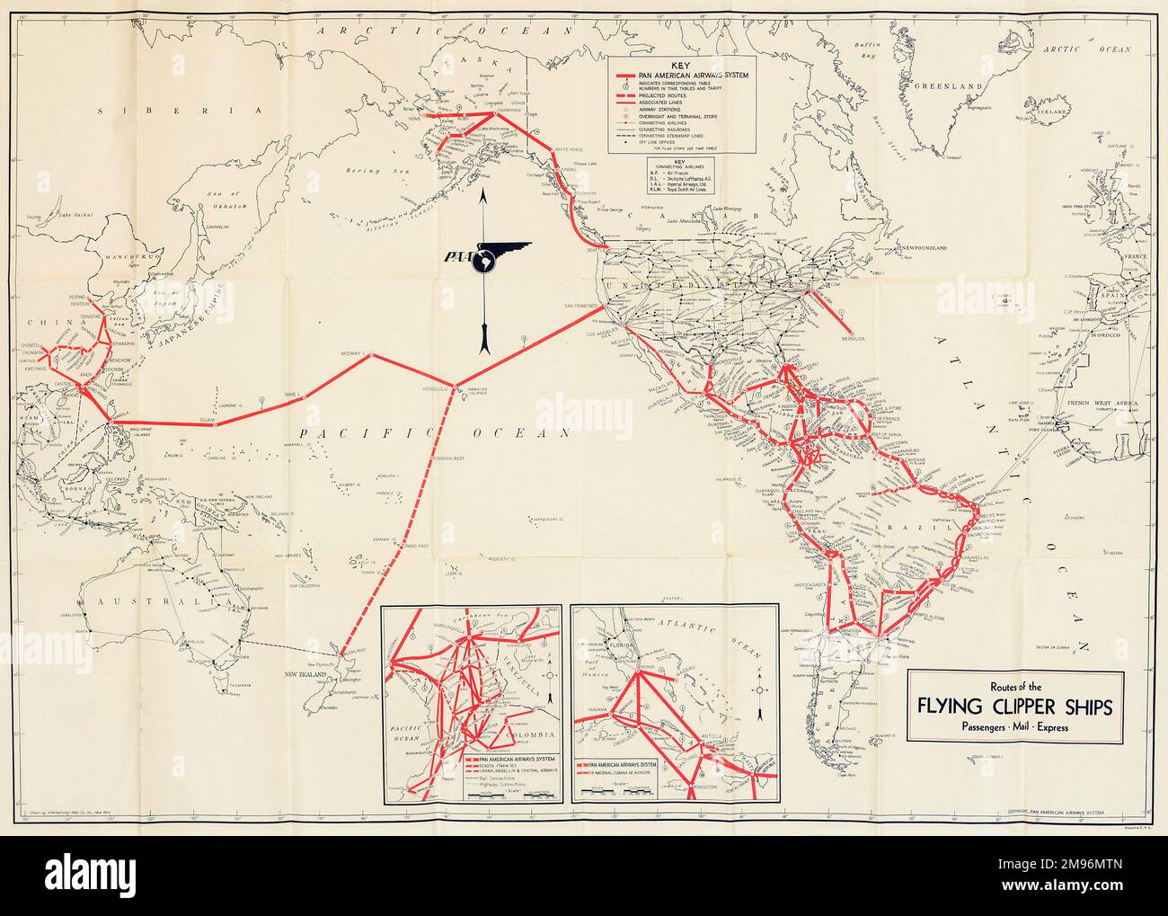 Pan American Airways System global route map of the Flying Clipper Ships (passengers, mail, express). Stock Photohttps://www.alamy.com/image-license-details/?v=1https://www.alamy.com/pan-american-airways-system-global-route-map-of-the-flying-clipper-ships-passengers-mail-express-image504780661.html
RM2M96MTN–Pan American Airways System global route map of the Flying Clipper Ships (passengers, mail, express).
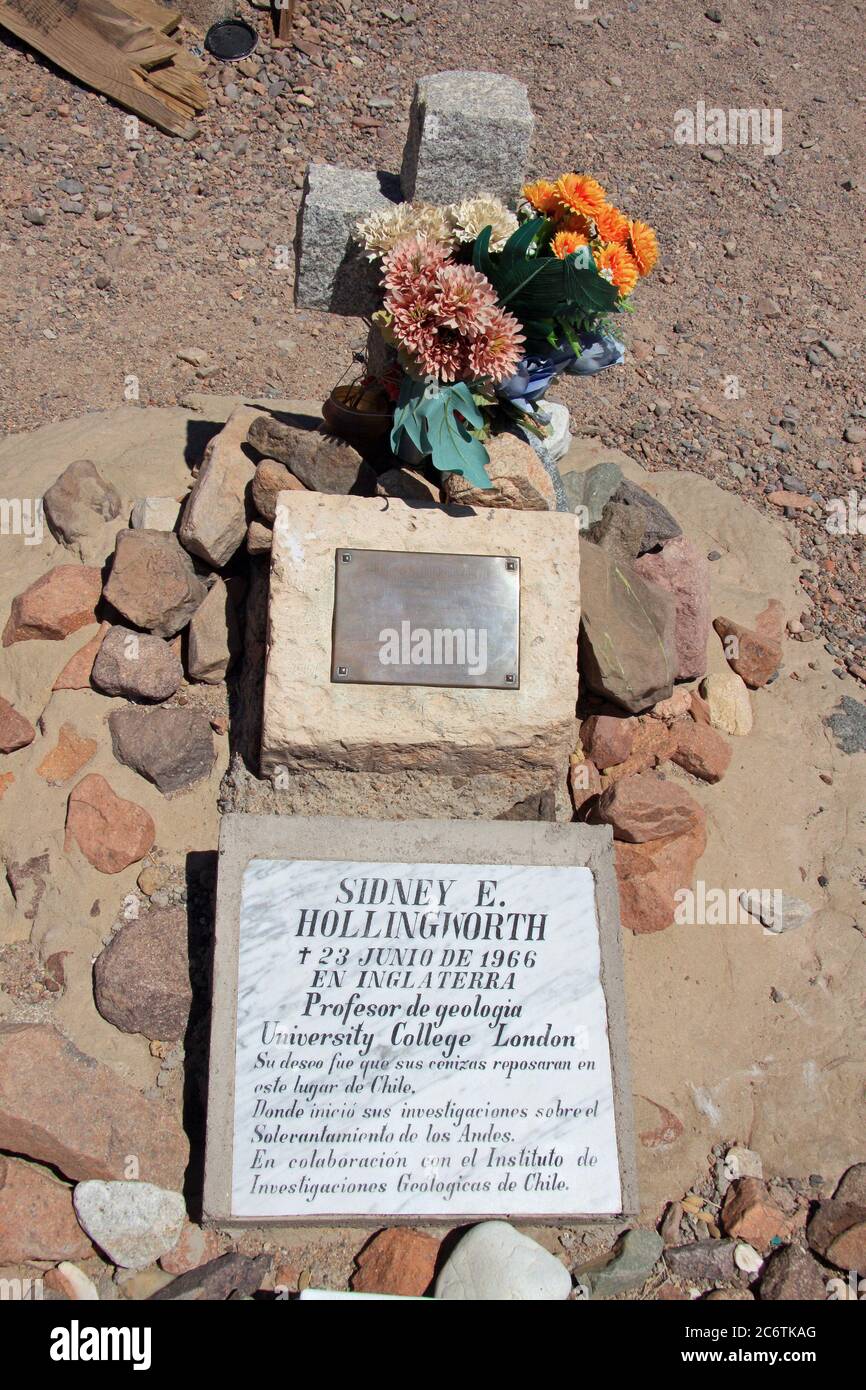 Grave of Sydney Ewart Hollingworth, Atacama desert, Chile Stock Photohttps://www.alamy.com/image-license-details/?v=1https://www.alamy.com/grave-of-sydney-ewart-hollingworth-atacama-desert-chile-image365647704.html
RF2C6TKAG–Grave of Sydney Ewart Hollingworth, Atacama desert, Chile
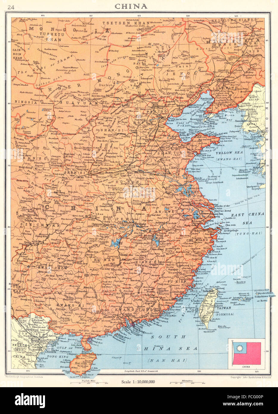 CHINA: Kwang-chow Taiwan Hong Kong, 1938 vintage map Stock Photohttps://www.alamy.com/image-license-details/?v=1https://www.alamy.com/stock-photo-china-kwang-chow-taiwan-hong-kong-1938-vintage-map-93778966.html
RFFCG00P–CHINA: Kwang-chow Taiwan Hong Kong, 1938 vintage map
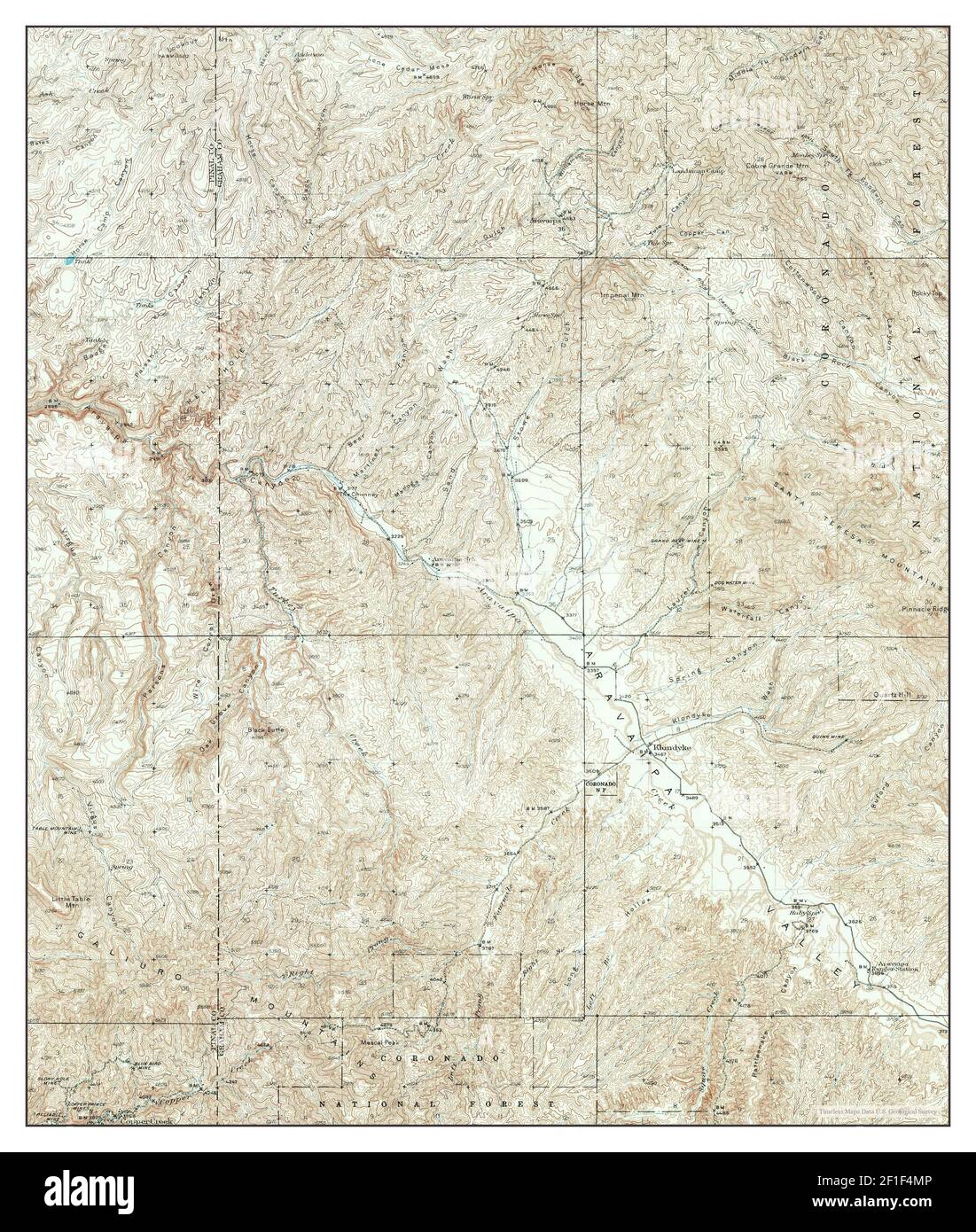 Klondyke, Arizona, map 1938, 1:62500, United States of America by Timeless Maps, data U.S. Geological Survey Stock Photohttps://www.alamy.com/image-license-details/?v=1https://www.alamy.com/klondyke-arizona-map-1938-162500-united-states-of-america-by-timeless-maps-data-us-geological-survey-image413996486.html
RM2F1F4MP–Klondyke, Arizona, map 1938, 1:62500, United States of America by Timeless Maps, data U.S. Geological Survey
 National Museum in Warsaw. The exhibition 'Warsaw yesterday, today, Tomorrow' (13 October 1938-30 April 1939). Sala 10. 'Urban development of the city, field policy and communication conditions' - the board 'the citizens' offering 281 ha in the city enabled all streets'; Plater-Zyberk, Stefan (1891-1943); 1938-1939 (1938-00-00-1939-00-00);National Museum in Warsaw (1862-), National Museum in Warsaw (1862-) - exhibitions, Warsaw (Masovian Voivodeship), Warsaw yesterday, today, tomorrow (Warsaw - exhibition - 1938/1939), exhibitions, maps, city plans, city plans, streets, urban planning, exhibit Stock Photohttps://www.alamy.com/image-license-details/?v=1https://www.alamy.com/national-museum-in-warsaw-the-exhibition-warsaw-yesterday-today-tomorrow-13-october-1938-30-april-1939-sala-10-urban-development-of-the-city-field-policy-and-communication-conditions-the-board-the-citizens-offering-281-ha-in-the-city-enabled-all-streets-plater-zyberk-stefan-1891-1943-1938-1939-1938-00-00-1939-00-00national-museum-in-warsaw-1862-national-museum-in-warsaw-1862-exhibitions-warsaw-masovian-voivodeship-warsaw-yesterday-today-tomorrow-warsaw-exhibition-19381939-exhibitions-maps-city-plans-city-plans-streets-urban-planning-exhibit-image598723380.html
RM2WP25NT–National Museum in Warsaw. The exhibition 'Warsaw yesterday, today, Tomorrow' (13 October 1938-30 April 1939). Sala 10. 'Urban development of the city, field policy and communication conditions' - the board 'the citizens' offering 281 ha in the city enabled all streets'; Plater-Zyberk, Stefan (1891-1943); 1938-1939 (1938-00-00-1939-00-00);National Museum in Warsaw (1862-), National Museum in Warsaw (1862-) - exhibitions, Warsaw (Masovian Voivodeship), Warsaw yesterday, today, tomorrow (Warsaw - exhibition - 1938/1939), exhibitions, maps, city plans, city plans, streets, urban planning, exhibit
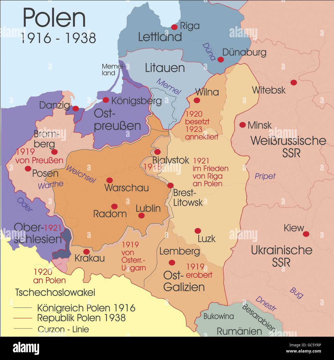 cartography, historical maps, modern times, Poland, 1916 - 1938, Additional-Rights-Clearences-Not Available Stock Photohttps://www.alamy.com/image-license-details/?v=1https://www.alamy.com/stock-photo-cartography-historical-maps-modern-times-poland-1916-1938-additional-110769674.html
RMGC5YRP–cartography, historical maps, modern times, Poland, 1916 - 1938, Additional-Rights-Clearences-Not Available
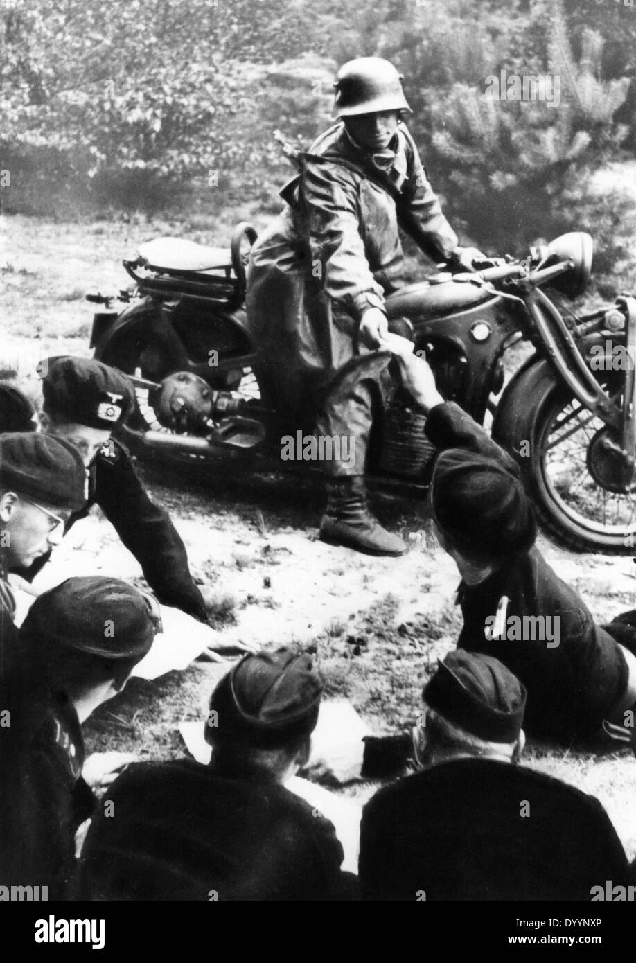 An armored officer during a maneuver, 1933-1938 Stock Photohttps://www.alamy.com/image-license-details/?v=1https://www.alamy.com/an-armored-officer-during-a-maneuver-1933-1938-image68836734.html
RMDYYNXP–An armored officer during a maneuver, 1933-1938
 H.V. Kaltenborn charting his itinerary for a three-week aerial tour of Europe. July 1938. His trip coincided with the developing Munich Crisis of 1938, which he covered in his program series, 'Kaltenborn from Europe,' in August 1938. He traveled and worked with his wife, Olga. He played himself in two movies, MR. SMITH GOES TO WASHINGTON (1939) and THE DAY THE EARTH STOOD STILL (1951). (CSU 2015 9 673) Stock Photohttps://www.alamy.com/image-license-details/?v=1https://www.alamy.com/stock-photo-hv-kaltenborn-charting-his-itinerary-for-a-three-week-aerial-tour-87522810.html
RMF2B06J–H.V. Kaltenborn charting his itinerary for a three-week aerial tour of Europe. July 1938. His trip coincided with the developing Munich Crisis of 1938, which he covered in his program series, 'Kaltenborn from Europe,' in August 1938. He traveled and worked with his wife, Olga. He played himself in two movies, MR. SMITH GOES TO WASHINGTON (1939) and THE DAY THE EARTH STOOD STILL (1951). (CSU 2015 9 673)
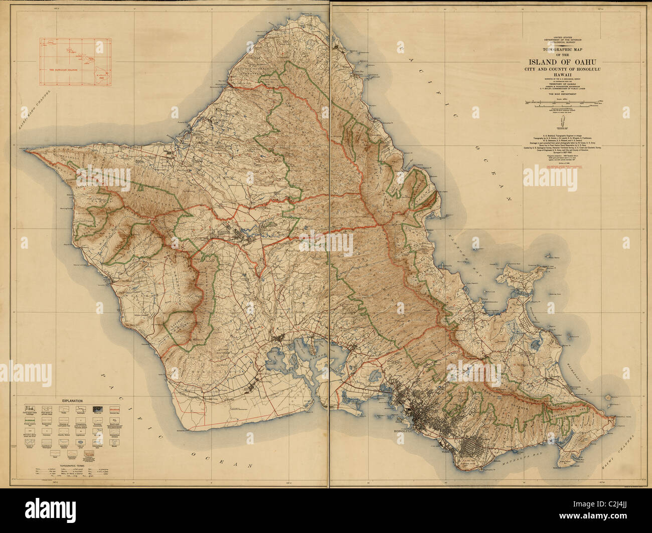 Topographic map of the Island of Oahu : city and county of Honolulu, Hawaii 1938 Stock Photohttps://www.alamy.com/image-license-details/?v=1https://www.alamy.com/stock-photo-topographic-map-of-the-island-of-oahu-city-and-county-of-honolulu-36048842.html
RMC2J4JJ–Topographic map of the Island of Oahu : city and county of Honolulu, Hawaii 1938
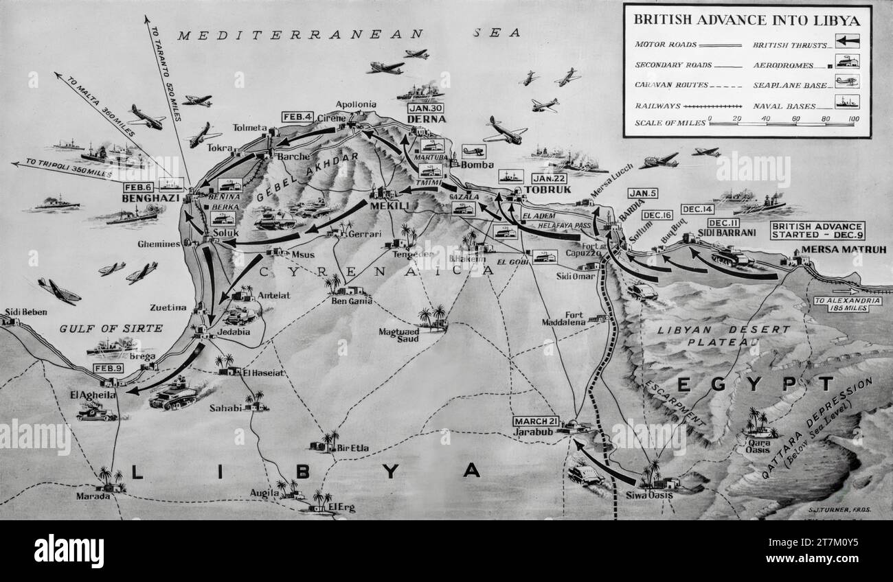 A Second World War map illustrating British advances into Libya that began in December 1940 and culminated in the capture of Benghazi on the 6th February 1941. Stock Photohttps://www.alamy.com/image-license-details/?v=1https://www.alamy.com/a-second-world-war-map-illustrating-british-advances-into-libya-that-began-in-december-1940-and-culminated-in-the-capture-of-benghazi-on-the-6th-february-1941-image572684537.html
RM2T7M0Y5–A Second World War map illustrating British advances into Libya that began in December 1940 and culminated in the capture of Benghazi on the 6th February 1941.
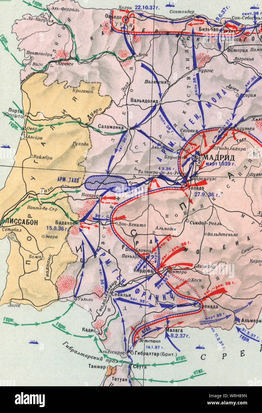 Map of Civil War and German-Italian intervention in Spain (July 1936 - March 1939), Stock Photohttps://www.alamy.com/image-license-details/?v=1https://www.alamy.com/map-of-civil-war-and-german-italian-intervention-in-spain-july-1936-march-1939-image272672337.html
RMWRH89N–Map of Civil War and German-Italian intervention in Spain (July 1936 - March 1939),
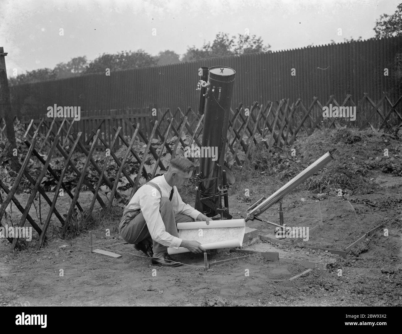 Dr Hugh Percival Wilkins PhD FRAS 1896 - 1960 was a British engineer by profession but most notably known as an amateur astronomer and particularly as a moon mapper . In his life he has created a number of moon maps , doing much of the observing from his home . Photo shows Mr Hugh Percy Wilkins at work in the garden of his home in Barnehurst , Kent . 1938 Stock Photohttps://www.alamy.com/image-license-details/?v=1https://www.alamy.com/dr-hugh-percival-wilkins-phd-fras-1896-1960-was-a-british-engineer-by-profession-but-most-notably-known-as-an-amateur-astronomer-and-particularly-as-a-moon-mapper-in-his-life-he-has-created-a-number-of-moon-maps-doing-much-of-the-observing-from-his-home-photo-shows-mr-hugh-percy-wilkins-at-work-in-the-garden-of-his-home-in-barnehurst-kent-1938-image359774410.html
RM2BW93X2–Dr Hugh Percival Wilkins PhD FRAS 1896 - 1960 was a British engineer by profession but most notably known as an amateur astronomer and particularly as a moon mapper . In his life he has created a number of moon maps , doing much of the observing from his home . Photo shows Mr Hugh Percy Wilkins at work in the garden of his home in Barnehurst , Kent . 1938
 Pictural Map of Umbria, Italy Colorful small map with vignettes of structures, nature, activities, products, crops, etc. Towns and cities labeled. Gilt used on most maps. from the book ' Italia ' by De Agostini, Giovanni; Nicouline, Vsevolod Petrovic Publication date 1938 Publisher Societa Anonima Editrice 'Italgeo', Milano artwork by Vsevolod Petrovic Nicouline Stock Photohttps://www.alamy.com/image-license-details/?v=1https://www.alamy.com/pictural-map-of-umbria-italy-colorful-small-map-with-vignettes-of-structures-nature-activities-products-crops-etc-towns-and-cities-labeled-gilt-used-on-most-maps-from-the-book-italia-by-de-agostini-giovanni-nicouline-vsevolod-petrovic-publication-date-1938-publisher-societa-anonima-editrice-italgeo-milano-artwork-by-vsevolod-petrovic-nicouline-image474662675.html
RF2JG6N2B–Pictural Map of Umbria, Italy Colorful small map with vignettes of structures, nature, activities, products, crops, etc. Towns and cities labeled. Gilt used on most maps. from the book ' Italia ' by De Agostini, Giovanni; Nicouline, Vsevolod Petrovic Publication date 1938 Publisher Societa Anonima Editrice 'Italgeo', Milano artwork by Vsevolod Petrovic Nicouline
 North Rim Grand Canyon Grand Canyon Bright Angel Point 1938 Stock Photohttps://www.alamy.com/image-license-details/?v=1https://www.alamy.com/north-rim-grand-canyon-grand-canyon-bright-angel-point-1938-image212184882.html
RMP95RYE–North Rim Grand Canyon Grand Canyon Bright Angel Point 1938
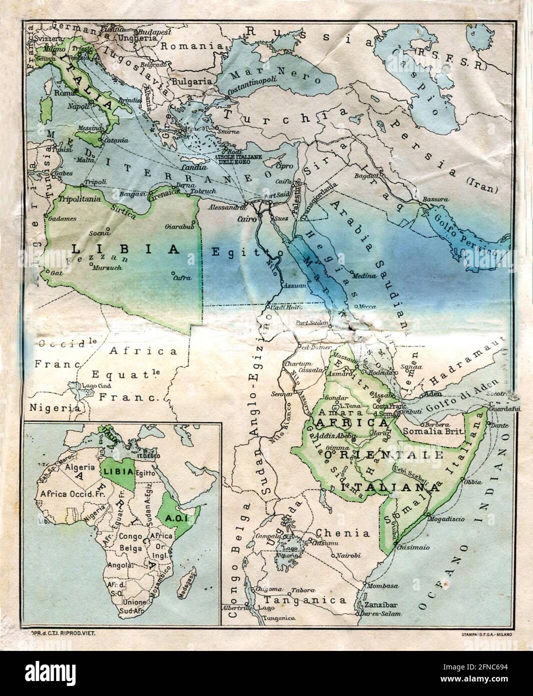 Ancient map of Eastern Africa (image from Italian Eastern Africa guide book 1938 edition) Stock Photohttps://www.alamy.com/image-license-details/?v=1https://www.alamy.com/ancient-map-of-eastern-africa-image-from-italian-eastern-africa-guide-book-1938-edition-image426224992.html
RF2FNC694–Ancient map of Eastern Africa (image from Italian Eastern Africa guide book 1938 edition)
 Borne Sulinowo, Poland. 3rd, August 2019 Pictures from the 1930 to present times showing complicated history of the city displayed on the city walls is seen in Borne Sulinowo, Poland on 3 August 2019 Borne Sulinowo former Gross Born was from 1933 the German Nazis large military base, and Artillery School of the Wehrmacht, officially opened by Adolf Hitler in 1938. Between 1945 and 1992 it was a secret Soviet military base, erased from all Polish maps and it was not transferred to Polish jurisdiction until 1992. In official documents were called forest areas and remained a secret for almost 50 Stock Photohttps://www.alamy.com/image-license-details/?v=1https://www.alamy.com/borne-sulinowo-poland-3rd-august-2019-pictures-from-the-1930-to-present-times-showing-complicated-history-of-the-city-displayed-on-the-city-walls-is-seen-in-borne-sulinowo-poland-on-3-august-2019-borne-sulinowo-former-gross-born-was-from-1933-the-german-nazis-large-military-base-and-artillery-school-of-the-wehrmacht-officially-opened-by-adolf-hitler-in-1938-between-1945-and-1992-it-was-a-secret-soviet-military-base-erased-from-all-polish-maps-and-it-was-not-transferred-to-polish-jurisdiction-until-1992-in-official-documents-were-called-forest-areas-and-remained-a-secret-for-almost-50-image262838796.html
RMW7H9FT–Borne Sulinowo, Poland. 3rd, August 2019 Pictures from the 1930 to present times showing complicated history of the city displayed on the city walls is seen in Borne Sulinowo, Poland on 3 August 2019 Borne Sulinowo former Gross Born was from 1933 the German Nazis large military base, and Artillery School of the Wehrmacht, officially opened by Adolf Hitler in 1938. Between 1945 and 1992 it was a secret Soviet military base, erased from all Polish maps and it was not transferred to Polish jurisdiction until 1992. In official documents were called forest areas and remained a secret for almost 50
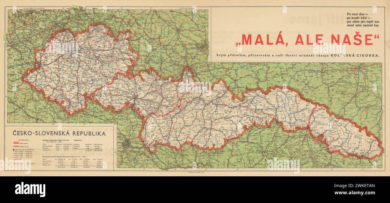 Vintage 1938 map of the Second Czechoslovak Republic after the Munich Agreement. The Territorial Results of the Munich Agreement. Stock Photohttps://www.alamy.com/image-license-details/?v=1https://www.alamy.com/vintage-1938-map-of-the-second-czechoslovak-republic-after-the-munich-agreement-the-territorial-results-of-the-munich-agreement-image597157421.html
RM2WKETAN–Vintage 1938 map of the Second Czechoslovak Republic after the Munich Agreement. The Territorial Results of the Munich Agreement.
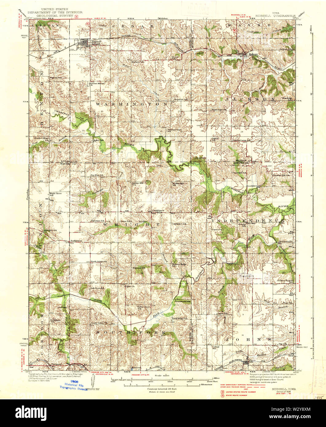 USGS TOPO Maps Iowa IA Russell 175456 1938 62500 Restoration Stock Photohttps://www.alamy.com/image-license-details/?v=1https://www.alamy.com/usgs-topo-maps-iowa-ia-russell-175456-1938-62500-restoration-image259984556.html
RMW2Y8XM–USGS TOPO Maps Iowa IA Russell 175456 1938 62500 Restoration
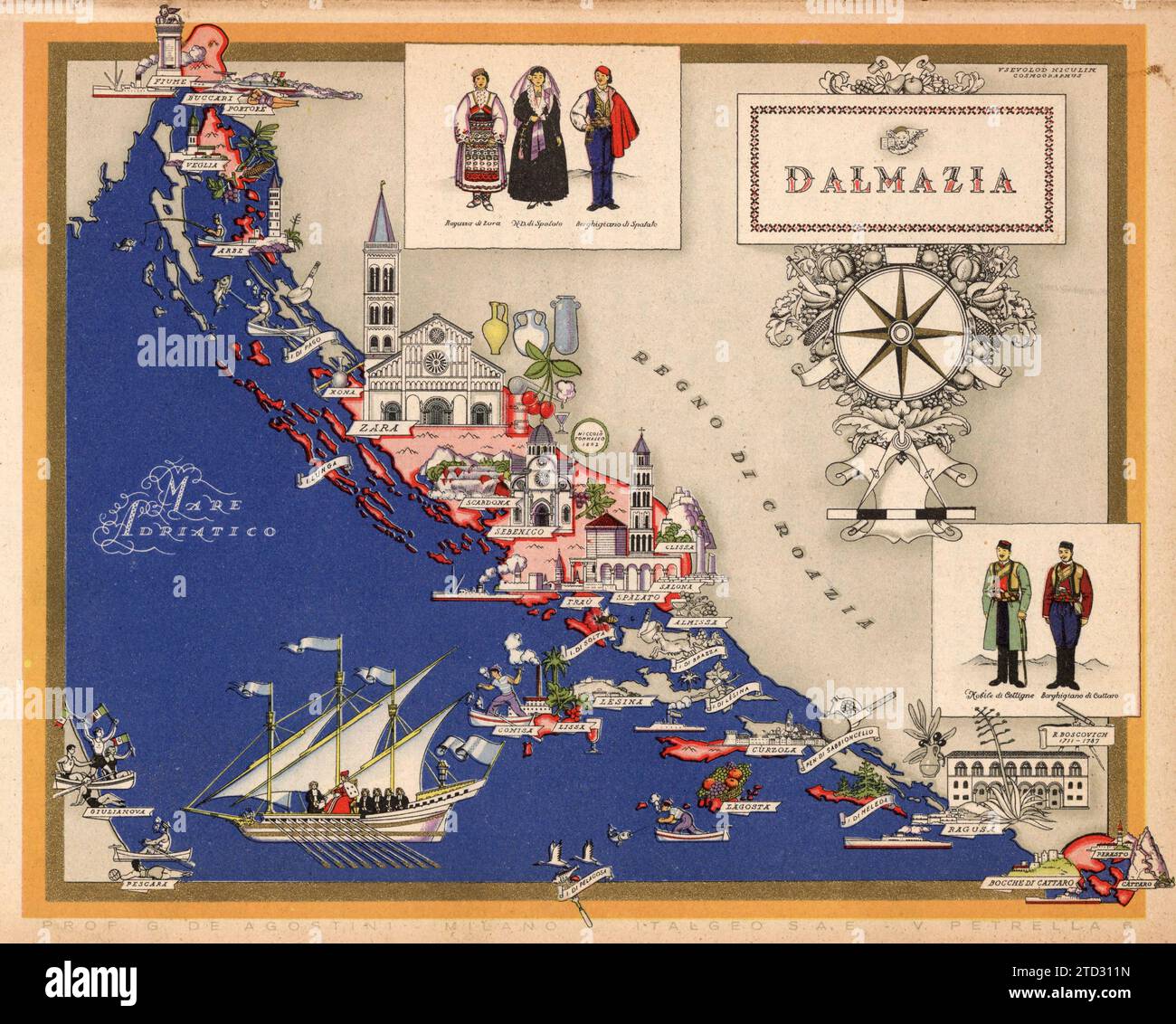 Illustrated map of Dalmazia, Italy. Towns and cities labelled. From 'Italia' by Giovanni De Agostini, artwork by Vsevolod Petrovic Nicouline. Publication date 1938. Stock Photohttps://www.alamy.com/image-license-details/?v=1https://www.alamy.com/illustrated-map-of-dalmazia-italy-towns-and-cities-labelled-from-italia-by-giovanni-de-agostini-artwork-by-vsevolod-petrovic-nicouline-publication-date-1938-image575999361.html
RF2TD311N–Illustrated map of Dalmazia, Italy. Towns and cities labelled. From 'Italia' by Giovanni De Agostini, artwork by Vsevolod Petrovic Nicouline. Publication date 1938.
 . Smithsonian miscellaneous collections. at 10° intersections of the lines of latitude andlongitude derived from daily weather maps by the Weather Bureau 5for the years 1929-1938. 3 Terrestrial Magnetism and Atmospheric Electricity, March 1942. 4 Monthly Weather Review, May 1943, p. 67. 5 World Weather Records, 1031-1940, to be published by the SmithsonianInstitution (in press). NO. 19 SUNSPOT CHANGES AND WEATHER CHANGES—CLAYTON IJ The monthly changes in these means were tabulated and averagedfor the months when sunspot numbers increased 10 or more. Themeans for the winter half-year and for th Stock Photohttps://www.alamy.com/image-license-details/?v=1https://www.alamy.com/smithsonian-miscellaneous-collections-at-10-intersections-of-the-lines-of-latitude-andlongitude-derived-from-daily-weather-maps-by-the-weather-bureau-5for-the-years-1929-1938-3-terrestrial-magnetism-and-atmospheric-electricity-march-1942-4-monthly-weather-review-may-1943-p-67-5-world-weather-records-1031-1940-to-be-published-by-the-smithsonianinstitution-in-press-no-19-sunspot-changes-and-weather-changesclayton-ij-the-monthly-changes-in-these-means-were-tabulated-and-averagedfor-the-months-when-sunspot-numbers-increased-10-or-more-themeans-for-the-winter-half-year-and-for-th-image370613930.html
RM2CEXWRP–. Smithsonian miscellaneous collections. at 10° intersections of the lines of latitude andlongitude derived from daily weather maps by the Weather Bureau 5for the years 1929-1938. 3 Terrestrial Magnetism and Atmospheric Electricity, March 1942. 4 Monthly Weather Review, May 1943, p. 67. 5 World Weather Records, 1031-1940, to be published by the SmithsonianInstitution (in press). NO. 19 SUNSPOT CHANGES AND WEATHER CHANGES—CLAYTON IJ The monthly changes in these means were tabulated and averagedfor the months when sunspot numbers increased 10 or more. Themeans for the winter half-year and for th
 Grave of Sydney Ewart Hollingworth, Atacama desert, Chile Stock Photohttps://www.alamy.com/image-license-details/?v=1https://www.alamy.com/grave-of-sydney-ewart-hollingworth-atacama-desert-chile-image365647650.html
RF2C6TK8J–Grave of Sydney Ewart Hollingworth, Atacama desert, Chile
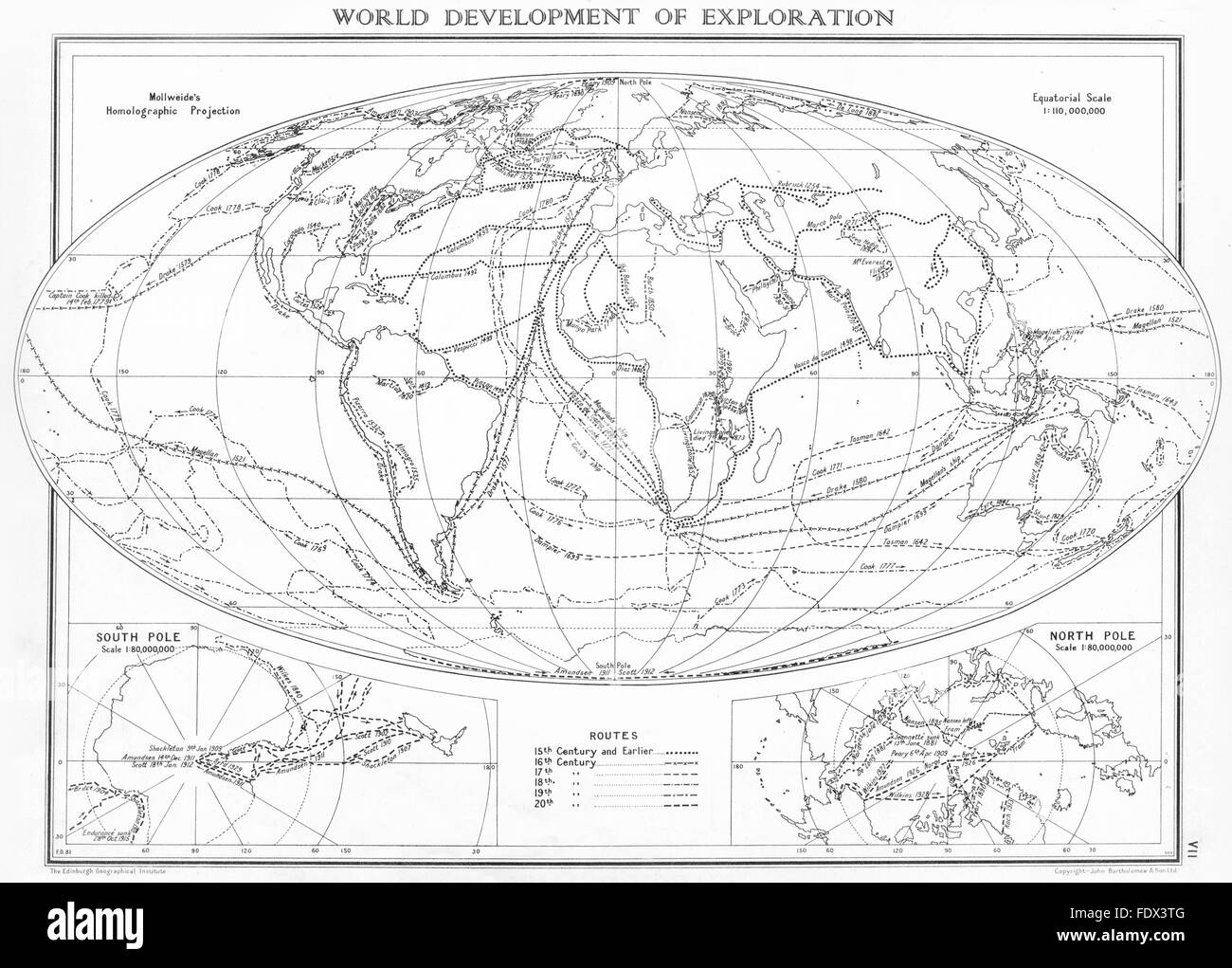 WORLD: Development of exploration; Inset maps south Pole; North Pole, 1938 Stock Photohttps://www.alamy.com/image-license-details/?v=1https://www.alamy.com/stock-photo-world-development-of-exploration-inset-maps-south-pole-north-pole-94616160.html
RFFDX3TG–WORLD: Development of exploration; Inset maps south Pole; North Pole, 1938
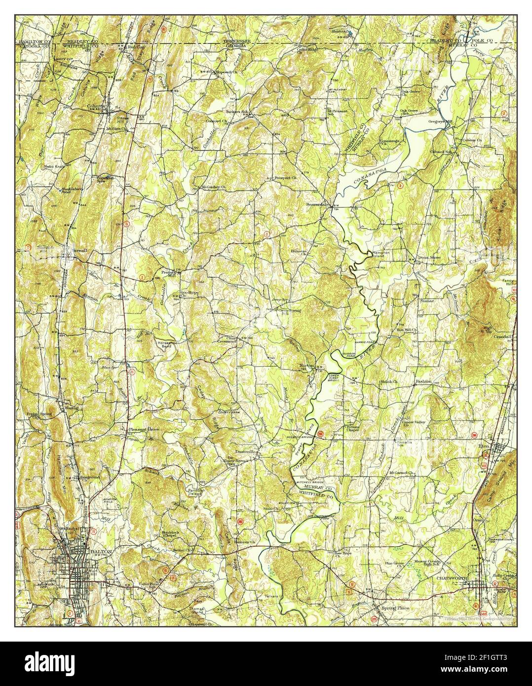 Dalton, Georgia, map 1938, 1:62500, United States of America by Timeless Maps, data U.S. Geological Survey Stock Photohttps://www.alamy.com/image-license-details/?v=1https://www.alamy.com/dalton-georgia-map-1938-162500-united-states-of-america-by-timeless-maps-data-us-geological-survey-image414034211.html
RM2F1GTT3–Dalton, Georgia, map 1938, 1:62500, United States of America by Timeless Maps, data U.S. Geological Survey
 National Museum in Warsaw. The exhibition 'Warsaw yesterday, today, Tomorrow' (13 October 1938-30 April 1939). Sala 10. 'Urban development of the city, field policy and communication conditions' - board 'until 1/X.1938, citizens offered the city 800,000 mtr2 to regulate existing and structures of new streets'; Plater-Zyberk, Stefan (1891-1943); 1938-1939 (1938-00-00-1939-00-00);National Museum in Warsaw (1862-), National Museum in Warsaw (1862-) - exhibitions, Warsaw (Masovian Voivodeship), Warsaw yesterday, today, tomorrow (Warsaw - exhibition - 1938/1939), exhibitions, maps, city plans, city Stock Photohttps://www.alamy.com/image-license-details/?v=1https://www.alamy.com/national-museum-in-warsaw-the-exhibition-warsaw-yesterday-today-tomorrow-13-october-1938-30-april-1939-sala-10-urban-development-of-the-city-field-policy-and-communication-conditions-board-until-1x1938-citizens-offered-the-city-800000-mtr2-to-regulate-existing-and-structures-of-new-streets-plater-zyberk-stefan-1891-1943-1938-1939-1938-00-00-1939-00-00national-museum-in-warsaw-1862-national-museum-in-warsaw-1862-exhibitions-warsaw-masovian-voivodeship-warsaw-yesterday-today-tomorrow-warsaw-exhibition-19381939-exhibitions-maps-city-plans-city-image598757452.html
RM2WP3N6M–National Museum in Warsaw. The exhibition 'Warsaw yesterday, today, Tomorrow' (13 October 1938-30 April 1939). Sala 10. 'Urban development of the city, field policy and communication conditions' - board 'until 1/X.1938, citizens offered the city 800,000 mtr2 to regulate existing and structures of new streets'; Plater-Zyberk, Stefan (1891-1943); 1938-1939 (1938-00-00-1939-00-00);National Museum in Warsaw (1862-), National Museum in Warsaw (1862-) - exhibitions, Warsaw (Masovian Voivodeship), Warsaw yesterday, today, tomorrow (Warsaw - exhibition - 1938/1939), exhibitions, maps, city plans, city
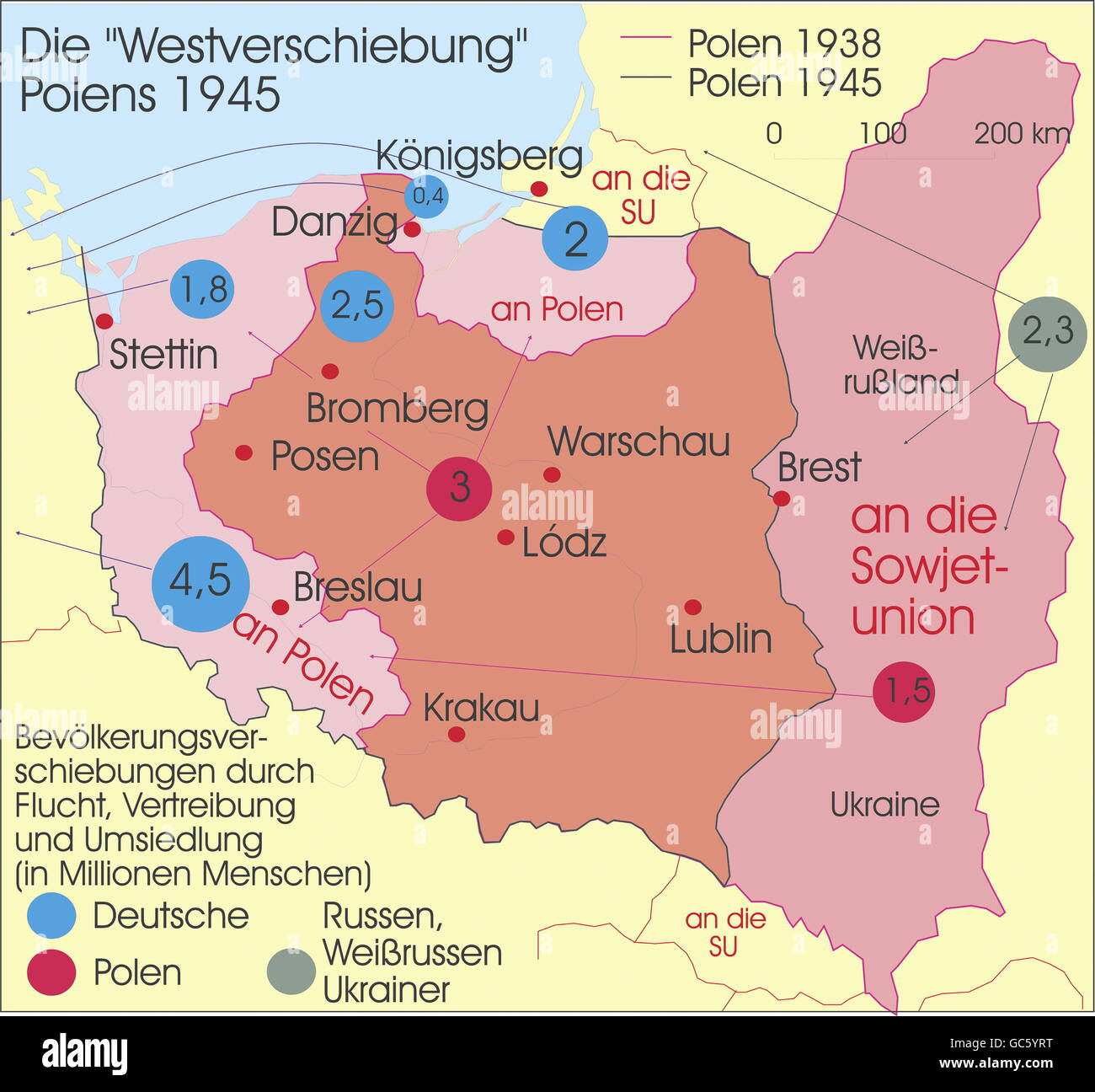 cartography, historical maps, modern times, Poland, territorial changes after World War II, Poland's old and new borders 1938 and 1945, Additional-Rights-Clearences-Not Available Stock Photohttps://www.alamy.com/image-license-details/?v=1https://www.alamy.com/stock-photo-cartography-historical-maps-modern-times-poland-territorial-changes-110769676.html
RMGC5YRT–cartography, historical maps, modern times, Poland, territorial changes after World War II, Poland's old and new borders 1938 and 1945, Additional-Rights-Clearences-Not Available
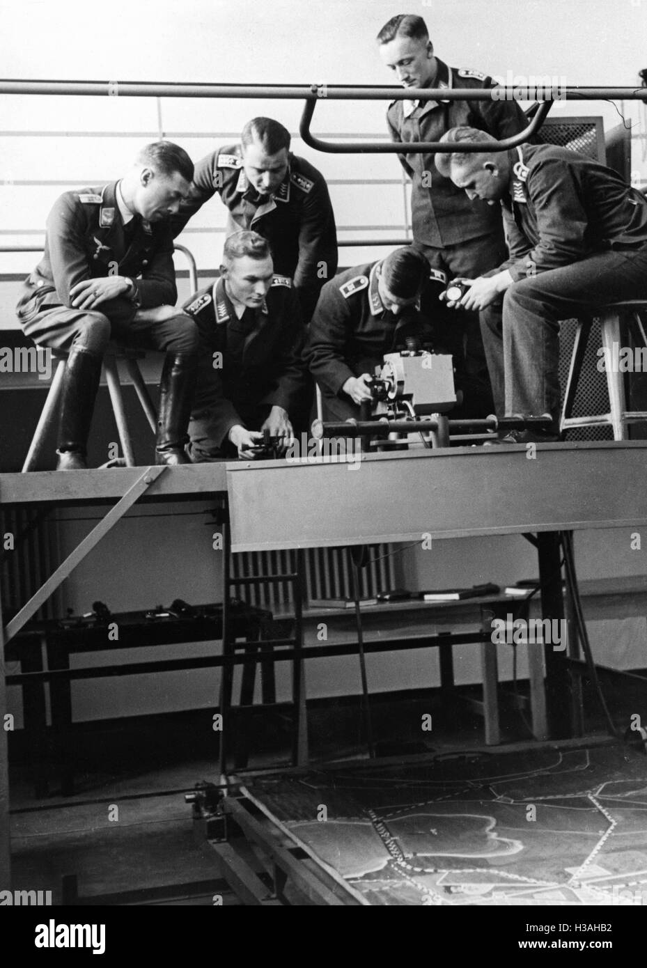 Courses for cadets of the Luftwaffe, 1938 Stock Photohttps://www.alamy.com/image-license-details/?v=1https://www.alamy.com/stock-photo-courses-for-cadets-of-the-luftwaffe-1938-122549702.html
RMH3AHB2–Courses for cadets of the Luftwaffe, 1938
 Image taken from page 285 of 'Butlletí del Centre Excursionista de Catalunya. any 1. no. 1.-any 48. no. 518/523. jan./juny 1891-jul./des. 1938' Image taken from page 285 of 'Butlletí del Centre Excursionista Stock Photohttps://www.alamy.com/image-license-details/?v=1https://www.alamy.com/stock-photo-image-taken-from-page-285-of-butlleti-del-centre-excursionista-de-130131344.html
RMHFKYT0–Image taken from page 285 of 'Butlletí del Centre Excursionista de Catalunya. any 1. no. 1.-any 48. no. 518/523. jan./juny 1891-jul./des. 1938' Image taken from page 285 of 'Butlletí del Centre Excursionista
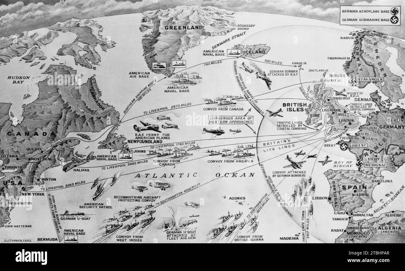 A Second World War map illustrating the routes taken by convoys and the measures taken to outwit German U-Boats and long range bombers during March and April 1941. The lifeline remained unbroken, despite losses of 225 ships, due to the work of the Royal Navy and Royal Air Force. Stock Photohttps://www.alamy.com/image-license-details/?v=1https://www.alamy.com/a-second-world-war-map-illustrating-the-routes-taken-by-convoys-and-the-measures-taken-to-outwit-german-u-boats-and-long-range-bombers-during-march-and-april-1941-the-lifeline-remained-unbroken-despite-losses-of-225-ships-due-to-the-work-of-the-royal-navy-and-royal-air-force-image575094095.html
RM2TBHPAR–A Second World War map illustrating the routes taken by convoys and the measures taken to outwit German U-Boats and long range bombers during March and April 1941. The lifeline remained unbroken, despite losses of 225 ships, due to the work of the Royal Navy and Royal Air Force.
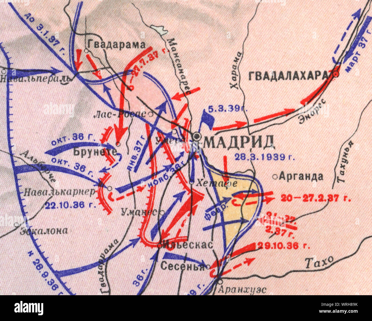 Madrid defense. Map of Civil War and German-Italian intervention in Spain, (October 1936 - March 1939), Stock Photohttps://www.alamy.com/image-license-details/?v=1https://www.alamy.com/madrid-defense-map-of-civil-war-and-german-italian-intervention-in-spain-october-1936-march-1939-image272672335.html
RMWRH89K–Madrid defense. Map of Civil War and German-Italian intervention in Spain, (October 1936 - March 1939),
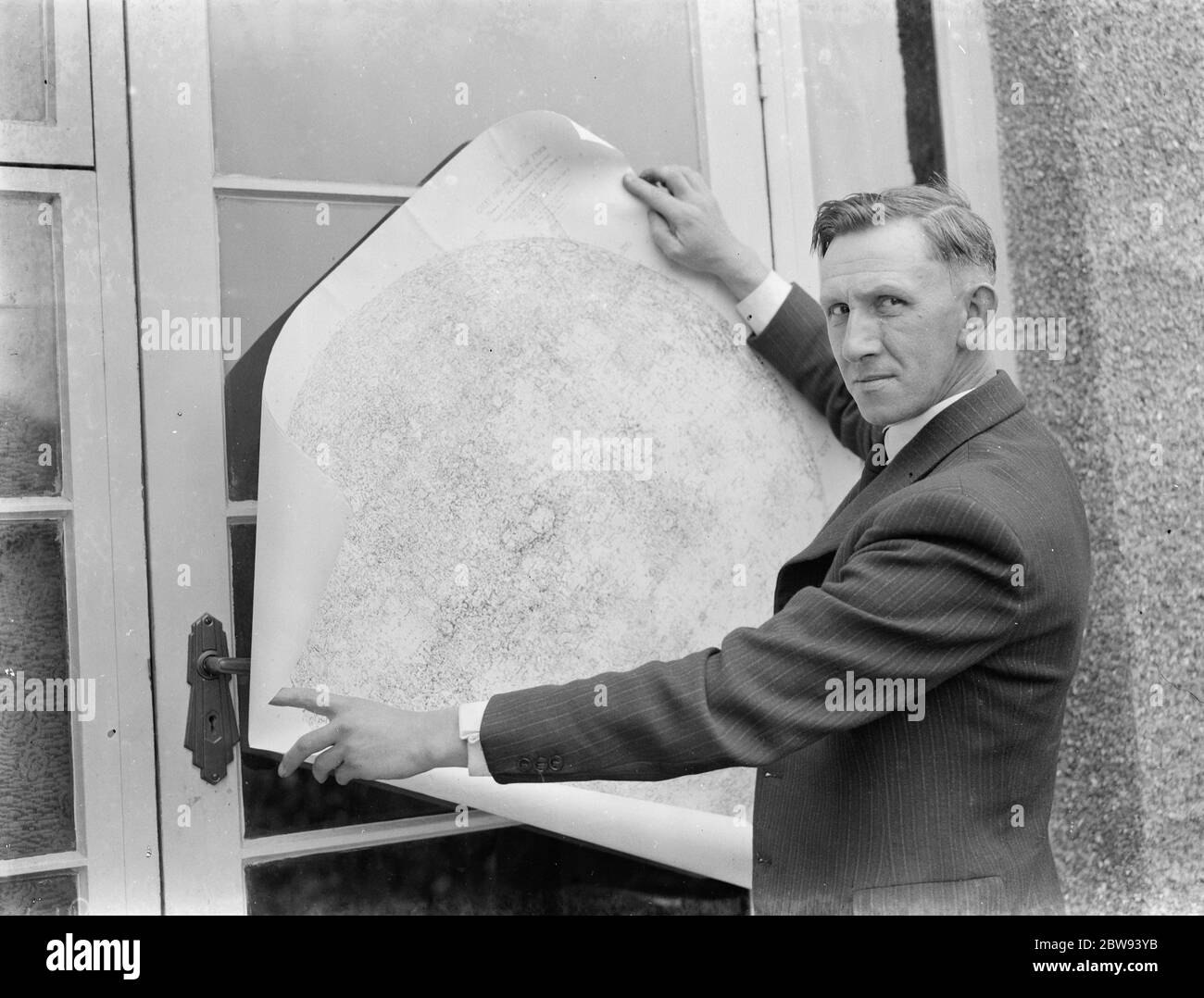 Dr Hugh Percival Wilkins PhD FRAS 1896 - 1960 was a British engineer by profession but most notably known as an amateur astronomer and particularly as a moon mapper . In his life he has created a number of moon maps , doing much of the observing from his home . In this photo Mr Hugh Percy Wilkins , at his home in Barnehurst , Kent , shows off pieces of a map of the moon that he has created . 1938 Stock Photohttps://www.alamy.com/image-license-details/?v=1https://www.alamy.com/dr-hugh-percival-wilkins-phd-fras-1896-1960-was-a-british-engineer-by-profession-but-most-notably-known-as-an-amateur-astronomer-and-particularly-as-a-moon-mapper-in-his-life-he-has-created-a-number-of-moon-maps-doing-much-of-the-observing-from-his-home-in-this-photo-mr-hugh-percy-wilkins-at-his-home-in-barnehurst-kent-shows-off-pieces-of-a-map-of-the-moon-that-he-has-created-1938-image359774447.html
RM2BW93YB–Dr Hugh Percival Wilkins PhD FRAS 1896 - 1960 was a British engineer by profession but most notably known as an amateur astronomer and particularly as a moon mapper . In his life he has created a number of moon maps , doing much of the observing from his home . In this photo Mr Hugh Percy Wilkins , at his home in Barnehurst , Kent , shows off pieces of a map of the moon that he has created . 1938
 Pictural Map of Puglia, Italy Colorful small map with vignettes of structures, nature, activities, products, crops, etc. Towns and cities labeled. Gilt used on most maps. from the book ' Italia ' by De Agostini, Giovanni; Nicouline, Vsevolod Petrovic Publication date 1938 Publisher Societa Anonima Editrice 'Italgeo', Milano artwork by Vsevolod Petrovic Nicouline Stock Photohttps://www.alamy.com/image-license-details/?v=1https://www.alamy.com/pictural-map-of-puglia-italy-colorful-small-map-with-vignettes-of-structures-nature-activities-products-crops-etc-towns-and-cities-labeled-gilt-used-on-most-maps-from-the-book-italia-by-de-agostini-giovanni-nicouline-vsevolod-petrovic-publication-date-1938-publisher-societa-anonima-editrice-italgeo-milano-artwork-by-vsevolod-petrovic-nicouline-image474662685.html
RF2JG6N2N–Pictural Map of Puglia, Italy Colorful small map with vignettes of structures, nature, activities, products, crops, etc. Towns and cities labeled. Gilt used on most maps. from the book ' Italia ' by De Agostini, Giovanni; Nicouline, Vsevolod Petrovic Publication date 1938 Publisher Societa Anonima Editrice 'Italgeo', Milano artwork by Vsevolod Petrovic Nicouline
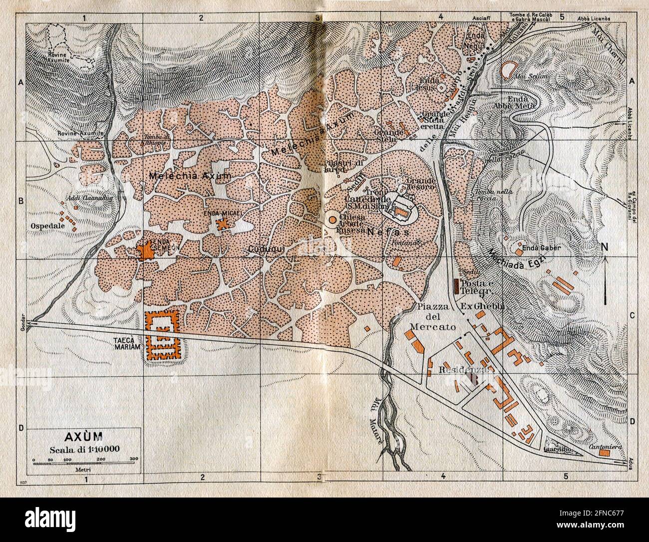 Ancient map of Axum, Ethiopia (image from Italian Eastern Africa guide book 1938 edition) Stock Photohttps://www.alamy.com/image-license-details/?v=1https://www.alamy.com/ancient-map-of-axum-ethiopia-image-from-italian-eastern-africa-guide-book-1938-edition-image426224939.html
RF2FNC677–Ancient map of Axum, Ethiopia (image from Italian Eastern Africa guide book 1938 edition)
 Borne Sulinowo, Poland. 3rd, August 2019 Pictures from the 1930 to present times showing complicated history of the city displayed on the city walls is seen in Borne Sulinowo, Poland on 3 August 2019 Borne Sulinowo former Gross Born was from 1933 the German Nazis large military base, and Artillery School of the Wehrmacht, officially opened by Adolf Hitler in 1938. Between 1945 and 1992 it was a secret Soviet military base, erased from all Polish maps and it was not transferred to Polish jurisdiction until 1992. In official documents were called forest areas and remained a secret for almost 50 Stock Photohttps://www.alamy.com/image-license-details/?v=1https://www.alamy.com/borne-sulinowo-poland-3rd-august-2019-pictures-from-the-1930-to-present-times-showing-complicated-history-of-the-city-displayed-on-the-city-walls-is-seen-in-borne-sulinowo-poland-on-3-august-2019-borne-sulinowo-former-gross-born-was-from-1933-the-german-nazis-large-military-base-and-artillery-school-of-the-wehrmacht-officially-opened-by-adolf-hitler-in-1938-between-1945-and-1992-it-was-a-secret-soviet-military-base-erased-from-all-polish-maps-and-it-was-not-transferred-to-polish-jurisdiction-until-1992-in-official-documents-were-called-forest-areas-and-remained-a-secret-for-almost-50-image262838847.html
RMW7H9HK–Borne Sulinowo, Poland. 3rd, August 2019 Pictures from the 1930 to present times showing complicated history of the city displayed on the city walls is seen in Borne Sulinowo, Poland on 3 August 2019 Borne Sulinowo former Gross Born was from 1933 the German Nazis large military base, and Artillery School of the Wehrmacht, officially opened by Adolf Hitler in 1938. Between 1945 and 1992 it was a secret Soviet military base, erased from all Polish maps and it was not transferred to Polish jurisdiction until 1992. In official documents were called forest areas and remained a secret for almost 50
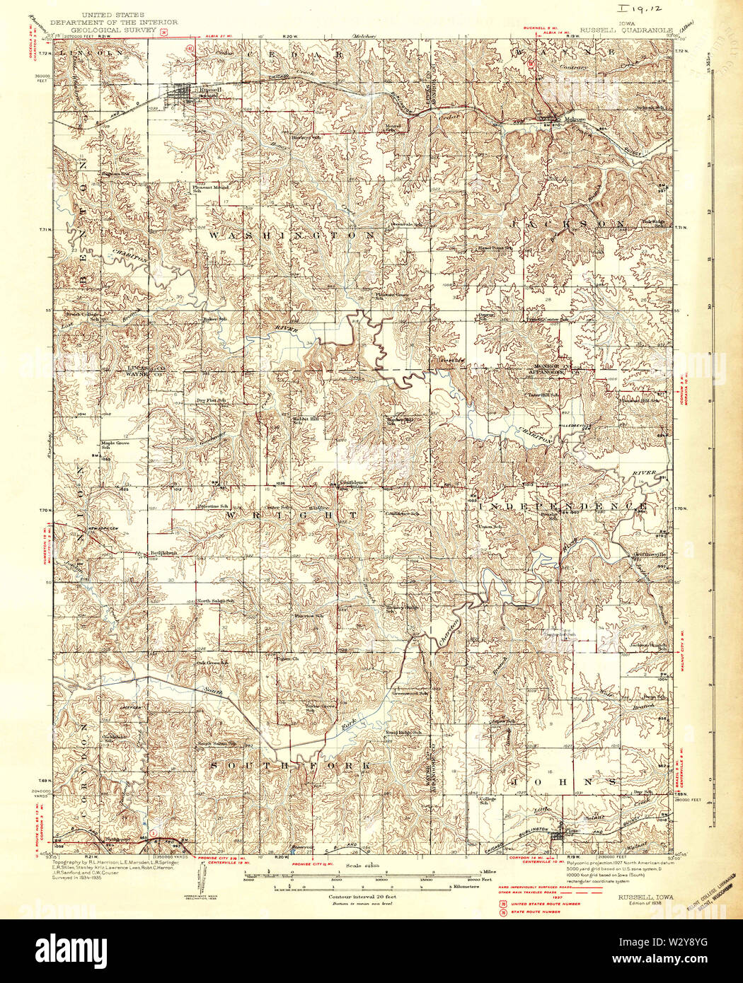 USGS TOPO Maps Iowa IA Russell 175457 1938 62500 Restoration Stock Photohttps://www.alamy.com/image-license-details/?v=1https://www.alamy.com/usgs-topo-maps-iowa-ia-russell-175457-1938-62500-restoration-image259984580.html
RMW2Y8YG–USGS TOPO Maps Iowa IA Russell 175457 1938 62500 Restoration
 Illustrated map of Corsica, France. Towns and cities labelled. From 'Italia' by Giovanni De Agostini, artwork by Vsevolod Petrovic Nicouline. Publication date 1938. Stock Photohttps://www.alamy.com/image-license-details/?v=1https://www.alamy.com/illustrated-map-of-corsica-france-towns-and-cities-labelled-from-italia-by-giovanni-de-agostini-artwork-by-vsevolod-petrovic-nicouline-publication-date-1938-image575999363.html
RF2TD311R–Illustrated map of Corsica, France. Towns and cities labelled. From 'Italia' by Giovanni De Agostini, artwork by Vsevolod Petrovic Nicouline. Publication date 1938.
![. Atlas of zoogeography; a series of maps illustrating the distribution of over seven hundred families, genera, and species of existing animals. Zoology; Zoogeography. . Please note that these images are extracted from scanned page images that may have been digitally enhanced for readability - coloration and appearance of these illustrations may not perfectly resemble the original work.. Bartholomew, J. G. (John George), 1860-1920; Clarke, William Eagle, 1853-1938; Grimshaw, Percy Hall. [Edinburgh] Pub. at the Edinburg Geographical Institute, by J. Bartholomew & Co. Stock Photo . Atlas of zoogeography; a series of maps illustrating the distribution of over seven hundred families, genera, and species of existing animals. Zoology; Zoogeography. . Please note that these images are extracted from scanned page images that may have been digitally enhanced for readability - coloration and appearance of these illustrations may not perfectly resemble the original work.. Bartholomew, J. G. (John George), 1860-1920; Clarke, William Eagle, 1853-1938; Grimshaw, Percy Hall. [Edinburgh] Pub. at the Edinburg Geographical Institute, by J. Bartholomew & Co. Stock Photo](https://c8.alamy.com/comp/RJY3RR/atlas-of-zoogeography-a-series-of-maps-illustrating-the-distribution-of-over-seven-hundred-families-genera-and-species-of-existing-animals-zoology-zoogeography-please-note-that-these-images-are-extracted-from-scanned-page-images-that-may-have-been-digitally-enhanced-for-readability-coloration-and-appearance-of-these-illustrations-may-not-perfectly-resemble-the-original-work-bartholomew-j-g-john-george-1860-1920-clarke-william-eagle-1853-1938-grimshaw-percy-hall-edinburgh-pub-at-the-edinburg-geographical-institute-by-j-bartholomew-amp-co-RJY3RR.jpg) . Atlas of zoogeography; a series of maps illustrating the distribution of over seven hundred families, genera, and species of existing animals. Zoology; Zoogeography. . Please note that these images are extracted from scanned page images that may have been digitally enhanced for readability - coloration and appearance of these illustrations may not perfectly resemble the original work.. Bartholomew, J. G. (John George), 1860-1920; Clarke, William Eagle, 1853-1938; Grimshaw, Percy Hall. [Edinburgh] Pub. at the Edinburg Geographical Institute, by J. Bartholomew & Co. Stock Photohttps://www.alamy.com/image-license-details/?v=1https://www.alamy.com/atlas-of-zoogeography-a-series-of-maps-illustrating-the-distribution-of-over-seven-hundred-families-genera-and-species-of-existing-animals-zoology-zoogeography-please-note-that-these-images-are-extracted-from-scanned-page-images-that-may-have-been-digitally-enhanced-for-readability-coloration-and-appearance-of-these-illustrations-may-not-perfectly-resemble-the-original-work-bartholomew-j-g-john-george-1860-1920-clarke-william-eagle-1853-1938-grimshaw-percy-hall-edinburgh-pub-at-the-edinburg-geographical-institute-by-j-bartholomew-amp-co-image235394315.html
. Atlas of zoogeography; a series of maps illustrating the distribution of over seven hundred families, genera, and species of existing animals. Zoology; Zoogeography. . Please note that these images are extracted from scanned page images that may have been digitally enhanced for readability - coloration and appearance of these illustrations may not perfectly resemble the original work.. Bartholomew, J. G. (John George), 1860-1920; Clarke, William Eagle, 1853-1938; Grimshaw, Percy Hall. [Edinburgh] Pub. at the Edinburg Geographical Institute, by J. Bartholomew & Co. Stock Photohttps://www.alamy.com/image-license-details/?v=1https://www.alamy.com/atlas-of-zoogeography-a-series-of-maps-illustrating-the-distribution-of-over-seven-hundred-families-genera-and-species-of-existing-animals-zoology-zoogeography-please-note-that-these-images-are-extracted-from-scanned-page-images-that-may-have-been-digitally-enhanced-for-readability-coloration-and-appearance-of-these-illustrations-may-not-perfectly-resemble-the-original-work-bartholomew-j-g-john-george-1860-1920-clarke-william-eagle-1853-1938-grimshaw-percy-hall-edinburgh-pub-at-the-edinburg-geographical-institute-by-j-bartholomew-amp-co-image235394315.htmlRMRJY3RR–. Atlas of zoogeography; a series of maps illustrating the distribution of over seven hundred families, genera, and species of existing animals. Zoology; Zoogeography. . Please note that these images are extracted from scanned page images that may have been digitally enhanced for readability - coloration and appearance of these illustrations may not perfectly resemble the original work.. Bartholomew, J. G. (John George), 1860-1920; Clarke, William Eagle, 1853-1938; Grimshaw, Percy Hall. [Edinburgh] Pub. at the Edinburg Geographical Institute, by J. Bartholomew & Co.
 Grave of Sydney Ewart Hollingworth, Atacama desert, Chile Stock Photohttps://www.alamy.com/image-license-details/?v=1https://www.alamy.com/grave-of-sydney-ewart-hollingworth-atacama-desert-chile-image365647657.html
RF2C6TK8W–Grave of Sydney Ewart Hollingworth, Atacama desert, Chile
 Alexandria harbour. Mediterranean Sea Egypt. ADMIRALTY sea chart 1938 (1954) map Stock Photohttps://www.alamy.com/image-license-details/?v=1https://www.alamy.com/alexandria-harbour-mediterranean-sea-egypt-admiralty-sea-chart-1938-1954-map-image442252277.html
RF2GKE985–Alexandria harbour. Mediterranean Sea Egypt. ADMIRALTY sea chart 1938 (1954) map
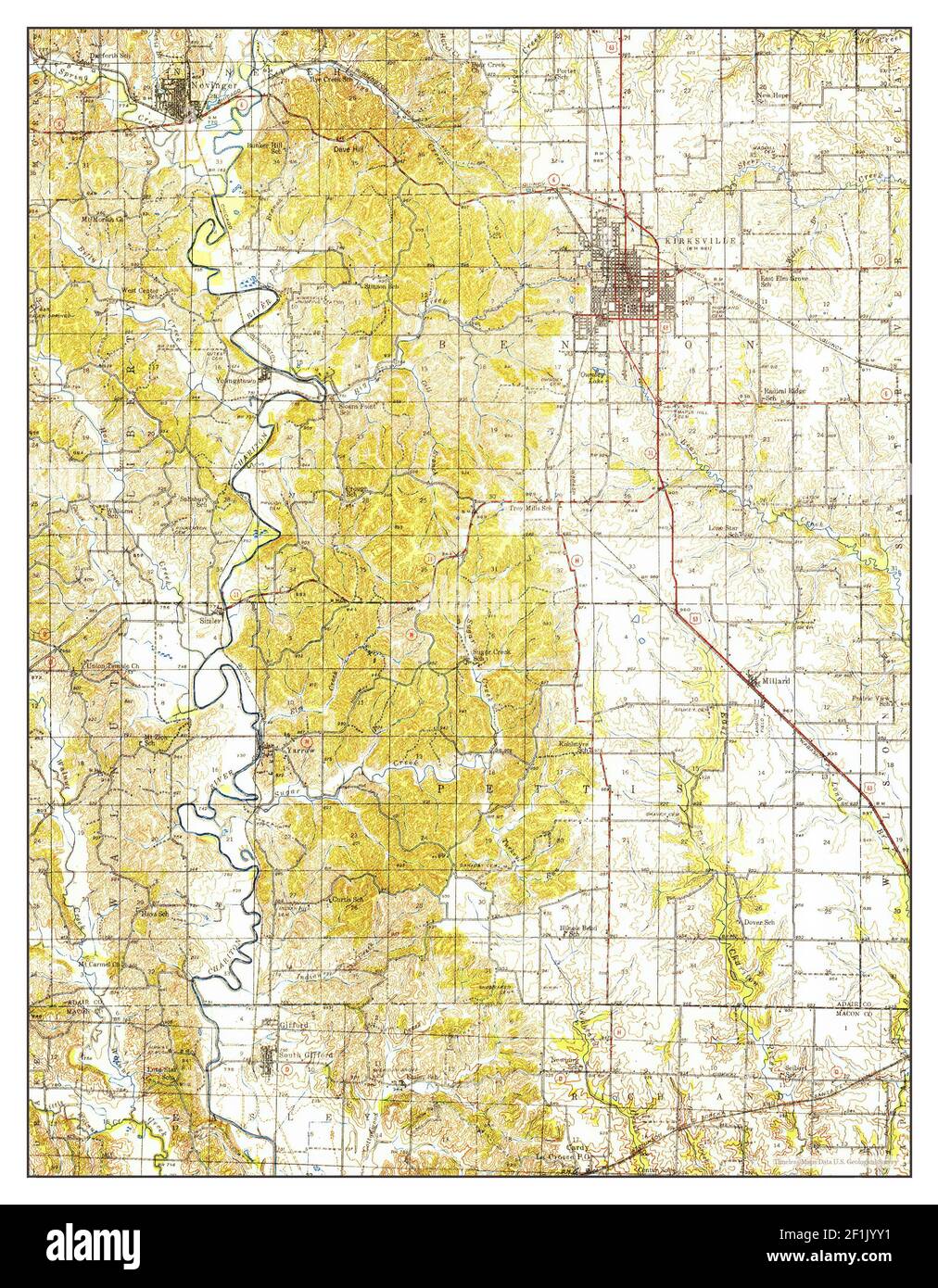 Kirksville, Missouri, map 1938, 1:62500, United States of America by Timeless Maps, data U.S. Geological Survey Stock Photohttps://www.alamy.com/image-license-details/?v=1https://www.alamy.com/kirksville-missouri-map-1938-162500-united-states-of-america-by-timeless-maps-data-us-geological-survey-image414080549.html
RM2F1JYY1–Kirksville, Missouri, map 1938, 1:62500, United States of America by Timeless Maps, data U.S. Geological Survey
 French Morocco port traffic, 1938 , Imports, Morocco, Maps, Exports, Morocco, Maps, Imports, Morocco, Statistics, Exports, Morocco, Statistics, Morocco, Maps Norman B. Leventhal Map Center Collection Stock Photohttps://www.alamy.com/image-license-details/?v=1https://www.alamy.com/french-morocco-port-traffic-1938-imports-morocco-maps-exports-morocco-maps-imports-morocco-statistics-exports-morocco-statistics-morocco-maps-norman-b-leventhal-map-center-collection-image500971531.html
RM2M3168B–French Morocco port traffic, 1938 , Imports, Morocco, Maps, Exports, Morocco, Maps, Imports, Morocco, Statistics, Exports, Morocco, Statistics, Morocco, Maps Norman B. Leventhal Map Center Collection
 34th Guards Tikhvinsky Order of the Red Banner Bomber Air Regiment, a memory album 1938 - 43 Large, landscape format album with artificial leather cover. 70 pages, largely painted in watercolours and with many photos. Drawn of Stalin, soldiers, who received the Hero of the Soviet Union medal, maps with combat sites, regimental history, commanders, officers, squadron fact sheets, group photos, numbers of missions and bomber types, burning German aircraft and trains, number of bombs, photos of Soviet bombers, aerial photos, a Hitler caricature etc. Very detailed,, Stock Photohttps://www.alamy.com/image-license-details/?v=1https://www.alamy.com/stock-photo-34th-guards-tikhvinsky-order-of-the-red-banner-bomber-air-regiment-31666801.html
RMBREF95–34th Guards Tikhvinsky Order of the Red Banner Bomber Air Regiment, a memory album 1938 - 43 Large, landscape format album with artificial leather cover. 70 pages, largely painted in watercolours and with many photos. Drawn of Stalin, soldiers, who received the Hero of the Soviet Union medal, maps with combat sites, regimental history, commanders, officers, squadron fact sheets, group photos, numbers of missions and bomber types, burning German aircraft and trains, number of bombs, photos of Soviet bombers, aerial photos, a Hitler caricature etc. Very detailed,,
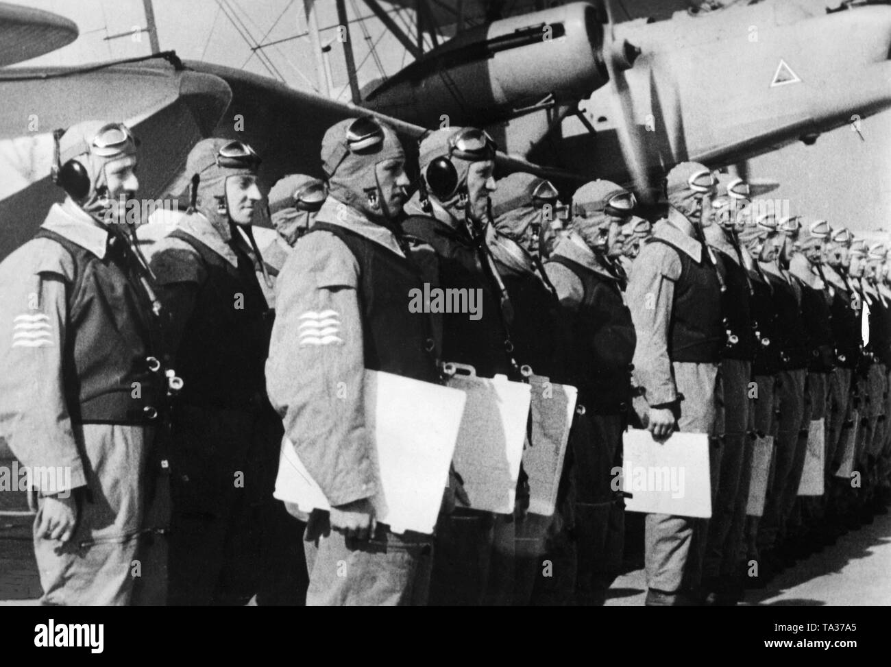 Film scene from the short 'documentary' called 'Flieger zur See' from (1938/1939), a propagandistic short film. The picture shows the crew who lined up for the issue of orders. The picture was published in 1939 in the newspaper 'Filmwelt'. Stock Photohttps://www.alamy.com/image-license-details/?v=1https://www.alamy.com/film-scene-from-the-short-documentary-called-flieger-zur-see-from-19381939-a-propagandistic-short-film-the-picture-shows-the-crew-who-lined-up-for-the-issue-of-orders-the-picture-was-published-in-1939-in-the-newspaper-filmwelt-image247163341.html
RMTA37A5–Film scene from the short 'documentary' called 'Flieger zur See' from (1938/1939), a propagandistic short film. The picture shows the crew who lined up for the issue of orders. The picture was published in 1939 in the newspaper 'Filmwelt'.
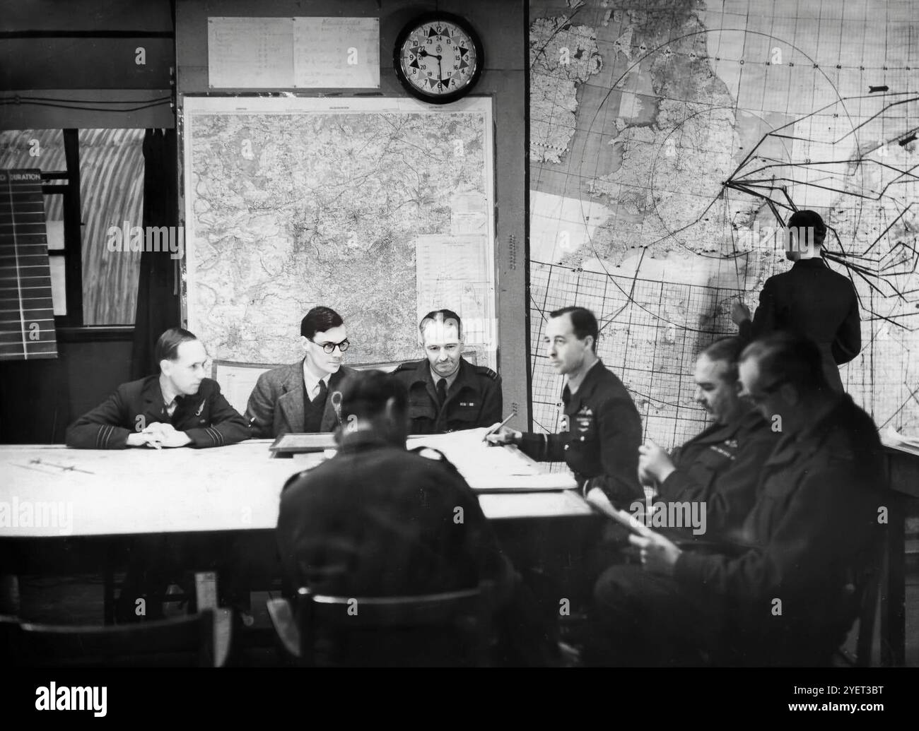 A Second World War pathfinder planning meeting in RAF Wyton in Cambridgeshire, England, home to the Pathfinder Force under the Command of Group Captain (later Air Vice-Marshal) Don Bennett in 1942. Stock Photohttps://www.alamy.com/image-license-details/?v=1https://www.alamy.com/a-second-world-war-pathfinder-planning-meeting-in-raf-wyton-in-cambridgeshire-england-home-to-the-pathfinder-force-under-the-command-of-group-captain-later-air-vice-marshal-don-bennett-in-1942-image628707964.html
RM2YET3BT–A Second World War pathfinder planning meeting in RAF Wyton in Cambridgeshire, England, home to the Pathfinder Force under the Command of Group Captain (later Air Vice-Marshal) Don Bennett in 1942.
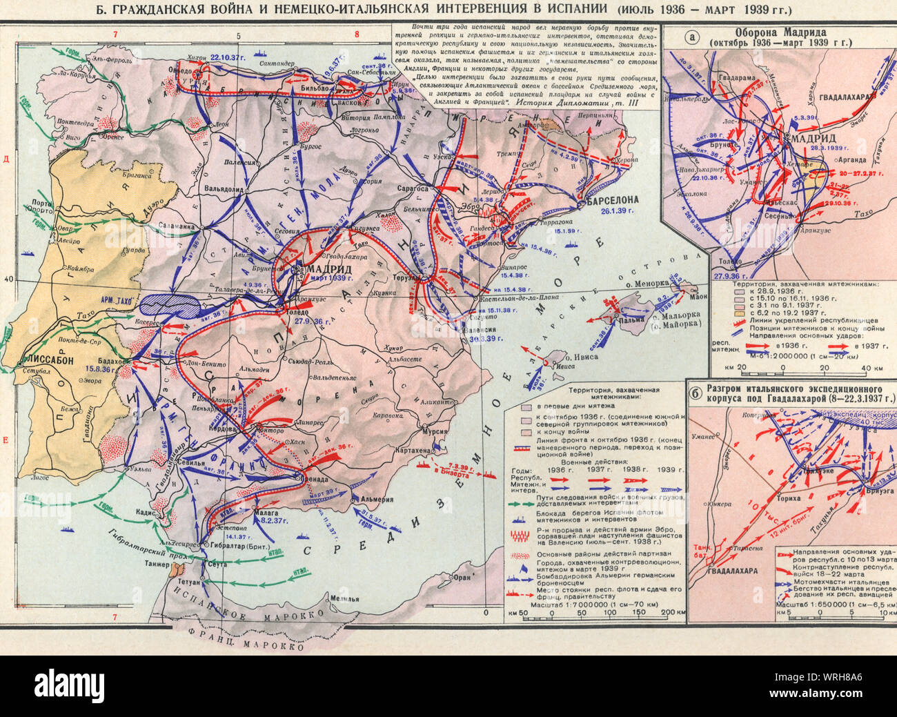 Map of Civil War and German-Italian intervention in Spain (July 1936 - March 1939), Stock Photohttps://www.alamy.com/image-license-details/?v=1https://www.alamy.com/map-of-civil-war-and-german-italian-intervention-in-spain-july-1936-march-1939-image272672350.html
RMWRH8A6–Map of Civil War and German-Italian intervention in Spain (July 1936 - March 1939),
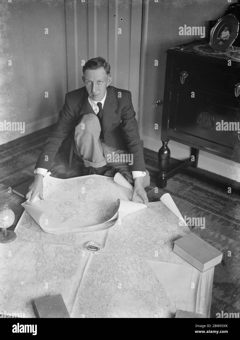 Dr Hugh Percival Wilkins PhD FRAS 1896 - 1960 was a British engineer by profession but most notably known as an amateur astronomer and particularly as a moon mapper . In his life he has created a number of moon maps , doing much of the observing from his home . In this photo Mr Hugh Percy Wilkins , at his home in Barnehurst , Kent , shows off pieces of a map of the moon that he has created . 1938 Stock Photohttps://www.alamy.com/image-license-details/?v=1https://www.alamy.com/dr-hugh-percival-wilkins-phd-fras-1896-1960-was-a-british-engineer-by-profession-but-most-notably-known-as-an-amateur-astronomer-and-particularly-as-a-moon-mapper-in-his-life-he-has-created-a-number-of-moon-maps-doing-much-of-the-observing-from-his-home-in-this-photo-mr-hugh-percy-wilkins-at-his-home-in-barnehurst-kent-shows-off-pieces-of-a-map-of-the-moon-that-he-has-created-1938-image359774427.html
RM2BW93XK–Dr Hugh Percival Wilkins PhD FRAS 1896 - 1960 was a British engineer by profession but most notably known as an amateur astronomer and particularly as a moon mapper . In his life he has created a number of moon maps , doing much of the observing from his home . In this photo Mr Hugh Percy Wilkins , at his home in Barnehurst , Kent , shows off pieces of a map of the moon that he has created . 1938
 Pictural Map of Sicilia Italy Colorful small map with vignettes of structures, nature, activities, products, crops, etc. Towns and cities labeled. Gilt used on most maps. from the book ' Italia ' by De Agostini, Giovanni; Nicouline, Vsevolod Petrovic Publication date 1938 Publisher Societa Anonima Editrice 'Italgeo', Milano artwork by Vsevolod Petrovic Nicouline Stock Photohttps://www.alamy.com/image-license-details/?v=1https://www.alamy.com/pictural-map-of-sicilia-italy-colorful-small-map-with-vignettes-of-structures-nature-activities-products-crops-etc-towns-and-cities-labeled-gilt-used-on-most-maps-from-the-book-italia-by-de-agostini-giovanni-nicouline-vsevolod-petrovic-publication-date-1938-publisher-societa-anonima-editrice-italgeo-milano-artwork-by-vsevolod-petrovic-nicouline-image474662729.html
RF2JG6N49–Pictural Map of Sicilia Italy Colorful small map with vignettes of structures, nature, activities, products, crops, etc. Towns and cities labeled. Gilt used on most maps. from the book ' Italia ' by De Agostini, Giovanni; Nicouline, Vsevolod Petrovic Publication date 1938 Publisher Societa Anonima Editrice 'Italgeo', Milano artwork by Vsevolod Petrovic Nicouline
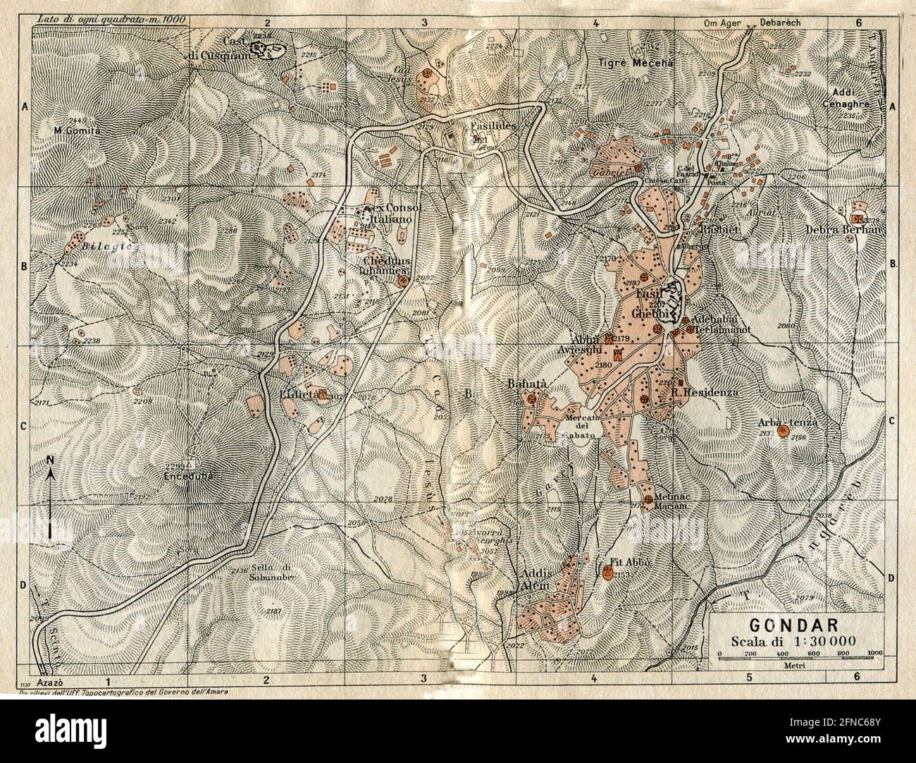 Ancient map of Gondar, Ethiopia (image from Italian Eastern Africa guide book 1938 edition) Stock Photohttps://www.alamy.com/image-license-details/?v=1https://www.alamy.com/ancient-map-of-gondar-ethiopia-image-from-italian-eastern-africa-guide-book-1938-edition-image426224987.html
RF2FNC68Y–Ancient map of Gondar, Ethiopia (image from Italian Eastern Africa guide book 1938 edition)
 Borne Sulinowo, Poland. 3rd, August 2019 Pictures from the 1930 to present times showing complicated history of the city displayed on the city walls is seen in Borne Sulinowo, Poland on 3 August 2019 Borne Sulinowo former Gross Born was from 1933 the German Nazis large military base, and Artillery School of the Wehrmacht, officially opened by Adolf Hitler in 1938. Between 1945 and 1992 it was a secret Soviet military base, erased from all Polish maps and it was not transferred to Polish jurisdiction until 1992. In official documents were called forest areas and remained a secret for almost 50 Stock Photohttps://www.alamy.com/image-license-details/?v=1https://www.alamy.com/borne-sulinowo-poland-3rd-august-2019-pictures-from-the-1930-to-present-times-showing-complicated-history-of-the-city-displayed-on-the-city-walls-is-seen-in-borne-sulinowo-poland-on-3-august-2019-borne-sulinowo-former-gross-born-was-from-1933-the-german-nazis-large-military-base-and-artillery-school-of-the-wehrmacht-officially-opened-by-adolf-hitler-in-1938-between-1945-and-1992-it-was-a-secret-soviet-military-base-erased-from-all-polish-maps-and-it-was-not-transferred-to-polish-jurisdiction-until-1992-in-official-documents-were-called-forest-areas-and-remained-a-secret-for-almost-50-image262838780.html
RMW7H9F8–Borne Sulinowo, Poland. 3rd, August 2019 Pictures from the 1930 to present times showing complicated history of the city displayed on the city walls is seen in Borne Sulinowo, Poland on 3 August 2019 Borne Sulinowo former Gross Born was from 1933 the German Nazis large military base, and Artillery School of the Wehrmacht, officially opened by Adolf Hitler in 1938. Between 1945 and 1992 it was a secret Soviet military base, erased from all Polish maps and it was not transferred to Polish jurisdiction until 1992. In official documents were called forest areas and remained a secret for almost 50
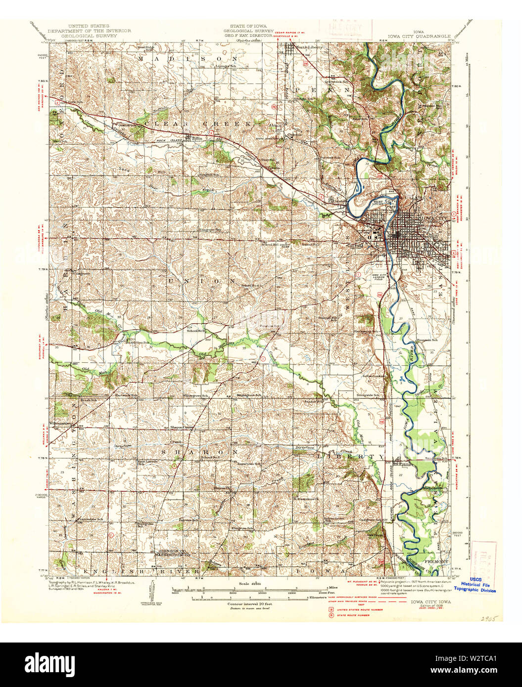 USGS TOPO Maps Iowa IA Iowa City 174882 1938 62500 Restoration Stock Photohttps://www.alamy.com/image-license-details/?v=1https://www.alamy.com/usgs-topo-maps-iowa-ia-iowa-city-174882-1938-62500-restoration-image259921369.html
RMW2TCA1–USGS TOPO Maps Iowa IA Iowa City 174882 1938 62500 Restoration
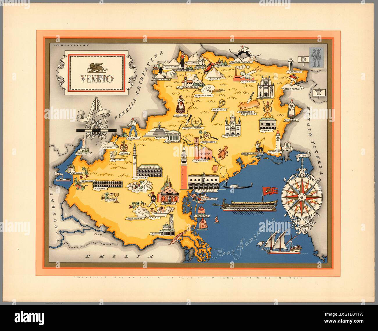 Illustrated map of Veneto, Italy. Towns and cities labelled. From 'Italia' by Giovanni De Agostini, artwork by Vsevolod Petrovic Nicouline. Publication date 1938. Stock Photohttps://www.alamy.com/image-license-details/?v=1https://www.alamy.com/illustrated-map-of-veneto-italy-towns-and-cities-labelled-from-italia-by-giovanni-de-agostini-artwork-by-vsevolod-petrovic-nicouline-publication-date-1938-image575999365.html
RF2TD311W–Illustrated map of Veneto, Italy. Towns and cities labelled. From 'Italia' by Giovanni De Agostini, artwork by Vsevolod Petrovic Nicouline. Publication date 1938.
![. Atlas of zoogeography; a series of maps illustrating the distribution of over seven hundred families, genera, and species of existing animals. Zoology; Zoogeography. . Please note that these images are extracted from scanned page images that may have been digitally enhanced for readability - coloration and appearance of these illustrations may not perfectly resemble the original work.. Bartholomew, J. G. (John George), 1860-1920; Clarke, William Eagle, 1853-1938; Grimshaw, Percy Hall. [Edinburgh] Pub. at the Edinburg Geographical Institute, by J. Bartholomew & Co. Stock Photo . Atlas of zoogeography; a series of maps illustrating the distribution of over seven hundred families, genera, and species of existing animals. Zoology; Zoogeography. . Please note that these images are extracted from scanned page images that may have been digitally enhanced for readability - coloration and appearance of these illustrations may not perfectly resemble the original work.. Bartholomew, J. G. (John George), 1860-1920; Clarke, William Eagle, 1853-1938; Grimshaw, Percy Hall. [Edinburgh] Pub. at the Edinburg Geographical Institute, by J. Bartholomew & Co. Stock Photo](https://c8.alamy.com/comp/RJXW4F/atlas-of-zoogeography-a-series-of-maps-illustrating-the-distribution-of-over-seven-hundred-families-genera-and-species-of-existing-animals-zoology-zoogeography-please-note-that-these-images-are-extracted-from-scanned-page-images-that-may-have-been-digitally-enhanced-for-readability-coloration-and-appearance-of-these-illustrations-may-not-perfectly-resemble-the-original-work-bartholomew-j-g-john-george-1860-1920-clarke-william-eagle-1853-1938-grimshaw-percy-hall-edinburgh-pub-at-the-edinburg-geographical-institute-by-j-bartholomew-amp-co-RJXW4F.jpg) . Atlas of zoogeography; a series of maps illustrating the distribution of over seven hundred families, genera, and species of existing animals. Zoology; Zoogeography. . Please note that these images are extracted from scanned page images that may have been digitally enhanced for readability - coloration and appearance of these illustrations may not perfectly resemble the original work.. Bartholomew, J. G. (John George), 1860-1920; Clarke, William Eagle, 1853-1938; Grimshaw, Percy Hall. [Edinburgh] Pub. at the Edinburg Geographical Institute, by J. Bartholomew & Co. Stock Photohttps://www.alamy.com/image-license-details/?v=1https://www.alamy.com/atlas-of-zoogeography-a-series-of-maps-illustrating-the-distribution-of-over-seven-hundred-families-genera-and-species-of-existing-animals-zoology-zoogeography-please-note-that-these-images-are-extracted-from-scanned-page-images-that-may-have-been-digitally-enhanced-for-readability-coloration-and-appearance-of-these-illustrations-may-not-perfectly-resemble-the-original-work-bartholomew-j-g-john-george-1860-1920-clarke-william-eagle-1853-1938-grimshaw-percy-hall-edinburgh-pub-at-the-edinburg-geographical-institute-by-j-bartholomew-amp-co-image235389071.html
. Atlas of zoogeography; a series of maps illustrating the distribution of over seven hundred families, genera, and species of existing animals. Zoology; Zoogeography. . Please note that these images are extracted from scanned page images that may have been digitally enhanced for readability - coloration and appearance of these illustrations may not perfectly resemble the original work.. Bartholomew, J. G. (John George), 1860-1920; Clarke, William Eagle, 1853-1938; Grimshaw, Percy Hall. [Edinburgh] Pub. at the Edinburg Geographical Institute, by J. Bartholomew & Co. Stock Photohttps://www.alamy.com/image-license-details/?v=1https://www.alamy.com/atlas-of-zoogeography-a-series-of-maps-illustrating-the-distribution-of-over-seven-hundred-families-genera-and-species-of-existing-animals-zoology-zoogeography-please-note-that-these-images-are-extracted-from-scanned-page-images-that-may-have-been-digitally-enhanced-for-readability-coloration-and-appearance-of-these-illustrations-may-not-perfectly-resemble-the-original-work-bartholomew-j-g-john-george-1860-1920-clarke-william-eagle-1853-1938-grimshaw-percy-hall-edinburgh-pub-at-the-edinburg-geographical-institute-by-j-bartholomew-amp-co-image235389071.htmlRMRJXW4F–. Atlas of zoogeography; a series of maps illustrating the distribution of over seven hundred families, genera, and species of existing animals. Zoology; Zoogeography. . Please note that these images are extracted from scanned page images that may have been digitally enhanced for readability - coloration and appearance of these illustrations may not perfectly resemble the original work.. Bartholomew, J. G. (John George), 1860-1920; Clarke, William Eagle, 1853-1938; Grimshaw, Percy Hall. [Edinburgh] Pub. at the Edinburg Geographical Institute, by J. Bartholomew & Co.
 Grave of Sydney Ewart Hollingworth, Atacama desert, Chile Stock Photohttps://www.alamy.com/image-license-details/?v=1https://www.alamy.com/grave-of-sydney-ewart-hollingworth-atacama-desert-chile-image365647642.html
RF2C6TK8A–Grave of Sydney Ewart Hollingworth, Atacama desert, Chile
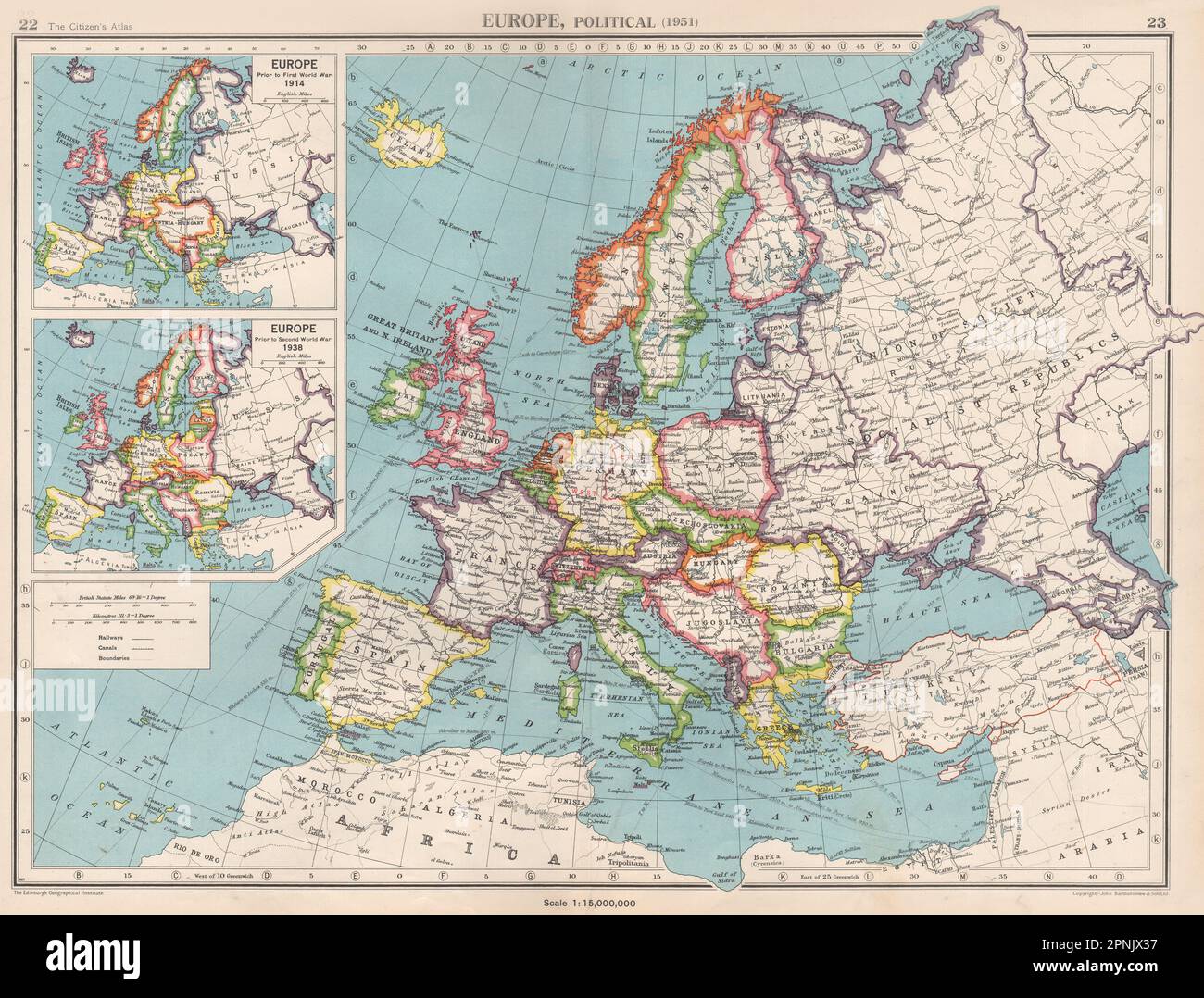 EUROPE in 1951. & inset in 1914 & 1938. Germany divided. BARTHOLOMEW 1952 map Stock Photohttps://www.alamy.com/image-license-details/?v=1https://www.alamy.com/europe-in-1951-inset-in-1914-1938-germany-divided-bartholomew-1952-map-image546844795.html
RF2PNJX37–EUROPE in 1951. & inset in 1914 & 1938. Germany divided. BARTHOLOMEW 1952 map
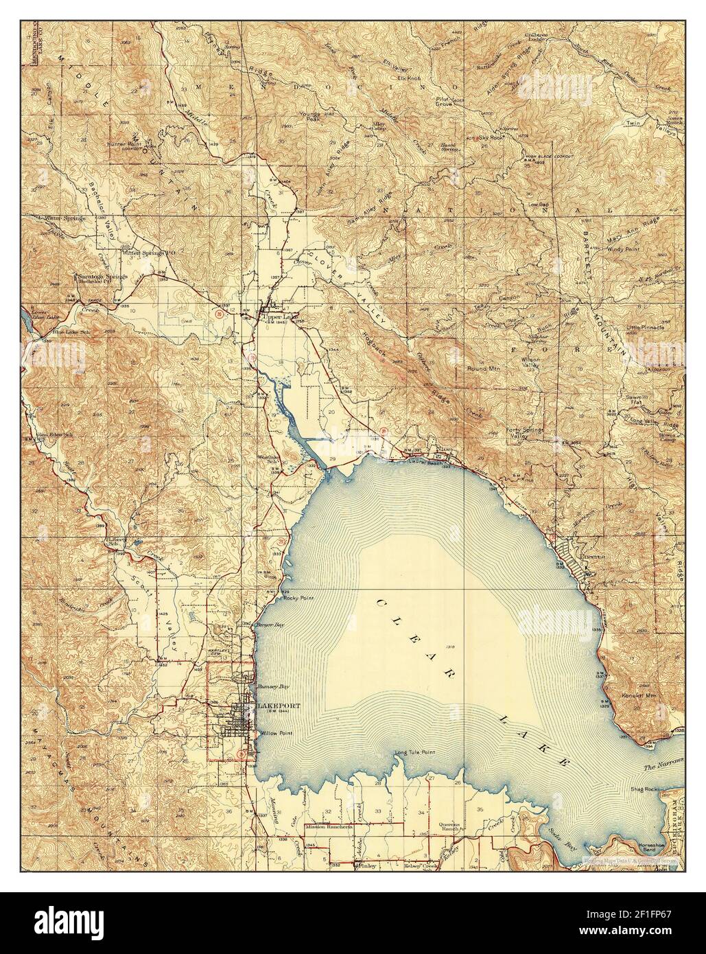 Lakeport, California, map 1938, 1:62500, United States of America by Timeless Maps, data U.S. Geological Survey Stock Photohttps://www.alamy.com/image-license-details/?v=1https://www.alamy.com/lakeport-california-map-1938-162500-united-states-of-america-by-timeless-maps-data-us-geological-survey-image414010191.html
RM2F1FP67–Lakeport, California, map 1938, 1:62500, United States of America by Timeless Maps, data U.S. Geological Survey
 text. Tables. 1938 - 1957. Lionel Pincus and Princess Firyal Map Division. Real property , New York (State) , New York (N.Y.), Bronx (New York, N.Y.) , Maps Table for Corrections Stock Photohttps://www.alamy.com/image-license-details/?v=1https://www.alamy.com/text-tables-1938-1957-lionel-pincus-and-princess-firyal-map-division-real-property-new-york-state-new-york-ny-bronx-new-york-ny-maps-table-for-corrections-image483691993.html
RM2K2X221–text. Tables. 1938 - 1957. Lionel Pincus and Princess Firyal Map Division. Real property , New York (State) , New York (N.Y.), Bronx (New York, N.Y.) , Maps Table for Corrections
 34th Guards Tikhvinsky Order of the Red Banner Bomber Air Regiment, a memory album 1938 - 43 Large, landscape format album with artificial leather cover. 70 pages, largely painted in watercolours and with many photos. Drawn of Stalin, soldiers, who received the Hero of the Soviet Union medal, maps with combat sites, regimental history, commanders, officers, squadron fact sheets, group photos, numbers of missions and bomber types, burning German aircraft and trains, number of bombs, photos of Soviet bombers, aerial photos, a Hitler caricature etc. Very detailed,, Stock Photohttps://www.alamy.com/image-license-details/?v=1https://www.alamy.com/stock-photo-34th-guards-tikhvinsky-order-of-the-red-banner-bomber-air-regiment-31666819.html
RMBREF9R–34th Guards Tikhvinsky Order of the Red Banner Bomber Air Regiment, a memory album 1938 - 43 Large, landscape format album with artificial leather cover. 70 pages, largely painted in watercolours and with many photos. Drawn of Stalin, soldiers, who received the Hero of the Soviet Union medal, maps with combat sites, regimental history, commanders, officers, squadron fact sheets, group photos, numbers of missions and bomber types, burning German aircraft and trains, number of bombs, photos of Soviet bombers, aerial photos, a Hitler caricature etc. Very detailed,,
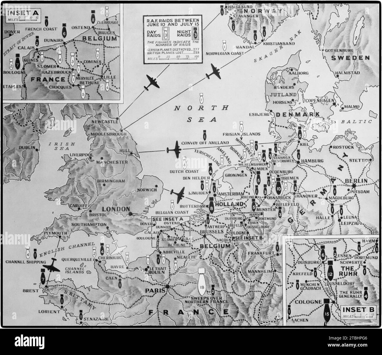 A map illustrating Britain's aerial offensive Second World War against Germany and occupied countries between 10th June and 15th July 1941. There were 76 daylight raids (white bomb symbol) and 154 night raids (black bomb symbol) with the number of attacks on each bomb with the map showing the main main targets. Stock Photohttps://www.alamy.com/image-license-details/?v=1https://www.alamy.com/a-map-illustrating-britains-aerial-offensive-second-world-war-against-germany-and-occupied-countries-between-10th-june-and-15th-july-1941-there-were-76-daylight-raids-white-bomb-symbol-and-154-night-raids-black-bomb-symbol-with-the-number-of-attacks-on-each-bomb-with-the-map-showing-the-main-main-targets-image575094246.html
RM2TBHPG6–A map illustrating Britain's aerial offensive Second World War against Germany and occupied countries between 10th June and 15th July 1941. There were 76 daylight raids (white bomb symbol) and 154 night raids (black bomb symbol) with the number of attacks on each bomb with the map showing the main main targets.
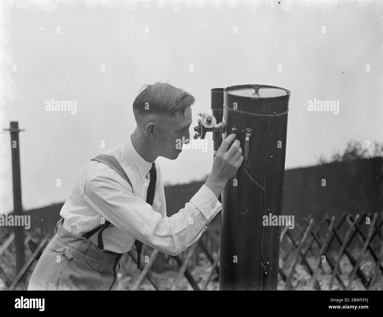 Dr Hugh Percival Wilkins PhD FRAS 1896 - 1960 was a British engineer by profession but most notably known as an amateur astronomer and particularly as a moon mapper . In his life he has created a number of moon maps , doing much of the observing from his home . Photo shows Mr Hugh Percy Wilkins at work , looking through a telescope , in the garden of his home in Barnehurst , Kent . 1938 Stock Photohttps://www.alamy.com/image-license-details/?v=1https://www.alamy.com/dr-hugh-percival-wilkins-phd-fras-1896-1960-was-a-british-engineer-by-profession-but-most-notably-known-as-an-amateur-astronomer-and-particularly-as-a-moon-mapper-in-his-life-he-has-created-a-number-of-moon-maps-doing-much-of-the-observing-from-his-home-photo-shows-mr-hugh-percy-wilkins-at-work-looking-through-a-telescope-in-the-garden-of-his-home-in-barnehurst-kent-1938-image359774454.html
RM2BW93YJ–Dr Hugh Percival Wilkins PhD FRAS 1896 - 1960 was a British engineer by profession but most notably known as an amateur astronomer and particularly as a moon mapper . In his life he has created a number of moon maps , doing much of the observing from his home . Photo shows Mr Hugh Percy Wilkins at work , looking through a telescope , in the garden of his home in Barnehurst , Kent . 1938
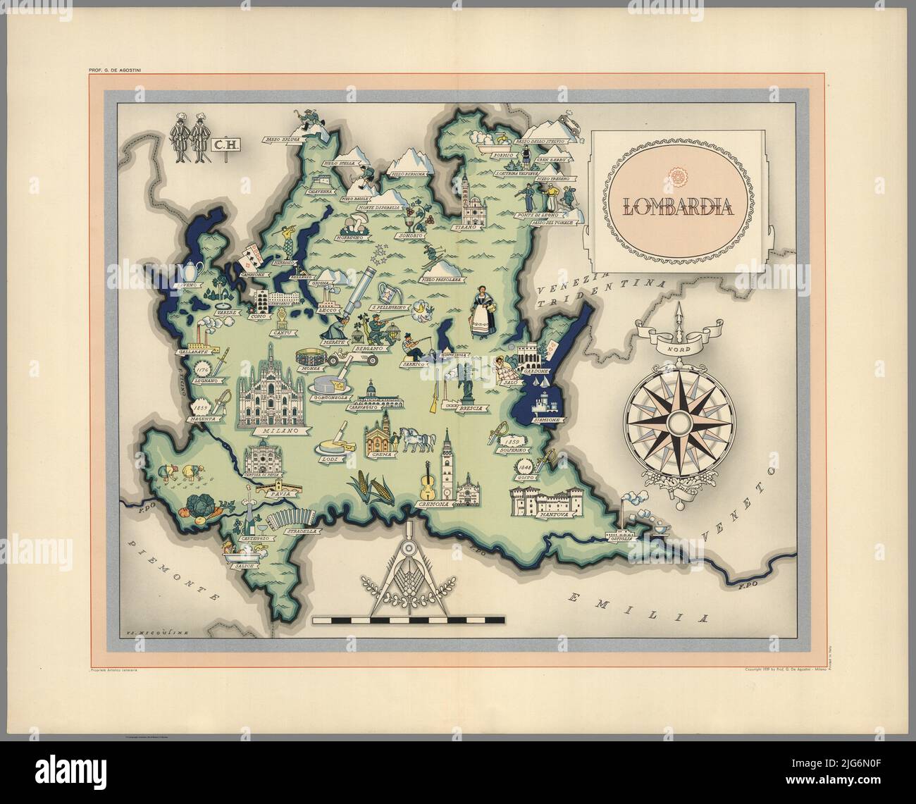 Pictural Map of Lombardia, Italy Colorful small map with vignettes of structures, nature, activities, products, crops, etc. Towns and cities labeled. Gilt used on most maps. from the book ' Italia ' by De Agostini, Giovanni; Nicouline, Vsevolod Petrovic Publication date 1938 Publisher Societa Anonima Editrice 'Italgeo', Milano artwork by Vsevolod Petrovic Nicouline Stock Photohttps://www.alamy.com/image-license-details/?v=1https://www.alamy.com/pictural-map-of-lombardia-italy-colorful-small-map-with-vignettes-of-structures-nature-activities-products-crops-etc-towns-and-cities-labeled-gilt-used-on-most-maps-from-the-book-italia-by-de-agostini-giovanni-nicouline-vsevolod-petrovic-publication-date-1938-publisher-societa-anonima-editrice-italgeo-milano-artwork-by-vsevolod-petrovic-nicouline-image474662623.html
RF2JG6N0F–Pictural Map of Lombardia, Italy Colorful small map with vignettes of structures, nature, activities, products, crops, etc. Towns and cities labeled. Gilt used on most maps. from the book ' Italia ' by De Agostini, Giovanni; Nicouline, Vsevolod Petrovic Publication date 1938 Publisher Societa Anonima Editrice 'Italgeo', Milano artwork by Vsevolod Petrovic Nicouline
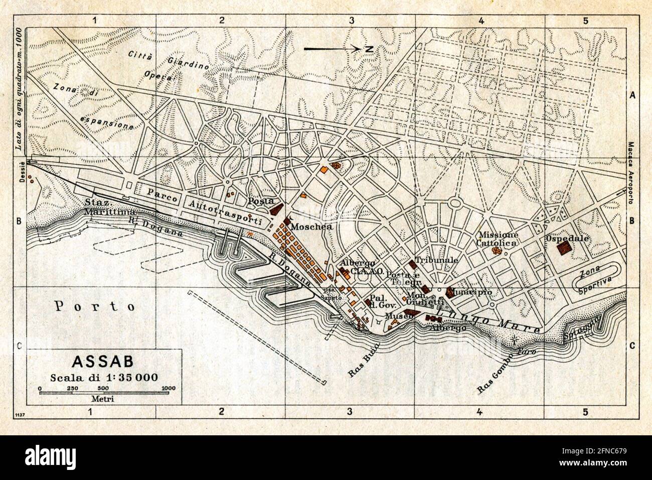 Ancient map of Assab, Eritrea (image from Italian Eastern Africa guide book 1938 edition) Stock Photohttps://www.alamy.com/image-license-details/?v=1https://www.alamy.com/ancient-map-of-assab-eritrea-image-from-italian-eastern-africa-guide-book-1938-edition-image426224941.html
RF2FNC679–Ancient map of Assab, Eritrea (image from Italian Eastern Africa guide book 1938 edition)
 Borne Sulinowo, Poland. 3rd, August 2019 Pictures from the 1930 to present times showing complicated history of the city displayed on the city walls is seen in Borne Sulinowo, Poland on 3 August 2019 Borne Sulinowo former Gross Born was from 1933 the German Nazis large military base, and Artillery School of the Wehrmacht, officially opened by Adolf Hitler in 1938. Between 1945 and 1992 it was a secret Soviet military base, erased from all Polish maps and it was not transferred to Polish jurisdiction until 1992. In official documents were called forest areas and remained a secret for almost 50 Stock Photohttps://www.alamy.com/image-license-details/?v=1https://www.alamy.com/borne-sulinowo-poland-3rd-august-2019-pictures-from-the-1930-to-present-times-showing-complicated-history-of-the-city-displayed-on-the-city-walls-is-seen-in-borne-sulinowo-poland-on-3-august-2019-borne-sulinowo-former-gross-born-was-from-1933-the-german-nazis-large-military-base-and-artillery-school-of-the-wehrmacht-officially-opened-by-adolf-hitler-in-1938-between-1945-and-1992-it-was-a-secret-soviet-military-base-erased-from-all-polish-maps-and-it-was-not-transferred-to-polish-jurisdiction-until-1992-in-official-documents-were-called-forest-areas-and-remained-a-secret-for-almost-50-image262838764.html
RMW7H9EM–Borne Sulinowo, Poland. 3rd, August 2019 Pictures from the 1930 to present times showing complicated history of the city displayed on the city walls is seen in Borne Sulinowo, Poland on 3 August 2019 Borne Sulinowo former Gross Born was from 1933 the German Nazis large military base, and Artillery School of the Wehrmacht, officially opened by Adolf Hitler in 1938. Between 1945 and 1992 it was a secret Soviet military base, erased from all Polish maps and it was not transferred to Polish jurisdiction until 1992. In official documents were called forest areas and remained a secret for almost 50
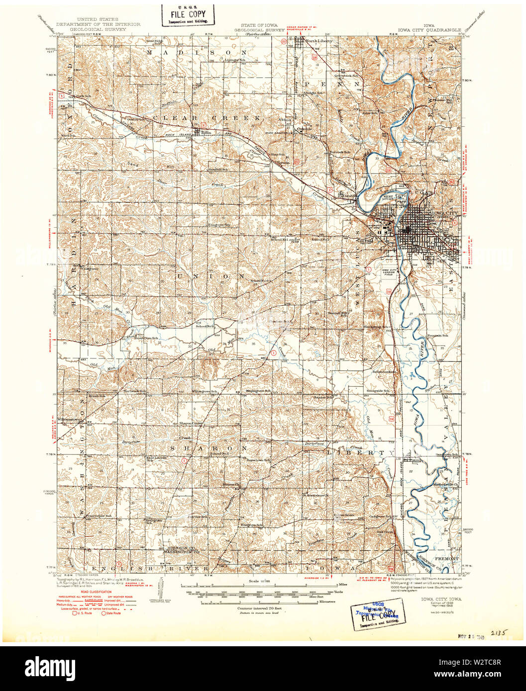 USGS TOPO Maps Iowa IA Iowa City 174884 1938 62500 Restoration Stock Photohttps://www.alamy.com/image-license-details/?v=1https://www.alamy.com/usgs-topo-maps-iowa-ia-iowa-city-174884-1938-62500-restoration-image259921335.html
RMW2TC8R–USGS TOPO Maps Iowa IA Iowa City 174884 1938 62500 Restoration
 Illustrated map of Lucania, Italy. Towns and cities labelled. From 'Italia' by Giovanni De Agostini, artwork by Vsevolod Petrovic Nicouline. Publication date 1938. Stock Photohttps://www.alamy.com/image-license-details/?v=1https://www.alamy.com/illustrated-map-of-lucania-italy-towns-and-cities-labelled-from-italia-by-giovanni-de-agostini-artwork-by-vsevolod-petrovic-nicouline-publication-date-1938-image575999384.html
RF2TD312G–Illustrated map of Lucania, Italy. Towns and cities labelled. From 'Italia' by Giovanni De Agostini, artwork by Vsevolod Petrovic Nicouline. Publication date 1938.
![. Atlas of zoogeography; a series of maps illustrating the distribution of over seven hundred families, genera, and species of existing animals. Zoology; Zoogeography. . Please note that these images are extracted from scanned page images that may have been digitally enhanced for readability - coloration and appearance of these illustrations may not perfectly resemble the original work.. Bartholomew, J. G. (John George), 1860-1920; Clarke, William Eagle, 1853-1938; Grimshaw, Percy Hall. [Edinburgh] Pub. at the Edinburg Geographical Institute, by J. Bartholomew & Co. Stock Photo . Atlas of zoogeography; a series of maps illustrating the distribution of over seven hundred families, genera, and species of existing animals. Zoology; Zoogeography. . Please note that these images are extracted from scanned page images that may have been digitally enhanced for readability - coloration and appearance of these illustrations may not perfectly resemble the original work.. Bartholomew, J. G. (John George), 1860-1920; Clarke, William Eagle, 1853-1938; Grimshaw, Percy Hall. [Edinburgh] Pub. at the Edinburg Geographical Institute, by J. Bartholomew & Co. Stock Photo](https://c8.alamy.com/comp/RJY58X/atlas-of-zoogeography-a-series-of-maps-illustrating-the-distribution-of-over-seven-hundred-families-genera-and-species-of-existing-animals-zoology-zoogeography-please-note-that-these-images-are-extracted-from-scanned-page-images-that-may-have-been-digitally-enhanced-for-readability-coloration-and-appearance-of-these-illustrations-may-not-perfectly-resemble-the-original-work-bartholomew-j-g-john-george-1860-1920-clarke-william-eagle-1853-1938-grimshaw-percy-hall-edinburgh-pub-at-the-edinburg-geographical-institute-by-j-bartholomew-amp-co-RJY58X.jpg) . Atlas of zoogeography; a series of maps illustrating the distribution of over seven hundred families, genera, and species of existing animals. Zoology; Zoogeography. . Please note that these images are extracted from scanned page images that may have been digitally enhanced for readability - coloration and appearance of these illustrations may not perfectly resemble the original work.. Bartholomew, J. G. (John George), 1860-1920; Clarke, William Eagle, 1853-1938; Grimshaw, Percy Hall. [Edinburgh] Pub. at the Edinburg Geographical Institute, by J. Bartholomew & Co. Stock Photohttps://www.alamy.com/image-license-details/?v=1https://www.alamy.com/atlas-of-zoogeography-a-series-of-maps-illustrating-the-distribution-of-over-seven-hundred-families-genera-and-species-of-existing-animals-zoology-zoogeography-please-note-that-these-images-are-extracted-from-scanned-page-images-that-may-have-been-digitally-enhanced-for-readability-coloration-and-appearance-of-these-illustrations-may-not-perfectly-resemble-the-original-work-bartholomew-j-g-john-george-1860-1920-clarke-william-eagle-1853-1938-grimshaw-percy-hall-edinburgh-pub-at-the-edinburg-geographical-institute-by-j-bartholomew-amp-co-image235395466.html
. Atlas of zoogeography; a series of maps illustrating the distribution of over seven hundred families, genera, and species of existing animals. Zoology; Zoogeography. . Please note that these images are extracted from scanned page images that may have been digitally enhanced for readability - coloration and appearance of these illustrations may not perfectly resemble the original work.. Bartholomew, J. G. (John George), 1860-1920; Clarke, William Eagle, 1853-1938; Grimshaw, Percy Hall. [Edinburgh] Pub. at the Edinburg Geographical Institute, by J. Bartholomew & Co. Stock Photohttps://www.alamy.com/image-license-details/?v=1https://www.alamy.com/atlas-of-zoogeography-a-series-of-maps-illustrating-the-distribution-of-over-seven-hundred-families-genera-and-species-of-existing-animals-zoology-zoogeography-please-note-that-these-images-are-extracted-from-scanned-page-images-that-may-have-been-digitally-enhanced-for-readability-coloration-and-appearance-of-these-illustrations-may-not-perfectly-resemble-the-original-work-bartholomew-j-g-john-george-1860-1920-clarke-william-eagle-1853-1938-grimshaw-percy-hall-edinburgh-pub-at-the-edinburg-geographical-institute-by-j-bartholomew-amp-co-image235395466.htmlRMRJY58X–. Atlas of zoogeography; a series of maps illustrating the distribution of over seven hundred families, genera, and species of existing animals. Zoology; Zoogeography. . Please note that these images are extracted from scanned page images that may have been digitally enhanced for readability - coloration and appearance of these illustrations may not perfectly resemble the original work.. Bartholomew, J. G. (John George), 1860-1920; Clarke, William Eagle, 1853-1938; Grimshaw, Percy Hall. [Edinburgh] Pub. at the Edinburg Geographical Institute, by J. Bartholomew & Co.
 CANADA & NEWFOUNDLAND: railways. Dominion of Canada., 1938 vintage map Stock Photohttps://www.alamy.com/image-license-details/?v=1https://www.alamy.com/stock-photo-canada-newfoundland-railways-dominion-of-canada-1938-vintage-map-93780632.html
RFFCG248–CANADA & NEWFOUNDLAND: railways. Dominion of Canada., 1938 vintage map
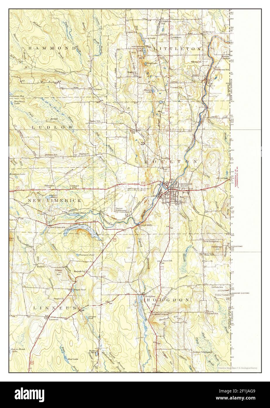 Houlton, Maine, map 1938, 1:62500, United States of America by Timeless Maps, data U.S. Geological Survey Stock Photohttps://www.alamy.com/image-license-details/?v=1https://www.alamy.com/houlton-maine-map-1938-162500-united-states-of-america-by-timeless-maps-data-us-geological-survey-image414066921.html
RM2F1JAG9–Houlton, Maine, map 1938, 1:62500, United States of America by Timeless Maps, data U.S. Geological Survey
 Cartographic, Maps, Indexes. 1938. Lionel Pincus and Princess Firyal Map Division. Bronx (New York, N.Y.) , Maps, Real property , New York (State) , New York (N.Y.) Block Index. Volume Two Stock Photohttps://www.alamy.com/image-license-details/?v=1https://www.alamy.com/cartographic-maps-indexes-1938-lionel-pincus-and-princess-firyal-map-division-bronx-new-york-ny-maps-real-property-new-york-state-new-york-ny-block-index-volume-two-image483636489.html
RM2K2RF7N–Cartographic, Maps, Indexes. 1938. Lionel Pincus and Princess Firyal Map Division. Bronx (New York, N.Y.) , Maps, Real property , New York (State) , New York (N.Y.) Block Index. Volume Two
 34th Guards Tikhvinsky Order of the Red Banner Bomber Air Regiment, a memory album 1938 - 43 Large, landscape format album with artificial leather cover. 70 pages, largely painted in watercolours and with many photos. Drawn of Stalin, soldiers, who received the Hero of the Soviet Union medal, maps with combat sites, regimental history, commanders, officers, squadron fact sheets, group photos, numbers of missions and bomber types, burning German aircraft and trains, number of bombs, photos of Soviet bombers, aerial photos, a Hitler caricature etc. Very detailed,, Stock Photohttps://www.alamy.com/image-license-details/?v=1https://www.alamy.com/stock-photo-34th-guards-tikhvinsky-order-of-the-red-banner-bomber-air-regiment-31666814.html
RMBREF9J–34th Guards Tikhvinsky Order of the Red Banner Bomber Air Regiment, a memory album 1938 - 43 Large, landscape format album with artificial leather cover. 70 pages, largely painted in watercolours and with many photos. Drawn of Stalin, soldiers, who received the Hero of the Soviet Union medal, maps with combat sites, regimental history, commanders, officers, squadron fact sheets, group photos, numbers of missions and bomber types, burning German aircraft and trains, number of bombs, photos of Soviet bombers, aerial photos, a Hitler caricature etc. Very detailed,,
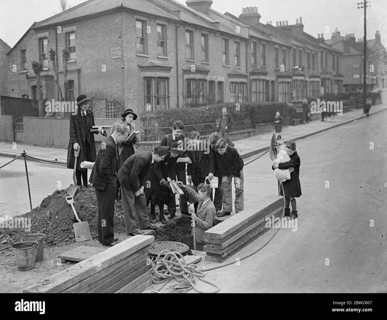 London school children study geography by seeing for themselves. Boys and girls at Dulwich Central School, London, have a new way of learning geography and they are enjoying it. Instead of studying textbooks they are given practical work. Classes are taken for walks to study the geography of their own and other districts, and pupils are allowed to go to the local library to obtain data for maps on population density, industrial works of the area and details of local contours. Factories of importance in the borough are also visited. Photo shows, children of the Dulwich Central School take posse Stock Photohttps://www.alamy.com/image-license-details/?v=1https://www.alamy.com/london-school-children-study-geography-by-seeing-for-themselves-boys-and-girls-at-dulwich-central-school-london-have-a-new-way-of-learning-geography-and-they-are-enjoying-it-instead-of-studying-textbooks-they-are-given-practical-work-classes-are-taken-for-walks-to-study-the-geography-of-their-own-and-other-districts-and-pupils-are-allowed-to-go-to-the-local-library-to-obtain-data-for-maps-on-population-density-industrial-works-of-the-area-and-details-of-local-contours-factories-of-importance-in-the-borough-are-also-visited-photo-shows-children-of-the-dulwich-central-school-take-posse-image359623943.html
RM2BW2807–London school children study geography by seeing for themselves. Boys and girls at Dulwich Central School, London, have a new way of learning geography and they are enjoying it. Instead of studying textbooks they are given practical work. Classes are taken for walks to study the geography of their own and other districts, and pupils are allowed to go to the local library to obtain data for maps on population density, industrial works of the area and details of local contours. Factories of importance in the borough are also visited. Photo shows, children of the Dulwich Central School take posse
 Pictural Map of Calabria, Italy Colorful small map with vignettes of structures, nature, activities, products, crops, etc. Towns and cities labeled. Gilt used on most maps. from the book ' Italia ' by De Agostini, Giovanni; Nicouline, Vsevolod Petrovic Publication date 1938 Publisher Societa Anonima Editrice 'Italgeo', Milano artwork by Vsevolod Petrovic Nicouline Stock Photohttps://www.alamy.com/image-license-details/?v=1https://www.alamy.com/pictural-map-of-calabria-italy-colorful-small-map-with-vignettes-of-structures-nature-activities-products-crops-etc-towns-and-cities-labeled-gilt-used-on-most-maps-from-the-book-italia-by-de-agostini-giovanni-nicouline-vsevolod-petrovic-publication-date-1938-publisher-societa-anonima-editrice-italgeo-milano-artwork-by-vsevolod-petrovic-nicouline-image474662725.html
RF2JG6N45–Pictural Map of Calabria, Italy Colorful small map with vignettes of structures, nature, activities, products, crops, etc. Towns and cities labeled. Gilt used on most maps. from the book ' Italia ' by De Agostini, Giovanni; Nicouline, Vsevolod Petrovic Publication date 1938 Publisher Societa Anonima Editrice 'Italgeo', Milano artwork by Vsevolod Petrovic Nicouline
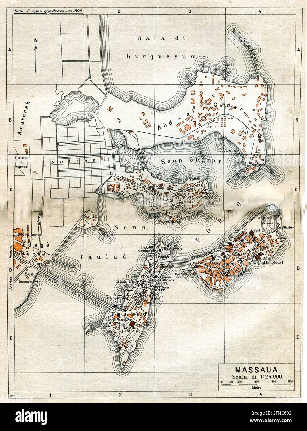 Ancient map of Massaua, Eritrea (image from Italian Eastern Africa guide book 1938 edition) Stock Photohttps://www.alamy.com/image-license-details/?v=1https://www.alamy.com/ancient-map-of-massaua-eritrea-image-from-italian-eastern-africa-guide-book-1938-edition-image426224990.html
RF2FNC692–Ancient map of Massaua, Eritrea (image from Italian Eastern Africa guide book 1938 edition)
 Borne Sulinowo, Poland. 3rd, August 2019 Pictures from the 1930 to present times showing complicated history of the city displayed on the city walls is seen in Borne Sulinowo, Poland on 3 August 2019 Borne Sulinowo former Gross Born was from 1933 the German Nazis large military base, and Artillery School of the Wehrmacht, officially opened by Adolf Hitler in 1938. Between 1945 and 1992 it was a secret Soviet military base, erased from all Polish maps and it was not transferred to Polish jurisdiction until 1992. In official documents were called forest areas and remained a secret for almost 50 Stock Photohttps://www.alamy.com/image-license-details/?v=1https://www.alamy.com/borne-sulinowo-poland-3rd-august-2019-pictures-from-the-1930-to-present-times-showing-complicated-history-of-the-city-displayed-on-the-city-walls-is-seen-in-borne-sulinowo-poland-on-3-august-2019-borne-sulinowo-former-gross-born-was-from-1933-the-german-nazis-large-military-base-and-artillery-school-of-the-wehrmacht-officially-opened-by-adolf-hitler-in-1938-between-1945-and-1992-it-was-a-secret-soviet-military-base-erased-from-all-polish-maps-and-it-was-not-transferred-to-polish-jurisdiction-until-1992-in-official-documents-were-called-forest-areas-and-remained-a-secret-for-almost-50-image262838856.html
RMW7H9J0–Borne Sulinowo, Poland. 3rd, August 2019 Pictures from the 1930 to present times showing complicated history of the city displayed on the city walls is seen in Borne Sulinowo, Poland on 3 August 2019 Borne Sulinowo former Gross Born was from 1933 the German Nazis large military base, and Artillery School of the Wehrmacht, officially opened by Adolf Hitler in 1938. Between 1945 and 1992 it was a secret Soviet military base, erased from all Polish maps and it was not transferred to Polish jurisdiction until 1992. In official documents were called forest areas and remained a secret for almost 50
 Civil War Maps 1938 Balloon view of the attack on Fort Darling in the James River by Commander Rogers's sic ie Rodger's gun-boat flotilla ''Galena'' ''Monitor'' etc May 16 1862 Rebuild and Repair Stock Photohttps://www.alamy.com/image-license-details/?v=1https://www.alamy.com/civil-war-maps-1938-balloon-view-of-the-attack-on-fort-darling-in-the-james-river-by-commander-rogerss-sic-ie-rodgers-gun-boat-flotilla-galena-monitor-etc-may-16-1862-rebuild-and-repair-image261981885.html
RMW668FW–Civil War Maps 1938 Balloon view of the attack on Fort Darling in the James River by Commander Rogers's sic ie Rodger's gun-boat flotilla ''Galena'' ''Monitor'' etc May 16 1862 Rebuild and Repair
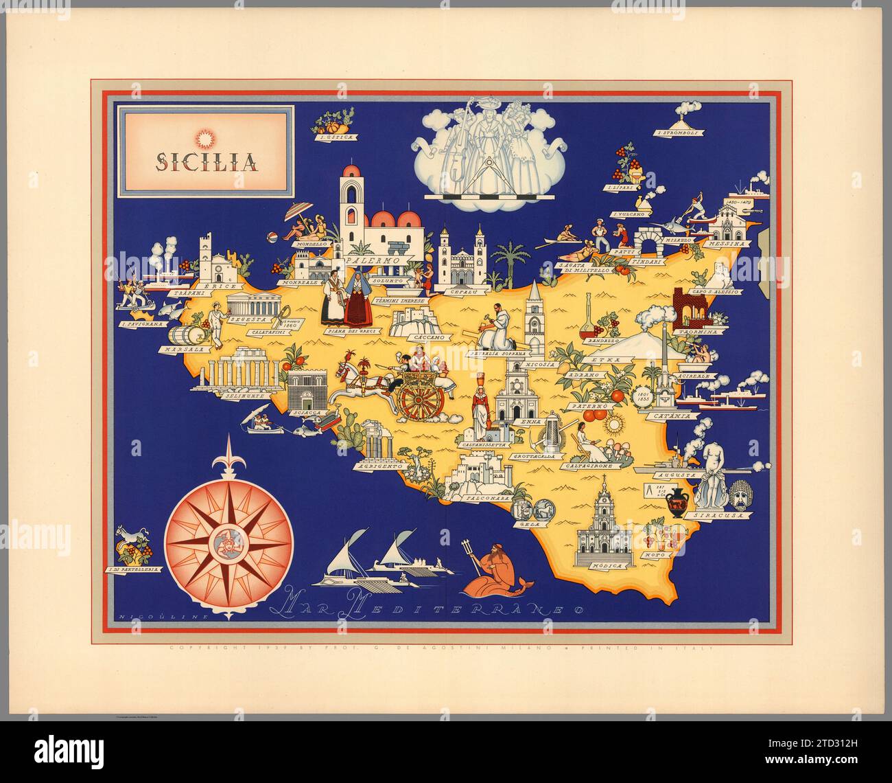 Illustrated map of Sicily, Italy. Towns and cities labelled. From 'Italia' by Giovanni De Agostini, artwork by Vsevolod Petrovic Nicouline. Publication date 1938. Stock Photohttps://www.alamy.com/image-license-details/?v=1https://www.alamy.com/illustrated-map-of-sicily-italy-towns-and-cities-labelled-from-italia-by-giovanni-de-agostini-artwork-by-vsevolod-petrovic-nicouline-publication-date-1938-image575999385.html
RF2TD312H–Illustrated map of Sicily, Italy. Towns and cities labelled. From 'Italia' by Giovanni De Agostini, artwork by Vsevolod Petrovic Nicouline. Publication date 1938.
![. Atlas of zoogeography; a series of maps illustrating the distribution of over seven hundred families, genera, and species of existing animals. Zoology; Zoogeography. . Please note that these images are extracted from scanned page images that may have been digitally enhanced for readability - coloration and appearance of these illustrations may not perfectly resemble the original work.. Bartholomew, J. G. (John George), 1860-1920; Clarke, William Eagle, 1853-1938; Grimshaw, Percy Hall. [Edinburgh] Pub. at the Edinburg Geographical Institute, by J. Bartholomew & Co. Stock Photo . Atlas of zoogeography; a series of maps illustrating the distribution of over seven hundred families, genera, and species of existing animals. Zoology; Zoogeography. . Please note that these images are extracted from scanned page images that may have been digitally enhanced for readability - coloration and appearance of these illustrations may not perfectly resemble the original work.. Bartholomew, J. G. (John George), 1860-1920; Clarke, William Eagle, 1853-1938; Grimshaw, Percy Hall. [Edinburgh] Pub. at the Edinburg Geographical Institute, by J. Bartholomew & Co. Stock Photo](https://c8.alamy.com/comp/RJY3DY/atlas-of-zoogeography-a-series-of-maps-illustrating-the-distribution-of-over-seven-hundred-families-genera-and-species-of-existing-animals-zoology-zoogeography-please-note-that-these-images-are-extracted-from-scanned-page-images-that-may-have-been-digitally-enhanced-for-readability-coloration-and-appearance-of-these-illustrations-may-not-perfectly-resemble-the-original-work-bartholomew-j-g-john-george-1860-1920-clarke-william-eagle-1853-1938-grimshaw-percy-hall-edinburgh-pub-at-the-edinburg-geographical-institute-by-j-bartholomew-amp-co-RJY3DY.jpg) . Atlas of zoogeography; a series of maps illustrating the distribution of over seven hundred families, genera, and species of existing animals. Zoology; Zoogeography. . Please note that these images are extracted from scanned page images that may have been digitally enhanced for readability - coloration and appearance of these illustrations may not perfectly resemble the original work.. Bartholomew, J. G. (John George), 1860-1920; Clarke, William Eagle, 1853-1938; Grimshaw, Percy Hall. [Edinburgh] Pub. at the Edinburg Geographical Institute, by J. Bartholomew & Co. Stock Photohttps://www.alamy.com/image-license-details/?v=1https://www.alamy.com/atlas-of-zoogeography-a-series-of-maps-illustrating-the-distribution-of-over-seven-hundred-families-genera-and-species-of-existing-animals-zoology-zoogeography-please-note-that-these-images-are-extracted-from-scanned-page-images-that-may-have-been-digitally-enhanced-for-readability-coloration-and-appearance-of-these-illustrations-may-not-perfectly-resemble-the-original-work-bartholomew-j-g-john-george-1860-1920-clarke-william-eagle-1853-1938-grimshaw-percy-hall-edinburgh-pub-at-the-edinburg-geographical-institute-by-j-bartholomew-amp-co-image235394039.html
. Atlas of zoogeography; a series of maps illustrating the distribution of over seven hundred families, genera, and species of existing animals. Zoology; Zoogeography. . Please note that these images are extracted from scanned page images that may have been digitally enhanced for readability - coloration and appearance of these illustrations may not perfectly resemble the original work.. Bartholomew, J. G. (John George), 1860-1920; Clarke, William Eagle, 1853-1938; Grimshaw, Percy Hall. [Edinburgh] Pub. at the Edinburg Geographical Institute, by J. Bartholomew & Co. Stock Photohttps://www.alamy.com/image-license-details/?v=1https://www.alamy.com/atlas-of-zoogeography-a-series-of-maps-illustrating-the-distribution-of-over-seven-hundred-families-genera-and-species-of-existing-animals-zoology-zoogeography-please-note-that-these-images-are-extracted-from-scanned-page-images-that-may-have-been-digitally-enhanced-for-readability-coloration-and-appearance-of-these-illustrations-may-not-perfectly-resemble-the-original-work-bartholomew-j-g-john-george-1860-1920-clarke-william-eagle-1853-1938-grimshaw-percy-hall-edinburgh-pub-at-the-edinburg-geographical-institute-by-j-bartholomew-amp-co-image235394039.htmlRMRJY3DY–. Atlas of zoogeography; a series of maps illustrating the distribution of over seven hundred families, genera, and species of existing animals. Zoology; Zoogeography. . Please note that these images are extracted from scanned page images that may have been digitally enhanced for readability - coloration and appearance of these illustrations may not perfectly resemble the original work.. Bartholomew, J. G. (John George), 1860-1920; Clarke, William Eagle, 1853-1938; Grimshaw, Percy Hall. [Edinburgh] Pub. at the Edinburg Geographical Institute, by J. Bartholomew & Co.
 MEXICO & WEST INDIES: Caribbean. Santo Domingo, 1938 vintage map Stock Photohttps://www.alamy.com/image-license-details/?v=1https://www.alamy.com/stock-photo-mexico-west-indies-caribbean-santo-domingo-1938-vintage-map-93780875.html
RFFCG2CY–MEXICO & WEST INDIES: Caribbean. Santo Domingo, 1938 vintage map
 Rehoboth, Delaware, map 1938, 1:62500, United States of America by Timeless Maps, data U.S. Geological Survey Stock Photohttps://www.alamy.com/image-license-details/?v=1https://www.alamy.com/rehoboth-delaware-map-1938-162500-united-states-of-america-by-timeless-maps-data-us-geological-survey-image414030322.html
RM2F1GKW6–Rehoboth, Delaware, map 1938, 1:62500, United States of America by Timeless Maps, data U.S. Geological Survey
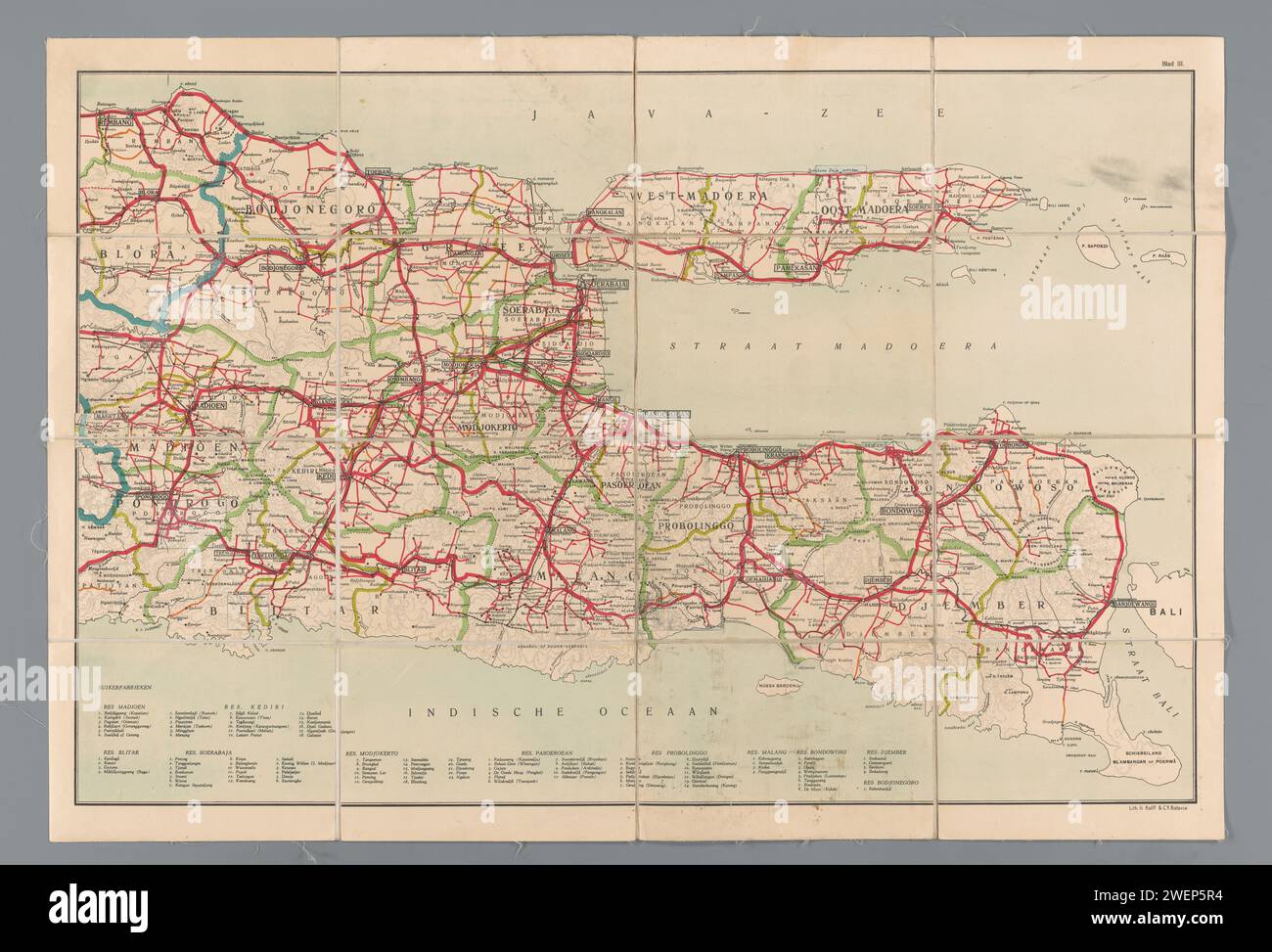 Road map of East Java, Anonymous, 1906 - 1938 print Scale 1: 500,000. Under the map a legend of sugar factories per regent. paper. linen (material) maps of separate countries or regions East Java Stock Photohttps://www.alamy.com/image-license-details/?v=1https://www.alamy.com/road-map-of-east-java-anonymous-1906-1938-print-scale-1-500000-under-the-map-a-legend-of-sugar-factories-per-regent-paper-linen-material-maps-of-separate-countries-or-regions-east-java-image594245208.html
RM2WEP5R4–Road map of East Java, Anonymous, 1906 - 1938 print Scale 1: 500,000. Under the map a legend of sugar factories per regent. paper. linen (material) maps of separate countries or regions East Java
 34th Guards Tikhvinsky Order of the Red Banner Bomber Air Regiment, a memory album 1938 - 43 Large, landscape format album with artificial leather cover. 70 pages, largely painted in watercolours and with many photos. Drawn of Stalin, soldiers, who received the Hero of the Soviet Union medal, maps with combat sites, regimental history, commanders, officers, squadron fact sheets, group photos, numbers of missions and bomber types, burning German aircraft and trains, number of bombs, photos of Soviet bombers, aerial photos, a Hitler caricature etc. Very detailed,, Stock Photohttps://www.alamy.com/image-license-details/?v=1https://www.alamy.com/stock-photo-34th-guards-tikhvinsky-order-of-the-red-banner-bomber-air-regiment-31666883.html
RMBREFC3–34th Guards Tikhvinsky Order of the Red Banner Bomber Air Regiment, a memory album 1938 - 43 Large, landscape format album with artificial leather cover. 70 pages, largely painted in watercolours and with many photos. Drawn of Stalin, soldiers, who received the Hero of the Soviet Union medal, maps with combat sites, regimental history, commanders, officers, squadron fact sheets, group photos, numbers of missions and bomber types, burning German aircraft and trains, number of bombs, photos of Soviet bombers, aerial photos, a Hitler caricature etc. Very detailed,,
 Children of London school take traffic census, new way of teaching geography. Boys and girls at Dulwich Central School, London, have a new way of learning geography and they are enjoying it. Instead of studying textbooks they are given practical work. Classes are taken for walks to study the geography of their own and other districts, and pupils are allowed to go to the local library to obtain data for maps on population density, industrial works of the area and details of local contours. Factories of importance in the borough are also visited. Photo shows, children from Dulwich Central School Stock Photohttps://www.alamy.com/image-license-details/?v=1https://www.alamy.com/children-of-london-school-take-traffic-census-new-way-of-teaching-geography-boys-and-girls-at-dulwich-central-school-london-have-a-new-way-of-learning-geography-and-they-are-enjoying-it-instead-of-studying-textbooks-they-are-given-practical-work-classes-are-taken-for-walks-to-study-the-geography-of-their-own-and-other-districts-and-pupils-are-allowed-to-go-to-the-local-library-to-obtain-data-for-maps-on-population-density-industrial-works-of-the-area-and-details-of-local-contours-factories-of-importance-in-the-borough-are-also-visited-photo-shows-children-from-dulwich-central-school-image359623930.html
RM2BW27YP–Children of London school take traffic census, new way of teaching geography. Boys and girls at Dulwich Central School, London, have a new way of learning geography and they are enjoying it. Instead of studying textbooks they are given practical work. Classes are taken for walks to study the geography of their own and other districts, and pupils are allowed to go to the local library to obtain data for maps on population density, industrial works of the area and details of local contours. Factories of importance in the borough are also visited. Photo shows, children from Dulwich Central School
 Pictural Map of Liguria Italy Colorful small map with vignettes of structures, nature, activities, products, crops, etc. Towns and cities labeled. Gilt used on most maps. from the book ' Italia ' by De Agostini, Giovanni; Nicouline, Vsevolod Petrovic Publication date 1938 Publisher Societa Anonima Editrice 'Italgeo', Milano artwork by Vsevolod Petrovic Nicouline Stock Photohttps://www.alamy.com/image-license-details/?v=1https://www.alamy.com/pictural-map-of-liguria-italy-colorful-small-map-with-vignettes-of-structures-nature-activities-products-crops-etc-towns-and-cities-labeled-gilt-used-on-most-maps-from-the-book-italia-by-de-agostini-giovanni-nicouline-vsevolod-petrovic-publication-date-1938-publisher-societa-anonima-editrice-italgeo-milano-artwork-by-vsevolod-petrovic-nicouline-image474662664.html
RF2JG6N20–Pictural Map of Liguria Italy Colorful small map with vignettes of structures, nature, activities, products, crops, etc. Towns and cities labeled. Gilt used on most maps. from the book ' Italia ' by De Agostini, Giovanni; Nicouline, Vsevolod Petrovic Publication date 1938 Publisher Societa Anonima Editrice 'Italgeo', Milano artwork by Vsevolod Petrovic Nicouline
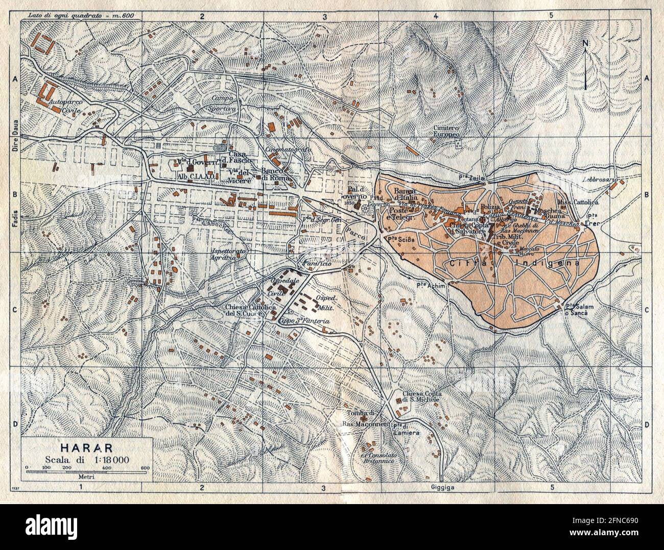 Ancient map of Harar, Ethiopia (image from Italian Eastern Africa guide book 1938 edition) Stock Photohttps://www.alamy.com/image-license-details/?v=1https://www.alamy.com/ancient-map-of-harar-ethiopia-image-from-italian-eastern-africa-guide-book-1938-edition-image426224988.html
RF2FNC690–Ancient map of Harar, Ethiopia (image from Italian Eastern Africa guide book 1938 edition)
 Civil War Maps 1938 Balloon view of the attack on Fort Darling in the James River by Commander Rogers's sic ie Rodger's gun-boat flotilla ''Galena'' ''Monitor'' etc May 16 1862 Inverted Rebuild and Repair Stock Photohttps://www.alamy.com/image-license-details/?v=1https://www.alamy.com/civil-war-maps-1938-balloon-view-of-the-attack-on-fort-darling-in-the-james-river-by-commander-rogerss-sic-ie-rodgers-gun-boat-flotilla-galena-monitor-etc-may-16-1862-inverted-rebuild-and-repair-image261981891.html
RMW668G3–Civil War Maps 1938 Balloon view of the attack on Fort Darling in the James River by Commander Rogers's sic ie Rodger's gun-boat flotilla ''Galena'' ''Monitor'' etc May 16 1862 Inverted Rebuild and Repair