Quick filters:
1960s satellite image Stock Photos and Images
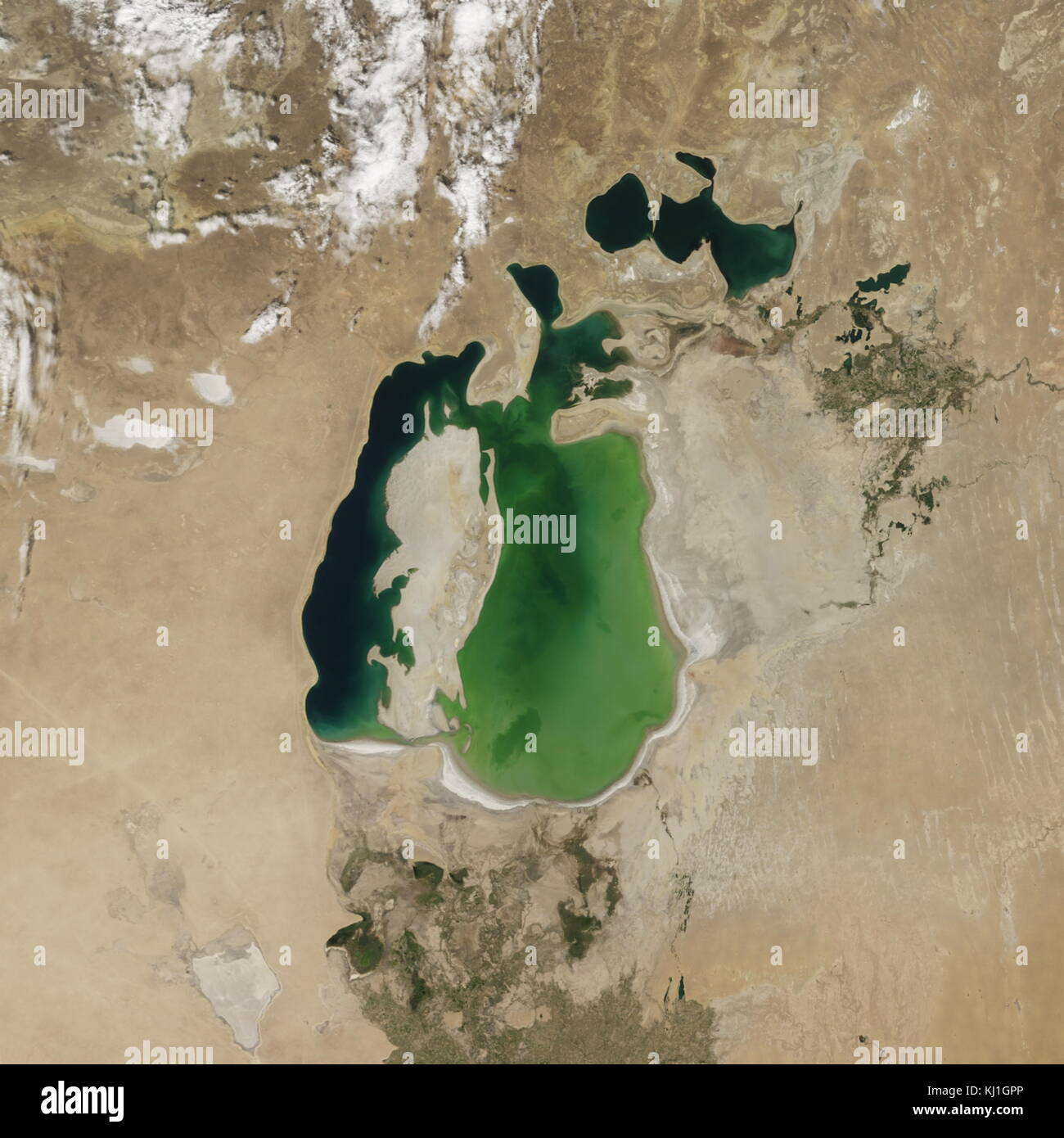 Satellite image of the shrinking of the Aral Sea taken in 2000. The Aral Sea, is a lake lying between Kazakhstan, in the north and Uzbekistan in the south. The name roughly translates as 'Sea of Islands', referring to over 1,100 islands that once dotted its waters; Formerly one of the four largest lakes in the world with an area of 68,000 km2 (26,300 sq mi), the Aral Sea has been steadily shrinking since the 1960s after the rivers that fed it were diverted by Soviet irrigation projects. Stock Photohttps://www.alamy.com/image-license-details/?v=1https://www.alamy.com/stock-image-satellite-image-of-the-shrinking-of-the-aral-sea-taken-in-2000-the-165992254.html
RMKJ1GPP–Satellite image of the shrinking of the Aral Sea taken in 2000. The Aral Sea, is a lake lying between Kazakhstan, in the north and Uzbekistan in the south. The name roughly translates as 'Sea of Islands', referring to over 1,100 islands that once dotted its waters; Formerly one of the four largest lakes in the world with an area of 68,000 km2 (26,300 sq mi), the Aral Sea has been steadily shrinking since the 1960s after the rivers that fed it were diverted by Soviet irrigation projects.
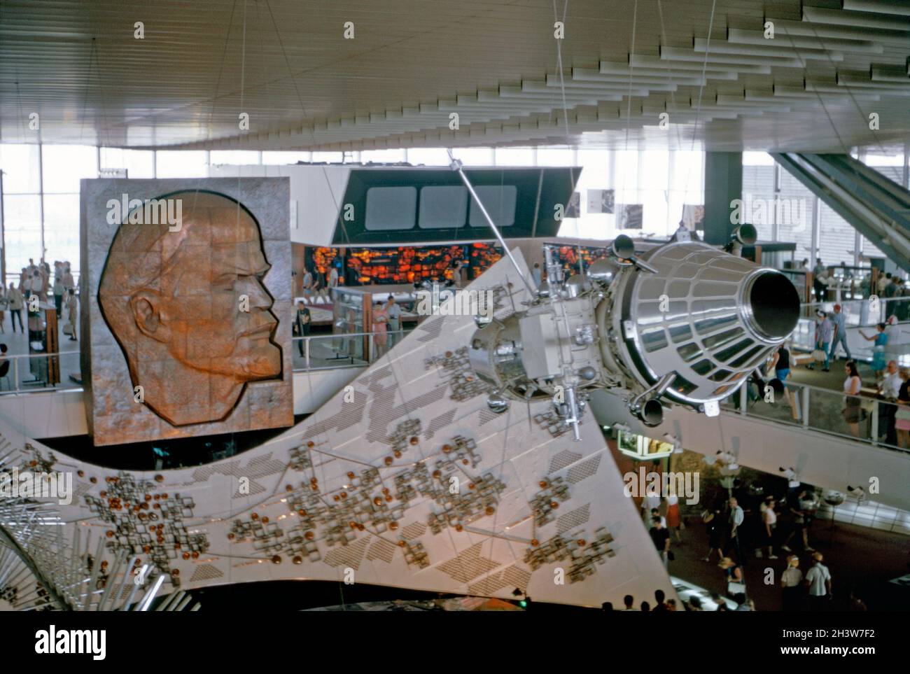 The USSR pavilion (Soviet Union, URSS or Moscow Pavilion) at Expo 67, Montreal, Quebec, Canada in 1967. It was designed by a team of architects led by Mikhail Posokhin. Amongst the interior displays in the steel and glass pavilion were a relief sculpture of Lenin (left), a sputnik (right) and a giant electronic circuit board. The attraction lived on after 1967 during summer months and finally closed in 1981. This image is from an old amateur Kodak colour transparency taken by a visitor to the fair – a vintage 1960s photograph. Stock Photohttps://www.alamy.com/image-license-details/?v=1https://www.alamy.com/the-ussr-pavilion-soviet-union-urss-or-moscow-pavilion-at-expo-67-montreal-quebec-canada-in-1967-it-was-designed-by-a-team-of-architects-led-by-mikhail-posokhin-amongst-the-interior-displays-in-the-steel-and-glass-pavilion-were-a-relief-sculpture-of-lenin-left-a-sputnik-right-and-a-giant-electronic-circuit-board-the-attraction-lived-on-after-1967-during-summer-months-and-finally-closed-in-1981-this-image-is-from-an-old-amateur-kodak-colour-transparency-taken-by-a-visitor-to-the-fair-a-vintage-1960s-photograph-image449868246.html
RM2H3W7F2–The USSR pavilion (Soviet Union, URSS or Moscow Pavilion) at Expo 67, Montreal, Quebec, Canada in 1967. It was designed by a team of architects led by Mikhail Posokhin. Amongst the interior displays in the steel and glass pavilion were a relief sculpture of Lenin (left), a sputnik (right) and a giant electronic circuit board. The attraction lived on after 1967 during summer months and finally closed in 1981. This image is from an old amateur Kodak colour transparency taken by a visitor to the fair – a vintage 1960s photograph.
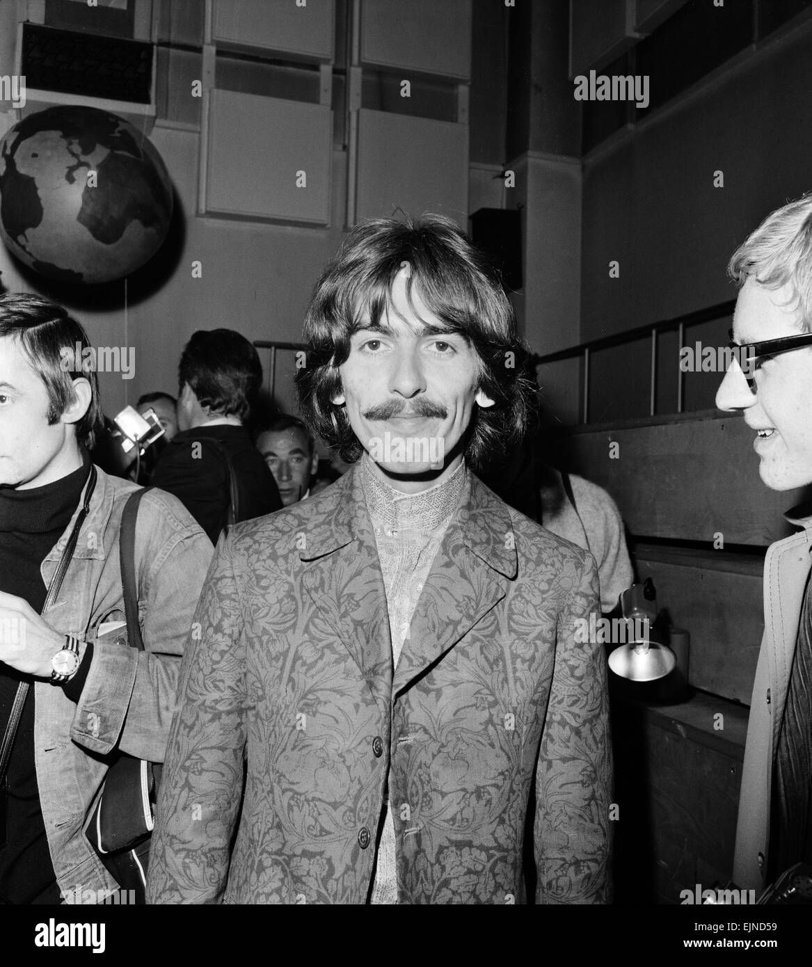 Press call for Our World, the first live global television link. Broadcast to 26 countries and watched by 400 million, the programme was broadcast via satellite on June 25, 1967. The BBC had commissioned the Beatles to write a song for the UK's contribution. 'All You Need Is Love' a song written by John Lennon and credited to Lennon/McCartney was first performed by The Beatles at this event & released as a single the following month. Pictured at Abbey Road Studios 24th June 1967. Stock Photohttps://www.alamy.com/image-license-details/?v=1https://www.alamy.com/stock-photo-press-call-for-our-world-the-first-live-global-television-link-broadcast-80376613.html
RMEJND59–Press call for Our World, the first live global television link. Broadcast to 26 countries and watched by 400 million, the programme was broadcast via satellite on June 25, 1967. The BBC had commissioned the Beatles to write a song for the UK's contribution. 'All You Need Is Love' a song written by John Lennon and credited to Lennon/McCartney was first performed by The Beatles at this event & released as a single the following month. Pictured at Abbey Road Studios 24th June 1967.
 ‘Rocket Row’ along the west side of the Arts and Industries Building (before the National Air and Space Museum was built), Washington DC, USA in 1964. The four missiles are the Jupiter C, which launched Explorer I, the first U.S. satellite (left), the Vanguard (centre) and the Polaris A-1, the first U.S. submarine-launched ICBM (right). Cars are parked in the parking lot. The Air and Space Museum was originally called the National Air Museum when formed in 1946. This image is from an old American amateur Kodak colour transparency – a vintage 1960s photograph. Stock Photohttps://www.alamy.com/image-license-details/?v=1https://www.alamy.com/rocket-row-along-the-west-side-of-the-arts-and-industries-building-before-the-national-air-and-space-museum-was-built-washington-dc-usa-in-1964-the-four-missiles-are-the-jupiter-c-which-launched-explorer-i-the-first-us-satellite-left-the-vanguard-centre-and-the-polaris-a-1-the-first-us-submarine-launched-icbm-right-cars-are-parked-in-the-parking-lot-the-air-and-space-museum-was-originally-called-the-national-air-museum-when-formed-in-1946-this-image-is-from-an-old-american-amateur-kodak-colour-transparency-a-vintage-1960s-photograph-image417797101.html
RM2F7M8D1–‘Rocket Row’ along the west side of the Arts and Industries Building (before the National Air and Space Museum was built), Washington DC, USA in 1964. The four missiles are the Jupiter C, which launched Explorer I, the first U.S. satellite (left), the Vanguard (centre) and the Polaris A-1, the first U.S. submarine-launched ICBM (right). Cars are parked in the parking lot. The Air and Space Museum was originally called the National Air Museum when formed in 1946. This image is from an old American amateur Kodak colour transparency – a vintage 1960s photograph.
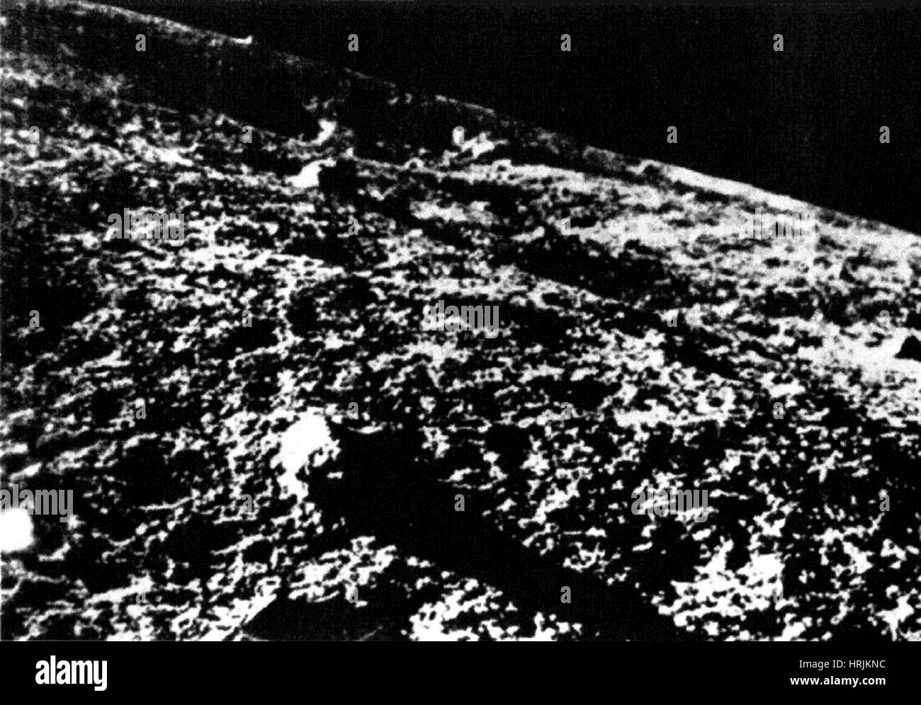 First Image from Moon's Surface, 1966 Stock Photohttps://www.alamy.com/image-license-details/?v=1https://www.alamy.com/stock-photo-first-image-from-moons-surface-1966-135020296.html
RMHRJKNC–First Image from Moon's Surface, 1966
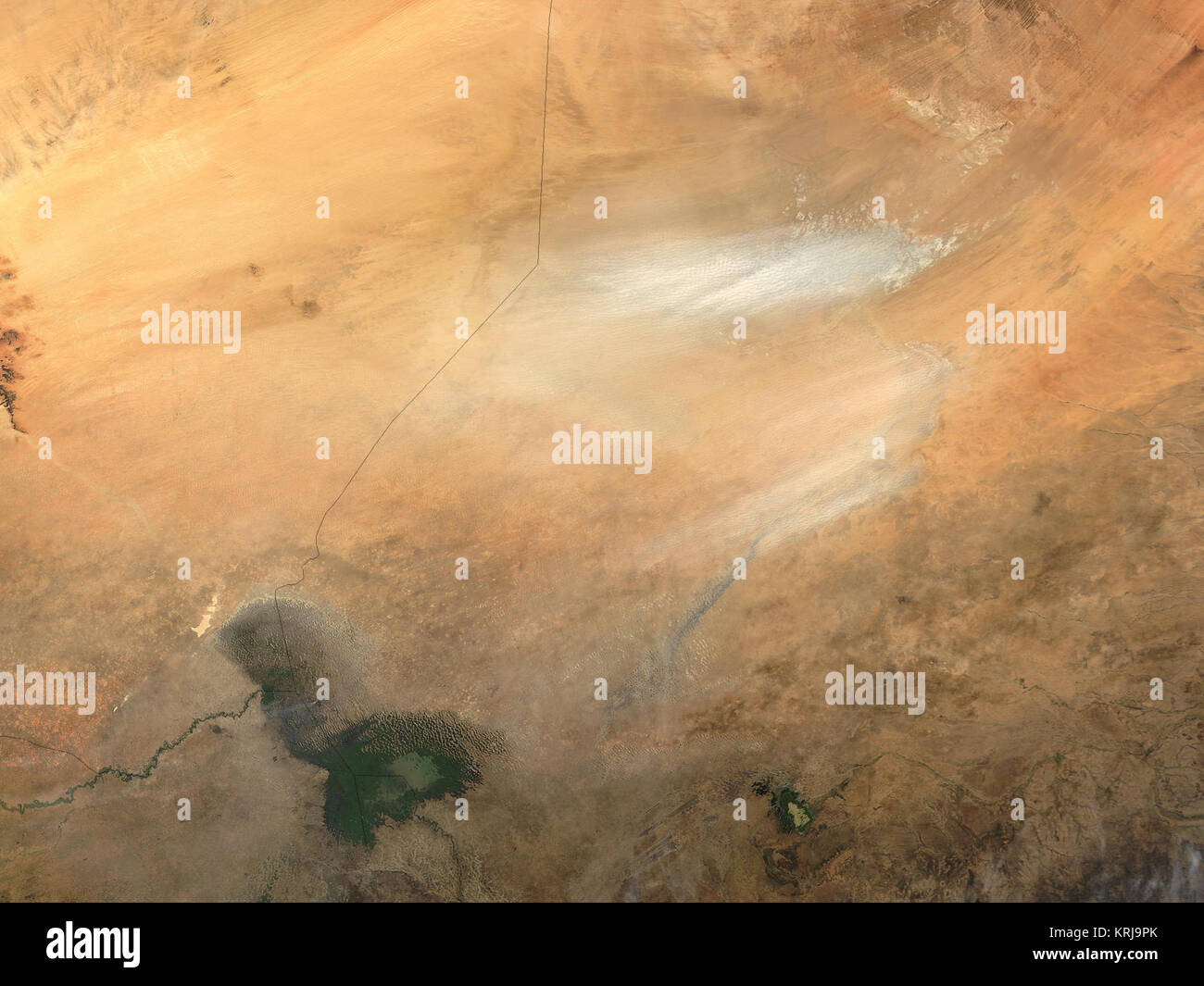 Dust from the Bodele depression in Chad, Africa (image right), is blowing across the Lake Chad region in this modis.gsfc.nasa.gov Moderate Resolution Imaging Spectroradiometer (MODIS) image taken by the terra.nasa.gov/ Terra satellite on November 10, 2003. As recently as the 1960s, Lake Chad filled an area in the depression roughly the size of Lake Erie in North America, but lack of rain and increased demand for irrigation water have shrunk the shorelines of the lake, leaving much of the Bodele depression dry. Now dust storms in the Bodele depression are common. The low-lying area is a ma Stock Photohttps://www.alamy.com/image-license-details/?v=1https://www.alamy.com/stock-image-dust-from-the-bodele-depression-in-chad-africa-image-right-is-blowing-169433227.html
RMKRJ9PK–Dust from the Bodele depression in Chad, Africa (image right), is blowing across the Lake Chad region in this modis.gsfc.nasa.gov Moderate Resolution Imaging Spectroradiometer (MODIS) image taken by the terra.nasa.gov/ Terra satellite on November 10, 2003. As recently as the 1960s, Lake Chad filled an area in the depression roughly the size of Lake Erie in North America, but lack of rain and increased demand for irrigation water have shrunk the shorelines of the lake, leaving much of the Bodele depression dry. Now dust storms in the Bodele depression are common. The low-lying area is a ma
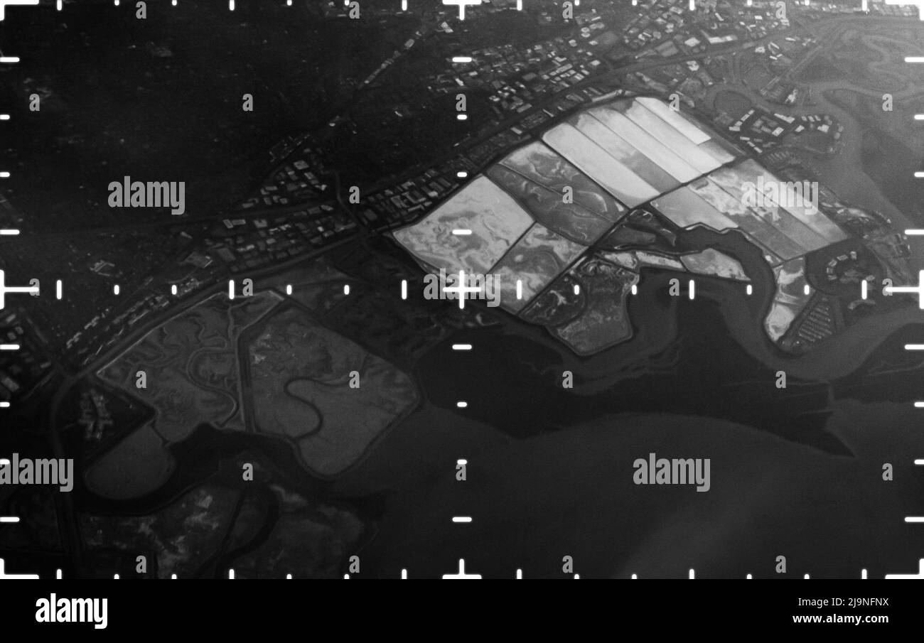 A spy satellite aerial image Stock Photohttps://www.alamy.com/image-license-details/?v=1https://www.alamy.com/a-spy-satellite-aerial-image-image470685206.html
RM2J9NFNX–A spy satellite aerial image
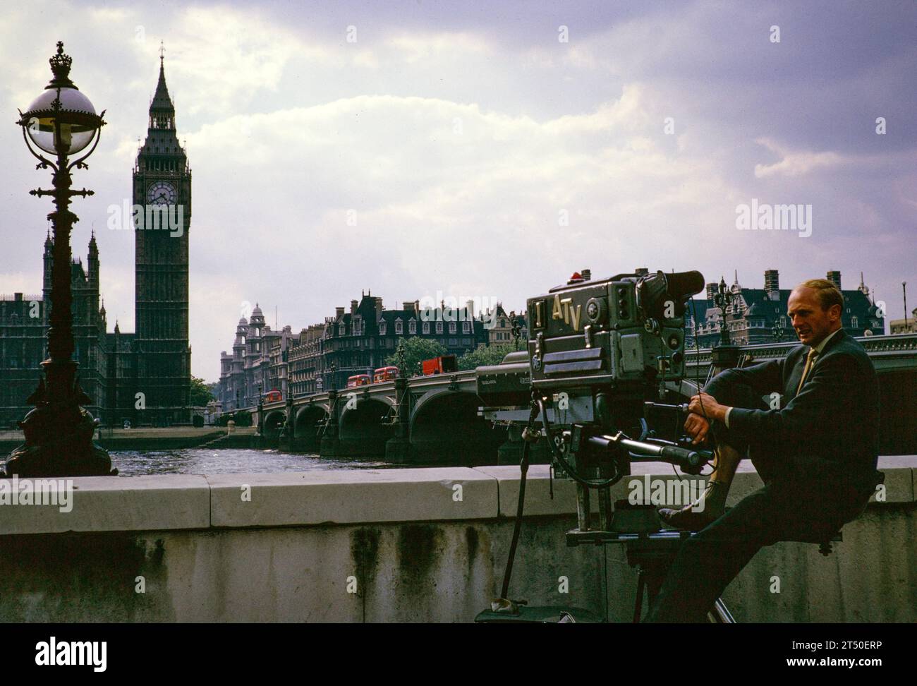 ATV TV cameraman Mike Whitcutt outside broadcast Telstar satellite launch, Westminster Bridge, London, England, UK, July 1962 Stock Photohttps://www.alamy.com/image-license-details/?v=1https://www.alamy.com/atv-tv-cameraman-mike-whitcutt-outside-broadcast-telstar-satellite-launch-westminster-bridge-london-england-uk-july-1962-image571027066.html
RM2T50ERP–ATV TV cameraman Mike Whitcutt outside broadcast Telstar satellite launch, Westminster Bridge, London, England, UK, July 1962
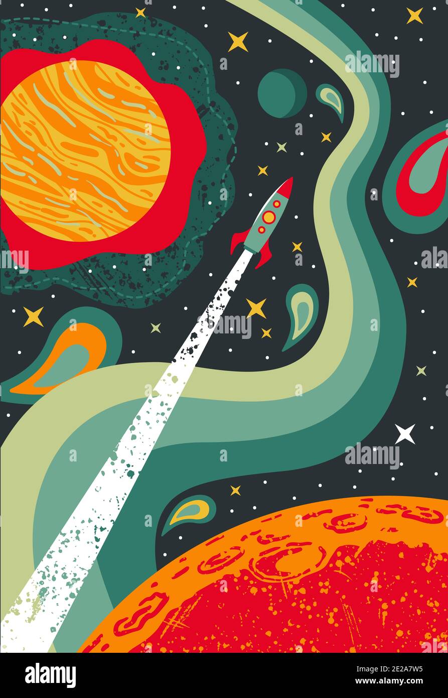 Psychedelic Space 1960s Style Backgrounds, Illustrations, Covers, Posters Templates Stock Photohttps://www.alamy.com/image-license-details/?v=1https://www.alamy.com/psychedelic-space-1960s-style-backgrounds-illustrations-covers-posters-templates-image397293489.html
RF2E2A7W5–Psychedelic Space 1960s Style Backgrounds, Illustrations, Covers, Posters Templates
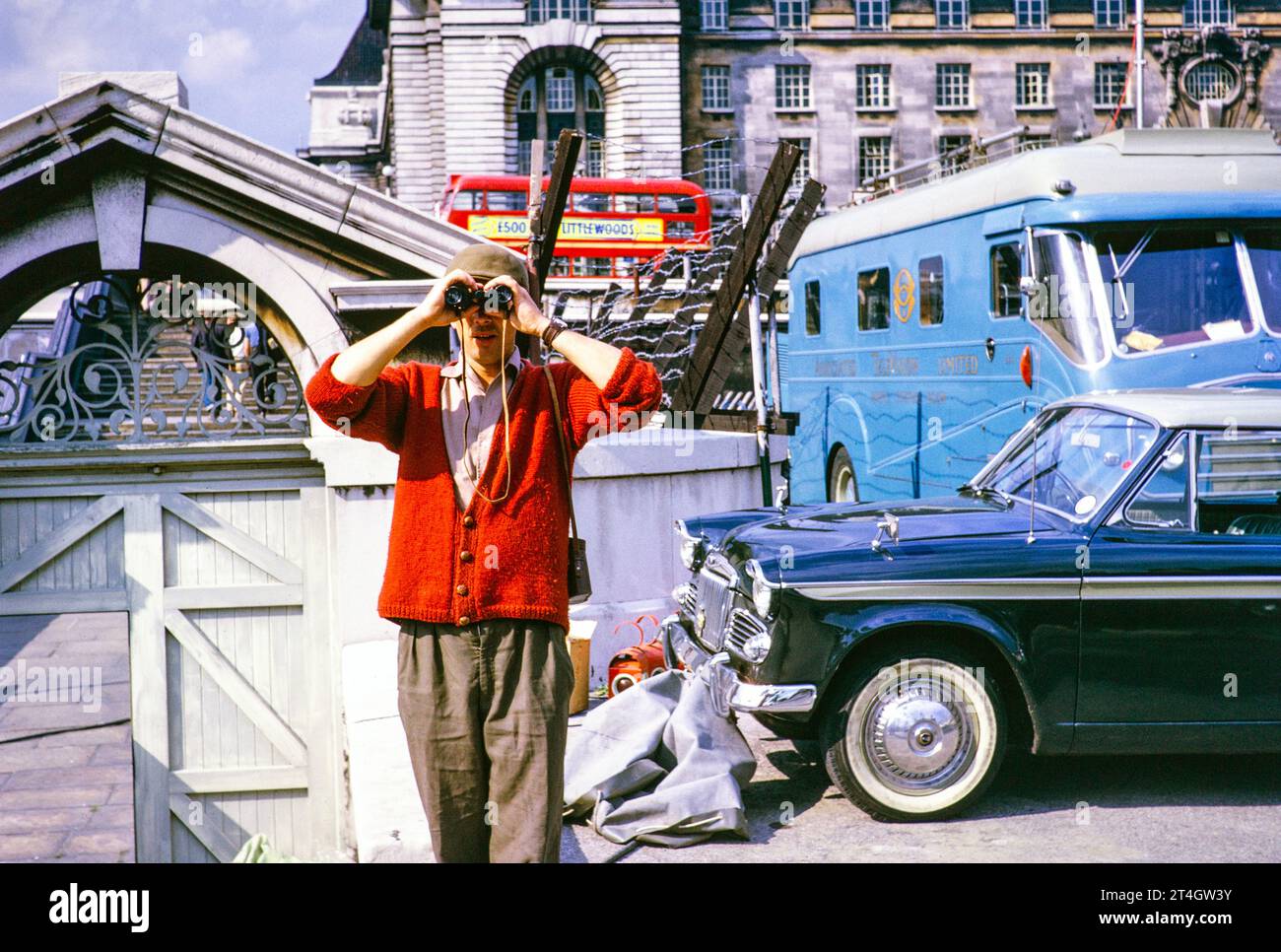 ATV outside broadcast, Telstar TV satellite launch, Westminster Bridge, London, England, UK, July 1962 - rigger Phil Comber with binoculars. Photograph by Alan 'Taffy' Harries Stock Photohttps://www.alamy.com/image-license-details/?v=1https://www.alamy.com/atv-outside-broadcast-telstar-tv-satellite-launch-westminster-bridge-london-england-uk-july-1962-rigger-phil-comber-with-binoculars-photograph-by-alan-taffy-harries-image570771711.html
RM2T4GW3Y–ATV outside broadcast, Telstar TV satellite launch, Westminster Bridge, London, England, UK, July 1962 - rigger Phil Comber with binoculars. Photograph by Alan 'Taffy' Harries
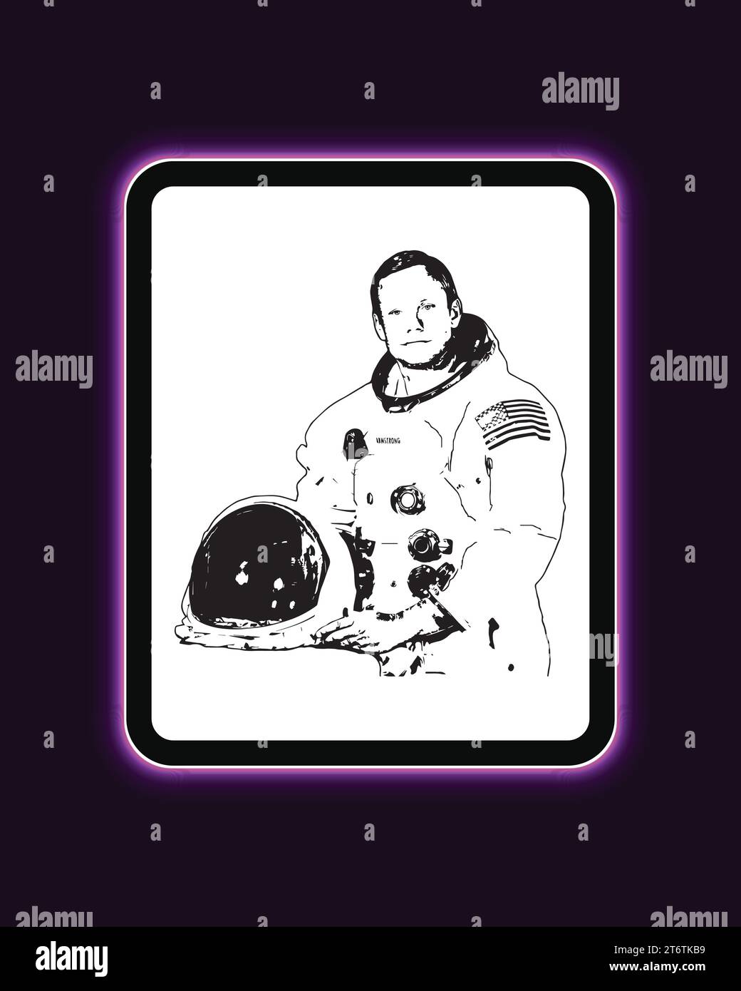 Neil Armstrong American astronaut and aeronautical engineer Neon Light Board View Purple Background, Vector Illustration Abstract Editable image Stock Vectorhttps://www.alamy.com/image-license-details/?v=1https://www.alamy.com/neil-armstrong-american-astronaut-and-aeronautical-engineer-neon-light-board-view-purple-background-vector-illustration-abstract-editable-image-image572172141.html
RF2T6TKB9–Neil Armstrong American astronaut and aeronautical engineer Neon Light Board View Purple Background, Vector Illustration Abstract Editable image
 This deadly tropical cyclone's picture was taken by the TIROS X weather satellite over the Bay of Bengal on December 14, 1965 Stock Photohttps://www.alamy.com/image-license-details/?v=1https://www.alamy.com/this-deadly-tropical-cyclones-picture-was-taken-by-the-tiros-x-weather-satellite-over-the-bay-of-bengal-on-december-14-1965-image451159727.html
RM2H602RB–This deadly tropical cyclone's picture was taken by the TIROS X weather satellite over the Bay of Bengal on December 14, 1965
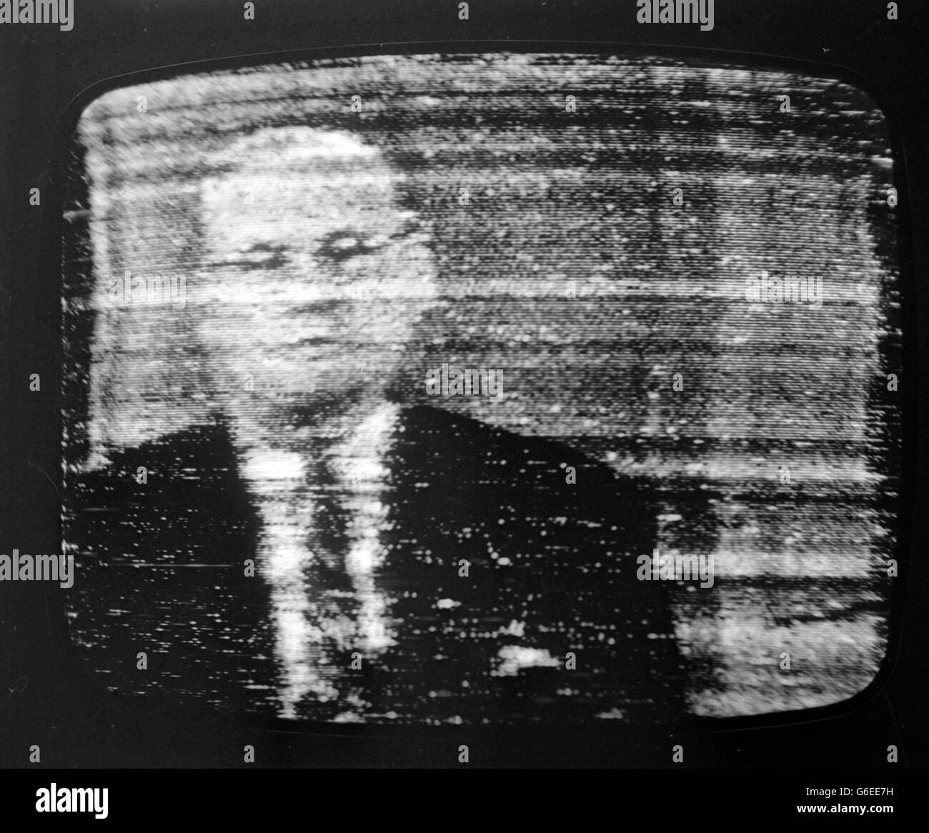 This is the picture that made TV history when it was received in Britain via Telstar satellite. The Subject is Mr Frederick Kappel, chairman of the American Telephone and Telegraph Company. Stock Photohttps://www.alamy.com/image-license-details/?v=1https://www.alamy.com/stock-photo-this-is-the-picture-that-made-tv-history-when-it-was-received-in-britain-107268661.html
RMG6EE7H–This is the picture that made TV history when it was received in Britain via Telstar satellite. The Subject is Mr Frederick Kappel, chairman of the American Telephone and Telegraph Company.
 Moon surface with astronaut in the background of night Earth. Elements of this image furnished by NASA. Stock Photohttps://www.alamy.com/image-license-details/?v=1https://www.alamy.com/moon-surface-with-astronaut-in-the-background-of-night-earth-elements-of-this-image-furnished-by-nasa-image592951260.html
RF2WCK7AM–Moon surface with astronaut in the background of night Earth. Elements of this image furnished by NASA.
 ARTISTS IMPRESSION - SATELLITE STATIONS GERMANY 11 JANUARY 1962 Stock Photohttps://www.alamy.com/image-license-details/?v=1https://www.alamy.com/artists-impression-satellite-stations-germany-11-january-1962-image623791674.html
RM2Y6T4J2–ARTISTS IMPRESSION - SATELLITE STATIONS GERMANY 11 JANUARY 1962
 Panorama of completed residences at Inala, August 1962. The tiny township of Serviceton was selected in 1946 by the Serviceton Co-operative Society for development to help meet the shortage of post-war housing. The Society purchased 850 acres of land which was taken over by the Queensland Housing Commission in 1950, to which it added another 200 acres. The area was renamed Inala in 1953 to avoid confusion with the town of Serviceton in South Australia. Inala was planned as a satellite town of Brisbane and houses were largely Modernist Revival style with elements of Art Deco. Stock Photohttps://www.alamy.com/image-license-details/?v=1https://www.alamy.com/panorama-of-completed-residences-at-inala-august-1962-the-tiny-township-of-serviceton-was-selected-in-1946-by-the-serviceton-co-operative-society-for-development-to-help-meet-the-shortage-of-post-war-housing-the-society-purchased-850-acres-of-land-which-was-taken-over-by-the-queensland-housing-commission-in-1950-to-which-it-added-another-200-acres-the-area-was-renamed-inala-in-1953-to-avoid-confusion-with-the-town-of-serviceton-in-south-australia-inala-was-planned-as-a-satellite-town-of-brisbane-and-houses-were-largely-modernist-revival-style-with-elements-of-art-deco-image188715841.html
RMMY0MYD–Panorama of completed residences at Inala, August 1962. The tiny township of Serviceton was selected in 1946 by the Serviceton Co-operative Society for development to help meet the shortage of post-war housing. The Society purchased 850 acres of land which was taken over by the Queensland Housing Commission in 1950, to which it added another 200 acres. The area was renamed Inala in 1953 to avoid confusion with the town of Serviceton in South Australia. Inala was planned as a satellite town of Brisbane and houses were largely Modernist Revival style with elements of Art Deco.
 Stamp printed in Russia, shows portraits Russian astronauts of V.A. Shatalov and A.S. Eliseev Stock Photohttps://www.alamy.com/image-license-details/?v=1https://www.alamy.com/stamp-printed-in-russia-shows-portraits-russian-astronauts-of-va-shatalov-and-as-eliseev-image367935702.html
RF2CAGWMP–Stamp printed in Russia, shows portraits Russian astronauts of V.A. Shatalov and A.S. Eliseev
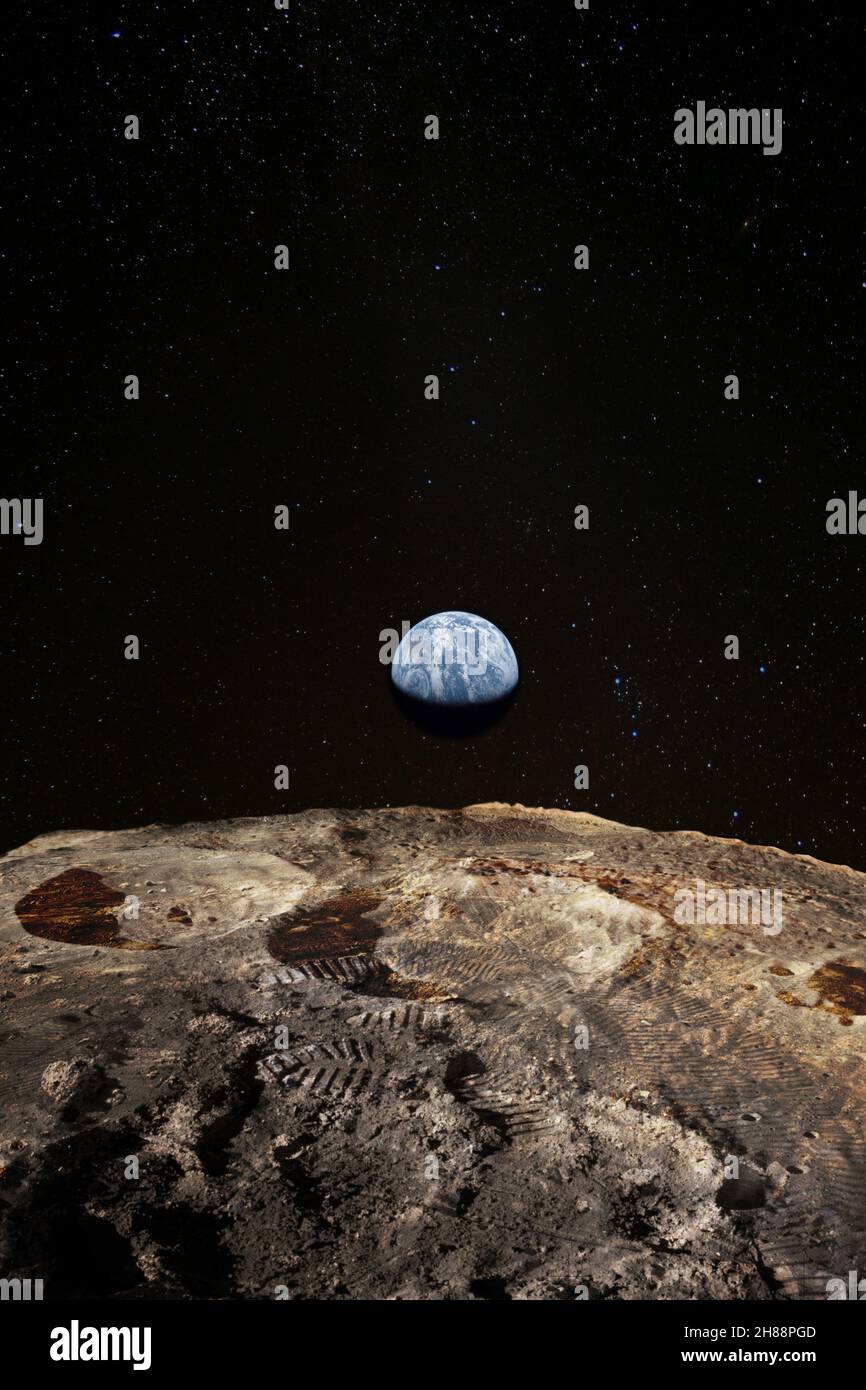 Footsteps on the moon surface, Earth rises above lunar horizon. Elements of this image furnished by NASA. Stock Photohttps://www.alamy.com/image-license-details/?v=1https://www.alamy.com/footsteps-on-the-moon-surface-earth-rises-above-lunar-horizon-elements-of-this-image-furnished-by-nasa-image452580141.html
RF2H88PGD–Footsteps on the moon surface, Earth rises above lunar horizon. Elements of this image furnished by NASA.
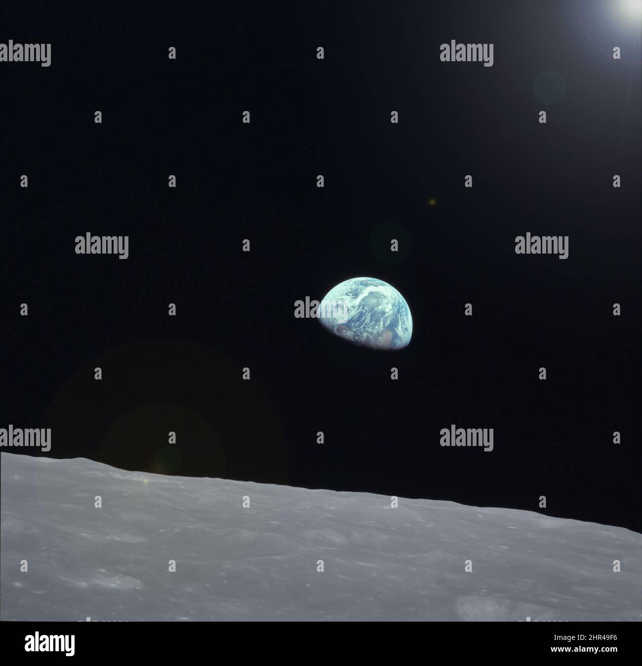 Earth photo taken from moon,world rising from lunar surface on the horizon,blue World image from moon surface.Elements of this image furnished by NASA Stock Photohttps://www.alamy.com/image-license-details/?v=1https://www.alamy.com/earth-photo-taken-from-moonworld-rising-from-lunar-surface-on-the-horizonblue-world-image-from-moon-surfaceelements-of-this-image-furnished-by-nasa-image461701946.html
RF2HR49F6–Earth photo taken from moon,world rising from lunar surface on the horizon,blue World image from moon surface.Elements of this image furnished by NASA
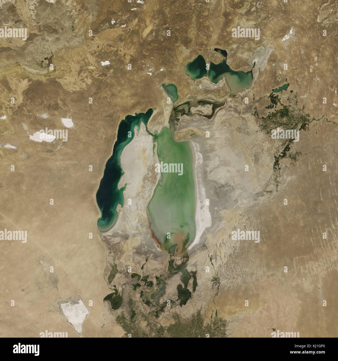 Satellite image of the shrinking of the Aral Sea taken in 2005. The Aral Sea, is a lake lying between Kazakhstan, in the north and Uzbekistan in the south. The name roughly translates as 'Sea of Islands', referring to over 1,100 islands that once dotted its waters; Formerly one of the four largest lakes in the world with an area of 68,000 km2 (26,300 sq mi), the Aral Sea has been steadily shrinking since the 1960s after the rivers that fed it were diverted by Soviet irrigation projects. Stock Photohttps://www.alamy.com/image-license-details/?v=1https://www.alamy.com/stock-image-satellite-image-of-the-shrinking-of-the-aral-sea-taken-in-2005-the-165992258.html
RMKJ1GPX–Satellite image of the shrinking of the Aral Sea taken in 2005. The Aral Sea, is a lake lying between Kazakhstan, in the north and Uzbekistan in the south. The name roughly translates as 'Sea of Islands', referring to over 1,100 islands that once dotted its waters; Formerly one of the four largest lakes in the world with an area of 68,000 km2 (26,300 sq mi), the Aral Sea has been steadily shrinking since the 1960s after the rivers that fed it were diverted by Soviet irrigation projects.
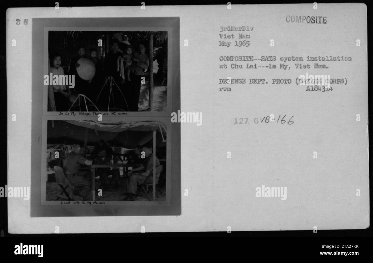 Marines from the 3rdMarDiv enjoy lunch with VC women in Le My Village during May 1965. The image showcases the COMPOSITE COMPOSITE-SATS system installation at Chu Lai, Viet Nam. This photograph was taken by the Defense Department and is labeled as A184314 Xuma 127 GVB-166. Stock Photohttps://www.alamy.com/image-license-details/?v=1https://www.alamy.com/marines-from-the-3rdmardiv-enjoy-lunch-with-vc-women-in-le-my-village-during-may-1965-the-image-showcases-the-composite-composite-sats-system-installation-at-chu-lai-viet-nam-this-photograph-was-taken-by-the-defense-department-and-is-labeled-as-a184314-xuma-127-gvb-166-image574138647.html
RM2TA27KK–Marines from the 3rdMarDiv enjoy lunch with VC women in Le My Village during May 1965. The image showcases the COMPOSITE COMPOSITE-SATS system installation at Chu Lai, Viet Nam. This photograph was taken by the Defense Department and is labeled as A184314 Xuma 127 GVB-166.
 Press call for Our World, the first live global television link. Broadcast to 26 countries and watched by 400 million, the programme was broadcast via satellite on June 25, 1967. The BBC had commissioned the Beatles to write a song for the UK's contribution. 'All You Need Is Love' a song written by John Lennon and credited to Lennon/McCartney was first performed by The Beatles at this event & released as a single the following month. Pictured at Abbey Road Studios 24th June 1967. Stock Photohttps://www.alamy.com/image-license-details/?v=1https://www.alamy.com/stock-photo-press-call-for-our-world-the-first-live-global-television-link-broadcast-81255176.html
RMEM5DPG–Press call for Our World, the first live global television link. Broadcast to 26 countries and watched by 400 million, the programme was broadcast via satellite on June 25, 1967. The BBC had commissioned the Beatles to write a song for the UK's contribution. 'All You Need Is Love' a song written by John Lennon and credited to Lennon/McCartney was first performed by The Beatles at this event & released as a single the following month. Pictured at Abbey Road Studios 24th June 1967.
 The surface of the moon, with craters and mountains. Elements of this image were furnished by NASA. For any purpose. Stock Photohttps://www.alamy.com/image-license-details/?v=1https://www.alamy.com/the-surface-of-the-moon-with-craters-and-mountains-elements-of-this-image-were-furnished-by-nasa-for-any-purpose-image341314530.html
RF2AR864J–The surface of the moon, with craters and mountains. Elements of this image were furnished by NASA. For any purpose.
 Beijing Subway in Construction. Spatial tentatively corrected. ca. 20 September 1967 Stock Photohttps://www.alamy.com/image-license-details/?v=1https://www.alamy.com/beijing-subway-in-construction-spatial-tentatively-corrected-ca-20-september-1967-image454762404.html
RM2HBT62C–Beijing Subway in Construction. Spatial tentatively corrected. ca. 20 September 1967
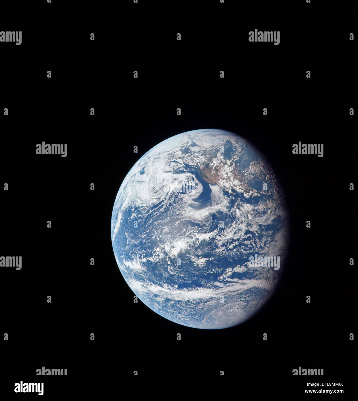 July 16, 1969 - Planet Earth taken by the Apollo 11 crew on their outbound journey from Earth to the Moon. California, the Pacif Stock Photohttps://www.alamy.com/image-license-details/?v=1https://www.alamy.com/stock-photo-july-16-1969-planet-earth-taken-by-the-apollo-11-crew-on-their-outbound-74213608.html
RFE8MM60–July 16, 1969 - Planet Earth taken by the Apollo 11 crew on their outbound journey from Earth to the Moon. California, the Pacif
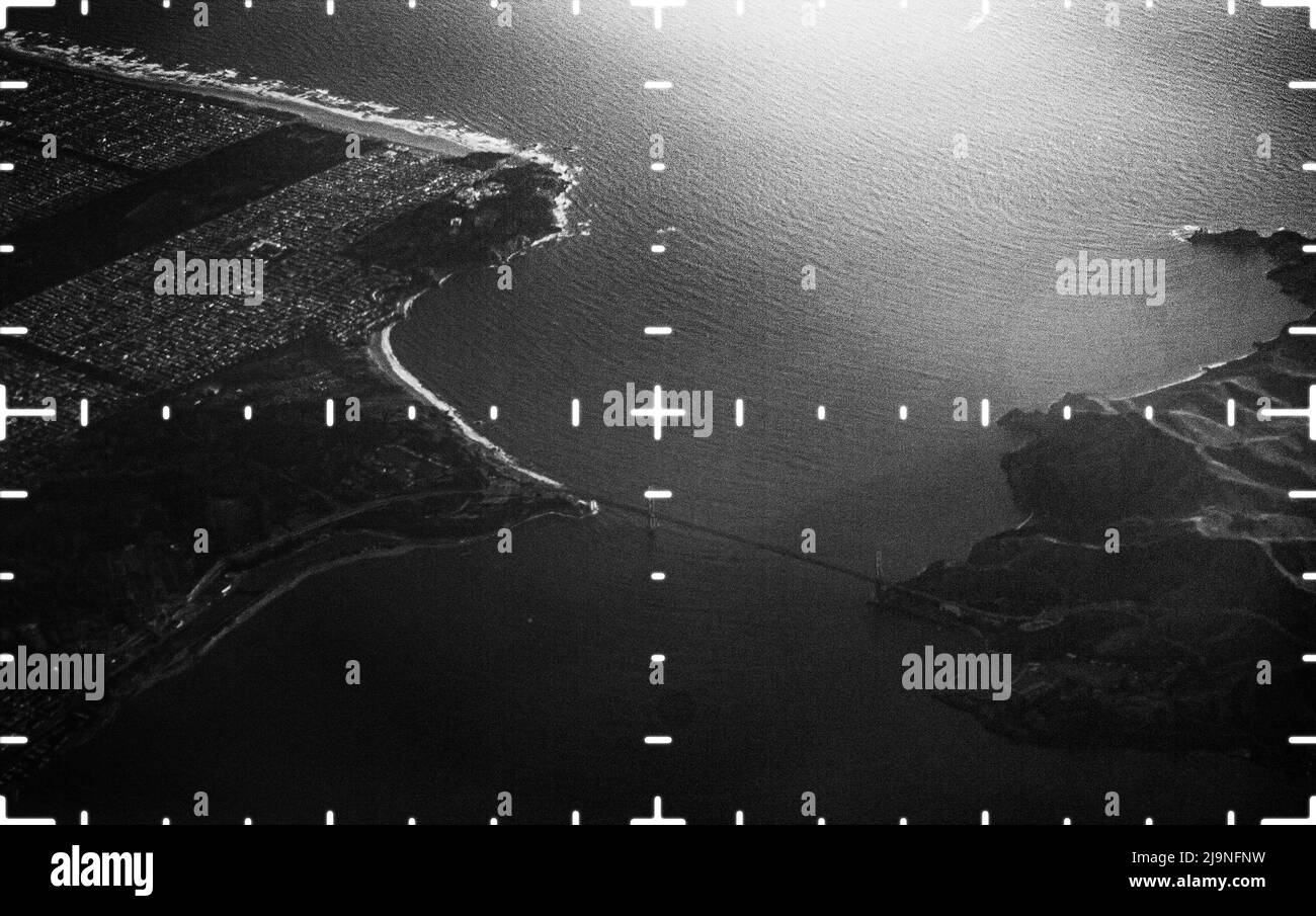 A spy satellite aerial image Stock Photohttps://www.alamy.com/image-license-details/?v=1https://www.alamy.com/a-spy-satellite-aerial-image-image470685205.html
RM2J9NFNW–A spy satellite aerial image
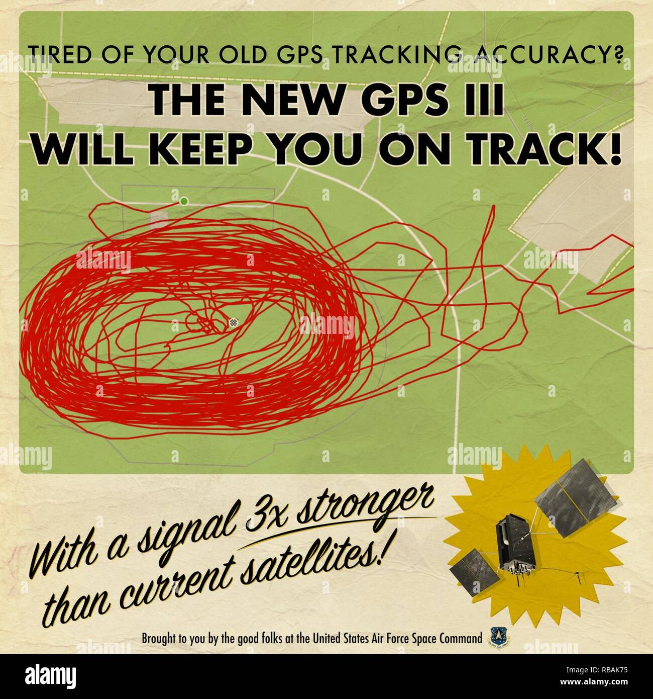 Infographic created for U.S. Air Force Space Command’s Twitter feed to inform about the increased signal strength and accuracy of the Air Force GPS III satellite that was launched on December 23rd, 2018. The design was intended to feel like an advertisement from the 1960’s. Graphic elements and layout were done in Adobe Illustrator and image editing and the wrinkled paper texturing were done in Adobe Photoshop to give the graphic an old, worn appearance. Stock Photohttps://www.alamy.com/image-license-details/?v=1https://www.alamy.com/infographic-created-for-us-air-force-space-commands-twitter-feed-to-inform-about-the-increased-signal-strength-and-accuracy-of-the-air-force-gps-iii-satellite-that-was-launched-on-december-23rd-2018-the-design-was-intended-to-feel-like-an-advertisement-from-the-1960s-graphic-elements-and-layout-were-done-in-adobe-illustrator-and-image-editing-and-the-wrinkled-paper-texturing-were-done-in-adobe-photoshop-to-give-the-graphic-an-old-worn-appearance-image230730617.html
RMRBAK75–Infographic created for U.S. Air Force Space Command’s Twitter feed to inform about the increased signal strength and accuracy of the Air Force GPS III satellite that was launched on December 23rd, 2018. The design was intended to feel like an advertisement from the 1960’s. Graphic elements and layout were done in Adobe Illustrator and image editing and the wrinkled paper texturing were done in Adobe Photoshop to give the graphic an old, worn appearance.
 Psychedelic Space 1960s Style Backgrounds, Illustrations, Covers, Posters Templates Stock Vectorhttps://www.alamy.com/image-license-details/?v=1https://www.alamy.com/psychedelic-space-1960s-style-backgrounds-illustrations-covers-posters-templates-image397459640.html
RF2E2HRR4–Psychedelic Space 1960s Style Backgrounds, Illustrations, Covers, Posters Templates
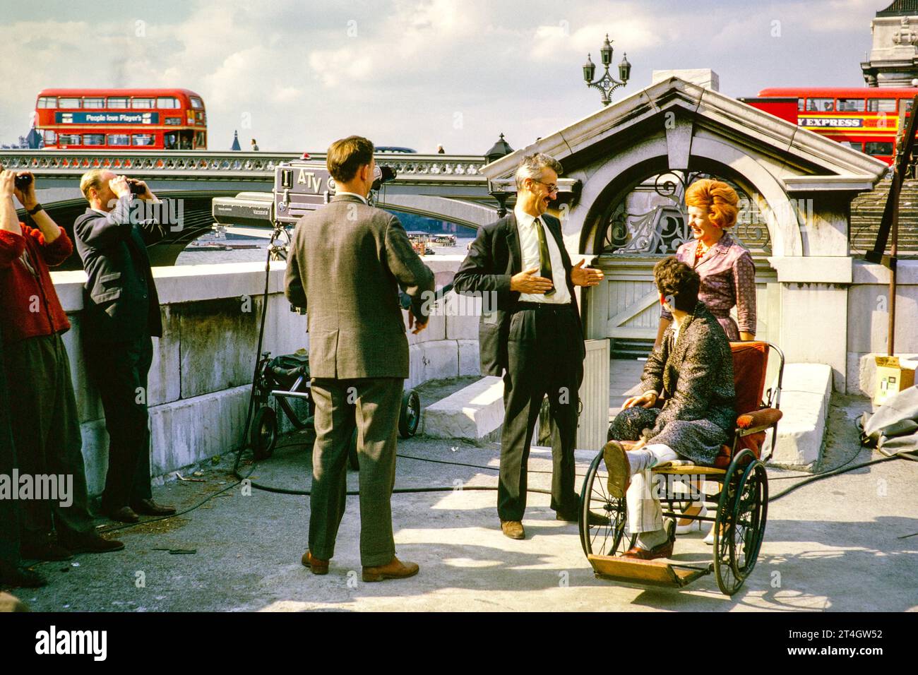 ATV outside TV broadcast, Telstar satellite launch, Westminster Bridge, London, England, UK, July 1962 Director Steve Wade with outstretched hands. Photograph by Alan 'Taffy' Harries Stock Photohttps://www.alamy.com/image-license-details/?v=1https://www.alamy.com/atv-outside-tv-broadcast-telstar-satellite-launch-westminster-bridge-london-england-uk-july-1962-director-steve-wade-with-outstretched-hands-photograph-by-alan-taffy-harries-image570771742.html
RM2T4GW52–ATV outside TV broadcast, Telstar satellite launch, Westminster Bridge, London, England, UK, July 1962 Director Steve Wade with outstretched hands. Photograph by Alan 'Taffy' Harries
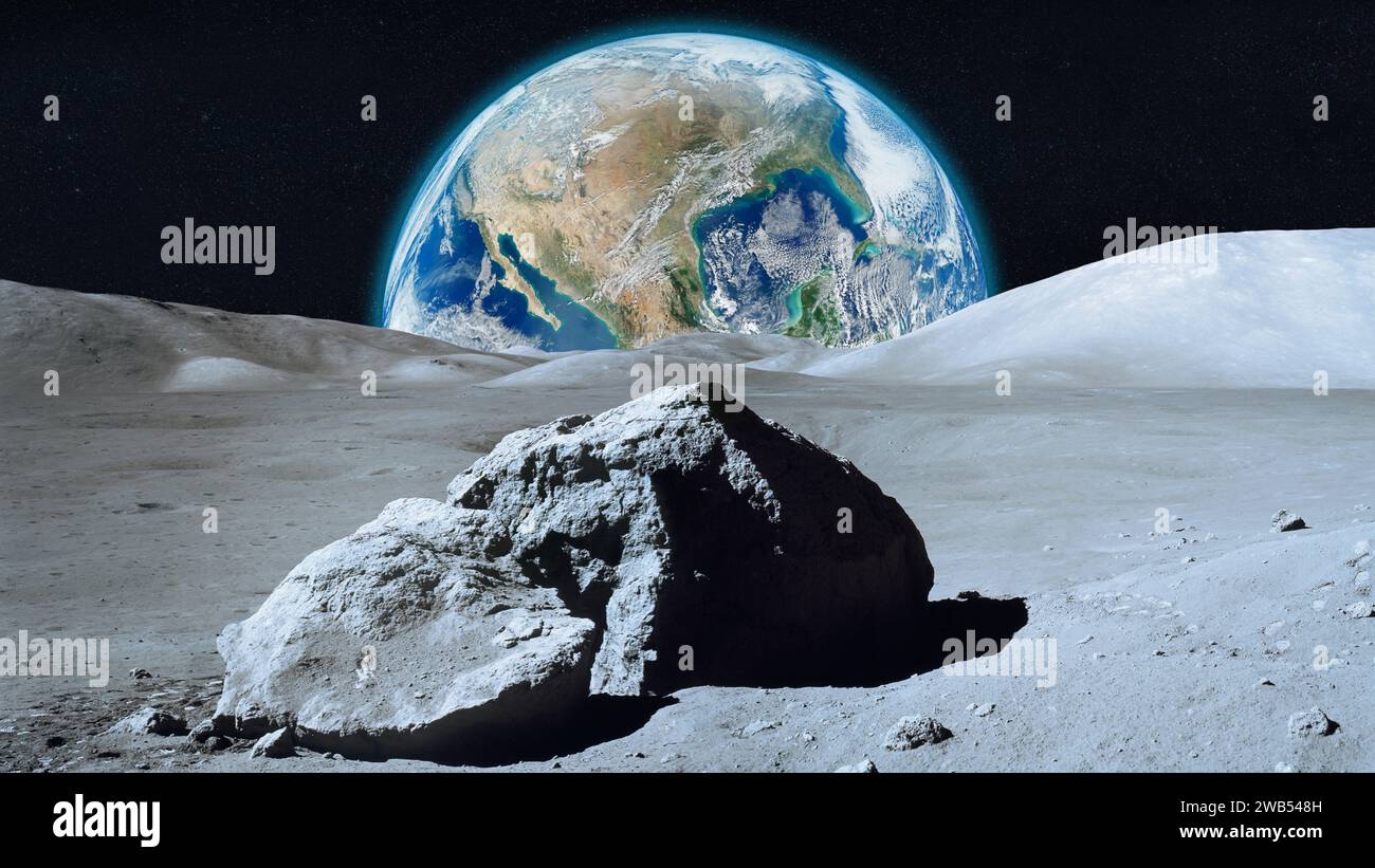 View from the Moon on Earth in outer space. Moon and Earth. Elements of this image furnished by NASA. Stock Photohttps://www.alamy.com/image-license-details/?v=1https://www.alamy.com/view-from-the-moon-on-earth-in-outer-space-moon-and-earth-elements-of-this-image-furnished-by-nasa-image592026865.html
RF2WB548H–View from the Moon on Earth in outer space. Moon and Earth. Elements of this image furnished by NASA.
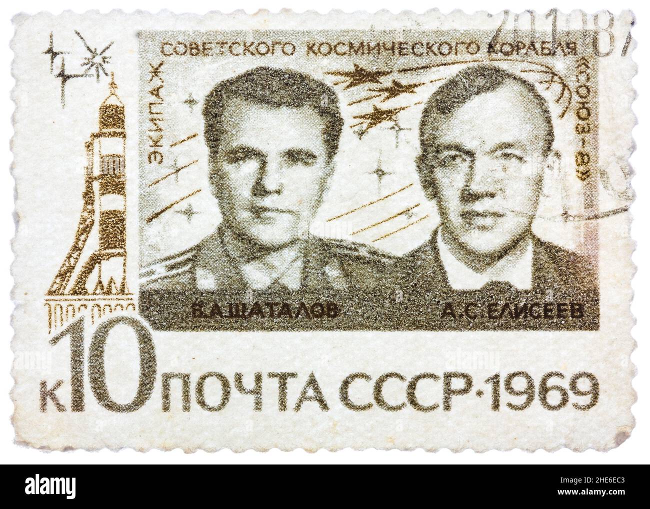 Stamp printed in Russia, shows portraits Russian astronauts of V.A. Shatalov and A.S. Eliseev Stock Photohttps://www.alamy.com/image-license-details/?v=1https://www.alamy.com/stamp-printed-in-russia-shows-portraits-russian-astronauts-of-va-shatalov-and-as-eliseev-image456217779.html
RF2HE6EC3–Stamp printed in Russia, shows portraits Russian astronauts of V.A. Shatalov and A.S. Eliseev
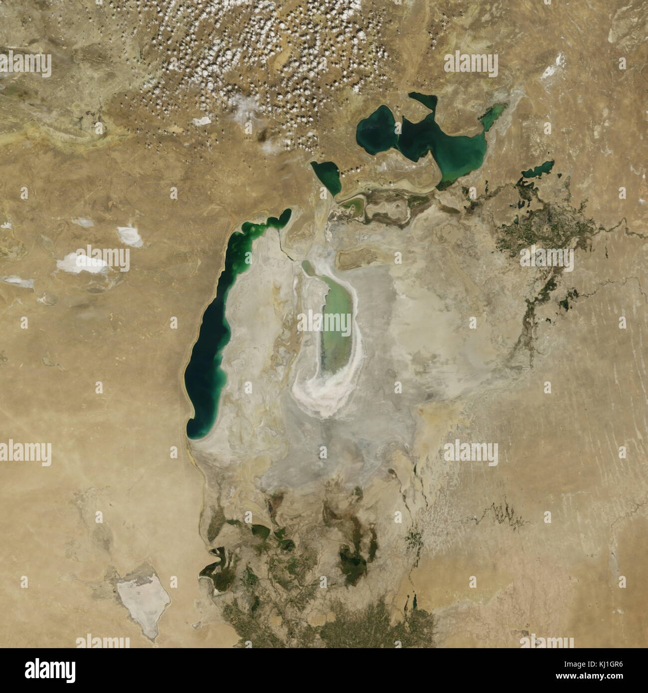 Satellite image of the shrinking of the Aral Sea taken in 2013. The Aral Sea, is a lake lying between Kazakhstan, in the north and Uzbekistan in the south. The name roughly translates as 'Sea of Islands', referring to over 1,100 islands that once dotted its waters; Formerly one of the four largest lakes in the world with an area of 68,000 km2 (26,300 sq mi), the Aral Sea has been steadily shrinking since the 1960s after the rivers that fed it were diverted by Soviet irrigation projects. Stock Photohttps://www.alamy.com/image-license-details/?v=1https://www.alamy.com/stock-image-satellite-image-of-the-shrinking-of-the-aral-sea-taken-in-2013-the-165992266.html
RMKJ1GR6–Satellite image of the shrinking of the Aral Sea taken in 2013. The Aral Sea, is a lake lying between Kazakhstan, in the north and Uzbekistan in the south. The name roughly translates as 'Sea of Islands', referring to over 1,100 islands that once dotted its waters; Formerly one of the four largest lakes in the world with an area of 68,000 km2 (26,300 sq mi), the Aral Sea has been steadily shrinking since the 1960s after the rivers that fed it were diverted by Soviet irrigation projects.
 Press call for Our World, the first live global television link. Broadcast to 26 countries and watched by 400 million, the programme was broadcast via satellite on June 25, 1967. The BBC had commissioned the Beatles to write a song for the UK's contribution. 'All You Need Is Love' a song written by John Lennon and credited to Lennon/McCartney was first performed by The Beatles at this event & released as a single the following month. Pictured at Abbey Road Studios 24th June 1967. Stock Photohttps://www.alamy.com/image-license-details/?v=1https://www.alamy.com/stock-photo-press-call-for-our-world-the-first-live-global-television-link-broadcast-81253554.html
RMEM5BMJ–Press call for Our World, the first live global television link. Broadcast to 26 countries and watched by 400 million, the programme was broadcast via satellite on June 25, 1967. The BBC had commissioned the Beatles to write a song for the UK's contribution. 'All You Need Is Love' a song written by John Lennon and credited to Lennon/McCartney was first performed by The Beatles at this event & released as a single the following month. Pictured at Abbey Road Studios 24th June 1967.
 The surface of the moon, with craters and mountains. Elements of this image were furnished by NASA. For any purpose. Stock Photohttps://www.alamy.com/image-license-details/?v=1https://www.alamy.com/the-surface-of-the-moon-with-craters-and-mountains-elements-of-this-image-were-furnished-by-nasa-for-any-purpose-image341315046.html
RF2AR86R2–The surface of the moon, with craters and mountains. Elements of this image were furnished by NASA. For any purpose.
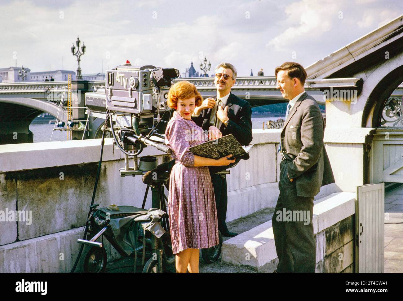 ATV outside TV broadcast, Telstar satellite launch, Westminster Bridge, London, England, UK, July 1962, female PA, Director Steve Wade, Floor Manager Jim Smith. Photograph by Alan 'Taffy' Harries Stock Photohttps://www.alamy.com/image-license-details/?v=1https://www.alamy.com/atv-outside-tv-broadcast-telstar-satellite-launch-westminster-bridge-london-england-uk-july-1962-female-pa-director-steve-wade-floor-manager-jim-smith-photograph-by-alan-taffy-harries-image570771713.html
RM2T4GW41–ATV outside TV broadcast, Telstar satellite launch, Westminster Bridge, London, England, UK, July 1962, female PA, Director Steve Wade, Floor Manager Jim Smith. Photograph by Alan 'Taffy' Harries
 Earth seen from the surface of the Moon. Elements of this image furnished by NASA. Stock Photohttps://www.alamy.com/image-license-details/?v=1https://www.alamy.com/earth-seen-from-the-surface-of-the-moon-elements-of-this-image-furnished-by-nasa-image572306275.html
RF2T72PDR–Earth seen from the surface of the Moon. Elements of this image furnished by NASA.
 stamp printed in Russia, shows portraits Russian astronauts of V.A. Shatalov and A.S. Eliseev, series, circa 1969 Stock Photohttps://www.alamy.com/image-license-details/?v=1https://www.alamy.com/stamp-printed-in-russia-shows-portraits-russian-astronauts-of-va-shatalov-image66526985.html
RMDT6FRN–stamp printed in Russia, shows portraits Russian astronauts of V.A. Shatalov and A.S. Eliseev, series, circa 1969
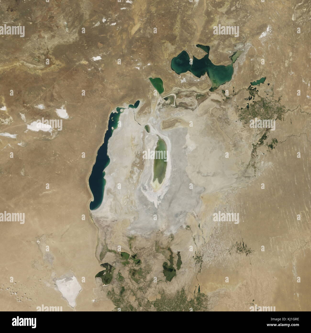 Satellite image of the shrinking of the Aral Sea taken in 2016. The Aral Sea, is a lake lying between Kazakhstan, in the north and Uzbekistan in the south. The name roughly translates as 'Sea of Islands', referring to over 1,100 islands that once dotted its waters; Formerly one of the four largest lakes in the world with an area of 68,000 km2 (26,300 sq mi), the Aral Sea has been steadily shrinking since the 1960s after the rivers that fed it were diverted by Soviet irrigation projects. Stock Photohttps://www.alamy.com/image-license-details/?v=1https://www.alamy.com/stock-image-satellite-image-of-the-shrinking-of-the-aral-sea-taken-in-2016-the-165992274.html
RMKJ1GRE–Satellite image of the shrinking of the Aral Sea taken in 2016. The Aral Sea, is a lake lying between Kazakhstan, in the north and Uzbekistan in the south. The name roughly translates as 'Sea of Islands', referring to over 1,100 islands that once dotted its waters; Formerly one of the four largest lakes in the world with an area of 68,000 km2 (26,300 sq mi), the Aral Sea has been steadily shrinking since the 1960s after the rivers that fed it were diverted by Soviet irrigation projects.
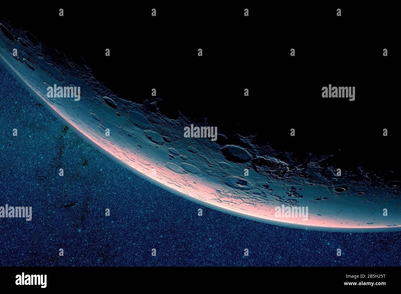 The moon is in a growing phase. On a dark background. Elements of this image were furnished by NASA. Stock Photohttps://www.alamy.com/image-license-details/?v=1https://www.alamy.com/the-moon-is-in-a-growing-phase-on-a-dark-background-elements-of-this-image-were-furnished-by-nasa-image347655556.html
RF2B5H25T–The moon is in a growing phase. On a dark background. Elements of this image were furnished by NASA.
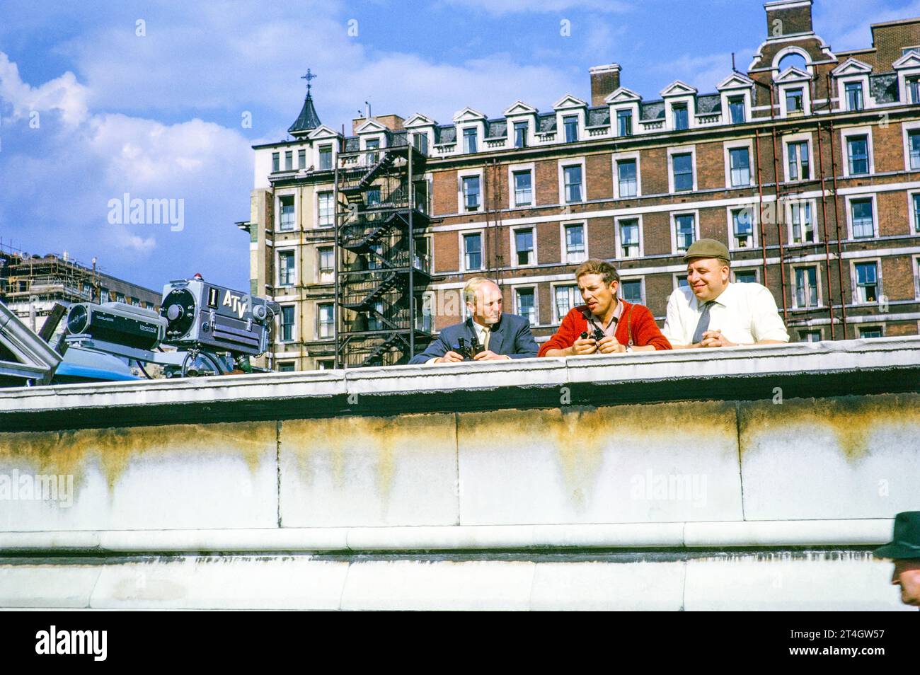 ATV outside TV broadcast, Telstar satellite launch, Westminster Bridge, London, England, UK, July 1962, Mike Whitcutt cameraman, Phil Comber rigger, 'Tiny' Crane vision engineer. Photograph by Alan 'Taffy' Harries Stock Photohttps://www.alamy.com/image-license-details/?v=1https://www.alamy.com/atv-outside-tv-broadcast-telstar-satellite-launch-westminster-bridge-london-england-uk-july-1962-mike-whitcutt-cameraman-phil-comber-rigger-tiny-crane-vision-engineer-photograph-by-alan-taffy-harries-image570771747.html
RM2T4GW57–ATV outside TV broadcast, Telstar satellite launch, Westminster Bridge, London, England, UK, July 1962, Mike Whitcutt cameraman, Phil Comber rigger, 'Tiny' Crane vision engineer. Photograph by Alan 'Taffy' Harries
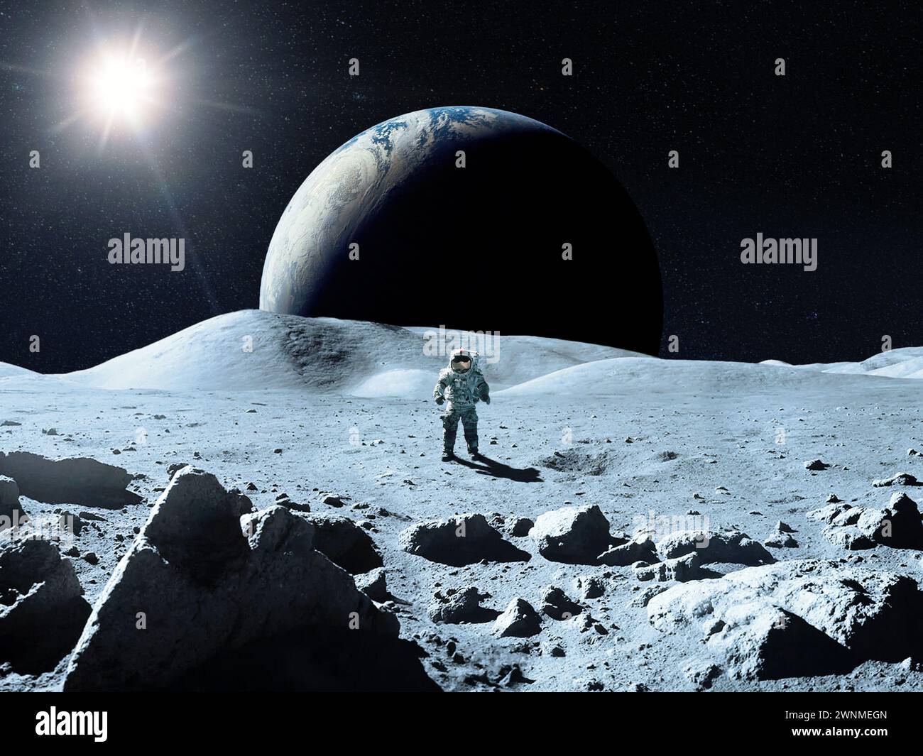 Moon surface with cosmonaut in the background of Earth. Elements of this image furnished by NASA. Stock Photohttps://www.alamy.com/image-license-details/?v=1https://www.alamy.com/moon-surface-with-cosmonaut-in-the-background-of-earth-elements-of-this-image-furnished-by-nasa-image598510773.html
RF2WNMEGN–Moon surface with cosmonaut in the background of Earth. Elements of this image furnished by NASA.
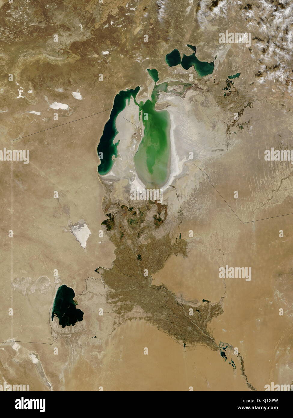 Satellite image of the shrinking of the Aral Sea taken in 2003. The Aral Sea, is a lake lying between Kazakhstan, in the north and Uzbekistan in the south. The name roughly translates as 'Sea of Islands', referring to over 1,100 islands that once dotted its waters; Formerly one of the four largest lakes in the world with an area of 68,000 km2 (26,300 sq mi), the Aral Sea has been steadily shrinking since the 1960s after the rivers that fed it were diverted by Soviet irrigation projects. Stock Photohttps://www.alamy.com/image-license-details/?v=1https://www.alamy.com/stock-image-satellite-image-of-the-shrinking-of-the-aral-sea-taken-in-2003-the-165992257.html
RMKJ1GPW–Satellite image of the shrinking of the Aral Sea taken in 2003. The Aral Sea, is a lake lying between Kazakhstan, in the north and Uzbekistan in the south. The name roughly translates as 'Sea of Islands', referring to over 1,100 islands that once dotted its waters; Formerly one of the four largest lakes in the world with an area of 68,000 km2 (26,300 sq mi), the Aral Sea has been steadily shrinking since the 1960s after the rivers that fed it were diverted by Soviet irrigation projects.
 Planet Mars, on a dark background. Elements of this image were furnished by NASA. High quality photo Stock Photohttps://www.alamy.com/image-license-details/?v=1https://www.alamy.com/planet-mars-on-a-dark-background-elements-of-this-image-were-furnished-by-nasa-high-quality-photo-image399277624.html
RF2E5GJK4–Planet Mars, on a dark background. Elements of this image were furnished by NASA. High quality photo
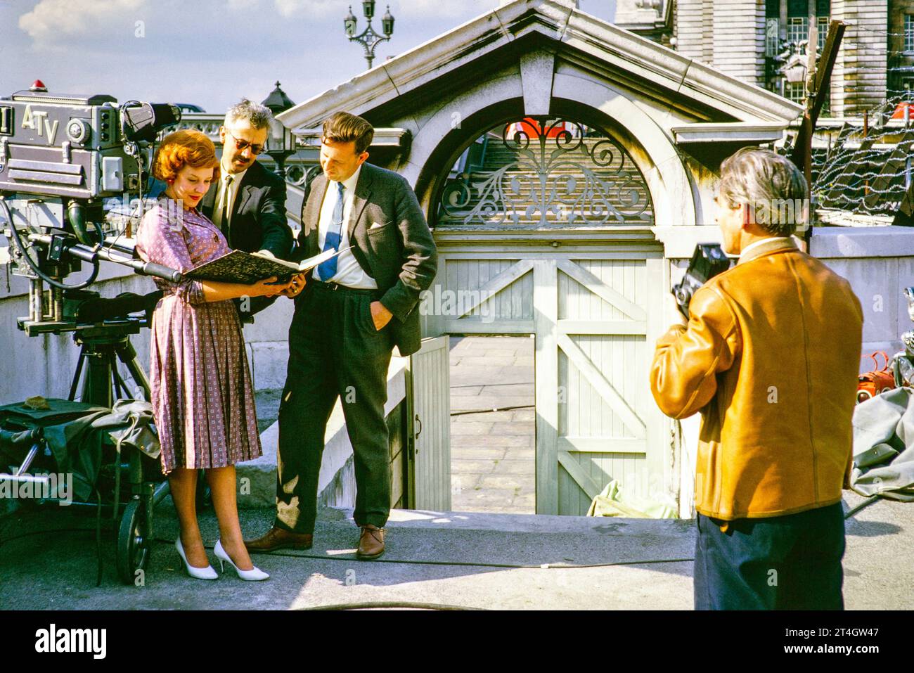 ATV outside TV broadcast, Telstar satellite launch, Westminster Bridge, London, England, UK, July 1962. Jack Moody still photographer, female PA, Director Steve Wade, Floor Manager Jim Smith. Photograph by Alan 'Taffy' Harries Stock Photohttps://www.alamy.com/image-license-details/?v=1https://www.alamy.com/atv-outside-tv-broadcast-telstar-satellite-launch-westminster-bridge-london-england-uk-july-1962-jack-moody-still-photographer-female-pa-director-steve-wade-floor-manager-jim-smith-photograph-by-alan-taffy-harries-image570771719.html
RM2T4GW47–ATV outside TV broadcast, Telstar satellite launch, Westminster Bridge, London, England, UK, July 1962. Jack Moody still photographer, female PA, Director Steve Wade, Floor Manager Jim Smith. Photograph by Alan 'Taffy' Harries
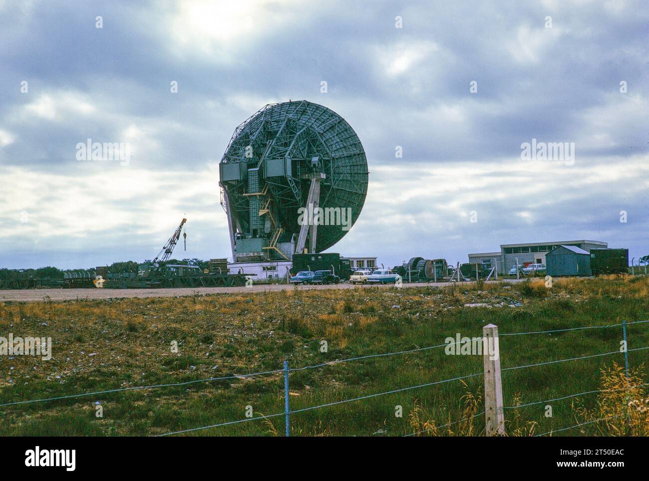 Antenna One parabolic dish known as 'Arthur' constructed 1962, Goonhilly Satellite Earth Station radio communication site, Lizard Peninsula, Cornwall, England, UK 1964 Stock Photohttps://www.alamy.com/image-license-details/?v=1https://www.alamy.com/antenna-one-parabolic-dish-known-as-arthur-constructed-1962-goonhilly-satellite-earth-station-radio-communication-site-lizard-peninsula-cornwall-england-uk-1964-image571026692.html
RM2T50EAC–Antenna One parabolic dish known as 'Arthur' constructed 1962, Goonhilly Satellite Earth Station radio communication site, Lizard Peninsula, Cornwall, England, UK 1964
 Moon surface with astronaut in the background of planet Earth. Elements of this image furnished by NASA. Stock Photohttps://www.alamy.com/image-license-details/?v=1https://www.alamy.com/moon-surface-with-astronaut-in-the-background-of-planet-earth-elements-of-this-image-furnished-by-nasa-image594486715.html
RF2WF55TB–Moon surface with astronaut in the background of planet Earth. Elements of this image furnished by NASA.
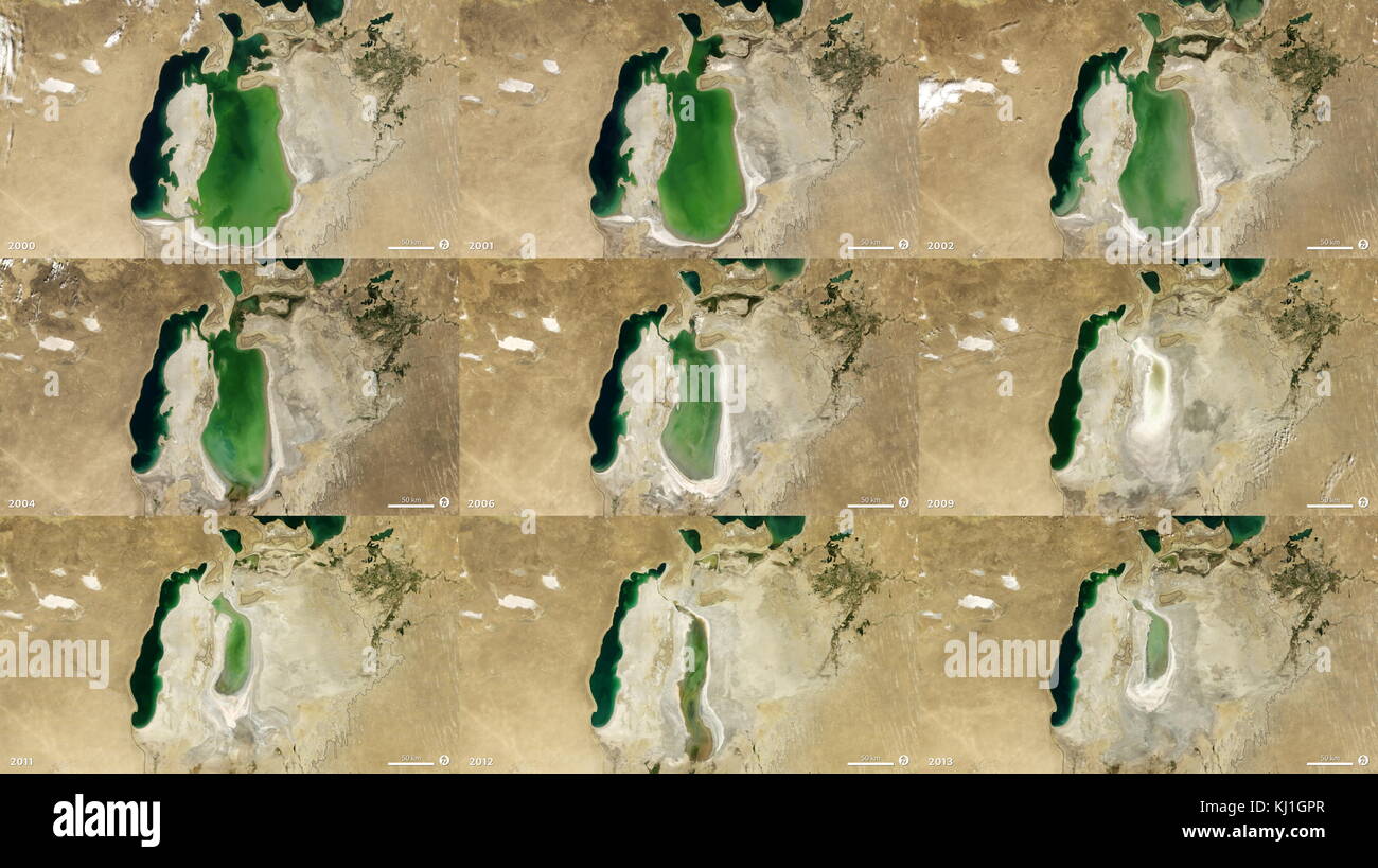 Satellite image of the shrinking of the Aral Sea from 2000 to 2013. The Aral Sea, is a lake lying between Kazakhstan, in the north and Uzbekistan in the south. The name roughly translates as 'Sea of Islands', referring to over 1,100 islands that once dotted its waters; Formerly one of the four largest lakes in the world with an area of 68,000 km2 (26,300 sq mi), the Aral Sea has been steadily shrinking since the 1960s after the rivers that fed it were diverted by Soviet irrigation projects. Stock Photohttps://www.alamy.com/image-license-details/?v=1https://www.alamy.com/stock-image-satellite-image-of-the-shrinking-of-the-aral-sea-from-2000-to-2013-165992255.html
RMKJ1GPR–Satellite image of the shrinking of the Aral Sea from 2000 to 2013. The Aral Sea, is a lake lying between Kazakhstan, in the north and Uzbekistan in the south. The name roughly translates as 'Sea of Islands', referring to over 1,100 islands that once dotted its waters; Formerly one of the four largest lakes in the world with an area of 68,000 km2 (26,300 sq mi), the Aral Sea has been steadily shrinking since the 1960s after the rivers that fed it were diverted by Soviet irrigation projects.
 The moon in high quality, on a dark background. Elements of this image were furnished by NASA. For any purpose. Stock Photohttps://www.alamy.com/image-license-details/?v=1https://www.alamy.com/the-moon-in-high-quality-on-a-dark-background-elements-of-this-image-were-furnished-by-nasa-for-any-purpose-image341314107.html
RF2AR85HF–The moon in high quality, on a dark background. Elements of this image were furnished by NASA. For any purpose.
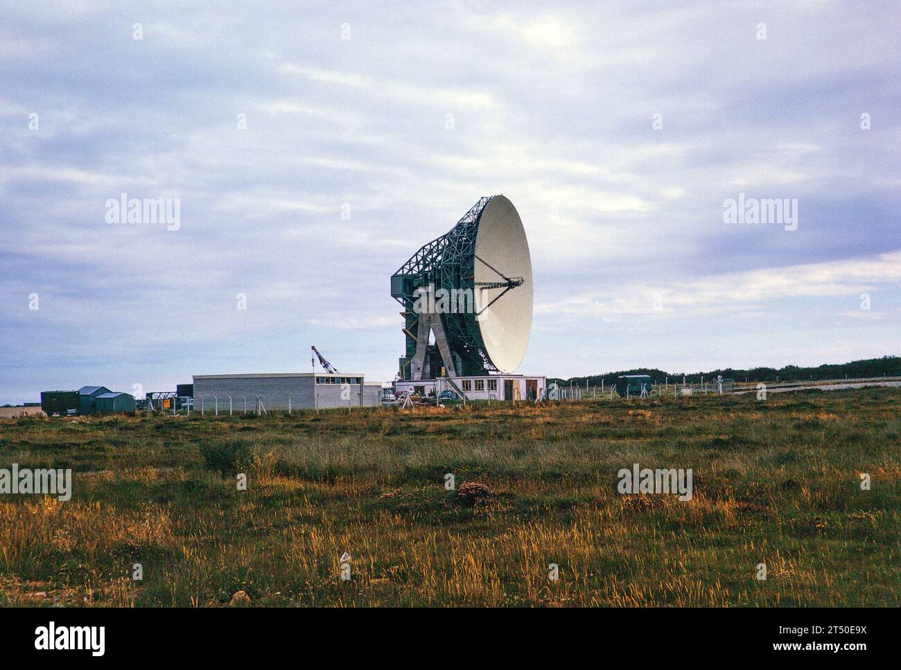 Antenna One parabolic dish known as 'Arthur' constructed 1962, Goonhilly Satellite Earth Station radio communication site, Lizard Peninsula, Cornwall, England, UK 1964 Stock Photohttps://www.alamy.com/image-license-details/?v=1https://www.alamy.com/antenna-one-parabolic-dish-known-as-arthur-constructed-1962-goonhilly-satellite-earth-station-radio-communication-site-lizard-peninsula-cornwall-england-uk-1964-image571026678.html
RM2T50E9X–Antenna One parabolic dish known as 'Arthur' constructed 1962, Goonhilly Satellite Earth Station radio communication site, Lizard Peninsula, Cornwall, England, UK 1964
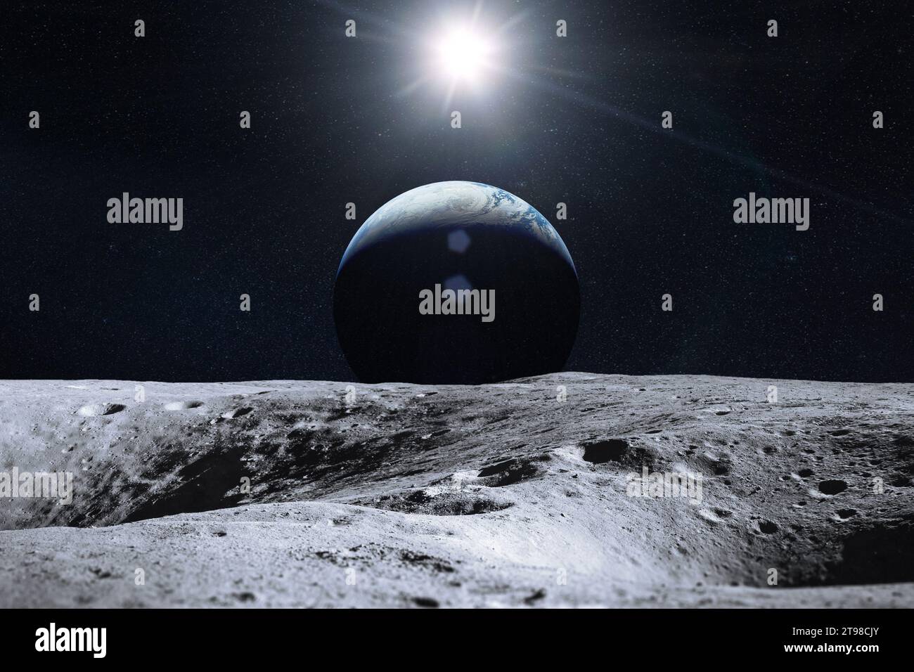 Earth planet from Moon surface. Moon and Earth. Elements of this image furnished by NASA. Stock Photohttps://www.alamy.com/image-license-details/?v=1https://www.alamy.com/earth-planet-from-moon-surface-moon-and-earth-elements-of-this-image-furnished-by-nasa-image573659603.html
RF2T98CJY–Earth planet from Moon surface. Moon and Earth. Elements of this image furnished by NASA.
 Satellite image of the shrinking of the Aral Sea taken in 2014. The Aral Sea, is a lake lying between Kazakhstan, in the north and Uzbekistan in the south. The name roughly translates as 'Sea of Islands', referring to over 1,100 islands that once dotted its waters; Formerly one of the four largest lakes in the world with an area of 68,000 km2 (26,300 sq mi), the Aral Sea has been steadily shrinking since the 1960s after the rivers that fed it were diverted by Soviet irrigation projects. Stock Photohttps://www.alamy.com/image-license-details/?v=1https://www.alamy.com/stock-image-satellite-image-of-the-shrinking-of-the-aral-sea-taken-in-2014-the-165992267.html
RMKJ1GR7–Satellite image of the shrinking of the Aral Sea taken in 2014. The Aral Sea, is a lake lying between Kazakhstan, in the north and Uzbekistan in the south. The name roughly translates as 'Sea of Islands', referring to over 1,100 islands that once dotted its waters; Formerly one of the four largest lakes in the world with an area of 68,000 km2 (26,300 sq mi), the Aral Sea has been steadily shrinking since the 1960s after the rivers that fed it were diverted by Soviet irrigation projects.
 The moon is in a declining phase. On a dark background. Elements of this image were furnished by NASA. For any purpose. Stock Photohttps://www.alamy.com/image-license-details/?v=1https://www.alamy.com/the-moon-is-in-a-declining-phase-on-a-dark-background-elements-of-this-image-were-furnished-by-nasa-for-any-purpose-image341315137.html
RF2AR86X9–The moon is in a declining phase. On a dark background. Elements of this image were furnished by NASA. For any purpose.
 Moon with craters in deep space. Moon and Earth at night. Elements of this image furnished by NASA. Stock Photohttps://www.alamy.com/image-license-details/?v=1https://www.alamy.com/moon-with-craters-in-deep-space-moon-and-earth-at-night-elements-of-this-image-furnished-by-nasa-image572306283.html
RF2T72PE3–Moon with craters in deep space. Moon and Earth at night. Elements of this image furnished by NASA.
 Satellite image of the shrinking of the Aral Sea taken in 2012. The Aral Sea, is a lake lying between Kazakhstan, in the north and Uzbekistan in the south. The name roughly translates as 'Sea of Islands', referring to over 1,100 islands that once dotted its waters; Formerly one of the four largest lakes in the world with an area of 68,000 km2 (26,300 sq mi), the Aral Sea has been steadily shrinking since the 1960s after the rivers that fed it were diverted by Soviet irrigation projects. Stock Photohttps://www.alamy.com/image-license-details/?v=1https://www.alamy.com/stock-image-satellite-image-of-the-shrinking-of-the-aral-sea-taken-in-2012-the-165992264.html
RMKJ1GR4–Satellite image of the shrinking of the Aral Sea taken in 2012. The Aral Sea, is a lake lying between Kazakhstan, in the north and Uzbekistan in the south. The name roughly translates as 'Sea of Islands', referring to over 1,100 islands that once dotted its waters; Formerly one of the four largest lakes in the world with an area of 68,000 km2 (26,300 sq mi), the Aral Sea has been steadily shrinking since the 1960s after the rivers that fed it were diverted by Soviet irrigation projects.
 The moon is in a growing phase. On a dark background. Elements of this image were furnished by NASA. For any purpose. Stock Photohttps://www.alamy.com/image-license-details/?v=1https://www.alamy.com/the-moon-is-in-a-growing-phase-on-a-dark-background-elements-of-this-image-were-furnished-by-nasa-for-any-purpose-image341313391.html
RF2AR84KY–The moon is in a growing phase. On a dark background. Elements of this image were furnished by NASA. For any purpose.
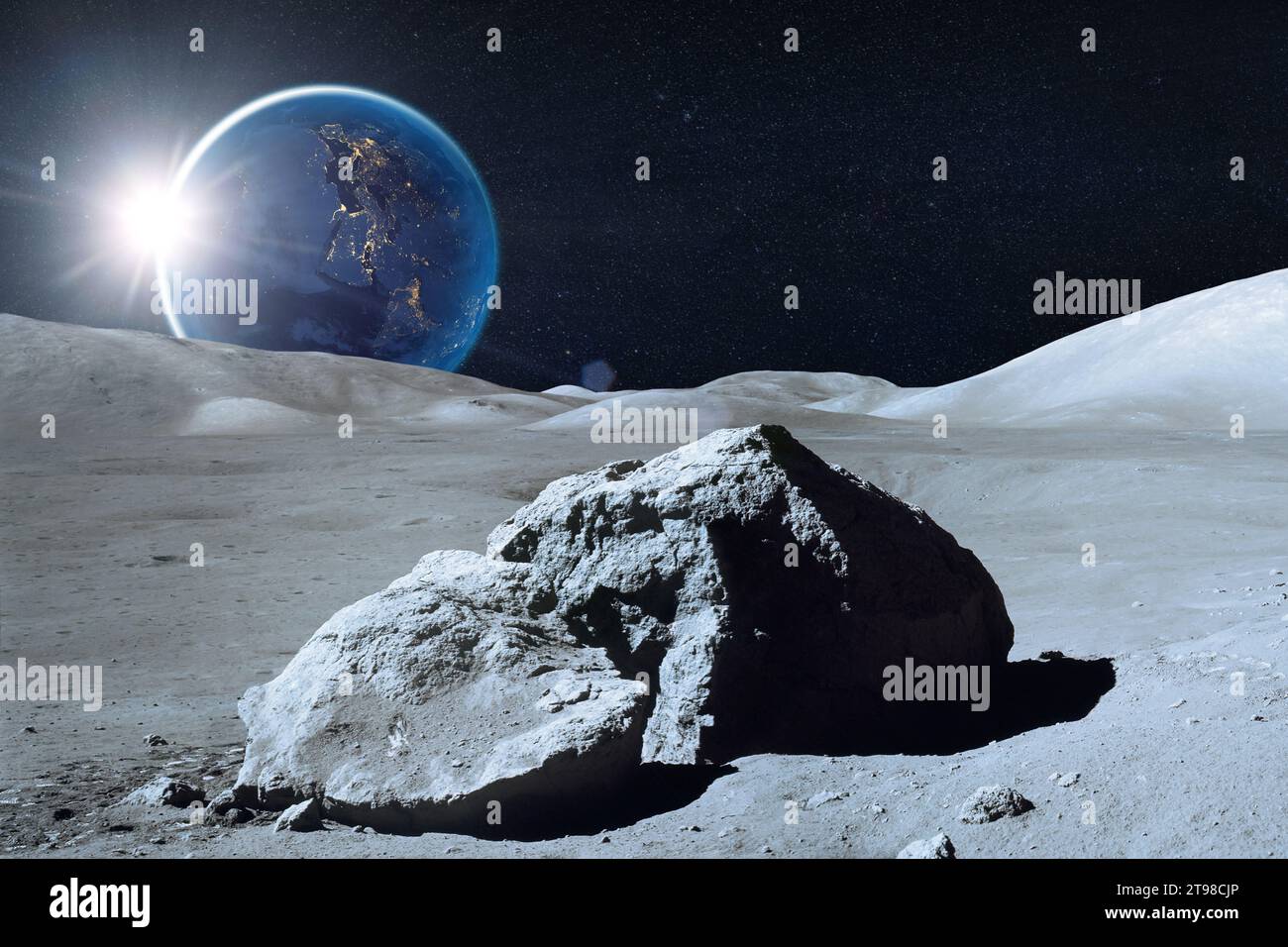 Moon surface in deep space. Moon and Earth at night. Elements of this image furnished by NASA. Stock Photohttps://www.alamy.com/image-license-details/?v=1https://www.alamy.com/moon-surface-in-deep-space-moon-and-earth-at-night-elements-of-this-image-furnished-by-nasa-image573659598.html
RF2T98CJP–Moon surface in deep space. Moon and Earth at night. Elements of this image furnished by NASA.
 Satellite image of the shrinking of the Aral Sea taken in 2011. The Aral Sea, is a lake lying between Kazakhstan, in the north and Uzbekistan in the south. The name roughly translates as 'Sea of Islands', referring to over 1,100 islands that once dotted its waters; Formerly one of the four largest lakes in the world with an area of 68,000 km2 (26,300 sq mi), the Aral Sea has been steadily shrinking since the 1960s after the rivers that fed it were diverted by Soviet irrigation projects. Stock Photohttps://www.alamy.com/image-license-details/?v=1https://www.alamy.com/stock-image-satellite-image-of-the-shrinking-of-the-aral-sea-taken-in-2011-the-165992262.html
RMKJ1GR2–Satellite image of the shrinking of the Aral Sea taken in 2011. The Aral Sea, is a lake lying between Kazakhstan, in the north and Uzbekistan in the south. The name roughly translates as 'Sea of Islands', referring to over 1,100 islands that once dotted its waters; Formerly one of the four largest lakes in the world with an area of 68,000 km2 (26,300 sq mi), the Aral Sea has been steadily shrinking since the 1960s after the rivers that fed it were diverted by Soviet irrigation projects.
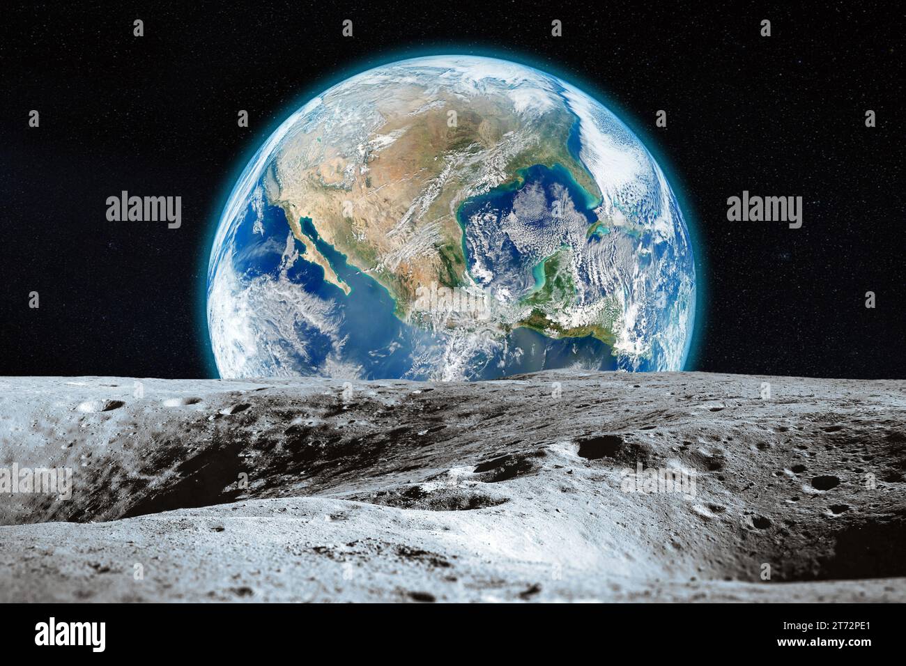 View from the Moon with craters on Earth in deep space. Moon and Earth. Elements of this image furnished by NASA. Stock Photohttps://www.alamy.com/image-license-details/?v=1https://www.alamy.com/view-from-the-moon-with-craters-on-earth-in-deep-space-moon-and-earth-elements-of-this-image-furnished-by-nasa-image572306281.html
RF2T72PE1–View from the Moon with craters on Earth in deep space. Moon and Earth. Elements of this image furnished by NASA.
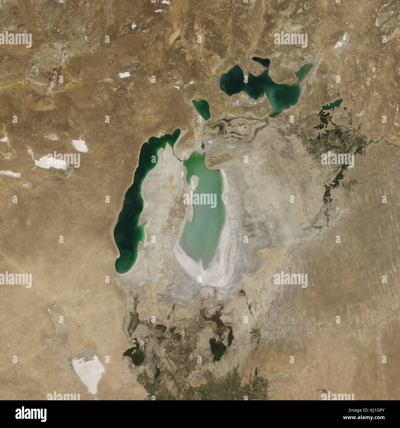 Satellite image of the shrinking of the Aral Sea taken in 2007. The Aral Sea, is a lake lying between Kazakhstan, in the north and Uzbekistan in the south. The name roughly translates as 'Sea of Islands', referring to over 1,100 islands that once dotted its waters; Formerly one of the four largest lakes in the world with an area of 68,000 km2 (26,300 sq mi), the Aral Sea has been steadily shrinking since the 1960s after the rivers that fed it were diverted by Soviet irrigation projects. Stock Photohttps://www.alamy.com/image-license-details/?v=1https://www.alamy.com/stock-image-satellite-image-of-the-shrinking-of-the-aral-sea-taken-in-2007-the-165992259.html
RMKJ1GPY–Satellite image of the shrinking of the Aral Sea taken in 2007. The Aral Sea, is a lake lying between Kazakhstan, in the north and Uzbekistan in the south. The name roughly translates as 'Sea of Islands', referring to over 1,100 islands that once dotted its waters; Formerly one of the four largest lakes in the world with an area of 68,000 km2 (26,300 sq mi), the Aral Sea has been steadily shrinking since the 1960s after the rivers that fed it were diverted by Soviet irrigation projects.
 Satellite image of the shrinking of the Aral Sea taken in 2015. The Aral Sea, is a lake lying between Kazakhstan, in the north and Uzbekistan in the south. The name roughly translates as 'Sea of Islands', referring to over 1,100 islands that once dotted its waters; Formerly one of the four largest lakes in the world with an area of 68,000 km2 (26,300 sq mi), the Aral Sea has been steadily shrinking since the 1960s after the rivers that fed it were diverted by Soviet irrigation projects. Stock Photohttps://www.alamy.com/image-license-details/?v=1https://www.alamy.com/stock-image-satellite-image-of-the-shrinking-of-the-aral-sea-taken-in-2015-the-165992268.html
RMKJ1GR8–Satellite image of the shrinking of the Aral Sea taken in 2015. The Aral Sea, is a lake lying between Kazakhstan, in the north and Uzbekistan in the south. The name roughly translates as 'Sea of Islands', referring to over 1,100 islands that once dotted its waters; Formerly one of the four largest lakes in the world with an area of 68,000 km2 (26,300 sq mi), the Aral Sea has been steadily shrinking since the 1960s after the rivers that fed it were diverted by Soviet irrigation projects.
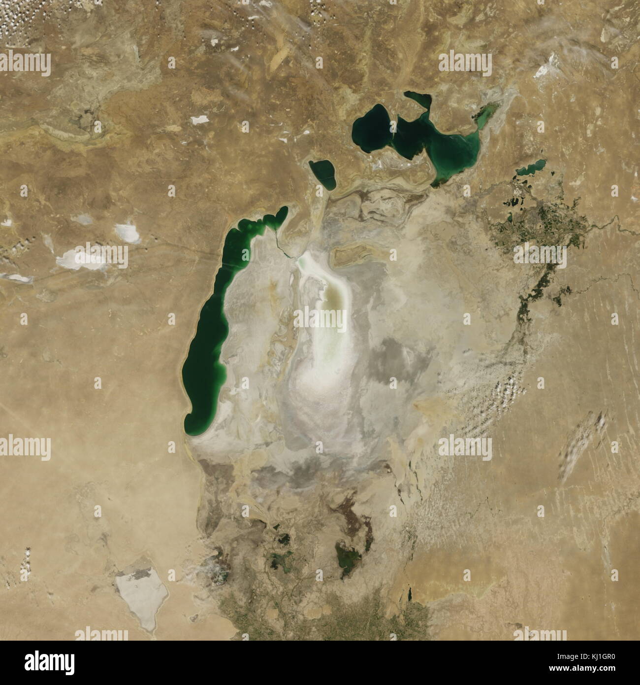 Satellite image of the shrinking of the Aral Sea taken in 2009. The Aral Sea, is a lake lying between Kazakhstan, in the north and Uzbekistan in the south. The name roughly translates as 'Sea of Islands', referring to over 1,100 islands that once dotted its waters; Formerly one of the four largest lakes in the world with an area of 68,000 km2 (26,300 sq mi), the Aral Sea has been steadily shrinking since the 1960s after the rivers that fed it were diverted by Soviet irrigation projects. Stock Photohttps://www.alamy.com/image-license-details/?v=1https://www.alamy.com/stock-image-satellite-image-of-the-shrinking-of-the-aral-sea-taken-in-2009-the-165992260.html
RMKJ1GR0–Satellite image of the shrinking of the Aral Sea taken in 2009. The Aral Sea, is a lake lying between Kazakhstan, in the north and Uzbekistan in the south. The name roughly translates as 'Sea of Islands', referring to over 1,100 islands that once dotted its waters; Formerly one of the four largest lakes in the world with an area of 68,000 km2 (26,300 sq mi), the Aral Sea has been steadily shrinking since the 1960s after the rivers that fed it were diverted by Soviet irrigation projects.
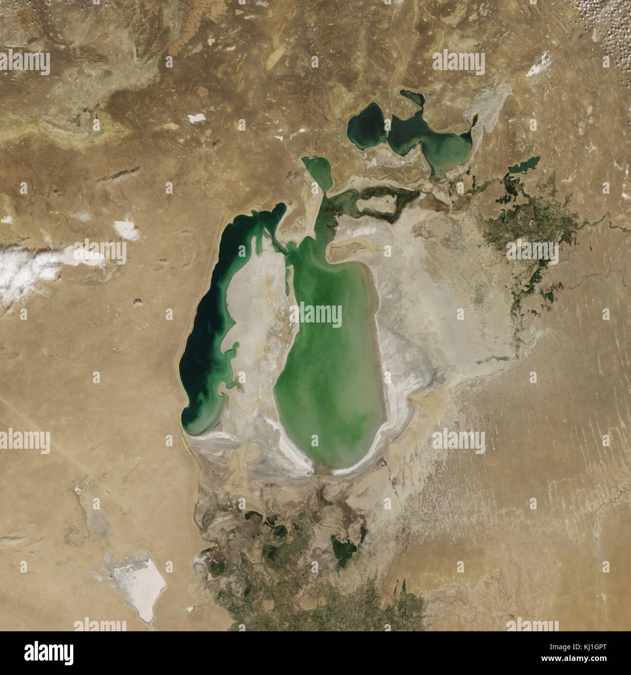 Satellite image of the shrinking of the Aral Sea taken in 2002. The Aral Sea, is a lake lying between Kazakhstan, in the north and Uzbekistan in the south. The name roughly translates as 'Sea of Islands', referring to over 1,100 islands that once dotted its waters; Formerly one of the four largest lakes in the world with an area of 68,000 km2 (26,300 sq mi), the Aral Sea has been steadily shrinking since the 1960s after the rivers that fed it were diverted by Soviet irrigation projects. Stock Photohttps://www.alamy.com/image-license-details/?v=1https://www.alamy.com/stock-image-satellite-image-of-the-shrinking-of-the-aral-sea-taken-in-2002-the-165992256.html
RMKJ1GPT–Satellite image of the shrinking of the Aral Sea taken in 2002. The Aral Sea, is a lake lying between Kazakhstan, in the north and Uzbekistan in the south. The name roughly translates as 'Sea of Islands', referring to over 1,100 islands that once dotted its waters; Formerly one of the four largest lakes in the world with an area of 68,000 km2 (26,300 sq mi), the Aral Sea has been steadily shrinking since the 1960s after the rivers that fed it were diverted by Soviet irrigation projects.
 Whether seen at night or during the day, the capital city of Brazil is unmistakable from orbit. Brasília is located on a Stock Photohttps://www.alamy.com/image-license-details/?v=1https://www.alamy.com/stock-photo-whether-seen-at-night-or-during-the-day-the-capital-city-of-brazil-57347892.html
RMD98BR0–Whether seen at night or during the day, the capital city of Brazil is unmistakable from orbit. Brasília is located on a