19th century map of india Stock Photos and Images
(1,010)See 19th century map of india stock video clipsQuick filters:
19th century map of india Stock Photos and Images
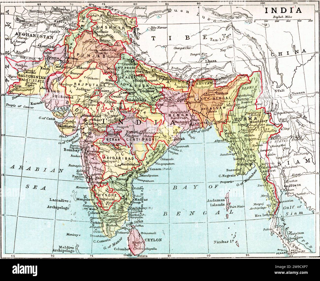 19th century Map of India Stock Photohttps://www.alamy.com/image-license-details/?v=1https://www.alamy.com/19th-century-map-of-india-image504917007.html
RM2M9CXP7–19th century Map of India
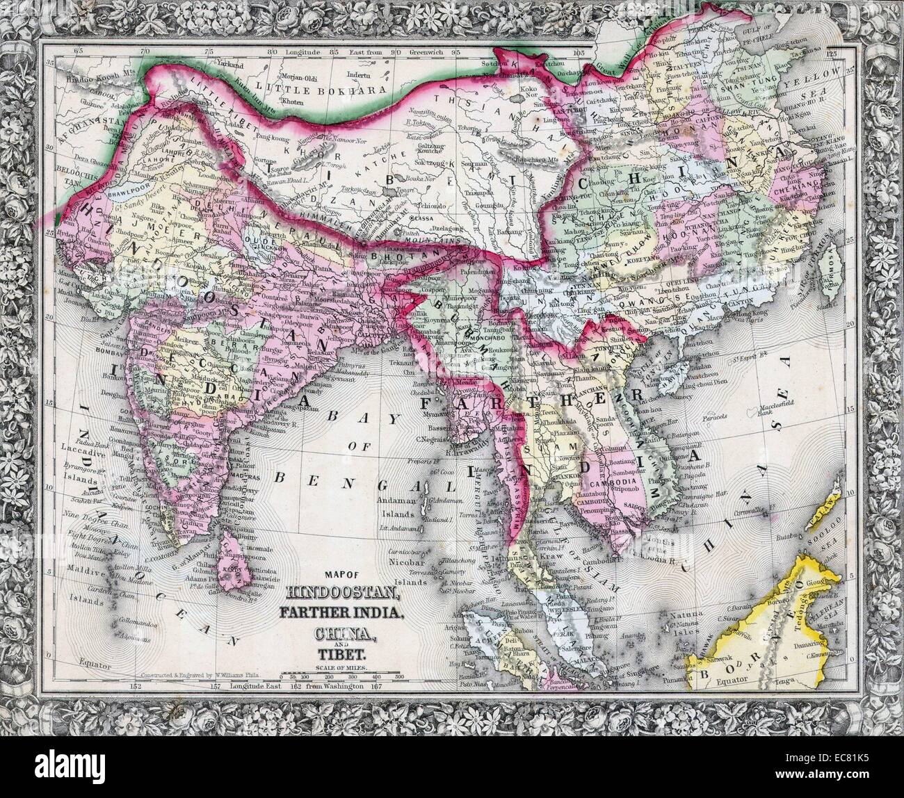 19th Century Map of India, Tibet, China and Southeast Asia. Dated 1864 Stock Photohttps://www.alamy.com/image-license-details/?v=1https://www.alamy.com/stock-photo-19th-century-map-of-india-tibet-china-and-southeast-asia-dated-1864-76394281.html
RMEC81K5–19th Century Map of India, Tibet, China and Southeast Asia. Dated 1864
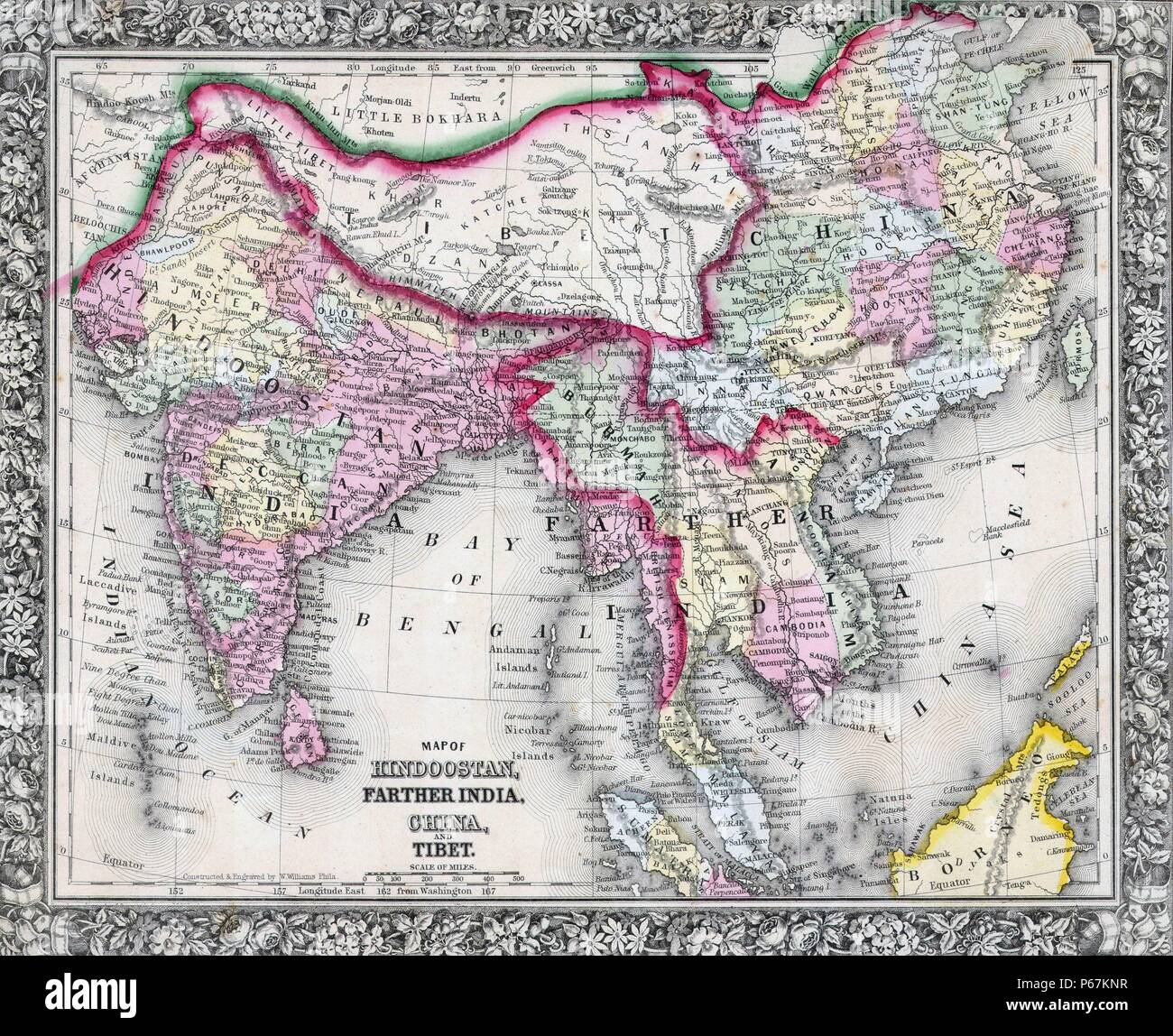 19th Century Map of India, Tibet, China and Southeast Asia. Dated 1864 Stock Photohttps://www.alamy.com/image-license-details/?v=1https://www.alamy.com/19th-century-map-of-india-tibet-china-and-southeast-asia-dated-1864-image210381523.html
RMP67KNR–19th Century Map of India, Tibet, China and Southeast Asia. Dated 1864
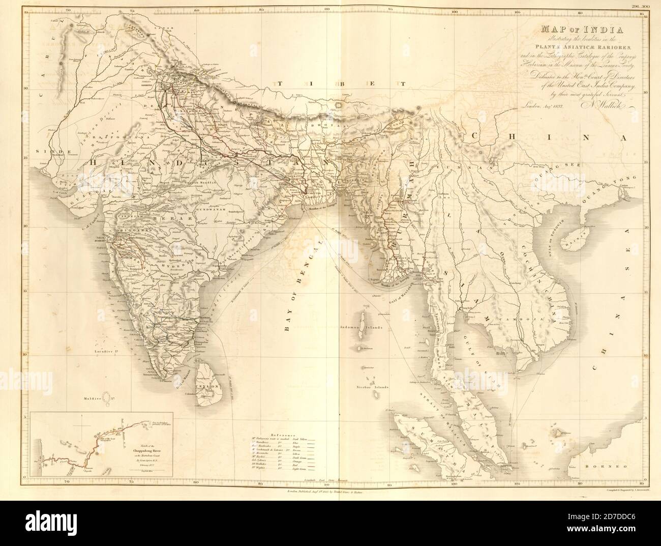 19th century map of India and Indochina From Plantae Asiaticae rariores, or, Descriptions and figures of a select number of unpublished East Indian plants Volume III by Nathaniel Wolff Wallich. Published in London in 1832 Stock Photohttps://www.alamy.com/image-license-details/?v=1https://www.alamy.com/19th-century-map-of-india-and-indochina-from-plantae-asiaticae-rariores-or-descriptions-and-figures-of-a-select-number-of-unpublished-east-indian-plants-volume-iii-by-nathaniel-wolff-wallich-published-in-london-in-1832-image383226598.html
RF2D7DDC6–19th century map of India and Indochina From Plantae Asiaticae rariores, or, Descriptions and figures of a select number of unpublished East Indian plants Volume III by Nathaniel Wolff Wallich. Published in London in 1832
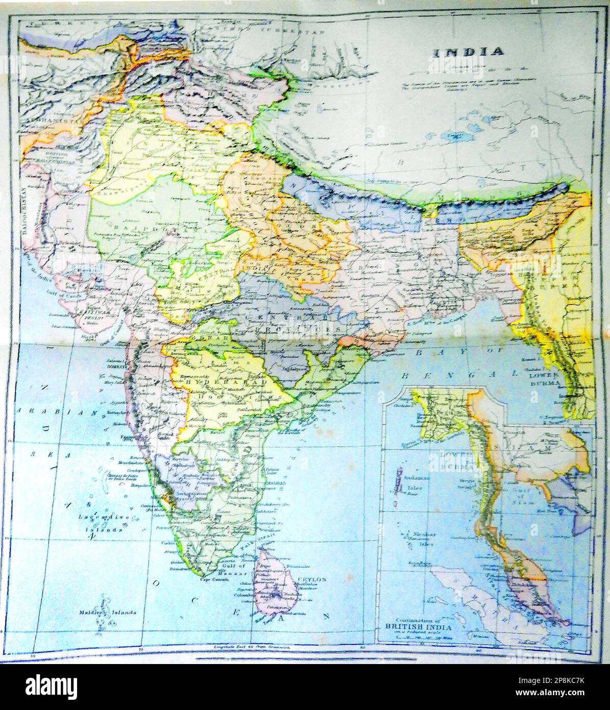 An old 19th century coloured map of India and what is now Pakistan -19 वीं शताब्दी का एक पुराना रंगीन नक्शा भारत और अब पाकिस्तान क्या है - 19 ویں صدی کا ایک پرانا رنگین نقشہ جو ہندوستان اور اب پاکستان ہے Stock Photohttps://www.alamy.com/image-license-details/?v=1https://www.alamy.com/an-old-19th-century-coloured-map-of-india-and-what-is-now-pakistan-19-19-image538865367.html
RM2P8KC7K–An old 19th century coloured map of India and what is now Pakistan -19 वीं शताब्दी का एक पुराना रंगीन नक्शा भारत और अब पाकिस्तान क्या है - 19 ویں صدی کا ایک پرانا رنگین نقشہ جو ہندوستان اور اب پاکستان ہے
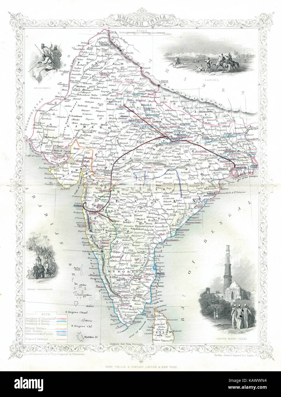 Illustrated Map of British India in the 19th Century Stock Photohttps://www.alamy.com/image-license-details/?v=1https://www.alamy.com/stock-image-illustrated-map-of-british-india-in-the-19th-century-161608864.html
RMKAWWN4–Illustrated Map of British India in the 19th Century
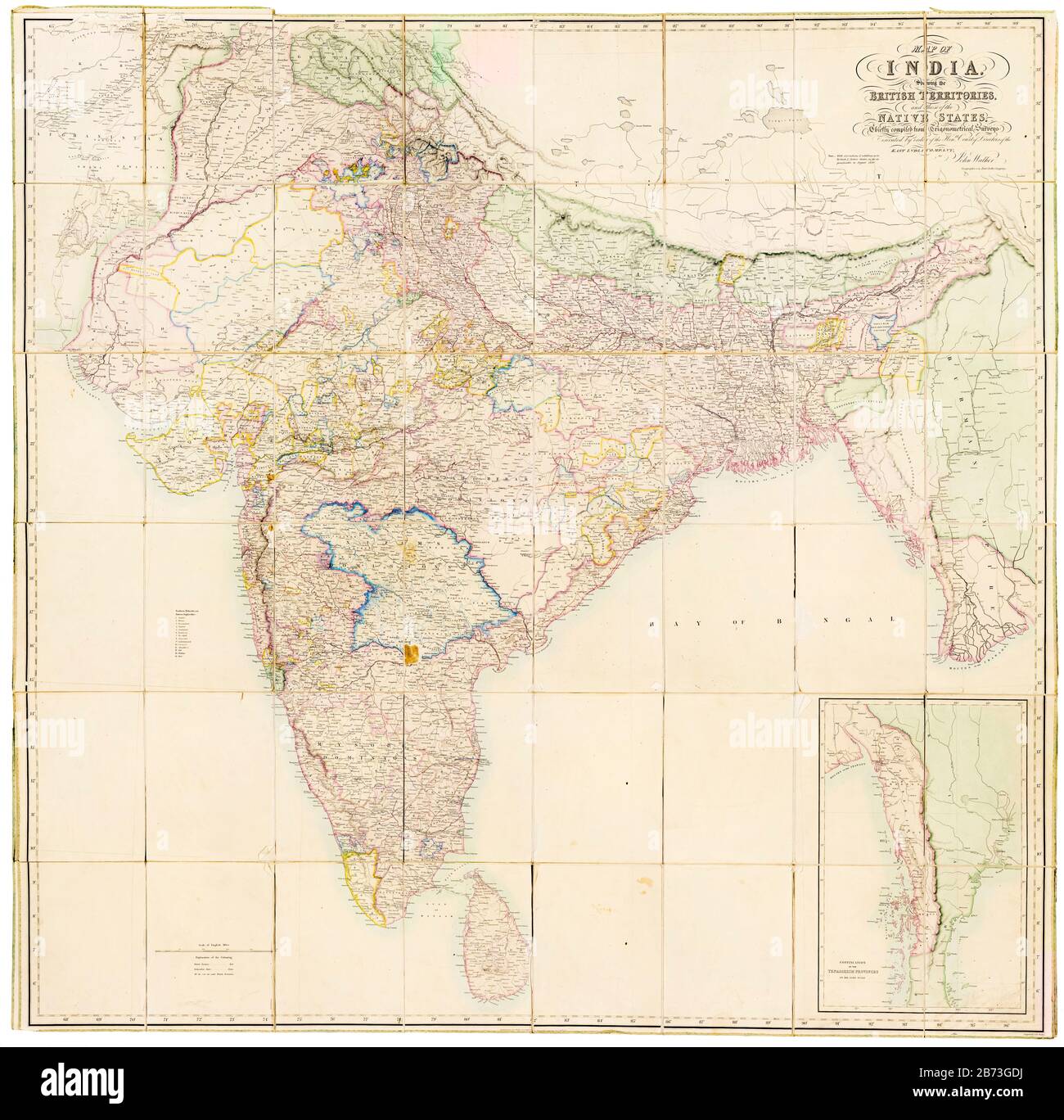 Map of India showing the British Territories and those of the Native States, 19th Century map by John Walker, East India Company, 1856 Stock Photohttps://www.alamy.com/image-license-details/?v=1https://www.alamy.com/map-of-india-showing-the-british-territories-and-those-of-the-native-states-19th-century-map-by-john-walker-east-india-company-1856-image348588734.html
RM2B73GDJ–Map of India showing the British Territories and those of the Native States, 19th Century map by John Walker, East India Company, 1856
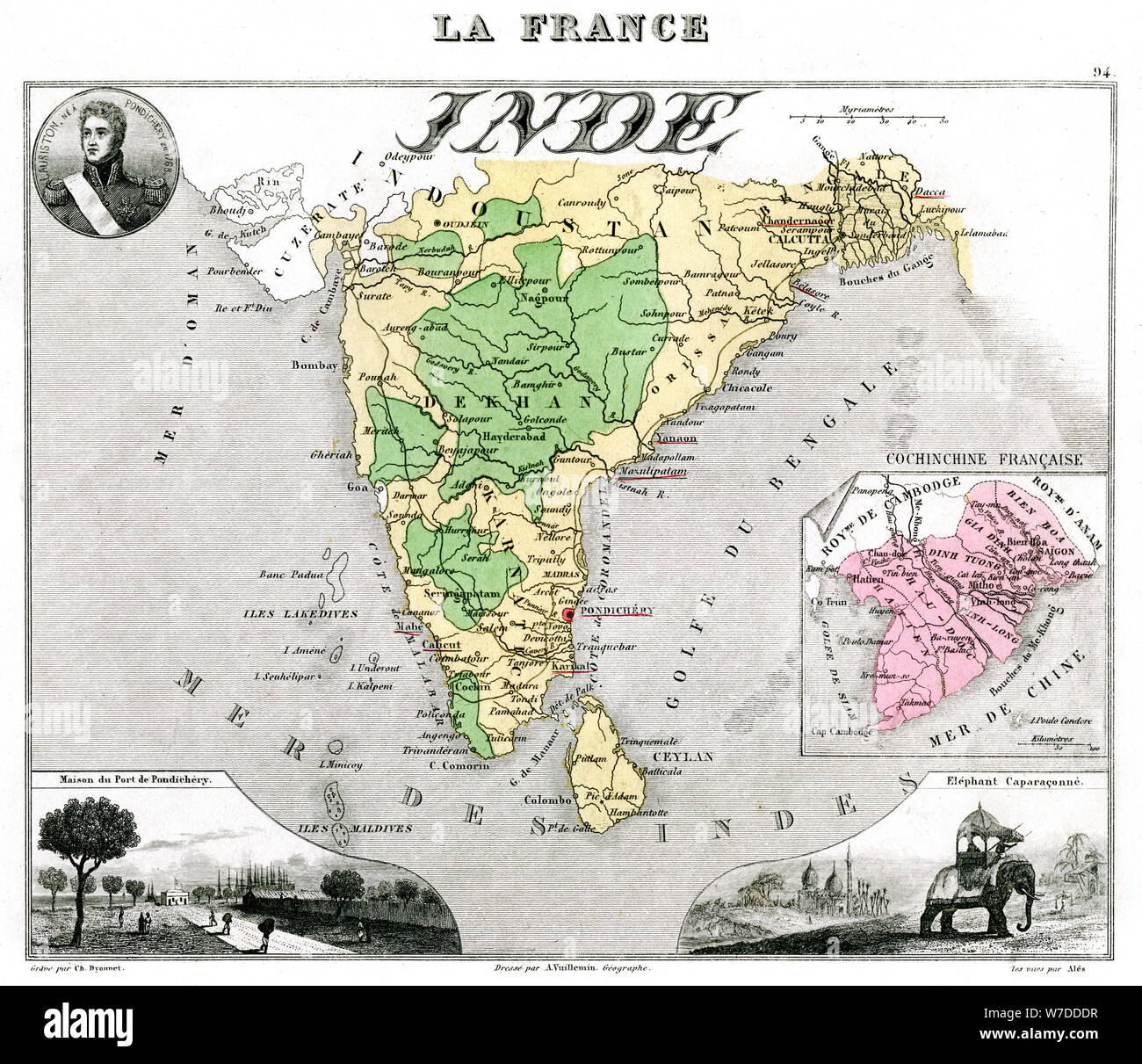 Map of French-occupied India, late 19th century.Artist: Edmond Dyonnet Stock Photohttps://www.alamy.com/image-license-details/?v=1https://www.alamy.com/map-of-french-occupied-india-late-19th-centuryartist-edmond-dyonnet-image262754067.html
RMW7DDDR–Map of French-occupied India, late 19th century.Artist: Edmond Dyonnet
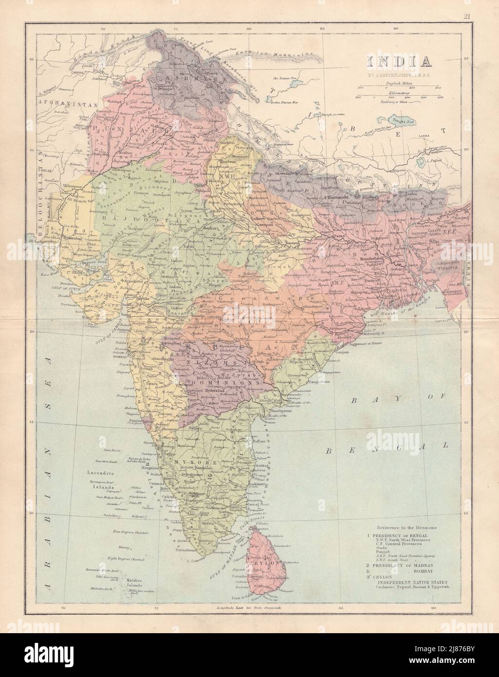 BRITISH INDIA. Showing states, French & Portuguese settlements. COLLINS 1873 map Stock Photohttps://www.alamy.com/image-license-details/?v=1https://www.alamy.com/british-india-showing-states-french-portuguese-settlements-collins-1873-map-image469755887.html
RF2J876BY–BRITISH INDIA. Showing states, French & Portuguese settlements. COLLINS 1873 map
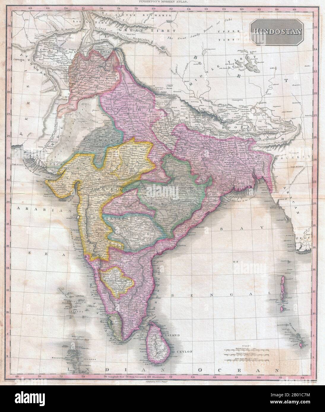 India/South Asia: Map of Hindostan showing British Raj by John Pinkerton (17 Februar 1758 - 10 March 1826), c. 1818. Map of Hindostan from Pinkerton's Modern Atlas, early 19th century. It covers the subcontinent from Tibet to Ceylon (Sri Lanka) and from the mouth of the Indus to the Kingdom of Pegu (Burma/Myanmar). The map also colour codes various political divisions and princely states. Stock Photohttps://www.alamy.com/image-license-details/?v=1https://www.alamy.com/indiasouth-asia-map-of-hindostan-showing-british-raj-by-john-pinkerton-17-februar-1758-10-march-1826-c-1818-map-of-hindostan-from-pinkertons-modern-atlas-early-19th-century-it-covers-the-subcontinent-from-tibet-to-ceylon-sri-lanka-and-from-the-mouth-of-the-indus-to-the-kingdom-of-pegu-burmamyanmar-the-map-also-colour-codes-various-political-divisions-and-princely-states-image344238936.html
RM2B01C7M–India/South Asia: Map of Hindostan showing British Raj by John Pinkerton (17 Februar 1758 - 10 March 1826), c. 1818. Map of Hindostan from Pinkerton's Modern Atlas, early 19th century. It covers the subcontinent from Tibet to Ceylon (Sri Lanka) and from the mouth of the Indus to the Kingdom of Pegu (Burma/Myanmar). The map also colour codes various political divisions and princely states.
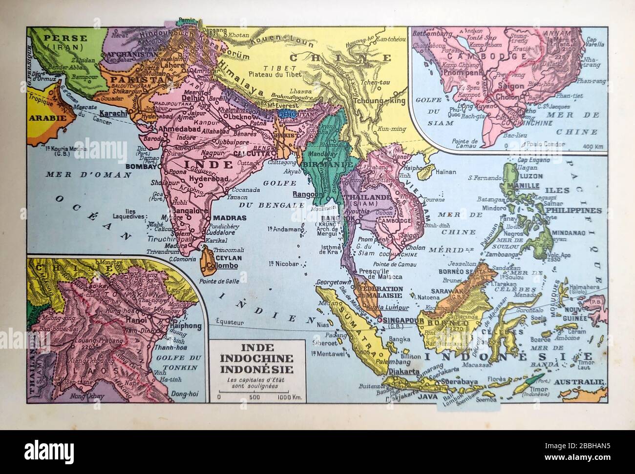 Old map of India, Indochina and Indonesia printed in the late 19th century. Stock Photohttps://www.alamy.com/image-license-details/?v=1https://www.alamy.com/old-map-of-india-indochina-and-indonesia-printed-in-the-late-19th-century-image351350193.html
RF2BBHAN5–Old map of India, Indochina and Indonesia printed in the late 19th century.
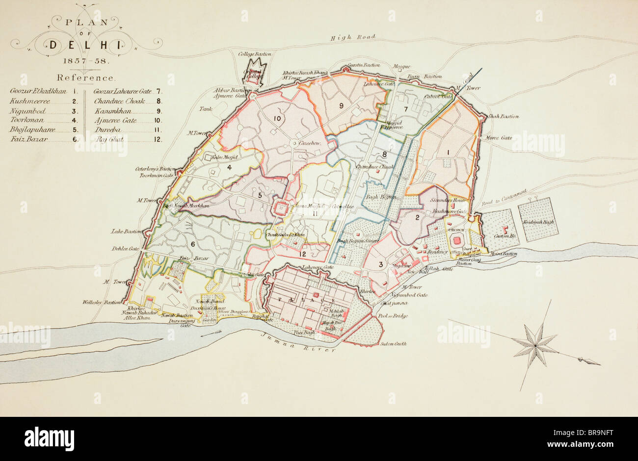 Plan of Delhi in 1857 - 1858. Stock Photohttps://www.alamy.com/image-license-details/?v=1https://www.alamy.com/stock-photo-plan-of-delhi-in-1857-1858-31561932.html
RMBR9NFT–Plan of Delhi in 1857 - 1858.
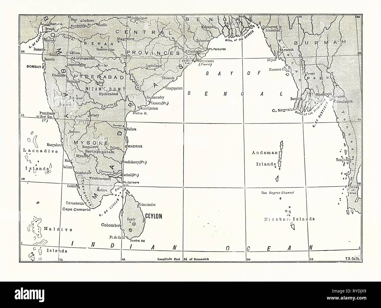 Map of Lower India and Ceylon, Sri Lanka Stock Photohttps://www.alamy.com/image-license-details/?v=1https://www.alamy.com/map-of-lower-india-and-ceylon-sri-lanka-image240630721.html
RMRYDJX9–Map of Lower India and Ceylon, Sri Lanka
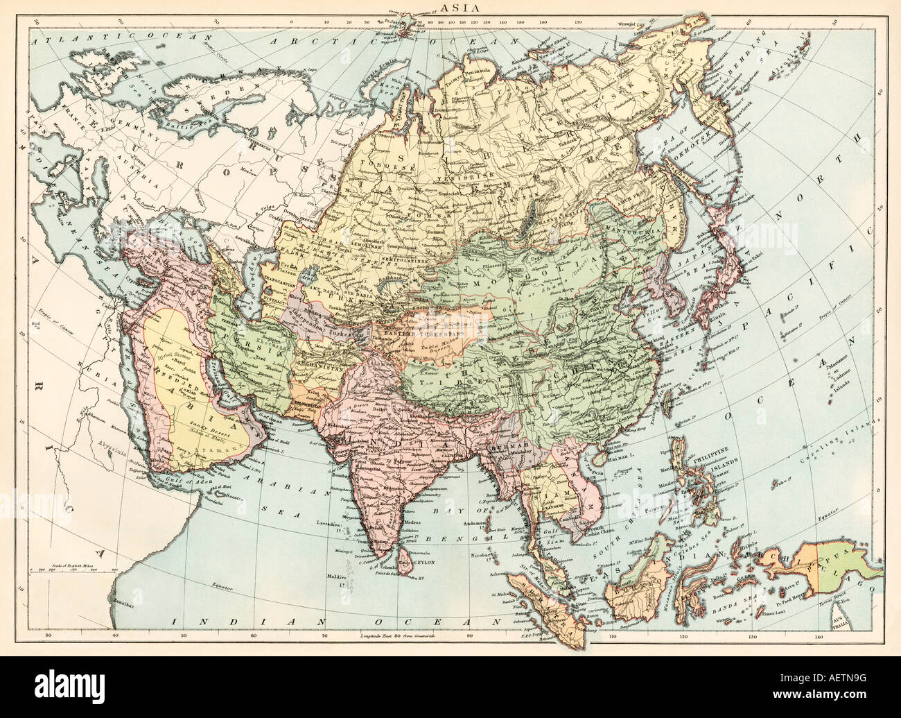 Map of Asia circa 1870. Color lithograph Stock Photohttps://www.alamy.com/image-license-details/?v=1https://www.alamy.com/stock-photo-map-of-asia-circa-1870-color-lithograph-13755387.html
RMAETN9G–Map of Asia circa 1870. Color lithograph
 Ancient 19th century map of Palestine central Ridge from the book Palestine illustrated by Sir Richard Temple, 1st Baronet, GCSI, CIE, PC, FRS (8 March 1826 – 15 March 1902) was an administrator in British India and a British politician. Published in London by W.H. Allen & Co. in 1888 Stock Photohttps://www.alamy.com/image-license-details/?v=1https://www.alamy.com/ancient-19th-century-map-of-palestine-central-ridge-from-the-book-palestine-illustrated-by-sir-richard-temple-1st-baronet-gcsi-cie-pc-frs-8-march-1826-15-march-1902-was-an-administrator-in-british-india-and-a-british-politician-published-in-london-by-wh-allen-co-in-1888-image376533453.html
RM2CTGG79–Ancient 19th century map of Palestine central Ridge from the book Palestine illustrated by Sir Richard Temple, 1st Baronet, GCSI, CIE, PC, FRS (8 March 1826 – 15 March 1902) was an administrator in British India and a British politician. Published in London by W.H. Allen & Co. in 1888
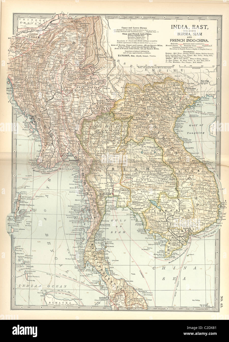 Map of Eastern India Stock Photohttps://www.alamy.com/image-license-details/?v=1https://www.alamy.com/stock-photo-map-of-eastern-india-35956033.html
RMC2DX81–Map of Eastern India
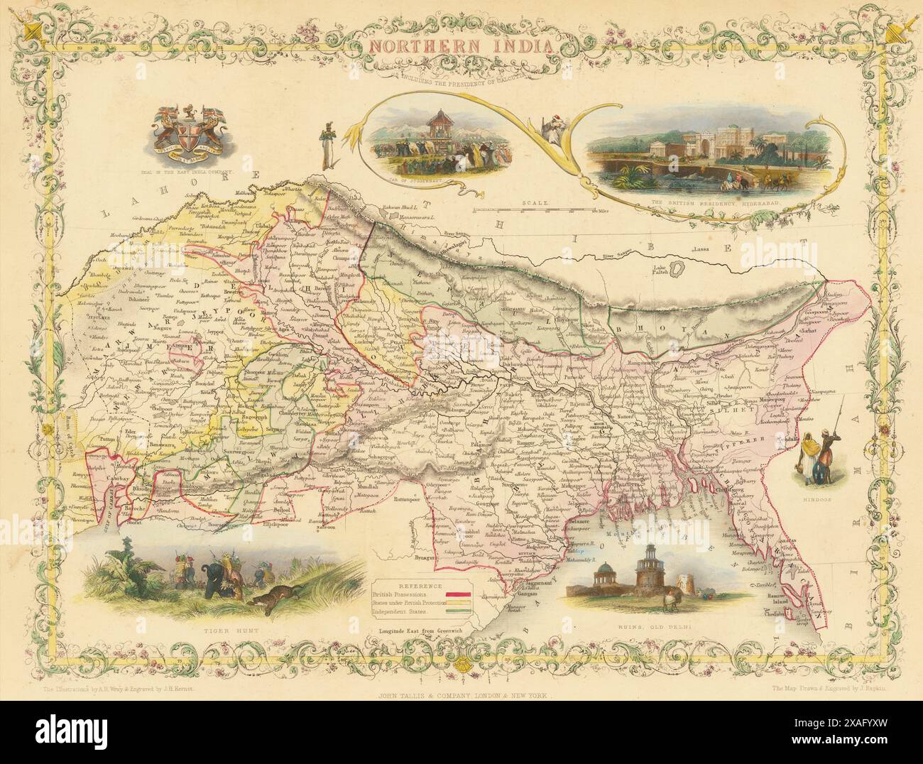 Vintage Illustrated John Tallis Map: Northern India, showing colonial British Possessions. 1860s Stock Photohttps://www.alamy.com/image-license-details/?v=1https://www.alamy.com/vintage-illustrated-john-tallis-map-northern-india-showing-colonial-british-possessions-1860s-image608860641.html
RM2XAFYXW–Vintage Illustrated John Tallis Map: Northern India, showing colonial British Possessions. 1860s
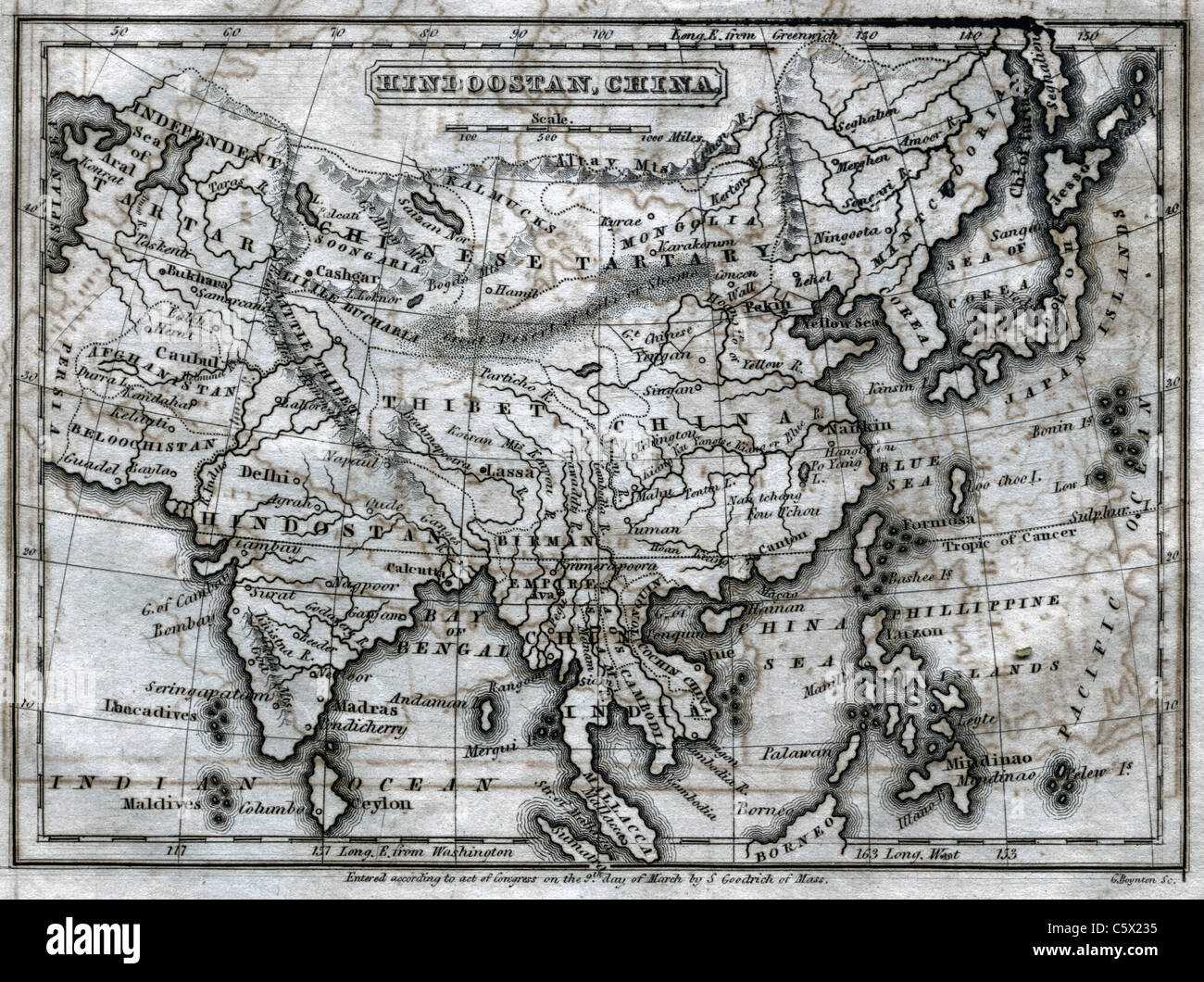 Hindoostan, China - Antiquarian Black and White Map from 'The Second Book of History' Stock Photohttps://www.alamy.com/image-license-details/?v=1https://www.alamy.com/stock-photo-hindoostan-china-antiquarian-black-and-white-map-from-the-second-book-38066425.html
RFC5X235–Hindoostan, China - Antiquarian Black and White Map from 'The Second Book of History'
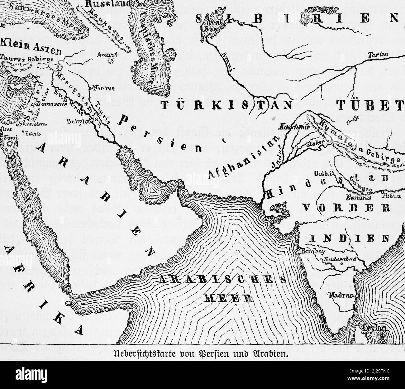 Map, Persia, Arabia, India, Turkestan, historical illustration 1885, 19th century, Central Asia Stock Photohttps://www.alamy.com/image-license-details/?v=1https://www.alamy.com/map-persia-arabia-india-turkestan-historical-illustration-1885-19th-century-central-asia-image466126232.html
RM2J29TNC–Map, Persia, Arabia, India, Turkestan, historical illustration 1885, 19th century, Central Asia
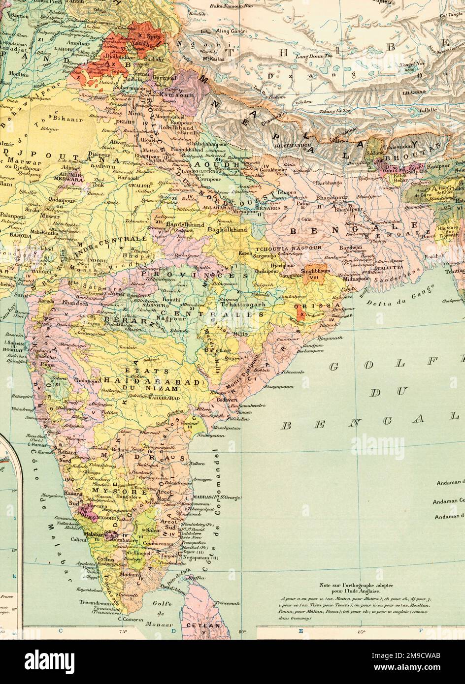 19th century Map of India Stock Photohttps://www.alamy.com/image-license-details/?v=1https://www.alamy.com/19th-century-map-of-india-image504915891.html
RM2M9CWAB–19th century Map of India
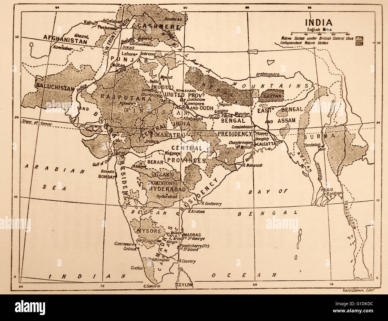 Map showing the British Control over India. Dated 19th Century Stock Photohttps://www.alamy.com/image-license-details/?v=1https://www.alamy.com/stock-photo-map-showing-the-british-control-over-india-dated-19th-century-104177512.html
RMG1DKDC–Map showing the British Control over India. Dated 19th Century
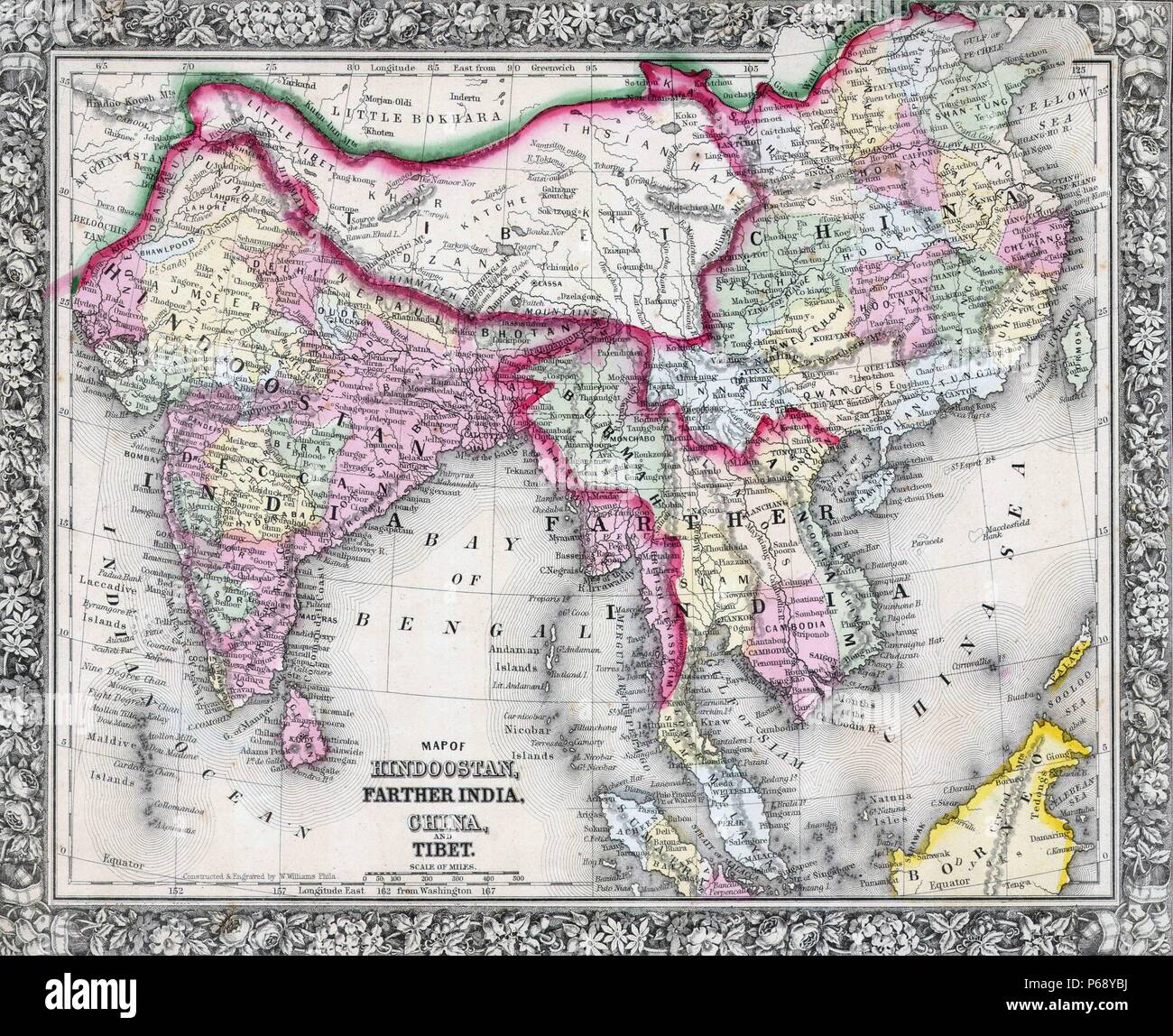 Mitchell Map of India, Tibet, China and Southeast Asia. Dated 1864 Stock Photohttps://www.alamy.com/image-license-details/?v=1https://www.alamy.com/mitchell-map-of-india-tibet-china-and-southeast-asia-dated-1864-image210409462.html
RMP68YBJ–Mitchell Map of India, Tibet, China and Southeast Asia. Dated 1864
 Ancient 19th century map of 'Modern' Palestine from the book Palestine illustrated by Sir Richard Temple, 1st Baronet, GCSI, CIE, PC, FRS (8 March 1826 – 15 March 1902) was an administrator in British India and a British politician. Published in London by W.H. Allen & Co. in 1888 Stock Photohttps://www.alamy.com/image-license-details/?v=1https://www.alamy.com/ancient-19th-century-map-of-modern-palestine-from-the-book-palestine-illustrated-by-sir-richard-temple-1st-baronet-gcsi-cie-pc-frs-8-march-1826-15-march-1902-was-an-administrator-in-british-india-and-a-british-politician-published-in-london-by-wh-allen-co-in-1888-image376644363.html
RM2CTNHMB–Ancient 19th century map of 'Modern' Palestine from the book Palestine illustrated by Sir Richard Temple, 1st Baronet, GCSI, CIE, PC, FRS (8 March 1826 – 15 March 1902) was an administrator in British India and a British politician. Published in London by W.H. Allen & Co. in 1888
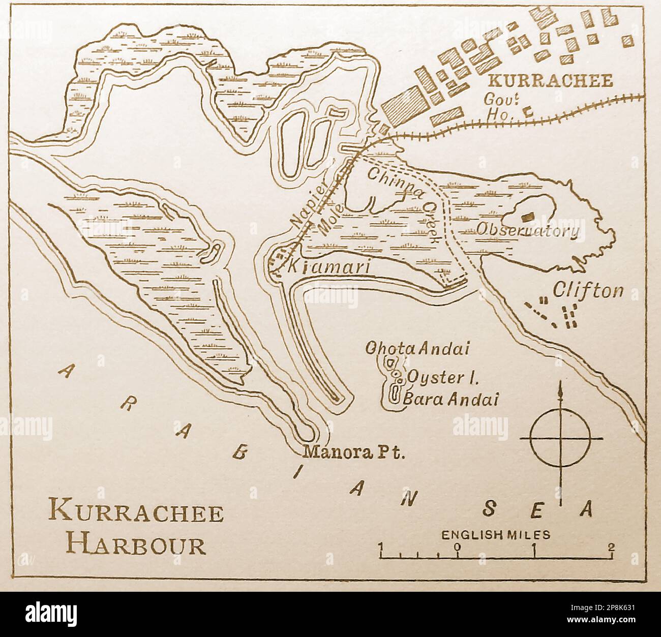 An old 19th century map An old 19th century map of the harbour at Kurrache (Karachi). India. (Now in Pakistan) ------ 19 ویں صدی کا ایک پرانا نقشہ 19 ویں صدی کا ایک پرانا نقشہ کراچی (کراچی) میں بندرگاہ کا ہے۔ ہندوستان. . اب پاکستان میں -- कुर्राचे (कराची) में बंदरगाह का एक पुराना 19 वीं शताब्दी का नक्शा। भारत।. अब पाकिस्तान में Stock Photohttps://www.alamy.com/image-license-details/?v=1https://www.alamy.com/an-old-19th-century-map-an-old-19th-century-map-of-the-harbour-at-kurrache-karachi-india-now-in-pakistan-19-19-19-image538860533.html
RM2P8K631–An old 19th century map An old 19th century map of the harbour at Kurrache (Karachi). India. (Now in Pakistan) ------ 19 ویں صدی کا ایک پرانا نقشہ 19 ویں صدی کا ایک پرانا نقشہ کراچی (کراچی) میں بندرگاہ کا ہے۔ ہندوستان. . اب پاکستان میں -- कुर्राचे (कराची) में बंदरगाह का एक पुराना 19 वीं शताब्दी का नक्शा। भारत।. अब पाकिस्तान में
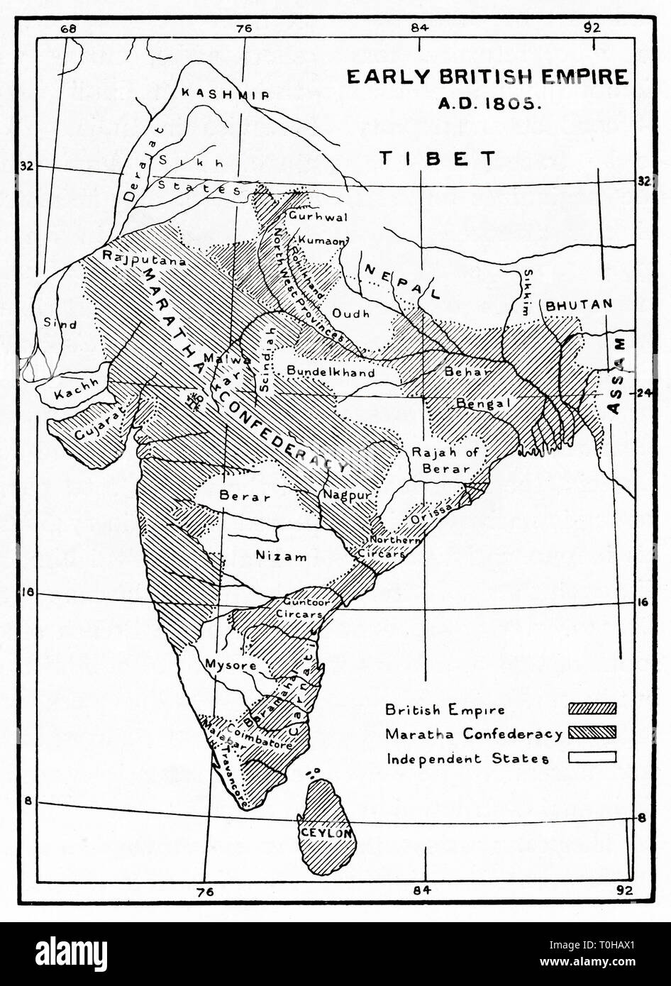 Map showing areas controlled by British in India and Ceylon, 1805 Stock Photohttps://www.alamy.com/image-license-details/?v=1https://www.alamy.com/map-showing-areas-controlled-by-british-in-india-and-ceylon-1805-image241326905.html
RMT0HAX1–Map showing areas controlled by British in India and Ceylon, 1805
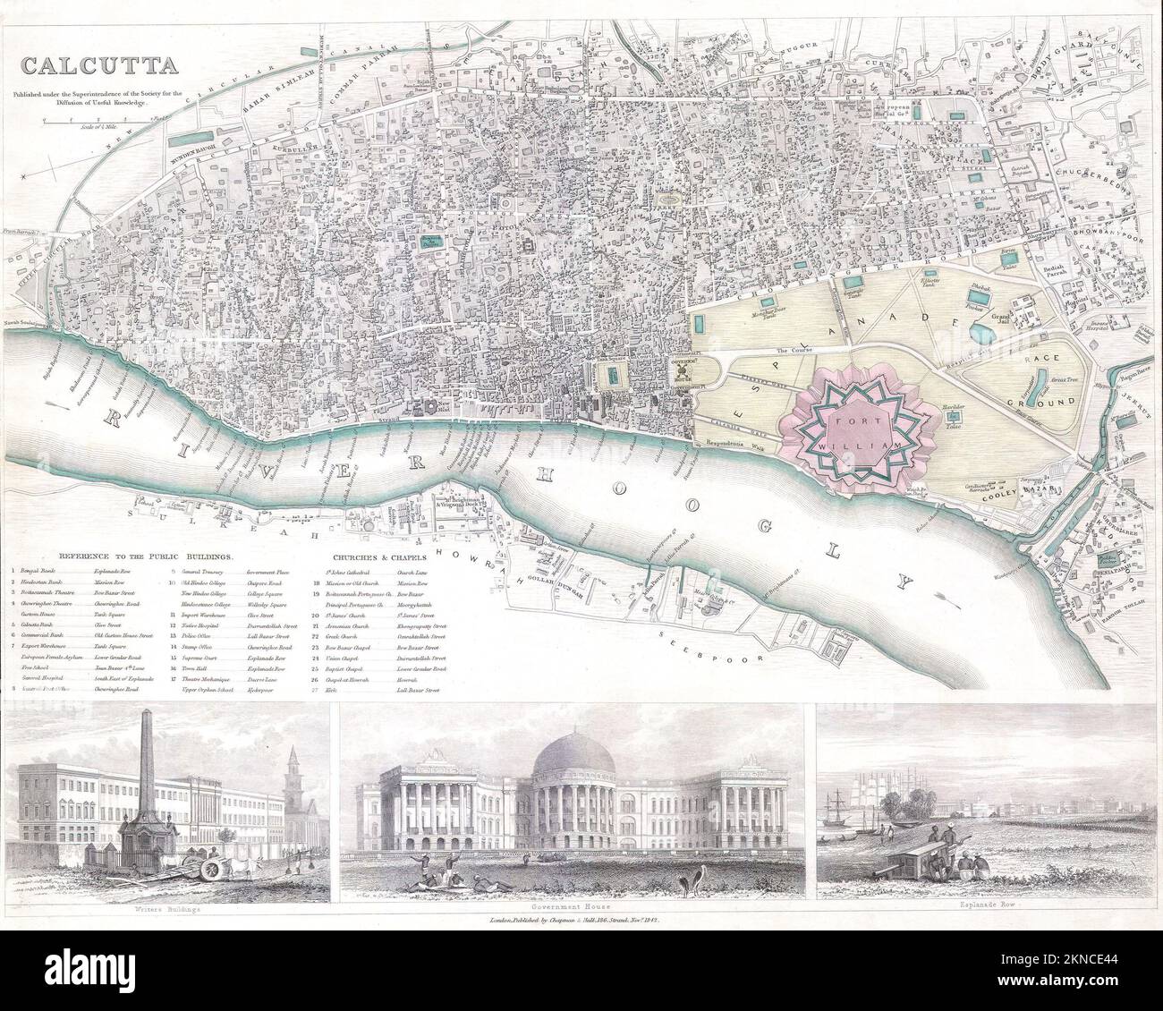 Vintage city plan of Calcutta and area around it from 19th century. Maps are beautifully hand illustrated and engraved showing it at the time. Stock Photohttps://www.alamy.com/image-license-details/?v=1https://www.alamy.com/vintage-city-plan-of-calcutta-and-area-around-it-from-19th-century-maps-are-beautifully-hand-illustrated-and-engraved-showing-it-at-the-time-image495072596.html
RF2KNCE44–Vintage city plan of Calcutta and area around it from 19th century. Maps are beautifully hand illustrated and engraved showing it at the time.
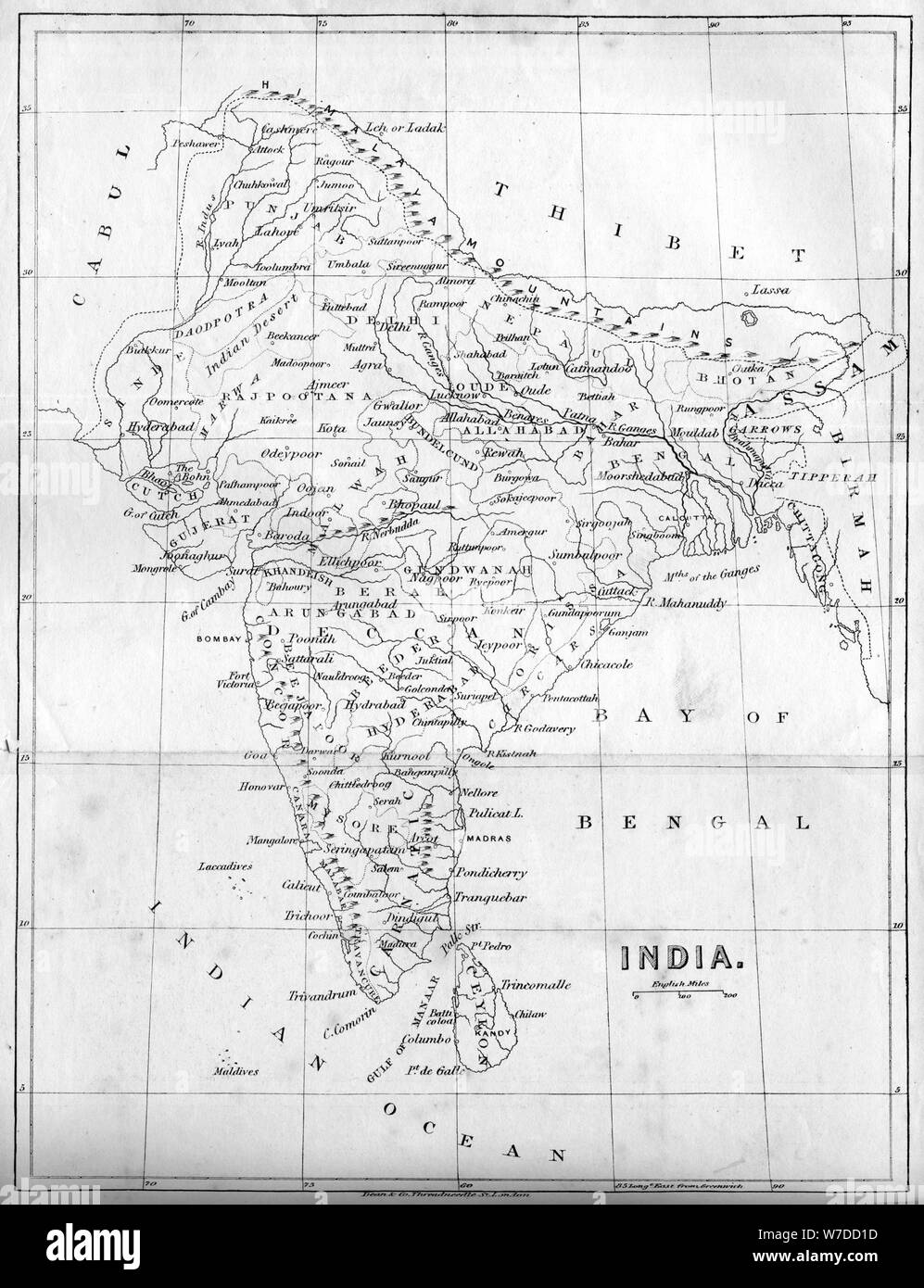 Map of India, 1847. Artist: Unknown Stock Photohttps://www.alamy.com/image-license-details/?v=1https://www.alamy.com/map-of-india-1847-artist-unknown-image262753721.html
RMW7DD1D–Map of India, 1847. Artist: Unknown
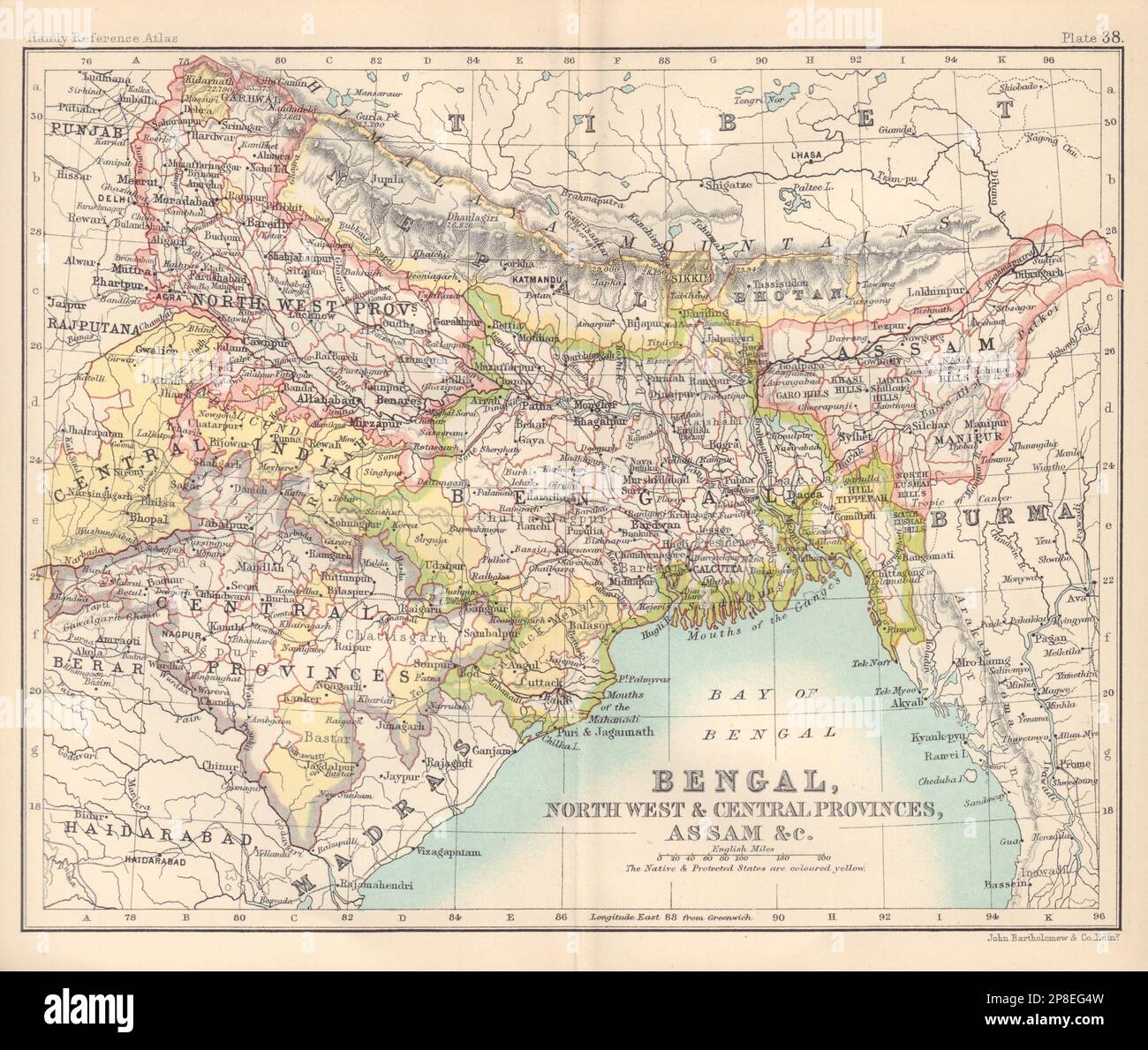 NE British India. Bengal, Central Provinces, Assam, &c. BARTHOLOMEW 1898 map Stock Photohttps://www.alamy.com/image-license-details/?v=1https://www.alamy.com/ne-british-india-bengal-central-provinces-assam-c-bartholomew-1898-map-image538758665.html
RF2P8EG4W–NE British India. Bengal, Central Provinces, Assam, &c. BARTHOLOMEW 1898 map
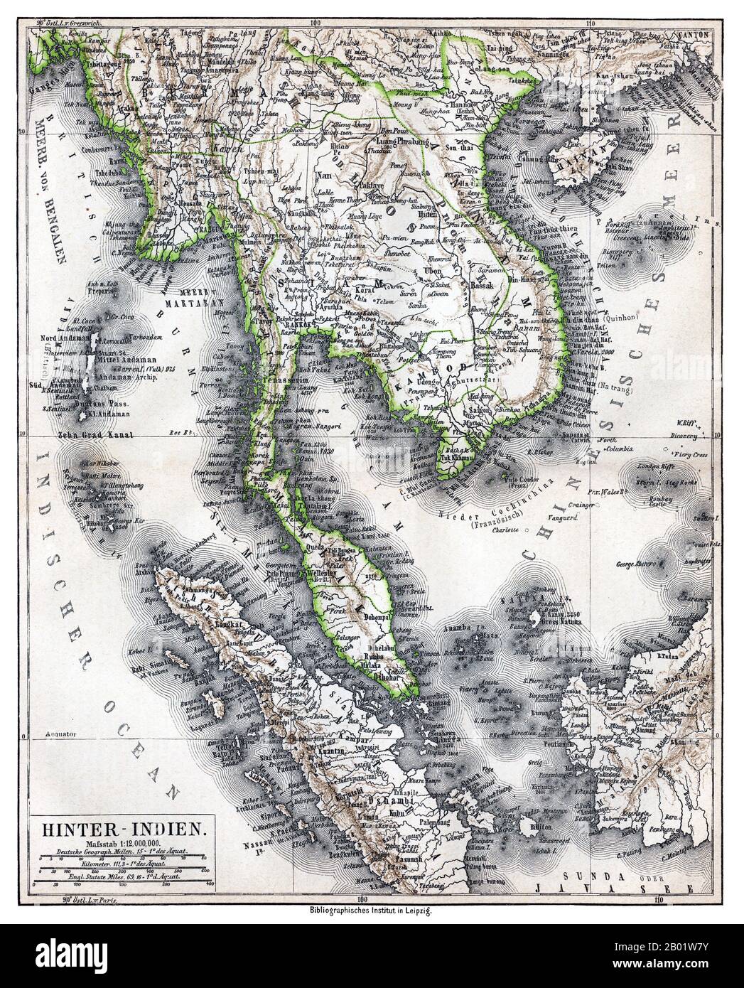 Southeast Asia: 'Hinter-Indien' ('Further India'), a map of Greater Indochina and the western part of the Malay-Indonesian Archipelago, Bibliographisches Institut in Leipzig, Germany, 1876. Physical map showing approximate political frontiers in Green. The Shan and Lao states are shown independent of (or tributary to) Siam. Chiang Mai ('Tshien-Mai'and Luang Prabang are both shown lying within the frontiers of a greater Siam,, but the territoryy of Chiang Mai extends further to the northwest, into Burma's Shan State, beyond the Salween River, than it does today. Stock Photohttps://www.alamy.com/image-license-details/?v=1https://www.alamy.com/southeast-asia-hinter-indien-further-india-a-map-of-greater-indochina-and-the-western-part-of-the-malay-indonesian-archipelago-bibliographisches-institut-in-leipzig-germany-1876-physical-map-showing-approximate-political-frontiers-in-green-the-shan-and-lao-states-are-shown-independent-of-or-tributary-to-siam-chiang-mai-tshien-maiand-luang-prabang-are-both-shown-lying-within-the-frontiers-of-a-greater-siam-but-the-territoryy-of-chiang-mai-extends-further-to-the-northwest-into-burmas-shan-state-beyond-the-salween-river-than-it-does-today-image344249135.html
RM2B01W7Y–Southeast Asia: 'Hinter-Indien' ('Further India'), a map of Greater Indochina and the western part of the Malay-Indonesian Archipelago, Bibliographisches Institut in Leipzig, Germany, 1876. Physical map showing approximate political frontiers in Green. The Shan and Lao states are shown independent of (or tributary to) Siam. Chiang Mai ('Tshien-Mai'and Luang Prabang are both shown lying within the frontiers of a greater Siam,, but the territoryy of Chiang Mai extends further to the northwest, into Burma's Shan State, beyond the Salween River, than it does today.
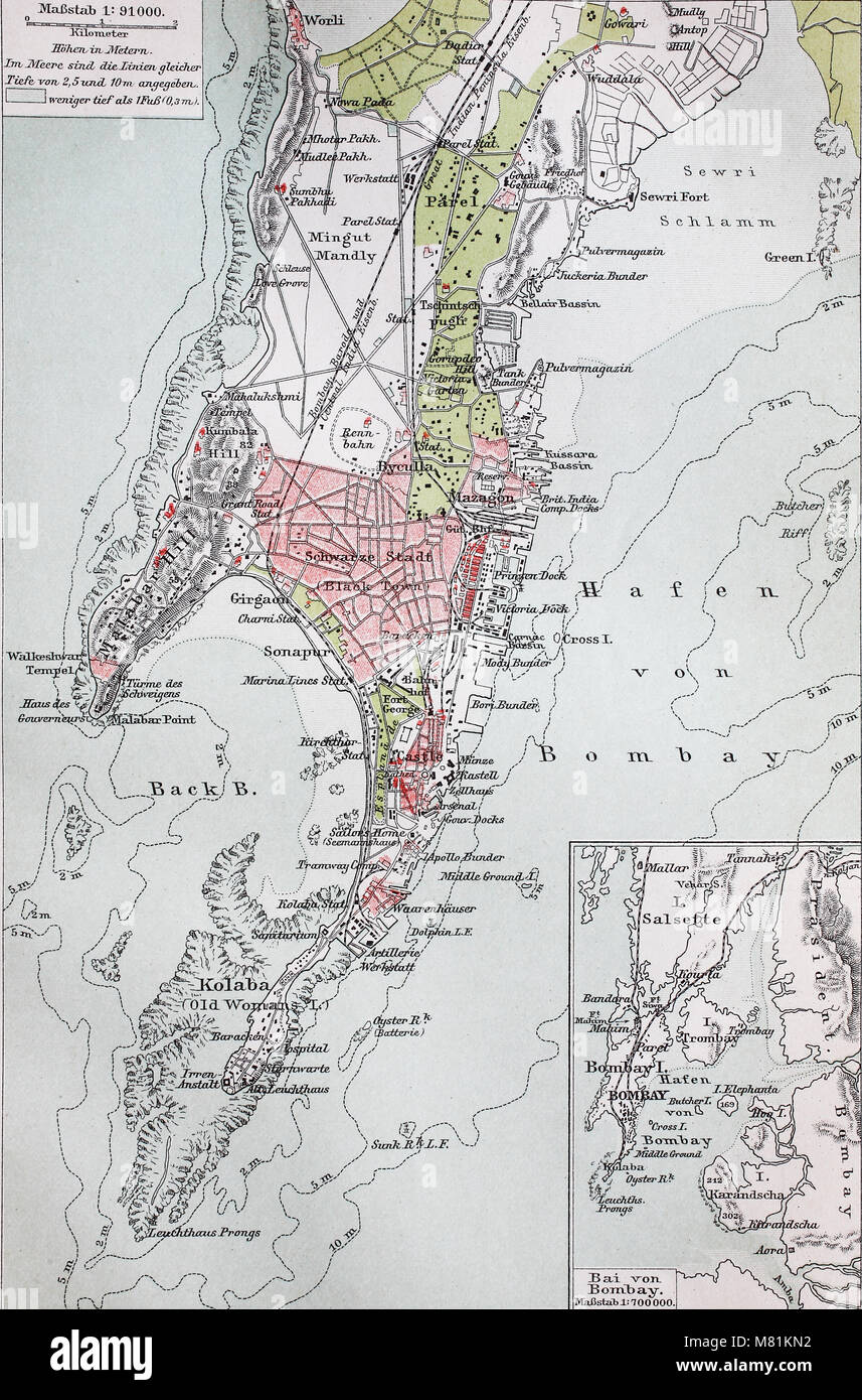 city map from the year 1892: Bombay, now Mumbai, India, digital improved reproduction of an original print from the year 1895 Stock Photohttps://www.alamy.com/image-license-details/?v=1https://www.alamy.com/stock-photo-city-map-from-the-year-1892-bombay-now-mumbai-india-digital-improved-177058366.html
RFM81KN2–city map from the year 1892: Bombay, now Mumbai, India, digital improved reproduction of an original print from the year 1895
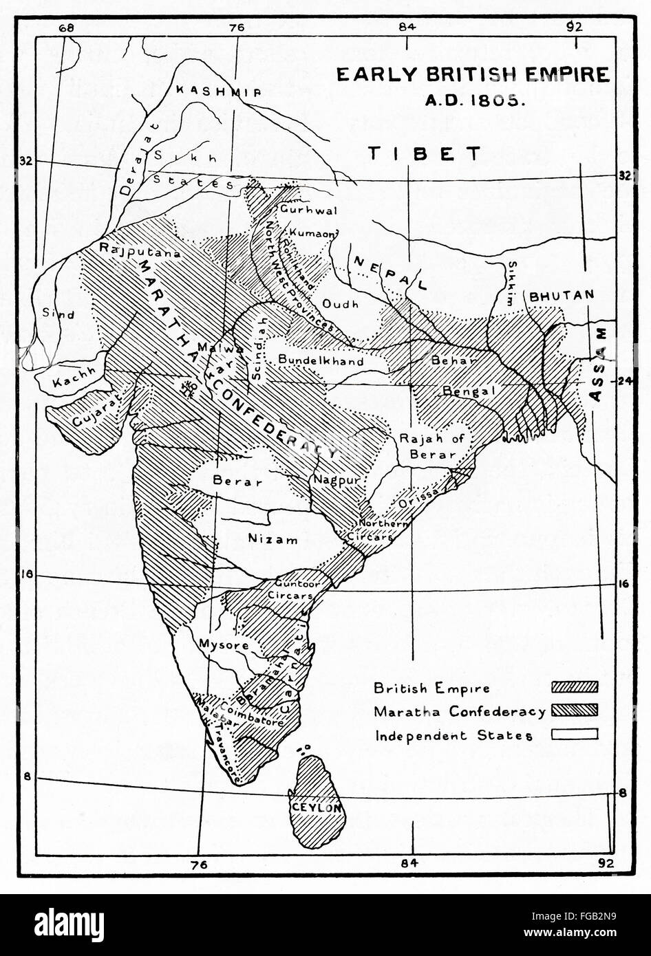 Map showing areas controlled by British in India and Ceylon, 1805. Stock Photohttps://www.alamy.com/image-license-details/?v=1https://www.alamy.com/stock-photo-map-showing-areas-controlled-by-british-in-india-and-ceylon-1805-96129973.html
RMFGB2N9–Map showing areas controlled by British in India and Ceylon, 1805.
 East India Islands map, 19th century engraving Stock Photohttps://www.alamy.com/image-license-details/?v=1https://www.alamy.com/stock-photo-east-india-islands-map-19th-century-engraving-77459194.html
RMEE0FYP–East India Islands map, 19th century engraving
 Map of Himalaya region of Asia, 1870s. Color lithograph Stock Photohttps://www.alamy.com/image-license-details/?v=1https://www.alamy.com/map-of-himalaya-region-of-asia-1870s-color-lithograph-image60596199.html
RMDEGB1Y–Map of Himalaya region of Asia, 1870s. Color lithograph
 Ancient 19th century map of 'Modern' Palestine from the book Palestine illustrated by Sir Richard Temple, 1st Baronet, GCSI, CIE, PC, FRS (8 March 1826 – 15 March 1902) was an administrator in British India and a British politician. Published in London by W.H. Allen & Co. in 1888 Stock Photohttps://www.alamy.com/image-license-details/?v=1https://www.alamy.com/ancient-19th-century-map-of-modern-palestine-from-the-book-palestine-illustrated-by-sir-richard-temple-1st-baronet-gcsi-cie-pc-frs-8-march-1826-15-march-1902-was-an-administrator-in-british-india-and-a-british-politician-published-in-london-by-wh-allen-co-in-1888-image376532382.html
RM2CTGEW2–Ancient 19th century map of 'Modern' Palestine from the book Palestine illustrated by Sir Richard Temple, 1st Baronet, GCSI, CIE, PC, FRS (8 March 1826 – 15 March 1902) was an administrator in British India and a British politician. Published in London by W.H. Allen & Co. in 1888
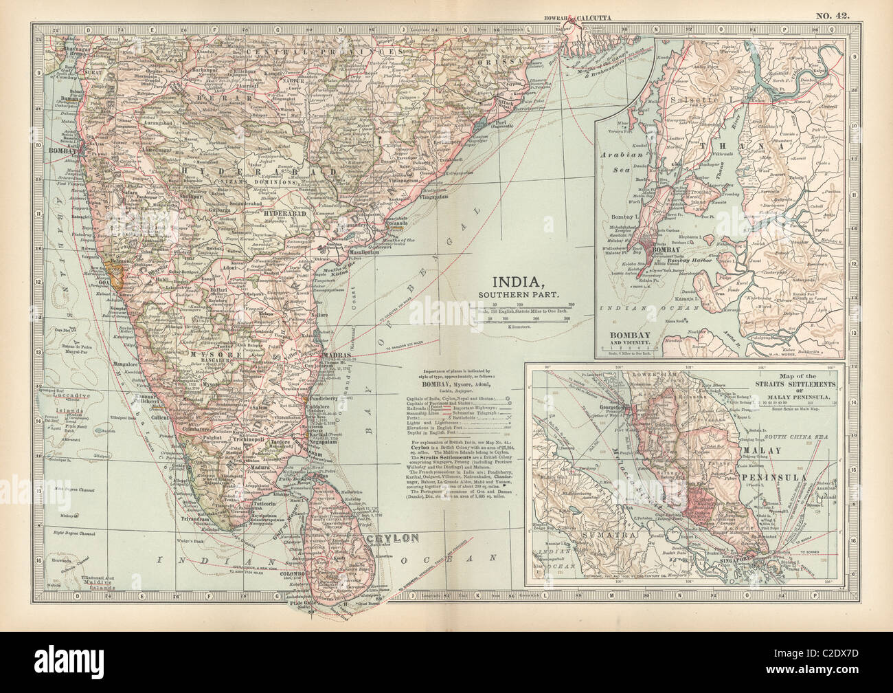 Map of southern India with Bombay Stock Photohttps://www.alamy.com/image-license-details/?v=1https://www.alamy.com/stock-photo-map-of-southern-india-with-bombay-35956017.html
RMC2DX7D–Map of southern India with Bombay
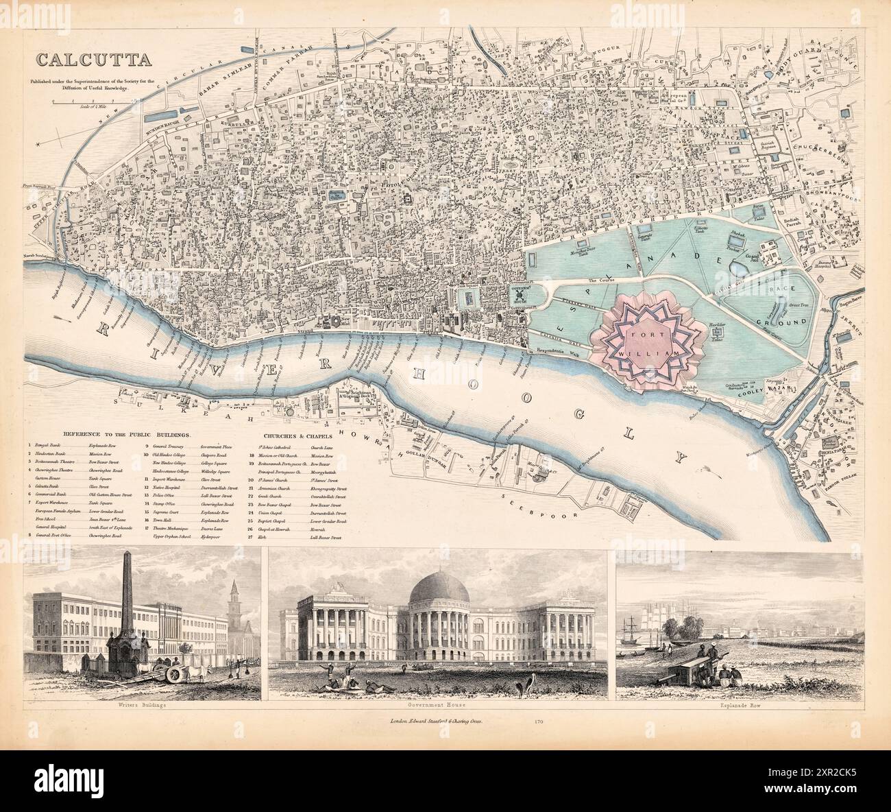 Vintage Pictorial Map of the city of Calcutta, India. by Society for the Diffusion of Useful Knowledge (Great Britain), 1859 Stock Photohttps://www.alamy.com/image-license-details/?v=1https://www.alamy.com/vintage-pictorial-map-of-the-city-of-calcutta-india-by-society-for-the-diffusion-of-useful-knowledge-great-britain-1859-image616553817.html
RM2XR2CK5–Vintage Pictorial Map of the city of Calcutta, India. by Society for the Diffusion of Useful Knowledge (Great Britain), 1859
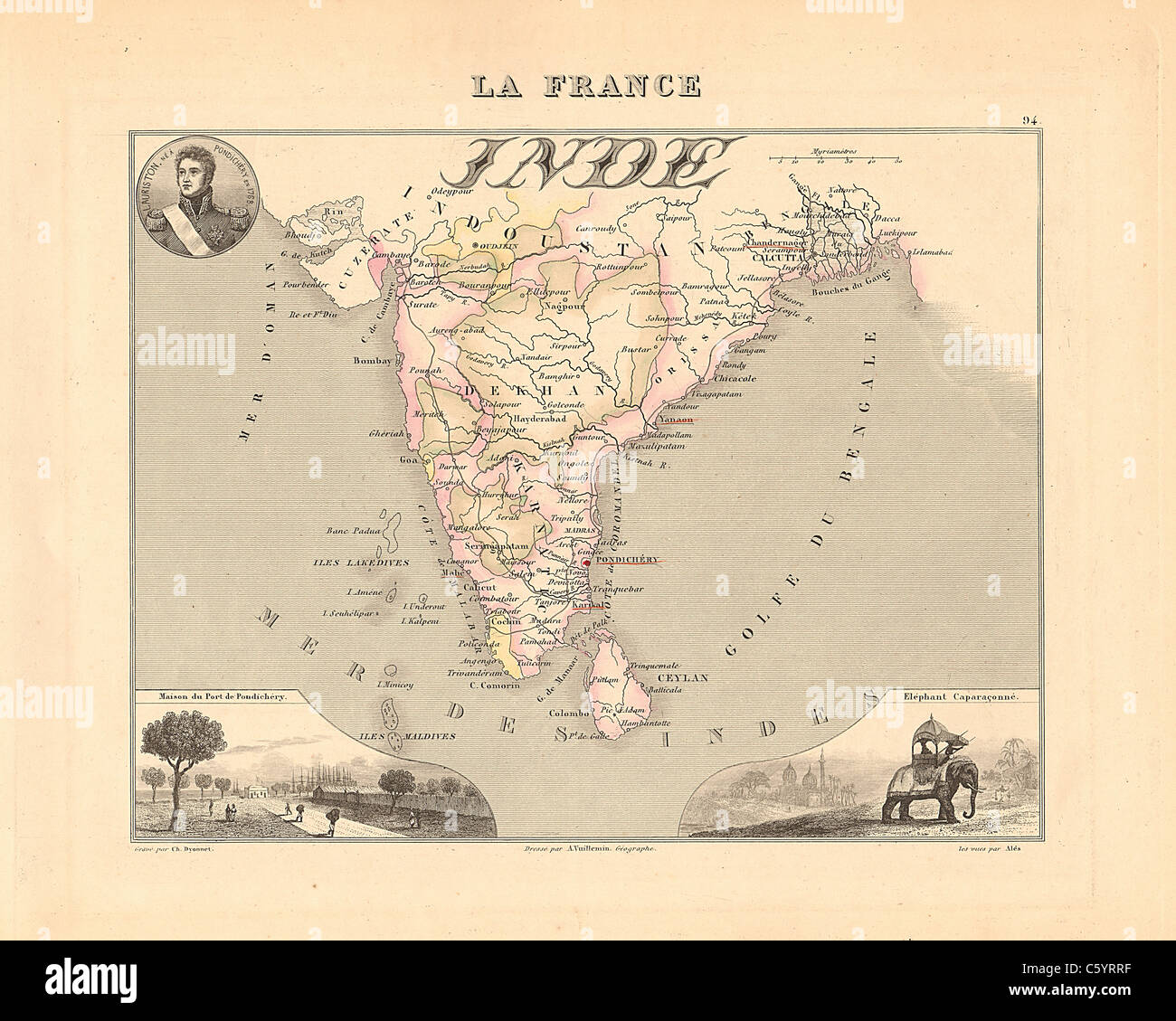 Inde (India) - Antiquarian Map from an 1858 French Atlas 'France and its Colonies' (La France et ses Colonies ) by Alexandre Vuillemin Stock Photohttps://www.alamy.com/image-license-details/?v=1https://www.alamy.com/stock-photo-inde-india-antiquarian-map-from-an-1858-french-atlas-france-and-its-38105411.html
RFC5YRRF–Inde (India) - Antiquarian Map from an 1858 French Atlas 'France and its Colonies' (La France et ses Colonies ) by Alexandre Vuillemin
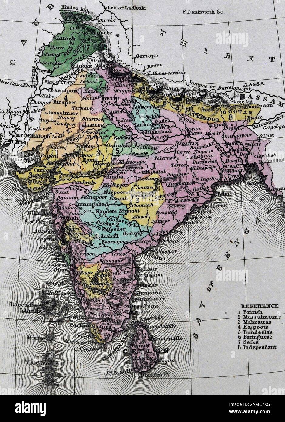 1834 Carey Map India Bombay Calcutta Delhi Ceylon Goa Madras Nepal Tibet Stock Photohttps://www.alamy.com/image-license-details/?v=1https://www.alamy.com/1834-carey-map-india-bombay-calcutta-delhi-ceylon-goa-madras-nepal-tibet-image339559768.html
RF2AMC7XG–1834 Carey Map India Bombay Calcutta Delhi Ceylon Goa Madras Nepal Tibet
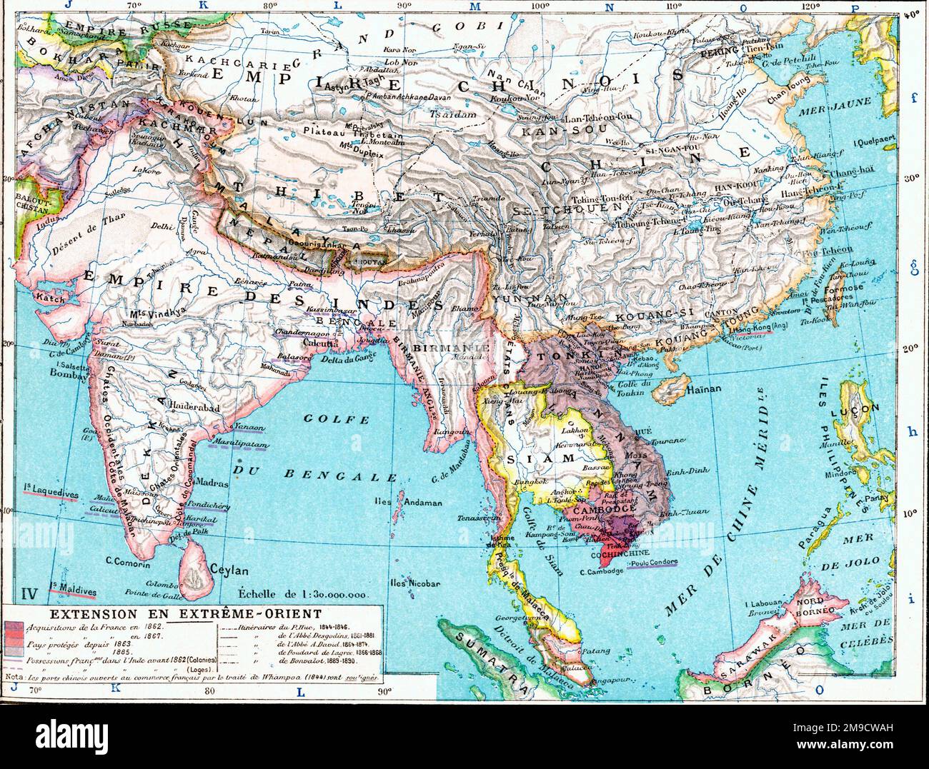 19th century Map of the Far East, Asia and India Stock Photohttps://www.alamy.com/image-license-details/?v=1https://www.alamy.com/19th-century-map-of-the-far-east-asia-and-india-image504915897.html
RM2M9CWAH–19th century Map of the Far East, Asia and India
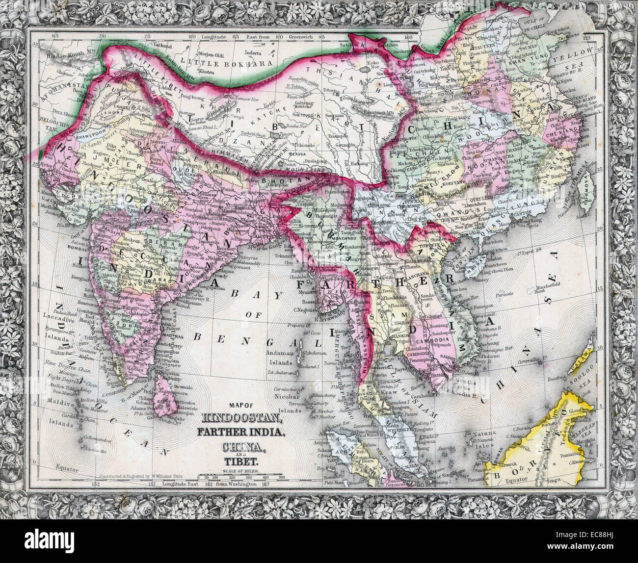 Mitchell Map of India, Tibet, China and Southeast Asia. Dated 1864 Stock Photohttps://www.alamy.com/image-license-details/?v=1https://www.alamy.com/stock-photo-mitchell-map-of-india-tibet-china-and-southeast-asia-dated-1864-76399726.html
RMEC88HJ–Mitchell Map of India, Tibet, China and Southeast Asia. Dated 1864
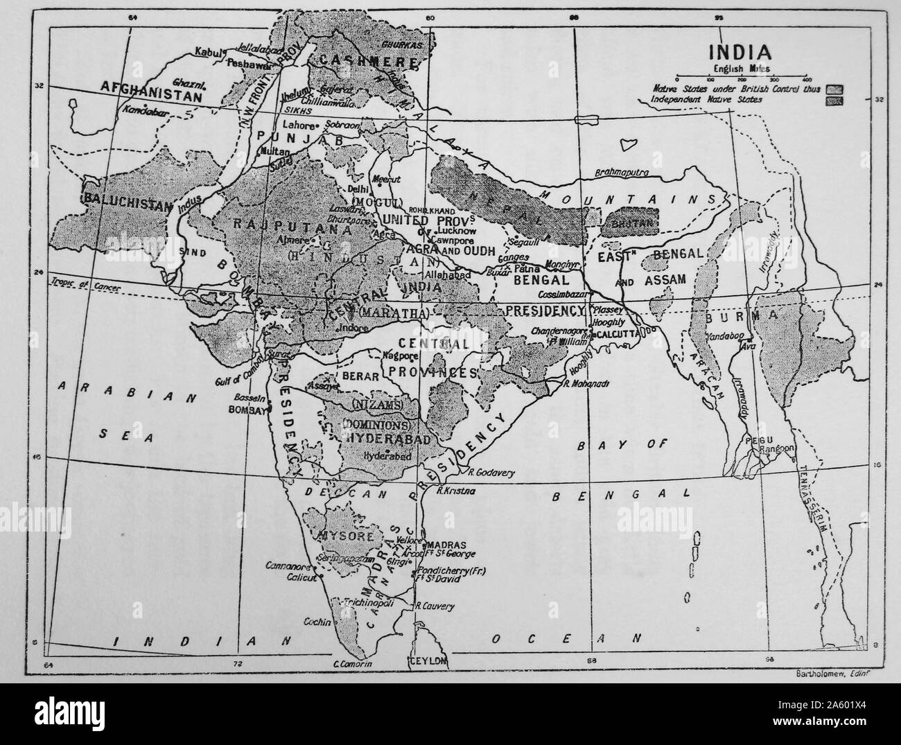 Map showing the British Control over India. Dated 19th Century Stock Photohttps://www.alamy.com/image-license-details/?v=1https://www.alamy.com/map-showing-the-british-control-over-india-dated-19th-century-image330686444.html
RM2A601X4–Map showing the British Control over India. Dated 19th Century
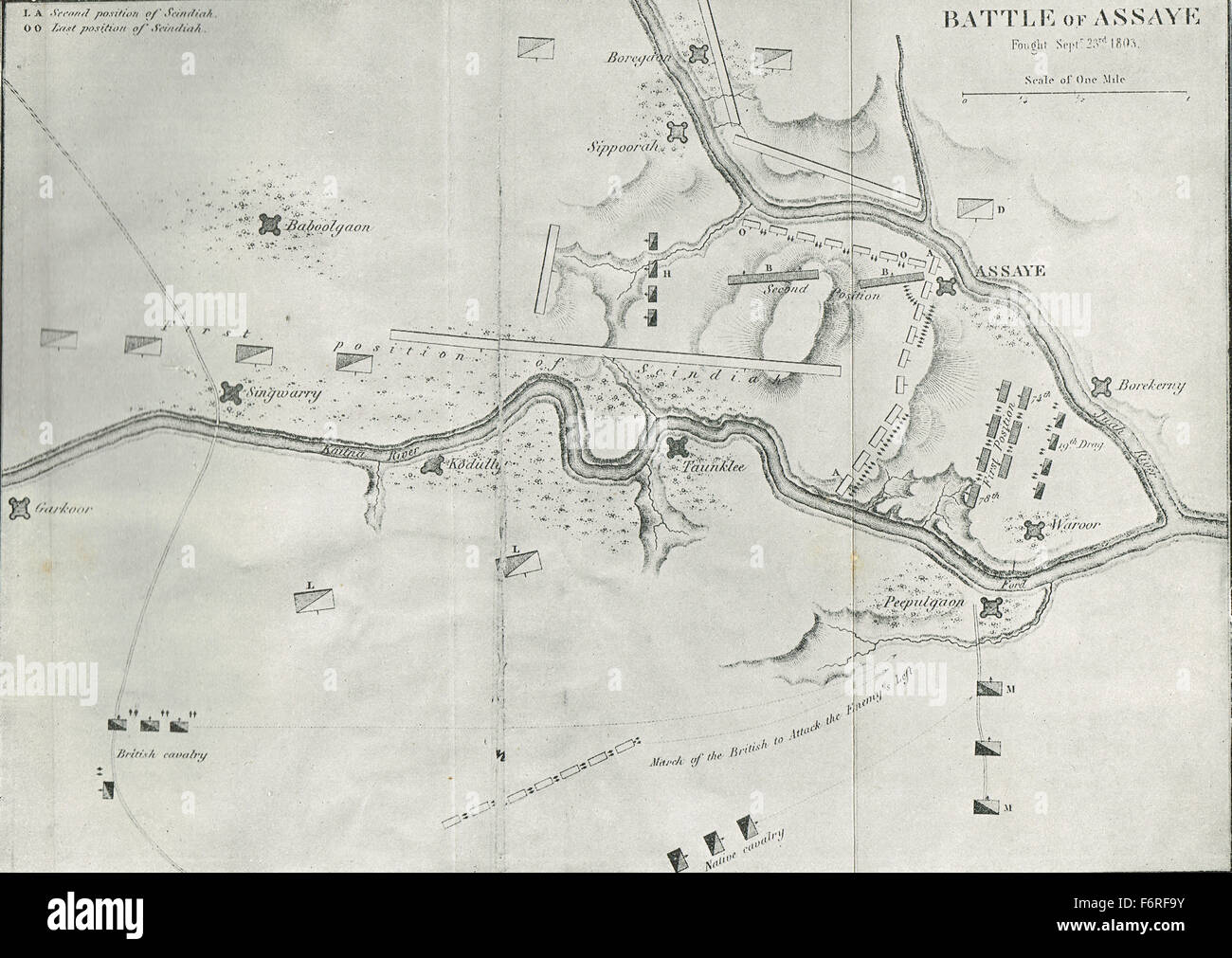 Sketch map Battle of Assaye India 1803 Stock Photohttps://www.alamy.com/image-license-details/?v=1https://www.alamy.com/stock-photo-sketch-map-battle-of-assaye-india-1803-90256711.html
RMF6RF9Y–Sketch map Battle of Assaye India 1803
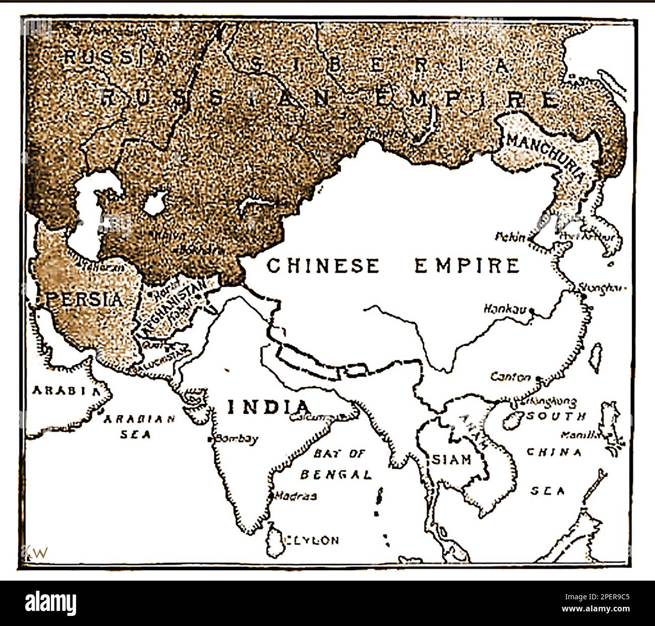 An 1892 map showing the advance of Russian forces on India. (In the 19th century Russia wanted to take India from British control?, a pan only defeated following the assassination of Russian Emperor Paul I -- Карта 1892 года, показывающая продвижение русских войск на Индию. (В 19-м веке Россия хотела отвести Индию из-под британского контроля?, пан побежден только по1892 ----का एक नक्शा जो भारत पर रूसी सेना की प्रगति को दर्शाता है। उल आई -сле убийства российского -- императора Павла I..-----1892 کا ایک نقشہ جس میں ہندوستان پر روسی افواج کی پیش قدمی کو دکھایا گیا ہے۔ میں -- Stock Photohttps://www.alamy.com/image-license-details/?v=1https://www.alamy.com/an-1892-map-showing-the-advance-of-russian-forces-on-india-in-the-19th-century-russia-wanted-to-take-india-from-british-control-a-pan-only-defeated-following-the-assassination-of-russian-emperor-paul-i-1892-19-1892-i-1892-image542638885.html
RM2PER9C5–An 1892 map showing the advance of Russian forces on India. (In the 19th century Russia wanted to take India from British control?, a pan only defeated following the assassination of Russian Emperor Paul I -- Карта 1892 года, показывающая продвижение русских войск на Индию. (В 19-м веке Россия хотела отвести Индию из-под британского контроля?, пан побежден только по1892 ----का एक नक्शा जो भारत पर रूसी सेना की प्रगति को दर्शाता है। उल आई -сле убийства российского -- императора Павла I..-----1892 کا ایک نقشہ جس میں ہندوستان پر روسی افواج کی پیش قدمی کو دکھایا گیا ہے۔ میں --
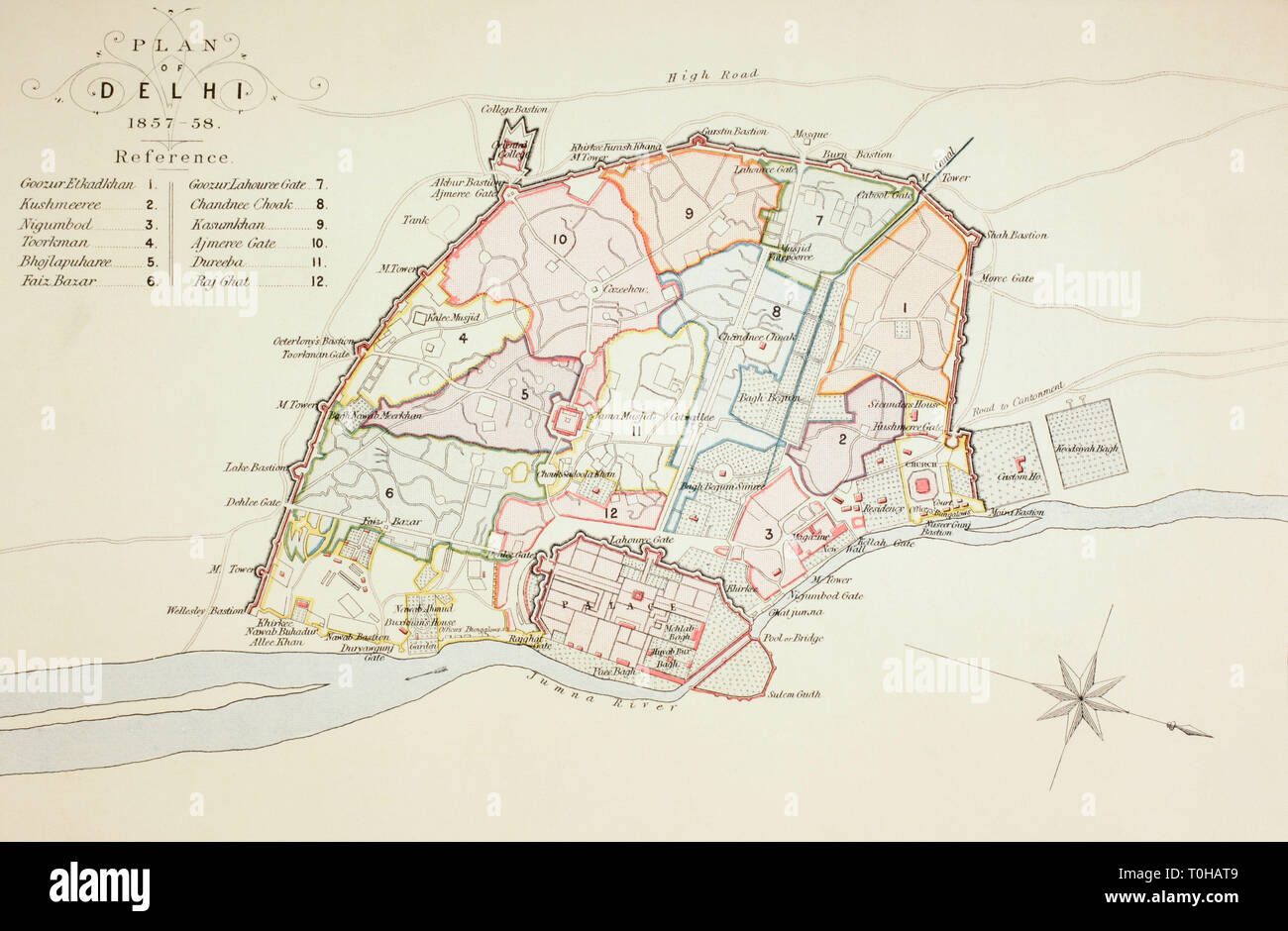 Plan of Delhi, India, Asia, 1857 Stock Photohttps://www.alamy.com/image-license-details/?v=1https://www.alamy.com/plan-of-delhi-india-asia-1857-image241326857.html
RMT0HAT9–Plan of Delhi, India, Asia, 1857
 Detail of a stamp from India celebrating the life of Nain Singh Rawat - Indian explorer and cartographer of the 19th century. Stock Photohttps://www.alamy.com/image-license-details/?v=1https://www.alamy.com/stock-photo-detail-of-a-stamp-from-india-celebrating-the-life-of-nain-singh-rawat-43829211.html
RMCF8GGY–Detail of a stamp from India celebrating the life of Nain Singh Rawat - Indian explorer and cartographer of the 19th century.
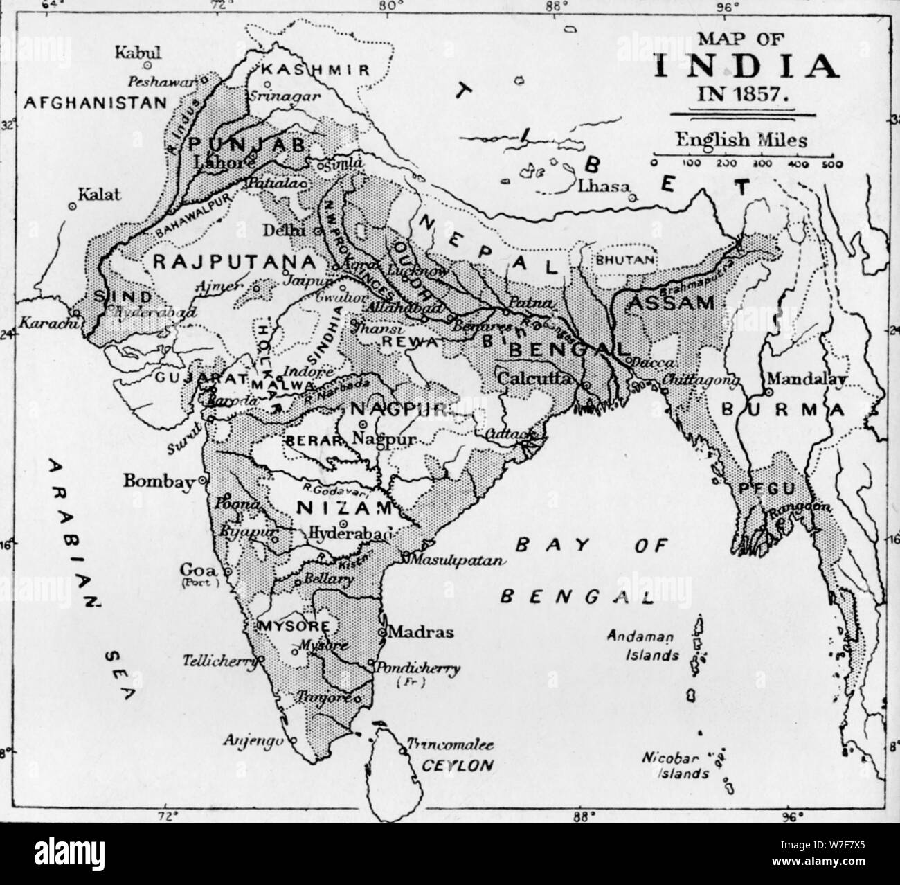 'Map of India in 1857', c1912. Artist: Unknown. Stock Photohttps://www.alamy.com/image-license-details/?v=1https://www.alamy.com/map-of-india-in-1857-c1912-artist-unknown-image262793613.html
RMW7F7X5–'Map of India in 1857', c1912. Artist: Unknown.
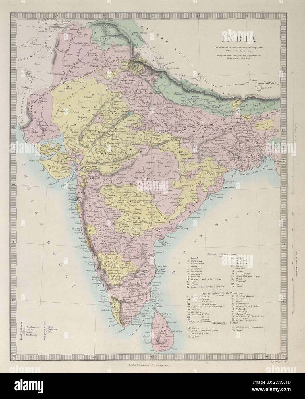 BRITISH INDIA British French Portuguese possessions/protectorates. SDUK 1857 map Stock Photohttps://www.alamy.com/image-license-details/?v=1https://www.alamy.com/british-india-british-french-portuguese-possessionsprotectorates-sduk-1857-map-image385038513.html
RF2DAC0FD–BRITISH INDIA British French Portuguese possessions/protectorates. SDUK 1857 map
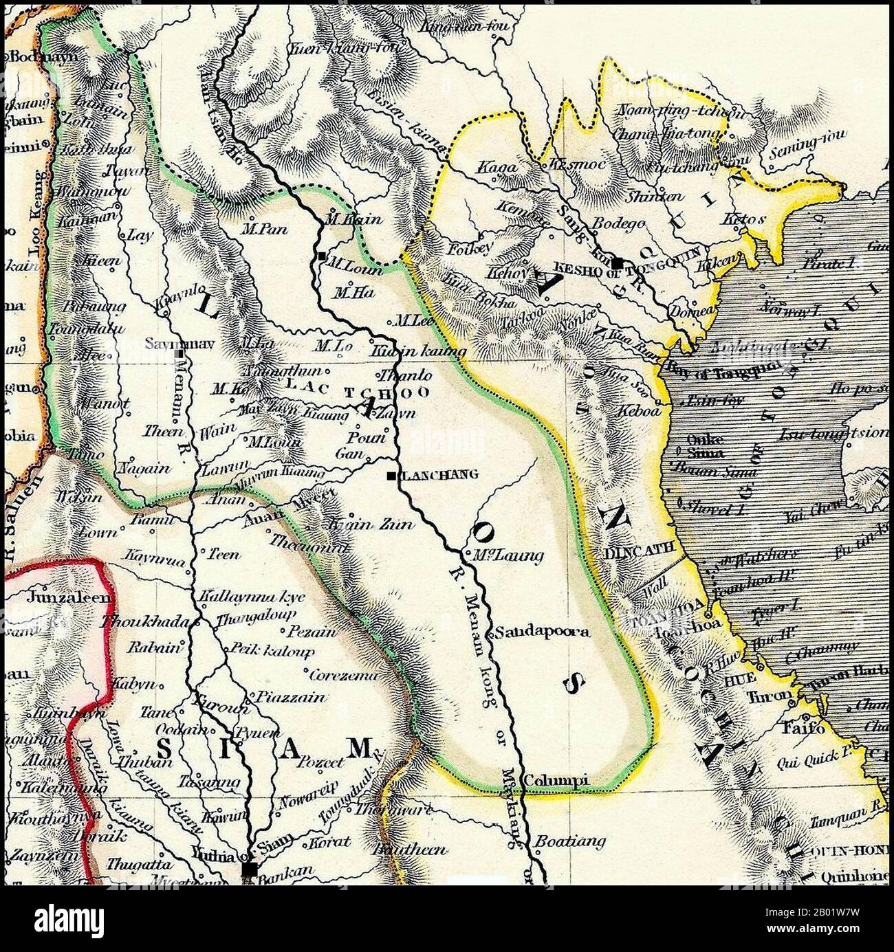 Thailand/Laos: Detail of a map of Siam, Laos and Tonkin, c. 1825. 'Laos' includes both the Lan Na Kingdom, with its capital at 'Saymamay' (Chiang Mai), and Laos, with its capital at 'Lanchang' (Vientiane). Detail of a British map dating from the early 19th century. Burma's Tenasserim Province (pink) is marked as being British and was seized by Britain after the First Anglo-Burmese War (1824-1826). The geography is very imperfect, the first British surveying teams into 'Laos Land' not being dispatched until the missions of McLeod and Richardson (1836-1837). Stock Photohttps://www.alamy.com/image-license-details/?v=1https://www.alamy.com/thailandlaos-detail-of-a-map-of-siam-laos-and-tonkin-c-1825-laos-includes-both-the-lan-na-kingdom-with-its-capital-at-saymamay-chiang-mai-and-laos-with-its-capital-at-lanchang-vientiane-detail-of-a-british-map-dating-from-the-early-19th-century-burmas-tenasserim-province-pink-is-marked-as-being-british-and-was-seized-by-britain-after-the-first-anglo-burmese-war-1824-1826-the-geography-is-very-imperfect-the-first-british-surveying-teams-into-laos-land-not-being-dispatched-until-the-missions-of-mcleod-and-richardson-1836-1837-image344249133.html
RM2B01W7W–Thailand/Laos: Detail of a map of Siam, Laos and Tonkin, c. 1825. 'Laos' includes both the Lan Na Kingdom, with its capital at 'Saymamay' (Chiang Mai), and Laos, with its capital at 'Lanchang' (Vientiane). Detail of a British map dating from the early 19th century. Burma's Tenasserim Province (pink) is marked as being British and was seized by Britain after the First Anglo-Burmese War (1824-1826). The geography is very imperfect, the first British surveying teams into 'Laos Land' not being dispatched until the missions of McLeod and Richardson (1836-1837).
 Map of Bantam War (approximately made in 17th Century) Stock Photohttps://www.alamy.com/image-license-details/?v=1https://www.alamy.com/map-of-bantam-war-approximately-made-in-17th-century-image599765192.html
RM2WRNJHC–Map of Bantam War (approximately made in 17th Century)
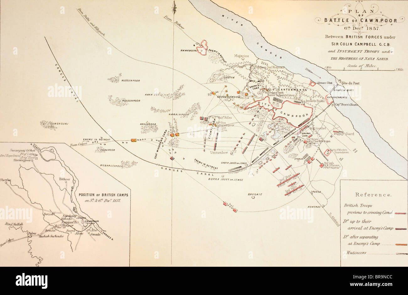 Plan of the Battle of Cawnpore, India,1857. Stock Photohttps://www.alamy.com/image-license-details/?v=1https://www.alamy.com/stock-photo-plan-of-the-battle-of-cawnpore-india1857-31561836.html
RMBR9NCC–Plan of the Battle of Cawnpore, India,1857.
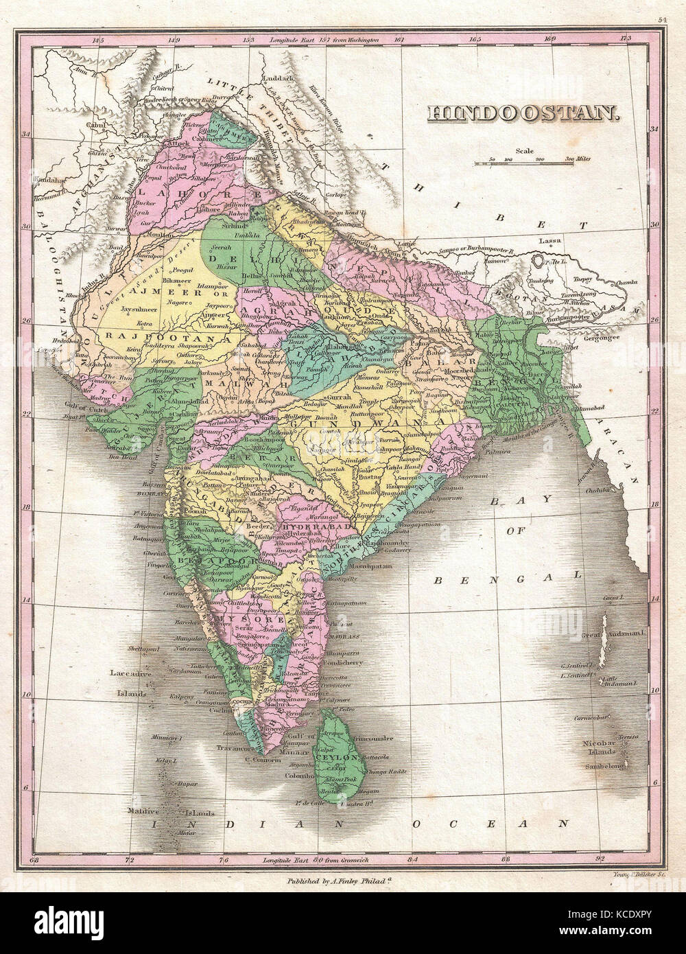 1827, Finley Map of India, Anthony Finley mapmaker of the United States in the 19th century Stock Photohttps://www.alamy.com/image-license-details/?v=1https://www.alamy.com/stock-image-1827-finley-map-of-india-anthony-finley-mapmaker-of-the-united-states-162575587.html
RMKCDXPY–1827, Finley Map of India, Anthony Finley mapmaker of the United States in the 19th century
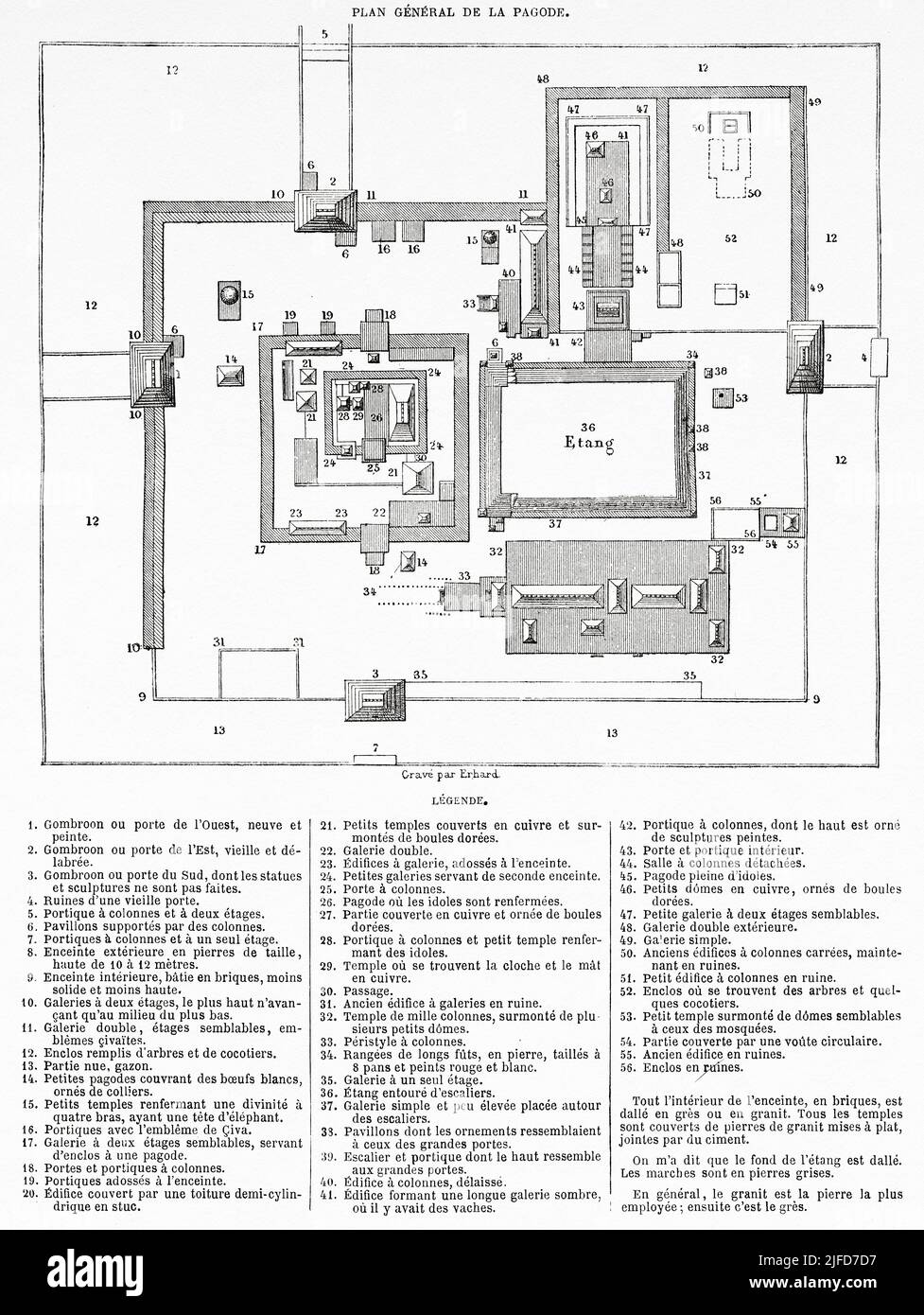 Old plan of Scillambaran pagoda. Pondicherry, India. The Scillambaran pagoda by Admiral Francois-Edmond 1838-1844 from Le Tour du Monde 1867 Stock Photohttps://www.alamy.com/image-license-details/?v=1https://www.alamy.com/old-plan-of-scillambaran-pagoda-pondicherry-india-the-scillambaran-pagoda-by-admiral-francois-edmond-1838-1844-from-le-tour-du-monde-1867-image474191011.html
RM2JFD7D7–Old plan of Scillambaran pagoda. Pondicherry, India. The Scillambaran pagoda by Admiral Francois-Edmond 1838-1844 from Le Tour du Monde 1867
 Ancient 19th century map of the City of jerusalem from the book Palestine illustrated by Sir Richard Temple, 1st Baronet, GCSI, CIE, PC, FRS (8 March 1826 – 15 March 1902) was an administrator in British India and a British politician. Published in London by W.H. Allen & Co. in 1888 Stock Photohttps://www.alamy.com/image-license-details/?v=1https://www.alamy.com/ancient-19th-century-map-of-the-city-of-jerusalem-from-the-book-palestine-illustrated-by-sir-richard-temple-1st-baronet-gcsi-cie-pc-frs-8-march-1826-15-march-1902-was-an-administrator-in-british-india-and-a-british-politician-published-in-london-by-wh-allen-co-in-1888-image376532672.html
RM2CTGF7C–Ancient 19th century map of the City of jerusalem from the book Palestine illustrated by Sir Richard Temple, 1st Baronet, GCSI, CIE, PC, FRS (8 March 1826 – 15 March 1902) was an administrator in British India and a British politician. Published in London by W.H. Allen & Co. in 1888
 Map of northern India with Calcutta Stock Photohttps://www.alamy.com/image-license-details/?v=1https://www.alamy.com/stock-photo-map-of-northern-india-with-calcutta-35956009.html
RMC2DX75–Map of northern India with Calcutta
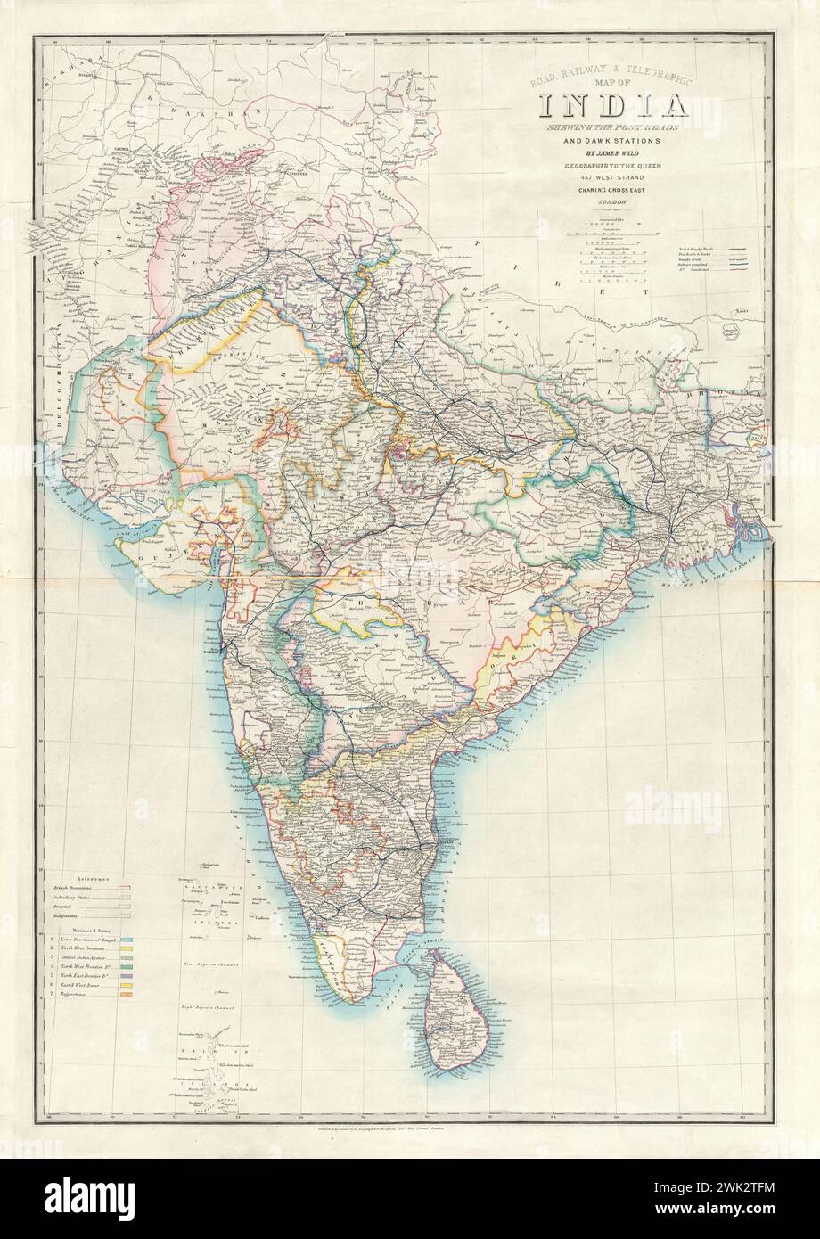 Road, railway & telegraphic map of India : shewing the post roads and dawk stations / by James Wyld, Geographer to the Queen. c1850 Stock Photohttps://www.alamy.com/image-license-details/?v=1https://www.alamy.com/road-railway-telegraphic-map-of-india-shewing-the-post-roads-and-dawk-stations-by-james-wyld-geographer-to-the-queen-c1850-image596894136.html
RM2WK2TFM–Road, railway & telegraphic map of India : shewing the post roads and dawk stations / by James Wyld, Geographer to the Queen. c1850
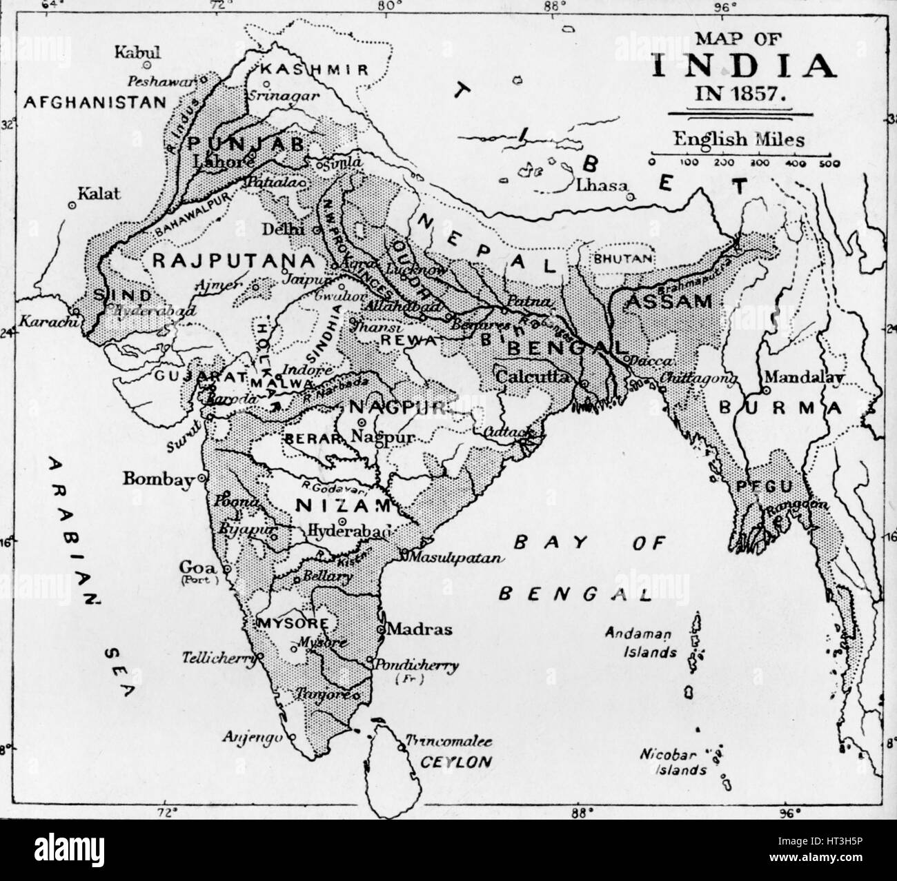 'Map of India in 1857', c1912. Artist: Unknown. Stock Photohttps://www.alamy.com/image-license-details/?v=1https://www.alamy.com/stock-photo-map-of-india-in-1857-c1912-artist-unknown-135303666.html
RMHT3H5P–'Map of India in 1857', c1912. Artist: Unknown.
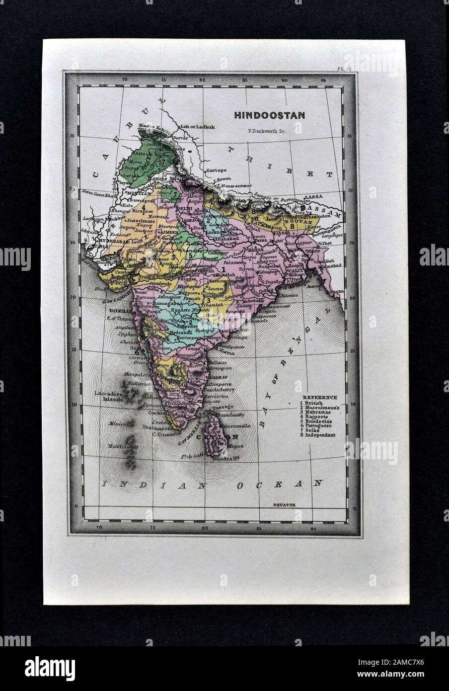 1834 Carey Map India Bombay Calcutta Delhi Ceylon Goa Madras Nepal Tibet Stock Photohttps://www.alamy.com/image-license-details/?v=1https://www.alamy.com/1834-carey-map-india-bombay-calcutta-delhi-ceylon-goa-madras-nepal-tibet-image339559758.html
RF2AMC7X6–1834 Carey Map India Bombay Calcutta Delhi Ceylon Goa Madras Nepal Tibet
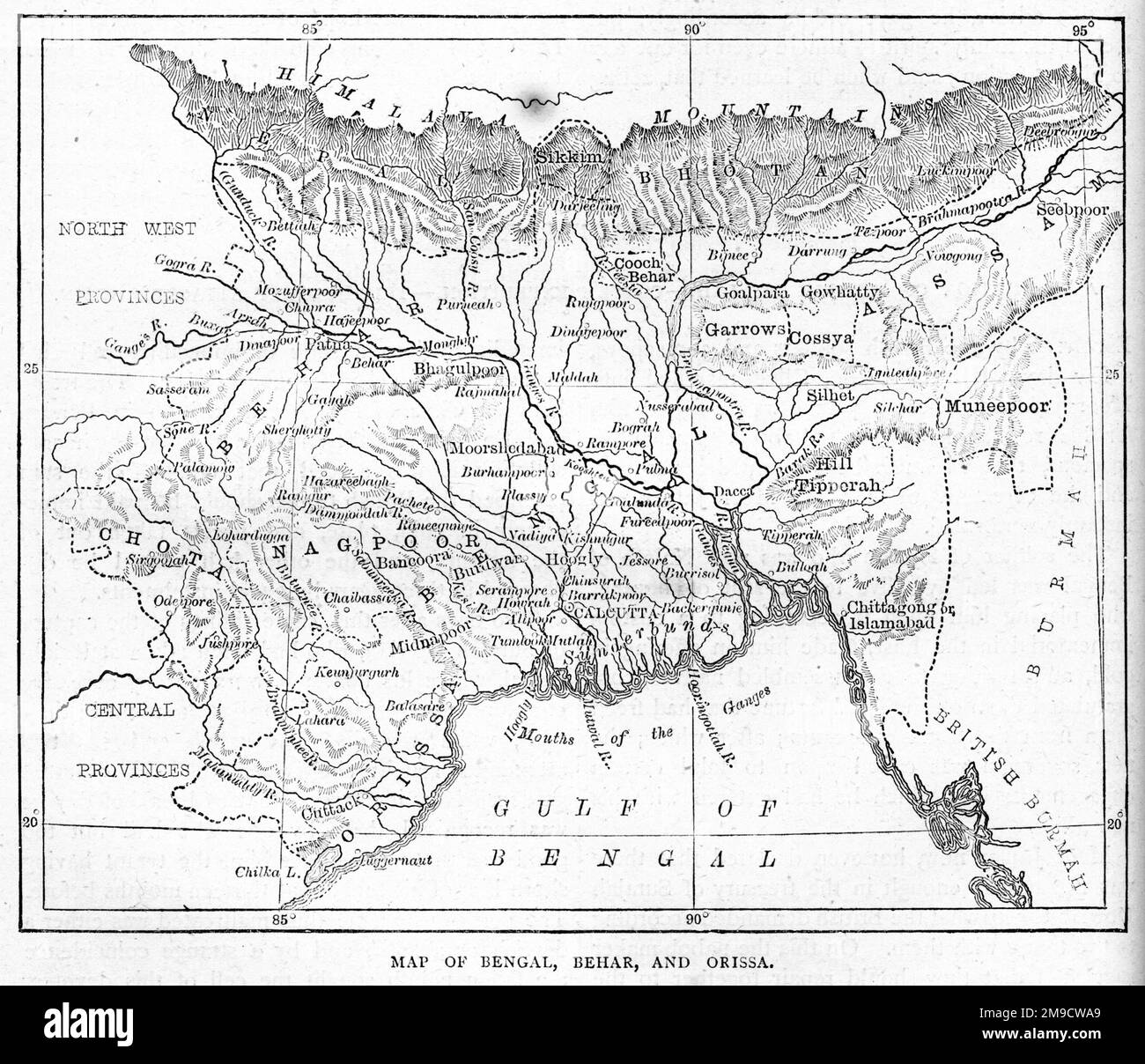 19th century Map of Bengal, Behar and Orissa in India Stock Photohttps://www.alamy.com/image-license-details/?v=1https://www.alamy.com/19th-century-map-of-bengal-behar-and-orissa-in-india-image504915889.html
RM2M9CWA9–19th century Map of Bengal, Behar and Orissa in India
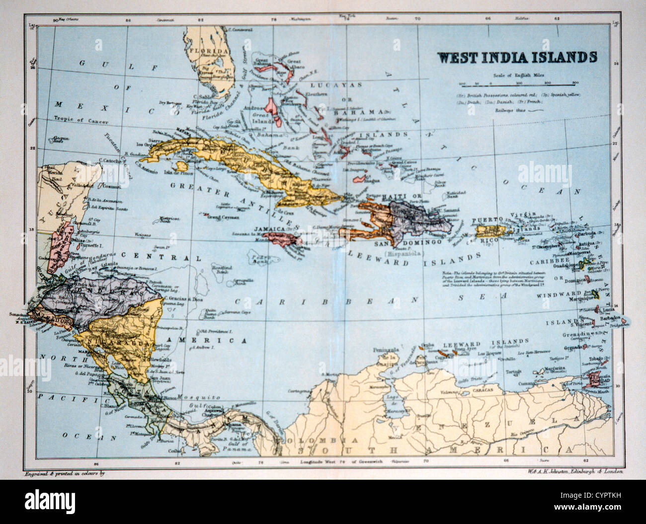 West India Islands, Historical Map, Circa 1893 Stock Photohttps://www.alamy.com/image-license-details/?v=1https://www.alamy.com/stock-photo-west-india-islands-historical-map-circa-1893-51518757.html
RMCYPTKH–West India Islands, Historical Map, Circa 1893
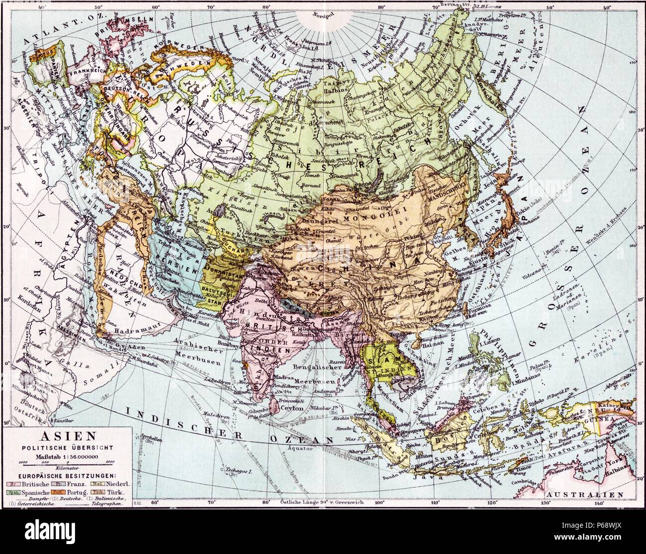 German map of Europe; Russia and Asia dated to 1890. The British India colony and Dutch East Indies are shown as well as The Russian Empire Stock Photohttps://www.alamy.com/image-license-details/?v=1https://www.alamy.com/german-map-of-europe-russia-and-asia-dated-to-1890-the-british-india-colony-and-dutch-east-indies-are-shown-as-well-as-the-russian-empire-image210408098.html
RMP68WJX–German map of Europe; Russia and Asia dated to 1890. The British India colony and Dutch East Indies are shown as well as The Russian Empire
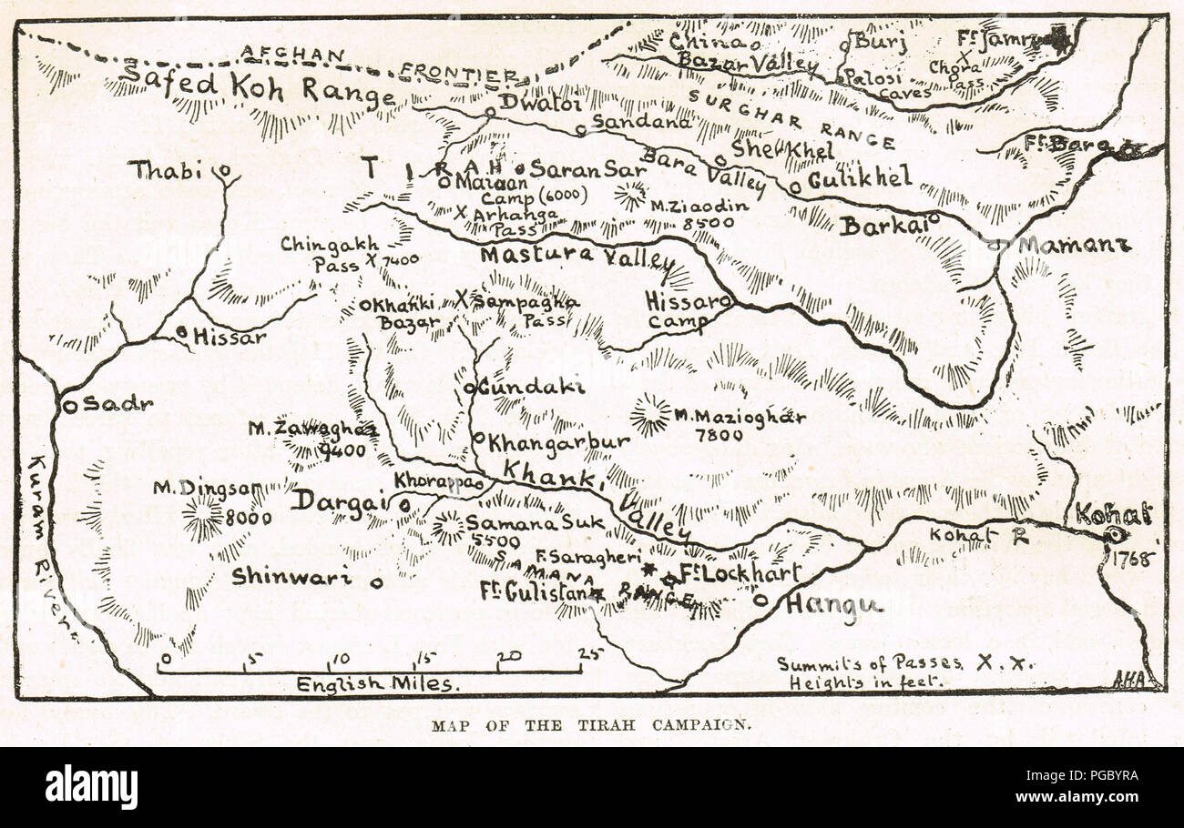 Map of the Tirah Campaign, also known as the Tirah Expedition, an Indian frontier war in 1897–1898 Stock Photohttps://www.alamy.com/image-license-details/?v=1https://www.alamy.com/map-of-the-tirah-campaign-also-known-as-the-tirah-expedition-an-indian-frontier-war-in-18971898-image216622206.html
RMPGBYRA–Map of the Tirah Campaign, also known as the Tirah Expedition, an Indian frontier war in 1897–1898
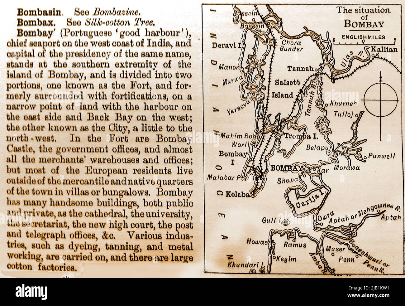 An 1893 encyclopaedia entry giving a map and description of Bombay (Mumbai), India, at that time with islands, rivers and distances in English miles. --------------- 1893 की एक विश्वकोश प्रविष्टि जिसमें बॉम्बे (मुंबई), भारत का नक्शा और विवरण दिया गया था, उस समय अंग्रेजी मील में द्वीपों, नदियों और दूरी के साथ। Stock Photohttps://www.alamy.com/image-license-details/?v=1https://www.alamy.com/an-1893-encyclopaedia-entry-giving-a-map-and-description-of-bombay-mumbai-india-at-that-time-with-islands-rivers-and-distances-in-english-miles-1893-image471478701.html
RM2JB1KW1–An 1893 encyclopaedia entry giving a map and description of Bombay (Mumbai), India, at that time with islands, rivers and distances in English miles. --------------- 1893 की एक विश्वकोश प्रविष्टि जिसमें बॉम्बे (मुंबई), भारत का नक्शा और विवरण दिया गया था, उस समय अंग्रेजी मील में द्वीपों, नदियों और दूरी के साथ।
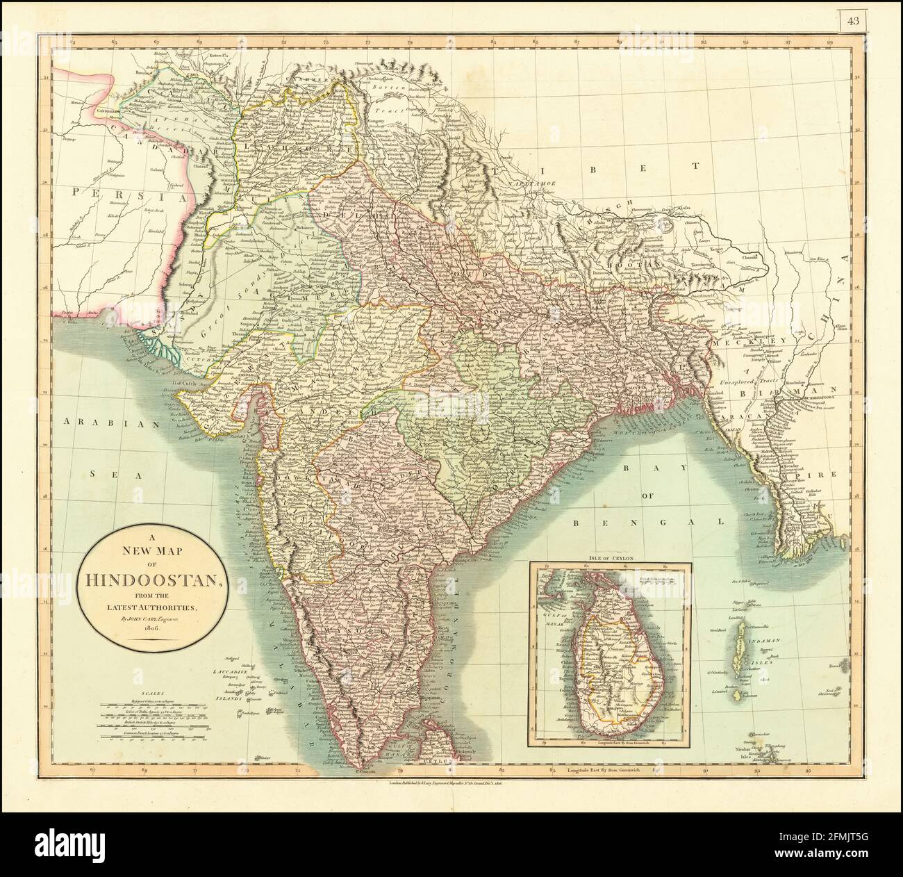 Vintage copper engraved map of India from 19th century. All maps are beautifully colored and illustrated showing the world at the time. Stock Photohttps://www.alamy.com/image-license-details/?v=1https://www.alamy.com/vintage-copper-engraved-map-of-india-from-19th-century-all-maps-are-beautifully-colored-and-illustrated-showing-the-world-at-the-time-image425756060.html
RF2FMJT5G–Vintage copper engraved map of India from 19th century. All maps are beautifully colored and illustrated showing the world at the time.
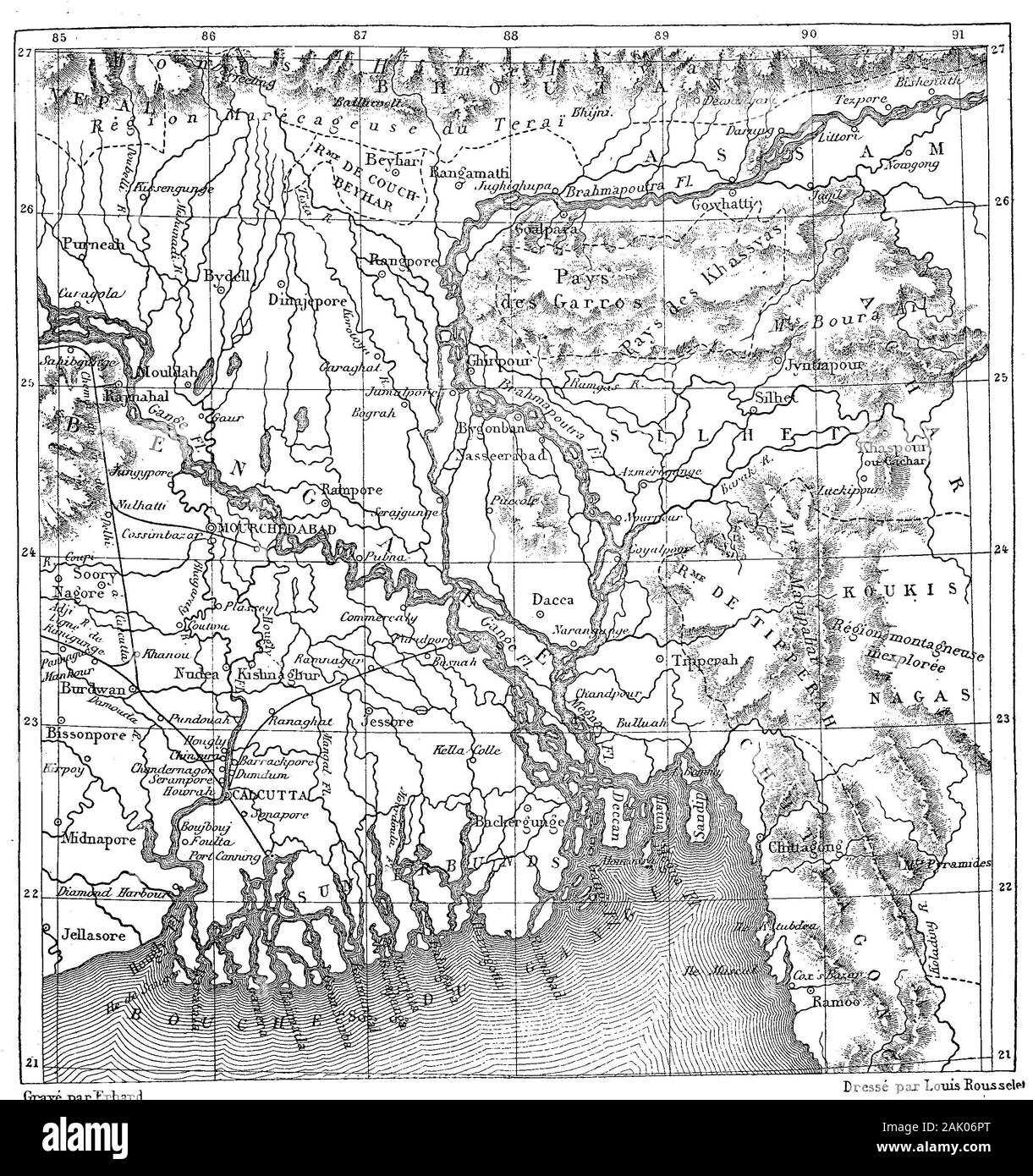 Historische Landkarte von Südindien mit dem Delta des Ganges, 1880 / Historical map of southern India with the Delta of the Ganges, 1880, Digitale Reproduktion von einer Originalvorlage aus dem 19. Jahrhundert / digital improved reproduction of an original print from the 19th century Stock Photohttps://www.alamy.com/image-license-details/?v=1https://www.alamy.com/historische-landkarte-von-sdindien-mit-dem-delta-des-ganges-1880-historical-map-of-southern-india-with-the-delta-of-the-ganges-1880-digitale-reproduktion-von-einer-originalvorlage-aus-dem-19-jahrhundert-digital-improved-reproduction-of-an-original-print-from-the-19th-century-image338680800.html
RF2AK06PT–Historische Landkarte von Südindien mit dem Delta des Ganges, 1880 / Historical map of southern India with the Delta of the Ganges, 1880, Digitale Reproduktion von einer Originalvorlage aus dem 19. Jahrhundert / digital improved reproduction of an original print from the 19th century
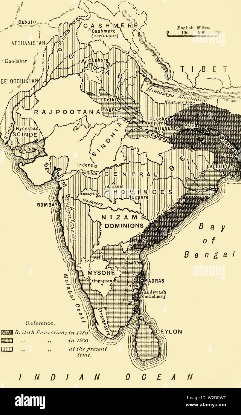 'Map of India, Showing the British Possessions in 1780,1800, and at the Present Time', 1890. Creator: Unknown. Stock Photohttps://www.alamy.com/image-license-details/?v=1https://www.alamy.com/map-of-india-showing-the-british-possessions-in-17801800-and-at-the-present-time-1890-creator-unknown-image259688964.html
RMW2DRWT–'Map of India, Showing the British Possessions in 1780,1800, and at the Present Time', 1890. Creator: Unknown.
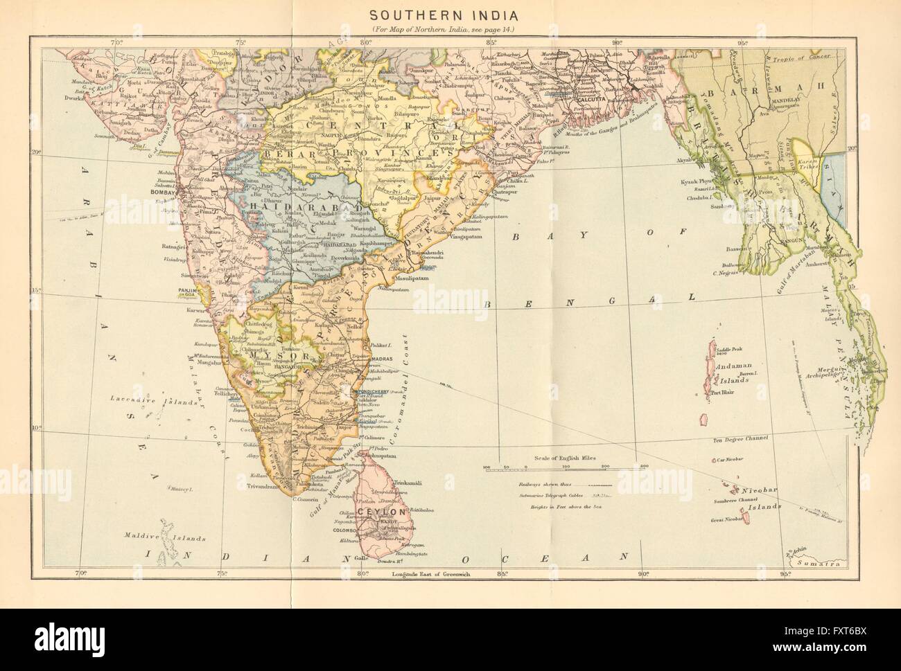 INDIA: South, c1885 antique map Stock Photohttps://www.alamy.com/image-license-details/?v=1https://www.alamy.com/stock-photo-india-south-c1885-antique-map-102564782.html
RFFXT6BX–INDIA: South, c1885 antique map
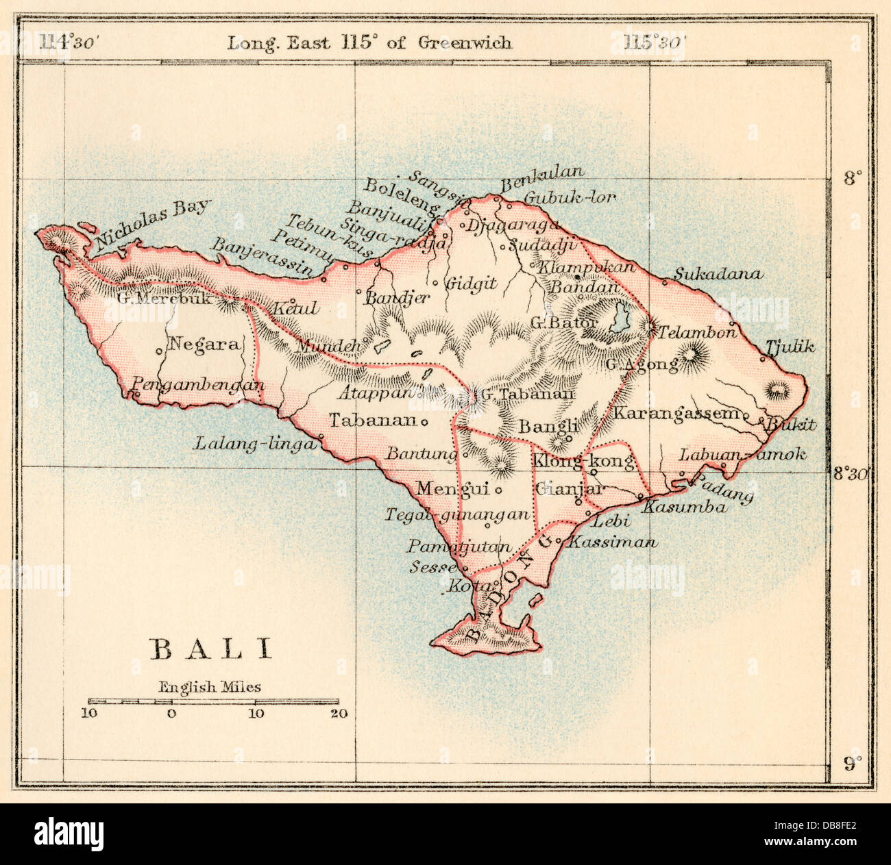 Map of Bali, 1870s. Color lithograph Stock Photohttps://www.alamy.com/image-license-details/?v=1https://www.alamy.com/stock-photo-map-of-bali-1870s-color-lithograph-58580090.html
RMDB8FE2–Map of Bali, 1870s. Color lithograph
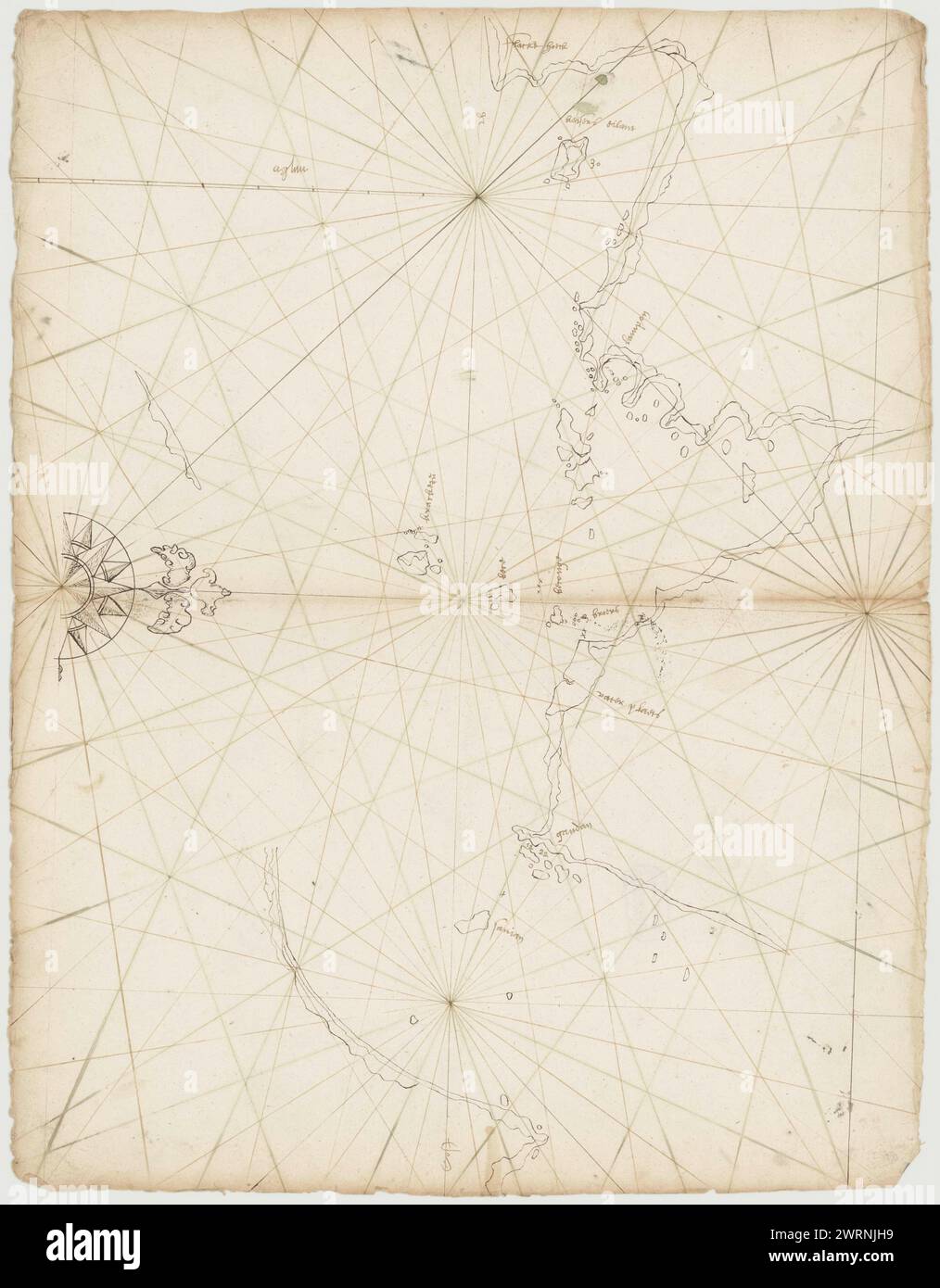 Portolans Map of Sunda Strait appr. made in 17th century. Stock Photohttps://www.alamy.com/image-license-details/?v=1https://www.alamy.com/portolans-map-of-sunda-strait-appr-made-in-17th-century-image599765189.html
RM2WRNJH9–Portolans Map of Sunda Strait appr. made in 17th century.
 . English: This hand colored map of India or Hindostan is a steel plate engraving, dating to 1855 by the well regarded mid 19th century American cartographer Colton. Map depicts most of what is today modern India and what was, when this map was made, British India. Also includes the province of Pegu or what is now Burma / Myanmar. India or Hindostan.. 1855. 1855 Colton Map of India or Hindostan - Geographicus - India-cbl-1855 Stock Photohttps://www.alamy.com/image-license-details/?v=1https://www.alamy.com/english-this-hand-colored-map-of-india-or-hindostan-is-a-steel-plate-engraving-dating-to-1855-by-the-well-regarded-mid-19th-century-american-cartographer-colton-map-depicts-most-of-what-is-today-modern-india-and-what-was-when-this-map-was-made-british-india-also-includes-the-province-of-pegu-or-what-is-now-burma-myanmar-india-or-hindostan-1855-1855-colton-map-of-india-or-hindostan-geographicus-india-cbl-1855-image184959677.html
RMMMWHXN–. English: This hand colored map of India or Hindostan is a steel plate engraving, dating to 1855 by the well regarded mid 19th century American cartographer Colton. Map depicts most of what is today modern India and what was, when this map was made, British India. Also includes the province of Pegu or what is now Burma / Myanmar. India or Hindostan.. 1855. 1855 Colton Map of India or Hindostan - Geographicus - India-cbl-1855
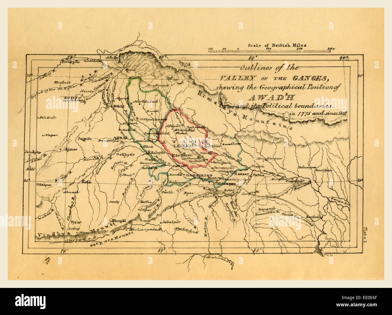 Map valley of the Ganges India, Outline of the Topography and Statistics of the Southern Districts of Oud'h Stock Photohttps://www.alamy.com/image-license-details/?v=1https://www.alamy.com/stock-photo-map-valley-of-the-ganges-india-outline-of-the-topography-and-statistics-77457815.html
RMEE0E6F–Map valley of the Ganges India, Outline of the Topography and Statistics of the Southern Districts of Oud'h
 Old plan of Scillambaran pagoda. Pondicherry, India. The Scillambaran pagoda by Admiral Francois-Edmond 1838-1844 from Le Tour du Monde 1867 Stock Photohttps://www.alamy.com/image-license-details/?v=1https://www.alamy.com/old-plan-of-scillambaran-pagoda-pondicherry-india-the-scillambaran-pagoda-by-admiral-francois-edmond-1838-1844-from-le-tour-du-monde-1867-image479853936.html
RM2JTK6GG–Old plan of Scillambaran pagoda. Pondicherry, India. The Scillambaran pagoda by Admiral Francois-Edmond 1838-1844 from Le Tour du Monde 1867
![Ancient 19th century map of Galilee and the Plain of Esdraelon [Jezreel Valley or Valley of Megiddo] from the book Palestine illustrated by Sir Richard Temple, 1st Baronet, GCSI, CIE, PC, FRS (8 March 1826 – 15 March 1902) was an administrator in British India and a British politician. Published in London by W.H. Allen & Co. in 1888 Stock Photo Ancient 19th century map of Galilee and the Plain of Esdraelon [Jezreel Valley or Valley of Megiddo] from the book Palestine illustrated by Sir Richard Temple, 1st Baronet, GCSI, CIE, PC, FRS (8 March 1826 – 15 March 1902) was an administrator in British India and a British politician. Published in London by W.H. Allen & Co. in 1888 Stock Photo](https://c8.alamy.com/comp/2CTGGBY/ancient-19th-century-map-of-galilee-and-the-plain-of-esdraelon-jezreel-valley-or-valley-of-megiddo-from-the-book-palestine-illustrated-by-sir-richard-temple-1st-baronet-gcsi-cie-pc-frs-8-march-1826-15-march-1902-was-an-administrator-in-british-india-and-a-british-politician-published-in-london-by-wh-allen-co-in-1888-2CTGGBY.jpg) Ancient 19th century map of Galilee and the Plain of Esdraelon [Jezreel Valley or Valley of Megiddo] from the book Palestine illustrated by Sir Richard Temple, 1st Baronet, GCSI, CIE, PC, FRS (8 March 1826 – 15 March 1902) was an administrator in British India and a British politician. Published in London by W.H. Allen & Co. in 1888 Stock Photohttps://www.alamy.com/image-license-details/?v=1https://www.alamy.com/ancient-19th-century-map-of-galilee-and-the-plain-of-esdraelon-jezreel-valley-or-valley-of-megiddo-from-the-book-palestine-illustrated-by-sir-richard-temple-1st-baronet-gcsi-cie-pc-frs-8-march-1826-15-march-1902-was-an-administrator-in-british-india-and-a-british-politician-published-in-london-by-wh-allen-co-in-1888-image376533583.html
Ancient 19th century map of Galilee and the Plain of Esdraelon [Jezreel Valley or Valley of Megiddo] from the book Palestine illustrated by Sir Richard Temple, 1st Baronet, GCSI, CIE, PC, FRS (8 March 1826 – 15 March 1902) was an administrator in British India and a British politician. Published in London by W.H. Allen & Co. in 1888 Stock Photohttps://www.alamy.com/image-license-details/?v=1https://www.alamy.com/ancient-19th-century-map-of-galilee-and-the-plain-of-esdraelon-jezreel-valley-or-valley-of-megiddo-from-the-book-palestine-illustrated-by-sir-richard-temple-1st-baronet-gcsi-cie-pc-frs-8-march-1826-15-march-1902-was-an-administrator-in-british-india-and-a-british-politician-published-in-london-by-wh-allen-co-in-1888-image376533583.htmlRM2CTGGBY–Ancient 19th century map of Galilee and the Plain of Esdraelon [Jezreel Valley or Valley of Megiddo] from the book Palestine illustrated by Sir Richard Temple, 1st Baronet, GCSI, CIE, PC, FRS (8 March 1826 – 15 March 1902) was an administrator in British India and a British politician. Published in London by W.H. Allen & Co. in 1888
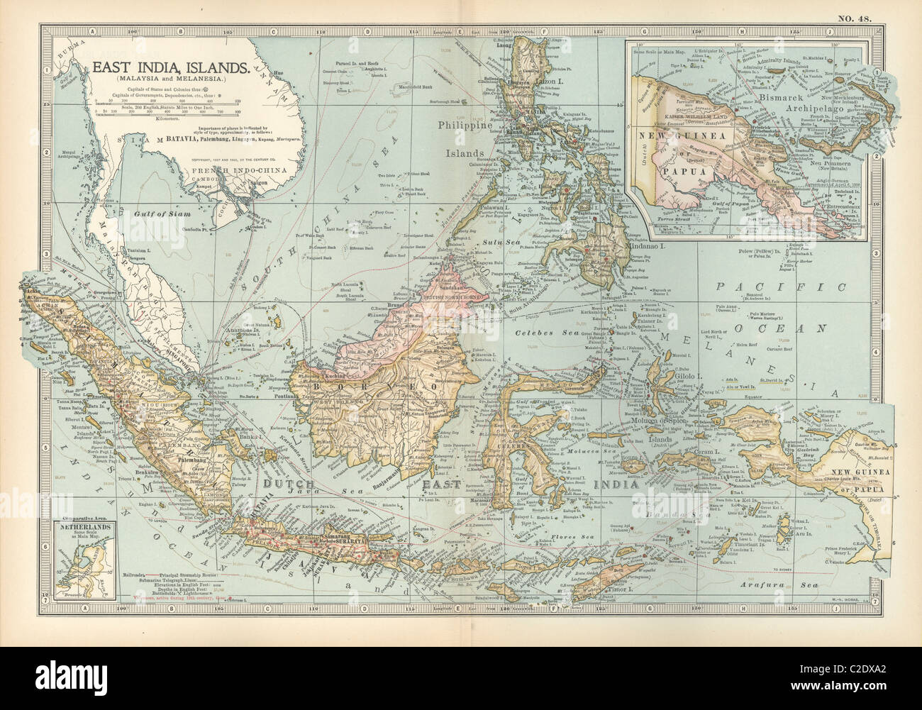 Map of East India Islands with New Guinea Stock Photohttps://www.alamy.com/image-license-details/?v=1https://www.alamy.com/stock-photo-map-of-east-india-islands-with-new-guinea-35956090.html
RMC2DXA2–Map of East India Islands with New Guinea
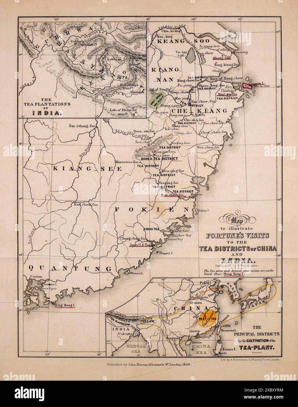 Vintage Map. To Illustrate Robert Fortune's Visits to the Tea Districts of China and India. by A.Petermann. published John Murray 1853 Stock Photohttps://www.alamy.com/image-license-details/?v=1https://www.alamy.com/vintage-map-to-illustrate-robert-fortunes-visits-to-the-tea-districts-of-china-and-india-by-apetermann-published-john-murray-1853-image609716680.html
RM2XBXYRM–Vintage Map. To Illustrate Robert Fortune's Visits to the Tea Districts of China and India. by A.Petermann. published John Murray 1853
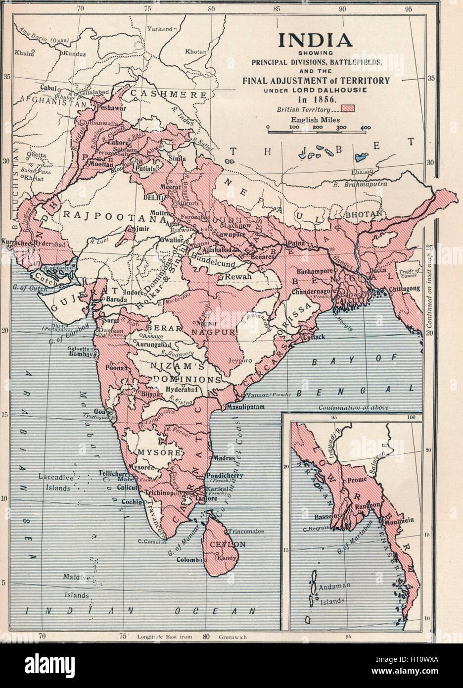 Map of India in 1856 (1906). Artist: Unknown. Stock Photohttps://www.alamy.com/image-license-details/?v=1https://www.alamy.com/stock-photo-map-of-india-in-1856-1906-artist-unknown-135244658.html
RMHT0WXA–Map of India in 1856 (1906). Artist: Unknown.
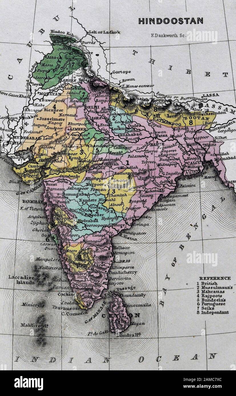 1834 Carey Map India Bombay Calcutta Delhi Ceylon Goa Madras Nepal Tibet Stock Photohttps://www.alamy.com/image-license-details/?v=1https://www.alamy.com/1834-carey-map-india-bombay-calcutta-delhi-ceylon-goa-madras-nepal-tibet-image339559764.html
RF2AMC7XC–1834 Carey Map India Bombay Calcutta Delhi Ceylon Goa Madras Nepal Tibet
 19th century Map of the Isle of Dogs, Greenwich, London (Extract) showing the West and East India Docks, Limehouse, Poplar, Greenwich and Deptford. Stock Photohttps://www.alamy.com/image-license-details/?v=1https://www.alamy.com/19th-century-map-of-the-isle-of-dogs-greenwich-london-extract-showing-the-west-and-east-india-docks-limehouse-poplar-greenwich-and-deptford-image504916748.html
RM2M9CXD0–19th century Map of the Isle of Dogs, Greenwich, London (Extract) showing the West and East India Docks, Limehouse, Poplar, Greenwich and Deptford.
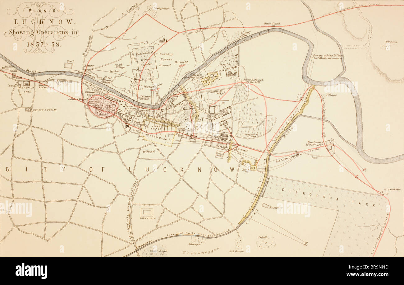 Plan of Lucknow showing operations during the Siege and Indian Rebellion of 1857 - 1858. Stock Photohttps://www.alamy.com/image-license-details/?v=1https://www.alamy.com/stock-photo-plan-of-lucknow-showing-operations-during-the-siege-and-indian-rebellion-31562089.html
RMBR9NND–Plan of Lucknow showing operations during the Siege and Indian Rebellion of 1857 - 1858.
 Malaysia: 'British Territory of Malacca', from 'An Atlas of the Southern Part of India'. Map of Mount Ophir, Melaka (Malacca), British Straits Settlements, 1854. The Straits Settlements were a group of British territories located in Southeast Asia. Originally established in 1826 as part of the territories controlled by the British East India Company, the Straits Settlements came under direct British control as a crown colony on 1 April 1867. The colony was dissolved in 1946 as part of the British reorganisation of its South-East Asian dependencies following the end of the Second World War. Stock Photohttps://www.alamy.com/image-license-details/?v=1https://www.alamy.com/malaysia-british-territory-of-malacca-from-an-atlas-of-the-southern-part-of-india-map-of-mount-ophir-melaka-malacca-british-straits-settlements-1854-the-straits-settlements-were-a-group-of-british-territories-located-in-southeast-asia-originally-established-in-1826-as-part-of-the-territories-controlled-by-the-british-east-india-company-the-straits-settlements-came-under-direct-british-control-as-a-crown-colony-on-1-april-1867-the-colony-was-dissolved-in-1946-as-part-of-the-british-reorganisation-of-its-south-east-asian-dependencies-following-the-end-of-the-second-world-war-image344250287.html
RM2B01XN3–Malaysia: 'British Territory of Malacca', from 'An Atlas of the Southern Part of India'. Map of Mount Ophir, Melaka (Malacca), British Straits Settlements, 1854. The Straits Settlements were a group of British territories located in Southeast Asia. Originally established in 1826 as part of the territories controlled by the British East India Company, the Straits Settlements came under direct British control as a crown colony on 1 April 1867. The colony was dissolved in 1946 as part of the British reorganisation of its South-East Asian dependencies following the end of the Second World War.
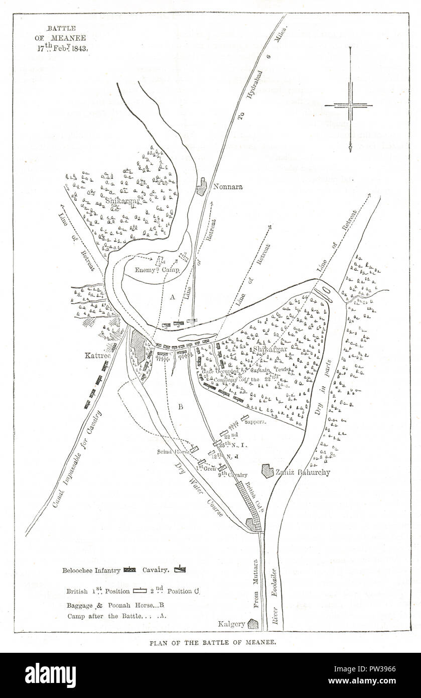 Plan of the Battle of Meeanee, 17 February 1843, also known as Battle of Miani Stock Photohttps://www.alamy.com/image-license-details/?v=1https://www.alamy.com/plan-of-the-battle-of-meeanee-17-february-1843-also-known-as-battle-of-miani-image221963902.html
RMPW3966–Plan of the Battle of Meeanee, 17 February 1843, also known as Battle of Miani
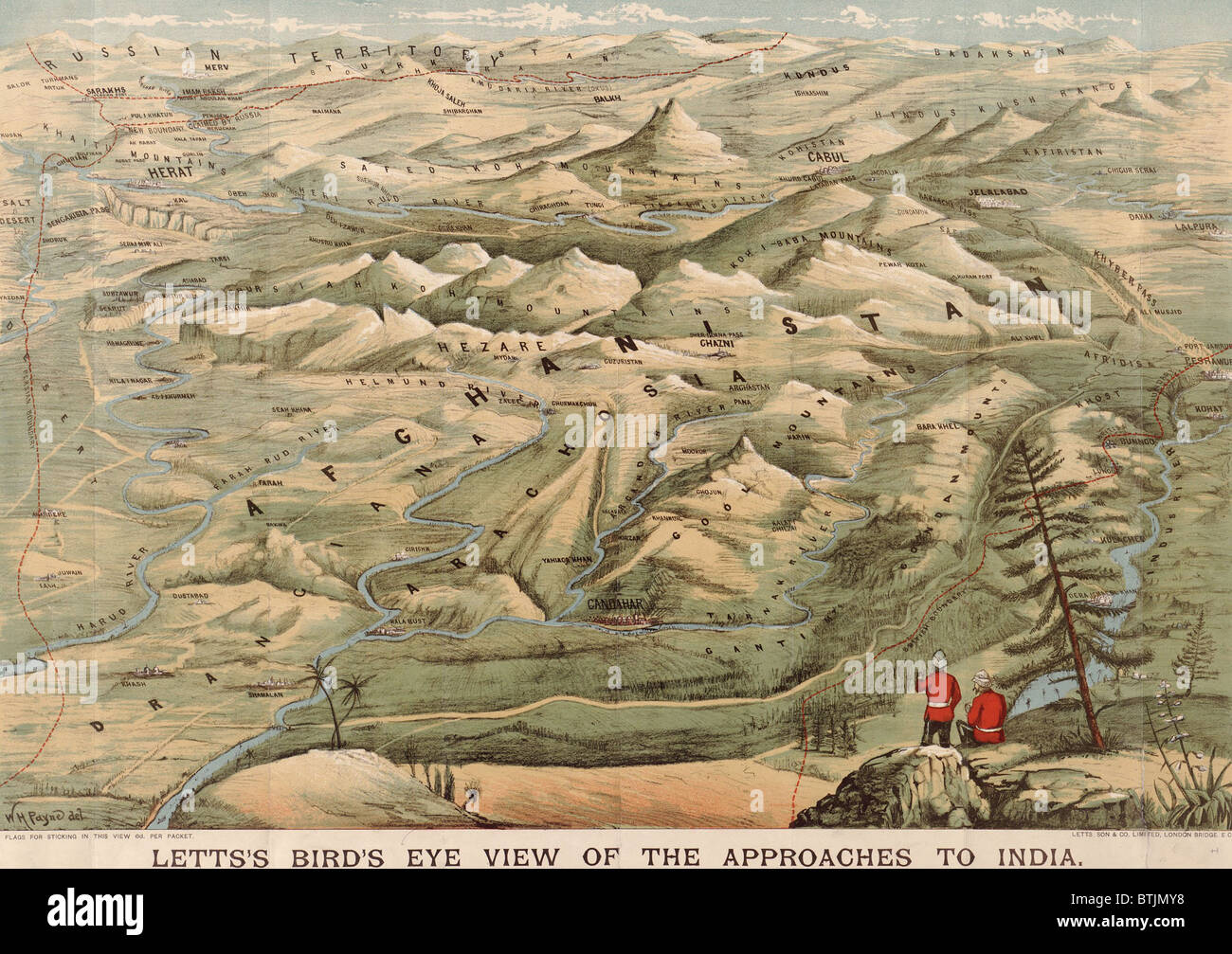 Early 20th century British map shows red coated soldiers looking into the Indus Valley and Afghanistan from Indian territory. In the late 19th century, the British failed to extend their colonial rule over Afghanistan. Stock Photohttps://www.alamy.com/image-license-details/?v=1https://www.alamy.com/stock-photo-early-20th-century-british-map-shows-red-coated-soldiers-looking-into-32373692.html
RMBTJMY8–Early 20th century British map shows red coated soldiers looking into the Indus Valley and Afghanistan from Indian territory. In the late 19th century, the British failed to extend their colonial rule over Afghanistan.
 Vintage copper engraved map of India from 19th century. All maps are beautifully colored and illustrated showing the world at the time. Stock Photohttps://www.alamy.com/image-license-details/?v=1https://www.alamy.com/vintage-copper-engraved-map-of-india-from-19th-century-all-maps-are-beautifully-colored-and-illustrated-showing-the-world-at-the-time-image425753813.html
RF2FMJN99–Vintage copper engraved map of India from 19th century. All maps are beautifully colored and illustrated showing the world at the time.
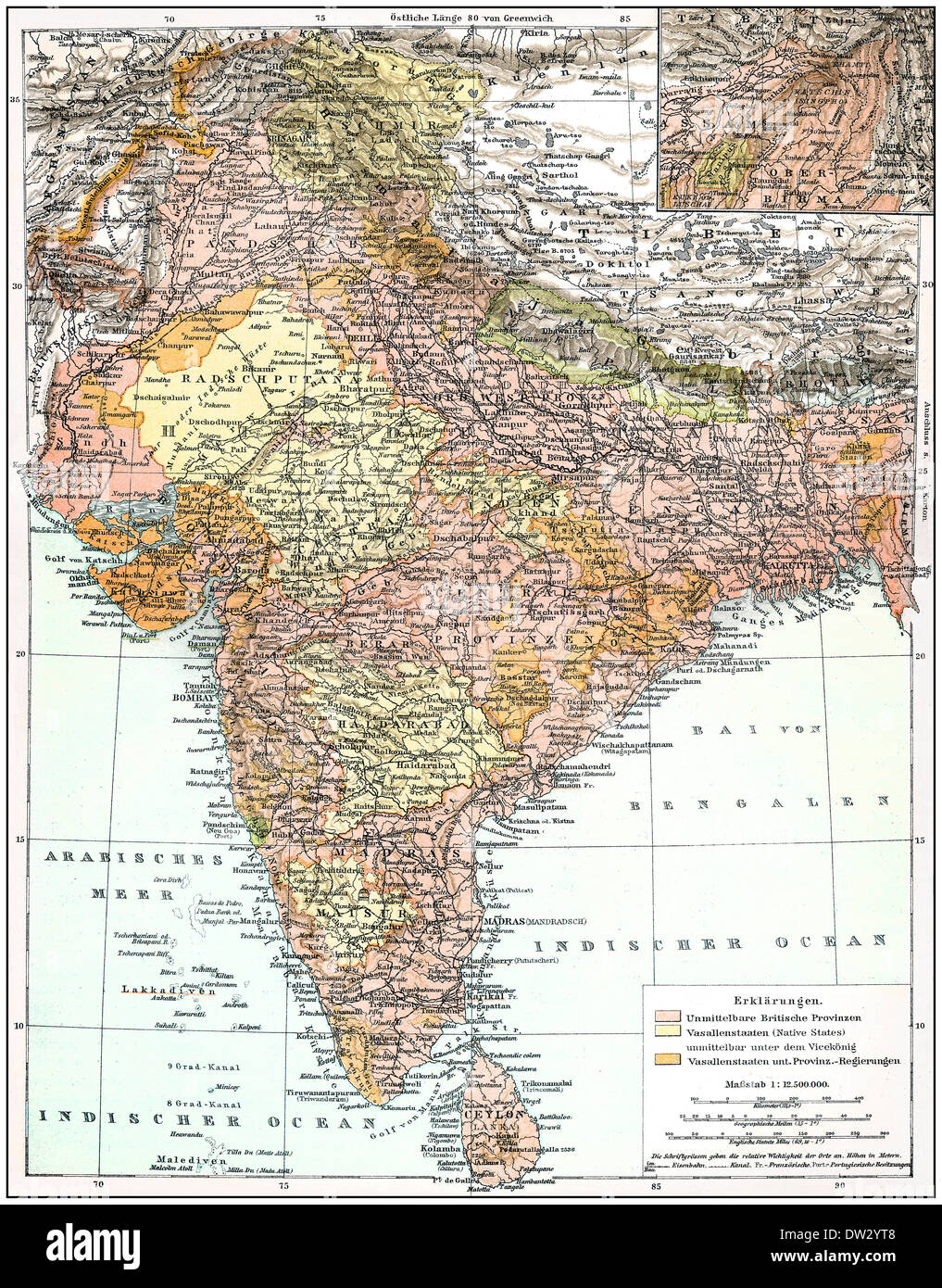 Map of the Indian Empire, historical graphic representation, 1896, Stock Photohttps://www.alamy.com/image-license-details/?v=1https://www.alamy.com/map-of-the-indian-empire-historical-graphic-representation-1896-image67063256.html
RMDW2YT8–Map of the Indian Empire, historical graphic representation, 1896,
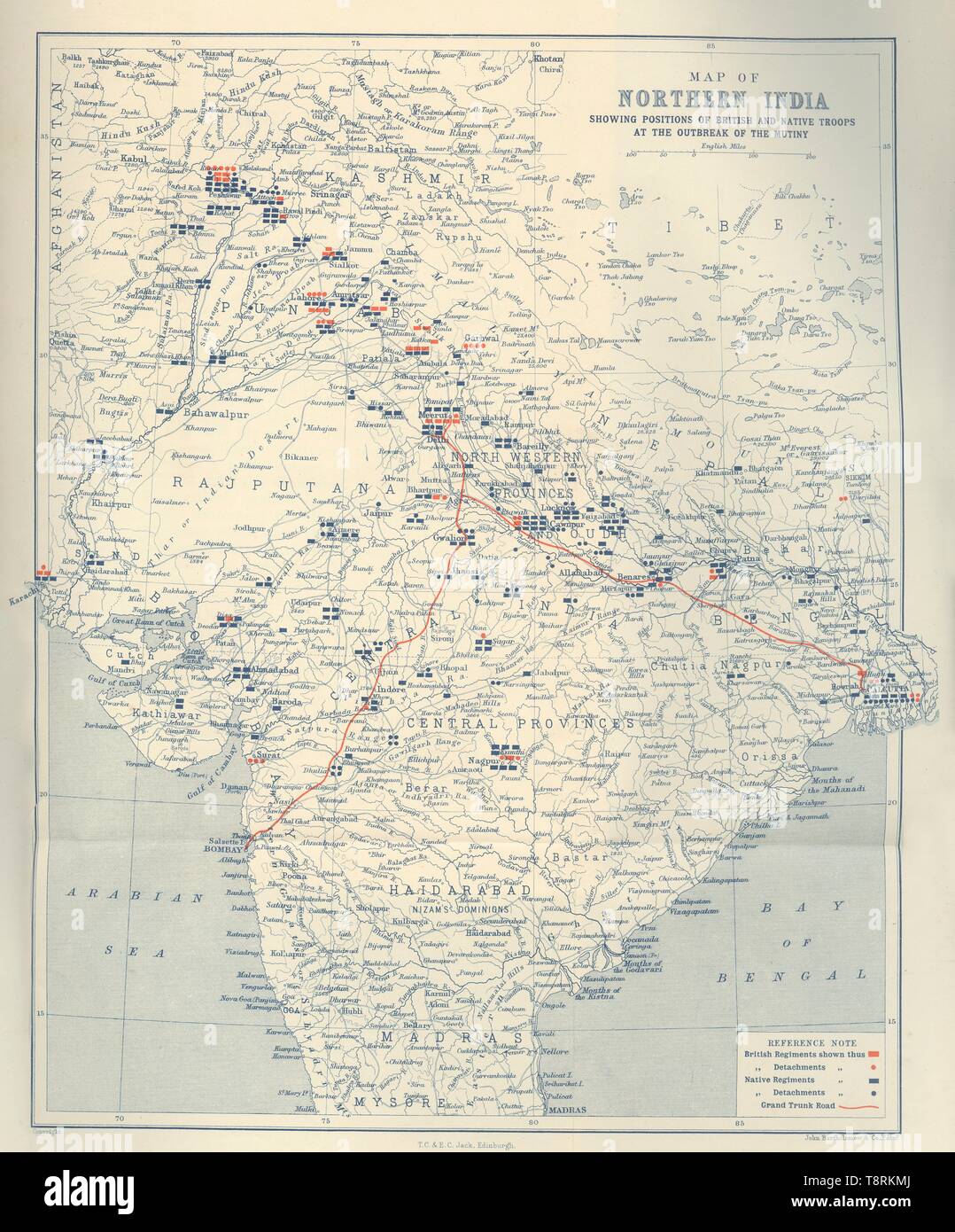 'Map of Northern India', 1901. Creator: John Bartholomew. Stock Photohttps://www.alamy.com/image-license-details/?v=1https://www.alamy.com/map-of-northern-india-1901-creator-john-bartholomew-image246382770.html
RMT8RKMJ–'Map of Northern India', 1901. Creator: John Bartholomew.
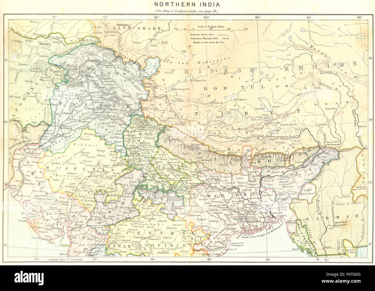 INDIA: North, c1885 antique map Stock Photohttps://www.alamy.com/image-license-details/?v=1https://www.alamy.com/stock-photo-india-north-c1885-antique-map-102564464.html
RFFXT60G–INDIA: North, c1885 antique map
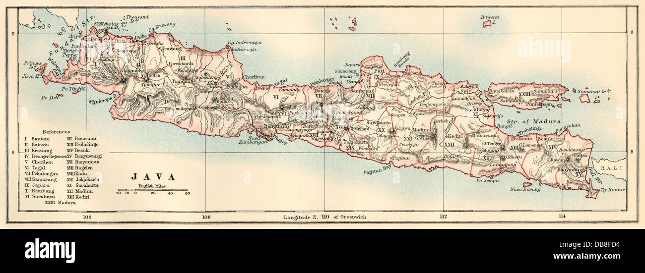 Map of Java, 1870s. Color lithograph Stock Photohttps://www.alamy.com/image-license-details/?v=1https://www.alamy.com/stock-photo-map-of-java-1870s-color-lithograph-58580064.html
RMDB8FD4–Map of Java, 1870s. Color lithograph
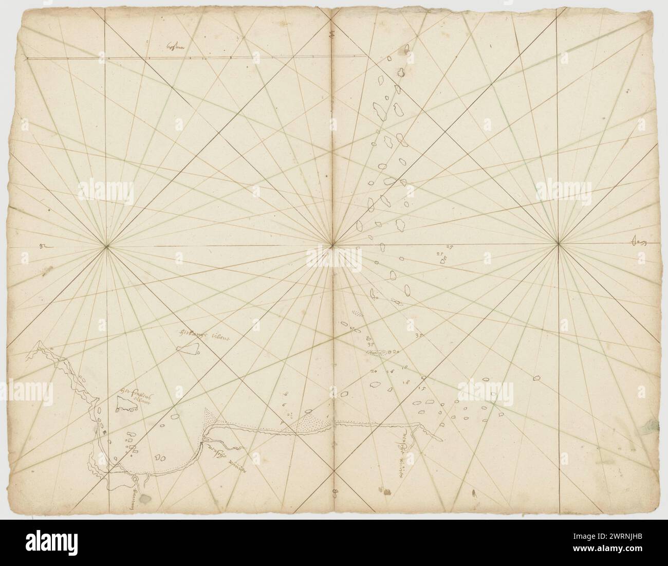 Portolans Map of Bantam Bay, appr. made in 17th century Stock Photohttps://www.alamy.com/image-license-details/?v=1https://www.alamy.com/portolans-map-of-bantam-bay-appr-made-in-17th-century-image599765191.html
RM2WRNJHB–Portolans Map of Bantam Bay, appr. made in 17th century
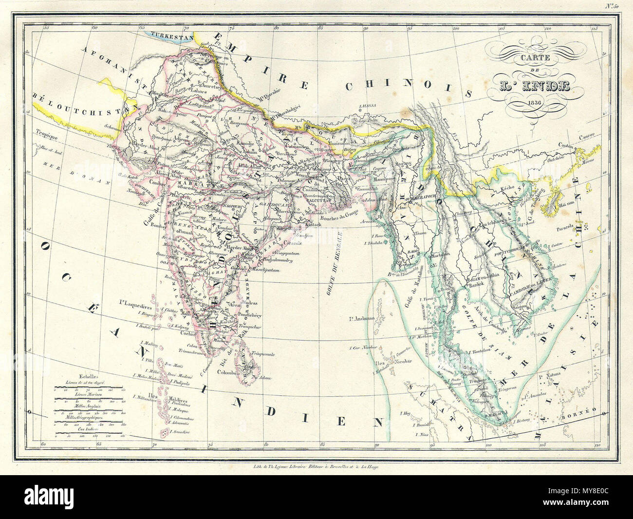 . Carte de L'Inde. English: This is a beautiful 1836 copperplate lithograph map of India and Southeast Asia by French cartographer Malte-Brun. Includes the modern day nations of India, Bangladesh, Burma (Myanmar), Thailand, Cambodia, Vietnam, Malaysia, and Singapore. Also shows the 19th century kingdoms of Tonquin and Cochin in modern day Vietnam. Straits of Singapore or Sincapour noted. All text is in French. . 1836 6 1837 Malte-Brun Map of India, Burma and Southeast Asia (Siam , Vietnam ) - Geographicus - India-mb-1837 Stock Photohttps://www.alamy.com/image-license-details/?v=1https://www.alamy.com/carte-de-linde-english-this-is-a-beautiful-1836-copperplate-lithograph-map-of-india-and-southeast-asia-by-french-cartographer-malte-brun-includes-the-modern-day-nations-of-india-bangladesh-burma-myanmar-thailand-cambodia-vietnam-malaysia-and-singapore-also-shows-the-19th-century-kingdoms-of-tonquin-and-cochin-in-modern-day-vietnam-straits-of-singapore-or-sincapour-noted-all-text-is-in-french-1836-6-1837-malte-brun-map-of-india-burma-and-southeast-asia-siam-vietnam-geographicus-india-mb-1837-image188885996.html
RMMY8E0C–. Carte de L'Inde. English: This is a beautiful 1836 copperplate lithograph map of India and Southeast Asia by French cartographer Malte-Brun. Includes the modern day nations of India, Bangladesh, Burma (Myanmar), Thailand, Cambodia, Vietnam, Malaysia, and Singapore. Also shows the 19th century kingdoms of Tonquin and Cochin in modern day Vietnam. Straits of Singapore or Sincapour noted. All text is in French. . 1836 6 1837 Malte-Brun Map of India, Burma and Southeast Asia (Siam , Vietnam ) - Geographicus - India-mb-1837
 MAP OF THE EUPHRATES VALLEY ROUTE TO INDIA Stock Photohttps://www.alamy.com/image-license-details/?v=1https://www.alamy.com/map-of-the-euphrates-valley-route-to-india-image60173166.html
RMDDW3DJ–MAP OF THE EUPHRATES VALLEY ROUTE TO INDIA
 Plan of the Battle of Cawnpore, 1857 Stock Photohttps://www.alamy.com/image-license-details/?v=1https://www.alamy.com/plan-of-the-battle-of-cawnpore-1857-image241326856.html
RMT0HAT8–Plan of the Battle of Cawnpore, 1857
 Map of the Europe Asia and Africa from Souvenirs d'un voyage dans l'Inde exécuté de 1834 à 1839 (A voyage to India) by Delessert, Adolphe, published in Paris in 1843 Stock Photohttps://www.alamy.com/image-license-details/?v=1https://www.alamy.com/map-of-the-europe-asia-and-africa-from-souvenirs-dun-voyage-dans-linde-execute-de-1834-a-1839-a-voyage-to-india-by-delessert-adolphe-published-in-paris-in-1843-image349571230.html
RM2B8M9JP–Map of the Europe Asia and Africa from Souvenirs d'un voyage dans l'Inde exécuté de 1834 à 1839 (A voyage to India) by Delessert, Adolphe, published in Paris in 1843
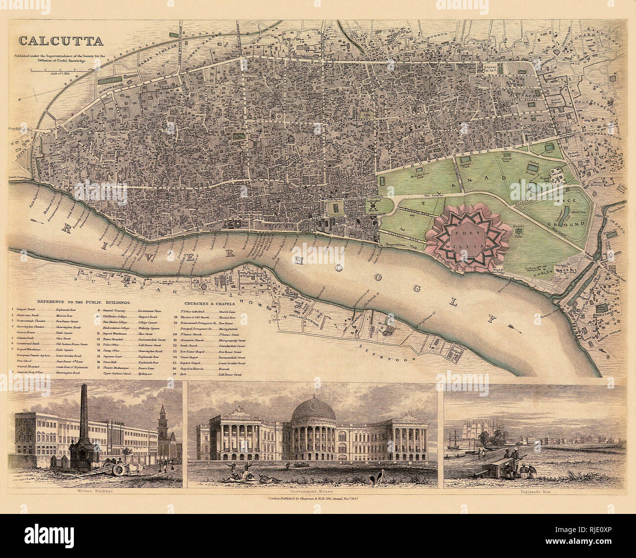 Map of Calcutta. Stock Photohttps://www.alamy.com/image-license-details/?v=1https://www.alamy.com/map-of-calcutta-image235106670.html
RMRJE0XP–Map of Calcutta.
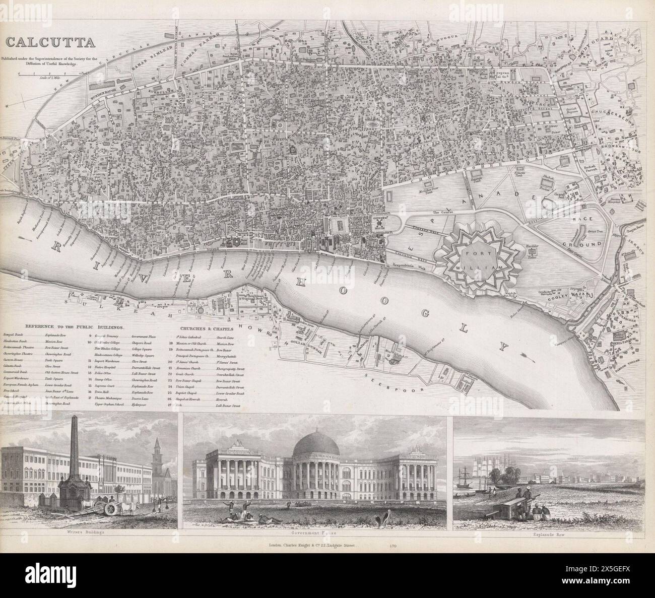 Vintage B&W pictorial Map of Calcutta. Stock Photohttps://www.alamy.com/image-license-details/?v=1https://www.alamy.com/vintage-bw-pictorial-map-of-calcutta-image605798814.html
RM2X5GEFX–Vintage B&W pictorial Map of Calcutta.
 Krishna and Arjun on the chariot Mahabharata 18th 19th century India Stock Photohttps://www.alamy.com/image-license-details/?v=1https://www.alamy.com/stock-photo-krishna-and-arjun-on-the-chariot-mahabharata-18th-19th-century-india-140475884.html
RMJ4F6BT–Krishna and Arjun on the chariot Mahabharata 18th 19th century India
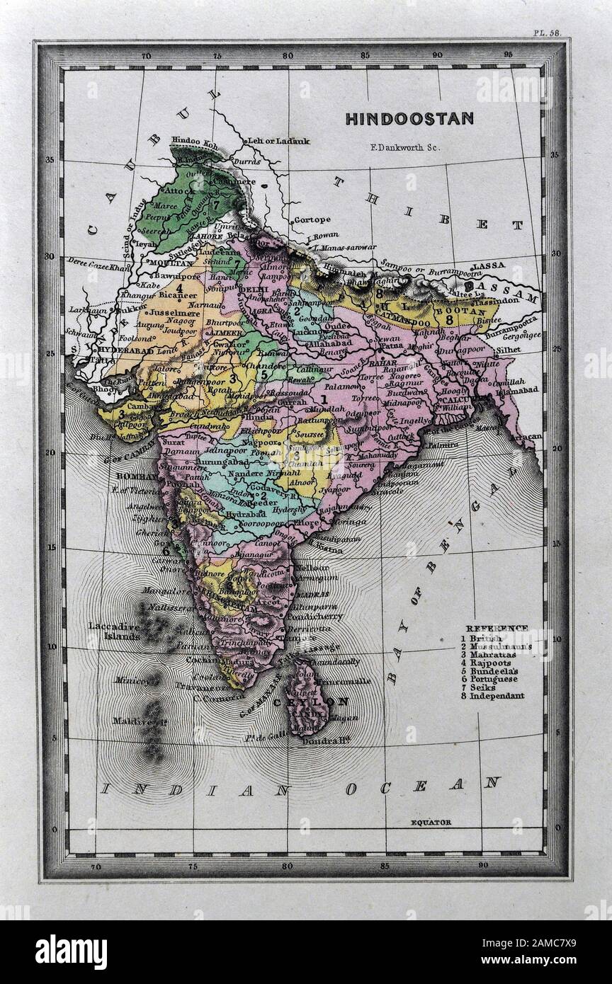 1834 Carey Map India Bombay Calcutta Delhi Ceylon Goa Madras Nepal Tibet Stock Photohttps://www.alamy.com/image-license-details/?v=1https://www.alamy.com/1834-carey-map-india-bombay-calcutta-delhi-ceylon-goa-madras-nepal-tibet-image339559761.html
RF2AMC7X9–1834 Carey Map India Bombay Calcutta Delhi Ceylon Goa Madras Nepal Tibet
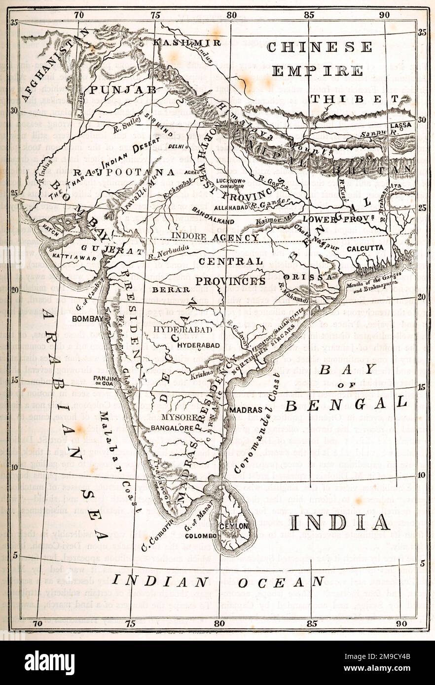 Map Of India Stock Photohttps://www.alamy.com/image-license-details/?v=1https://www.alamy.com/map-of-india-image504917291.html
RM2M9CY4B–Map Of India
 09 03 2021 Vintage Map of India,the United States in the 19th century studio shot Lokgram Kalyan Maharashtra India. Stock Photohttps://www.alamy.com/image-license-details/?v=1https://www.alamy.com/09-03-2021-vintage-map-of-indiathe-united-states-in-the-19th-century-studio-shot-lokgram-kalyan-maharashtra-india-image456589745.html
RF2HERCTH–09 03 2021 Vintage Map of India,the United States in the 19th century studio shot Lokgram Kalyan Maharashtra India.
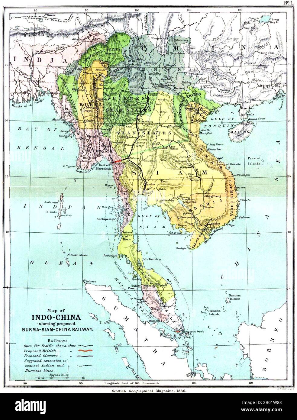 Southeast Asia: A UK (Scottish Geographical Magazine) map of Greater Indochina and the Malay Peninsula, 1886. A detailed and remarkably accurate map of Burma, Siam, Vietnam, Cambodia and Malaya dating from 1886 and showing the rectangle of independent Burma around Mandalay - which was losing its independence to Great Britain in 1885-1886 when the map was published. The Burmese Shan States are shown as under Burmese influence (shortly to be replaced by that of Great Britain). Stock Photohttps://www.alamy.com/image-license-details/?v=1https://www.alamy.com/southeast-asia-a-uk-scottish-geographical-magazine-map-of-greater-indochina-and-the-malay-peninsula-1886-a-detailed-and-remarkably-accurate-map-of-burma-siam-vietnam-cambodia-and-malaya-dating-from-1886-and-showing-the-rectangle-of-independent-burma-around-mandalay-which-was-losing-its-independence-to-great-britain-in-1885-1886-when-the-map-was-published-the-burmese-shan-states-are-shown-as-under-burmese-influence-shortly-to-be-replaced-by-that-of-great-britain-image344249139.html
RM2B01W83–Southeast Asia: A UK (Scottish Geographical Magazine) map of Greater Indochina and the Malay Peninsula, 1886. A detailed and remarkably accurate map of Burma, Siam, Vietnam, Cambodia and Malaya dating from 1886 and showing the rectangle of independent Burma around Mandalay - which was losing its independence to Great Britain in 1885-1886 when the map was published. The Burmese Shan States are shown as under Burmese influence (shortly to be replaced by that of Great Britain).
RME9DCMH–Engraved illustration of a Map of Asia from Iconographic Encyclopedia of Science, Literature and Art, Published in 1851
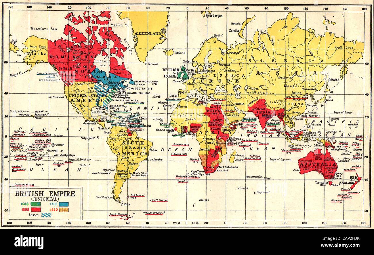 A coloured British empire map 1920 showing its expansion since 1688 (and losses) with dates Stock Photohttps://www.alamy.com/image-license-details/?v=1https://www.alamy.com/a-coloured-british-empire-map-1920-showing-its-expansion-since-1688-and-losses-with-dates-image340575471.html
RM2AP2FDK–A coloured British empire map 1920 showing its expansion since 1688 (and losses) with dates