Quick filters:
50 kilometres Stock Photos and Images
 Athletics - IAAF World Athletics Championships - Helsinki 2005 - Olympic Stadium. Russia's Sergey Kirdyapkin enters the stadium on his way to victory in the 50 Kilometres Road Walk. Stock Photohttps://www.alamy.com/image-license-details/?v=1https://www.alamy.com/stock-photo-athletics-iaaf-world-athletics-championships-helsinki-2005-olympic-108603412.html
RMG8K8N8–Athletics - IAAF World Athletics Championships - Helsinki 2005 - Olympic Stadium. Russia's Sergey Kirdyapkin enters the stadium on his way to victory in the 50 Kilometres Road Walk.
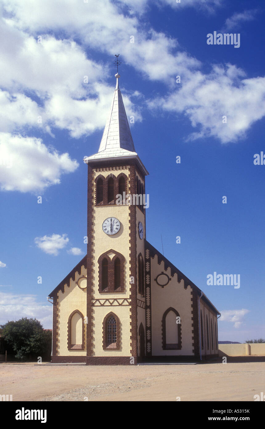 Church of Rehoboth 50 Kilometres south of Windhoek Namibia south west Africa Stock Photohttps://www.alamy.com/image-license-details/?v=1https://www.alamy.com/stock-photo-church-of-rehoboth-50-kilometres-south-of-windhoek-namibia-south-west-11180238.html
RMA5315K–Church of Rehoboth 50 Kilometres south of Windhoek Namibia south west Africa
 Civic reception for the Olympic 50 kilometres Marathon victor Harold Whitlock at Deptford Town Hall, south east London, 12 August 1936. Stock Photohttps://www.alamy.com/image-license-details/?v=1https://www.alamy.com/civic-reception-for-the-olympic-50-kilometres-marathon-victor-harold-whitlock-at-deptford-town-hall-south-east-london-12-august-1936-image504840878.html
RM2M99DKA–Civic reception for the Olympic 50 kilometres Marathon victor Harold Whitlock at Deptford Town Hall, south east London, 12 August 1936.
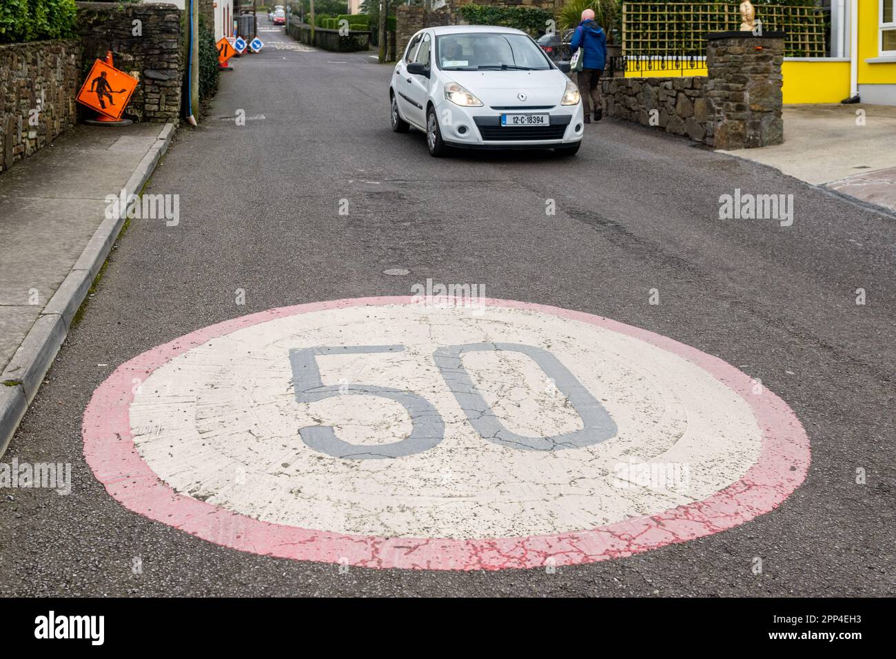 Car passing 50 KMH sign in the road in Ireland. Stock Photohttps://www.alamy.com/image-license-details/?v=1https://www.alamy.com/car-passing-50-kmh-sign-in-the-road-in-ireland-image547143103.html
RM2PP4EH3–Car passing 50 KMH sign in the road in Ireland.
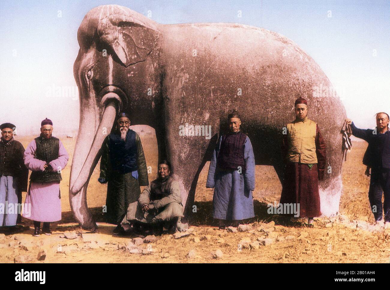 China: A group of well-to-do Chinese men posing in front of a stone elephant at the Ming Dynasty Tombs, 1872. The Ming Dynasty Tombs ( Míng shísān líng; lit. Thirteen Tombs of the Ming Dynasty) are located some 50 kilometres due north of Beijing. The site was chosen by the third Ming Dynasty emperor Yongle (1402-1424), who moved the capital of China from Nanjing to the present location of Beijing. Yongle is credited with envisioning the layout of the ancient city of Beijing as well as a number of landmarks and monuments located therein. Stock Photohttps://www.alamy.com/image-license-details/?v=1https://www.alamy.com/china-a-group-of-well-to-do-chinese-men-posing-in-front-of-a-stone-elephant-at-the-ming-dynasty-tombs-1872-the-ming-dynasty-tombs-mng-shsn-lng-lit-thirteen-tombs-of-the-ming-dynasty-are-located-some-50-kilometres-due-north-of-beijing-the-site-was-chosen-by-the-third-ming-dynasty-emperor-yongle-1402-1424-who-moved-the-capital-of-china-from-nanjing-to-the-present-location-of-beijing-yongle-is-credited-with-envisioning-the-layout-of-the-ancient-city-of-beijing-as-well-as-a-number-of-landmarks-and-monuments-located-therein-image344237632.html
RM2B01AH4–China: A group of well-to-do Chinese men posing in front of a stone elephant at the Ming Dynasty Tombs, 1872. The Ming Dynasty Tombs ( Míng shísān líng; lit. Thirteen Tombs of the Ming Dynasty) are located some 50 kilometres due north of Beijing. The site was chosen by the third Ming Dynasty emperor Yongle (1402-1424), who moved the capital of China from Nanjing to the present location of Beijing. Yongle is credited with envisioning the layout of the ancient city of Beijing as well as a number of landmarks and monuments located therein.
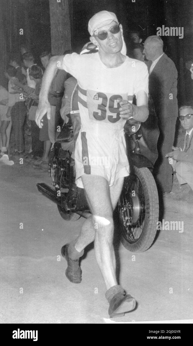 Rome: Britian's Don Thompson who got Gold for 50 Kilometres Walk at Olympic Games in Rome. Record of 4 Hours 25 Minutes 30 Seconds. 7 September 1960 Stock Photohttps://www.alamy.com/image-license-details/?v=1https://www.alamy.com/rome-britians-don-thompson-who-got-gold-for-50-kilometres-walk-at-olympic-games-in-rome-record-of-4-hours-25-minutes-30-seconds-7-september-1960-image441336331.html
RM2GJ0GYR–Rome: Britian's Don Thompson who got Gold for 50 Kilometres Walk at Olympic Games in Rome. Record of 4 Hours 25 Minutes 30 Seconds. 7 September 1960
 Dec. 14, 2011 - Olympic Games in Rome. Gold Medal for Britain in 50 km. walk..: Don Thompson, of Great Britain, yesterday won the Men's 50 kilometres walk, to win a Gold Medal for Britain in the Olympic games. His time of 4 hrs. 25 mins. 30 secs, was a new Olympic record. J. Ljunggren, of Sweden was second and A. Pamich of Italy was third. Photo shows a happy Don Thompson after his great win yesterday. Stock Photohttps://www.alamy.com/image-license-details/?v=1https://www.alamy.com/dec-14-2011-olympic-games-in-rome-gold-medal-for-britain-in-50-km-image69510414.html
RME12D6P–Dec. 14, 2011 - Olympic Games in Rome. Gold Medal for Britain in 50 km. walk..: Don Thompson, of Great Britain, yesterday won the Men's 50 kilometres walk, to win a Gold Medal for Britain in the Olympic games. His time of 4 hrs. 25 mins. 30 secs, was a new Olympic record. J. Ljunggren, of Sweden was second and A. Pamich of Italy was third. Photo shows a happy Don Thompson after his great win yesterday.
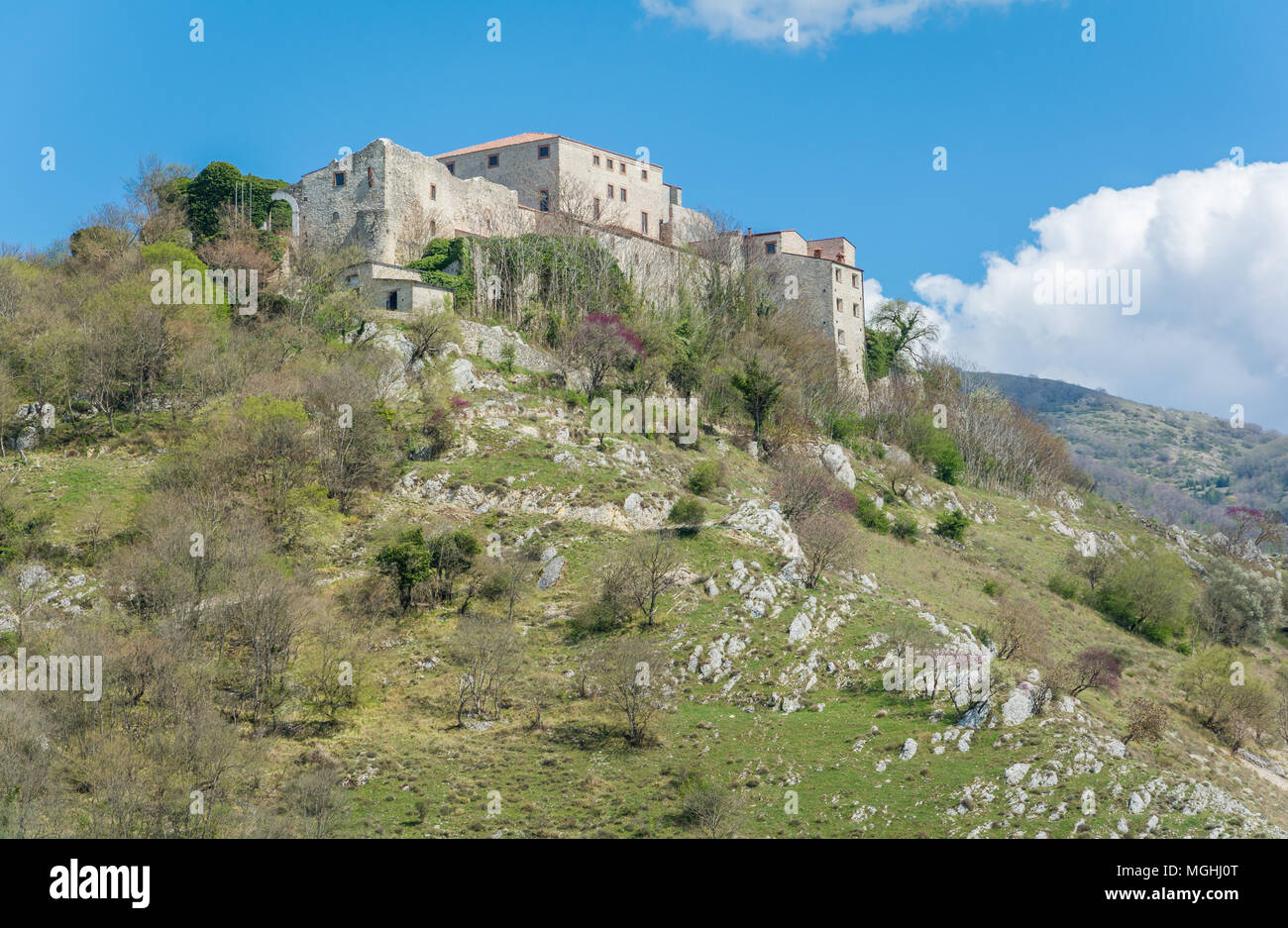 Antuni Castel near Castel di Tora, Province of Rieti, Latium, located about 50 kilometres northeast of Rome. Stock Photohttps://www.alamy.com/image-license-details/?v=1https://www.alamy.com/antuni-castel-near-castel-di-tora-province-of-rieti-latium-located-about-50-kilometres-northeast-of-rome-image182325496.html
RFMGHJ0T–Antuni Castel near Castel di Tora, Province of Rieti, Latium, located about 50 kilometres northeast of Rome.
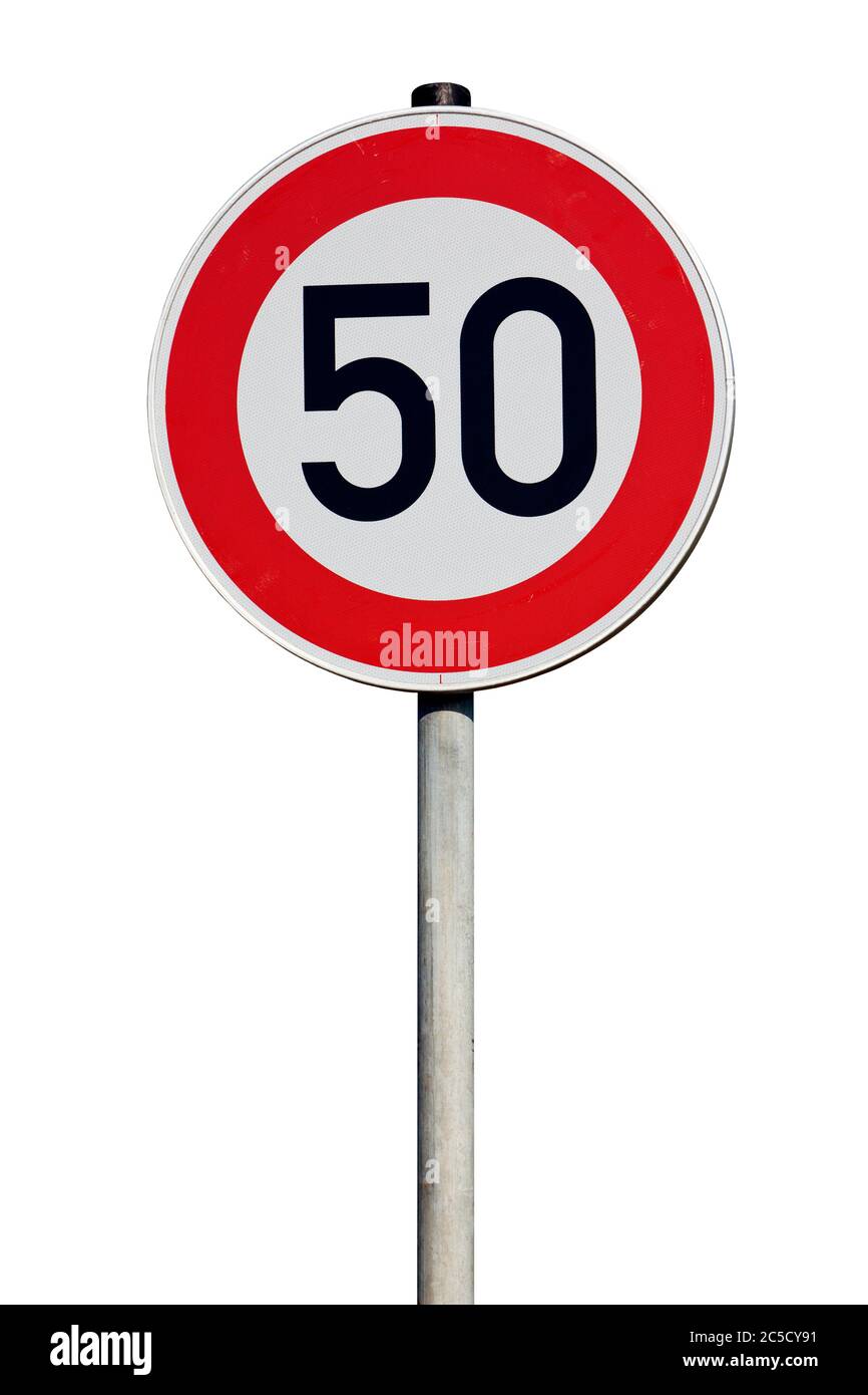 Isolated Traffic Sign - Speed limit 50 kilometres Stock Photohttps://www.alamy.com/image-license-details/?v=1https://www.alamy.com/isolated-traffic-sign-speed-limit-50-kilometres-image364775853.html
RF2C5CY91–Isolated Traffic Sign - Speed limit 50 kilometres
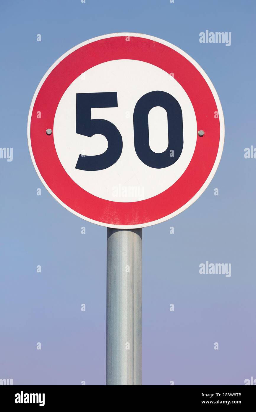 50 kilometres per hour speed limit sign on city street Stock Photohttps://www.alamy.com/image-license-details/?v=1https://www.alamy.com/50-kilometres-per-hour-speed-limit-sign-on-city-street-image432658923.html
RM2G3W8TB–50 kilometres per hour speed limit sign on city street
 Jerash, Jordanian capital Amman. 18th Sep, 2017. Italian tenor Andrea Bocelli performs during a concert at the archaeological site of Jerash, some 50 kilometres north of Jordanian capital Amman, on Sept. 18, 2017. Credit: Mohammad Abu Ghosh/Xinhua/Alamy Live News Stock Photohttps://www.alamy.com/image-license-details/?v=1https://www.alamy.com/stock-image-jerash-jordanian-capital-amman-18th-sep-2017-italian-tenor-andrea-160027506.html
RMK89TM2–Jerash, Jordanian capital Amman. 18th Sep, 2017. Italian tenor Andrea Bocelli performs during a concert at the archaeological site of Jerash, some 50 kilometres north of Jordanian capital Amman, on Sept. 18, 2017. Credit: Mohammad Abu Ghosh/Xinhua/Alamy Live News
 Motorhome and campervan by beach Playa de Orinon Cantabria Spain 50 kilometres from Santander Stock Photohttps://www.alamy.com/image-license-details/?v=1https://www.alamy.com/motorhome-and-campervan-by-beach-playa-de-orinon-cantabria-spain-50-kilometres-from-santander-image518004349.html
RF2N2N3R9–Motorhome and campervan by beach Playa de Orinon Cantabria Spain 50 kilometres from Santander
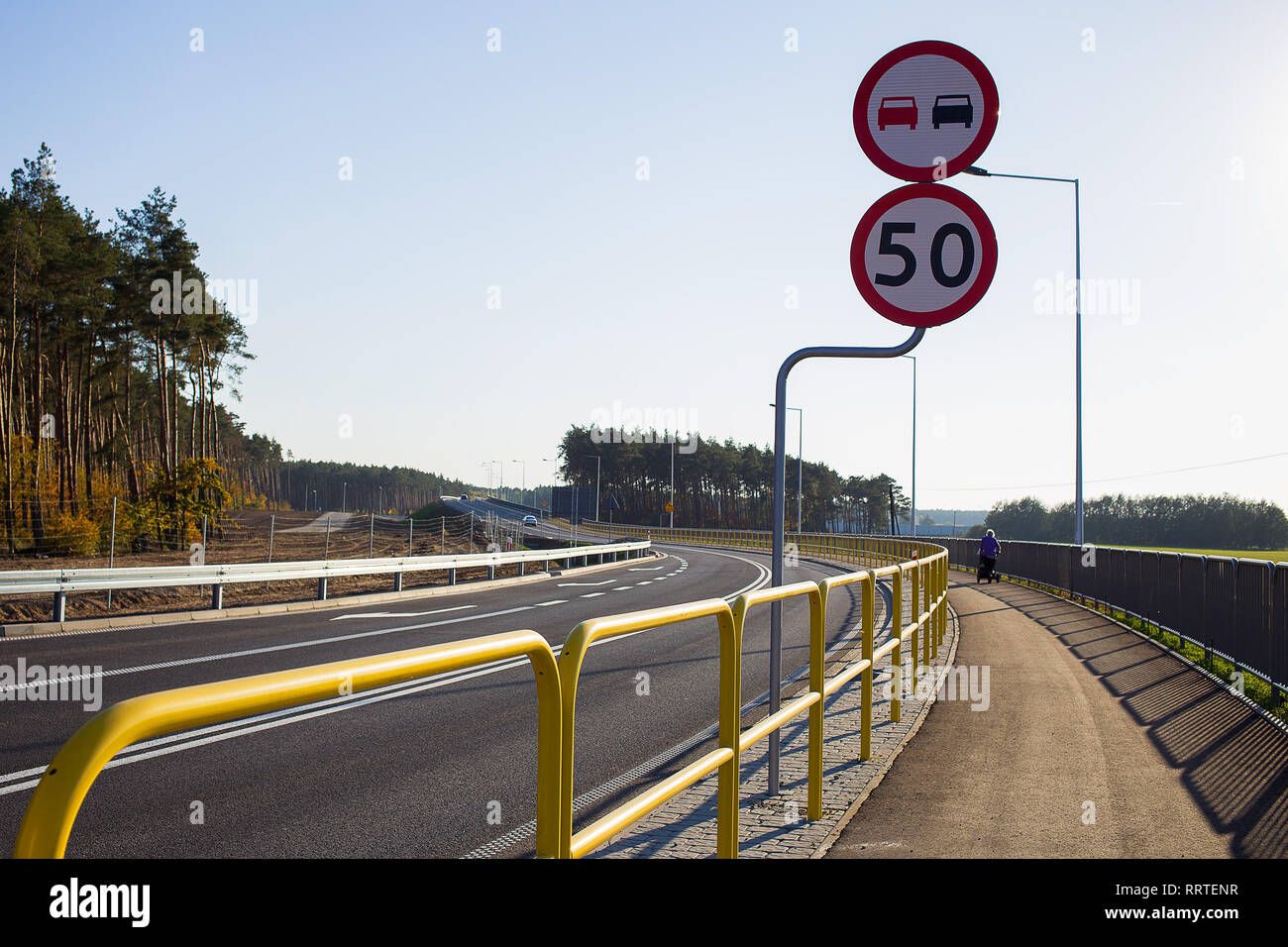 Newly build and opened road with road signs ordering speed limit 50 km and no overtaking Stock Photohttps://www.alamy.com/image-license-details/?v=1https://www.alamy.com/newly-build-and-opened-road-with-road-signs-ordering-speed-limit-50-km-and-no-overtaking-image238410307.html
RFRRTENR–Newly build and opened road with road signs ordering speed limit 50 km and no overtaking
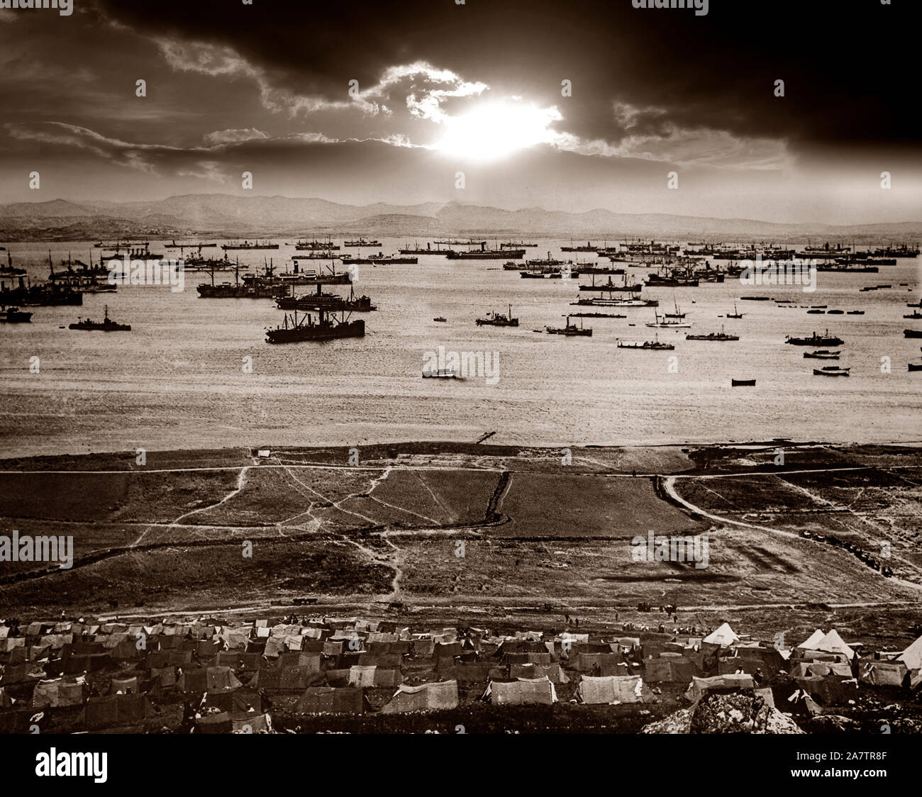 In early 1915, the Allies used the island of Lemnos in the northern part of the Aegean Sea, to try to capture the Dardanelles Straits, some 50 kilometres (31 miles) away. Massed shipping in the harbour at Moudros was put under the control of British Admiral Rosslyn Wemyss, who was ordered to prepare the then largely unused harbour for operations against the Dardanelles. This was done chiefly by the British and largely through the enthusiasm of Winston Churchill. Stock Photohttps://www.alamy.com/image-license-details/?v=1https://www.alamy.com/in-early-1915-the-allies-used-the-island-of-lemnos-in-the-northern-part-of-the-aegean-sea-to-try-to-capture-the-dardanelles-straits-some-50-kilometres-31-miles-away-massed-shipping-in-the-harbour-at-moudros-was-put-under-the-control-of-british-admiral-rosslyn-wemyss-who-was-ordered-to-prepare-the-then-largely-unused-harbour-for-operations-against-the-dardanelles-this-was-done-chiefly-by-the-british-and-largely-through-the-enthusiasm-of-winston-churchill-image331844703.html
RM2A7TR8F–In early 1915, the Allies used the island of Lemnos in the northern part of the Aegean Sea, to try to capture the Dardanelles Straits, some 50 kilometres (31 miles) away. Massed shipping in the harbour at Moudros was put under the control of British Admiral Rosslyn Wemyss, who was ordered to prepare the then largely unused harbour for operations against the Dardanelles. This was done chiefly by the British and largely through the enthusiasm of Winston Churchill.
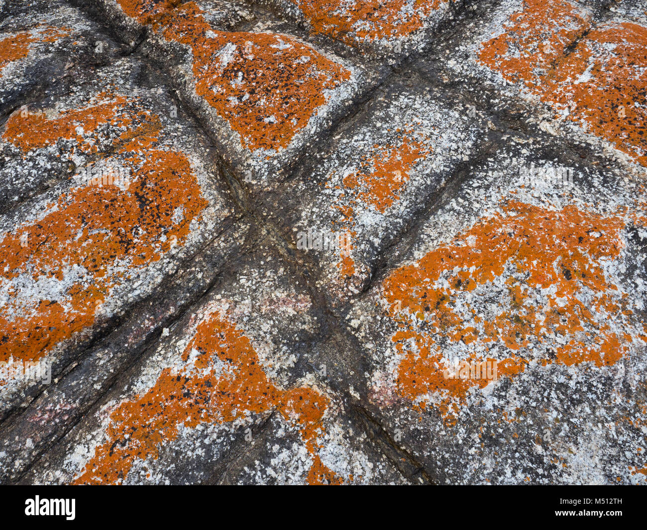 The Bay of Fires Tasmania east coast Stock Photohttps://www.alamy.com/image-license-details/?v=1https://www.alamy.com/stock-photo-the-bay-of-fires-tasmania-east-coast-175201169.html
RMM512TH–The Bay of Fires Tasmania east coast
 Eglington river. Fiordland NP. NZ, The Eglinton River is located in the region of Southland in the southwest of New Zealand. It flows through Fiordland National Park for 50 kilometres (31 mi). Its headwaters are at Lake Gunn, 25 kilometres (16 mi) east of Milford Sound, and it flows generally south before entering Lake Te Anau along the lake's eastern shore opposite the entrance to North Fiord Stock Photohttps://www.alamy.com/image-license-details/?v=1https://www.alamy.com/eglington-river-fiordland-np-nz-the-eglinton-river-is-located-in-the-region-of-southland-in-the-southwest-of-new-zealand-it-flows-through-fiordland-national-park-for-50-kilometres-31-mi-its-headwaters-are-at-lake-gunn-25-kilometres-16-mi-east-of-milford-sound-and-it-flows-generally-south-before-entering-lake-te-anau-along-the-lakes-eastern-shore-opposite-the-entrance-to-north-fiord-image573373533.html
RM2T8RBP5–Eglington river. Fiordland NP. NZ, The Eglinton River is located in the region of Southland in the southwest of New Zealand. It flows through Fiordland National Park for 50 kilometres (31 mi). Its headwaters are at Lake Gunn, 25 kilometres (16 mi) east of Milford Sound, and it flows generally south before entering Lake Te Anau along the lake's eastern shore opposite the entrance to North Fiord
 Australia's Nathan Deakes celebrates winning gold in the Men's 50 Kilometres Race Walk Final Stock Photohttps://www.alamy.com/image-license-details/?v=1https://www.alamy.com/australias-nathan-deakes-celebrates-winning-gold-in-the-mens-50-kilometres-race-walk-final-image382468605.html
RM2D66XH1–Australia's Nathan Deakes celebrates winning gold in the Men's 50 Kilometres Race Walk Final
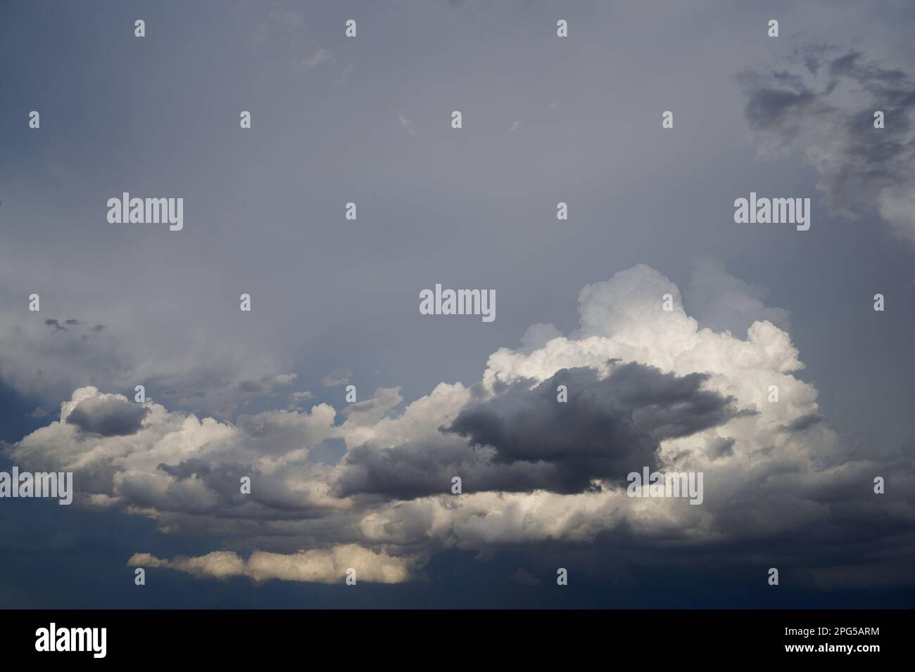 Late afternoon thunderstorm developing approximately 50 kilometres from camera positioin. Isolated heavy rainfall resulted from this storm. Stock Photohttps://www.alamy.com/image-license-details/?v=1https://www.alamy.com/late-afternoon-thunderstorm-developing-approximately-50-kilometres-from-camera-positioin-isolated-heavy-rainfall-resulted-from-this-storm-image543474168.html
RF2PG5ARM–Late afternoon thunderstorm developing approximately 50 kilometres from camera positioin. Isolated heavy rainfall resulted from this storm.
 hideway beach This tiny coastal hamlet is set on a long, white, sandy beach on a no-through road about 50 kilometres from Airlie Beach Stock Photohttps://www.alamy.com/image-license-details/?v=1https://www.alamy.com/hideway-beach-this-tiny-coastal-hamlet-is-set-on-a-long-white-sandy-beach-on-a-no-through-road-about-50-kilometres-from-airlie-beach-image331069893.html
RF2A6HF0N–hideway beach This tiny coastal hamlet is set on a long, white, sandy beach on a no-through road about 50 kilometres from Airlie Beach
 Athletics - IAAF World Athletics Championships - Osaka 2007 - Nagai Stadium. Norway's Erik Tysse in action during the Men's 50 Kilometres Race Walk final Stock Photohttps://www.alamy.com/image-license-details/?v=1https://www.alamy.com/stock-photo-athletics-iaaf-world-athletics-championships-osaka-2007-nagai-stadium-109618611.html
RMGA9FJB–Athletics - IAAF World Athletics Championships - Osaka 2007 - Nagai Stadium. Norway's Erik Tysse in action during the Men's 50 Kilometres Race Walk final
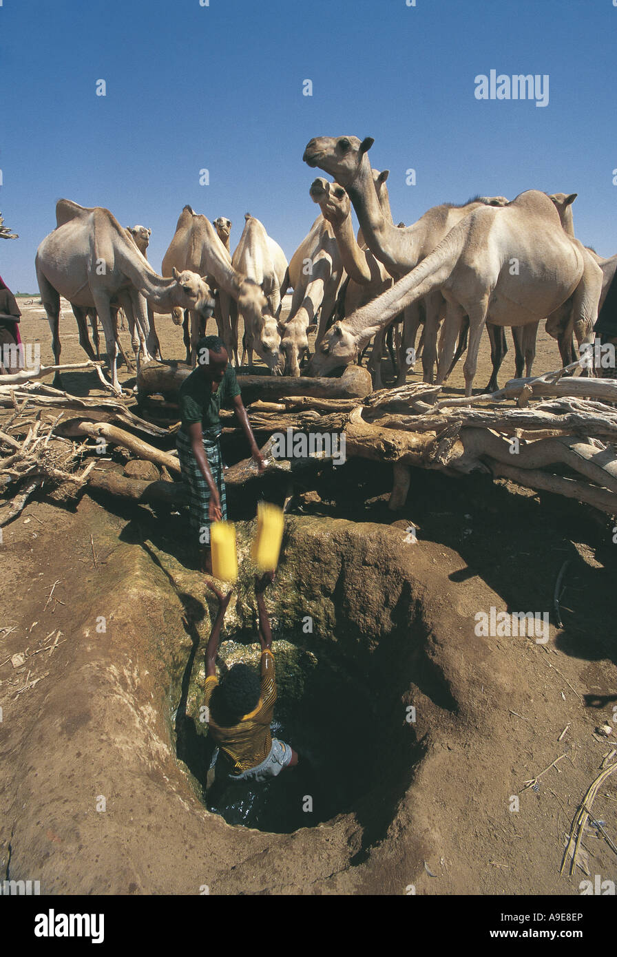 Watering camels from shallow wells Gode Ethiopia These camels have travelled 50 kilometres to find water Stock Photohttps://www.alamy.com/image-license-details/?v=1https://www.alamy.com/stock-photo-watering-camels-from-shallow-wells-gode-ethiopia-these-camels-have-12339885.html
RMA9E8EP–Watering camels from shallow wells Gode Ethiopia These camels have travelled 50 kilometres to find water
 Vue du quai de Sétubal ( Portugal), ville portuaire située sur l'estuaire de Sado, à 50 kilomètres au sud de Lisbonne. Gouache du lieutenant de vaisseau J.C. Raoul, embarqué dans la corvette Le Newton, sous le commandement du capitaine de frégate Simonet De Maisonneuve, offert en 1852 à Théodore Ducos ( 1801- 1855) ministre de la marine et des colonies de 1851 à 1855. Stock Photohttps://www.alamy.com/image-license-details/?v=1https://www.alamy.com/vue-du-quai-de-stubal-portugal-ville-portuaire-situe-sur-lestuaire-de-sado-50-kilomtres-au-sud-de-lisbonne-gouache-du-lieutenant-de-vaisseau-jc-raoul-embarqu-dans-la-corvette-le-newton-sous-le-commandement-du-capitaine-de-frgate-simonet-de-maisonneuve-offert-en-1852-thodore-ducos-1801-1855-ministre-de-la-marine-et-des-colonies-de-1851-1855-image546269642.html
RM2PMMME2–Vue du quai de Sétubal ( Portugal), ville portuaire située sur l'estuaire de Sado, à 50 kilomètres au sud de Lisbonne. Gouache du lieutenant de vaisseau J.C. Raoul, embarqué dans la corvette Le Newton, sous le commandement du capitaine de frégate Simonet De Maisonneuve, offert en 1852 à Théodore Ducos ( 1801- 1855) ministre de la marine et des colonies de 1851 à 1855.
 Railway station, Maxwelton. Maxwelton is a small town and locality in the Shire of Richmond in central north Queensland. It was a small railway siding, 50 kilometres west of Richmond and derived its name from Maxwelton Station, one of the original pastoral holdings taken up in the 1800s. The site for the township was chosen in 1908, at the junction of the new railway line and the road from McKinlay to the Camp Hotel on the Flinders River. The main occupants of the town were rail workers who had a row of fetters cottages along the southern side of the rail track which carried two trains a day Stock Photohttps://www.alamy.com/image-license-details/?v=1https://www.alamy.com/railway-station-maxwelton-maxwelton-is-a-small-town-and-locality-in-the-shire-of-richmond-in-central-north-queensland-it-was-a-small-railway-siding-50-kilometres-west-of-richmond-and-derived-its-name-from-maxwelton-station-one-of-the-original-pastoral-holdings-taken-up-in-the-1800s-the-site-for-the-township-was-chosen-in-1908-at-the-junction-of-the-new-railway-line-and-the-road-from-mckinlay-to-the-camp-hotel-on-the-flinders-river-the-main-occupants-of-the-town-were-rail-workers-who-had-a-row-of-fetters-cottages-along-the-southern-side-of-the-rail-track-which-carried-two-trains-a-day-image188717319.html
RMMY0PT7–Railway station, Maxwelton. Maxwelton is a small town and locality in the Shire of Richmond in central north Queensland. It was a small railway siding, 50 kilometres west of Richmond and derived its name from Maxwelton Station, one of the original pastoral holdings taken up in the 1800s. The site for the township was chosen in 1908, at the junction of the new railway line and the road from McKinlay to the Camp Hotel on the Flinders River. The main occupants of the town were rail workers who had a row of fetters cottages along the southern side of the rail track which carried two trains a day
 Kŭmgangsan is a 1,638-metre (5,374 ft)-high mountain in Kangwon-do, North Korea. It is about 50 kilometres (31 mi) from the South Korean city of Sokcho in Gangwon-do. It is one of the best-known mountains in North Korea. It is located on the east coast of the country, in Mount Kumgang Tourist Region, formerly part of Kangwŏn Province. Mount Kumgang is part of the Taebaek mountain range which runs along the east of the Korean peninsula. The name means Vajra (or Diamond) Mountain. From 1019--1945 Korea was an unwilling annexed dependency of the Empire of Japan. Stock Photohttps://www.alamy.com/image-license-details/?v=1https://www.alamy.com/kmgangsan-is-a-1638-metre-5374-ft-high-mountain-in-kangwon-do-north-korea-it-is-about-50-kilometres-31-mi-from-the-south-korean-city-of-sokcho-in-gangwon-do-it-is-one-of-the-best-known-mountains-in-north-korea-it-is-located-on-the-east-coast-of-the-country-in-mount-kumgang-tourist-region-formerly-part-of-kangwn-province-mount-kumgang-is-part-of-the-taebaek-mountain-range-which-runs-along-the-east-of-the-korean-peninsula-the-name-means-vajra-or-diamond-mountain-from-1019-1945-korea-was-an-unwilling-annexed-dependency-of-the-empire-of-japan-image344266998.html
RM2B02M1X–Kŭmgangsan is a 1,638-metre (5,374 ft)-high mountain in Kangwon-do, North Korea. It is about 50 kilometres (31 mi) from the South Korean city of Sokcho in Gangwon-do. It is one of the best-known mountains in North Korea. It is located on the east coast of the country, in Mount Kumgang Tourist Region, formerly part of Kangwŏn Province. Mount Kumgang is part of the Taebaek mountain range which runs along the east of the Korean peninsula. The name means Vajra (or Diamond) Mountain. From 1019--1945 Korea was an unwilling annexed dependency of the Empire of Japan.
 Rome: 50 Kilometres Walk, Donald Thompson (gold Meda of Britian), J. Ljunggren of Sweden (second), A. Pamich of Italy (Third). A. Stcherbina of Russia (Forth) at Olympic Games in Rome. 8 September 1960 Stock Photohttps://www.alamy.com/image-license-details/?v=1https://www.alamy.com/rome-50-kilometres-walk-donald-thompson-gold-meda-of-britian-j-ljunggren-of-sweden-second-a-pamich-of-italy-third-a-stcherbina-of-russia-forth-at-olympic-games-in-rome-8-september-1960-image623749517.html
RM2Y6P6TD–Rome: 50 Kilometres Walk, Donald Thompson (gold Meda of Britian), J. Ljunggren of Sweden (second), A. Pamich of Italy (Third). A. Stcherbina of Russia (Forth) at Olympic Games in Rome. 8 September 1960
 Famous of the ochre of Luberon, located 10 kilometres west of Apt and 50 kilometres from Avignon in region Provence in France. Stock Photohttps://www.alamy.com/image-license-details/?v=1https://www.alamy.com/famous-of-the-ochre-of-luberon-located-10-kilometres-west-of-apt-and-50-kilometres-from-avignon-in-region-provence-in-france-image214531172.html
RFPD0MKG–Famous of the ochre of Luberon, located 10 kilometres west of Apt and 50 kilometres from Avignon in region Provence in France.
 Castel di Tora, comune in the Province of Rieti in the Italian region Latium, located about 50 kilometres northeast of Rome. Stock Photohttps://www.alamy.com/image-license-details/?v=1https://www.alamy.com/castel-di-tora-comune-in-the-province-of-rieti-in-the-italian-region-latium-located-about-50-kilometres-northeast-of-rome-image182325441.html
RFMGHHXW–Castel di Tora, comune in the Province of Rieti in the Italian region Latium, located about 50 kilometres northeast of Rome.
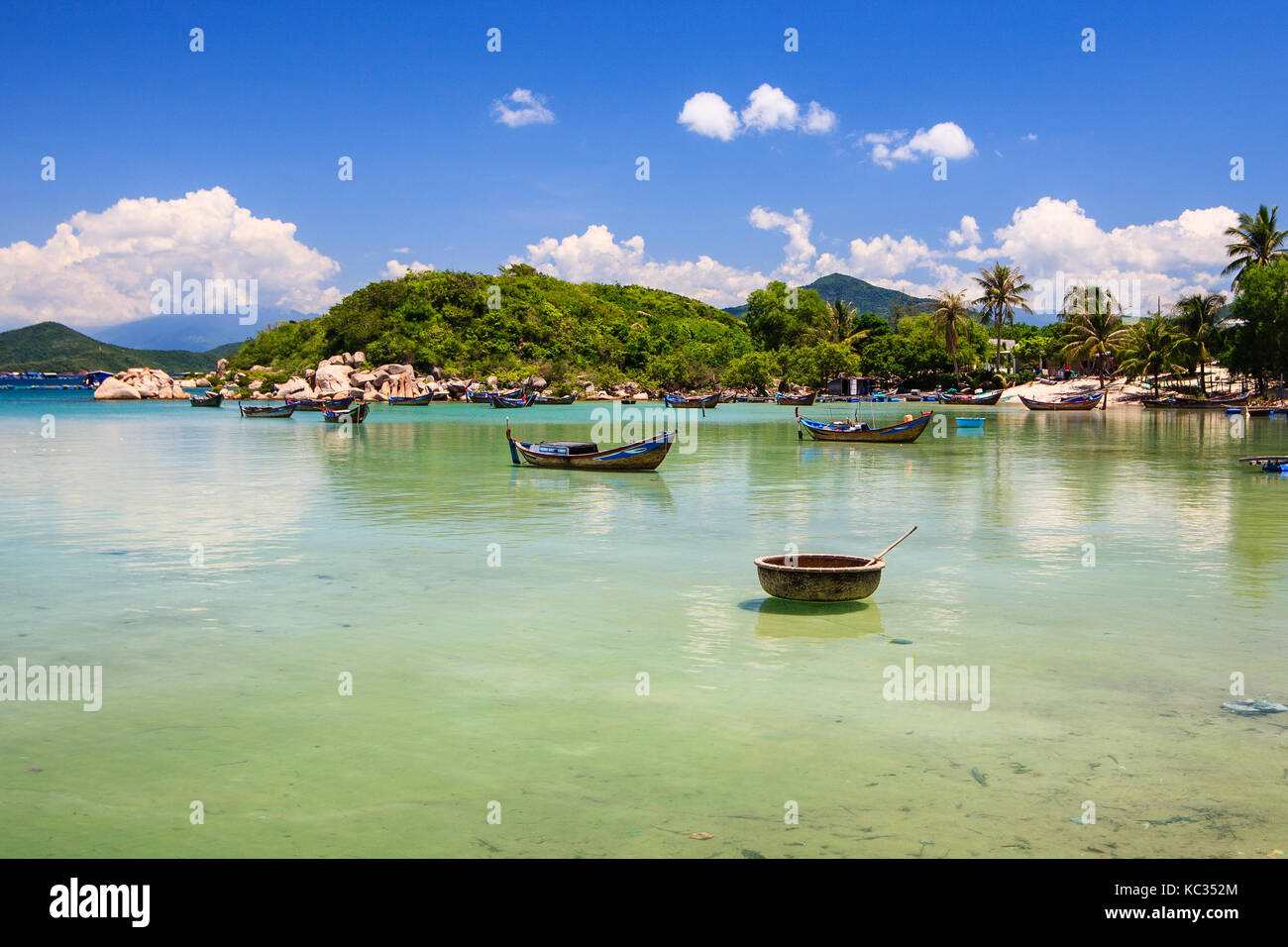 Xuan Dung beach, Van Phong bay, Khanh Hoa, Vietnam. From Nha Trang, driving some 50 kilometres toward the north. Stock Photohttps://www.alamy.com/image-license-details/?v=1https://www.alamy.com/stock-image-xuan-dung-beach-van-phong-bay-khanh-hoa-vietnam-from-nha-trang-driving-162339036.html
RFKC352M–Xuan Dung beach, Van Phong bay, Khanh Hoa, Vietnam. From Nha Trang, driving some 50 kilometres toward the north.
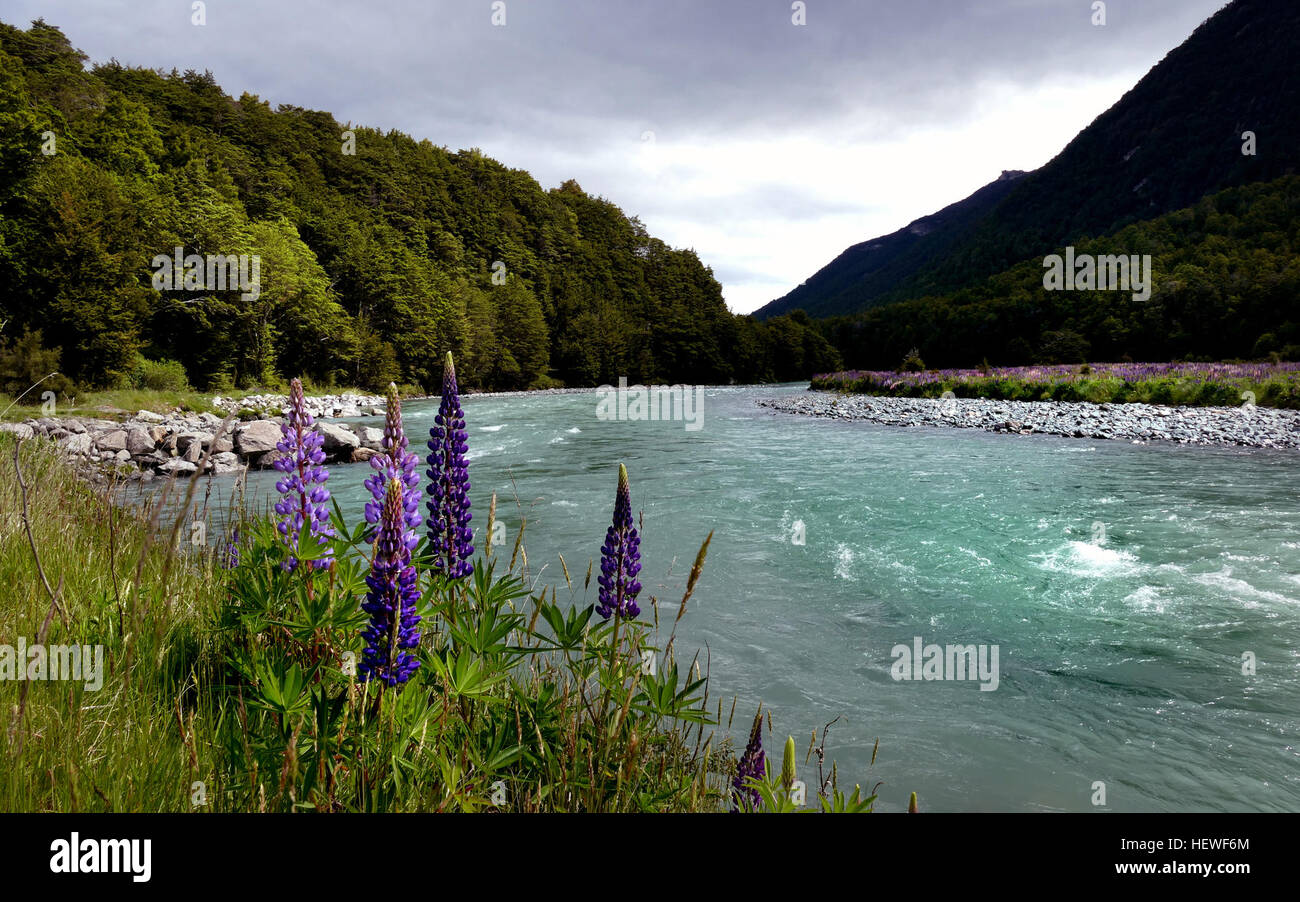 The Eglinton River is located in the region of Southland in the southwest of New Zealand. It flows through Fiordland National Park for 50 kilometres (31 mi). Its headwaters are at Lake Gunn, 25 kilometres (16 mi) east of Milford Sound, and it flows generally south before entering Lake Te Anau along the lake's eastern shore opposite the entrance to North Fiord. For much of its length the Eglinton is accompanied by the only road in the region, State Highway 94 from Te Anau to Milford Sound. The southern end of the Milford Track is located close to the Eglinton River. Stock Photohttps://www.alamy.com/image-license-details/?v=1https://www.alamy.com/stock-photo-the-eglinton-river-is-located-in-the-region-of-southland-in-the-southwest-129638508.html
RMHEWF6M–The Eglinton River is located in the region of Southland in the southwest of New Zealand. It flows through Fiordland National Park for 50 kilometres (31 mi). Its headwaters are at Lake Gunn, 25 kilometres (16 mi) east of Milford Sound, and it flows generally south before entering Lake Te Anau along the lake's eastern shore opposite the entrance to North Fiord. For much of its length the Eglinton is accompanied by the only road in the region, State Highway 94 from Te Anau to Milford Sound. The southern end of the Milford Track is located close to the Eglinton River.
 Jerash, Jordanian capital Amman. 18th Sep, 2017. Italian tenor Andrea Bocelli performs during a concert at the archaeological site of Jerash, some 50 kilometres north of Jordanian capital Amman, on Sept. 18, 2017. Credit: Mohammad Abu Ghosh/Xinhua/Alamy Live News Stock Photohttps://www.alamy.com/image-license-details/?v=1https://www.alamy.com/stock-image-jerash-jordanian-capital-amman-18th-sep-2017-italian-tenor-andrea-160027499.html
RMK89TKR–Jerash, Jordanian capital Amman. 18th Sep, 2017. Italian tenor Andrea Bocelli performs during a concert at the archaeological site of Jerash, some 50 kilometres north of Jordanian capital Amman, on Sept. 18, 2017. Credit: Mohammad Abu Ghosh/Xinhua/Alamy Live News
 Mountain view by beach Playa de Orinon Cantabria North Spain about 50 kilometres from Sa Stock Photohttps://www.alamy.com/image-license-details/?v=1https://www.alamy.com/mountain-view-by-beach-playa-de-orinon-cantabria-north-spain-about-50-kilometres-from-sa-image518004354.html
RF2N2N3RE–Mountain view by beach Playa de Orinon Cantabria North Spain about 50 kilometres from Sa
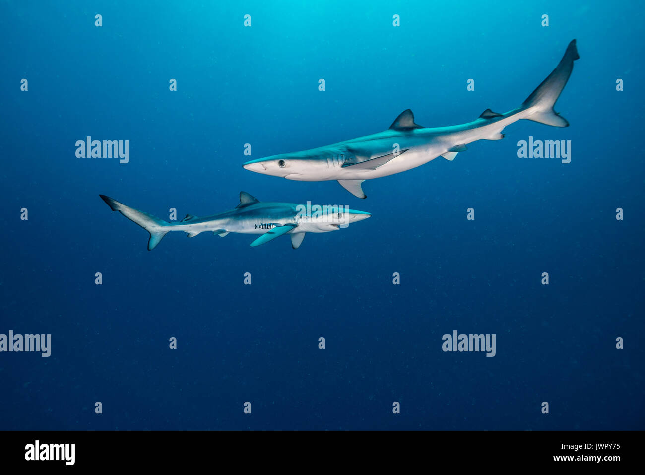 Two blue sharks, underwater view, taken about 50 kilometres offshore out past Western Cape, South Africa. Stock Photohttps://www.alamy.com/image-license-details/?v=1https://www.alamy.com/two-blue-sharks-underwater-view-taken-about-50-kilometres-offshore-image153553657.html
RFJWPY75–Two blue sharks, underwater view, taken about 50 kilometres offshore out past Western Cape, South Africa.
 View on an empty autobahn A44 near Meerhof, Germany, 14 February 2010. Heavy snowfalls and lack of road salt caused a shut-off of some 50 kilometres autobahn. Photo: Uwe Zucchi Stock Photohttps://www.alamy.com/image-license-details/?v=1https://www.alamy.com/stock-photo-view-on-an-empty-autobahn-a44-near-meerhof-germany-14-february-2010-55090554.html
RMD5HGFP–View on an empty autobahn A44 near Meerhof, Germany, 14 February 2010. Heavy snowfalls and lack of road salt caused a shut-off of some 50 kilometres autobahn. Photo: Uwe Zucchi
 The Bay of Fires Tasmania east coast Stock Photohttps://www.alamy.com/image-license-details/?v=1https://www.alamy.com/stock-photo-the-bay-of-fires-tasmania-east-coast-175200868.html
RMM512DT–The Bay of Fires Tasmania east coast
 Cars travel on the access road to the town of Ivankiv, Ukraine, 13 April 2016. The former nuclear plant Chernobyl, which commemorates the 30th anniversary of the nuclear disaster, is only 50 kilometres away. Photo: Andreas Stein/dpa Stock Photohttps://www.alamy.com/image-license-details/?v=1https://www.alamy.com/stock-photo-cars-travel-on-the-access-road-to-the-town-of-ivankiv-ukraine-13-april-102853232.html
RMFY9A9M–Cars travel on the access road to the town of Ivankiv, Ukraine, 13 April 2016. The former nuclear plant Chernobyl, which commemorates the 30th anniversary of the nuclear disaster, is only 50 kilometres away. Photo: Andreas Stein/dpa
 ***FILE PHOTO*** Czech police are checking a 50-million-crown European subsidy granted to Capi hnizdo countryside hotel of Andrej Babis, Aktualne.cz news server writes on December 30, 2015. The prospering Agrofert is suspected of deliberately applying for the subsidy as an unknown firm in order to win the subsidy, the server writes. The Capi Hnizdo (The Stork´s Nest, pictured in Olbramovice, Czech Republic, March 27, 2014) is a luxurious resort 50 kilometres south of Prague. Shortly before the subsidy application was filed in 2008, Agrofert issued bearer shares and hid the real owner. Only in Stock Photohttps://www.alamy.com/image-license-details/?v=1https://www.alamy.com/stock-photo-file-photo-czech-police-are-checking-a-50-million-crown-european-subsidy-92575063.html
RMFAH4C7–***FILE PHOTO*** Czech police are checking a 50-million-crown European subsidy granted to Capi hnizdo countryside hotel of Andrej Babis, Aktualne.cz news server writes on December 30, 2015. The prospering Agrofert is suspected of deliberately applying for the subsidy as an unknown firm in order to win the subsidy, the server writes. The Capi Hnizdo (The Stork´s Nest, pictured in Olbramovice, Czech Republic, March 27, 2014) is a luxurious resort 50 kilometres south of Prague. Shortly before the subsidy application was filed in 2008, Agrofert issued bearer shares and hid the real owner. Only in
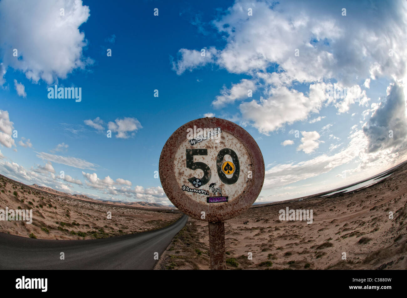 50 MPH road sign Fuerteventura Canary Islands Stock Photohttps://www.alamy.com/image-license-details/?v=1https://www.alamy.com/stock-photo-50-mph-road-sign-fuerteventura-canary-islands-36446617.html
RMC3880W–50 MPH road sign Fuerteventura Canary Islands
 hideway beach This tiny coastal hamlet is set on a long, white, sandy beach on a no-through road about 50 kilometres from Airlie Beach Stock Photohttps://www.alamy.com/image-license-details/?v=1https://www.alamy.com/hideway-beach-this-tiny-coastal-hamlet-is-set-on-a-long-white-sandy-beach-on-a-no-through-road-about-50-kilometres-from-airlie-beach-image331069874.html
RF2A6HF02–hideway beach This tiny coastal hamlet is set on a long, white, sandy beach on a no-through road about 50 kilometres from Airlie Beach
 Athletics - IAAF World Athletics Championships - Osaka 2007 - Nagai Stadium. China's Ken Akashi in action during the Men's 50 Kilometres Race Walk Final Stock Photohttps://www.alamy.com/image-license-details/?v=1https://www.alamy.com/stock-photo-athletics-iaaf-world-athletics-championships-osaka-2007-nagai-stadium-109636107.html
RMGAA9Y7–Athletics - IAAF World Athletics Championships - Osaka 2007 - Nagai Stadium. China's Ken Akashi in action during the Men's 50 Kilometres Race Walk Final
 Rice terraces in Indonesia, Bali at sunset, Belimbing. Belimbing is located about 50 kilometres northwest of Denpasar. Stock Photohttps://www.alamy.com/image-license-details/?v=1https://www.alamy.com/stock-image-rice-terraces-in-indonesia-bali-at-sunset-belimbing-belimbing-is-located-163090265.html
RMKD9B89–Rice terraces in Indonesia, Bali at sunset, Belimbing. Belimbing is located about 50 kilometres northwest of Denpasar.
 Life And Death Trees - Nieu-Bethesda is a village in the Eastern Cape at the foot of the Sneeuberge, approximately 50 kilometres Stock Photohttps://www.alamy.com/image-license-details/?v=1https://www.alamy.com/stock-photo-life-and-death-trees-nieu-bethesda-is-a-village-in-the-eastern-cape-116324214.html
RFGN70M6–Life And Death Trees - Nieu-Bethesda is a village in the Eastern Cape at the foot of the Sneeuberge, approximately 50 kilometres
 Stellenbosch is a town in the Western Cape province of South Africa, situated about 50 kilometres (31 miles) east of Cape Town, along the banks of the Stock Photohttps://www.alamy.com/image-license-details/?v=1https://www.alamy.com/stellenbosch-is-a-town-in-the-western-cape-province-of-south-africa-situated-about-50-kilometres-31-miles-east-of-cape-town-along-the-banks-of-the-image186678842.html
RFMRKXNE–Stellenbosch is a town in the Western Cape province of South Africa, situated about 50 kilometres (31 miles) east of Cape Town, along the banks of the
![Zanzibar (from Arabic: زنجبار Zanjibār, from Persian: زنگبار Zangibār'Coast of Blacks'; zangi [black-skinned] + bār [coast]) is a semi-autonomous part of Tanzania in East Africa. It is composed of the Zanzibar Archipelago in the Indian Ocean, 25–50 kilometres (16–31 mi) off the coast of the mainland, and consists of numerous small islands and two large ones: Unguja (the main island, referred to informally as Zanzibar), and Pemba. The capital of Zanzibar, located on the island of Unguja, is Zanzibar City. Its historic centre, known as Stone Town, is a World Heritage Site and is claimed to be Stock Photo Zanzibar (from Arabic: زنجبار Zanjibār, from Persian: زنگبار Zangibār'Coast of Blacks'; zangi [black-skinned] + bār [coast]) is a semi-autonomous part of Tanzania in East Africa. It is composed of the Zanzibar Archipelago in the Indian Ocean, 25–50 kilometres (16–31 mi) off the coast of the mainland, and consists of numerous small islands and two large ones: Unguja (the main island, referred to informally as Zanzibar), and Pemba. The capital of Zanzibar, located on the island of Unguja, is Zanzibar City. Its historic centre, known as Stone Town, is a World Heritage Site and is claimed to be Stock Photo](https://c8.alamy.com/comp/2B0276F/zanzibar-from-arabic-zanjibr-from-persian-zangibrcoast-of-blacks-zangi-black-skinned-br-coast-is-a-semi-autonomous-part-of-tanzania-in-east-africa-it-is-composed-of-the-zanzibar-archipelago-in-the-indian-ocean-2550-kilometres-1631-mi-off-the-coast-of-the-mainland-and-consists-of-numerous-small-islands-and-two-large-ones-unguja-the-main-island-referred-to-informally-as-zanzibar-and-pemba-the-capital-of-zanzibar-located-on-the-island-of-unguja-is-zanzibar-city-its-historic-centre-known-as-stone-town-is-a-world-heritage-site-and-is-claimed-to-be-2B0276F.jpg) Zanzibar (from Arabic: زنجبار Zanjibār, from Persian: زنگبار Zangibār'Coast of Blacks'; zangi [black-skinned] + bār [coast]) is a semi-autonomous part of Tanzania in East Africa. It is composed of the Zanzibar Archipelago in the Indian Ocean, 25–50 kilometres (16–31 mi) off the coast of the mainland, and consists of numerous small islands and two large ones: Unguja (the main island, referred to informally as Zanzibar), and Pemba. The capital of Zanzibar, located on the island of Unguja, is Zanzibar City. Its historic centre, known as Stone Town, is a World Heritage Site and is claimed to be Stock Photohttps://www.alamy.com/image-license-details/?v=1https://www.alamy.com/zanzibar-from-arabic-zanjibr-from-persian-zangibrcoast-of-blacks-zangi-black-skinned-br-coast-is-a-semi-autonomous-part-of-tanzania-in-east-africa-it-is-composed-of-the-zanzibar-archipelago-in-the-indian-ocean-2550-kilometres-1631-mi-off-the-coast-of-the-mainland-and-consists-of-numerous-small-islands-and-two-large-ones-unguja-the-main-island-referred-to-informally-as-zanzibar-and-pemba-the-capital-of-zanzibar-located-on-the-island-of-unguja-is-zanzibar-city-its-historic-centre-known-as-stone-town-is-a-world-heritage-site-and-is-claimed-to-be-image344256935.html
Zanzibar (from Arabic: زنجبار Zanjibār, from Persian: زنگبار Zangibār'Coast of Blacks'; zangi [black-skinned] + bār [coast]) is a semi-autonomous part of Tanzania in East Africa. It is composed of the Zanzibar Archipelago in the Indian Ocean, 25–50 kilometres (16–31 mi) off the coast of the mainland, and consists of numerous small islands and two large ones: Unguja (the main island, referred to informally as Zanzibar), and Pemba. The capital of Zanzibar, located on the island of Unguja, is Zanzibar City. Its historic centre, known as Stone Town, is a World Heritage Site and is claimed to be Stock Photohttps://www.alamy.com/image-license-details/?v=1https://www.alamy.com/zanzibar-from-arabic-zanjibr-from-persian-zangibrcoast-of-blacks-zangi-black-skinned-br-coast-is-a-semi-autonomous-part-of-tanzania-in-east-africa-it-is-composed-of-the-zanzibar-archipelago-in-the-indian-ocean-2550-kilometres-1631-mi-off-the-coast-of-the-mainland-and-consists-of-numerous-small-islands-and-two-large-ones-unguja-the-main-island-referred-to-informally-as-zanzibar-and-pemba-the-capital-of-zanzibar-located-on-the-island-of-unguja-is-zanzibar-city-its-historic-centre-known-as-stone-town-is-a-world-heritage-site-and-is-claimed-to-be-image344256935.htmlRM2B0276F–Zanzibar (from Arabic: زنجبار Zanjibār, from Persian: زنگبار Zangibār'Coast of Blacks'; zangi [black-skinned] + bār [coast]) is a semi-autonomous part of Tanzania in East Africa. It is composed of the Zanzibar Archipelago in the Indian Ocean, 25–50 kilometres (16–31 mi) off the coast of the mainland, and consists of numerous small islands and two large ones: Unguja (the main island, referred to informally as Zanzibar), and Pemba. The capital of Zanzibar, located on the island of Unguja, is Zanzibar City. Its historic centre, known as Stone Town, is a World Heritage Site and is claimed to be
 Israel: Work on the Israel oil pipe line, being laid between Eilat and Beer Sheba, is progressing at fast tempo; The construction crew reached a point 50 kilometres south of Beer Sheba. The eight inch pipe will hardly satisfy even the domest oil needs of Israel, but it has been proposed that a 30 inch pipe line is to be laid. The French Government recently announced that France will aid Israel in building an oil pipe line from Eilat to Haifa, and that work would begin shortly. 15 January 1957 Stock Photohttps://www.alamy.com/image-license-details/?v=1https://www.alamy.com/israel-work-on-the-israel-oil-pipe-line-being-laid-between-eilat-and-beer-sheba-is-progressing-at-fast-tempo-the-construction-crew-reached-a-point-50-kilometres-south-of-beer-sheba-the-eight-inch-pipe-will-hardly-satisfy-even-the-domest-oil-needs-of-israel-but-it-has-been-proposed-that-a-30-inch-pipe-line-is-to-be-laid-the-french-government-recently-announced-that-france-will-aid-israel-in-building-an-oil-pipe-line-from-eilat-to-haifa-and-that-work-would-begin-shortly-15-january-1957-image623735469.html
RM2Y6NGXN–Israel: Work on the Israel oil pipe line, being laid between Eilat and Beer Sheba, is progressing at fast tempo; The construction crew reached a point 50 kilometres south of Beer Sheba. The eight inch pipe will hardly satisfy even the domest oil needs of Israel, but it has been proposed that a 30 inch pipe line is to be laid. The French Government recently announced that France will aid Israel in building an oil pipe line from Eilat to Haifa, and that work would begin shortly. 15 January 1957
 Famous of the ochre of Luberon, located 10 kilometres west of Apt and 50 kilometres from Avignon in region Provence in France. Stock Photohttps://www.alamy.com/image-license-details/?v=1https://www.alamy.com/famous-of-the-ochre-of-luberon-located-10-kilometres-west-of-apt-and-50-kilometres-from-avignon-in-region-provence-in-france-image214531124.html
RFPD0MHT–Famous of the ochre of Luberon, located 10 kilometres west of Apt and 50 kilometres from Avignon in region Provence in France.
 Castel di Tora, comune in the Province of Rieti in the Italian region Latium, located about 50 kilometres northeast of Rome. Stock Photohttps://www.alamy.com/image-license-details/?v=1https://www.alamy.com/castel-di-tora-comune-in-the-province-of-rieti-in-the-italian-region-latium-located-about-50-kilometres-northeast-of-rome-image182325469.html
RFMGHHYW–Castel di Tora, comune in the Province of Rieti in the Italian region Latium, located about 50 kilometres northeast of Rome.
 Xuan Dung beach, Van Phong bay, Khanh Hoa, Vietnam. From Nha Trang, driving some 50 kilometres toward the north. Stock Photohttps://www.alamy.com/image-license-details/?v=1https://www.alamy.com/stock-image-xuan-dung-beach-van-phong-bay-khanh-hoa-vietnam-from-nha-trang-driving-162339053.html
RFKC3539–Xuan Dung beach, Van Phong bay, Khanh Hoa, Vietnam. From Nha Trang, driving some 50 kilometres toward the north.
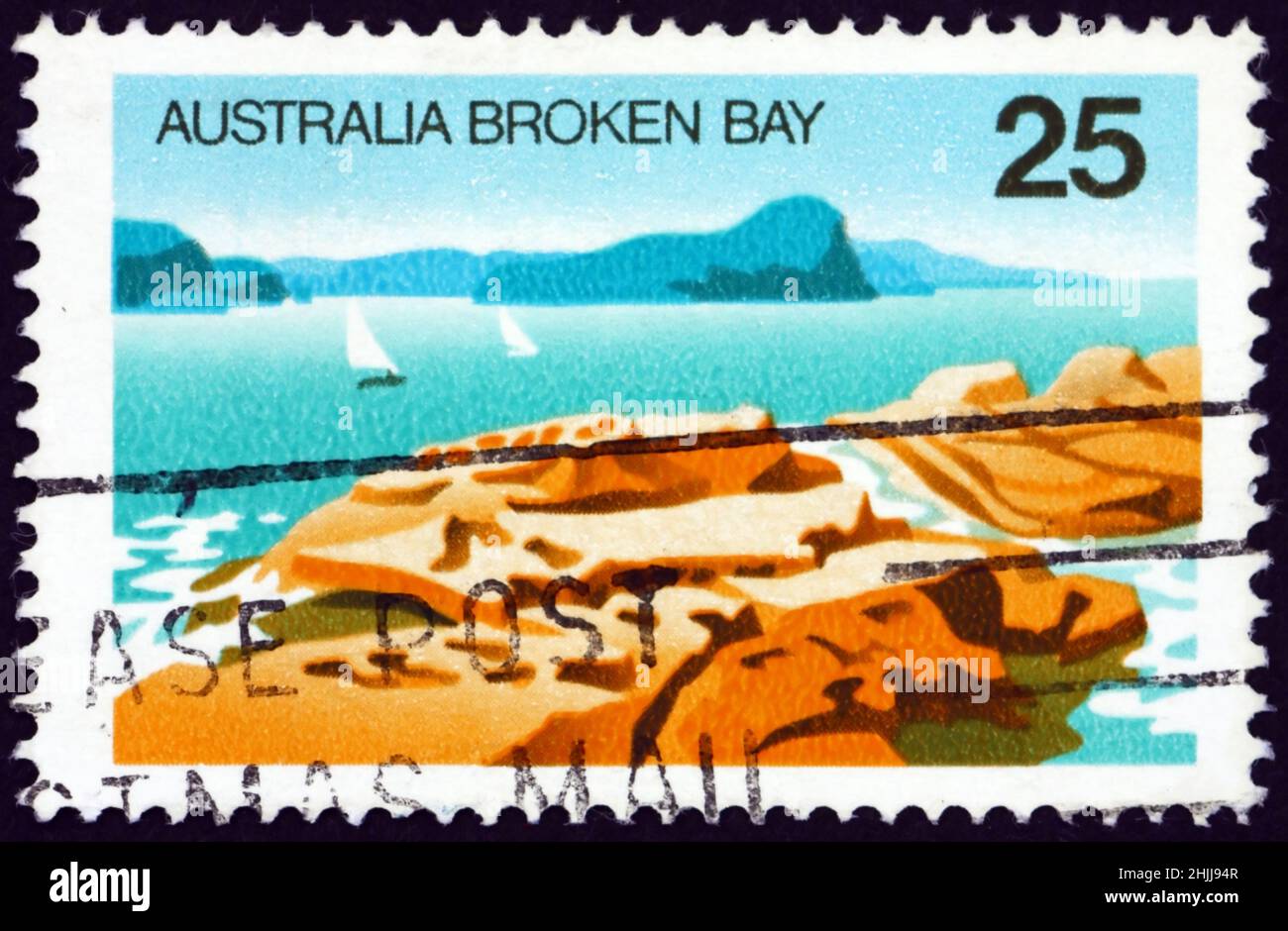 AUSTRALIA - CIRCA 1976: a stamp printed in Australia shows Broken Bay, New South Wales, is a drowned valley estuary located about 50 kilometres north Stock Photohttps://www.alamy.com/image-license-details/?v=1https://www.alamy.com/australia-circa-1976-a-stamp-printed-in-australia-shows-broken-bay-new-south-wales-is-a-drowned-valley-estuary-located-about-50-kilometres-north-image458935703.html
RF2HJJ94R–AUSTRALIA - CIRCA 1976: a stamp printed in Australia shows Broken Bay, New South Wales, is a drowned valley estuary located about 50 kilometres north
 Jerash, Jordanian capital Amman. 18th Sep, 2017. Italian tenor Andrea Bocelli (R) performs during a concert at the archaeological site of Jerash, some 50 kilometres north of Jordanian capital Amman, on Sept. 18, 2017. Credit: Mohammad Abu Ghosh/Xinhua/Alamy Live News Stock Photohttps://www.alamy.com/image-license-details/?v=1https://www.alamy.com/stock-image-jerash-jordanian-capital-amman-18th-sep-2017-italian-tenor-andrea-160027503.html
RMK89TKY–Jerash, Jordanian capital Amman. 18th Sep, 2017. Italian tenor Andrea Bocelli (R) performs during a concert at the archaeological site of Jerash, some 50 kilometres north of Jordanian capital Amman, on Sept. 18, 2017. Credit: Mohammad Abu Ghosh/Xinhua/Alamy Live News
 (170919) -- JERASH, Sept. 19, 2017 -- Italian tenor Andrea Bocelli performs during a concert at the archaeological site of Jerash, some 50 kilometres north of Jordanian capital Amman, on Sept. 18, 2017. )(whw) JORDAN-JERASH-ANDREA BOCELLI-CONCERT MohammadxAbuxGhosh PUBLICATIONxNOTxINxCHN Stock Photohttps://www.alamy.com/image-license-details/?v=1https://www.alamy.com/170919-jerash-sept-19-2017-italian-tenor-andrea-bocelli-performs-during-a-concert-at-the-archaeological-site-of-jerash-some-50-kilometres-north-of-jordanian-capital-amman-on-sept-18-2017-whw-jordan-jerash-andrea-bocelli-concert-mohammadxabuxghosh-publicationxnotxinxchn-image564148539.html
RM2RNR563–(170919) -- JERASH, Sept. 19, 2017 -- Italian tenor Andrea Bocelli performs during a concert at the archaeological site of Jerash, some 50 kilometres north of Jordanian capital Amman, on Sept. 18, 2017. )(whw) JORDAN-JERASH-ANDREA BOCELLI-CONCERT MohammadxAbuxGhosh PUBLICATIONxNOTxINxCHN
 Underwater view of a blue shark and pilot fish, image was taken about 50 kilometres offshore past Western Cape, South Africa. Stock Photohttps://www.alamy.com/image-license-details/?v=1https://www.alamy.com/underwater-view-of-a-blue-shark-and-pilot-fish-image-was-taken-about-image153553471.html
RFJWPY0F–Underwater view of a blue shark and pilot fish, image was taken about 50 kilometres offshore past Western Cape, South Africa.
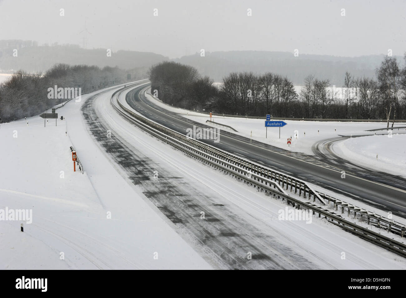 View on an empty autobahn A44 near Meerhof, Germany, 14 February 2010. Heavy snowfalls and lack of road salt caused a shut-off of some 50 kilometres autobahn. Photo: Uwe Zucchi Stock Photohttps://www.alamy.com/image-license-details/?v=1https://www.alamy.com/stock-photo-view-on-an-empty-autobahn-a44-near-meerhof-germany-14-february-2010-55090553.html
RMD5HGFN–View on an empty autobahn A44 near Meerhof, Germany, 14 February 2010. Heavy snowfalls and lack of road salt caused a shut-off of some 50 kilometres autobahn. Photo: Uwe Zucchi
 The Bay of Fires Tasmania east coast Stock Photohttps://www.alamy.com/image-license-details/?v=1https://www.alamy.com/stock-photo-the-bay-of-fires-tasmania-east-coast-175201741.html
RMM513H1–The Bay of Fires Tasmania east coast
 Pedestrians walk along a road in Ivankiv, Ukraine, 13 April 2016. The former nuclear plant Chernobyl, which commemorates the 30th anniversary of the Chernobyl nuclear disaster, is only 50 kilometres away. Photo: Andreas Stein/dpa Stock Photohttps://www.alamy.com/image-license-details/?v=1https://www.alamy.com/stock-photo-pedestrians-walk-along-a-road-in-ivankiv-ukraine-13-april-2016-the-102853229.html
RMFY9A9H–Pedestrians walk along a road in Ivankiv, Ukraine, 13 April 2016. The former nuclear plant Chernobyl, which commemorates the 30th anniversary of the Chernobyl nuclear disaster, is only 50 kilometres away. Photo: Andreas Stein/dpa
 ***FILE PHOTO*** Czech police are checking a 50-million-crown European subsidy granted to Capi hnizdo countryside hotel of Andrej Babis, Aktualne.cz news server writes on December 30, 2015. The prospering Agrofert is suspected of deliberately applying for the subsidy as an unknown firm in order to win the subsidy, the server writes. The Capi Hnizdo (The Stork´s Nest, pictured in Olbramovice, Czech Republic, March 27, 2014) is a luxurious resort 50 kilometres south of Prague. Shortly before the subsidy application was filed in 2008, Agrofert issued bearer shares and hid the real owner. Only in Stock Photohttps://www.alamy.com/image-license-details/?v=1https://www.alamy.com/stock-photo-file-photo-czech-police-are-checking-a-50-million-crown-european-subsidy-92575066.html
RMFAH4CA–***FILE PHOTO*** Czech police are checking a 50-million-crown European subsidy granted to Capi hnizdo countryside hotel of Andrej Babis, Aktualne.cz news server writes on December 30, 2015. The prospering Agrofert is suspected of deliberately applying for the subsidy as an unknown firm in order to win the subsidy, the server writes. The Capi Hnizdo (The Stork´s Nest, pictured in Olbramovice, Czech Republic, March 27, 2014) is a luxurious resort 50 kilometres south of Prague. Shortly before the subsidy application was filed in 2008, Agrofert issued bearer shares and hid the real owner. Only in
 ©PHOTOPQR/LE PARISIEN/Julien BARBARE ; Chantilly ; 21/09/2020 ; OISE TOURISME VISITES TOURISTES CHATEAU PARC DOMAINE CHANTILLY MASQUES COVID-19 CORONAVIRUS MUSEE CONDE - The Château de Chantilly is a historic French château located in the town of Chantilly, Oise, about 50 kilometres north of Paris. Stock Photohttps://www.alamy.com/image-license-details/?v=1https://www.alamy.com/photopqrle-parisienjulien-barbare-chantilly-21092020-oise-tourisme-visites-touristes-chateau-parc-domaine-chantilly-masques-covid-19-coronavirus-musee-conde-the-chteau-de-chantilly-is-a-historic-french-chteau-located-in-the-town-of-chantilly-oise-about-50-kilometres-north-of-paris-image486435677.html
RM2K7B1JN– ©PHOTOPQR/LE PARISIEN/Julien BARBARE ; Chantilly ; 21/09/2020 ; OISE TOURISME VISITES TOURISTES CHATEAU PARC DOMAINE CHANTILLY MASQUES COVID-19 CORONAVIRUS MUSEE CONDE - The Château de Chantilly is a historic French château located in the town of Chantilly, Oise, about 50 kilometres north of Paris.
 hideway beach This tiny coastal hamlet is set on a long, white, sandy beach on a no-through road about 50 kilometres from Airlie Beach Stock Photohttps://www.alamy.com/image-license-details/?v=1https://www.alamy.com/hideway-beach-this-tiny-coastal-hamlet-is-set-on-a-long-white-sandy-beach-on-a-no-through-road-about-50-kilometres-from-airlie-beach-image331069904.html
RF2A6HF14–hideway beach This tiny coastal hamlet is set on a long, white, sandy beach on a no-through road about 50 kilometres from Airlie Beach
 Athletics - IAAF World Athletics Championships - Osaka 2007 - Nagai Stadium. Portugal's Augusto Cardoso in action during the Men's 50 Kilometres Race Walk Final Stock Photohttps://www.alamy.com/image-license-details/?v=1https://www.alamy.com/stock-photo-athletics-iaaf-world-athletics-championships-osaka-2007-nagai-stadium-109636123.html
RMGAA9YR–Athletics - IAAF World Athletics Championships - Osaka 2007 - Nagai Stadium. Portugal's Augusto Cardoso in action during the Men's 50 Kilometres Race Walk Final
 Iraqi civilians flee from fighting while the smoke rise in the background from burning oil fields which was damaged during the fighting between Iraqi forces and Islamic state fighters(IS) in Qayara town, some 50 kilometres south of Mosul, northern Iraq. Tuesday, November. 01, 2016. Photo by Murat Bay/UPI Stock Photohttps://www.alamy.com/image-license-details/?v=1https://www.alamy.com/iraqi-civilians-flee-from-fighting-while-the-smoke-rise-in-the-background-from-burning-oil-fields-which-was-damaged-during-the-fighting-between-iraqi-forces-and-islamic-state-fightersis-in-qayara-town-some-50-kilometres-south-of-mosul-northern-iraq-tuesday-november-01-2016-photo-by-murat-bayupi-image257471725.html
RMTXTRPN–Iraqi civilians flee from fighting while the smoke rise in the background from burning oil fields which was damaged during the fighting between Iraqi forces and Islamic state fighters(IS) in Qayara town, some 50 kilometres south of Mosul, northern Iraq. Tuesday, November. 01, 2016. Photo by Murat Bay/UPI
 Baramulla, India. 16th Feb, 2022. Visitors seen next to partially frozen waterfall in Drung. Drung, a small village is a beautiful tourist spot in the Tangmarg area of Baramulla. It is around 50 kilometres away from the capital city of Kashmir, Srinagar. Credit: SOPA Images Limited/Alamy Live News Stock Photohttps://www.alamy.com/image-license-details/?v=1https://www.alamy.com/baramulla-india-16th-feb-2022-visitors-seen-next-to-partially-frozen-waterfall-in-drung-drung-a-small-village-is-a-beautiful-tourist-spot-in-the-tangmarg-area-of-baramulla-it-is-around-50-kilometres-away-from-the-capital-city-of-kashmir-srinagar-credit-sopa-images-limitedalamy-live-news-image460693009.html
RM2HNEAHN–Baramulla, India. 16th Feb, 2022. Visitors seen next to partially frozen waterfall in Drung. Drung, a small village is a beautiful tourist spot in the Tangmarg area of Baramulla. It is around 50 kilometres away from the capital city of Kashmir, Srinagar. Credit: SOPA Images Limited/Alamy Live News
 Stellenbosch is a town in the Western Cape province of South Africa, situated about 50 kilometres (31 miles) east of Cape Town, along the banks of the Stock Photohttps://www.alamy.com/image-license-details/?v=1https://www.alamy.com/stellenbosch-is-a-town-in-the-western-cape-province-of-south-africa-situated-about-50-kilometres-31-miles-east-of-cape-town-along-the-banks-of-the-image186678245.html
RFMRKX05–Stellenbosch is a town in the Western Cape province of South Africa, situated about 50 kilometres (31 miles) east of Cape Town, along the banks of the
![Zanzibar (from Arabic: زنجبار Zanjibār, from Persian: زنگبار Zangibār'Coast of Blacks'; zangi [black-skinned] + bār [coast]) is a semi-autonomous part of Tanzania in East Africa. It is composed of the Zanzibar Archipelago in the Indian Ocean, 25–50 kilometres (16–31 mi) off the coast of the mainland, and consists of numerous small islands and two large ones: Unguja (the main island, referred to informally as Zanzibar), and Pemba. The capital of Zanzibar, located on the island of Unguja, is Zanzibar City. Its historic centre, known as Stone Town, is a World Heritage Site and is claimed to be Stock Photo Zanzibar (from Arabic: زنجبار Zanjibār, from Persian: زنگبار Zangibār'Coast of Blacks'; zangi [black-skinned] + bār [coast]) is a semi-autonomous part of Tanzania in East Africa. It is composed of the Zanzibar Archipelago in the Indian Ocean, 25–50 kilometres (16–31 mi) off the coast of the mainland, and consists of numerous small islands and two large ones: Unguja (the main island, referred to informally as Zanzibar), and Pemba. The capital of Zanzibar, located on the island of Unguja, is Zanzibar City. Its historic centre, known as Stone Town, is a World Heritage Site and is claimed to be Stock Photo](https://c8.alamy.com/comp/2B0276B/zanzibar-from-arabic-zanjibr-from-persian-zangibrcoast-of-blacks-zangi-black-skinned-br-coast-is-a-semi-autonomous-part-of-tanzania-in-east-africa-it-is-composed-of-the-zanzibar-archipelago-in-the-indian-ocean-2550-kilometres-1631-mi-off-the-coast-of-the-mainland-and-consists-of-numerous-small-islands-and-two-large-ones-unguja-the-main-island-referred-to-informally-as-zanzibar-and-pemba-the-capital-of-zanzibar-located-on-the-island-of-unguja-is-zanzibar-city-its-historic-centre-known-as-stone-town-is-a-world-heritage-site-and-is-claimed-to-be-2B0276B.jpg) Zanzibar (from Arabic: زنجبار Zanjibār, from Persian: زنگبار Zangibār'Coast of Blacks'; zangi [black-skinned] + bār [coast]) is a semi-autonomous part of Tanzania in East Africa. It is composed of the Zanzibar Archipelago in the Indian Ocean, 25–50 kilometres (16–31 mi) off the coast of the mainland, and consists of numerous small islands and two large ones: Unguja (the main island, referred to informally as Zanzibar), and Pemba. The capital of Zanzibar, located on the island of Unguja, is Zanzibar City. Its historic centre, known as Stone Town, is a World Heritage Site and is claimed to be Stock Photohttps://www.alamy.com/image-license-details/?v=1https://www.alamy.com/zanzibar-from-arabic-zanjibr-from-persian-zangibrcoast-of-blacks-zangi-black-skinned-br-coast-is-a-semi-autonomous-part-of-tanzania-in-east-africa-it-is-composed-of-the-zanzibar-archipelago-in-the-indian-ocean-2550-kilometres-1631-mi-off-the-coast-of-the-mainland-and-consists-of-numerous-small-islands-and-two-large-ones-unguja-the-main-island-referred-to-informally-as-zanzibar-and-pemba-the-capital-of-zanzibar-located-on-the-island-of-unguja-is-zanzibar-city-its-historic-centre-known-as-stone-town-is-a-world-heritage-site-and-is-claimed-to-be-image344256931.html
Zanzibar (from Arabic: زنجبار Zanjibār, from Persian: زنگبار Zangibār'Coast of Blacks'; zangi [black-skinned] + bār [coast]) is a semi-autonomous part of Tanzania in East Africa. It is composed of the Zanzibar Archipelago in the Indian Ocean, 25–50 kilometres (16–31 mi) off the coast of the mainland, and consists of numerous small islands and two large ones: Unguja (the main island, referred to informally as Zanzibar), and Pemba. The capital of Zanzibar, located on the island of Unguja, is Zanzibar City. Its historic centre, known as Stone Town, is a World Heritage Site and is claimed to be Stock Photohttps://www.alamy.com/image-license-details/?v=1https://www.alamy.com/zanzibar-from-arabic-zanjibr-from-persian-zangibrcoast-of-blacks-zangi-black-skinned-br-coast-is-a-semi-autonomous-part-of-tanzania-in-east-africa-it-is-composed-of-the-zanzibar-archipelago-in-the-indian-ocean-2550-kilometres-1631-mi-off-the-coast-of-the-mainland-and-consists-of-numerous-small-islands-and-two-large-ones-unguja-the-main-island-referred-to-informally-as-zanzibar-and-pemba-the-capital-of-zanzibar-located-on-the-island-of-unguja-is-zanzibar-city-its-historic-centre-known-as-stone-town-is-a-world-heritage-site-and-is-claimed-to-be-image344256931.htmlRM2B0276B–Zanzibar (from Arabic: زنجبار Zanjibār, from Persian: زنگبار Zangibār'Coast of Blacks'; zangi [black-skinned] + bār [coast]) is a semi-autonomous part of Tanzania in East Africa. It is composed of the Zanzibar Archipelago in the Indian Ocean, 25–50 kilometres (16–31 mi) off the coast of the mainland, and consists of numerous small islands and two large ones: Unguja (the main island, referred to informally as Zanzibar), and Pemba. The capital of Zanzibar, located on the island of Unguja, is Zanzibar City. Its historic centre, known as Stone Town, is a World Heritage Site and is claimed to be
 Israel: Work on the Israel oil pipe line, being laid between Eilat and Beer Sheba, is progressing at fast tempo; The construction crew hace reached a point 50 kilometres south of Beer Sheba. The eight inch pipe will hardly satisfy even the domest oil needs of Israel, but it has been proposed that a 30 inch pipe line is to be laid. The French Government recently announced that France will aid Israel in building an oil pipe line from Eilat to Haifa, and that work would begin shortly. 15 January 1957 Stock Photohttps://www.alamy.com/image-license-details/?v=1https://www.alamy.com/israel-work-on-the-israel-oil-pipe-line-being-laid-between-eilat-and-beer-sheba-is-progressing-at-fast-tempo-the-construction-crew-hace-reached-a-point-50-kilometres-south-of-beer-sheba-the-eight-inch-pipe-will-hardly-satisfy-even-the-domest-oil-needs-of-israel-but-it-has-been-proposed-that-a-30-inch-pipe-line-is-to-be-laid-the-french-government-recently-announced-that-france-will-aid-israel-in-building-an-oil-pipe-line-from-eilat-to-haifa-and-that-work-would-begin-shortly-15-january-1957-image623734887.html
RM2Y6NG5Y–Israel: Work on the Israel oil pipe line, being laid between Eilat and Beer Sheba, is progressing at fast tempo; The construction crew hace reached a point 50 kilometres south of Beer Sheba. The eight inch pipe will hardly satisfy even the domest oil needs of Israel, but it has been proposed that a 30 inch pipe line is to be laid. The French Government recently announced that France will aid Israel in building an oil pipe line from Eilat to Haifa, and that work would begin shortly. 15 January 1957
 Famous of the ochre of Luberon, located 10 kilometres west of Apt and 50 kilometres from Avignon in region Provence in France. Stock Photohttps://www.alamy.com/image-license-details/?v=1https://www.alamy.com/famous-of-the-ochre-of-luberon-located-10-kilometres-west-of-apt-and-50-kilometres-from-avignon-in-region-provence-in-france-image214531190.html
RFPD0MM6–Famous of the ochre of Luberon, located 10 kilometres west of Apt and 50 kilometres from Avignon in region Provence in France.
 Castel di Tora, comune in the Province of Rieti in the Italian region Latium, located about 50 kilometres northeast of Rome. Stock Photohttps://www.alamy.com/image-license-details/?v=1https://www.alamy.com/castel-di-tora-comune-in-the-province-of-rieti-in-the-italian-region-latium-located-about-50-kilometres-northeast-of-rome-image182325504.html
RFMGHJ14–Castel di Tora, comune in the Province of Rieti in the Italian region Latium, located about 50 kilometres northeast of Rome.
 Xuan Dung beach, Van Phong bay, Khanh Hoa, Vietnam. From Nha Trang, driving some 50 kilometres toward the north. Stock Photohttps://www.alamy.com/image-license-details/?v=1https://www.alamy.com/stock-image-xuan-dung-beach-van-phong-bay-khanh-hoa-vietnam-from-nha-trang-driving-162339049.html
RFKC3535–Xuan Dung beach, Van Phong bay, Khanh Hoa, Vietnam. From Nha Trang, driving some 50 kilometres toward the north.
 FRANCE - 1965 July 17: An 30 centimes blue, violet-blue and brown-violet postage stamp depicting Road and tunnel, Mont Blanc. For the opening of the Mont Blanc Tunnel, a highway tunnel between France and Italy, under the Mont Blanc mountain in the Alps. The passageway is one of the major trans-Alpine transport routes, particularly for Italy, which relies on this tunnel for transporting as much as one-third of its freight to northern Europe. It reduces the route from France to Turin by 50 kilometres and to Milan by 100 km Stock Photohttps://www.alamy.com/image-license-details/?v=1https://www.alamy.com/france-1965-july-17-an-30-centimes-blue-violet-blue-and-brown-violet-postage-stamp-depicting-road-and-tunnel-mont-blanc-for-the-opening-of-the-mont-blanc-tunnel-a-highway-tunnel-between-france-and-italy-under-the-mont-blanc-mountain-in-the-alps-the-passageway-is-one-of-the-major-trans-alpine-transport-routes-particularly-for-italy-which-relies-on-this-tunnel-for-transporting-as-much-as-one-third-of-its-freight-to-northern-europe-it-reduces-the-route-from-france-to-turin-by-50-kilometres-and-to-milan-by-100-km-image488356848.html
RM2KAEG40–FRANCE - 1965 July 17: An 30 centimes blue, violet-blue and brown-violet postage stamp depicting Road and tunnel, Mont Blanc. For the opening of the Mont Blanc Tunnel, a highway tunnel between France and Italy, under the Mont Blanc mountain in the Alps. The passageway is one of the major trans-Alpine transport routes, particularly for Italy, which relies on this tunnel for transporting as much as one-third of its freight to northern Europe. It reduces the route from France to Turin by 50 kilometres and to Milan by 100 km
 Jerash, Jordanian capital Amman. 18th Sep, 2017. Italian tenor Andrea Bocelli (C) performs during a concert at the archaeological site of Jerash, some 50 kilometres north of Jordanian capital Amman, on Sept. 18, 2017. Credit: Mohammad Abu Ghosh/Xinhua/Alamy Live News Stock Photohttps://www.alamy.com/image-license-details/?v=1https://www.alamy.com/stock-image-jerash-jordanian-capital-amman-18th-sep-2017-italian-tenor-andrea-160027528.html
RMK89TMT–Jerash, Jordanian capital Amman. 18th Sep, 2017. Italian tenor Andrea Bocelli (C) performs during a concert at the archaeological site of Jerash, some 50 kilometres north of Jordanian capital Amman, on Sept. 18, 2017. Credit: Mohammad Abu Ghosh/Xinhua/Alamy Live News
 (170919) -- JERASH, Sept. 19, 2017 -- Italian tenor Andrea Bocelli performs during a concert at the archaeological site of Jerash, some 50 kilometres north of Jordanian capital Amman, on Sept. 18, 2017. )(whw) JORDAN-JERASH-ANDREA BOCELLI-CONCERT MohammadxAbuxGhosh PUBLICATIONxNOTxINxCHN Stock Photohttps://www.alamy.com/image-license-details/?v=1https://www.alamy.com/170919-jerash-sept-19-2017-italian-tenor-andrea-bocelli-performs-during-a-concert-at-the-archaeological-site-of-jerash-some-50-kilometres-north-of-jordanian-capital-amman-on-sept-18-2017-whw-jordan-jerash-andrea-bocelli-concert-mohammadxabuxghosh-publicationxnotxinxchn-image564148651.html
RM2RNR5A3–(170919) -- JERASH, Sept. 19, 2017 -- Italian tenor Andrea Bocelli performs during a concert at the archaeological site of Jerash, some 50 kilometres north of Jordanian capital Amman, on Sept. 18, 2017. )(whw) JORDAN-JERASH-ANDREA BOCELLI-CONCERT MohammadxAbuxGhosh PUBLICATIONxNOTxINxCHN
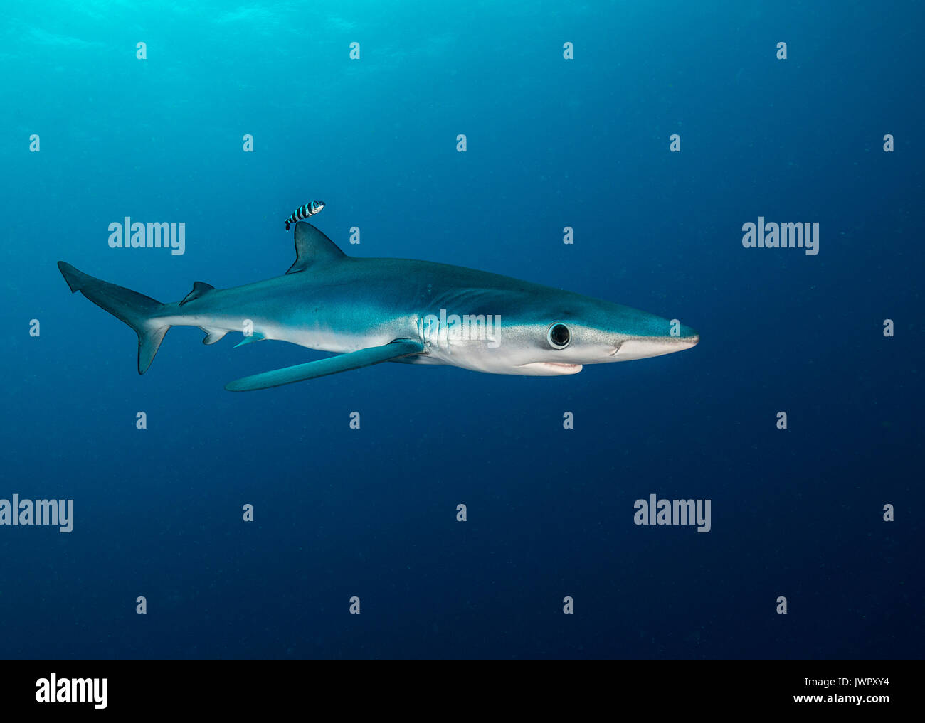 Underwater view of a blue shark and pilot fish, image was taken about 50 kilometres offshore past Western Cape, South Africa. Stock Photohttps://www.alamy.com/image-license-details/?v=1https://www.alamy.com/underwater-view-of-a-blue-shark-and-pilot-fish-image-was-taken-about-image153553432.html
RFJWPXY4–Underwater view of a blue shark and pilot fish, image was taken about 50 kilometres offshore past Western Cape, South Africa.
 German cycling pro Ronny Scholz of team Gerolsteiner escapes the peloton during the second stage of the Tour of Germany from Minden to Goslar, Germany, Thursday, 03 August 2006. Scholz was being caught up 50 kilometres prior to the finish. The ProTour race leads over 1390,5 kilometres from Duesseldorf to Karlsruhe. Photo: Steffen Kugler Stock Photohttps://www.alamy.com/image-license-details/?v=1https://www.alamy.com/stock-photo-german-cycling-pro-ronny-scholz-of-team-gerolsteiner-escapes-the-peloton-53959717.html
RMD3P24N–German cycling pro Ronny Scholz of team Gerolsteiner escapes the peloton during the second stage of the Tour of Germany from Minden to Goslar, Germany, Thursday, 03 August 2006. Scholz was being caught up 50 kilometres prior to the finish. The ProTour race leads over 1390,5 kilometres from Duesseldorf to Karlsruhe. Photo: Steffen Kugler
 The Bay of Fires Tasmania east coast Stock Photohttps://www.alamy.com/image-license-details/?v=1https://www.alamy.com/stock-photo-the-bay-of-fires-tasmania-east-coast-175201319.html
RMM5131Y–The Bay of Fires Tasmania east coast
 Pedestrians walk along a road in Ivankiv, Ukraine, 13 April 2016. The former nuclear plant Chernobyl, which commemorates the 30th anniversary of the Chernobyl nuclear disaster, is only 50 kilometres away. Photo: Andreas Stein/dpa Stock Photohttps://www.alamy.com/image-license-details/?v=1https://www.alamy.com/stock-photo-pedestrians-walk-along-a-road-in-ivankiv-ukraine-13-april-2016-the-102853222.html
RMFY9A9A–Pedestrians walk along a road in Ivankiv, Ukraine, 13 April 2016. The former nuclear plant Chernobyl, which commemorates the 30th anniversary of the Chernobyl nuclear disaster, is only 50 kilometres away. Photo: Andreas Stein/dpa
 ***FILE PHOTO*** Czech police are checking a 50-million-crown European subsidy granted to Capi hnizdo countryside hotel of Andrej Babis, Aktualne.cz news server writes on December 30, 2015. The prospering Agrofert is suspected of deliberately applying for the subsidy as an unknown firm in order to win the subsidy, the server writes. The Capi Hnizdo (The Stork´s Nest, pictured in Olbramovice, Czech Republic, March 27, 2014) is a luxurious resort 50 kilometres south of Prague. Shortly before the subsidy application was filed in 2008, Agrofert issued bearer shares and hid the real owner. Only in Stock Photohttps://www.alamy.com/image-license-details/?v=1https://www.alamy.com/stock-photo-file-photo-czech-police-are-checking-a-50-million-crown-european-subsidy-92575053.html
RMFAH4BW–***FILE PHOTO*** Czech police are checking a 50-million-crown European subsidy granted to Capi hnizdo countryside hotel of Andrej Babis, Aktualne.cz news server writes on December 30, 2015. The prospering Agrofert is suspected of deliberately applying for the subsidy as an unknown firm in order to win the subsidy, the server writes. The Capi Hnizdo (The Stork´s Nest, pictured in Olbramovice, Czech Republic, March 27, 2014) is a luxurious resort 50 kilometres south of Prague. Shortly before the subsidy application was filed in 2008, Agrofert issued bearer shares and hid the real owner. Only in
 ©PHOTOPQR/LE PARISIEN/Julien BARBARE ; Chantilly ; 21/09/2020 ; OISE TOURISME VISITES TOURISTES CHATEAU PARC DOMAINE CHANTILLY MASQUES COVID-19 CORONAVIRUS MUSEE CONDE - The Château de Chantilly is a historic French château located in the town of Chantilly, Oise, about 50 kilometres north of Paris. Stock Photohttps://www.alamy.com/image-license-details/?v=1https://www.alamy.com/photopqrle-parisienjulien-barbare-chantilly-21092020-oise-tourisme-visites-touristes-chateau-parc-domaine-chantilly-masques-covid-19-coronavirus-musee-conde-the-chteau-de-chantilly-is-a-historic-french-chteau-located-in-the-town-of-chantilly-oise-about-50-kilometres-north-of-paris-image486435685.html
RM2K7B1K1– ©PHOTOPQR/LE PARISIEN/Julien BARBARE ; Chantilly ; 21/09/2020 ; OISE TOURISME VISITES TOURISTES CHATEAU PARC DOMAINE CHANTILLY MASQUES COVID-19 CORONAVIRUS MUSEE CONDE - The Château de Chantilly is a historic French château located in the town of Chantilly, Oise, about 50 kilometres north of Paris.
 Srinagar, India. 24th November 2021. A Kashmiri man walks past Icicles created by water from a drinking water supply pipe, at Tangmarg some 50 Kilometres north of Srinagar City. A cold wave further tightened its grip on Jammu and Kashmir with most places in the state recording sub-zero temperatures. The sub-zero temperatures have frozen many water bodies in Kashmir and even drinking water taps have frozen at some places. Credit: Majority World CIC/Alamy Live News Stock Photohttps://www.alamy.com/image-license-details/?v=1https://www.alamy.com/srinagar-india-24th-november-2021-a-kashmiri-man-walks-past-icicles-created-by-water-from-a-drinking-water-supply-pipe-at-tangmarg-some-50-kilometres-north-of-srinagar-city-a-cold-wave-further-tightened-its-grip-on-jammu-and-kashmir-with-most-places-in-the-state-recording-sub-zero-temperatures-the-sub-zero-temperatures-have-frozen-many-water-bodies-in-kashmir-and-even-drinking-water-taps-have-frozen-at-some-places-credit-majority-world-cicalamy-live-news-image452272198.html
RM2H7PNPE–Srinagar, India. 24th November 2021. A Kashmiri man walks past Icicles created by water from a drinking water supply pipe, at Tangmarg some 50 Kilometres north of Srinagar City. A cold wave further tightened its grip on Jammu and Kashmir with most places in the state recording sub-zero temperatures. The sub-zero temperatures have frozen many water bodies in Kashmir and even drinking water taps have frozen at some places. Credit: Majority World CIC/Alamy Live News
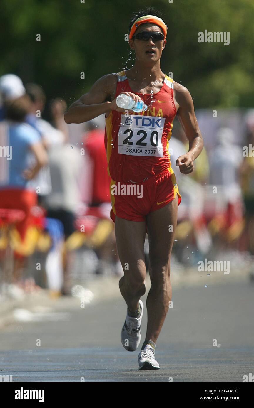 Athletics - IAAF World Athletics Championships - Osaka 2007 - Nagai Stadium. China's Chao Sun in action during the Men's 50 Kilometres Race Walk Final Stock Photohttps://www.alamy.com/image-license-details/?v=1https://www.alamy.com/stock-photo-athletics-iaaf-world-athletics-championships-osaka-2007-nagai-stadium-109636096.html
RMGAA9XT–Athletics - IAAF World Athletics Championships - Osaka 2007 - Nagai Stadium. China's Chao Sun in action during the Men's 50 Kilometres Race Walk Final
 Iraqi civilians flee from fighting while the smoke rise in the background from burning oil fields which was damaged during the fighting between Iraqi forces and Islamic state fighters(IS) in Qayara town, some 50 kilometres south of Mosul, northern Iraq. Tuesday, November. 01, 2016. Photo by Murat Bay/UPI Stock Photohttps://www.alamy.com/image-license-details/?v=1https://www.alamy.com/iraqi-civilians-flee-from-fighting-while-the-smoke-rise-in-the-background-from-burning-oil-fields-which-was-damaged-during-the-fighting-between-iraqi-forces-and-islamic-state-fightersis-in-qayara-town-some-50-kilometres-south-of-mosul-northern-iraq-tuesday-november-01-2016-photo-by-murat-bayupi-image257471723.html
RMTXTRPK–Iraqi civilians flee from fighting while the smoke rise in the background from burning oil fields which was damaged during the fighting between Iraqi forces and Islamic state fighters(IS) in Qayara town, some 50 kilometres south of Mosul, northern Iraq. Tuesday, November. 01, 2016. Photo by Murat Bay/UPI
 Baramulla, India. 16th Feb, 2022. A view of snow covered drung village in Tangmarg. Drung, a small village is a beautiful tourist spot in the Tangmarg area of Baramulla. It is around 50 kilometres away from the capital city of Kashmir, Srinagar. Credit: SOPA Images Limited/Alamy Live News Stock Photohttps://www.alamy.com/image-license-details/?v=1https://www.alamy.com/baramulla-india-16th-feb-2022-a-view-of-snow-covered-drung-village-in-tangmarg-drung-a-small-village-is-a-beautiful-tourist-spot-in-the-tangmarg-area-of-baramulla-it-is-around-50-kilometres-away-from-the-capital-city-of-kashmir-srinagar-credit-sopa-images-limitedalamy-live-news-image460693017.html
RM2HNEAJ1–Baramulla, India. 16th Feb, 2022. A view of snow covered drung village in Tangmarg. Drung, a small village is a beautiful tourist spot in the Tangmarg area of Baramulla. It is around 50 kilometres away from the capital city of Kashmir, Srinagar. Credit: SOPA Images Limited/Alamy Live News
 Stellenbosch is a town in the Western Cape province of South Africa, situated about 50 kilometres (31 miles) east of Cape Town, along the banks of the Stock Photohttps://www.alamy.com/image-license-details/?v=1https://www.alamy.com/stellenbosch-is-a-town-in-the-western-cape-province-of-south-africa-situated-about-50-kilometres-31-miles-east-of-cape-town-along-the-banks-of-the-image186675814.html
RFMRKPWA–Stellenbosch is a town in the Western Cape province of South Africa, situated about 50 kilometres (31 miles) east of Cape Town, along the banks of the
![Zanzibar (from Arabic: زنجبار Zanjibār, from Persian: زنگبار Zangibār'Coast of Blacks'; zangi [black-skinned] + bār [coast]) is a semi-autonomous part of Tanzania in East Africa. It is composed of the Zanzibar Archipelago in the Indian Ocean, 25–50 kilometres (16–31 mi) off the coast of the mainland, and consists of numerous small islands and two large ones: Unguja (the main island, referred to informally as Zanzibar), and Pemba. The capital of Zanzibar, located on the island of Unguja, is Zanzibar City. Its historic centre, known as Stone Town, is a World Heritage Site and is claimed to be Stock Photo Zanzibar (from Arabic: زنجبار Zanjibār, from Persian: زنگبار Zangibār'Coast of Blacks'; zangi [black-skinned] + bār [coast]) is a semi-autonomous part of Tanzania in East Africa. It is composed of the Zanzibar Archipelago in the Indian Ocean, 25–50 kilometres (16–31 mi) off the coast of the mainland, and consists of numerous small islands and two large ones: Unguja (the main island, referred to informally as Zanzibar), and Pemba. The capital of Zanzibar, located on the island of Unguja, is Zanzibar City. Its historic centre, known as Stone Town, is a World Heritage Site and is claimed to be Stock Photo](https://c8.alamy.com/comp/2B02769/zanzibar-from-arabic-zanjibr-from-persian-zangibrcoast-of-blacks-zangi-black-skinned-br-coast-is-a-semi-autonomous-part-of-tanzania-in-east-africa-it-is-composed-of-the-zanzibar-archipelago-in-the-indian-ocean-2550-kilometres-1631-mi-off-the-coast-of-the-mainland-and-consists-of-numerous-small-islands-and-two-large-ones-unguja-the-main-island-referred-to-informally-as-zanzibar-and-pemba-the-capital-of-zanzibar-located-on-the-island-of-unguja-is-zanzibar-city-its-historic-centre-known-as-stone-town-is-a-world-heritage-site-and-is-claimed-to-be-2B02769.jpg) Zanzibar (from Arabic: زنجبار Zanjibār, from Persian: زنگبار Zangibār'Coast of Blacks'; zangi [black-skinned] + bār [coast]) is a semi-autonomous part of Tanzania in East Africa. It is composed of the Zanzibar Archipelago in the Indian Ocean, 25–50 kilometres (16–31 mi) off the coast of the mainland, and consists of numerous small islands and two large ones: Unguja (the main island, referred to informally as Zanzibar), and Pemba. The capital of Zanzibar, located on the island of Unguja, is Zanzibar City. Its historic centre, known as Stone Town, is a World Heritage Site and is claimed to be Stock Photohttps://www.alamy.com/image-license-details/?v=1https://www.alamy.com/zanzibar-from-arabic-zanjibr-from-persian-zangibrcoast-of-blacks-zangi-black-skinned-br-coast-is-a-semi-autonomous-part-of-tanzania-in-east-africa-it-is-composed-of-the-zanzibar-archipelago-in-the-indian-ocean-2550-kilometres-1631-mi-off-the-coast-of-the-mainland-and-consists-of-numerous-small-islands-and-two-large-ones-unguja-the-main-island-referred-to-informally-as-zanzibar-and-pemba-the-capital-of-zanzibar-located-on-the-island-of-unguja-is-zanzibar-city-its-historic-centre-known-as-stone-town-is-a-world-heritage-site-and-is-claimed-to-be-image344256929.html
Zanzibar (from Arabic: زنجبار Zanjibār, from Persian: زنگبار Zangibār'Coast of Blacks'; zangi [black-skinned] + bār [coast]) is a semi-autonomous part of Tanzania in East Africa. It is composed of the Zanzibar Archipelago in the Indian Ocean, 25–50 kilometres (16–31 mi) off the coast of the mainland, and consists of numerous small islands and two large ones: Unguja (the main island, referred to informally as Zanzibar), and Pemba. The capital of Zanzibar, located on the island of Unguja, is Zanzibar City. Its historic centre, known as Stone Town, is a World Heritage Site and is claimed to be Stock Photohttps://www.alamy.com/image-license-details/?v=1https://www.alamy.com/zanzibar-from-arabic-zanjibr-from-persian-zangibrcoast-of-blacks-zangi-black-skinned-br-coast-is-a-semi-autonomous-part-of-tanzania-in-east-africa-it-is-composed-of-the-zanzibar-archipelago-in-the-indian-ocean-2550-kilometres-1631-mi-off-the-coast-of-the-mainland-and-consists-of-numerous-small-islands-and-two-large-ones-unguja-the-main-island-referred-to-informally-as-zanzibar-and-pemba-the-capital-of-zanzibar-located-on-the-island-of-unguja-is-zanzibar-city-its-historic-centre-known-as-stone-town-is-a-world-heritage-site-and-is-claimed-to-be-image344256929.htmlRM2B02769–Zanzibar (from Arabic: زنجبار Zanjibār, from Persian: زنگبار Zangibār'Coast of Blacks'; zangi [black-skinned] + bār [coast]) is a semi-autonomous part of Tanzania in East Africa. It is composed of the Zanzibar Archipelago in the Indian Ocean, 25–50 kilometres (16–31 mi) off the coast of the mainland, and consists of numerous small islands and two large ones: Unguja (the main island, referred to informally as Zanzibar), and Pemba. The capital of Zanzibar, located on the island of Unguja, is Zanzibar City. Its historic centre, known as Stone Town, is a World Heritage Site and is claimed to be
 The Tegernsee is the centre of a popular recreation area 50 kilometres (31 mi) south-east of Munich. Stock Photohttps://www.alamy.com/image-license-details/?v=1https://www.alamy.com/the-tegernsee-is-the-centre-of-a-popular-recreation-area-50-kilometres-31-mi-south-east-of-munich-image244665384.html
RMT61D5C–The Tegernsee is the centre of a popular recreation area 50 kilometres (31 mi) south-east of Munich.
 Famous of the ochre of Luberon, located 10 kilometres west of Apt and 50 kilometres from Avignon in region Provence in France. Stock Photohttps://www.alamy.com/image-license-details/?v=1https://www.alamy.com/famous-of-the-ochre-of-luberon-located-10-kilometres-west-of-apt-and-50-kilometres-from-avignon-in-region-provence-in-france-image214531141.html
RFPD0MJD–Famous of the ochre of Luberon, located 10 kilometres west of Apt and 50 kilometres from Avignon in region Provence in France.
 Castel di Tora, comune in the Province of Rieti in the Italian region Latium, located about 50 kilometres northeast of Rome. Stock Photohttps://www.alamy.com/image-license-details/?v=1https://www.alamy.com/castel-di-tora-comune-in-the-province-of-rieti-in-the-italian-region-latium-located-about-50-kilometres-northeast-of-rome-image182325476.html
RFMGHJ04–Castel di Tora, comune in the Province of Rieti in the Italian region Latium, located about 50 kilometres northeast of Rome.
 Xuan Dung beach, Van Phong bay, Khanh Hoa, Vietnam. From Nha Trang, driving some 50 kilometres toward the north. Stock Photohttps://www.alamy.com/image-license-details/?v=1https://www.alamy.com/stock-image-xuan-dung-beach-van-phong-bay-khanh-hoa-vietnam-from-nha-trang-driving-162339045.html
RFKC3531–Xuan Dung beach, Van Phong bay, Khanh Hoa, Vietnam. From Nha Trang, driving some 50 kilometres toward the north.
 Chmer Lokot has left his family and started on a journey. He is moving his livestock 50 kilometres to reach green fields. Stock Photohttps://www.alamy.com/image-license-details/?v=1https://www.alamy.com/stock-photo-chmer-lokot-has-left-his-family-and-started-on-a-journey-he-is-moving-29752782.html
RMBMB9YA–Chmer Lokot has left his family and started on a journey. He is moving his livestock 50 kilometres to reach green fields.
 Jerash, Jordanian capital Amman. 18th Sep, 2017. Italian tenor Andrea Bocelli (C) performs during a concert at the archaeological site of Jerash, some 50 kilometres north of Jordanian capital Amman, on Sept. 18, 2017. Credit: Mohammad Abu Ghosh/Xinhua/Alamy Live News Stock Photohttps://www.alamy.com/image-license-details/?v=1https://www.alamy.com/stock-image-jerash-jordanian-capital-amman-18th-sep-2017-italian-tenor-andrea-160027507.html
RMK89TM3–Jerash, Jordanian capital Amman. 18th Sep, 2017. Italian tenor Andrea Bocelli (C) performs during a concert at the archaeological site of Jerash, some 50 kilometres north of Jordanian capital Amman, on Sept. 18, 2017. Credit: Mohammad Abu Ghosh/Xinhua/Alamy Live News
 (170919) -- JERASH, Sept. 19, 2017 -- Italian tenor Andrea Bocelli (C) performs during a concert at the archaeological site of Jerash, some 50 kilometres north of Jordanian capital Amman, on Sept. 18, 2017. )(whw) JORDAN-JERASH-ANDREA BOCELLI-CONCERT MohammadxAbuxGhosh PUBLICATIONxNOTxINxCHN Stock Photohttps://www.alamy.com/image-license-details/?v=1https://www.alamy.com/170919-jerash-sept-19-2017-italian-tenor-andrea-bocelli-c-performs-during-a-concert-at-the-archaeological-site-of-jerash-some-50-kilometres-north-of-jordanian-capital-amman-on-sept-18-2017-whw-jordan-jerash-andrea-bocelli-concert-mohammadxabuxghosh-publicationxnotxinxchn-image564148649.html
RM2RNR5A1–(170919) -- JERASH, Sept. 19, 2017 -- Italian tenor Andrea Bocelli (C) performs during a concert at the archaeological site of Jerash, some 50 kilometres north of Jordanian capital Amman, on Sept. 18, 2017. )(whw) JORDAN-JERASH-ANDREA BOCELLI-CONCERT MohammadxAbuxGhosh PUBLICATIONxNOTxINxCHN
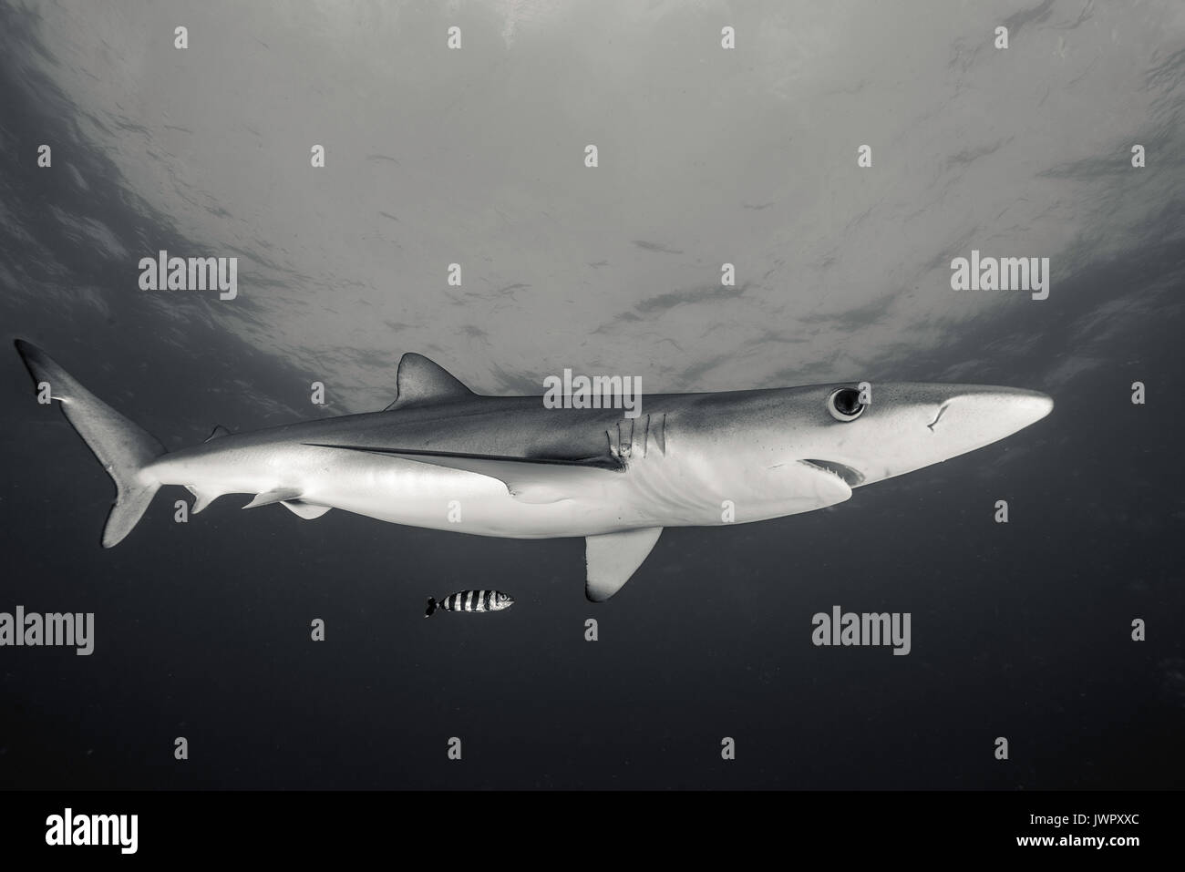 Underwater view of a blue shark and pilot fish, image was taken about 50 kilometres offshore past Western Cape, South Africa. Stock Photohttps://www.alamy.com/image-license-details/?v=1https://www.alamy.com/underwater-view-of-a-blue-shark-and-pilot-fish-image-was-taken-about-image153553412.html
RFJWPXXC–Underwater view of a blue shark and pilot fish, image was taken about 50 kilometres offshore past Western Cape, South Africa.
 German cycling pro Ronny Scholz of team Gerolsteiner escapes the field during the second stage of the Tour of Germany from Minden to Goslar, Germany, Thursday, 03 August 2006. Scholz was being caught up 50 kilometres prior to the finish. The ProTour race leads over 1390,5 kilometres from Duesseldorf to Karlsruhe. Photo: Steffen Kugler Stock Photohttps://www.alamy.com/image-license-details/?v=1https://www.alamy.com/stock-photo-german-cycling-pro-ronny-scholz-of-team-gerolsteiner-escapes-the-field-53959715.html
RMD3P24K–German cycling pro Ronny Scholz of team Gerolsteiner escapes the field during the second stage of the Tour of Germany from Minden to Goslar, Germany, Thursday, 03 August 2006. Scholz was being caught up 50 kilometres prior to the finish. The ProTour race leads over 1390,5 kilometres from Duesseldorf to Karlsruhe. Photo: Steffen Kugler
 The Bay of Fires Tasmania east coast Stock Photohttps://www.alamy.com/image-license-details/?v=1https://www.alamy.com/stock-photo-the-bay-of-fires-tasmania-east-coast-175201791.html
RMM513JR–The Bay of Fires Tasmania east coast
 The head of the 13-meter-high Buddha statue 'Daibutsu' is seen in Kamakura, Japan, 24 April 2013. Kamakura is about 50 kilometres (31 miles) south-south-west of Tokyo. Photo: Peter Jaehnel - NO WIRE SERVICE Stock Photohttps://www.alamy.com/image-license-details/?v=1https://www.alamy.com/the-head-of-the-13-meter-high-buddha-statue-daibutsu-is-seen-in-kamakura-image65934020.html
RMDR7FEC–The head of the 13-meter-high Buddha statue 'Daibutsu' is seen in Kamakura, Japan, 24 April 2013. Kamakura is about 50 kilometres (31 miles) south-south-west of Tokyo. Photo: Peter Jaehnel - NO WIRE SERVICE
 ***FILE PHOTO*** Czech police are checking a 50-million-crown European subsidy granted to Capi hnizdo countryside hotel of Andrej Babis, Aktualne.cz news server writes on December 30, 2015. The prospering Agrofert is suspected of deliberately applying for the subsidy as an unknown firm in order to win the subsidy, the server writes. The Capi Hnizdo (The Stork´s Nest, pictured in Olbramovice, Czech Republic, March 27, 2014) is a luxurious resort 50 kilometres south of Prague. Shortly before the subsidy application was filed in 2008, Agrofert issued bearer shares and hid the real owner. Only in Stock Photohttps://www.alamy.com/image-license-details/?v=1https://www.alamy.com/stock-photo-file-photo-czech-police-are-checking-a-50-million-crown-european-subsidy-92575056.html
RMFAH4C0–***FILE PHOTO*** Czech police are checking a 50-million-crown European subsidy granted to Capi hnizdo countryside hotel of Andrej Babis, Aktualne.cz news server writes on December 30, 2015. The prospering Agrofert is suspected of deliberately applying for the subsidy as an unknown firm in order to win the subsidy, the server writes. The Capi Hnizdo (The Stork´s Nest, pictured in Olbramovice, Czech Republic, March 27, 2014) is a luxurious resort 50 kilometres south of Prague. Shortly before the subsidy application was filed in 2008, Agrofert issued bearer shares and hid the real owner. Only in
 ©PHOTOPQR/LE PARISIEN/Julien BARBARE ; Chantilly ; 21/09/2020 ; OISE TOURISME VISITES TOURISTES CHATEAU PARC DOMAINE CHANTILLY MASQUES COVID-19 CORONAVIRUS MUSEE CONDE - The Château de Chantilly is a historic French château located in the town of Chantilly, Oise, about 50 kilometres north of Paris. Stock Photohttps://www.alamy.com/image-license-details/?v=1https://www.alamy.com/photopqrle-parisienjulien-barbare-chantilly-21092020-oise-tourisme-visites-touristes-chateau-parc-domaine-chantilly-masques-covid-19-coronavirus-musee-conde-the-chteau-de-chantilly-is-a-historic-french-chteau-located-in-the-town-of-chantilly-oise-about-50-kilometres-north-of-paris-image486435678.html
RM2K7B1JP– ©PHOTOPQR/LE PARISIEN/Julien BARBARE ; Chantilly ; 21/09/2020 ; OISE TOURISME VISITES TOURISTES CHATEAU PARC DOMAINE CHANTILLY MASQUES COVID-19 CORONAVIRUS MUSEE CONDE - The Château de Chantilly is a historic French château located in the town of Chantilly, Oise, about 50 kilometres north of Paris.
 Srinagar, India. 24th November 2021. A Kashmiri man walks past Icicles created by water from a drinking water supply pipe, at Tangmarg some 50 Kilometres north of Srinagar City. A cold wave further tightened its grip on Jammu and Kashmir with most places in the state recording sub-zero temperatures. The sub-zero temperatures have frozen many water bodies in Kashmir and even drinking water taps have frozen at some places. Credit: Majority World CIC/Alamy Live News Stock Photohttps://www.alamy.com/image-license-details/?v=1https://www.alamy.com/srinagar-india-24th-november-2021-a-kashmiri-man-walks-past-icicles-created-by-water-from-a-drinking-water-supply-pipe-at-tangmarg-some-50-kilometres-north-of-srinagar-city-a-cold-wave-further-tightened-its-grip-on-jammu-and-kashmir-with-most-places-in-the-state-recording-sub-zero-temperatures-the-sub-zero-temperatures-have-frozen-many-water-bodies-in-kashmir-and-even-drinking-water-taps-have-frozen-at-some-places-credit-majority-world-cicalamy-live-news-image452272069.html
RM2H7PNHW–Srinagar, India. 24th November 2021. A Kashmiri man walks past Icicles created by water from a drinking water supply pipe, at Tangmarg some 50 Kilometres north of Srinagar City. A cold wave further tightened its grip on Jammu and Kashmir with most places in the state recording sub-zero temperatures. The sub-zero temperatures have frozen many water bodies in Kashmir and even drinking water taps have frozen at some places. Credit: Majority World CIC/Alamy Live News
 Athletics - IAAF World Athletics Championships - Osaka 2007 - Nagai Stadium. China's Chao Sun in action during the Men's 50 Kilometres Race Walk Final Stock Photohttps://www.alamy.com/image-license-details/?v=1https://www.alamy.com/stock-photo-athletics-iaaf-world-athletics-championships-osaka-2007-nagai-stadium-109636087.html
RMGAA9XF–Athletics - IAAF World Athletics Championships - Osaka 2007 - Nagai Stadium. China's Chao Sun in action during the Men's 50 Kilometres Race Walk Final
 Iraqi civilians flee from fighting while the smoke rise in the background from burning oil fields which was damaged during the fighting between Iraqi forces and Islamic state fighters(IS) in Qayara town, some 50 kilometres south of Mosul, northern Iraq. Tuesday, November. 01, 2016. Photo by Murat Bay/UPI Stock Photohttps://www.alamy.com/image-license-details/?v=1https://www.alamy.com/iraqi-civilians-flee-from-fighting-while-the-smoke-rise-in-the-background-from-burning-oil-fields-which-was-damaged-during-the-fighting-between-iraqi-forces-and-islamic-state-fightersis-in-qayara-town-some-50-kilometres-south-of-mosul-northern-iraq-tuesday-november-01-2016-photo-by-murat-bayupi-image257471727.html
RMTXTRPR–Iraqi civilians flee from fighting while the smoke rise in the background from burning oil fields which was damaged during the fighting between Iraqi forces and Islamic state fighters(IS) in Qayara town, some 50 kilometres south of Mosul, northern Iraq. Tuesday, November. 01, 2016. Photo by Murat Bay/UPI
 Baramulla, India. 16th Feb, 2022. A view of snow covered slopes in Drung. Drung, a small village is a beautiful tourist spot in the Tangmarg area of Baramulla. It is around 50 kilometres away from the capital city of Kashmir, Srinagar. Credit: SOPA Images Limited/Alamy Live News Stock Photohttps://www.alamy.com/image-license-details/?v=1https://www.alamy.com/baramulla-india-16th-feb-2022-a-view-of-snow-covered-slopes-in-drung-drung-a-small-village-is-a-beautiful-tourist-spot-in-the-tangmarg-area-of-baramulla-it-is-around-50-kilometres-away-from-the-capital-city-of-kashmir-srinagar-credit-sopa-images-limitedalamy-live-news-image460693006.html
RM2HNEAHJ–Baramulla, India. 16th Feb, 2022. A view of snow covered slopes in Drung. Drung, a small village is a beautiful tourist spot in the Tangmarg area of Baramulla. It is around 50 kilometres away from the capital city of Kashmir, Srinagar. Credit: SOPA Images Limited/Alamy Live News
 Stellenbosch is a town in the Western Cape province of South Africa, situated about 50 kilometres (31 miles) east of Cape Town, along the banks of the Stock Photohttps://www.alamy.com/image-license-details/?v=1https://www.alamy.com/stellenbosch-is-a-town-in-the-western-cape-province-of-south-africa-situated-about-50-kilometres-31-miles-east-of-cape-town-along-the-banks-of-the-image185752617.html
RFMP5NA1–Stellenbosch is a town in the Western Cape province of South Africa, situated about 50 kilometres (31 miles) east of Cape Town, along the banks of the
![Zanzibar (from Arabic: زنجبار Zanjibār, from Persian: زنگبار Zangibār'Coast of Blacks'; zangi [black-skinned] + bār [coast]) is a semi-autonomous part of Tanzania in East Africa. It is composed of the Zanzibar Archipelago in the Indian Ocean, 25–50 kilometres (16–31 mi) off the coast of the mainland, and consists of numerous small islands and two large ones: Unguja (the main island, referred to informally as Zanzibar), and Pemba. The capital of Zanzibar, located on the island of Unguja, is Zanzibar City. Its historic centre, known as Stone Town, is a World Heritage Site and is claimed to be Stock Photo Zanzibar (from Arabic: زنجبار Zanjibār, from Persian: زنگبار Zangibār'Coast of Blacks'; zangi [black-skinned] + bār [coast]) is a semi-autonomous part of Tanzania in East Africa. It is composed of the Zanzibar Archipelago in the Indian Ocean, 25–50 kilometres (16–31 mi) off the coast of the mainland, and consists of numerous small islands and two large ones: Unguja (the main island, referred to informally as Zanzibar), and Pemba. The capital of Zanzibar, located on the island of Unguja, is Zanzibar City. Its historic centre, known as Stone Town, is a World Heritage Site and is claimed to be Stock Photo](https://c8.alamy.com/comp/2B0276D/zanzibar-from-arabic-zanjibr-from-persian-zangibrcoast-of-blacks-zangi-black-skinned-br-coast-is-a-semi-autonomous-part-of-tanzania-in-east-africa-it-is-composed-of-the-zanzibar-archipelago-in-the-indian-ocean-2550-kilometres-1631-mi-off-the-coast-of-the-mainland-and-consists-of-numerous-small-islands-and-two-large-ones-unguja-the-main-island-referred-to-informally-as-zanzibar-and-pemba-the-capital-of-zanzibar-located-on-the-island-of-unguja-is-zanzibar-city-its-historic-centre-known-as-stone-town-is-a-world-heritage-site-and-is-claimed-to-be-2B0276D.jpg) Zanzibar (from Arabic: زنجبار Zanjibār, from Persian: زنگبار Zangibār'Coast of Blacks'; zangi [black-skinned] + bār [coast]) is a semi-autonomous part of Tanzania in East Africa. It is composed of the Zanzibar Archipelago in the Indian Ocean, 25–50 kilometres (16–31 mi) off the coast of the mainland, and consists of numerous small islands and two large ones: Unguja (the main island, referred to informally as Zanzibar), and Pemba. The capital of Zanzibar, located on the island of Unguja, is Zanzibar City. Its historic centre, known as Stone Town, is a World Heritage Site and is claimed to be Stock Photohttps://www.alamy.com/image-license-details/?v=1https://www.alamy.com/zanzibar-from-arabic-zanjibr-from-persian-zangibrcoast-of-blacks-zangi-black-skinned-br-coast-is-a-semi-autonomous-part-of-tanzania-in-east-africa-it-is-composed-of-the-zanzibar-archipelago-in-the-indian-ocean-2550-kilometres-1631-mi-off-the-coast-of-the-mainland-and-consists-of-numerous-small-islands-and-two-large-ones-unguja-the-main-island-referred-to-informally-as-zanzibar-and-pemba-the-capital-of-zanzibar-located-on-the-island-of-unguja-is-zanzibar-city-its-historic-centre-known-as-stone-town-is-a-world-heritage-site-and-is-claimed-to-be-image344256933.html
Zanzibar (from Arabic: زنجبار Zanjibār, from Persian: زنگبار Zangibār'Coast of Blacks'; zangi [black-skinned] + bār [coast]) is a semi-autonomous part of Tanzania in East Africa. It is composed of the Zanzibar Archipelago in the Indian Ocean, 25–50 kilometres (16–31 mi) off the coast of the mainland, and consists of numerous small islands and two large ones: Unguja (the main island, referred to informally as Zanzibar), and Pemba. The capital of Zanzibar, located on the island of Unguja, is Zanzibar City. Its historic centre, known as Stone Town, is a World Heritage Site and is claimed to be Stock Photohttps://www.alamy.com/image-license-details/?v=1https://www.alamy.com/zanzibar-from-arabic-zanjibr-from-persian-zangibrcoast-of-blacks-zangi-black-skinned-br-coast-is-a-semi-autonomous-part-of-tanzania-in-east-africa-it-is-composed-of-the-zanzibar-archipelago-in-the-indian-ocean-2550-kilometres-1631-mi-off-the-coast-of-the-mainland-and-consists-of-numerous-small-islands-and-two-large-ones-unguja-the-main-island-referred-to-informally-as-zanzibar-and-pemba-the-capital-of-zanzibar-located-on-the-island-of-unguja-is-zanzibar-city-its-historic-centre-known-as-stone-town-is-a-world-heritage-site-and-is-claimed-to-be-image344256933.htmlRM2B0276D–Zanzibar (from Arabic: زنجبار Zanjibār, from Persian: زنگبار Zangibār'Coast of Blacks'; zangi [black-skinned] + bār [coast]) is a semi-autonomous part of Tanzania in East Africa. It is composed of the Zanzibar Archipelago in the Indian Ocean, 25–50 kilometres (16–31 mi) off the coast of the mainland, and consists of numerous small islands and two large ones: Unguja (the main island, referred to informally as Zanzibar), and Pemba. The capital of Zanzibar, located on the island of Unguja, is Zanzibar City. Its historic centre, known as Stone Town, is a World Heritage Site and is claimed to be