Quick filters:
500 feet altitude Stock Photos and Images
 NEWARK, New Jersey, United States — An aerial view of downtown Newark at night, captured from a helicopter at approximately 500 feet altitude, showcases the city's vibrant urban landscape. The bright lights of streets, buildings, and landmarks create a dazzling tapestry against the dark backdrop, offering a striking perspective of New Jersey's largest city. Note: Some high ISO noise is visible at full resolution due to the challenging low-light conditions of night aerial photography. Stock Photohttps://www.alamy.com/image-license-details/?v=1https://www.alamy.com/stock-photo-newark-new-jersey-united-states-an-aerial-view-of-downtown-newark-52126382.html
RMD0PFME–NEWARK, New Jersey, United States — An aerial view of downtown Newark at night, captured from a helicopter at approximately 500 feet altitude, showcases the city's vibrant urban landscape. The bright lights of streets, buildings, and landmarks create a dazzling tapestry against the dark backdrop, offering a striking perspective of New Jersey's largest city. Note: Some high ISO noise is visible at full resolution due to the challenging low-light conditions of night aerial photography.
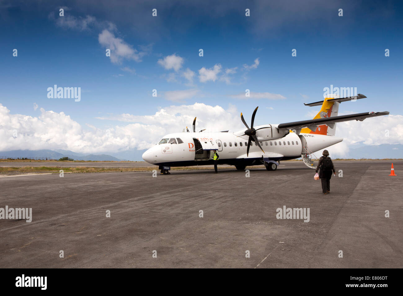 Eastern Bhutan, Yongphula, Airport Druk Air ATR 42-500 aircraft on apron at high altitude runway Stock Photohttps://www.alamy.com/image-license-details/?v=1https://www.alamy.com/stock-photo-eastern-bhutan-yongphula-airport-druk-air-atr-42-500-aircraft-on-apron-73763812.html
RME806DT–Eastern Bhutan, Yongphula, Airport Druk Air ATR 42-500 aircraft on apron at high altitude runway
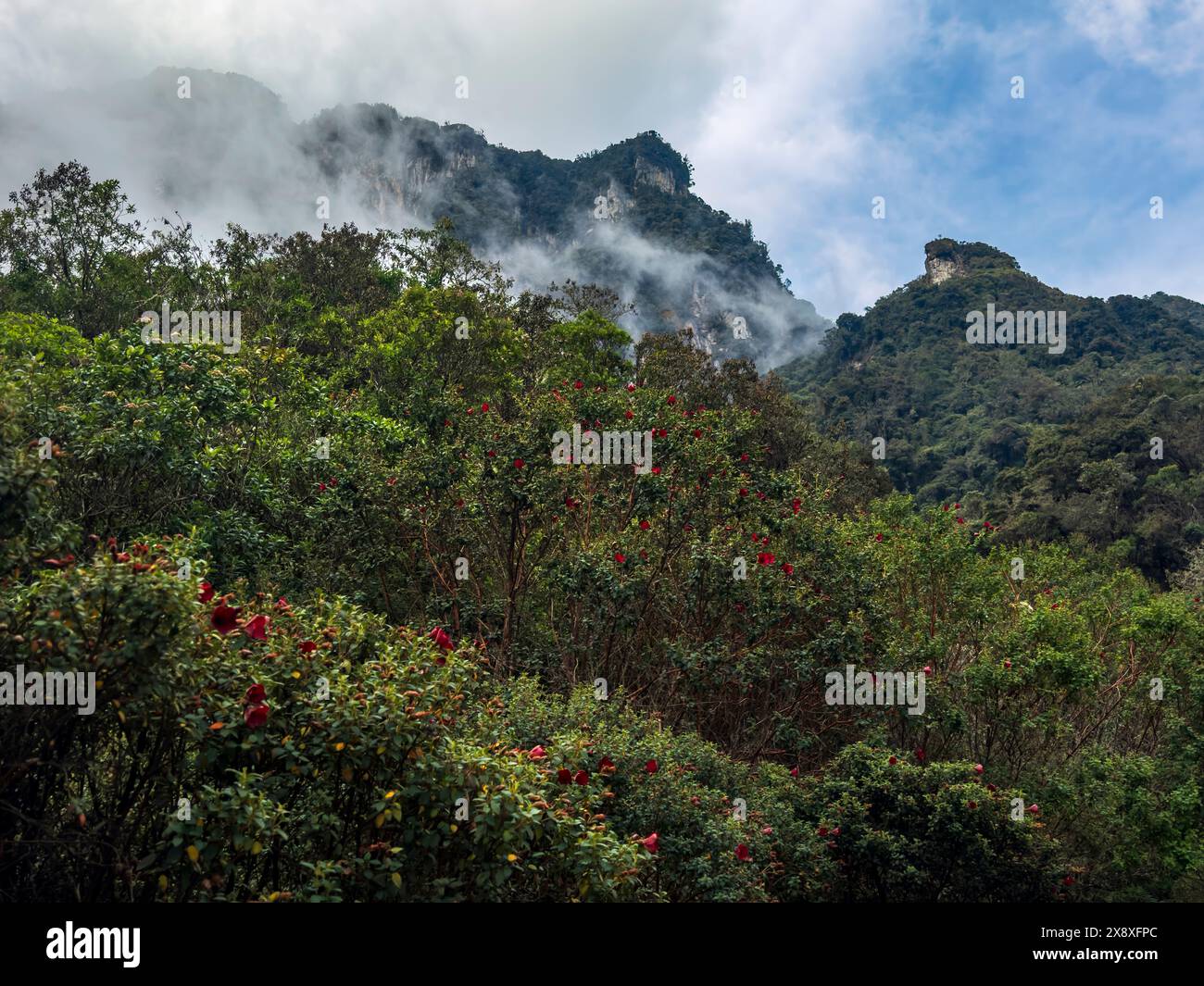 High altitude forest grows at 10,500 feet in the Colombian Andes below Nevado del Ruiz - Colombia Stock Photohttps://www.alamy.com/image-license-details/?v=1https://www.alamy.com/high-altitude-forest-grows-at-10500-feet-in-the-colombian-andes-below-nevado-del-ruiz-colombia-image607863268.html
RF2X8XFPC–High altitude forest grows at 10,500 feet in the Colombian Andes below Nevado del Ruiz - Colombia
 Image shot from slightly above a Paraglider at an altitude of about 500 feet headed toward people on beach and lifeguard tower on finger of land loca Stock Photohttps://www.alamy.com/image-license-details/?v=1https://www.alamy.com/image-shot-from-slightly-above-a-paraglider-at-an-altitude-of-about-500-feet-headed-toward-people-on-beach-and-lifeguard-tower-on-finger-of-land-loca-image348443115.html
RF2B6TXMY–Image shot from slightly above a Paraglider at an altitude of about 500 feet headed toward people on beach and lifeguard tower on finger of land loca
 The village of Gokyo is situated between the Ngozumpa glacier and Gokyo Lake at over 15,500 feet with the snowy Himalayas in the background. Stock Photohttps://www.alamy.com/image-license-details/?v=1https://www.alamy.com/the-village-of-gokyo-is-situated-between-the-ngozumpa-glacier-and-gokyo-lake-at-over-15500-feet-with-the-snowy-himalayas-in-the-background-image561755241.html
RM2RHX4F5–The village of Gokyo is situated between the Ngozumpa glacier and Gokyo Lake at over 15,500 feet with the snowy Himalayas in the background.
 A frozen lake at about 10.500 feet in altitude on Pikes Peak. Stock Photohttps://www.alamy.com/image-license-details/?v=1https://www.alamy.com/stock-photo-a-frozen-lake-at-about-10500-feet-in-altitude-on-pikes-peak-102749985.html
RMFY4JJ9–A frozen lake at about 10.500 feet in altitude on Pikes Peak.
 Set between Gokyo Lake and debris shed by the Ngozumpa glacier the village of Gokyo sits at over 15,500 feet backed by the Cho Oyu. Stock Photohttps://www.alamy.com/image-license-details/?v=1https://www.alamy.com/set-between-gokyo-lake-and-debris-shed-by-the-ngozumpa-glacier-the-village-of-gokyo-sits-at-over-15500-feet-backed-by-the-cho-oyu-image600382830.html
RM2WTNPBX–Set between Gokyo Lake and debris shed by the Ngozumpa glacier the village of Gokyo sits at over 15,500 feet backed by the Cho Oyu.
 High Altitude vehicle testing Sierra Nevada mountains spain Stock Photohttps://www.alamy.com/image-license-details/?v=1https://www.alamy.com/stock-photo-high-altitude-vehicle-testing-sierra-nevada-mountains-spain-31689232.html
RMBRFFX8–High Altitude vehicle testing Sierra Nevada mountains spain
 This is a photograph of a Lorraine 240 H.P. Night bombing aircraft from the Parman 13 BN2 squadron during World War I. The aircraft is equipped with two engines and has a maximum speed of 90 miles per hour at 6,500 feet altitude. It can climb to 10,300 feet (fully loaded) in 44 seconds and has an endurance of 2 hours and 30 minutes. The photograph was taken in 1919. Stock Photohttps://www.alamy.com/image-license-details/?v=1https://www.alamy.com/this-is-a-photograph-of-a-lorraine-240-hp-night-bombing-aircraft-from-the-parman-13-bn2-squadron-during-world-war-i-the-aircraft-is-equipped-with-two-engines-and-has-a-maximum-speed-of-90-miles-per-hour-at-6500-feet-altitude-it-can-climb-to-10300-feet-fully-loaded-in-44-seconds-and-has-an-endurance-of-2-hours-and-30-minutes-the-photograph-was-taken-in-1919-image558494622.html
RM2RCHHGE–This is a photograph of a Lorraine 240 H.P. Night bombing aircraft from the Parman 13 BN2 squadron during World War I. The aircraft is equipped with two engines and has a maximum speed of 90 miles per hour at 6,500 feet altitude. It can climb to 10,300 feet (fully loaded) in 44 seconds and has an endurance of 2 hours and 30 minutes. The photograph was taken in 1919.
 McDonnell Douglas F15C Eagle of the 493rd Fighter Squadron, 48th Fighter Wing, RAF Lakenheath, Suffolk, UK, a high speed fighter interceptor. Stock Photohttps://www.alamy.com/image-license-details/?v=1https://www.alamy.com/mcdonnell-douglas-f15c-eagle-of-the-493rd-fighter-squadron-48th-fighter-wing-raf-lakenheath-suffolk-uk-a-high-speed-fighter-interceptor-image219355011.html
RMPMTDFF–McDonnell Douglas F15C Eagle of the 493rd Fighter Squadron, 48th Fighter Wing, RAF Lakenheath, Suffolk, UK, a high speed fighter interceptor.
 Aviation student at Kelly Field, San Antonio, Texas, flying over the field at approximately 2,500 feet altitude. The photograph was taken by L.H.P. Kinganore, a photographer for the Signal Corps. The image was censored and released on May 17, 1918, by the Historical Branch, W.P.D. Number of the photograph: A TAKEN LIFE OF AN AVIATION STUDENT AT KELLY FIELD, SAN ANTONIO, TEXAS. (Description is from May 1, 1918) Stock Photohttps://www.alamy.com/image-license-details/?v=1https://www.alamy.com/aviation-student-at-kelly-field-san-antonio-texas-flying-over-the-field-at-approximately-2500-feet-altitude-the-photograph-was-taken-by-lhp-kinganore-a-photographer-for-the-signal-corps-the-image-was-censored-and-released-on-may-17-1918-by-the-historical-branch-wpd-number-of-the-photograph-a-taken-life-of-an-aviation-student-at-kelly-field-san-antonio-texas-description-is-from-may-1-1918-image558095701.html
RM2RBYCN9–Aviation student at Kelly Field, San Antonio, Texas, flying over the field at approximately 2,500 feet altitude. The photograph was taken by L.H.P. Kinganore, a photographer for the Signal Corps. The image was censored and released on May 17, 1918, by the Historical Branch, W.P.D. Number of the photograph: A TAKEN LIFE OF AN AVIATION STUDENT AT KELLY FIELD, SAN ANTONIO, TEXAS. (Description is from May 1, 1918)
 View of the Incan agricultural terraces at Pisac with protective roofing over the stone ruins in the foreground Stock Photohttps://www.alamy.com/image-license-details/?v=1https://www.alamy.com/stock-photo-view-of-the-incan-agricultural-terraces-at-pisac-with-protective-roofing-104860972.html
RMG2GR6M–View of the Incan agricultural terraces at Pisac with protective roofing over the stone ruins in the foreground
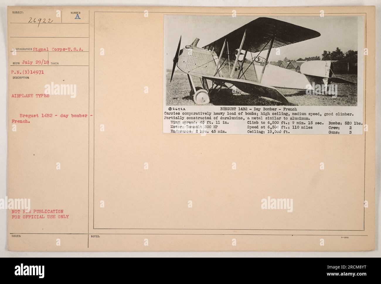 The image features a Breguet 14B2, day bomber that was used by the French during World War I. The airplane had a wing span of 45 feet, 11 inches, and was powered by a Renault 300 HP engine. It could carry a load of 520 lbs of bombs and had a maximum ceiling of 19,000 feet. The plane had a top speed of 110 miles per hour at 6,500 feet altitude. Stock Photohttps://www.alamy.com/image-license-details/?v=1https://www.alamy.com/the-image-features-a-breguet-14b2-day-bomber-that-was-used-by-the-french-during-world-war-i-the-airplane-had-a-wing-span-of-45-feet-11-inches-and-was-powered-by-a-renault-300-hp-engine-it-could-carry-a-load-of-520-lbs-of-bombs-and-had-a-maximum-ceiling-of-19000-feet-the-plane-had-a-top-speed-of-110-miles-per-hour-at-6500-feet-altitude-image558553740.html
RM2RCM8YT–The image features a Breguet 14B2, day bomber that was used by the French during World War I. The airplane had a wing span of 45 feet, 11 inches, and was powered by a Renault 300 HP engine. It could carry a load of 520 lbs of bombs and had a maximum ceiling of 19,000 feet. The plane had a top speed of 110 miles per hour at 6,500 feet altitude.
 Vedauwoo rock formations Wyoming Stock Photohttps://www.alamy.com/image-license-details/?v=1https://www.alamy.com/vedauwoo-rock-formations-wyoming-image455837843.html
RF2HDH5PY–Vedauwoo rock formations Wyoming
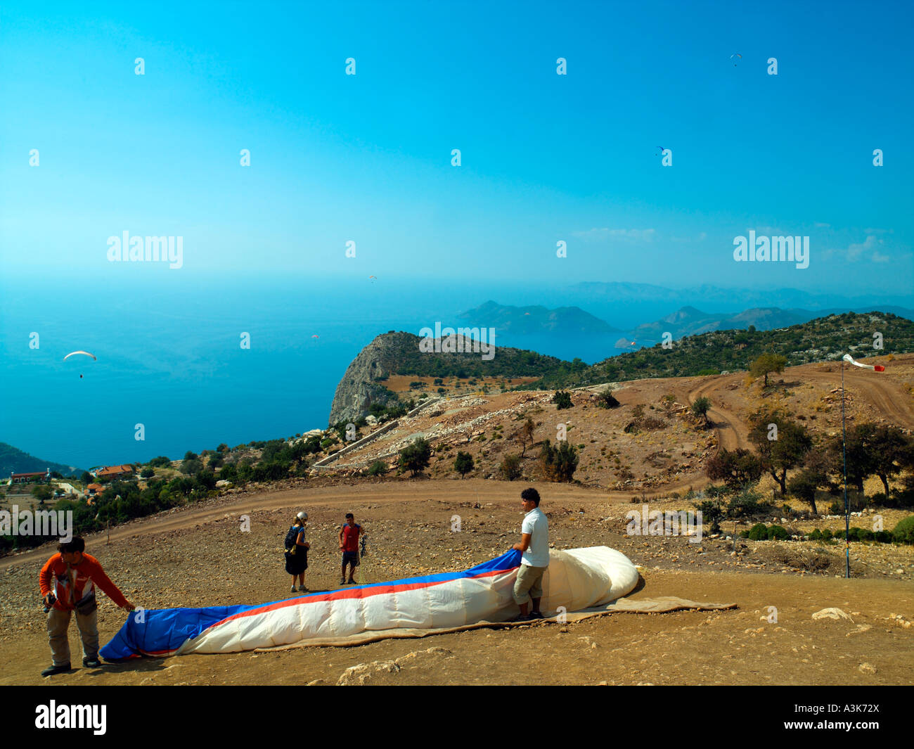 Take off site from 4,500 feet on Mt Baba Dag Oludeniz Stock Photohttps://www.alamy.com/image-license-details/?v=1https://www.alamy.com/stock-photo-take-off-site-from-4500-feet-on-mt-baba-dag-oludeniz-10805905.html
RMA3K72X–Take off site from 4,500 feet on Mt Baba Dag Oludeniz
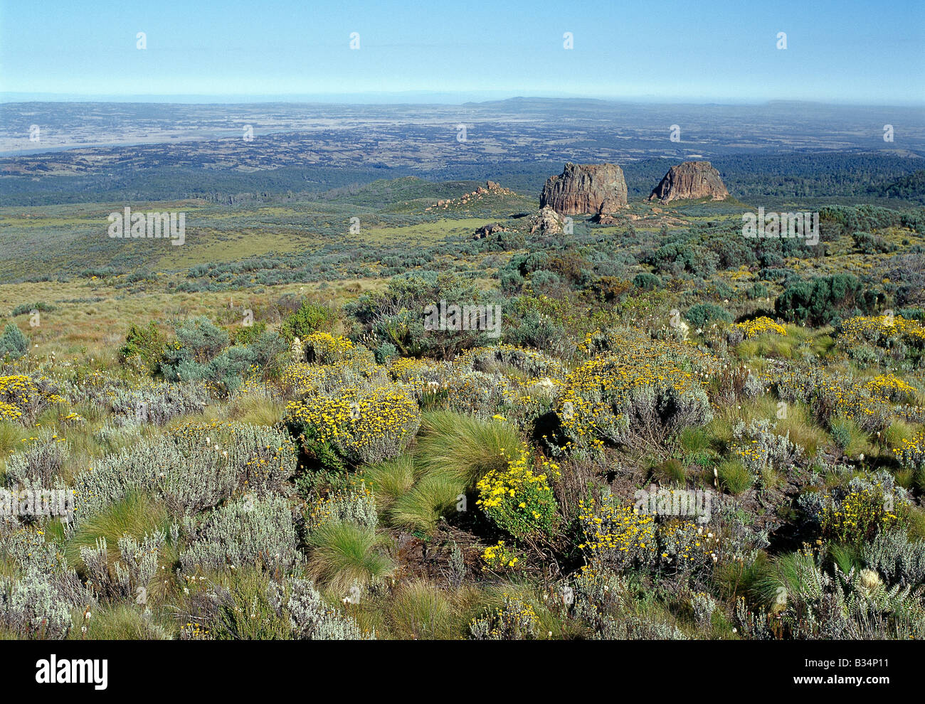 Kenya, Aberdare National Park, Aberdare Mountains. The northern end of the Aberdare Mountains where, on the moorlands at an altitude of 10,500 feet , everlasting flowers (Helichrysum) and plants of the afro-alpine region flourish. Stock Photohttps://www.alamy.com/image-license-details/?v=1https://www.alamy.com/stock-photo-kenya-aberdare-national-park-aberdare-mountains-the-northern-end-of-19159421.html
RMB34P11–Kenya, Aberdare National Park, Aberdare Mountains. The northern end of the Aberdare Mountains where, on the moorlands at an altitude of 10,500 feet , everlasting flowers (Helichrysum) and plants of the afro-alpine region flourish.
 NASA research pilot John A. Manke is seen here in front of the M2-F3 lifting body. Manke was hired by NASA on May 25, 1962, as a flight research engineer. He was later assigned to the pilot's office and flew various support aircraft including the F-104, F-5D, F-111 and C-47. The M2-F3 reached a top speed of l,064 mph (Mach 1.6). Highest altitude reached by the vehicle was 7l,500 feet on December 21, 1972, the date of its last flight with NASA pilot John Manke at the controls. The information the lifting body program generated contributed to the data base that led to development of today's Spac Stock Photohttps://www.alamy.com/image-license-details/?v=1https://www.alamy.com/stock-photo-nasa-research-pilot-john-a-manke-is-seen-here-in-front-of-the-m2-f3-111969454.html
RMGE4J52–NASA research pilot John A. Manke is seen here in front of the M2-F3 lifting body. Manke was hired by NASA on May 25, 1962, as a flight research engineer. He was later assigned to the pilot's office and flew various support aircraft including the F-104, F-5D, F-111 and C-47. The M2-F3 reached a top speed of l,064 mph (Mach 1.6). Highest altitude reached by the vehicle was 7l,500 feet on December 21, 1972, the date of its last flight with NASA pilot John Manke at the controls. The information the lifting body program generated contributed to the data base that led to development of today's Spac
 PT. MUGU, Calif. (Oct. 31, 2013) An MQ-8C Fire Scout unmanned aerial vehicle takes off from Naval Base Ventura County at Point Mugu.The Navy's newest variant of the Fire Scout unmanned helicopter completed its first day of flying Oct. 31 with two flights reaching 500 feet altitude. The MQ-8C air vehicle upgrade will provide longer endurance, range and greater payload capability than the MQ-8B. Initial operating capability for the MQ-8C is planned for 2016, with the potential for an early deployment in 2014. Navy's New Fire Scout Unmanned Helicopter Takes its First Flight by #PACOM Stock Photohttps://www.alamy.com/image-license-details/?v=1https://www.alamy.com/stock-photo-pt-mugu-calif-oct-31-2013-an-mq-8c-fire-scout-unmanned-aerial-vehicle-173996037.html
RMM325M5–PT. MUGU, Calif. (Oct. 31, 2013) An MQ-8C Fire Scout unmanned aerial vehicle takes off from Naval Base Ventura County at Point Mugu.The Navy's newest variant of the Fire Scout unmanned helicopter completed its first day of flying Oct. 31 with two flights reaching 500 feet altitude. The MQ-8C air vehicle upgrade will provide longer endurance, range and greater payload capability than the MQ-8B. Initial operating capability for the MQ-8C is planned for 2016, with the potential for an early deployment in 2014. Navy's New Fire Scout Unmanned Helicopter Takes its First Flight by #PACOM
 Barrage Balloons being towed by their winch vehicles. In 1938 the British Balloon Command was established to protect cities and key targets such as industrial areas, ports and harbours. Balloons were intended to defend against dive bombers flying at heights up to 5,000 feet (1,500 m), forcing them to fly higher and into the range of concentrated anti-aircraft fire—anti-aircraft guns could not traverse fast enough to attack aircraft flying at low altitude and high speed. Stock Photohttps://www.alamy.com/image-license-details/?v=1https://www.alamy.com/barrage-balloons-being-towed-by-their-winch-vehicles-in-1938-the-british-balloon-command-was-established-to-protect-cities-and-key-targets-such-as-industrial-areas-ports-and-harbours-balloons-were-intended-to-defend-against-dive-bombers-flying-at-heights-up-to-5000-feet-1500-m-forcing-them-to-fly-higher-and-into-the-range-of-concentrated-anti-aircraft-fireanti-aircraft-guns-could-not-traverse-fast-enough-to-attack-aircraft-flying-at-low-altitude-and-high-speed-image626290825.html
RM2YAX09D–Barrage Balloons being towed by their winch vehicles. In 1938 the British Balloon Command was established to protect cities and key targets such as industrial areas, ports and harbours. Balloons were intended to defend against dive bombers flying at heights up to 5,000 feet (1,500 m), forcing them to fly higher and into the range of concentrated anti-aircraft fire—anti-aircraft guns could not traverse fast enough to attack aircraft flying at low altitude and high speed.
 NEWARK, New Jersey, United States — An aerial view of Newark Liberty International Airport (EWR) at night, captured from a helicopter at approximately 500 feet altitude, reveals the sprawling airport complex illuminated against the darkness. The intricate patterns of runway and taxiway lights, along with the glowing terminal buildings, create a striking contrast with the surrounding urban landscape. Note: Some high ISO noise is visible at full resolution due to the challenging low-light conditions of night aerial photography. Stock Photohttps://www.alamy.com/image-license-details/?v=1https://www.alamy.com/stock-photo-newark-new-jersey-united-states-an-aerial-view-of-newark-liberty-international-52126366.html
RMD0PFKX–NEWARK, New Jersey, United States — An aerial view of Newark Liberty International Airport (EWR) at night, captured from a helicopter at approximately 500 feet altitude, reveals the sprawling airport complex illuminated against the darkness. The intricate patterns of runway and taxiway lights, along with the glowing terminal buildings, create a striking contrast with the surrounding urban landscape. Note: Some high ISO noise is visible at full resolution due to the challenging low-light conditions of night aerial photography.
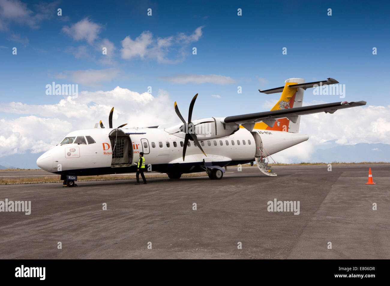 Eastern Bhutan, Yongphula, Airport Druk Air ATR 42-500 aircraft on apron at high altitude runway Stock Photohttps://www.alamy.com/image-license-details/?v=1https://www.alamy.com/stock-photo-eastern-bhutan-yongphula-airport-druk-air-atr-42-500-aircraft-on-apron-73763811.html
RME806DR–Eastern Bhutan, Yongphula, Airport Druk Air ATR 42-500 aircraft on apron at high altitude runway
 The Termales Del Ruiz Hotel located at 10,500 feet in the Andes - Colombia Stock Photohttps://www.alamy.com/image-license-details/?v=1https://www.alamy.com/the-termales-del-ruiz-hotel-located-at-10500-feet-in-the-andes-colombia-image607863457.html
RF2X8XG15–The Termales Del Ruiz Hotel located at 10,500 feet in the Andes - Colombia
 The chairlift station in Velika Planina, on 26th June 2018, in Velika Planina, near Kamnik, Slovenia. Velika Planina is a mountain plateau in the Kamnik–Savinja Alps - a 5.8 square kilometres area 1,500 metres (4,900 feet) above sea level. Otherwise known as The Big Pasture Plateau, Velika Planina is a winter skiing destination and hiking route in summer. The herders' huts became popular in the early 1930s as holiday cabins (known as bajtarstvo) but these were were destroyed by the Germans during WW2 and rebuilt right afterwards by Vlasto Kopac in the summer of 1945. Stock Photohttps://www.alamy.com/image-license-details/?v=1https://www.alamy.com/the-chairlift-station-in-velika-planina-on-26th-june-2018-in-velika-planina-near-kamnik-slovenia-velika-planina-is-a-mountain-plateau-in-the-kamniksavinja-alps-a-58-square-kilometres-area-1500-metres-4900-feet-above-sea-level-otherwise-known-as-the-big-pasture-plateau-velika-planina-is-a-winter-skiing-destination-and-hiking-route-in-summer-the-herders-huts-became-popular-in-the-early-1930s-as-holiday-cabins-known-as-bajtarstvo-but-these-were-were-destroyed-by-the-germans-during-ww2-and-rebuilt-right-afterwards-by-vlasto-kopac-in-the-summer-of-1945-image210828592.html
RMP7020G–The chairlift station in Velika Planina, on 26th June 2018, in Velika Planina, near Kamnik, Slovenia. Velika Planina is a mountain plateau in the Kamnik–Savinja Alps - a 5.8 square kilometres area 1,500 metres (4,900 feet) above sea level. Otherwise known as The Big Pasture Plateau, Velika Planina is a winter skiing destination and hiking route in summer. The herders' huts became popular in the early 1930s as holiday cabins (known as bajtarstvo) but these were were destroyed by the Germans during WW2 and rebuilt right afterwards by Vlasto Kopac in the summer of 1945.
 The Termales Del Ruiz Hotel located at 10,500 feet in the Andes - Colombia Stock Photohttps://www.alamy.com/image-license-details/?v=1https://www.alamy.com/the-termales-del-ruiz-hotel-located-at-10500-feet-in-the-andes-colombia-image607862531.html
RF2X8XET3–The Termales Del Ruiz Hotel located at 10,500 feet in the Andes - Colombia
 A frozen lake at about 10.500 feet in altitude on Pikes Peak. Stock Photohttps://www.alamy.com/image-license-details/?v=1https://www.alamy.com/stock-photo-a-frozen-lake-at-about-10500-feet-in-altitude-on-pikes-peak-102749988.html
RMFY4JJC–A frozen lake at about 10.500 feet in altitude on Pikes Peak.
 Langza, Kaza, Himachal Pradesh, India 7 May 2019 - Serene golden large Buddha statue at Langza situated at altitude of 14,500 feet believed 1000 years Stock Photohttps://www.alamy.com/image-license-details/?v=1https://www.alamy.com/langza-kaza-himachal-pradesh-india-7-may-2019-serene-golden-large-buddha-statue-at-langza-situated-at-altitude-of-14500-feet-believed-1000-years-image333212675.html
RF2AA344K–Langza, Kaza, Himachal Pradesh, India 7 May 2019 - Serene golden large Buddha statue at Langza situated at altitude of 14,500 feet believed 1000 years
 High Altitude vehicle testing Sierra Nevada mountains spain Stock Photohttps://www.alamy.com/image-license-details/?v=1https://www.alamy.com/stock-photo-high-altitude-vehicle-testing-sierra-nevada-mountains-spain-31696452.html
RMBRFW44–High Altitude vehicle testing Sierra Nevada mountains spain
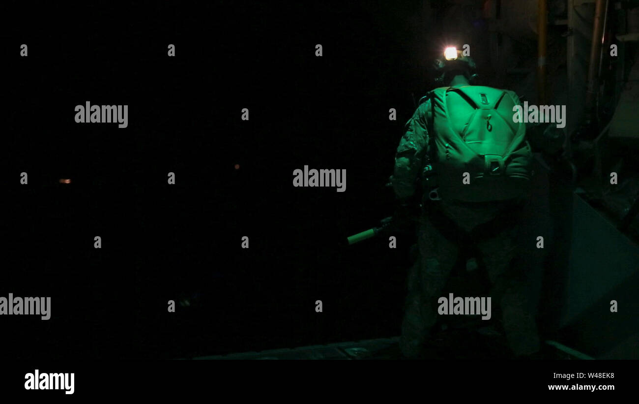 U.S. and Australian Special Operations Forces (SOF) conduct a military free-fall parachute insertion at night with zero natural illumination from 7,500 feet (2,300 meters) altitude, July 2019 during Talisman Sabre. By inserting behind enemy lines SOF conduct surveillance and reconnaissance to enable precision targeting. Talisman Sabre is a bilateral exercise that tests the two forces combat training, readiness and interoperability. (U.S. Marine Corps photos by Lance Cpl. Nicole Rogge) Stock Photohttps://www.alamy.com/image-license-details/?v=1https://www.alamy.com/us-and-australian-special-operations-forces-sof-conduct-a-military-free-fall-parachute-insertion-at-night-with-zero-natural-illumination-from-7500-feet-2300-meters-altitude-july-2019-during-talisman-sabre-by-inserting-behind-enemy-lines-sof-conduct-surveillance-and-reconnaissance-to-enable-precision-targeting-talisman-sabre-is-a-bilateral-exercise-that-tests-the-two-forces-combat-training-readiness-and-interoperability-us-marine-corps-photos-by-lance-cpl-nicole-rogge-image260801276.html
RMW48EK8–U.S. and Australian Special Operations Forces (SOF) conduct a military free-fall parachute insertion at night with zero natural illumination from 7,500 feet (2,300 meters) altitude, July 2019 during Talisman Sabre. By inserting behind enemy lines SOF conduct surveillance and reconnaissance to enable precision targeting. Talisman Sabre is a bilateral exercise that tests the two forces combat training, readiness and interoperability. (U.S. Marine Corps photos by Lance Cpl. Nicole Rogge)
 A cadet at Kelly Field, San Antonio, Texas, on his second flight. He is seen reaching an altitude of 500 feet, during which he is given partial control of the aircraft. Photograph taken by L.H.P.Kinganore, Sig.R.C. and released on May 17, 1918 by Historical Branch, W.P. D. 99450. Stock Photohttps://www.alamy.com/image-license-details/?v=1https://www.alamy.com/a-cadet-at-kelly-field-san-antonio-texas-on-his-second-flight-he-is-seen-reaching-an-altitude-of-500-feet-during-which-he-is-given-partial-control-of-the-aircraft-photograph-taken-by-lhpkinganore-sigrc-and-released-on-may-17-1918-by-historical-branch-wp-d-99450-image558098945.html
RM2RBYGW5–A cadet at Kelly Field, San Antonio, Texas, on his second flight. He is seen reaching an altitude of 500 feet, during which he is given partial control of the aircraft. Photograph taken by L.H.P.Kinganore, Sig.R.C. and released on May 17, 1918 by Historical Branch, W.P. D. 99450.
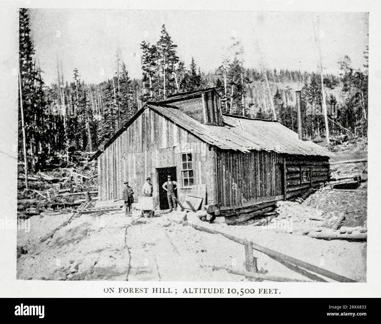 On Forest Hill, Altitude 10,500 Feet from the Article THE LESS-KNOWN GOLD FIELDS OF COLORADO. By Thomas Tonge. from The Engineering Magazine DEVOTED TO INDUSTRIAL PROGRESS Volume XI October 1896 NEW YORK The Engineering Magazine Co Stock Photohttps://www.alamy.com/image-license-details/?v=1https://www.alamy.com/on-forest-hill-altitude-10500-feet-from-the-article-the-less-known-gold-fields-of-colorado-by-thomas-tonge-from-the-engineering-magazine-devoted-to-industrial-progress-volume-xi-october-1896-new-york-the-engineering-magazine-co-image562548311.html
RF2RK6833–On Forest Hill, Altitude 10,500 Feet from the Article THE LESS-KNOWN GOLD FIELDS OF COLORADO. By Thomas Tonge. from The Engineering Magazine DEVOTED TO INDUSTRIAL PROGRESS Volume XI October 1896 NEW YORK The Engineering Magazine Co
 View of the Incan agricultural terraces at Pisac with protective roofing over the stone ruins in the foreground Stock Photohttps://www.alamy.com/image-license-details/?v=1https://www.alamy.com/stock-photo-view-of-the-incan-agricultural-terraces-at-pisac-with-protective-roofing-104860984.html
RMG2GR74–View of the Incan agricultural terraces at Pisac with protective roofing over the stone ruins in the foreground
 Aerial photograph showing the difference in views when taken from different angles. The first two photographs were taken at incorrect angles, resulting in a loss of contour and detail. The third photograph was taken at the correct angle, showcasing good contours and detail. Oblique (Landscape) photographs yield optimal results when taken at an altitude of 500 to 1000 feet with a camera angle of 10 to 20 degrees below the horizontal. Stock Photohttps://www.alamy.com/image-license-details/?v=1https://www.alamy.com/aerial-photograph-showing-the-difference-in-views-when-taken-from-different-angles-the-first-two-photographs-were-taken-at-incorrect-angles-resulting-in-a-loss-of-contour-and-detail-the-third-photograph-was-taken-at-the-correct-angle-showcasing-good-contours-and-detail-oblique-landscape-photographs-yield-optimal-results-when-taken-at-an-altitude-of-500-to-1000-feet-with-a-camera-angle-of-10-to-20-degrees-below-the-horizontal-image558105608.html
RM2RBYWB4–Aerial photograph showing the difference in views when taken from different angles. The first two photographs were taken at incorrect angles, resulting in a loss of contour and detail. The third photograph was taken at the correct angle, showcasing good contours and detail. Oblique (Landscape) photographs yield optimal results when taken at an altitude of 500 to 1000 feet with a camera angle of 10 to 20 degrees below the horizontal.
 Vedauwoo rock formations Wyoming Stock Photohttps://www.alamy.com/image-license-details/?v=1https://www.alamy.com/vedauwoo-rock-formations-wyoming-image455834023.html
RF2HDH0XF–Vedauwoo rock formations Wyoming
 Ansaldo 1, an Italian pursuit airplane used during World War I. It had a high speed and fast climb, but short endurance. It had a wing span of 25 feet and 2 inches, and was powered by a 220 HP motor. Its endurance was around 1 hour and 40 minutes. It had a climb time of 5 minutes and 30 seconds to reach 6,500 feet and a top speed of 134 miles per hour at that altitude. Its ceiling was 26,200 feet and it was armed with 2 guns. This photograph was taken by the Signal Corps of the United States Army. Stock Photohttps://www.alamy.com/image-license-details/?v=1https://www.alamy.com/ansaldo-1-an-italian-pursuit-airplane-used-during-world-war-i-it-had-a-high-speed-and-fast-climb-but-short-endurance-it-had-a-wing-span-of-25-feet-and-2-inches-and-was-powered-by-a-220-hp-motor-its-endurance-was-around-1-hour-and-40-minutes-it-had-a-climb-time-of-5-minutes-and-30-seconds-to-reach-6500-feet-and-a-top-speed-of-134-miles-per-hour-at-that-altitude-its-ceiling-was-26200-feet-and-it-was-armed-with-2-guns-this-photograph-was-taken-by-the-signal-corps-of-the-united-states-army-image558470812.html
RM2RCGF64–Ansaldo 1, an Italian pursuit airplane used during World War I. It had a high speed and fast climb, but short endurance. It had a wing span of 25 feet and 2 inches, and was powered by a 220 HP motor. Its endurance was around 1 hour and 40 minutes. It had a climb time of 5 minutes and 30 seconds to reach 6,500 feet and a top speed of 134 miles per hour at that altitude. Its ceiling was 26,200 feet and it was armed with 2 guns. This photograph was taken by the Signal Corps of the United States Army.
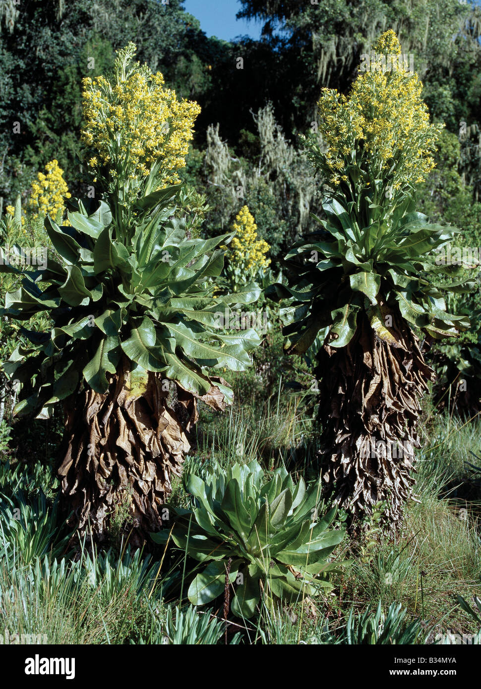 Kenya, Kapenguria, Cherangani Hills. Flowering tree senecios (Senecio johnstonii ssp. Cheranganiensis), or giant groundsels, are found only in the Cherangani Hills above 8,500 feet above sea level. Related to the common groundsel of European gardens, giant groundels flourish at high altitude and display remarkable afro-alpine plant gigantism. Stock Photohttps://www.alamy.com/image-license-details/?v=1https://www.alamy.com/stock-photo-kenya-kapenguria-cherangani-hills-flowering-tree-senecios-senecio-19158590.html
RMB34MYA–Kenya, Kapenguria, Cherangani Hills. Flowering tree senecios (Senecio johnstonii ssp. Cheranganiensis), or giant groundsels, are found only in the Cherangani Hills above 8,500 feet above sea level. Related to the common groundsel of European gardens, giant groundels flourish at high altitude and display remarkable afro-alpine plant gigantism.
 AERIAL - HELICOPTER ALTITUDE WORLD RECORD - CAPE TOWN (AFS) - 23/03/2002 - PHOTO: IGOR MEIJER / DPPI 12 954 METERS / 42 500 FEET - FRED NORTH (FRA) / ECUREUIL B2 - EXCLUSIF FRED BREAKS THE 30 YEARS OLD ALTITUDE RECORD Stock Photohttps://www.alamy.com/image-license-details/?v=1https://www.alamy.com/aerial-helicopter-altitude-world-record-cape-town-afs-23032002-photo-igor-meijer-dppi-12-954-meters-42-500-feet-fred-north-fra-ecureuil-b2-exclusif-fred-breaks-the-30-years-old-altitude-record-image415364746.html
RM2F3NDY6–AERIAL - HELICOPTER ALTITUDE WORLD RECORD - CAPE TOWN (AFS) - 23/03/2002 - PHOTO: IGOR MEIJER / DPPI 12 954 METERS / 42 500 FEET - FRED NORTH (FRA) / ECUREUIL B2 - EXCLUSIF FRED BREAKS THE 30 YEARS OLD ALTITUDE RECORD
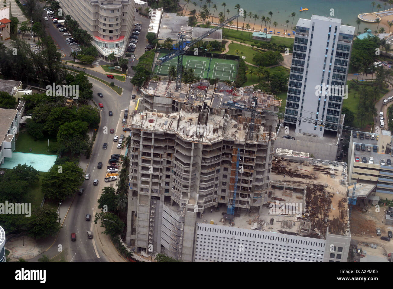 A city under constant construction San Juan Puerto Rico Seen from the air at altitude of 500 800 feet Stock Photohttps://www.alamy.com/image-license-details/?v=1https://www.alamy.com/a-city-under-constant-construction-san-juan-puerto-rico-seen-from-image6042932.html
RMA2PMK5–A city under constant construction San Juan Puerto Rico Seen from the air at altitude of 500 800 feet
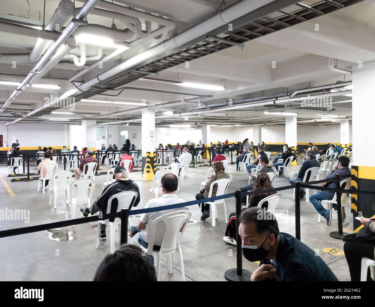 Bogota, Colombia - June 03, 2021: Local Colombian people seen sitting on socially distanced plastic chairs and waiting in a public underground car park, to be vaccinated against Covid-19. They are all wearing protective face masks due to the pandemic situation. At a street level altitude of about 8,500 feet above mean sea level on the Andes Mountains, all people in the image are seen wearing warm clothing. Image taken on a mobile phone. Stock Photohttps://www.alamy.com/image-license-details/?v=1https://www.alamy.com/bogota-colombia-june-03-2021-local-colombian-people-seen-sitting-on-socially-distanced-plastic-chairs-and-waiting-in-a-public-underground-car-park-to-be-vaccinated-against-covid-19-they-are-all-wearing-protective-face-masks-due-to-the-pandemic-situation-at-a-street-level-altitude-of-about-8500-feet-above-mean-sea-level-on-the-andes-mountains-all-people-in-the-image-are-seen-wearing-warm-clothing-image-taken-on-a-mobile-phone-image431513994.html
RM2G214E2–Bogota, Colombia - June 03, 2021: Local Colombian people seen sitting on socially distanced plastic chairs and waiting in a public underground car park, to be vaccinated against Covid-19. They are all wearing protective face masks due to the pandemic situation. At a street level altitude of about 8,500 feet above mean sea level on the Andes Mountains, all people in the image are seen wearing warm clothing. Image taken on a mobile phone.
 LINDEN/ELIZABETH, New Jersey, United States — An aerial view of the Bayway Refinery, captured at night from a helicopter at approximately 500 feet altitude, reveals the sprawling industrial complex brilliantly illuminated against the darkness. The intricate network of lights outlines the refinery's structures, tanks, and processing units, creating a striking industrial landscape on the border of Linden and Elizabeth, NJ. Note: Some high ISO noise is visible at full resolution due to the challenging low-light conditions of night aerial photography. Stock Photohttps://www.alamy.com/image-license-details/?v=1https://www.alamy.com/stock-photo-lindenelizabeth-new-jersey-united-states-an-aerial-view-of-the-bayway-52126360.html
RMD0PFKM–LINDEN/ELIZABETH, New Jersey, United States — An aerial view of the Bayway Refinery, captured at night from a helicopter at approximately 500 feet altitude, reveals the sprawling industrial complex brilliantly illuminated against the darkness. The intricate network of lights outlines the refinery's structures, tanks, and processing units, creating a striking industrial landscape on the border of Linden and Elizabeth, NJ. Note: Some high ISO noise is visible at full resolution due to the challenging low-light conditions of night aerial photography.
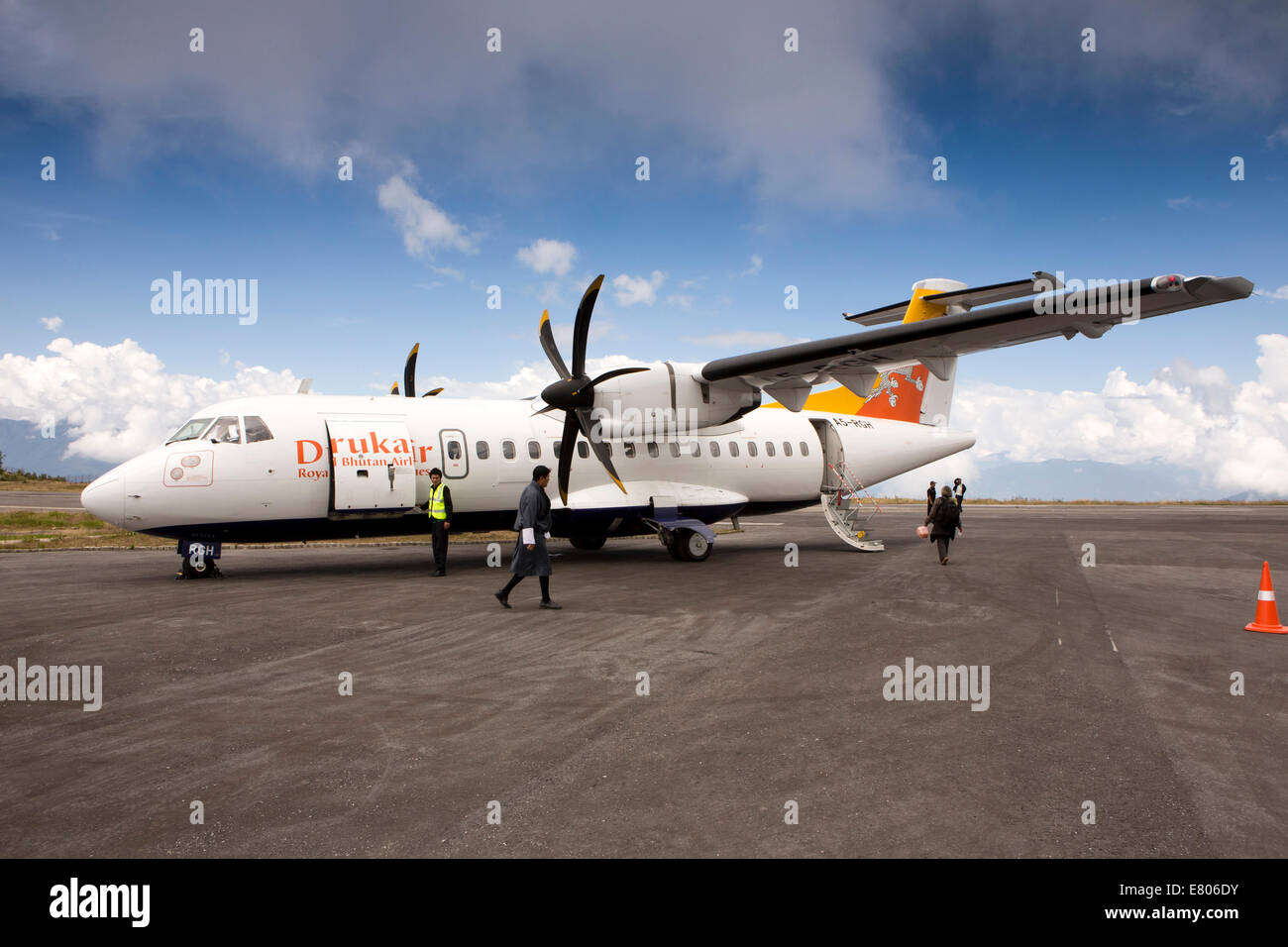 Eastern Bhutan, Yongphula, Airport Druk Air ATR 42-500 aircraft on apron at high altitude runway Stock Photohttps://www.alamy.com/image-license-details/?v=1https://www.alamy.com/stock-photo-eastern-bhutan-yongphula-airport-druk-air-atr-42-500-aircraft-on-apron-73763815.html
RME806DY–Eastern Bhutan, Yongphula, Airport Druk Air ATR 42-500 aircraft on apron at high altitude runway
 Women tea workers plucking tea leaves during cloudy monsoon at the British-era tea garden Orange Valley Tea Garden spread over an area of 347.26 hectares (858.1 acres) at an altitude ranging from 3,500 to 6,000 feet (1,100 to 1,800 m) above the mean sea level, is a bio-organic garden producing mainly black tea at Darjeeling, West Bengal. India is the world's second-largest tea producer Country after China. The poor female tea workers' work wages are very low, and most of them are coming from neighbouring country Nepal in search of work. India. Stock Photohttps://www.alamy.com/image-license-details/?v=1https://www.alamy.com/women-tea-workers-plucking-tea-leaves-during-cloudy-monsoon-at-the-british-era-tea-garden-orange-valley-tea-garden-spread-over-an-area-of-34726-hectares-8581-acres-at-an-altitude-ranging-from-3500-to-6000-feet-1100-to-1800-m-above-the-mean-sea-level-is-a-bio-organic-garden-producing-mainly-black-tea-at-darjeeling-west-bengal-india-is-the-worlds-second-largest-tea-producer-country-after-china-the-poor-female-tea-workers-work-wages-are-very-low-and-most-of-them-are-coming-from-neighbouring-country-nepal-in-search-of-work-india-image475110118.html
RM2JGY3PE–Women tea workers plucking tea leaves during cloudy monsoon at the British-era tea garden Orange Valley Tea Garden spread over an area of 347.26 hectares (858.1 acres) at an altitude ranging from 3,500 to 6,000 feet (1,100 to 1,800 m) above the mean sea level, is a bio-organic garden producing mainly black tea at Darjeeling, West Bengal. India is the world's second-largest tea producer Country after China. The poor female tea workers' work wages are very low, and most of them are coming from neighbouring country Nepal in search of work. India.
 Construction of a new Slovenian holiday mountain hut in the style of a herders' shelter in Velika Planina, on 26th June 2018, in Velika Planina, near Kamnik, Slovenia. Velika Planina is a mountain plateau in the Kamnik–Savinja Alps - a 5.8 square kilometres area 1,500 metres (4,900 feet) above sea level. Otherwise known as The Big Pasture Plateau, Velika Planina is a winter skiing destination and hiking route in summer. The herders' huts became popular in the early 1930s as holiday cabins (known as bajtarstvo) but these were were destroyed by the Germans during WW2 and rebuilt right afterwards Stock Photohttps://www.alamy.com/image-license-details/?v=1https://www.alamy.com/construction-of-a-new-slovenian-holiday-mountain-hut-in-the-style-of-a-herders-shelter-in-velika-planina-on-26th-june-2018-in-velika-planina-near-kamnik-slovenia-velika-planina-is-a-mountain-plateau-in-the-kamniksavinja-alps-a-58-square-kilometres-area-1500-metres-4900-feet-above-sea-level-otherwise-known-as-the-big-pasture-plateau-velika-planina-is-a-winter-skiing-destination-and-hiking-route-in-summer-the-herders-huts-became-popular-in-the-early-1930s-as-holiday-cabins-known-as-bajtarstvo-but-these-were-were-destroyed-by-the-germans-during-ww2-and-rebuilt-right-afterwards-image210828565.html
RMP701YH–Construction of a new Slovenian holiday mountain hut in the style of a herders' shelter in Velika Planina, on 26th June 2018, in Velika Planina, near Kamnik, Slovenia. Velika Planina is a mountain plateau in the Kamnik–Savinja Alps - a 5.8 square kilometres area 1,500 metres (4,900 feet) above sea level. Otherwise known as The Big Pasture Plateau, Velika Planina is a winter skiing destination and hiking route in summer. The herders' huts became popular in the early 1930s as holiday cabins (known as bajtarstvo) but these were were destroyed by the Germans during WW2 and rebuilt right afterwards
 The Termales Del Ruiz Hotel located at 10,500 feet in the Andes - Colombia Stock Photohttps://www.alamy.com/image-license-details/?v=1https://www.alamy.com/the-termales-del-ruiz-hotel-located-at-10500-feet-in-the-andes-colombia-image607862376.html
RF2X8XEJG–The Termales Del Ruiz Hotel located at 10,500 feet in the Andes - Colombia
 Women tea workers are plucking tea leaves during cloudy monsoon at the British-era tea garden Orange Valley Tea Garden spread over an area of 347.26 hectares (858.1 acres) at an altitude ranging from 3,500 to 6,000 feet (1,100 to 1,800 m) above the mean sea level, is a bio-organic garden producing mainly black tea at Darjeeling, West Bengal, India on 11/06/2022. India is the world's second-largest tea producer Country after China. The Poor female tea workers' work wages are very low, and most of them are coming from neighbouring country Nepal in search of work. (Photo by Soumyabrata Roy/NurPho Stock Photohttps://www.alamy.com/image-license-details/?v=1https://www.alamy.com/women-tea-workers-are-plucking-tea-leaves-during-cloudy-monsoon-at-the-british-era-tea-garden-orange-valley-tea-garden-spread-over-an-area-of-34726-hectares-8581-acres-at-an-altitude-ranging-from-3500-to-6000-feet-1100-to-1800-m-above-the-mean-sea-level-is-a-bio-organic-garden-producing-mainly-black-tea-at-darjeeling-west-bengal-india-on-11062022-india-is-the-worlds-second-largest-tea-producer-country-after-china-the-poor-female-tea-workers-work-wages-are-very-low-and-most-of-them-are-coming-from-neighbouring-country-nepal-in-search-of-work-photo-by-soumyabrata-roynurpho-image490162387.html
RM2KDCR3F–Women tea workers are plucking tea leaves during cloudy monsoon at the British-era tea garden Orange Valley Tea Garden spread over an area of 347.26 hectares (858.1 acres) at an altitude ranging from 3,500 to 6,000 feet (1,100 to 1,800 m) above the mean sea level, is a bio-organic garden producing mainly black tea at Darjeeling, West Bengal, India on 11/06/2022. India is the world's second-largest tea producer Country after China. The Poor female tea workers' work wages are very low, and most of them are coming from neighbouring country Nepal in search of work. (Photo by Soumyabrata Roy/NurPho
 Panorama of the Termales Del Ruiz Hotel located at 10,500 feet in the Andes - Colombia Stock Photohttps://www.alamy.com/image-license-details/?v=1https://www.alamy.com/panorama-of-the-termales-del-ruiz-hotel-located-at-10500-feet-in-the-andes-colombia-image607863516.html
RF2X8XG38–Panorama of the Termales Del Ruiz Hotel located at 10,500 feet in the Andes - Colombia
 High Altitude vehicle testing Sierra Nevada mountains spain Stock Photohttps://www.alamy.com/image-license-details/?v=1https://www.alamy.com/stock-photo-high-altitude-vehicle-testing-sierra-nevada-mountains-spain-31696213.html
RMBRFTRH–High Altitude vehicle testing Sierra Nevada mountains spain
 A living rooftop at the Termales Del Ruiz Hotel located at 10,500 feet in the Andes - Colombia Stock Photohttps://www.alamy.com/image-license-details/?v=1https://www.alamy.com/a-living-rooftop-at-the-termales-del-ruiz-hotel-located-at-10500-feet-in-the-andes-colombia-image607862628.html
RF2X8XEYG–A living rooftop at the Termales Del Ruiz Hotel located at 10,500 feet in the Andes - Colombia
 U.S. and Australian Special Operations Forces (SOF) conduct a military free-fall parachute insertion at night with zero natural illumination from 7,500 feet (2,300 meters) altitude, July 2019 during Talisman Sabre. By inserting behind enemy lines SOF conduct surveillance and reconnaissance to enable precision targeting. Talisman Sabre is a bilateral exercise that tests the two forces combat training, readiness and interoperability. (U.S. Marine Corps photos by Lance Cpl. Nicole Rogge) Stock Photohttps://www.alamy.com/image-license-details/?v=1https://www.alamy.com/us-and-australian-special-operations-forces-sof-conduct-a-military-free-fall-parachute-insertion-at-night-with-zero-natural-illumination-from-7500-feet-2300-meters-altitude-july-2019-during-talisman-sabre-by-inserting-behind-enemy-lines-sof-conduct-surveillance-and-reconnaissance-to-enable-precision-targeting-talisman-sabre-is-a-bilateral-exercise-that-tests-the-two-forces-combat-training-readiness-and-interoperability-us-marine-corps-photos-by-lance-cpl-nicole-rogge-image260801313.html
RMW48EMH–U.S. and Australian Special Operations Forces (SOF) conduct a military free-fall parachute insertion at night with zero natural illumination from 7,500 feet (2,300 meters) altitude, July 2019 during Talisman Sabre. By inserting behind enemy lines SOF conduct surveillance and reconnaissance to enable precision targeting. Talisman Sabre is a bilateral exercise that tests the two forces combat training, readiness and interoperability. (U.S. Marine Corps photos by Lance Cpl. Nicole Rogge)
 NASA research pilot John A. Manke is seen here in front of the M2-F3 lifting body. Manke was hired by NASA on May 25, 1962, as a flight research engineer. He was later assigned to the pilot's office and flew various support aircraft including the F-104, F-5D, F-111 and C-47. The M2-F3 reached a top speed of l,064 mph (Mach 1.6). Highest altitude reached by the vehicle was 7l,500 feet on December 21, 1972, the date of its last flight with NASA pilot John Manke at the controls. The information the lifting body program generated contributed to the data base that led to development of today's Spac Stock Photohttps://www.alamy.com/image-license-details/?v=1https://www.alamy.com/nasa-research-pilot-john-a-manke-is-seen-here-in-front-of-the-m2-f3-lifting-body-manke-was-hired-by-nasa-on-may-25-1962-as-a-flight-research-engineer-he-was-later-assigned-to-the-pilots-office-and-flew-various-support-aircraft-including-the-f-104-f-5d-f-111-and-c-47-the-m2-f3-reached-a-top-speed-of-l064-mph-mach-16-highest-altitude-reached-by-the-vehicle-was-7l500-feet-on-december-21-1972-the-date-of-its-last-flight-with-nasa-pilot-john-manke-at-the-controls-the-information-the-lifting-body-program-generated-contributed-to-the-data-base-that-led-to-development-of-todays-spac-image498450013.html
RM2KXXA25–NASA research pilot John A. Manke is seen here in front of the M2-F3 lifting body. Manke was hired by NASA on May 25, 1962, as a flight research engineer. He was later assigned to the pilot's office and flew various support aircraft including the F-104, F-5D, F-111 and C-47. The M2-F3 reached a top speed of l,064 mph (Mach 1.6). Highest altitude reached by the vehicle was 7l,500 feet on December 21, 1972, the date of its last flight with NASA pilot John Manke at the controls. The information the lifting body program generated contributed to the data base that led to development of today's Spac
 Mojave, USA. 29th May 2018. 5-29-18. MOJAVE CA. Virgin Galactic took another step on Tuesday toward beginning commercial operations with its latest test flight. This test flight bested April's in altitude, with Unity hitting the top of its climb at 114,500 feet, with the first test reached 84,271 feet at its peak. Sir. Richard Branson said this was the sixth powered test flight of the SpaceShipTwo design, and the second since the fatal crash of the Spaceship Enterprise on Oct. 31, 2014. Credit: ZUMA Press, Inc./Alamy Live News Stock Photohttps://www.alamy.com/image-license-details/?v=1https://www.alamy.com/mojave-usa-29th-may-2018-5-29-18-mojave-ca-virgin-galactic-took-another-step-on-tuesday-toward-beginning-commercial-operations-with-its-latest-test-flight-this-test-flight-bested-aprils-in-altitude-with-unity-hitting-the-top-of-its-climb-at-114500-feet-with-the-first-test-reached-84271-feet-at-its-peak-sir-richard-branson-said-this-was-the-sixth-powered-test-flight-of-the-spaceshiptwo-design-and-the-second-since-the-fatal-crash-of-the-spaceship-enterprise-on-oct-31-2014-credit-zuma-press-incalamy-live-news-image187151951.html
RMMTDE67–Mojave, USA. 29th May 2018. 5-29-18. MOJAVE CA. Virgin Galactic took another step on Tuesday toward beginning commercial operations with its latest test flight. This test flight bested April's in altitude, with Unity hitting the top of its climb at 114,500 feet, with the first test reached 84,271 feet at its peak. Sir. Richard Branson said this was the sixth powered test flight of the SpaceShipTwo design, and the second since the fatal crash of the Spaceship Enterprise on Oct. 31, 2014. Credit: ZUMA Press, Inc./Alamy Live News
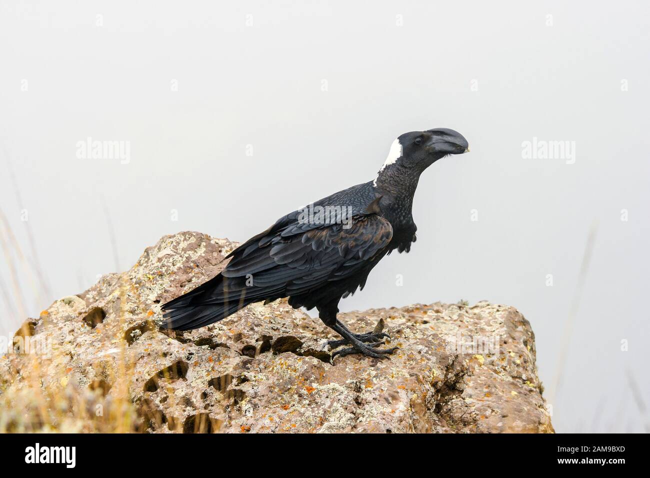 Thick-Billed Raven (Corvus crassirostris), is a bird which is common to abundant from about 1200 to at least 4100 meters (4000 .13,500 feet). Simien M Stock Photohttps://www.alamy.com/image-license-details/?v=1https://www.alamy.com/thick-billed-raven-corvus-crassirostris-is-a-bird-which-is-common-to-abundant-from-about-1200-to-at-least-4100-meters-4000-13500-feet-simien-m-image339497045.html
RF2AM9BXD–Thick-Billed Raven (Corvus crassirostris), is a bird which is common to abundant from about 1200 to at least 4100 meters (4000 .13,500 feet). Simien M
 Critical skills operators with Marine Raider Regiment, U.S. Marine Corps Forces, Special Operations Command, execute a static-line jump from an MV-22 Osprey in the skies above Marine Corps Air Station New River, N.C., July 29, 2015. Jumping from an altitude of 1,500 feet, the team landed at Camp Davis, Marine Corps Base Camp Lejeune, N.C. (U.S. Marine Corps photo by Cpl. Paul S. Martinez/Released) Skyfall, VMM-263 supports MARSOC para-operations 150729-M-ZM882-641 Stock Photohttps://www.alamy.com/image-license-details/?v=1https://www.alamy.com/stock-photo-critical-skills-operators-with-marine-raider-regiment-us-marine-corps-129772168.html
RMHF3HM8–Critical skills operators with Marine Raider Regiment, U.S. Marine Corps Forces, Special Operations Command, execute a static-line jump from an MV-22 Osprey in the skies above Marine Corps Air Station New River, N.C., July 29, 2015. Jumping from an altitude of 1,500 feet, the team landed at Camp Davis, Marine Corps Base Camp Lejeune, N.C. (U.S. Marine Corps photo by Cpl. Paul S. Martinez/Released) Skyfall, VMM-263 supports MARSOC para-operations 150729-M-ZM882-641
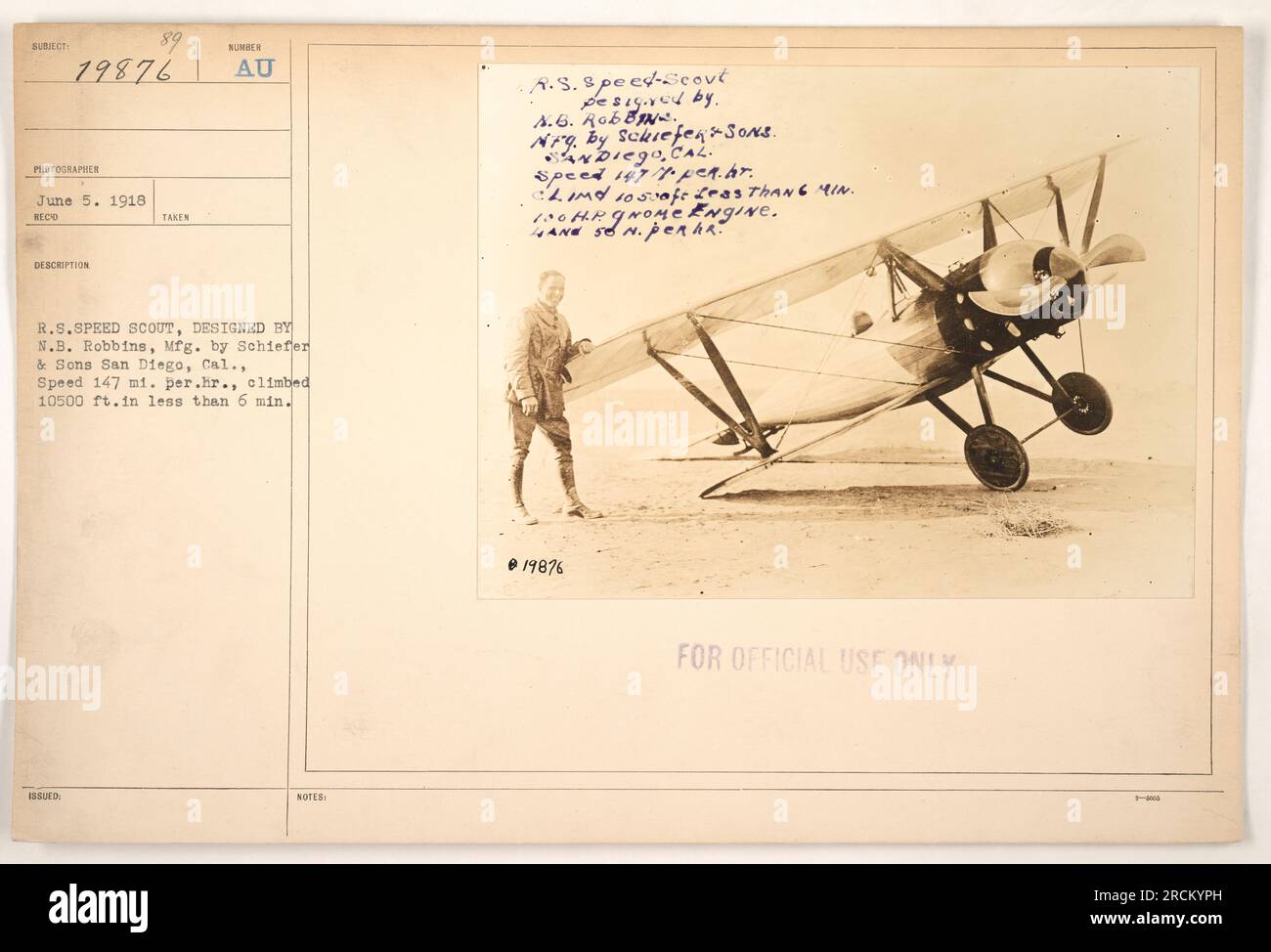 Official photograph of the A.S. Spect-Scout aircraft, model R.S.Speed, designed by N.B. Robbins and manufactured by Schiefer & Sons in San Diego, California. The aircraft had a top speed of 147 miles per hour and could climb to 10,500 feet in less than 6 minutes. Equipped with a 100 horsepower Gnome engine. Photograph taken on June 5, 1918. For official use only. Stock Photohttps://www.alamy.com/image-license-details/?v=1https://www.alamy.com/official-photograph-of-the-as-spect-scout-aircraft-model-rsspeed-designed-by-nb-robbins-and-manufactured-by-schiefer-sons-in-san-diego-california-the-aircraft-had-a-top-speed-of-147-miles-per-hour-and-could-climb-to-10500-feet-in-less-than-6-minutes-equipped-with-a-100-horsepower-gnome-engine-photograph-taken-on-june-5-1918-for-official-use-only-image558546537.html
RM2RCKYPH–Official photograph of the A.S. Spect-Scout aircraft, model R.S.Speed, designed by N.B. Robbins and manufactured by Schiefer & Sons in San Diego, California. The aircraft had a top speed of 147 miles per hour and could climb to 10,500 feet in less than 6 minutes. Equipped with a 100 horsepower Gnome engine. Photograph taken on June 5, 1918. For official use only.
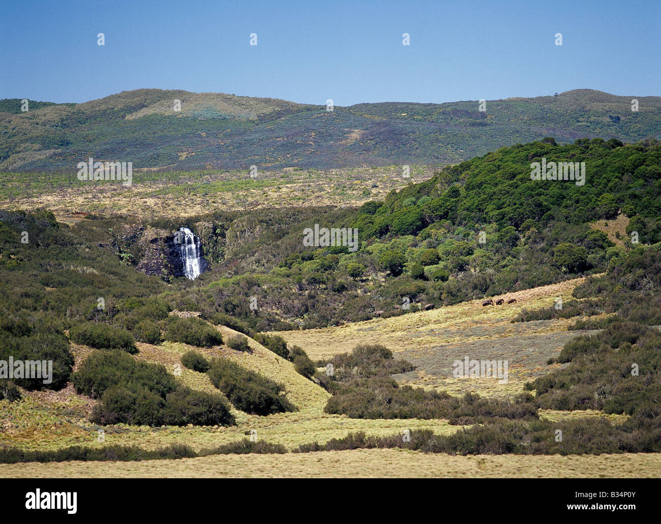 Kenya, Aberdare National Park, Aberdare Mountains. A small herd of elephants feeds on coarse moorland grass at an altitude of 10,500 feet on top of the Aberdare Mountains. Hagenia trees (Hagenia abyssinica) are the only trees that grow above the bamboo zone at this altitude. Stock Photohttps://www.alamy.com/image-license-details/?v=1https://www.alamy.com/stock-photo-kenya-aberdare-national-park-aberdare-mountains-a-small-herd-of-elephants-19159419.html
RMB34P0Y–Kenya, Aberdare National Park, Aberdare Mountains. A small herd of elephants feeds on coarse moorland grass at an altitude of 10,500 feet on top of the Aberdare Mountains. Hagenia trees (Hagenia abyssinica) are the only trees that grow above the bamboo zone at this altitude.
 AERIAL - HELICOPTER ALTITUDE WORLD RECORD - CAPE TOWN (AFS) - 23/03/2002 - PHOTO: IGOR MEIJER / DPPI 12 954 METERS / 42 500 FEET - FRED NORTH (FRA) / ECUREUIL B2 - EXCLUSIF FRED BREAKS THE 30 YEARS OLD ALTITUDE RECORD Stock Photohttps://www.alamy.com/image-license-details/?v=1https://www.alamy.com/aerial-helicopter-altitude-world-record-cape-town-afs-23032002-photo-igor-meijer-dppi-12-954-meters-42-500-feet-fred-north-fra-ecureuil-b2-exclusif-fred-breaks-the-30-years-old-altitude-record-image415364740.html
RM2F3NDY0–AERIAL - HELICOPTER ALTITUDE WORLD RECORD - CAPE TOWN (AFS) - 23/03/2002 - PHOTO: IGOR MEIJER / DPPI 12 954 METERS / 42 500 FEET - FRED NORTH (FRA) / ECUREUIL B2 - EXCLUSIF FRED BREAKS THE 30 YEARS OLD ALTITUDE RECORD
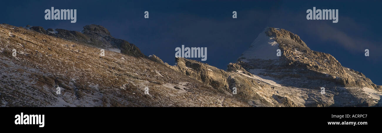 Sunset panorama of Everest's Northeast Ridge from Camp VI at 27,300 feet. Visible are the First Second and Third Steps & summit. Stock Photohttps://www.alamy.com/image-license-details/?v=1https://www.alamy.com/sunset-panorama-of-everests-northeast-ridge-from-camp-vi-at-27300-image4315846.html
RMACRPC7–Sunset panorama of Everest's Northeast Ridge from Camp VI at 27,300 feet. Visible are the First Second and Third Steps & summit.
 Bogota, Colombia - June 03, 2021: Local Colombian people seen sitting on socially distanced plastic chairs and waiting in a public underground car park, to be vaccinated against Covid-19. They are all wearing protective face masks due to the pandemic situation. At a street level altitude of about 8,500 feet above mean sea level on the Andes Mountains, all people in the image are seen wearing warm clothing. Image taken on a mobile phone. Stock Photohttps://www.alamy.com/image-license-details/?v=1https://www.alamy.com/bogota-colombia-june-03-2021-local-colombian-people-seen-sitting-on-socially-distanced-plastic-chairs-and-waiting-in-a-public-underground-car-park-to-be-vaccinated-against-covid-19-they-are-all-wearing-protective-face-masks-due-to-the-pandemic-situation-at-a-street-level-altitude-of-about-8500-feet-above-mean-sea-level-on-the-andes-mountains-all-people-in-the-image-are-seen-wearing-warm-clothing-image-taken-on-a-mobile-phone-image431514080.html
RM2G214H4–Bogota, Colombia - June 03, 2021: Local Colombian people seen sitting on socially distanced plastic chairs and waiting in a public underground car park, to be vaccinated against Covid-19. They are all wearing protective face masks due to the pandemic situation. At a street level altitude of about 8,500 feet above mean sea level on the Andes Mountains, all people in the image are seen wearing warm clothing. Image taken on a mobile phone.
 NEWARK, New Jersey, United States — An aerial view of Newark Liberty International Airport (EWR) at night, captured from a helicopter at approximately 500 feet altitude, reveals the sprawling terminal complex illuminated against the darkness. The Airtrain monorail system is distinctly visible as a string of white lights stretching from the center to the bottom of the frame, showcasing the airport's modern transportation infrastructure. Note: Some high ISO noise is visible at full resolution due to the challenging low-light conditions of night aerial photography. Stock Photohttps://www.alamy.com/image-license-details/?v=1https://www.alamy.com/stock-photo-newark-new-jersey-united-states-an-aerial-view-of-newark-liberty-international-52126372.html
RMD0PFM4–NEWARK, New Jersey, United States — An aerial view of Newark Liberty International Airport (EWR) at night, captured from a helicopter at approximately 500 feet altitude, reveals the sprawling terminal complex illuminated against the darkness. The Airtrain monorail system is distinctly visible as a string of white lights stretching from the center to the bottom of the frame, showcasing the airport's modern transportation infrastructure. Note: Some high ISO noise is visible at full resolution due to the challenging low-light conditions of night aerial photography.
 Windsor, Berkshire, UK. 9th January, 2022. A no fly zone with a radius of 1.4 miles around Windsor Castle is reported to be coming into force from 27th January 2022. Aircraft would be prohibited from flying lower than at an altitude of 2,500 feet above the royal residence. Drones will also be prohibited. Her Majesty Queen Elizabeth II is currently in residence at Windsor Castle during the latest Covid-19 Omicron variant phase. These new security measures are reported to be due to an intruder with a cross bow entering the grounds of Windsor Castle on Christmas Day. The man has since been sectio Stock Photohttps://www.alamy.com/image-license-details/?v=1https://www.alamy.com/windsor-berkshire-uk-9th-january-2022-a-no-fly-zone-with-a-radius-of-14-miles-around-windsor-castle-is-reported-to-be-coming-into-force-from-27th-january-2022-aircraft-would-be-prohibited-from-flying-lower-than-at-an-altitude-of-2500-feet-above-the-royal-residence-drones-will-also-be-prohibited-her-majesty-queen-elizabeth-ii-is-currently-in-residence-at-windsor-castle-during-the-latest-covid-19-omicron-variant-phase-these-new-security-measures-are-reported-to-be-due-to-an-intruder-with-a-cross-bow-entering-the-grounds-of-windsor-castle-on-christmas-day-the-man-has-since-been-sectio-image456230312.html
RM2HE72BM–Windsor, Berkshire, UK. 9th January, 2022. A no fly zone with a radius of 1.4 miles around Windsor Castle is reported to be coming into force from 27th January 2022. Aircraft would be prohibited from flying lower than at an altitude of 2,500 feet above the royal residence. Drones will also be prohibited. Her Majesty Queen Elizabeth II is currently in residence at Windsor Castle during the latest Covid-19 Omicron variant phase. These new security measures are reported to be due to an intruder with a cross bow entering the grounds of Windsor Castle on Christmas Day. The man has since been sectio
 MOUNT KILIMANJARO, Tanzania — A rare directions sign amidst the rocky, rugged apline desert on Mt Kilimanjaro Lemosho Route. These shots were taken on the trail between Moir Hut Camp and Lava Tower at approximately 14,500 feet. Stock Photohttps://www.alamy.com/image-license-details/?v=1https://www.alamy.com/stock-photo-mount-kilimanjaro-tanzania-a-rare-directions-sign-amidst-the-rocky-52125070.html
RMD0PE1J–MOUNT KILIMANJARO, Tanzania — A rare directions sign amidst the rocky, rugged apline desert on Mt Kilimanjaro Lemosho Route. These shots were taken on the trail between Moir Hut Camp and Lava Tower at approximately 14,500 feet.
 A mobile phone mast located at the cablecar station in Velika Planina, on 26th June 2018, in Velika Planina, near Kamnik, Slovenia. Velika Planina is a mountain plateau in the Kamnik–Savinja Alps - a 5.8 square kilometres area 1,500 metres (4,900 feet) above sea level. Otherwise known as The Big Pasture Plateau, Velika Planina is a winter skiing destination and hiking route in summer. The herders' huts became popular in the early 1930s as holiday cabins (known as bajtarstvo) but these were were destroyed by the Germans during WW2 and rebuilt right afterwards by Vlasto Kopac in the summer of 19 Stock Photohttps://www.alamy.com/image-license-details/?v=1https://www.alamy.com/a-mobile-phone-mast-located-at-the-cablecar-station-in-velika-planina-on-26th-june-2018-in-velika-planina-near-kamnik-slovenia-velika-planina-is-a-mountain-plateau-in-the-kamniksavinja-alps-a-58-square-kilometres-area-1500-metres-4900-feet-above-sea-level-otherwise-known-as-the-big-pasture-plateau-velika-planina-is-a-winter-skiing-destination-and-hiking-route-in-summer-the-herders-huts-became-popular-in-the-early-1930s-as-holiday-cabins-known-as-bajtarstvo-but-these-were-were-destroyed-by-the-germans-during-ww2-and-rebuilt-right-afterwards-by-vlasto-kopac-in-the-summer-of-19-image210828803.html
RMP70283–A mobile phone mast located at the cablecar station in Velika Planina, on 26th June 2018, in Velika Planina, near Kamnik, Slovenia. Velika Planina is a mountain plateau in the Kamnik–Savinja Alps - a 5.8 square kilometres area 1,500 metres (4,900 feet) above sea level. Otherwise known as The Big Pasture Plateau, Velika Planina is a winter skiing destination and hiking route in summer. The herders' huts became popular in the early 1930s as holiday cabins (known as bajtarstvo) but these were were destroyed by the Germans during WW2 and rebuilt right afterwards by Vlasto Kopac in the summer of 19
 Women tea workers plucking tea leaves during cloudy monsoon at the British-era tea garden Orange Valley Tea Garden spread over an area of 347.26 hectares (858.1 acres) at an altitude ranging from 3,500 to 6,000 feet (1,100 to 1,800 m) above the mean sea level, is a bio-organic garden producing mainly black tea at Darjeeling, West Bengal. India is the world's second-largest tea producer Country after China. The poor female tea workers' work wages are very low, and most of them are coming from neighbouring country Nepal in search of work. India. Stock Photohttps://www.alamy.com/image-license-details/?v=1https://www.alamy.com/women-tea-workers-plucking-tea-leaves-during-cloudy-monsoon-at-the-british-era-tea-garden-orange-valley-tea-garden-spread-over-an-area-of-34726-hectares-8581-acres-at-an-altitude-ranging-from-3500-to-6000-feet-1100-to-1800-m-above-the-mean-sea-level-is-a-bio-organic-garden-producing-mainly-black-tea-at-darjeeling-west-bengal-india-is-the-worlds-second-largest-tea-producer-country-after-china-the-poor-female-tea-workers-work-wages-are-very-low-and-most-of-them-are-coming-from-neighbouring-country-nepal-in-search-of-work-india-image475110631.html
RM2JGY4CR–Women tea workers plucking tea leaves during cloudy monsoon at the British-era tea garden Orange Valley Tea Garden spread over an area of 347.26 hectares (858.1 acres) at an altitude ranging from 3,500 to 6,000 feet (1,100 to 1,800 m) above the mean sea level, is a bio-organic garden producing mainly black tea at Darjeeling, West Bengal. India is the world's second-largest tea producer Country after China. The poor female tea workers' work wages are very low, and most of them are coming from neighbouring country Nepal in search of work. India.
 Women tea workers are plucking tea leaves during cloudy monsoon at the British-era tea garden Orange Valley Tea Garden spread over an area of 347.26 hectares (858.1 acres) at an altitude ranging from 3,500 to 6,000 feet (1,100 to 1,800 m) above the mean sea level, is a bio-organic garden producing mainly black tea at Darjeeling, West Bengal, India on 11/06/2022. India is the world's second-largest tea producer Country after China. The Poor female tea workers' work wages are very low, and most of them are coming from neighbouring country Nepal in search of work. (Photo by Soumyabrata Roy/NurPho Stock Photohttps://www.alamy.com/image-license-details/?v=1https://www.alamy.com/women-tea-workers-are-plucking-tea-leaves-during-cloudy-monsoon-at-the-british-era-tea-garden-orange-valley-tea-garden-spread-over-an-area-of-34726-hectares-8581-acres-at-an-altitude-ranging-from-3500-to-6000-feet-1100-to-1800-m-above-the-mean-sea-level-is-a-bio-organic-garden-producing-mainly-black-tea-at-darjeeling-west-bengal-india-on-11062022-india-is-the-worlds-second-largest-tea-producer-country-after-china-the-poor-female-tea-workers-work-wages-are-very-low-and-most-of-them-are-coming-from-neighbouring-country-nepal-in-search-of-work-photo-by-soumyabrata-roynurpho-image490162400.html
RM2KDCR40–Women tea workers are plucking tea leaves during cloudy monsoon at the British-era tea garden Orange Valley Tea Garden spread over an area of 347.26 hectares (858.1 acres) at an altitude ranging from 3,500 to 6,000 feet (1,100 to 1,800 m) above the mean sea level, is a bio-organic garden producing mainly black tea at Darjeeling, West Bengal, India on 11/06/2022. India is the world's second-largest tea producer Country after China. The Poor female tea workers' work wages are very low, and most of them are coming from neighbouring country Nepal in search of work. (Photo by Soumyabrata Roy/NurPho
 Bluffs in Donner Pass. 500 feet; altitude of Pass 7,090 feet.. Attributed to Alfred A. Hart (American, 1816 - 1908) Stock Photohttps://www.alamy.com/image-license-details/?v=1https://www.alamy.com/bluffs-in-donner-pass-500-feet-altitude-of-pass-7090-feet-attributed-to-alfred-a-hart-american-1816-1908-image416584849.html
RM2F5N269–Bluffs in Donner Pass. 500 feet; altitude of Pass 7,090 feet.. Attributed to Alfred A. Hart (American, 1816 - 1908)
 High Altitude vehicle testing Sierra Nevada mountains spain Stock Photohttps://www.alamy.com/image-license-details/?v=1https://www.alamy.com/stock-photo-high-altitude-vehicle-testing-sierra-nevada-mountains-spain-31696597.html
RMBRFW99–High Altitude vehicle testing Sierra Nevada mountains spain
 A visitor enjoys the rooftop viewing platform at the Termales Del Ruiz Hotel located at 10,500 feet in the Andes - Colombia Stock Photohttps://www.alamy.com/image-license-details/?v=1https://www.alamy.com/a-visitor-enjoys-the-rooftop-viewing-platform-at-the-termales-del-ruiz-hotel-located-at-10500-feet-in-the-andes-colombia-image607862621.html
RF2X8XEY9–A visitor enjoys the rooftop viewing platform at the Termales Del Ruiz Hotel located at 10,500 feet in the Andes - Colombia
 U.S. and Australian Special Operations Forces (SOF) conduct a military freefall parachute insertion at night with zero natural illumination from 7,500 feet (2,300 meters) altitude, July 2019 during Talisman Sabre. By inserting behind enemy lines SOF conduct surveillance and reconnaissance to enable precision targeting. Talisman Sabre is a bilateral exercise that tests the two forces combat training, readiness and interoperability. (U.S. Marine Corps photos by Lance Cpl. Nicole Rogge) Stock Photohttps://www.alamy.com/image-license-details/?v=1https://www.alamy.com/us-and-australian-special-operations-forces-sof-conduct-a-military-freefall-parachute-insertion-at-night-with-zero-natural-illumination-from-7500-feet-2300-meters-altitude-july-2019-during-talisman-sabre-by-inserting-behind-enemy-lines-sof-conduct-surveillance-and-reconnaissance-to-enable-precision-targeting-talisman-sabre-is-a-bilateral-exercise-that-tests-the-two-forces-combat-training-readiness-and-interoperability-us-marine-corps-photos-by-lance-cpl-nicole-rogge-image260801274.html
RMW48EK6–U.S. and Australian Special Operations Forces (SOF) conduct a military freefall parachute insertion at night with zero natural illumination from 7,500 feet (2,300 meters) altitude, July 2019 during Talisman Sabre. By inserting behind enemy lines SOF conduct surveillance and reconnaissance to enable precision targeting. Talisman Sabre is a bilateral exercise that tests the two forces combat training, readiness and interoperability. (U.S. Marine Corps photos by Lance Cpl. Nicole Rogge)
 The Meteorographic Station upon the 'Sahkok' at an Altitude of 3,500 feet Stock Photohttps://www.alamy.com/image-license-details/?v=1https://www.alamy.com/stock-photo-the-meteorographic-station-upon-the-sahkok-at-an-altitude-of-3500-171174080.html
RFKXDJ80–The Meteorographic Station upon the 'Sahkok' at an Altitude of 3,500 feet
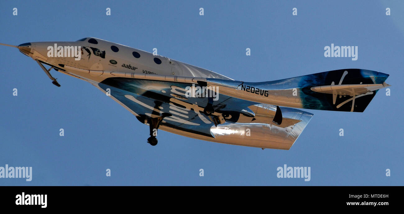 Mojave, USA. 29th May 2018. 5-29-18. MOJAVE CA. Virgin Galactic took another step on Tuesday toward beginning commercial operations with its latest test flight. This test flight bested April's in altitude, with Unity hitting the top of its climb at 114,500 feet, with the first test reached 84,271 feet at its peak. Sir. Richard Branson said this was the sixth powered test flight of the SpaceShipTwo design, and the second since the fatal crash of the Spaceship Enterprise on Oct. 31, 2014. Credit: ZUMA Press, Inc./Alamy Live News Stock Photohttps://www.alamy.com/image-license-details/?v=1https://www.alamy.com/mojave-usa-29th-may-2018-5-29-18-mojave-ca-virgin-galactic-took-another-step-on-tuesday-toward-beginning-commercial-operations-with-its-latest-test-flight-this-test-flight-bested-aprils-in-altitude-with-unity-hitting-the-top-of-its-climb-at-114500-feet-with-the-first-test-reached-84271-feet-at-its-peak-sir-richard-branson-said-this-was-the-sixth-powered-test-flight-of-the-spaceshiptwo-design-and-the-second-since-the-fatal-crash-of-the-spaceship-enterprise-on-oct-31-2014-credit-zuma-press-incalamy-live-news-image187151961.html
RMMTDE6H–Mojave, USA. 29th May 2018. 5-29-18. MOJAVE CA. Virgin Galactic took another step on Tuesday toward beginning commercial operations with its latest test flight. This test flight bested April's in altitude, with Unity hitting the top of its climb at 114,500 feet, with the first test reached 84,271 feet at its peak. Sir. Richard Branson said this was the sixth powered test flight of the SpaceShipTwo design, and the second since the fatal crash of the Spaceship Enterprise on Oct. 31, 2014. Credit: ZUMA Press, Inc./Alamy Live News
 Thick-Billed Raven (Corvus crassirostris), is a bird which is common to abundant from about 1200 to at least 4100 meters (4000 .13,500 feet). Simien M Stock Photohttps://www.alamy.com/image-license-details/?v=1https://www.alamy.com/thick-billed-raven-corvus-crassirostris-is-a-bird-which-is-common-to-abundant-from-about-1200-to-at-least-4100-meters-4000-13500-feet-simien-m-image339497039.html
RF2AM9BX7–Thick-Billed Raven (Corvus crassirostris), is a bird which is common to abundant from about 1200 to at least 4100 meters (4000 .13,500 feet). Simien M
 Critical skills operators with Marine Raider Regiment, U.S. Marine Corps Forces, Special Operations Command, prepare for a static-line jump aboard an MV-22 Osprey in the skies above Marine Corps Air Station New River, N.C., July 29, 2015. Jumping from an altitude of 1,500 feet, the team landed at on Marine Corps Outlying Field Camp Davis, N.C. (U.S. Marine Corps photo by Cpl. Paul S. Martinez/Released) Skyfall, VMM-263 supports MARSOC para-operations 150729-M-ZM882-151 Stock Photohttps://www.alamy.com/image-license-details/?v=1https://www.alamy.com/stock-photo-critical-skills-operators-with-marine-raider-regiment-us-marine-corps-129772162.html
RMHF3HM2–Critical skills operators with Marine Raider Regiment, U.S. Marine Corps Forces, Special Operations Command, prepare for a static-line jump aboard an MV-22 Osprey in the skies above Marine Corps Air Station New River, N.C., July 29, 2015. Jumping from an altitude of 1,500 feet, the team landed at on Marine Corps Outlying Field Camp Davis, N.C. (U.S. Marine Corps photo by Cpl. Paul S. Martinez/Released) Skyfall, VMM-263 supports MARSOC para-operations 150729-M-ZM882-151
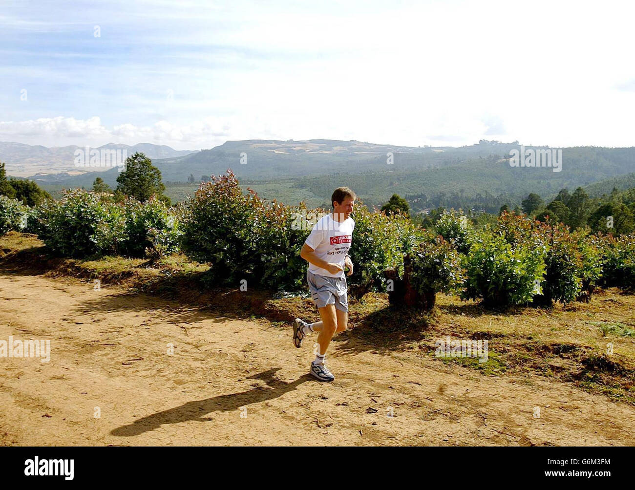 Former Downing Street Director of Communications Alistair Campbell during a training run in the hills above Addis Ababa, before the Great Ethiopian Run 2003 in Addis Ababa tomorrow. Campbell is taking part in the gruelling 10km race, which is run at an altitude of 7,500 feet, to raise funds for his favourite charity Leukaemia Research. Stock Photohttps://www.alamy.com/image-license-details/?v=1https://www.alamy.com/stock-photo-former-downing-street-director-of-communications-alistair-campbell-107391976.html
RMG6M3FM–Former Downing Street Director of Communications Alistair Campbell during a training run in the hills above Addis Ababa, before the Great Ethiopian Run 2003 in Addis Ababa tomorrow. Campbell is taking part in the gruelling 10km race, which is run at an altitude of 7,500 feet, to raise funds for his favourite charity Leukaemia Research.
![. Burbidgea nitida. English: Burbidgea nitida, which is described by Sir Joseph Dalton Hooker in the source thus: 'This very beautiful plant is the type of an entirely new genus ... Mr. F.W. Burbidge [Frederick William Burbidge (1847–1905), British explorer], who discovered it when travelling in Borneo, for Messrs. Veitch, informs me that it grows in shady forests of the Murut district in N.W. Borneo, between the Lawas and Trusan rivers, at an altitude of 1,000 to 1,500 feet ...' . 1879 105 Burbidgea nitida from Curtis's Botanical Magazine 1879 Stock Photo . Burbidgea nitida. English: Burbidgea nitida, which is described by Sir Joseph Dalton Hooker in the source thus: 'This very beautiful plant is the type of an entirely new genus ... Mr. F.W. Burbidge [Frederick William Burbidge (1847–1905), British explorer], who discovered it when travelling in Borneo, for Messrs. Veitch, informs me that it grows in shady forests of the Murut district in N.W. Borneo, between the Lawas and Trusan rivers, at an altitude of 1,000 to 1,500 feet ...' . 1879 105 Burbidgea nitida from Curtis's Botanical Magazine 1879 Stock Photo](https://c8.alamy.com/comp/MX74PX/burbidgea-nitida-english-burbidgea-nitida-which-is-described-by-sir-joseph-dalton-hooker-in-the-source-thus-this-very-beautiful-plant-is-the-type-of-an-entirely-new-genus-mr-fw-burbidge-frederick-william-burbidge-18471905-british-explorer-who-discovered-it-when-travelling-in-borneo-for-messrs-veitch-informs-me-that-it-grows-in-shady-forests-of-the-murut-district-in-nw-borneo-between-the-lawas-and-trusan-rivers-at-an-altitude-of-1000-to-1500-feet-1879-105-burbidgea-nitida-from-curtiss-botanical-magazine-1879-MX74PX.jpg) . Burbidgea nitida. English: Burbidgea nitida, which is described by Sir Joseph Dalton Hooker in the source thus: 'This very beautiful plant is the type of an entirely new genus ... Mr. F.W. Burbidge [Frederick William Burbidge (1847–1905), British explorer], who discovered it when travelling in Borneo, for Messrs. Veitch, informs me that it grows in shady forests of the Murut district in N.W. Borneo, between the Lawas and Trusan rivers, at an altitude of 1,000 to 1,500 feet ...' . 1879 105 Burbidgea nitida from Curtis's Botanical Magazine 1879 Stock Photohttps://www.alamy.com/image-license-details/?v=1https://www.alamy.com/burbidgea-nitida-english-burbidgea-nitida-which-is-described-by-sir-joseph-dalton-hooker-in-the-source-thus-this-very-beautiful-plant-is-the-type-of-an-entirely-new-genus-mr-fw-burbidge-frederick-william-burbidge-18471905-british-explorer-who-discovered-it-when-travelling-in-borneo-for-messrs-veitch-informs-me-that-it-grows-in-shady-forests-of-the-murut-district-in-nw-borneo-between-the-lawas-and-trusan-rivers-at-an-altitude-of-1000-to-1500-feet-1879-105-burbidgea-nitida-from-curtiss-botanical-magazine-1879-image188242178.html
. Burbidgea nitida. English: Burbidgea nitida, which is described by Sir Joseph Dalton Hooker in the source thus: 'This very beautiful plant is the type of an entirely new genus ... Mr. F.W. Burbidge [Frederick William Burbidge (1847–1905), British explorer], who discovered it when travelling in Borneo, for Messrs. Veitch, informs me that it grows in shady forests of the Murut district in N.W. Borneo, between the Lawas and Trusan rivers, at an altitude of 1,000 to 1,500 feet ...' . 1879 105 Burbidgea nitida from Curtis's Botanical Magazine 1879 Stock Photohttps://www.alamy.com/image-license-details/?v=1https://www.alamy.com/burbidgea-nitida-english-burbidgea-nitida-which-is-described-by-sir-joseph-dalton-hooker-in-the-source-thus-this-very-beautiful-plant-is-the-type-of-an-entirely-new-genus-mr-fw-burbidge-frederick-william-burbidge-18471905-british-explorer-who-discovered-it-when-travelling-in-borneo-for-messrs-veitch-informs-me-that-it-grows-in-shady-forests-of-the-murut-district-in-nw-borneo-between-the-lawas-and-trusan-rivers-at-an-altitude-of-1000-to-1500-feet-1879-105-burbidgea-nitida-from-curtiss-botanical-magazine-1879-image188242178.htmlRMMX74PX–. Burbidgea nitida. English: Burbidgea nitida, which is described by Sir Joseph Dalton Hooker in the source thus: 'This very beautiful plant is the type of an entirely new genus ... Mr. F.W. Burbidge [Frederick William Burbidge (1847–1905), British explorer], who discovered it when travelling in Borneo, for Messrs. Veitch, informs me that it grows in shady forests of the Murut district in N.W. Borneo, between the Lawas and Trusan rivers, at an altitude of 1,000 to 1,500 feet ...' . 1879 105 Burbidgea nitida from Curtis's Botanical Magazine 1879
 AERIAL - HELICOPTER ALTITUDE WORLD RECORD - CAPE TOWN (AFS) - 23/03/2002 - PHOTO: IGOR MEIJER / DPPI 12 954 METERS / 42 500 FEET - FRED NORTH (FRA) / ECUREUIL B2 - EXCLUSIF FRED BREAKS THE 30 YEARS OLD ALTITUDE RECORD Stock Photohttps://www.alamy.com/image-license-details/?v=1https://www.alamy.com/aerial-helicopter-altitude-world-record-cape-town-afs-23032002-photo-igor-meijer-dppi-12-954-meters-42-500-feet-fred-north-fra-ecureuil-b2-exclusif-fred-breaks-the-30-years-old-altitude-record-image415364728.html
RM2F3NDXG–AERIAL - HELICOPTER ALTITUDE WORLD RECORD - CAPE TOWN (AFS) - 23/03/2002 - PHOTO: IGOR MEIJER / DPPI 12 954 METERS / 42 500 FEET - FRED NORTH (FRA) / ECUREUIL B2 - EXCLUSIF FRED BREAKS THE 30 YEARS OLD ALTITUDE RECORD
 The X-38, a research vehicle built to help develop technology for an emergency Crew Return Vehicle (CRV), descends under its steerable parachute during a July 1999 test flight at the Dryden Flight Research Center, Edwards, California. It was the fourth free flight of the test vehicles in the X-38 program, and the second free flight test of Vehicle 132 or Ship 2. The goal of this flight was to release the vehicle from a higher altitude (31,500 feet) and to fly the vehicle longer (31 seconds) than any previous X-38 vehicle had yet flown. The project team also conducted aerodynamic verification m Stock Photohttps://www.alamy.com/image-license-details/?v=1https://www.alamy.com/stock-photo-the-x-38-a-research-vehicle-built-to-help-develop-technology-for-an-111969769.html
RMGE4JG9–The X-38, a research vehicle built to help develop technology for an emergency Crew Return Vehicle (CRV), descends under its steerable parachute during a July 1999 test flight at the Dryden Flight Research Center, Edwards, California. It was the fourth free flight of the test vehicles in the X-38 program, and the second free flight test of Vehicle 132 or Ship 2. The goal of this flight was to release the vehicle from a higher altitude (31,500 feet) and to fly the vehicle longer (31 seconds) than any previous X-38 vehicle had yet flown. The project team also conducted aerodynamic verification m
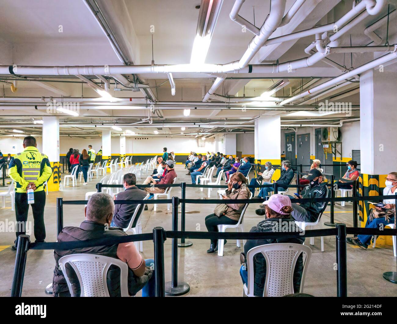 Bogota, Colombia - June 03, 2021: Local Colombian people seen sitting on socially distanced plastic chairs and waiting in a public underground car park, to be vaccinated against Covid-19. They are all wearing protective face masks due to the pandemic situation. At a street level altitude of about 8,500 feet above mean sea level on the Andes Mountains, all people in the image are seen wearing warm clothing. Image taken on a mobile phone. Stock Photohttps://www.alamy.com/image-license-details/?v=1https://www.alamy.com/bogota-colombia-june-03-2021-local-colombian-people-seen-sitting-on-socially-distanced-plastic-chairs-and-waiting-in-a-public-underground-car-park-to-be-vaccinated-against-covid-19-they-are-all-wearing-protective-face-masks-due-to-the-pandemic-situation-at-a-street-level-altitude-of-about-8500-feet-above-mean-sea-level-on-the-andes-mountains-all-people-in-the-image-are-seen-wearing-warm-clothing-image-taken-on-a-mobile-phone-image431513979.html
RM2G214DF–Bogota, Colombia - June 03, 2021: Local Colombian people seen sitting on socially distanced plastic chairs and waiting in a public underground car park, to be vaccinated against Covid-19. They are all wearing protective face masks due to the pandemic situation. At a street level altitude of about 8,500 feet above mean sea level on the Andes Mountains, all people in the image are seen wearing warm clothing. Image taken on a mobile phone.
 Miniature Drum with Four Frogs. Culture: Vietnam. Dimensions: H. 4 in. (10.2 cm). Date: ca. 500 B.C.-A.D. 300. Ranging in height from a few inches to over six feet, up to four feet in diameter, and often of considerable weight, drums are the most widely dispersed products of the Dongson culture of northern Vietnam. Examples produced in Vietnam, in addition to works made locally, have been found in south China and throughout mainland and island Southeast Asia. The function of these drums, often found in burials, remains unclear. They may have been used in warfare, as political regalia, or as Stock Photohttps://www.alamy.com/image-license-details/?v=1https://www.alamy.com/miniature-drum-with-four-frogs-culture-vietnam-dimensions-h-4-in-102-cm-date-ca-500-bc-ad-300-ranging-in-height-from-a-few-inches-to-over-six-feet-up-to-four-feet-in-diameter-and-often-of-considerable-weight-drums-are-the-most-widely-dispersed-products-of-the-dongson-culture-of-northern-vietnam-examples-produced-in-vietnam-in-addition-to-works-made-locally-have-been-found-in-south-china-and-throughout-mainland-and-island-southeast-asia-the-function-of-these-drums-often-found-in-burials-remains-unclear-they-may-have-been-used-in-warfare-as-political-regalia-or-as-image212907489.html
RMPAANJW–Miniature Drum with Four Frogs. Culture: Vietnam. Dimensions: H. 4 in. (10.2 cm). Date: ca. 500 B.C.-A.D. 300. Ranging in height from a few inches to over six feet, up to four feet in diameter, and often of considerable weight, drums are the most widely dispersed products of the Dongson culture of northern Vietnam. Examples produced in Vietnam, in addition to works made locally, have been found in south China and throughout mainland and island Southeast Asia. The function of these drums, often found in burials, remains unclear. They may have been used in warfare, as political regalia, or as
 Windsor, Berkshire, UK. 9th January, 2022. A no fly zone with a radius of 1.4 miles around Windsor Castle is reported to be coming into force from 27th January 2022. Aircraft would be prohibited from flying lower than at an altitude of 2,500 feet above the royal residence. Drones will also be prohibited. Her Majesty Queen Elizabeth II is currently in residence at Windsor Castle during the latest Covid-19 Omicron variant phase. These new security measures are reported to be due to an intruder with a cross bow entering the grounds of Windsor Castle on Christmas Day. The man has since been sectio Stock Photohttps://www.alamy.com/image-license-details/?v=1https://www.alamy.com/windsor-berkshire-uk-9th-january-2022-a-no-fly-zone-with-a-radius-of-14-miles-around-windsor-castle-is-reported-to-be-coming-into-force-from-27th-january-2022-aircraft-would-be-prohibited-from-flying-lower-than-at-an-altitude-of-2500-feet-above-the-royal-residence-drones-will-also-be-prohibited-her-majesty-queen-elizabeth-ii-is-currently-in-residence-at-windsor-castle-during-the-latest-covid-19-omicron-variant-phase-these-new-security-measures-are-reported-to-be-due-to-an-intruder-with-a-cross-bow-entering-the-grounds-of-windsor-castle-on-christmas-day-the-man-has-since-been-sectio-image456230387.html
RM2HE72EB–Windsor, Berkshire, UK. 9th January, 2022. A no fly zone with a radius of 1.4 miles around Windsor Castle is reported to be coming into force from 27th January 2022. Aircraft would be prohibited from flying lower than at an altitude of 2,500 feet above the royal residence. Drones will also be prohibited. Her Majesty Queen Elizabeth II is currently in residence at Windsor Castle during the latest Covid-19 Omicron variant phase. These new security measures are reported to be due to an intruder with a cross bow entering the grounds of Windsor Castle on Christmas Day. The man has since been sectio
 MOUNT KILIMANJARO, Tanzania — The rocky, rugged apline desert on Mt Kilimanjaro Lemosho Route. These shots were taken on the trail between Moir Hut Camp and Lava Tower at approximately 14,500 feet. In the distance is the summit, partly hidden by clouds. Stock Photohttps://www.alamy.com/image-license-details/?v=1https://www.alamy.com/stock-photo-mount-kilimanjaro-tanzania-the-rocky-rugged-apline-desert-on-mt-kilimanjaro-52124977.html
RMD0PDX9–MOUNT KILIMANJARO, Tanzania — The rocky, rugged apline desert on Mt Kilimanjaro Lemosho Route. These shots were taken on the trail between Moir Hut Camp and Lava Tower at approximately 14,500 feet. In the distance is the summit, partly hidden by clouds.
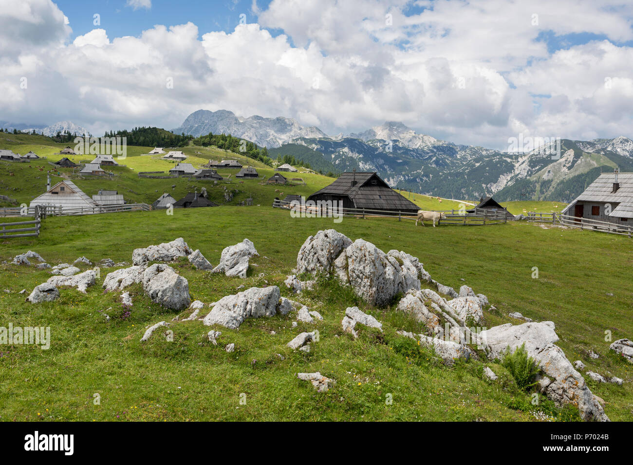 A landscape of Slovenian herders' holiday mountain huts in Velika Planina, on 26th June 2018, in Velika Planina, near Kamnik, Slovenia. Velika Planina is a mountain plateau in the Kamnik–Savinja Alps - a 5.8 square kilometres area 1,500 metres (4,900 feet) above sea level. Otherwise known as The Big Pasture Plateau, Velika Planina is a winter skiing destination and hiking route in summer. The herders' huts became popular in the early 1930s as holiday cabins (known as bajtarstvo) but these were were destroyed by the Germans during WW2 and rebuilt right afterwards by Vlasto Kopac in the summer o Stock Photohttps://www.alamy.com/image-license-details/?v=1https://www.alamy.com/a-landscape-of-slovenian-herders-holiday-mountain-huts-in-velika-planina-on-26th-june-2018-in-velika-planina-near-kamnik-slovenia-velika-planina-is-a-mountain-plateau-in-the-kamniksavinja-alps-a-58-square-kilometres-area-1500-metres-4900-feet-above-sea-level-otherwise-known-as-the-big-pasture-plateau-velika-planina-is-a-winter-skiing-destination-and-hiking-route-in-summer-the-herders-huts-became-popular-in-the-early-1930s-as-holiday-cabins-known-as-bajtarstvo-but-these-were-were-destroyed-by-the-germans-during-ww2-and-rebuilt-right-afterwards-by-vlasto-kopac-in-the-summer-o-image210828699.html
RMP7024B–A landscape of Slovenian herders' holiday mountain huts in Velika Planina, on 26th June 2018, in Velika Planina, near Kamnik, Slovenia. Velika Planina is a mountain plateau in the Kamnik–Savinja Alps - a 5.8 square kilometres area 1,500 metres (4,900 feet) above sea level. Otherwise known as The Big Pasture Plateau, Velika Planina is a winter skiing destination and hiking route in summer. The herders' huts became popular in the early 1930s as holiday cabins (known as bajtarstvo) but these were were destroyed by the Germans during WW2 and rebuilt right afterwards by Vlasto Kopac in the summer o
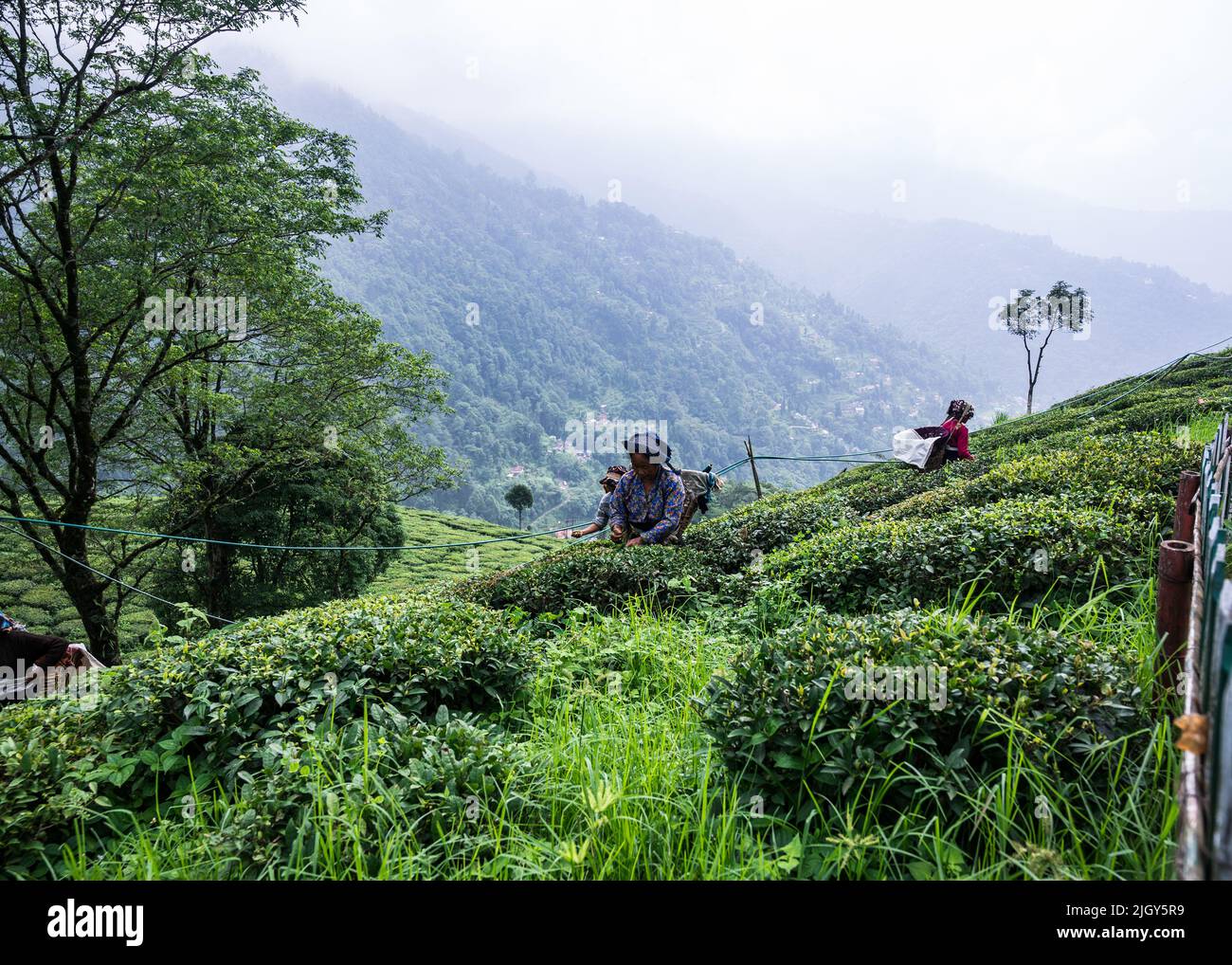 Women tea workers plucking tea leaves during cloudy monsoon at the British-era tea garden Orange Valley Tea Garden spread over an area of 347.26 hectares (858.1 acres) at an altitude ranging from 3,500 to 6,000 feet (1,100 to 1,800 m) above the mean sea level, is a bio-organic garden producing mainly black tea at Darjeeling, West Bengal. India is the world's second-largest tea producer Country after China. The poor female tea workers' work wages are very low, and most of them are coming from neighbouring country Nepal in search of work. India. Stock Photohttps://www.alamy.com/image-license-details/?v=1https://www.alamy.com/women-tea-workers-plucking-tea-leaves-during-cloudy-monsoon-at-the-british-era-tea-garden-orange-valley-tea-garden-spread-over-an-area-of-34726-hectares-8581-acres-at-an-altitude-ranging-from-3500-to-6000-feet-1100-to-1800-m-above-the-mean-sea-level-is-a-bio-organic-garden-producing-mainly-black-tea-at-darjeeling-west-bengal-india-is-the-worlds-second-largest-tea-producer-country-after-china-the-poor-female-tea-workers-work-wages-are-very-low-and-most-of-them-are-coming-from-neighbouring-country-nepal-in-search-of-work-india-image475111709.html
RM2JGY5R9–Women tea workers plucking tea leaves during cloudy monsoon at the British-era tea garden Orange Valley Tea Garden spread over an area of 347.26 hectares (858.1 acres) at an altitude ranging from 3,500 to 6,000 feet (1,100 to 1,800 m) above the mean sea level, is a bio-organic garden producing mainly black tea at Darjeeling, West Bengal. India is the world's second-largest tea producer Country after China. The poor female tea workers' work wages are very low, and most of them are coming from neighbouring country Nepal in search of work. India.
 Women tea workers are plucking tea leaves during cloudy monsoon at the British-era tea garden Orange Valley Tea Garden spread over an area of 347.26 hectares (858.1 acres) at an altitude ranging from 3,500 to 6,000 feet (1,100 to 1,800 m) above the mean sea level, is a bio-organic garden producing mainly black tea at Darjeeling, West Bengal, India on 11/06/2022. India is the world's second-largest tea producer Country after China. The Poor female tea workers' work wages are very low, and most of them are coming from neighbouring country Nepal in search of work. (Photo by Soumyabrata Roy/NurPho Stock Photohttps://www.alamy.com/image-license-details/?v=1https://www.alamy.com/women-tea-workers-are-plucking-tea-leaves-during-cloudy-monsoon-at-the-british-era-tea-garden-orange-valley-tea-garden-spread-over-an-area-of-34726-hectares-8581-acres-at-an-altitude-ranging-from-3500-to-6000-feet-1100-to-1800-m-above-the-mean-sea-level-is-a-bio-organic-garden-producing-mainly-black-tea-at-darjeeling-west-bengal-india-on-11062022-india-is-the-worlds-second-largest-tea-producer-country-after-china-the-poor-female-tea-workers-work-wages-are-very-low-and-most-of-them-are-coming-from-neighbouring-country-nepal-in-search-of-work-photo-by-soumyabrata-roynurpho-image490162388.html
RM2KDCR3G–Women tea workers are plucking tea leaves during cloudy monsoon at the British-era tea garden Orange Valley Tea Garden spread over an area of 347.26 hectares (858.1 acres) at an altitude ranging from 3,500 to 6,000 feet (1,100 to 1,800 m) above the mean sea level, is a bio-organic garden producing mainly black tea at Darjeeling, West Bengal, India on 11/06/2022. India is the world's second-largest tea producer Country after China. The Poor female tea workers' work wages are very low, and most of them are coming from neighbouring country Nepal in search of work. (Photo by Soumyabrata Roy/NurPho
 View of junction of US 1 and US 22 at Newark airport. Original caption: View of junction of US 1 and US 22 at Newark airport on duasl-dual section. Looking south; Taken from about 500 feet altitude above southbound division of US 1 and US 22 at Newark Airport. State: New Jersey. Place: Newark. Stock Photohttps://www.alamy.com/image-license-details/?v=1https://www.alamy.com/view-of-junction-of-us-1-and-us-22-at-newark-airport-original-caption-view-of-junction-of-us-1-and-us-22-at-newark-airport-on-duasl-dual-section-looking-south-taken-from-about-500-feet-altitude-above-southbound-division-of-us-1-and-us-22-at-newark-airport-state-new-jersey-place-newark-image501726746.html
RM2M47HGA–View of junction of US 1 and US 22 at Newark airport. Original caption: View of junction of US 1 and US 22 at Newark airport on duasl-dual section. Looking south; Taken from about 500 feet altitude above southbound division of US 1 and US 22 at Newark Airport. State: New Jersey. Place: Newark.
 High Altitude vehicle testing Sierra Nevada mountains spain Stock Photohttps://www.alamy.com/image-license-details/?v=1https://www.alamy.com/stock-photo-high-altitude-vehicle-testing-sierra-nevada-mountains-spain-31691467.html
RMBRFJP3–High Altitude vehicle testing Sierra Nevada mountains spain
 Sunset near Termales del Ruiz which sits at 10,500 feet in the Andes - Colombia Stock Photohttps://www.alamy.com/image-license-details/?v=1https://www.alamy.com/sunset-near-termales-del-ruiz-which-sits-at-10500-feet-in-the-andes-colombia-image607863116.html
RF2X8XFH0–Sunset near Termales del Ruiz which sits at 10,500 feet in the Andes - Colombia
 U.S. and Australian Special Operations Forces (SOF) conduct a military free-fall parachute insertion at night with zero natural illumination from 7,500 feet (2,300 meters) altitude, July 2019 during Talisman Sabre. By inserting behind enemy lines SOF conduct surveillance and reconnaissance to enable precision targeting. Talisman Sabre is a bilateral exercise that tests the two forces combat training, readiness and interoperability. (U.S. Marine Corps photos by Lance Cpl. Nicole Rogge) Stock Photohttps://www.alamy.com/image-license-details/?v=1https://www.alamy.com/us-and-australian-special-operations-forces-sof-conduct-a-military-free-fall-parachute-insertion-at-night-with-zero-natural-illumination-from-7500-feet-2300-meters-altitude-july-2019-during-talisman-sabre-by-inserting-behind-enemy-lines-sof-conduct-surveillance-and-reconnaissance-to-enable-precision-targeting-talisman-sabre-is-a-bilateral-exercise-that-tests-the-two-forces-combat-training-readiness-and-interoperability-us-marine-corps-photos-by-lance-cpl-nicole-rogge-image260801289.html
RMW48EKN–U.S. and Australian Special Operations Forces (SOF) conduct a military free-fall parachute insertion at night with zero natural illumination from 7,500 feet (2,300 meters) altitude, July 2019 during Talisman Sabre. By inserting behind enemy lines SOF conduct surveillance and reconnaissance to enable precision targeting. Talisman Sabre is a bilateral exercise that tests the two forces combat training, readiness and interoperability. (U.S. Marine Corps photos by Lance Cpl. Nicole Rogge)
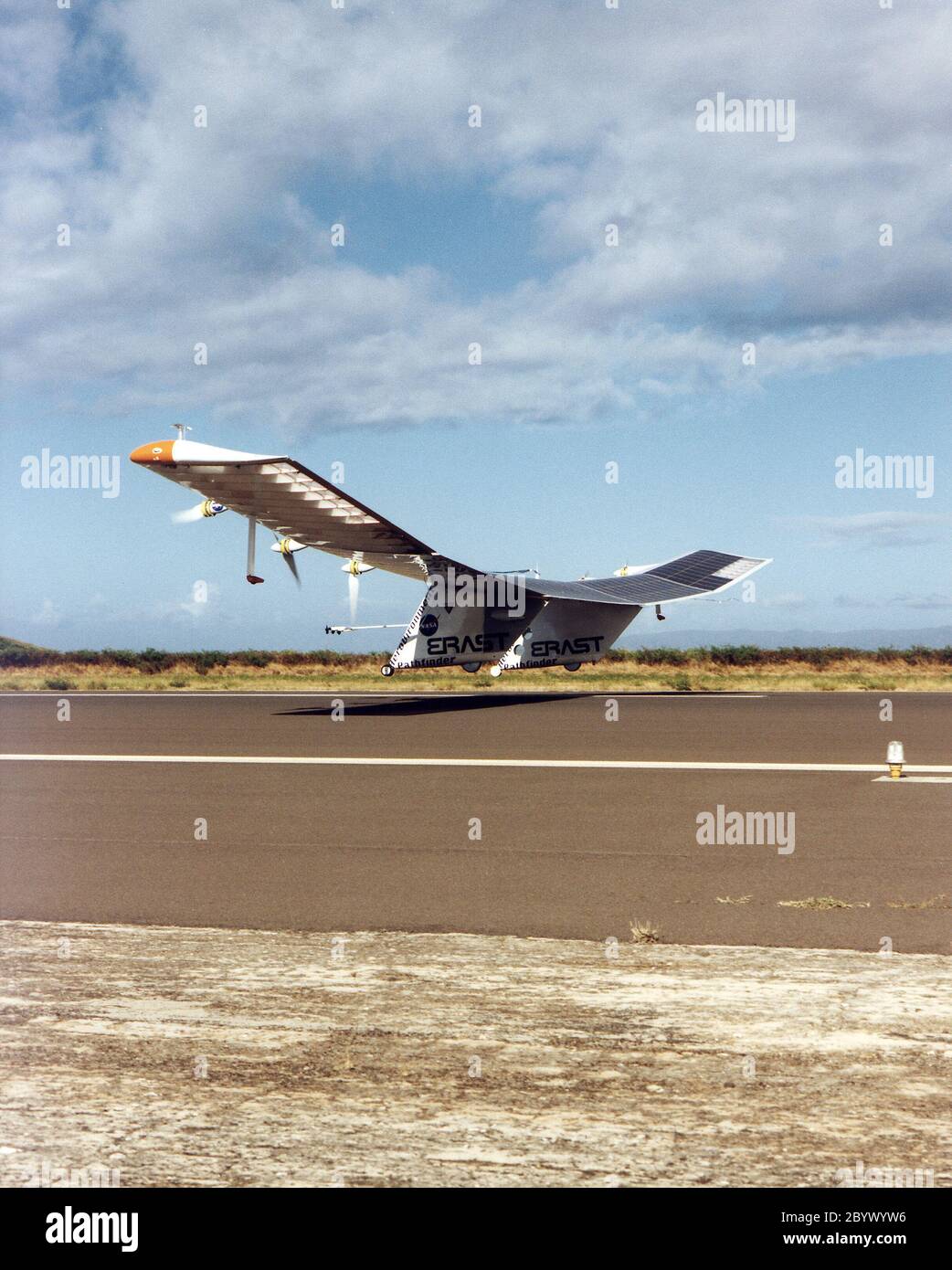 The Pathfinder aircraft has set a new unofficial world record for high-altitude flight of over 71,500 feet for solar-powered aircraft at the U.S. Navy's Pacific Missile Range Facility, Kauai, Hawaii. Pathfinder was designed and manufactured by AeroVironment, Inc, of Simi Valley, California, and was operated by the firm under a jointly sponsored research agreement with NASA's Dryden Flight Research Center, Edwards, California. Pathfinder's record-breaking flight occurred July 7, 1997. The aircraft took off at 11:34 a.m. PDT, passed its previous record altitude of 67,350 feet at about 5:45 p.m. Stock Photohttps://www.alamy.com/image-license-details/?v=1https://www.alamy.com/the-pathfinder-aircraft-has-set-a-new-unofficial-world-record-for-high-altitude-flight-of-over-71500-feet-for-solar-powered-aircraft-at-the-us-navys-pacific-missile-range-facility-kauai-hawaii-pathfinder-was-designed-and-manufactured-by-aerovironment-inc-of-simi-valley-california-and-was-operated-by-the-firm-under-a-jointly-sponsored-research-agreement-with-nasas-dryden-flight-research-center-edwards-california-pathfinders-record-breaking-flight-occurred-july-7-1997-the-aircraft-took-off-at-1134-am-pdt-passed-its-previous-record-altitude-of-67350-feet-at-about-545-pm-image361373746.html
RM2BYWYW6–The Pathfinder aircraft has set a new unofficial world record for high-altitude flight of over 71,500 feet for solar-powered aircraft at the U.S. Navy's Pacific Missile Range Facility, Kauai, Hawaii. Pathfinder was designed and manufactured by AeroVironment, Inc, of Simi Valley, California, and was operated by the firm under a jointly sponsored research agreement with NASA's Dryden Flight Research Center, Edwards, California. Pathfinder's record-breaking flight occurred July 7, 1997. The aircraft took off at 11:34 a.m. PDT, passed its previous record altitude of 67,350 feet at about 5:45 p.m.
 Mojave, USA. 29th May 2018. 5-29-18. MOJAVE CA. Virgin Galactic took another step on Tuesday toward beginning commercial operations with its latest test flight. This test flight bested April's in altitude, with Unity hitting the top of its climb at 114,500 feet, with the first test reached 84,271 feet at its peak. Sir. Richard Branson said this was the sixth powered test flight of the SpaceShipTwo design, and the second since the fatal crash of the Spaceship Enterprise on Oct. 31, 2014. Credit: ZUMA Press, Inc./Alamy Live News Stock Photohttps://www.alamy.com/image-license-details/?v=1https://www.alamy.com/mojave-usa-29th-may-2018-5-29-18-mojave-ca-virgin-galactic-took-another-step-on-tuesday-toward-beginning-commercial-operations-with-its-latest-test-flight-this-test-flight-bested-aprils-in-altitude-with-unity-hitting-the-top-of-its-climb-at-114500-feet-with-the-first-test-reached-84271-feet-at-its-peak-sir-richard-branson-said-this-was-the-sixth-powered-test-flight-of-the-spaceshiptwo-design-and-the-second-since-the-fatal-crash-of-the-spaceship-enterprise-on-oct-31-2014-credit-zuma-press-incalamy-live-news-image187151984.html
RMMTDE7C–Mojave, USA. 29th May 2018. 5-29-18. MOJAVE CA. Virgin Galactic took another step on Tuesday toward beginning commercial operations with its latest test flight. This test flight bested April's in altitude, with Unity hitting the top of its climb at 114,500 feet, with the first test reached 84,271 feet at its peak. Sir. Richard Branson said this was the sixth powered test flight of the SpaceShipTwo design, and the second since the fatal crash of the Spaceship Enterprise on Oct. 31, 2014. Credit: ZUMA Press, Inc./Alamy Live News
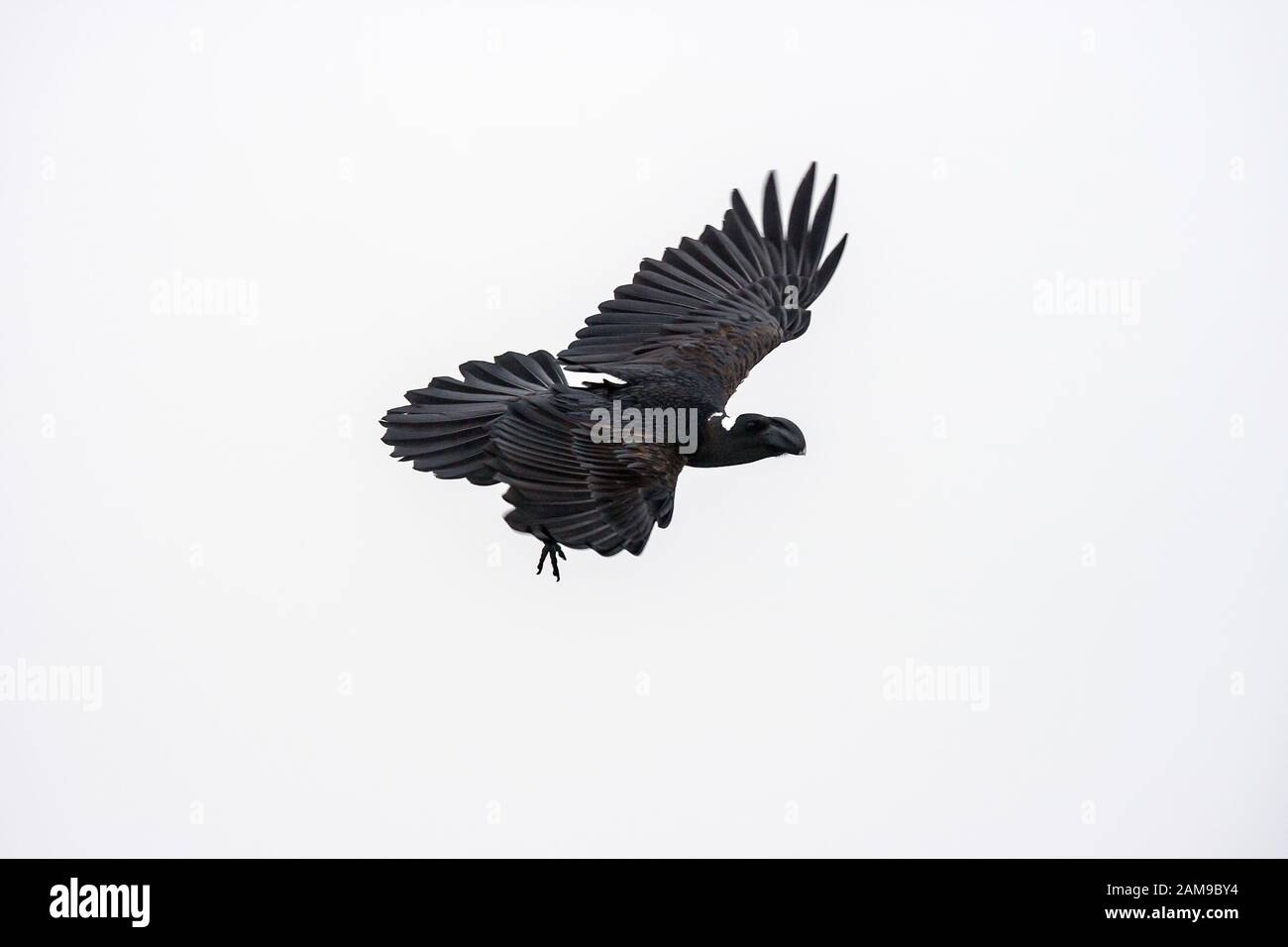 Thick-Billed Raven (Corvus crassirostris), is a bird which is common to abundant from about 1200 to at least 4100 meters (4000 .13,500 feet). Simien M Stock Photohttps://www.alamy.com/image-license-details/?v=1https://www.alamy.com/thick-billed-raven-corvus-crassirostris-is-a-bird-which-is-common-to-abundant-from-about-1200-to-at-least-4100-meters-4000-13500-feet-simien-m-image339497064.html
RF2AM9BY4–Thick-Billed Raven (Corvus crassirostris), is a bird which is common to abundant from about 1200 to at least 4100 meters (4000 .13,500 feet). Simien M
 Critical skills operators with Marine Raider Regiment, U.S. Marine Corps Forces, Special Operations Command, prepare for a static-line jump aboard an MV-22 Osprey in the skies above Marine Corps Air Station New River, N.C., July 29, 2015. Jumping from an altitude of 1,500 feet, the team landed at on Marine Corps Outlying Field Camp Davis, N.C. (U.S. Marine Corps photo by Cpl. Paul S. Martinez/Released) Skyfall, VMM-263 supports MARSOC para-operations 150729-M-ZM882-137 Stock Photohttps://www.alamy.com/image-license-details/?v=1https://www.alamy.com/stock-photo-critical-skills-operators-with-marine-raider-regiment-us-marine-corps-129772161.html
RMHF3HM1–Critical skills operators with Marine Raider Regiment, U.S. Marine Corps Forces, Special Operations Command, prepare for a static-line jump aboard an MV-22 Osprey in the skies above Marine Corps Air Station New River, N.C., July 29, 2015. Jumping from an altitude of 1,500 feet, the team landed at on Marine Corps Outlying Field Camp Davis, N.C. (U.S. Marine Corps photo by Cpl. Paul S. Martinez/Released) Skyfall, VMM-263 supports MARSOC para-operations 150729-M-ZM882-137
 Former Downing Street Director of Communications Alistair Campbell during a training run in the hills above Addis Ababa, before the Great Ethiopian Run 2003 in Addis Ababa tomorrow. Campbell is taking part in the gruelling 10km race, which is run at an altitude of 7,500 feet, to raise funds for his favourite charity Leukaemia Research. Stock Photohttps://www.alamy.com/image-license-details/?v=1https://www.alamy.com/stock-photo-former-downing-street-director-of-communications-alistair-campbell-107391975.html
RMG6M3FK–Former Downing Street Director of Communications Alistair Campbell during a training run in the hills above Addis Ababa, before the Great Ethiopian Run 2003 in Addis Ababa tomorrow. Campbell is taking part in the gruelling 10km race, which is run at an altitude of 7,500 feet, to raise funds for his favourite charity Leukaemia Research.
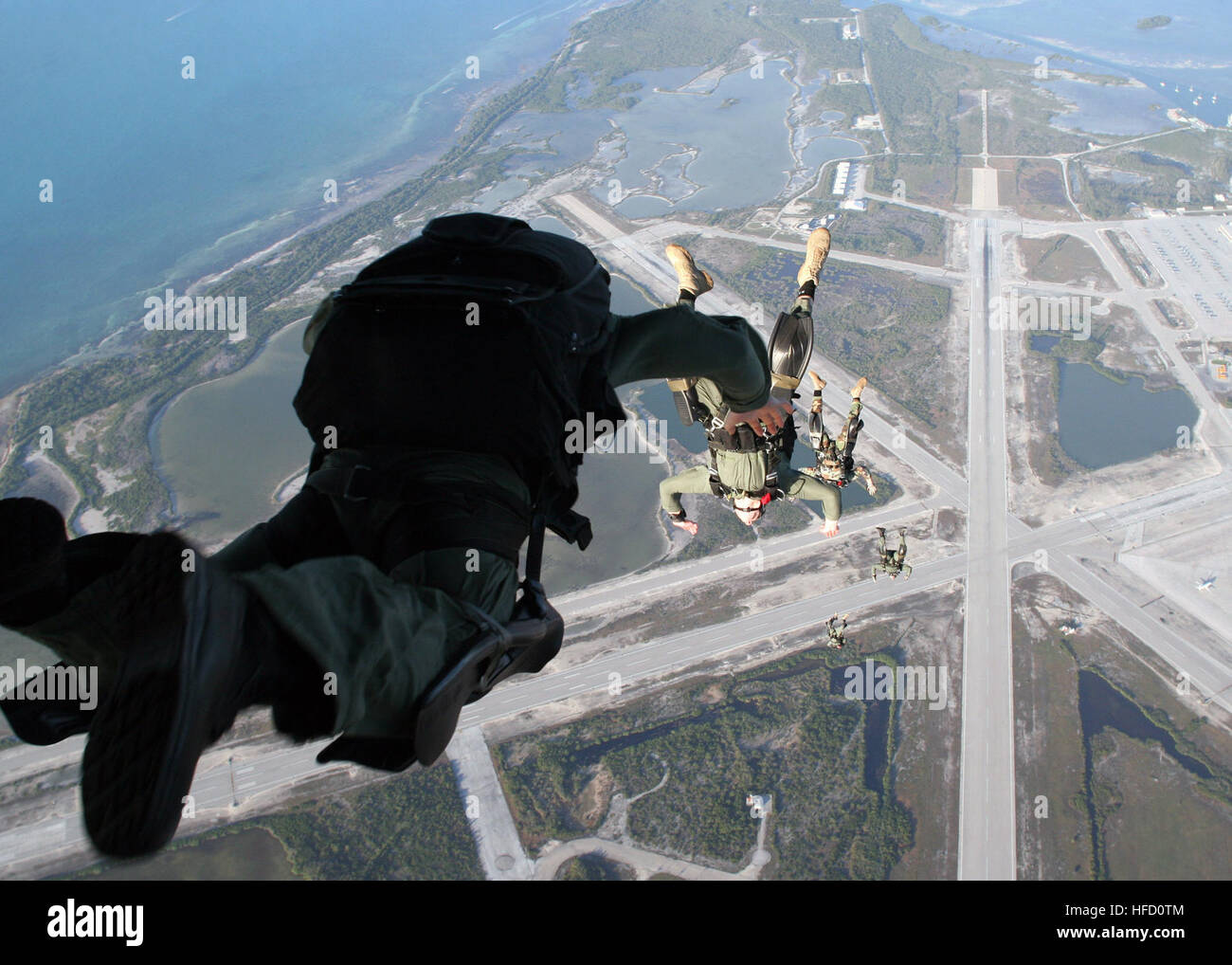 Special Warfare Combatant-craft crewmen assigned to Special Boat Team 20 line out after each other during a free-fall parachute jump from an Air Force C-130 at an altitude of approximately 12,500 feet. SWCCs employ their unique training, equipment, and tactics in missions worldwide. Sailors parachute in Florida 100913 Stock Photohttps://www.alamy.com/image-license-details/?v=1https://www.alamy.com/stock-photo-special-warfare-combatant-craft-crewmen-assigned-to-special-boat-team-129978484.html
RMHFD0TM–Special Warfare Combatant-craft crewmen assigned to Special Boat Team 20 line out after each other during a free-fall parachute jump from an Air Force C-130 at an altitude of approximately 12,500 feet. SWCCs employ their unique training, equipment, and tactics in missions worldwide. Sailors parachute in Florida 100913
 AERIAL - HELICOPTER ALTITUDE WORLD RECORD - CAPE TOWN (AFS) - 23/03/2002 - PHOTO: IGOR MEIJER / DPPI 12 954 METERS / 42 500 FEET - FRED NORTH (FRA) / ECUREUIL B2 - EXCLUSIF FRED BREAKS THE 30 YEARS OLD ALTITUDE RECORD Stock Photohttps://www.alamy.com/image-license-details/?v=1https://www.alamy.com/aerial-helicopter-altitude-world-record-cape-town-afs-23032002-photo-igor-meijer-dppi-12-954-meters-42-500-feet-fred-north-fra-ecureuil-b2-exclusif-fred-breaks-the-30-years-old-altitude-record-image415364761.html
RM2F3NDYN–AERIAL - HELICOPTER ALTITUDE WORLD RECORD - CAPE TOWN (AFS) - 23/03/2002 - PHOTO: IGOR MEIJER / DPPI 12 954 METERS / 42 500 FEET - FRED NORTH (FRA) / ECUREUIL B2 - EXCLUSIF FRED BREAKS THE 30 YEARS OLD ALTITUDE RECORD
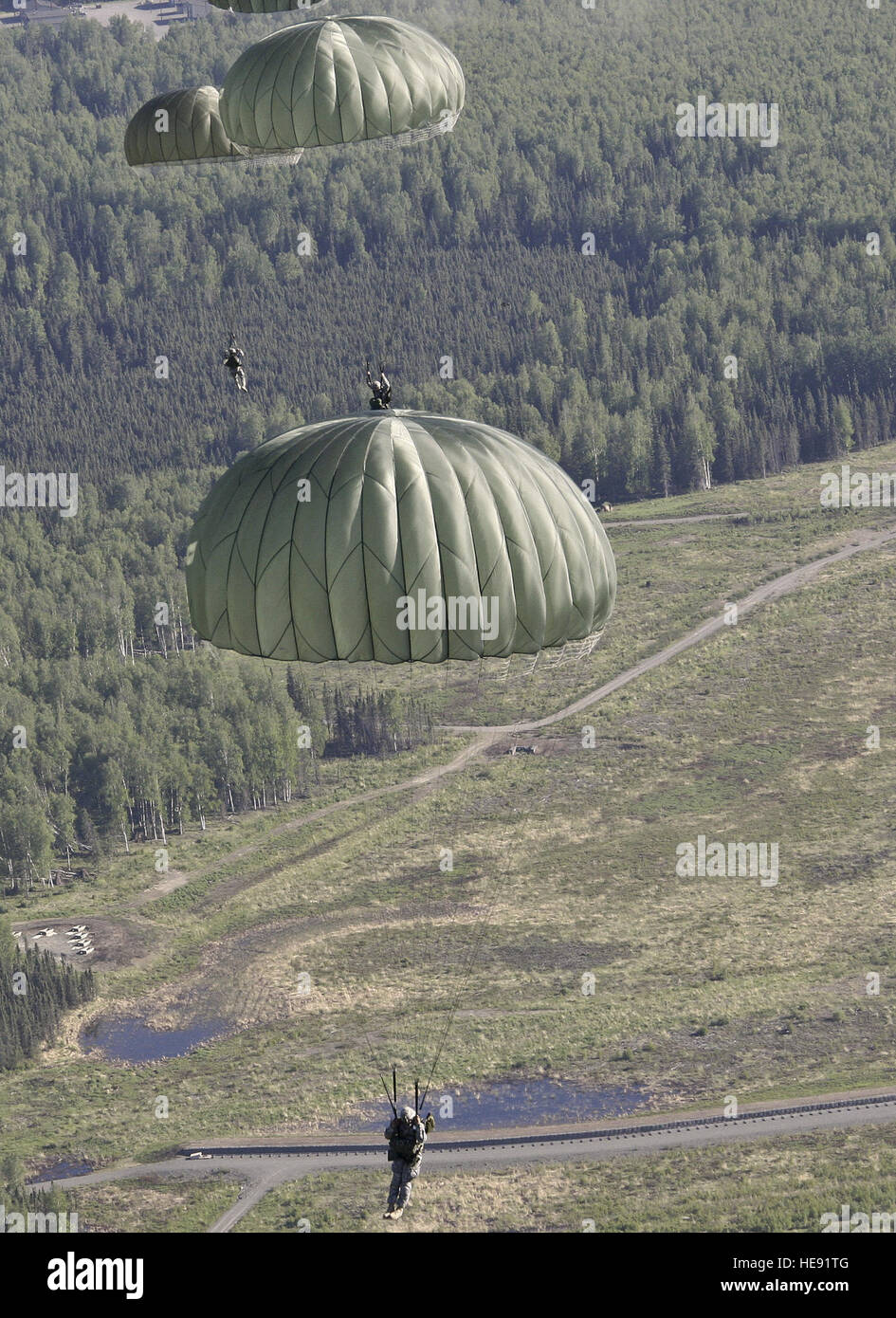 Soldiers parachute onto Malamute Drop Zone during airborne operations, June 12, 2013. Nearly 300 soldiers jumped at 1,500 feet with both full combat equipment and 'Hollywood,' or no load, from C-23 Sherpa aircraft piloted by members of the 1st Battalion, 207th Aviation Regiment, Alaska Army National Guard. Capable of increased speed, higher altitude, and the ability to cover longer distances than military helicopters, the C-23 can be configured to carry out missions from troop transport to surveillance. Stock Photohttps://www.alamy.com/image-license-details/?v=1https://www.alamy.com/stock-photo-soldiers-parachute-onto-malamute-drop-zone-during-airborne-operations-129276800.html
RMHE91TG–Soldiers parachute onto Malamute Drop Zone during airborne operations, June 12, 2013. Nearly 300 soldiers jumped at 1,500 feet with both full combat equipment and 'Hollywood,' or no load, from C-23 Sherpa aircraft piloted by members of the 1st Battalion, 207th Aviation Regiment, Alaska Army National Guard. Capable of increased speed, higher altitude, and the ability to cover longer distances than military helicopters, the C-23 can be configured to carry out missions from troop transport to surveillance.
![. English: Burbidgea nitida, which is described by Sir Joseph Dalton Hooker in the source thus: 'This very beautiful plant is the type of an entirely new genus ... Mr. F.W. Burbidge [Frederick William Burbidge (1847–1905), British explorer], who discovered it when travelling in Borneo, for Messrs. Veitch, informs me that it grows in shady forests of the Murut district in N.W. Borneo, between the Lawas and Trusan rivers, at an altitude of 1,000 to 1,500 feet ...' Burbidgea nitida.. 1879. 104 Burbidgea nitida from Curtis's Botanical Magazine 1879 Stock Photo . English: Burbidgea nitida, which is described by Sir Joseph Dalton Hooker in the source thus: 'This very beautiful plant is the type of an entirely new genus ... Mr. F.W. Burbidge [Frederick William Burbidge (1847–1905), British explorer], who discovered it when travelling in Borneo, for Messrs. Veitch, informs me that it grows in shady forests of the Murut district in N.W. Borneo, between the Lawas and Trusan rivers, at an altitude of 1,000 to 1,500 feet ...' Burbidgea nitida.. 1879. 104 Burbidgea nitida from Curtis's Botanical Magazine 1879 Stock Photo](https://c8.alamy.com/comp/MMN857/english-burbidgea-nitida-which-is-described-by-sir-joseph-dalton-hooker-in-the-source-thus-this-very-beautiful-plant-is-the-type-of-an-entirely-new-genus-mr-fw-burbidge-frederick-william-burbidge-18471905-british-explorer-who-discovered-it-when-travelling-in-borneo-for-messrs-veitch-informs-me-that-it-grows-in-shady-forests-of-the-murut-district-in-nw-borneo-between-the-lawas-and-trusan-rivers-at-an-altitude-of-1000-to-1500-feet-burbidgea-nitida-1879-104-burbidgea-nitida-from-curtiss-botanical-magazine-1879-MMN857.jpg) . English: Burbidgea nitida, which is described by Sir Joseph Dalton Hooker in the source thus: 'This very beautiful plant is the type of an entirely new genus ... Mr. F.W. Burbidge [Frederick William Burbidge (1847–1905), British explorer], who discovered it when travelling in Borneo, for Messrs. Veitch, informs me that it grows in shady forests of the Murut district in N.W. Borneo, between the Lawas and Trusan rivers, at an altitude of 1,000 to 1,500 feet ...' Burbidgea nitida.. 1879. 104 Burbidgea nitida from Curtis's Botanical Magazine 1879 Stock Photohttps://www.alamy.com/image-license-details/?v=1https://www.alamy.com/english-burbidgea-nitida-which-is-described-by-sir-joseph-dalton-hooker-in-the-source-thus-this-very-beautiful-plant-is-the-type-of-an-entirely-new-genus-mr-fw-burbidge-frederick-william-burbidge-18471905-british-explorer-who-discovered-it-when-travelling-in-borneo-for-messrs-veitch-informs-me-that-it-grows-in-shady-forests-of-the-murut-district-in-nw-borneo-between-the-lawas-and-trusan-rivers-at-an-altitude-of-1000-to-1500-feet-burbidgea-nitida-1879-104-burbidgea-nitida-from-curtiss-botanical-magazine-1879-image184864211.html
. English: Burbidgea nitida, which is described by Sir Joseph Dalton Hooker in the source thus: 'This very beautiful plant is the type of an entirely new genus ... Mr. F.W. Burbidge [Frederick William Burbidge (1847–1905), British explorer], who discovered it when travelling in Borneo, for Messrs. Veitch, informs me that it grows in shady forests of the Murut district in N.W. Borneo, between the Lawas and Trusan rivers, at an altitude of 1,000 to 1,500 feet ...' Burbidgea nitida.. 1879. 104 Burbidgea nitida from Curtis's Botanical Magazine 1879 Stock Photohttps://www.alamy.com/image-license-details/?v=1https://www.alamy.com/english-burbidgea-nitida-which-is-described-by-sir-joseph-dalton-hooker-in-the-source-thus-this-very-beautiful-plant-is-the-type-of-an-entirely-new-genus-mr-fw-burbidge-frederick-william-burbidge-18471905-british-explorer-who-discovered-it-when-travelling-in-borneo-for-messrs-veitch-informs-me-that-it-grows-in-shady-forests-of-the-murut-district-in-nw-borneo-between-the-lawas-and-trusan-rivers-at-an-altitude-of-1000-to-1500-feet-burbidgea-nitida-1879-104-burbidgea-nitida-from-curtiss-botanical-magazine-1879-image184864211.htmlRMMMN857–. English: Burbidgea nitida, which is described by Sir Joseph Dalton Hooker in the source thus: 'This very beautiful plant is the type of an entirely new genus ... Mr. F.W. Burbidge [Frederick William Burbidge (1847–1905), British explorer], who discovered it when travelling in Borneo, for Messrs. Veitch, informs me that it grows in shady forests of the Murut district in N.W. Borneo, between the Lawas and Trusan rivers, at an altitude of 1,000 to 1,500 feet ...' Burbidgea nitida.. 1879. 104 Burbidgea nitida from Curtis's Botanical Magazine 1879
 Sgt. 1st Class Rob Trone of the 197th Special Troops Company (Airborne), Utah Army National Guard, gives an equipment safety inspection before a night static line airborne operation at Hill Air Force Base, Utah, Oct. 14, 2011. The paratroopers board a C-130 Hercules and prepare to jump from an altitude of 1,500 feet at the Global One drop zone in Fairfield, Utah, under the cover of darkness; which satisfies the quarterly training requirement for the unit. Stock Photohttps://www.alamy.com/image-license-details/?v=1https://www.alamy.com/stock-photo-sgt-1st-class-rob-trone-of-the-197th-special-troops-company-airborne-129294511.html
RMHE9TD3–Sgt. 1st Class Rob Trone of the 197th Special Troops Company (Airborne), Utah Army National Guard, gives an equipment safety inspection before a night static line airborne operation at Hill Air Force Base, Utah, Oct. 14, 2011. The paratroopers board a C-130 Hercules and prepare to jump from an altitude of 1,500 feet at the Global One drop zone in Fairfield, Utah, under the cover of darkness; which satisfies the quarterly training requirement for the unit.
 Windsor, Berkshire, UK. 9th January, 2022. A no fly zone with a radius of 1.4 miles around Windsor Castle is reported to be coming into force from 27th January 2022. Aircraft would be prohibited from flying lower than at an altitude of 2,500 feet above the royal residence. Drones will also be prohibited. Her Majesty Queen Elizabeth II is currently in residence at Windsor Castle during the latest Covid-19 Omicron variant phase. These new security measures are reported to be due to an intruder with a cross bow entering the grounds of Windsor Castle on Christmas Day. The man has since been sectio Stock Photohttps://www.alamy.com/image-license-details/?v=1https://www.alamy.com/windsor-berkshire-uk-9th-january-2022-a-no-fly-zone-with-a-radius-of-14-miles-around-windsor-castle-is-reported-to-be-coming-into-force-from-27th-january-2022-aircraft-would-be-prohibited-from-flying-lower-than-at-an-altitude-of-2500-feet-above-the-royal-residence-drones-will-also-be-prohibited-her-majesty-queen-elizabeth-ii-is-currently-in-residence-at-windsor-castle-during-the-latest-covid-19-omicron-variant-phase-these-new-security-measures-are-reported-to-be-due-to-an-intruder-with-a-cross-bow-entering-the-grounds-of-windsor-castle-on-christmas-day-the-man-has-since-been-sectio-image456230320.html
RM2HE72C0–Windsor, Berkshire, UK. 9th January, 2022. A no fly zone with a radius of 1.4 miles around Windsor Castle is reported to be coming into force from 27th January 2022. Aircraft would be prohibited from flying lower than at an altitude of 2,500 feet above the royal residence. Drones will also be prohibited. Her Majesty Queen Elizabeth II is currently in residence at Windsor Castle during the latest Covid-19 Omicron variant phase. These new security measures are reported to be due to an intruder with a cross bow entering the grounds of Windsor Castle on Christmas Day. The man has since been sectio
 MOUNT KILIMANJARO, Tanzania — The summit of Mt Meru pokes through the clouds, as seen from about 14,500 feet on Mt Kilimanjaro's Lemosho Route. Stock Photohttps://www.alamy.com/image-license-details/?v=1https://www.alamy.com/stock-photo-mount-kilimanjaro-tanzania-the-summit-of-mt-meru-pokes-through-the-52125099.html
RMD0PE2K–MOUNT KILIMANJARO, Tanzania — The summit of Mt Meru pokes through the clouds, as seen from about 14,500 feet on Mt Kilimanjaro's Lemosho Route.
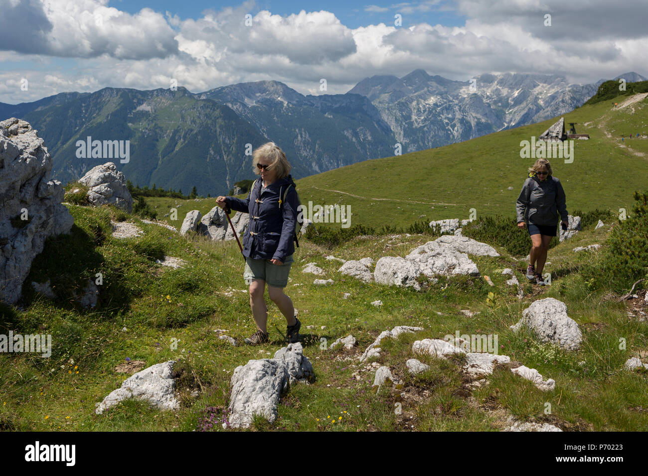 Walkers walk in Velika Planina, on 26th June 2018, in Velika Planina, near Kamnik, Slovenia. Velika Planina is a mountain plateau in the Kamnik–Savinja Alps - a 5.8 square kilometres area 1,500 metres (4,900 feet) above sea level. Otherwise known as The Big Pasture Plateau, Velika Planina is a winter skiing destination and hiking route in summer. The herders' huts became popular in the early 1930s as holiday cabins (known as bajtarstvo) but these were were destroyed by the Germans during WW2 and rebuilt right afterwards by Vlasto Kopac in the summer of 1945. Stock Photohttps://www.alamy.com/image-license-details/?v=1https://www.alamy.com/walkers-walk-in-velika-planina-on-26th-june-2018-in-velika-planina-near-kamnik-slovenia-velika-planina-is-a-mountain-plateau-in-the-kamniksavinja-alps-a-58-square-kilometres-area-1500-metres-4900-feet-above-sea-level-otherwise-known-as-the-big-pasture-plateau-velika-planina-is-a-winter-skiing-destination-and-hiking-route-in-summer-the-herders-huts-became-popular-in-the-early-1930s-as-holiday-cabins-known-as-bajtarstvo-but-these-were-were-destroyed-by-the-germans-during-ww2-and-rebuilt-right-afterwards-by-vlasto-kopac-in-the-summer-of-1945-image210828635.html
RMP70223–Walkers walk in Velika Planina, on 26th June 2018, in Velika Planina, near Kamnik, Slovenia. Velika Planina is a mountain plateau in the Kamnik–Savinja Alps - a 5.8 square kilometres area 1,500 metres (4,900 feet) above sea level. Otherwise known as The Big Pasture Plateau, Velika Planina is a winter skiing destination and hiking route in summer. The herders' huts became popular in the early 1930s as holiday cabins (known as bajtarstvo) but these were were destroyed by the Germans during WW2 and rebuilt right afterwards by Vlasto Kopac in the summer of 1945.
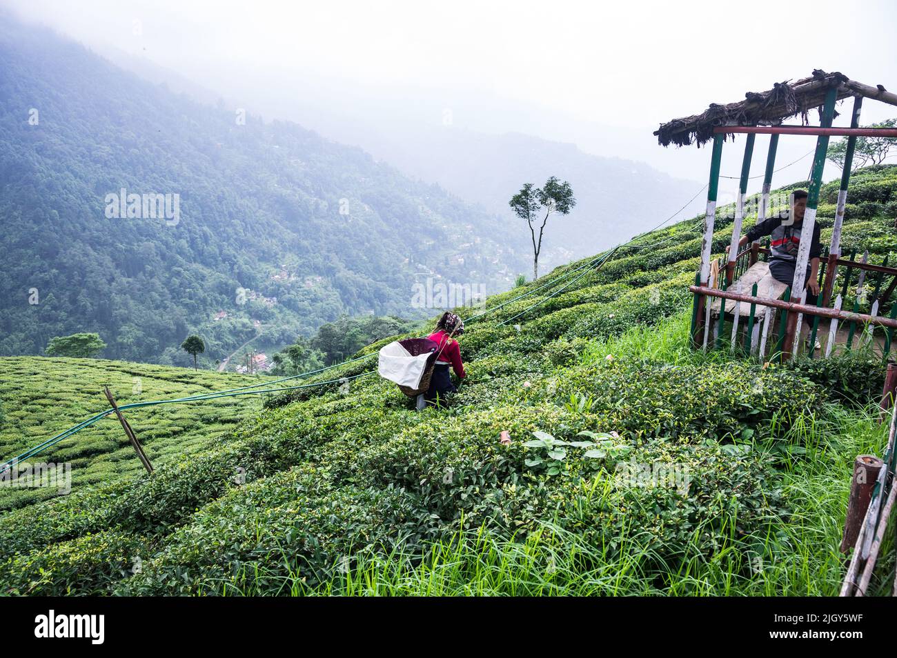 Women tea workers plucking tea leaves during cloudy monsoon at the British-era tea garden Orange Valley Tea Garden spread over an area of 347.26 hectares (858.1 acres) at an altitude ranging from 3,500 to 6,000 feet (1,100 to 1,800 m) above the mean sea level, is a bio-organic garden producing mainly black tea at Darjeeling, West Bengal. India is the world's second-largest tea producer Country after China. The poor female tea workers' work wages are very low, and most of them are coming from neighbouring country Nepal in search of work. India. Stock Photohttps://www.alamy.com/image-license-details/?v=1https://www.alamy.com/women-tea-workers-plucking-tea-leaves-during-cloudy-monsoon-at-the-british-era-tea-garden-orange-valley-tea-garden-spread-over-an-area-of-34726-hectares-8581-acres-at-an-altitude-ranging-from-3500-to-6000-feet-1100-to-1800-m-above-the-mean-sea-level-is-a-bio-organic-garden-producing-mainly-black-tea-at-darjeeling-west-bengal-india-is-the-worlds-second-largest-tea-producer-country-after-china-the-poor-female-tea-workers-work-wages-are-very-low-and-most-of-them-are-coming-from-neighbouring-country-nepal-in-search-of-work-india-image475111771.html
RM2JGY5WF–Women tea workers plucking tea leaves during cloudy monsoon at the British-era tea garden Orange Valley Tea Garden spread over an area of 347.26 hectares (858.1 acres) at an altitude ranging from 3,500 to 6,000 feet (1,100 to 1,800 m) above the mean sea level, is a bio-organic garden producing mainly black tea at Darjeeling, West Bengal. India is the world's second-largest tea producer Country after China. The poor female tea workers' work wages are very low, and most of them are coming from neighbouring country Nepal in search of work. India.