Stanwood Cut Out Stock Images
 Amish work horse on a snowy day off in Mecosta County near Big Rapids and Stanwood, Michigan, USA Stock Photohttps://www.alamy.com/image-license-details/?v=1https://www.alamy.com/stock-photo-amish-work-horse-on-a-snowy-day-off-in-mecosta-county-near-big-rapids-78001164.html
RFEEW77T–Amish work horse on a snowy day off in Mecosta County near Big Rapids and Stanwood, Michigan, USA
 USGS Topo Map Washington State WA Stanwood 20110418 TM Restoration Stock Photohttps://www.alamy.com/image-license-details/?v=1https://www.alamy.com/usgs-topo-map-washington-state-wa-stanwood-20110418-tm-restoration-image267952623.html
RMWFX88F–USGS Topo Map Washington State WA Stanwood 20110418 TM Restoration
 Male Gray Treefrog, Dryophytes versicolor, on a white studio background in central Michigan, USA Stock Photohttps://www.alamy.com/image-license-details/?v=1https://www.alamy.com/male-gray-treefrog-dryophytes-versicolor-on-a-white-studio-background-in-central-michigan-usa-image360054204.html
RF2BWNTPM–Male Gray Treefrog, Dryophytes versicolor, on a white studio background in central Michigan, USA
 USGS Topo Map Washington State WA Stanwood 244000 1956 24000 Restoration Stock Photohttps://www.alamy.com/image-license-details/?v=1https://www.alamy.com/usgs-topo-map-washington-state-wa-stanwood-244000-1956-24000-restoration-image267955622.html
RMWFXC3J–USGS Topo Map Washington State WA Stanwood 244000 1956 24000 Restoration
 Stanwood, Cedar County, US, United States, Iowa, N 41 53' 35'', S 91 9' 2'', map, Cartascapes Map published in 2024. Explore Cartascapes, a map revealing Earth's diverse landscapes, cultures, and ecosystems. Journey through time and space, discovering the interconnectedness of our planet's past, present, and future. Stock Photohttps://www.alamy.com/image-license-details/?v=1https://www.alamy.com/stanwood-cedar-county-us-united-states-iowa-n-41-53-35-s-91-9-2-map-cartascapes-map-published-in-2024-explore-cartascapes-a-map-revealing-earths-diverse-landscapes-cultures-and-ecosystems-journey-through-time-and-space-discovering-the-interconnectedness-of-our-planets-past-present-and-future-image621422564.html
RM2Y306R0–Stanwood, Cedar County, US, United States, Iowa, N 41 53' 35'', S 91 9' 2'', map, Cartascapes Map published in 2024. Explore Cartascapes, a map revealing Earth's diverse landscapes, cultures, and ecosystems. Journey through time and space, discovering the interconnectedness of our planet's past, present, and future.
 Franklin Stanwood - 3324690b98. Stock Photohttps://www.alamy.com/image-license-details/?v=1https://www.alamy.com/franklin-stanwood-3324690b98-image638580584.html
RM2S2WT1C–Franklin Stanwood - 3324690b98.
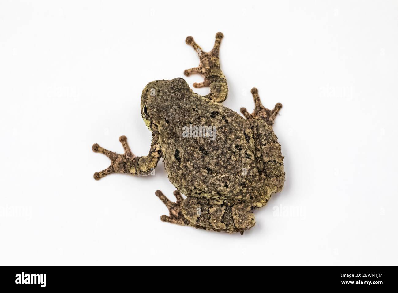 Male Gray Treefrog, Dryophytes versicolor, on a white studio background in central Michigan, USA Stock Photohttps://www.alamy.com/image-license-details/?v=1https://www.alamy.com/male-gray-treefrog-dryophytes-versicolor-on-a-white-studio-background-in-central-michigan-usa-image360054092.html
RF2BWNTJM–Male Gray Treefrog, Dryophytes versicolor, on a white studio background in central Michigan, USA
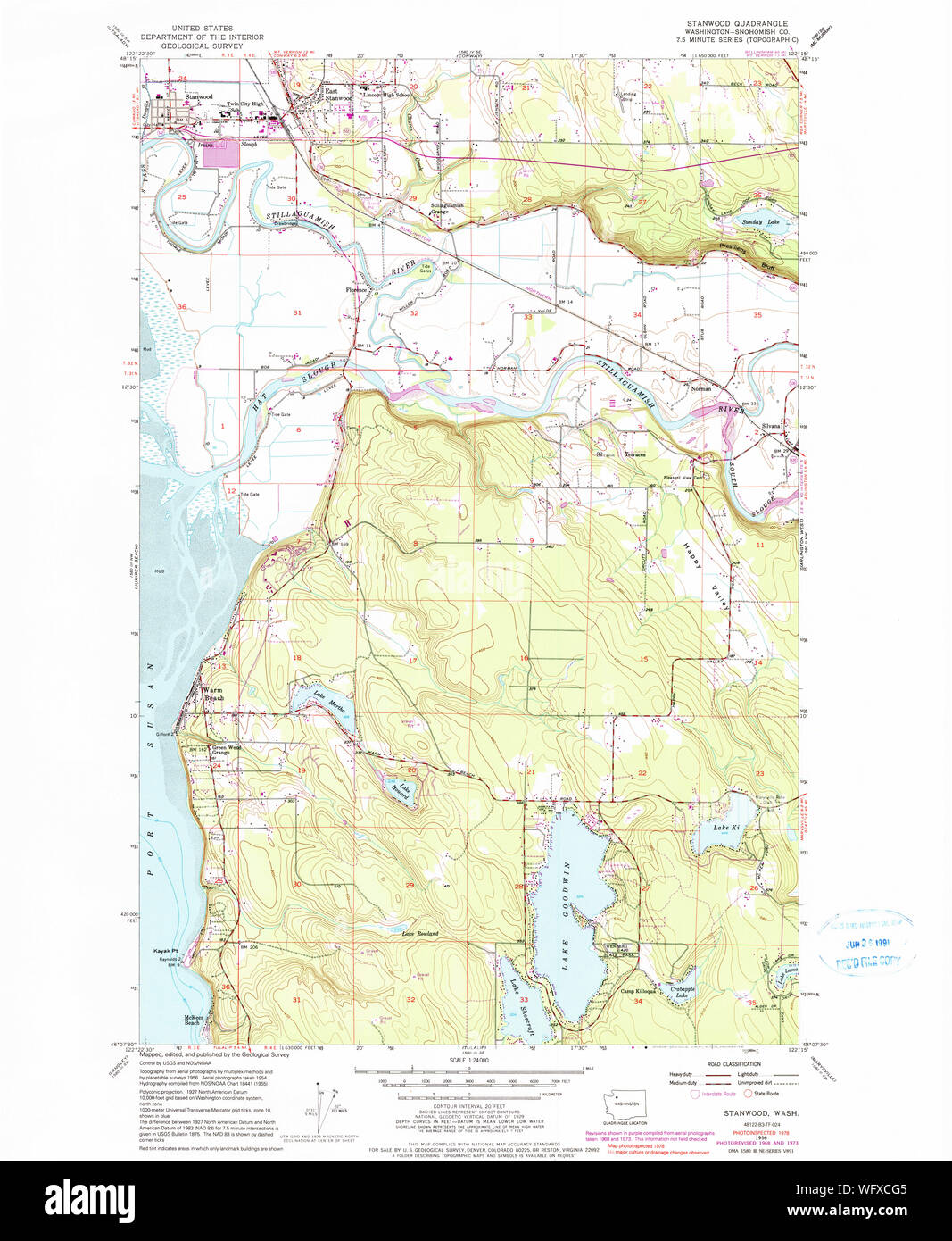 USGS Topo Map Washington State WA Stanwood 244001 1956 24000 Restoration Stock Photohttps://www.alamy.com/image-license-details/?v=1https://www.alamy.com/usgs-topo-map-washington-state-wa-stanwood-244001-1956-24000-restoration-image267955973.html
RMWFXCG5–USGS Topo Map Washington State WA Stanwood 244001 1956 24000 Restoration
 Stanwood, Mecosta County, US, United States, Michigan, N 43 34' 43'', S 85 26' 57'', map, Cartascapes Map published in 2024. Explore Cartascapes, a map revealing Earth's diverse landscapes, cultures, and ecosystems. Journey through time and space, discovering the interconnectedness of our planet's past, present, and future. Stock Photohttps://www.alamy.com/image-license-details/?v=1https://www.alamy.com/stanwood-mecosta-county-us-united-states-michigan-n-43-34-43-s-85-26-57-map-cartascapes-map-published-in-2024-explore-cartascapes-a-map-revealing-earths-diverse-landscapes-cultures-and-ecosystems-journey-through-time-and-space-discovering-the-interconnectedness-of-our-planets-past-present-and-future-image621252398.html
RM2Y2MDNJ–Stanwood, Mecosta County, US, United States, Michigan, N 43 34' 43'', S 85 26' 57'', map, Cartascapes Map published in 2024. Explore Cartascapes, a map revealing Earth's diverse landscapes, cultures, and ecosystems. Journey through time and space, discovering the interconnectedness of our planet's past, present, and future.
 USGS TOPO Map Michigan MI Stanwood 20120724 TM Stock Photohttps://www.alamy.com/image-license-details/?v=1https://www.alamy.com/usgs-topo-map-michigan-mi-stanwood-20120724-tm-image332275655.html
RM2A8GCYK–USGS TOPO Map Michigan MI Stanwood 20120724 TM
 Stanwood, Mecosta County, US, United States, Michigan, N 43 34' 43'', S 85 26' 57'', map, Cartascapes Map published in 2024. Explore Cartascapes, a map revealing Earth's diverse landscapes, cultures, and ecosystems. Journey through time and space, discovering the interconnectedness of our planet's past, present, and future. Stock Photohttps://www.alamy.com/image-license-details/?v=1https://www.alamy.com/stanwood-mecosta-county-us-united-states-michigan-n-43-34-43-s-85-26-57-map-cartascapes-map-published-in-2024-explore-cartascapes-a-map-revealing-earths-diverse-landscapes-cultures-and-ecosystems-journey-through-time-and-space-discovering-the-interconnectedness-of-our-planets-past-present-and-future-image621308994.html
RM2Y2R1XX–Stanwood, Mecosta County, US, United States, Michigan, N 43 34' 43'', S 85 26' 57'', map, Cartascapes Map published in 2024. Explore Cartascapes, a map revealing Earth's diverse landscapes, cultures, and ecosystems. Journey through time and space, discovering the interconnectedness of our planet's past, present, and future.
 USGS TOPO Maps Iowa IA Stanwood 20130425 TM Restoration Stock Photohttps://www.alamy.com/image-license-details/?v=1https://www.alamy.com/usgs-topo-maps-iowa-ia-stanwood-20130425-tm-restoration-image259994464.html
RMW2YNGG–USGS TOPO Maps Iowa IA Stanwood 20130425 TM Restoration
 Northwest Stanwood, Snohomish County, US, United States, Washington, N 48 15' 43'', S 122 21' 0'', map, Cartascapes Map published in 2024. Explore Cartascapes, a map revealing Earth's diverse landscapes, cultures, and ecosystems. Journey through time and space, discovering the interconnectedness of our planet's past, present, and future. Stock Photohttps://www.alamy.com/image-license-details/?v=1https://www.alamy.com/northwest-stanwood-snohomish-county-us-united-states-washington-n-48-15-43-s-122-21-0-map-cartascapes-map-published-in-2024-explore-cartascapes-a-map-revealing-earths-diverse-landscapes-cultures-and-ecosystems-journey-through-time-and-space-discovering-the-interconnectedness-of-our-planets-past-present-and-future-image621283360.html
RM2Y2NW7C–Northwest Stanwood, Snohomish County, US, United States, Washington, N 48 15' 43'', S 122 21' 0'', map, Cartascapes Map published in 2024. Explore Cartascapes, a map revealing Earth's diverse landscapes, cultures, and ecosystems. Journey through time and space, discovering the interconnectedness of our planet's past, present, and future.
 USGS TOPO Map Michigan MI Stanwood 277321 1985 24000 Stock Photohttps://www.alamy.com/image-license-details/?v=1https://www.alamy.com/usgs-topo-map-michigan-mi-stanwood-277321-1985-24000-image332275657.html
RM2A8GCYN–USGS TOPO Map Michigan MI Stanwood 277321 1985 24000
 North Stanwood, Snohomish County, US, United States, Washington, N 48 15' 35'', S 122 20' 48'', map, Cartascapes Map published in 2024. Explore Cartascapes, a map revealing Earth's diverse landscapes, cultures, and ecosystems. Journey through time and space, discovering the interconnectedness of our planet's past, present, and future. Stock Photohttps://www.alamy.com/image-license-details/?v=1https://www.alamy.com/north-stanwood-snohomish-county-us-united-states-washington-n-48-15-35-s-122-20-48-map-cartascapes-map-published-in-2024-explore-cartascapes-a-map-revealing-earths-diverse-landscapes-cultures-and-ecosystems-journey-through-time-and-space-discovering-the-interconnectedness-of-our-planets-past-present-and-future-image621364938.html
RM2Y2WH8X–North Stanwood, Snohomish County, US, United States, Washington, N 48 15' 35'', S 122 20' 48'', map, Cartascapes Map published in 2024. Explore Cartascapes, a map revealing Earth's diverse landscapes, cultures, and ecosystems. Journey through time and space, discovering the interconnectedness of our planet's past, present, and future.
 USGS TOPO Maps Iowa IA Stanwood 20100514 TM Restoration Stock Photohttps://www.alamy.com/image-license-details/?v=1https://www.alamy.com/usgs-topo-maps-iowa-ia-stanwood-20100514-tm-restoration-image259994481.html
RMW2YNH5–USGS TOPO Maps Iowa IA Stanwood 20100514 TM Restoration
 Stanwood Park, Cumberland County, US, United States, Maine, N 43 37' 11'', S 70 16' 10'', map, Cartascapes Map published in 2024. Explore Cartascapes, a map revealing Earth's diverse landscapes, cultures, and ecosystems. Journey through time and space, discovering the interconnectedness of our planet's past, present, and future. Stock Photohttps://www.alamy.com/image-license-details/?v=1https://www.alamy.com/stanwood-park-cumberland-county-us-united-states-maine-n-43-37-11-s-70-16-10-map-cartascapes-map-published-in-2024-explore-cartascapes-a-map-revealing-earths-diverse-landscapes-cultures-and-ecosystems-journey-through-time-and-space-discovering-the-interconnectedness-of-our-planets-past-present-and-future-image621165563.html
RM2Y2GF0B–Stanwood Park, Cumberland County, US, United States, Maine, N 43 37' 11'', S 70 16' 10'', map, Cartascapes Map published in 2024. Explore Cartascapes, a map revealing Earth's diverse landscapes, cultures, and ecosystems. Journey through time and space, discovering the interconnectedness of our planet's past, present, and future.
 USGS TOPO Maps Iowa IA Stanwood 175585 1965 24000 Restoration Stock Photohttps://www.alamy.com/image-license-details/?v=1https://www.alamy.com/usgs-topo-maps-iowa-ia-stanwood-175585-1965-24000-restoration-image259994430.html
RMW2YNFA–USGS TOPO Maps Iowa IA Stanwood 175585 1965 24000 Restoration
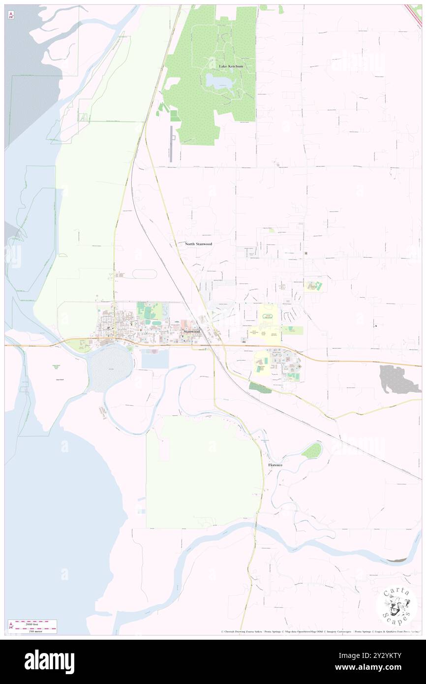 East Stanwood, Snohomish County, US, United States, Washington, N 48 14' 38'', S 122 20' 48'', map, Cartascapes Map published in 2024. Explore Cartascapes, a map revealing Earth's diverse landscapes, cultures, and ecosystems. Journey through time and space, discovering the interconnectedness of our planet's past, present, and future. Stock Photohttps://www.alamy.com/image-license-details/?v=1https://www.alamy.com/east-stanwood-snohomish-county-us-united-states-washington-n-48-14-38-s-122-20-48-map-cartascapes-map-published-in-2024-explore-cartascapes-a-map-revealing-earths-diverse-landscapes-cultures-and-ecosystems-journey-through-time-and-space-discovering-the-interconnectedness-of-our-planets-past-present-and-future-image621410859.html
RM2Y2YKTY–East Stanwood, Snohomish County, US, United States, Washington, N 48 14' 38'', S 122 20' 48'', map, Cartascapes Map published in 2024. Explore Cartascapes, a map revealing Earth's diverse landscapes, cultures, and ecosystems. Journey through time and space, discovering the interconnectedness of our planet's past, present, and future.
 Stanwood, Stark County, US, United States, Ohio, N 40 45' 30'', S 81 38' 1'', map, Cartascapes Map published in 2024. Explore Cartascapes, a map revealing Earth's diverse landscapes, cultures, and ecosystems. Journey through time and space, discovering the interconnectedness of our planet's past, present, and future. Stock Photohttps://www.alamy.com/image-license-details/?v=1https://www.alamy.com/stanwood-stark-county-us-united-states-ohio-n-40-45-30-s-81-38-1-map-cartascapes-map-published-in-2024-explore-cartascapes-a-map-revealing-earths-diverse-landscapes-cultures-and-ecosystems-journey-through-time-and-space-discovering-the-interconnectedness-of-our-planets-past-present-and-future-image620868939.html
RM2Y230JK–Stanwood, Stark County, US, United States, Ohio, N 40 45' 30'', S 81 38' 1'', map, Cartascapes Map published in 2024. Explore Cartascapes, a map revealing Earth's diverse landscapes, cultures, and ecosystems. Journey through time and space, discovering the interconnectedness of our planet's past, present, and future.
 Stanwood, Snohomish County, US, United States, Washington, N 48 14' 28'', S 122 22' 14'', map, Cartascapes Map published in 2024. Explore Cartascapes, a map revealing Earth's diverse landscapes, cultures, and ecosystems. Journey through time and space, discovering the interconnectedness of our planet's past, present, and future. Stock Photohttps://www.alamy.com/image-license-details/?v=1https://www.alamy.com/stanwood-snohomish-county-us-united-states-washington-n-48-14-28-s-122-22-14-map-cartascapes-map-published-in-2024-explore-cartascapes-a-map-revealing-earths-diverse-landscapes-cultures-and-ecosystems-journey-through-time-and-space-discovering-the-interconnectedness-of-our-planets-past-present-and-future-image620856469.html
RM2Y22CN9–Stanwood, Snohomish County, US, United States, Washington, N 48 14' 28'', S 122 22' 14'', map, Cartascapes Map published in 2024. Explore Cartascapes, a map revealing Earth's diverse landscapes, cultures, and ecosystems. Journey through time and space, discovering the interconnectedness of our planet's past, present, and future.
 Stanwood, Bucks County, US, United States, Pennsylvania, N 40 6' 26'', S 74 57' 8'', map, Cartascapes Map published in 2024. Explore Cartascapes, a map revealing Earth's diverse landscapes, cultures, and ecosystems. Journey through time and space, discovering the interconnectedness of our planet's past, present, and future. Stock Photohttps://www.alamy.com/image-license-details/?v=1https://www.alamy.com/stanwood-bucks-county-us-united-states-pennsylvania-n-40-6-26-s-74-57-8-map-cartascapes-map-published-in-2024-explore-cartascapes-a-map-revealing-earths-diverse-landscapes-cultures-and-ecosystems-journey-through-time-and-space-discovering-the-interconnectedness-of-our-planets-past-present-and-future-image620815539.html
RM2Y20GFF–Stanwood, Bucks County, US, United States, Pennsylvania, N 40 6' 26'', S 74 57' 8'', map, Cartascapes Map published in 2024. Explore Cartascapes, a map revealing Earth's diverse landscapes, cultures, and ecosystems. Journey through time and space, discovering the interconnectedness of our planet's past, present, and future.
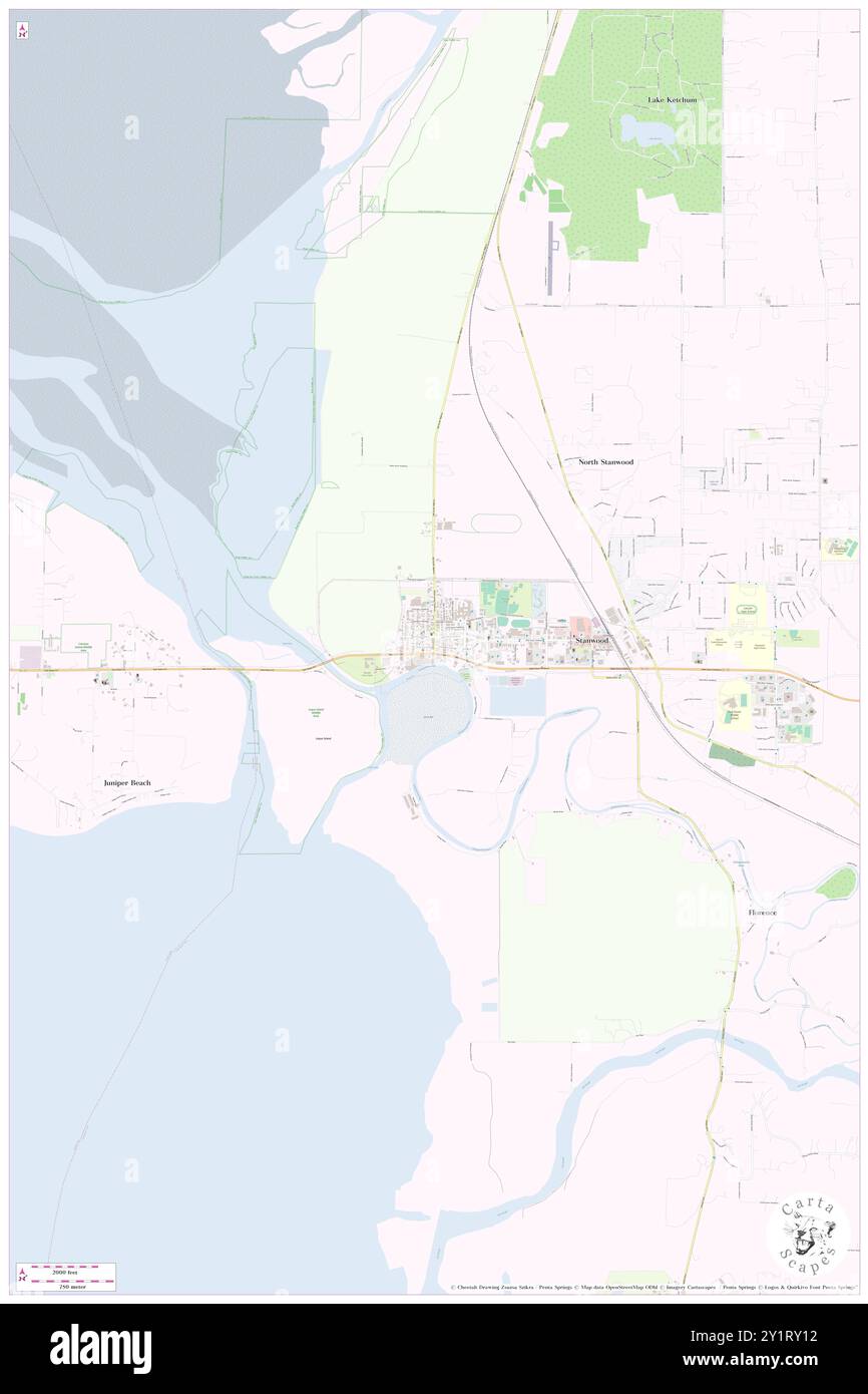 Stanwood, Snohomish County, US, United States, Washington, N 48 14' 28'', S 122 22' 14'', map, Cartascapes Map published in 2024. Explore Cartascapes, a map revealing Earth's diverse landscapes, cultures, and ecosystems. Journey through time and space, discovering the interconnectedness of our planet's past, present, and future. Stock Photohttps://www.alamy.com/image-license-details/?v=1https://www.alamy.com/stanwood-snohomish-county-us-united-states-washington-n-48-14-28-s-122-22-14-map-cartascapes-map-published-in-2024-explore-cartascapes-a-map-revealing-earths-diverse-landscapes-cultures-and-ecosystems-journey-through-time-and-space-discovering-the-interconnectedness-of-our-planets-past-present-and-future-image620713998.html
RM2Y1RY12–Stanwood, Snohomish County, US, United States, Washington, N 48 14' 28'', S 122 22' 14'', map, Cartascapes Map published in 2024. Explore Cartascapes, a map revealing Earth's diverse landscapes, cultures, and ecosystems. Journey through time and space, discovering the interconnectedness of our planet's past, present, and future.
 Stanwood, Cedar County, US, United States, Iowa, N 41 53' 35'', S 91 9' 2'', map, Cartascapes Map published in 2024. Explore Cartascapes, a map revealing Earth's diverse landscapes, cultures, and ecosystems. Journey through time and space, discovering the interconnectedness of our planet's past, present, and future. Stock Photohttps://www.alamy.com/image-license-details/?v=1https://www.alamy.com/stanwood-cedar-county-us-united-states-iowa-n-41-53-35-s-91-9-2-map-cartascapes-map-published-in-2024-explore-cartascapes-a-map-revealing-earths-diverse-landscapes-cultures-and-ecosystems-journey-through-time-and-space-discovering-the-interconnectedness-of-our-planets-past-present-and-future-image620733626.html
RM2Y1TT22–Stanwood, Cedar County, US, United States, Iowa, N 41 53' 35'', S 91 9' 2'', map, Cartascapes Map published in 2024. Explore Cartascapes, a map revealing Earth's diverse landscapes, cultures, and ecosystems. Journey through time and space, discovering the interconnectedness of our planet's past, present, and future.
 Stanwood, Westchester County, US, United States, New York, N 41 14' 20'', S 73 44' 47'', map, Cartascapes Map published in 2024. Explore Cartascapes, a map revealing Earth's diverse landscapes, cultures, and ecosystems. Journey through time and space, discovering the interconnectedness of our planet's past, present, and future. Stock Photohttps://www.alamy.com/image-license-details/?v=1https://www.alamy.com/stanwood-westchester-county-us-united-states-new-york-n-41-14-20-s-73-44-47-map-cartascapes-map-published-in-2024-explore-cartascapes-a-map-revealing-earths-diverse-landscapes-cultures-and-ecosystems-journey-through-time-and-space-discovering-the-interconnectedness-of-our-planets-past-present-and-future-image620849011.html
RM2Y2236Y–Stanwood, Westchester County, US, United States, New York, N 41 14' 20'', S 73 44' 47'', map, Cartascapes Map published in 2024. Explore Cartascapes, a map revealing Earth's diverse landscapes, cultures, and ecosystems. Journey through time and space, discovering the interconnectedness of our planet's past, present, and future.
 Northwest Stanwood, Snohomish County, US, United States, Washington, N 48 15' 43'', S 122 21' 0'', map, Cartascapes Map published in 2024. Explore Cartascapes, a map revealing Earth's diverse landscapes, cultures, and ecosystems. Journey through time and space, discovering the interconnectedness of our planet's past, present, and future. Stock Photohttps://www.alamy.com/image-license-details/?v=1https://www.alamy.com/northwest-stanwood-snohomish-county-us-united-states-washington-n-48-15-43-s-122-21-0-map-cartascapes-map-published-in-2024-explore-cartascapes-a-map-revealing-earths-diverse-landscapes-cultures-and-ecosystems-journey-through-time-and-space-discovering-the-interconnectedness-of-our-planets-past-present-and-future-image620746203.html
RM2Y1WC37–Northwest Stanwood, Snohomish County, US, United States, Washington, N 48 15' 43'', S 122 21' 0'', map, Cartascapes Map published in 2024. Explore Cartascapes, a map revealing Earth's diverse landscapes, cultures, and ecosystems. Journey through time and space, discovering the interconnectedness of our planet's past, present, and future.
 North Stanwood, Snohomish County, US, United States, Washington, N 48 15' 31'', S 122 20' 33'', map, Cartascapes Map published in 2024. Explore Cartascapes, a map revealing Earth's diverse landscapes, cultures, and ecosystems. Journey through time and space, discovering the interconnectedness of our planet's past, present, and future. Stock Photohttps://www.alamy.com/image-license-details/?v=1https://www.alamy.com/north-stanwood-snohomish-county-us-united-states-washington-n-48-15-31-s-122-20-33-map-cartascapes-map-published-in-2024-explore-cartascapes-a-map-revealing-earths-diverse-landscapes-cultures-and-ecosystems-journey-through-time-and-space-discovering-the-interconnectedness-of-our-planets-past-present-and-future-image620833153.html
RM2Y21B0H–North Stanwood, Snohomish County, US, United States, Washington, N 48 15' 31'', S 122 20' 33'', map, Cartascapes Map published in 2024. Explore Cartascapes, a map revealing Earth's diverse landscapes, cultures, and ecosystems. Journey through time and space, discovering the interconnectedness of our planet's past, present, and future.
 Village of Stanwood, Mecosta County, US, United States, Michigan, N 43 34' 49'', S 85 26' 53'', map, Cartascapes Map published in 2024. Explore Cartascapes, a map revealing Earth's diverse landscapes, cultures, and ecosystems. Journey through time and space, discovering the interconnectedness of our planet's past, present, and future. Stock Photohttps://www.alamy.com/image-license-details/?v=1https://www.alamy.com/village-of-stanwood-mecosta-county-us-united-states-michigan-n-43-34-49-s-85-26-53-map-cartascapes-map-published-in-2024-explore-cartascapes-a-map-revealing-earths-diverse-landscapes-cultures-and-ecosystems-journey-through-time-and-space-discovering-the-interconnectedness-of-our-planets-past-present-and-future-image633871897.html
RM2YR7A21–Village of Stanwood, Mecosta County, US, United States, Michigan, N 43 34' 49'', S 85 26' 53'', map, Cartascapes Map published in 2024. Explore Cartascapes, a map revealing Earth's diverse landscapes, cultures, and ecosystems. Journey through time and space, discovering the interconnectedness of our planet's past, present, and future.
 City of Stanwood, Cedar County, US, United States, Iowa, N 41 53' 34'', S 91 8' 55'', map, Cartascapes Map published in 2024. Explore Cartascapes, a map revealing Earth's diverse landscapes, cultures, and ecosystems. Journey through time and space, discovering the interconnectedness of our planet's past, present, and future. Stock Photohttps://www.alamy.com/image-license-details/?v=1https://www.alamy.com/city-of-stanwood-cedar-county-us-united-states-iowa-n-41-53-34-s-91-8-55-map-cartascapes-map-published-in-2024-explore-cartascapes-a-map-revealing-earths-diverse-landscapes-cultures-and-ecosystems-journey-through-time-and-space-discovering-the-interconnectedness-of-our-planets-past-present-and-future-image633839651.html
RM2YR5TXB–City of Stanwood, Cedar County, US, United States, Iowa, N 41 53' 34'', S 91 8' 55'', map, Cartascapes Map published in 2024. Explore Cartascapes, a map revealing Earth's diverse landscapes, cultures, and ecosystems. Journey through time and space, discovering the interconnectedness of our planet's past, present, and future.
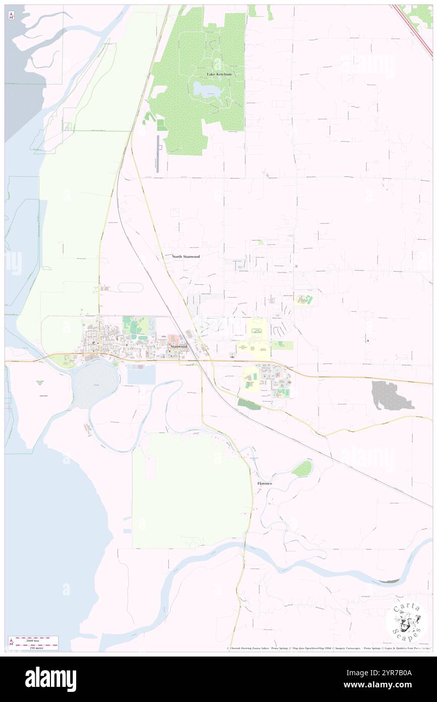 City of Stanwood, Snohomish County, US, United States, Washington, N 48 14' 41'', S 122 20' 33'', map, Cartascapes Map published in 2024. Explore Cartascapes, a map revealing Earth's diverse landscapes, cultures, and ecosystems. Journey through time and space, discovering the interconnectedness of our planet's past, present, and future. Stock Photohttps://www.alamy.com/image-license-details/?v=1https://www.alamy.com/city-of-stanwood-snohomish-county-us-united-states-washington-n-48-14-41-s-122-20-33-map-cartascapes-map-published-in-2024-explore-cartascapes-a-map-revealing-earths-diverse-landscapes-cultures-and-ecosystems-journey-through-time-and-space-discovering-the-interconnectedness-of-our-planets-past-present-and-future-image633872634.html
RM2YR7B0A–City of Stanwood, Snohomish County, US, United States, Washington, N 48 14' 41'', S 122 20' 33'', map, Cartascapes Map published in 2024. Explore Cartascapes, a map revealing Earth's diverse landscapes, cultures, and ecosystems. Journey through time and space, discovering the interconnectedness of our planet's past, present, and future.
 Stanwood, Canada, Ontario, N 44 23' 52'', W 77 45' 36'', map, Timeless Map published in 2021. Travelers, explorers and adventurers like Florence Nightingale, David Livingstone, Ernest Shackleton, Lewis and Clark and Sherlock Holmes relied on maps to plan travels to the world's most remote corners, Timeless Maps is mapping most locations on the globe, showing the achievement of great dreams Stock Photohttps://www.alamy.com/image-license-details/?v=1https://www.alamy.com/stanwood-canada-ontario-n-44-23-52-w-77-45-36-map-timeless-map-published-in-2021-travelers-explorers-and-adventurers-like-florence-nightingale-david-livingstone-ernest-shackleton-lewis-and-clark-and-sherlock-holmes-relied-on-maps-to-plan-travels-to-the-worlds-most-remote-corners-timeless-maps-is-mapping-most-locations-on-the-globe-showing-the-achievement-of-great-dreams-image457885864.html
RM2HGXE2G–Stanwood, Canada, Ontario, N 44 23' 52'', W 77 45' 36'', map, Timeless Map published in 2021. Travelers, explorers and adventurers like Florence Nightingale, David Livingstone, Ernest Shackleton, Lewis and Clark and Sherlock Holmes relied on maps to plan travels to the world's most remote corners, Timeless Maps is mapping most locations on the globe, showing the achievement of great dreams
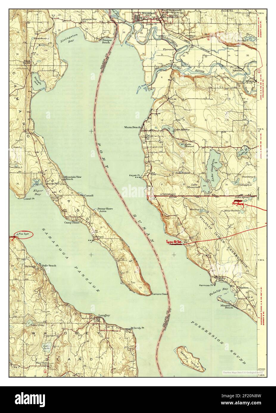 Stanwood, Washington, map 1943, 1:62500, United States of America by Timeless Maps, data U.S. Geological Survey Stock Photohttps://www.alamy.com/image-license-details/?v=1https://www.alamy.com/stanwood-washington-map-1943-162500-united-states-of-america-by-timeless-maps-data-us-geological-survey-image414294857.html
RM2F20N8W–Stanwood, Washington, map 1943, 1:62500, United States of America by Timeless Maps, data U.S. Geological Survey
 Stanwood, Washington, map 1956, 1:24000, United States of America by Timeless Maps, data U.S. Geological Survey Stock Photohttps://www.alamy.com/image-license-details/?v=1https://www.alamy.com/stanwood-washington-map-1956-124000-united-states-of-america-by-timeless-maps-data-us-geological-survey-image407028703.html
RM2EJ5N7B–Stanwood, Washington, map 1956, 1:24000, United States of America by Timeless Maps, data U.S. Geological Survey
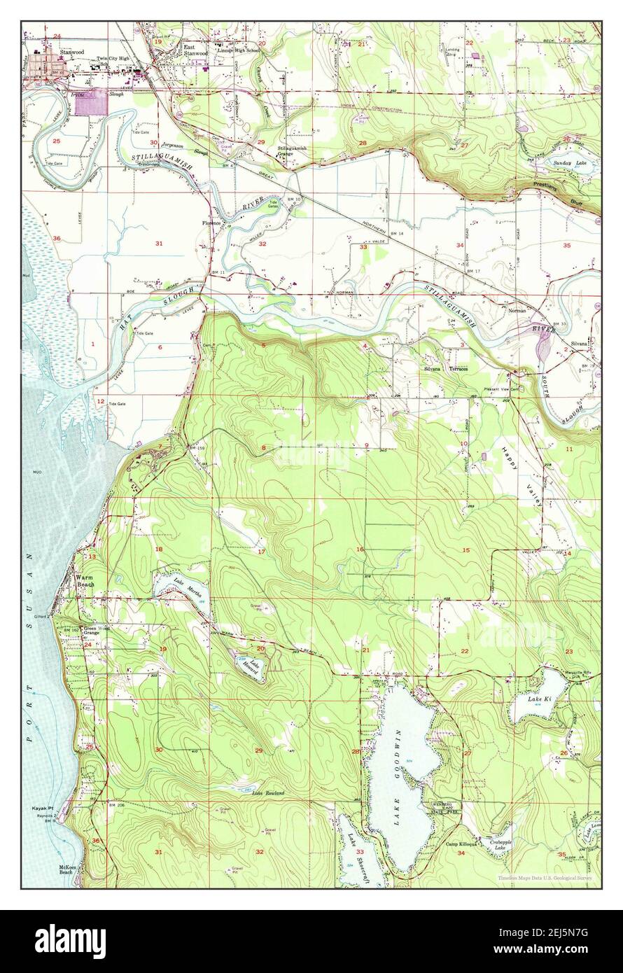 Stanwood, Washington, map 1956, 1:24000, United States of America by Timeless Maps, data U.S. Geological Survey Stock Photohttps://www.alamy.com/image-license-details/?v=1https://www.alamy.com/stanwood-washington-map-1956-124000-united-states-of-america-by-timeless-maps-data-us-geological-survey-image407028708.html
RM2EJ5N7G–Stanwood, Washington, map 1956, 1:24000, United States of America by Timeless Maps, data U.S. Geological Survey
 Stanwood, Iowa, map 1965, 1:24000, United States of America by Timeless Maps, data U.S. Geological Survey Stock Photohttps://www.alamy.com/image-license-details/?v=1https://www.alamy.com/stanwood-iowa-map-1965-124000-united-states-of-america-by-timeless-maps-data-us-geological-survey-image406334613.html
RM2EH23XD–Stanwood, Iowa, map 1965, 1:24000, United States of America by Timeless Maps, data U.S. Geological Survey
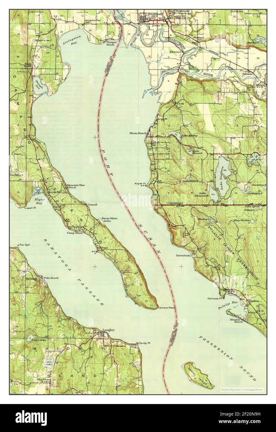 Stanwood, Washington, map 1943, 1:62500, United States of America by Timeless Maps, data U.S. Geological Survey Stock Photohttps://www.alamy.com/image-license-details/?v=1https://www.alamy.com/stanwood-washington-map-1943-162500-united-states-of-america-by-timeless-maps-data-us-geological-survey-image414294877.html
RM2F20N9H–Stanwood, Washington, map 1943, 1:62500, United States of America by Timeless Maps, data U.S. Geological Survey
 Stanwood, Iowa, map 1901, 1:125000, United States of America by Timeless Maps, data U.S. Geological Survey Stock Photohttps://www.alamy.com/image-license-details/?v=1https://www.alamy.com/stanwood-iowa-map-1901-1125000-united-states-of-america-by-timeless-maps-data-us-geological-survey-image406334619.html
RM2EH23XK–Stanwood, Iowa, map 1901, 1:125000, United States of America by Timeless Maps, data U.S. Geological Survey
 Stanwood, Iowa, map 1901, 1:125000, United States of America by Timeless Maps, data U.S. Geological Survey Stock Photohttps://www.alamy.com/image-license-details/?v=1https://www.alamy.com/stanwood-iowa-map-1901-1125000-united-states-of-america-by-timeless-maps-data-us-geological-survey-image406334977.html
RM2EH24BD–Stanwood, Iowa, map 1901, 1:125000, United States of America by Timeless Maps, data U.S. Geological Survey
 Stanwood, Washington, map 1956, 1:24000, United States of America by Timeless Maps, data U.S. Geological Survey Stock Photohttps://www.alamy.com/image-license-details/?v=1https://www.alamy.com/stanwood-washington-map-1956-124000-united-states-of-america-by-timeless-maps-data-us-geological-survey-image407028704.html
RM2EJ5N7C–Stanwood, Washington, map 1956, 1:24000, United States of America by Timeless Maps, data U.S. Geological Survey
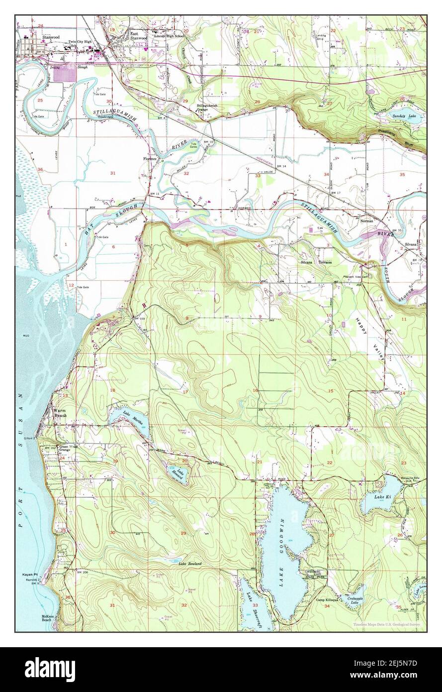 Stanwood, Washington, map 1956, 1:24000, United States of America by Timeless Maps, data U.S. Geological Survey Stock Photohttps://www.alamy.com/image-license-details/?v=1https://www.alamy.com/stanwood-washington-map-1956-124000-united-states-of-america-by-timeless-maps-data-us-geological-survey-image407028705.html
RM2EJ5N7D–Stanwood, Washington, map 1956, 1:24000, United States of America by Timeless Maps, data U.S. Geological Survey
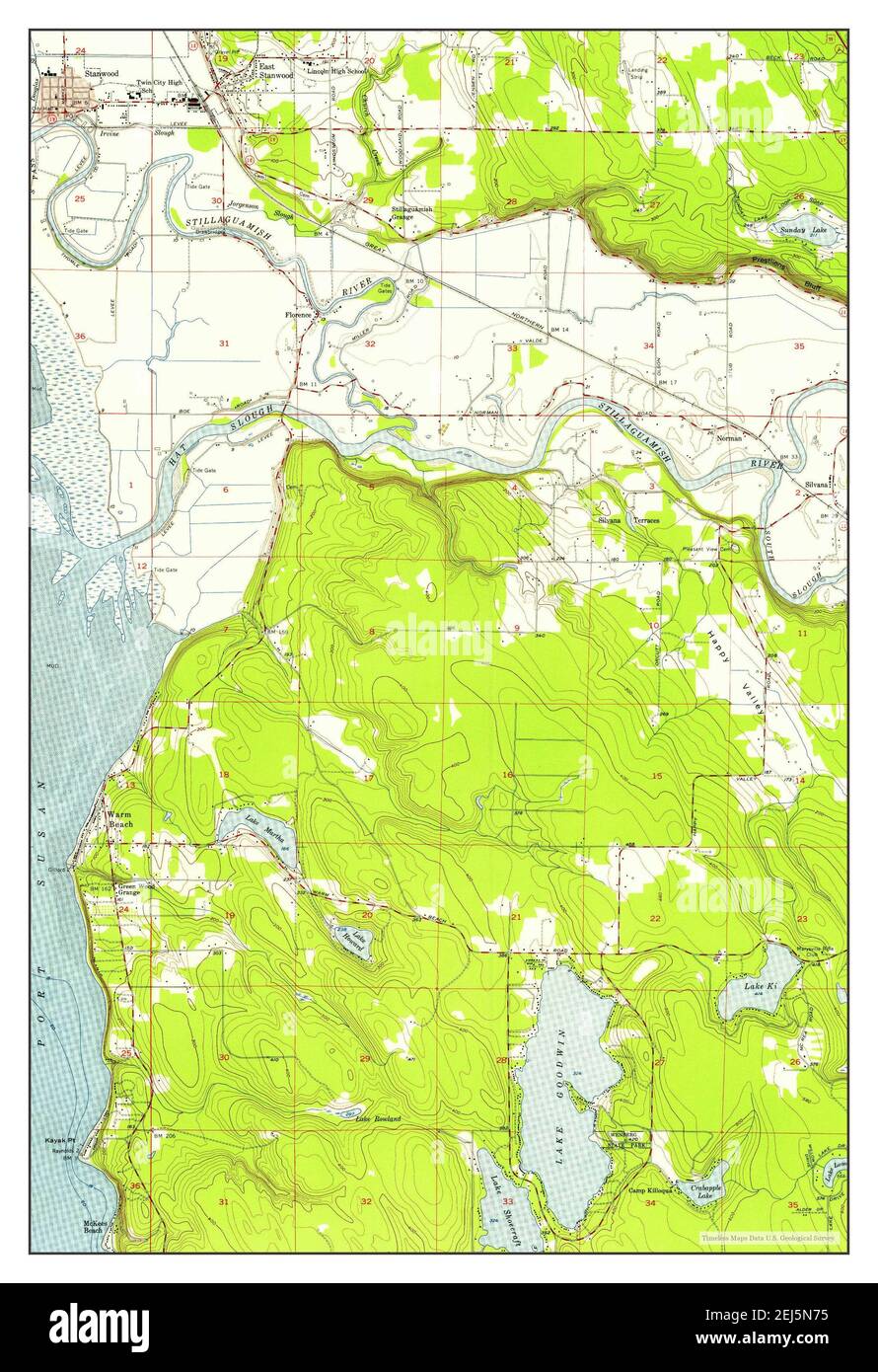 Stanwood, Washington, map 1956, 1:24000, United States of America by Timeless Maps, data U.S. Geological Survey Stock Photohttps://www.alamy.com/image-license-details/?v=1https://www.alamy.com/stanwood-washington-map-1956-124000-united-states-of-america-by-timeless-maps-data-us-geological-survey-image407028697.html
RM2EJ5N75–Stanwood, Washington, map 1956, 1:24000, United States of America by Timeless Maps, data U.S. Geological Survey
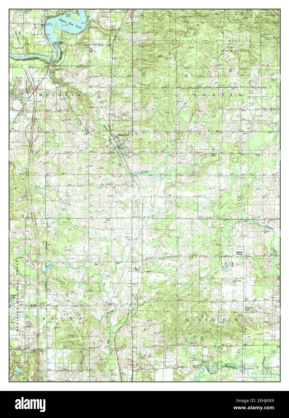 Stanwood, Michigan, map 1985, 1:24000, United States of America by Timeless Maps, data U.S. Geological Survey Stock Photohttps://www.alamy.com/image-license-details/?v=1https://www.alamy.com/stanwood-michigan-map-1985-124000-united-states-of-america-by-timeless-maps-data-us-geological-survey-image406698318.html
RM2EHJKRX–Stanwood, Michigan, map 1985, 1:24000, United States of America by Timeless Maps, data U.S. Geological Survey