A map of the somme battlefield Stock Photos and Images
(21)See a map of the somme battlefield stock video clipsQuick filters:
A map of the somme battlefield Stock Photos and Images
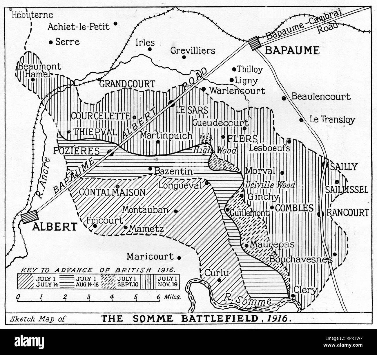 A map of the Somme Battlefield, 1916. The Battle of the Somme, also known as the Somme Offensive, was a battle of the World War I fought by the armies of the British Empire and French Third Republic against the German Empire. It took place between 1st July and 18th November 1916. Stock Photohttps://www.alamy.com/image-license-details/?v=1https://www.alamy.com/a-map-of-the-somme-battlefield-1916-the-battle-of-the-somme-also-known-as-the-somme-offensive-was-a-battle-of-the-world-war-i-fought-by-the-armies-of-the-british-empire-and-french-third-republic-against-the-german-empire-it-took-place-between-1st-july-and-18th-november-1916-image237781635.html
RMRPRTW7–A map of the Somme Battlefield, 1916. The Battle of the Somme, also known as the Somme Offensive, was a battle of the World War I fought by the armies of the British Empire and French Third Republic against the German Empire. It took place between 1st July and 18th November 1916.
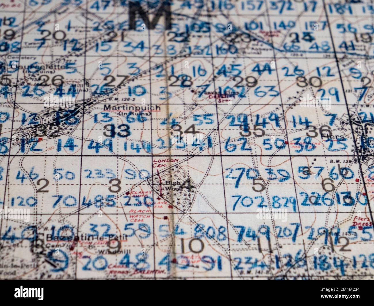 A marked up map of the Somme battlefield showing the number of temporary grave markers in eaach sector, Imperial War Museum, London, UK. Stock Photohttps://www.alamy.com/image-license-details/?v=1https://www.alamy.com/a-marked-up-map-of-the-somme-battlefield-showing-the-number-of-temporary-grave-markers-in-eaach-sector-imperial-war-museum-london-uk-image501999992.html
RM2M4M234–A marked up map of the Somme battlefield showing the number of temporary grave markers in eaach sector, Imperial War Museum, London, UK.
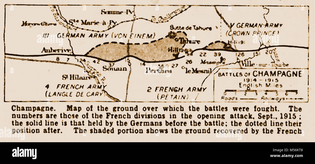 WWI - A printed map showing the movement of military forces during the battles of Champagne, France. Sptember 1915 Stock Photohttps://www.alamy.com/image-license-details/?v=1https://www.alamy.com/stock-photo-wwi-a-printed-map-showing-the-movement-of-military-forces-during-the-175324248.html
RMM56KT8–WWI - A printed map showing the movement of military forces during the battles of Champagne, France. Sptember 1915
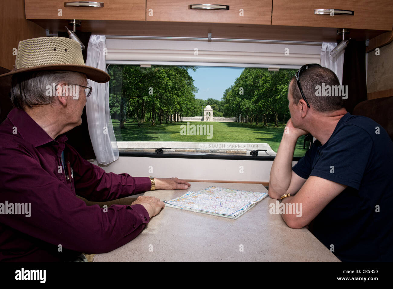 Two Male tourists viewing the ww1 South African memorial at Delville Wood on the Somme, France from the window of a motorhome Stock Photohttps://www.alamy.com/image-license-details/?v=1https://www.alamy.com/stock-photo-two-male-tourists-viewing-the-ww1-south-african-memorial-at-delville-48676348.html
RMCR5B50–Two Male tourists viewing the ww1 South African memorial at Delville Wood on the Somme, France from the window of a motorhome
!['Map Showing the Great British Advance of July 1916', 1916. From "The War Illustrated Album De Luxe - Volume VI. Allied operations during the Battle of the Somme. The Spring and Summer Campaign of 1916", edited by J. A. Hammerton. [The Amalgamated Press, Limited, London, 1916] Stock Photo 'Map Showing the Great British Advance of July 1916', 1916. From "The War Illustrated Album De Luxe - Volume VI. Allied operations during the Battle of the Somme. The Spring and Summer Campaign of 1916", edited by J. A. Hammerton. [The Amalgamated Press, Limited, London, 1916] Stock Photo](https://c8.alamy.com/comp/2A8E9J7/map-showing-the-great-british-advance-of-july-1916-1916-from-quotthe-war-illustrated-album-de-luxe-volume-vi-allied-operations-during-the-battle-of-the-somme-the-spring-and-summer-campaign-of-1916quot-edited-by-j-a-hammerton-the-amalgamated-press-limited-london-1916-2A8E9J7.jpg) 'Map Showing the Great British Advance of July 1916', 1916. From "The War Illustrated Album De Luxe - Volume VI. Allied operations during the Battle of the Somme. The Spring and Summer Campaign of 1916", edited by J. A. Hammerton. [The Amalgamated Press, Limited, London, 1916] Stock Photohttps://www.alamy.com/image-license-details/?v=1https://www.alamy.com/map-showing-the-great-british-advance-of-july-1916-1916-from-quotthe-war-illustrated-album-de-luxe-volume-vi-allied-operations-during-the-battle-of-the-somme-the-spring-and-summer-campaign-of-1916quot-edited-by-j-a-hammerton-the-amalgamated-press-limited-london-1916-image332229135.html
'Map Showing the Great British Advance of July 1916', 1916. From "The War Illustrated Album De Luxe - Volume VI. Allied operations during the Battle of the Somme. The Spring and Summer Campaign of 1916", edited by J. A. Hammerton. [The Amalgamated Press, Limited, London, 1916] Stock Photohttps://www.alamy.com/image-license-details/?v=1https://www.alamy.com/map-showing-the-great-british-advance-of-july-1916-1916-from-quotthe-war-illustrated-album-de-luxe-volume-vi-allied-operations-during-the-battle-of-the-somme-the-spring-and-summer-campaign-of-1916quot-edited-by-j-a-hammerton-the-amalgamated-press-limited-london-1916-image332229135.htmlRM2A8E9J7–'Map Showing the Great British Advance of July 1916', 1916. From "The War Illustrated Album De Luxe - Volume VI. Allied operations during the Battle of the Somme. The Spring and Summer Campaign of 1916", edited by J. A. Hammerton. [The Amalgamated Press, Limited, London, 1916]
 Map of Combles (Somme), taken in 1918 by Humber 1616 photographer. The map shows the location of Maurepas, situated 3 kilometers south of Combles, in the Somme region. Notes indicate that the photo was taken during a military activity on September 2nd, with references to Tomas Tune Peln and a Nor Acronique Ca. Stock Photohttps://www.alamy.com/image-license-details/?v=1https://www.alamy.com/map-of-combles-somme-taken-in-1918-by-humber-1616-photographer-the-map-shows-the-location-of-maurepas-situated-3-kilometers-south-of-combles-in-the-somme-region-notes-indicate-that-the-photo-was-taken-during-a-military-activity-on-september-2nd-with-references-to-tomas-tune-peln-and-a-nor-acronique-ca-image558168335.html
RM2RC2NBB–Map of Combles (Somme), taken in 1918 by Humber 1616 photographer. The map shows the location of Maurepas, situated 3 kilometers south of Combles, in the Somme region. Notes indicate that the photo was taken during a military activity on September 2nd, with references to Tomas Tune Peln and a Nor Acronique Ca.
 . Battlefields of the World War, western and southern fronts; a study in military geography . ttlefield The most striking characteristic of the Somme battlefield isits monotonous succession of low, rolling plain. It is true thatthe faint northwest-southeast folds, which have produced inthe region immediately to the west a marked parallelism ofvalley trenches and upland strips, are continued into the areanow under discussion. A layered map of the battlefield (Fig. 28)shows a suggestion of the northwest-southeast alignment oftopography in the form of alternate belts of slightly higherand lower l Stock Photohttps://www.alamy.com/image-license-details/?v=1https://www.alamy.com/battlefields-of-the-world-war-western-and-southern-fronts-a-study-in-military-geography-ttlefield-the-most-striking-characteristic-of-the-somme-battlefield-isits-monotonous-succession-of-low-rolling-plain-it-is-true-thatthe-faint-northwest-southeast-folds-which-have-produced-inthe-region-immediately-to-the-west-a-marked-parallelism-ofvalley-trenches-and-upland-strips-are-continued-into-the-areanow-under-discussion-a-layered-map-of-the-battlefield-fig-28shows-a-suggestion-of-the-northwest-southeast-alignment-oftopography-in-the-form-of-alternate-belts-of-slightly-higherand-lower-l-image370154107.html
RM2CE5Y9F–. Battlefields of the World War, western and southern fronts; a study in military geography . ttlefield The most striking characteristic of the Somme battlefield isits monotonous succession of low, rolling plain. It is true thatthe faint northwest-southeast folds, which have produced inthe region immediately to the west a marked parallelism ofvalley trenches and upland strips, are continued into the areanow under discussion. A layered map of the battlefield (Fig. 28)shows a suggestion of the northwest-southeast alignment oftopography in the form of alternate belts of slightly higherand lower l
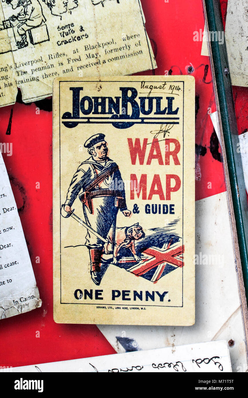 Military memorabilia 1914 John Bull world war 1 map & guide for sale one penny memorial wars army armed forces military combat soldier infantry maps Stock Photohttps://www.alamy.com/image-license-details/?v=1https://www.alamy.com/stock-photo-military-memorabilia-1914-john-bull-world-war-1-map-guide-for-sale-176447204.html
RMM71T5T–Military memorabilia 1914 John Bull world war 1 map & guide for sale one penny memorial wars army armed forces military combat soldier infantry maps
!['Map showing approximately the area gained on the Thiepval Ridge between September 14 and October 31, 1916', (c1920). The British line in northern France during the Battle of the Somme, First World War. From "The Great World War: A History", Volume VI, edited by Frank A Mumby. [The Gresham Publishing Company Ltd, London, c1920] Stock Photo 'Map showing approximately the area gained on the Thiepval Ridge between September 14 and October 31, 1916', (c1920). The British line in northern France during the Battle of the Somme, First World War. From "The Great World War: A History", Volume VI, edited by Frank A Mumby. [The Gresham Publishing Company Ltd, London, c1920] Stock Photo](https://c8.alamy.com/comp/2A8E7JH/map-showing-approximately-the-area-gained-on-the-thiepval-ridge-between-september-14-and-october-31-1916-c1920-the-british-line-in-northern-france-during-the-battle-of-the-somme-first-world-war-from-quotthe-great-world-war-a-historyquot-volume-vi-edited-by-frank-a-mumby-the-gresham-publishing-company-ltd-london-c1920-2A8E7JH.jpg) 'Map showing approximately the area gained on the Thiepval Ridge between September 14 and October 31, 1916', (c1920). The British line in northern France during the Battle of the Somme, First World War. From "The Great World War: A History", Volume VI, edited by Frank A Mumby. [The Gresham Publishing Company Ltd, London, c1920] Stock Photohttps://www.alamy.com/image-license-details/?v=1https://www.alamy.com/map-showing-approximately-the-area-gained-on-the-thiepval-ridge-between-september-14-and-october-31-1916-c1920-the-british-line-in-northern-france-during-the-battle-of-the-somme-first-world-war-from-quotthe-great-world-war-a-historyquot-volume-vi-edited-by-frank-a-mumby-the-gresham-publishing-company-ltd-london-c1920-image332227577.html
'Map showing approximately the area gained on the Thiepval Ridge between September 14 and October 31, 1916', (c1920). The British line in northern France during the Battle of the Somme, First World War. From "The Great World War: A History", Volume VI, edited by Frank A Mumby. [The Gresham Publishing Company Ltd, London, c1920] Stock Photohttps://www.alamy.com/image-license-details/?v=1https://www.alamy.com/map-showing-approximately-the-area-gained-on-the-thiepval-ridge-between-september-14-and-october-31-1916-c1920-the-british-line-in-northern-france-during-the-battle-of-the-somme-first-world-war-from-quotthe-great-world-war-a-historyquot-volume-vi-edited-by-frank-a-mumby-the-gresham-publishing-company-ltd-london-c1920-image332227577.htmlRM2A8E7JH–'Map showing approximately the area gained on the Thiepval Ridge between September 14 and October 31, 1916', (c1920). The British line in northern France during the Battle of the Somme, First World War. From "The Great World War: A History", Volume VI, edited by Frank A Mumby. [The Gresham Publishing Company Ltd, London, c1920]
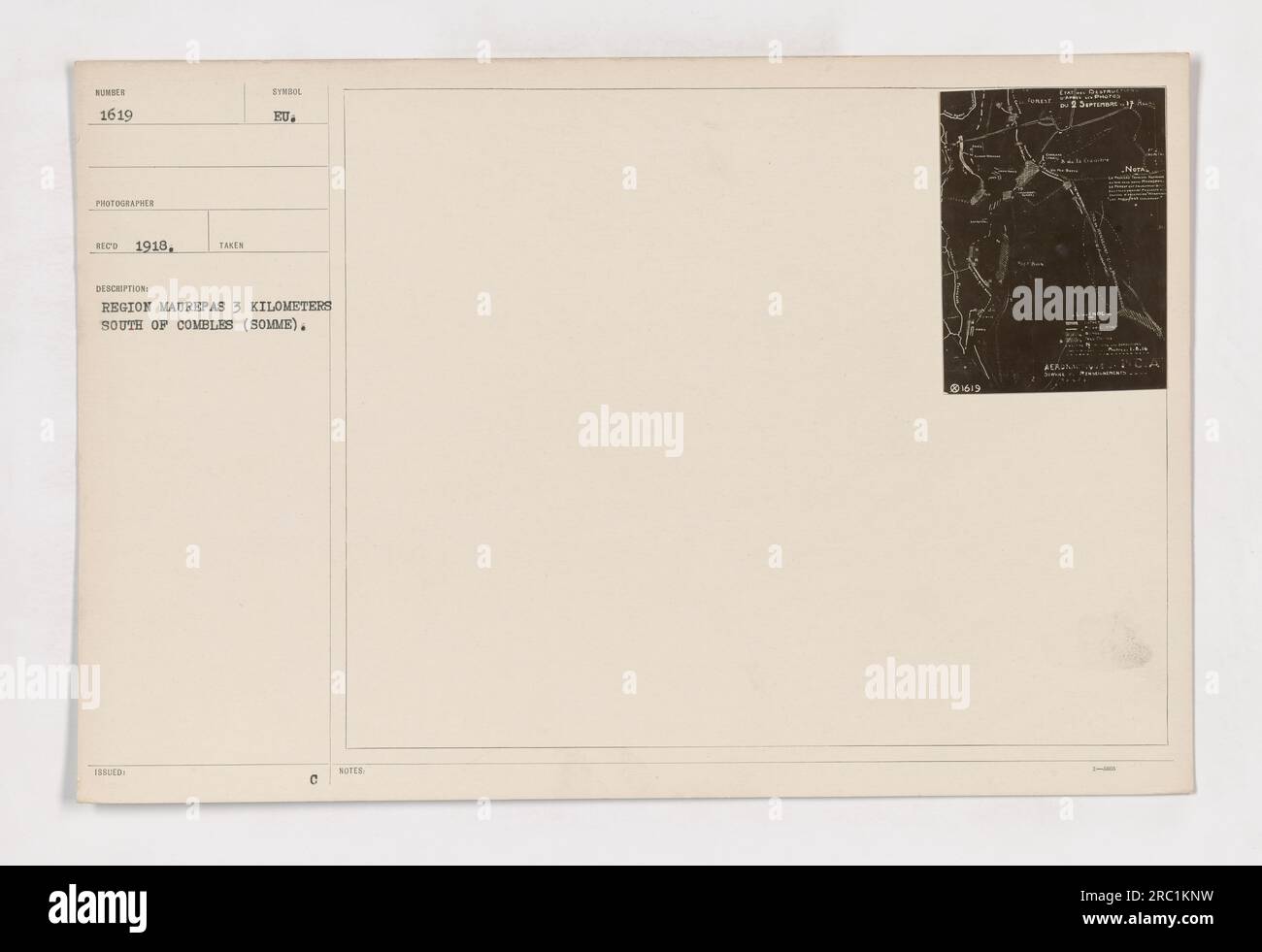 Aerial view of the region Maurepas, located 3 kilometers south of Combles (Somme), shown in the map. The number of the photograph is 111-SC-1619, taken and received in 1918. This image is part of a collection of photographs depicting American military activities during World War I. Stock Photohttps://www.alamy.com/image-license-details/?v=1https://www.alamy.com/aerial-view-of-the-region-maurepas-located-3-kilometers-south-of-combles-somme-shown-in-the-map-the-number-of-the-photograph-is-111-sc-1619-taken-and-received-in-1918-this-image-is-part-of-a-collection-of-photographs-depicting-american-military-activities-during-world-war-i-image558145109.html
RM2RC1KNW–Aerial view of the region Maurepas, located 3 kilometers south of Combles (Somme), shown in the map. The number of the photograph is 111-SC-1619, taken and received in 1918. This image is part of a collection of photographs depicting American military activities during World War I.
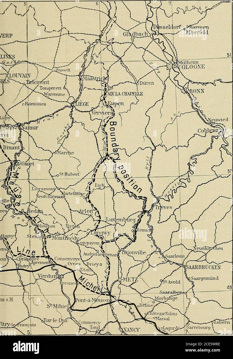 . Battlefields of the World War, western and southern fronts; a study in military geography . KMontdidierNovo eauvais P^^fff^W^ pChantillv FismesoTere-en-Tardenaii; Donna TTnatftair-Trriprry Fig. ss—Map of northern France with the main German defensive positions (dash lim THIRD SOMME BATTLE 209. owing the use made by the German military leaders of the natural topographic barriers. 210 BATTLEFIELD OF THE SOMME long sufficed to shield the enemy. That the barrier fell as soonas it did is undoubtedly due in part to the fact that the Germanarmy was no longer what it had been. Excessive losses hadgr Stock Photohttps://www.alamy.com/image-license-details/?v=1https://www.alamy.com/battlefields-of-the-world-war-western-and-southern-fronts-a-study-in-military-geography-kmontdidiernovo-eauvais-pfffw-pchantillv-fismesotere-en-tardenaii-donna-ttnatftair-trriprry-fig-ssmap-of-northern-france-with-the-main-german-defensive-positions-dash-lim-third-somme-battle-209-owing-the-use-made-by-the-german-military-leaders-of-the-natural-topographic-barriers-210-battlefield-of-the-somme-long-sufficed-to-shield-the-enemy-that-the-barrier-fell-as-soonas-it-did-is-undoubtedly-due-in-part-to-the-fact-that-the-germanarmy-was-no-longer-what-it-had-been-excessive-losses-hadgr-image370152930.html
RM2CE5WRE–. Battlefields of the World War, western and southern fronts; a study in military geography . KMontdidierNovo eauvais P^^fff^W^ pChantillv FismesoTere-en-Tardenaii; Donna TTnatftair-Trriprry Fig. ss—Map of northern France with the main German defensive positions (dash lim THIRD SOMME BATTLE 209. owing the use made by the German military leaders of the natural topographic barriers. 210 BATTLEFIELD OF THE SOMME long sufficed to shield the enemy. That the barrier fell as soonas it did is undoubtedly due in part to the fact that the Germanarmy was no longer what it had been. Excessive losses hadgr
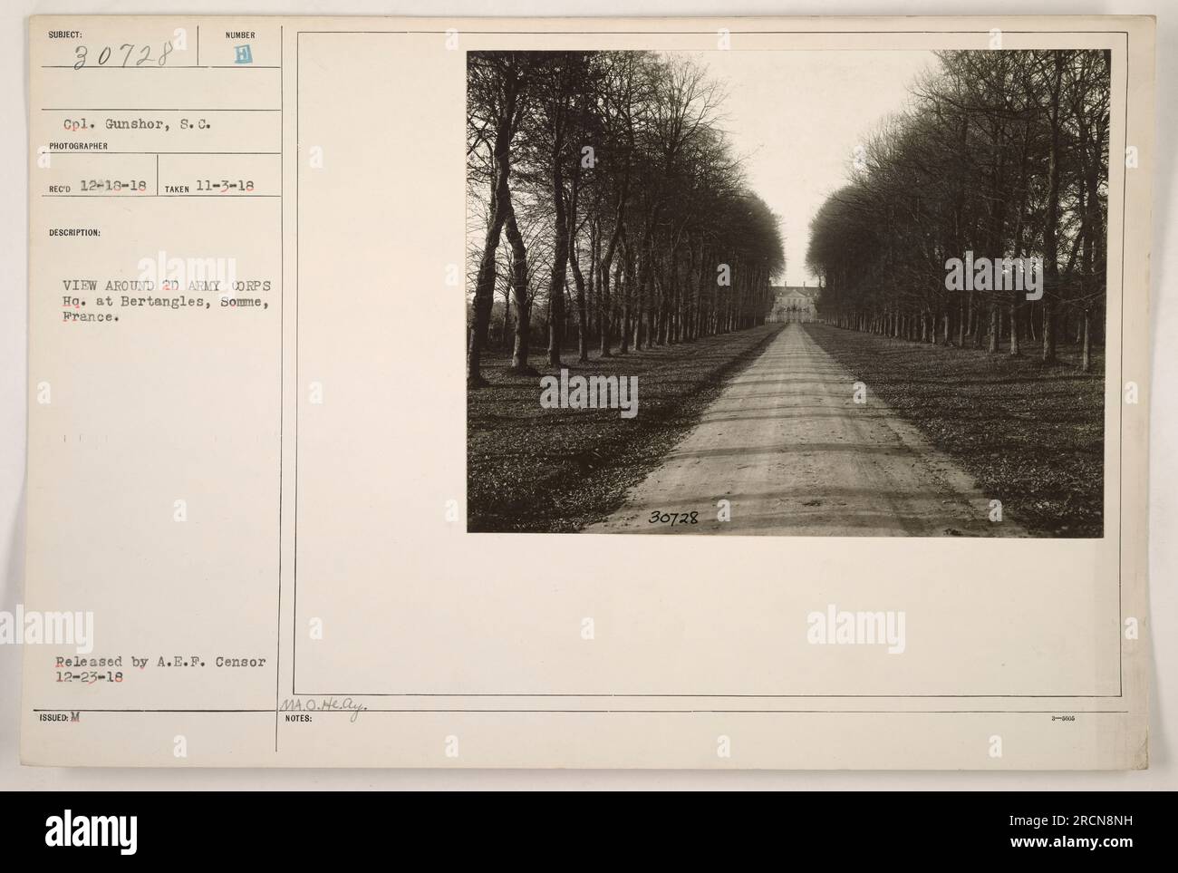 Soldier viewing the surroundings near the 2D Army Corps Headquarters in Bertangles, Somme, France. Photograph taken on November 3, 1918 by Cpl. Gunshor, S.C. Released by the A.E.F. Censor on December 23, 1918. Photo number is MA.O.A 30728. Stock Photohttps://www.alamy.com/image-license-details/?v=1https://www.alamy.com/soldier-viewing-the-surroundings-near-the-2d-army-corps-headquarters-in-bertangles-somme-france-photograph-taken-on-november-3-1918-by-cpl-gunshor-sc-released-by-the-aef-censor-on-december-23-1918-photo-number-is-maoa-30728-image558575517.html
RM2RCN8NH–Soldier viewing the surroundings near the 2D Army Corps Headquarters in Bertangles, Somme, France. Photograph taken on November 3, 1918 by Cpl. Gunshor, S.C. Released by the A.E.F. Censor on December 23, 1918. Photo number is MA.O.A 30728.
!['Battle of the Somme', First World War, 1916, (c1920). 'Successive Lines of Advance, North of the Somme: 1st July till 30th November, 1916'. Map of northern France showing 'Allies' Lines in black, Enemy Entrenchments [Germans] in red'. From "The Great World War: A History", Volume VI, edited by Frank A Mumby. [The Gresham Publishing Company Ltd, London, c1920] Stock Photo 'Battle of the Somme', First World War, 1916, (c1920). 'Successive Lines of Advance, North of the Somme: 1st July till 30th November, 1916'. Map of northern France showing 'Allies' Lines in black, Enemy Entrenchments [Germans] in red'. From "The Great World War: A History", Volume VI, edited by Frank A Mumby. [The Gresham Publishing Company Ltd, London, c1920] Stock Photo](https://c8.alamy.com/comp/2A8E7KH/battle-of-the-somme-first-world-war-1916-c1920-successive-lines-of-advance-north-of-the-somme-1st-july-till-30th-november-1916-map-of-northern-france-showing-allies-lines-in-black-enemy-entrenchments-germans-in-red-from-quotthe-great-world-war-a-historyquot-volume-vi-edited-by-frank-a-mumby-the-gresham-publishing-company-ltd-london-c1920-2A8E7KH.jpg) 'Battle of the Somme', First World War, 1916, (c1920). 'Successive Lines of Advance, North of the Somme: 1st July till 30th November, 1916'. Map of northern France showing 'Allies' Lines in black, Enemy Entrenchments [Germans] in red'. From "The Great World War: A History", Volume VI, edited by Frank A Mumby. [The Gresham Publishing Company Ltd, London, c1920] Stock Photohttps://www.alamy.com/image-license-details/?v=1https://www.alamy.com/battle-of-the-somme-first-world-war-1916-c1920-successive-lines-of-advance-north-of-the-somme-1st-july-till-30th-november-1916-map-of-northern-france-showing-allies-lines-in-black-enemy-entrenchments-germans-in-red-from-quotthe-great-world-war-a-historyquot-volume-vi-edited-by-frank-a-mumby-the-gresham-publishing-company-ltd-london-c1920-image332227605.html
'Battle of the Somme', First World War, 1916, (c1920). 'Successive Lines of Advance, North of the Somme: 1st July till 30th November, 1916'. Map of northern France showing 'Allies' Lines in black, Enemy Entrenchments [Germans] in red'. From "The Great World War: A History", Volume VI, edited by Frank A Mumby. [The Gresham Publishing Company Ltd, London, c1920] Stock Photohttps://www.alamy.com/image-license-details/?v=1https://www.alamy.com/battle-of-the-somme-first-world-war-1916-c1920-successive-lines-of-advance-north-of-the-somme-1st-july-till-30th-november-1916-map-of-northern-france-showing-allies-lines-in-black-enemy-entrenchments-germans-in-red-from-quotthe-great-world-war-a-historyquot-volume-vi-edited-by-frank-a-mumby-the-gresham-publishing-company-ltd-london-c1920-image332227605.htmlRM2A8E7KH–'Battle of the Somme', First World War, 1916, (c1920). 'Successive Lines of Advance, North of the Somme: 1st July till 30th November, 1916'. Map of northern France showing 'Allies' Lines in black, Enemy Entrenchments [Germans] in red'. From "The Great World War: A History", Volume VI, edited by Frank A Mumby. [The Gresham Publishing Company Ltd, London, c1920]
![. Battlefields of the World War, western and southern fronts; a study in military geography . :* oAmiens ? ? ?• •* :-- . as. .. .. StOuentid ? £, , G» • ?• v-o - • -••% y ,,-,> ???„•? ?t • /? s./t^fsreo ] Areas higherthan| | Areas la1 M00meters(328ft) ID0.meters(328ft.J Fig. 28—Map showing the in-fluence of the shallow northwest-southeast folds on the Sommebattlefield. The slightly upfoldedbelts (anticlines) remain on theaverage a little higher than thedown-folded belts (synclines). 94 BATTLEFIELD OF THE SOMME. .5 c STRATEGIC POSITION 95 Stock Photo . Battlefields of the World War, western and southern fronts; a study in military geography . :* oAmiens ? ? ?• •* :-- . as. .. .. StOuentid ? £, , G» • ?• v-o - • -••% y ,,-,> ???„•? ?t • /? s./t^fsreo ] Areas higherthan| | Areas la1 M00meters(328ft) ID0.meters(328ft.J Fig. 28—Map showing the in-fluence of the shallow northwest-southeast folds on the Sommebattlefield. The slightly upfoldedbelts (anticlines) remain on theaverage a little higher than thedown-folded belts (synclines). 94 BATTLEFIELD OF THE SOMME. .5 c STRATEGIC POSITION 95 Stock Photo](https://c8.alamy.com/comp/2CE5YCE/battlefields-of-the-world-war-western-and-southern-fronts-a-study-in-military-geography-oamiens-as-stouentid-g-v-o-y-gt-t-stfsreo-areas-higherthan-areas-la1-m00meters328ft-id0meters328ftj-fig-28map-showing-the-in-fluence-of-the-shallow-northwest-southeast-folds-on-the-sommebattlefield-the-slightly-upfoldedbelts-anticlines-remain-on-theaverage-a-little-higher-than-thedown-folded-belts-synclines-94-battlefield-of-the-somme-5-c-strategic-position-95-2CE5YCE.jpg) . Battlefields of the World War, western and southern fronts; a study in military geography . :* oAmiens ? ? ?• •* :-- . as. .. .. StOuentid ? £, , G» • ?• v-o - • -••% y ,,-,> ???„•? ?t • /? s./t^fsreo ] Areas higherthan| | Areas la1 M00meters(328ft) ID0.meters(328ft.J Fig. 28—Map showing the in-fluence of the shallow northwest-southeast folds on the Sommebattlefield. The slightly upfoldedbelts (anticlines) remain on theaverage a little higher than thedown-folded belts (synclines). 94 BATTLEFIELD OF THE SOMME. .5 c STRATEGIC POSITION 95 Stock Photohttps://www.alamy.com/image-license-details/?v=1https://www.alamy.com/battlefields-of-the-world-war-western-and-southern-fronts-a-study-in-military-geography-oamiens-as-stouentid-g-v-o-y-gt-t-stfsreo-areas-higherthan-areas-la1-m00meters328ft-id0meters328ftj-fig-28map-showing-the-in-fluence-of-the-shallow-northwest-southeast-folds-on-the-sommebattlefield-the-slightly-upfoldedbelts-anticlines-remain-on-theaverage-a-little-higher-than-thedown-folded-belts-synclines-94-battlefield-of-the-somme-5-c-strategic-position-95-image370154190.html
. Battlefields of the World War, western and southern fronts; a study in military geography . :* oAmiens ? ? ?• •* :-- . as. .. .. StOuentid ? £, , G» • ?• v-o - • -••% y ,,-,> ???„•? ?t • /? s./t^fsreo ] Areas higherthan| | Areas la1 M00meters(328ft) ID0.meters(328ft.J Fig. 28—Map showing the in-fluence of the shallow northwest-southeast folds on the Sommebattlefield. The slightly upfoldedbelts (anticlines) remain on theaverage a little higher than thedown-folded belts (synclines). 94 BATTLEFIELD OF THE SOMME. .5 c STRATEGIC POSITION 95 Stock Photohttps://www.alamy.com/image-license-details/?v=1https://www.alamy.com/battlefields-of-the-world-war-western-and-southern-fronts-a-study-in-military-geography-oamiens-as-stouentid-g-v-o-y-gt-t-stfsreo-areas-higherthan-areas-la1-m00meters328ft-id0meters328ftj-fig-28map-showing-the-in-fluence-of-the-shallow-northwest-southeast-folds-on-the-sommebattlefield-the-slightly-upfoldedbelts-anticlines-remain-on-theaverage-a-little-higher-than-thedown-folded-belts-synclines-94-battlefield-of-the-somme-5-c-strategic-position-95-image370154190.htmlRM2CE5YCE–. Battlefields of the World War, western and southern fronts; a study in military geography . :* oAmiens ? ? ?• •* :-- . as. .. .. StOuentid ? £, , G» • ?• v-o - • -••% y ,,-,> ???„•? ?t • /? s./t^fsreo ] Areas higherthan| | Areas la1 M00meters(328ft) ID0.meters(328ft.J Fig. 28—Map showing the in-fluence of the shallow northwest-southeast folds on the Sommebattlefield. The slightly upfoldedbelts (anticlines) remain on theaverage a little higher than thedown-folded belts (synclines). 94 BATTLEFIELD OF THE SOMME. .5 c STRATEGIC POSITION 95
!['Battle of the Somme', First World War, July 1916, (c1920). Map of northern France showing 'Successive Stages of Advance at the Fricourt Salient...British line in black, Enemy Defences [Germans] in red'. Also indicated are trenches, 'wire entanglement' and craters. From "The Great World War: A History", Volume VI, edited by Frank A Mumby. [The Gresham Publishing Company Ltd, London, c1920] Stock Photo 'Battle of the Somme', First World War, July 1916, (c1920). Map of northern France showing 'Successive Stages of Advance at the Fricourt Salient...British line in black, Enemy Defences [Germans] in red'. Also indicated are trenches, 'wire entanglement' and craters. From "The Great World War: A History", Volume VI, edited by Frank A Mumby. [The Gresham Publishing Company Ltd, London, c1920] Stock Photo](https://c8.alamy.com/comp/2A8E7JY/battle-of-the-somme-first-world-war-july-1916-c1920-map-of-northern-france-showing-successive-stages-of-advance-at-the-fricourt-salientbritish-line-in-black-enemy-defences-germans-in-red-also-indicated-are-trenches-wire-entanglement-and-craters-from-quotthe-great-world-war-a-historyquot-volume-vi-edited-by-frank-a-mumby-the-gresham-publishing-company-ltd-london-c1920-2A8E7JY.jpg) 'Battle of the Somme', First World War, July 1916, (c1920). Map of northern France showing 'Successive Stages of Advance at the Fricourt Salient...British line in black, Enemy Defences [Germans] in red'. Also indicated are trenches, 'wire entanglement' and craters. From "The Great World War: A History", Volume VI, edited by Frank A Mumby. [The Gresham Publishing Company Ltd, London, c1920] Stock Photohttps://www.alamy.com/image-license-details/?v=1https://www.alamy.com/battle-of-the-somme-first-world-war-july-1916-c1920-map-of-northern-france-showing-successive-stages-of-advance-at-the-fricourt-salientbritish-line-in-black-enemy-defences-germans-in-red-also-indicated-are-trenches-wire-entanglement-and-craters-from-quotthe-great-world-war-a-historyquot-volume-vi-edited-by-frank-a-mumby-the-gresham-publishing-company-ltd-london-c1920-image332227587.html
'Battle of the Somme', First World War, July 1916, (c1920). Map of northern France showing 'Successive Stages of Advance at the Fricourt Salient...British line in black, Enemy Defences [Germans] in red'. Also indicated are trenches, 'wire entanglement' and craters. From "The Great World War: A History", Volume VI, edited by Frank A Mumby. [The Gresham Publishing Company Ltd, London, c1920] Stock Photohttps://www.alamy.com/image-license-details/?v=1https://www.alamy.com/battle-of-the-somme-first-world-war-july-1916-c1920-map-of-northern-france-showing-successive-stages-of-advance-at-the-fricourt-salientbritish-line-in-black-enemy-defences-germans-in-red-also-indicated-are-trenches-wire-entanglement-and-craters-from-quotthe-great-world-war-a-historyquot-volume-vi-edited-by-frank-a-mumby-the-gresham-publishing-company-ltd-london-c1920-image332227587.htmlRM2A8E7JY–'Battle of the Somme', First World War, July 1916, (c1920). Map of northern France showing 'Successive Stages of Advance at the Fricourt Salient...British line in black, Enemy Defences [Germans] in red'. Also indicated are trenches, 'wire entanglement' and craters. From "The Great World War: A History", Volume VI, edited by Frank A Mumby. [The Gresham Publishing Company Ltd, London, c1920]
!['Map illustrating the German Retirement after the Battle of the Somme', (c1920). The First World War Battle of the Somme, fought between the armies of the British Empire and French Third Republic against the German Empire, took place between 1 July and 18 November 1916 on both sides of the River Somme in northern France. Showing the British and French lines, 'Approximate winter line before [Field Marshal von] Hindenburg's withdrawal', railways and canals. From "The Great World War: A History", Volume VII, edited by Frank A Mumby. [The Gresham Publishing Company Ltd, London, c1920] Stock Photo 'Map illustrating the German Retirement after the Battle of the Somme', (c1920). The First World War Battle of the Somme, fought between the armies of the British Empire and French Third Republic against the German Empire, took place between 1 July and 18 November 1916 on both sides of the River Somme in northern France. Showing the British and French lines, 'Approximate winter line before [Field Marshal von] Hindenburg's withdrawal', railways and canals. From "The Great World War: A History", Volume VII, edited by Frank A Mumby. [The Gresham Publishing Company Ltd, London, c1920] Stock Photo](https://c8.alamy.com/comp/2A8E7MH/map-illustrating-the-german-retirement-after-the-battle-of-the-somme-c1920-the-first-world-war-battle-of-the-somme-fought-between-the-armies-of-the-british-empire-and-french-third-republic-against-the-german-empire-took-place-between-1-july-and-18-november-1916-on-both-sides-of-the-river-somme-in-northern-france-showing-the-british-and-french-lines-approximate-winter-line-before-field-marshal-von-hindenburgs-withdrawal-railways-and-canals-from-quotthe-great-world-war-a-historyquot-volume-vii-edited-by-frank-a-mumby-the-gresham-publishing-company-ltd-london-c1920-2A8E7MH.jpg) 'Map illustrating the German Retirement after the Battle of the Somme', (c1920). The First World War Battle of the Somme, fought between the armies of the British Empire and French Third Republic against the German Empire, took place between 1 July and 18 November 1916 on both sides of the River Somme in northern France. Showing the British and French lines, 'Approximate winter line before [Field Marshal von] Hindenburg's withdrawal', railways and canals. From "The Great World War: A History", Volume VII, edited by Frank A Mumby. [The Gresham Publishing Company Ltd, London, c1920] Stock Photohttps://www.alamy.com/image-license-details/?v=1https://www.alamy.com/map-illustrating-the-german-retirement-after-the-battle-of-the-somme-c1920-the-first-world-war-battle-of-the-somme-fought-between-the-armies-of-the-british-empire-and-french-third-republic-against-the-german-empire-took-place-between-1-july-and-18-november-1916-on-both-sides-of-the-river-somme-in-northern-france-showing-the-british-and-french-lines-approximate-winter-line-before-field-marshal-von-hindenburgs-withdrawal-railways-and-canals-from-quotthe-great-world-war-a-historyquot-volume-vii-edited-by-frank-a-mumby-the-gresham-publishing-company-ltd-london-c1920-image332227633.html
'Map illustrating the German Retirement after the Battle of the Somme', (c1920). The First World War Battle of the Somme, fought between the armies of the British Empire and French Third Republic against the German Empire, took place between 1 July and 18 November 1916 on both sides of the River Somme in northern France. Showing the British and French lines, 'Approximate winter line before [Field Marshal von] Hindenburg's withdrawal', railways and canals. From "The Great World War: A History", Volume VII, edited by Frank A Mumby. [The Gresham Publishing Company Ltd, London, c1920] Stock Photohttps://www.alamy.com/image-license-details/?v=1https://www.alamy.com/map-illustrating-the-german-retirement-after-the-battle-of-the-somme-c1920-the-first-world-war-battle-of-the-somme-fought-between-the-armies-of-the-british-empire-and-french-third-republic-against-the-german-empire-took-place-between-1-july-and-18-november-1916-on-both-sides-of-the-river-somme-in-northern-france-showing-the-british-and-french-lines-approximate-winter-line-before-field-marshal-von-hindenburgs-withdrawal-railways-and-canals-from-quotthe-great-world-war-a-historyquot-volume-vii-edited-by-frank-a-mumby-the-gresham-publishing-company-ltd-london-c1920-image332227633.htmlRM2A8E7MH–'Map illustrating the German Retirement after the Battle of the Somme', (c1920). The First World War Battle of the Somme, fought between the armies of the British Empire and French Third Republic against the German Empire, took place between 1 July and 18 November 1916 on both sides of the River Somme in northern France. Showing the British and French lines, 'Approximate winter line before [Field Marshal von] Hindenburg's withdrawal', railways and canals. From "The Great World War: A History", Volume VII, edited by Frank A Mumby. [The Gresham Publishing Company Ltd, London, c1920]
!['The Battlefields of the Aisne, Oise and Somme', 1915. Battlefields of the Western Front during World War One. From "The War Illustrated Album De Luxe - Volume I. The First Phase", edited by J. A. Hammerton. [The Amalgamated Press, Limited, London, 1915] Stock Photo 'The Battlefields of the Aisne, Oise and Somme', 1915. Battlefields of the Western Front during World War One. From "The War Illustrated Album De Luxe - Volume I. The First Phase", edited by J. A. Hammerton. [The Amalgamated Press, Limited, London, 1915] Stock Photo](https://c8.alamy.com/comp/2A8E9GA/the-battlefields-of-the-aisne-oise-and-somme-1915-battlefields-of-the-western-front-during-world-war-one-from-quotthe-war-illustrated-album-de-luxe-volume-i-the-first-phasequot-edited-by-j-a-hammerton-the-amalgamated-press-limited-london-1915-2A8E9GA.jpg) 'The Battlefields of the Aisne, Oise and Somme', 1915. Battlefields of the Western Front during World War One. From "The War Illustrated Album De Luxe - Volume I. The First Phase", edited by J. A. Hammerton. [The Amalgamated Press, Limited, London, 1915] Stock Photohttps://www.alamy.com/image-license-details/?v=1https://www.alamy.com/the-battlefields-of-the-aisne-oise-and-somme-1915-battlefields-of-the-western-front-during-world-war-one-from-quotthe-war-illustrated-album-de-luxe-volume-i-the-first-phasequot-edited-by-j-a-hammerton-the-amalgamated-press-limited-london-1915-image332229082.html
'The Battlefields of the Aisne, Oise and Somme', 1915. Battlefields of the Western Front during World War One. From "The War Illustrated Album De Luxe - Volume I. The First Phase", edited by J. A. Hammerton. [The Amalgamated Press, Limited, London, 1915] Stock Photohttps://www.alamy.com/image-license-details/?v=1https://www.alamy.com/the-battlefields-of-the-aisne-oise-and-somme-1915-battlefields-of-the-western-front-during-world-war-one-from-quotthe-war-illustrated-album-de-luxe-volume-i-the-first-phasequot-edited-by-j-a-hammerton-the-amalgamated-press-limited-london-1915-image332229082.htmlRM2A8E9GA–'The Battlefields of the Aisne, Oise and Somme', 1915. Battlefields of the Western Front during World War One. From "The War Illustrated Album De Luxe - Volume I. The First Phase", edited by J. A. Hammerton. [The Amalgamated Press, Limited, London, 1915]
!['The Battles of the Ancre', northern France, First World War, 1916-1917, (c1920). '...map illustrating the successive British advances from October, 1916, to February 28, 1917'. From "The Great World War: A History", Volume VI, edited by Frank A Mumby. [The Gresham Publishing Company Ltd, London, c1920] Stock Photo 'The Battles of the Ancre', northern France, First World War, 1916-1917, (c1920). '...map illustrating the successive British advances from October, 1916, to February 28, 1917'. From "The Great World War: A History", Volume VI, edited by Frank A Mumby. [The Gresham Publishing Company Ltd, London, c1920] Stock Photo](https://c8.alamy.com/comp/2A8E7MW/the-battles-of-the-ancre-northern-france-first-world-war-1916-1917-c1920-map-illustrating-the-successive-british-advances-from-october-1916-to-february-28-1917-from-quotthe-great-world-war-a-historyquot-volume-vi-edited-by-frank-a-mumby-the-gresham-publishing-company-ltd-london-c1920-2A8E7MW.jpg) 'The Battles of the Ancre', northern France, First World War, 1916-1917, (c1920). '...map illustrating the successive British advances from October, 1916, to February 28, 1917'. From "The Great World War: A History", Volume VI, edited by Frank A Mumby. [The Gresham Publishing Company Ltd, London, c1920] Stock Photohttps://www.alamy.com/image-license-details/?v=1https://www.alamy.com/the-battles-of-the-ancre-northern-france-first-world-war-1916-1917-c1920-map-illustrating-the-successive-british-advances-from-october-1916-to-february-28-1917-from-quotthe-great-world-war-a-historyquot-volume-vi-edited-by-frank-a-mumby-the-gresham-publishing-company-ltd-london-c1920-image332227641.html
'The Battles of the Ancre', northern France, First World War, 1916-1917, (c1920). '...map illustrating the successive British advances from October, 1916, to February 28, 1917'. From "The Great World War: A History", Volume VI, edited by Frank A Mumby. [The Gresham Publishing Company Ltd, London, c1920] Stock Photohttps://www.alamy.com/image-license-details/?v=1https://www.alamy.com/the-battles-of-the-ancre-northern-france-first-world-war-1916-1917-c1920-map-illustrating-the-successive-british-advances-from-october-1916-to-february-28-1917-from-quotthe-great-world-war-a-historyquot-volume-vi-edited-by-frank-a-mumby-the-gresham-publishing-company-ltd-london-c1920-image332227641.htmlRM2A8E7MW–'The Battles of the Ancre', northern France, First World War, 1916-1917, (c1920). '...map illustrating the successive British advances from October, 1916, to February 28, 1917'. From "The Great World War: A History", Volume VI, edited by Frank A Mumby. [The Gresham Publishing Company Ltd, London, c1920]
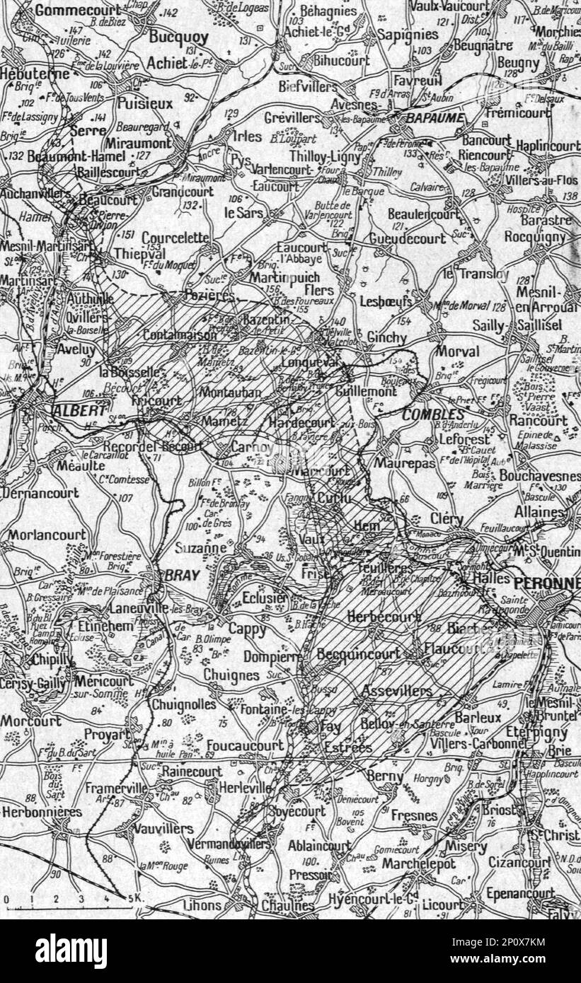 'La Guerre 20-26 juillet 1916; Carte-croquis du terrain au Nord et au Sud de la Somme. Le grise indique l'avance franco-britannique a la date du 26 juillet', 1916. From "Collection de la Guerre IV. L'Illustration Tome CXLVIII. La Guerre Juillet, Aout, Septembre, Octobre, Novembre, Decembre 1916". Stock Photohttps://www.alamy.com/image-license-details/?v=1https://www.alamy.com/la-guerre-20-26-juillet-1916-carte-croquis-du-terrain-au-nord-et-au-sud-de-la-somme-le-grise-indique-lavance-franco-britannique-a-la-date-du-26-juillet-1916-from-quotcollection-de-la-guerre-iv-lillustration-tome-cxlviii-la-guerre-juillet-aout-septembre-octobre-novembre-decembre-1916quot-image534098200.html
RM2P0X7KM–'La Guerre 20-26 juillet 1916; Carte-croquis du terrain au Nord et au Sud de la Somme. Le grise indique l'avance franco-britannique a la date du 26 juillet', 1916. From "Collection de la Guerre IV. L'Illustration Tome CXLVIII. La Guerre Juillet, Aout, Septembre, Octobre, Novembre, Decembre 1916".
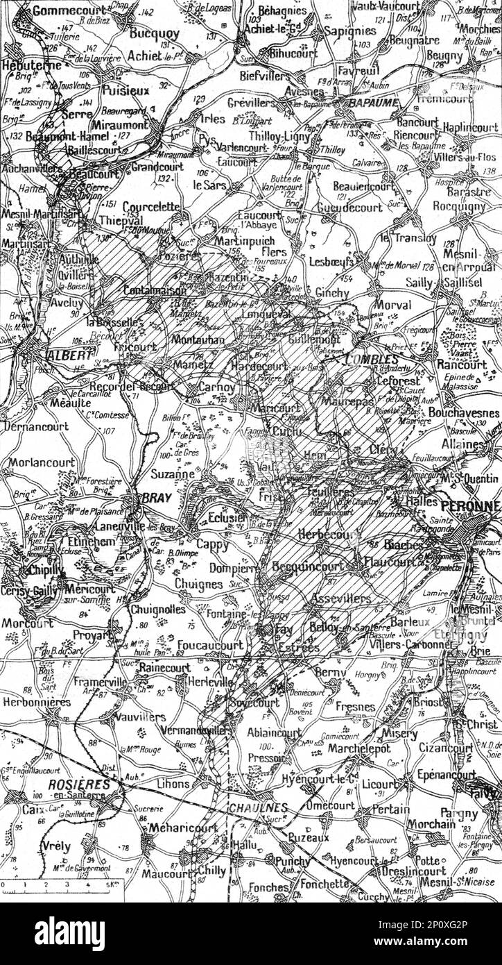 'Ensemble du terrain des offensives franco-britanniques au Nord et au Sud de la Somme. Le grise indique l'avance realisee a la date 5 septembre. Le 6, nous avons pris Berny, au S-E d'Estrees, et progresse entre Chaulnes ey Chilly', 1916. From "Collection de la Guerre IV. L'Illustration Tome CXLVIII. La Guerre Juillet, Aout, Septembre, Octobre, Novembre, Decembre 1916". Stock Photohttps://www.alamy.com/image-license-details/?v=1https://www.alamy.com/ensemble-du-terrain-des-offensives-franco-britanniques-au-nord-et-au-sud-de-la-somme-le-grise-indique-lavance-realisee-a-la-date-5-septembre-le-6-nous-avons-pris-berny-au-s-e-destrees-et-progresse-entre-chaulnes-ey-chilly-1916-from-quotcollection-de-la-guerre-iv-lillustration-tome-cxlviii-la-guerre-juillet-aout-septembre-octobre-novembre-decembre-1916quot-image534104782.html
RM2P0XG2P–'Ensemble du terrain des offensives franco-britanniques au Nord et au Sud de la Somme. Le grise indique l'avance realisee a la date 5 septembre. Le 6, nous avons pris Berny, au S-E d'Estrees, et progresse entre Chaulnes ey Chilly', 1916. From "Collection de la Guerre IV. L'Illustration Tome CXLVIII. La Guerre Juillet, Aout, Septembre, Octobre, Novembre, Decembre 1916".
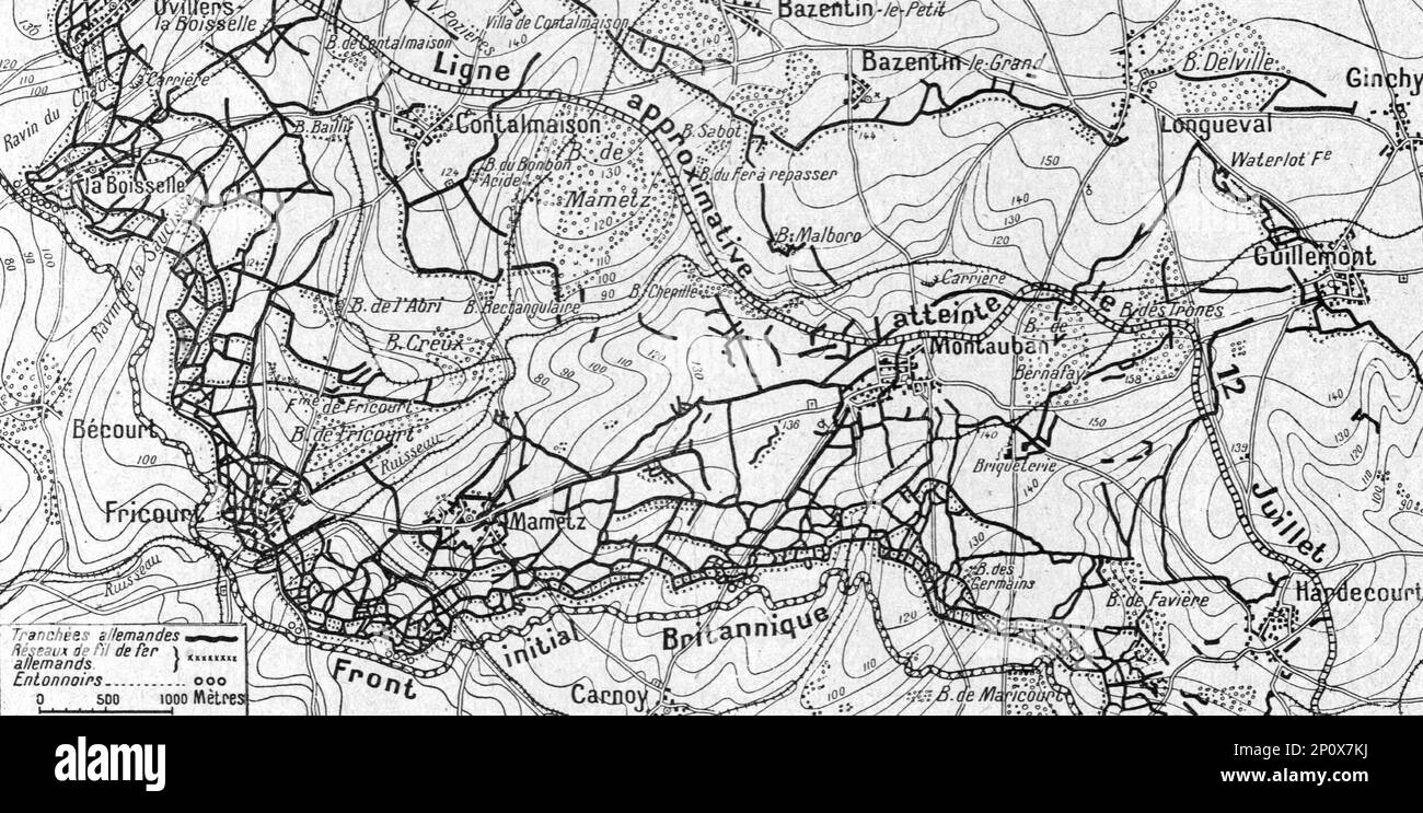 'La Guerre 20-26 juillet 1916; cartes des ouvrages allemands d'Ovillers a Hardecourt, communiquee officiellement a la presse britannique, et mont la force et la complexite des organisations que nos allies ont trouvees devant aux', 1916. From "Collection de la Guerre IV. L'Illustration Tome CXLVIII. La Guerre Juillet, Aout, Septembre, Octobre, Novembre, Decembre 1916". Stock Photohttps://www.alamy.com/image-license-details/?v=1https://www.alamy.com/la-guerre-20-26-juillet-1916-cartes-des-ouvrages-allemands-dovillers-a-hardecourt-communiquee-officiellement-a-la-presse-britannique-et-mont-la-force-et-la-complexite-des-organisations-que-nos-allies-ont-trouvees-devant-aux-1916-from-quotcollection-de-la-guerre-iv-lillustration-tome-cxlviii-la-guerre-juillet-aout-septembre-octobre-novembre-decembre-1916quot-image534098198.html
RM2P0X7KJ–'La Guerre 20-26 juillet 1916; cartes des ouvrages allemands d'Ovillers a Hardecourt, communiquee officiellement a la presse britannique, et mont la force et la complexite des organisations que nos allies ont trouvees devant aux', 1916. From "Collection de la Guerre IV. L'Illustration Tome CXLVIII. La Guerre Juillet, Aout, Septembre, Octobre, Novembre, Decembre 1916".