Ancient map of jerusalem Stock Photos and Images
(3,015)See ancient map of jerusalem stock video clipsQuick filters:
Ancient map of jerusalem Stock Photos and Images
 Ancient 6th Century Map Jerusalem Mosaic Saint George Greek Orthodox Church Madaba Jordan. Mosaic discovered 1884 and depicts the Holy Land Stock Photohttps://www.alamy.com/image-license-details/?v=1https://www.alamy.com/stock-photo-ancient-6th-century-map-jerusalem-mosaic-saint-george-greek-orthodox-130603917.html
RFHGDEHH–Ancient 6th Century Map Jerusalem Mosaic Saint George Greek Orthodox Church Madaba Jordan. Mosaic discovered 1884 and depicts the Holy Land
 Ancient Map of Jerusalem Madaba Jordan Stock Photohttps://www.alamy.com/image-license-details/?v=1https://www.alamy.com/ancient-map-of-jerusalem-madaba-jordan-image4546236.html
RMAFEPBD–Ancient Map of Jerusalem Madaba Jordan
 Map of Old Jerusalem Stock Photohttps://www.alamy.com/image-license-details/?v=1https://www.alamy.com/map-of-old-jerusalem-image634323004.html
RM2YRYWD0–Map of Old Jerusalem
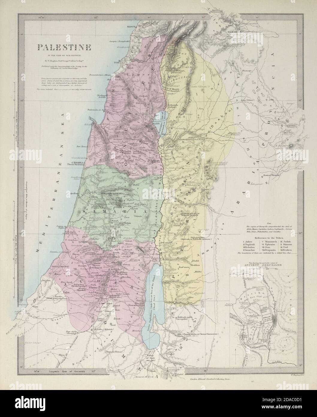 PALESTINE in the time of Our Saviour. Ancient Jerusalem. Israel. SDUK 1857 map Stock Photohttps://www.alamy.com/image-license-details/?v=1https://www.alamy.com/palestine-in-the-time-of-our-saviour-ancient-jerusalem-israel-sduk-1857-map-image385038445.html
RF2DAC0D1–PALESTINE in the time of Our Saviour. Ancient Jerusalem. Israel. SDUK 1857 map
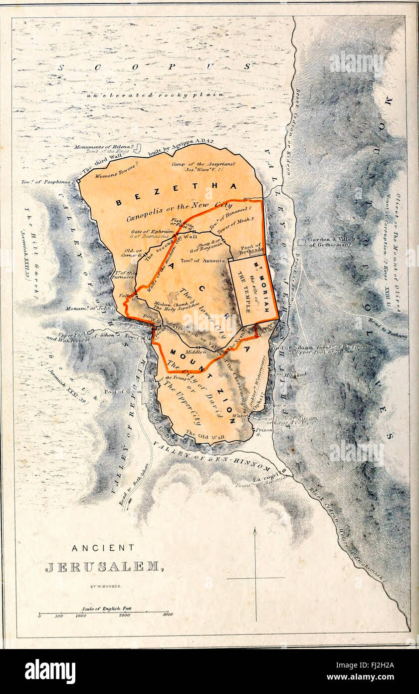 Map of Plan of Ancient Jerusalem Stock Photohttps://www.alamy.com/image-license-details/?v=1https://www.alamy.com/stock-photo-map-of-plan-of-ancient-jerusalem-97172946.html
RMFJ2H2A–Map of Plan of Ancient Jerusalem
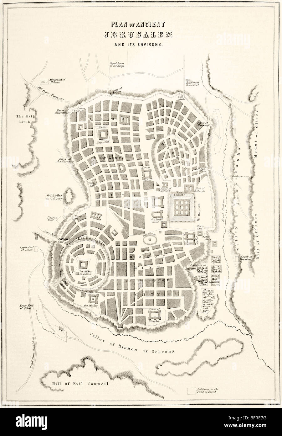 Plan of ancient Jerusalem as it was presumed to be at the time of Jesus Christ Stock Photohttps://www.alamy.com/image-license-details/?v=1https://www.alamy.com/stock-photo-plan-of-ancient-jerusalem-as-it-was-presumed-to-be-at-the-time-of-26946292.html
RMBFRE7G–Plan of ancient Jerusalem as it was presumed to be at the time of Jesus Christ
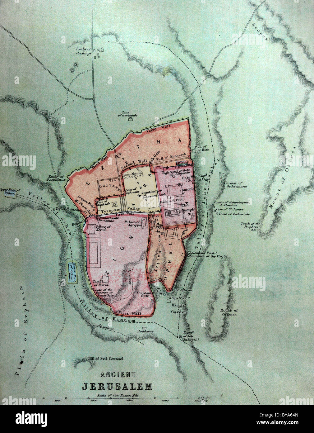 Map Of Ancient Jerusalem In Old Bible Stock Photohttps://www.alamy.com/image-license-details/?v=1https://www.alamy.com/stock-photo-map-of-ancient-jerusalem-in-old-bible-34030437.html
RMBYA64N–Map Of Ancient Jerusalem In Old Bible
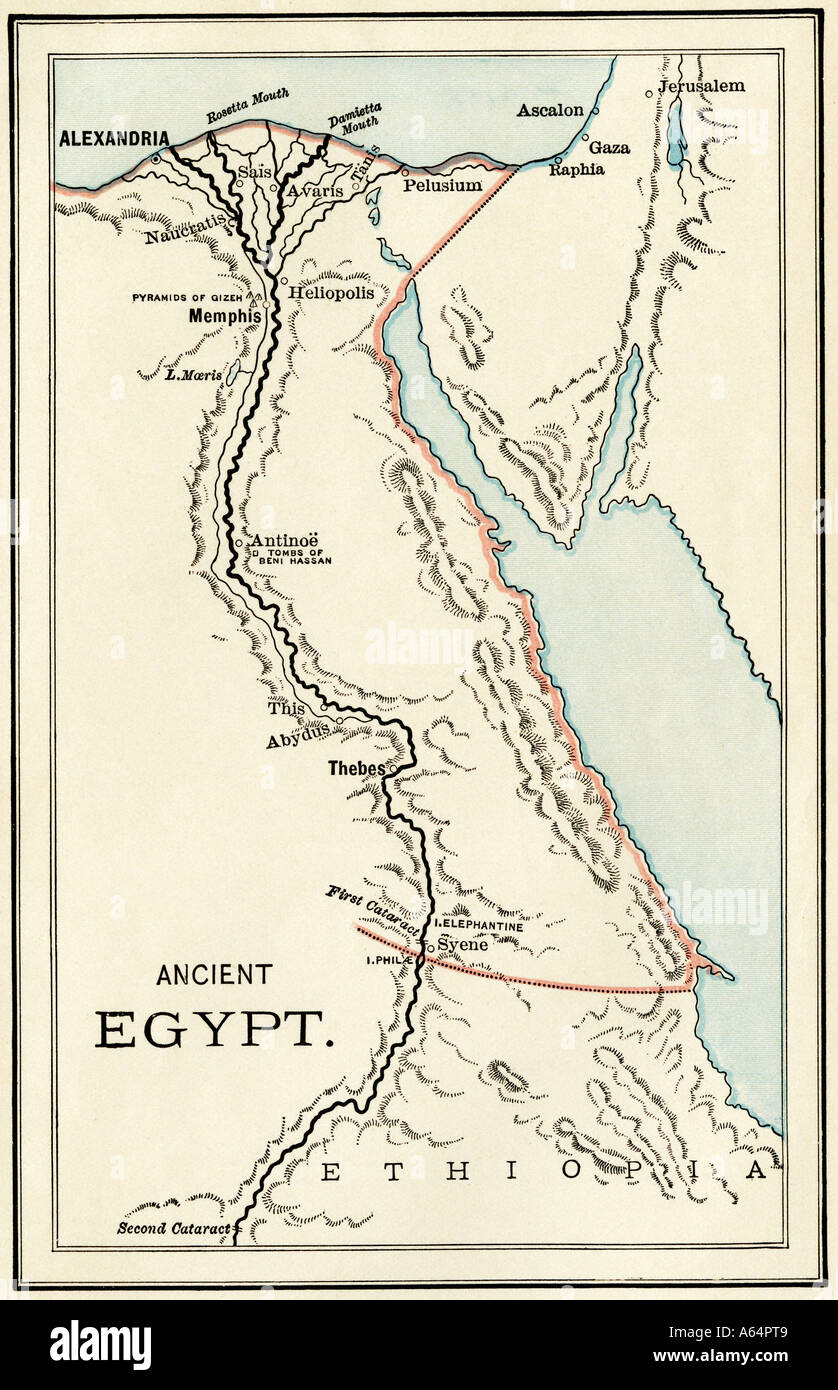 Map of important sites in ancient Egypt. Color lithograph Stock Photohttps://www.alamy.com/image-license-details/?v=1https://www.alamy.com/map-of-important-sites-in-ancient-egypt-color-lithograph-image6548744.html
RMA64PT9–Map of important sites in ancient Egypt. Color lithograph
 Walled city of Jerusalem Part of the Ancient Madaba Mosaic Map Jordan Stock Photohttps://www.alamy.com/image-license-details/?v=1https://www.alamy.com/walled-city-of-jerusalem-part-of-the-ancient-madaba-mosaic-map-jordan-image7105905.html
RMA9TCR2–Walled city of Jerusalem Part of the Ancient Madaba Mosaic Map Jordan
 The Holy and Expanded City of Jerusalem, First Known as Salem by Visscher, Claes Jansz in 1756 reprint ( originally 1643 ) Stock Photohttps://www.alamy.com/image-license-details/?v=1https://www.alamy.com/the-holy-and-expanded-city-of-jerusalem-first-known-as-salem-by-visscher-claes-jansz-in-1756-reprint-originally-1643-image603562316.html
RM2X1XHW0–The Holy and Expanded City of Jerusalem, First Known as Salem by Visscher, Claes Jansz in 1756 reprint ( originally 1643 )
 Ancient mosaic of Jerusalem of Madaba map on postage stamps Stock Photohttps://www.alamy.com/image-license-details/?v=1https://www.alamy.com/ancient-mosaic-of-jerusalem-of-madaba-map-on-postage-stamps-image566986631.html
RF2RXCD6F–Ancient mosaic of Jerusalem of Madaba map on postage stamps
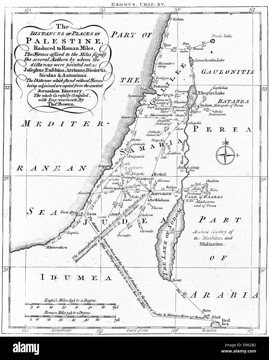 Map of Palestine showing distances in Roman miles. Based on various ancient authors and the ' Jerusalem Itinerary'. Engraving c1830. Stock Photohttps://www.alamy.com/image-license-details/?v=1https://www.alamy.com/stock-photo-map-of-palestine-showing-distances-in-roman-miles-based-on-various-57296598.html
RMD962B2–Map of Palestine showing distances in Roman miles. Based on various ancient authors and the ' Jerusalem Itinerary'. Engraving c1830.
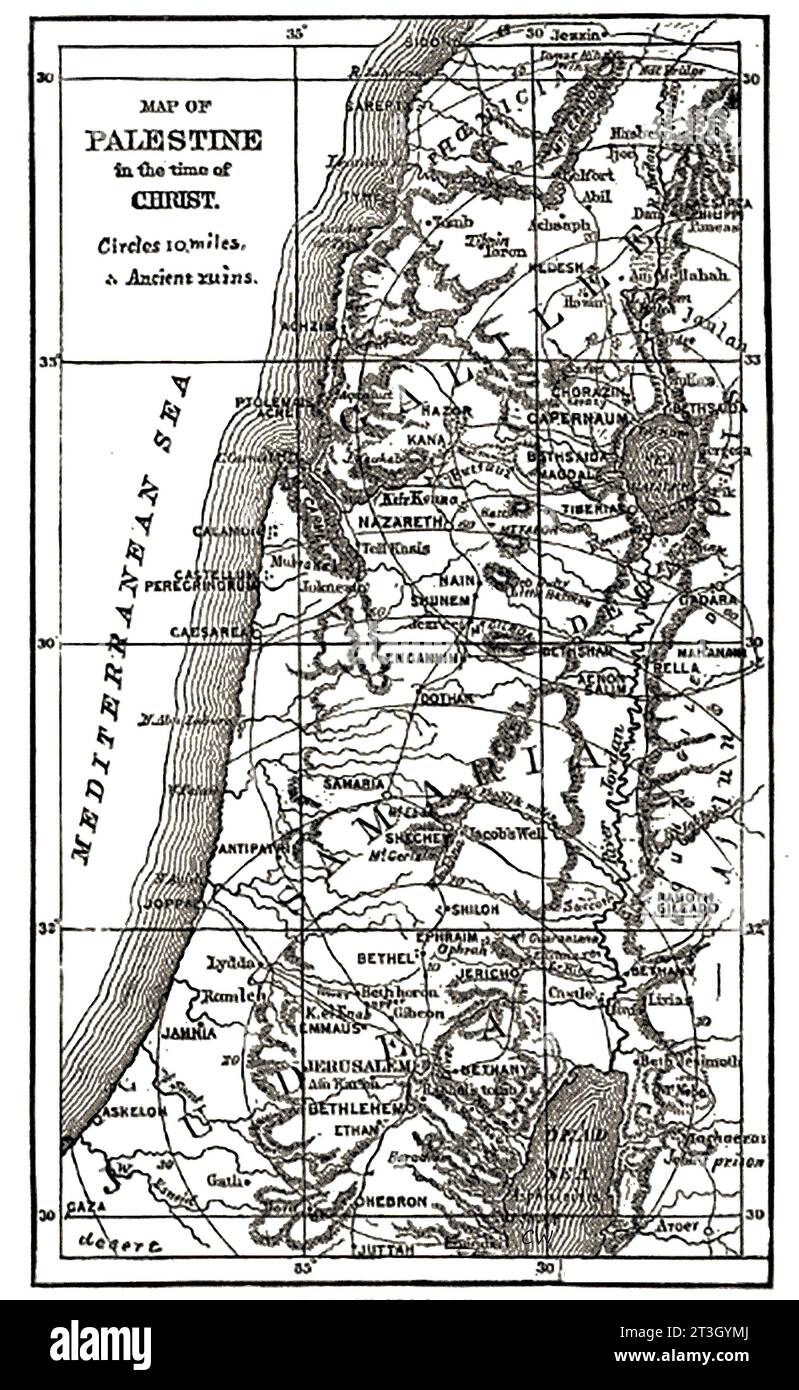 1874 map of Ancient Palestine at the time of Christ. Stock Photohttps://www.alamy.com/image-license-details/?v=1https://www.alamy.com/1874-map-of-ancient-palestine-at-the-time-of-christ-image570159090.html
RM2T3GYMJ–1874 map of Ancient Palestine at the time of Christ.
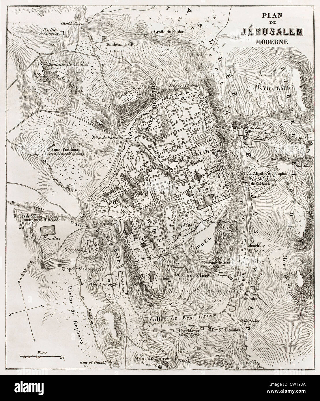 Jerusalem old map Stock Photohttps://www.alamy.com/image-license-details/?v=1https://www.alamy.com/stock-photo-jerusalem-old-map-50335246.html
RFCWTY3A–Jerusalem old map
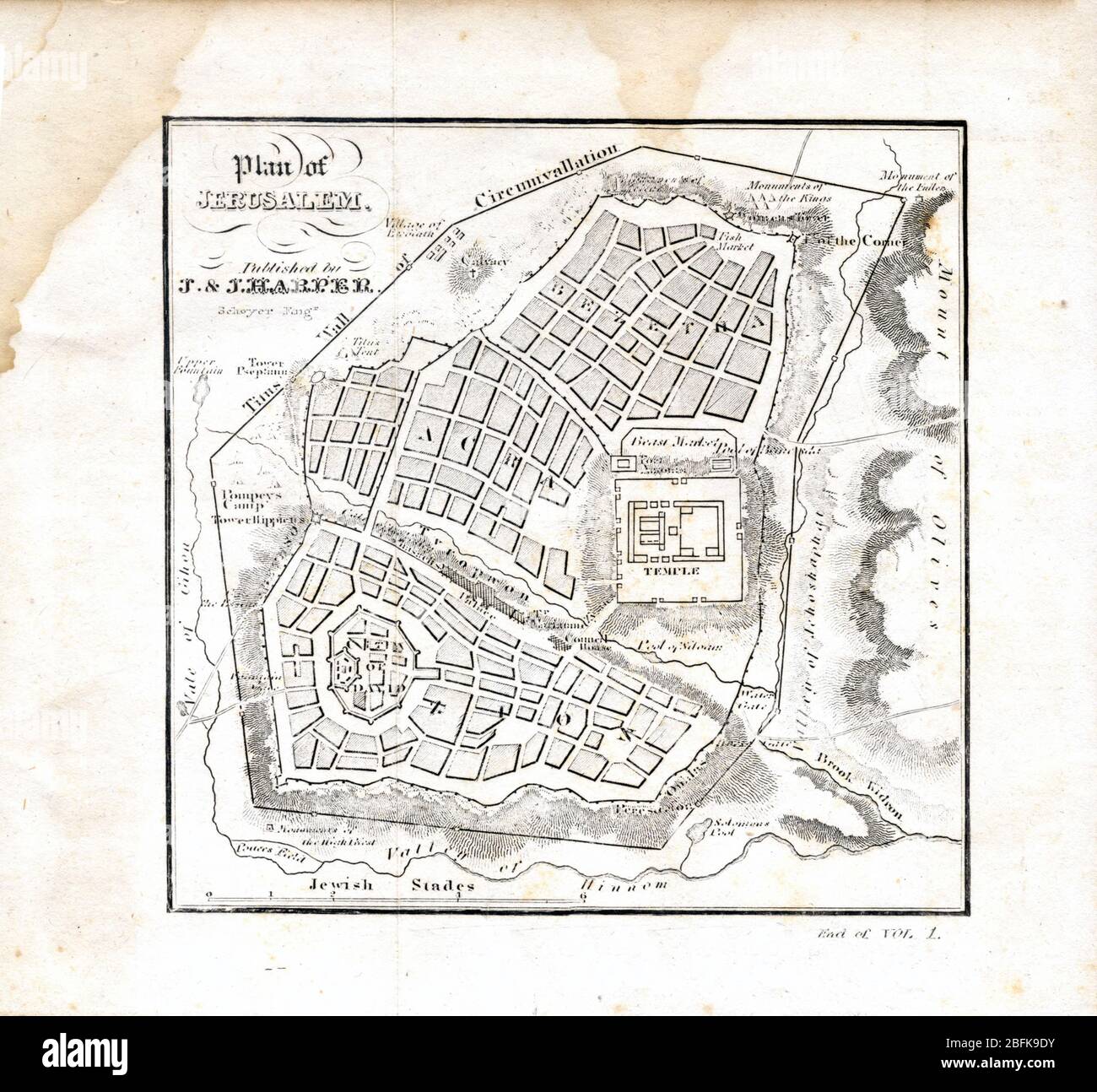 Plan of Jerusalem 1841 Originally from 'The history of the Jews : from the earliest period to the present time' Scanned map showing mid 19th century interpretation of ancient Jerusalem Stock Photohttps://www.alamy.com/image-license-details/?v=1https://www.alamy.com/plan-of-jerusalem-1841-originally-from-the-history-of-the-jews-from-the-earliest-period-to-the-present-time-scanned-map-showing-mid-19th-century-interpretation-of-ancient-jerusalem-image353851735.html
RM2BFK9DY–Plan of Jerusalem 1841 Originally from 'The history of the Jews : from the earliest period to the present time' Scanned map showing mid 19th century interpretation of ancient Jerusalem
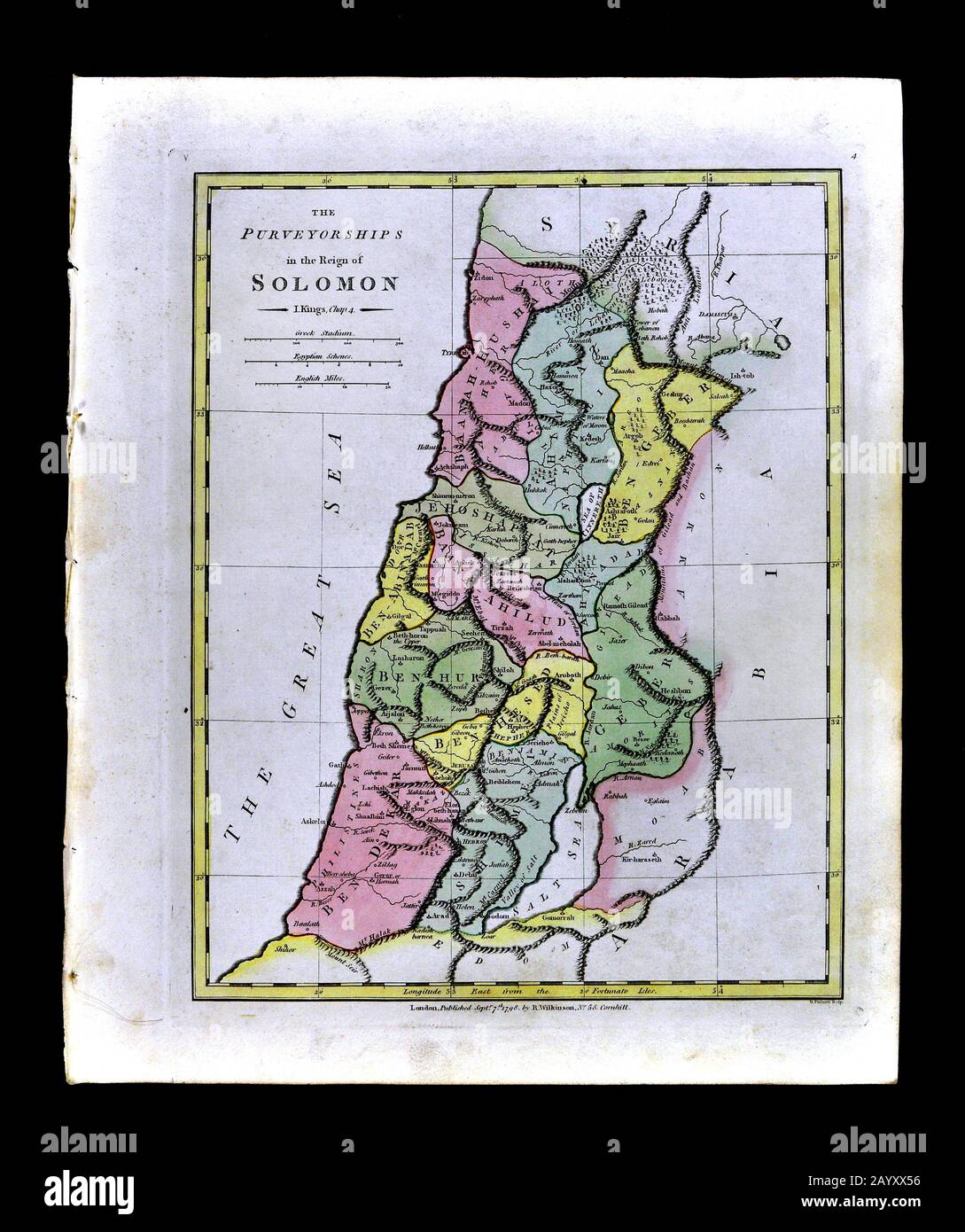 1808 Wilkinson Map Kingdom of Solomon Old Testament Holy Land Ancient Palestine Palestina Jerusalem Stock Photohttps://www.alamy.com/image-license-details/?v=1https://www.alamy.com/1808-wilkinson-map-kingdom-of-solomon-old-testament-holy-land-ancient-palestine-palestina-jerusalem-image344183986.html
RM2AYXX56–1808 Wilkinson Map Kingdom of Solomon Old Testament Holy Land Ancient Palestine Palestina Jerusalem
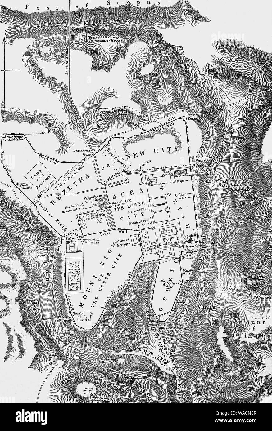 A map of Jerusalem following the death of Jesus Christ. King Herod the Great, (73 – 4 BCE) ruled over the Jews in Israel following his appointment by the Roman conquerers. Once he was king, Herod launched an ambitious building program, both in Jerusalem and the spectacular port city of Caesarea, named after the emperor. He restored the magnificent Jerusalem temple, which was later destroyed by the Romans following a rebellion in A.D. 70. Stock Photohttps://www.alamy.com/image-license-details/?v=1https://www.alamy.com/a-map-of-jerusalem-following-the-death-of-jesus-christ-king-herod-the-great-73-4-bce-ruled-over-the-jews-in-israel-following-his-appointment-by-the-roman-conquerers-once-he-was-king-herod-launched-an-ambitious-building-program-both-in-jerusalem-and-the-spectacular-port-city-of-caesarea-named-after-the-emperor-he-restored-the-magnificent-jerusalem-temple-which-was-later-destroyed-by-the-romans-following-a-rebellion-in-ad-70-image264582215.html
RMWACN8R–A map of Jerusalem following the death of Jesus Christ. King Herod the Great, (73 – 4 BCE) ruled over the Jews in Israel following his appointment by the Roman conquerers. Once he was king, Herod launched an ambitious building program, both in Jerusalem and the spectacular port city of Caesarea, named after the emperor. He restored the magnificent Jerusalem temple, which was later destroyed by the Romans following a rebellion in A.D. 70.
 Plan of Jerusalem from The Exploration of the World, Celebrated Travels and Travellers, Celebrated Voyages by Jules Verne nonfiction. Published in three volumes from 1878 to 1880, Celebrated Travels and Travelers is a history of the explorers and adventurers who voyaged to the far reaches of the globe, discovered the wonders of exotic lands, and filled in the blank spaces on the world map. With illustrations by L. Benett and P. Philippoteaux, Stock Photohttps://www.alamy.com/image-license-details/?v=1https://www.alamy.com/plan-of-jerusalem-from-the-exploration-of-the-world-celebrated-travels-and-travellers-celebrated-voyages-by-jules-verne-nonfiction-published-in-three-volumes-from-1878-to-1880-celebrated-travels-and-travelers-is-a-history-of-the-explorers-and-adventurers-who-voyaged-to-the-far-reaches-of-the-globe-discovered-the-wonders-of-exotic-lands-and-filled-in-the-blank-spaces-on-the-world-map-with-illustrations-by-l-benett-and-p-philippoteaux-image458407732.html
RF2HHP7MM–Plan of Jerusalem from The Exploration of the World, Celebrated Travels and Travellers, Celebrated Voyages by Jules Verne nonfiction. Published in three volumes from 1878 to 1880, Celebrated Travels and Travelers is a history of the explorers and adventurers who voyaged to the far reaches of the globe, discovered the wonders of exotic lands, and filled in the blank spaces on the world map. With illustrations by L. Benett and P. Philippoteaux,
 Illustration of Old City map with eight gates in Jerusalem, Israel on blue background Stock Photohttps://www.alamy.com/image-license-details/?v=1https://www.alamy.com/stock-photo-illustration-of-old-city-map-with-eight-gates-in-jerusalem-israel-89675408.html
RFF5W1W4–Illustration of Old City map with eight gates in Jerusalem, Israel on blue background
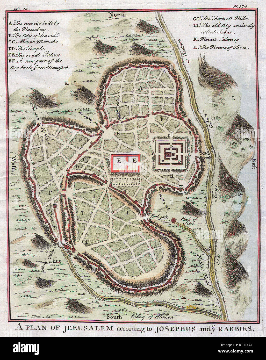 1730, Street Map or Plan of Jerusalem Stock Photohttps://www.alamy.com/image-license-details/?v=1https://www.alamy.com/stock-image-1730-street-map-or-plan-of-jerusalem-162575236.html
RMKCDXAC–1730, Street Map or Plan of Jerusalem
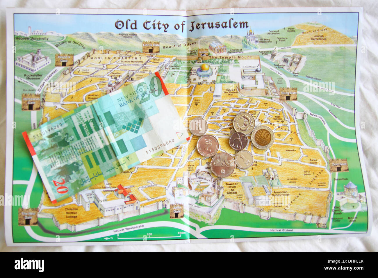 This is map of the old city of Jerusalem in Israel, with the ancient currency of Shekels on top. Stock Photohttps://www.alamy.com/image-license-details/?v=1https://www.alamy.com/this-is-map-of-the-old-city-of-jerusalem-in-israel-with-the-ancient-image62574587.html
RMDHPEEK–This is map of the old city of Jerusalem in Israel, with the ancient currency of Shekels on top.
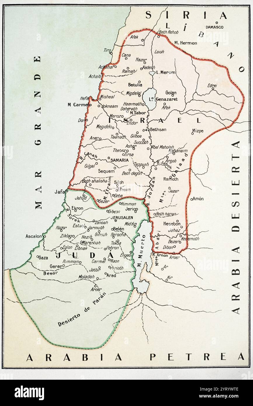 Map of the Kingdoms of Judah and Israel Stock Photohttps://www.alamy.com/image-license-details/?v=1https://www.alamy.com/map-of-the-kingdoms-of-judah-and-israel-image634323326.html
RM2YRYWTE–Map of the Kingdoms of Judah and Israel
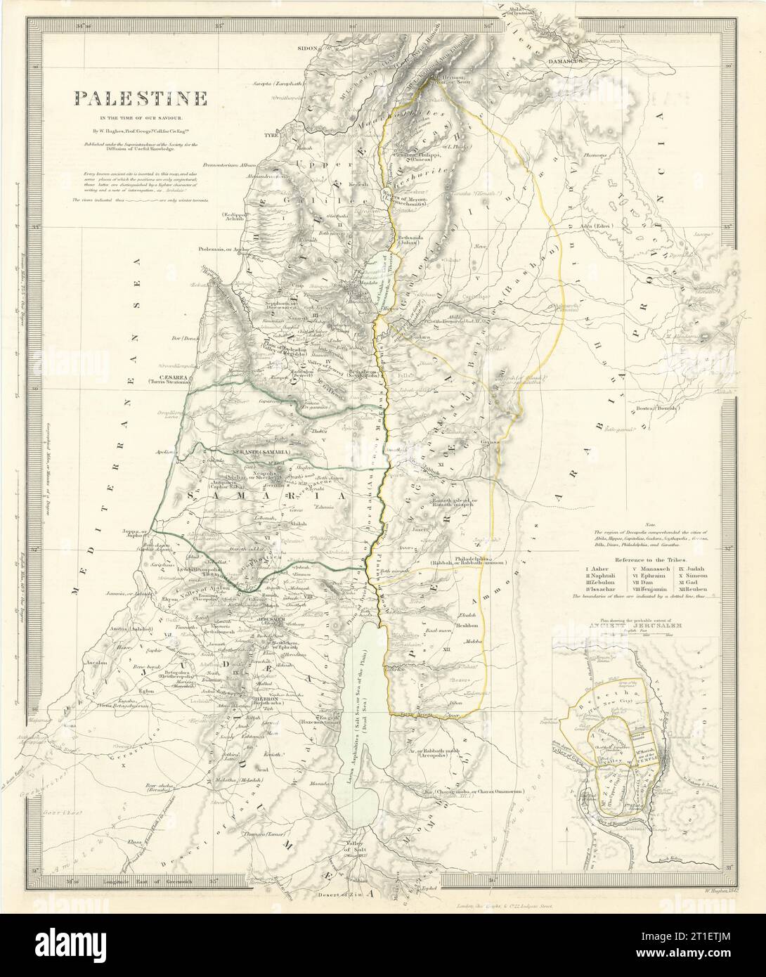 PALESTINE. in the time of Our Saviour Jesus; Ancient Jerusalem. SDUK 1844 map Stock Photohttps://www.alamy.com/image-license-details/?v=1https://www.alamy.com/palestine-in-the-time-of-our-saviour-jesus-ancient-jerusalem-sduk-1844-map-image568883468.html
RF2T1ETJM–PALESTINE. in the time of Our Saviour Jesus; Ancient Jerusalem. SDUK 1844 map
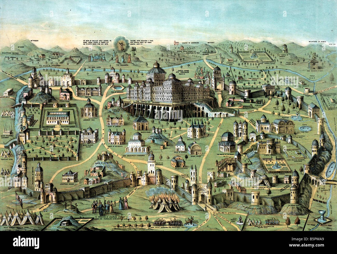 ancient Map of the city of Jerusalem with Solomon's Temple Stock Photohttps://www.alamy.com/image-license-details/?v=1https://www.alamy.com/stock-photo-ancient-map-of-the-city-of-jerusalem-with-solomons-temple-20786481.html
RMB5PWA9–ancient Map of the city of Jerusalem with Solomon's Temple
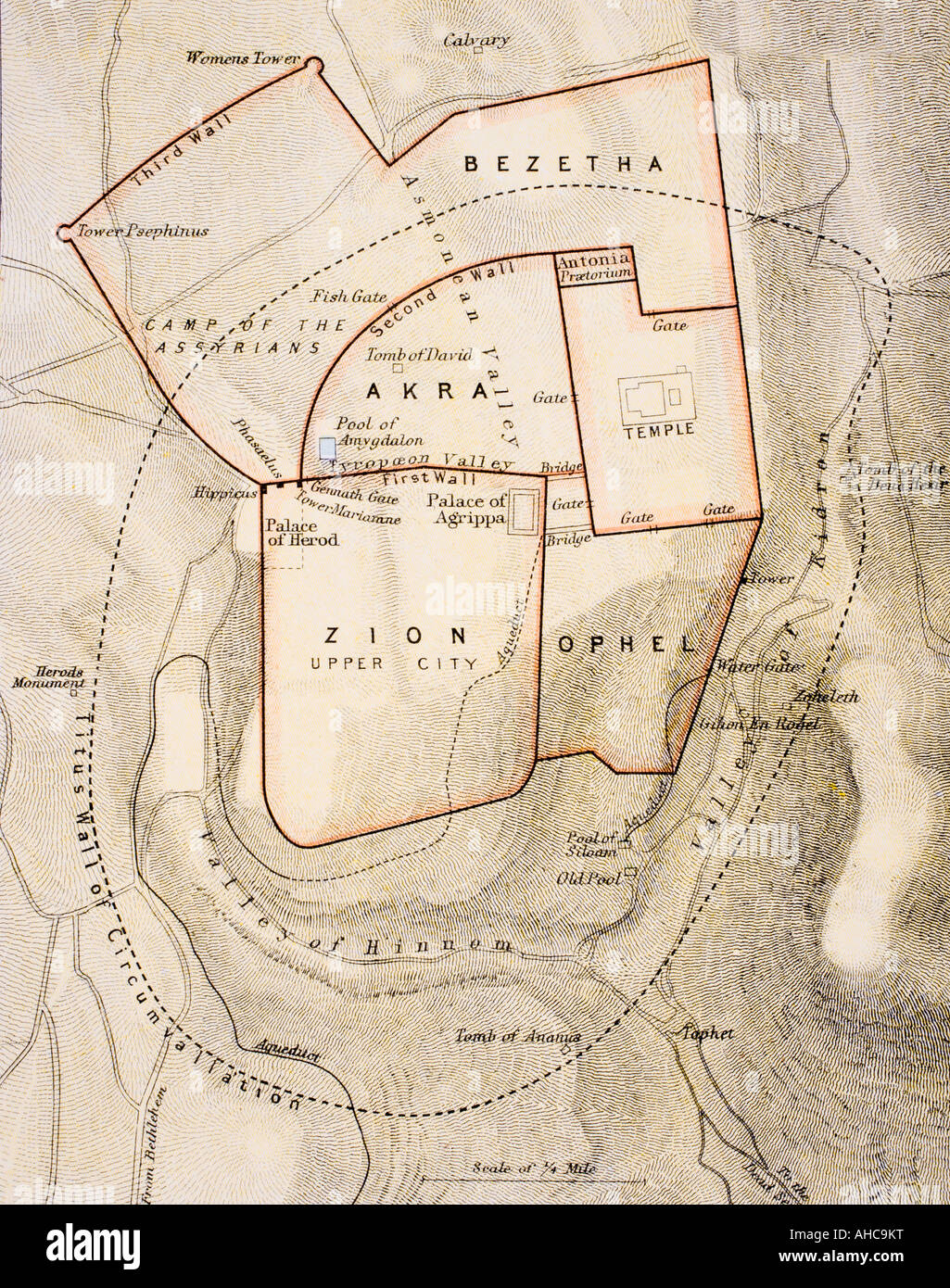 City map of ancient Jerusalem. From The Citizen's Atlas of the World, published circa 1899. Stock Photohttps://www.alamy.com/image-license-details/?v=1https://www.alamy.com/stock-photo-city-map-of-ancient-jerusalem-from-the-citizens-atlas-of-the-world-14428859.html
RMAHC9KT–City map of ancient Jerusalem. From The Citizen's Atlas of the World, published circa 1899.
 19th Century Map of Ancient Jerusalem Israel in Antique Self-Explanatory Family Bible Stock Photohttps://www.alamy.com/image-license-details/?v=1https://www.alamy.com/19th-century-map-of-ancient-jerusalem-israel-in-antique-self-explanatory-family-bible-image610559243.html
RM2XD9AF7–19th Century Map of Ancient Jerusalem Israel in Antique Self-Explanatory Family Bible
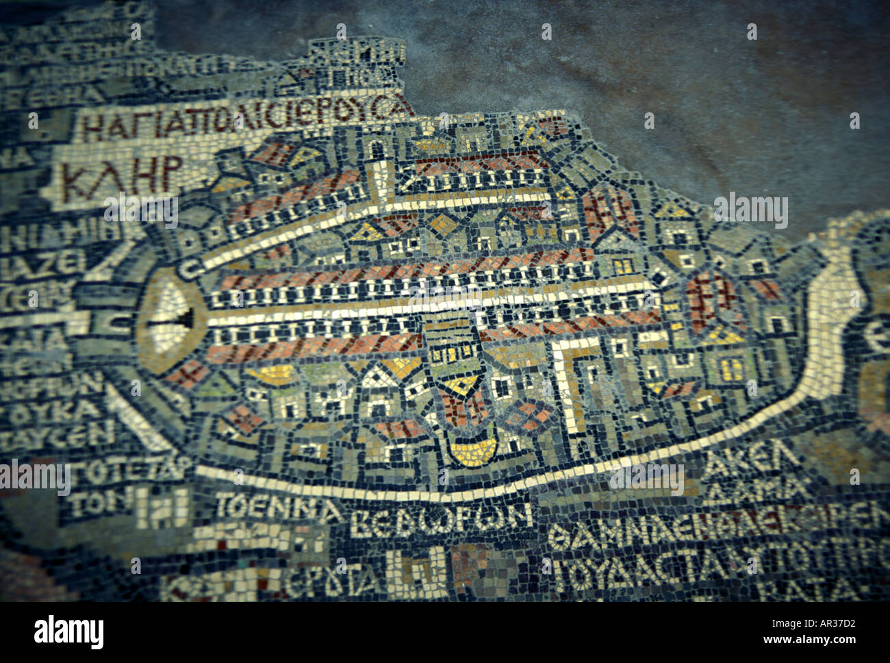 Mosaic map of Jerusalem dating from the 6th century CE Stock Photohttps://www.alamy.com/image-license-details/?v=1https://www.alamy.com/mosaic-map-of-jerusalem-dating-from-the-6th-century-ce-image1521617.html
RMAR37D2–Mosaic map of Jerusalem dating from the 6th century CE
 Fragment of the oldest floor mosaic map, Jordan Stock Photohttps://www.alamy.com/image-license-details/?v=1https://www.alamy.com/stock-photo-fragment-of-the-oldest-floor-mosaic-map-jordan-100362106.html
RMFR7TTX–Fragment of the oldest floor mosaic map, Jordan
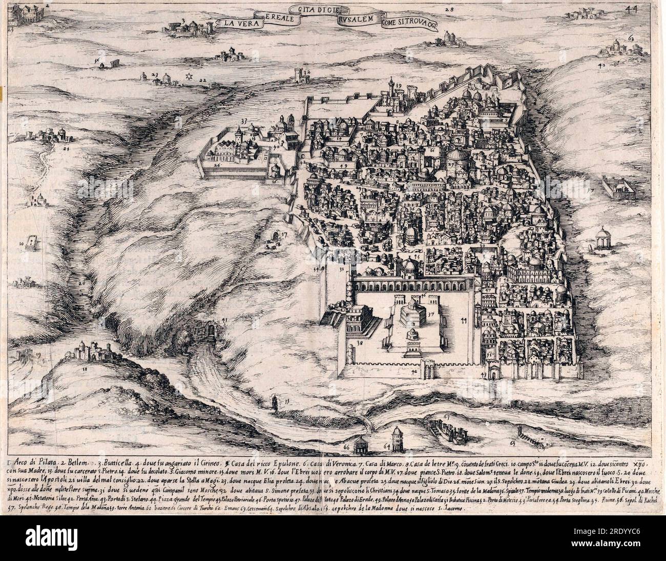 36th Plate, from Trattato delle Piante & Immagini de Sacri Edifizi di Terra Santa (Treatise of the Plans & Images of the Sacred Buildings of the Holy Land) 1620 Stock Photohttps://www.alamy.com/image-license-details/?v=1https://www.alamy.com/36th-plate-from-trattato-delle-piante-immagini-de-sacri-edifizi-di-terra-santa-treatise-of-the-plans-images-of-the-sacred-buildings-of-the-holy-land-1620-image559336518.html
RM2RDYYC6–36th Plate, from Trattato delle Piante & Immagini de Sacri Edifizi di Terra Santa (Treatise of the Plans & Images of the Sacred Buildings of the Holy Land) 1620
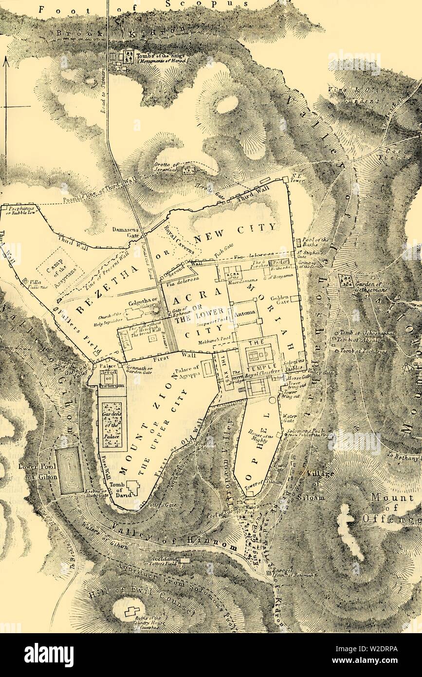 'Plan of Jerusalem in the First Christian Century', 1890. Creator: Unknown. Stock Photohttps://www.alamy.com/image-license-details/?v=1https://www.alamy.com/plan-of-jerusalem-in-the-first-christian-century-1890-creator-unknown-image259688866.html
RMW2DRPA–'Plan of Jerusalem in the First Christian Century', 1890. Creator: Unknown.
 Palace of King Herod the Great, the House of Annas, the House of Caiaphas, the Praetorium, the House of Pontius Pilate and Via Dolorosa in Jerusalem depicted in the mural by Czech artist Jan Rehor (1900) in the narthex of the Church of the Holy Family in Ceske Budejovice, South Bohemia, Czech Republic. Walls and towers of Mount Zion (2), Zion Gate (6), House of Caiaphas (7), House of Annas (8), Palace of King Herod the Great (9), Praetorium (18), House of Pontius Pilate (19), Via Dolorosa (20) and Tomb of Ananias (24) are depicted in the detail of the mural. The mural was drawn after the engra Stock Photohttps://www.alamy.com/image-license-details/?v=1https://www.alamy.com/stock-photo-palace-of-king-herod-the-great-the-house-of-annas-the-house-of-caiaphas-88154029.html
RMF3BNA5–Palace of King Herod the Great, the House of Annas, the House of Caiaphas, the Praetorium, the House of Pontius Pilate and Via Dolorosa in Jerusalem depicted in the mural by Czech artist Jan Rehor (1900) in the narthex of the Church of the Holy Family in Ceske Budejovice, South Bohemia, Czech Republic. Walls and towers of Mount Zion (2), Zion Gate (6), House of Caiaphas (7), House of Annas (8), Palace of King Herod the Great (9), Praetorium (18), House of Pontius Pilate (19), Via Dolorosa (20) and Tomb of Ananias (24) are depicted in the detail of the mural. The mural was drawn after the engra
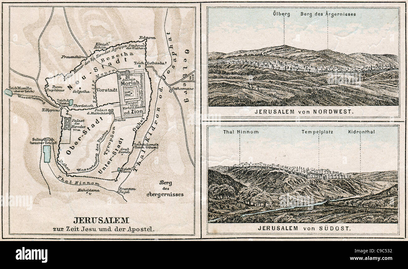 Map of Jerusalem and surroundings. The Bible. Germany, circa 1895 Stock Photohttps://www.alamy.com/image-license-details/?v=1https://www.alamy.com/stock-photo-map-of-jerusalem-and-surroundings-the-bible-germany-circa-1895-40220070.html
RFC9C532–Map of Jerusalem and surroundings. The Bible. Germany, circa 1895
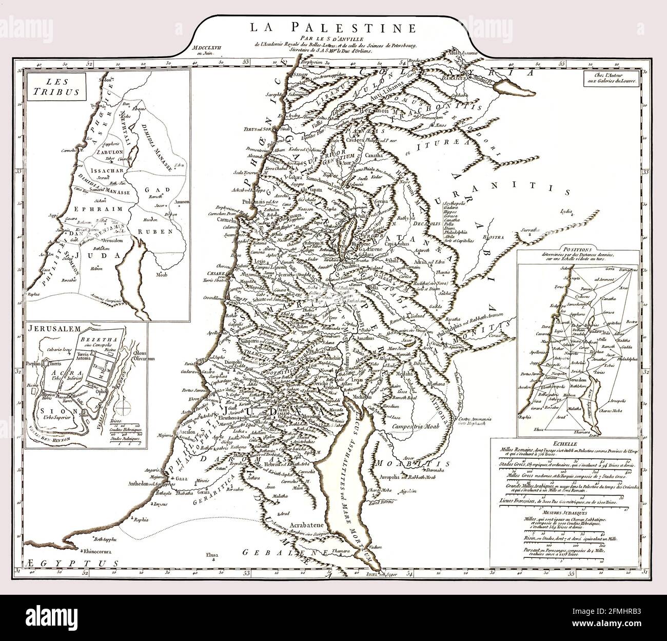 Enhanced restored reproduction of an ancient detailed map of Palestine circa 1767 depicting area known as Palestine and modern day Israel. The map features three insert maps including one of Jerusalem. Stock Photohttps://www.alamy.com/image-license-details/?v=1https://www.alamy.com/enhanced-restored-reproduction-of-an-ancient-detailed-map-of-palestine-circa-1767-depicting-area-known-as-palestine-and-modern-day-israel-the-map-features-three-insert-maps-including-one-of-jerusalem-image425733479.html
RF2FMHRB3–Enhanced restored reproduction of an ancient detailed map of Palestine circa 1767 depicting area known as Palestine and modern day Israel. The map features three insert maps including one of Jerusalem.
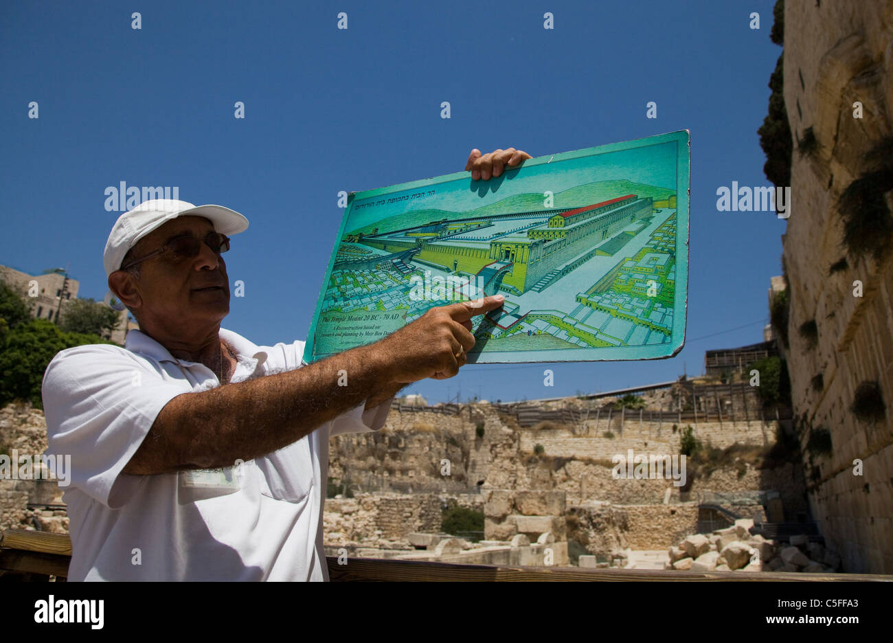 A guide tour holds a map depicting the ancient Jewish temple as he stands next to the renovation site of Mughrabi Bridge Old city Jerusalem Israel Stock Photohttps://www.alamy.com/image-license-details/?v=1https://www.alamy.com/stock-photo-a-guide-tour-holds-a-map-depicting-the-ancient-jewish-temple-as-he-37835339.html
RMC5FFA3–A guide tour holds a map depicting the ancient Jewish temple as he stands next to the renovation site of Mughrabi Bridge Old city Jerusalem Israel
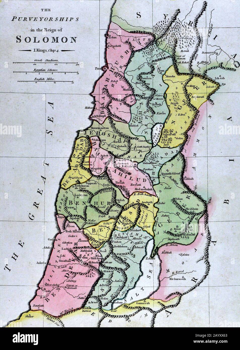 1808 Wilkinson Map Kingdom of Solomon Old Testament Holy Land Ancient Palestine Palestina Jerusalem Stock Photohttps://www.alamy.com/image-license-details/?v=1https://www.alamy.com/1808-wilkinson-map-kingdom-of-solomon-old-testament-holy-land-ancient-palestine-palestina-jerusalem-image344184011.html
RM2AYXX63–1808 Wilkinson Map Kingdom of Solomon Old Testament Holy Land Ancient Palestine Palestina Jerusalem
 A closeup shot of an 18-19th century vintage map of Jerusalem Stock Photohttps://www.alamy.com/image-license-details/?v=1https://www.alamy.com/a-closeup-shot-of-an-18-19th-century-vintage-map-of-jerusalem-image474267982.html
RF2JFGNJ6–A closeup shot of an 18-19th century vintage map of Jerusalem
 Ancient 19th century map of the City of jerusalem from the book Palestine illustrated by Sir Richard Temple, 1st Baronet, GCSI, CIE, PC, FRS (8 March 1826 – 15 March 1902) was an administrator in British India and a British politician. Published in London by W.H. Allen & Co. in 1888 Stock Photohttps://www.alamy.com/image-license-details/?v=1https://www.alamy.com/ancient-19th-century-map-of-the-city-of-jerusalem-from-the-book-palestine-illustrated-by-sir-richard-temple-1st-baronet-gcsi-cie-pc-frs-8-march-1826-15-march-1902-was-an-administrator-in-british-india-and-a-british-politician-published-in-london-by-wh-allen-co-in-1888-image376532672.html
RM2CTGF7C–Ancient 19th century map of the City of jerusalem from the book Palestine illustrated by Sir Richard Temple, 1st Baronet, GCSI, CIE, PC, FRS (8 March 1826 – 15 March 1902) was an administrator in British India and a British politician. Published in London by W.H. Allen & Co. in 1888
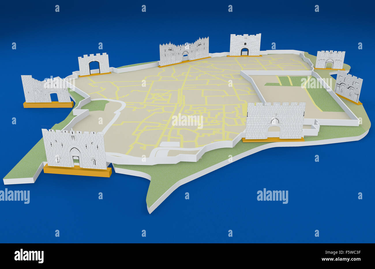 Illustration of Old City map with eight gates in Jerusalem, Israel on blue background Stock Photohttps://www.alamy.com/image-license-details/?v=1https://www.alamy.com/stock-photo-illustration-of-old-city-map-with-eight-gates-in-jerusalem-israel-89683427.html
RFF5WC3F–Illustration of Old City map with eight gates in Jerusalem, Israel on blue background
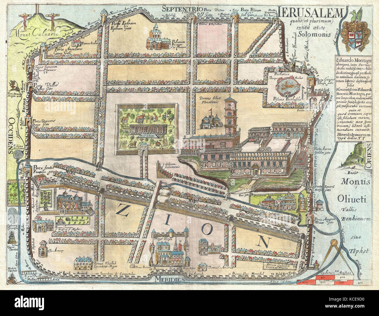 1650, Fuller Map of Jerusalem, Israel, Palestine, Holy Land Stock Photohttps://www.alamy.com/image-license-details/?v=1https://www.alamy.com/stock-image-1650-fuller-map-of-jerusalem-israel-palestine-holy-land-162583932.html
RMKCE9D0–1650, Fuller Map of Jerusalem, Israel, Palestine, Holy Land
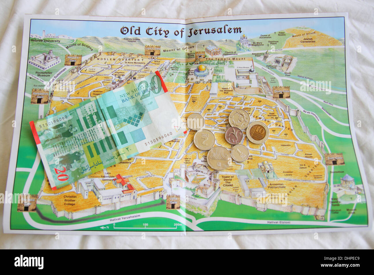 This is map of the old city of Jerusalem in Israel, with the ancient currency of Shekels on top. Stock Photohttps://www.alamy.com/image-license-details/?v=1https://www.alamy.com/this-is-map-of-the-old-city-of-jerusalem-in-israel-with-the-ancient-image62574521.html
RMDHPEC9–This is map of the old city of Jerusalem in Israel, with the ancient currency of Shekels on top.
 Plan of Jerusalem from The Exploration of the World, Celebrated Travels and Travellers, Celebrated Voyages by Jules Verne nonfiction. Published in three volumes from 1878 to 1880, Celebrated Travels and Travelers is a history of the explorers and adventurers who voyaged to the far reaches of the globe, discovered the wonders of exotic lands, and filled in the blank spaces on the world map. With illustrations by L. Benett and P. Philippoteaux, Stock Photohttps://www.alamy.com/image-license-details/?v=1https://www.alamy.com/plan-of-jerusalem-from-the-exploration-of-the-world-celebrated-travels-and-travellers-celebrated-voyages-by-jules-verne-nonfiction-published-in-three-volumes-from-1878-to-1880-celebrated-travels-and-travelers-is-a-history-of-the-explorers-and-adventurers-who-voyaged-to-the-far-reaches-of-the-globe-discovered-the-wonders-of-exotic-lands-and-filled-in-the-blank-spaces-on-the-world-map-with-illustrations-by-l-benett-and-p-philippoteaux-image460499738.html
RF2HN5G36–Plan of Jerusalem from The Exploration of the World, Celebrated Travels and Travellers, Celebrated Voyages by Jules Verne nonfiction. Published in three volumes from 1878 to 1880, Celebrated Travels and Travelers is a history of the explorers and adventurers who voyaged to the far reaches of the globe, discovered the wonders of exotic lands, and filled in the blank spaces on the world map. With illustrations by L. Benett and P. Philippoteaux,
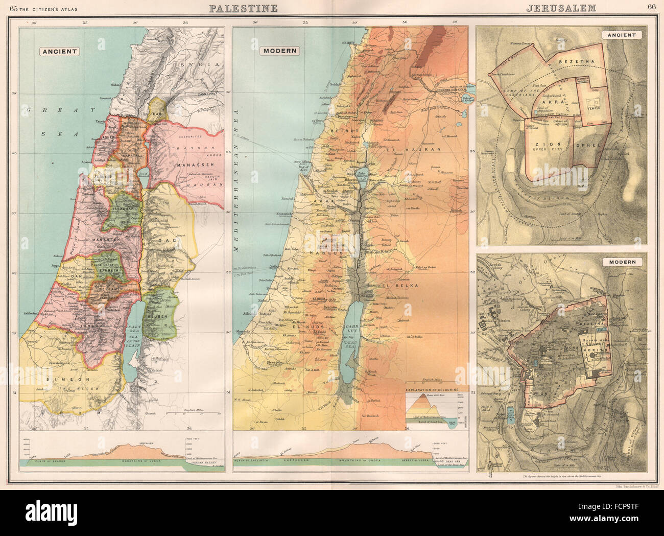 12 TRIBES OF ISRAEL: Palestine/Jerusalem Ancient & Modern. BARTHOLOMEW, 1898 map Stock Photohttps://www.alamy.com/image-license-details/?v=1https://www.alamy.com/stock-photo-12-tribes-of-israel-palestinejerusalem-ancient-modern-bartholomew-93918399.html
RFFCP9TF–12 TRIBES OF ISRAEL: Palestine/Jerusalem Ancient & Modern. BARTHOLOMEW, 1898 map
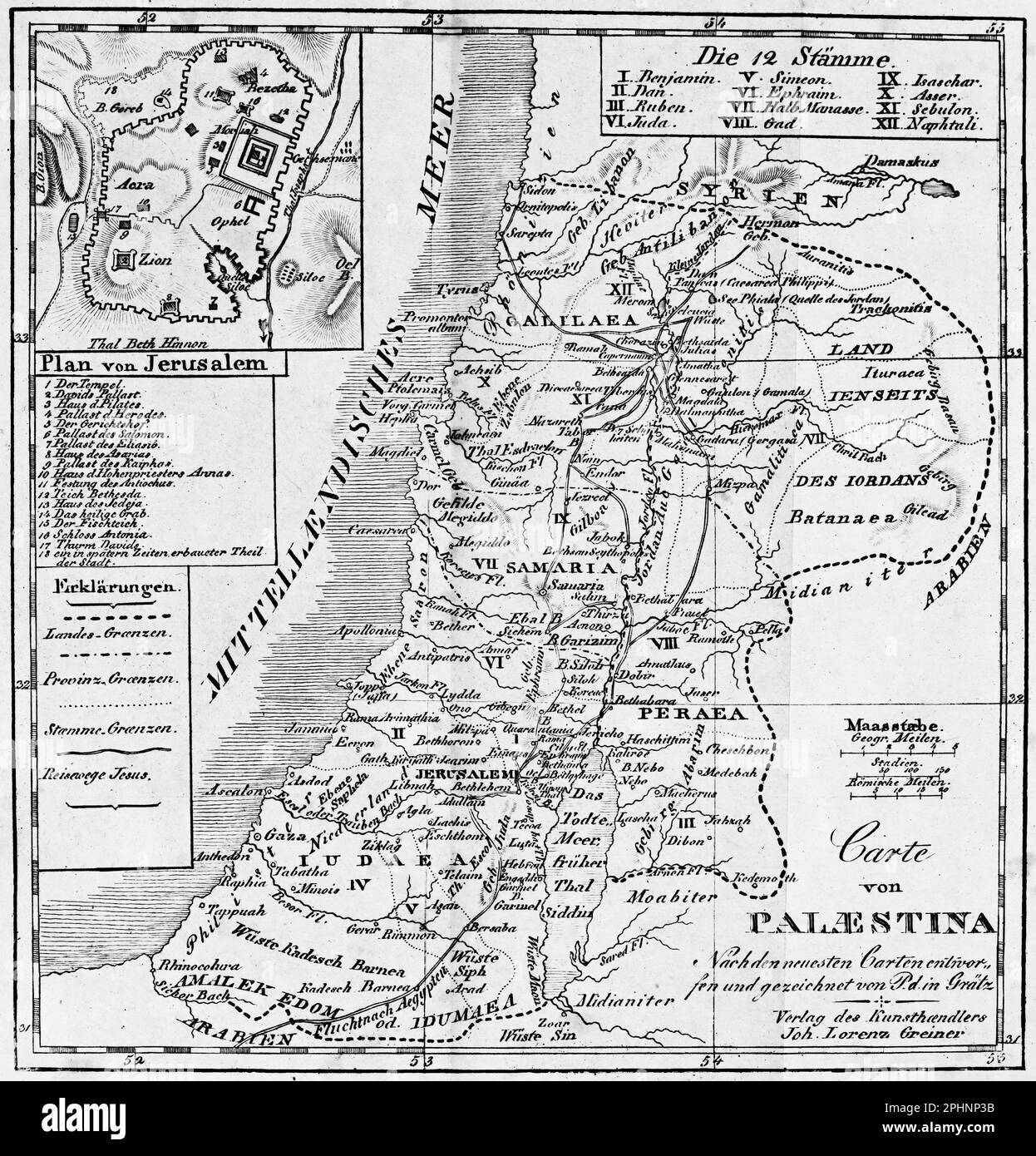 Map of Palestine at the times of Jesus Christ, bible 1831, historical illustration Stock Photohttps://www.alamy.com/image-license-details/?v=1https://www.alamy.com/map-of-palestine-at-the-times-of-jesus-christ-bible-1831-historical-illustration-image544448895.html
RM2PHNP3B–Map of Palestine at the times of Jesus Christ, bible 1831, historical illustration
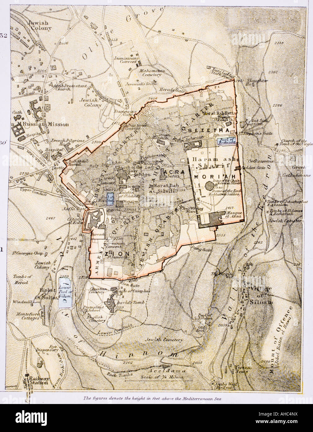 City map of Jerusalem in the 1890's Stock Photohttps://www.alamy.com/image-license-details/?v=1https://www.alamy.com/stock-photo-city-map-of-jerusalem-in-the-1890s-14427205.html
RMAHC4NX–City map of Jerusalem in the 1890's
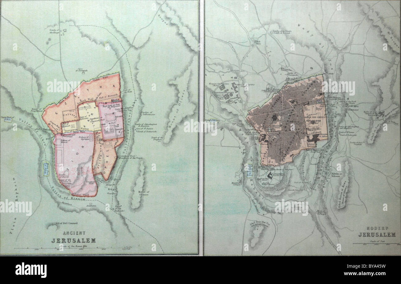 Bible With Maps On Ancient Jerusalem Stock Photohttps://www.alamy.com/image-license-details/?v=1https://www.alamy.com/stock-photo-bible-with-maps-on-ancient-jerusalem-34028901.html
RMBYA45W–Bible With Maps On Ancient Jerusalem
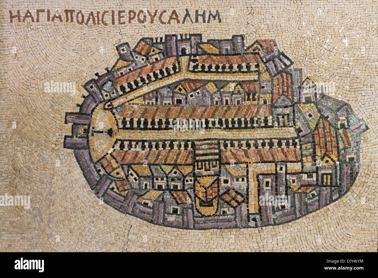 A copy of the Madaba Mosaic Map of the old city of Jerusalem, Israel Stock Photohttps://www.alamy.com/image-license-details/?v=1https://www.alamy.com/stock-photo-a-copy-of-the-madaba-mosaic-map-of-the-old-city-of-jerusalem-israel-56312360.html
RFD7H6YM–A copy of the Madaba Mosaic Map of the old city of Jerusalem, Israel
 The 8th-century Turin world map has world circular but flat and surrounded by the ocean stream, with four winds in the corners Stock Photohttps://www.alamy.com/image-license-details/?v=1https://www.alamy.com/stock-photo-the-8th-century-turin-world-map-has-world-circular-but-flat-and-surrounded-30934882.html
RFBP95N6–The 8th-century Turin world map has world circular but flat and surrounded by the ocean stream, with four winds in the corners
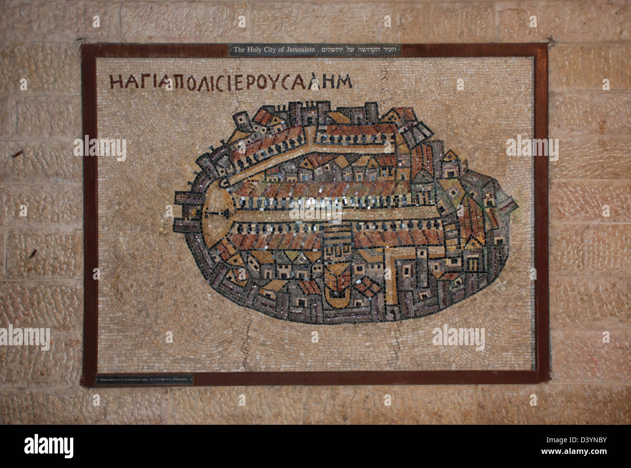 Ancient map of Jerusalem Israel Stock Photohttps://www.alamy.com/image-license-details/?v=1https://www.alamy.com/stock-photo-ancient-map-of-jerusalem-israel-54084575.html
RMD3YNBY–Ancient map of Jerusalem Israel
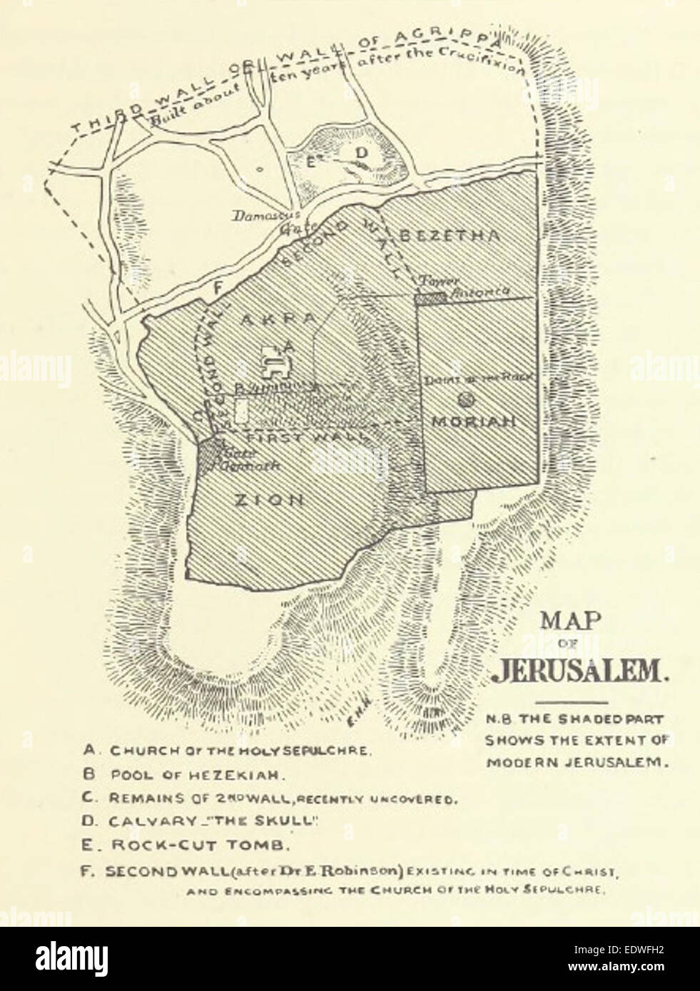 HOPKINS(1899) p013 MAP OF JERUSALEM Stock Photohttps://www.alamy.com/image-license-details/?v=1https://www.alamy.com/stock-photo-hopkins1899-p013-map-of-jerusalem-77393038.html
RMEDWFH2–HOPKINS(1899) p013 MAP OF JERUSALEM
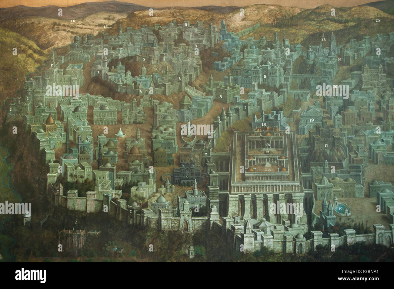 Temple Mount with the Jerusalem Temple and other Biblical sites in Jerusalem depicted in the mural by Czech artist Jan Rehor (1900) in the narthex of the Church of the Holy Family in Ceske Budejovice, South Bohemia, Czech Republic. Temple Mount with the Jerusalem Temple (1a), the Holy of Holies (1b), walls and towers of Mount Zion (2), Palace of King Solomon (3), Zion Fortress (4), City of David (5), Zion Gate (6), House of Caiaphas (7), House of Annas (8), Palace of King Herod the Great (9), road to Bethlehem (15), Pool of Bethesda (16), Antonia Fortress (17), Praetorium (18), House of Pontiu Stock Photohttps://www.alamy.com/image-license-details/?v=1https://www.alamy.com/stock-photo-temple-mount-with-the-jerusalem-temple-and-other-biblical-sites-in-88154025.html
RMF3BNA1–Temple Mount with the Jerusalem Temple and other Biblical sites in Jerusalem depicted in the mural by Czech artist Jan Rehor (1900) in the narthex of the Church of the Holy Family in Ceske Budejovice, South Bohemia, Czech Republic. Temple Mount with the Jerusalem Temple (1a), the Holy of Holies (1b), walls and towers of Mount Zion (2), Palace of King Solomon (3), Zion Fortress (4), City of David (5), Zion Gate (6), House of Caiaphas (7), House of Annas (8), Palace of King Herod the Great (9), road to Bethlehem (15), Pool of Bethesda (16), Antonia Fortress (17), Praetorium (18), House of Pontiu
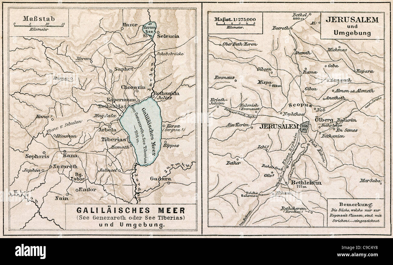 Map of Sea of Galilee and Jerusalem, with the surroundings. The Bible. Germany, circa 1895 Stock Photohttps://www.alamy.com/image-license-details/?v=1https://www.alamy.com/stock-photo-map-of-sea-of-galilee-and-jerusalem-with-the-surroundings-the-bible-40219964.html
RFC9C4Y8–Map of Sea of Galilee and Jerusalem, with the surroundings. The Bible. Germany, circa 1895
 Map of Jerusalem in 33 A D Temple Square Mormon Headquarters Salt Lake City Utah Stock Photohttps://www.alamy.com/image-license-details/?v=1https://www.alamy.com/map-of-jerusalem-in-33-a-d-temple-square-mormon-headquarters-salt-image2661633.html
RMAGWD02–Map of Jerusalem in 33 A D Temple Square Mormon Headquarters Salt Lake City Utah
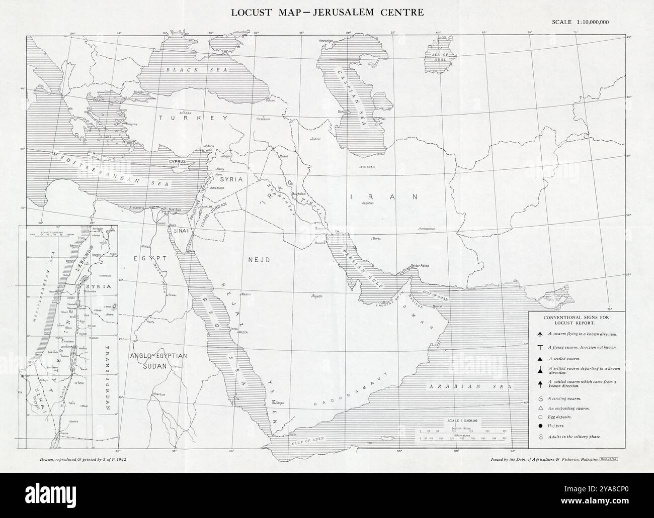 Locust map - Jerusalem centre. Drawn, reproduced and printed by S. of P. Published byd Dept. of Agriculture and Fisheries, Palestine, 1942 Stock Photohttps://www.alamy.com/image-license-details/?v=1https://www.alamy.com/locust-map-jerusalem-centre-drawn-reproduced-and-printed-by-s-of-p-published-byd-dept-of-agriculture-and-fisheries-palestine-1942-image625905448.html
RM2YA8CP0–Locust map - Jerusalem centre. Drawn, reproduced and printed by S. of P. Published byd Dept. of Agriculture and Fisheries, Palestine, 1942
 1832 Murphy Map Holy Land Palaestina Antiqua Ancient Palestine Old Testament Hebrew Tribes Israel Judah Jerusalem Stock Photohttps://www.alamy.com/image-license-details/?v=1https://www.alamy.com/1832-murphy-map-holy-land-palaestina-antiqua-ancient-palestine-old-testament-hebrew-tribes-israel-judah-jerusalem-image344191447.html
RM2AYY7KK–1832 Murphy Map Holy Land Palaestina Antiqua Ancient Palestine Old Testament Hebrew Tribes Israel Judah Jerusalem
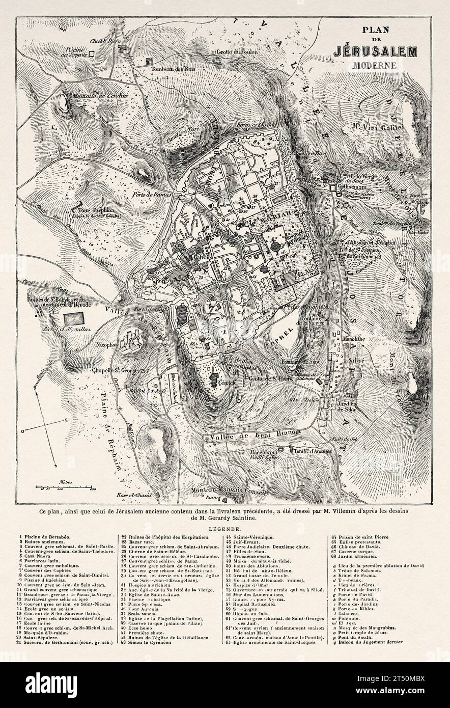 Jerusalem old map. Travels in Palestine, 1856-1859. Old 19th century engraving from Le Tour du Monde 1860 Stock Photohttps://www.alamy.com/image-license-details/?v=1https://www.alamy.com/jerusalem-old-map-travels-in-palestine-1856-1859-old-19th-century-engraving-from-le-tour-du-monde-1860-image571031438.html
RM2T50MBX–Jerusalem old map. Travels in Palestine, 1856-1859. Old 19th century engraving from Le Tour du Monde 1860
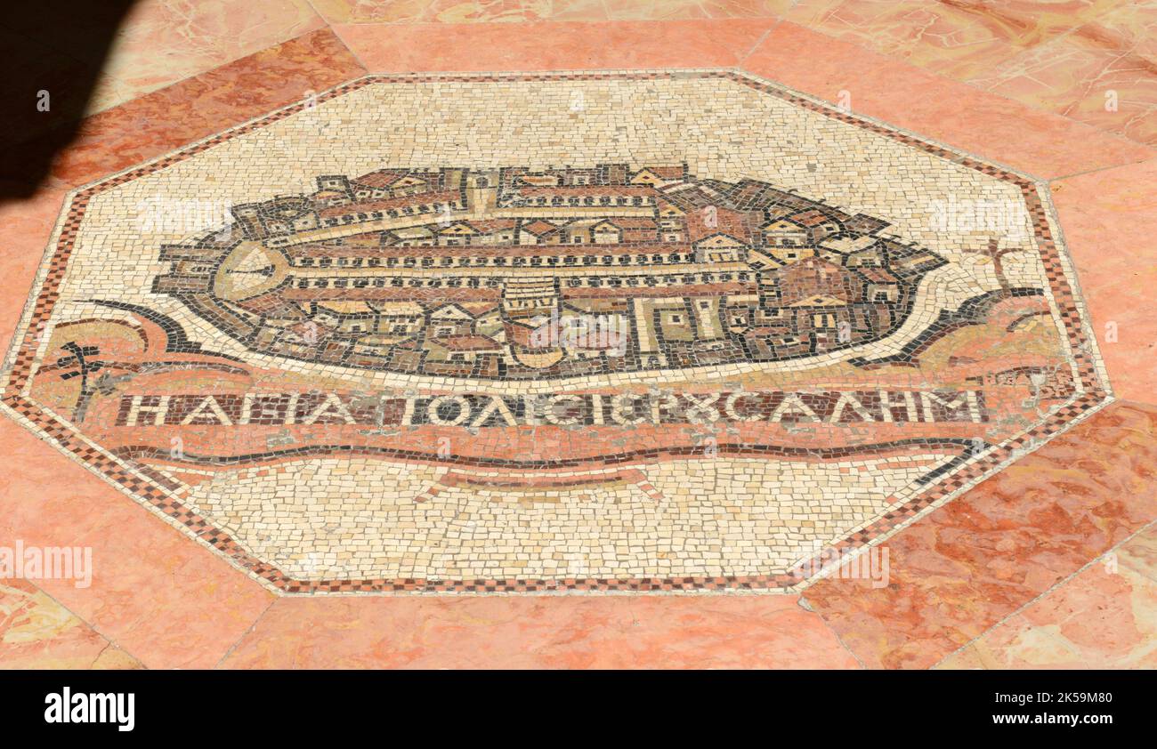 The floor by the entrance of the YMCA in Jerusalem decorated with a replica of the ancient Madaba map of Jerusalem. Stock Photohttps://www.alamy.com/image-license-details/?v=1https://www.alamy.com/the-floor-by-the-entrance-of-the-ymca-in-jerusalem-decorated-with-a-replica-of-the-ancient-madaba-map-of-jerusalem-image485177056.html
RM2K59M80–The floor by the entrance of the YMCA in Jerusalem decorated with a replica of the ancient Madaba map of Jerusalem.
 Beautiful woodcut pages from the 1493 Nuremberg Chronicle, which is an enyclodpedia of world events, mythology and christian history. This extra-ordinary work was one of the earliest books ever printed and the first to successfully integrate text and images. These pages show latin text and an engraving of the town of Jerusalem. Stock Photohttps://www.alamy.com/image-license-details/?v=1https://www.alamy.com/beautiful-woodcut-pages-from-the-1493-nuremberg-chronicle-which-is-an-enyclodpedia-of-world-events-mythology-and-christian-history-this-extra-ordinary-work-was-one-of-the-earliest-books-ever-printed-and-the-first-to-successfully-integrate-text-and-images-these-pages-show-latin-text-and-an-engraving-of-the-town-of-jerusalem-image598932187.html
RM2WPBM37–Beautiful woodcut pages from the 1493 Nuremberg Chronicle, which is an enyclodpedia of world events, mythology and christian history. This extra-ordinary work was one of the earliest books ever printed and the first to successfully integrate text and images. These pages show latin text and an engraving of the town of Jerusalem.
 Jerusalem on the Madaba Map. The Madaba Map, a Byzantine mosaic map of the old city walled city of Jerusalem with the cardo running from north to sout Stock Photohttps://www.alamy.com/image-license-details/?v=1https://www.alamy.com/jerusalem-on-the-madaba-map-the-madaba-map-a-byzantine-mosaic-map-of-the-old-city-walled-city-of-jerusalem-with-the-cardo-running-from-north-to-sout-image351730507.html
RF2BC6KRR–Jerusalem on the Madaba Map. The Madaba Map, a Byzantine mosaic map of the old city walled city of Jerusalem with the cardo running from north to sout
 Medieval map of the ancient city of Jerusalem. 1535-1590 Stock Photohttps://www.alamy.com/image-license-details/?v=1https://www.alamy.com/medieval-map-of-the-ancient-city-of-jerusalem-1535-1590-image482285892.html
RF2K0J0G4–Medieval map of the ancient city of Jerusalem. 1535-1590
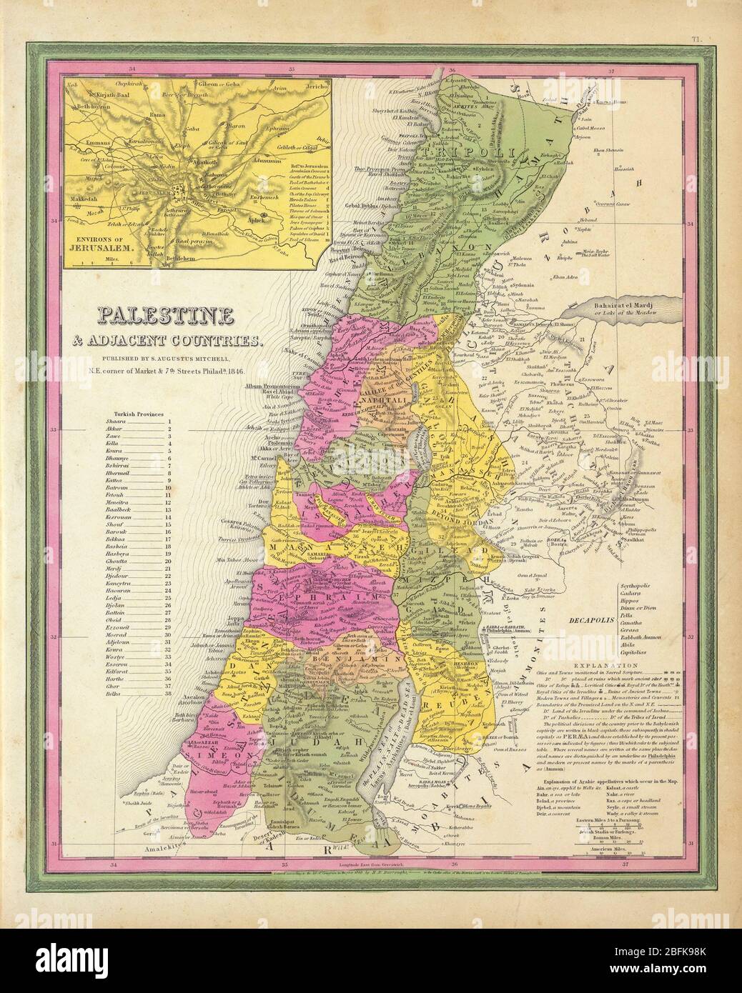 Ancient map of Palestine & Adjacent Countries. by Mitchell, Samuel Augustus Published in 1846 In full color by region with Turkish Provinces numbered and listed. Palestine & Adjacent Countries. (with) Environs of Jerusalem. Published By S. Augustus Mitchell, N.E. Corner of Market & 7th Street Philada., 1846. Entered 1846 by H.N. Burroughs Pennsylvania. Stock Photohttps://www.alamy.com/image-license-details/?v=1https://www.alamy.com/ancient-map-of-palestine-adjacent-countries-by-mitchell-samuel-augustus-published-in-1846-in-full-color-by-region-with-turkish-provinces-numbered-and-listed-palestine-adjacent-countries-with-environs-of-jerusalem-published-by-s-augustus-mitchell-ne-corner-of-market-7th-street-philada-1846-entered-1846-by-hn-burroughs-pennsylvania-image353851587.html
RM2BFK98K–Ancient map of Palestine & Adjacent Countries. by Mitchell, Samuel Augustus Published in 1846 In full color by region with Turkish Provinces numbered and listed. Palestine & Adjacent Countries. (with) Environs of Jerusalem. Published By S. Augustus Mitchell, N.E. Corner of Market & 7th Street Philada., 1846. Entered 1846 by H.N. Burroughs Pennsylvania.
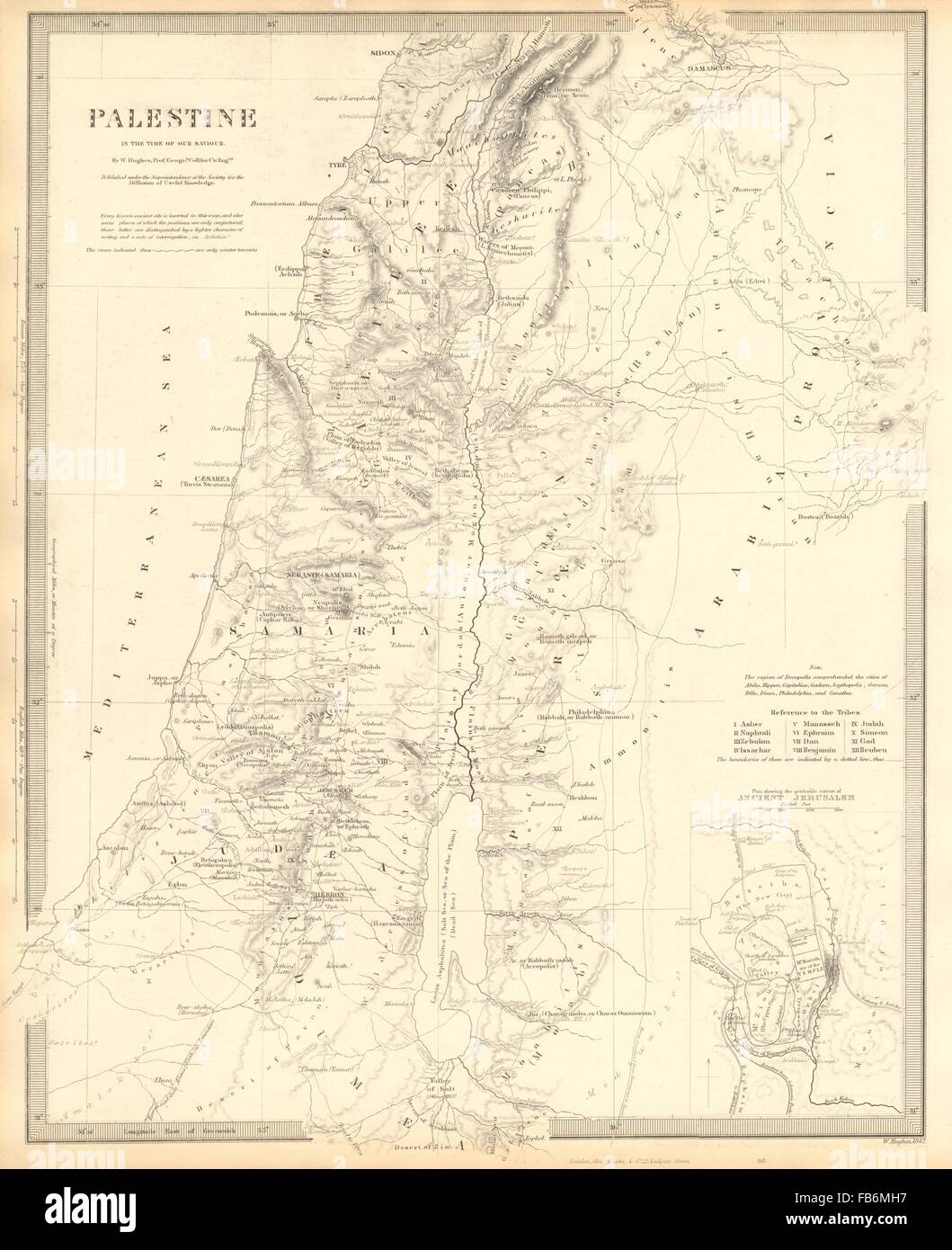 PALESTINE: in the time of Our Saviour Jesus; Ancient Jerusalem. SDUK, 1848 map Stock Photohttps://www.alamy.com/image-license-details/?v=1https://www.alamy.com/stock-photo-palestine-in-the-time-of-our-saviour-jesus-ancient-jerusalem-sduk-92960931.html
RFFB6MH7–PALESTINE: in the time of Our Saviour Jesus; Ancient Jerusalem. SDUK, 1848 map
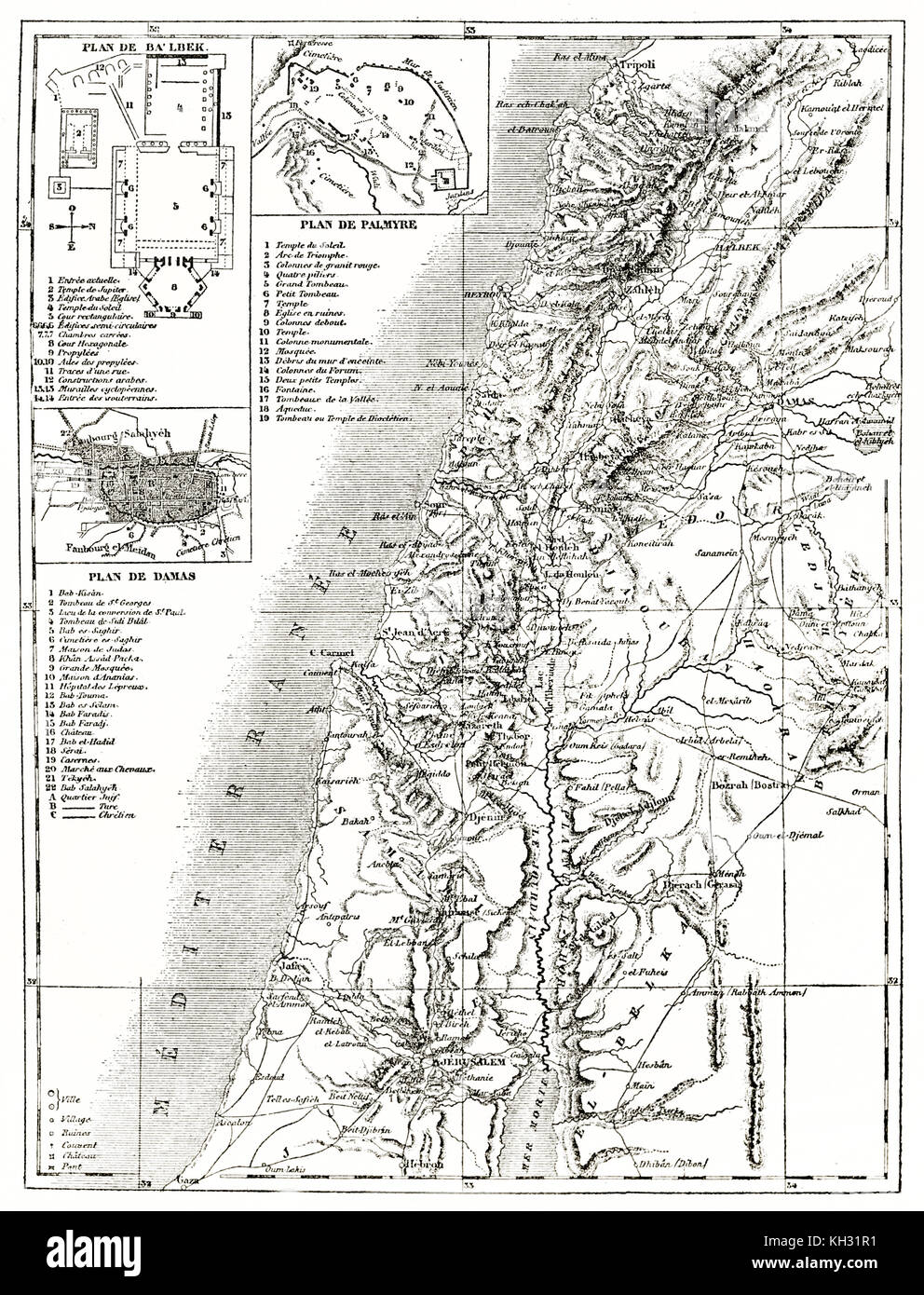 Old map of Syria with insert maps. By unidentified author, publ. on le Tour du Monde, Paris, 1863 Stock Photohttps://www.alamy.com/image-license-details/?v=1https://www.alamy.com/stock-image-old-map-of-syria-with-insert-maps-by-unidentified-author-publ-on-le-165409749.html
RFKH31R1–Old map of Syria with insert maps. By unidentified author, publ. on le Tour du Monde, Paris, 1863
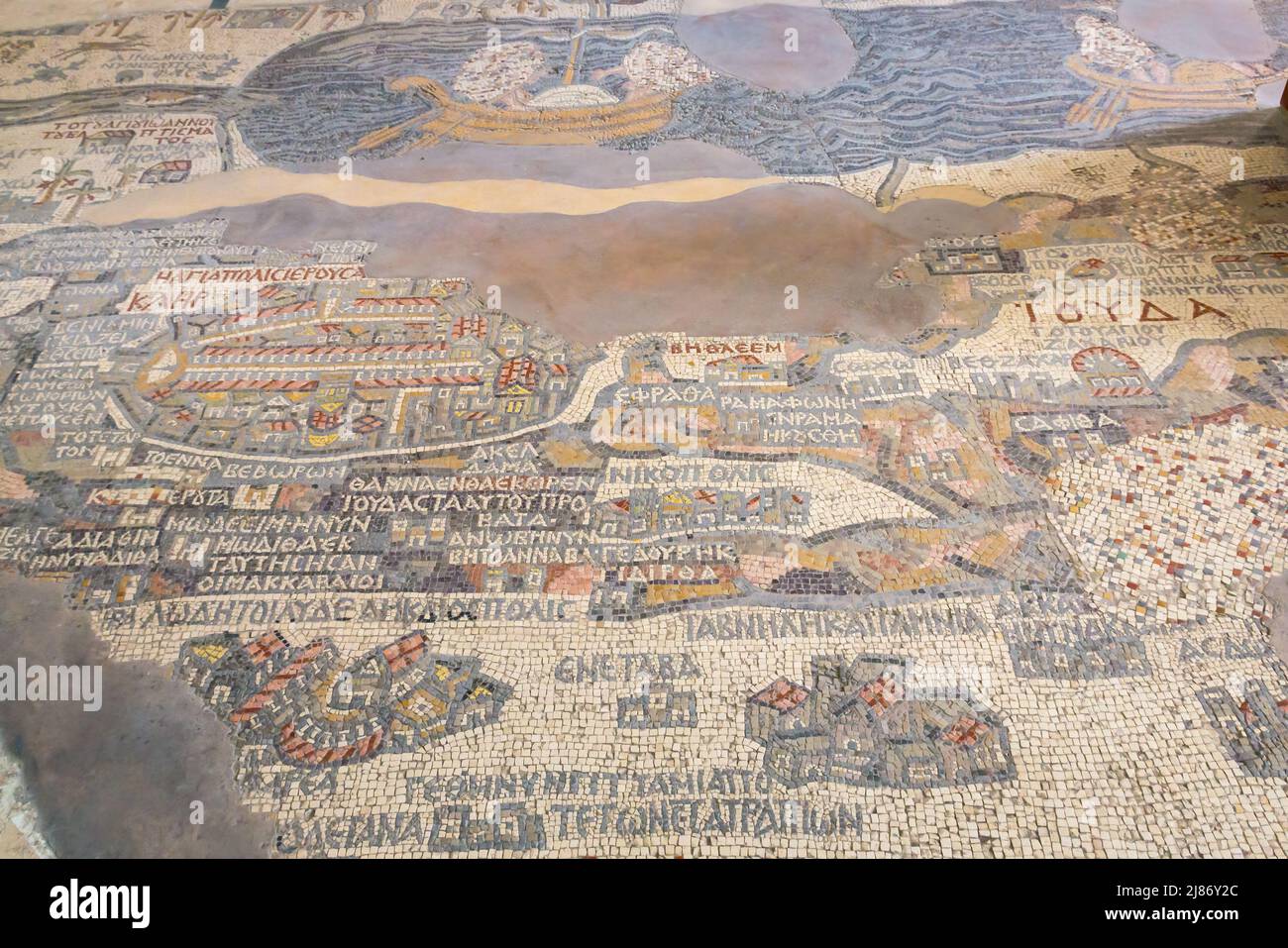 6th century ancient tiled Madaba Mosaic Map showing Jerusalem and the Dead Sea in floor of Greek Orthodox Basilica Saint George, Jordan, Middle East Stock Photohttps://www.alamy.com/image-license-details/?v=1https://www.alamy.com/6th-century-ancient-tiled-madaba-mosaic-map-showing-jerusalem-and-the-dead-sea-in-floor-of-greek-orthodox-basilica-saint-george-jordan-middle-east-image469750132.html
RM2J86Y2C–6th century ancient tiled Madaba Mosaic Map showing Jerusalem and the Dead Sea in floor of Greek Orthodox Basilica Saint George, Jordan, Middle East
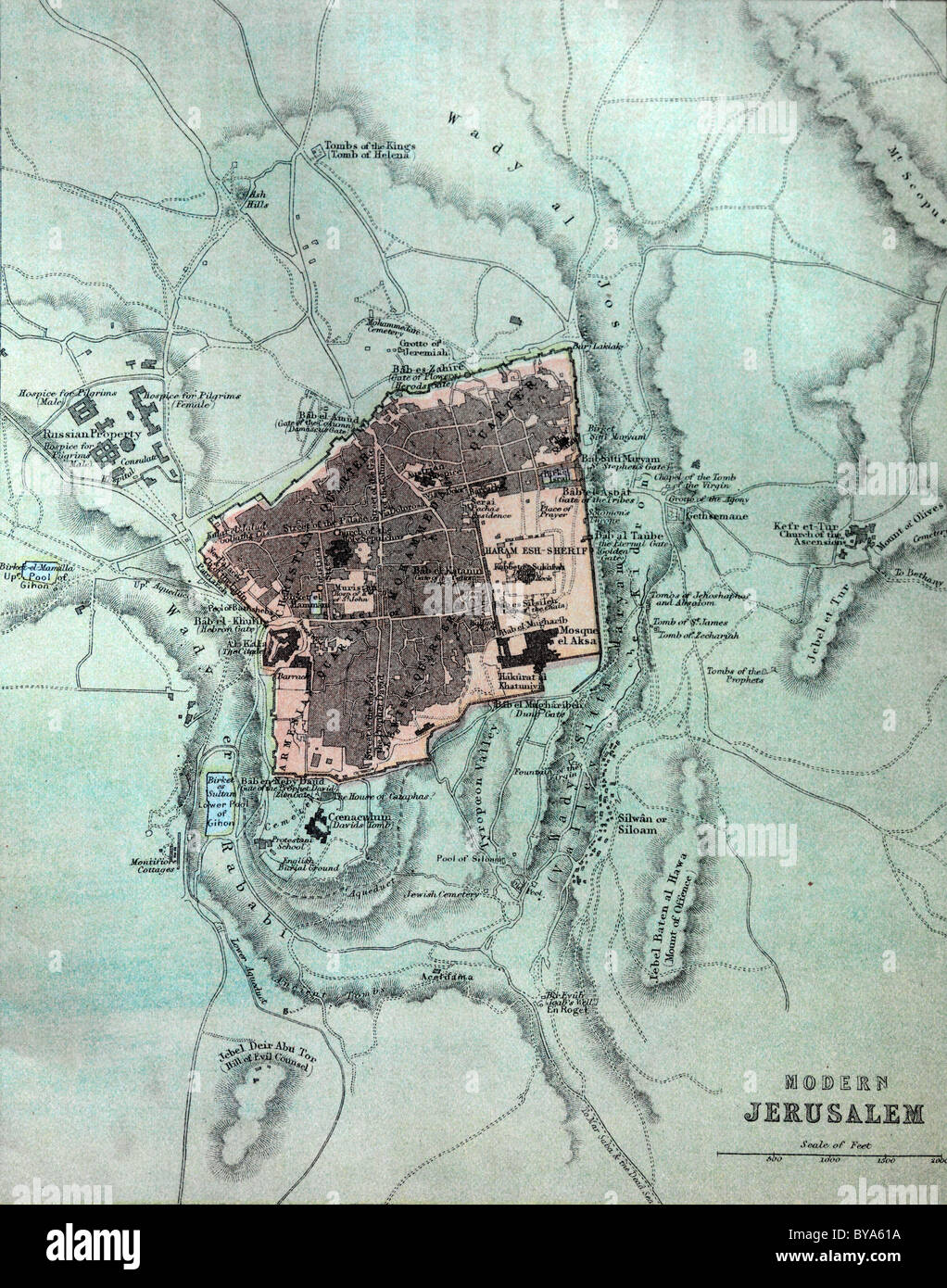 Map Showing Jerusalem In An Old Bible Stock Photohttps://www.alamy.com/image-license-details/?v=1https://www.alamy.com/stock-photo-map-showing-jerusalem-in-an-old-bible-34030342.html
RMBYA61A–Map Showing Jerusalem In An Old Bible
 Map of ancient Jerusalem, 1683 Stock Photohttps://www.alamy.com/image-license-details/?v=1https://www.alamy.com/stock-photo-map-of-ancient-jerusalem-1683-140209150.html
RMJ4325J–Map of ancient Jerusalem, 1683
 A map of Jerusalem, one of the illustrations in the book: Apparatus biblicus, sive manuductio ad sacram scripturam, tum clarius, tum facilius intelligendam, written by Bernard Lamy. This edition was published in 1767. Stock Photohttps://www.alamy.com/image-license-details/?v=1https://www.alamy.com/a-map-of-jerusalem-one-of-the-illustrations-in-the-book-apparatus-biblicus-sive-manuductio-ad-sacram-scripturam-tum-clarius-tum-facilius-intelligendam-written-by-bernard-lamy-this-edition-was-published-in-1767-image338065207.html
RM2AJ05HB–A map of Jerusalem, one of the illustrations in the book: Apparatus biblicus, sive manuductio ad sacram scripturam, tum clarius, tum facilius intelligendam, written by Bernard Lamy. This edition was published in 1767.
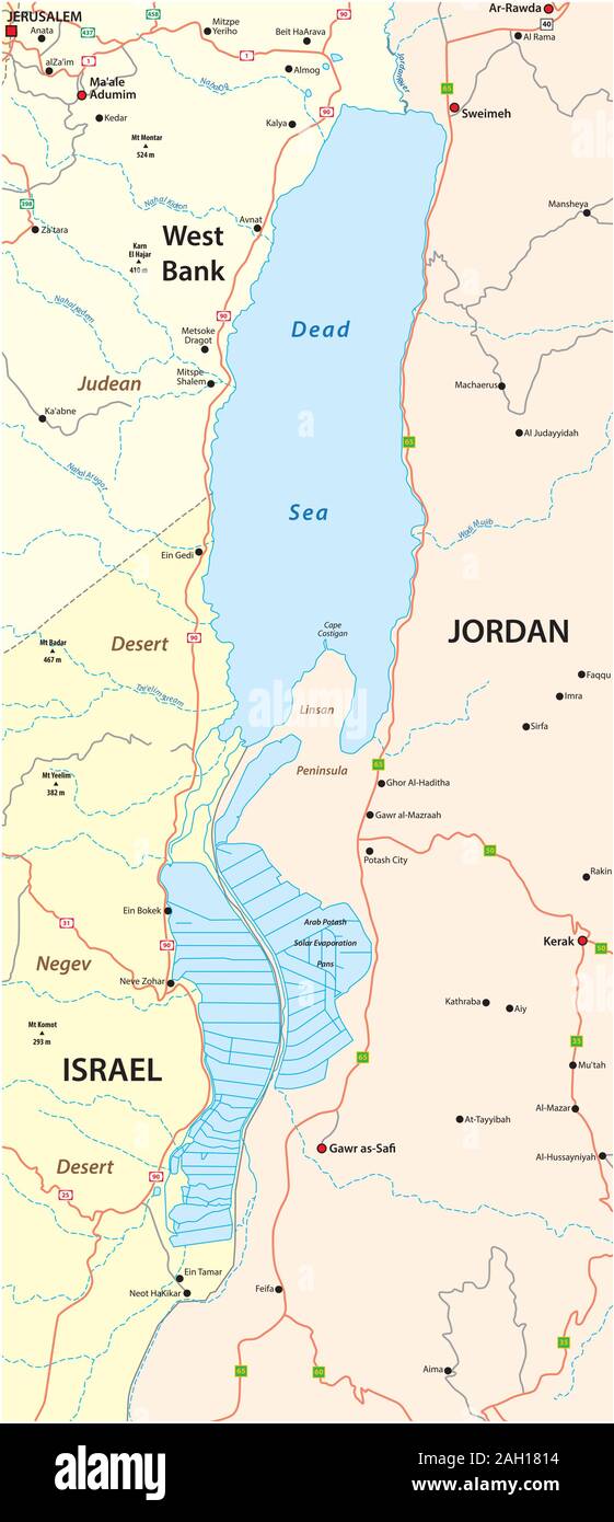 Map of the Dead Sea lying between Israel West Bank and Jordan Stock Vectorhttps://www.alamy.com/image-license-details/?v=1https://www.alamy.com/map-of-the-dead-sea-lying-between-israel-west-bank-and-jordan-image337474400.html
RF2AH1814–Map of the Dead Sea lying between Israel West Bank and Jordan
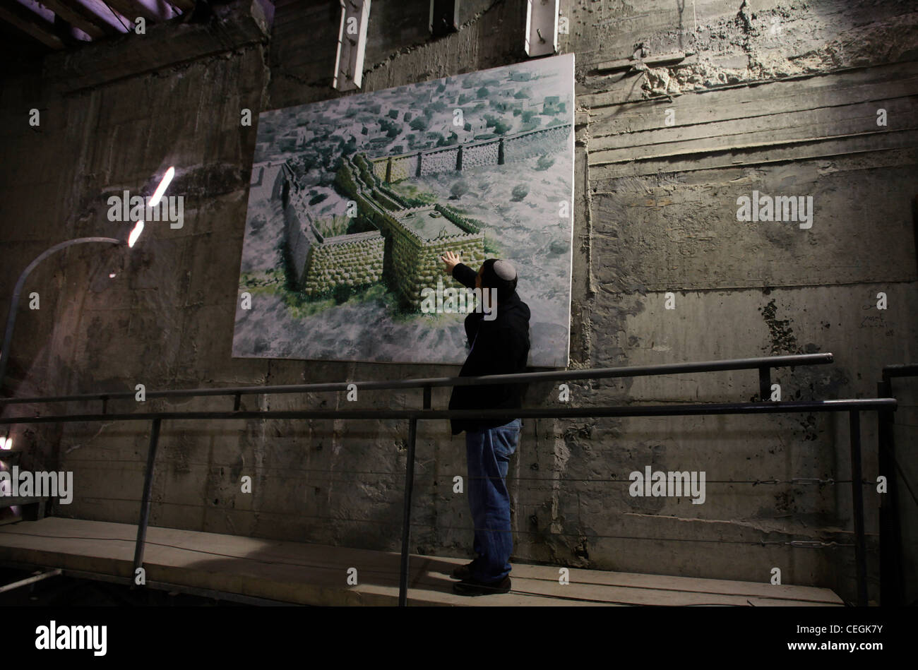 An Israeli tour guide describes the story of ancient Jerusalem fortifications with the assistance of a chart at the ancient underground Hezekiah's Tunnel or the Siloam Tunnel in Ir David or City of David the archaeological site which is speculated to compose the original urban core of ancient Jerusalem in Israel Stock Photohttps://www.alamy.com/image-license-details/?v=1https://www.alamy.com/stock-photo-an-israeli-tour-guide-describes-the-story-of-ancient-jerusalem-fortifications-43392271.html
RMCEGK7Y–An Israeli tour guide describes the story of ancient Jerusalem fortifications with the assistance of a chart at the ancient underground Hezekiah's Tunnel or the Siloam Tunnel in Ir David or City of David the archaeological site which is speculated to compose the original urban core of ancient Jerusalem in Israel
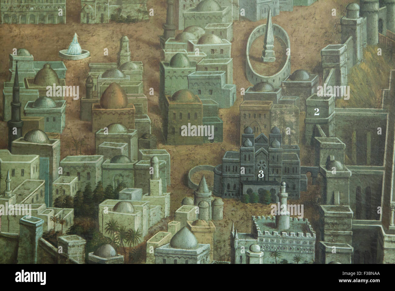 Palace of King Solomon in Jerusalem depicted in the mural by Czech artist Jan Rehor (1900) in the narthex of the Church of the Holy Family in Ceske Budejovice, South Bohemia, Czech Republic. Walls and towers of Mount Zion (2) and the Palace of King Solomon (3) are depicted in the detail of the mural. The mural was drawn after the engraving by French artist Adolphe Elzzner printed in 1852. Stock Photohttps://www.alamy.com/image-license-details/?v=1https://www.alamy.com/stock-photo-palace-of-king-solomon-in-jerusalem-depicted-in-the-mural-by-czech-88154034.html
RMF3BNAA–Palace of King Solomon in Jerusalem depicted in the mural by Czech artist Jan Rehor (1900) in the narthex of the Church of the Holy Family in Ceske Budejovice, South Bohemia, Czech Republic. Walls and towers of Mount Zion (2) and the Palace of King Solomon (3) are depicted in the detail of the mural. The mural was drawn after the engraving by French artist Adolphe Elzzner printed in 1852.
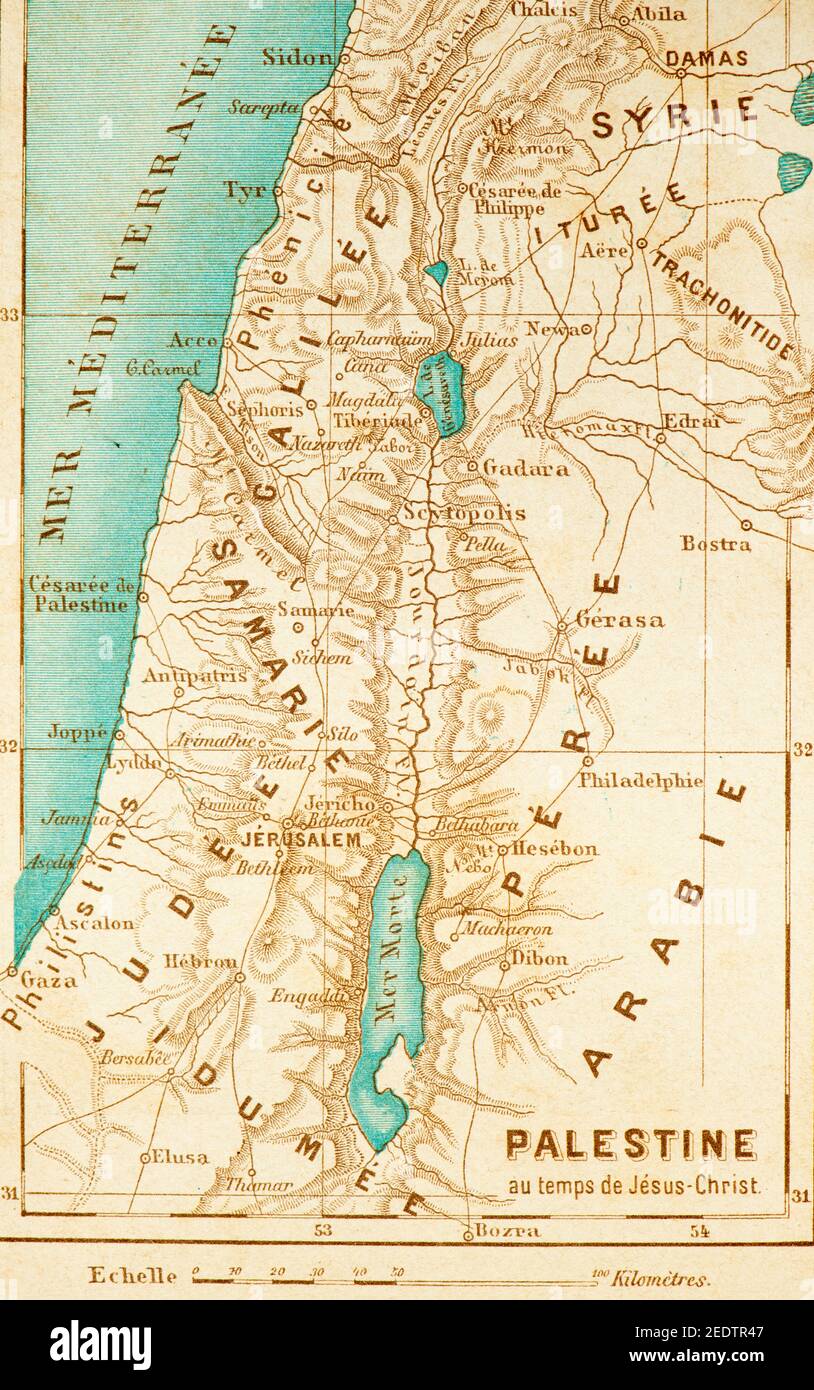 Historic map of Palestine at the times of Jesus Christ, Histoire Biblique de L´Ancien Testament, Stock Photohttps://www.alamy.com/image-license-details/?v=1https://www.alamy.com/historic-map-of-palestine-at-the-times-of-jesus-christ-histoire-biblique-de-lancien-testament-image404373991.html
RM2EDTR47–Historic map of Palestine at the times of Jesus Christ, Histoire Biblique de L´Ancien Testament,
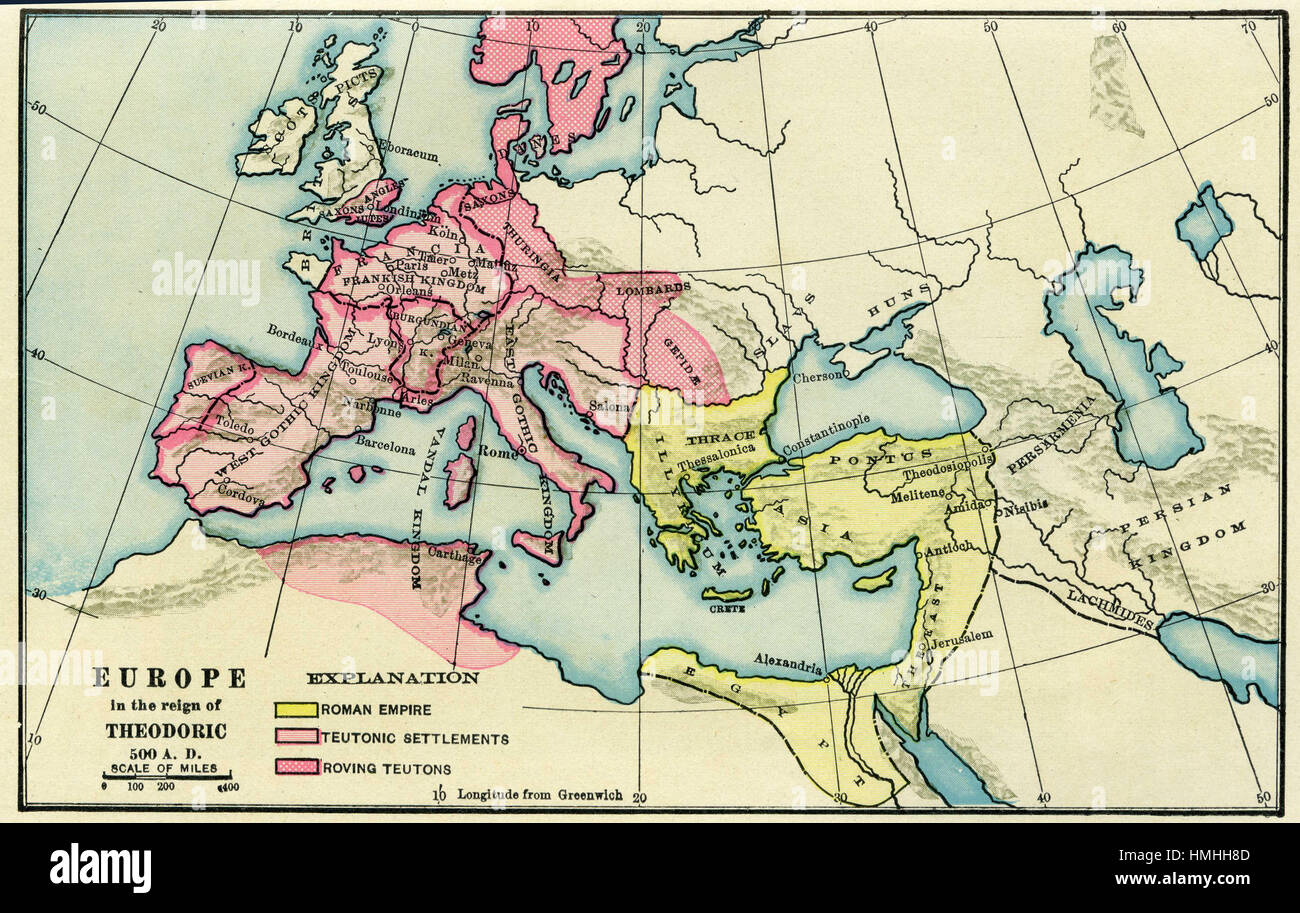 map of europe Stock Photohttps://www.alamy.com/image-license-details/?v=1https://www.alamy.com/stock-photo-map-of-europe-133152445.html
RFHMHH8D–map of europe
 Pictorial map of Jerusalem - Taken from a book - Blat LXIIII Destruccio Iherosolime Jerusalem zerstozung (Nuremberg Chronicle) 1493 - Author Schedel, Hartmann (1440-1514) Nuremberg. Stock Photohttps://www.alamy.com/image-license-details/?v=1https://www.alamy.com/pictorial-map-of-jerusalem-taken-from-a-book-blat-lxiiii-destruccio-iherosolime-jerusalem-zerstozung-nuremberg-chronicle-1493-author-schedel-hartmann-1440-1514-nuremberg-image625991844.html
RM2YACAYG–Pictorial map of Jerusalem - Taken from a book - Blat LXIIII Destruccio Iherosolime Jerusalem zerstozung (Nuremberg Chronicle) 1493 - Author Schedel, Hartmann (1440-1514) Nuremberg.
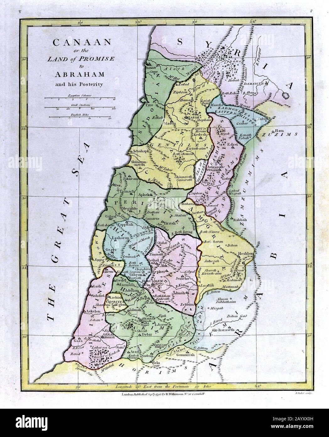 1808 Wilkinson Map Canaan Promise Land Kingdom of Abraham Old Testament Holy Land Ancient Palestine Palestina Jerusalem Stock Photohttps://www.alamy.com/image-license-details/?v=1https://www.alamy.com/1808-wilkinson-map-canaan-promise-land-kingdom-of-abraham-old-testament-holy-land-ancient-palestine-palestina-jerusalem-image344183857.html
RM2AYXX0H–1808 Wilkinson Map Canaan Promise Land Kingdom of Abraham Old Testament Holy Land Ancient Palestine Palestina Jerusalem
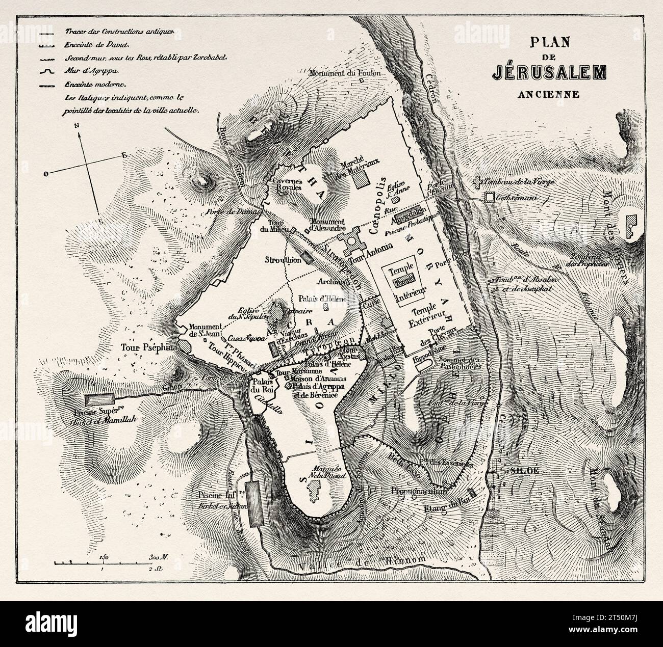 Jerusalem old city map. Travels in Palestine, 1856-1859. Old 19th century engraving from Le Tour du Monde 1860 Stock Photohttps://www.alamy.com/image-license-details/?v=1https://www.alamy.com/jerusalem-old-city-map-travels-in-palestine-1856-1859-old-19th-century-engraving-from-le-tour-du-monde-1860-image571031318.html
RM2T50M7J–Jerusalem old city map. Travels in Palestine, 1856-1859. Old 19th century engraving from Le Tour du Monde 1860
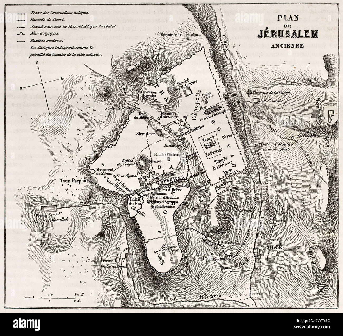 Old plan of Jerusalem Stock Photohttps://www.alamy.com/image-license-details/?v=1https://www.alamy.com/stock-photo-old-plan-of-jerusalem-50335248.html
RFCWTY3C–Old plan of Jerusalem
 1771, Bonne Map of the New Testament Lands, w- Holy Land and Jerusalem, Rigobert Bonne 1727 – 1794 Stock Photohttps://www.alamy.com/image-license-details/?v=1https://www.alamy.com/stock-image-1771-bonne-map-of-the-new-testament-lands-w-holy-land-and-jerusalem-162567816.html
RMKCDGWC–1771, Bonne Map of the New Testament Lands, w- Holy Land and Jerusalem, Rigobert Bonne 1727 – 1794
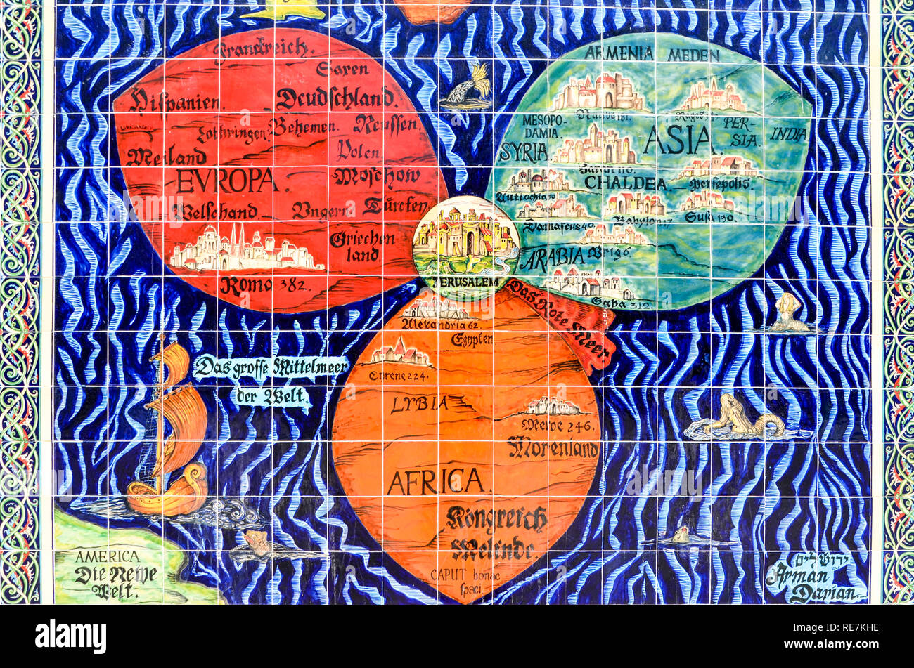 Bunting's cloverleaf map of the world, with Jerusalem at the center, seen on a mosaic in Jerusalem itself Stock Photohttps://www.alamy.com/image-license-details/?v=1https://www.alamy.com/buntings-cloverleaf-map-of-the-world-with-jerusalem-at-the-center-seen-on-a-mosaic-in-jerusalem-itself-image232509018.html
RMRE7KHE–Bunting's cloverleaf map of the world, with Jerusalem at the center, seen on a mosaic in Jerusalem itself
 Mosaic of Jerusalem, Madaba Map, Byzantine mosaic, Church of St. George, Madaba, Jordan. 'Hagiapolis Ierousa...'- Greek: 'Holy City of Jerusalem' Stock Photohttps://www.alamy.com/image-license-details/?v=1https://www.alamy.com/mosaic-of-jerusalem-madaba-map-byzantine-mosaic-church-of-st-george-madaba-jordan-hagiapolis-ierousa-greek-holy-city-of-jerusalem-image614436059.html
RM2XKHYCY–Mosaic of Jerusalem, Madaba Map, Byzantine mosaic, Church of St. George, Madaba, Jordan. 'Hagiapolis Ierousa...'- Greek: 'Holy City of Jerusalem'
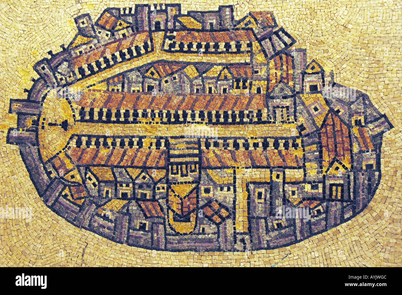 Israel Jerusalem The Madaba Map a Byzantine mosaic map of the old city Stock Photohttps://www.alamy.com/image-license-details/?v=1https://www.alamy.com/israel-jerusalem-the-madaba-map-a-byzantine-mosaic-map-of-the-old-image9785547.html
RMAYJWGC–Israel Jerusalem The Madaba Map a Byzantine mosaic map of the old city
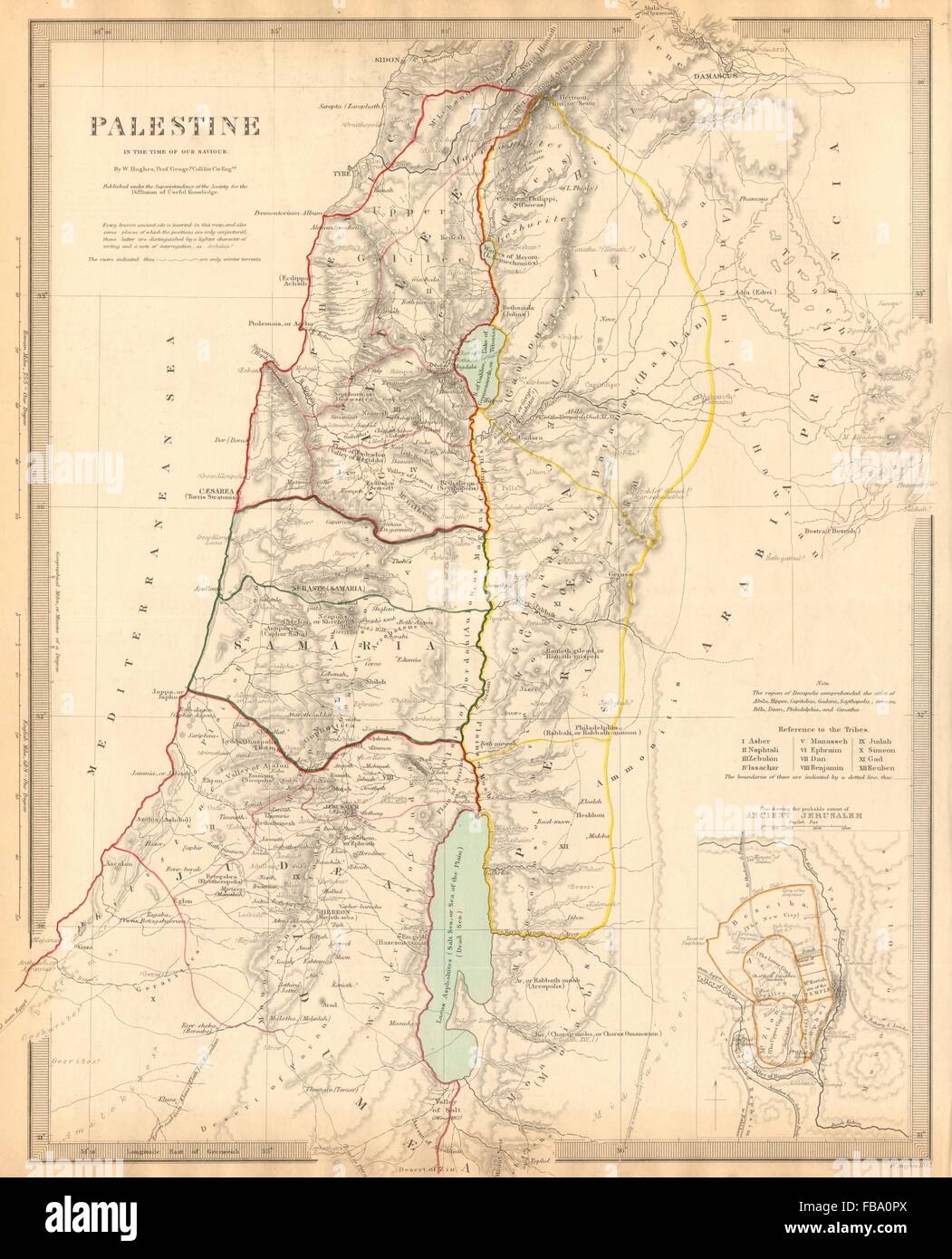 PALESTINE. in the time of Our Saviour Jesus; Ancient Jerusalem. SDUK, 1844 map Stock Photohttps://www.alamy.com/image-license-details/?v=1https://www.alamy.com/stock-photo-palestine-in-the-time-of-our-saviour-jesus-ancient-jerusalem-sduk-93033218.html
RFFBA0PX–PALESTINE. in the time of Our Saviour Jesus; Ancient Jerusalem. SDUK, 1844 map
 Jericho and its surroundings, including the river Jordan and dead Sea, in the sixth century Madaba map, one of the earliest examples of cartography. Stock Photohttps://www.alamy.com/image-license-details/?v=1https://www.alamy.com/jericho-and-its-surroundings-including-the-river-jordan-and-dead-sea-in-the-sixth-century-madaba-map-one-of-the-earliest-examples-of-cartography-image351730882.html
RF2BC6M96–Jericho and its surroundings, including the river Jordan and dead Sea, in the sixth century Madaba map, one of the earliest examples of cartography.
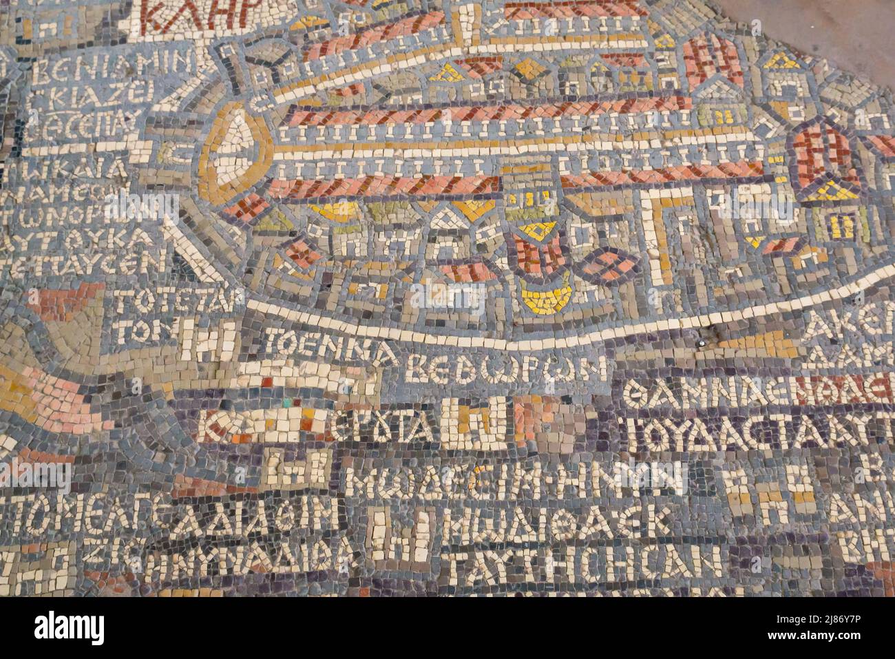 6th century ancient Madaba Mosaic Map with Jerusalem in floor of early Byzantine church, now Greek Orthodox Basilica Saint George, Jordan, Middle East Stock Photohttps://www.alamy.com/image-license-details/?v=1https://www.alamy.com/6th-century-ancient-madaba-mosaic-map-with-jerusalem-in-floor-of-early-byzantine-church-now-greek-orthodox-basilica-saint-george-jordan-middle-east-image469750282.html
RM2J86Y7P–6th century ancient Madaba Mosaic Map with Jerusalem in floor of early Byzantine church, now Greek Orthodox Basilica Saint George, Jordan, Middle East
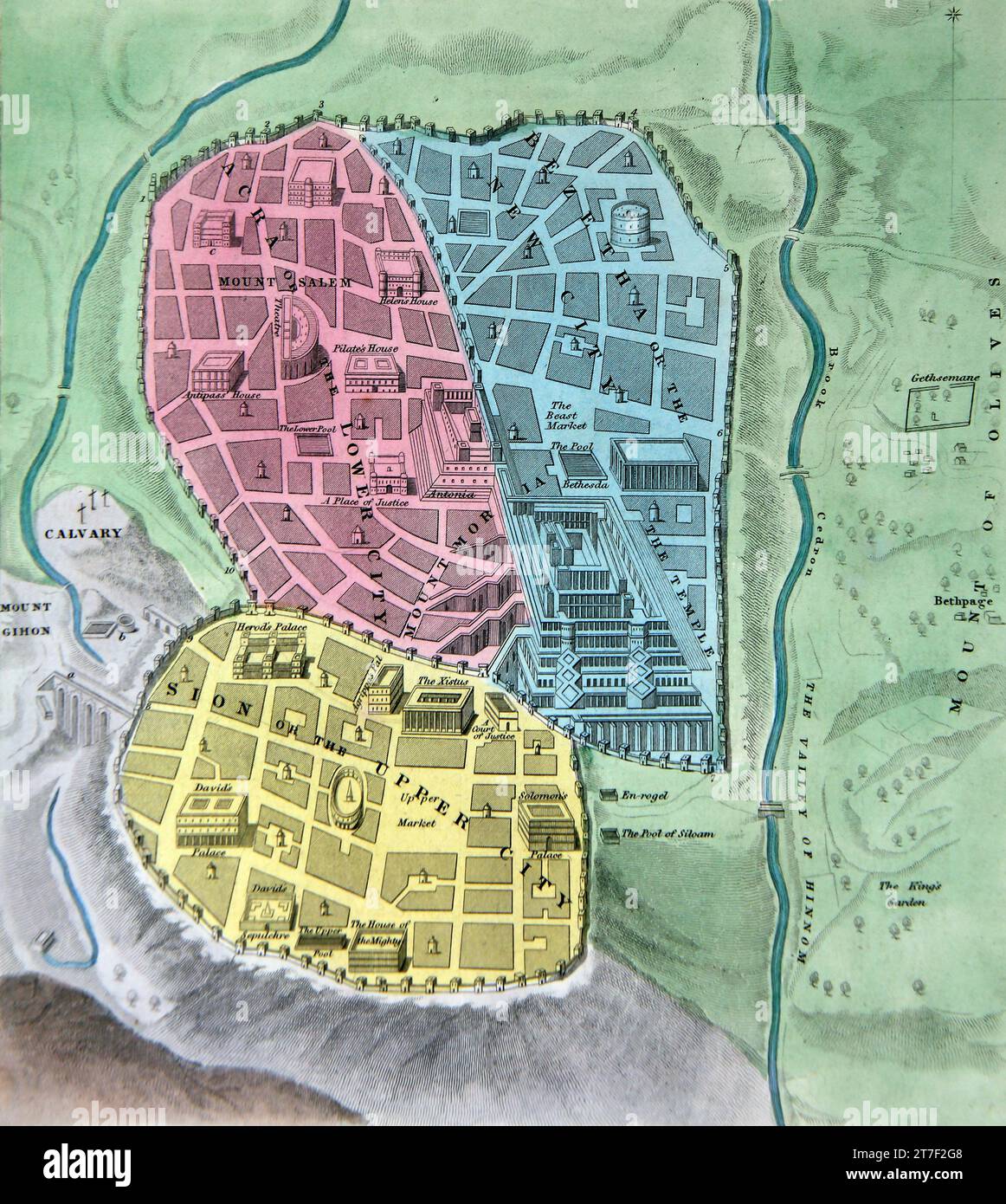 Illustration of a Plan of the Ancient City of Jerusalem Israel from the Self-Interpreting Family Bible Stock Photohttps://www.alamy.com/image-license-details/?v=1https://www.alamy.com/illustration-of-a-plan-of-the-ancient-city-of-jerusalem-israel-from-the-self-interpreting-family-bible-image572576040.html
RM2T7F2G8–Illustration of a Plan of the Ancient City of Jerusalem Israel from the Self-Interpreting Family Bible
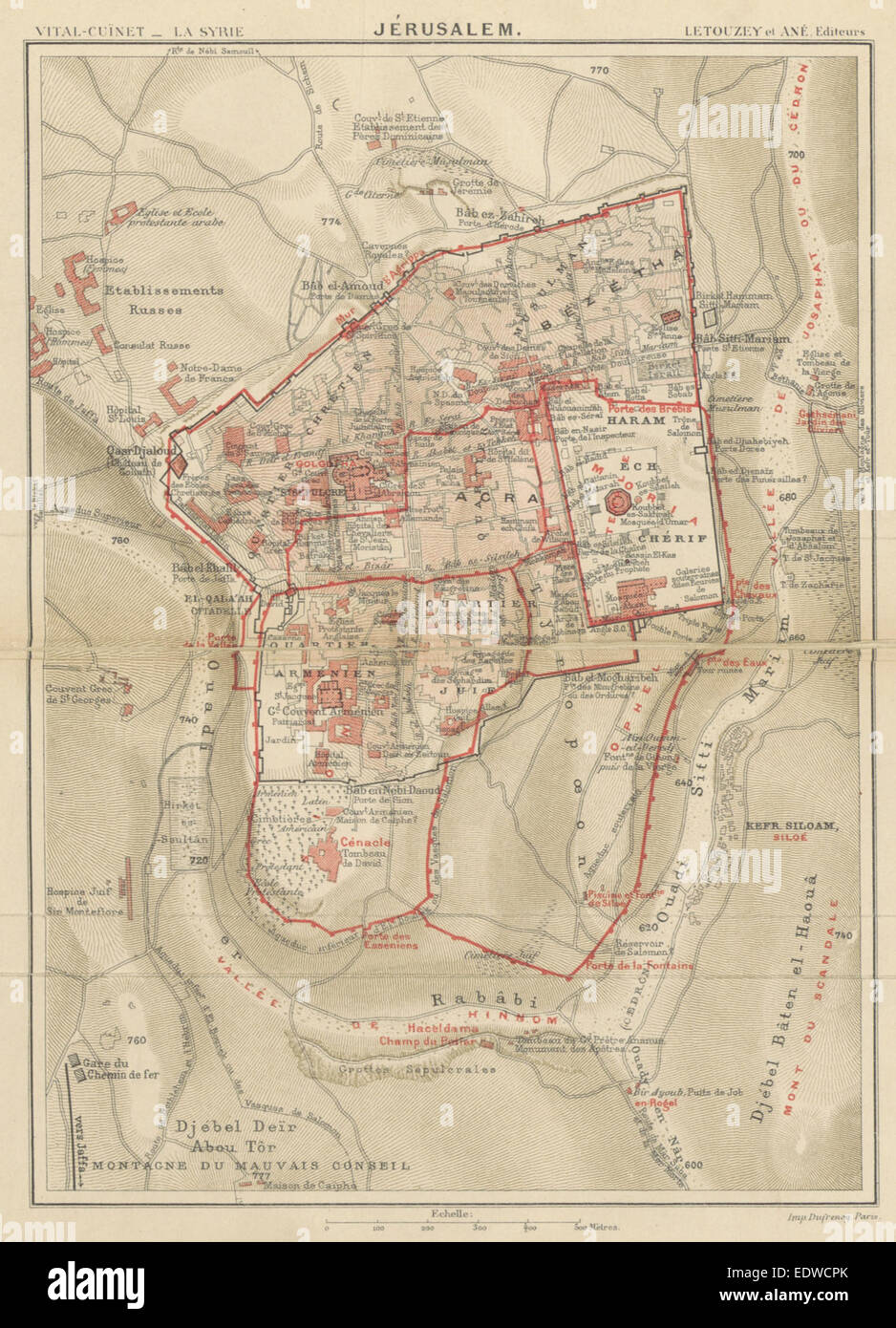 CUINET(1896) JERUSALEM Stock Photohttps://www.alamy.com/image-license-details/?v=1https://www.alamy.com/stock-photo-cuinet1896-jerusalem-77390843.html
RMEDWCPK–CUINET(1896) JERUSALEM
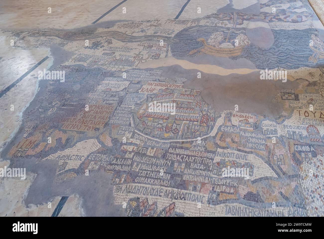 The mosaic map depicts part of the Middle East and contains the oldest surviving original cartographic depiction of the Holy Land Stock Photohttps://www.alamy.com/image-license-details/?v=1https://www.alamy.com/the-mosaic-map-depicts-part-of-the-middle-east-and-contains-the-oldest-surviving-original-cartographic-depiction-of-the-holy-land-image591221257.html
RF2W9TCMW–The mosaic map depicts part of the Middle East and contains the oldest surviving original cartographic depiction of the Holy Land
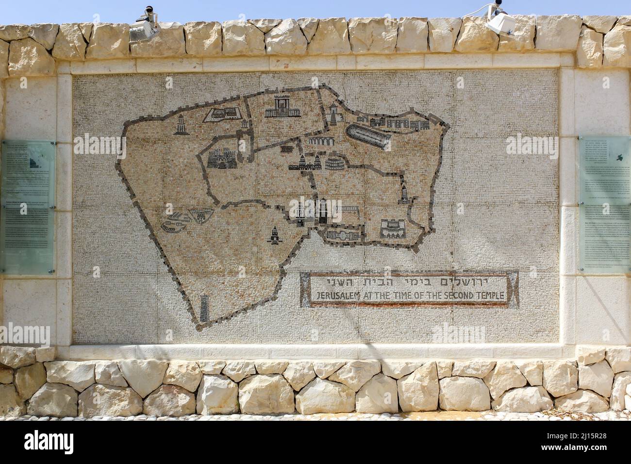 An map of the old city of Jerusalem, Israel at the time of the second temple. Stock Photohttps://www.alamy.com/image-license-details/?v=1https://www.alamy.com/an-map-of-the-old-city-of-jerusalem-israel-at-the-time-of-the-second-temple-image465422448.html
RM2J15R28–An map of the old city of Jerusalem, Israel at the time of the second temple.
 Ancient 6th Century Map Jerusalem Mosaic Saint George Greek Orthodox Church Madaba Jordan. Mosaic discovered 1884 and depicts the Holy Land Stock Photohttps://www.alamy.com/image-license-details/?v=1https://www.alamy.com/stock-photo-ancient-6th-century-map-jerusalem-mosaic-saint-george-greek-orthodox-130648868.html
RFHGFFY0–Ancient 6th Century Map Jerusalem Mosaic Saint George Greek Orthodox Church Madaba Jordan. Mosaic discovered 1884 and depicts the Holy Land
 Zion Fortress and the City of David in Jerusalem depicted in the mural by Czech artist Jan Rehor (1900) in the narthex of the Church of the Holy Family in Ceske Budejovice, South Bohemia, Czech Republic. Zion Fortress (4), City of David (5), Zion Gate (6), House of Caiaphas (7) and the Road to Bethlehem (15) are depicted in the detail of the mural. The mural was drawn after the engraving by French artist Adolphe Elzzner printed in 1852. Stock Photohttps://www.alamy.com/image-license-details/?v=1https://www.alamy.com/stock-photo-zion-fortress-and-the-city-of-david-in-jerusalem-depicted-in-the-mural-88154033.html
RMF3BNA9–Zion Fortress and the City of David in Jerusalem depicted in the mural by Czech artist Jan Rehor (1900) in the narthex of the Church of the Holy Family in Ceske Budejovice, South Bohemia, Czech Republic. Zion Fortress (4), City of David (5), Zion Gate (6), House of Caiaphas (7) and the Road to Bethlehem (15) are depicted in the detail of the mural. The mural was drawn after the engraving by French artist Adolphe Elzzner printed in 1852.
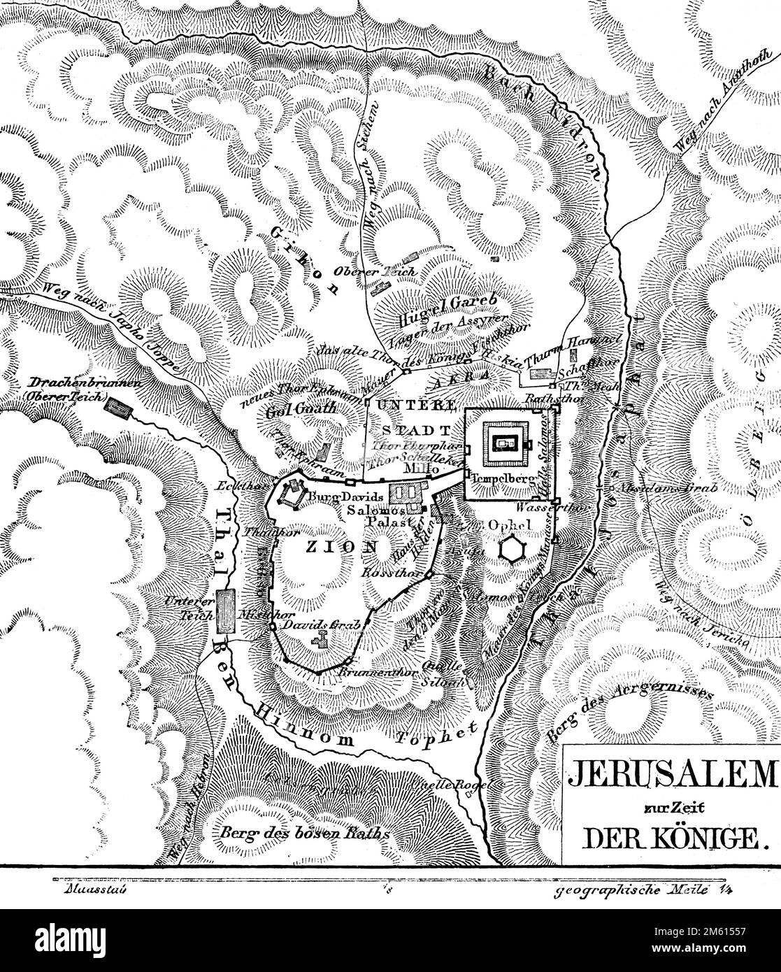 Jerusalem zur Zeit der Könige, Landkarte, Bible, Old Testament, Second Book of Samuel, historical illustration 1850 Stock Photohttps://www.alamy.com/image-license-details/?v=1https://www.alamy.com/jerusalem-zur-zeit-der-knige-landkarte-bible-old-testament-second-book-of-samuel-historical-illustration-1850-image502814627.html
RM2M61557–Jerusalem zur Zeit der Könige, Landkarte, Bible, Old Testament, Second Book of Samuel, historical illustration 1850
 Elk164 1722 Jordan Madaba St George s Church Mosaic Map of Middle East 560 AD Stock Photohttps://www.alamy.com/image-license-details/?v=1https://www.alamy.com/stock-photo-elk164-1722-jordan-madaba-st-george-s-church-mosaic-map-of-middle-25156687.html
RMBCWYH3–Elk164 1722 Jordan Madaba St George s Church Mosaic Map of Middle East 560 AD
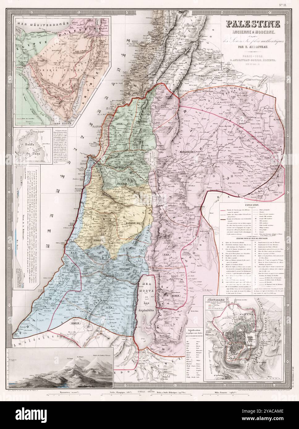 Map of Palestine, Ancient and modern, 1862 - Andriveau-Goujon, Eugene - Atlas map. Stock Photohttps://www.alamy.com/image-license-details/?v=1https://www.alamy.com/map-of-palestine-ancient-and-modern-1862-andriveau-goujon-eugene-atlas-map-image625991646.html
RM2YACAME–Map of Palestine, Ancient and modern, 1862 - Andriveau-Goujon, Eugene - Atlas map.
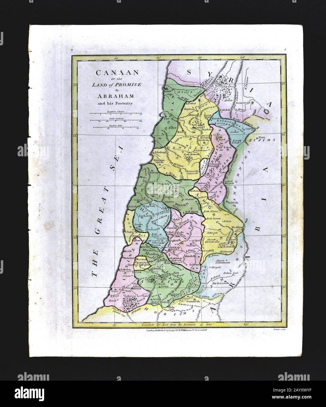 1808 Wilkinson Map Canaan Promise Land Kingdom of Abraham Old Testament Holy Land Ancient Palestine Palestina Jerusalem Stock Photohttps://www.alamy.com/image-license-details/?v=1https://www.alamy.com/1808-wilkinson-map-canaan-promise-land-kingdom-of-abraham-old-testament-holy-land-ancient-palestine-palestina-jerusalem-image344183827.html
RM2AYXWYF–1808 Wilkinson Map Canaan Promise Land Kingdom of Abraham Old Testament Holy Land Ancient Palestine Palestina Jerusalem
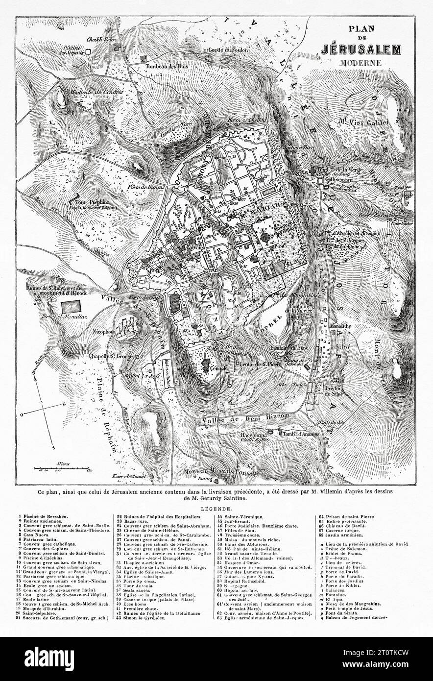 Jerusalem old map. Travels in Palestine, 1856-1859. Old 19th century engraving from Le Tour du Monde 1860 Stock Photohttps://www.alamy.com/image-license-details/?v=1https://www.alamy.com/jerusalem-old-map-travels-in-palestine-1856-1859-old-19th-century-engraving-from-le-tour-du-monde-1860-image568484249.html
RM2T0TKCW–Jerusalem old map. Travels in Palestine, 1856-1859. Old 19th century engraving from Le Tour du Monde 1860
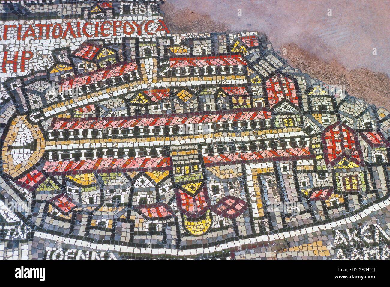 Madaba Mosaic Map Byzantine church of Saint George Jordan. Stock Photohttps://www.alamy.com/image-license-details/?v=1https://www.alamy.com/madaba-mosaic-map-byzantine-church-of-saint-george-jordan-image414670414.html
RM2F2HT9J–Madaba Mosaic Map Byzantine church of Saint George Jordan.
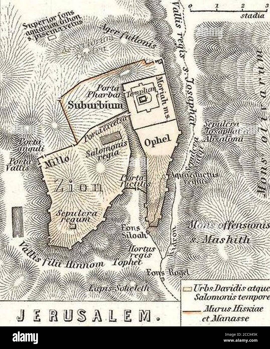 Jerusalem. 1865 Spruner Map of Israel Canaan or Palestine in Ancient Times - Geographicus - Canaan-spruner-1865. Stock Photohttps://www.alamy.com/image-license-details/?v=1https://www.alamy.com/jerusalem-1865-spruner-map-of-israel-canaan-or-palestine-in-ancient-times-geographicus-canaan-spruner-1865-image369367647.html
RM2CCX45K–Jerusalem. 1865 Spruner Map of Israel Canaan or Palestine in Ancient Times - Geographicus - Canaan-spruner-1865.
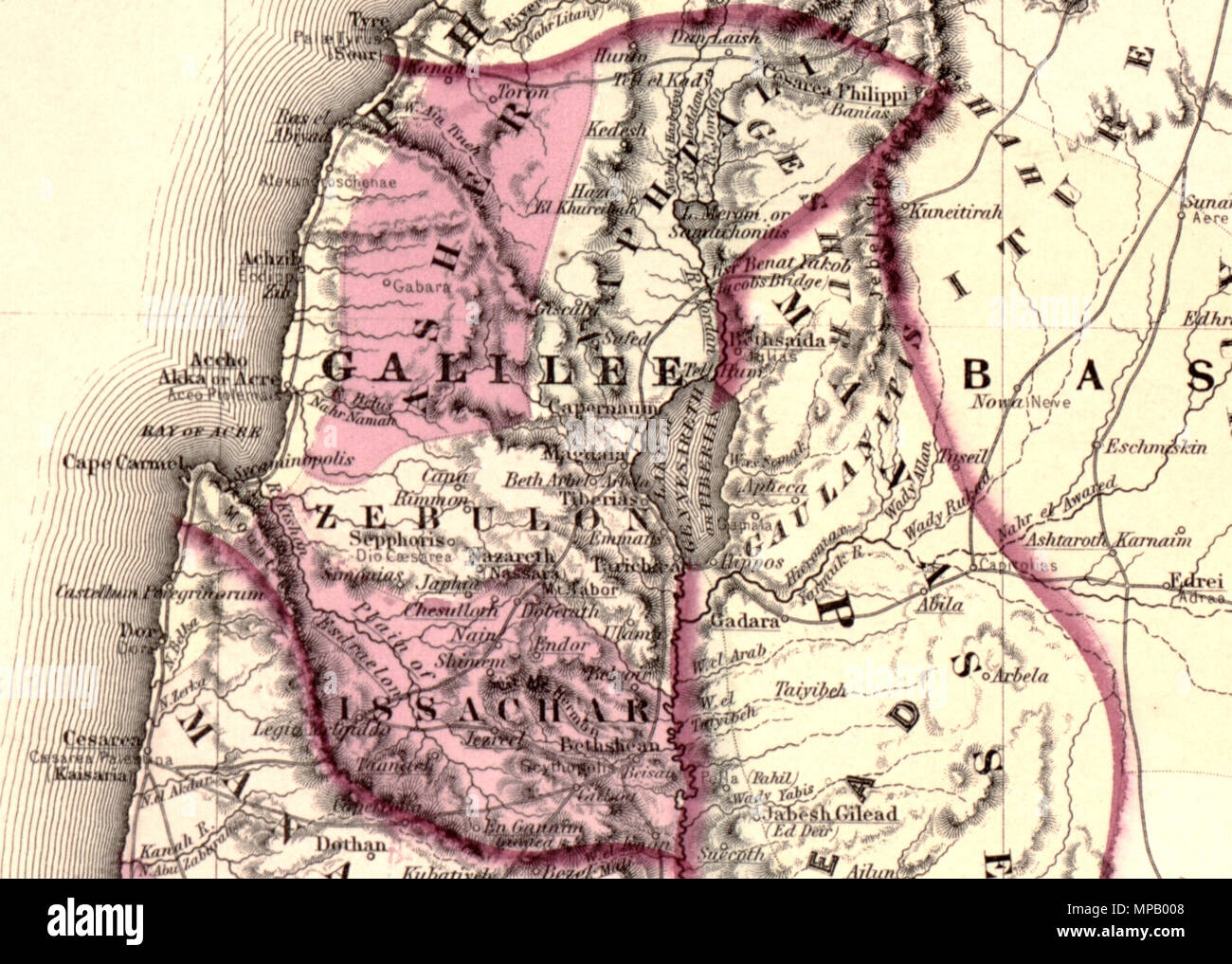 Johnson's Palestine. English: A beautiful example of A. J. Johnson’s 1862 map of Palestine / Israel / Holy Land. Details the region from Beirut south to Busaireh and Kadesh Barnea. Extends eastward as far as Mount Alsadamus in modern day Syria. Offers both contemporary and ancient geography, often noting multiple names for the same political and geographical features. Also shows numerous roadways and caravan routes throughout the region. An inset in the lower left hand quadrant details the Jerusalem with 10 important churches, biblical sites, and mosques noted. An engraved view of Damascus de Stock Photohttps://www.alamy.com/image-license-details/?v=1https://www.alamy.com/johnsons-palestine-english-a-beautiful-example-of-a-j-johnsons-1862-map-of-palestine-israel-holy-land-details-the-region-from-beirut-south-to-busaireh-and-kadesh-barnea-extends-eastward-as-far-as-mount-alsadamus-in-modern-day-syria-offers-both-contemporary-and-ancient-geography-often-noting-multiple-names-for-the-same-political-and-geographical-features-also-shows-numerous-roadways-and-caravan-routes-throughout-the-region-an-inset-in-the-lower-left-hand-quadrant-details-the-jerusalem-with-10-important-churches-biblical-sites-and-mosques-noted-an-engraved-view-of-damascus-de-image185867592.html
RMMPB008–Johnson's Palestine. English: A beautiful example of A. J. Johnson’s 1862 map of Palestine / Israel / Holy Land. Details the region from Beirut south to Busaireh and Kadesh Barnea. Extends eastward as far as Mount Alsadamus in modern day Syria. Offers both contemporary and ancient geography, often noting multiple names for the same political and geographical features. Also shows numerous roadways and caravan routes throughout the region. An inset in the lower left hand quadrant details the Jerusalem with 10 important churches, biblical sites, and mosques noted. An engraved view of Damascus de
 Mosaic of Jerusalem, Madaba Map, Byzantine mosaic, Church of St. George, Madaba, Jordan. 'Hagiapolis Ierousa...'- Greek: 'Holy City of Jerusalem' Stock Photohttps://www.alamy.com/image-license-details/?v=1https://www.alamy.com/mosaic-of-jerusalem-madaba-map-byzantine-mosaic-church-of-st-george-madaba-jordan-hagiapolis-ierousa-greek-holy-city-of-jerusalem-image614421221.html
RM2XKH8F1–Mosaic of Jerusalem, Madaba Map, Byzantine mosaic, Church of St. George, Madaba, Jordan. 'Hagiapolis Ierousa...'- Greek: 'Holy City of Jerusalem'
 travel concept - tourist takes picture of ancient byzantine map of Holy Land, Madaba on smartphone, Jordan Stock Photohttps://www.alamy.com/image-license-details/?v=1https://www.alamy.com/stock-photo-travel-concept-tourist-takes-picture-of-ancient-byzantine-map-of-holy-79960955.html
RFEJ2F0B–travel concept - tourist takes picture of ancient byzantine map of Holy Land, Madaba on smartphone, Jordan
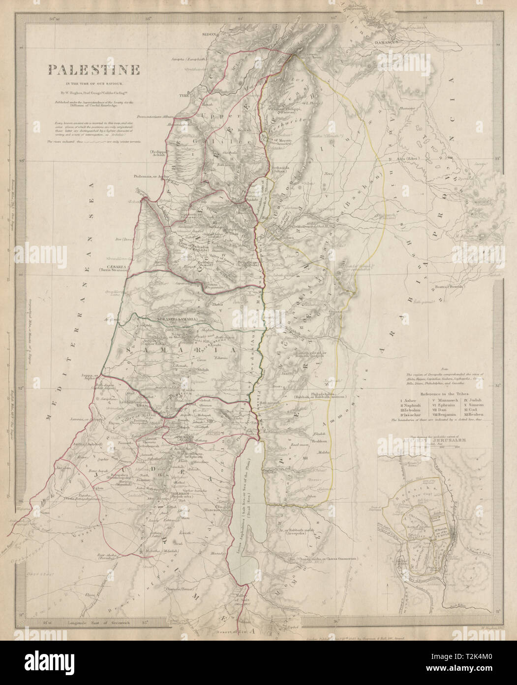 PALESTINE in the time of Our Saviour Jesus; Ancient Jerusalem. SDUK 1844 map Stock Photohttps://www.alamy.com/image-license-details/?v=1https://www.alamy.com/palestine-in-the-time-of-our-saviour-jesus-ancient-jerusalem-sduk-1844-map-image242595248.html
RFT2K4M0–PALESTINE in the time of Our Saviour Jesus; Ancient Jerusalem. SDUK 1844 map
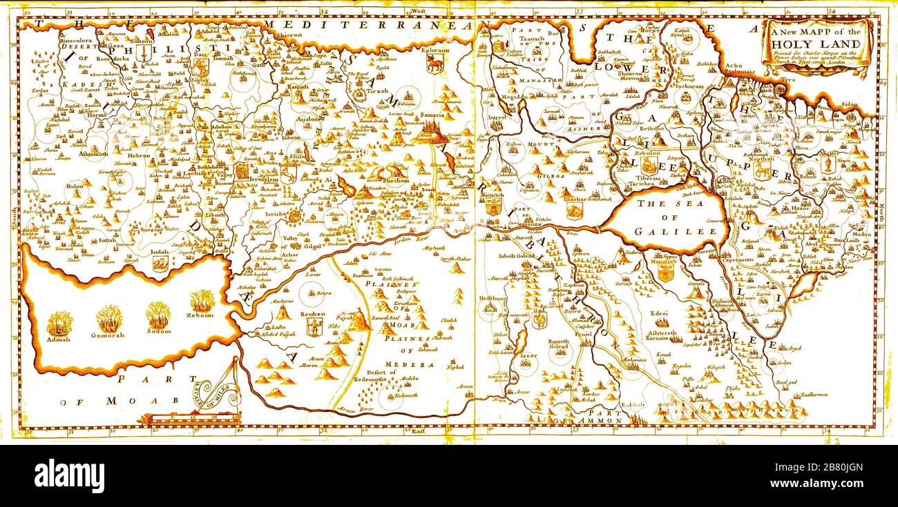 17th century Mapp of the Holy Land by Harper 1600 Ancient map in English Stock Photohttps://www.alamy.com/image-license-details/?v=1https://www.alamy.com/17th-century-mapp-of-the-holy-land-by-harper-1600-ancient-map-in-english-image349139189.html
RM2B80JGN–17th century Mapp of the Holy Land by Harper 1600 Ancient map in English