Quick filters:
Anticlines Stock Photos and Images
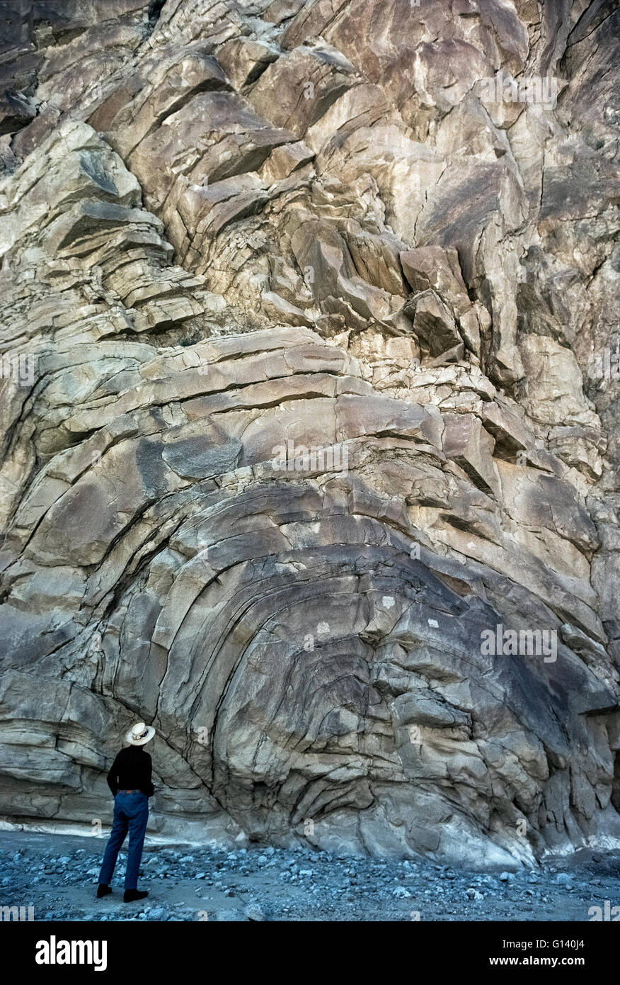 A man gives scale to this unusual geological formation called an anticline that shows arch-shaped folds in Split Mountain rocks found in the vast Anza-Borrego Desert State Park in Southern California, USA. An anticline is evident when layers of stratified rock bend downward in opposite directions from the crest of an arch. These curving folds of rock were caused by movements in the earth's fault lines that run through the park, which lies in the Colorado Desert and is California's largest state park. Some of the rocks found in the Anza-Borrego park are estimated to be 450 million years old. Stock Photohttps://www.alamy.com/image-license-details/?v=1https://www.alamy.com/stock-photo-a-man-gives-scale-to-this-unusual-geological-formation-called-an-anticline-103965180.html
RMG140J4–A man gives scale to this unusual geological formation called an anticline that shows arch-shaped folds in Split Mountain rocks found in the vast Anza-Borrego Desert State Park in Southern California, USA. An anticline is evident when layers of stratified rock bend downward in opposite directions from the crest of an arch. These curving folds of rock were caused by movements in the earth's fault lines that run through the park, which lies in the Colorado Desert and is California's largest state park. Some of the rocks found in the Anza-Borrego park are estimated to be 450 million years old.
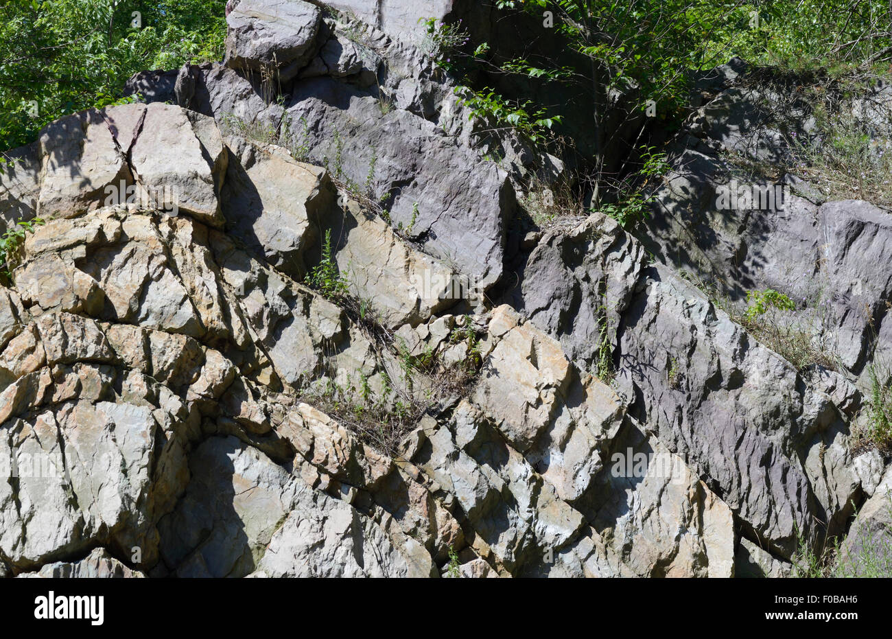 Layers of Pre-Cambrian gneiss showing anticlines and synclines, northern NJ Stock Photohttps://www.alamy.com/image-license-details/?v=1https://www.alamy.com/stock-photo-layers-of-pre-cambrian-gneiss-showing-anticlines-and-synclines-northern-86301634.html
RMF0BAH6–Layers of Pre-Cambrian gneiss showing anticlines and synclines, northern NJ
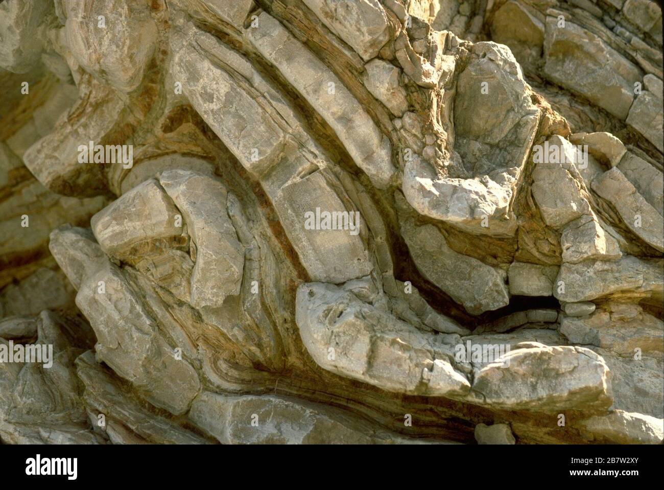 Big Bend National Park, Texas: Canyon formation of Ernst Tinaja along Old Ore Road. ©Bob Daemmrich Stock Photohttps://www.alamy.com/image-license-details/?v=1https://www.alamy.com/big-bend-national-park-texas-canyon-formation-of-ernst-tinaja-along-old-ore-road-bob-daemmrich-image349061075.html
RM2B7W2XY–Big Bend National Park, Texas: Canyon formation of Ernst Tinaja along Old Ore Road. ©Bob Daemmrich
 Coastal mountains around Grytviken bay, South Georgia, Antartica Stock Photohttps://www.alamy.com/image-license-details/?v=1https://www.alamy.com/coastal-mountains-around-grytviken-bay-south-georgia-antartica-image255866143.html
RMTT7KTF–Coastal mountains around Grytviken bay, South Georgia, Antartica
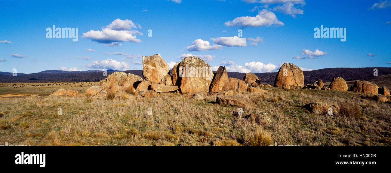 A series of sandstone Anticlines where folds in the rock happen under pressure. Stock Photohttps://www.alamy.com/image-license-details/?v=1https://www.alamy.com/stock-photo-a-series-of-sandstone-anticlines-where-folds-in-the-rock-happen-under-133380699.html
RFHN00CB–A series of sandstone Anticlines where folds in the rock happen under pressure.
 Quarry face showing strongly folded Ystrad Meurig Grits Formation of early Silurian age. Ystrad Meurig quarry. Ceredigion, Wales Stock Photohttps://www.alamy.com/image-license-details/?v=1https://www.alamy.com/stock-photo-quarry-face-showing-strongly-folded-ystrad-meurig-grits-formation-88444992.html
RMF3W0DM–Quarry face showing strongly folded Ystrad Meurig Grits Formation of early Silurian age. Ystrad Meurig quarry. Ceredigion, Wales
 A series of sandstone Anticlines where folds in the rock happen under pressure. Stock Photohttps://www.alamy.com/image-license-details/?v=1https://www.alamy.com/stock-photo-a-series-of-sandstone-anticlines-where-folds-in-the-rock-happen-under-132946954.html
RFHM875E–A series of sandstone Anticlines where folds in the rock happen under pressure.
 Panoramic view of Lulworth Cove on a summers day in Lulworth, Dorset, UK Stock Photohttps://www.alamy.com/image-license-details/?v=1https://www.alamy.com/panoramic-view-of-lulworth-cove-on-a-summers-day-in-lulworth-dorset-uk-image383367644.html
RF2D7KW9G–Panoramic view of Lulworth Cove on a summers day in Lulworth, Dorset, UK
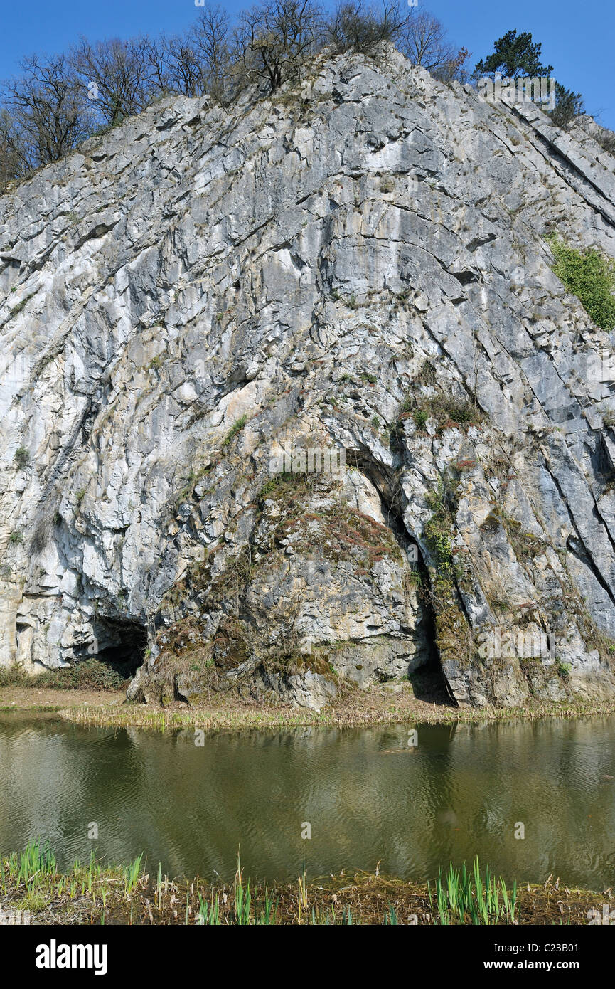 The Rock of Falize, a Frasnian limestone anticline from the Devonian era, Durbuy, Belgium Stock Photohttps://www.alamy.com/image-license-details/?v=1https://www.alamy.com/stock-photo-the-rock-of-falize-a-frasnian-limestone-anticline-from-the-devonian-35724529.html
RMC23B01–The Rock of Falize, a Frasnian limestone anticline from the Devonian era, Durbuy, Belgium
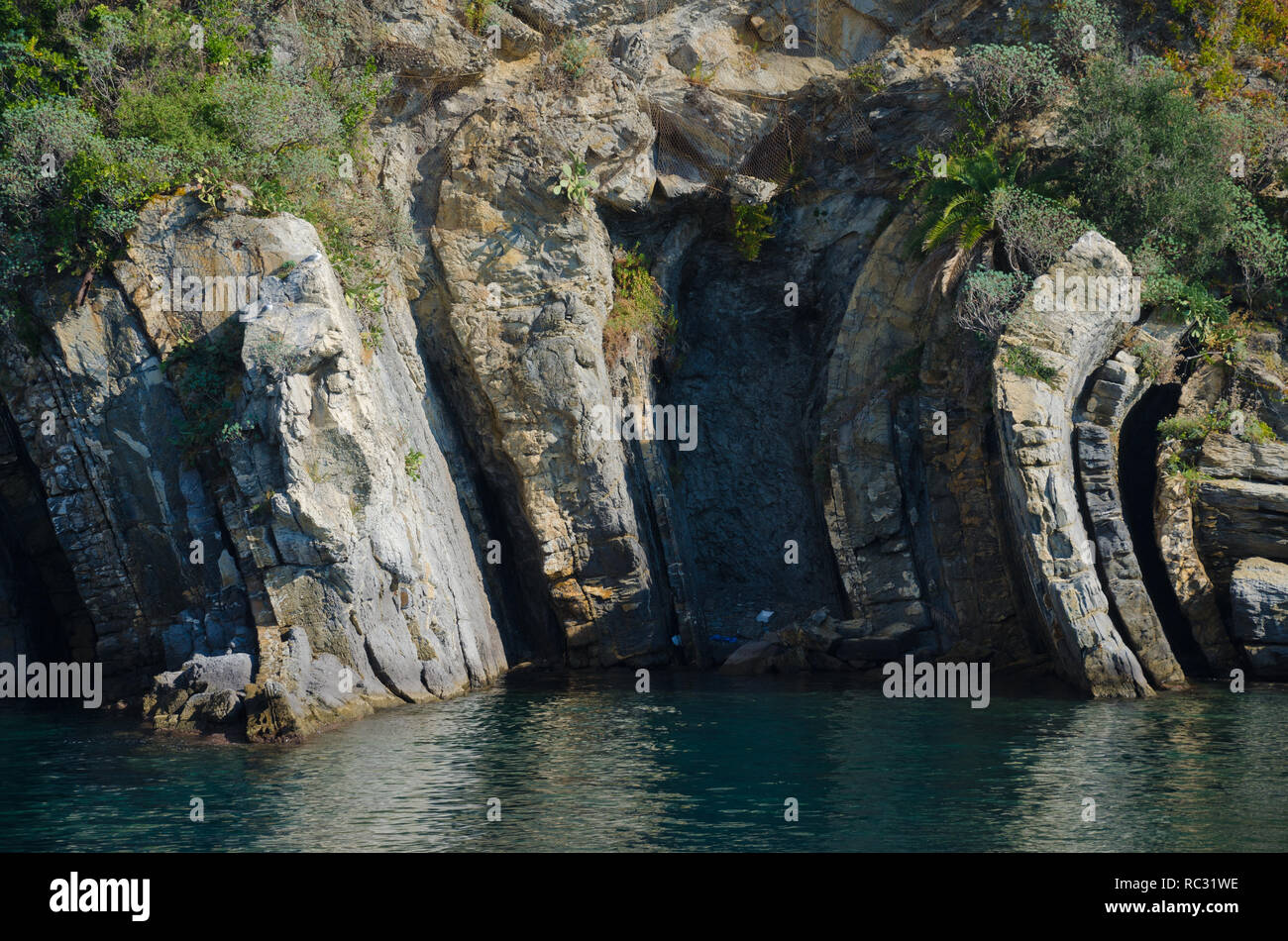 Anticline rock folds in tne limestone on the Ligurian coast of Italy Stock Photohttps://www.alamy.com/image-license-details/?v=1https://www.alamy.com/anticline-rock-folds-in-tne-limestone-on-the-ligurian-coast-of-italy-image231178010.html
RFRC31WE–Anticline rock folds in tne limestone on the Ligurian coast of Italy
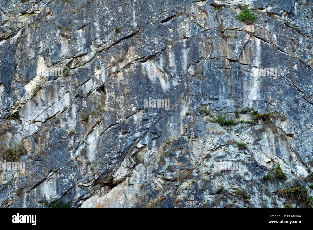 The Rock of Falize, a Frasnian limestone anticline from the Devonian era, Durbuy, Belgium Stock Photohttps://www.alamy.com/image-license-details/?v=1https://www.alamy.com/stock-photo-the-rock-of-falize-a-frasnian-limestone-anticline-from-the-devonian-26271178.html
RMBEMN4A–The Rock of Falize, a Frasnian limestone anticline from the Devonian era, Durbuy, Belgium
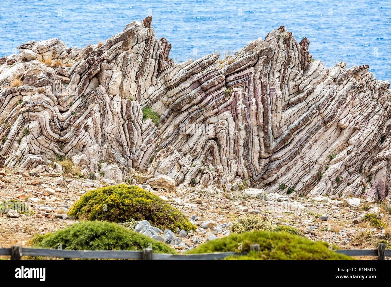 Extreme geological folds , anticlines and synclines, in Crete, Greece taken on 8 May 2016 Stock Photohttps://www.alamy.com/image-license-details/?v=1https://www.alamy.com/extreme-geological-folds-anticlines-and-synclines-in-crete-greece-taken-on-8-may-2016-image224826789.html
RFR1NMT5–Extreme geological folds , anticlines and synclines, in Crete, Greece taken on 8 May 2016
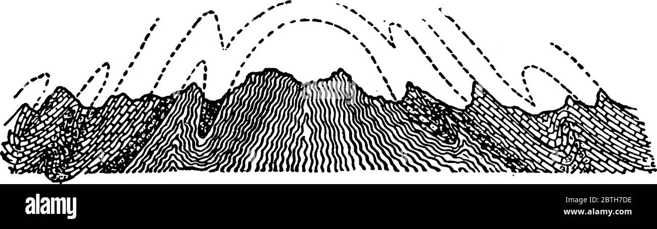 Anticlinorium, it is a vast elongated anticline with its strata further folded into anticlines, vintage line drawing or engraving illustration. Stock Vectorhttps://www.alamy.com/image-license-details/?v=1https://www.alamy.com/anticlinorium-it-is-a-vast-elongated-anticline-with-its-strata-further-folded-into-anticlines-vintage-line-drawing-or-engraving-illustration-image359338154.html
RF2BTH7DE–Anticlinorium, it is a vast elongated anticline with its strata further folded into anticlines, vintage line drawing or engraving illustration.
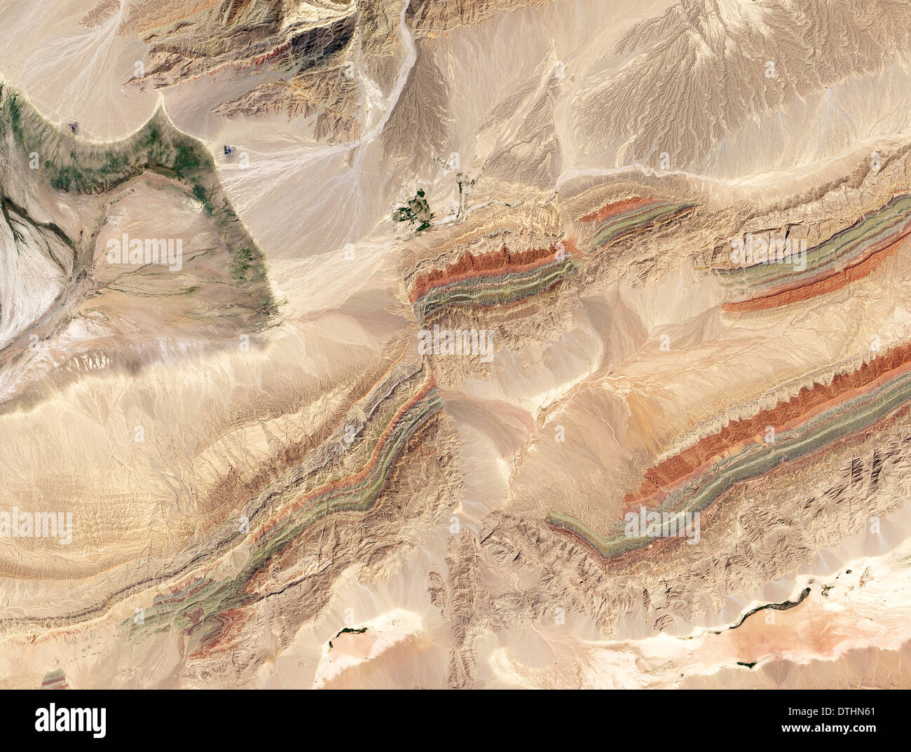 fold and thrust belts in China as seen from NASA's Landsat 8 satellite Stock Photohttps://www.alamy.com/image-license-details/?v=1https://www.alamy.com/fold-and-thrust-belts-in-china-as-seen-from-nasas-landsat-8-satellite-image66772665.html
RMDTHN61–fold and thrust belts in China as seen from NASA's Landsat 8 satellite
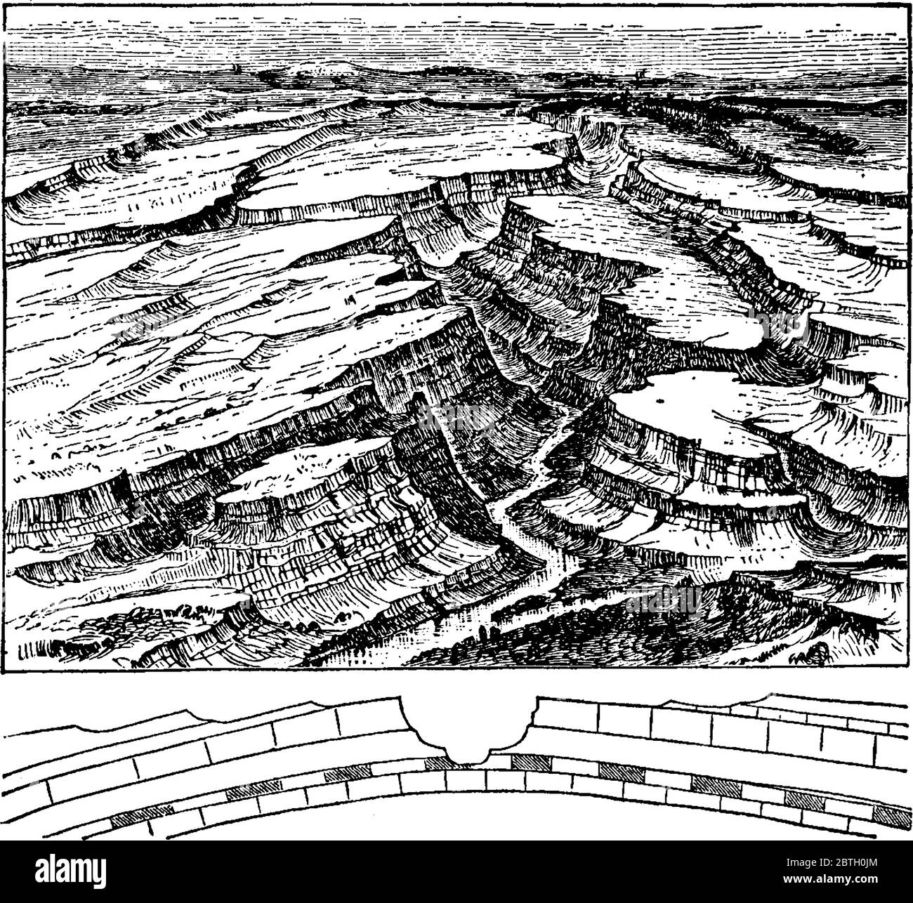 Stream on an anticline, anticlines can become incised by stream erosion, forming an anticlinal valley, vintage line drawing or engraving illustration. Stock Vectorhttps://www.alamy.com/image-license-details/?v=1https://www.alamy.com/stream-on-an-anticline-anticlines-can-become-incised-by-stream-erosion-forming-an-anticlinal-valley-vintage-line-drawing-or-engraving-illustration-image359332812.html
RF2BTH0JM–Stream on an anticline, anticlines can become incised by stream erosion, forming an anticlinal valley, vintage line drawing or engraving illustration.
 Geological magazine . st of clays and lenticular,current-bedded sandstones, the whole sequence displaying remarkablelateral variation. Along the anticlines, which generally are sharpand very steep, petroleum has accumulated where the conditions arefavourable, and its presence is manifested by escaping gas, seepages ofoil, and by extensive surface spreads of pitch. In some places occurbeds of clay-shale, which have become burnt (probably at depth) intored brick by the spontaneous combustion of the hydrocarbonscontained. JVeiffhiourin^ Mud Volcanoes. Along the Southern Anticline mud volcanoes ar Stock Photohttps://www.alamy.com/image-license-details/?v=1https://www.alamy.com/geological-magazine-st-of-clays-and-lenticularcurrent-bedded-sandstones-the-whole-sequence-displaying-remarkablelateral-variation-along-the-anticlines-which-generally-are-sharpand-very-steep-petroleum-has-accumulated-where-the-conditions-arefavourable-and-its-presence-is-manifested-by-escaping-gas-seepages-ofoil-and-by-extensive-surface-spreads-of-pitch-in-some-places-occurbeds-of-clay-shale-which-have-become-burnt-probably-at-depth-intored-brick-by-the-spontaneous-combustion-of-the-hydrocarbonscontained-jveiffhiourin-mud-volcanoes-along-the-southern-anticline-mud-volcanoes-ar-image342694888.html
RM2AWF2R4–Geological magazine . st of clays and lenticular,current-bedded sandstones, the whole sequence displaying remarkablelateral variation. Along the anticlines, which generally are sharpand very steep, petroleum has accumulated where the conditions arefavourable, and its presence is manifested by escaping gas, seepages ofoil, and by extensive surface spreads of pitch. In some places occurbeds of clay-shale, which have become burnt (probably at depth) intored brick by the spontaneous combustion of the hydrocarbonscontained. JVeiffhiourin^ Mud Volcanoes. Along the Southern Anticline mud volcanoes ar
 Arches National Park in Utah has one of the largest collections of natural arches in the world. Stock Photohttps://www.alamy.com/image-license-details/?v=1https://www.alamy.com/arches-national-park-in-utah-has-one-of-the-largest-collections-of-natural-arches-in-the-world-image633084049.html
RF2YNYD4H–Arches National Park in Utah has one of the largest collections of natural arches in the world.
 Early geophysical papers of the Early geophysical papers of the Society of Exploration Geophysicists earlygeophysical00soci Year: 1947 146 C. A. HEILAND phase curves. It will be noticed that the potential decreases above a good conductor, while the phase angle has a maximum, and vice versa. b. LOCATION OF STRUCTURE Both resistivity and potential-drop-ratio methods have found already several remarkable applications in locating geologic structure favorable for the accumulation of oil, such as anticlines, salt domes, and the like. They have also been applied very successfully in extend- ing know Stock Photohttps://www.alamy.com/image-license-details/?v=1https://www.alamy.com/early-geophysical-papers-of-the-early-geophysical-papers-of-the-society-of-exploration-geophysicists-earlygeophysical00soci-year-1947-146-c-a-heiland-phase-curves-it-will-be-noticed-that-the-potential-decreases-above-a-good-conductor-while-the-phase-angle-has-a-maximum-and-vice-versa-b-location-of-structure-both-resistivity-and-potential-drop-ratio-methods-have-found-already-several-remarkable-applications-in-locating-geologic-structure-favorable-for-the-accumulation-of-oil-such-as-anticlines-salt-domes-and-the-like-they-have-also-been-applied-very-successfully-in-extend-ing-know-image241239567.html
RMT0DBER–Early geophysical papers of the Early geophysical papers of the Society of Exploration Geophysicists earlygeophysical00soci Year: 1947 146 C. A. HEILAND phase curves. It will be noticed that the potential decreases above a good conductor, while the phase angle has a maximum, and vice versa. b. LOCATION OF STRUCTURE Both resistivity and potential-drop-ratio methods have found already several remarkable applications in locating geologic structure favorable for the accumulation of oil, such as anticlines, salt domes, and the like. They have also been applied very successfully in extend- ing know
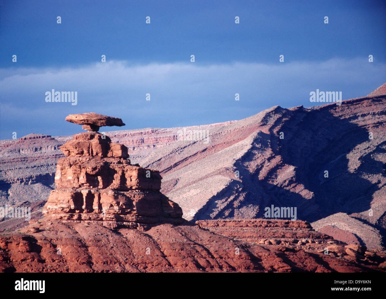 Mexican Hat balanced rock erosion resistant Halgaito Formation Sandstone with crest Raplee Anticline beyond Mexican Hat Utah. Stock Photohttps://www.alamy.com/image-license-details/?v=1https://www.alamy.com/stock-photo-mexican-hat-balanced-rock-erosion-resistant-halgaito-formation-sandstone-57760969.html
RMD9Y6KN–Mexican Hat balanced rock erosion resistant Halgaito Formation Sandstone with crest Raplee Anticline beyond Mexican Hat Utah.
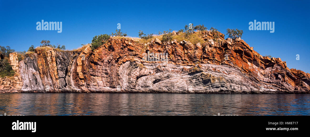 A series of sandstone Anticlines where folds in the rock happen under pressure. Stock Photohttps://www.alamy.com/image-license-details/?v=1https://www.alamy.com/stock-photo-a-series-of-sandstone-anticlines-where-folds-in-the-rock-happen-under-132946835.html
RFHM8717–A series of sandstone Anticlines where folds in the rock happen under pressure.
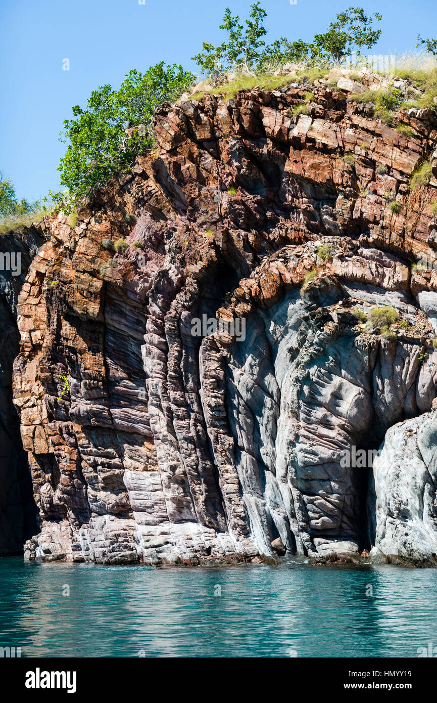 A series of sandstone Anticlines where folds in the rock happen under pressure. Stock Photohttps://www.alamy.com/image-license-details/?v=1https://www.alamy.com/stock-photo-a-series-of-sandstone-anticlines-where-folds-in-the-rock-happen-under-133379605.html
RFHMYY19–A series of sandstone Anticlines where folds in the rock happen under pressure.
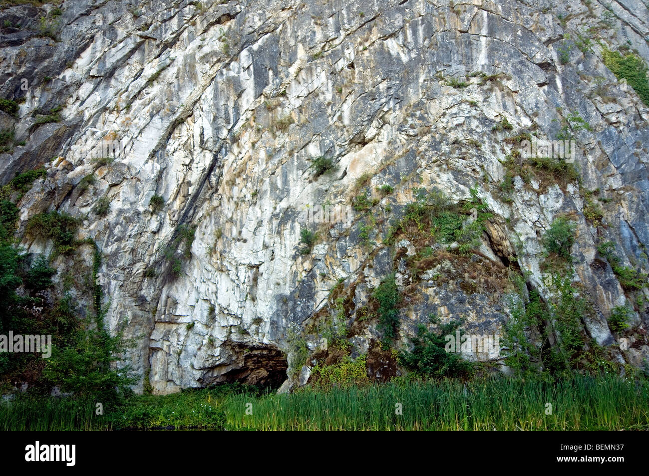 The Rock of Falize, a Frasnian limestone anticline from the Devonian era, Durbuy, Belgium Stock Photohttps://www.alamy.com/image-license-details/?v=1https://www.alamy.com/stock-photo-the-rock-of-falize-a-frasnian-limestone-anticline-from-the-devonian-26271147.html
RMBEMN37–The Rock of Falize, a Frasnian limestone anticline from the Devonian era, Durbuy, Belgium
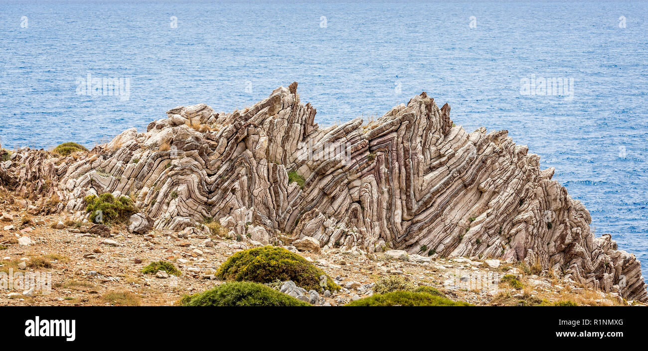 Extreme geological folds , anticlines and synclines, in Crete, Greece taken on 8 May 2016 Stock Photohttps://www.alamy.com/image-license-details/?v=1https://www.alamy.com/extreme-geological-folds-anticlines-and-synclines-in-crete-greece-taken-on-8-may-2016-image224826856.html
RFR1NMXG–Extreme geological folds , anticlines and synclines, in Crete, Greece taken on 8 May 2016
 The cell in development and inheritance . urface {anticlines^ or parallel to it {periclines). Ideal schemes ofdivision may thus be constructed for various geometrical figures. Ina flat circular disc, for example, the anticlinal planes pass throughthe radii; the periclines are circles concentric with the periphery. Ifthe disc be elongated to form an ellipse, the periclines also becomeellipses, while the anticlines are converted into hyperbolas confocalwith the periclines. If it have the form of a parabola, the periclinesand anticlines form two systems of confocal parabolas intersecting atright Stock Photohttps://www.alamy.com/image-license-details/?v=1https://www.alamy.com/the-cell-in-development-and-inheritance-urface-anticlines-or-parallel-to-it-periclines-ideal-schemes-ofdivision-may-thus-be-constructed-for-various-geometrical-figures-ina-flat-circular-disc-for-example-the-anticlinal-planes-pass-throughthe-radii-the-periclines-are-circles-concentric-with-the-periphery-ifthe-disc-be-elongated-to-form-an-ellipse-the-periclines-also-becomeellipses-while-the-anticlines-are-converted-into-hyperbolas-confocalwith-the-periclines-if-it-have-the-form-of-a-parabola-the-periclinesand-anticlines-form-two-systems-of-confocal-parabolas-intersecting-atright-image338372436.html
RM2AJE5DT–The cell in development and inheritance . urface {anticlines^ or parallel to it {periclines). Ideal schemes ofdivision may thus be constructed for various geometrical figures. Ina flat circular disc, for example, the anticlinal planes pass throughthe radii; the periclines are circles concentric with the periphery. Ifthe disc be elongated to form an ellipse, the periclines also becomeellipses, while the anticlines are converted into hyperbolas confocalwith the periclines. If it have the form of a parabola, the periclinesand anticlines form two systems of confocal parabolas intersecting atright
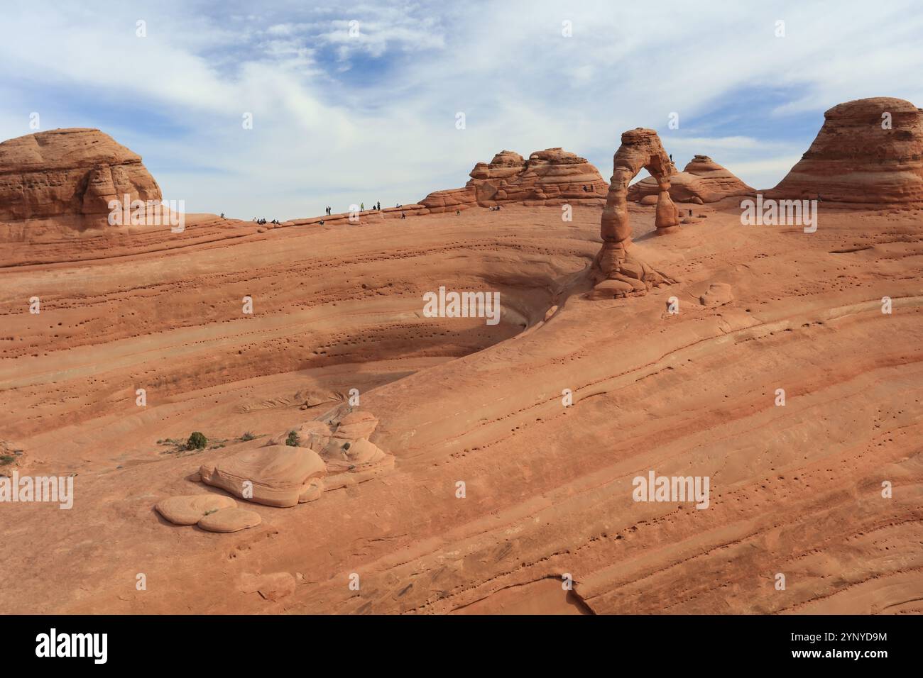 Arches National Park in Utah has one of the largest collections of natural arches in the world. Stock Photohttps://www.alamy.com/image-license-details/?v=1https://www.alamy.com/arches-national-park-in-utah-has-one-of-the-largest-collections-of-natural-arches-in-the-world-image633084192.html
RF2YNYD9M–Arches National Park in Utah has one of the largest collections of natural arches in the world.
 Early geophysical papers of the Early geophysical papers of the Society of Exploration Geophysicists earlygeophysical00soci Year: 1947 NORMAL GEOTHERMAL GRADIENT 79 c'c'c) rise in passing over the anticlines. Expressed in terms of gradi- ents, this is the equivalent of saying that the gradients are a maxi- mum, or the reciprocal gradients are a minimum, along the crests of the anticlines. Fig. i.—Cross section of typical anticline. Variations in the vertical are illustrated by the concave and convex types of depth-temperature curves {AA' and BB') shown in Figure 2. Each of the lines cc an Stock Photohttps://www.alamy.com/image-license-details/?v=1https://www.alamy.com/early-geophysical-papers-of-the-early-geophysical-papers-of-the-society-of-exploration-geophysicists-earlygeophysical00soci-year-1947-normal-geothermal-gradient-79-ccc-rise-in-passing-over-the-anticlines-expressed-in-terms-of-gradi-ents-this-is-the-equivalent-of-saying-that-the-gradients-are-a-maxi-mum-or-the-reciprocal-gradients-are-a-minimum-along-the-crests-of-the-anticlines-fig-icross-section-of-typical-anticline-variations-in-the-vertical-are-illustrated-by-the-concave-and-convex-types-of-depth-temperature-curves-aa-and-bb-shown-in-figure-2-each-of-the-lines-cc-an-image241501434.html
RMT0W9F6–Early geophysical papers of the Early geophysical papers of the Society of Exploration Geophysicists earlygeophysical00soci Year: 1947 NORMAL GEOTHERMAL GRADIENT 79 c'c'c) rise in passing over the anticlines. Expressed in terms of gradi- ents, this is the equivalent of saying that the gradients are a maxi- mum, or the reciprocal gradients are a minimum, along the crests of the anticlines. Fig. i.—Cross section of typical anticline. Variations in the vertical are illustrated by the concave and convex types of depth-temperature curves {AA' and BB') shown in Figure 2. Each of the lines cc an
 A series of sandstone Anticlines where folds in the rock happen under pressure. Stock Photohttps://www.alamy.com/image-license-details/?v=1https://www.alamy.com/stock-photo-a-series-of-sandstone-anticlines-where-folds-in-the-rock-happen-under-132934966.html
RFHM7KWA–A series of sandstone Anticlines where folds in the rock happen under pressure.
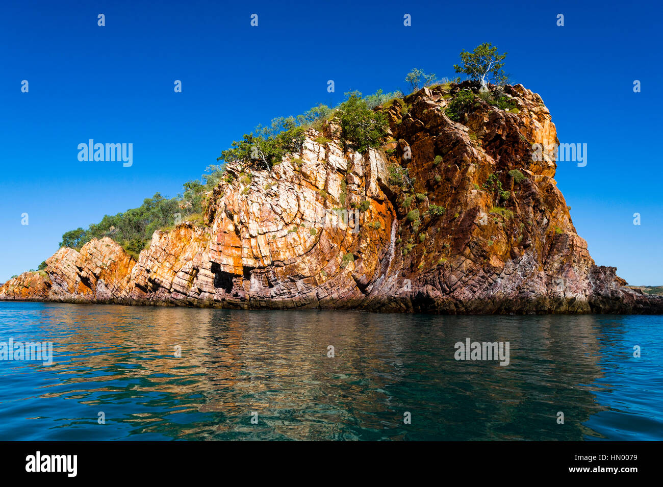 A series of sandstone synclines where folds in the rock happen under pressure. Stock Photohttps://www.alamy.com/image-license-details/?v=1https://www.alamy.com/stock-photo-a-series-of-sandstone-synclines-where-folds-in-the-rock-happen-under-133380557.html
RFHN0079–A series of sandstone synclines where folds in the rock happen under pressure.
 Geological magazine . from fissures, fault-planes, planes of unconformity,cavities, etc. B. Oil Accumulations depending on Denudation.—Outcroppingpetroliferous strata have been referred to by practical men asmonoclines in contradistinction to anticlines, which at one timewere thought essential for the accumulation of oil. These monoclinesare often really limbs of denuded anticlines, and the term would be T. 0. Bosivorth— Outlines of Oilfield Geology. 55 applied to sexeral of the cases already described and to all cases wherethe oil-rocks crop out. Most of the gas and much of the lighterconstit Stock Photohttps://www.alamy.com/image-license-details/?v=1https://www.alamy.com/geological-magazine-from-fissures-fault-planes-planes-of-unconformitycavities-etc-b-oil-accumulations-depending-on-denudationoutcroppingpetroliferous-strata-have-been-referred-to-by-practical-men-asmonoclines-in-contradistinction-to-anticlines-which-at-one-timewere-thought-essential-for-the-accumulation-of-oil-these-monoclinesare-often-really-limbs-of-denuded-anticlines-and-the-term-would-be-t-0-bosivorth-outlines-of-oilfield-geology-55-applied-to-sexeral-of-the-cases-already-described-and-to-all-cases-wherethe-oil-rocks-crop-out-most-of-the-gas-and-much-of-the-lighterconstit-image342701375.html
RM2AWFB2R–Geological magazine . from fissures, fault-planes, planes of unconformity,cavities, etc. B. Oil Accumulations depending on Denudation.—Outcroppingpetroliferous strata have been referred to by practical men asmonoclines in contradistinction to anticlines, which at one timewere thought essential for the accumulation of oil. These monoclinesare often really limbs of denuded anticlines, and the term would be T. 0. Bosivorth— Outlines of Oilfield Geology. 55 applied to sexeral of the cases already described and to all cases wherethe oil-rocks crop out. Most of the gas and much of the lighterconstit
 Arches National Park in Utah has one of the largest collections of natural arches in the world. Stock Photohttps://www.alamy.com/image-license-details/?v=1https://www.alamy.com/arches-national-park-in-utah-has-one-of-the-largest-collections-of-natural-arches-in-the-world-image633084156.html
RF2YNYD8C–Arches National Park in Utah has one of the largest collections of natural arches in the world.
 A series of sandstone synclines where folds in the rock happen under pressure. Stock Photohttps://www.alamy.com/image-license-details/?v=1https://www.alamy.com/stock-photo-a-series-of-sandstone-synclines-where-folds-in-the-rock-happen-under-133380556.html
RFHN0078–A series of sandstone synclines where folds in the rock happen under pressure.
 Allegany County . be removed completely, while the trough remains as thecrest of a synclinal ridge. Between the anticlines and the svnclines,the rocks come to the surface only as eastward- or westward-dippingbeds. Thus the foundations are furnished for monoclinal. synclinaland anticlinal ridges and valleys. Stream Adjustments in the Ridge District.—In discussing thetopography of the Ridge District, the valleys have already beendescribed and referred to as of subsequent origin. The streamsoccupying such valleys are always, in part at least, confined to them.In a number of cases in the Ridge Dis Stock Photohttps://www.alamy.com/image-license-details/?v=1https://www.alamy.com/allegany-county-be-removed-completely-while-the-trough-remains-as-thecrest-of-a-synclinal-ridge-between-the-anticlines-and-the-svnclinesthe-rocks-come-to-the-surface-only-as-eastward-or-westward-dippingbeds-thus-the-foundations-are-furnished-for-monoclinal-synclinaland-anticlinal-ridges-and-valleys-stream-adjustments-in-the-ridge-districtin-discussing-thetopography-of-the-ridge-district-the-valleys-have-already-beendescribed-and-referred-to-as-of-subsequent-origin-the-streamsoccupying-such-valleys-are-always-in-part-at-least-confined-to-themin-a-number-of-cases-in-the-ridge-dis-image343154311.html
RM2AX80R3–Allegany County . be removed completely, while the trough remains as thecrest of a synclinal ridge. Between the anticlines and the svnclines,the rocks come to the surface only as eastward- or westward-dippingbeds. Thus the foundations are furnished for monoclinal. synclinaland anticlinal ridges and valleys. Stream Adjustments in the Ridge District.—In discussing thetopography of the Ridge District, the valleys have already beendescribed and referred to as of subsequent origin. The streamsoccupying such valleys are always, in part at least, confined to them.In a number of cases in the Ridge Dis
 Arches National Park in Utah has one of the largest collections of natural arches in the world. Stock Photohttps://www.alamy.com/image-license-details/?v=1https://www.alamy.com/arches-national-park-in-utah-has-one-of-the-largest-collections-of-natural-arches-in-the-world-image633084209.html
RF2YNYDA9–Arches National Park in Utah has one of the largest collections of natural arches in the world.
 Agricultural geology . Fie. 7. Stratified rocks folded into a series of anticlines and synclines.. Fig. S. A recumbent fold. All of these varieties are most easily imderstood from the figures.Another term commonly employed is isochnal folding, whereboth limbs of an overturned fold dip in the same direction.Folds again may be complex; that is a number of smallfolds may be combined into the general form of one largefold, as shown in the figure of an anticlinorium (Fig. 9). Anexaggerated form of an anticlinorium is the fan-structure of Stock Photohttps://www.alamy.com/image-license-details/?v=1https://www.alamy.com/agricultural-geology-fie-7-stratified-rocks-folded-into-a-series-of-anticlines-and-synclines-fig-s-a-recumbent-fold-all-of-these-varieties-are-most-easily-imderstood-from-the-figuresanother-term-commonly-employed-is-isochnal-folding-whereboth-limbs-of-an-overturned-fold-dip-in-the-same-directionfolds-again-may-be-complex-that-is-a-number-of-smallfolds-may-be-combined-into-the-general-form-of-one-largefold-as-shown-in-the-figure-of-an-anticlinorium-fig-9-anexaggerated-form-of-an-anticlinorium-is-the-fan-structure-of-image338255027.html
RM2AJ8RMK–Agricultural geology . Fie. 7. Stratified rocks folded into a series of anticlines and synclines.. Fig. S. A recumbent fold. All of these varieties are most easily imderstood from the figures.Another term commonly employed is isochnal folding, whereboth limbs of an overturned fold dip in the same direction.Folds again may be complex; that is a number of smallfolds may be combined into the general form of one largefold, as shown in the figure of an anticlinorium (Fig. 9). Anexaggerated form of an anticlinorium is the fan-structure of
 Arches National Park in Utah has one of the largest collections of natural arches in the world. Stock Photohttps://www.alamy.com/image-license-details/?v=1https://www.alamy.com/arches-national-park-in-utah-has-one-of-the-largest-collections-of-natural-arches-in-the-world-image633084086.html
RF2YNYD5X–Arches National Park in Utah has one of the largest collections of natural arches in the world.
 The Quarterly journal of the Geological Society of London . ion ; and streams carrying the materialsflowed down the flanks of the emergent land into the sea or estuaryto the westward. This process was going on all through the Meso-zoic period. As time went on, these western tracts, wherever inthe line of anticlines, were themselves elevated and eroded, andultimately the synclines themselves ; but the necessary result ofthis unequal process of erosion would be to leave the synclinal tractsrelatively higher than the anticlines. At a later epoch the Cumber-land Plateau began to be formed by the c Stock Photohttps://www.alamy.com/image-license-details/?v=1https://www.alamy.com/the-quarterly-journal-of-the-geological-society-of-london-ion-and-streams-carrying-the-materialsflowed-down-the-flanks-of-the-emergent-land-into-the-sea-or-estuaryto-the-westward-this-process-was-going-on-all-through-the-meso-zoic-period-as-time-went-on-these-western-tracts-wherever-inthe-line-of-anticlines-were-themselves-elevated-and-eroded-andultimately-the-synclines-themselves-but-the-necessary-result-ofthis-unequal-process-of-erosion-would-be-to-leave-the-synclinal-tractsrelatively-higher-than-the-anticlines-at-a-later-epoch-the-cumber-land-plateau-began-to-be-formed-by-the-c-image340033935.html
RM2AN5TN3–The Quarterly journal of the Geological Society of London . ion ; and streams carrying the materialsflowed down the flanks of the emergent land into the sea or estuaryto the westward. This process was going on all through the Meso-zoic period. As time went on, these western tracts, wherever inthe line of anticlines, were themselves elevated and eroded, andultimately the synclines themselves ; but the necessary result ofthis unequal process of erosion would be to leave the synclinal tractsrelatively higher than the anticlines. At a later epoch the Cumber-land Plateau began to be formed by the c
 Arches National Park in Utah has one of the largest collections of natural arches in the world. Stock Photohttps://www.alamy.com/image-license-details/?v=1https://www.alamy.com/arches-national-park-in-utah-has-one-of-the-largest-collections-of-natural-arches-in-the-world-image633084260.html
RF2YNYDC4–Arches National Park in Utah has one of the largest collections of natural arches in the world.
 Geological magazine . causes such special con-centration at the domes that sometimes the intervening parts of theanticline are barren. When an anticline is asymmetrical the gentler slope generallyprovides the best well-sites, and gentle anticlines are usually moreprolific than steep ones ; indeed, many of the richest fields are onanticlines whose flanks slope at only a few degrees and whose crestsare very broad. On very broad anticlinals, several miles across, thehydrocarbons are often concentrated in isolated pools where thecircumstances are particularly favourable. Variation in porosity andb Stock Photohttps://www.alamy.com/image-license-details/?v=1https://www.alamy.com/geological-magazine-causes-such-special-con-centration-at-the-domes-that-sometimes-the-intervening-parts-of-theanticline-are-barren-when-an-anticline-is-asymmetrical-the-gentler-slope-generallyprovides-the-best-well-sites-and-gentle-anticlines-are-usually-moreprolific-than-steep-ones-indeed-many-of-the-richest-fields-are-onanticlines-whose-flanks-slope-at-only-a-few-degrees-and-whose-crestsare-very-broad-on-very-broad-anticlinals-several-miles-across-thehydrocarbons-are-often-concentrated-in-isolated-pools-where-thecircumstances-are-particularly-favourable-variation-in-porosity-andb-image342704291.html
RM2AWFEPY–Geological magazine . causes such special con-centration at the domes that sometimes the intervening parts of theanticline are barren. When an anticline is asymmetrical the gentler slope generallyprovides the best well-sites, and gentle anticlines are usually moreprolific than steep ones ; indeed, many of the richest fields are onanticlines whose flanks slope at only a few degrees and whose crestsare very broad. On very broad anticlinals, several miles across, thehydrocarbons are often concentrated in isolated pools where thecircumstances are particularly favourable. Variation in porosity andb
 Arches National Park in Utah has one of the largest collections of natural arches in the world. Stock Photohttps://www.alamy.com/image-license-details/?v=1https://www.alamy.com/arches-national-park-in-utah-has-one-of-the-largest-collections-of-natural-arches-in-the-world-image633084095.html
RF2YNYD67–Arches National Park in Utah has one of the largest collections of natural arches in the world.
 The deposits of the useful minerals & rocks; their origin, form, and content . %/8J0leyel 614 OEE-DEPOSITS recent movement they now occur in steep anticlines and synclines. Eastof Ballarat granitic rocks appear, which have effected contact-meta-morphism of the slates. Finally, the Carboniferous glacial deposits in theeast of the plateau are noteworthy. The gold-quartz lodes of the district may be divided into threegroups, those respectively of Little Bendigo, Ballarat East, and BallaratWest, the general trend of these districts being approximately parallel,and north-south. Little Bendigo, the Stock Photohttps://www.alamy.com/image-license-details/?v=1https://www.alamy.com/the-deposits-of-the-useful-minerals-rocks-their-origin-form-and-content-8j0leyel-614-oee-deposits-recent-movement-they-now-occur-in-steep-anticlines-and-synclines-eastof-ballarat-granitic-rocks-appear-which-have-effected-contact-meta-morphism-of-the-slates-finally-the-carboniferous-glacial-deposits-in-theeast-of-the-plateau-are-noteworthy-the-gold-quartz-lodes-of-the-district-may-be-divided-into-threegroups-those-respectively-of-little-bendigo-ballarat-east-and-ballaratwest-the-general-trend-of-these-districts-being-approximately-paralleland-north-south-little-bendigo-the-image340244221.html
RM2ANFCY9–The deposits of the useful minerals & rocks; their origin, form, and content . %/8J0leyel 614 OEE-DEPOSITS recent movement they now occur in steep anticlines and synclines. Eastof Ballarat granitic rocks appear, which have effected contact-meta-morphism of the slates. Finally, the Carboniferous glacial deposits in theeast of the plateau are noteworthy. The gold-quartz lodes of the district may be divided into threegroups, those respectively of Little Bendigo, Ballarat East, and BallaratWest, the general trend of these districts being approximately parallel,and north-south. Little Bendigo, the
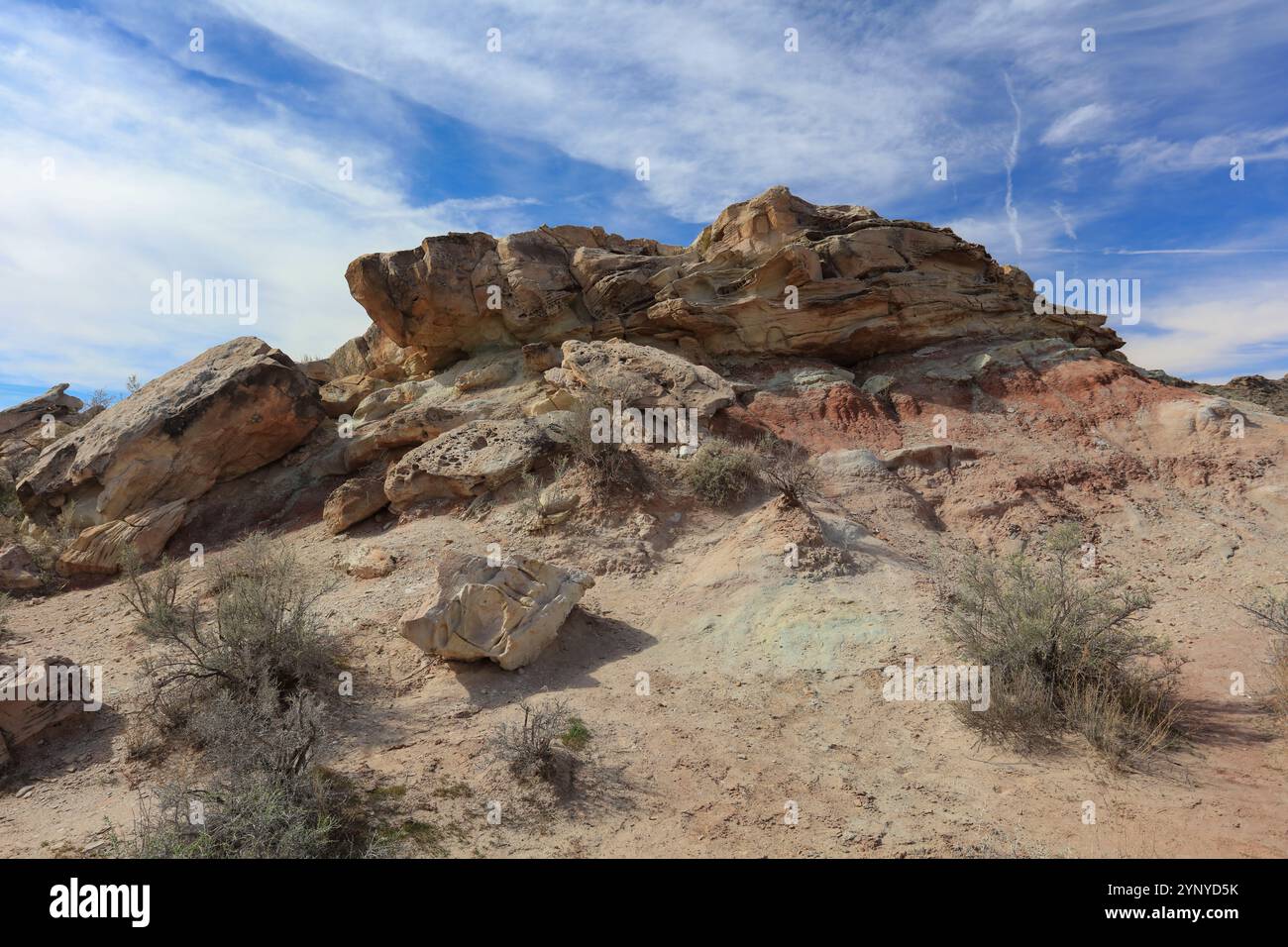 Arches National Park in Utah has one of the largest collections of natural arches in the world. Stock Photohttps://www.alamy.com/image-license-details/?v=1https://www.alamy.com/arches-national-park-in-utah-has-one-of-the-largest-collections-of-natural-arches-in-the-world-image633084079.html
RF2YNYD5K–Arches National Park in Utah has one of the largest collections of natural arches in the world.
 Geological and topographical maps, their interpretation and use, a handbook for the geologist and civil engineer . ines are hardened by compression, while the tops ofthe saddles are weakened by stretching, the result beingthat after long-protracted denudation the anticlines havenot only been cut down to the level of the synclines, butthe latter, owing to the superior hardness of their strata, 37 38 GEOLOGICAL AND TOPOGRAPHICAL MAPS have been left as hills, while the intervening anti-clines have been still further cut away to form valleys(Fig, 15). In the same manner the upthrow side of a fault Stock Photohttps://www.alamy.com/image-license-details/?v=1https://www.alamy.com/geological-and-topographical-maps-their-interpretation-and-use-a-handbook-for-the-geologist-and-civil-engineer-ines-are-hardened-by-compression-while-the-tops-ofthe-saddles-are-weakened-by-stretching-the-result-beingthat-after-long-protracted-denudation-the-anticlines-havenot-only-been-cut-down-to-the-level-of-the-synclines-butthe-latter-owing-to-the-superior-hardness-of-their-strata-37-38-geological-and-topographical-maps-have-been-left-as-hills-while-the-intervening-anti-clines-have-been-still-further-cut-away-to-form-valleysfig-15-in-the-same-manner-the-upthrow-side-of-a-fault-image339964741.html
RM2AN2MDW–Geological and topographical maps, their interpretation and use, a handbook for the geologist and civil engineer . ines are hardened by compression, while the tops ofthe saddles are weakened by stretching, the result beingthat after long-protracted denudation the anticlines havenot only been cut down to the level of the synclines, butthe latter, owing to the superior hardness of their strata, 37 38 GEOLOGICAL AND TOPOGRAPHICAL MAPS have been left as hills, while the intervening anti-clines have been still further cut away to form valleys(Fig, 15). In the same manner the upthrow side of a fault
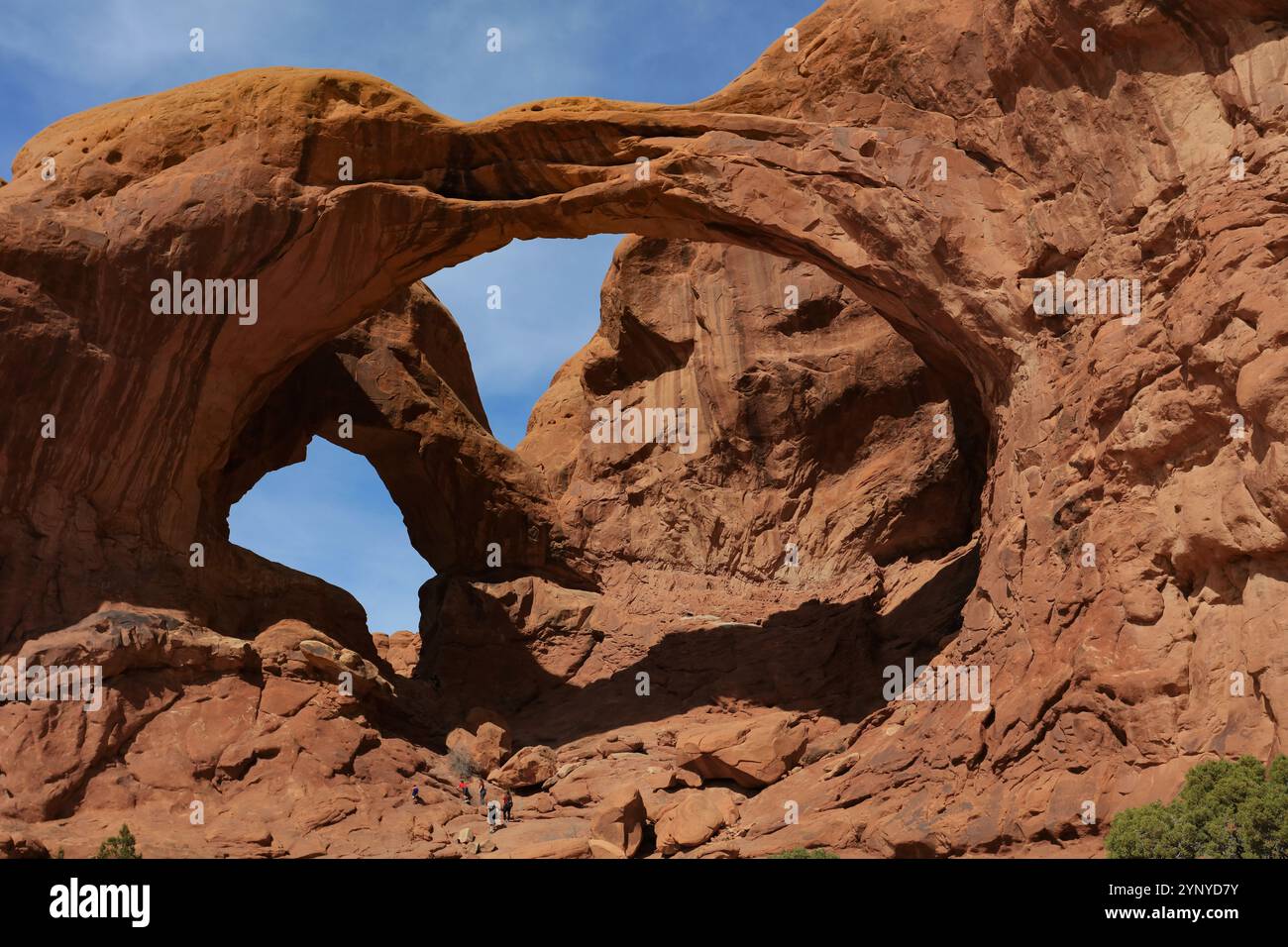 Arches National Park in Utah has one of the largest collections of natural arches in the world. Stock Photohttps://www.alamy.com/image-license-details/?v=1https://www.alamy.com/arches-national-park-in-utah-has-one-of-the-largest-collections-of-natural-arches-in-the-world-image633084143.html
RF2YNYD7Y–Arches National Park in Utah has one of the largest collections of natural arches in the world.
 The first exposition of conservation and its builders; an official history of the National conservation exposition, held at Knoxville, Tenn., in 1913 and of its forerunners, the Appalachian expositions of 1910-11, embracing a review of the conservation movement in the United States from its inception to the present time . id-Continent Field the rocks hae been folded into a series of anticlines andsynclines. The oil and gas occur in the Pennsylvanian sandstones which lieinterbedded with the shales. Amount oe Natural Gas. At the present time there is not sufificient data to enable us to estimat Stock Photohttps://www.alamy.com/image-license-details/?v=1https://www.alamy.com/the-first-exposition-of-conservation-and-its-builders-an-official-history-of-the-national-conservation-exposition-held-at-knoxville-tenn-in-1913-and-of-its-forerunners-the-appalachian-expositions-of-1910-11-embracing-a-review-of-the-conservation-movement-in-the-united-states-from-its-inception-to-the-present-time-id-continent-field-the-rocks-hae-been-folded-into-a-series-of-anticlines-andsynclines-the-oil-and-gas-occur-in-the-pennsylvanian-sandstones-which-lieinterbedded-with-the-shales-amount-oe-natural-gas-at-the-present-time-there-is-not-sufificient-data-to-enable-us-to-estimat-image342720052.html
RM2AWG6WT–The first exposition of conservation and its builders; an official history of the National conservation exposition, held at Knoxville, Tenn., in 1913 and of its forerunners, the Appalachian expositions of 1910-11, embracing a review of the conservation movement in the United States from its inception to the present time . id-Continent Field the rocks hae been folded into a series of anticlines andsynclines. The oil and gas occur in the Pennsylvanian sandstones which lieinterbedded with the shales. Amount oe Natural Gas. At the present time there is not sufificient data to enable us to estimat
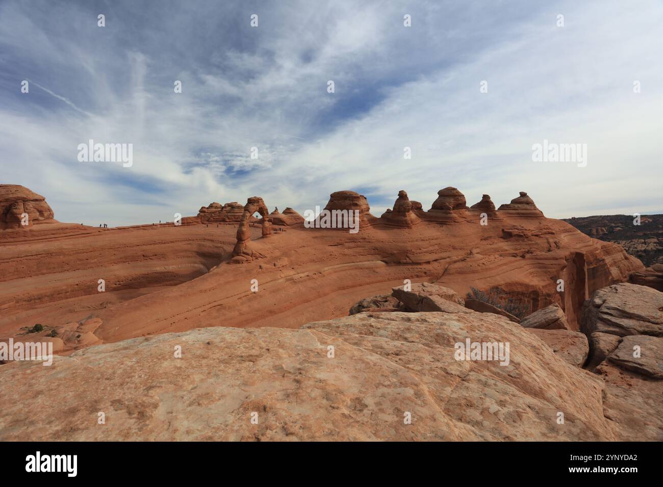 Arches National Park in Utah has one of the largest collections of natural arches in the world. Stock Photohttps://www.alamy.com/image-license-details/?v=1https://www.alamy.com/arches-national-park-in-utah-has-one-of-the-largest-collections-of-natural-arches-in-the-world-image633084202.html
RF2YNYDA2–Arches National Park in Utah has one of the largest collections of natural arches in the world.
 California mines and minerals . the uplifting, or other move-ments, of the earth; and if these oils are concreted into asphaltum,by oxidation and evaporation, they retain possession. The oil, occu-pying the surface of the water in a formation, has an advantageousposition to perform this work, as the formation is more fractured inthese parts than in the synclines and the dips of the anticlines. The cut (Fig. 10) shows strata of bituminized sand on a ridge run-ning north and south, between the Coja Creek and a branch of the Bald-win Creek, seven miles west of Santa Cruz, California. The bitumi-n Stock Photohttps://www.alamy.com/image-license-details/?v=1https://www.alamy.com/california-mines-and-minerals-the-uplifting-or-other-move-ments-of-the-earth-and-if-these-oils-are-concreted-into-asphaltumby-oxidation-and-evaporation-they-retain-possession-the-oil-occu-pying-the-surface-of-the-water-in-a-formation-has-an-advantageousposition-to-perform-this-work-as-the-formation-is-more-fractured-inthese-parts-than-in-the-synclines-and-the-dips-of-the-anticlines-the-cut-fig-10-shows-strata-of-bituminized-sand-on-a-ridge-run-ning-north-and-south-between-the-coja-creek-and-a-branch-of-the-bald-win-creek-seven-miles-west-of-santa-cruz-california-the-bitumi-n-image339132125.html
RM2AKMPDH–California mines and minerals . the uplifting, or other move-ments, of the earth; and if these oils are concreted into asphaltum,by oxidation and evaporation, they retain possession. The oil, occu-pying the surface of the water in a formation, has an advantageousposition to perform this work, as the formation is more fractured inthese parts than in the synclines and the dips of the anticlines. The cut (Fig. 10) shows strata of bituminized sand on a ridge run-ning north and south, between the Coja Creek and a branch of the Bald-win Creek, seven miles west of Santa Cruz, California. The bitumi-n
 Arches National Park in Utah has one of the largest collections of natural arches in the world. Stock Photohttps://www.alamy.com/image-license-details/?v=1https://www.alamy.com/arches-national-park-in-utah-has-one-of-the-largest-collections-of-natural-arches-in-the-world-image633084253.html
RF2YNYDBW–Arches National Park in Utah has one of the largest collections of natural arches in the world.
 California mines and minerals . e fully developed, a gentle stream of water from 130 CALIFORNIA MINES AND MINERALS a tup is allowed to flow over it to wash off the turpentine. If alloperations have been conducted rightly, a very delicate and perfectpicture in asphaltum is the result. Anticlines, synclines, monoclines, centroclines and quaquaversals,and also faults, exert a great influence in the accumulations of gas,petroleum oil and water. Especially is this true in California, wherethe dips and undulations along the strike of the anticline are exposedand well defined. Although a description Stock Photohttps://www.alamy.com/image-license-details/?v=1https://www.alamy.com/california-mines-and-minerals-e-fully-developed-a-gentle-stream-of-water-from-130-california-mines-and-minerals-a-tup-is-allowed-to-flow-over-it-to-wash-off-the-turpentine-if-alloperations-have-been-conducted-rightly-a-very-delicate-and-perfectpicture-in-asphaltum-is-the-result-anticlines-synclines-monoclines-centroclines-and-quaquaversalsand-also-faults-exert-a-great-influence-in-the-accumulations-of-gaspetroleum-oil-and-water-especially-is-this-true-in-california-wherethe-dips-and-undulations-along-the-strike-of-the-anticline-are-exposedand-well-defined-although-a-description-image339141010.html
RM2AKN5PX–California mines and minerals . e fully developed, a gentle stream of water from 130 CALIFORNIA MINES AND MINERALS a tup is allowed to flow over it to wash off the turpentine. If alloperations have been conducted rightly, a very delicate and perfectpicture in asphaltum is the result. Anticlines, synclines, monoclines, centroclines and quaquaversals,and also faults, exert a great influence in the accumulations of gas,petroleum oil and water. Especially is this true in California, wherethe dips and undulations along the strike of the anticline are exposedand well defined. Although a description
 Arches National Park in Utah has one of the largest collections of natural arches in the world. Stock Photohttps://www.alamy.com/image-license-details/?v=1https://www.alamy.com/arches-national-park-in-utah-has-one-of-the-largest-collections-of-natural-arches-in-the-world-image633084198.html
RF2YNYD9X–Arches National Park in Utah has one of the largest collections of natural arches in the world.
 . The cell; outlines of general anatomy and physiology. by the embryonic substance is partitionedout, so that anticlinal and periclinal walls intersect at right angles.This being granted, the network of cells in Fig. Ill may be con-structed according to a well-known geometrical law. Let x x re-present the axis, and y y the direction of the parameter, then allthe periclines, denoted by P p, form a group of confocal parabolas.Similarly, all the anticlines, A a, form another group of confocalparabolas, whose focus and axis coincide with those of the pre-ceding group, but which run in the opposite Stock Photohttps://www.alamy.com/image-license-details/?v=1https://www.alamy.com/the-cell-outlines-of-general-anatomy-and-physiology-by-the-embryonic-substance-is-partitionedout-so-that-anticlinal-and-periclinal-walls-intersect-at-right-anglesthis-being-granted-the-network-of-cells-in-fig-ill-may-be-con-structed-according-to-a-well-known-geometrical-law-let-x-x-re-present-the-axis-and-y-y-the-direction-of-the-parameter-then-allthe-periclines-denoted-by-p-p-form-a-group-of-confocal-parabolassimilarly-all-the-anticlines-a-a-form-another-group-of-confocalparabolas-whose-focus-and-axis-coincide-with-those-of-the-pre-ceding-group-but-which-run-in-the-opposite-image336838530.html
RM2AG08YE–. The cell; outlines of general anatomy and physiology. by the embryonic substance is partitionedout, so that anticlinal and periclinal walls intersect at right angles.This being granted, the network of cells in Fig. Ill may be con-structed according to a well-known geometrical law. Let x x re-present the axis, and y y the direction of the parameter, then allthe periclines, denoted by P p, form a group of confocal parabolas.Similarly, all the anticlines, A a, form another group of confocalparabolas, whose focus and axis coincide with those of the pre-ceding group, but which run in the opposite
 Arches National Park in Utah has one of the largest collections of natural arches in the world. Stock Photohttps://www.alamy.com/image-license-details/?v=1https://www.alamy.com/arches-national-park-in-utah-has-one-of-the-largest-collections-of-natural-arches-in-the-world-image633084101.html
RF2YNYD6D–Arches National Park in Utah has one of the largest collections of natural arches in the world.
 The deposits of the useful minerals & rocks; their origin, form, and content . -south andhaving individual points which reach to heights of 13,000-14,000 feet. Itconsists in greater part of Palaeozoic beds which to the east are overlaid byothers of Mesozoic age. With these old sediments considerable masses oferuptive rocks in the form of sheets and laccoliths are interbedded, theseeruptives being older than the tilting of the beds. This tilting appears tohave been caused by pressure from the east, which, afJecting sediment anderuptive ahke, formed a number of asymmetrical anticlines and syn-cl Stock Photohttps://www.alamy.com/image-license-details/?v=1https://www.alamy.com/the-deposits-of-the-useful-minerals-rocks-their-origin-form-and-content-south-andhaving-individual-points-which-reach-to-heights-of-13000-14000-feet-itconsists-in-greater-part-of-palaeozoic-beds-which-to-the-east-are-overlaid-byothers-of-mesozoic-age-with-these-old-sediments-considerable-masses-oferuptive-rocks-in-the-form-of-sheets-and-laccoliths-are-interbedded-theseeruptives-being-older-than-the-tilting-of-the-beds-this-tilting-appears-tohave-been-caused-by-pressure-from-the-east-which-afjecting-sediment-anderuptive-ahke-formed-a-number-of-asymmetrical-anticlines-and-syn-cl-image340235126.html
RM2ANF1AE–The deposits of the useful minerals & rocks; their origin, form, and content . -south andhaving individual points which reach to heights of 13,000-14,000 feet. Itconsists in greater part of Palaeozoic beds which to the east are overlaid byothers of Mesozoic age. With these old sediments considerable masses oferuptive rocks in the form of sheets and laccoliths are interbedded, theseeruptives being older than the tilting of the beds. This tilting appears tohave been caused by pressure from the east, which, afJecting sediment anderuptive ahke, formed a number of asymmetrical anticlines and syn-cl
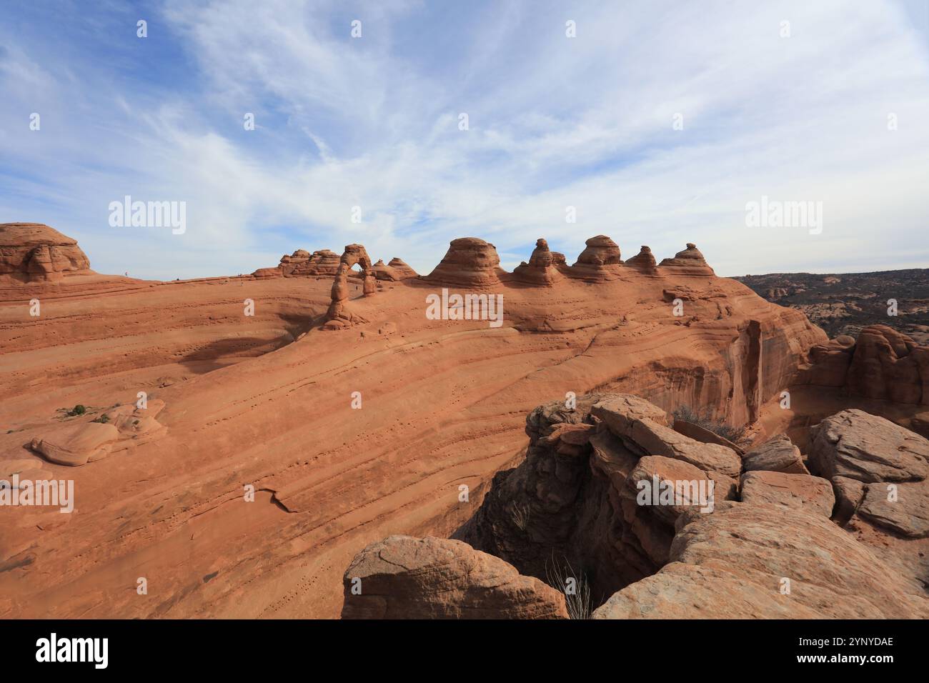 Arches National Park in Utah has one of the largest collections of natural arches in the world. Stock Photohttps://www.alamy.com/image-license-details/?v=1https://www.alamy.com/arches-national-park-in-utah-has-one-of-the-largest-collections-of-natural-arches-in-the-world-image633084214.html
RF2YNYDAE–Arches National Park in Utah has one of the largest collections of natural arches in the world.
 . Transactions. Sphalerite Ci - / v Limestonefragments Calcite andDolomite Fig. 16.—Brecciated Limestone Cemented with Calcite and Blende.Mossy Creek Zinc-Mines, Jefferson City, Tenn. The group of deposits which extend southwestward fromnear New Market to near Knoxville are apparently located onthe same zone of disturbance, several of which are definitelylocated in broken strata along small anticlines. The MossyCreek deposit at Jefferson City, in Jefferson county, probablythe most extensively mined zinc-ores in the district, occurs ina breccia-zone; the ore filling the crevices in the mass a Stock Photohttps://www.alamy.com/image-license-details/?v=1https://www.alamy.com/transactions-sphalerite-ci-v-limestonefragments-calcite-anddolomite-fig-16brecciated-limestone-cemented-with-calcite-and-blendemossy-creek-zinc-mines-jefferson-city-tenn-the-group-of-deposits-which-extend-southwestward-fromnear-new-market-to-near-knoxville-are-apparently-located-onthe-same-zone-of-disturbance-several-of-which-are-definitelylocated-in-broken-strata-along-small-anticlines-the-mossycreek-deposit-at-jefferson-city-in-jefferson-county-probablythe-most-extensively-mined-zinc-ores-in-the-district-occurs-ina-breccia-zone-the-ore-filling-the-crevices-in-the-mass-a-image337129176.html
RM2AGDFKM–. Transactions. Sphalerite Ci - / v Limestonefragments Calcite andDolomite Fig. 16.—Brecciated Limestone Cemented with Calcite and Blende.Mossy Creek Zinc-Mines, Jefferson City, Tenn. The group of deposits which extend southwestward fromnear New Market to near Knoxville are apparently located onthe same zone of disturbance, several of which are definitelylocated in broken strata along small anticlines. The MossyCreek deposit at Jefferson City, in Jefferson county, probablythe most extensively mined zinc-ores in the district, occurs ina breccia-zone; the ore filling the crevices in the mass a
 Arches National Park in Utah has one of the largest collections of natural arches in the world. Stock Photohttps://www.alamy.com/image-license-details/?v=1https://www.alamy.com/arches-national-park-in-utah-has-one-of-the-largest-collections-of-natural-arches-in-the-world-image633084054.html
RF2YNYD4P–Arches National Park in Utah has one of the largest collections of natural arches in the world.
 Geological and topographical maps, their interpretation and use, a handbook for the geologist and civil engineer . —Inlier in Glen Bally-emon, Co. Antrim. (1) Schist ;(2) Old Red Sandstone ; (3)sometimes affected by later Trias. (4) Cretaceous; (5) Ter-folds striking in a different tiary Basalt,direction, and in this way extremely complex outcrops are sometimes produced.These vary so widely in form that no general discussionof them is possible, but it may be well to remember that,where two anticlines cross, a dome-like structure with qua-qua-versal dip will be produced, while the intersection Stock Photohttps://www.alamy.com/image-license-details/?v=1https://www.alamy.com/geological-and-topographical-maps-their-interpretation-and-use-a-handbook-for-the-geologist-and-civil-engineer-inlier-in-glen-bally-emon-co-antrim-1-schist-2-old-red-sandstone-3sometimes-affected-by-later-trias-4-cretaceous-5-ter-folds-striking-in-a-different-tiary-basaltdirection-and-in-this-way-extremely-complex-outcrops-are-sometimes-producedthese-vary-so-widely-in-form-that-no-general-discussionof-them-is-possible-but-it-may-be-well-to-remember-thatwhere-two-anticlines-cross-a-dome-like-structure-with-qua-qua-versal-dip-will-be-produced-while-the-intersection-image339958503.html
RM2AN2CF3–Geological and topographical maps, their interpretation and use, a handbook for the geologist and civil engineer . —Inlier in Glen Bally-emon, Co. Antrim. (1) Schist ;(2) Old Red Sandstone ; (3)sometimes affected by later Trias. (4) Cretaceous; (5) Ter-folds striking in a different tiary Basalt,direction, and in this way extremely complex outcrops are sometimes produced.These vary so widely in form that no general discussionof them is possible, but it may be well to remember that,where two anticlines cross, a dome-like structure with qua-qua-versal dip will be produced, while the intersection
 Arches National Park in Utah has one of the largest collections of natural arches in the world. Stock Photohttps://www.alamy.com/image-license-details/?v=1https://www.alamy.com/arches-national-park-in-utah-has-one-of-the-largest-collections-of-natural-arches-in-the-world-image633084139.html
RF2YNYD7R–Arches National Park in Utah has one of the largest collections of natural arches in the world.
 The deposits of the useful minerals & rocks; their origin, form, and content . character, so 1 Ante, pp. 314, 315. THE METASOMATIC GOLD DEPOSITS 639 that it easily crumbles and covers the floor of the working. The beds areonly in places horizontal; more usually they form flat anticlines andsynclines. In greater detail the circumstances of their bedding are illus- S/ate -^ii^v . Dolomite- ?H-..v./;-^*jjI,?-;•.;?.•..•;.•.• •.•.?;•-+ * r^°0lfj,^^^ +vl,*+*+ >•??? •.• • Dolomite .; ; .^t: +^+V4- ci- i^*r; • :•.:?? ? •??-.? ?.?:? .-r^-^A*:^-* Fig. 327.—Section showing the geological position of Stock Photohttps://www.alamy.com/image-license-details/?v=1https://www.alamy.com/the-deposits-of-the-useful-minerals-rocks-their-origin-form-and-content-character-so-1-ante-pp-314-315-the-metasomatic-gold-deposits-639-that-it-easily-crumbles-and-covers-the-floor-of-the-working-the-beds-areonly-in-places-horizontal-more-usually-they-form-flat-anticlines-andsynclines-in-greater-detail-the-circumstances-of-their-bedding-are-illus-sate-iiv-dolomite-h-v-jji-r0lfj-vl-gt-dolomite-t-v4-ci-ir-r-a-fig-327section-showing-the-geological-position-of-image340240428.html
RM2ANF83T–The deposits of the useful minerals & rocks; their origin, form, and content . character, so 1 Ante, pp. 314, 315. THE METASOMATIC GOLD DEPOSITS 639 that it easily crumbles and covers the floor of the working. The beds areonly in places horizontal; more usually they form flat anticlines andsynclines. In greater detail the circumstances of their bedding are illus- S/ate -^ii^v . Dolomite- ?H-..v./;-^*jjI,?-;•.;?.•..•;.•.• •.•.?;•-+ * r^°0lfj,^^^ +vl,*+*+ >•??? •.• • Dolomite .; ; .^t: +^+V4- ci- i^*r; • :•.:?? ? •??-.? ?.?:? .-r^-^A*:^-* Fig. 327.—Section showing the geological position of
 Arches National Park in Utah has one of the largest collections of natural arches in the world. Stock Photohttps://www.alamy.com/image-license-details/?v=1https://www.alamy.com/arches-national-park-in-utah-has-one-of-the-largest-collections-of-natural-arches-in-the-world-image633084243.html
RF2YNYDBF–Arches National Park in Utah has one of the largest collections of natural arches in the world.
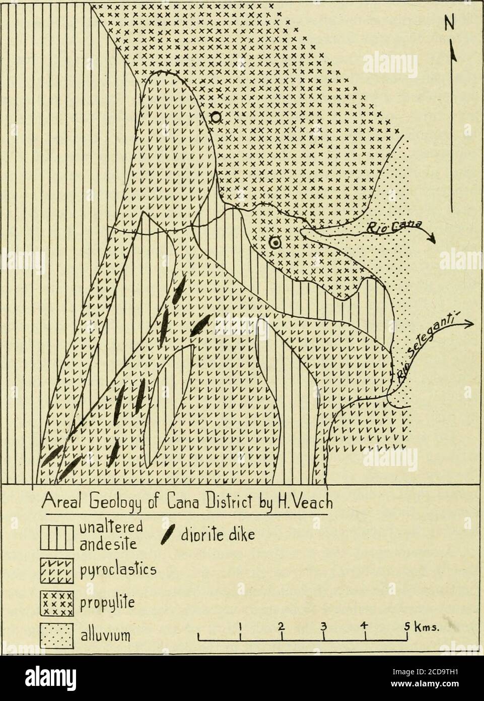 . Occasional papers of the California Academy of Sciences . ntly intersected bysome of these faults. Seismic activity, however, is apparently lessthan on the Pacific side and damage has been comparatively small. A summary of the structural conditions in the isthmus indicatesthat in both eastern and western Panama, asymmetric anticlines fac-ing toward the sea are found on both sides of the country. Thesestructures are believed to be, in most cases, cut off by offshore thrustfaults dipping toward the land. Most of the structures facing theCaribbean are arcuate and convex to the north. Those faci Stock Photohttps://www.alamy.com/image-license-details/?v=1https://www.alamy.com/occasional-papers-of-the-california-academy-of-sciences-ntly-intersected-bysome-of-these-faults-seismic-activity-however-is-apparently-lessthan-on-the-pacific-side-and-damage-has-been-comparatively-small-a-summary-of-the-structural-conditions-in-the-isthmus-indicatesthat-in-both-eastern-and-western-panama-asymmetric-anticlines-fac-ing-toward-the-sea-are-found-on-both-sides-of-the-country-thesestructures-are-believed-to-be-in-most-cases-cut-off-by-offshore-thrustfaults-dipping-toward-the-land-most-of-the-structures-facing-thecaribbean-are-arcuate-and-convex-to-the-north-those-faci-image369625117.html
RM2CD9TH1–. Occasional papers of the California Academy of Sciences . ntly intersected bysome of these faults. Seismic activity, however, is apparently lessthan on the Pacific side and damage has been comparatively small. A summary of the structural conditions in the isthmus indicatesthat in both eastern and western Panama, asymmetric anticlines fac-ing toward the sea are found on both sides of the country. Thesestructures are believed to be, in most cases, cut off by offshore thrustfaults dipping toward the land. Most of the structures facing theCaribbean are arcuate and convex to the north. Those faci
 Arches National Park in Utah has one of the largest collections of natural arches in the world. Stock Photohttps://www.alamy.com/image-license-details/?v=1https://www.alamy.com/arches-national-park-in-utah-has-one-of-the-largest-collections-of-natural-arches-in-the-world-image633084051.html
RF2YNYD4K–Arches National Park in Utah has one of the largest collections of natural arches in the world.
 . Oil investigations in 1917 and 1918 . port to point out the areas in which favorablestructures exist. The accumulation of oil in a given structure is to a considerabledegree dependent upon the presence and amount of salt water in thesand. The productive oil fields of Illinois are in the main surroundedby barren areas in which the sand contains salt water. Where the sandis saturated, the oil lies near the crest of the anticlines or domes, withthe gas, if any, above it (fig. 14 A). Where the sand is only partlysaturated the oil lies farther down the sides of the folds, at the uppersurface of t Stock Photohttps://www.alamy.com/image-license-details/?v=1https://www.alamy.com/oil-investigations-in-1917-and-1918-port-to-point-out-the-areas-in-which-favorablestructures-exist-the-accumulation-of-oil-in-a-given-structure-is-to-a-considerabledegree-dependent-upon-the-presence-and-amount-of-salt-water-in-thesand-the-productive-oil-fields-of-illinois-are-in-the-main-surroundedby-barren-areas-in-which-the-sand-contains-salt-water-where-the-sandis-saturated-the-oil-lies-near-the-crest-of-the-anticlines-or-domes-withthe-gas-if-any-above-it-fig-14-a-where-the-sand-is-only-partlysaturated-the-oil-lies-farther-down-the-sides-of-the-folds-at-the-uppersurface-of-t-image369758950.html
RM2CDFY8P–. Oil investigations in 1917 and 1918 . port to point out the areas in which favorablestructures exist. The accumulation of oil in a given structure is to a considerabledegree dependent upon the presence and amount of salt water in thesand. The productive oil fields of Illinois are in the main surroundedby barren areas in which the sand contains salt water. Where the sandis saturated, the oil lies near the crest of the anticlines or domes, withthe gas, if any, above it (fig. 14 A). Where the sand is only partlysaturated the oil lies farther down the sides of the folds, at the uppersurface of t
 Arches National Park in Utah has one of the largest collections of natural arches in the world. Stock Photohttps://www.alamy.com/image-license-details/?v=1https://www.alamy.com/arches-national-park-in-utah-has-one-of-the-largest-collections-of-natural-arches-in-the-world-image633084150.html
RF2YNYD86–Arches National Park in Utah has one of the largest collections of natural arches in the world.
 . British Antarctic expedition, 1907-9, under the command of E.H. Shackleton : reports on the scientific investigations ; geology. st two undulations could be distinctly seen, each wave occupying a space oftwo or three miles, but, beyond that, the existence of further waves was onlyindicated by alternate light and shadow, growing fainter in the distance. Scott further says that Armitage reported that, in his shoit sledge journey otabout 12 miles, he crossed four of these undulations. They extended in a generaleast Hnd west direction, and were not in the nature of symmetrical anticlines andsync Stock Photohttps://www.alamy.com/image-license-details/?v=1https://www.alamy.com/british-antarctic-expedition-1907-9-under-the-command-of-eh-shackleton-reports-on-the-scientific-investigations-geology-st-two-undulations-could-be-distinctly-seen-each-wave-occupying-a-space-oftwo-or-three-miles-but-beyond-that-the-existence-of-further-waves-was-onlyindicated-by-alternate-light-and-shadow-growing-fainter-in-the-distance-scott-further-says-that-armitage-reported-that-in-his-shoit-sledge-journey-otabout-12-miles-he-crossed-four-of-these-undulations-they-extended-in-a-generaleast-hnd-west-direction-and-were-not-in-the-nature-of-symmetrical-anticlines-andsync-image370600417.html
RM2CEX8H5–. British Antarctic expedition, 1907-9, under the command of E.H. Shackleton : reports on the scientific investigations ; geology. st two undulations could be distinctly seen, each wave occupying a space oftwo or three miles, but, beyond that, the existence of further waves was onlyindicated by alternate light and shadow, growing fainter in the distance. Scott further says that Armitage reported that, in his shoit sledge journey otabout 12 miles, he crossed four of these undulations. They extended in a generaleast Hnd west direction, and were not in the nature of symmetrical anticlines andsync
 Arches National Park in Utah has one of the largest collections of natural arches in the world. Stock Photohttps://www.alamy.com/image-license-details/?v=1https://www.alamy.com/arches-national-park-in-utah-has-one-of-the-largest-collections-of-natural-arches-in-the-world-image633084146.html
RF2YNYD82–Arches National Park in Utah has one of the largest collections of natural arches in the world.
 . After earthquake and fire . e is no faulting between the sedimentary rockJ and the metamorphic rock. Gases and mineral waters ascendthrough the fissures and cracks in these anticlines. The elevation of the strata has progressed several feet at atime. In the last fifty years in San Benito county the east-ern side of the master fault was raised 14 feet, then two andone-half feet, then one foot and then two feet, higher than thewestern side. When the lateral pressure described above has increasedsufficiently to overcome the weight of the overlying rocks andthe friction, the rocks on the side of Stock Photohttps://www.alamy.com/image-license-details/?v=1https://www.alamy.com/after-earthquake-and-fire-e-is-no-faulting-between-the-sedimentary-rockj-and-the-metamorphic-rock-gases-and-mineral-waters-ascendthrough-the-fissures-and-cracks-in-these-anticlines-the-elevation-of-the-strata-has-progressed-several-feet-at-atime-in-the-last-fifty-years-in-san-benito-county-the-east-ern-side-of-the-master-fault-was-raised-14-feet-then-two-andone-half-feet-then-one-foot-and-then-two-feet-higher-than-thewestern-side-when-the-lateral-pressure-described-above-has-increasedsufficiently-to-overcome-the-weight-of-the-overlying-rocks-andthe-friction-the-rocks-on-the-side-of-image371625819.html
RM2CGH0EK–. After earthquake and fire . e is no faulting between the sedimentary rockJ and the metamorphic rock. Gases and mineral waters ascendthrough the fissures and cracks in these anticlines. The elevation of the strata has progressed several feet at atime. In the last fifty years in San Benito county the east-ern side of the master fault was raised 14 feet, then two andone-half feet, then one foot and then two feet, higher than thewestern side. When the lateral pressure described above has increasedsufficiently to overcome the weight of the overlying rocks andthe friction, the rocks on the side of
 . After earthquake and fire . severalfeet higher than was the land on the southwest side. Thefault marked by a white line on the relief map east of themaster fault was also affected simultaneously, fissures openingfor a long distance. All of the cities and towns lying withinfifteen miles of this fault-line between Fort Bragg and SalinasCity were badly damaged. Fig. 1 is an ideal section from the Sierra Nevada throughthe San Joaquin valley and the coast ranges to the Pacificocean in a northeast and southwest direction. As will be seenby reference to this section, all of the anticlines forming t Stock Photohttps://www.alamy.com/image-license-details/?v=1https://www.alamy.com/after-earthquake-and-fire-severalfeet-higher-than-was-the-land-on-the-southwest-side-thefault-marked-by-a-white-line-on-the-relief-map-east-of-themaster-fault-was-also-affected-simultaneously-fissures-openingfor-a-long-distance-all-of-the-cities-and-towns-lying-withinfifteen-miles-of-this-fault-line-between-fort-bragg-and-salinascity-were-badly-damaged-fig-1-is-an-ideal-section-from-the-sierra-nevada-throughthe-san-joaquin-valley-and-the-coast-ranges-to-the-pacificocean-in-a-northeast-and-southwest-direction-as-will-be-seenby-reference-to-this-section-all-of-the-anticlines-forming-t-image371628112.html
RM2CGH3CG–. After earthquake and fire . severalfeet higher than was the land on the southwest side. Thefault marked by a white line on the relief map east of themaster fault was also affected simultaneously, fissures openingfor a long distance. All of the cities and towns lying withinfifteen miles of this fault-line between Fort Bragg and SalinasCity were badly damaged. Fig. 1 is an ideal section from the Sierra Nevada throughthe San Joaquin valley and the coast ranges to the Pacificocean in a northeast and southwest direction. As will be seenby reference to this section, all of the anticlines forming t
 . Transactions. for them with the drill; a set of shallow testsmight uncover something that might later justify deep testing. Geological StructureIn no other areas are ordinary haphazard wildcatting methods soexcusable as here, since the geologist can be of little assistance in guidinginitial prospecting. DORSEY HAGER 525 The most significant feature of all these oil pools is their relation tostructural folding of the beds; every pool so far discovered occurs on afold. This folding is of three general types: (1) closed domes (Fig. 3);(2) plunging anticlines, called noses (Fig. 4); (3) terraces Stock Photohttps://www.alamy.com/image-license-details/?v=1https://www.alamy.com/transactions-for-them-with-the-drill-a-set-of-shallow-testsmight-uncover-something-that-might-later-justify-deep-testing-geological-structurein-no-other-areas-are-ordinary-haphazard-wildcatting-methods-soexcusable-as-here-since-the-geologist-can-be-of-little-assistance-in-guidinginitial-prospecting-dorsey-hager-525-the-most-significant-feature-of-all-these-oil-pools-is-their-relation-tostructural-folding-of-the-beds-every-pool-so-far-discovered-occurs-on-afold-this-folding-is-of-three-general-types-1-closed-domes-fig-32-plunging-anticlines-called-noses-fig-4-3-terraces-image370363384.html
RM2CEFE7M–. Transactions. for them with the drill; a set of shallow testsmight uncover something that might later justify deep testing. Geological StructureIn no other areas are ordinary haphazard wildcatting methods soexcusable as here, since the geologist can be of little assistance in guidinginitial prospecting. DORSEY HAGER 525 The most significant feature of all these oil pools is their relation tostructural folding of the beds; every pool so far discovered occurs on afold. This folding is of three general types: (1) closed domes (Fig. 3);(2) plunging anticlines, called noses (Fig. 4); (3) terraces
 . Water Supply and Irrigation Papers of the United States Geological Survey . 7er.. Fk;. 11.—Diagram illustrating lines of flow of groundwater over a series of monoclines, syn-clines, and anticlines, as at M, S, and A, respectively. It is also influenced in a marked degree by the varying altitude of thesurface or receiving area, by the character of the pervious layer, by the SHAPE OF THE WATER TABLE. 35 altitude and distance of the nearest thalweg or drainage channel, andfinally by the amount of the rainfall. These elements acl Lng togetherin a region determine the depth of the water table bel Stock Photohttps://www.alamy.com/image-license-details/?v=1https://www.alamy.com/water-supply-and-irrigation-papers-of-the-united-states-geological-survey-7er-fk-11diagram-illustrating-lines-of-flow-of-groundwater-over-a-series-of-monoclines-syn-clines-and-anticlines-as-at-m-s-and-a-respectively-it-is-also-influenced-in-a-marked-degree-by-the-varying-altitude-of-thesurface-or-receiving-area-by-the-character-of-the-pervious-layer-by-the-shape-of-the-water-table-35-altitude-and-distance-of-the-nearest-thalweg-or-drainage-channel-andfinally-by-the-amount-of-the-rainfall-these-elements-acl-lng-togetherin-a-region-determine-the-depth-of-the-water-table-bel-image370135681.html
RM2CE53RD–. Water Supply and Irrigation Papers of the United States Geological Survey . 7er.. Fk;. 11.—Diagram illustrating lines of flow of groundwater over a series of monoclines, syn-clines, and anticlines, as at M, S, and A, respectively. It is also influenced in a marked degree by the varying altitude of thesurface or receiving area, by the character of the pervious layer, by the SHAPE OF THE WATER TABLE. 35 altitude and distance of the nearest thalweg or drainage channel, andfinally by the amount of the rainfall. These elements acl Lng togetherin a region determine the depth of the water table bel
![. Battlefields of the World War, western and southern fronts; a study in military geography . :* oAmiens ? ? ?• •* :-- . as. .. .. StOuentid ? £, , G» • ?• v-o - • -••% y ,,-,> ???„•? ?t • /? s./t^fsreo ] Areas higherthan| | Areas la1 M00meters(328ft) ID0.meters(328ft.J Fig. 28—Map showing the in-fluence of the shallow northwest-southeast folds on the Sommebattlefield. The slightly upfoldedbelts (anticlines) remain on theaverage a little higher than thedown-folded belts (synclines). 94 BATTLEFIELD OF THE SOMME. .5 c STRATEGIC POSITION 95 Stock Photo . Battlefields of the World War, western and southern fronts; a study in military geography . :* oAmiens ? ? ?• •* :-- . as. .. .. StOuentid ? £, , G» • ?• v-o - • -••% y ,,-,> ???„•? ?t • /? s./t^fsreo ] Areas higherthan| | Areas la1 M00meters(328ft) ID0.meters(328ft.J Fig. 28—Map showing the in-fluence of the shallow northwest-southeast folds on the Sommebattlefield. The slightly upfoldedbelts (anticlines) remain on theaverage a little higher than thedown-folded belts (synclines). 94 BATTLEFIELD OF THE SOMME. .5 c STRATEGIC POSITION 95 Stock Photo](https://c8.alamy.com/comp/2CE5YCE/battlefields-of-the-world-war-western-and-southern-fronts-a-study-in-military-geography-oamiens-as-stouentid-g-v-o-y-gt-t-stfsreo-areas-higherthan-areas-la1-m00meters328ft-id0meters328ftj-fig-28map-showing-the-in-fluence-of-the-shallow-northwest-southeast-folds-on-the-sommebattlefield-the-slightly-upfoldedbelts-anticlines-remain-on-theaverage-a-little-higher-than-thedown-folded-belts-synclines-94-battlefield-of-the-somme-5-c-strategic-position-95-2CE5YCE.jpg) . Battlefields of the World War, western and southern fronts; a study in military geography . :* oAmiens ? ? ?• •* :-- . as. .. .. StOuentid ? £, , G» • ?• v-o - • -••% y ,,-,> ???„•? ?t • /? s./t^fsreo ] Areas higherthan| | Areas la1 M00meters(328ft) ID0.meters(328ft.J Fig. 28—Map showing the in-fluence of the shallow northwest-southeast folds on the Sommebattlefield. The slightly upfoldedbelts (anticlines) remain on theaverage a little higher than thedown-folded belts (synclines). 94 BATTLEFIELD OF THE SOMME. .5 c STRATEGIC POSITION 95 Stock Photohttps://www.alamy.com/image-license-details/?v=1https://www.alamy.com/battlefields-of-the-world-war-western-and-southern-fronts-a-study-in-military-geography-oamiens-as-stouentid-g-v-o-y-gt-t-stfsreo-areas-higherthan-areas-la1-m00meters328ft-id0meters328ftj-fig-28map-showing-the-in-fluence-of-the-shallow-northwest-southeast-folds-on-the-sommebattlefield-the-slightly-upfoldedbelts-anticlines-remain-on-theaverage-a-little-higher-than-thedown-folded-belts-synclines-94-battlefield-of-the-somme-5-c-strategic-position-95-image370154190.html
. Battlefields of the World War, western and southern fronts; a study in military geography . :* oAmiens ? ? ?• •* :-- . as. .. .. StOuentid ? £, , G» • ?• v-o - • -••% y ,,-,> ???„•? ?t • /? s./t^fsreo ] Areas higherthan| | Areas la1 M00meters(328ft) ID0.meters(328ft.J Fig. 28—Map showing the in-fluence of the shallow northwest-southeast folds on the Sommebattlefield. The slightly upfoldedbelts (anticlines) remain on theaverage a little higher than thedown-folded belts (synclines). 94 BATTLEFIELD OF THE SOMME. .5 c STRATEGIC POSITION 95 Stock Photohttps://www.alamy.com/image-license-details/?v=1https://www.alamy.com/battlefields-of-the-world-war-western-and-southern-fronts-a-study-in-military-geography-oamiens-as-stouentid-g-v-o-y-gt-t-stfsreo-areas-higherthan-areas-la1-m00meters328ft-id0meters328ftj-fig-28map-showing-the-in-fluence-of-the-shallow-northwest-southeast-folds-on-the-sommebattlefield-the-slightly-upfoldedbelts-anticlines-remain-on-theaverage-a-little-higher-than-thedown-folded-belts-synclines-94-battlefield-of-the-somme-5-c-strategic-position-95-image370154190.htmlRM2CE5YCE–. Battlefields of the World War, western and southern fronts; a study in military geography . :* oAmiens ? ? ?• •* :-- . as. .. .. StOuentid ? £, , G» • ?• v-o - • -••% y ,,-,> ???„•? ?t • /? s./t^fsreo ] Areas higherthan| | Areas la1 M00meters(328ft) ID0.meters(328ft.J Fig. 28—Map showing the in-fluence of the shallow northwest-southeast folds on the Sommebattlefield. The slightly upfoldedbelts (anticlines) remain on theaverage a little higher than thedown-folded belts (synclines). 94 BATTLEFIELD OF THE SOMME. .5 c STRATEGIC POSITION 95
 . Bulletin de la Société botanique de Genève . Fig. 22.— Lycopodium Selago. Section transversale équatoriale.. Fig. 23. — Lycopodium Selago. Section transversale équatoiiale. Le fonctionnement de ce stomate doit cesser de bonne lieure, parsuite de lapparition des épaississements cellulosiques dont je viens deparler; sur les feuilles jeunes, on trouve des stomates avec des cellulesde bordure à anticlines dorsales amincies et permettant une communi-cation entre les lumens respectifs des cellules annexes et de bordure ;comme jai pu men rendre compte en faisant des coupes longiliidinaieset polaire Stock Photohttps://www.alamy.com/image-license-details/?v=1https://www.alamy.com/bulletin-de-la-socit-botanique-de-genve-fig-22-lycopodium-selago-section-transversale-quatoriale-fig-23-lycopodium-selago-section-transversale-quatoiiale-le-fonctionnement-de-ce-stomate-doit-cesser-de-bonne-lieure-parsuite-de-lapparition-des-paississements-cellulosiques-dont-je-viens-deparler-sur-les-feuilles-jeunes-on-trouve-des-stomates-avec-des-cellulesde-bordure-anticlines-dorsales-amincies-et-permettant-une-communi-cation-entre-les-lumens-respectifs-des-cellules-annexes-et-de-bordure-comme-jai-pu-men-rendre-compte-en-faisant-des-coupes-longiliidinaieset-polaire-image370111325.html
RM2CE40NH–. Bulletin de la Société botanique de Genève . Fig. 22.— Lycopodium Selago. Section transversale équatoriale.. Fig. 23. — Lycopodium Selago. Section transversale équatoiiale. Le fonctionnement de ce stomate doit cesser de bonne lieure, parsuite de lapparition des épaississements cellulosiques dont je viens deparler; sur les feuilles jeunes, on trouve des stomates avec des cellulesde bordure à anticlines dorsales amincies et permettant une communi-cation entre les lumens respectifs des cellules annexes et de bordure ;comme jai pu men rendre compte en faisant des coupes longiliidinaieset polaire
 . Bulletin de la Société botanique de Genève . Fig. 91. — Salacia crassifolia. Section transversale équatoriale. I^ar contre, cliez Sahiciu mi.ssifolid, tes épaississements des péricliiiesexternes des ceJlides annexes et épidermiques, de même que leprolongement de la couche de cutine le long des anticlines, font défaut. On retrouve cependaiit le cloisonnement de la cellule annexe. Salacia iAxhiulata L. (A^tte espèce est assez différente de la précédente par la strnctuie deson épidémie fort éjjaissi ; par contre, les cellules de boidure, tout enprésentant nue sti-ucturc générale analogue, sont Stock Photohttps://www.alamy.com/image-license-details/?v=1https://www.alamy.com/bulletin-de-la-socit-botanique-de-genve-fig-91-salacia-crassifolia-section-transversale-quatoriale-iar-contre-cliez-sahiciu-missifolid-tes-paississements-des-pricliiiesexternes-des-cejlides-annexes-et-pidermiques-de-mme-que-leprolongement-de-la-couche-de-cutine-le-long-des-anticlines-font-dfaut-on-retrouve-cependaiit-le-cloisonnement-de-la-cellule-annexe-salacia-iaxhiulata-l-atte-espce-est-assez-diffrente-de-la-prcdente-par-la-strnctuie-deson-pidmie-fort-jjaissi-par-contre-les-cellules-de-boidure-tout-enprsentant-nue-sti-ucturc-gnrale-analogue-sont-image370107794.html
RM2CE3T7E–. Bulletin de la Société botanique de Genève . Fig. 91. — Salacia crassifolia. Section transversale équatoriale. I^ar contre, cliez Sahiciu mi.ssifolid, tes épaississements des péricliiiesexternes des ceJlides annexes et épidermiques, de même que leprolongement de la couche de cutine le long des anticlines, font défaut. On retrouve cependaiit le cloisonnement de la cellule annexe. Salacia iAxhiulata L. (A^tte espèce est assez différente de la précédente par la strnctuie deson épidémie fort éjjaissi ; par contre, les cellules de boidure, tout enprésentant nue sti-ucturc générale analogue, sont
 . Bulletin de la Société botanique de Genève . Fig. 35. — Taxus bac-cata. Section trans-versale équatoriale(canalicule très penmarqué). Quant à la structure, elle rappelle celle des stomates de liiiun;W<.anticlines, du côté de la cellule annexe, ne sont que partiellementcutinisées (tig. 35) et le lumen se piolonge dans la partie cellulosique en BULLETIN DE LA SOCIÉTÉ BOTANIUUE OE GEiXKVK, N^S 4-5-6, parilS le 2.) SOpl. l.MT. Il 290 RULMiTIN DE LA. SOCTKTK TîOTAINIOUE DE GENEVE (46) un canalicule (llg. 36) établissant la comimmication entre la cellulestomatique (fig. 37) et la cellule annexe Stock Photohttps://www.alamy.com/image-license-details/?v=1https://www.alamy.com/bulletin-de-la-socit-botanique-de-genve-fig-35-taxus-bac-cata-section-trans-versale-quatorialecanalicule-trs-penmarqu-quant-la-structure-elle-rappelle-celle-des-stomates-de-liiiunwltanticlines-du-ct-de-la-cellule-annexe-ne-sont-que-partiellementcutinises-tig-35-et-le-lumen-se-piolonge-dans-la-partie-cellulosique-en-bulletin-de-la-socit-botaniuue-oe-geixkvk-ns-4-5-6-parils-le-2-sopl-lmt-il-290-rulmitin-de-la-soctktk-totainioue-de-geneve-46-un-canalicule-llg-36-tablissant-la-comimmication-entre-la-cellulestomatique-fig-37-et-la-cellule-annexe-image370110909.html
RM2CE406N–. Bulletin de la Société botanique de Genève . Fig. 35. — Taxus bac-cata. Section trans-versale équatoriale(canalicule très penmarqué). Quant à la structure, elle rappelle celle des stomates de liiiun;W<.anticlines, du côté de la cellule annexe, ne sont que partiellementcutinisées (tig. 35) et le lumen se piolonge dans la partie cellulosique en BULLETIN DE LA SOCIÉTÉ BOTANIUUE OE GEiXKVK, N^S 4-5-6, parilS le 2.) SOpl. l.MT. Il 290 RULMiTIN DE LA. SOCTKTK TîOTAINIOUE DE GENEVE (46) un canalicule (llg. 36) établissant la comimmication entre la cellulestomatique (fig. 37) et la cellule annexe
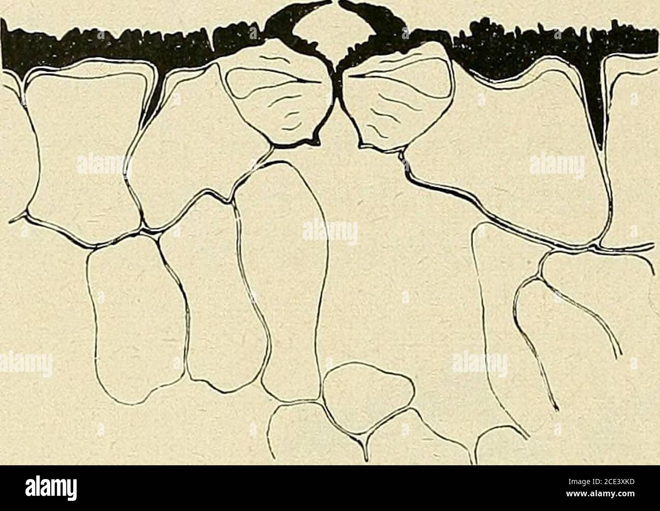 . Bulletin de la Société botanique de Genève . ©pi-dermiques (lig. 64.). Jusquà présent, tous lescaractères rencontrés se re-trouvent chez les stomatesde Jufilaiin regia, un seulest vraiment nouveau, (juidonne un aspect différent à cet appareil slomatique,cest le très gros développe-ment de la couche de cutinequi recouvre la péricline externe des cellules de bordure, des cellulesannexes et épidermiques; cette cutinisation se prolonge même le longdes anticlines, séparant les cellules annexes des cellules épidermiques;de plus, elle nest pas uniforme ; tandis quelle fait presque dé Stock Photohttps://www.alamy.com/image-license-details/?v=1https://www.alamy.com/bulletin-de-la-socit-botanique-de-genve-pi-dermiques-lig-64-jusqu-prsent-tous-lescaractres-rencontrs-se-re-trouvent-chez-les-stomatesde-jufilaiin-regia-un-seulest-vraiment-nouveau-juidonne-un-aspect-diffrent-cet-appareil-slomatiquecest-le-trs-gros-dveloppe-ment-de-la-couche-de-cutinequi-recouvre-la-pricline-externe-des-cellules-de-bordure-des-cellulesannexes-et-pidermiques-cette-cutinisation-se-prolonge-mme-le-longdes-anticlines-sparant-les-cellules-annexes-des-cellules-pidermiquesde-plus-elle-nest-pas-uniforme-tandis-quelle-fait-presque-d-image370109697.html
RM2CE3XKD–. Bulletin de la Société botanique de Genève . ©pi-dermiques (lig. 64.). Jusquà présent, tous lescaractères rencontrés se re-trouvent chez les stomatesde Jufilaiin regia, un seulest vraiment nouveau, (juidonne un aspect différent à cet appareil slomatique,cest le très gros développe-ment de la couche de cutinequi recouvre la péricline externe des cellules de bordure, des cellulesannexes et épidermiques; cette cutinisation se prolonge même le longdes anticlines, séparant les cellules annexes des cellules épidermiques;de plus, elle nest pas uniforme ; tandis quelle fait presque dé
 . Bulletin de la Société botanique de Genève. que de lumière; nous devons égalementnoter la minceur des anticlines dorsales des cellules de bordure,minceur que lon retrouve dans tous les cas figurés ci-dessous et quipermet un échange rapide entre les cellules de bordure et annexes. IIA. STOMATES DES PLUMULES DU « ZEA-MAYS » Lorigine et le développement du stomate sur les jeunes plumulessont absolument pareils, à ce que nous avons observé chez les coléop-tiles ; il est donc inutile dy revenir ; cependant, nous avons constatéici une différence dans la rapidité avec laquelle le stomate se déve-lo Stock Photohttps://www.alamy.com/image-license-details/?v=1https://www.alamy.com/bulletin-de-la-socit-botanique-de-genve-que-de-lumire-nous-devons-galementnoter-la-minceur-des-anticlines-dorsales-des-cellules-de-bordureminceur-que-lon-retrouve-dans-tous-les-cas-figurs-ci-dessous-et-quipermet-un-change-rapide-entre-les-cellules-de-bordure-et-annexes-iia-stomates-des-plumules-du-zea-mays-lorigine-et-le-dveloppement-du-stomate-sur-les-jeunes-plumulessont-absolument-pareils-ce-que-nous-avons-observ-chez-les-colop-tiles-il-est-donc-inutile-dy-revenir-cependant-nous-avons-constatici-une-diffrence-dans-la-rapidit-avec-laquelle-le-stomate-se-dve-lo-image370646535.html
RM2CF0BC7–. Bulletin de la Société botanique de Genève. que de lumière; nous devons égalementnoter la minceur des anticlines dorsales des cellules de bordure,minceur que lon retrouve dans tous les cas figurés ci-dessous et quipermet un échange rapide entre les cellules de bordure et annexes. IIA. STOMATES DES PLUMULES DU « ZEA-MAYS » Lorigine et le développement du stomate sur les jeunes plumulessont absolument pareils, à ce que nous avons observé chez les coléop-tiles ; il est donc inutile dy revenir ; cependant, nous avons constatéici une différence dans la rapidité avec laquelle le stomate se déve-lo
![. Collected reprints / Atlantic Oceanographic and Meteorological Laboratories [and] Pacific Oceanographic Laboratories. Oceanography Periodicals.. MALLOY: DEPOSITIONAL ANTICLINES versus TECTONIC "REVERSE DRAG" 120. aya7 oiagg ^^uto t. OIJSB. Please note that these images are extracted from scanned page images that may have been digitally enhanced for readability - coloration and appearance of these illustrations may not perfectly resemble the original work.. Atlantic Oceanographic and Meteorological Laboratories; Pacific Oceanographic Laboratories; United States. Environmental Scienc Stock Photo . Collected reprints / Atlantic Oceanographic and Meteorological Laboratories [and] Pacific Oceanographic Laboratories. Oceanography Periodicals.. MALLOY: DEPOSITIONAL ANTICLINES versus TECTONIC "REVERSE DRAG" 120. aya7 oiagg ^^uto t. OIJSB. Please note that these images are extracted from scanned page images that may have been digitally enhanced for readability - coloration and appearance of these illustrations may not perfectly resemble the original work.. Atlantic Oceanographic and Meteorological Laboratories; Pacific Oceanographic Laboratories; United States. Environmental Scienc Stock Photo](https://c8.alamy.com/comp/REH2WP/collected-reprints-atlantic-oceanographic-and-meteorological-laboratories-and-pacific-oceanographic-laboratories-oceanography-periodicals-malloy-depositional-anticlines-versus-tectonic-quotreverse-dragquot-120-aya7-oiagg-uto-t-oijsb-please-note-that-these-images-are-extracted-from-scanned-page-images-that-may-have-been-digitally-enhanced-for-readability-coloration-and-appearance-of-these-illustrations-may-not-perfectly-resemble-the-original-work-atlantic-oceanographic-and-meteorological-laboratories-pacific-oceanographic-laboratories-united-states-environmental-scienc-REH2WP.jpg) . Collected reprints / Atlantic Oceanographic and Meteorological Laboratories [and] Pacific Oceanographic Laboratories. Oceanography Periodicals.. MALLOY: DEPOSITIONAL ANTICLINES versus TECTONIC "REVERSE DRAG" 120. aya7 oiagg ^^uto t. OIJSB. Please note that these images are extracted from scanned page images that may have been digitally enhanced for readability - coloration and appearance of these illustrations may not perfectly resemble the original work.. Atlantic Oceanographic and Meteorological Laboratories; Pacific Oceanographic Laboratories; United States. Environmental Scienc Stock Photohttps://www.alamy.com/image-license-details/?v=1https://www.alamy.com/collected-reprints-atlantic-oceanographic-and-meteorological-laboratories-and-pacific-oceanographic-laboratories-oceanography-periodicals-malloy-depositional-anticlines-versus-tectonic-quotreverse-dragquot-120-aya7-oiagg-uto-t-oijsb-please-note-that-these-images-are-extracted-from-scanned-page-images-that-may-have-been-digitally-enhanced-for-readability-coloration-and-appearance-of-these-illustrations-may-not-perfectly-resemble-the-original-work-atlantic-oceanographic-and-meteorological-laboratories-pacific-oceanographic-laboratories-united-states-environmental-scienc-image232715442.html
. Collected reprints / Atlantic Oceanographic and Meteorological Laboratories [and] Pacific Oceanographic Laboratories. Oceanography Periodicals.. MALLOY: DEPOSITIONAL ANTICLINES versus TECTONIC "REVERSE DRAG" 120. aya7 oiagg ^^uto t. OIJSB. Please note that these images are extracted from scanned page images that may have been digitally enhanced for readability - coloration and appearance of these illustrations may not perfectly resemble the original work.. Atlantic Oceanographic and Meteorological Laboratories; Pacific Oceanographic Laboratories; United States. Environmental Scienc Stock Photohttps://www.alamy.com/image-license-details/?v=1https://www.alamy.com/collected-reprints-atlantic-oceanographic-and-meteorological-laboratories-and-pacific-oceanographic-laboratories-oceanography-periodicals-malloy-depositional-anticlines-versus-tectonic-quotreverse-dragquot-120-aya7-oiagg-uto-t-oijsb-please-note-that-these-images-are-extracted-from-scanned-page-images-that-may-have-been-digitally-enhanced-for-readability-coloration-and-appearance-of-these-illustrations-may-not-perfectly-resemble-the-original-work-atlantic-oceanographic-and-meteorological-laboratories-pacific-oceanographic-laboratories-united-states-environmental-scienc-image232715442.htmlRMREH2WP–. Collected reprints / Atlantic Oceanographic and Meteorological Laboratories [and] Pacific Oceanographic Laboratories. Oceanography Periodicals.. MALLOY: DEPOSITIONAL ANTICLINES versus TECTONIC "REVERSE DRAG" 120. aya7 oiagg ^^uto t. OIJSB. Please note that these images are extracted from scanned page images that may have been digitally enhanced for readability - coloration and appearance of these illustrations may not perfectly resemble the original work.. Atlantic Oceanographic and Meteorological Laboratories; Pacific Oceanographic Laboratories; United States. Environmental Scienc
 . Annual report. New York State Museum; Science; Science. POSTGLACIAL FAULTS OF EASTERN NEW YORK 27 be of the reverse type, indicating compression. The direction of the throw must depend upon the attitude of the planes of struc- ture—stratification or cleavage, or both—along which the move- ment takes place. In stratified rocks which have been thrown into anticlines and synclines, and have been subsequently rather deeply base-leveled, it is probable that the continuance of the lateral pressure which gave rise to the folds would con- centrate the horizontal strain upon the cores of the syncline Stock Photohttps://www.alamy.com/image-license-details/?v=1https://www.alamy.com/annual-report-new-york-state-museum-science-science-postglacial-faults-of-eastern-new-york-27-be-of-the-reverse-type-indicating-compression-the-direction-of-the-throw-must-depend-upon-the-attitude-of-the-planes-of-struc-turestratification-or-cleavage-or-bothalong-which-the-move-ment-takes-place-in-stratified-rocks-which-have-been-thrown-into-anticlines-and-synclines-and-have-been-subsequently-rather-deeply-base-leveled-it-is-probable-that-the-continuance-of-the-lateral-pressure-which-gave-rise-to-the-folds-would-con-centrate-the-horizontal-strain-upon-the-cores-of-the-syncline-image236223362.html
RMRM8W8J–. Annual report. New York State Museum; Science; Science. POSTGLACIAL FAULTS OF EASTERN NEW YORK 27 be of the reverse type, indicating compression. The direction of the throw must depend upon the attitude of the planes of struc- ture—stratification or cleavage, or both—along which the move- ment takes place. In stratified rocks which have been thrown into anticlines and synclines, and have been subsequently rather deeply base-leveled, it is probable that the continuance of the lateral pressure which gave rise to the folds would con- centrate the horizontal strain upon the cores of the syncline
 . Bulletin - New York State Museum. Science. POSTGLACIAL FAULTS OF EASTERN NEW YORK 27 be of the reverse type, indicating compression. The direction of the throw must depend upon the attitude of the planes of struc- ture—stratification or cleavage, or both—along which the move- ment takes place. In stratified rocks which have been thrown into anticlines and synclines, and have been subsequently rather deeply base-leveled, it is probable that the continuance of the lateral pressure which gave rise to the folds would con- centrate the horizontal strain upon the cores of the synclines in such a m Stock Photohttps://www.alamy.com/image-license-details/?v=1https://www.alamy.com/bulletin-new-york-state-museum-science-postglacial-faults-of-eastern-new-york-27-be-of-the-reverse-type-indicating-compression-the-direction-of-the-throw-must-depend-upon-the-attitude-of-the-planes-of-struc-turestratification-or-cleavage-or-bothalong-which-the-move-ment-takes-place-in-stratified-rocks-which-have-been-thrown-into-anticlines-and-synclines-and-have-been-subsequently-rather-deeply-base-leveled-it-is-probable-that-the-continuance-of-the-lateral-pressure-which-gave-rise-to-the-folds-would-con-centrate-the-horizontal-strain-upon-the-cores-of-the-synclines-in-such-a-m-image233999520.html
RMRGKGNM–. Bulletin - New York State Museum. Science. POSTGLACIAL FAULTS OF EASTERN NEW YORK 27 be of the reverse type, indicating compression. The direction of the throw must depend upon the attitude of the planes of struc- ture—stratification or cleavage, or both—along which the move- ment takes place. In stratified rocks which have been thrown into anticlines and synclines, and have been subsequently rather deeply base-leveled, it is probable that the continuance of the lateral pressure which gave rise to the folds would con- centrate the horizontal strain upon the cores of the synclines in such a m
 . Bulletin of the Geological Society of America. Geology. 370 M. L. FULLER—GEOLOGY OF FISHERS ISLAND At other localities, as at the Isabella Beach hill and the hill forming the headland three-quarters of a mile to the northeast, the topography is more puzzling, and only after the unraveling of the geology was it determined that these hills were primarily constructional in form, repre- senting in reality great anticlines in the Pleistocene sediments. Some of the depressions occupied by ponds are evidently true kettles, representing the position of detached ice masses, which later become sur- ro Stock Photohttps://www.alamy.com/image-license-details/?v=1https://www.alamy.com/bulletin-of-the-geological-society-of-america-geology-370-m-l-fullergeology-of-fishers-island-at-other-localities-as-at-the-isabella-beach-hill-and-the-hill-forming-the-headland-three-quarters-of-a-mile-to-the-northeast-the-topography-is-more-puzzling-and-only-after-the-unraveling-of-the-geology-was-it-determined-that-these-hills-were-primarily-constructional-in-form-repre-senting-in-reality-great-anticlines-in-the-pleistocene-sediments-some-of-the-depressions-occupied-by-ponds-are-evidently-true-kettles-representing-the-position-of-detached-ice-masses-which-later-become-sur-ro-image233939733.html
RMRGGTED–. Bulletin of the Geological Society of America. Geology. 370 M. L. FULLER—GEOLOGY OF FISHERS ISLAND At other localities, as at the Isabella Beach hill and the hill forming the headland three-quarters of a mile to the northeast, the topography is more puzzling, and only after the unraveling of the geology was it determined that these hills were primarily constructional in form, repre- senting in reality great anticlines in the Pleistocene sediments. Some of the depressions occupied by ponds are evidently true kettles, representing the position of detached ice masses, which later become sur- ro
 . Early geophysical papers of the Society of Exploration Geophysicists. Petroleum; Prospecting. 146 C. A. HEILAND phase curves. It will be noticed that the potential decreases above a good conductor, while the phase angle has a maximum, and vice versa. b. LOCATION OF STRUCTURE Both resistivity and potential-drop-ratio methods have found already several remarkable applications in locating geologic structure favorable for the accumulation of oil, such as anticlines, salt domes, and the like. They have also been applied very successfully in extend- ing known geologic information into unknown terr Stock Photohttps://www.alamy.com/image-license-details/?v=1https://www.alamy.com/early-geophysical-papers-of-the-society-of-exploration-geophysicists-petroleum-prospecting-146-c-a-heiland-phase-curves-it-will-be-noticed-that-the-potential-decreases-above-a-good-conductor-while-the-phase-angle-has-a-maximum-and-vice-versa-b-location-of-structure-both-resistivity-and-potential-drop-ratio-methods-have-found-already-several-remarkable-applications-in-locating-geologic-structure-favorable-for-the-accumulation-of-oil-such-as-anticlines-salt-domes-and-the-like-they-have-also-been-applied-very-successfully-in-extend-ing-known-geologic-information-into-unknown-terr-image232549799.html
RMRE9FHY–. Early geophysical papers of the Society of Exploration Geophysicists. Petroleum; Prospecting. 146 C. A. HEILAND phase curves. It will be noticed that the potential decreases above a good conductor, while the phase angle has a maximum, and vice versa. b. LOCATION OF STRUCTURE Both resistivity and potential-drop-ratio methods have found already several remarkable applications in locating geologic structure favorable for the accumulation of oil, such as anticlines, salt domes, and the like. They have also been applied very successfully in extend- ing known geologic information into unknown terr
![. The cell in development and inheritance. Cells; Cells. 266 CELL-DIVISION AND DEVELOPMENT the disc be elongated to form an ellipse, the periclines also become ellipses, while the anticlines are converted into hyperbolas confocal with the periclines. If it have the form of a parabola, the periclines and anticlines form two systems of confocal parabolas intersecting at. Fig. 119.— Geometrical relations of cleavage-planes in growing plant-tissues. [From Sachs, after various authors.] A. Flat ellipsoidal germ-disc of Melobesia (Rosanoff) ; nearly typical relation of elliptic periclines and hyperb Stock Photo . The cell in development and inheritance. Cells; Cells. 266 CELL-DIVISION AND DEVELOPMENT the disc be elongated to form an ellipse, the periclines also become ellipses, while the anticlines are converted into hyperbolas confocal with the periclines. If it have the form of a parabola, the periclines and anticlines form two systems of confocal parabolas intersecting at. Fig. 119.— Geometrical relations of cleavage-planes in growing plant-tissues. [From Sachs, after various authors.] A. Flat ellipsoidal germ-disc of Melobesia (Rosanoff) ; nearly typical relation of elliptic periclines and hyperb Stock Photo](https://c8.alamy.com/comp/RJBCGX/the-cell-in-development-and-inheritance-cells-cells-266-cell-division-and-development-the-disc-be-elongated-to-form-an-ellipse-the-periclines-also-become-ellipses-while-the-anticlines-are-converted-into-hyperbolas-confocal-with-the-periclines-if-it-have-the-form-of-a-parabola-the-periclines-and-anticlines-form-two-systems-of-confocal-parabolas-intersecting-at-fig-119-geometrical-relations-of-cleavage-planes-in-growing-plant-tissues-from-sachs-after-various-authors-a-flat-ellipsoidal-germ-disc-of-melobesia-rosanoff-nearly-typical-relation-of-elliptic-periclines-and-hyperb-RJBCGX.jpg) . The cell in development and inheritance. Cells; Cells. 266 CELL-DIVISION AND DEVELOPMENT the disc be elongated to form an ellipse, the periclines also become ellipses, while the anticlines are converted into hyperbolas confocal with the periclines. If it have the form of a parabola, the periclines and anticlines form two systems of confocal parabolas intersecting at. Fig. 119.— Geometrical relations of cleavage-planes in growing plant-tissues. [From Sachs, after various authors.] A. Flat ellipsoidal germ-disc of Melobesia (Rosanoff) ; nearly typical relation of elliptic periclines and hyperb Stock Photohttps://www.alamy.com/image-license-details/?v=1https://www.alamy.com/the-cell-in-development-and-inheritance-cells-cells-266-cell-division-and-development-the-disc-be-elongated-to-form-an-ellipse-the-periclines-also-become-ellipses-while-the-anticlines-are-converted-into-hyperbolas-confocal-with-the-periclines-if-it-have-the-form-of-a-parabola-the-periclines-and-anticlines-form-two-systems-of-confocal-parabolas-intersecting-at-fig-119-geometrical-relations-of-cleavage-planes-in-growing-plant-tissues-from-sachs-after-various-authors-a-flat-ellipsoidal-germ-disc-of-melobesia-rosanoff-nearly-typical-relation-of-elliptic-periclines-and-hyperb-image235049946.html
. The cell in development and inheritance. Cells; Cells. 266 CELL-DIVISION AND DEVELOPMENT the disc be elongated to form an ellipse, the periclines also become ellipses, while the anticlines are converted into hyperbolas confocal with the periclines. If it have the form of a parabola, the periclines and anticlines form two systems of confocal parabolas intersecting at. Fig. 119.— Geometrical relations of cleavage-planes in growing plant-tissues. [From Sachs, after various authors.] A. Flat ellipsoidal germ-disc of Melobesia (Rosanoff) ; nearly typical relation of elliptic periclines and hyperb Stock Photohttps://www.alamy.com/image-license-details/?v=1https://www.alamy.com/the-cell-in-development-and-inheritance-cells-cells-266-cell-division-and-development-the-disc-be-elongated-to-form-an-ellipse-the-periclines-also-become-ellipses-while-the-anticlines-are-converted-into-hyperbolas-confocal-with-the-periclines-if-it-have-the-form-of-a-parabola-the-periclines-and-anticlines-form-two-systems-of-confocal-parabolas-intersecting-at-fig-119-geometrical-relations-of-cleavage-planes-in-growing-plant-tissues-from-sachs-after-various-authors-a-flat-ellipsoidal-germ-disc-of-melobesia-rosanoff-nearly-typical-relation-of-elliptic-periclines-and-hyperb-image235049946.htmlRMRJBCGX–. The cell in development and inheritance. Cells; Cells. 266 CELL-DIVISION AND DEVELOPMENT the disc be elongated to form an ellipse, the periclines also become ellipses, while the anticlines are converted into hyperbolas confocal with the periclines. If it have the form of a parabola, the periclines and anticlines form two systems of confocal parabolas intersecting at. Fig. 119.— Geometrical relations of cleavage-planes in growing plant-tissues. [From Sachs, after various authors.] A. Flat ellipsoidal germ-disc of Melobesia (Rosanoff) ; nearly typical relation of elliptic periclines and hyperb
![. Biological lectures delivered at the Marine Biological Laboratory of Wood's Holl [sic]. Biology. CELL-DIVISION AND DEVELOPMENT. I 29 terms the confocal ellipses the periclines, and the hyperbolas anticlines, the division of the protoplasmic disc being produced by an alternation of these two kinds of cleavage planes. The result of this mode of division is a number of cells arranged in definite curves, each cell belonging to two curves which cross one another at right angles, one of the curves being portion of an ellipse while the other is portion of an hyperbola. The periclines and anticlines Stock Photo . Biological lectures delivered at the Marine Biological Laboratory of Wood's Holl [sic]. Biology. CELL-DIVISION AND DEVELOPMENT. I 29 terms the confocal ellipses the periclines, and the hyperbolas anticlines, the division of the protoplasmic disc being produced by an alternation of these two kinds of cleavage planes. The result of this mode of division is a number of cells arranged in definite curves, each cell belonging to two curves which cross one another at right angles, one of the curves being portion of an ellipse while the other is portion of an hyperbola. The periclines and anticlines Stock Photo](https://c8.alamy.com/comp/RHM5N1/biological-lectures-delivered-at-the-marine-biological-laboratory-of-woods-holl-sic-biology-cell-division-and-development-i-29-terms-the-confocal-ellipses-the-periclines-and-the-hyperbolas-anticlines-the-division-of-the-protoplasmic-disc-being-produced-by-an-alternation-of-these-two-kinds-of-cleavage-planes-the-result-of-this-mode-of-division-is-a-number-of-cells-arranged-in-definite-curves-each-cell-belonging-to-two-curves-which-cross-one-another-at-right-angles-one-of-the-curves-being-portion-of-an-ellipse-while-the-other-is-portion-of-an-hyperbola-the-periclines-and-anticlines-RHM5N1.jpg) . Biological lectures delivered at the Marine Biological Laboratory of Wood's Holl [sic]. Biology. CELL-DIVISION AND DEVELOPMENT. I 29 terms the confocal ellipses the periclines, and the hyperbolas anticlines, the division of the protoplasmic disc being produced by an alternation of these two kinds of cleavage planes. The result of this mode of division is a number of cells arranged in definite curves, each cell belonging to two curves which cross one another at right angles, one of the curves being portion of an ellipse while the other is portion of an hyperbola. The periclines and anticlines Stock Photohttps://www.alamy.com/image-license-details/?v=1https://www.alamy.com/biological-lectures-delivered-at-the-marine-biological-laboratory-of-woods-holl-sic-biology-cell-division-and-development-i-29-terms-the-confocal-ellipses-the-periclines-and-the-hyperbolas-anticlines-the-division-of-the-protoplasmic-disc-being-produced-by-an-alternation-of-these-two-kinds-of-cleavage-planes-the-result-of-this-mode-of-division-is-a-number-of-cells-arranged-in-definite-curves-each-cell-belonging-to-two-curves-which-cross-one-another-at-right-angles-one-of-the-curves-being-portion-of-an-ellipse-while-the-other-is-portion-of-an-hyperbola-the-periclines-and-anticlines-image234627485.html
. Biological lectures delivered at the Marine Biological Laboratory of Wood's Holl [sic]. Biology. CELL-DIVISION AND DEVELOPMENT. I 29 terms the confocal ellipses the periclines, and the hyperbolas anticlines, the division of the protoplasmic disc being produced by an alternation of these two kinds of cleavage planes. The result of this mode of division is a number of cells arranged in definite curves, each cell belonging to two curves which cross one another at right angles, one of the curves being portion of an ellipse while the other is portion of an hyperbola. The periclines and anticlines Stock Photohttps://www.alamy.com/image-license-details/?v=1https://www.alamy.com/biological-lectures-delivered-at-the-marine-biological-laboratory-of-woods-holl-sic-biology-cell-division-and-development-i-29-terms-the-confocal-ellipses-the-periclines-and-the-hyperbolas-anticlines-the-division-of-the-protoplasmic-disc-being-produced-by-an-alternation-of-these-two-kinds-of-cleavage-planes-the-result-of-this-mode-of-division-is-a-number-of-cells-arranged-in-definite-curves-each-cell-belonging-to-two-curves-which-cross-one-another-at-right-angles-one-of-the-curves-being-portion-of-an-ellipse-while-the-other-is-portion-of-an-hyperbola-the-periclines-and-anticlines-image234627485.htmlRMRHM5N1–. Biological lectures delivered at the Marine Biological Laboratory of Wood's Holl [sic]. Biology. CELL-DIVISION AND DEVELOPMENT. I 29 terms the confocal ellipses the periclines, and the hyperbolas anticlines, the division of the protoplasmic disc being produced by an alternation of these two kinds of cleavage planes. The result of this mode of division is a number of cells arranged in definite curves, each cell belonging to two curves which cross one another at right angles, one of the curves being portion of an ellipse while the other is portion of an hyperbola. The periclines and anticlines
![. The cell in development and inheritance. Cells. 266 CELL-DIVISION AND DEVELOPMENT the disc be elongated to form an ellipse, the periclines also become ellipses, while the anticlines are converted into hyperbolas confocal with the periclines. If it have the form of a parabola, the periclines and anticlines form two systems of confocal parabolas intersecting at. Fig. 119.— Geometrical relations of cleavage-planes in growing plant-tissues. [From Sachs, after various authors.] A. Flat ellipsoidal germ-disc of Melobesia (Rosanoff) : nearly typical relation of elliptic periclines and iiyperbolic a Stock Photo . The cell in development and inheritance. Cells. 266 CELL-DIVISION AND DEVELOPMENT the disc be elongated to form an ellipse, the periclines also become ellipses, while the anticlines are converted into hyperbolas confocal with the periclines. If it have the form of a parabola, the periclines and anticlines form two systems of confocal parabolas intersecting at. Fig. 119.— Geometrical relations of cleavage-planes in growing plant-tissues. [From Sachs, after various authors.] A. Flat ellipsoidal germ-disc of Melobesia (Rosanoff) : nearly typical relation of elliptic periclines and iiyperbolic a Stock Photo](https://c8.alamy.com/comp/RJBC90/the-cell-in-development-and-inheritance-cells-266-cell-division-and-development-the-disc-be-elongated-to-form-an-ellipse-the-periclines-also-become-ellipses-while-the-anticlines-are-converted-into-hyperbolas-confocal-with-the-periclines-if-it-have-the-form-of-a-parabola-the-periclines-and-anticlines-form-two-systems-of-confocal-parabolas-intersecting-at-fig-119-geometrical-relations-of-cleavage-planes-in-growing-plant-tissues-from-sachs-after-various-authors-a-flat-ellipsoidal-germ-disc-of-melobesia-rosanoff-nearly-typical-relation-of-elliptic-periclines-and-iiyperbolic-a-RJBC90.jpg) . The cell in development and inheritance. Cells. 266 CELL-DIVISION AND DEVELOPMENT the disc be elongated to form an ellipse, the periclines also become ellipses, while the anticlines are converted into hyperbolas confocal with the periclines. If it have the form of a parabola, the periclines and anticlines form two systems of confocal parabolas intersecting at. Fig. 119.— Geometrical relations of cleavage-planes in growing plant-tissues. [From Sachs, after various authors.] A. Flat ellipsoidal germ-disc of Melobesia (Rosanoff) : nearly typical relation of elliptic periclines and iiyperbolic a Stock Photohttps://www.alamy.com/image-license-details/?v=1https://www.alamy.com/the-cell-in-development-and-inheritance-cells-266-cell-division-and-development-the-disc-be-elongated-to-form-an-ellipse-the-periclines-also-become-ellipses-while-the-anticlines-are-converted-into-hyperbolas-confocal-with-the-periclines-if-it-have-the-form-of-a-parabola-the-periclines-and-anticlines-form-two-systems-of-confocal-parabolas-intersecting-at-fig-119-geometrical-relations-of-cleavage-planes-in-growing-plant-tissues-from-sachs-after-various-authors-a-flat-ellipsoidal-germ-disc-of-melobesia-rosanoff-nearly-typical-relation-of-elliptic-periclines-and-iiyperbolic-a-image235049724.html
. The cell in development and inheritance. Cells. 266 CELL-DIVISION AND DEVELOPMENT the disc be elongated to form an ellipse, the periclines also become ellipses, while the anticlines are converted into hyperbolas confocal with the periclines. If it have the form of a parabola, the periclines and anticlines form two systems of confocal parabolas intersecting at. Fig. 119.— Geometrical relations of cleavage-planes in growing plant-tissues. [From Sachs, after various authors.] A. Flat ellipsoidal germ-disc of Melobesia (Rosanoff) : nearly typical relation of elliptic periclines and iiyperbolic a Stock Photohttps://www.alamy.com/image-license-details/?v=1https://www.alamy.com/the-cell-in-development-and-inheritance-cells-266-cell-division-and-development-the-disc-be-elongated-to-form-an-ellipse-the-periclines-also-become-ellipses-while-the-anticlines-are-converted-into-hyperbolas-confocal-with-the-periclines-if-it-have-the-form-of-a-parabola-the-periclines-and-anticlines-form-two-systems-of-confocal-parabolas-intersecting-at-fig-119-geometrical-relations-of-cleavage-planes-in-growing-plant-tissues-from-sachs-after-various-authors-a-flat-ellipsoidal-germ-disc-of-melobesia-rosanoff-nearly-typical-relation-of-elliptic-periclines-and-iiyperbolic-a-image235049724.htmlRMRJBC90–. The cell in development and inheritance. Cells. 266 CELL-DIVISION AND DEVELOPMENT the disc be elongated to form an ellipse, the periclines also become ellipses, while the anticlines are converted into hyperbolas confocal with the periclines. If it have the form of a parabola, the periclines and anticlines form two systems of confocal parabolas intersecting at. Fig. 119.— Geometrical relations of cleavage-planes in growing plant-tissues. [From Sachs, after various authors.] A. Flat ellipsoidal germ-disc of Melobesia (Rosanoff) : nearly typical relation of elliptic periclines and iiyperbolic a
 . Bulletin of the Geological Society of America. Geology. EXTENT OF FOLDING AND SUBSEQUENT EROSION 445 of the anticlines had been cut clown to the Bald Eagle quartzites and conglomer- ates. Here I think we have the source of the Medina red sands and of the suc- ceeding Tuscarora white quartzites, the Oneida con- glomerate and its westward extension, the T h o r o 1 d quartzite or upper gray band of Kochester, Niagara, and the northwestern re- gion. These relationships are shown in figures 8 and 9. That a part of the beds classed collectively as the Juniata of Pennsylvania in- clude some of the Stock Photohttps://www.alamy.com/image-license-details/?v=1https://www.alamy.com/bulletin-of-the-geological-society-of-america-geology-extent-of-folding-and-subsequent-erosion-445-of-the-anticlines-had-been-cut-clown-to-the-bald-eagle-quartzites-and-conglomer-ates-here-i-think-we-have-the-source-of-the-medina-red-sands-and-of-the-suc-ceeding-tuscarora-white-quartzites-the-oneida-con-glomerate-and-its-westward-extension-the-t-h-o-r-o-1-d-quartzite-or-upper-gray-band-of-kochester-niagara-and-the-northwestern-re-gion-these-relationships-are-shown-in-figures-8-and-9-that-a-part-of-the-beds-classed-collectively-as-the-juniata-of-pennsylvania-in-clude-some-of-the-image233939815.html
RMRGGTHB–. Bulletin of the Geological Society of America. Geology. EXTENT OF FOLDING AND SUBSEQUENT EROSION 445 of the anticlines had been cut clown to the Bald Eagle quartzites and conglomer- ates. Here I think we have the source of the Medina red sands and of the suc- ceeding Tuscarora white quartzites, the Oneida con- glomerate and its westward extension, the T h o r o 1 d quartzite or upper gray band of Kochester, Niagara, and the northwestern re- gion. These relationships are shown in figures 8 and 9. That a part of the beds classed collectively as the Juniata of Pennsylvania in- clude some of the
 . Early geophysical papers of the Society of Exploration Geophysicists. Petroleum; Prospecting. NORMAL GEOTHERMAL GRADIENT 79 c"c'c) rise in passing over the anticlines. Expressed in terms of gradi- ents, this is the equivalent of saying that the gradients are a maxi- mum, or the reciprocal gradients are a minimum, along the crests of the anticlines.. Fig. i.—Cross section of typical anticline. Variations in the vertical are illustrated by the concave and convex types of depth-temperature curves {AA' and BB') shown in Figure 2. Each of the lines cc and ee represents the least square adjus Stock Photohttps://www.alamy.com/image-license-details/?v=1https://www.alamy.com/early-geophysical-papers-of-the-society-of-exploration-geophysicists-petroleum-prospecting-normal-geothermal-gradient-79-cquotcc-rise-in-passing-over-the-anticlines-expressed-in-terms-of-gradi-ents-this-is-the-equivalent-of-saying-that-the-gradients-are-a-maxi-mum-or-the-reciprocal-gradients-are-a-minimum-along-the-crests-of-the-anticlines-fig-icross-section-of-typical-anticline-variations-in-the-vertical-are-illustrated-by-the-concave-and-convex-types-of-depth-temperature-curves-aa-and-bb-shown-in-figure-2-each-of-the-lines-cc-and-ee-represents-the-least-square-adjus-image232548743.html
RMRE9E87–. Early geophysical papers of the Society of Exploration Geophysicists. Petroleum; Prospecting. NORMAL GEOTHERMAL GRADIENT 79 c"c'c) rise in passing over the anticlines. Expressed in terms of gradi- ents, this is the equivalent of saying that the gradients are a maxi- mum, or the reciprocal gradients are a minimum, along the crests of the anticlines.. Fig. i.—Cross section of typical anticline. Variations in the vertical are illustrated by the concave and convex types of depth-temperature curves {AA' and BB') shown in Figure 2. Each of the lines cc and ee represents the least square adjus
 . Annals of the New York Academy of Sciences. Science. LOBECK, NEW. YORK CITY. A PHYSIOGRAPHIC CENTER 19 studied at Delaware Water Gap (Fig. 17). At Harrisburg, Pennsylva- nia (Fig. 19), the zig-zag ridges developed on pitching anticlines and synclines are of classic renown, and throughout central Pennsylvania the folded Appalachians provide examples of infinite variety and perfection. This whole belt in Pennsylvania, Maryland, and Virginia is so replete with material for the study of folded mountains that it hardly seems feasible to draw any further examples in particular from it. That por- t Stock Photohttps://www.alamy.com/image-license-details/?v=1https://www.alamy.com/annals-of-the-new-york-academy-of-sciences-science-lobeck-new-york-city-a-physiographic-center-19-studied-at-delaware-water-gap-fig-17-at-harrisburg-pennsylva-nia-fig-19-the-zig-zag-ridges-developed-on-pitching-anticlines-and-synclines-are-of-classic-renown-and-throughout-central-pennsylvania-the-folded-appalachians-provide-examples-of-infinite-variety-and-perfection-this-whole-belt-in-pennsylvania-maryland-and-virginia-is-so-replete-with-material-for-the-study-of-folded-mountains-that-it-hardly-seems-feasible-to-draw-any-further-examples-in-particular-from-it-that-por-t-image236535164.html
RMRMR30C–. Annals of the New York Academy of Sciences. Science. LOBECK, NEW. YORK CITY. A PHYSIOGRAPHIC CENTER 19 studied at Delaware Water Gap (Fig. 17). At Harrisburg, Pennsylva- nia (Fig. 19), the zig-zag ridges developed on pitching anticlines and synclines are of classic renown, and throughout central Pennsylvania the folded Appalachians provide examples of infinite variety and perfection. This whole belt in Pennsylvania, Maryland, and Virginia is so replete with material for the study of folded mountains that it hardly seems feasible to draw any further examples in particular from it. That por- t
 . Bulletin of the Geological Society of America. Geology. SEDIMENTARY ROCKS L39 and 2 of plate 17 will show how sharply the limestone is folded, and figure 5 is a rough sketch of a crushed anticline and overthrust fault chosen as one of many possible illustrations. There are anticlines with almost vertical pitch, and the rocks have evidently suffered very much. 6 Figure ( 5^ ^ 3 2 1 -Sedimentariee: Blue Creek Series resting on Porphyry, north of Mount Scott. disturbance. It may be tentatively suggested, though the data collected hardly warrant any generalization, that the rocks seem to have Stock Photohttps://www.alamy.com/image-license-details/?v=1https://www.alamy.com/bulletin-of-the-geological-society-of-america-geology-sedimentary-rocks-l39-and-2-of-plate-17-will-show-how-sharply-the-limestone-is-folded-and-figure-5-is-a-rough-sketch-of-a-crushed-anticline-and-overthrust-fault-chosen-as-one-of-many-possible-illustrations-there-are-anticlines-with-almost-vertical-pitch-and-the-rocks-have-evidently-suffered-very-much-6-figure-5-3-2-1-sedimentariee-blue-creek-series-resting-on-porphyry-north-of-mount-scott-disturbance-it-may-be-tentatively-suggested-though-the-data-collected-hardly-warrant-any-generalization-that-the-rocks-seem-to-have-image233882198.html
RMRGE73J–. Bulletin of the Geological Society of America. Geology. SEDIMENTARY ROCKS L39 and 2 of plate 17 will show how sharply the limestone is folded, and figure 5 is a rough sketch of a crushed anticline and overthrust fault chosen as one of many possible illustrations. There are anticlines with almost vertical pitch, and the rocks have evidently suffered very much. 6 Figure ( 5^ ^ 3 2 1 -Sedimentariee: Blue Creek Series resting on Porphyry, north of Mount Scott. disturbance. It may be tentatively suggested, though the data collected hardly warrant any generalization, that the rocks seem to have
 . Bulletin of the Geological Society of America. Geology. THE STRUCTURAL CLASSIFICATION 561 majority of oil fields of the world, and as a matter of fact is common in the Appalachian, Ohio, Indiana, Illinois, Mid-Continent, Wyoming, northern Louisiana, and some of the California fields in this country, and supposedly in the Eiissian, Austrian, Burma, and Borneo fields in the eastern hemisphere. Class II is divided into five subclasses, in order to distinguish between various structural relations in which oil ig found associated with anticlines and synclines.. Figure 1.—Examine of siihacUnal Str Stock Photohttps://www.alamy.com/image-license-details/?v=1https://www.alamy.com/bulletin-of-the-geological-society-of-america-geology-the-structural-classification-561-majority-of-oil-fields-of-the-world-and-as-a-matter-of-fact-is-common-in-the-appalachian-ohio-indiana-illinois-mid-continent-wyoming-northern-louisiana-and-some-of-the-california-fields-in-this-country-and-supposedly-in-the-eiissian-austrian-burma-and-borneo-fields-in-the-eastern-hemisphere-class-ii-is-divided-into-five-subclasses-in-order-to-distinguish-between-various-structural-relations-in-which-oil-ig-found-associated-with-anticlines-and-synclines-figure-1examine-of-siihacunal-str-image233911373.html
RMRGFG9H–. Bulletin of the Geological Society of America. Geology. THE STRUCTURAL CLASSIFICATION 561 majority of oil fields of the world, and as a matter of fact is common in the Appalachian, Ohio, Indiana, Illinois, Mid-Continent, Wyoming, northern Louisiana, and some of the California fields in this country, and supposedly in the Eiissian, Austrian, Burma, and Borneo fields in the eastern hemisphere. Class II is divided into five subclasses, in order to distinguish between various structural relations in which oil ig found associated with anticlines and synclines.. Figure 1.—Examine of siihacUnal Str
 . Annual report. New York State Museum; Science; Science. 76 NEW YORK STATE MUSEUM THE GASPE SANDSTONES To Sir William Logan we again turn for the fullest account of the extensive series of deposits which he embraced under this name. The greater part of Gaspe county has been regarded as covered by these beds folded into anticlines and synclines presumably conforming with the lime- stones beneath. We are not certain of any erosion interval between the two. The contact line at Little Gaspe cove is a practical conformity, its variation therefrom being nothing in excess of the slight beach angle o Stock Photohttps://www.alamy.com/image-license-details/?v=1https://www.alamy.com/annual-report-new-york-state-museum-science-science-76-new-york-state-museum-the-gaspe-sandstones-to-sir-william-logan-we-again-turn-for-the-fullest-account-of-the-extensive-series-of-deposits-which-he-embraced-under-this-name-the-greater-part-of-gaspe-county-has-been-regarded-as-covered-by-these-beds-folded-into-anticlines-and-synclines-presumably-conforming-with-the-lime-stones-beneath-we-are-not-certain-of-any-erosion-interval-between-the-two-the-contact-line-at-little-gaspe-cove-is-a-practical-conformity-its-variation-therefrom-being-nothing-in-excess-of-the-slight-beach-angle-o-image236259706.html
RMRMAFJJ–. Annual report. New York State Museum; Science; Science. 76 NEW YORK STATE MUSEUM THE GASPE SANDSTONES To Sir William Logan we again turn for the fullest account of the extensive series of deposits which he embraced under this name. The greater part of Gaspe county has been regarded as covered by these beds folded into anticlines and synclines presumably conforming with the lime- stones beneath. We are not certain of any erosion interval between the two. The contact line at Little Gaspe cove is a practical conformity, its variation therefrom being nothing in excess of the slight beach angle o
 . Bulletin of the Geological Society of America. Geology. GEOLOGIC STRUCTURE 51 a Cfi PI a H 12 S3 modified by the presence of tilted fault blocks whose longer axes are par- allel to the trend of the anticlines. Each of the mountain ranges, or sierras, which have been de- scribed above is a long, nar1 row, sharply folded anti- cline. The length of these folds is in each case ap- proximately equivalent to the length of the sierra and 5 is, therefore, to be meas- g ured in scores of miles. £ The width of each fold is I considerably greater than |' the width of the mountain g range for which it Stock Photohttps://www.alamy.com/image-license-details/?v=1https://www.alamy.com/bulletin-of-the-geological-society-of-america-geology-geologic-structure-51-a-cfi-pi-a-h-12-s3-modified-by-the-presence-of-tilted-fault-blocks-whose-longer-axes-are-par-allel-to-the-trend-of-the-anticlines-each-of-the-mountain-ranges-or-sierras-which-have-been-de-scribed-above-is-a-long-nar1-row-sharply-folded-anti-cline-the-length-of-these-folds-is-in-each-case-ap-proximately-equivalent-to-the-length-of-the-sierra-and-5-is-therefore-to-be-meas-g-ured-in-scores-of-miles-the-width-of-each-fold-is-i-considerably-greater-than-the-width-of-the-mountain-g-range-for-which-it-image233910152.html
RMRGFEP0–. Bulletin of the Geological Society of America. Geology. GEOLOGIC STRUCTURE 51 a Cfi PI a H 12 S3 modified by the presence of tilted fault blocks whose longer axes are par- allel to the trend of the anticlines. Each of the mountain ranges, or sierras, which have been de- scribed above is a long, nar1 row, sharply folded anti- cline. The length of these folds is in each case ap- proximately equivalent to the length of the sierra and 5 is, therefore, to be meas- g ured in scores of miles. £ The width of each fold is I considerably greater than |' the width of the mountain g range for which it
 . The Canadian record of science. Natural history. 530 Canadian Record of Science. The most interesting fold of the series occurs just east of the end of the concession road, a short distance west of the first point on the hiks shore west of Lome Park. There are here two bands of sandstone interbedded with the shales, the lower one about four and a half inches in thickness and the upper about two inches. When the writer first noticed the anticlines, two years ago, the beds were folded so that the section appeared as shown in the figure (Figure 1). The upper portion of the. H 10 Tt Figure 1.—Ho Stock Photohttps://www.alamy.com/image-license-details/?v=1https://www.alamy.com/the-canadian-record-of-science-natural-history-530-canadian-record-of-science-the-most-interesting-fold-of-the-series-occurs-just-east-of-the-end-of-the-concession-road-a-short-distance-west-of-the-first-point-on-the-hiks-shore-west-of-lome-park-there-are-here-two-bands-of-sandstone-interbedded-with-the-shales-the-lower-one-about-four-and-a-half-inches-in-thickness-and-the-upper-about-two-inches-when-the-writer-first-noticed-the-anticlines-two-years-ago-the-beds-were-folded-so-that-the-section-appeared-as-shown-in-the-figure-figure-1-the-upper-portion-of-the-h-10-tt-figure-1ho-image233510699.html
RMRFW97R–. The Canadian record of science. Natural history. 530 Canadian Record of Science. The most interesting fold of the series occurs just east of the end of the concession road, a short distance west of the first point on the hiks shore west of Lome Park. There are here two bands of sandstone interbedded with the shales, the lower one about four and a half inches in thickness and the upper about two inches. When the writer first noticed the anticlines, two years ago, the beds were folded so that the section appeared as shown in the figure (Figure 1). The upper portion of the. H 10 Tt Figure 1.—Ho
 . The cell; outlines of general anatomy and physiology. Cells; Anatomy; Physiology; Cells; Anatomy; Physiology. 222 THE CELL that the space occupied by the embryonic substance is partitioned out, so tbat anticlinal and periclinal walls intersect at right angles. This being granted, the network of cells in Fig. Ill may be con- structed according to a well-known geometrical law. Let x x re- present the axis, and y y the direction of the parameter, tben all the periclines, denoted by P p, form a group of confocal parabolas. Similarly, all the anticlines, A a, form another group of confocal parabo Stock Photohttps://www.alamy.com/image-license-details/?v=1https://www.alamy.com/the-cell-outlines-of-general-anatomy-and-physiology-cells-anatomy-physiology-cells-anatomy-physiology-222-the-cell-that-the-space-occupied-by-the-embryonic-substance-is-partitioned-out-so-tbat-anticlinal-and-periclinal-walls-intersect-at-right-angles-this-being-granted-the-network-of-cells-in-fig-ill-may-be-con-structed-according-to-a-well-known-geometrical-law-let-x-x-re-present-the-axis-and-y-y-the-direction-of-the-parameter-tben-all-the-periclines-denoted-by-p-p-form-a-group-of-confocal-parabolas-similarly-all-the-anticlines-a-a-form-another-group-of-confocal-parabo-image235050414.html
RMRJBD5J–. The cell; outlines of general anatomy and physiology. Cells; Anatomy; Physiology; Cells; Anatomy; Physiology. 222 THE CELL that the space occupied by the embryonic substance is partitioned out, so tbat anticlinal and periclinal walls intersect at right angles. This being granted, the network of cells in Fig. Ill may be con- structed according to a well-known geometrical law. Let x x re- present the axis, and y y the direction of the parameter, tben all the periclines, denoted by P p, form a group of confocal parabolas. Similarly, all the anticlines, A a, form another group of confocal parabo
 . The Earth beneath the sea : History. Ocean bottom; Marine geophysics. 300 GUILCHER [chat. 13 type upon wliich are superposed many folds running in a north-east and south- west direction, that is, obliquely to the trend of the coast. The Algerian margin is thus both flexured and folded. Off North Tunisia, the shelf widens considerably and extends as far as Sicily, but north-east-south-west ridges (anticlines) are found again as far as 11°E, where the structural trend changes and becomes north-west-south-east after the transverse Zaghouan fault is crossed (Castany, in Bourcart, 1959).. TTTHw- Stock Photohttps://www.alamy.com/image-license-details/?v=1https://www.alamy.com/the-earth-beneath-the-sea-history-ocean-bottom-marine-geophysics-300-guilcher-chat-13-type-upon-wliich-are-superposed-many-folds-running-in-a-north-east-and-south-west-direction-that-is-obliquely-to-the-trend-of-the-coast-the-algerian-margin-is-thus-both-flexured-and-folded-off-north-tunisia-the-shelf-widens-considerably-and-extends-as-far-as-sicily-but-north-east-south-west-ridges-anticlines-are-found-again-as-far-as-11e-where-the-structural-trend-changes-and-becomes-north-west-south-east-after-the-transverse-zaghouan-fault-is-crossed-castany-in-bourcart-1959-ttthw-image232541060.html
RMRE94DT–. The Earth beneath the sea : History. Ocean bottom; Marine geophysics. 300 GUILCHER [chat. 13 type upon wliich are superposed many folds running in a north-east and south- west direction, that is, obliquely to the trend of the coast. The Algerian margin is thus both flexured and folded. Off North Tunisia, the shelf widens considerably and extends as far as Sicily, but north-east-south-west ridges (anticlines) are found again as far as 11°E, where the structural trend changes and becomes north-west-south-east after the transverse Zaghouan fault is crossed (Castany, in Bourcart, 1959).. TTTHw-
![. Collected reprints / Atlantic Oceanographic and Meteorological Laboratories [and] Pacific Oceanographic Laboratories. Oceanography Periodicals.. MALLOY: DEPOSITIONAL ANTICLINES versus TECTONIC "REVERSE DRAG" 118. Figure 4. ScUmic reflection profile C-C (location on Fig. i). Vertical lines mark fixes every 30 minutes, or 4 nm. Record was made using a 2-sccood sweep marked off in .1 second increments (40 fathoms in sea water).. Please note that these images are extracted from scanned page images that may have been digitally enhanced for readability - coloration and appearance of thes Stock Photo . Collected reprints / Atlantic Oceanographic and Meteorological Laboratories [and] Pacific Oceanographic Laboratories. Oceanography Periodicals.. MALLOY: DEPOSITIONAL ANTICLINES versus TECTONIC "REVERSE DRAG" 118. Figure 4. ScUmic reflection profile C-C (location on Fig. i). Vertical lines mark fixes every 30 minutes, or 4 nm. Record was made using a 2-sccood sweep marked off in .1 second increments (40 fathoms in sea water).. Please note that these images are extracted from scanned page images that may have been digitally enhanced for readability - coloration and appearance of thes Stock Photo](https://c8.alamy.com/comp/REHRMR/collected-reprints-atlantic-oceanographic-and-meteorological-laboratories-and-pacific-oceanographic-laboratories-oceanography-periodicals-malloy-depositional-anticlines-versus-tectonic-quotreverse-dragquot-118-figure-4-scumic-reflection-profile-c-c-location-on-fig-i-vertical-lines-mark-fixes-every-30-minutes-or-4-nm-record-was-made-using-a-2-sccood-sweep-marked-off-in-1-second-increments-40-fathoms-in-sea-water-please-note-that-these-images-are-extracted-from-scanned-page-images-that-may-have-been-digitally-enhanced-for-readability-coloration-and-appearance-of-thes-REHRMR.jpg) . Collected reprints / Atlantic Oceanographic and Meteorological Laboratories [and] Pacific Oceanographic Laboratories. Oceanography Periodicals.. MALLOY: DEPOSITIONAL ANTICLINES versus TECTONIC "REVERSE DRAG" 118. Figure 4. ScUmic reflection profile C-C (location on Fig. i). Vertical lines mark fixes every 30 minutes, or 4 nm. Record was made using a 2-sccood sweep marked off in .1 second increments (40 fathoms in sea water).. Please note that these images are extracted from scanned page images that may have been digitally enhanced for readability - coloration and appearance of thes Stock Photohttps://www.alamy.com/image-license-details/?v=1https://www.alamy.com/collected-reprints-atlantic-oceanographic-and-meteorological-laboratories-and-pacific-oceanographic-laboratories-oceanography-periodicals-malloy-depositional-anticlines-versus-tectonic-quotreverse-dragquot-118-figure-4-scumic-reflection-profile-c-c-location-on-fig-i-vertical-lines-mark-fixes-every-30-minutes-or-4-nm-record-was-made-using-a-2-sccood-sweep-marked-off-in-1-second-increments-40-fathoms-in-sea-water-please-note-that-these-images-are-extracted-from-scanned-page-images-that-may-have-been-digitally-enhanced-for-readability-coloration-and-appearance-of-thes-image232731767.html
. Collected reprints / Atlantic Oceanographic and Meteorological Laboratories [and] Pacific Oceanographic Laboratories. Oceanography Periodicals.. MALLOY: DEPOSITIONAL ANTICLINES versus TECTONIC "REVERSE DRAG" 118. Figure 4. ScUmic reflection profile C-C (location on Fig. i). Vertical lines mark fixes every 30 minutes, or 4 nm. Record was made using a 2-sccood sweep marked off in .1 second increments (40 fathoms in sea water).. Please note that these images are extracted from scanned page images that may have been digitally enhanced for readability - coloration and appearance of thes Stock Photohttps://www.alamy.com/image-license-details/?v=1https://www.alamy.com/collected-reprints-atlantic-oceanographic-and-meteorological-laboratories-and-pacific-oceanographic-laboratories-oceanography-periodicals-malloy-depositional-anticlines-versus-tectonic-quotreverse-dragquot-118-figure-4-scumic-reflection-profile-c-c-location-on-fig-i-vertical-lines-mark-fixes-every-30-minutes-or-4-nm-record-was-made-using-a-2-sccood-sweep-marked-off-in-1-second-increments-40-fathoms-in-sea-water-please-note-that-these-images-are-extracted-from-scanned-page-images-that-may-have-been-digitally-enhanced-for-readability-coloration-and-appearance-of-thes-image232731767.htmlRMREHRMR–. Collected reprints / Atlantic Oceanographic and Meteorological Laboratories [and] Pacific Oceanographic Laboratories. Oceanography Periodicals.. MALLOY: DEPOSITIONAL ANTICLINES versus TECTONIC "REVERSE DRAG" 118. Figure 4. ScUmic reflection profile C-C (location on Fig. i). Vertical lines mark fixes every 30 minutes, or 4 nm. Record was made using a 2-sccood sweep marked off in .1 second increments (40 fathoms in sea water).. Please note that these images are extracted from scanned page images that may have been digitally enhanced for readability - coloration and appearance of thes
 . Annual report. New York State Museum; Science; Science. 20 NEW YORK STATE MUSEUM often show different inclinations. The close, compressed folds have straight sides which dip in nearly the same direction. The arches in such cases are often overturned so that one side rests upon the. Fig. 3 Folded strata, showing a syncline bounded by two anticlines or saddles other. Examples of the open types of folding are found in the strata that lie on the borders of our mountain areas and are oc- casionally seen in the limestones and sandstones of the Mohawk and central Hudson valleys. In the interior of Stock Photohttps://www.alamy.com/image-license-details/?v=1https://www.alamy.com/annual-report-new-york-state-museum-science-science-20-new-york-state-museum-often-show-different-inclinations-the-close-compressed-folds-have-straight-sides-which-dip-in-nearly-the-same-direction-the-arches-in-such-cases-are-often-overturned-so-that-one-side-rests-upon-the-fig-3-folded-strata-showing-a-syncline-bounded-by-two-anticlines-or-saddles-other-examples-of-the-open-types-of-folding-are-found-in-the-strata-that-lie-on-the-borders-of-our-mountain-areas-and-are-oc-casionally-seen-in-the-limestones-and-sandstones-of-the-mohawk-and-central-hudson-valleys-in-the-interior-of-image236264465.html
RMRMANMH–. Annual report. New York State Museum; Science; Science. 20 NEW YORK STATE MUSEUM often show different inclinations. The close, compressed folds have straight sides which dip in nearly the same direction. The arches in such cases are often overturned so that one side rests upon the. Fig. 3 Folded strata, showing a syncline bounded by two anticlines or saddles other. Examples of the open types of folding are found in the strata that lie on the borders of our mountain areas and are oc- casionally seen in the limestones and sandstones of the Mohawk and central Hudson valleys. In the interior of
 . Bulletin of the Geological Society of America. Geology. 392 W. M. DAVIS OBSERVATIONS IN SOUTlt AFR±CA A view of the same ridge, shown in natural section on the eastern side of the notch cut by Buffels river, is given in figure 5, looking northeast. This was drawn from a knob near the letters TT of "Wrinkled Witte- berg" in figure 2, about 2 miles west of the notch. A notable feature of t J: V Figure 5.—Eastern Wall of Buffels River Notch. The notch is in the southern Witteberg ridge, looking northeast. Three anticlines and three synclines are here seen, truncated by the northern sl Stock Photohttps://www.alamy.com/image-license-details/?v=1https://www.alamy.com/bulletin-of-the-geological-society-of-america-geology-392-w-m-davis-observations-in-soutlt-afrca-a-view-of-the-same-ridge-shown-in-natural-section-on-the-eastern-side-of-the-notch-cut-by-buffels-river-is-given-in-figure-5-looking-northeast-this-was-drawn-from-a-knob-near-the-letters-tt-of-quotwrinkled-witte-bergquot-in-figure-2-about-2-miles-west-of-the-notch-a-notable-feature-of-t-j-v-figure-5eastern-wall-of-buffels-river-notch-the-notch-is-in-the-southern-witteberg-ridge-looking-northeast-three-anticlines-and-three-synclines-are-here-seen-truncated-by-the-northern-sl-image233939611.html
RMRGGTA3–. Bulletin of the Geological Society of America. Geology. 392 W. M. DAVIS OBSERVATIONS IN SOUTlt AFR±CA A view of the same ridge, shown in natural section on the eastern side of the notch cut by Buffels river, is given in figure 5, looking northeast. This was drawn from a knob near the letters TT of "Wrinkled Witte- berg" in figure 2, about 2 miles west of the notch. A notable feature of t J: V Figure 5.—Eastern Wall of Buffels River Notch. The notch is in the southern Witteberg ridge, looking northeast. Three anticlines and three synclines are here seen, truncated by the northern sl
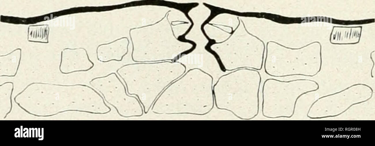 . Bulletin de la Socit botanique de Genve. Plants; Plants -- Switzerland. Fig. 91. Salacia crassifolia. Section transversale équatoriale. Parcontre, chez Salacia crassifolia, les épaississements des périclinos externes des cellnles ;uiiiees et épidermiques, de même que le prolongement de la couche de cutine le long des anticlines, l'ont défaut. On retrouve cependant le cloisonnement de la cellule annexe. Salacia paniculata L. dette espèce est assez différente de la précédente par la structure de son épidémie fort épaissi; parcontre, les cellules de bordure, tout en présentant nue structure gé Stock Photohttps://www.alamy.com/image-license-details/?v=1https://www.alamy.com/bulletin-de-la-socit-botanique-de-genve-plants-plants-switzerland-fig-91-salacia-crassifolia-section-transversale-quatoriale-parcontre-chez-salacia-crassifolia-les-paississements-des-priclinos-externes-des-cellnles-uiiiees-et-pidermiques-de-mme-que-le-prolongement-de-la-couche-de-cutine-le-long-des-anticlines-lont-dfaut-on-retrouve-cependant-le-cloisonnement-de-la-cellule-annexe-salacia-paniculata-l-dette-espce-est-assez-diffrente-de-la-prcdente-par-la-structure-de-son-pidmie-fort-paissi-parcontre-les-cellules-de-bordure-tout-en-prsentant-nue-structure-g-image234074417.html
RMRGR08H–. Bulletin de la Socit botanique de Genve. Plants; Plants -- Switzerland. Fig. 91. Salacia crassifolia. Section transversale équatoriale. Parcontre, chez Salacia crassifolia, les épaississements des périclinos externes des cellnles ;uiiiees et épidermiques, de même que le prolongement de la couche de cutine le long des anticlines, l'ont défaut. On retrouve cependant le cloisonnement de la cellule annexe. Salacia paniculata L. dette espèce est assez différente de la précédente par la structure de son épidémie fort épaissi; parcontre, les cellules de bordure, tout en présentant nue structure gé
 . Bulletin de l'Herbier Boissier. Plants. (5) C. R0ULET. DU GENRE THUNBERGIA LIN. FIL. 263 jeunes, la péricline externe amincie; toujours plus épaisse que les anticlines, elle n'atteint pas une épaisseur considérable dans les espèces qui sont groupées par Nées dans le genre Hexacentris (fîg. 3). Elle n'est pas non plus très épaisse chez les Thunbergia affinis Moore, Th. alata Boj. (flg. 2), mais chez certaines espèces cette cellulose atteint un grand développement. C'est ainsi que chez Thunbergia Cycnium Moore et Thunbergia Fischeri Engl, la péricline externe équivaut et. Fig. 4. — Épidémie et Stock Photohttps://www.alamy.com/image-license-details/?v=1https://www.alamy.com/bulletin-de-lherbier-boissier-plants-5-c-r0ulet-du-genre-thunbergia-lin-fil-263-jeunes-la-pricline-externe-amincie-toujours-plus-paisse-que-les-anticlines-elle-natteint-pas-une-paisseur-considrable-dans-les-espces-qui-sont-groupes-par-nes-dans-le-genre-hexacentris-fg-3-elle-nest-pas-non-plus-trs-paisse-chez-les-thunbergia-affinis-moore-th-alata-boj-flg-2-mais-chez-certaines-espces-cette-cellulose-atteint-un-grand-dveloppement-cest-ainsi-que-chez-thunbergia-cycnium-moore-et-thunbergia-fischeri-engl-la-pricline-externe-quivaut-et-fig-4-pidmie-et-image234029457.html
RMRGMXXW–. Bulletin de l'Herbier Boissier. Plants. (5) C. R0ULET. DU GENRE THUNBERGIA LIN. FIL. 263 jeunes, la péricline externe amincie; toujours plus épaisse que les anticlines, elle n'atteint pas une épaisseur considérable dans les espèces qui sont groupées par Nées dans le genre Hexacentris (fîg. 3). Elle n'est pas non plus très épaisse chez les Thunbergia affinis Moore, Th. alata Boj. (flg. 2), mais chez certaines espèces cette cellulose atteint un grand développement. C'est ainsi que chez Thunbergia Cycnium Moore et Thunbergia Fischeri Engl, la péricline externe équivaut et. Fig. 4. — Épidémie et
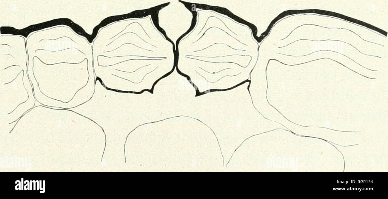 . Bulletin de la Socit botanique de Genve. Plants; Plants -- Switzerland. Fig. 22.â Lycopodium Selago. Section transversale équatoriale.. Fig. 23. â Lycopodium Selago. Section transversale équatoriale. Le fonctionnement de ce stomate doit cesser de bonne heure, par suite de l'apparition des épaississements cellulosiques dont je viens de parler; sur les feuilles jeunes, on trouve des stomates avec des cellules de bordure à anticlines dorsales amincies et permettant une communi- cation entre les lumens respectifs des cellules annexes et de bordure ; comme j'ai pu m'en rendre compte en faisant Stock Photohttps://www.alamy.com/image-license-details/?v=1https://www.alamy.com/bulletin-de-la-socit-botanique-de-genve-plants-plants-switzerland-fig-22-lycopodium-selago-section-transversale-quatoriale-fig-23-lycopodium-selago-section-transversale-quatoriale-le-fonctionnement-de-ce-stomate-doit-cesser-de-bonne-heure-par-suite-de-lapparition-des-paississements-cellulosiques-dont-je-viens-de-parler-sur-les-feuilles-jeunes-on-trouve-des-stomates-avec-des-cellules-de-bordure-anticlines-dorsales-amincies-et-permettant-une-communi-cation-entre-les-lumens-respectifs-des-cellules-annexes-et-de-bordure-comme-jai-pu-men-rendre-compte-en-faisant-image234075104.html
RMRGR154–. Bulletin de la Socit botanique de Genve. Plants; Plants -- Switzerland. Fig. 22.â Lycopodium Selago. Section transversale équatoriale.. Fig. 23. â Lycopodium Selago. Section transversale équatoriale. Le fonctionnement de ce stomate doit cesser de bonne heure, par suite de l'apparition des épaississements cellulosiques dont je viens de parler; sur les feuilles jeunes, on trouve des stomates avec des cellules de bordure à anticlines dorsales amincies et permettant une communi- cation entre les lumens respectifs des cellules annexes et de bordure ; comme j'ai pu m'en rendre compte en faisant
 . Anatomie et physiologie végétales à l'usage des étudiants en sciences naturelles des universités, des élèves à l'Institut agronomique, des écoles d'agriculture, etc. Plant anatomy; Plant physiology. IM.URALITK DES CELLULES MERES I) ENDOSPERME 869 Co jx'ut (Mro la cellule supéi-ieure (fig-. 1081, k), qui conliiie à la calolle (lig-. 1081, /). si elle existe (Agrapliide), ou direc- tement à répiderme dans le cas contraire ; ou bien, c'est la cellule suivante (Primevère). On nomme alors anticlines, les cellules sdHirs situées en arrière de la cellule mère^ et qui sont. Fig. 1078.— Nucelle de Sa Stock Photohttps://www.alamy.com/image-license-details/?v=1https://www.alamy.com/anatomie-et-physiologie-vgtales-lusage-des-tudiants-en-sciences-naturelles-des-universits-des-lves-linstitut-agronomique-des-coles-dagriculture-etc-plant-anatomy-plant-physiology-imuralitk-des-cellules-meres-i-endosperme-869-co-jxut-mro-la-cellule-supi-ieure-fig-1081-k-qui-conliiie-la-calolle-lig-1081-si-elle-existe-agrapliide-ou-direc-tement-rpiderme-dans-le-cas-contraire-ou-bien-cest-la-cellule-suivante-primevre-on-nomme-alors-anticlines-les-cellules-sdhirs-situes-en-arrire-de-la-cellule-mre-et-qui-sont-fig-1078-nucelle-de-sa-image236844805.html
RMRN95Y1–. Anatomie et physiologie végétales à l'usage des étudiants en sciences naturelles des universités, des élèves à l'Institut agronomique, des écoles d'agriculture, etc. Plant anatomy; Plant physiology. IM.URALITK DES CELLULES MERES I) ENDOSPERME 869 Co jx'ut (Mro la cellule supéi-ieure (fig-. 1081, k), qui conliiie à la calolle (lig-. 1081, /). si elle existe (Agrapliide), ou direc- tement à répiderme dans le cas contraire ; ou bien, c'est la cellule suivante (Primevère). On nomme alors anticlines, les cellules sdHirs situées en arrière de la cellule mère^ et qui sont. Fig. 1078.— Nucelle de Sa