Antique map of kent england Stock Photos and Images
(274)See antique map of kent england stock video clipsQuick filters:
Antique map of kent england Stock Photos and Images
 GREAT BRITAIN - CIRCA 1991: a stamp printed in the Great Britain shows Map of Village of Hamstreet, Kent, Bicentennial of Ordnance Survey Maps, circa Stock Photohttps://www.alamy.com/image-license-details/?v=1https://www.alamy.com/great-britain-circa-1991-a-stamp-printed-in-the-great-britain-shows-map-of-village-of-hamstreet-kent-bicentennial-of-ordnance-survey-maps-circa-image470851384.html
RF2JA13MT–GREAT BRITAIN - CIRCA 1991: a stamp printed in the Great Britain shows Map of Village of Hamstreet, Kent, Bicentennial of Ordnance Survey Maps, circa
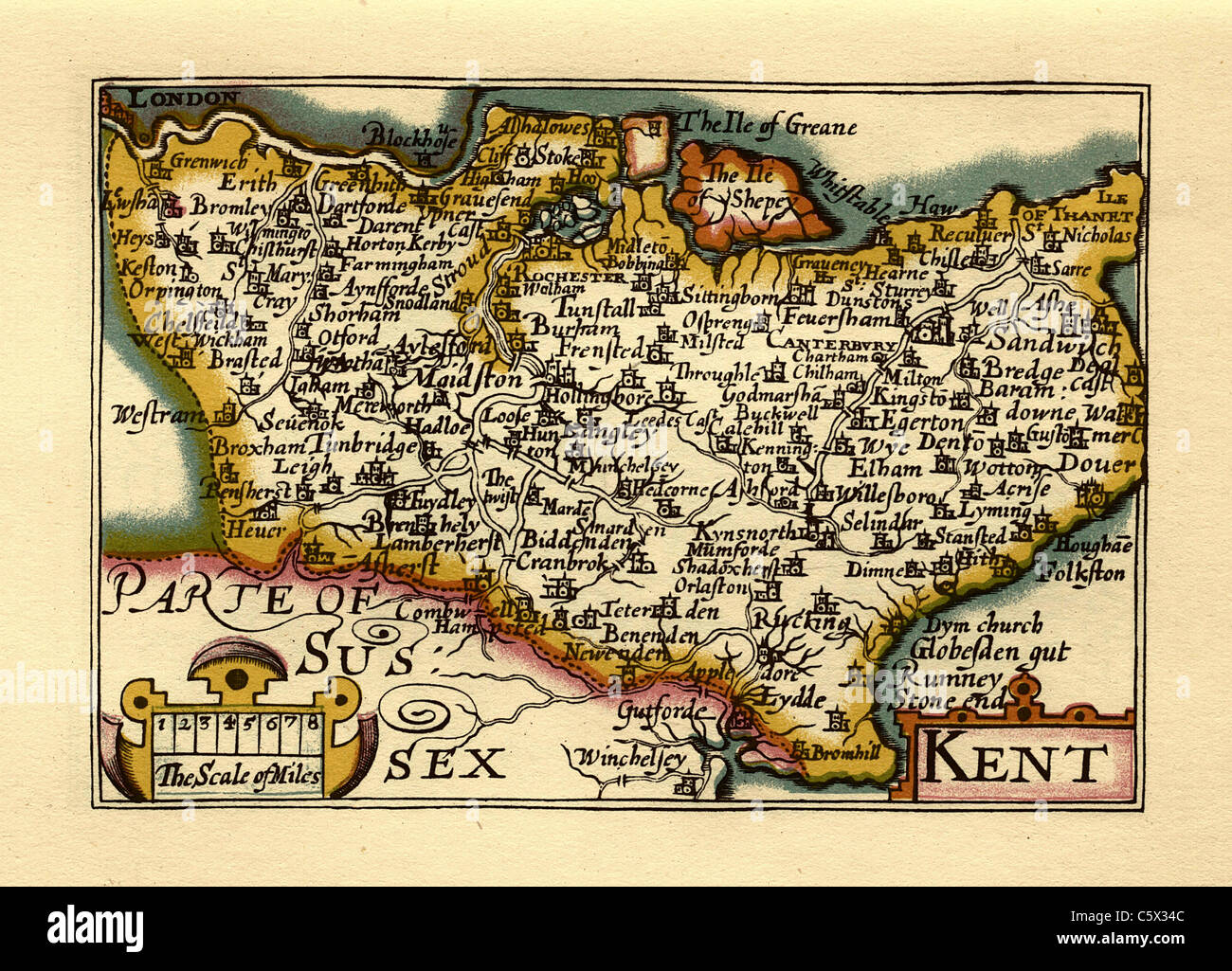 Kent - Old English County Map by John Speed, circa 1625 Stock Photohttps://www.alamy.com/image-license-details/?v=1https://www.alamy.com/stock-photo-kent-old-english-county-map-by-john-speed-circa-1625-38067244.html
RFC5X34C–Kent - Old English County Map by John Speed, circa 1625
 Essex is a county in the East of England, north-east of London. One of the home counties, it borders Suffolk and Cambridgeshire to the north, Hertfordshire to the west, Kent across the estuary of the River Thames to the south and London to the south-west. The county town is Chelmsford, the only city in the county. Copperplate engraving From the Encyclopaedia Londinensis or, Universal dictionary of arts, sciences, and literature; Volume VII; Edited by Wilkes, John. Published in London in 1810 Stock Photohttps://www.alamy.com/image-license-details/?v=1https://www.alamy.com/essex-is-a-county-in-the-east-of-england-north-east-of-london-one-of-the-home-counties-it-borders-suffolk-and-cambridgeshire-to-the-north-hertfordshire-to-the-west-kent-across-the-estuary-of-the-river-thames-to-the-south-and-london-to-the-south-west-the-county-town-is-chelmsford-the-only-city-in-the-county-copperplate-engraving-from-the-encyclopaedia-londinensis-or-universal-dictionary-of-arts-sciences-and-literature-volume-vii-edited-by-wilkes-john-published-in-london-in-1810-image432272271.html
RM2G37KKB–Essex is a county in the East of England, north-east of London. One of the home counties, it borders Suffolk and Cambridgeshire to the north, Hertfordshire to the west, Kent across the estuary of the River Thames to the south and London to the south-west. The county town is Chelmsford, the only city in the county. Copperplate engraving From the Encyclopaedia Londinensis or, Universal dictionary of arts, sciences, and literature; Volume VII; Edited by Wilkes, John. Published in London in 1810
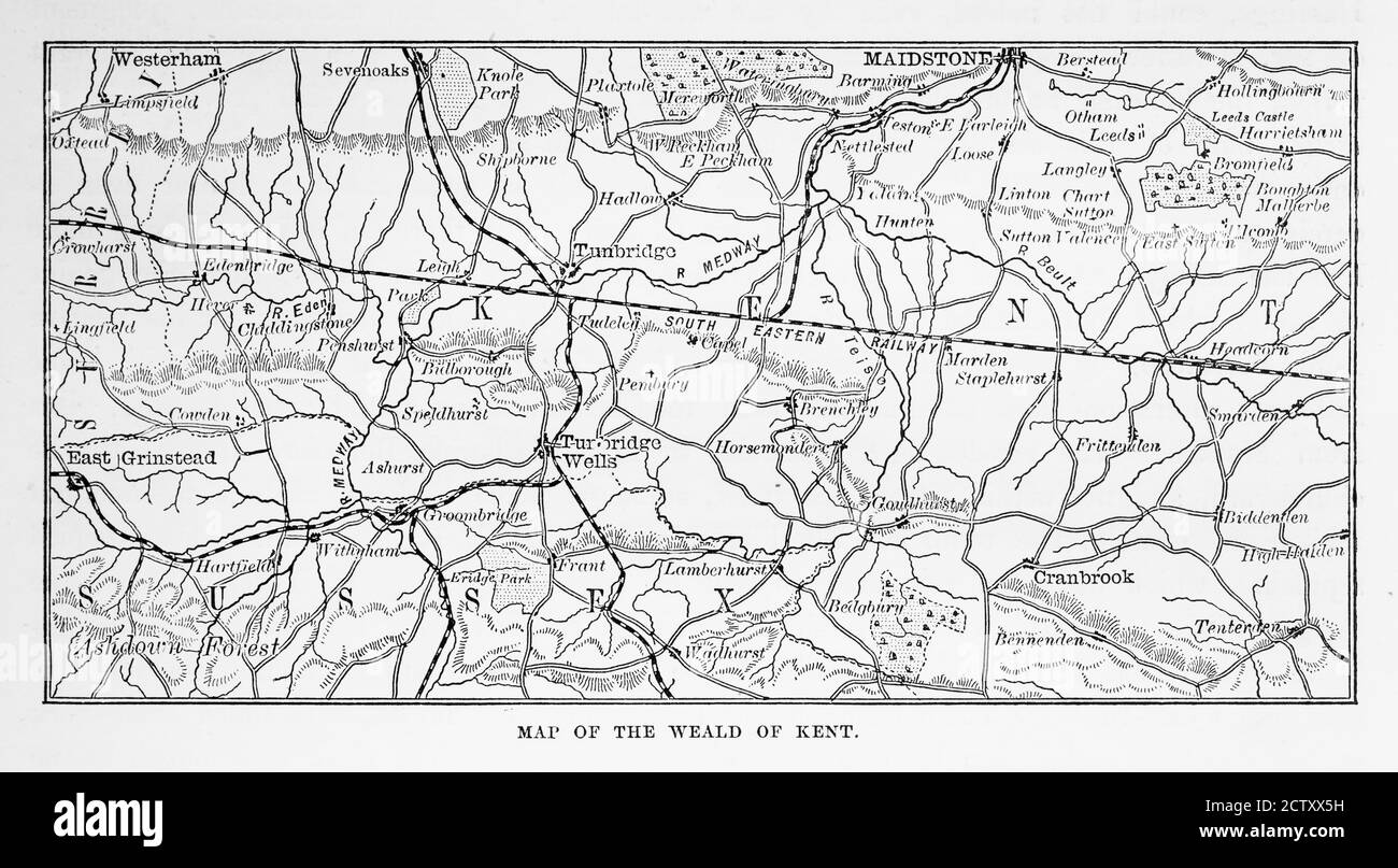 Map of Kent and Neighborhoods, England Victorian Engraving, 1840 Stock Photohttps://www.alamy.com/image-license-details/?v=1https://www.alamy.com/map-of-kent-and-neighborhoods-england-victorian-engraving-1840-image376760765.html
RM2CTXX5H–Map of Kent and Neighborhoods, England Victorian Engraving, 1840
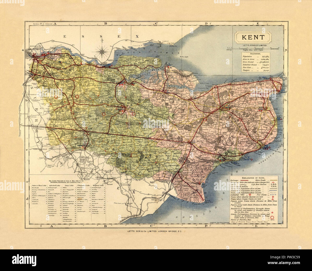 Map Of Kent 1884 Stock Photohttps://www.alamy.com/image-license-details/?v=1https://www.alamy.com/map-of-kent-1884-image221966229.html
RFPW3C59–Map Of Kent 1884
 A map of The Coast from Sandwich to Winchelsea UK scanned at high resolution from a book printed in 1806. Believed copyright free. Stock Photohttps://www.alamy.com/image-license-details/?v=1https://www.alamy.com/a-map-of-the-coast-from-sandwich-to-winchelsea-uk-scanned-at-high-resolution-from-a-book-printed-in-1806-believed-copyright-free-image560749565.html
RM2RG89P5–A map of The Coast from Sandwich to Winchelsea UK scanned at high resolution from a book printed in 1806. Believed copyright free.
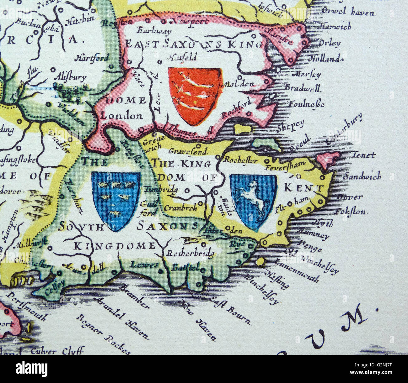 Shields of Sussex, Kent and Essex from the Heptarchy; a collective name applied to the Anglo-Saxon kingdoms of south, east, and central England during late antiquity and the early Middle Ages, Detail from an antique map of Britain, by the Dutch cartographer Willem Blaeu in Atlas Novus (Amsterdam 1635) Stock Photohttps://www.alamy.com/image-license-details/?v=1https://www.alamy.com/stock-photo-shields-of-sussex-kent-and-essex-from-the-heptarchy-a-collective-name-104966842.html
RMG2NJ7P–Shields of Sussex, Kent and Essex from the Heptarchy; a collective name applied to the Anglo-Saxon kingdoms of south, east, and central England during late antiquity and the early Middle Ages, Detail from an antique map of Britain, by the Dutch cartographer Willem Blaeu in Atlas Novus (Amsterdam 1635)
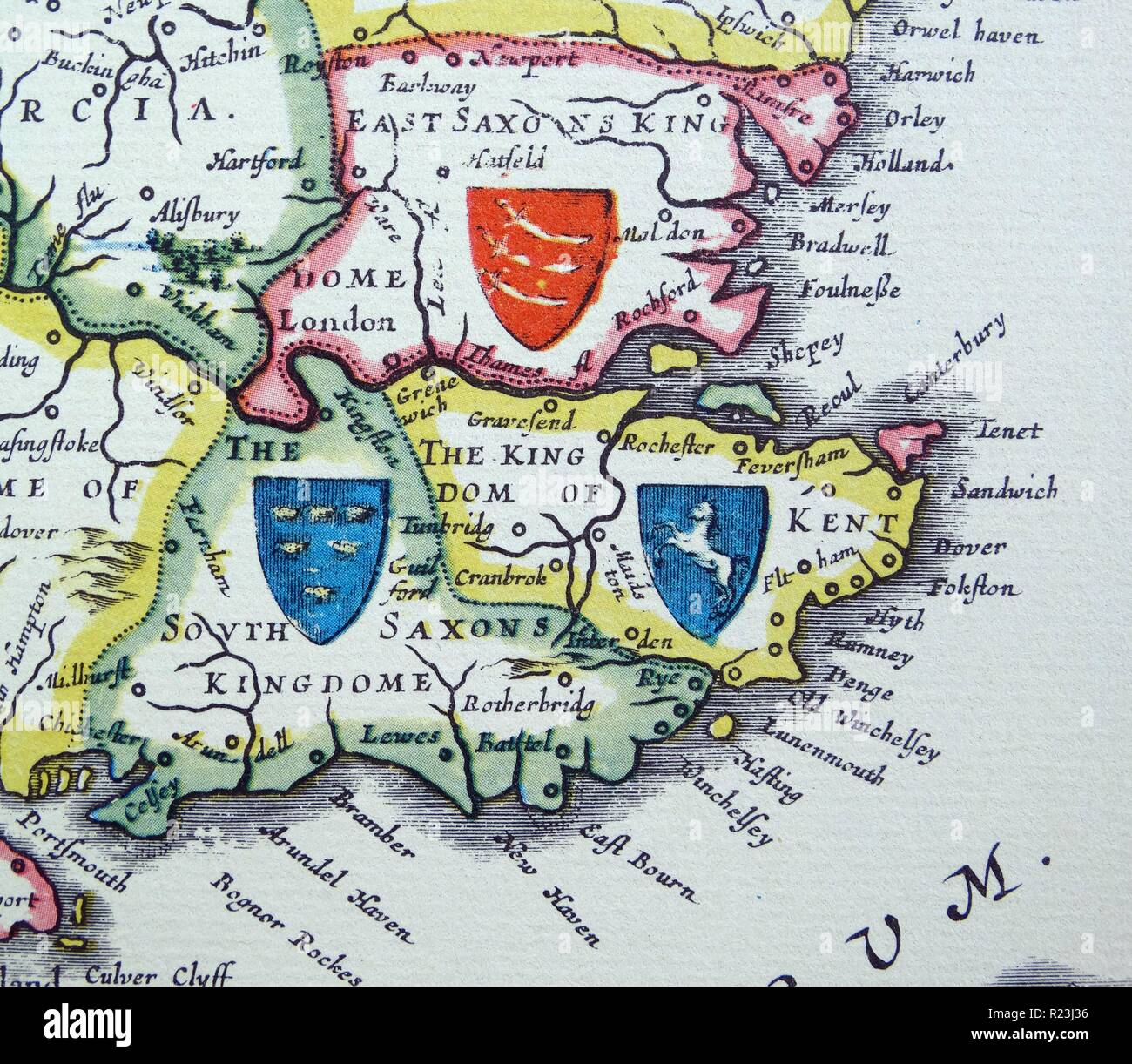 Shields of Sussex, Kent and Essex from the Heptarchy; a collective name applied to the Anglo-Saxon kingdoms of south, east, and central England during late antiquity and the early Middle Ages, Detail from an antique map of Britain, by the Dutch cartographer Willem Blaeu in Atlas Novus (Amsterdam 1635) Stock Photohttps://www.alamy.com/image-license-details/?v=1https://www.alamy.com/shields-of-sussex-kent-and-essex-from-the-heptarchy-a-collective-name-applied-to-the-anglo-saxon-kingdoms-of-south-east-and-central-england-during-late-antiquity-and-the-early-middle-ages-detail-from-an-antique-map-of-britain-by-the-dutch-cartographer-willem-blaeu-in-atlas-novus-amsterdam-1635-image225044154.html
RMR23J36–Shields of Sussex, Kent and Essex from the Heptarchy; a collective name applied to the Anglo-Saxon kingdoms of south, east, and central England during late antiquity and the early Middle Ages, Detail from an antique map of Britain, by the Dutch cartographer Willem Blaeu in Atlas Novus (Amsterdam 1635)
 Kent and Essex. 1935 – A pictorial map of the River Thames by Helen McKie. This map depicts the stretch of the River Thames from Lower Hope to The Warp, including Sea Reach. It is decorated with cartoon images depicting locations of historical interest. Stock Photohttps://www.alamy.com/image-license-details/?v=1https://www.alamy.com/kent-and-essex-1935-a-pictorial-map-of-the-river-thames-by-helen-mckie-this-map-depicts-the-stretch-of-the-river-thames-from-lower-hope-to-the-warp-including-sea-reach-it-is-decorated-with-cartoon-images-depicting-locations-of-historical-interest-image595785991.html
RM2WH8B33–Kent and Essex. 1935 – A pictorial map of the River Thames by Helen McKie. This map depicts the stretch of the River Thames from Lower Hope to The Warp, including Sea Reach. It is decorated with cartoon images depicting locations of historical interest.
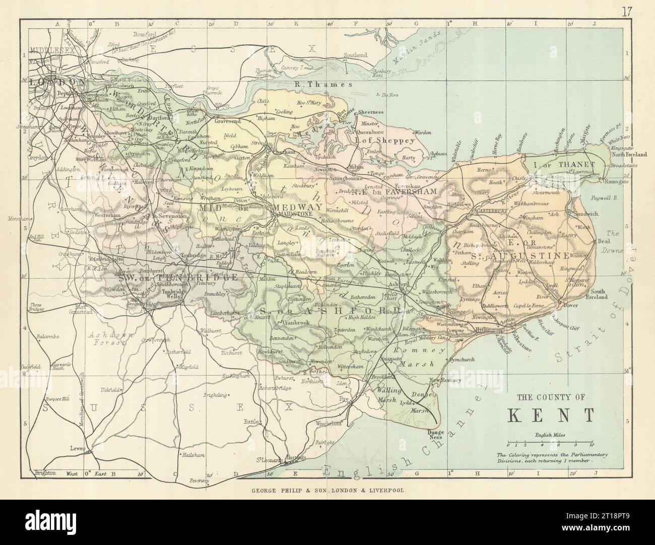 KENT. Antique county map. Railways roads. Constituencies. PHILIP 1889 old Stock Photohttps://www.alamy.com/image-license-details/?v=1https://www.alamy.com/kent-antique-county-map-railways-roads-constituencies-philip-1889-old-image568750345.html
RF2T18PT9–KENT. Antique county map. Railways roads. Constituencies. PHILIP 1889 old
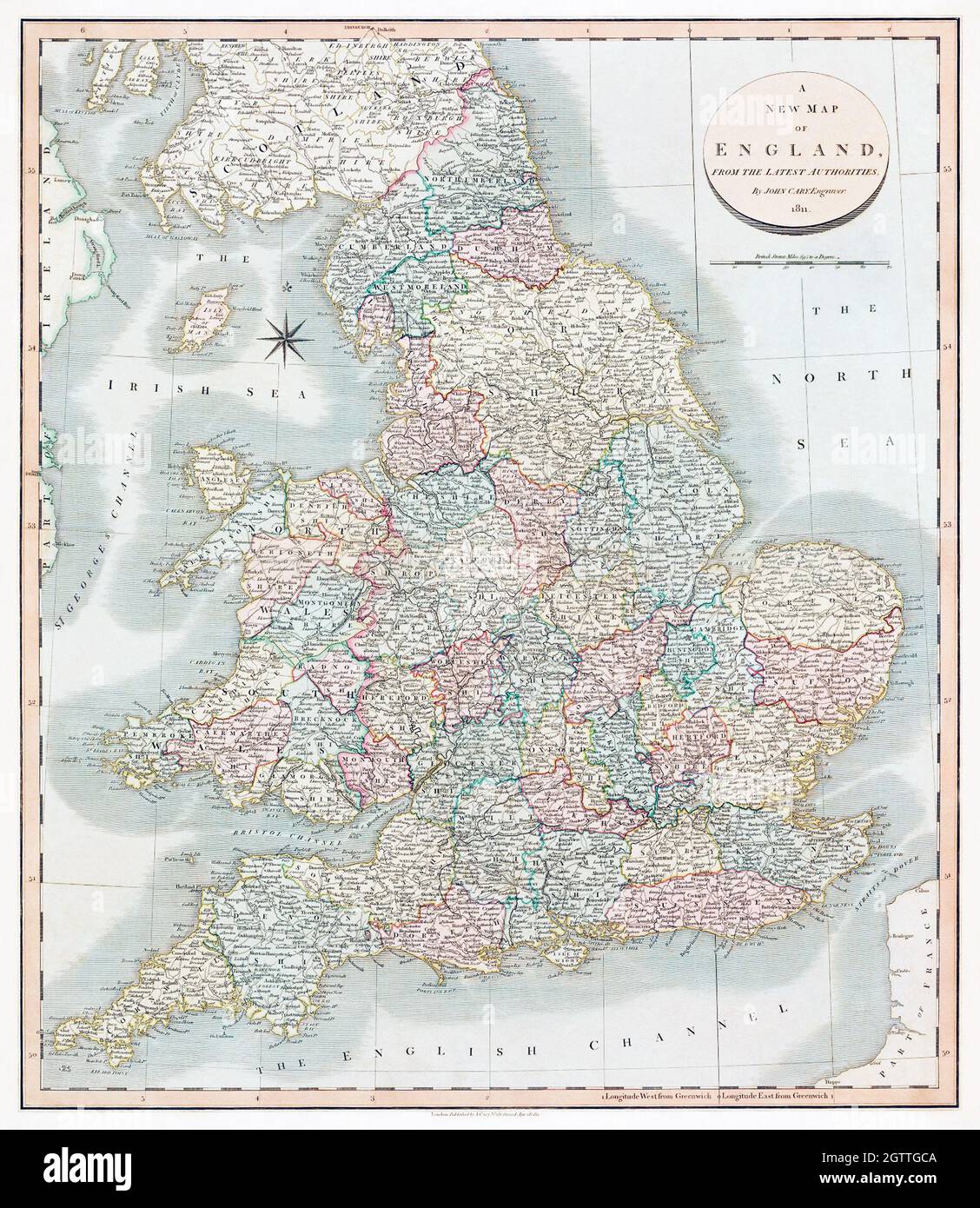 A new map of England (1811) by John Cary. United Kingdom, Great Britain. Stock Photohttps://www.alamy.com/image-license-details/?v=1https://www.alamy.com/a-new-map-of-england-1811-by-john-cary-united-kingdom-great-britain-image445550682.html
RF2GTTGCA–A new map of England (1811) by John Cary. United Kingdom, Great Britain.
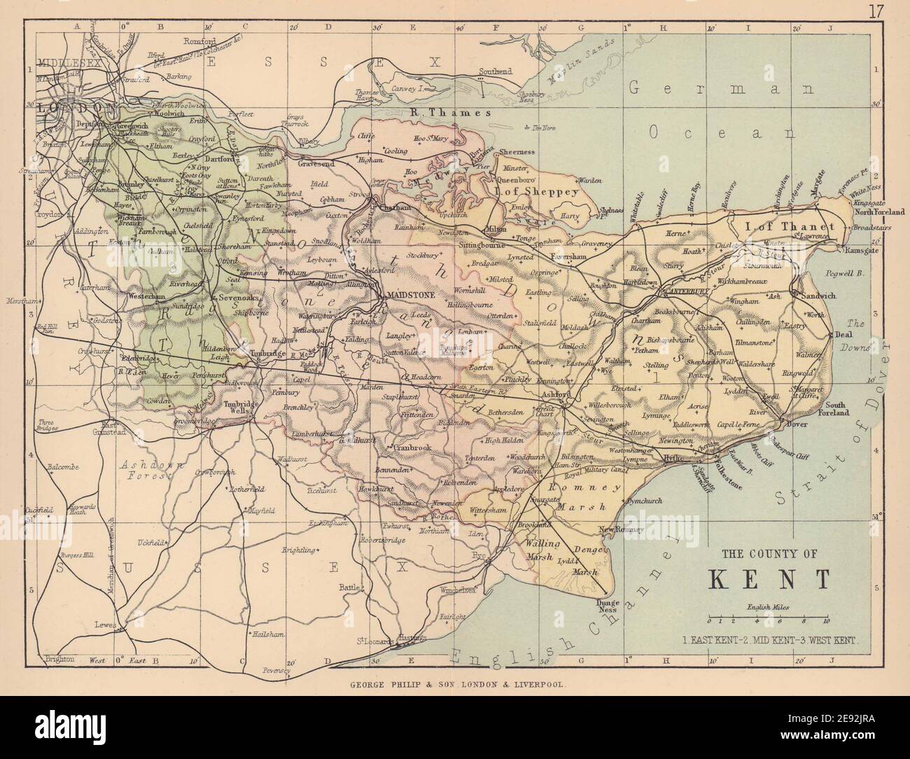 KENT. Antique county map. Railways roads. Constituencies. PHILIP 1885 old Stock Photohttps://www.alamy.com/image-license-details/?v=1https://www.alamy.com/kent-antique-county-map-railways-roads-constituencies-philip-1885-old-image401429038.html
RF2E92JRA–KENT. Antique county map. Railways roads. Constituencies. PHILIP 1885 old
![Image taken from page 152 of 'Collections for an History of Sandwich in Kent. With notices of the other Cinque Ports and members, and of Richborough. [With plates.]' Image taken from page 152 of 'Collections for an History Stock Photo Image taken from page 152 of 'Collections for an History of Sandwich in Kent. With notices of the other Cinque Ports and members, and of Richborough. [With plates.]' Image taken from page 152 of 'Collections for an History Stock Photo](https://c8.alamy.com/comp/HBT7XA/image-taken-from-page-152-of-collections-for-an-history-of-sandwich-HBT7XA.jpg) Image taken from page 152 of 'Collections for an History of Sandwich in Kent. With notices of the other Cinque Ports and members, and of Richborough. [With plates.]' Image taken from page 152 of 'Collections for an History Stock Photohttps://www.alamy.com/image-license-details/?v=1https://www.alamy.com/stock-photo-image-taken-from-page-152-of-collections-for-an-history-of-sandwich-127766866.html
Image taken from page 152 of 'Collections for an History of Sandwich in Kent. With notices of the other Cinque Ports and members, and of Richborough. [With plates.]' Image taken from page 152 of 'Collections for an History Stock Photohttps://www.alamy.com/image-license-details/?v=1https://www.alamy.com/stock-photo-image-taken-from-page-152-of-collections-for-an-history-of-sandwich-127766866.htmlRMHBT7XA–Image taken from page 152 of 'Collections for an History of Sandwich in Kent. With notices of the other Cinque Ports and members, and of Richborough. [With plates.]' Image taken from page 152 of 'Collections for an History
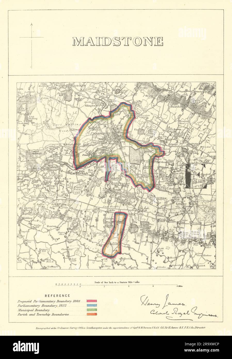 Maidstone, Kent. JAMES. Parliamentary Boundary Commission 1868 old antique map Stock Photohttps://www.alamy.com/image-license-details/?v=1https://www.alamy.com/maidstone-kent-james-parliamentary-boundary-commission-1868-old-antique-map-image556854390.html
RF2R9XWCP–Maidstone, Kent. JAMES. Parliamentary Boundary Commission 1868 old antique map
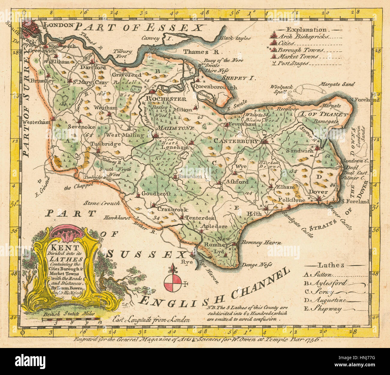 Map Of Kent 1756 Stock Photohttps://www.alamy.com/image-license-details/?v=1https://www.alamy.com/stock-photo-map-of-kent-1756-133781188.html
RFHNJ77G–Map Of Kent 1756
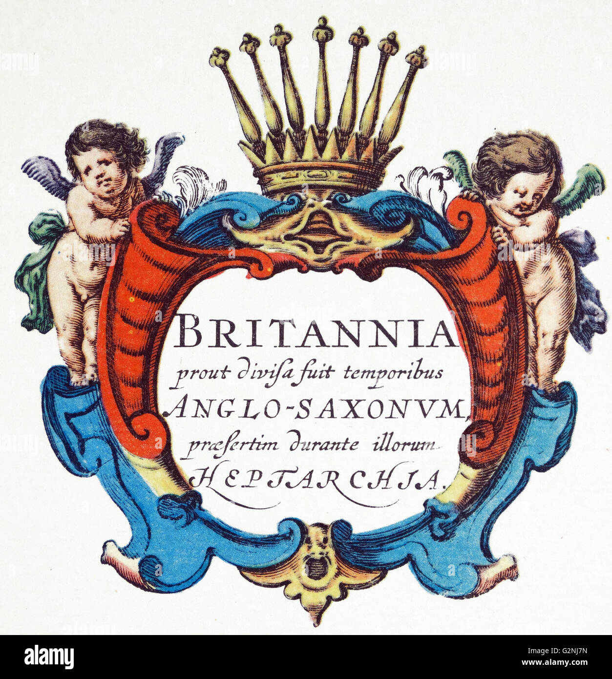 The Heptarchy is a collective name applied to the Anglo-Saxon kingdoms of south, east, and central England during late antiquity and the early Middle Ages, conventionally identified as seven: Northumbria, Mercia, East Anglia, Essex, Kent, Sussex, and Wessex. The Anglo-Saxon kingdoms eventually unified into the Kingdom of England. Detail from an antique map of Britain, by the Dutch cartographer Willem Blaeu in Atlas Novus (Amsterdam 1635) Stock Photohttps://www.alamy.com/image-license-details/?v=1https://www.alamy.com/stock-photo-the-heptarchy-is-a-collective-name-applied-to-the-anglo-saxon-kingdoms-104966841.html
RMG2NJ7N–The Heptarchy is a collective name applied to the Anglo-Saxon kingdoms of south, east, and central England during late antiquity and the early Middle Ages, conventionally identified as seven: Northumbria, Mercia, East Anglia, Essex, Kent, Sussex, and Wessex. The Anglo-Saxon kingdoms eventually unified into the Kingdom of England. Detail from an antique map of Britain, by the Dutch cartographer Willem Blaeu in Atlas Novus (Amsterdam 1635)
 The Heptarchy is a collective name applied to the Anglo-Saxon kingdoms of south, east, and central England during late antiquity and the early Middle Ages, conventionally identified as seven: Northumbria, Mercia, East Anglia, Essex, Kent, Sussex, and Wessex. The Anglo-Saxon kingdoms eventually unified into the Kingdom of England. Detail from an antique map of Britain, by the Dutch cartographer Willem Blaeu in Atlas Novus (Amsterdam 1635) Stock Photohttps://www.alamy.com/image-license-details/?v=1https://www.alamy.com/the-heptarchy-is-a-collective-name-applied-to-the-anglo-saxon-kingdoms-of-south-east-and-central-england-during-late-antiquity-and-the-early-middle-ages-conventionally-identified-as-seven-northumbria-mercia-east-anglia-essex-kent-sussex-and-wessex-the-anglo-saxon-kingdoms-eventually-unified-into-the-kingdom-of-england-detail-from-an-antique-map-of-britain-by-the-dutch-cartographer-willem-blaeu-in-atlas-novus-amsterdam-1635-image330678772.html
RM2A5YM44–The Heptarchy is a collective name applied to the Anglo-Saxon kingdoms of south, east, and central England during late antiquity and the early Middle Ages, conventionally identified as seven: Northumbria, Mercia, East Anglia, Essex, Kent, Sussex, and Wessex. The Anglo-Saxon kingdoms eventually unified into the Kingdom of England. Detail from an antique map of Britain, by the Dutch cartographer Willem Blaeu in Atlas Novus (Amsterdam 1635)
 Kent and Essex. 1935 – A pictorial map of the River Thames by Helen McKie. This map depicts the stretch of the River Thames from Long Reach to Gravesend Reach, including St. Clement’s Reach and Northfleet Hope. It is decorated with cartoon images depicting locations of historical interest. Stock Photohttps://www.alamy.com/image-license-details/?v=1https://www.alamy.com/kent-and-essex-1935-a-pictorial-map-of-the-river-thames-by-helen-mckie-this-map-depicts-the-stretch-of-the-river-thames-from-long-reach-to-gravesend-reach-including-st-clements-reach-and-northfleet-hope-it-is-decorated-with-cartoon-images-depicting-locations-of-historical-interest-image595785990.html
RM2WH8B32–Kent and Essex. 1935 – A pictorial map of the River Thames by Helen McKie. This map depicts the stretch of the River Thames from Long Reach to Gravesend Reach, including St. Clement’s Reach and Northfleet Hope. It is decorated with cartoon images depicting locations of historical interest.
 Image taken from page 43 of 'Memories of Malling and its Valley. With a fauna and flora of Kent, etc' Image taken from page 43 of 'Memories of Malling and Stock Photohttps://www.alamy.com/image-license-details/?v=1https://www.alamy.com/stock-photo-image-taken-from-page-43-of-memories-of-malling-and-its-valley-with-127814920.html
RMHBXD6G–Image taken from page 43 of 'Memories of Malling and its Valley. With a fauna and flora of Kent, etc' Image taken from page 43 of 'Memories of Malling and
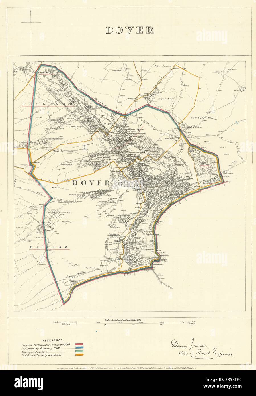 Dover, Kent. JAMES. Parliamentary Boundary Commission 1868 old antique map Stock Photohttps://www.alamy.com/image-license-details/?v=1https://www.alamy.com/dover-kent-james-parliamentary-boundary-commission-1868-old-antique-map-image556853780.html
RF2R9XTK0–Dover, Kent. JAMES. Parliamentary Boundary Commission 1868 old antique map
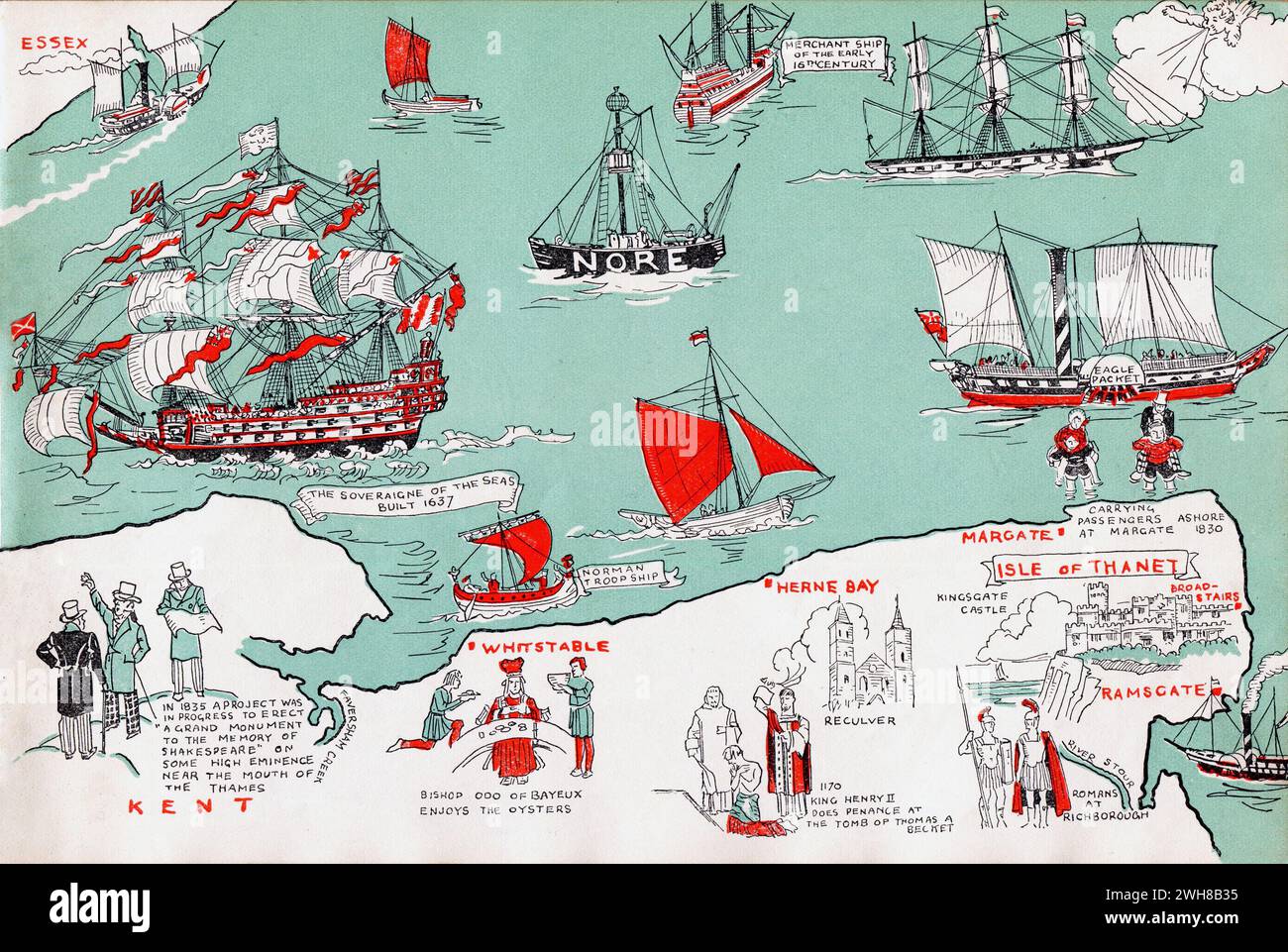 Kent. 1935 – A pictorial map of the Thames Estuary by Helen McKie. This map depicts the stretch of the Thames Estuary including The Nore. It is decorated with cartoon images depicting locations of historical interest. Stock Photohttps://www.alamy.com/image-license-details/?v=1https://www.alamy.com/kent-1935-a-pictorial-map-of-the-thames-estuary-by-helen-mckie-this-map-depicts-the-stretch-of-the-thames-estuary-including-the-nore-it-is-decorated-with-cartoon-images-depicting-locations-of-historical-interest-image595785993.html
RM2WH8B35–Kent. 1935 – A pictorial map of the Thames Estuary by Helen McKie. This map depicts the stretch of the Thames Estuary including The Nore. It is decorated with cartoon images depicting locations of historical interest.
![Image taken from page 152 of 'Collections for an History of Sandwich in Kent. With notices of the other Cinque Ports and members, and of Richborough. [With plates.]' Image taken from page 152 of 'Collections for an History Stock Photo Image taken from page 152 of 'Collections for an History of Sandwich in Kent. With notices of the other Cinque Ports and members, and of Richborough. [With plates.]' Image taken from page 152 of 'Collections for an History Stock Photo](https://c8.alamy.com/comp/HBT7X0/image-taken-from-page-152-of-collections-for-an-history-of-sandwich-HBT7X0.jpg) Image taken from page 152 of 'Collections for an History of Sandwich in Kent. With notices of the other Cinque Ports and members, and of Richborough. [With plates.]' Image taken from page 152 of 'Collections for an History Stock Photohttps://www.alamy.com/image-license-details/?v=1https://www.alamy.com/stock-photo-image-taken-from-page-152-of-collections-for-an-history-of-sandwich-127766856.html
Image taken from page 152 of 'Collections for an History of Sandwich in Kent. With notices of the other Cinque Ports and members, and of Richborough. [With plates.]' Image taken from page 152 of 'Collections for an History Stock Photohttps://www.alamy.com/image-license-details/?v=1https://www.alamy.com/stock-photo-image-taken-from-page-152-of-collections-for-an-history-of-sandwich-127766856.htmlRMHBT7X0–Image taken from page 152 of 'Collections for an History of Sandwich in Kent. With notices of the other Cinque Ports and members, and of Richborough. [With plates.]' Image taken from page 152 of 'Collections for an History
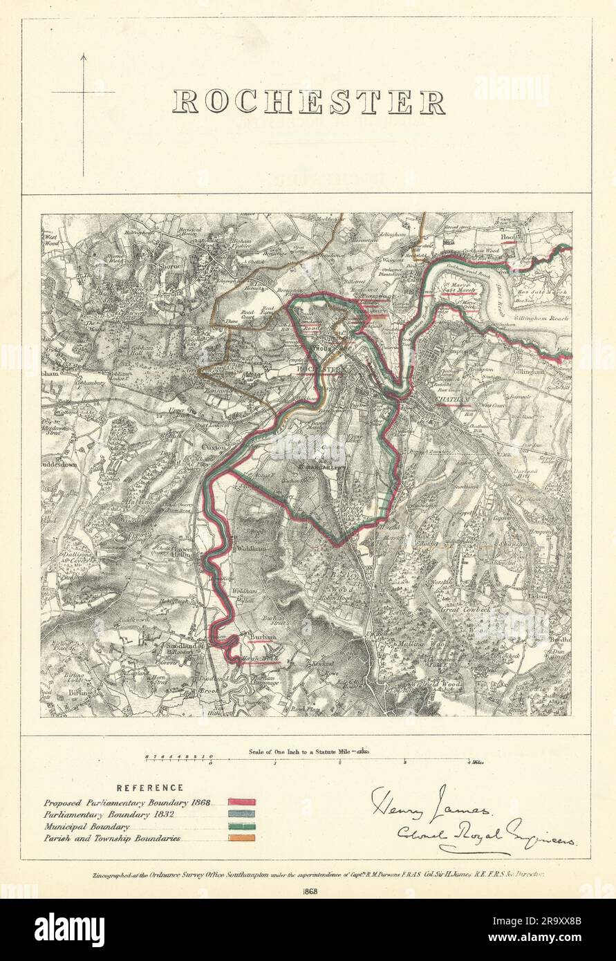 Rochester, Kent. JAMES. Parliamentary Boundary Commission 1868 old antique map Stock Photohttps://www.alamy.com/image-license-details/?v=1https://www.alamy.com/rochester-kent-james-parliamentary-boundary-commission-1868-old-antique-map-image556855051.html
RF2R9XX8B–Rochester, Kent. JAMES. Parliamentary Boundary Commission 1868 old antique map
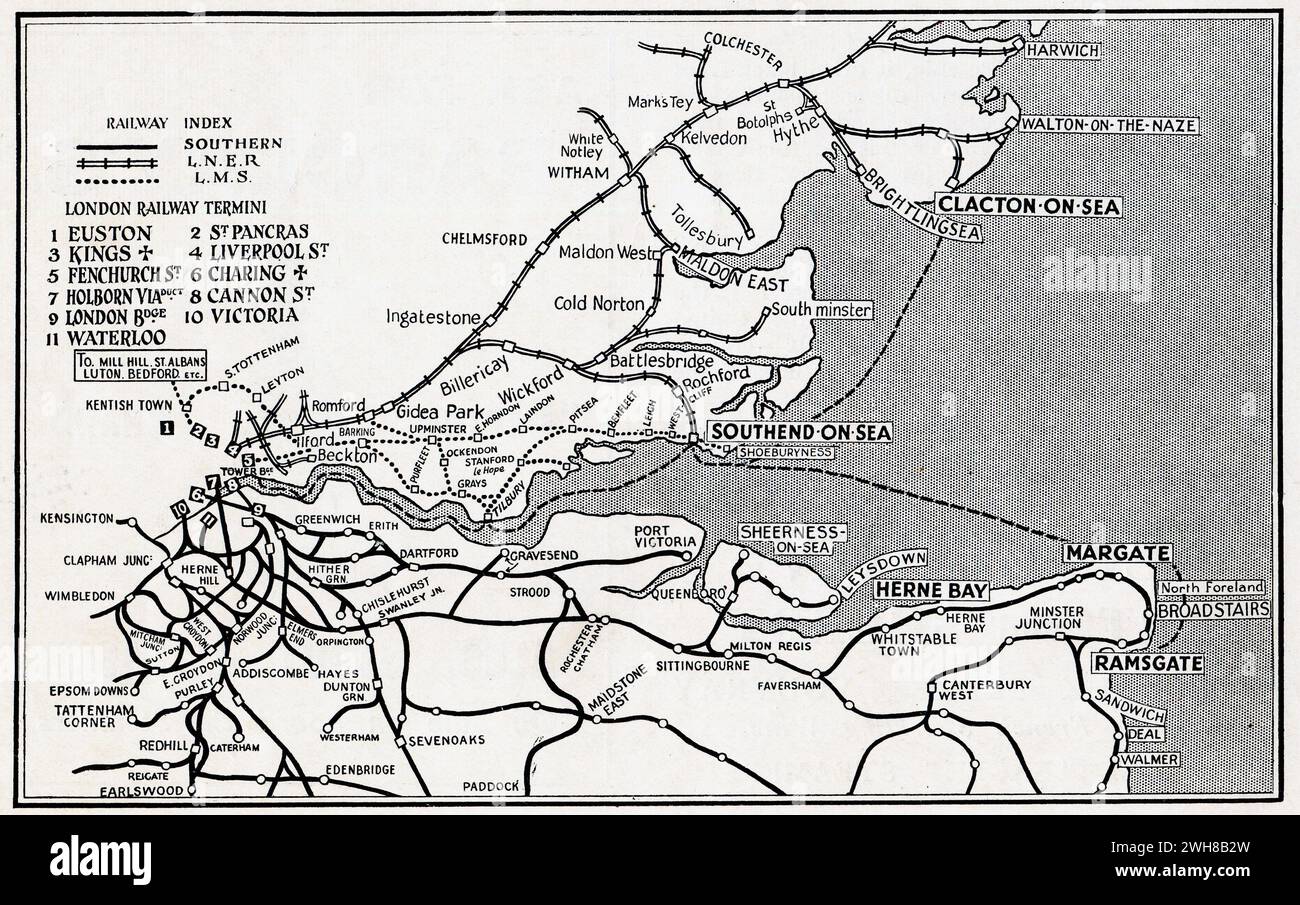 A map published circa. 1935 by the General Steam Navigation Company. It depicts the Southern; LNER and LMS rail networks serving the Essex and Kent coast. It also shows the routes used by General Steam Navigation Company, which was London's foremost short-sea coastal shipping line. This service connected London with Southend-on-Sea, Clacton-on-Sea, Margate and Ramsgate. Stock Photohttps://www.alamy.com/image-license-details/?v=1https://www.alamy.com/a-map-published-circa-1935-by-the-general-steam-navigation-company-it-depicts-the-southern-lner-and-lms-rail-networks-serving-the-essex-and-kent-coast-it-also-shows-the-routes-used-by-general-steam-navigation-company-which-was-londons-foremost-short-sea-coastal-shipping-line-this-service-connected-london-with-southend-on-sea-clacton-on-sea-margate-and-ramsgate-image595785985.html
RM2WH8B2W–A map published circa. 1935 by the General Steam Navigation Company. It depicts the Southern; LNER and LMS rail networks serving the Essex and Kent coast. It also shows the routes used by General Steam Navigation Company, which was London's foremost short-sea coastal shipping line. This service connected London with Southend-on-Sea, Clacton-on-Sea, Margate and Ramsgate.
![Image taken from page 40 of '[Memorials of Herne, Kent.]' Image taken from page 40 of '[Memorials of Herne, Kent]' Stock Photo Image taken from page 40 of '[Memorials of Herne, Kent.]' Image taken from page 40 of '[Memorials of Herne, Kent]' Stock Photo](https://c8.alamy.com/comp/HBTD7E/image-taken-from-page-40-of-memorials-of-herne-kent-image-taken-from-HBTD7E.jpg) Image taken from page 40 of '[Memorials of Herne, Kent.]' Image taken from page 40 of '[Memorials of Herne, Kent]' Stock Photohttps://www.alamy.com/image-license-details/?v=1https://www.alamy.com/stock-photo-image-taken-from-page-40-of-memorials-of-herne-kent-image-taken-from-127771042.html
Image taken from page 40 of '[Memorials of Herne, Kent.]' Image taken from page 40 of '[Memorials of Herne, Kent]' Stock Photohttps://www.alamy.com/image-license-details/?v=1https://www.alamy.com/stock-photo-image-taken-from-page-40-of-memorials-of-herne-kent-image-taken-from-127771042.htmlRMHBTD7E–Image taken from page 40 of '[Memorials of Herne, Kent.]' Image taken from page 40 of '[Memorials of Herne, Kent]'
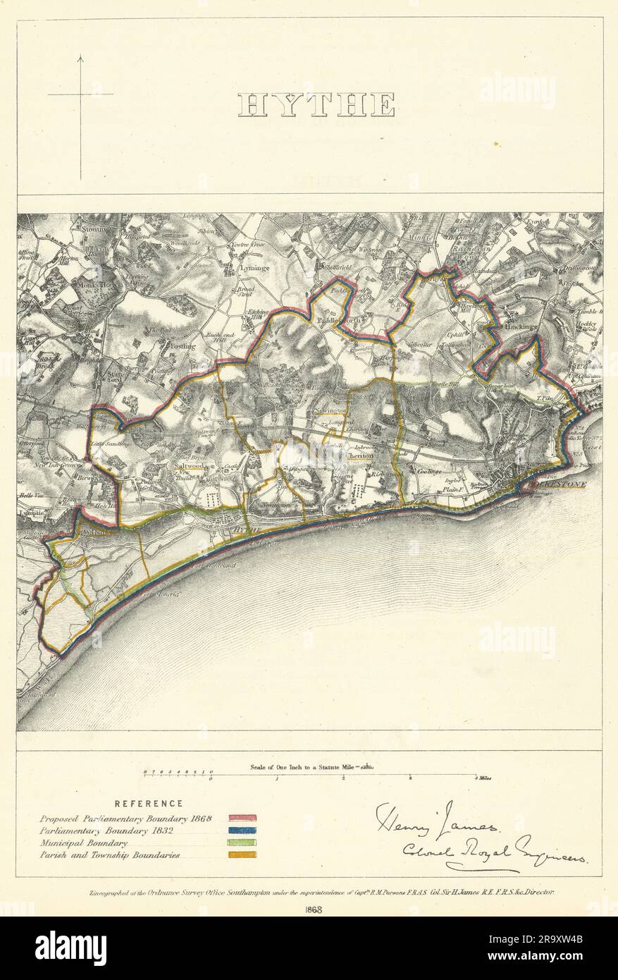 Hythe, Kent. JAMES. Parliamentary Boundary Commission 1868 old antique map Stock Photohttps://www.alamy.com/image-license-details/?v=1https://www.alamy.com/hythe-kent-james-parliamentary-boundary-commission-1868-old-antique-map-image556854155.html
RF2R9XW4B–Hythe, Kent. JAMES. Parliamentary Boundary Commission 1868 old antique map
 Kent and Essex. 1935 – A pictorial map of the River Thames by Helen McKie. This map depicts the stretch of the River Thames from Halfway Reach to Long Reach, including Erith Reach and Erith Rands. It is decorated with cartoon images depicting locations of historical interest. Stock Photohttps://www.alamy.com/image-license-details/?v=1https://www.alamy.com/kent-and-essex-1935-a-pictorial-map-of-the-river-thames-by-helen-mckie-this-map-depicts-the-stretch-of-the-river-thames-from-halfway-reach-to-long-reach-including-erith-reach-and-erith-rands-it-is-decorated-with-cartoon-images-depicting-locations-of-historical-interest-image595785989.html
RM2WH8B31–Kent and Essex. 1935 – A pictorial map of the River Thames by Helen McKie. This map depicts the stretch of the River Thames from Halfway Reach to Long Reach, including Erith Reach and Erith Rands. It is decorated with cartoon images depicting locations of historical interest.
![Image taken from page 152 of 'Collections for an History of Sandwich in Kent. With notices of the other Cinque Ports and members, and of Richborough. [With plates.]' Image taken from page 152 of 'Collections for an History Stock Photo Image taken from page 152 of 'Collections for an History of Sandwich in Kent. With notices of the other Cinque Ports and members, and of Richborough. [With plates.]' Image taken from page 152 of 'Collections for an History Stock Photo](https://c8.alamy.com/comp/HBT7XF/image-taken-from-page-152-of-collections-for-an-history-of-sandwich-HBT7XF.jpg) Image taken from page 152 of 'Collections for an History of Sandwich in Kent. With notices of the other Cinque Ports and members, and of Richborough. [With plates.]' Image taken from page 152 of 'Collections for an History Stock Photohttps://www.alamy.com/image-license-details/?v=1https://www.alamy.com/stock-photo-image-taken-from-page-152-of-collections-for-an-history-of-sandwich-127766871.html
Image taken from page 152 of 'Collections for an History of Sandwich in Kent. With notices of the other Cinque Ports and members, and of Richborough. [With plates.]' Image taken from page 152 of 'Collections for an History Stock Photohttps://www.alamy.com/image-license-details/?v=1https://www.alamy.com/stock-photo-image-taken-from-page-152-of-collections-for-an-history-of-sandwich-127766871.htmlRMHBT7XF–Image taken from page 152 of 'Collections for an History of Sandwich in Kent. With notices of the other Cinque Ports and members, and of Richborough. [With plates.]' Image taken from page 152 of 'Collections for an History
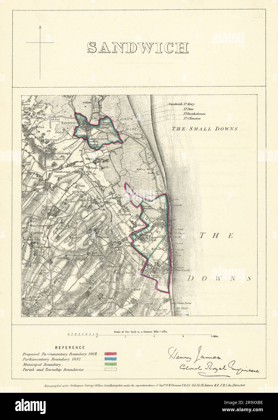 Sandwich, Kent. JAMES. Parliamentary Boundary Commission 1868 old antique map Stock Photohttps://www.alamy.com/image-license-details/?v=1https://www.alamy.com/sandwich-kent-james-parliamentary-boundary-commission-1868-old-antique-map-image556855138.html
RF2R9XXBE–Sandwich, Kent. JAMES. Parliamentary Boundary Commission 1868 old antique map
 Image taken from page 16 of 'Eltham Palace, Kent. A paper, etc' Image taken from page 16 of 'Eltham Palace, Kent A Stock Photohttps://www.alamy.com/image-license-details/?v=1https://www.alamy.com/stock-photo-image-taken-from-page-16-of-eltham-palace-kent-a-paper-etc-image-taken-127888478.html
RMHC1R1J–Image taken from page 16 of 'Eltham Palace, Kent. A paper, etc' Image taken from page 16 of 'Eltham Palace, Kent A
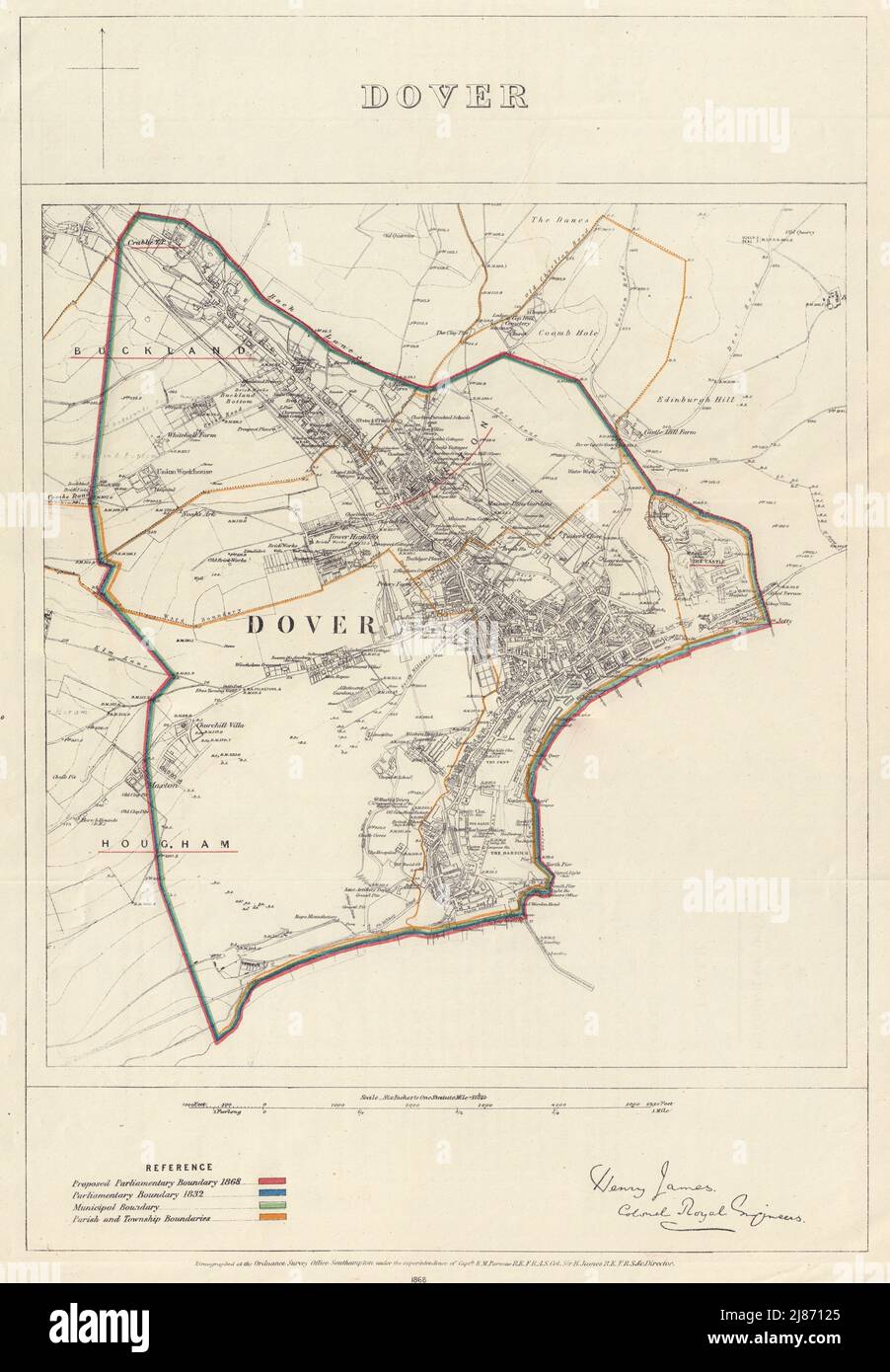 Dover, Kent. JAMES. PARLIAMENTARY BOUNDARY COMMISSION 1868 old antique map Stock Photohttps://www.alamy.com/image-license-details/?v=1https://www.alamy.com/dover-kent-james-parliamentary-boundary-commission-1868-old-antique-map-image469751693.html
RF2J87125–Dover, Kent. JAMES. PARLIAMENTARY BOUNDARY COMMISSION 1868 old antique map
![Image taken from page 169 of 'England in the nineteenth century. [Illustrated.]' Image taken from page 169 of 'England in the nineteenth Stock Photo Image taken from page 169 of 'England in the nineteenth century. [Illustrated.]' Image taken from page 169 of 'England in the nineteenth Stock Photo](https://c8.alamy.com/comp/HBW98P/image-taken-from-page-169-of-england-in-the-nineteenth-century-illustrated-HBW98P.jpg) Image taken from page 169 of 'England in the nineteenth century. [Illustrated.]' Image taken from page 169 of 'England in the nineteenth Stock Photohttps://www.alamy.com/image-license-details/?v=1https://www.alamy.com/stock-photo-image-taken-from-page-169-of-england-in-the-nineteenth-century-illustrated-127789894.html
Image taken from page 169 of 'England in the nineteenth century. [Illustrated.]' Image taken from page 169 of 'England in the nineteenth Stock Photohttps://www.alamy.com/image-license-details/?v=1https://www.alamy.com/stock-photo-image-taken-from-page-169-of-england-in-the-nineteenth-century-illustrated-127789894.htmlRMHBW98P–Image taken from page 169 of 'England in the nineteenth century. [Illustrated.]' Image taken from page 169 of 'England in the nineteenth
 Maidstone, Kent. JAMES. PARLIAMENTARY BOUNDARY COMMISSION 1868 old antique map Stock Photohttps://www.alamy.com/image-license-details/?v=1https://www.alamy.com/maidstone-kent-james-parliamentary-boundary-commission-1868-old-antique-map-image469751645.html
RF2J8710D–Maidstone, Kent. JAMES. PARLIAMENTARY BOUNDARY COMMISSION 1868 old antique map
 Image taken from page 26 of 'History of Kent ... With original sketches and maps' Image taken from page 26 of 'Hist Stock Photohttps://www.alamy.com/image-license-details/?v=1https://www.alamy.com/stock-photo-image-taken-from-page-26-of-history-of-kent-with-original-sketches-132293621.html
RMHK6DT5–Image taken from page 26 of 'History of Kent ... With original sketches and maps' Image taken from page 26 of 'Hist
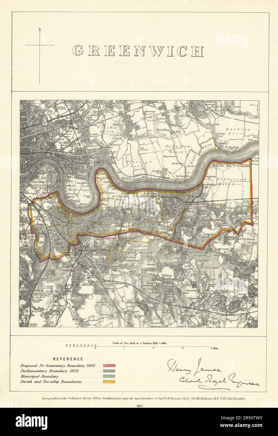 Greenwich, Kent. JAMES. Parliamentary Boundary Commission 1868 old antique map Stock Photohttps://www.alamy.com/image-license-details/?v=1https://www.alamy.com/greenwich-kent-james-parliamentary-boundary-commission-1868-old-antique-map-image556853953.html
RF2R9XTW5–Greenwich, Kent. JAMES. Parliamentary Boundary Commission 1868 old antique map
 Image taken from page 49 of 'The Castles of England: their story and structure ... With ... illustrations and ... plans' Image taken from page 49 of 'The Castles of England Stock Photohttps://www.alamy.com/image-license-details/?v=1https://www.alamy.com/stock-photo-image-taken-from-page-49-of-the-castles-of-england-their-story-and-130162133.html
RMHFNB3H–Image taken from page 49 of 'The Castles of England: their story and structure ... With ... illustrations and ... plans' Image taken from page 49 of 'The Castles of England
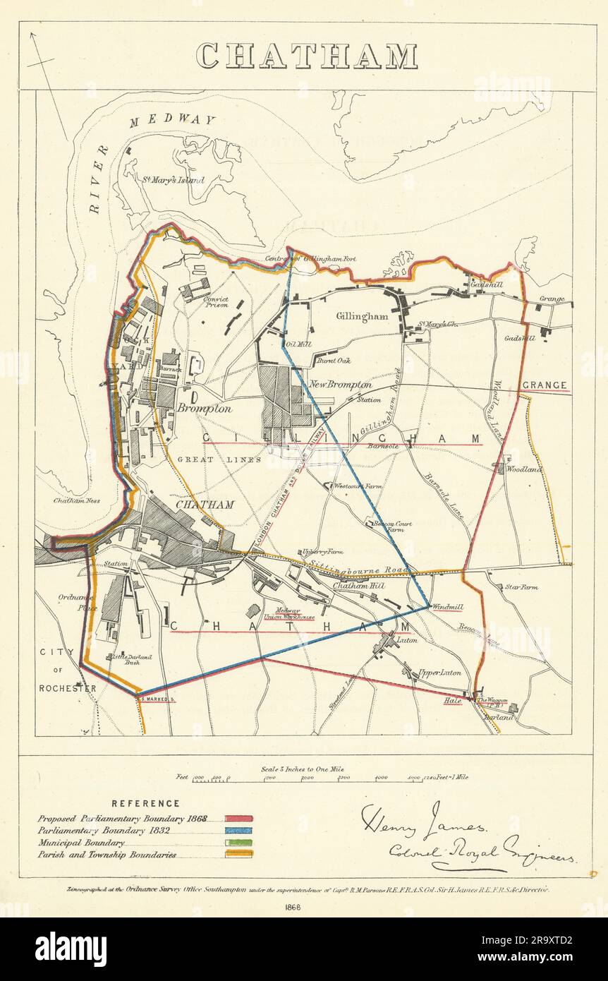 Chatham, Kent. JAMES. Parliamentary Boundary Commission 1868 old antique map Stock Photohttps://www.alamy.com/image-license-details/?v=1https://www.alamy.com/chatham-kent-james-parliamentary-boundary-commission-1868-old-antique-map-image556853614.html
RF2R9XTD2–Chatham, Kent. JAMES. Parliamentary Boundary Commission 1868 old antique map
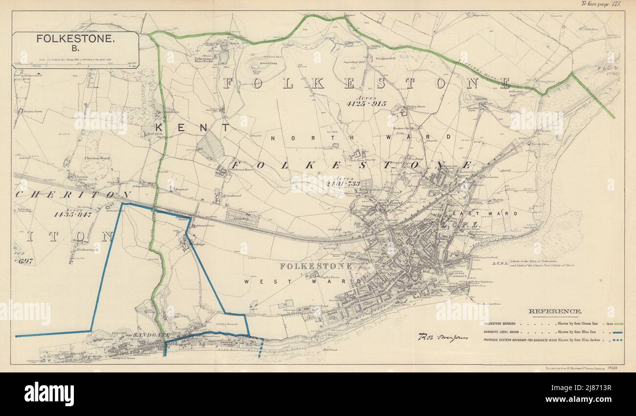 Folkestone, Kent. JONES. BOUNDARY COMMISSION 1888 old antique map plan chart Stock Photohttps://www.alamy.com/image-license-details/?v=1https://www.alamy.com/folkestone-kent-jones-boundary-commission-1888-old-antique-map-plan-chart-image469751739.html
RF2J8713R–Folkestone, Kent. JONES. BOUNDARY COMMISSION 1888 old antique map plan chart
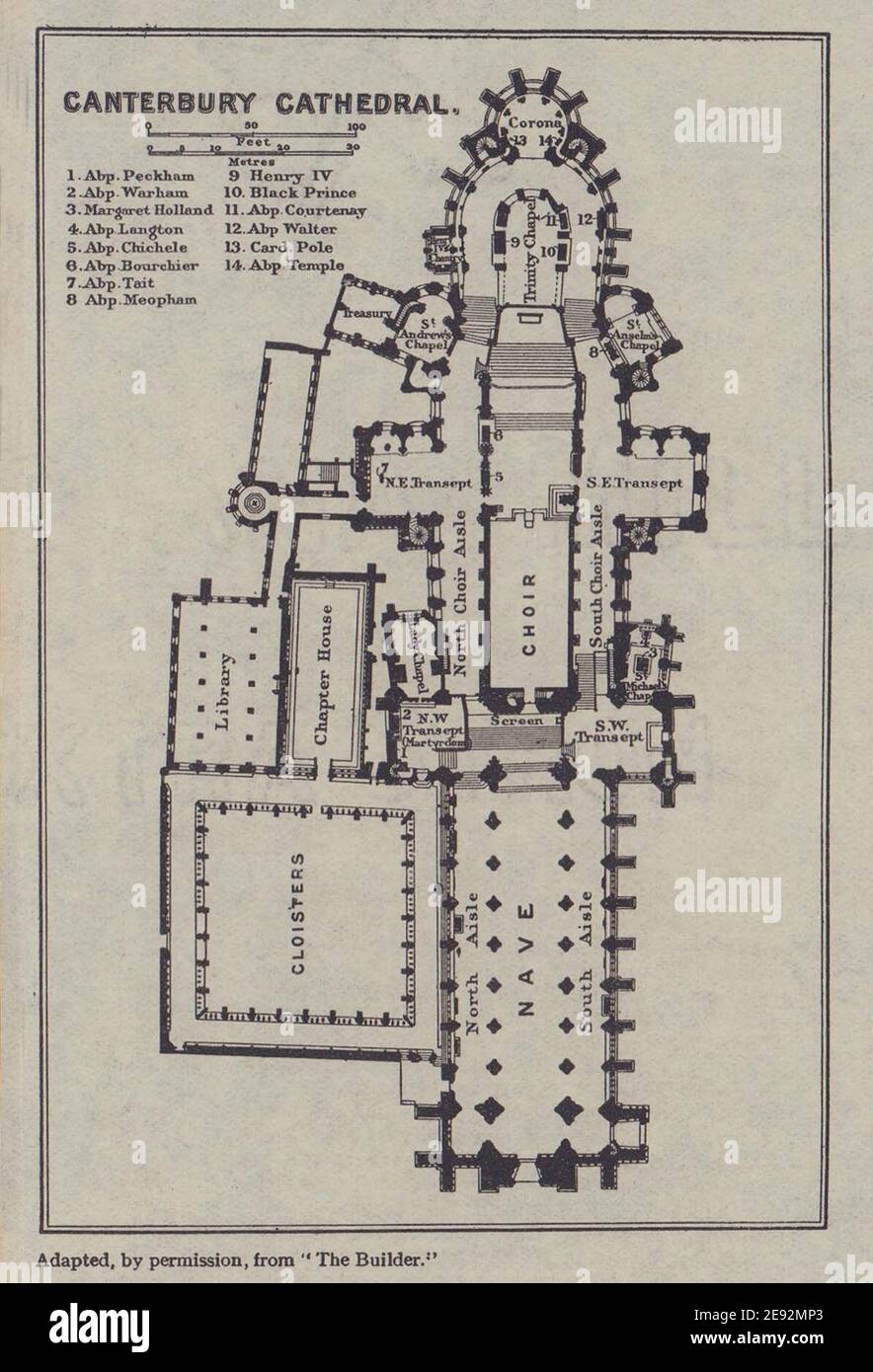 Canterbury Cathedral ground floor plan. Kent 1920 old antique map chart Stock Photohttps://www.alamy.com/image-license-details/?v=1https://www.alamy.com/canterbury-cathedral-ground-floor-plan-kent-1920-old-antique-map-chart-image401430571.html
RF2E92MP3–Canterbury Cathedral ground floor plan. Kent 1920 old antique map chart
 Alterations Proposed in Kent. JONES. BOUNDARY COMMISSION 1888 old antique map Stock Photohttps://www.alamy.com/image-license-details/?v=1https://www.alamy.com/alterations-proposed-in-kent-jones-boundary-commission-1888-old-antique-map-image469751793.html
RF2J8715N–Alterations Proposed in Kent. JONES. BOUNDARY COMMISSION 1888 old antique map
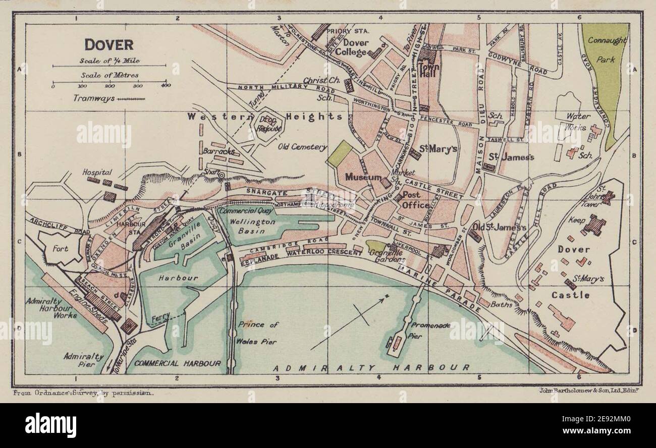 DOVER town city plan. Kent 1920 old antique vintage map chart Stock Photohttps://www.alamy.com/image-license-details/?v=1https://www.alamy.com/dover-town-city-plan-kent-1920-old-antique-vintage-map-chart-image401430512.html
RF2E92MM0–DOVER town city plan. Kent 1920 old antique vintage map chart
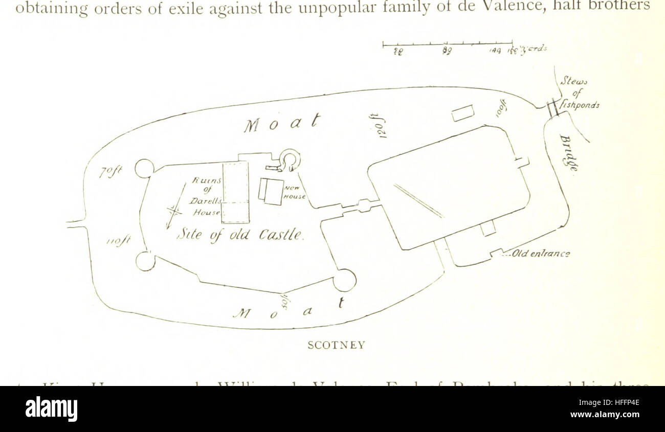 Image taken from page 132 of 'The Castles of England: their story and structure ... With ... illustrations and ... plans' Image taken from page 132 of 'The Castles of England Stock Photohttps://www.alamy.com/image-license-details/?v=1https://www.alamy.com/stock-photo-image-taken-from-page-132-of-the-castles-of-england-their-story-and-130039070.html
RMHFFP4E–Image taken from page 132 of 'The Castles of England: their story and structure ... With ... illustrations and ... plans' Image taken from page 132 of 'The Castles of England
 CANTERBURY town city plan. Kent 1920 old antique vintage map chart Stock Photohttps://www.alamy.com/image-license-details/?v=1https://www.alamy.com/canterbury-town-city-plan-kent-1920-old-antique-vintage-map-chart-image401430561.html
RF2E92MNN–CANTERBURY town city plan. Kent 1920 old antique vintage map chart
 Antique county map of Kent by Badeslade & Toms. West orientation 1742 old Stock Photohttps://www.alamy.com/image-license-details/?v=1https://www.alamy.com/antique-county-map-of-kent-by-badeslade-toms-west-orientation-1742-old-image469756043.html
RF2J876HF–Antique county map of Kent by Badeslade & Toms. West orientation 1742 old
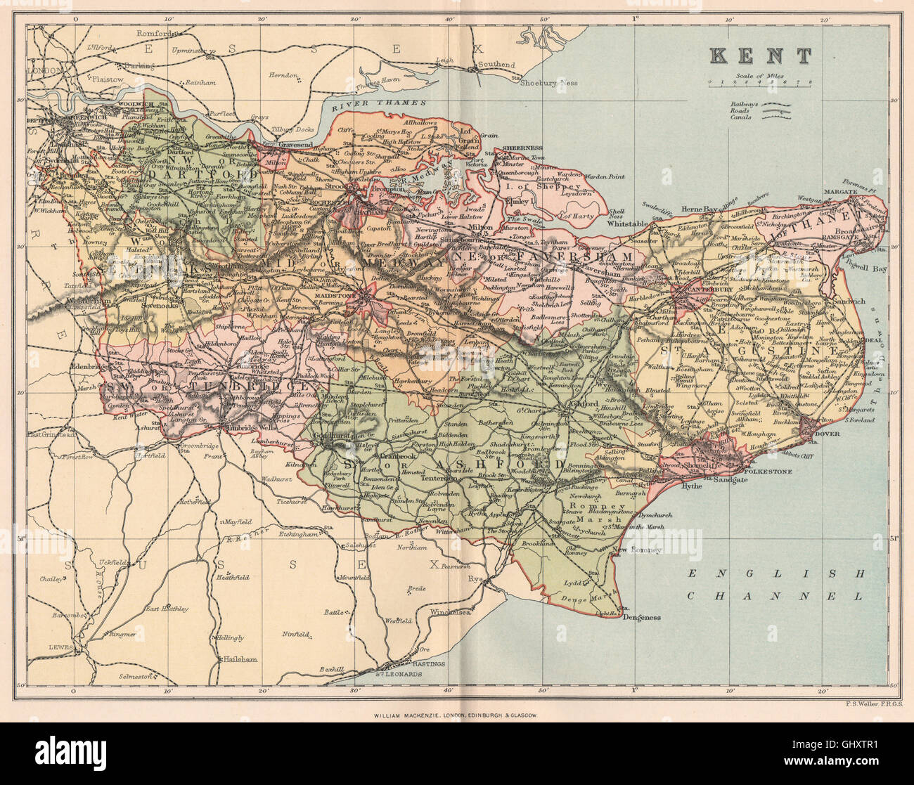 KENT. Antique county map, 1893 Stock Photohttps://www.alamy.com/image-license-details/?v=1https://www.alamy.com/stock-photo-kent-antique-county-map-1893-114301573.html
RFGHXTR1–KENT. Antique county map, 1893
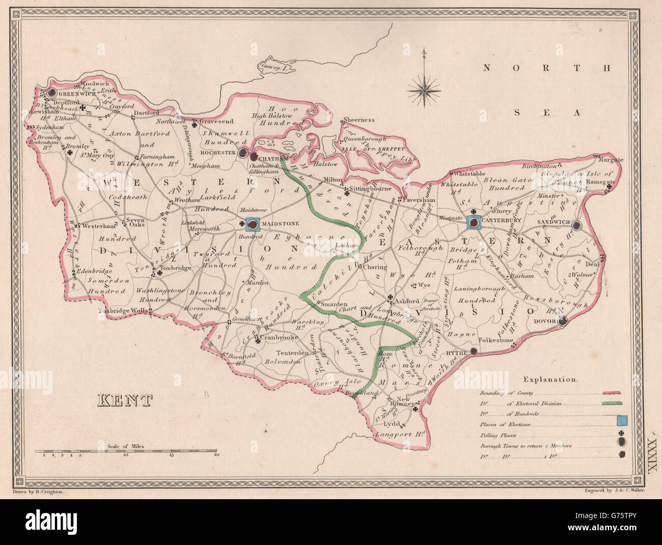 KENT antique county map by CREIGHTON/WALKER. Electoral, 1835 Stock Photohttps://www.alamy.com/image-license-details/?v=1https://www.alamy.com/stock-photo-kent-antique-county-map-by-creightonwalker-electoral-1835-107694019.html
RFG75TPY–KENT antique county map by CREIGHTON/WALKER. Electoral, 1835
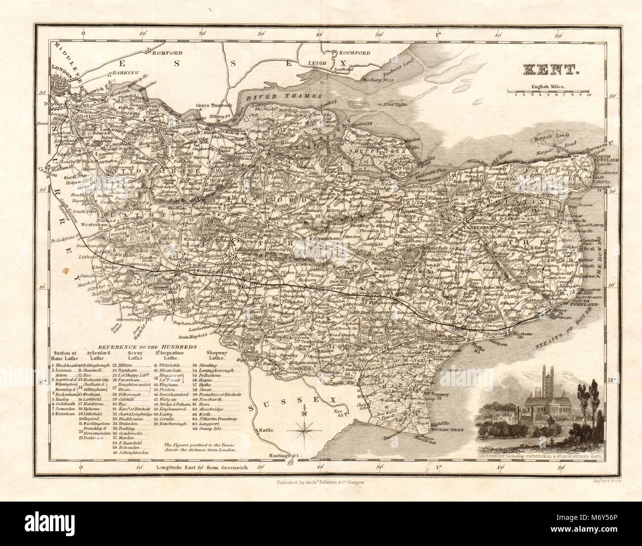 Antique county map of Kent by Archibald Fullarton c1833 old chart Stock Photohttps://www.alamy.com/image-license-details/?v=1https://www.alamy.com/stock-photo-antique-county-map-of-kent-by-archibald-fullarton-c1833-old-chart-176388430.html
RFM6Y56P–Antique county map of Kent by Archibald Fullarton c1833 old chart
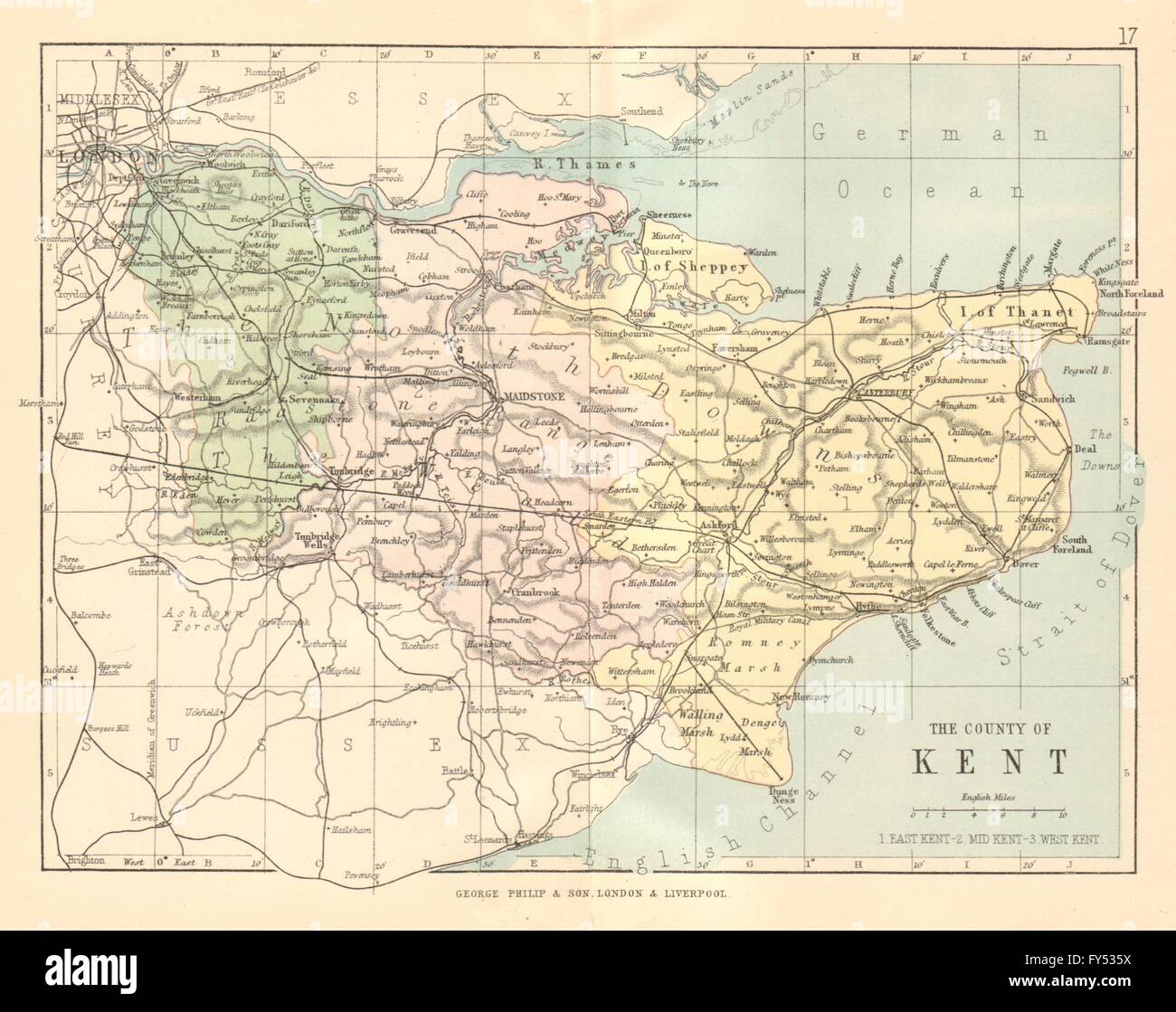 KENT: Antique county map. Railways roads. Constituencies. PHILIP, 1884 Stock Photohttps://www.alamy.com/image-license-details/?v=1https://www.alamy.com/stock-photo-kent-antique-county-map-railways-roads-constituencies-philip-1884-102759830.html
RFFY535X–KENT: Antique county map. Railways roads. Constituencies. PHILIP, 1884
 Image taken from page 38 of 'The Castles of England: their story and structure ... With ... illustrations and ... plans' Image taken from page 38 of 'The Castles of England Stock Photohttps://www.alamy.com/image-license-details/?v=1https://www.alamy.com/stock-photo-image-taken-from-page-38-of-the-castles-of-england-their-story-and-130148277.html
RMHFMNCN–Image taken from page 38 of 'The Castles of England: their story and structure ... With ... illustrations and ... plans' Image taken from page 38 of 'The Castles of England
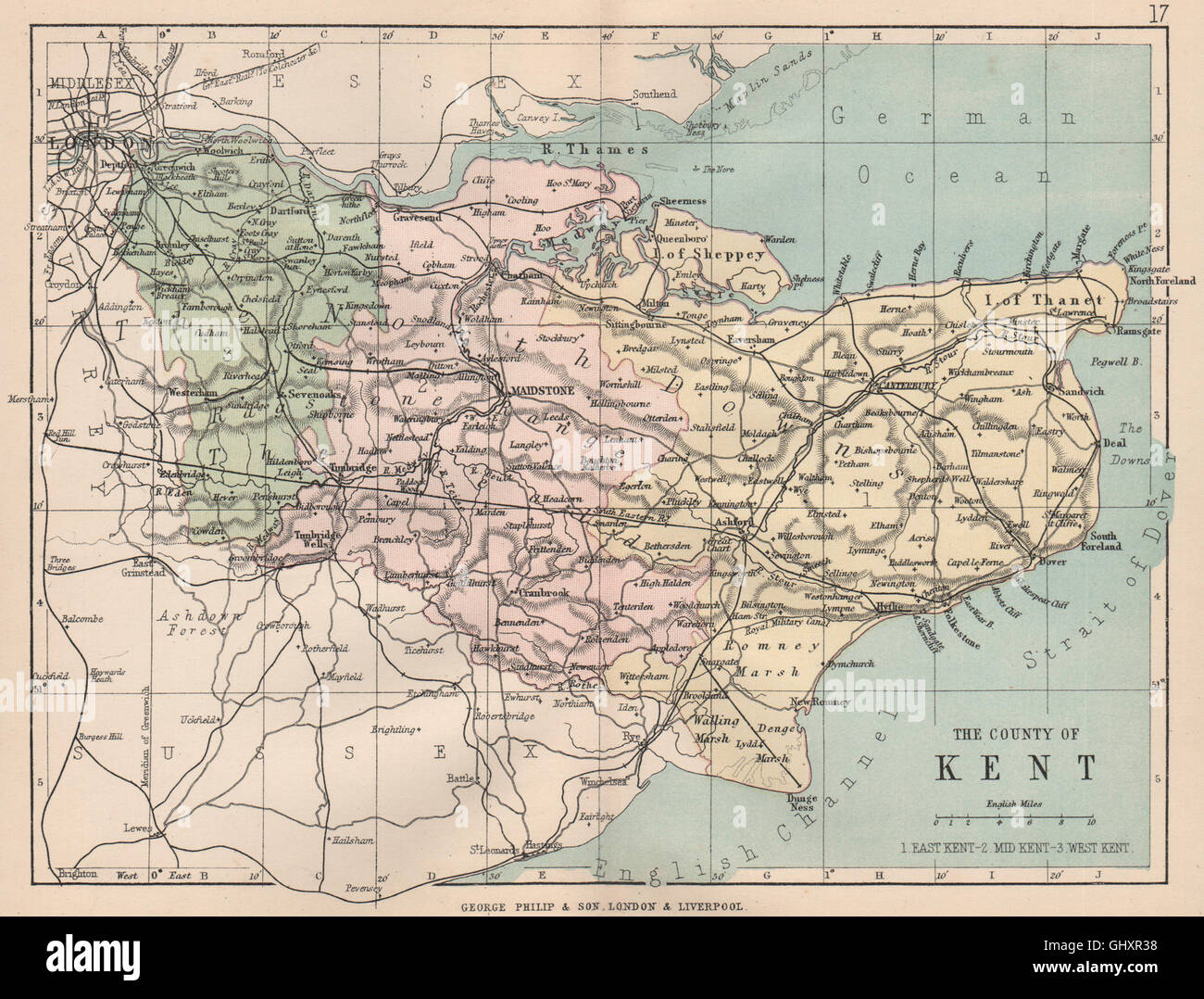 KENT: Antique county map. Railways roads. Constituencies. PHILIP, 1882 Stock Photohttps://www.alamy.com/image-license-details/?v=1https://www.alamy.com/stock-photo-kent-antique-county-map-railways-roads-constituencies-philip-1882-114300236.html
RFGHXR38–KENT: Antique county map. Railways roads. Constituencies. PHILIP, 1882
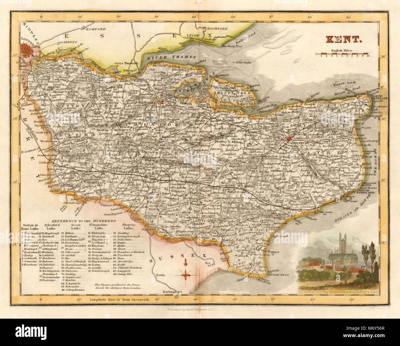 Antique county map of Kent by Archibald Fullarton. Hand coloured c1833 old Stock Photohttps://www.alamy.com/image-license-details/?v=1https://www.alamy.com/stock-photo-antique-county-map-of-kent-by-archibald-fullarton-hand-coloured-c1833-176388431.html
RFM6Y56R–Antique county map of Kent by Archibald Fullarton. Hand coloured c1833 old
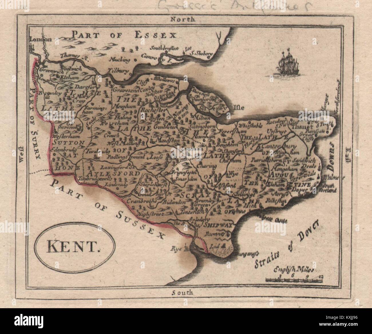 Antique county map of Kent by John Seller / Francis Grose c1780 old Stock Photohttps://www.alamy.com/image-license-details/?v=1https://www.alamy.com/stock-photo-antique-county-map-of-kent-by-john-seller-francis-grose-c1780-old-171283874.html
RFKXJJ96–Antique county map of Kent by John Seller / Francis Grose c1780 old
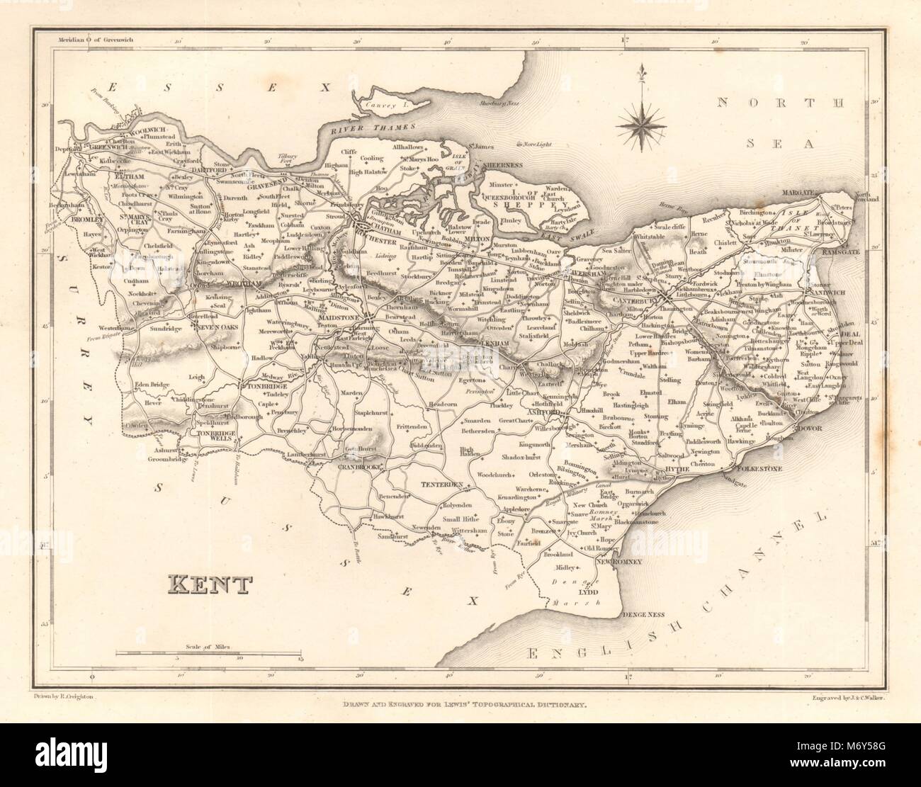 Antique county map of KENT by Walker & Creighton for Lewis c1840 old Stock Photohttps://www.alamy.com/image-license-details/?v=1https://www.alamy.com/stock-photo-antique-county-map-of-kent-by-walker-creighton-for-lewis-c1840-old-176388480.html
RFM6Y58G–Antique county map of KENT by Walker & Creighton for Lewis c1840 old
 Image taken from page 391 of 'History of Kent ... With original sketches and maps' Image taken from page 391 of 'History of Kent Stock Photohttps://www.alamy.com/image-license-details/?v=1https://www.alamy.com/stock-photo-image-taken-from-page-391-of-history-of-kent-with-original-sketches-130150060.html
RMHFMRMC–Image taken from page 391 of 'History of Kent ... With original sketches and maps' Image taken from page 391 of 'History of Kent
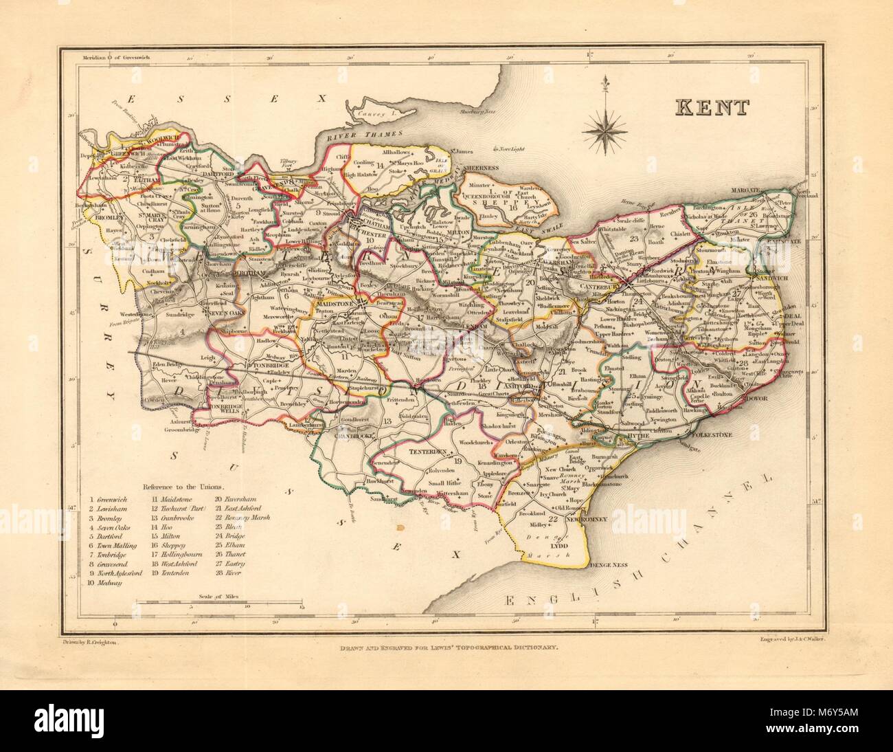 Antique county map of KENT by Creighton & Walker for Lewis c1840 old Stock Photohttps://www.alamy.com/image-license-details/?v=1https://www.alamy.com/stock-photo-antique-county-map-of-kent-by-creighton-walker-for-lewis-c1840-old-176388540.html
RFM6Y5AM–Antique county map of KENT by Creighton & Walker for Lewis c1840 old
 Antique county map of Kent by Badeslade & Toms. West orientation 1742 old Stock Photohttps://www.alamy.com/image-license-details/?v=1https://www.alamy.com/stock-photo-antique-county-map-of-kent-by-badeslade-toms-west-orientation-1742-139062167.html
RFJ26R5Y–Antique county map of Kent by Badeslade & Toms. West orientation 1742 old
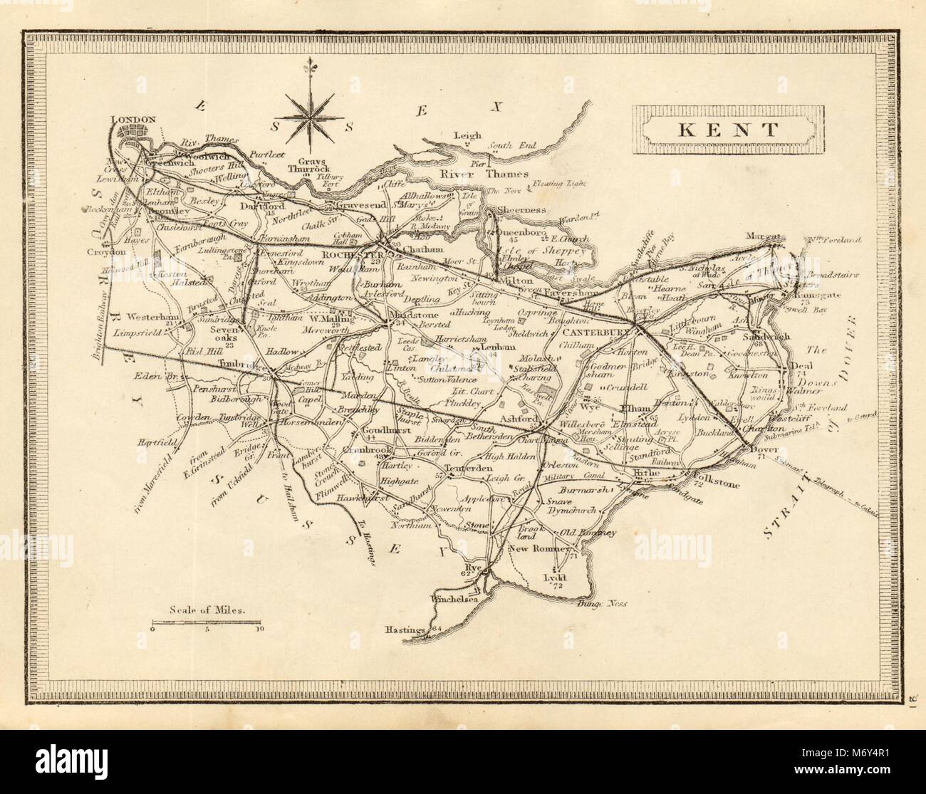 Antique county map of Kent by John Heywood. Railways & coach roads c1864 Stock Photohttps://www.alamy.com/image-license-details/?v=1https://www.alamy.com/stock-photo-antique-county-map-of-kent-by-john-heywood-railways-coach-roads-c1864-176388101.html
RFM6Y4R1–Antique county map of Kent by John Heywood. Railways & coach roads c1864
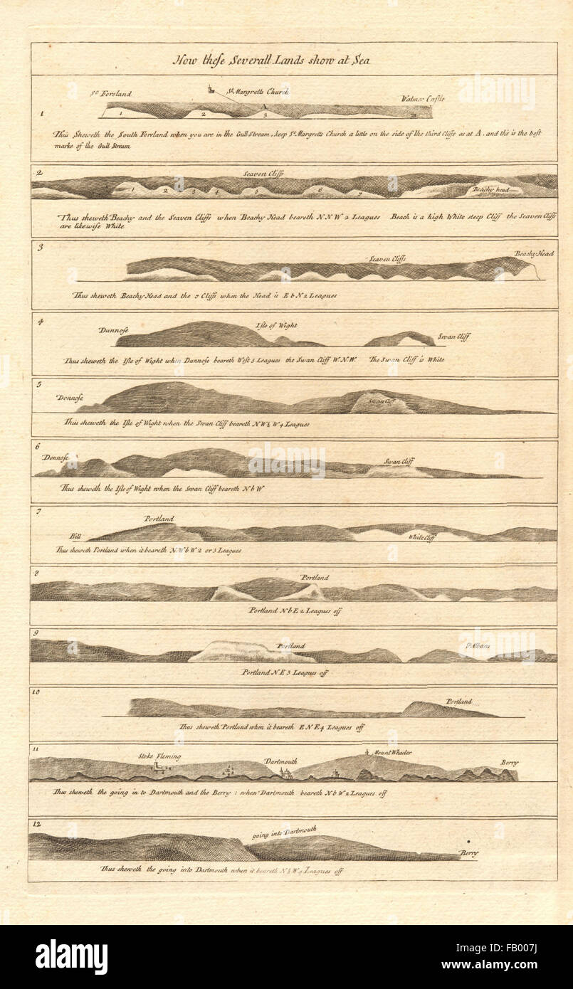 ENGLAND SOUTH COAST PROFILE Kent Sussex IOW Dorset Devon COLLINS, c1774 map Stock Photohttps://www.alamy.com/image-license-details/?v=1https://www.alamy.com/stock-photo-england-south-coast-profile-kent-sussex-iow-dorset-devon-collins-c1774-92813270.html
RFFB007J–ENGLAND SOUTH COAST PROFILE Kent Sussex IOW Dorset Devon COLLINS, c1774 map
 ENGLAND SOUTH COAST:Hants Dorset Sussex Kent.Isle of Man Channel Isles, 1891 map Stock Photohttps://www.alamy.com/image-license-details/?v=1https://www.alamy.com/stock-photo-england-south-coasthants-dorset-sussex-kentisle-of-man-channel-isles-93819512.html
RFFCHRMT–ENGLAND SOUTH COAST:Hants Dorset Sussex Kent.Isle of Man Channel Isles, 1891 map
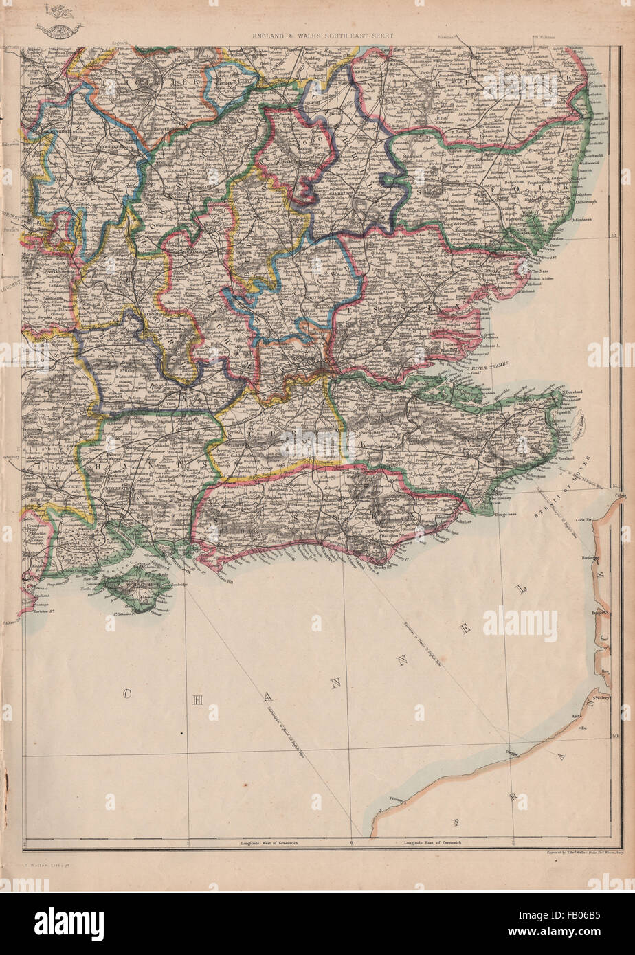 SOUTH EAST ENGLAND. Home Counties Surrey Kent Sussex Hants &c. WELLER, 1862 map Stock Photohttps://www.alamy.com/image-license-details/?v=1https://www.alamy.com/stock-photo-south-east-england-home-counties-surrey-kent-sussex-hants-c-weller-92818073.html
RFFB06B5–SOUTH EAST ENGLAND. Home Counties Surrey Kent Sussex Hants &c. WELLER, 1862 map
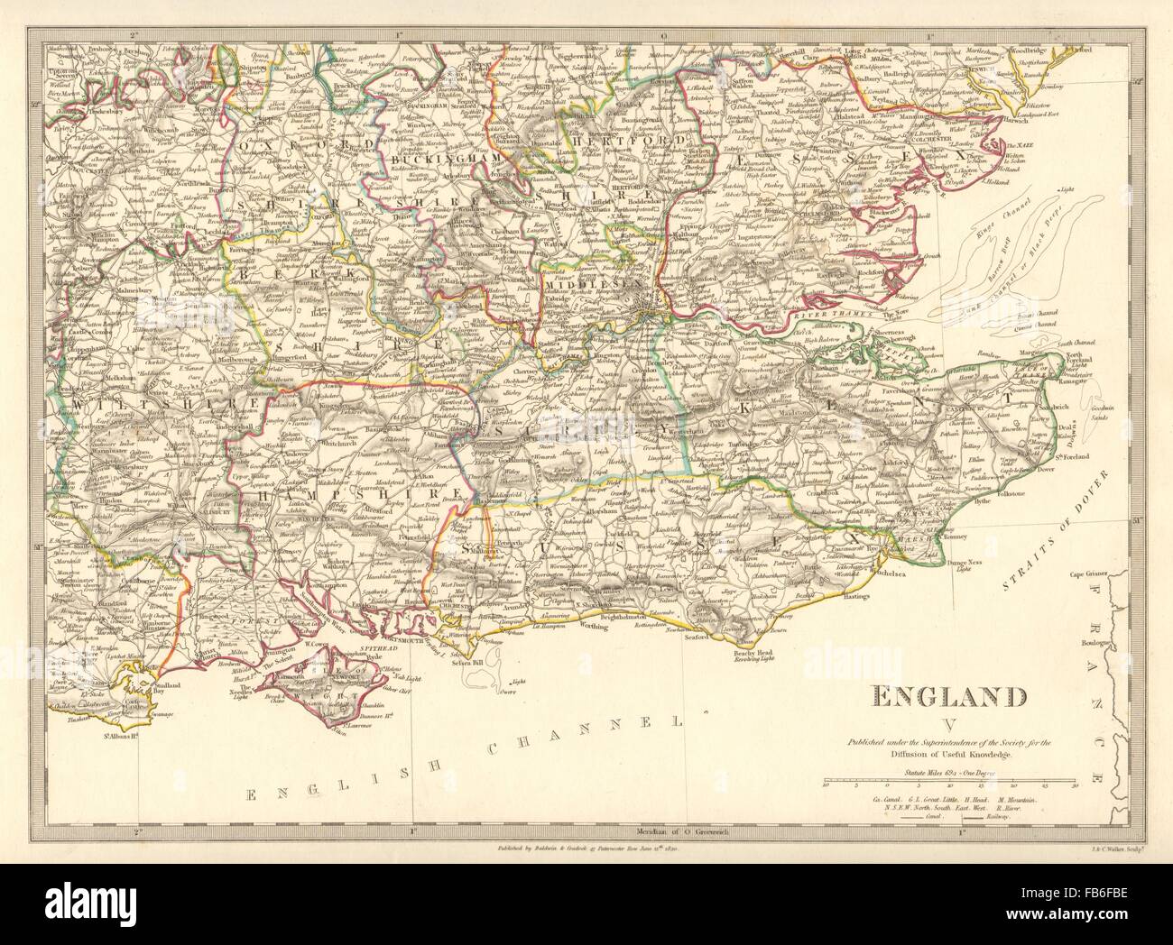 ENGLAND SE: Middx Kent Sussex Surrey Hants Berks Essex Herts. SDUK, 1848 map Stock Photohttps://www.alamy.com/image-license-details/?v=1https://www.alamy.com/stock-photo-england-se-middx-kent-sussex-surrey-hants-berks-essex-herts-sduk-1848-92956850.html
RFFB6FBE–ENGLAND SE: Middx Kent Sussex Surrey Hants Berks Essex Herts. SDUK, 1848 map
 Image taken from page 384 of 'An illustrated and descriptive guide to the great railways of England, and their connections with the continent' Image taken from page 384 of 'An illustrated and descriptive Stock Photohttps://www.alamy.com/image-license-details/?v=1https://www.alamy.com/stock-photo-image-taken-from-page-384-of-an-illustrated-and-descriptive-guide-130148855.html
RMHFMP5B–Image taken from page 384 of 'An illustrated and descriptive guide to the great railways of England, and their connections with the continent' Image taken from page 384 of 'An illustrated and descriptive
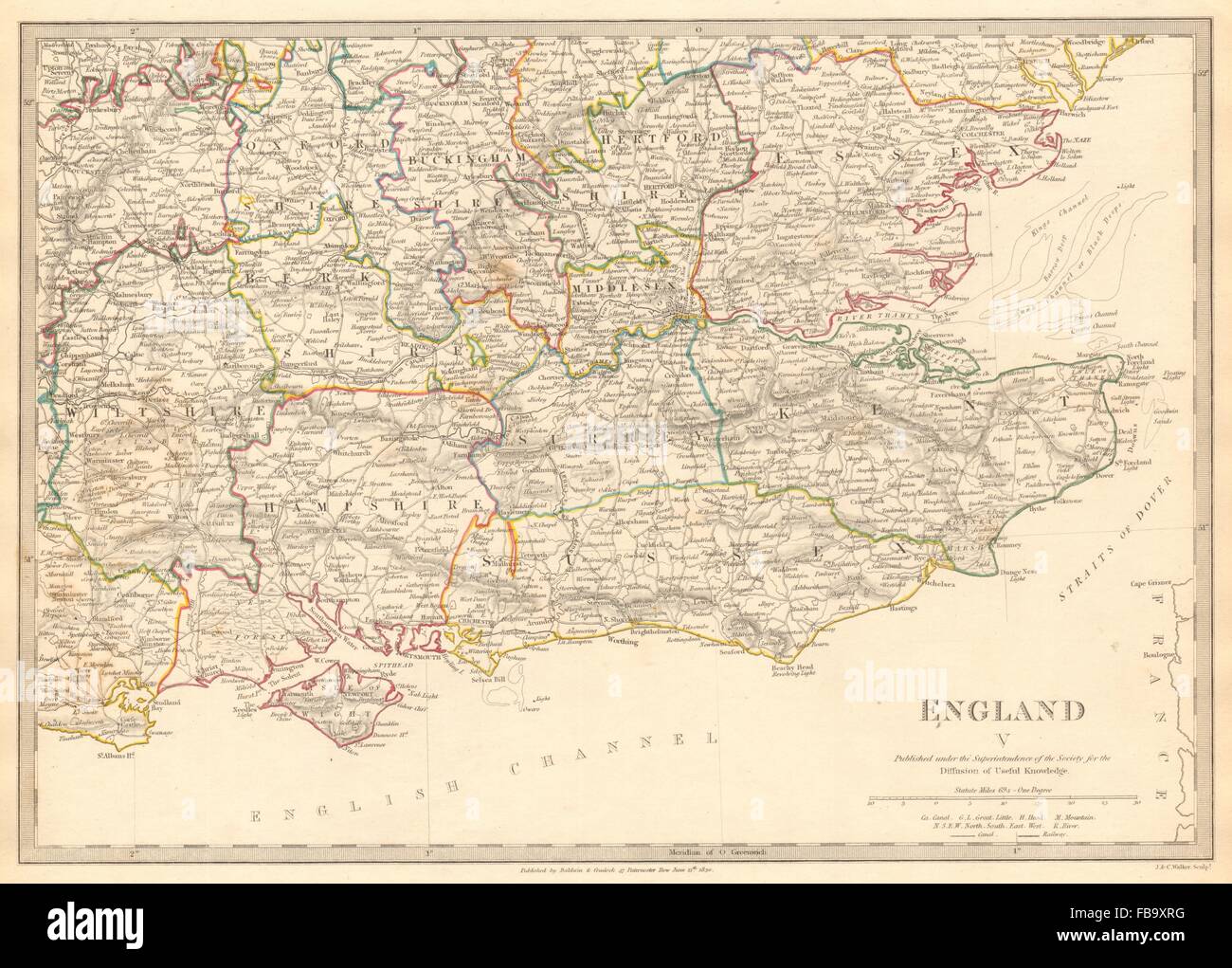 ENGLAND SE. Middx Kent Sussex Surrey Hants Berks Essex Herts. SDUK, 1844 map Stock Photohttps://www.alamy.com/image-license-details/?v=1https://www.alamy.com/stock-photo-england-se-middx-kent-sussex-surrey-hants-berks-essex-herts-sduk-1844-93031668.html
RFFB9XRG–ENGLAND SE. Middx Kent Sussex Surrey Hants Berks Essex Herts. SDUK, 1844 map
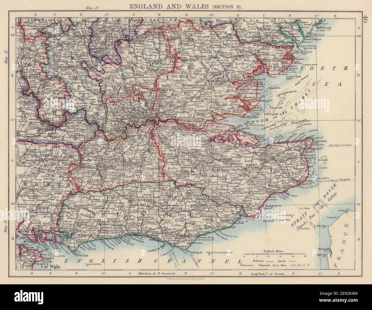 SOUTH EAST ENGLAND. Home counties London Kent Essex Sussex Surrey 1901 old map Stock Photohttps://www.alamy.com/image-license-details/?v=1https://www.alamy.com/south-east-england-home-counties-london-kent-essex-sussex-surrey-1901-old-map-image401429300.html
RF2E92K4M–SOUTH EAST ENGLAND. Home counties London Kent Essex Sussex Surrey 1901 old map
 South East England Home counties Kent Sussex Essex Thames Estuary BACON 1883 map Stock Photohttps://www.alamy.com/image-license-details/?v=1https://www.alamy.com/south-east-england-home-counties-kent-sussex-essex-thames-estuary-bacon-1883-map-image556923351.html
RF2RA21BK–South East England Home counties Kent Sussex Essex Thames Estuary BACON 1883 map
 Kent by van den Keere. 'Speed miniature' county map 1632 old antique chart Stock Photohttps://www.alamy.com/image-license-details/?v=1https://www.alamy.com/kent-by-van-den-keere-speed-miniature-county-map-1632-old-antique-chart-image556856839.html
RF2R9Y0G7–Kent by van den Keere. 'Speed miniature' county map 1632 old antique chart
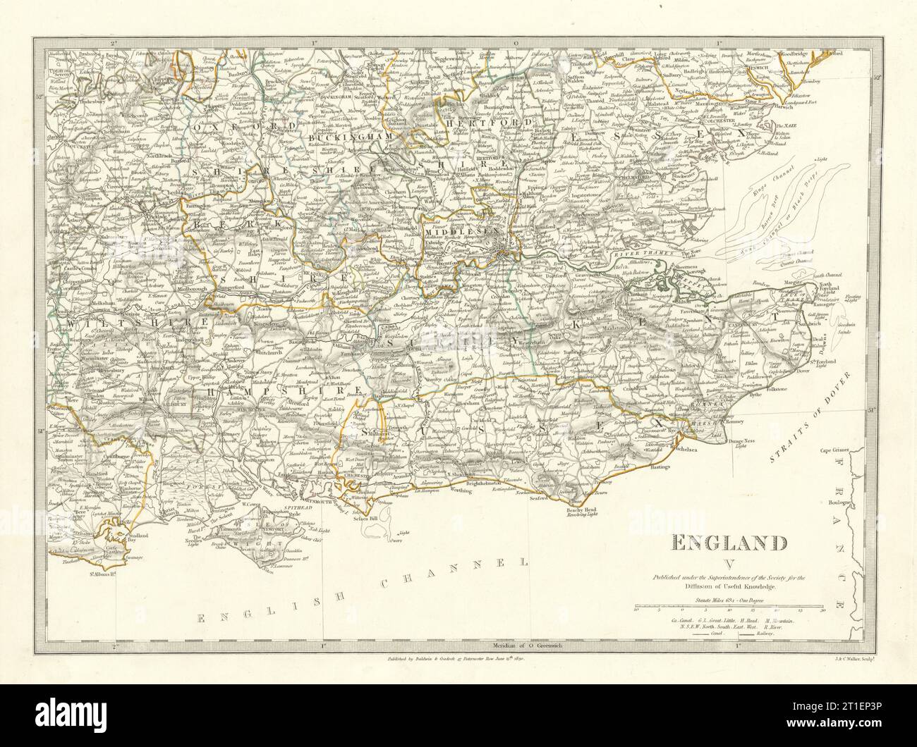 ENGLAND SE. Middx Kent Sussex Surrey Hants Berks Essex Herts. SDUK 1844 map Stock Photohttps://www.alamy.com/image-license-details/?v=1https://www.alamy.com/england-se-middx-kent-sussex-surrey-hants-berks-essex-herts-sduk-1844-map-image568881482.html
RF2T1EP3P–ENGLAND SE. Middx Kent Sussex Surrey Hants Berks Essex Herts. SDUK 1844 map
 Image taken from page 727 of 'A Gazetteeer of the World, or, Dictionary of geographical knowledge ... Edited by a member of the Royal Geographical Society. Illustrated with ... woodcuts and one hundred and twenty engravings on steel' Image taken from page 727 of 'A Gazetteeer of the Stock Photohttps://www.alamy.com/image-license-details/?v=1https://www.alamy.com/stock-photo-image-taken-from-page-727-of-a-gazetteeer-of-the-world-or-dictionary-127766246.html
RMHBT746–Image taken from page 727 of 'A Gazetteeer of the World, or, Dictionary of geographical knowledge ... Edited by a member of the Royal Geographical Society. Illustrated with ... woodcuts and one hundred and twenty engravings on steel' Image taken from page 727 of 'A Gazetteeer of the
 ENGLAND SE. Middx Kent Sussex Surrey Hants Berks Essex Herts. SDUK 1844 map Stock Photohttps://www.alamy.com/image-license-details/?v=1https://www.alamy.com/england-se-middx-kent-sussex-surrey-hants-berks-essex-herts-sduk-1844-map-image470930701.html
RF2JA4MWH–ENGLAND SE. Middx Kent Sussex Surrey Hants Berks Essex Herts. SDUK 1844 map
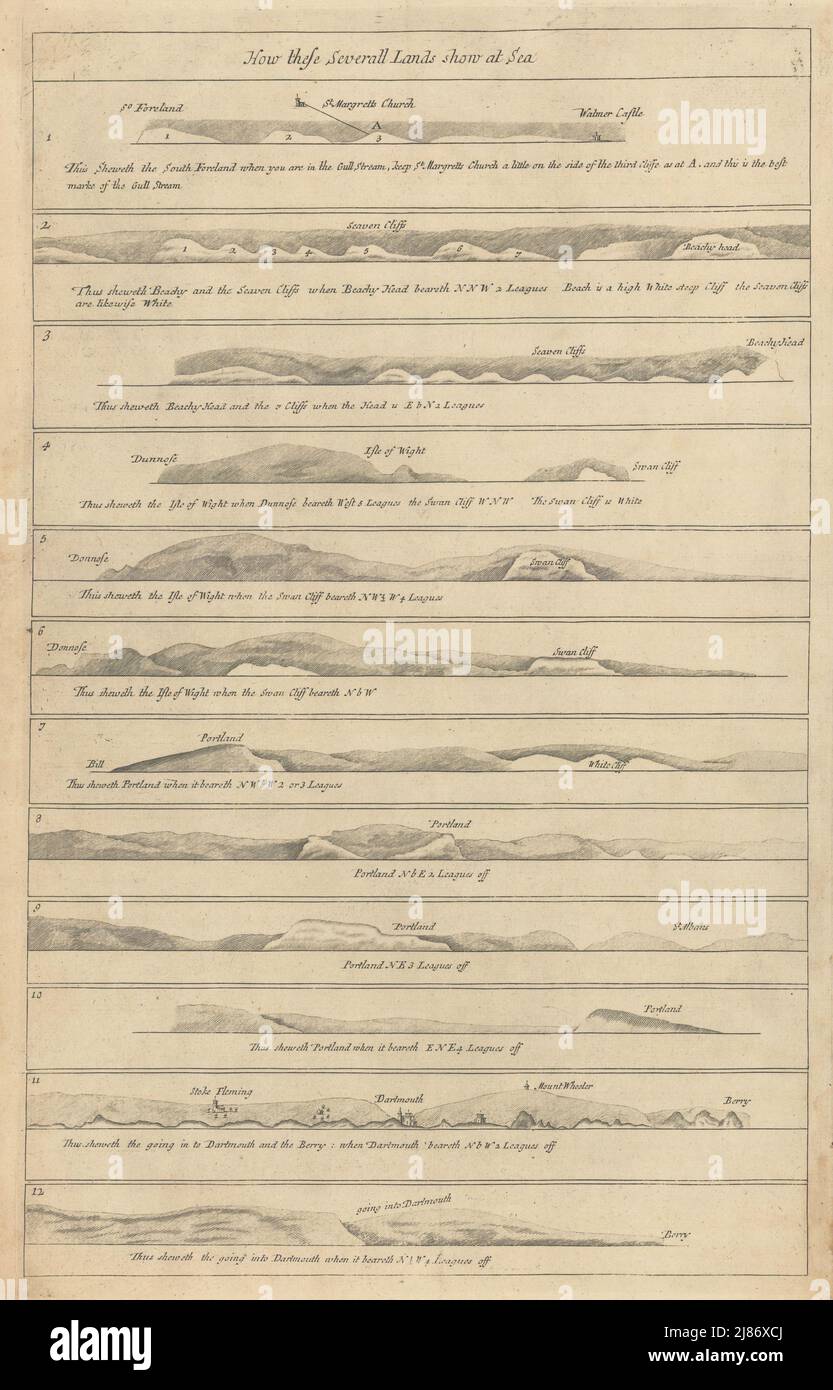 ENGLAND SOUTH COAST PROFILE Kent Sussex IOW Dorset Devon COLLINS 1723 old map Stock Photohttps://www.alamy.com/image-license-details/?v=1https://www.alamy.com/england-south-coast-profile-kent-sussex-iow-dorset-devon-collins-1723-old-map-image469749634.html
RF2J86XCJ–ENGLAND SOUTH COAST PROFILE Kent Sussex IOW Dorset Devon COLLINS 1723 old map
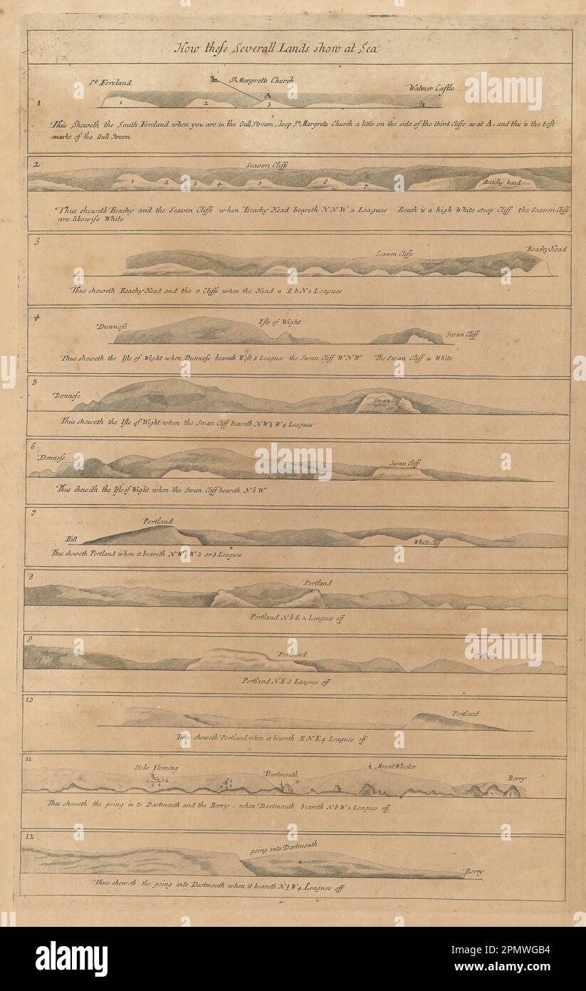 ENGLAND SOUTH COAST PROFILE Kent Sussex IOW Dorset Devon COLLINS 1693 old map Stock Photohttps://www.alamy.com/image-license-details/?v=1https://www.alamy.com/england-south-coast-profile-kent-sussex-iow-dorset-devon-collins-1693-old-map-image546376184.html
RF2PMWGB4–ENGLAND SOUTH COAST PROFILE Kent Sussex IOW Dorset Devon COLLINS 1693 old map
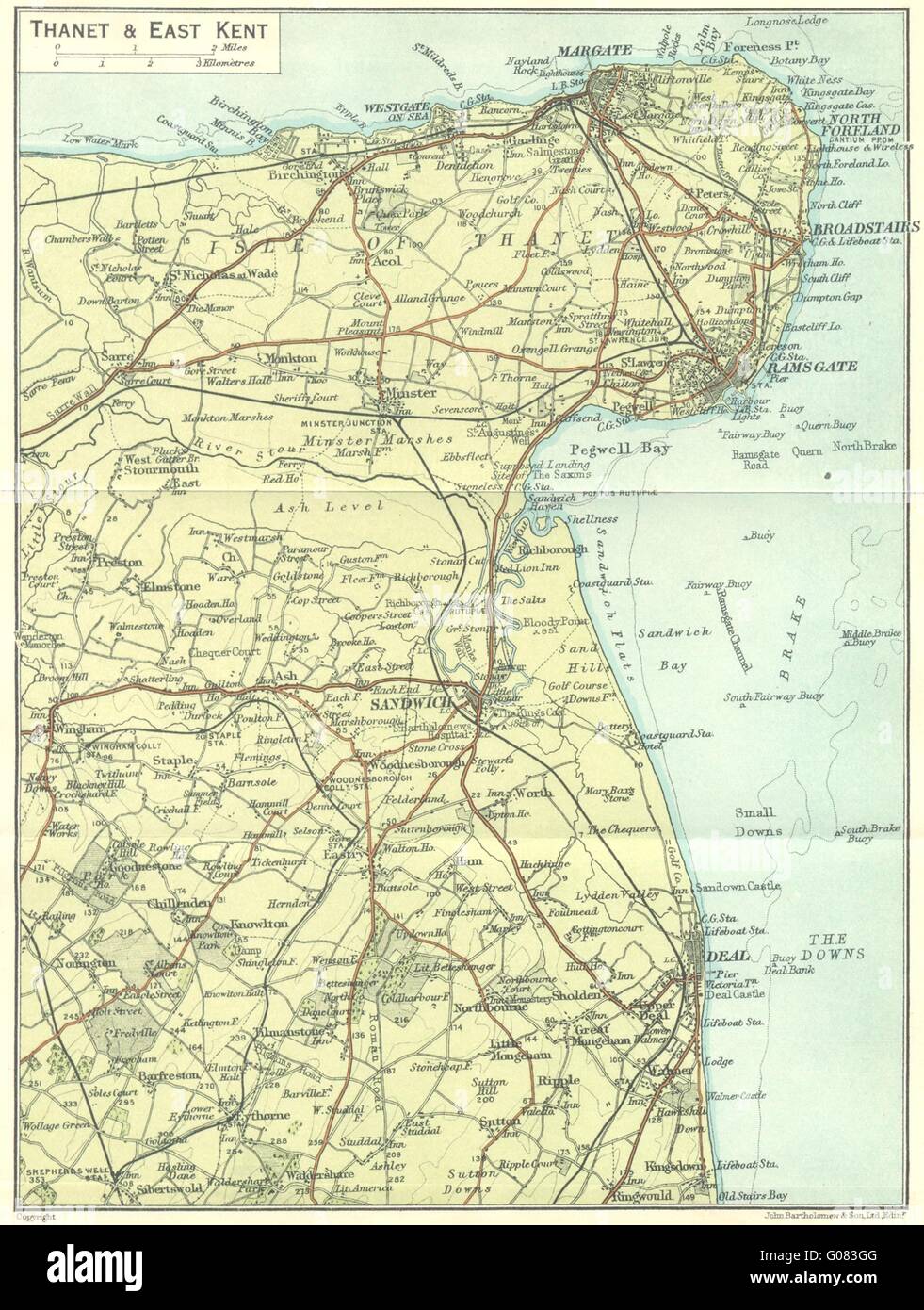 KENT: Thanet & east, 1924 vintage map Stock Photohttps://www.alamy.com/image-license-details/?v=1https://www.alamy.com/stock-photo-kent-thanet-east-1924-vintage-map-103440640.html
RFG083GG–KENT: Thanet & east, 1924 vintage map
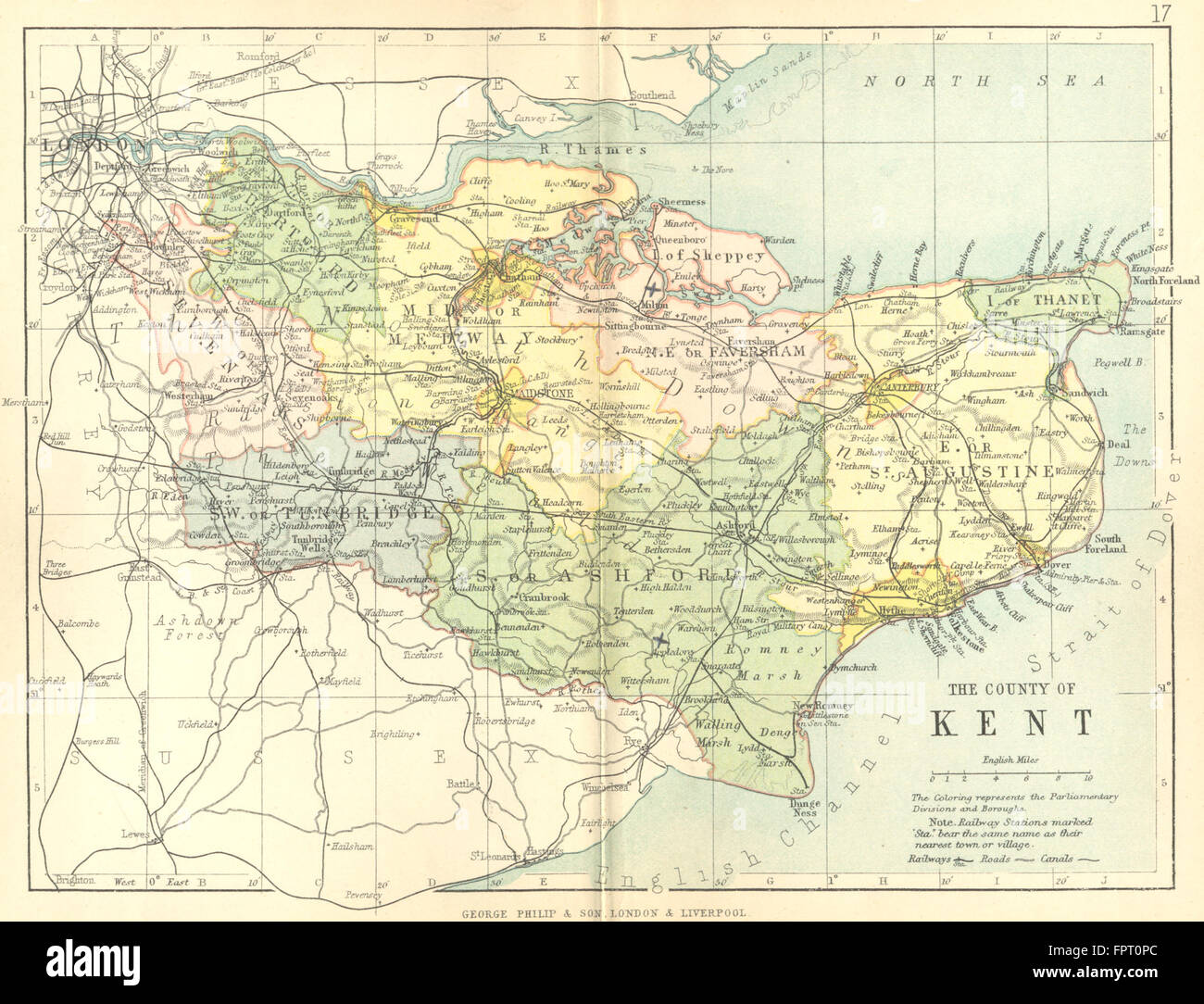 KENT: Philip, 1898 antique map Stock Photohttps://www.alamy.com/image-license-details/?v=1https://www.alamy.com/stock-photo-kent-philip-1898-antique-map-100101748.html
RFFPT0PC–KENT: Philip, 1898 antique map
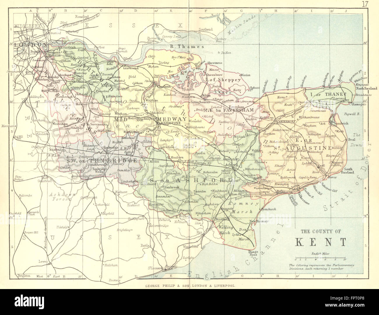 KENT: Philip, 1888 antique map Stock Photohttps://www.alamy.com/image-license-details/?v=1https://www.alamy.com/stock-photo-kent-philip-1888-antique-map-100101744.html
RFFPT0P8–KENT: Philip, 1888 antique map
 Image taken from page 727 of 'A Gazetteeer of the World, or, Dictionary of geographical knowledge ... Edited by a member of the Royal Geographical Society. Illustrated with ... woodcuts and one hundred and twenty engravings on steel' Image taken from page 727 of 'A Gazetteeer of the Stock Photohttps://www.alamy.com/image-license-details/?v=1https://www.alamy.com/stock-photo-image-taken-from-page-727-of-a-gazetteeer-of-the-world-or-dictionary-127766269.html
RMHBT751–Image taken from page 727 of 'A Gazetteeer of the World, or, Dictionary of geographical knowledge ... Edited by a member of the Royal Geographical Society. Illustrated with ... woodcuts and one hundred and twenty engravings on steel' Image taken from page 727 of 'A Gazetteeer of the
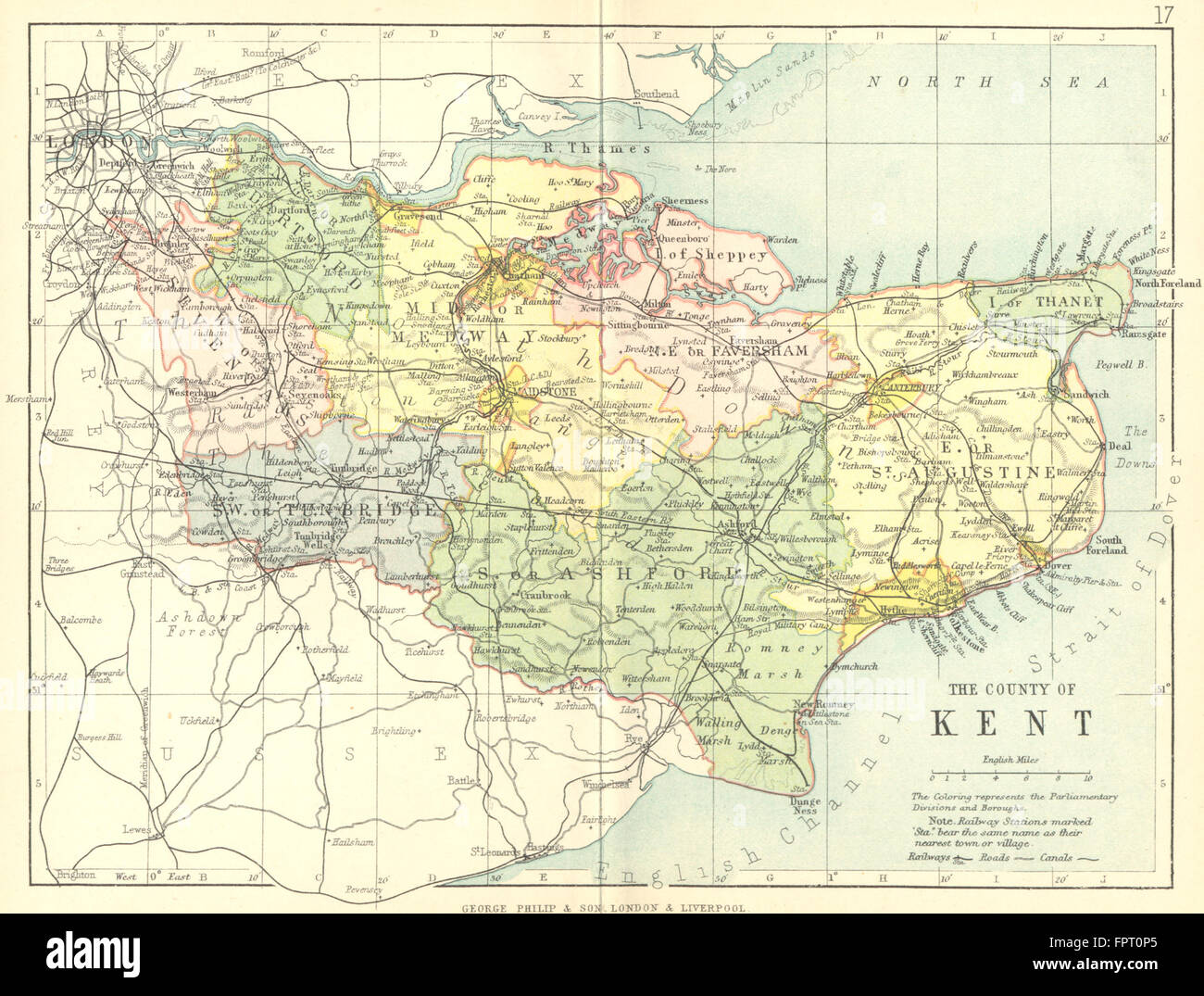 KENT: Philip, 1898 antique map Stock Photohttps://www.alamy.com/image-license-details/?v=1https://www.alamy.com/stock-photo-kent-philip-1898-antique-map-100101741.html
RFFPT0P5–KENT: Philip, 1898 antique map
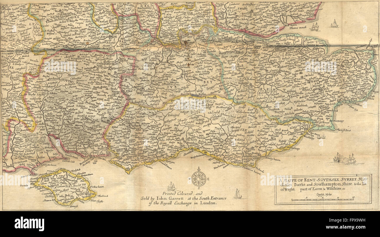 SE ENGLAND: Home Counties: HOLLAR, 1676 antique map Stock Photohttps://www.alamy.com/image-license-details/?v=1https://www.alamy.com/stock-photo-se-england-home-counties-hollar-1676-antique-map-100152797.html
RFFPX9WH–SE ENGLAND: Home Counties: HOLLAR, 1676 antique map
 Kent miniature county map by Samuel Leigh / Sidney Hall c1820 old antique Stock Photohttps://www.alamy.com/image-license-details/?v=1https://www.alamy.com/kent-miniature-county-map-by-samuel-leigh-sidney-hall-c1820-old-antique-image376530334.html
RF2CTGC7X–Kent miniature county map by Samuel Leigh / Sidney Hall c1820 old antique
 CANTERBURY antique town city plan. Kent. BAEDEKER 1927 old map chart Stock Photohttps://www.alamy.com/image-license-details/?v=1https://www.alamy.com/stock-photo-canterbury-antique-town-city-plan-kent-baedeker-1927-old-map-chart-122812157.html
RFH3PG4D–CANTERBURY antique town city plan. Kent. BAEDEKER 1927 old map chart
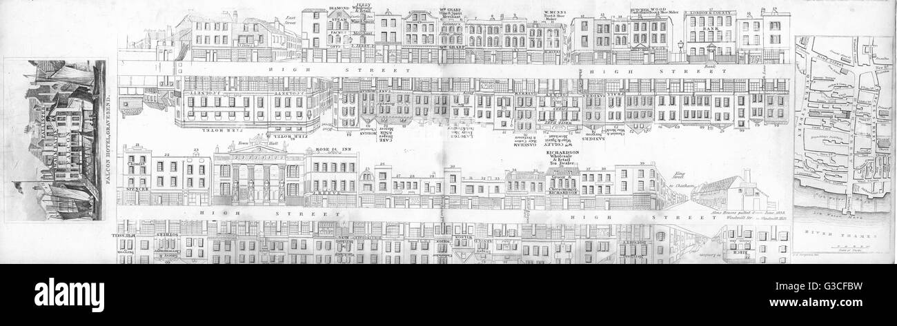 KENT: Gravesend: Street plan, Falcon hotel, map. DUGDALE, antique print 1845 Stock Photohttps://www.alamy.com/image-license-details/?v=1https://www.alamy.com/stock-photo-kent-gravesend-street-plan-falcon-hotel-map-dugdale-antique-print-105381693.html
RFG3CFBW–KENT: Gravesend: Street plan, Falcon hotel, map. DUGDALE, antique print 1845
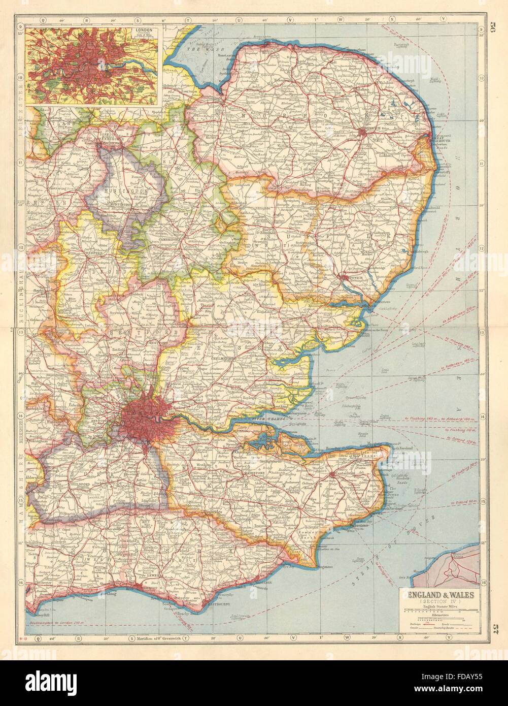 ENGLAND EAST: Norfolk Suffolk Essex Kent Surrey Cambs; Inset London, 1920 map Stock Photohttps://www.alamy.com/image-license-details/?v=1https://www.alamy.com/stock-photo-england-east-norfolk-suffolk-essex-kent-surrey-cambs-inset-london-94283201.html
RFFDAY55–ENGLAND EAST: Norfolk Suffolk Essex Kent Surrey Cambs; Inset London, 1920 map
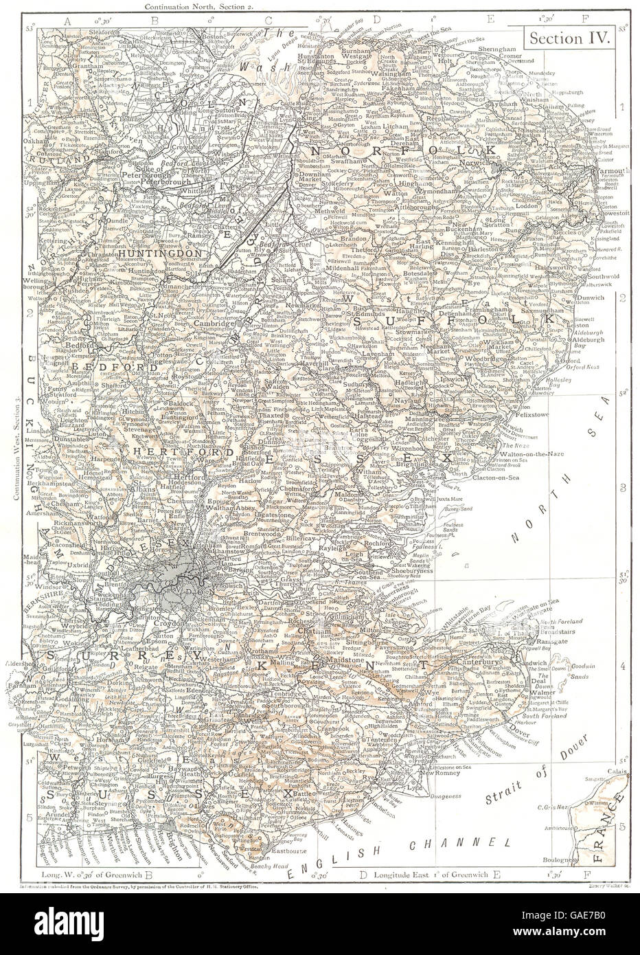 EASTERN ENGLAND: Kent London Home counties East Anglia East Midlands, 1910 map Stock Photohttps://www.alamy.com/image-license-details/?v=1https://www.alamy.com/stock-photo-eastern-england-kent-london-home-counties-east-anglia-east-midlands-109721892.html
RFGAE7B0–EASTERN ENGLAND: Kent London Home counties East Anglia East Midlands, 1910 map
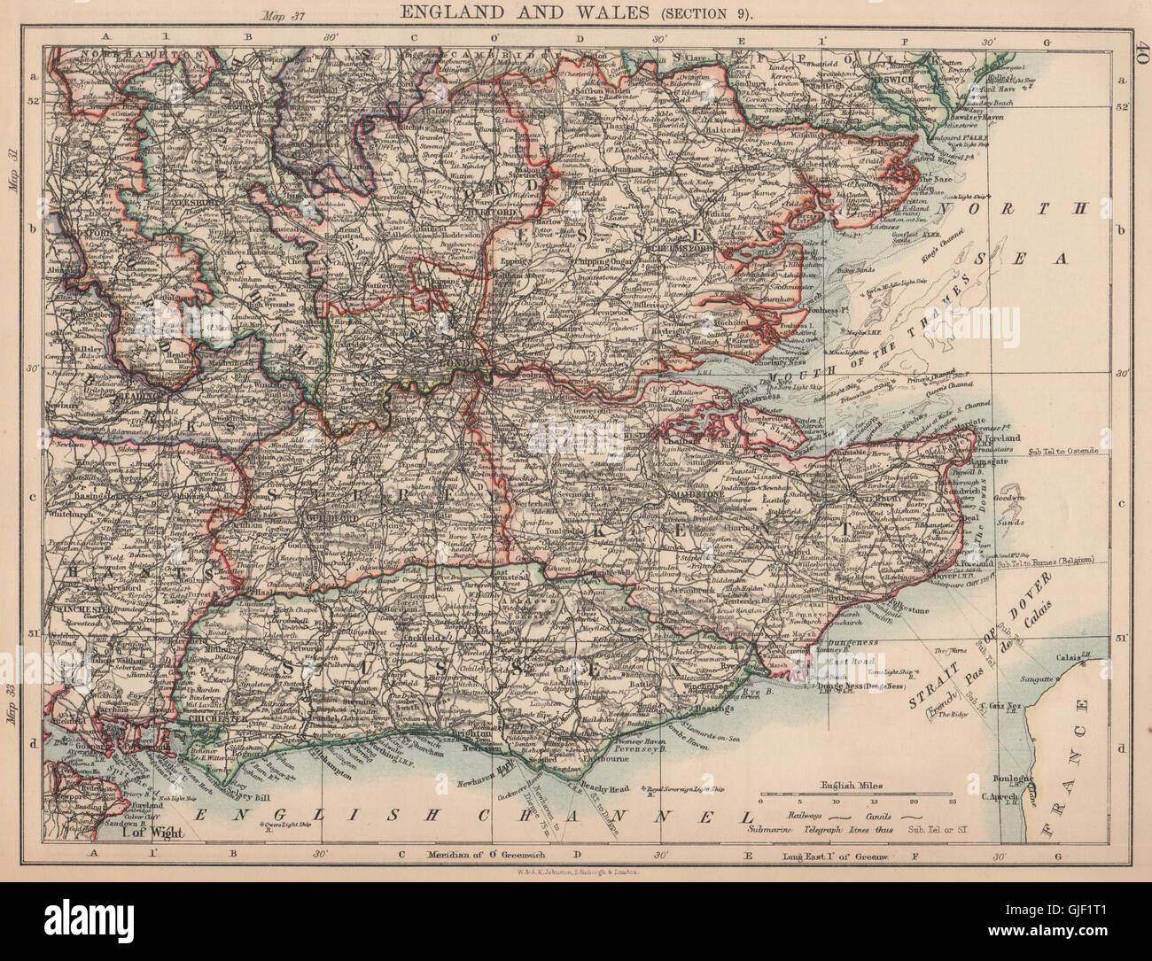 SOUTH EAST ENGLAND. Home counties London Kent Essex Sussex Surrey, 1906 map Stock Photohttps://www.alamy.com/image-license-details/?v=1https://www.alamy.com/stock-photo-south-east-england-home-counties-london-kent-essex-sussex-surrey-1906-114656753.html
RFGJF1T1–SOUTH EAST ENGLAND. Home counties London Kent Essex Sussex Surrey, 1906 map
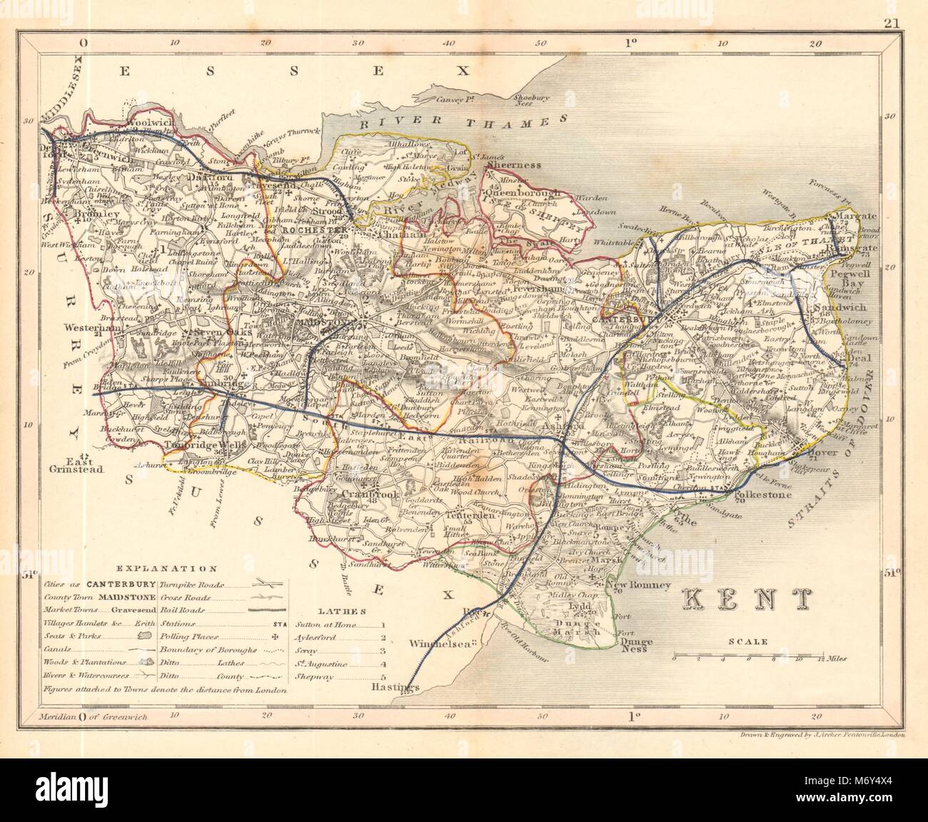 KENT map by ARCHER & DUGDALE. Seats canals polling places 1845 old antique Stock Photohttps://www.alamy.com/image-license-details/?v=1https://www.alamy.com/stock-photo-kent-map-by-archer-dugdale-seats-canals-polling-places-1845-old-antique-176388188.html
RFM6Y4X4–KENT map by ARCHER & DUGDALE. Seats canals polling places 1845 old antique
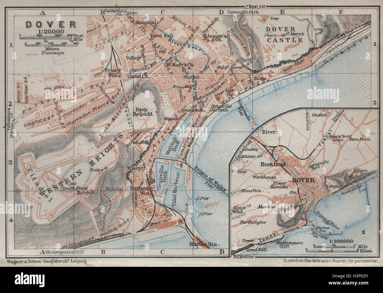 DOVER antique town city plan & environs. Kent. BAEDEKER 1927 old map Stock Photohttps://www.alamy.com/image-license-details/?v=1https://www.alamy.com/stock-photo-dover-antique-town-city-plan-environs-kent-baedeker-1927-old-map-122812143.html
RFH3PG3Y–DOVER antique town city plan & environs. Kent. BAEDEKER 1927 old map
![Image taken from page 810 of '[Paterson's Roads ... The sixteenth edition ... Remodelled, augmented, and improved ... By Edward Mogg.]' Image taken from page 810 of '[Paterson's Roads The Stock Photo Image taken from page 810 of '[Paterson's Roads ... The sixteenth edition ... Remodelled, augmented, and improved ... By Edward Mogg.]' Image taken from page 810 of '[Paterson's Roads The Stock Photo](https://c8.alamy.com/comp/HBT8YA/image-taken-from-page-810-of-patersons-roads-the-sixteenth-edition-HBT8YA.jpg) Image taken from page 810 of '[Paterson's Roads ... The sixteenth edition ... Remodelled, augmented, and improved ... By Edward Mogg.]' Image taken from page 810 of '[Paterson's Roads The Stock Photohttps://www.alamy.com/image-license-details/?v=1https://www.alamy.com/stock-photo-image-taken-from-page-810-of-patersons-roads-the-sixteenth-edition-127767678.html
Image taken from page 810 of '[Paterson's Roads ... The sixteenth edition ... Remodelled, augmented, and improved ... By Edward Mogg.]' Image taken from page 810 of '[Paterson's Roads The Stock Photohttps://www.alamy.com/image-license-details/?v=1https://www.alamy.com/stock-photo-image-taken-from-page-810-of-patersons-roads-the-sixteenth-edition-127767678.htmlRMHBT8YA–Image taken from page 810 of '[Paterson's Roads ... The sixteenth edition ... Remodelled, augmented, and improved ... By Edward Mogg.]' Image taken from page 810 of '[Paterson's Roads The
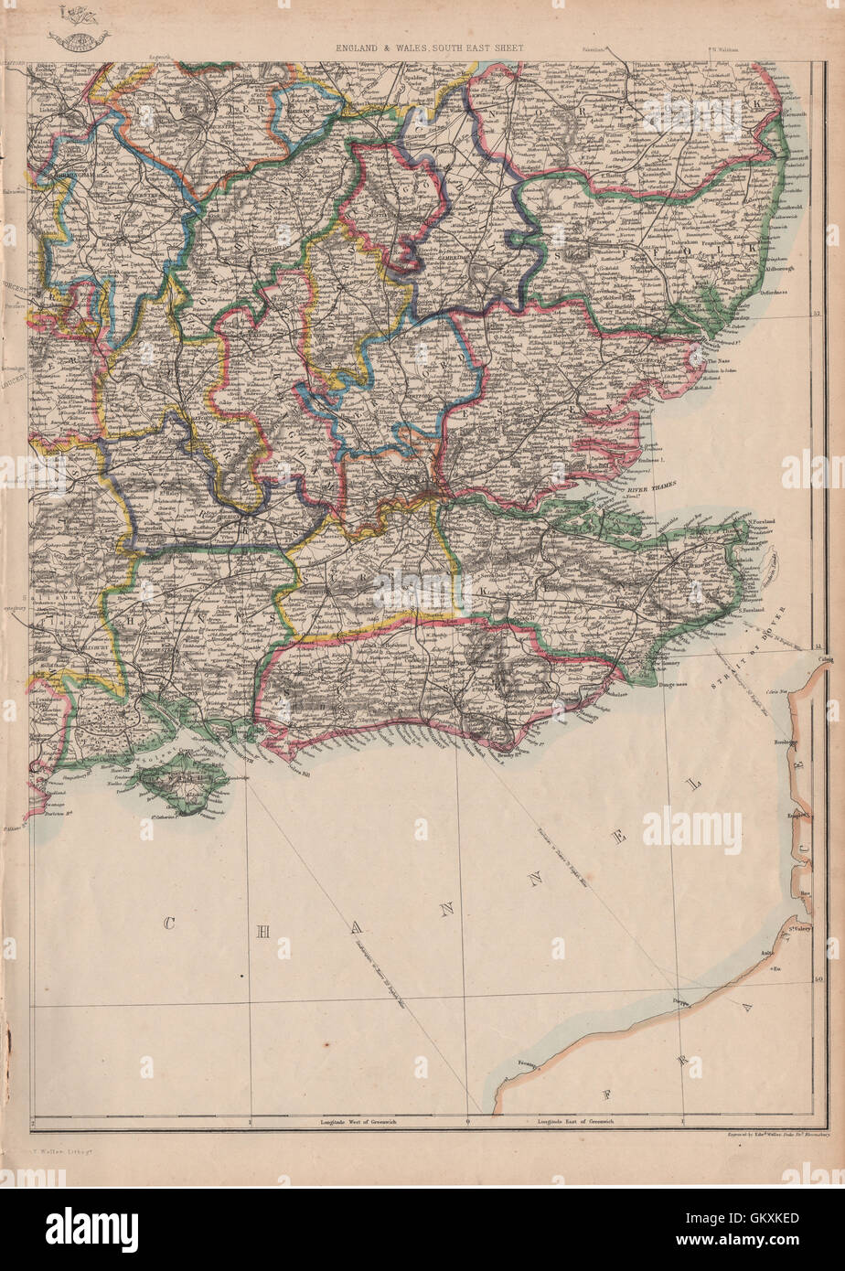 SOUTH EAST ENGLAND. Home Counties Surrey Kent Sussex Hants &c. WELLER, 1863 map Stock Photohttps://www.alamy.com/image-license-details/?v=1https://www.alamy.com/stock-photo-south-east-england-home-counties-surrey-kent-sussex-hants-c-weller-115526725.html
RFGKXKED–SOUTH EAST ENGLAND. Home Counties Surrey Kent Sussex Hants &c. WELLER, 1863 map
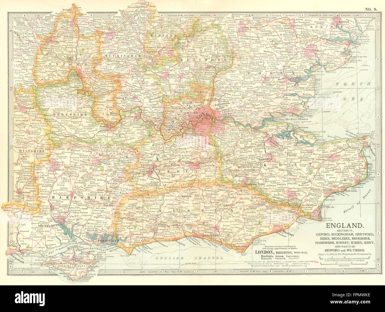 SOUTH EAST ENGLAND: Kent Sussex Essex Surrey Hants Berks Bucks Middx, 1903 map Stock Photohttps://www.alamy.com/image-license-details/?v=1https://www.alamy.com/stock-photo-south-east-england-kent-sussex-essex-surrey-hants-berks-bucks-middx-100033458.html
RFFPMWKE–SOUTH EAST ENGLAND: Kent Sussex Essex Surrey Hants Berks Bucks Middx, 1903 map
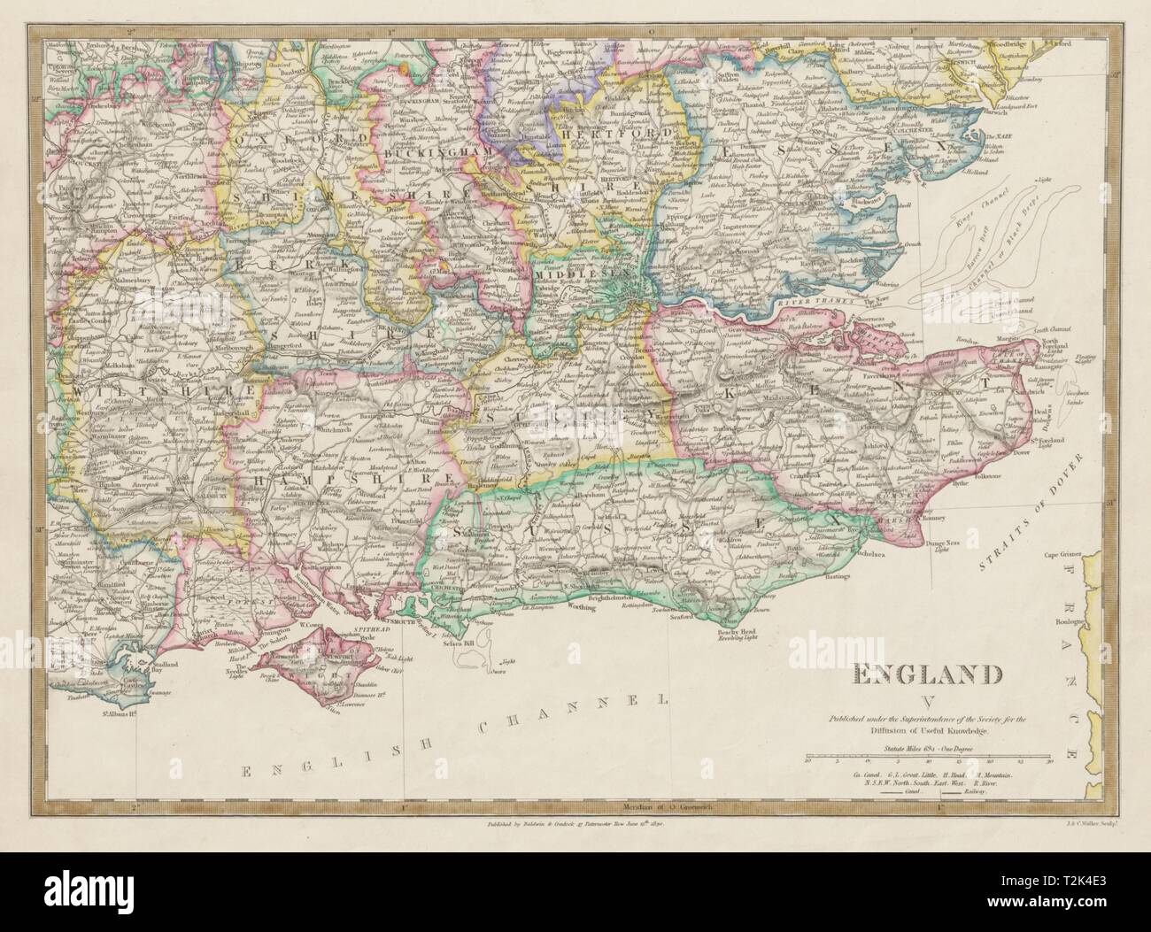 ENGLAND SE Middx Kent Sussex Surrey Hants Berks Essex Herts. SDUK 1844 old map Stock Photohttps://www.alamy.com/image-license-details/?v=1https://www.alamy.com/england-se-middx-kent-sussex-surrey-hants-berks-essex-herts-sduk-1844-old-map-image242595083.html
RFT2K4E3–ENGLAND SE Middx Kent Sussex Surrey Hants Berks Essex Herts. SDUK 1844 old map
 Canterbury, Kent. JAMES. Parliamentary Boundary Commission 1868 old map Stock Photohttps://www.alamy.com/image-license-details/?v=1https://www.alamy.com/canterbury-kent-james-parliamentary-boundary-commission-1868-old-map-image556853618.html
RF2R9XTD6–Canterbury, Kent. JAMES. Parliamentary Boundary Commission 1868 old map
 Image taken from page 45 of 'Viaggi di scoperta nel cuore dell'Africa. Il Giuba esplorato sotto gli auspici della Società geografica italiana. Con 143 incisioni e 4 grandi carte geografiche, etc' Image taken from page 45 of 'Viaggi di scoperta nel Stock Photohttps://www.alamy.com/image-license-details/?v=1https://www.alamy.com/stock-photo-image-taken-from-page-45-of-viaggi-di-scoperta-nel-cuore-dellafrica-127868760.html
RMHC0WWC–Image taken from page 45 of 'Viaggi di scoperta nel cuore dell'Africa. Il Giuba esplorato sotto gli auspici della Società geografica italiana. Con 143 incisioni e 4 grandi carte geografiche, etc' Image taken from page 45 of 'Viaggi di scoperta nel
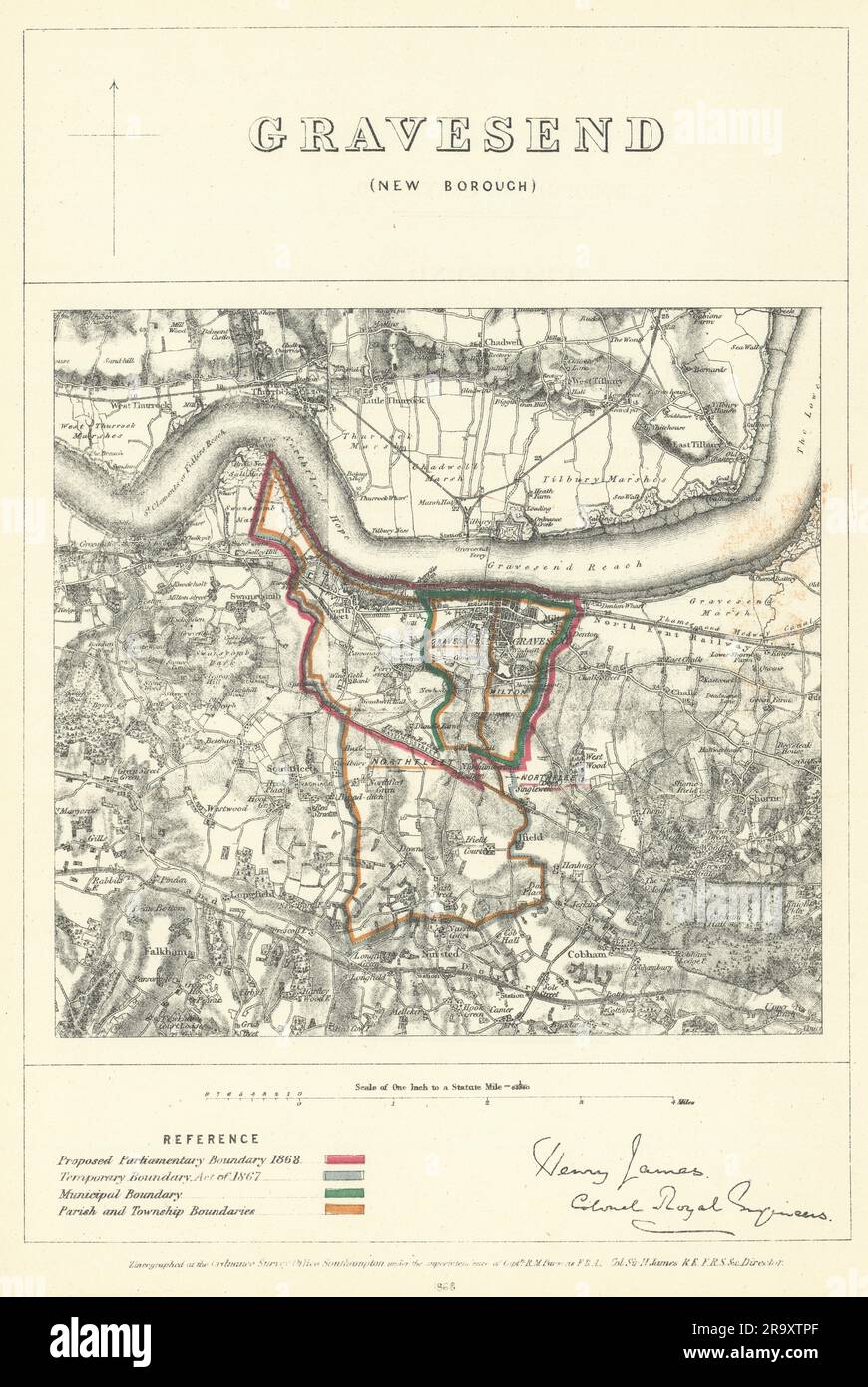 Gravesend (New Borough), Kent. JAMES. Parliamentary Boundary Commission 1868 map Stock Photohttps://www.alamy.com/image-license-details/?v=1https://www.alamy.com/gravesend-new-borough-kent-james-parliamentary-boundary-commission-1868-map-image556853879.html
RF2R9XTPF–Gravesend (New Borough), Kent. JAMES. Parliamentary Boundary Commission 1868 map
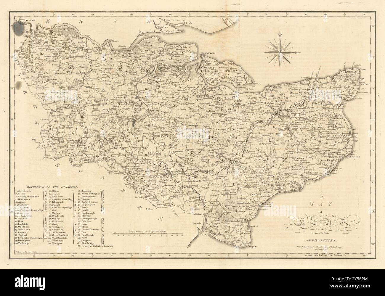 'A map of Kent from the best authorities'. County map. CARY 1806 old Stock Photohttps://www.alamy.com/image-license-details/?v=1https://www.alamy.com/a-map-of-kent-from-the-best-authorities-county-map-cary-1806-old-image622796049.html
RF2Y56PM1–'A map of Kent from the best authorities'. County map. CARY 1806 old
 Image taken from page 27 of 'An Archæological Description of Saltwood Castle near Hythe, Kent ... With illustrations ... The historical notes by C. Beeston' Image taken from page 27 of 'An Archæological Description of Stock Photohttps://www.alamy.com/image-license-details/?v=1https://www.alamy.com/stock-photo-image-taken-from-page-27-of-an-archological-description-of-saltwood-130128151.html
RMHFKRNY–Image taken from page 27 of 'An Archæological Description of Saltwood Castle near Hythe, Kent ... With illustrations ... The historical notes by C. Beeston' Image taken from page 27 of 'An Archæological Description of
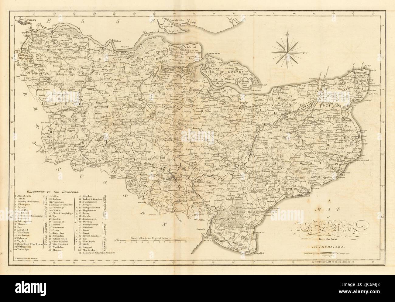 'A map of Kent from the best authorities'. County map. CARY 1806 old Stock Photohttps://www.alamy.com/image-license-details/?v=1https://www.alamy.com/a-map-of-kent-from-the-best-authorities-county-map-cary-1806-old-image472203712.html
RF2JC6MJ8–'A map of Kent from the best authorities'. County map. CARY 1806 old
 Dover Harbour, Kent. ADMIRALTY sea chart city map 1903 (1954) old vintage Stock Photohttps://www.alamy.com/image-license-details/?v=1https://www.alamy.com/dover-harbour-kent-admiralty-sea-chart-city-map-1903-1954-old-vintage-image442261321.html
RF2GKEMR5–Dover Harbour, Kent. ADMIRALTY sea chart city map 1903 (1954) old vintage
 KENT: Rochester cathedral, 1924 vintage map Stock Photohttps://www.alamy.com/image-license-details/?v=1https://www.alamy.com/stock-photo-kent-rochester-cathedral-1924-vintage-map-103440621.html
RFG083FW–KENT: Rochester cathedral, 1924 vintage map
![Image taken from page 26 of '[London ... With ... illustrations.]' Image taken from page 26 of '[London With Stock Photo Image taken from page 26 of '[London ... With ... illustrations.]' Image taken from page 26 of '[London With Stock Photo](https://c8.alamy.com/comp/HBXE2C/image-taken-from-page-26-of-london-with-illustrations-image-taken-HBXE2C.jpg) Image taken from page 26 of '[London ... With ... illustrations.]' Image taken from page 26 of '[London With Stock Photohttps://www.alamy.com/image-license-details/?v=1https://www.alamy.com/stock-photo-image-taken-from-page-26-of-london-with-illustrations-image-taken-127815588.html
Image taken from page 26 of '[London ... With ... illustrations.]' Image taken from page 26 of '[London With Stock Photohttps://www.alamy.com/image-license-details/?v=1https://www.alamy.com/stock-photo-image-taken-from-page-26-of-london-with-illustrations-image-taken-127815588.htmlRMHBXE2C–Image taken from page 26 of '[London ... With ... illustrations.]' Image taken from page 26 of '[London With
 KENT: Canterbury Town Plan, 1924 vintage map Stock Photohttps://www.alamy.com/image-license-details/?v=1https://www.alamy.com/stock-photo-kent-canterbury-town-plan-1924-vintage-map-103440633.html
RFG083G9–KENT: Canterbury Town Plan, 1924 vintage map
![Image taken from page 333 of '[The Japs at Home.]' Image taken from page 333 of '[The Japs at Home]' Stock Photo Image taken from page 333 of '[The Japs at Home.]' Image taken from page 333 of '[The Japs at Home]' Stock Photo](https://c8.alamy.com/comp/HC11P0/image-taken-from-page-333-of-the-japs-at-home-image-taken-from-page-HC11P0.jpg) Image taken from page 333 of '[The Japs at Home.]' Image taken from page 333 of '[The Japs at Home]' Stock Photohttps://www.alamy.com/image-license-details/?v=1https://www.alamy.com/stock-photo-image-taken-from-page-333-of-the-japs-at-home-image-taken-from-page-127871800.html
Image taken from page 333 of '[The Japs at Home.]' Image taken from page 333 of '[The Japs at Home]' Stock Photohttps://www.alamy.com/image-license-details/?v=1https://www.alamy.com/stock-photo-image-taken-from-page-333-of-the-japs-at-home-image-taken-from-page-127871800.htmlRMHC11P0–Image taken from page 333 of '[The Japs at Home.]' Image taken from page 333 of '[The Japs at Home]'