Arish Black & White Stock Photos
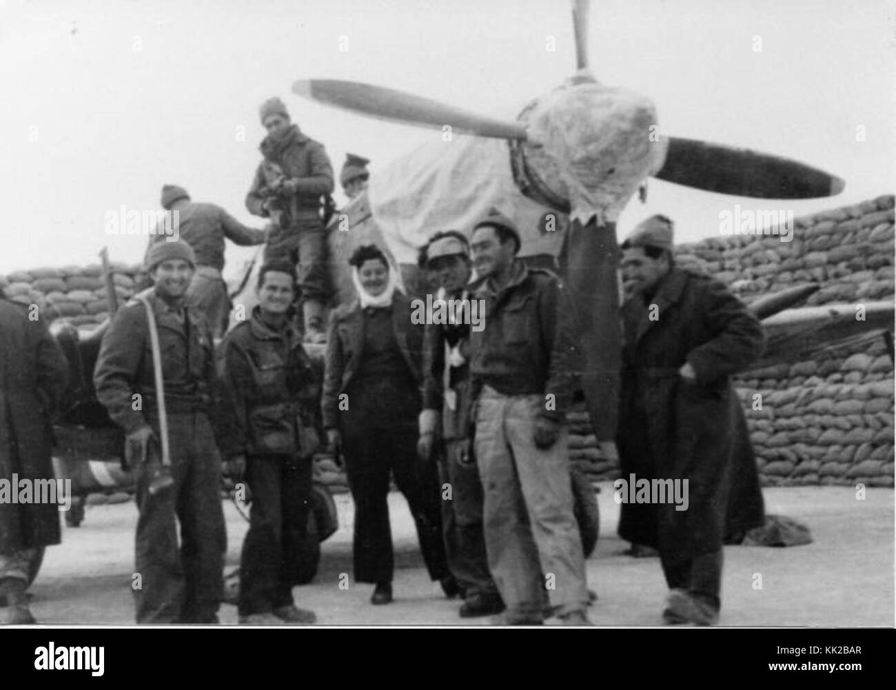 El Arish airfield Stock Photohttps://www.alamy.com/image-license-details/?v=1https://www.alamy.com/stock-image-el-arish-airfield-166624607.html
RMKK2BAR–El Arish airfield
 6 Day War El Arish, Egypt: Dead Egyptian soldiers in the area between El Arish and the Gaza Strip, with the track-marks of armoured vehicles (background). 7 June 1967 Stock Photohttps://www.alamy.com/image-license-details/?v=1https://www.alamy.com/6-day-war-el-arish-egypt-dead-egyptian-soldiers-in-the-area-between-el-arish-and-the-gaza-strip-with-the-track-marks-of-armoured-vehicles-background-7-june-1967-image623702173.html
RM2Y6M2DH–6 Day War El Arish, Egypt: Dead Egyptian soldiers in the area between El Arish and the Gaza Strip, with the track-marks of armoured vehicles (background). 7 June 1967
 Israeli Troops on their way to El Arish during Six-Day War Stock Photohttps://www.alamy.com/image-license-details/?v=1https://www.alamy.com/israeli-troops-on-their-way-to-el-arish-during-six-day-war-image69429196.html
RME0XNJ4–Israeli Troops on their way to El Arish during Six-Day War
 249 StateLibQld 1 202011 Soldiers settlement home at El Arish Stock Photohttps://www.alamy.com/image-license-details/?v=1https://www.alamy.com/249-statelibqld-1-202011-soldiers-settlement-home-at-el-arish-image215078598.html
RMPDWJXE–249 StateLibQld 1 202011 Soldiers settlement home at El Arish
 Israeli Troops after taking of El Arish military base Six-Day War Stock Photohttps://www.alamy.com/image-license-details/?v=1https://www.alamy.com/israeli-troops-after-taking-of-el-arish-military-base-six-day-war-image69428395.html
RME0XMHF–Israeli Troops after taking of El Arish military base Six-Day War
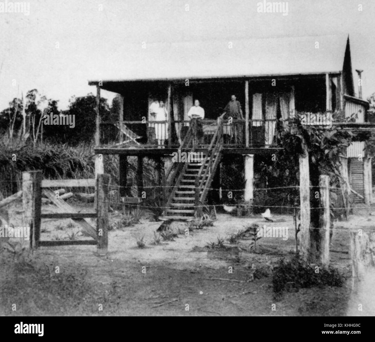 1 202011 Soldiers settlement home at El Arish Stock Photohttps://www.alamy.com/image-license-details/?v=1https://www.alamy.com/stock-image-1-202011-soldiers-settlement-home-at-el-arish-165728456.html
RMKHHG9C–1 202011 Soldiers settlement home at El Arish
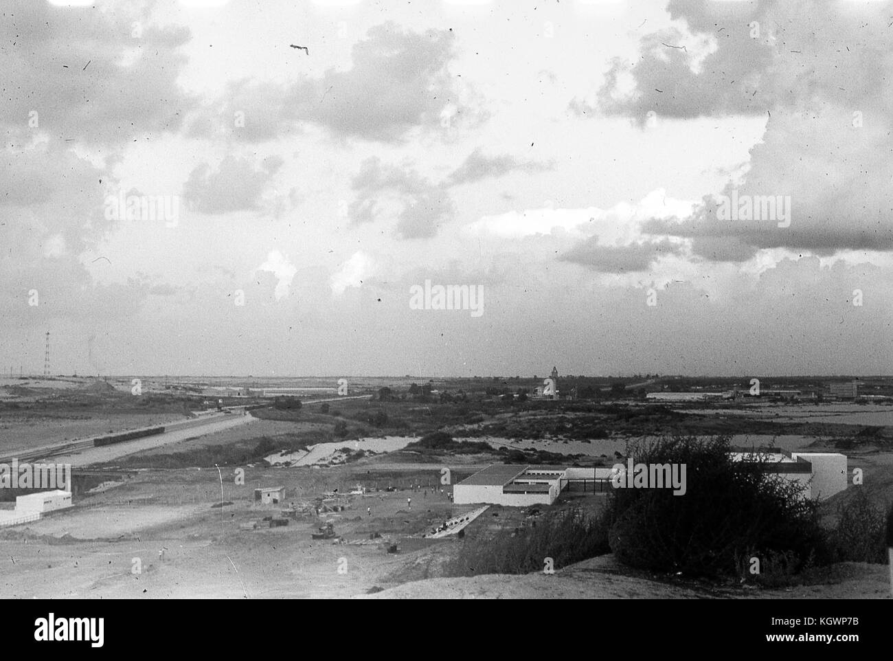 Panoramic view facing south of buildings and roadways in El Arish, Gaza, Israel, November, 1967. Stock Photohttps://www.alamy.com/image-license-details/?v=1https://www.alamy.com/stock-image-panoramic-view-facing-south-of-buildings-and-roadways-in-el-arish-165294063.html
RMKGWP7B–Panoramic view facing south of buildings and roadways in El Arish, Gaza, Israel, November, 1967.
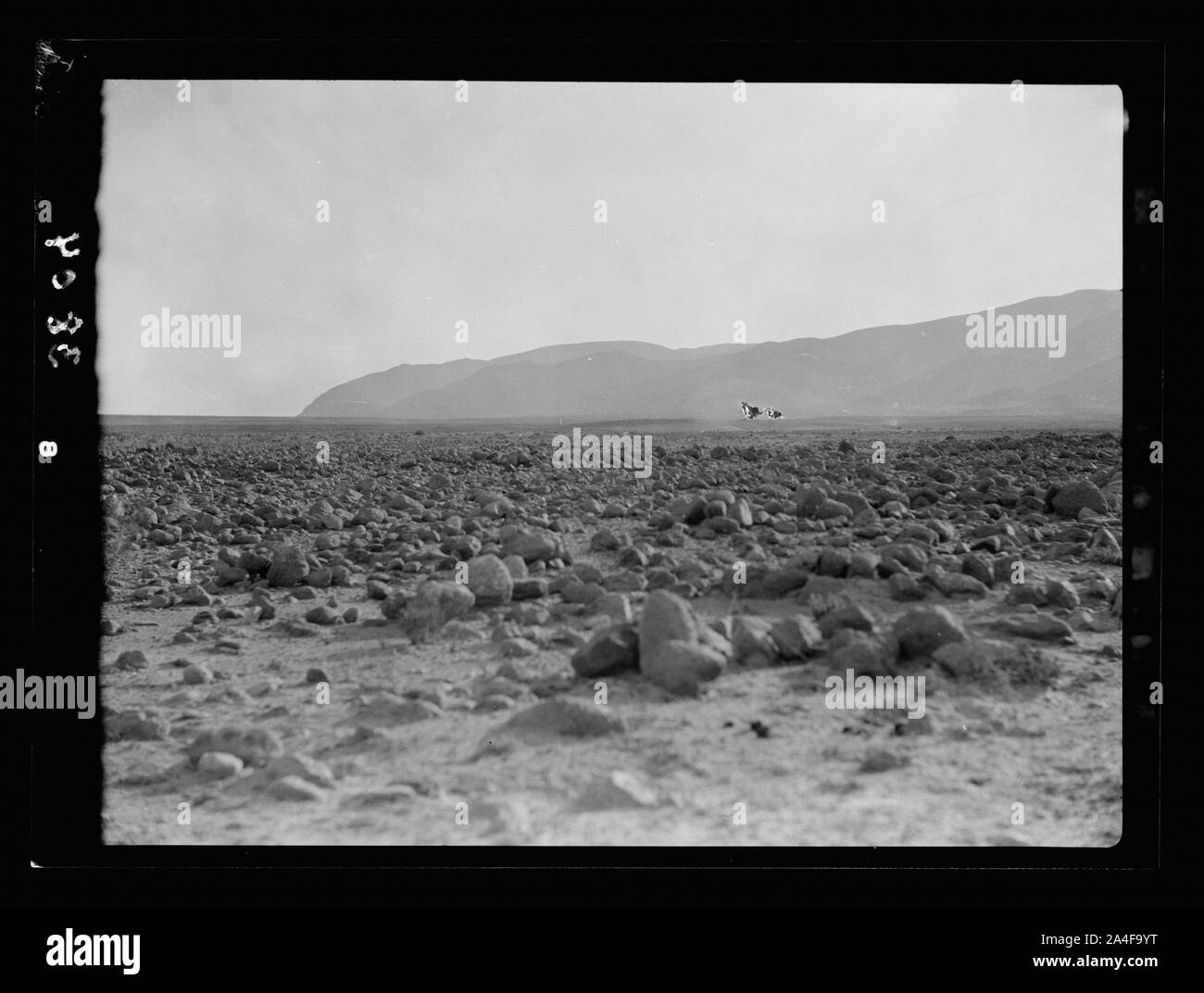 To Sinai by car. Gebel Hellal meaning lawful. 30 miles S. of el Arish Stock Photohttps://www.alamy.com/image-license-details/?v=1https://www.alamy.com/to-sinai-by-car-gebel-hellal-meaning-lawful-30-miles-s-of-el-arish-image329792732.html
RM2A4F9YT–To Sinai by car. Gebel Hellal meaning lawful. 30 miles S. of el Arish
 23 July 1967 - El Arish, Sinai The skeleton of an Egyptian soldier who was killed during the 6 Day War Stock Photohttps://www.alamy.com/image-license-details/?v=1https://www.alamy.com/23-july-1967-el-arish-sinai-the-skeleton-of-an-egyptian-soldier-who-was-killed-during-the-6-day-war-image623702159.html
RM2Y6M2D3–23 July 1967 - El Arish, Sinai The skeleton of an Egyptian soldier who was killed during the 6 Day War
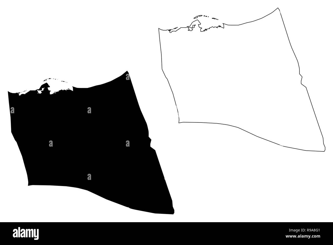 North Sinai Governorate (Governorates of Egypt, Arab Republic of Egypt) map vector illustration, scribble sketch South Sinai map Stock Vectorhttps://www.alamy.com/image-license-details/?v=1https://www.alamy.com/north-sinai-governorate-governorates-of-egypt-arab-republic-of-egypt-map-vector-illustration-scribble-sketch-south-sinai-map-image229492929.html
RFR9A8G1–North Sinai Governorate (Governorates of Egypt, Arab Republic of Egypt) map vector illustration, scribble sketch South Sinai map
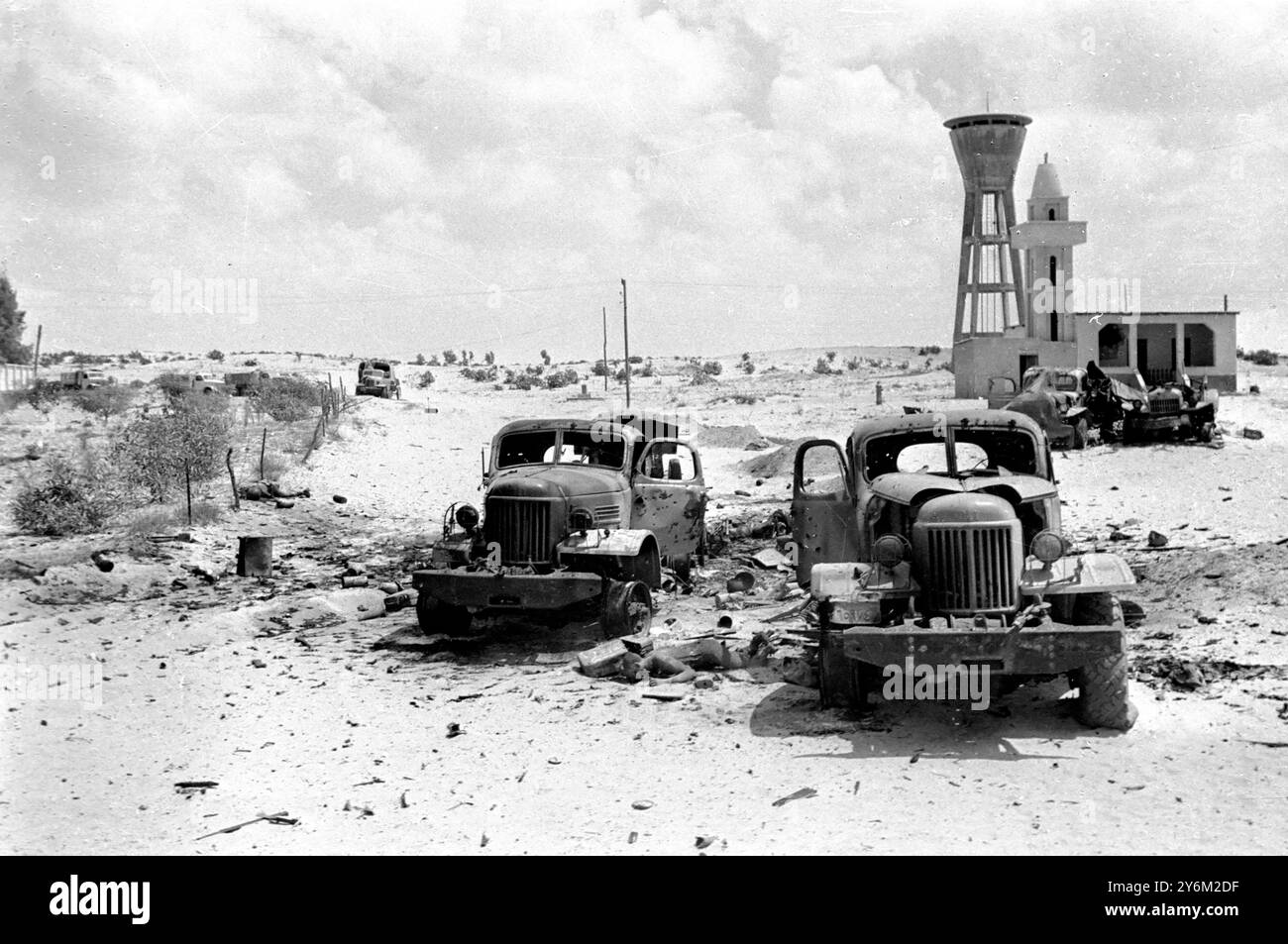 6 Day War El Arish, Egypt: The body of a dead Egyptian lies between two wrecked Egyptian army vehicles near the El Arish Rail Depot 7 June 1967 Stock Photohttps://www.alamy.com/image-license-details/?v=1https://www.alamy.com/6-day-war-el-arish-egypt-the-body-of-a-dead-egyptian-lies-between-two-wrecked-egyptian-army-vehicles-near-the-el-arish-rail-depot-7-june-1967-image623702171.html
RM2Y6M2DF–6 Day War El Arish, Egypt: The body of a dead Egyptian lies between two wrecked Egyptian army vehicles near the El Arish Rail Depot 7 June 1967
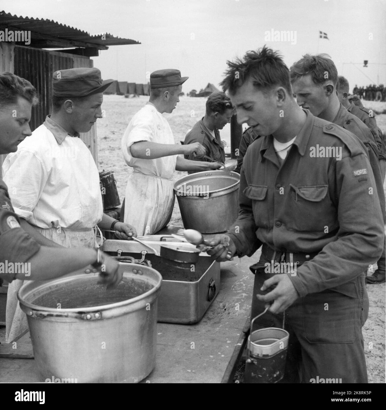 Gaza, 1957: The UN troops in the Sinai desert moved into the Gaza area after Israel evacuated this disputed country strip. The UN took on an important peace task and a great responsibility. This picture was taken in the Norwegian camp El Arish. Food service. Photo: Sverre A. Børretzen / Current / NTB Stock Photohttps://www.alamy.com/image-license-details/?v=1https://www.alamy.com/gaza-1957-the-un-troops-in-the-sinai-desert-moved-into-the-gaza-area-after-israel-evacuated-this-disputed-country-strip-the-un-took-on-an-important-peace-task-and-a-great-responsibility-this-picture-was-taken-in-the-norwegian-camp-el-arish-food-service-photo-sverre-a-brretzen-current-ntb-image487327506.html
RM2K8RK5P–Gaza, 1957: The UN troops in the Sinai desert moved into the Gaza area after Israel evacuated this disputed country strip. The UN took on an important peace task and a great responsibility. This picture was taken in the Norwegian camp El Arish. Food service. Photo: Sverre A. Børretzen / Current / NTB
 6 Day War El Arish, Egypt: Egyptian Prisoners, with their hands above their heads, are transported to camp, whilst an Israeli armoured column moves in the opposite direction near here this morning. 8 June 1967 Stock Photohttps://www.alamy.com/image-license-details/?v=1https://www.alamy.com/6-day-war-el-arish-egypt-egyptian-prisoners-with-their-hands-above-their-heads-are-transported-to-camp-whilst-an-israeli-armoured-column-moves-in-the-opposite-direction-near-here-this-morning-8-june-1967-image623702189.html
RM2Y6M2E5–6 Day War El Arish, Egypt: Egyptian Prisoners, with their hands above their heads, are transported to camp, whilst an Israeli armoured column moves in the opposite direction near here this morning. 8 June 1967
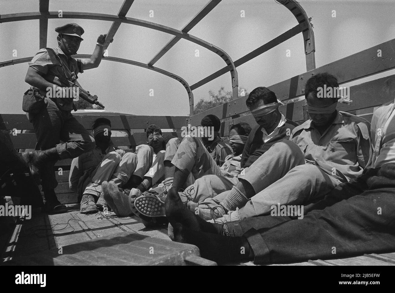 ARCHIVE PHOTO: 55 years ago, on June 5, 1967, the Six Day War began, An Israeli soldier with an Uzi submachine gun in hand (left) guards Egyptian soldiers officers who are bound and blindfolded in the back of a truck, near El Arish during the Six Day War, the Six Day War between Israel and the Arab states of Egypt, Jordan and Syria lasted from June 5 to June 10, 1967. Stock Photohttps://www.alamy.com/image-license-details/?v=1https://www.alamy.com/archive-photo-55-years-ago-on-june-5-1967-the-six-day-war-began-an-israeli-soldier-with-an-uzi-submachine-gun-in-hand-left-guards-egyptian-soldiers-officers-who-are-bound-and-blindfolded-in-the-back-of-a-truck-near-el-arish-during-the-six-day-war-the-six-day-war-between-israel-and-the-arab-states-of-egypt-jordan-and-syria-lasted-from-june-5-to-june-10-1967-image471562333.html
RM2JB5EFW–ARCHIVE PHOTO: 55 years ago, on June 5, 1967, the Six Day War began, An Israeli soldier with an Uzi submachine gun in hand (left) guards Egyptian soldiers officers who are bound and blindfolded in the back of a truck, near El Arish during the Six Day War, the Six Day War between Israel and the Arab states of Egypt, Jordan and Syria lasted from June 5 to June 10, 1967.
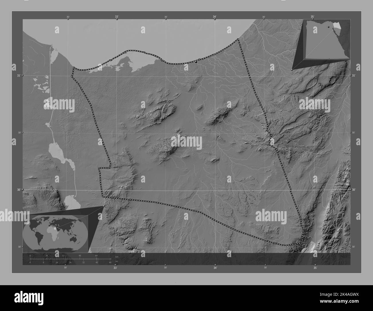 Shamal Sina', governorate of Egypt. Bilevel elevation map with lakes and rivers. Corner auxiliary location maps Stock Photohttps://www.alamy.com/image-license-details/?v=1https://www.alamy.com/shamal-sina-governorate-of-egypt-bilevel-elevation-map-with-lakes-and-rivers-corner-auxiliary-location-maps-image484581718.html
RF2K4AGWX–Shamal Sina', governorate of Egypt. Bilevel elevation map with lakes and rivers. Corner auxiliary location maps
 To Sinai by car. Gebel 'Hellal' meaning 'lawful.' 30 miles S. of el Arish Stock Photohttps://www.alamy.com/image-license-details/?v=1https://www.alamy.com/to-sinai-by-car-gebel-hellal-meaning-lawful-30-miles-s-of-el-arish-image478821020.html
RM2JR052M–To Sinai by car. Gebel 'Hellal' meaning 'lawful.' 30 miles S. of el Arish
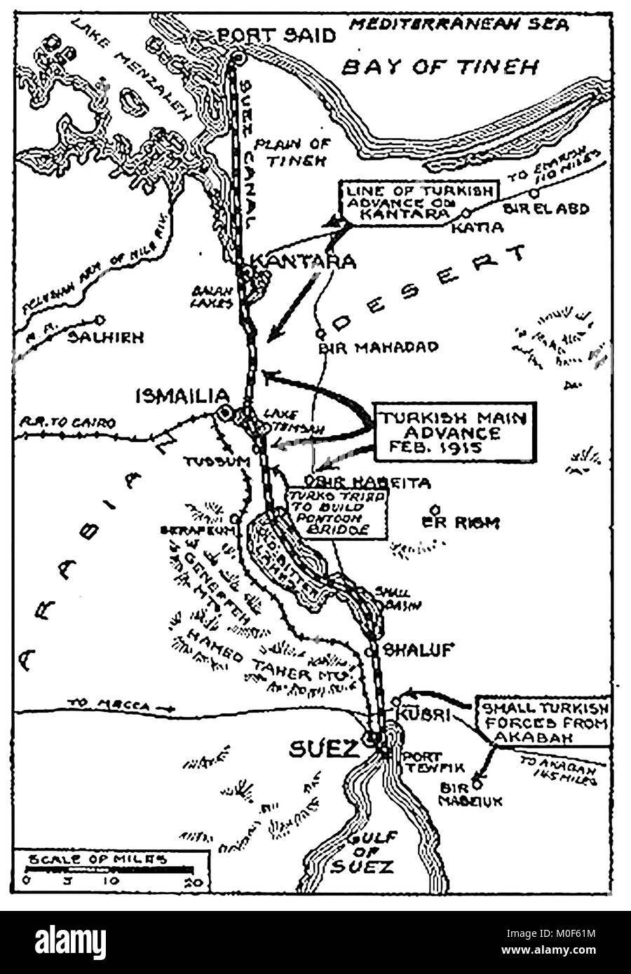 WWI - A 1917 map showing military activity in the 1914-1918 First World War - WWI map of the Turkish attack on the Suez Canal Stock Photohttps://www.alamy.com/image-license-details/?v=1https://www.alamy.com/stock-photo-wwi-a-1917-map-showing-military-activity-in-the-1914-1918-first-world-172437712.html
RMM0F61M–WWI - A 1917 map showing military activity in the 1914-1918 First World War - WWI map of the Turkish attack on the Suez Canal
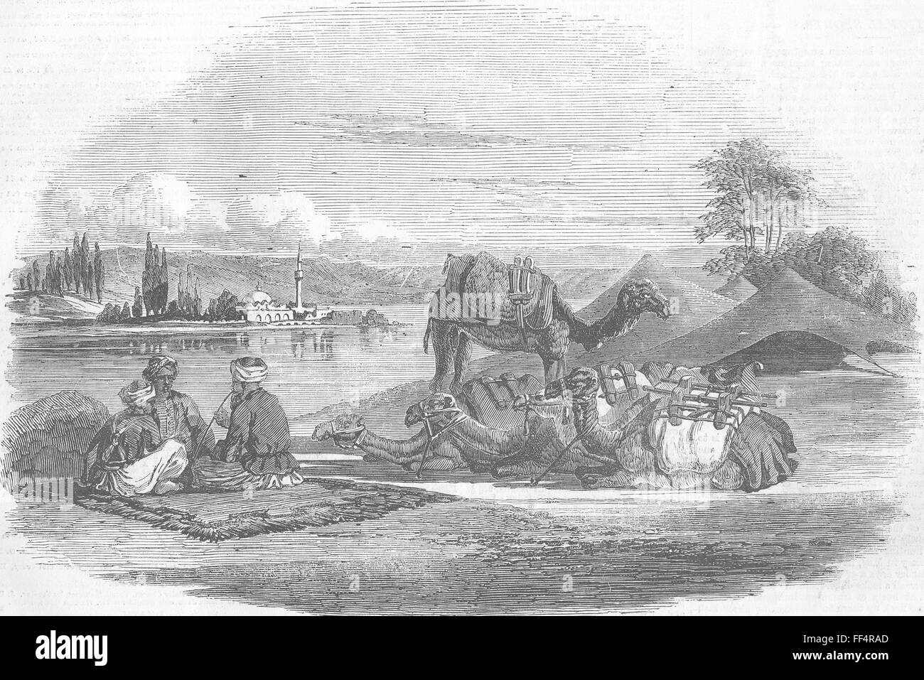 EGYPT Halt by a Stream Near El Arish 1857. Illustrated London News Stock Photohttps://www.alamy.com/image-license-details/?v=1https://www.alamy.com/stock-photo-egypt-halt-by-a-stream-near-el-arish-1857-illustrated-london-news-95377813.html
RFFF4RAD–EGYPT Halt by a Stream Near El Arish 1857. Illustrated London News
 Refuelling a German plane, 1917 Stock Photohttps://www.alamy.com/image-license-details/?v=1https://www.alamy.com/refuelling-a-german-plane-1917-image68843125.html
RME00231–Refuelling a German plane, 1917
 Middlesex; . arish whose nameseems better represented by the old form Harringay, field of hares, as it may well have been, like itsnamesake at the opposite end of the county. Hornseysnew Church overshadows an ivied tower of theold one, beside which the most distinguished tombis that of Samuel Rogers, the banker-poet, whose firstpleasures of memory belonged to Stoke NewingtonGreen. Tom Moore lived for a time at Muswell Hill,in a cottage named Lalla Rookh, said to have beenformerly a rural retreat of Abraham Newland, themost popular prose author of his day as signing theBank of England notes. I Stock Photohttps://www.alamy.com/image-license-details/?v=1https://www.alamy.com/middlesex-arish-whose-nameseems-better-represented-by-the-old-form-harringay-field-of-hares-as-it-may-well-have-been-like-itsnamesake-at-the-opposite-end-of-the-county-hornseysnew-church-overshadows-an-ivied-tower-of-theold-one-beside-which-the-most-distinguished-tombis-that-of-samuel-rogers-the-banker-poet-whose-firstpleasures-of-memory-belonged-to-stoke-newingtongreen-tom-moore-lived-for-a-time-at-muswell-hillin-a-cottage-named-lalla-rookh-said-to-have-beenformerly-a-rural-retreat-of-abraham-newland-themost-popular-prose-author-of-his-day-as-signing-thebank-of-england-notes-i-image340019400.html
RM2AN5660–Middlesex; . arish whose nameseems better represented by the old form Harringay, field of hares, as it may well have been, like itsnamesake at the opposite end of the county. Hornseysnew Church overshadows an ivied tower of theold one, beside which the most distinguished tombis that of Samuel Rogers, the banker-poet, whose firstpleasures of memory belonged to Stoke NewingtonGreen. Tom Moore lived for a time at Muswell Hill,in a cottage named Lalla Rookh, said to have beenformerly a rural retreat of Abraham Newland, themost popular prose author of his day as signing theBank of England notes. I
 German fighter pilots with tents housing their planes, 1916 Stock Photohttps://www.alamy.com/image-license-details/?v=1https://www.alamy.com/german-fighter-pilots-with-tents-housing-their-planes-1916-image68843126.html
RME00232–German fighter pilots with tents housing their planes, 1916
 Halt by a Stream near El Arish, 1857. Scene near 'El Arish - the Egyptian quarantine station, on the Syrian frontiers...On the other side of the river, where grow tall and graceful poplar-trees, a small village built on the water's edge; there is a large mosque and a finely-built minaret; and the whole town is perfectly reflected in the calm waters of the stream. On this side of the river are a party of Mahometans seated on a carpet spread on the ground, enjoying the cool of the evening and a whiff of tobacco, and waiting till the summons to prayer from the minaret shall be wafted across the w Stock Photohttps://www.alamy.com/image-license-details/?v=1https://www.alamy.com/halt-by-a-stream-near-el-arish-1857-scene-near-el-arish-the-egyptian-quarantine-station-on-the-syrian-frontierson-the-other-side-of-the-river-where-grow-tall-and-graceful-poplar-trees-a-small-village-built-on-the-waters-edge-there-is-a-large-mosque-and-a-finely-built-minaret-and-the-whole-town-is-perfectly-reflected-in-the-calm-waters-of-the-stream-on-this-side-of-the-river-are-a-party-of-mahometans-seated-on-a-carpet-spread-on-the-ground-enjoying-the-cool-of-the-evening-and-a-whiff-of-tobacco-and-waiting-till-the-summons-to-prayer-from-the-minaret-shall-be-wafted-across-the-w-image556248213.html
RM2R8Y87H–Halt by a Stream near El Arish, 1857. Scene near 'El Arish - the Egyptian quarantine station, on the Syrian frontiers...On the other side of the river, where grow tall and graceful poplar-trees, a small village built on the water's edge; there is a large mosque and a finely-built minaret; and the whole town is perfectly reflected in the calm waters of the stream. On this side of the river are a party of Mahometans seated on a carpet spread on the ground, enjoying the cool of the evening and a whiff of tobacco, and waiting till the summons to prayer from the minaret shall be wafted across the w
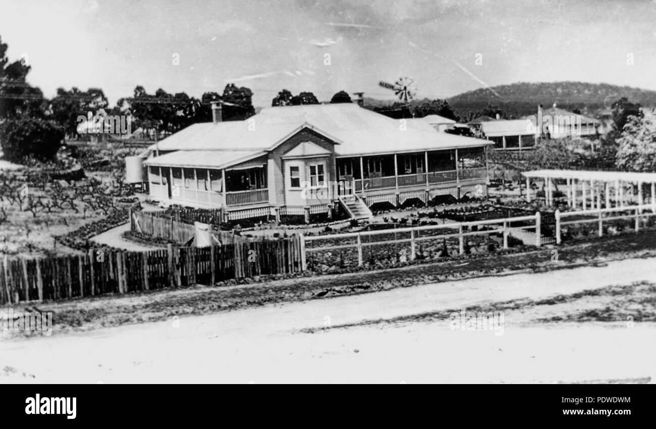 215 StateLibQld 1 127047 House known as El Arish at Stanthorpe, ca. 1920 Stock Photohttps://www.alamy.com/image-license-details/?v=1https://www.alamy.com/215-statelibqld-1-127047-house-known-as-el-arish-at-stanthorpe-ca-1920-image215074656.html
RMPDWDWM–215 StateLibQld 1 127047 House known as El Arish at Stanthorpe, ca. 1920
 1 76066 Mr and Mrs C. Harding at El Arish, 1921 Stock Photohttps://www.alamy.com/image-license-details/?v=1https://www.alamy.com/stock-image-1-76066-mr-and-mrs-c-harding-at-el-arish-1921-165726412.html
RMKHHDMC–1 76066 Mr and Mrs C. Harding at El Arish, 1921
 View of buildings, smokestacks, cranes working, and roadways running through El Arish, Gaza, Israel, November, 1967. Stock Photohttps://www.alamy.com/image-license-details/?v=1https://www.alamy.com/stock-image-view-of-buildings-smokestacks-cranes-working-and-roadways-running-165294056.html
RMKGWP74–View of buildings, smokestacks, cranes working, and roadways running through El Arish, Gaza, Israel, November, 1967.
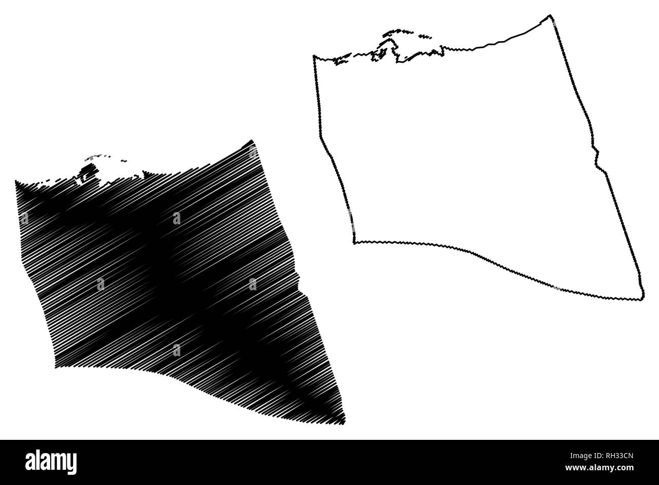 North Sinai Governorate (Governorates of Egypt, Arab Republic of Egypt) map vector illustration, scribble sketch South Sinai map Stock Vectorhttps://www.alamy.com/image-license-details/?v=1https://www.alamy.com/north-sinai-governorate-governorates-of-egypt-arab-republic-of-egypt-map-vector-illustration-scribble-sketch-south-sinai-map-image234252501.html
RFRH33CN–North Sinai Governorate (Governorates of Egypt, Arab Republic of Egypt) map vector illustration, scribble sketch South Sinai map
 Gaza 1957: The UN troops in the Sinai desert moved into the Gaza area after Israel evacuated this disputed country strip. The UN took on an important peace task and a great responsibility. The picture was taken near the field hospital in the Norwegian camp, El Arish. Photo: Sverre A. Børretzen / Current / NTB Stock Photohttps://www.alamy.com/image-license-details/?v=1https://www.alamy.com/gaza-1957-the-un-troops-in-the-sinai-desert-moved-into-the-gaza-area-after-israel-evacuated-this-disputed-country-strip-the-un-took-on-an-important-peace-task-and-a-great-responsibility-the-picture-was-taken-near-the-field-hospital-in-the-norwegian-camp-el-arish-photo-sverre-a-brretzen-current-ntb-image487261776.html
RM2K8MKA8–Gaza 1957: The UN troops in the Sinai desert moved into the Gaza area after Israel evacuated this disputed country strip. The UN took on an important peace task and a great responsibility. The picture was taken near the field hospital in the Norwegian camp, El Arish. Photo: Sverre A. Børretzen / Current / NTB
 6 Day War El Arish, Egypt: Egyptian Prisoners, with their hands above their heads, are transported to camp, whilst an Israeli armoured column moves in the opposite direction near here this morning. 8 June 1967 Stock Photohttps://www.alamy.com/image-license-details/?v=1https://www.alamy.com/6-day-war-el-arish-egypt-egyptian-prisoners-with-their-hands-above-their-heads-are-transported-to-camp-whilst-an-israeli-armoured-column-moves-in-the-opposite-direction-near-here-this-morning-8-june-1967-image623702168.html
RM2Y6M2DC–6 Day War El Arish, Egypt: Egyptian Prisoners, with their hands above their heads, are transported to camp, whilst an Israeli armoured column moves in the opposite direction near here this morning. 8 June 1967
 ARCHIVE PHOTO: 75 years ago, on May 14, 1948, the state of Israel was established, An Israeli soldier with an Uzi submachine gun in hand (left) guards Egyptian soldiers officers who are bound and blindfolded in the back of a truck El Arish during the Six-Day War, the Six-Day War between Israel and the Arab states of Egypt, Jordan and Syria lasted from June 5th to June 10th, 1967. ?SVEN SIMON#Prinzess-Luise-Strasse 41#45479 Muelheim/R clock #tel. 0208/9413250#fax. 0208/9413260# Postgiro Essen No. 244 293 433 (BLZ 360 100 43)# www.SvenSimon.net. Stock Photohttps://www.alamy.com/image-license-details/?v=1https://www.alamy.com/archive-photo-75-years-ago-on-may-14-1948-the-state-of-israel-was-established-an-israeli-soldier-with-an-uzi-submachine-gun-in-hand-left-guards-egyptian-soldiers-officers-who-are-bound-and-blindfolded-in-the-back-of-a-truck-el-arish-during-the-six-day-war-the-six-day-war-between-israel-and-the-arab-states-of-egypt-jordan-and-syria-lasted-from-june-5th-to-june-10th-1967-sven-simonprinzess-luise-strasse-4145479-muelheimr-clock-tel-02089413250fax-02089413260-postgiro-essen-no-244-293-433-blz-360-100-43-wwwsvensimonnet-image551016619.html
RM2R0CY8Y–ARCHIVE PHOTO: 75 years ago, on May 14, 1948, the state of Israel was established, An Israeli soldier with an Uzi submachine gun in hand (left) guards Egyptian soldiers officers who are bound and blindfolded in the back of a truck El Arish during the Six-Day War, the Six-Day War between Israel and the Arab states of Egypt, Jordan and Syria lasted from June 5th to June 10th, 1967. ?SVEN SIMON#Prinzess-Luise-Strasse 41#45479 Muelheim/R clock #tel. 0208/9413250#fax. 0208/9413260# Postgiro Essen No. 244 293 433 (BLZ 360 100 43)# www.SvenSimon.net.
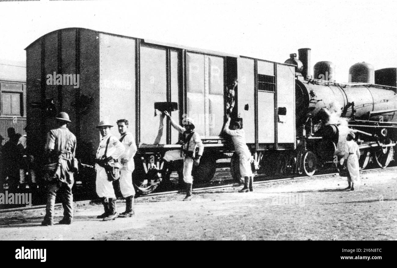 Scenes of Distruction at Jerusalem; and British Forces Restoring Order. An armoured train inpovised by troops landed from H.M.S. 'Sussex'; British forces patrolling the railway from El Arish on the Egyptian border, through ludd to Haifa. 14 September 1929 Stock Photohttps://www.alamy.com/image-license-details/?v=1https://www.alamy.com/scenes-of-distruction-at-jerusalem-and-british-forces-restoring-order-an-armoured-train-inpovised-by-troops-landed-from-hms-sussex-british-forces-patrolling-the-railway-from-el-arish-on-the-egyptian-border-through-ludd-to-haifa-14-september-1929-image623729132.html
RM2Y6N8TC–Scenes of Distruction at Jerusalem; and British Forces Restoring Order. An armoured train inpovised by troops landed from H.M.S. 'Sussex'; British forces patrolling the railway from El Arish on the Egyptian border, through ludd to Haifa. 14 September 1929
 Shamal Sina', governorate of Egypt. Grayscale elevation map with lakes and rivers. Corner auxiliary location maps Stock Photohttps://www.alamy.com/image-license-details/?v=1https://www.alamy.com/shamal-sina-governorate-of-egypt-grayscale-elevation-map-with-lakes-and-rivers-corner-auxiliary-location-maps-image484581815.html
RF2K4AH1B–Shamal Sina', governorate of Egypt. Grayscale elevation map with lakes and rivers. Corner auxiliary location maps
 Sinai : Advancing Israeli army troops using a battery of heavy mortas... as they make their swift thrust into the Sinai's... against the Egyptian troops. This battery was set up near the garison of El Arish which was captured by the Israelis during their advance towards the Suez Canal. 8 June 1967 Stock Photohttps://www.alamy.com/image-license-details/?v=1https://www.alamy.com/sinai-advancing-israeli-army-troops-using-a-battery-of-heavy-mortas-as-they-make-their-swift-thrust-into-the-sinais-against-the-egyptian-troops-this-battery-was-set-up-near-the-garison-of-el-arish-which-was-captured-by-the-israelis-during-their-advance-towards-the-suez-canal-8-june-1967-image623749637.html
RM2Y6P70N–Sinai : Advancing Israeli army troops using a battery of heavy mortas... as they make their swift thrust into the Sinai's... against the Egyptian troops. This battery was set up near the garison of El Arish which was captured by the Israelis during their advance towards the Suez Canal. 8 June 1967
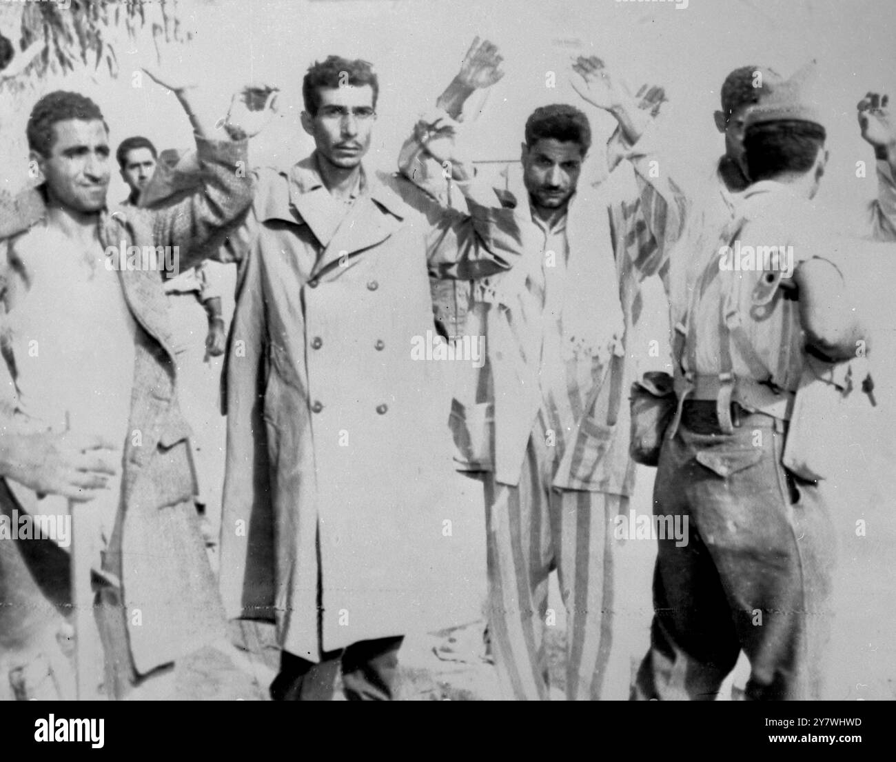 El Arish , Egypt : An Israeli soldier , armed with a sten gun , holds by gunpoint four arrested Egypt ions , Fedayeen ( Suicide Squad Commandos ) suspects , at El Arish . Reports from Tel Aviv say that nearly 5 ,000 Egyptian prisoners are being held by Israeli forces and the number is continually increasing many are surrendering for lack of food and water . 5 November 1956 Stock Photohttps://www.alamy.com/image-license-details/?v=1https://www.alamy.com/el-arish-egypt-an-israeli-soldier-armed-with-a-sten-gun-holds-by-gunpoint-four-arrested-egypt-ions-fedayeen-suicide-squad-commandos-suspects-at-el-arish-reports-from-tel-aviv-say-that-nearly-5-000-egyptian-prisoners-are-being-held-by-israeli-forces-and-the-number-is-continually-increasing-many-are-surrendering-for-lack-of-food-and-water-5-november-1956-image624438681.html
RM2Y7WHWD–El Arish , Egypt : An Israeli soldier , armed with a sten gun , holds by gunpoint four arrested Egypt ions , Fedayeen ( Suicide Squad Commandos ) suspects , at El Arish . Reports from Tel Aviv say that nearly 5 ,000 Egyptian prisoners are being held by Israeli forces and the number is continually increasing many are surrendering for lack of food and water . 5 November 1956
 272 StateLibQld 1 76066 Mr and Mrs C. Harding at El Arish, 1921 Stock Photohttps://www.alamy.com/image-license-details/?v=1https://www.alamy.com/272-statelibqld-1-76066-mr-and-mrs-c-harding-at-el-arish-1921-image215080823.html
RMPDWNNY–272 StateLibQld 1 76066 Mr and Mrs C. Harding at El Arish, 1921
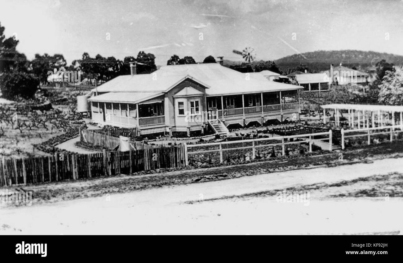 1 127047 House known as El Arish at Stanthorpe, ca. 1920 Stock Photohttps://www.alamy.com/image-license-details/?v=1https://www.alamy.com/stock-image-1-127047-house-known-as-el-arish-at-stanthorpe-ca-1920-164312809.html
RMKF92JH–1 127047 House known as El Arish at Stanthorpe, ca. 1920
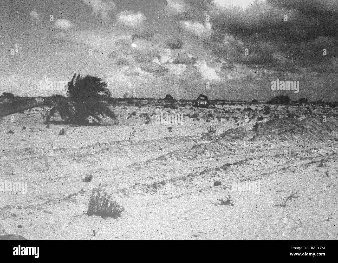 Desolate landscape scene showing war debris and the desert brush surrounding the town of El Arish, in the northern Sinai peninsula, in Gaza, Israel, November, 1967. Stock Photohttps://www.alamy.com/image-license-details/?v=1https://www.alamy.com/stock-photo-desolate-landscape-scene-showing-war-debris-and-the-desert-brush-surrounding-133092616.html
RMHMETYM–Desolate landscape scene showing war debris and the desert brush surrounding the town of El Arish, in the northern Sinai peninsula, in Gaza, Israel, November, 1967.
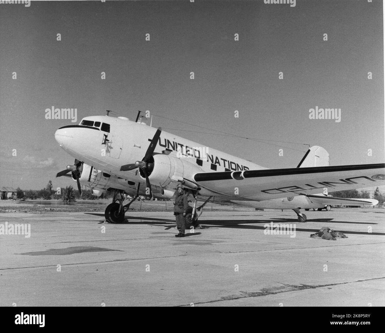 Gaza, 1957: The UN troops in the Sinai desert moved into the Gaza area after Israel evacuated this disputed country strip. The UN took on an important peace task and a great responsibility. The picture was taken at El Arish Airport and shows a Norwegian soldier in front of a UN aircraft. Photo: Sverre A. Børretzen / Current / NTB Stock Photohttps://www.alamy.com/image-license-details/?v=1https://www.alamy.com/gaza-1957-the-un-troops-in-the-sinai-desert-moved-into-the-gaza-area-after-israel-evacuated-this-disputed-country-strip-the-un-took-on-an-important-peace-task-and-a-great-responsibility-the-picture-was-taken-at-el-arish-airport-and-shows-a-norwegian-soldier-in-front-of-a-un-aircraft-photo-sverre-a-brretzen-current-ntb-image487295087.html
RM2K8P5RY–Gaza, 1957: The UN troops in the Sinai desert moved into the Gaza area after Israel evacuated this disputed country strip. The UN took on an important peace task and a great responsibility. The picture was taken at El Arish Airport and shows a Norwegian soldier in front of a UN aircraft. Photo: Sverre A. Børretzen / Current / NTB
 Gaza, Israel November 1957 UN forces in Gaza. The Norwegian soldiers take over the Finnish soldiers' guard at El Arish. Lieutenant Knut Stensby from Lier leads the relief, together with the soldiers (from V) Reidar Nyheim, Annbjørn Gjetram, Harry Rongeved, Nils Opsanger and Alf Amundsen. The Norwegian UN soldiers are called popular 'Ola boys'. The Finnish soldier is called Pentti Hinkanen. Photo: NTB Stock Photohttps://www.alamy.com/image-license-details/?v=1https://www.alamy.com/gaza-israel-november-1957-un-forces-in-gaza-the-norwegian-soldiers-take-over-the-finnish-soldiers-guard-at-el-arish-lieutenant-knut-stensby-from-lier-leads-the-relief-together-with-the-soldiers-from-v-reidar-nyheim-annbjrn-gjetram-harry-rongeved-nils-opsanger-and-alf-amundsen-the-norwegian-un-soldiers-are-called-popular-ola-boys-the-finnish-soldier-is-called-pentti-hinkanen-photo-ntb-image487272593.html
RM2K8N54H–Gaza, Israel November 1957 UN forces in Gaza. The Norwegian soldiers take over the Finnish soldiers' guard at El Arish. Lieutenant Knut Stensby from Lier leads the relief, together with the soldiers (from V) Reidar Nyheim, Annbjørn Gjetram, Harry Rongeved, Nils Opsanger and Alf Amundsen. The Norwegian UN soldiers are called popular 'Ola boys'. The Finnish soldier is called Pentti Hinkanen. Photo: NTB
 Shamal Sina', governorate of Egypt. Bilevel elevation map with lakes and rivers. Locations of major cities of the region. Corner auxiliary location ma Stock Photohttps://www.alamy.com/image-license-details/?v=1https://www.alamy.com/shamal-sina-governorate-of-egypt-bilevel-elevation-map-with-lakes-and-rivers-locations-of-major-cities-of-the-region-corner-auxiliary-location-ma-image484581702.html
RF2K4AGWA–Shamal Sina', governorate of Egypt. Bilevel elevation map with lakes and rivers. Locations of major cities of the region. Corner auxiliary location ma
 1777 Turkish prisoners on the road to El Arish from Rafa in 1917 Stock Photohttps://www.alamy.com/image-license-details/?v=1https://www.alamy.com/1777-turkish-prisoners-on-the-road-to-el-arish-from-rafa-in-1917-image213680106.html
RMPBHY4A–1777 Turkish prisoners on the road to El Arish from Rafa in 1917
 Turkish prisoners on the road to El Arish from Rafa in 1917 Stock Photohttps://www.alamy.com/image-license-details/?v=1https://www.alamy.com/stock-image-turkish-prisoners-on-the-road-to-el-arish-from-rafa-in-1917-163711480.html
RMKE9KJG–Turkish prisoners on the road to El Arish from Rafa in 1917
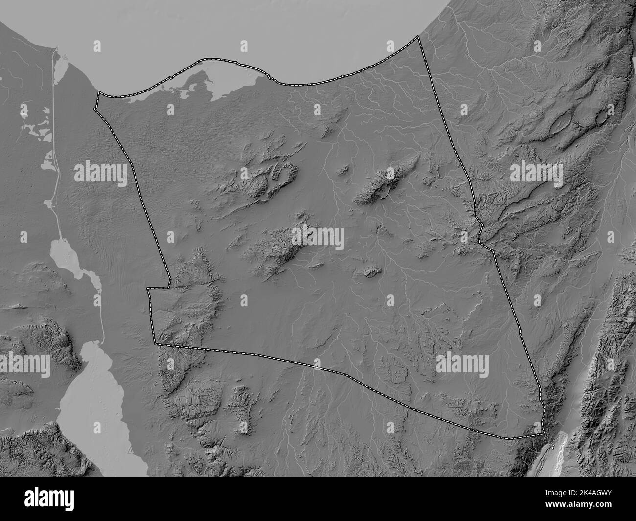 Shamal Sina', governorate of Egypt. Bilevel elevation map with lakes and rivers Stock Photohttps://www.alamy.com/image-license-details/?v=1https://www.alamy.com/shamal-sina-governorate-of-egypt-bilevel-elevation-map-with-lakes-and-rivers-image484581719.html
RF2K4AGWY–Shamal Sina', governorate of Egypt. Bilevel elevation map with lakes and rivers
 Turkish prisoners on the road to El Arish from Rafa in 1917 Stock Photohttps://www.alamy.com/image-license-details/?v=1https://www.alamy.com/stock-image-turkish-prisoners-on-the-road-to-el-arish-from-rafa-in-1917-166597875.html
RMKK1583–Turkish prisoners on the road to El Arish from Rafa in 1917
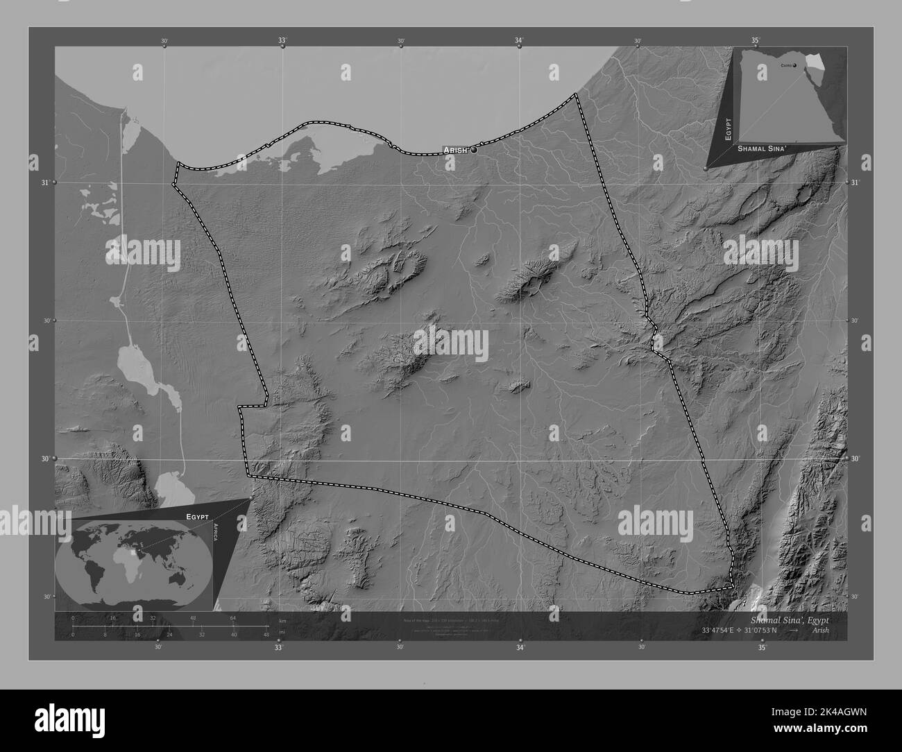 Shamal Sina', governorate of Egypt. Bilevel elevation map with lakes and rivers. Locations and names of major cities of the region. Corner auxiliary l Stock Photohttps://www.alamy.com/image-license-details/?v=1https://www.alamy.com/shamal-sina-governorate-of-egypt-bilevel-elevation-map-with-lakes-and-rivers-locations-and-names-of-major-cities-of-the-region-corner-auxiliary-l-image484581713.html
RF2K4AGWN–Shamal Sina', governorate of Egypt. Bilevel elevation map with lakes and rivers. Locations and names of major cities of the region. Corner auxiliary l
 To Sinai by car. Gebel 'Hellal' meaning 'lawful.' 30 miles S. of el Arish LOC matpc.15549 Stock Photohttps://www.alamy.com/image-license-details/?v=1https://www.alamy.com/stock-photo-to-sinai-by-car-gebel-hellal-meaning-lawful-30-miles-s-of-el-arish-176821064.html
RMM7JW20–To Sinai by car. Gebel 'Hellal' meaning 'lawful.' 30 miles S. of el Arish LOC matpc.15549
 Shamal Sina', governorate of Egypt. Grayscale elevation map with lakes and rivers. Locations of major cities of the region. Corner auxiliary location Stock Photohttps://www.alamy.com/image-license-details/?v=1https://www.alamy.com/shamal-sina-governorate-of-egypt-grayscale-elevation-map-with-lakes-and-rivers-locations-of-major-cities-of-the-region-corner-auxiliary-location-image484581804.html
RF2K4AH10–Shamal Sina', governorate of Egypt. Grayscale elevation map with lakes and rivers. Locations of major cities of the region. Corner auxiliary location
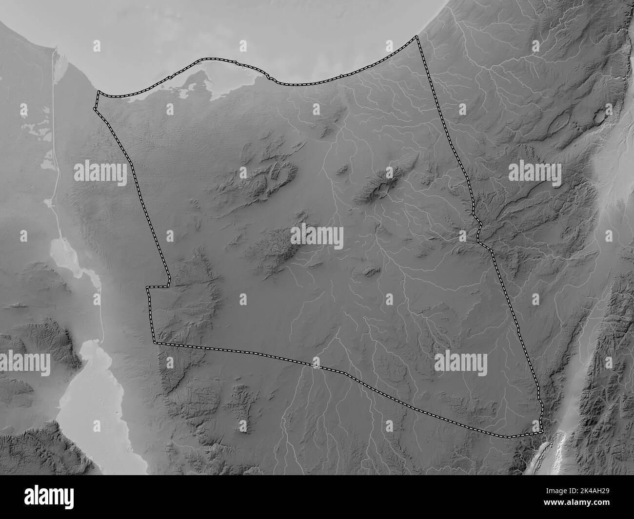 Shamal Sina', governorate of Egypt. Grayscale elevation map with lakes and rivers Stock Photohttps://www.alamy.com/image-license-details/?v=1https://www.alamy.com/shamal-sina-governorate-of-egypt-grayscale-elevation-map-with-lakes-and-rivers-image484581841.html
RF2K4AH29–Shamal Sina', governorate of Egypt. Grayscale elevation map with lakes and rivers
 Shamal Sina', governorate of Egypt. Grayscale elevation map with lakes and rivers. Locations and names of major cities of the region. Corner auxiliary Stock Photohttps://www.alamy.com/image-license-details/?v=1https://www.alamy.com/shamal-sina-governorate-of-egypt-grayscale-elevation-map-with-lakes-and-rivers-locations-and-names-of-major-cities-of-the-region-corner-auxiliary-image484581825.html
RF2K4AH1N–Shamal Sina', governorate of Egypt. Grayscale elevation map with lakes and rivers. Locations and names of major cities of the region. Corner auxiliary
 Shape of Shamal Sina', governorate of Egypt, with its capital isolated on a solid color background. Bilevel elevation map. 3D rendering Stock Photohttps://www.alamy.com/image-license-details/?v=1https://www.alamy.com/shape-of-shamal-sina-governorate-of-egypt-with-its-capital-isolated-on-a-solid-color-background-bilevel-elevation-map-3d-rendering-image368423943.html
RF2CBB4DY–Shape of Shamal Sina', governorate of Egypt, with its capital isolated on a solid color background. Bilevel elevation map. 3D rendering
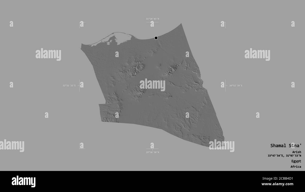 Area of Shamal Sina', governorate of Egypt, isolated on a solid background in a georeferenced bounding box. Labels. Bilevel elevation map. 3D renderin Stock Photohttps://www.alamy.com/image-license-details/?v=1https://www.alamy.com/area-of-shamal-sina-governorate-of-egypt-isolated-on-a-solid-background-in-a-georeferenced-bounding-box-labels-bilevel-elevation-map-3d-renderin-image368423917.html
RF2CBB4D1–Area of Shamal Sina', governorate of Egypt, isolated on a solid background in a georeferenced bounding box. Labels. Bilevel elevation map. 3D renderin
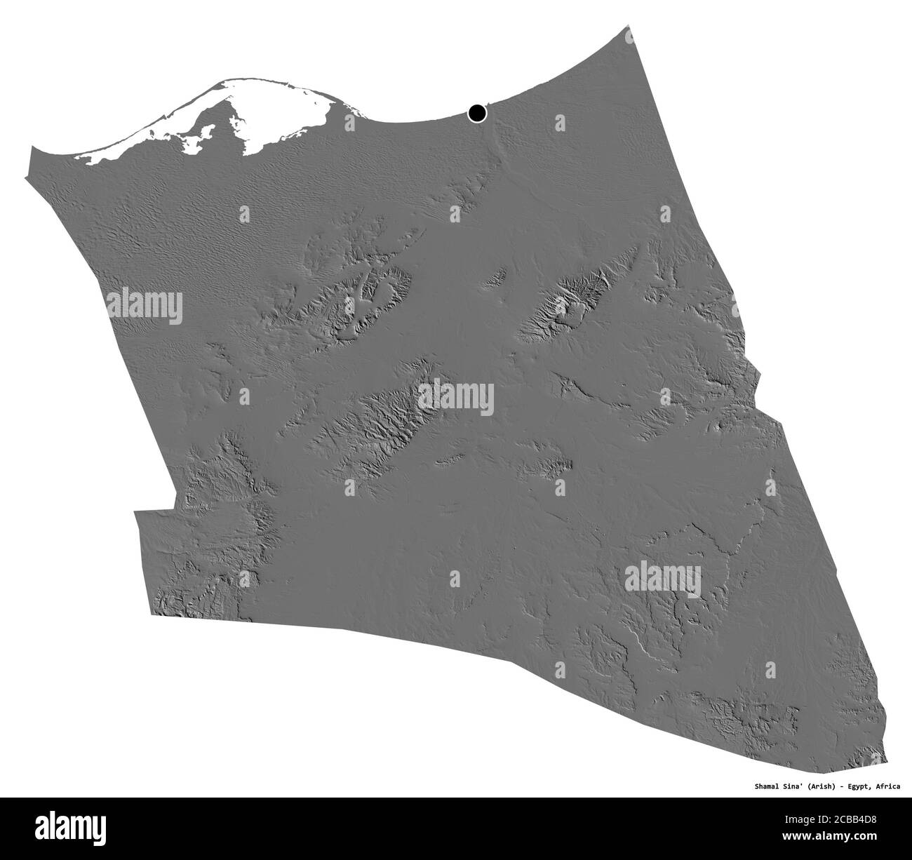 Shape of Shamal Sina', governorate of Egypt, with its capital isolated on white background. Bilevel elevation map. 3D rendering Stock Photohttps://www.alamy.com/image-license-details/?v=1https://www.alamy.com/shape-of-shamal-sina-governorate-of-egypt-with-its-capital-isolated-on-white-background-bilevel-elevation-map-3d-rendering-image368423924.html
RF2CBB4D8–Shape of Shamal Sina', governorate of Egypt, with its capital isolated on white background. Bilevel elevation map. 3D rendering
 Desaturated shape of Egypt with its capital, main regional division and the separated Shamal Sina' area. Labels. Bilevel elevation map. 3D rendering Stock Photohttps://www.alamy.com/image-license-details/?v=1https://www.alamy.com/desaturated-shape-of-egypt-with-its-capital-main-regional-division-and-the-separated-shamal-sina-area-labels-bilevel-elevation-map-3d-rendering-image368423915.html
RF2CBB4CY–Desaturated shape of Egypt with its capital, main regional division and the separated Shamal Sina' area. Labels. Bilevel elevation map. 3D rendering
 Shape of Shamal Sina', governorate of Egypt, and its capital. Distance scale, previews and labels. Bilevel elevation map. 3D rendering Stock Photohttps://www.alamy.com/image-license-details/?v=1https://www.alamy.com/shape-of-shamal-sina-governorate-of-egypt-and-its-capital-distance-scale-previews-and-labels-bilevel-elevation-map-3d-rendering-image368423938.html
RF2CBB4DP–Shape of Shamal Sina', governorate of Egypt, and its capital. Distance scale, previews and labels. Bilevel elevation map. 3D rendering
 Shape of Shamal Sina', governorate of Egypt, with its capital isolated on solid background. Distance scale, region preview and labels. Bilevel elevati Stock Photohttps://www.alamy.com/image-license-details/?v=1https://www.alamy.com/shape-of-shamal-sina-governorate-of-egypt-with-its-capital-isolated-on-solid-background-distance-scale-region-preview-and-labels-bilevel-elevati-image368423922.html
RF2CBB4D6–Shape of Shamal Sina', governorate of Egypt, with its capital isolated on solid background. Distance scale, region preview and labels. Bilevel elevati
 Zoom in on Shamal Sina' (governorate of Egypt) outlined. Oblique perspective. Bilevel elevation map with surface waters. 3D rendering Stock Photohttps://www.alamy.com/image-license-details/?v=1https://www.alamy.com/zoom-in-on-shamal-sina-governorate-of-egypt-outlined-oblique-perspective-bilevel-elevation-map-with-surface-waters-3d-rendering-image364311466.html
RF2C4KPYP–Zoom in on Shamal Sina' (governorate of Egypt) outlined. Oblique perspective. Bilevel elevation map with surface waters. 3D rendering
 Zoom in on Shamal Sina' (governorate of Egypt) extruded. Oblique perspective. Bilevel elevation map with surface waters. 3D rendering Stock Photohttps://www.alamy.com/image-license-details/?v=1https://www.alamy.com/zoom-in-on-shamal-sina-governorate-of-egypt-extruded-oblique-perspective-bilevel-elevation-map-with-surface-waters-3d-rendering-image364311491.html
RF2C4KR0K–Zoom in on Shamal Sina' (governorate of Egypt) extruded. Oblique perspective. Bilevel elevation map with surface waters. 3D rendering