Quick filters:
Basutoland colony Stock Photos and Images
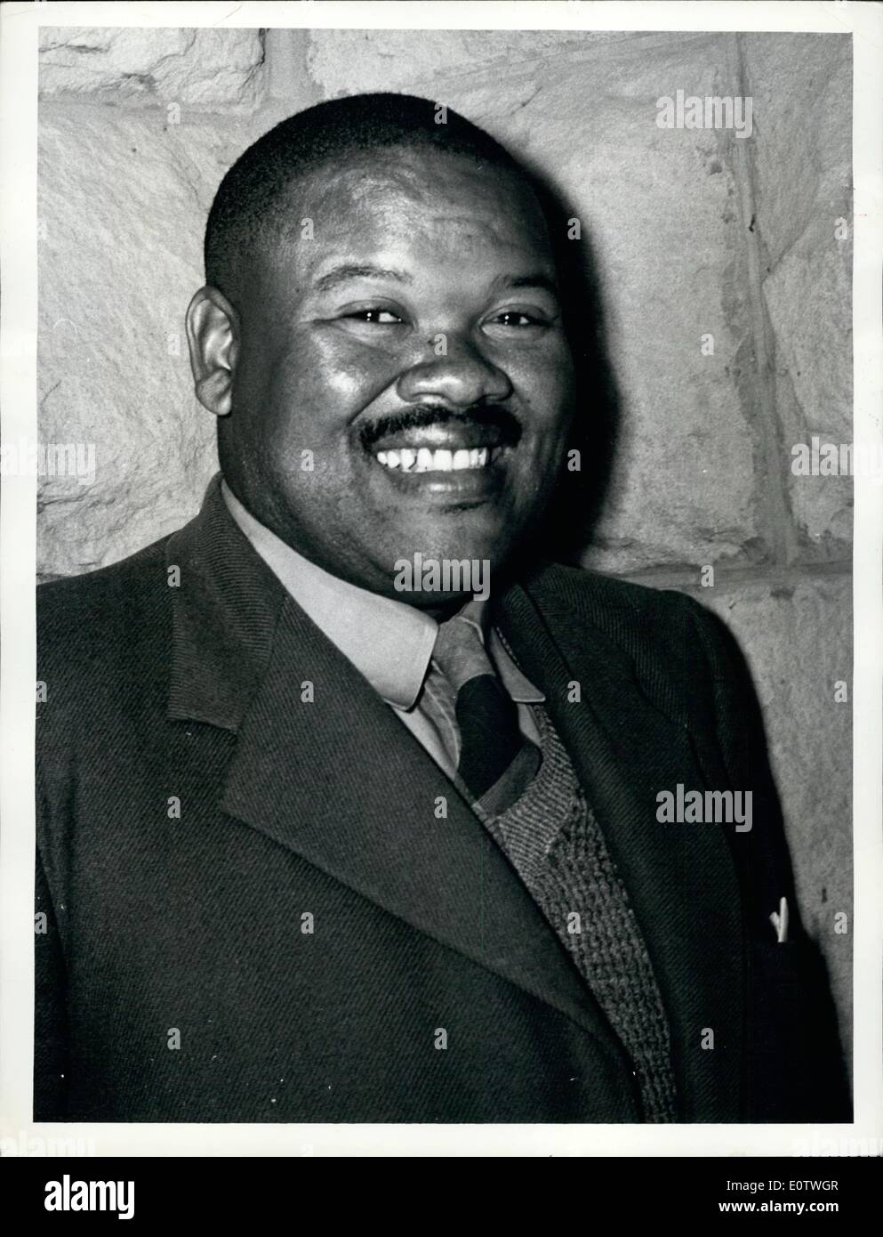 Aug. 08, 1960 - Basutoland Colony: Basutoland, with an area of some 11,700 square miles, is about the size of Belgium. An enclave within the Union of South Africa, its boundaries are those of Natal Province in the south, and of the Orange Free State in the north. About one quarter in the west in lowland; the rest is highland, rising to 11,000 feet in the east in the Drankensberg Range. In the centre is a high plateau, varying from 9,000 to 10,500 feet, where the Union's two largest rivers, the Orange and the Tugela, have their source Stock Photohttps://www.alamy.com/image-license-details/?v=1https://www.alamy.com/aug-08-1960-basutoland-colony-basutoland-with-an-area-of-some-11700-image69388391.html
RME0TWGR–Aug. 08, 1960 - Basutoland Colony: Basutoland, with an area of some 11,700 square miles, is about the size of Belgium. An enclave within the Union of South Africa, its boundaries are those of Natal Province in the south, and of the Orange Free State in the north. About one quarter in the west in lowland; the rest is highland, rising to 11,000 feet in the east in the Drankensberg Range. In the centre is a high plateau, varying from 9,000 to 10,500 feet, where the Union's two largest rivers, the Orange and the Tugela, have their source
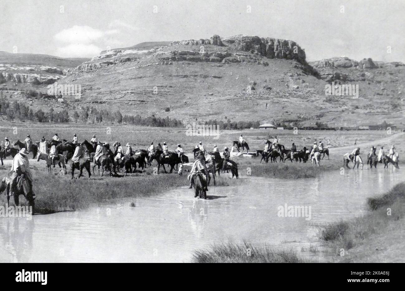 Basutoland was a British Crown colony that existed from 1884 to 1966 in present-day Lesotho. Though the Basotho and their territory had been under British control since 1868 and ruled by Cape Colony from 1871, the Cape Colony was unpopular and unable to control the territory. As a result, Basutoland was brought under direct authority of Queen Victoria, via the High Commissioner, and run by an Executive Council presided over by a series of British Resident Commissioners. 1947 Stock Photohttps://www.alamy.com/image-license-details/?v=1https://www.alamy.com/basutoland-was-a-british-crown-colony-that-existed-from-1884-to-1966-in-present-day-lesotho-though-the-basotho-and-their-territory-had-been-under-british-control-since-1868-and-ruled-by-cape-colony-from-1871-the-cape-colony-was-unpopular-and-unable-to-control-the-territory-as-a-result-basutoland-was-brought-under-direct-authority-of-queen-victoria-via-the-high-commissioner-and-run-by-an-executive-council-presided-over-by-a-series-of-british-resident-commissioners-1947-image482120986.html
RM2K0AE6J–Basutoland was a British Crown colony that existed from 1884 to 1966 in present-day Lesotho. Though the Basotho and their territory had been under British control since 1868 and ruled by Cape Colony from 1871, the Cape Colony was unpopular and unable to control the territory. As a result, Basutoland was brought under direct authority of Queen Victoria, via the High Commissioner, and run by an Executive Council presided over by a series of British Resident Commissioners. 1947
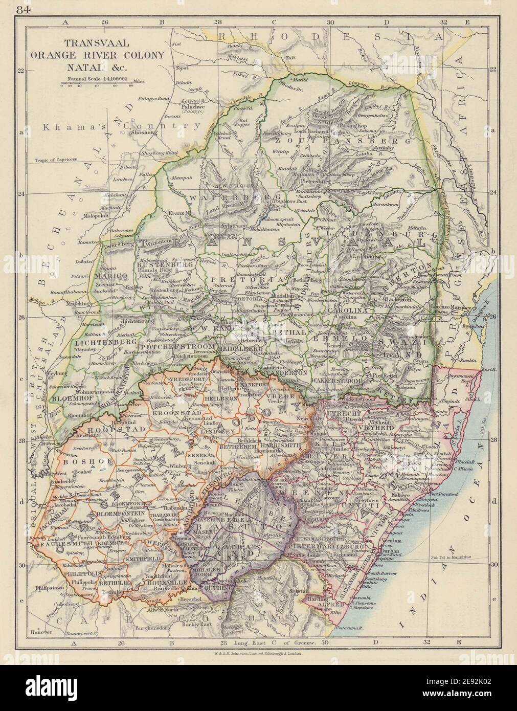 COLONIAL SOUTH AFRICA. Orange River Colony Natal Basutoland Transvaal 1910 map Stock Photohttps://www.alamy.com/image-license-details/?v=1https://www.alamy.com/colonial-south-africa-orange-river-colony-natal-basutoland-transvaal-1910-map-image401429170.html
RF2E92K02–COLONIAL SOUTH AFRICA. Orange River Colony Natal Basutoland Transvaal 1910 map
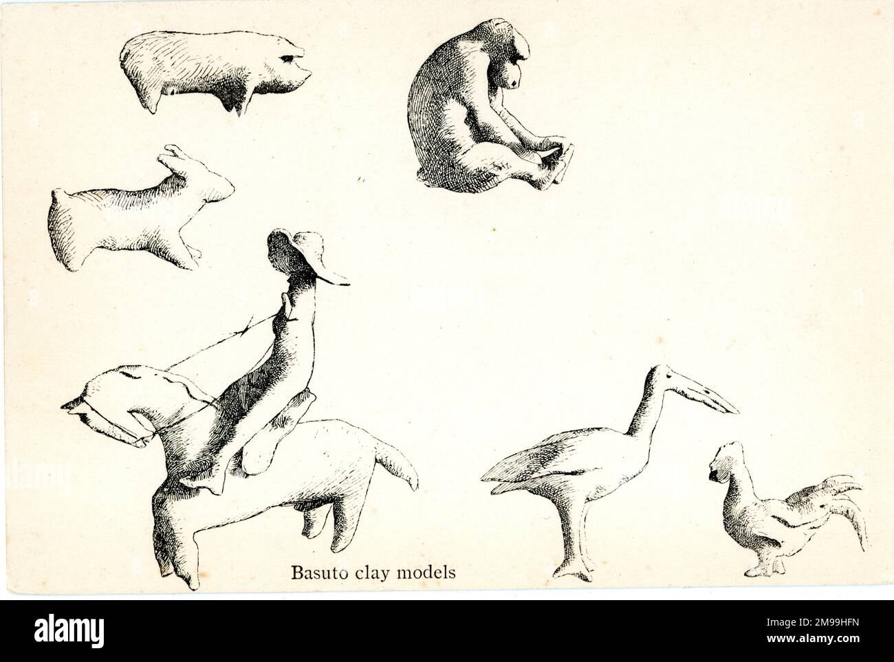 Basuto clay models from Basutoland, formerly a British Crown colony in southern Africa (now Lesotho). Stock Photohttps://www.alamy.com/image-license-details/?v=1https://www.alamy.com/basuto-clay-models-from-basutoland-formerly-a-british-crown-colony-in-southern-africa-now-lesotho-image504843913.html
RM2M99HFN–Basuto clay models from Basutoland, formerly a British Crown colony in southern Africa (now Lesotho).
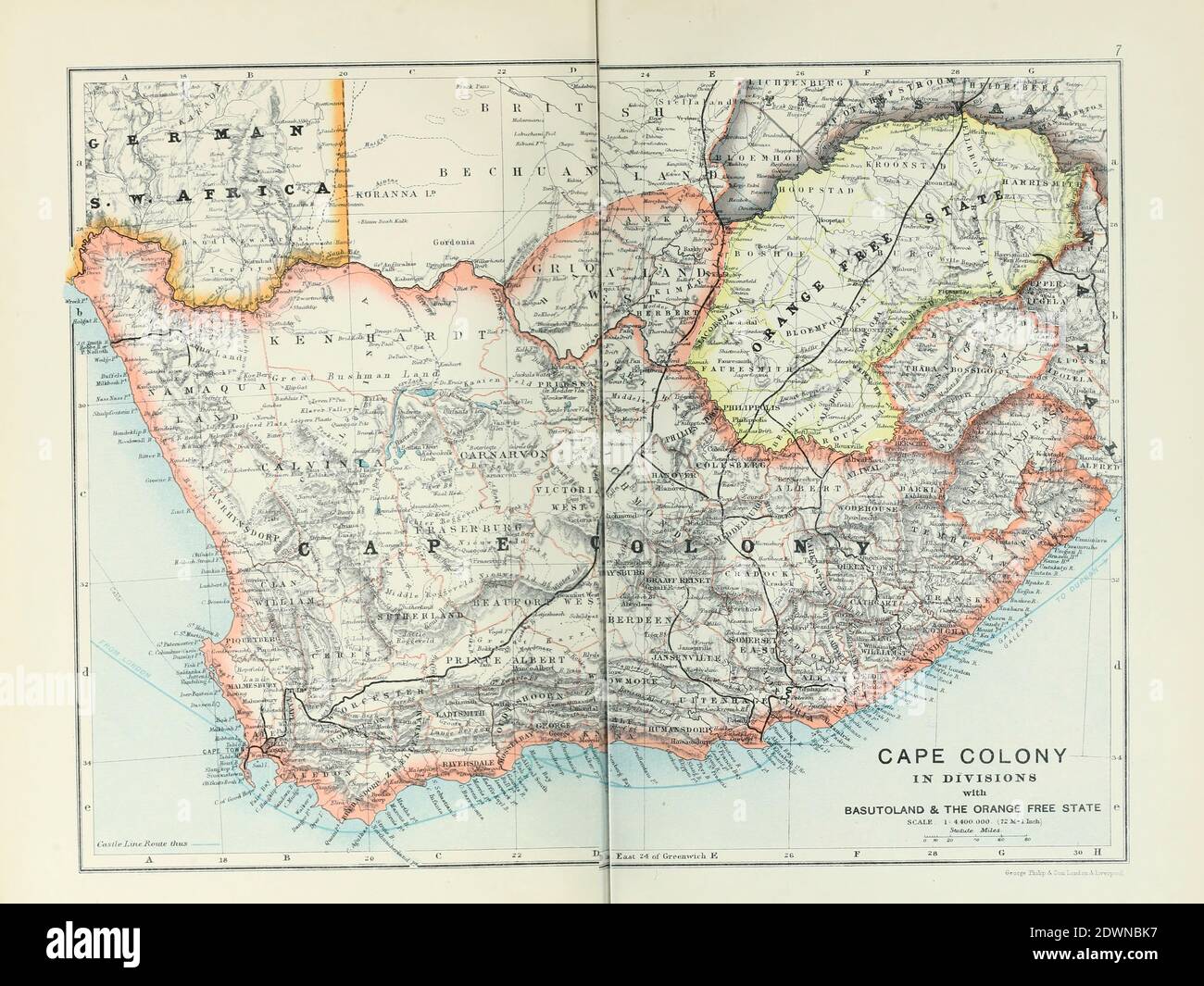 Ancient map of Cape Colony in Divisions with Basutoland and the Orange Free State (1895) from the book 'The Castle Line atlas of South Africa' : a series of 16 plates, printed in colour, containing 30 maps and diagrams, with an account of the geographical features , the climate, the mineral and other resources, and the history of South Africa. And an index of over 6,000 names Stock Photohttps://www.alamy.com/image-license-details/?v=1https://www.alamy.com/ancient-map-of-cape-colony-in-divisions-with-basutoland-and-the-orange-free-state-1895-from-the-book-the-castle-line-atlas-of-south-africa-a-series-of-16-plates-printed-in-colour-containing-30-maps-and-diagrams-with-an-account-of-the-geographical-features-the-climate-the-mineral-and-other-resources-and-the-history-of-south-africa-and-an-index-of-over-6000-names-image394464651.html
RF2DWNBK7–Ancient map of Cape Colony in Divisions with Basutoland and the Orange Free State (1895) from the book 'The Castle Line atlas of South Africa' : a series of 16 plates, printed in colour, containing 30 maps and diagrams, with an account of the geographical features , the climate, the mineral and other resources, and the history of South Africa. And an index of over 6,000 names
 COLONIAL SOUTH AFRICA. Orange River Colony Natal Basutoland Transvaal, 1906 map Stock Photohttps://www.alamy.com/image-license-details/?v=1https://www.alamy.com/stock-photo-colonial-south-africa-orange-river-colony-natal-basutoland-transvaal-102758103.html
RFFY5107–COLONIAL SOUTH AFRICA. Orange River Colony Natal Basutoland Transvaal, 1906 map
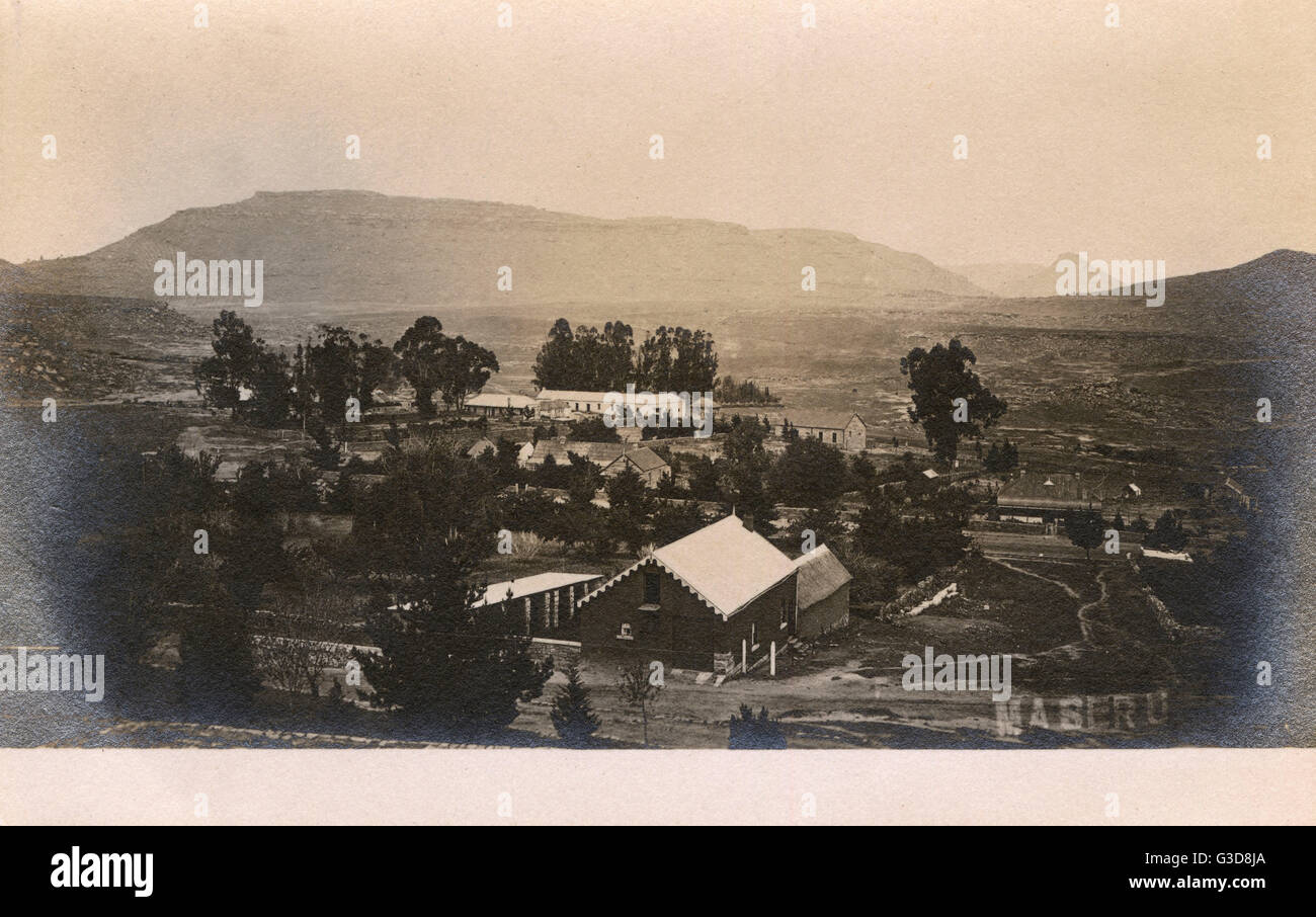 General view of Maseru, Basutoland, South Africa Stock Photohttps://www.alamy.com/image-license-details/?v=1https://www.alamy.com/stock-photo-general-view-of-maseru-basutoland-south-africa-105398338.html
RMG3D8JA–General view of Maseru, Basutoland, South Africa
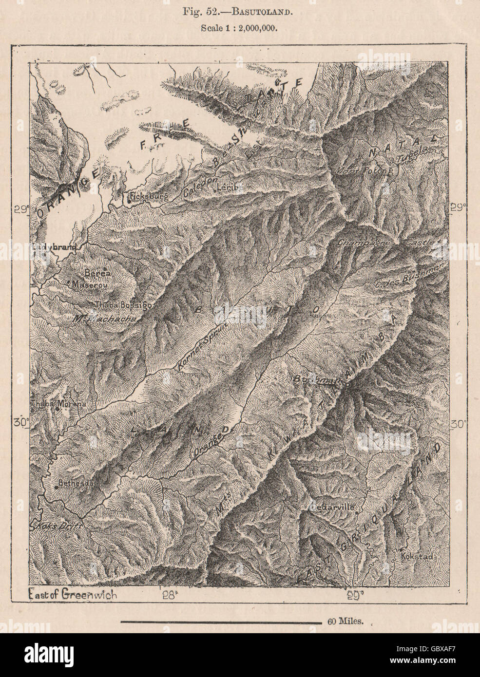 Lesotho. Lesotho, 1885 antique map Stock Photohttps://www.alamy.com/image-license-details/?v=1https://www.alamy.com/stock-photo-lesotho-lesotho-1885-antique-map-110602443.html
RFGBXAF7–Lesotho. Lesotho, 1885 antique map
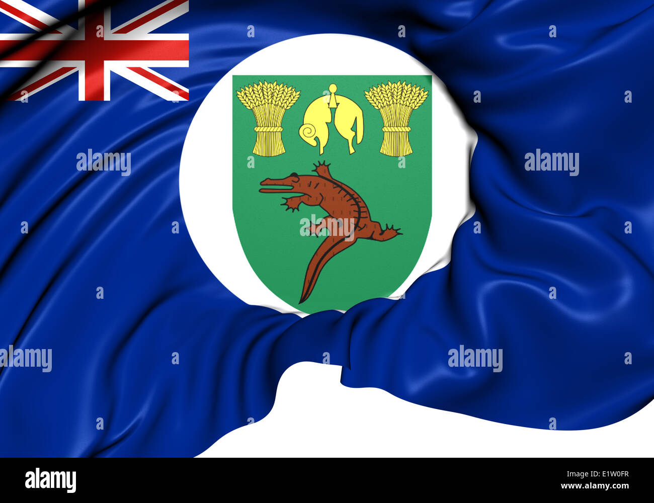 Territory of Basutoland Flag (1884-1966). Close Up. Stock Photohttps://www.alamy.com/image-license-details/?v=1https://www.alamy.com/stock-photo-territory-of-basutoland-flag-1884-1966-close-up-70005371.html
RFE1W0FR–Territory of Basutoland Flag (1884-1966). Close Up.
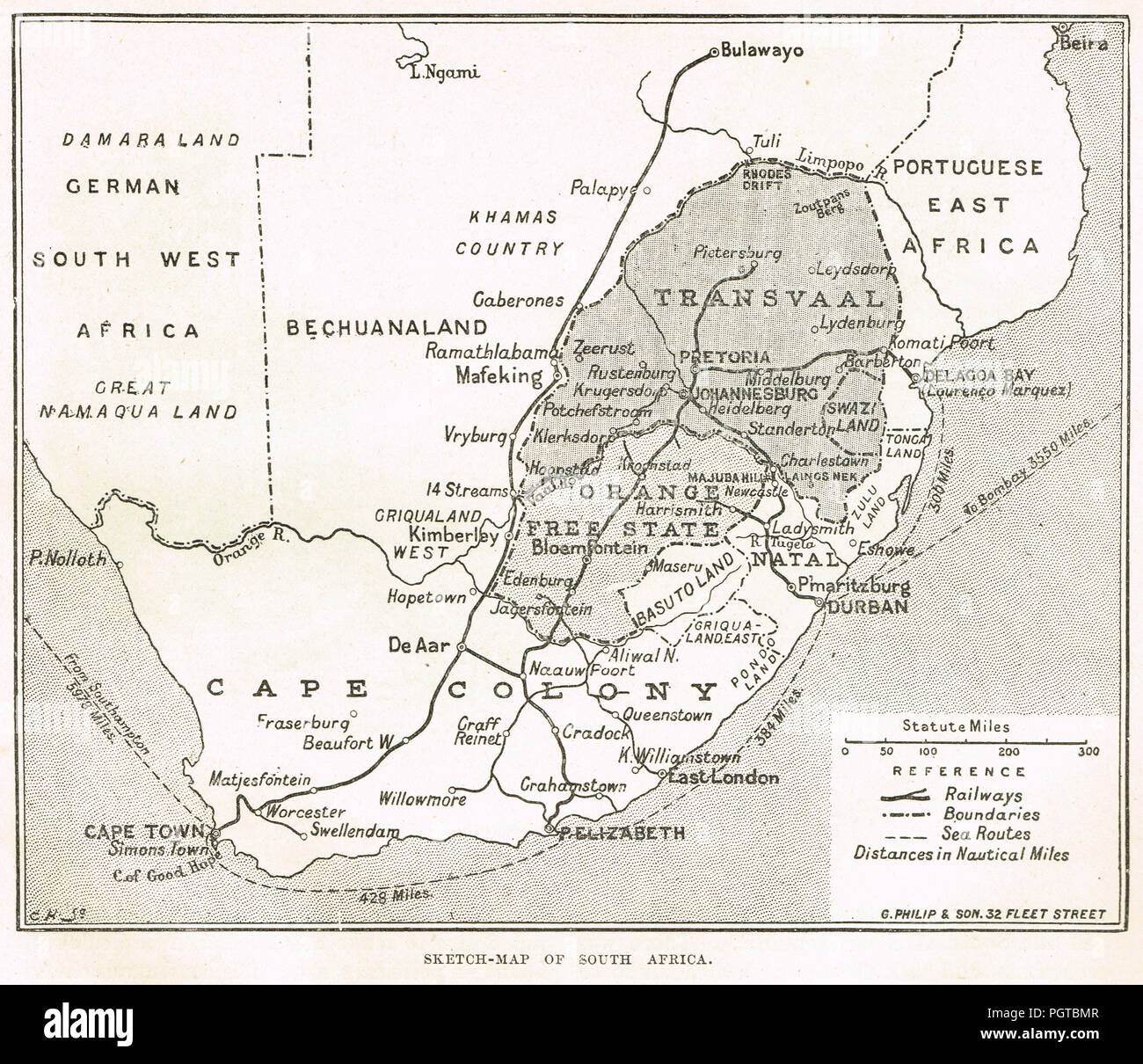 Sketch map of South Africa, Circa 1899. Pre second Boer war Stock Photohttps://www.alamy.com/image-license-details/?v=1https://www.alamy.com/sketch-map-of-south-africa-circa-1899-pre-second-boer-war-image216894967.html
RMPGTBMR–Sketch map of South Africa, Circa 1899. Pre second Boer war
 migratory locust, migratory locust migration in Kaffraria, the area belonging to the British Cape Colony between British Kaffraria, the districts of Queenstown and Wodehouse, Basutoland, Natal Colony and the Indian Ocean., Locusta migratoria, (, ), Wanderheuschrecke, Wanderheuschreckenzug in Kaffraria, dem zur britischen Kapkolonie gehörendes Gebiet zwischen Britisch-Kaffraria, den Distrikten Queenstown und Wodehouse, Basutoland, der Kolonie Natal und dem Indischen Ozean, Criquet migrateur, migration des criquets migrateurs dans le Kaffraria, la région de la colonie britannique du Cap située Stock Photohttps://www.alamy.com/image-license-details/?v=1https://www.alamy.com/migratory-locust-migratory-locust-migration-in-kaffraria-the-area-belonging-to-the-british-cape-colony-between-british-kaffraria-the-districts-of-queenstown-and-wodehouse-basutoland-natal-colony-and-the-indian-ocean-locusta-migratoria-wanderheuschrecke-wanderheuschreckenzug-in-kaffraria-dem-zur-britischen-kapkolonie-gehrendes-gebiet-zwischen-britisch-kaffraria-den-distrikten-queenstown-und-wodehouse-basutoland-der-kolonie-natal-und-dem-indischen-ozean-criquet-migrateur-migration-des-criquets-migrateurs-dans-le-kaffraria-la-rgion-de-la-colonie-britannique-du-cap-situe-image463117015.html
RM2HWCPDB–migratory locust, migratory locust migration in Kaffraria, the area belonging to the British Cape Colony between British Kaffraria, the districts of Queenstown and Wodehouse, Basutoland, Natal Colony and the Indian Ocean., Locusta migratoria, (, ), Wanderheuschrecke, Wanderheuschreckenzug in Kaffraria, dem zur britischen Kapkolonie gehörendes Gebiet zwischen Britisch-Kaffraria, den Distrikten Queenstown und Wodehouse, Basutoland, der Kolonie Natal und dem Indischen Ozean, Criquet migrateur, migration des criquets migrateurs dans le Kaffraria, la région de la colonie britannique du Cap située
 Postage due stamp from Basutoland (later Lesotho), overprinted with higher denomination. Stock Photohttps://www.alamy.com/image-license-details/?v=1https://www.alamy.com/stock-photo-postage-due-stamp-from-basutoland-later-lesotho-overprinted-with-higher-28749301.html
RMBJNJ0N–Postage due stamp from Basutoland (later Lesotho), overprinted with higher denomination.
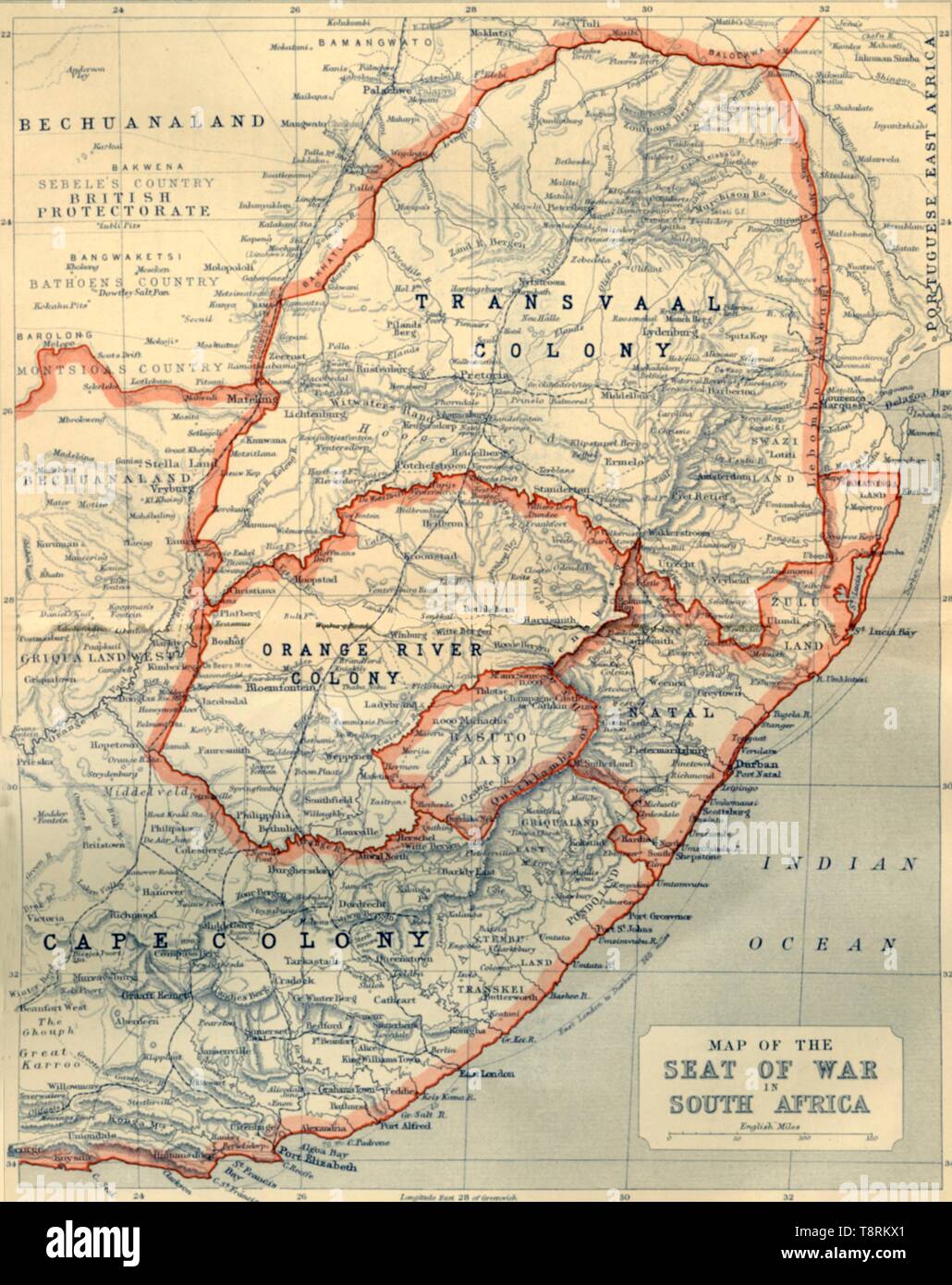 'Map of the Seat of War in South Africa', 1901. Creator: John Bartholomew. Stock Photohttps://www.alamy.com/image-license-details/?v=1https://www.alamy.com/map-of-the-seat-of-war-in-south-africa-1901-creator-john-bartholomew-image246382921.html
RMT8RKX1–'Map of the Seat of War in South Africa', 1901. Creator: John Bartholomew.
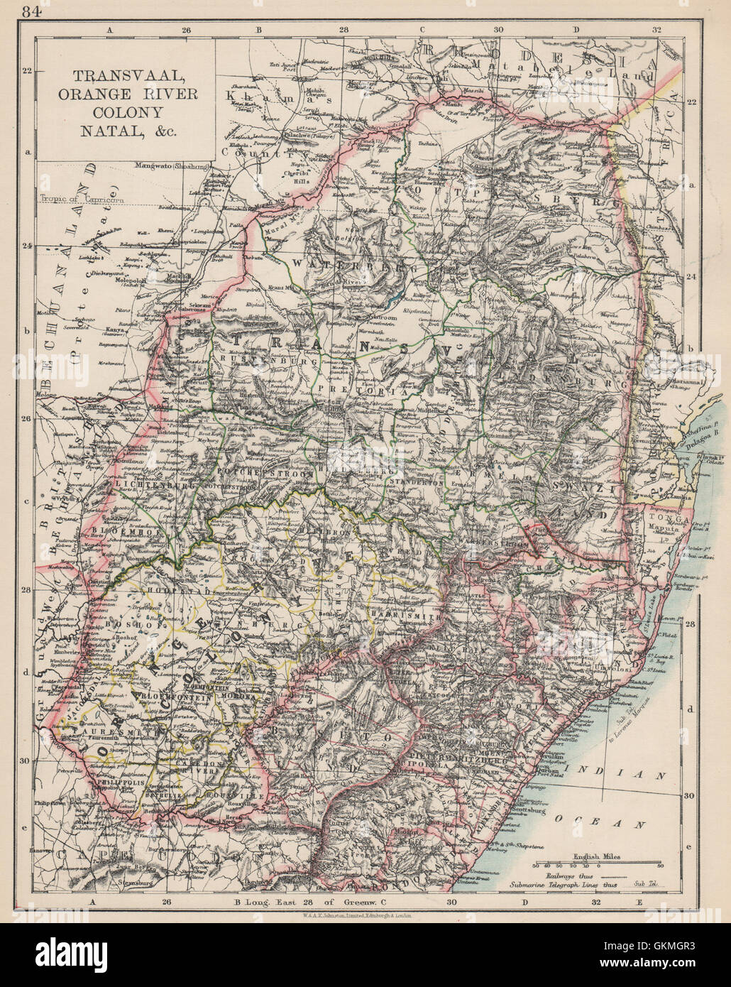 COLONIAL SOUTH AFRICA. Orange Free State Natal Basutoland SA Republic, 1903 map Stock Photohttps://www.alamy.com/image-license-details/?v=1https://www.alamy.com/stock-photo-colonial-south-africa-orange-free-state-natal-basutoland-sa-republic-115392903.html
RFGKMGR3–COLONIAL SOUTH AFRICA. Orange Free State Natal Basutoland SA Republic, 1903 map
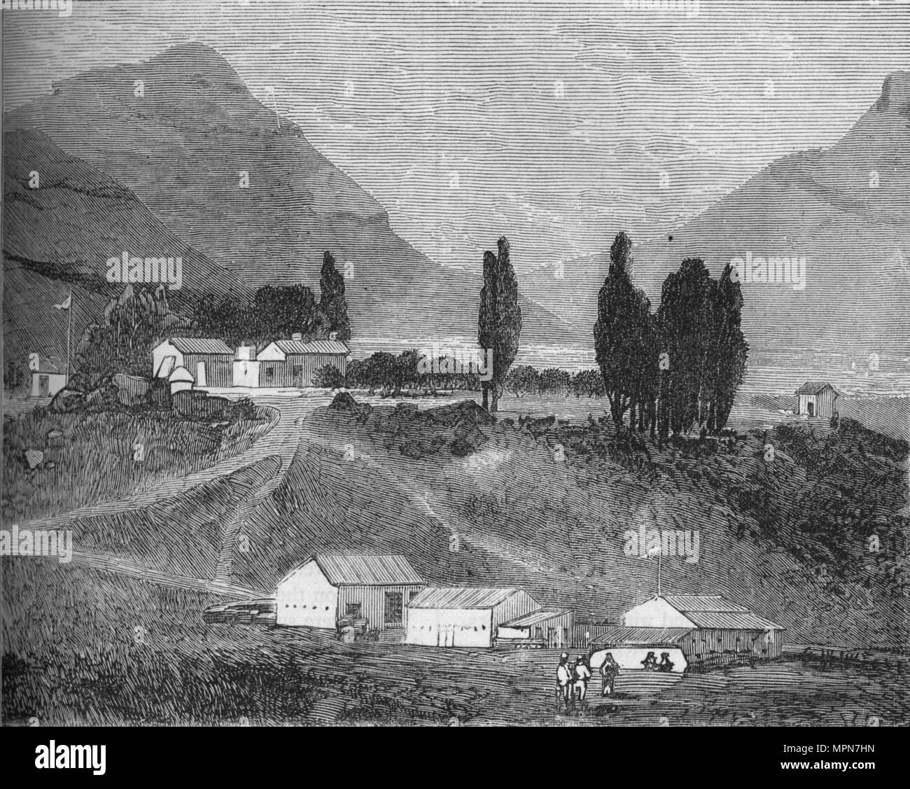 'The Residency, Maseru, Basutoland, Abode of the Chief Magistrate, Commandant Griffiths', c1880. Artist: Unknown. Stock Photohttps://www.alamy.com/image-license-details/?v=1https://www.alamy.com/the-residency-maseru-basutoland-abode-of-the-chief-magistrate-commandant-griffiths-c1880-artist-unknown-image186093089.html
RMMPN7HN–'The Residency, Maseru, Basutoland, Abode of the Chief Magistrate, Commandant Griffiths', c1880. Artist: Unknown.
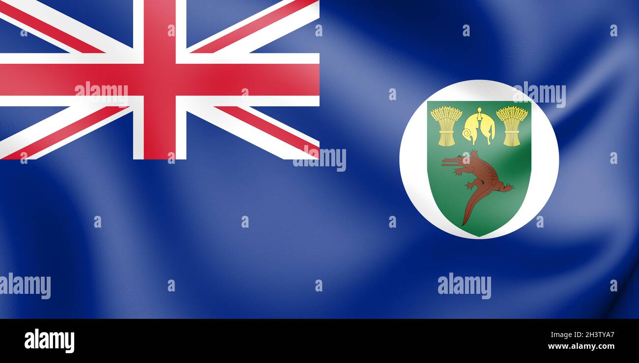 3D Territory of Basutoland Flag (1884-1966). 3D Illustration. Stock Photohttps://www.alamy.com/image-license-details/?v=1https://www.alamy.com/3d-territory-of-basutoland-flag-1884-1966-3d-illustration-image449861839.html
RF2H3TYA7–3D Territory of Basutoland Flag (1884-1966). 3D Illustration.
 Map of the Cape Colony from the book HISTORICAL GEOGRAPHY OF THE BRITISH COLONIES printed in 1897 Stock Photohttps://www.alamy.com/image-license-details/?v=1https://www.alamy.com/map-of-the-cape-colony-from-the-book-historical-geography-of-the-british-colonies-printed-in-1897-image456332327.html
RF2HEBMF3–Map of the Cape Colony from the book HISTORICAL GEOGRAPHY OF THE BRITISH COLONIES printed in 1897
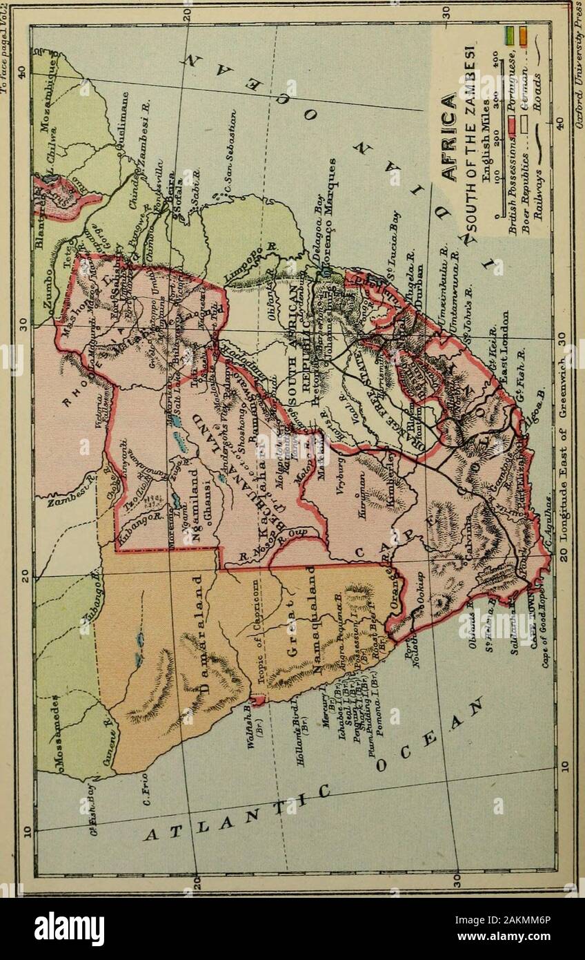 South and East Africa . OGRAPHY OF THE BRITISH COLONIES BY C p. LUCAS, B.A. OF BALLIOL COLLEGE, OXFORD, AND THE COLONIAL OFFICE, LONDO>f VOL. IV SOUTH AND EAST AFRICA PART II. GEOGRAPHICALWITH MAPS AT THE CLARENDON PRESS1897 PRINTED AT THE CLARENDON PRESS BY HORACE HARTPRINTKR TO THE UNIVERSITY CONTENTS OF PART II I SECTION I. BRITISH SOUTH AFRICA. PACK Introductory .... ...... i Chap. I. The Cape Colony 4 Chap. II. Natal 37 Chap. III. Ztiluland ........ 49 Chap. IV. Basutoland . . . . .60 Chap. V. TAe Beclmanalaiid Protectorate, Matabeleland and Mashonaland -7° SECTION II.British Central A Stock Photohttps://www.alamy.com/image-license-details/?v=1https://www.alamy.com/south-and-east-africa-ography-of-the-british-colonies-by-c-p-lucas-ba-of-balliol-college-oxford-and-the-colonial-office-londogtf-vol-iv-south-and-east-africa-part-ii-geographicalwith-maps-at-the-clarendon-press1897-printed-at-the-clarendon-press-by-horace-hartprintkr-to-the-university-contents-of-part-ii-i-section-i-british-south-africa-pack-introductory-i-chap-i-the-cape-colony-4-chap-ii-natal-37-chap-iii-ztiluland-49-chap-iv-basutoland-60-chap-v-tae-beclmanalaiid-protectorate-matabeleland-and-mashonaland-7-section-iibritish-central-a-image339130366.html
RM2AKMM6P–South and East Africa . OGRAPHY OF THE BRITISH COLONIES BY C p. LUCAS, B.A. OF BALLIOL COLLEGE, OXFORD, AND THE COLONIAL OFFICE, LONDO>f VOL. IV SOUTH AND EAST AFRICA PART II. GEOGRAPHICALWITH MAPS AT THE CLARENDON PRESS1897 PRINTED AT THE CLARENDON PRESS BY HORACE HARTPRINTKR TO THE UNIVERSITY CONTENTS OF PART II I SECTION I. BRITISH SOUTH AFRICA. PACK Introductory .... ...... i Chap. I. The Cape Colony 4 Chap. II. Natal 37 Chap. III. Ztiluland ........ 49 Chap. IV. Basutoland . . . . .60 Chap. V. TAe Beclmanalaiid Protectorate, Matabeleland and Mashonaland -7° SECTION II.British Central A
RFPJDT6A–Set of icons. British overseas territories (BOT) and colonies flags.
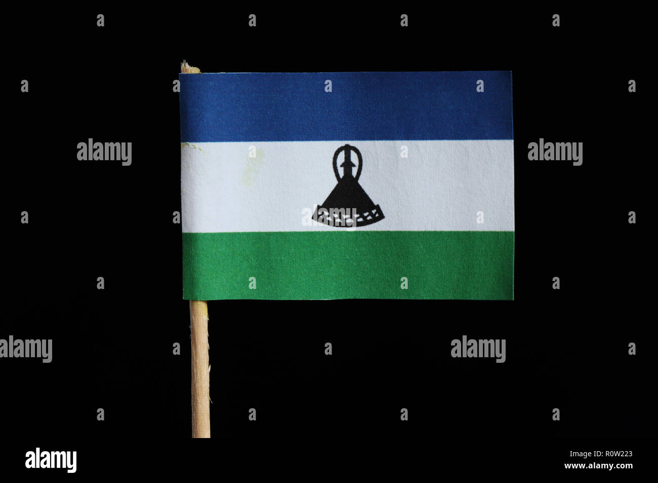 A official and original flag of Lesotho on toothpick on black background. A horizontal triband of blue, white and green with black mokorotlo centred o Stock Photohttps://www.alamy.com/image-license-details/?v=1https://www.alamy.com/a-official-and-original-flag-of-lesotho-on-toothpick-on-black-background-a-horizontal-triband-of-blue-white-and-green-with-black-mokorotlo-centred-o-image224285211.html
RFR0W223–A official and original flag of Lesotho on toothpick on black background. A horizontal triband of blue, white and green with black mokorotlo centred o
 A ' KRAAL' OR VILLAGE IN BASUTOLAND From the Book ' Britain across the seas : Africa : a history and description of the British Empire in Africa ' by Johnston, Harry Hamilton, Sir, 1858-1927 Published in 1910 in London by National Society's Depository Stock Photohttps://www.alamy.com/image-license-details/?v=1https://www.alamy.com/a-kraal-or-village-in-basutoland-from-the-book-britain-across-the-seas-africa-a-history-and-description-of-the-british-empire-in-africa-by-johnston-harry-hamilton-sir-1858-1927-published-in-1910-in-london-by-national-societys-depository-image424904369.html
RM2FK81T1–A ' KRAAL' OR VILLAGE IN BASUTOLAND From the Book ' Britain across the seas : Africa : a history and description of the British Empire in Africa ' by Johnston, Harry Hamilton, Sir, 1858-1927 Published in 1910 in London by National Society's Depository
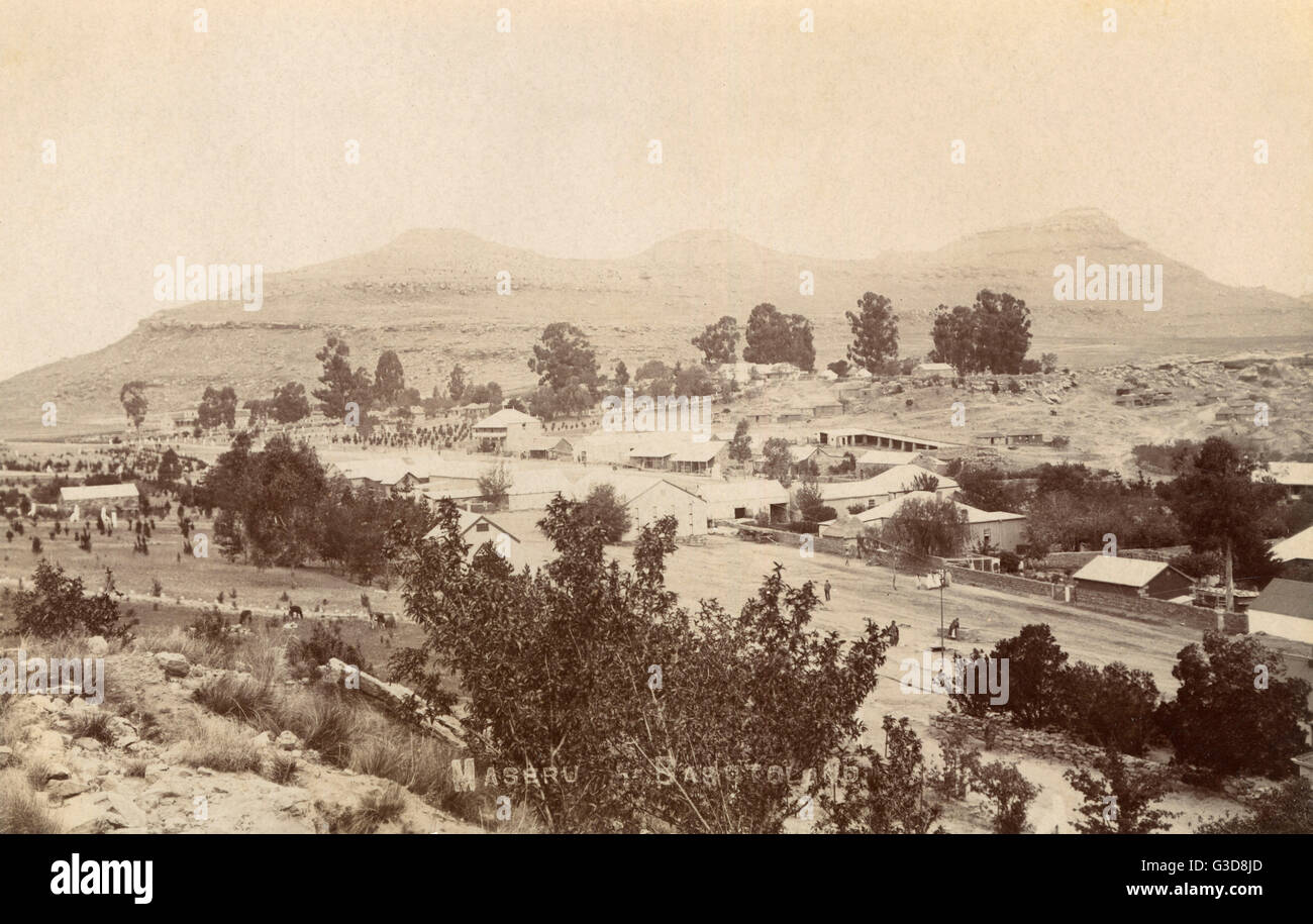 General view of Maseru, Basutoland, South Africa Stock Photohttps://www.alamy.com/image-license-details/?v=1https://www.alamy.com/stock-photo-general-view-of-maseru-basutoland-south-africa-105398341.html
RMG3D8JD–General view of Maseru, Basutoland, South Africa
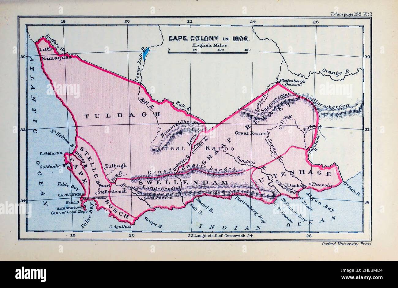 Cape Colony in 1806 from the book HISTORICAL GEOGRAPHY OF THE BRITISH COLONIES printed in 1897 Stock Photohttps://www.alamy.com/image-license-details/?v=1https://www.alamy.com/cape-colony-in-1806-from-the-book-historical-geography-of-the-british-colonies-printed-in-1897-image456332272.html
RF2HEBMD4–Cape Colony in 1806 from the book HISTORICAL GEOGRAPHY OF THE BRITISH COLONIES printed in 1897
 War in South Africa and the Dark continent from savagery to civilization : The strange story of a weird world from the earliest ages to the present, including the war with the Boers .. . toland. The ex-ports to the Cape, Natal and South African Republic are chiefly agri-cultural produce and diamonds, while other merchandise goes toBasutoland. The trade is estimated as follows for two years: IMPORTSFROM, 1896. Cape Colony £845,812 Natal 224,440 Basutoland 116,205 So. African Republic IMPORTSFROM, 1897. EXPORTSTO, 1896. EXPORTSTO, 1897. £913,158 £612,313 f735.883 185,469 Il6,96l 127,253 107,987 Stock Photohttps://www.alamy.com/image-license-details/?v=1https://www.alamy.com/war-in-south-africa-and-the-dark-continent-from-savagery-to-civilization-the-strange-story-of-a-weird-world-from-the-earliest-ages-to-the-present-including-the-war-with-the-boers-toland-the-ex-ports-to-the-cape-natal-and-south-african-republic-are-chiefly-agri-cultural-produce-and-diamonds-while-other-merchandise-goes-tobasutoland-the-trade-is-estimated-as-follows-for-two-years-importsfrom-1896-cape-colony-845812-natal-224440-basutoland-116205-so-african-republic-importsfrom-1897-exportsto-1896-exportsto-1897-913158-612313-f735883-185469-il696l-127253-107987-image339249318.html
RM2AKX3Y2–War in South Africa and the Dark continent from savagery to civilization : The strange story of a weird world from the earliest ages to the present, including the war with the Boers .. . toland. The ex-ports to the Cape, Natal and South African Republic are chiefly agri-cultural produce and diamonds, while other merchandise goes toBasutoland. The trade is estimated as follows for two years: IMPORTSFROM, 1896. Cape Colony £845,812 Natal 224,440 Basutoland 116,205 So. African Republic IMPORTSFROM, 1897. EXPORTSTO, 1896. EXPORTSTO, 1897. £913,158 £612,313 f735.883 185,469 Il6,96l 127,253 107,987
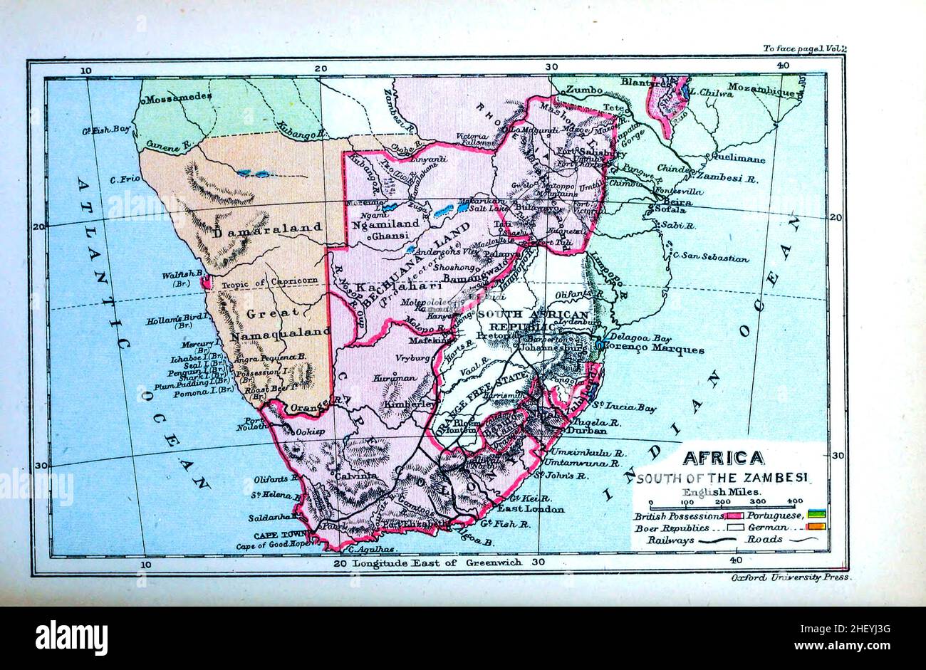 Map of Africa South of the Zambesi The Zambezi River (also spelled Zambeze and Zambesi) from the book HISTORICAL GEOGRAPHY OF THE BRITISH COLONIES printed in 1897 Stock Photohttps://www.alamy.com/image-license-details/?v=1https://www.alamy.com/map-of-africa-south-of-the-zambesi-the-zambezi-river-also-spelled-zambeze-and-zambesi-from-the-book-historical-geography-of-the-british-colonies-printed-in-1897-image456681668.html
RF2HEYJ3G–Map of Africa South of the Zambesi The Zambezi River (also spelled Zambeze and Zambesi) from the book HISTORICAL GEOGRAPHY OF THE BRITISH COLONIES printed in 1897
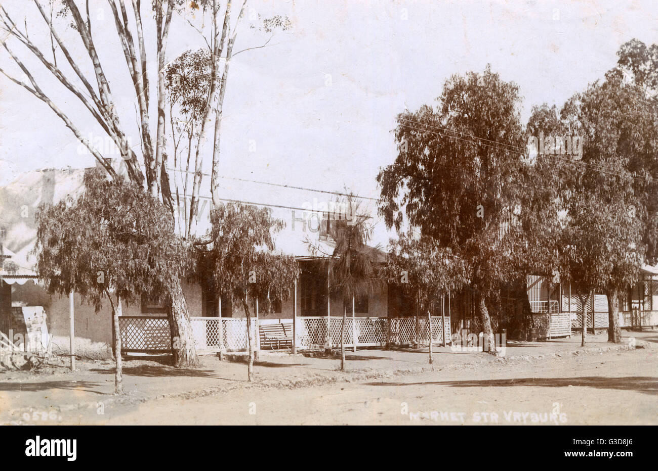 Vryburg Hotel, Vryburg, Basutoland, South Africa Stock Photohttps://www.alamy.com/image-license-details/?v=1https://www.alamy.com/stock-photo-vryburg-hotel-vryburg-basutoland-south-africa-105398334.html
RMG3D8J6–Vryburg Hotel, Vryburg, Basutoland, South Africa
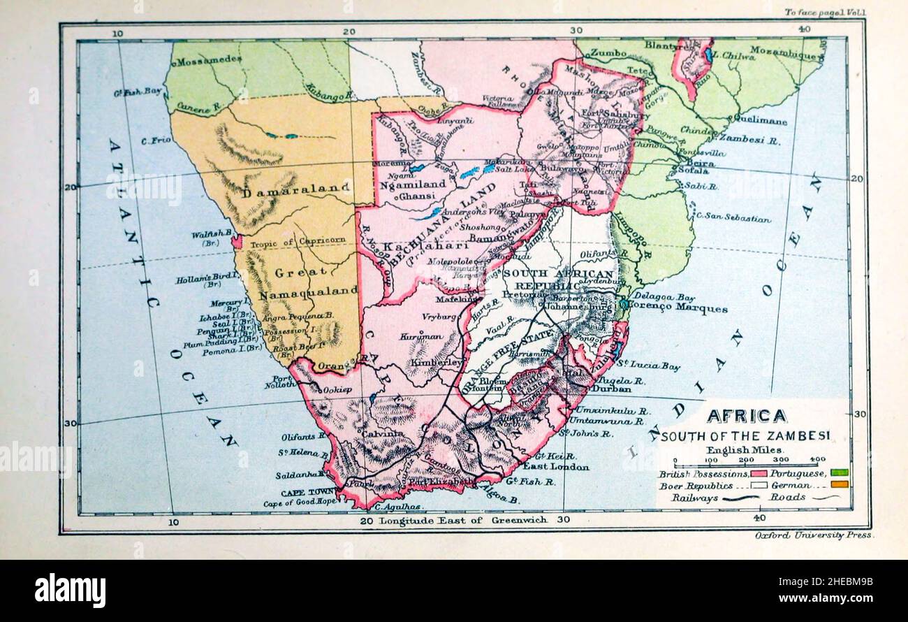 Map of Africa South of the Zambesi The Zambezi River (also spelled Zambeze and Zambesi) from the book HISTORICAL GEOGRAPHY OF THE BRITISH COLONIES printed in 1897 Stock Photohttps://www.alamy.com/image-license-details/?v=1https://www.alamy.com/map-of-africa-south-of-the-zambesi-the-zambezi-river-also-spelled-zambeze-and-zambesi-from-the-book-historical-geography-of-the-british-colonies-printed-in-1897-image456332167.html
RF2HEBM9B–Map of Africa South of the Zambesi The Zambezi River (also spelled Zambeze and Zambesi) from the book HISTORICAL GEOGRAPHY OF THE BRITISH COLONIES printed in 1897
 The colony of Natal; an official illustrated handbook and railway guide . 1^ i<N^^ik^&^K}v-^^^s^^l^i^ SECTION II. PHYSICAL GliOt;KAriIV. Position nr^HK Colon} of Natal is situated on the south-east coastBoundaries X °^ Africa, between 22h° and 31 S. Lat. and 29° and31^° E. Lon. Its area is about 20,000 square miles, equal to12,800,000 acres, or a square of 142 miles. Its greatestlength is 225 miles, and breadth 160 miles. The boundariesare as follows:—West and north-west, the Drakensberg, atowering range of mountains separating it from Basutoland,the Orange Free State, and the South African Stock Photohttps://www.alamy.com/image-license-details/?v=1https://www.alamy.com/the-colony-of-natal-an-official-illustrated-handbook-and-railway-guide-1-iltnikkv-sli-section-ii-physical-gliotkariiv-position-nrhk-colon-of-natal-is-situated-on-the-south-east-coastboundaries-x-africa-between-22h-and-31-s-lat-and-29-and31-e-lon-its-area-is-about-20000-square-miles-equal-to12800000-acres-or-a-square-of-142-miles-its-greatestlength-is-225-miles-and-breadth-160-miles-the-boundariesare-as-followswest-and-north-west-the-drakensberg-atowering-range-of-mountains-separating-it-from-basutolandthe-orange-free-state-and-the-south-african-image339166230.html
RM2AKP9YJ–The colony of Natal; an official illustrated handbook and railway guide . 1^ i<N^^ik^&^K}v-^^^s^^l^i^ SECTION II. PHYSICAL GliOt;KAriIV. Position nr^HK Colon} of Natal is situated on the south-east coastBoundaries X °^ Africa, between 22h° and 31 S. Lat. and 29° and31^° E. Lon. Its area is about 20,000 square miles, equal to12,800,000 acres, or a square of 142 miles. Its greatestlength is 225 miles, and breadth 160 miles. The boundariesare as follows:—West and north-west, the Drakensberg, atowering range of mountains separating it from Basutoland,the Orange Free State, and the South African
 Ancient map of South Africa Eastern Sheet (1895) from the book 'The Castle Line atlas of South Africa' : a series of 16 plates, printed in colour, containing 30 maps and diagrams, with an account of the geographical features , the climate, the mineral and other resources, and the history of South Africa. And an index of over 6,000 names Stock Photohttps://www.alamy.com/image-license-details/?v=1https://www.alamy.com/ancient-map-of-south-africa-eastern-sheet-1895-from-the-book-the-castle-line-atlas-of-south-africa-a-series-of-16-plates-printed-in-colour-containing-30-maps-and-diagrams-with-an-account-of-the-geographical-features-the-climate-the-mineral-and-other-resources-and-the-history-of-south-africa-and-an-index-of-over-6000-names-image394465842.html
RF2DWND5P–Ancient map of South Africa Eastern Sheet (1895) from the book 'The Castle Line atlas of South Africa' : a series of 16 plates, printed in colour, containing 30 maps and diagrams, with an account of the geographical features , the climate, the mineral and other resources, and the history of South Africa. And an index of over 6,000 names
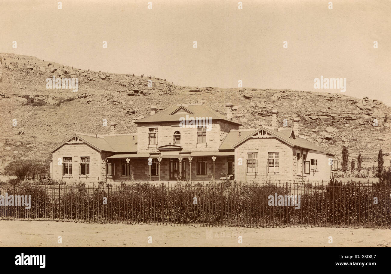 Maseru Hospital, Basutoland, South Africa Stock Photohttps://www.alamy.com/image-license-details/?v=1https://www.alamy.com/stock-photo-maseru-hospital-basutoland-south-africa-105398335.html
RMG3D8J7–Maseru Hospital, Basutoland, South Africa
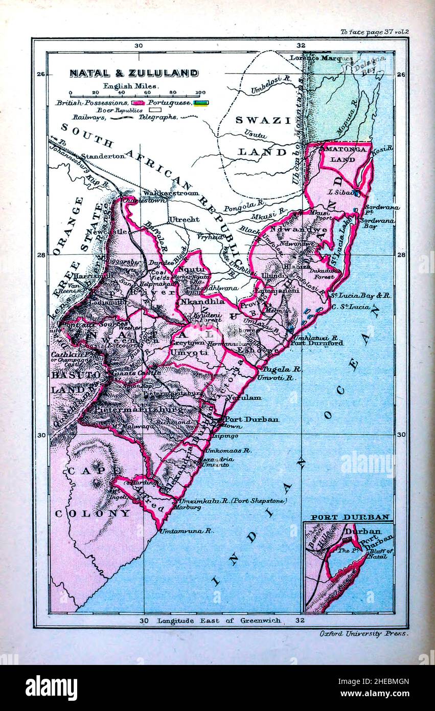 Map of Natal and Zululand from the book HISTORICAL GEOGRAPHY OF THE BRITISH COLONIES printed in 1897 Stock Photohttps://www.alamy.com/image-license-details/?v=1https://www.alamy.com/map-of-natal-and-zululand-from-the-book-historical-geography-of-the-british-colonies-printed-in-1897-image456332373.html
RF2HEBMGN–Map of Natal and Zululand from the book HISTORICAL GEOGRAPHY OF THE BRITISH COLONIES printed in 1897
 The Commercial and financial chronicle . Paid-up Capital £1,548,525 or $7,536,153 Reserve Fund £1,900,000 or $9,246,666 Reserve Liability of Share-holders £4,645,575 or $22,608,468 Deposits £18,377,856 or $89,438,899 Total Resources £26,171,558 or $127,368,249 Bankers to the Government of the Cape of Good Hope and the British Government in the Cape Colony and Transvaal One Hundred and Fifty-one (151)Branches in Cape Colony, Natal,Transvaal, Orange River Colony,Basutoland, Rhodesia, BritishCentral Africa and East Africa W. H. AACINTYRE, Agent 40 WALL STREET, NEW YORK Bank Premises, Johannesburg Stock Photohttps://www.alamy.com/image-license-details/?v=1https://www.alamy.com/the-commercial-and-financial-chronicle-paid-up-capital-1548525-or-7536153-reserve-fund-1900000-or-9246666-reserve-liability-of-share-holders-4645575-or-22608468-deposits-18377856-or-89438899-total-resources-26171558-or-127368249-bankers-to-the-government-of-the-cape-of-good-hope-and-the-british-government-in-the-cape-colony-and-transvaal-one-hundred-and-fifty-one-151branches-in-cape-colony-nataltransvaal-orange-river-colonybasutoland-rhodesia-britishcentral-africa-and-east-africa-w-h-aacintyre-agent-40-wall-street-new-york-bank-premises-johannesburg-image342858830.html
RM2AWPFX6–The Commercial and financial chronicle . Paid-up Capital £1,548,525 or $7,536,153 Reserve Fund £1,900,000 or $9,246,666 Reserve Liability of Share-holders £4,645,575 or $22,608,468 Deposits £18,377,856 or $89,438,899 Total Resources £26,171,558 or $127,368,249 Bankers to the Government of the Cape of Good Hope and the British Government in the Cape Colony and Transvaal One Hundred and Fifty-one (151)Branches in Cape Colony, Natal,Transvaal, Orange River Colony,Basutoland, Rhodesia, BritishCentral Africa and East Africa W. H. AACINTYRE, Agent 40 WALL STREET, NEW YORK Bank Premises, Johannesburg
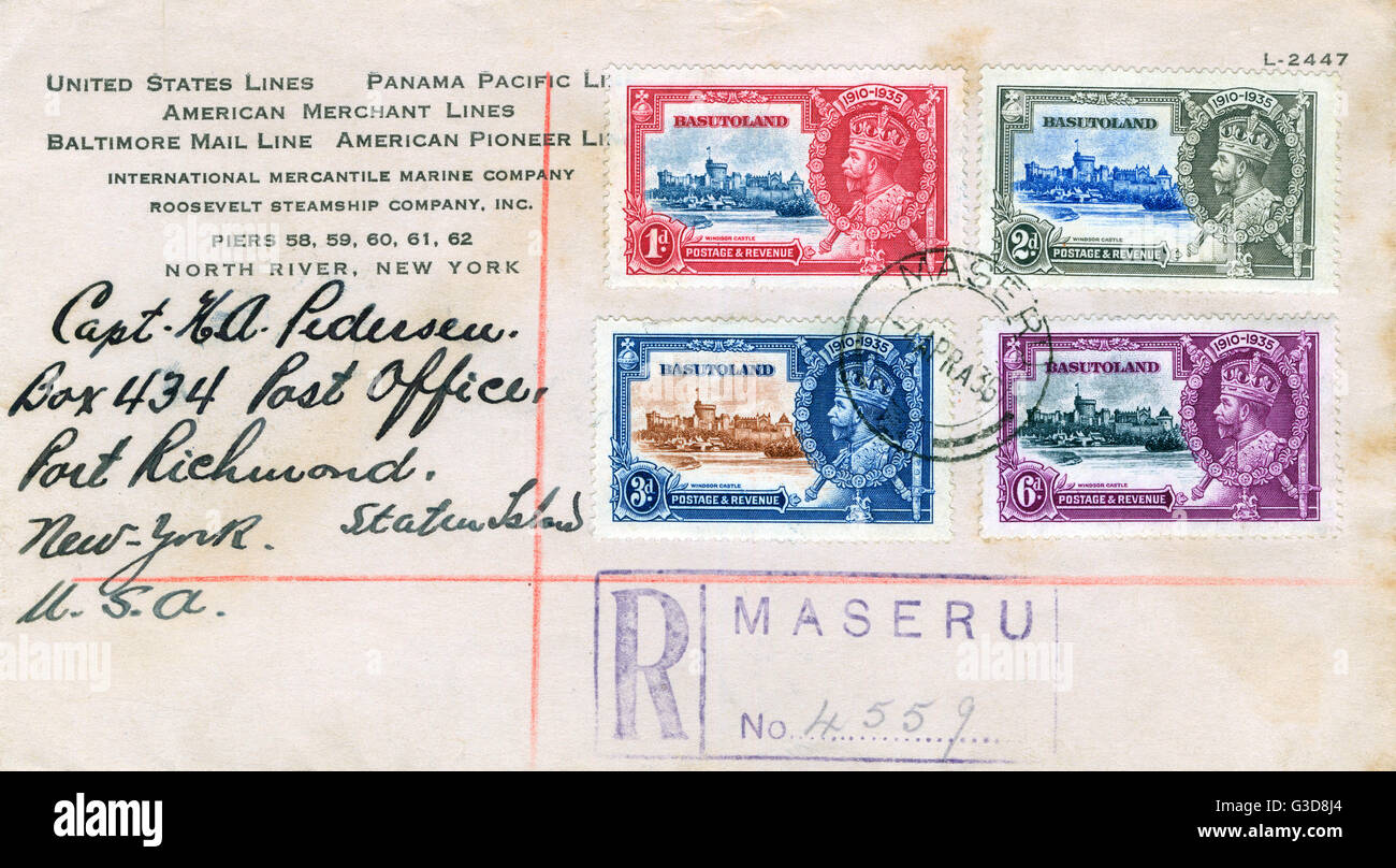 Envelope with stamps from Basutoland, South Africa Stock Photohttps://www.alamy.com/image-license-details/?v=1https://www.alamy.com/stock-photo-envelope-with-stamps-from-basutoland-south-africa-105398332.html
RMG3D8J4–Envelope with stamps from Basutoland, South Africa
![Zulu and Boer Wars [Top] Kaffraria to illustrate the Kaffir Wars from 1811 - 1878 [Bottom] from the book HISTORICAL GEOGRAPHY OF THE BRITISH COLONIES printed in 1897 Stock Photo Zulu and Boer Wars [Top] Kaffraria to illustrate the Kaffir Wars from 1811 - 1878 [Bottom] from the book HISTORICAL GEOGRAPHY OF THE BRITISH COLONIES printed in 1897 Stock Photo](https://c8.alamy.com/comp/2HEBMDB/zulu-and-boer-wars-top-kaffraria-to-illustrate-the-kaffir-wars-from-1811-1878-bottom-from-the-book-historical-geography-of-the-british-colonies-printed-in-1897-2HEBMDB.jpg) Zulu and Boer Wars [Top] Kaffraria to illustrate the Kaffir Wars from 1811 - 1878 [Bottom] from the book HISTORICAL GEOGRAPHY OF THE BRITISH COLONIES printed in 1897 Stock Photohttps://www.alamy.com/image-license-details/?v=1https://www.alamy.com/zulu-and-boer-wars-top-kaffraria-to-illustrate-the-kaffir-wars-from-1811-1878-bottom-from-the-book-historical-geography-of-the-british-colonies-printed-in-1897-image456332279.html
Zulu and Boer Wars [Top] Kaffraria to illustrate the Kaffir Wars from 1811 - 1878 [Bottom] from the book HISTORICAL GEOGRAPHY OF THE BRITISH COLONIES printed in 1897 Stock Photohttps://www.alamy.com/image-license-details/?v=1https://www.alamy.com/zulu-and-boer-wars-top-kaffraria-to-illustrate-the-kaffir-wars-from-1811-1878-bottom-from-the-book-historical-geography-of-the-british-colonies-printed-in-1897-image456332279.htmlRF2HEBMDB–Zulu and Boer Wars [Top] Kaffraria to illustrate the Kaffir Wars from 1811 - 1878 [Bottom] from the book HISTORICAL GEOGRAPHY OF THE BRITISH COLONIES printed in 1897
 . Natal province : descriptive guide and official hand-book . 1—Under Canvas 2—Ox Sledge Near the deepest recess of the retiring angle the mountains, almost as high, havethere been distinguished by the French missionaries (originally of the Cape Colony) as the Mont aux Sources, because they constitute at that spot the culminating focus of the landelevation of this part of the African Continent, and really form the watershed of three greatriver systems—the Tugela and its affluents, which flow down into Natal : the Orange Riverand Caledon. which pass through Basutoland to the south-west ; and th Stock Photohttps://www.alamy.com/image-license-details/?v=1https://www.alamy.com/natal-province-descriptive-guide-and-official-hand-book-1under-canvas-2ox-sledge-near-the-deepest-recess-of-the-retiring-angle-the-mountains-almost-as-high-havethere-been-distinguished-by-the-french-missionaries-originally-of-the-cape-colony-as-the-mont-aux-sources-because-they-constitute-at-that-spot-the-culminating-focus-of-the-landelevation-of-this-part-of-the-african-continent-and-really-form-the-watershed-of-three-greatriver-systemsthe-tugela-and-its-affluents-which-flow-down-into-natal-the-orange-riverand-caledon-which-pass-through-basutoland-to-the-south-west-and-th-image375308141.html
RM2CPGNA5–. Natal province : descriptive guide and official hand-book . 1—Under Canvas 2—Ox Sledge Near the deepest recess of the retiring angle the mountains, almost as high, havethere been distinguished by the French missionaries (originally of the Cape Colony) as the Mont aux Sources, because they constitute at that spot the culminating focus of the landelevation of this part of the African Continent, and really form the watershed of three greatriver systems—the Tugela and its affluents, which flow down into Natal : the Orange Riverand Caledon. which pass through Basutoland to the south-west ; and th
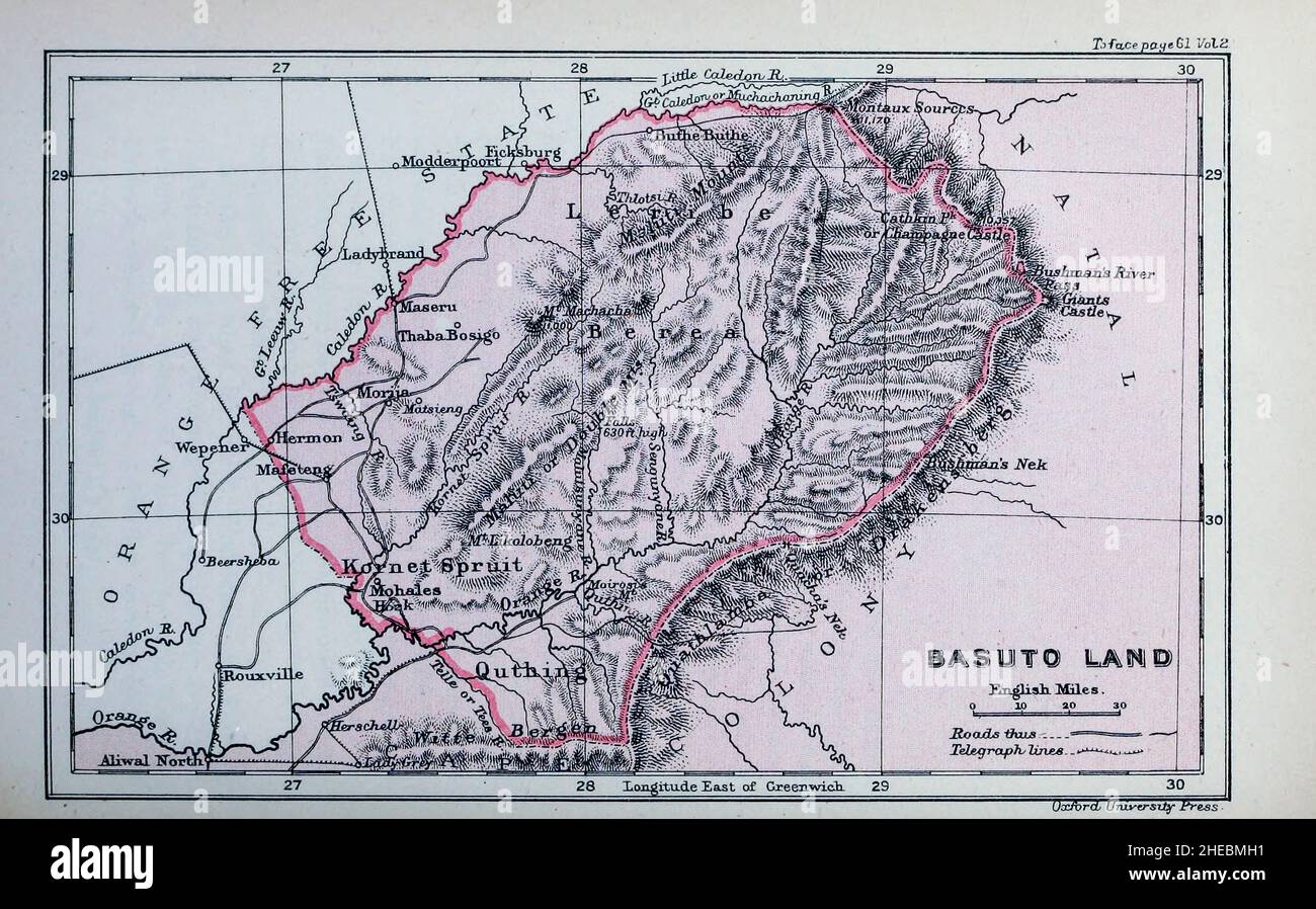 Basuto Land from the book HISTORICAL GEOGRAPHY OF THE BRITISH COLONIES printed in 1897 Stock Photohttps://www.alamy.com/image-license-details/?v=1https://www.alamy.com/basuto-land-from-the-book-historical-geography-of-the-british-colonies-printed-in-1897-image456332381.html
RF2HEBMH1–Basuto Land from the book HISTORICAL GEOGRAPHY OF THE BRITISH COLONIES printed in 1897
 . The Castle Line atlas of South Africa : a series of 16 plates, printed in colour, containing 30 maps and diagrams, with an account of the geograaphical features , the climate, the mineral and other resources, and the history of South Africa. And an index of over 6,000 names. At ^> .hian deNmml, ^. x.>;>T^ <«o 4«^, ,??- George Philip it Sori London VLi^erpunl. % INDEX. ABBREVIATIONS. B. = Bay. Bas. = Basutoland. B.C.A. = British Central Africa. Bech. = Bechuanaland. C. = Cape. C.C. = Cape Colony. C.F.S. = Congo Free State. Co. = County. Dist. = District. Div. = Division. E. = East Stock Photohttps://www.alamy.com/image-license-details/?v=1https://www.alamy.com/the-castle-line-atlas-of-south-africa-a-series-of-16-plates-printed-in-colour-containing-30-maps-and-diagrams-with-an-account-of-the-geograaphical-features-the-climate-the-mineral-and-other-resources-and-the-history-of-south-africa-and-an-index-of-over-6000-names-at-gt-hian-denmml-xgtgtt-lto-4-george-philip-it-sori-london-vlierpunl-index-abbreviations-b-=-bay-bas-=-basutoland-bca-=-british-central-africa-bech-=-bechuanaland-c-=-cape-cc-=-cape-colony-cfs-=-congo-free-state-co-=-county-dist-=-district-div-=-division-e-=-east-image370496508.html
RM2CENG24–. The Castle Line atlas of South Africa : a series of 16 plates, printed in colour, containing 30 maps and diagrams, with an account of the geograaphical features , the climate, the mineral and other resources, and the history of South Africa. And an index of over 6,000 names. At ^> .hian deNmml, ^. x.>;>T^ <«o 4«^, ,??- George Philip it Sori London VLi^erpunl. % INDEX. ABBREVIATIONS. B. = Bay. Bas. = Basutoland. B.C.A. = British Central Africa. Bech. = Bechuanaland. C. = Cape. C.C. = Cape Colony. C.F.S. = Congo Free State. Co. = County. Dist. = District. Div. = Division. E. = East
 . Geography of South and East Africa; being part 2 of vol. 4 of A historical geography of the British colonies, rev. to 1903, and with chapters on the Transvaal and Orange River Colony added . 30 ..« oTT^,^^^ ^J^^ Sk^^^^-^-^ mMorya. J^i [ ^ PROVISO a R^^NU ES++OVVE ^IJr..£>,«;71 4 TAT ^JETErWR)JzbURG . / SPRUIT V guttling O/J^ - -^v I 1 * UMZiMKULU. -^ X /^ Durban Worutliban-ow- 4Niazi^6uV Shepstone ^^r^^=a^ri*-ttn^j^ NATAL, ZULULAND AND BASUTOLAND. Scale, ofjnirxO ip ip 30 +0 50 Dorbishire & Stanford Ltd 32 Oxford NATAL 49 The executive power is in the hands of the Governor andhis Execu Stock Photohttps://www.alamy.com/image-license-details/?v=1https://www.alamy.com/geography-of-south-and-east-africa-being-part-2-of-vol-4-of-a-historical-geography-of-the-british-colonies-rev-to-1903-and-with-chapters-on-the-transvaal-and-orange-river-colony-added-30-ott-j-sk-mmorya-ji-proviso-a-rnu-esovve-ijrgt71-4-tat-jeterwrjzburg-spruit-v-guttling-oj-v-i-1-umzimkulu-x-durban-worutliban-ow-4niazi6uv-shepstone-r=ari-ttnj-natal-zululand-and-basutoland-scale-ofjnirxo-ip-ip-30-0-50-dorbishire-stanford-ltd-32-oxford-natal-49-the-executive-power-is-in-the-hands-of-the-governor-andhis-execu-image369793886.html
RM2CDHFTE–. Geography of South and East Africa; being part 2 of vol. 4 of A historical geography of the British colonies, rev. to 1903, and with chapters on the Transvaal and Orange River Colony added . 30 ..« oTT^,^^^ ^J^^ Sk^^^^-^-^ mMorya. J^i [ ^ PROVISO a R^^NU ES++OVVE ^IJr..£>,«;71 4 TAT ^JETErWR)JzbURG . / SPRUIT V guttling O/J^ - -^v I 1 * UMZiMKULU. -^ X /^ Durban Worutliban-ow- 4Niazi^6uV Shepstone ^^r^^=a^ri*-ttn^j^ NATAL, ZULULAND AND BASUTOLAND. Scale, ofjnirxO ip ip 30 +0 50 Dorbishire & Stanford Ltd 32 Oxford NATAL 49 The executive power is in the hands of the Governor andhis Execu
 . Records of big game with their distribution, characteristics, dimensions, weights, and horn & tusk measurements . n are wonderful. A peculiar featureof the vaal rhebok is the soft and woolly nature of the grey coat ;the horns afford insignificant trophies, and the flesh is of poorquality. sngth onfront. Circum-ference. 4 2i I of 2 ioA 2* ioTV 2 9i 2i 9 2f 8g 2§ 8§ 2i 84 2 8 2i 8 2 8 2 Tip to Tip. Locality. Owner. 44 ? Sir Owen Philipps. 2h Basutoland . Sir Abe Bailey. 3 Cape Colony H. Hodgson. 3i Near Middelburg . Major E. H. E. Abadie. 2| ? Dr. Oakeshott. 2| ? Mr. Justice Hopley. 2| Cape C Stock Photohttps://www.alamy.com/image-license-details/?v=1https://www.alamy.com/records-of-big-game-with-their-distribution-characteristics-dimensions-weights-and-horn-tusk-measurements-n-are-wonderful-a-peculiar-featureof-the-vaal-rhebok-is-the-soft-and-woolly-nature-of-the-grey-coat-the-horns-afford-insignificant-trophies-and-the-flesh-is-of-poorquality-sngth-onfront-circum-ference-4-2i-i-of-2-ioa-2-iotv-2-9i-2i-9-2f-8g-2-8-2i-84-2-8-2i-8-2-8-2-tip-to-tip-locality-owner-44-sir-owen-philipps-2h-basutoland-sir-abe-bailey-3-cape-colony-h-hodgson-3i-near-middelburg-major-e-h-e-abadie-2-dr-oakeshott-2-mr-justice-hopley-2-cape-c-image374884007.html
RM2CNWCAF–. Records of big game with their distribution, characteristics, dimensions, weights, and horn & tusk measurements . n are wonderful. A peculiar featureof the vaal rhebok is the soft and woolly nature of the grey coat ;the horns afford insignificant trophies, and the flesh is of poorquality. sngth onfront. Circum-ference. 4 2i I of 2 ioA 2* ioTV 2 9i 2i 9 2f 8g 2§ 8§ 2i 84 2 8 2i 8 2 8 2 Tip to Tip. Locality. Owner. 44 ? Sir Owen Philipps. 2h Basutoland . Sir Abe Bailey. 3 Cape Colony H. Hodgson. 3i Near Middelburg . Major E. H. E. Abadie. 2| ? Dr. Oakeshott. 2| ? Mr. Justice Hopley. 2| Cape C