Beautifully detailed borders Stock Photos and Images
(346)See beautifully detailed borders stock video clipsBeautifully detailed borders Stock Photos and Images
 Lilac flowers close up. Bouquet of purple flowers. City flower beds, a beautiful and well-groomed garden with flowering bushes Stock Photohttps://www.alamy.com/image-license-details/?v=1https://www.alamy.com/lilac-flowers-close-up-bouquet-of-purple-flowers-city-flower-beds-a-beautiful-and-well-groomed-garden-with-flowering-bushes-image628897757.html
RF2YF4NE5–Lilac flowers close up. Bouquet of purple flowers. City flower beds, a beautiful and well-groomed garden with flowering bushes
 Lepidoptera Indica, London, 1890-1913, India, Lepidoptera, Frederick Moore, This illustration features three beautifully detailed butterflies, showcasing their vibrant patterns and colors. The top two specimens display striking orange and brown wings, adorned with delicate black borders and intricate markings that highlight their unique features. The bottom butterfly, while similar in color palette, has distinct patterns that emphasize its elegance. Each butterfly is meticulously rendered to emphasize the diversity and beauty of these insects, illustrating their natural grace and the variety f Stock Photohttps://www.alamy.com/image-license-details/?v=1https://www.alamy.com/lepidoptera-indica-london-1890-1913-india-lepidoptera-frederick-moore-this-illustration-features-three-beautifully-detailed-butterflies-showcasing-their-vibrant-patterns-and-colors-the-top-two-specimens-display-striking-orange-and-brown-wings-adorned-with-delicate-black-borders-and-intricate-markings-that-highlight-their-unique-features-the-bottom-butterfly-while-similar-in-color-palette-has-distinct-patterns-that-emphasize-its-elegance-each-butterfly-is-meticulously-rendered-to-emphasize-the-diversity-and-beauty-of-these-insects-illustrating-their-natural-grace-and-the-variety-f-image636105202.html
RM2YXW2JX–Lepidoptera Indica, London, 1890-1913, India, Lepidoptera, Frederick Moore, This illustration features three beautifully detailed butterflies, showcasing their vibrant patterns and colors. The top two specimens display striking orange and brown wings, adorned with delicate black borders and intricate markings that highlight their unique features. The bottom butterfly, while similar in color palette, has distinct patterns that emphasize its elegance. Each butterfly is meticulously rendered to emphasize the diversity and beauty of these insects, illustrating their natural grace and the variety f
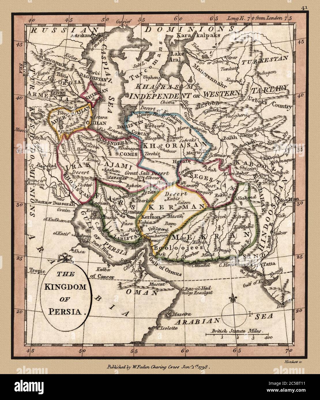 'Kingdom of Persia' Map shows political borders and important landmarks. This is a beautifully detailed historic map reproduction. Original from a British atlas published by famed cartographer William Faden was created circa 1798. Stock Photohttps://www.alamy.com/image-license-details/?v=1https://www.alamy.com/kingdom-of-persia-map-shows-political-borders-and-important-landmarks-this-is-a-beautifully-detailed-historic-map-reproduction-original-from-a-british-atlas-published-by-famed-cartographer-william-faden-was-created-circa-1798-image364751325.html
RM2C5BT11–'Kingdom of Persia' Map shows political borders and important landmarks. This is a beautifully detailed historic map reproduction. Original from a British atlas published by famed cartographer William Faden was created circa 1798.
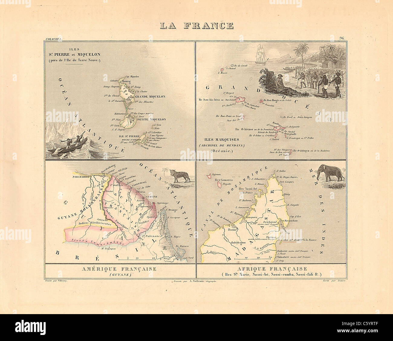 La France, Colonies - Antiquarian Map from an 1858 French Atlas 'France and its Colonies' (La France et ses Colonies ) by Alexandre Vuillemin Stock Photohttps://www.alamy.com/image-license-details/?v=1https://www.alamy.com/stock-photo-la-france-colonies-antiquarian-map-from-an-1858-french-atlas-france-38105439.html
RFC5YRTF–La France, Colonies - Antiquarian Map from an 1858 French Atlas 'France and its Colonies' (La France et ses Colonies ) by Alexandre Vuillemin
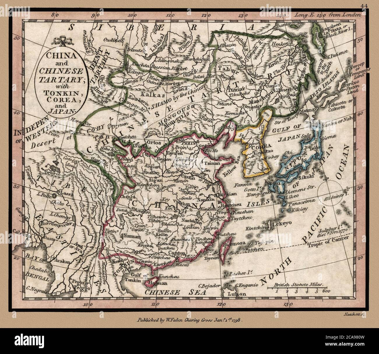 'China and Chinese Tartary, with Tonkin, Corea, and Japan.' Map shows political borders and important landmarks. This is a beautifully detailed historic map reproduction. Original from a British atlas published by famed cartographer William Faden was created circa 1798. Stock Photohttps://www.alamy.com/image-license-details/?v=1https://www.alamy.com/china-and-chinese-tartary-with-tonkin-corea-and-japan-map-shows-political-borders-and-important-landmarks-this-is-a-beautifully-detailed-historic-map-reproduction-original-from-a-british-atlas-published-by-famed-cartographer-william-faden-was-created-circa-1798-image367768153.html
RM2CA980W–'China and Chinese Tartary, with Tonkin, Corea, and Japan.' Map shows political borders and important landmarks. This is a beautifully detailed historic map reproduction. Original from a British atlas published by famed cartographer William Faden was created circa 1798.
 Antarctica from space. Beautifully detailed plastic planet surface with mountains and blue oceans with ripples. 3D illustration. Elements of this imag Stock Photohttps://www.alamy.com/image-license-details/?v=1https://www.alamy.com/antarctica-from-space-beautifully-detailed-plastic-planet-surface-with-mountains-and-blue-oceans-with-ripples-3d-illustration-elements-of-this-imag-image224536662.html
RFR18EPE–Antarctica from space. Beautifully detailed plastic planet surface with mountains and blue oceans with ripples. 3D illustration. Elements of this imag
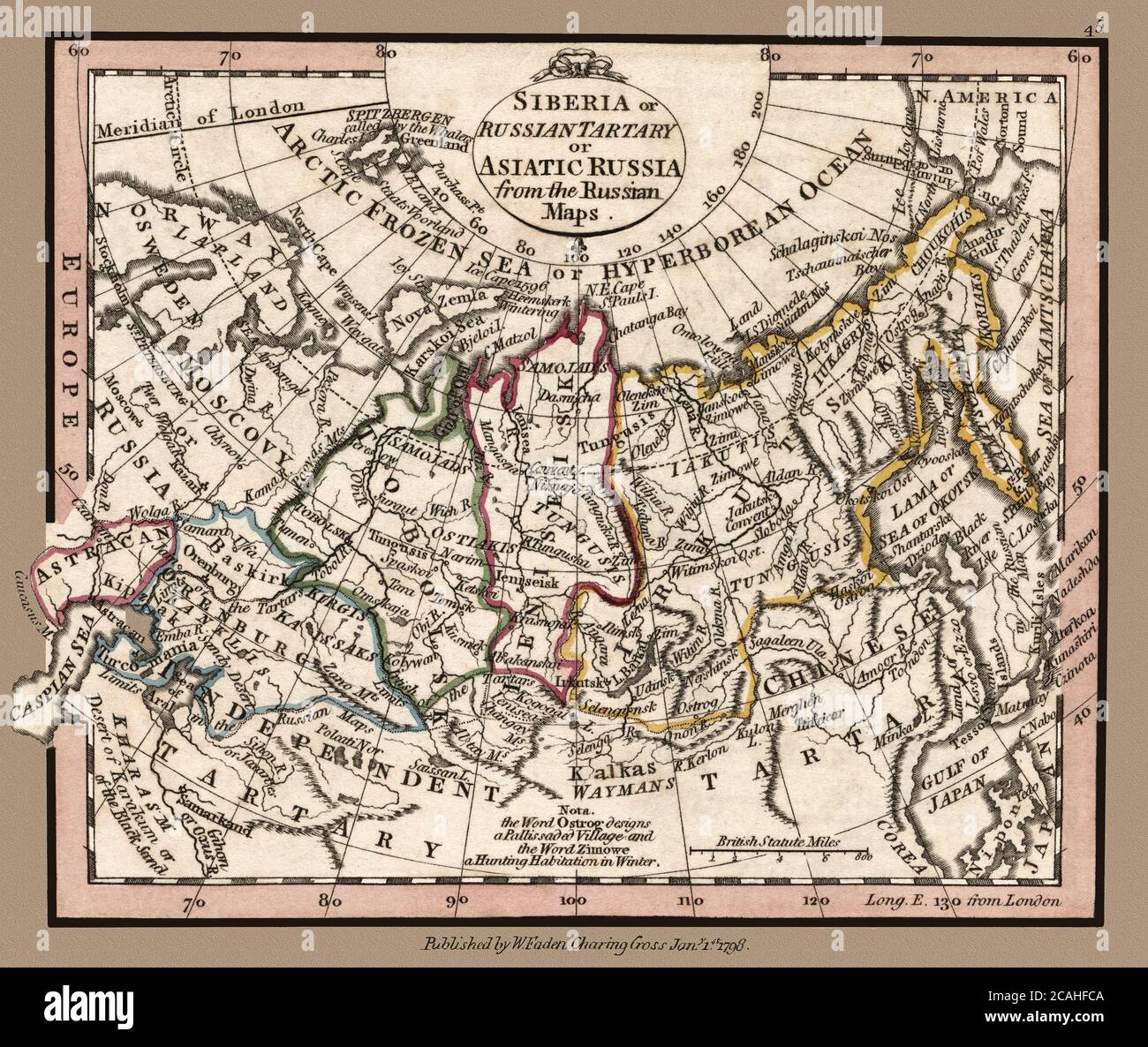 'Siberia or Russian Tartary or Asiatic Russia from the Russian maps.' Map shows political borders and important landmarks. This is a beautifully detailed historic map reproduction. Original from a British atlas published by famed cartographer William Faden was created circa 1798. Stock Photohttps://www.alamy.com/image-license-details/?v=1https://www.alamy.com/siberia-or-russian-tartary-or-asiatic-russia-from-the-russian-maps-map-shows-political-borders-and-important-landmarks-this-is-a-beautifully-detailed-historic-map-reproduction-original-from-a-british-atlas-published-by-famed-cartographer-william-faden-was-created-circa-1798-image367949578.html
RM2CAHFCA–'Siberia or Russian Tartary or Asiatic Russia from the Russian maps.' Map shows political borders and important landmarks. This is a beautifully detailed historic map reproduction. Original from a British atlas published by famed cartographer William Faden was created circa 1798.
![Original title: Map of Persia, Turkey in Asia, Afghanistan, Beloochistan ; Palestine, or the Holy Land [inset]. Map shows political borders and important landmarks. This is a beautifully detailed historic, enhanced reproduction of a 1863 map. It is framed by a floral border. Insert map shows the 'Holy Land.' Stock Photo Original title: Map of Persia, Turkey in Asia, Afghanistan, Beloochistan ; Palestine, or the Holy Land [inset]. Map shows political borders and important landmarks. This is a beautifully detailed historic, enhanced reproduction of a 1863 map. It is framed by a floral border. Insert map shows the 'Holy Land.' Stock Photo](https://c8.alamy.com/comp/2FNWCC0/original-title-map-of-persia-turkey-in-asia-afghanistan-beloochistan-palestine-or-the-holy-land-inset-map-shows-political-borders-and-important-landmarks-this-is-a-beautifully-detailed-historic-enhanced-reproduction-of-a-1863-map-it-is-framed-by-a-floral-border-insert-map-shows-the-holy-land-2FNWCC0.jpg) Original title: Map of Persia, Turkey in Asia, Afghanistan, Beloochistan ; Palestine, or the Holy Land [inset]. Map shows political borders and important landmarks. This is a beautifully detailed historic, enhanced reproduction of a 1863 map. It is framed by a floral border. Insert map shows the 'Holy Land.' Stock Photohttps://www.alamy.com/image-license-details/?v=1https://www.alamy.com/original-title-map-of-persia-turkey-in-asia-afghanistan-beloochistan-palestine-or-the-holy-land-inset-map-shows-political-borders-and-important-landmarks-this-is-a-beautifully-detailed-historic-enhanced-reproduction-of-a-1863-map-it-is-framed-by-a-floral-border-insert-map-shows-the-holy-land-image426515152.html
Original title: Map of Persia, Turkey in Asia, Afghanistan, Beloochistan ; Palestine, or the Holy Land [inset]. Map shows political borders and important landmarks. This is a beautifully detailed historic, enhanced reproduction of a 1863 map. It is framed by a floral border. Insert map shows the 'Holy Land.' Stock Photohttps://www.alamy.com/image-license-details/?v=1https://www.alamy.com/original-title-map-of-persia-turkey-in-asia-afghanistan-beloochistan-palestine-or-the-holy-land-inset-map-shows-political-borders-and-important-landmarks-this-is-a-beautifully-detailed-historic-enhanced-reproduction-of-a-1863-map-it-is-framed-by-a-floral-border-insert-map-shows-the-holy-land-image426515152.htmlRF2FNWCC0–Original title: Map of Persia, Turkey in Asia, Afghanistan, Beloochistan ; Palestine, or the Holy Land [inset]. Map shows political borders and important landmarks. This is a beautifully detailed historic, enhanced reproduction of a 1863 map. It is framed by a floral border. Insert map shows the 'Holy Land.'
 'South America from the latest Spanish and Portuguese surveys.' Rendition of a 1798 antique map shows political borders and important landmarks. Shows colonial territorial claims at the time., This is a beautifully detailed historic map reproduction. Original from a British atlas published by famed cartographer William Faden was created circa 1798. Stock Photohttps://www.alamy.com/image-license-details/?v=1https://www.alamy.com/south-america-from-the-latest-spanish-and-portuguese-surveys-rendition-of-a-1798-antique-map-shows-political-borders-and-important-landmarks-shows-colonial-territorial-claims-at-the-time-this-is-a-beautifully-detailed-historic-map-reproduction-original-from-a-british-atlas-published-by-famed-cartographer-william-faden-was-created-circa-1798-image368130391.html
RM2CAWP1Y–'South America from the latest Spanish and Portuguese surveys.' Rendition of a 1798 antique map shows political borders and important landmarks. Shows colonial territorial claims at the time., This is a beautifully detailed historic map reproduction. Original from a British atlas published by famed cartographer William Faden was created circa 1798.
![Original title: 'Map of the Austrian Empire, Italian States, Turkey in Europe, and Greece; Maltese Islands [inset].' Map publication date was 1863. This is a beautifully detailed historic map reproduction showing political borders and important landmarks.Note that longitude is given from both Greenwich and Washington, D.C. Shows political boundaries, cities, and seas. Stock Photo Original title: 'Map of the Austrian Empire, Italian States, Turkey in Europe, and Greece; Maltese Islands [inset].' Map publication date was 1863. This is a beautifully detailed historic map reproduction showing political borders and important landmarks.Note that longitude is given from both Greenwich and Washington, D.C. Shows political boundaries, cities, and seas. Stock Photo](https://c8.alamy.com/comp/2FKT607/original-title-map-of-the-austrian-empire-italian-states-turkey-in-europe-and-greece-maltese-islands-inset-map-publication-date-was-1863-this-is-a-beautifully-detailed-historic-map-reproduction-showing-political-borders-and-important-landmarksnote-that-longitude-is-given-from-both-greenwich-and-washington-dc-shows-political-boundaries-cities-and-seas-2FKT607.jpg) Original title: 'Map of the Austrian Empire, Italian States, Turkey in Europe, and Greece; Maltese Islands [inset].' Map publication date was 1863. This is a beautifully detailed historic map reproduction showing political borders and important landmarks.Note that longitude is given from both Greenwich and Washington, D.C. Shows political boundaries, cities, and seas. Stock Photohttps://www.alamy.com/image-license-details/?v=1https://www.alamy.com/original-title-map-of-the-austrian-empire-italian-states-turkey-in-europe-and-greece-maltese-islands-inset-map-publication-date-was-1863-this-is-a-beautifully-detailed-historic-map-reproduction-showing-political-borders-and-important-landmarksnote-that-longitude-is-given-from-both-greenwich-and-washington-dc-shows-political-boundaries-cities-and-seas-image425258855.html
Original title: 'Map of the Austrian Empire, Italian States, Turkey in Europe, and Greece; Maltese Islands [inset].' Map publication date was 1863. This is a beautifully detailed historic map reproduction showing political borders and important landmarks.Note that longitude is given from both Greenwich and Washington, D.C. Shows political boundaries, cities, and seas. Stock Photohttps://www.alamy.com/image-license-details/?v=1https://www.alamy.com/original-title-map-of-the-austrian-empire-italian-states-turkey-in-europe-and-greece-maltese-islands-inset-map-publication-date-was-1863-this-is-a-beautifully-detailed-historic-map-reproduction-showing-political-borders-and-important-landmarksnote-that-longitude-is-given-from-both-greenwich-and-washington-dc-shows-political-boundaries-cities-and-seas-image425258855.htmlRF2FKT607–Original title: 'Map of the Austrian Empire, Italian States, Turkey in Europe, and Greece; Maltese Islands [inset].' Map publication date was 1863. This is a beautifully detailed historic map reproduction showing political borders and important landmarks.Note that longitude is given from both Greenwich and Washington, D.C. Shows political boundaries, cities, and seas.
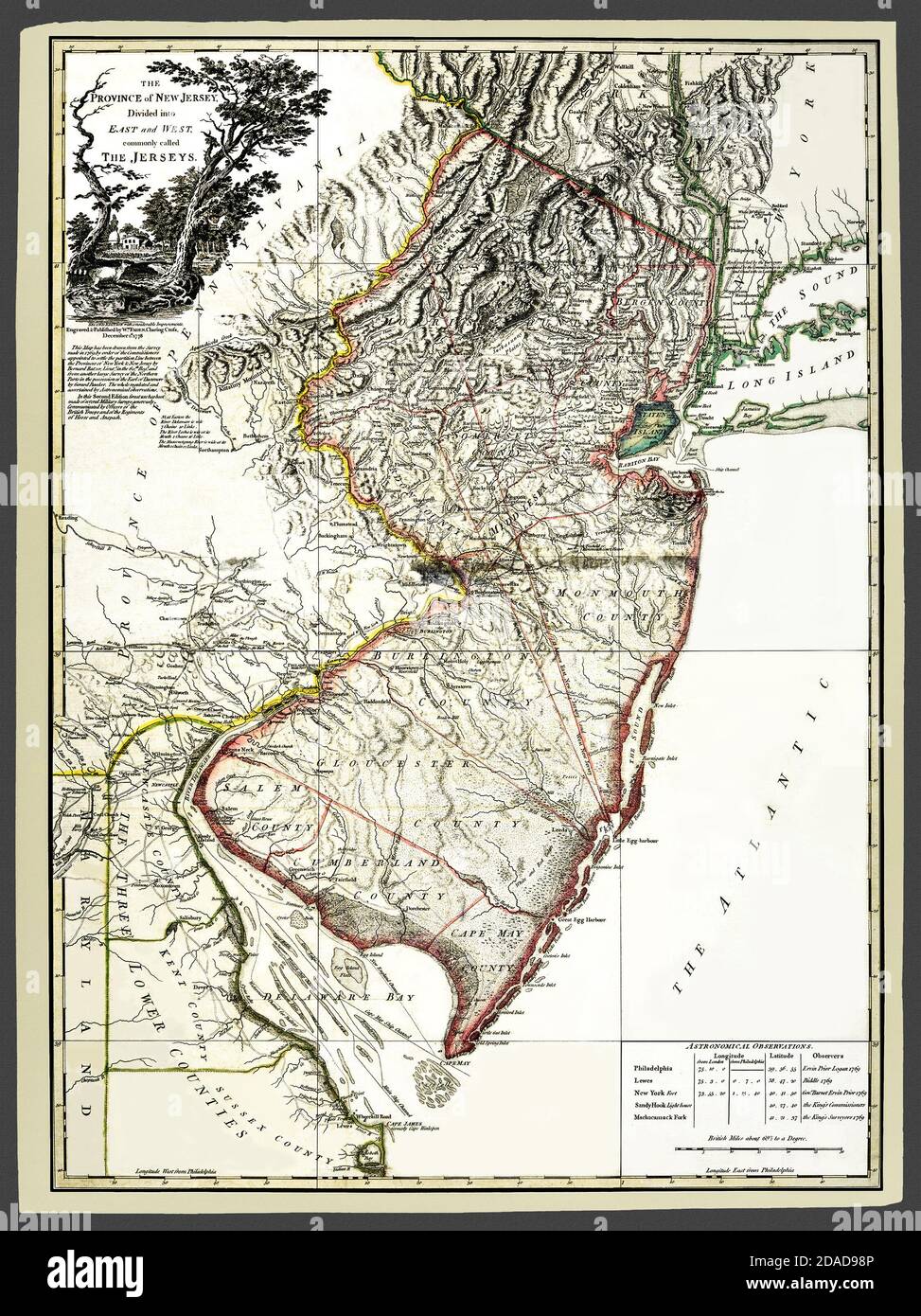 Title: 'The Province of New Jersey, divided into East and West, commonly called the Jerseys.' Map shows political borders and important landmarks. This is a beautifully detailed historic map reproduction. Original from a British atlas published by famed cartographer William Faden was issued circa 1778 based on a 1769 survey. Map features a table of astronomical observations. Stock Photohttps://www.alamy.com/image-license-details/?v=1https://www.alamy.com/title-the-province-of-new-jersey-divided-into-east-and-west-commonly-called-the-jerseys-map-shows-political-borders-and-important-landmarks-this-is-a-beautifully-detailed-historic-map-reproduction-original-from-a-british-atlas-published-by-famed-cartographer-william-faden-was-issued-circa-1778-based-on-a-1769-survey-map-features-a-table-of-astronomical-observations-image385067334.html
RM2DAD98P–Title: 'The Province of New Jersey, divided into East and West, commonly called the Jerseys.' Map shows political borders and important landmarks. This is a beautifully detailed historic map reproduction. Original from a British atlas published by famed cartographer William Faden was issued circa 1778 based on a 1769 survey. Map features a table of astronomical observations.
 New Zealand ferns Auckland, New Zealand, Dobbie, H. B, 1880, botany, botany pictorial works, ferns, New Zealand, ferns New Zealand pictorial works, nature prints New Zealand, New Zealand, rare books 19th century, Auckland War Memorial Museum Tāmaki Paenga Hira, The artwork features a striking botanical illustration of a fern, specifically identified as *Pteris scaberula*. The detailed rendering displays the intricate structure of the fern’s fronds, with delicate leaflets arranged along the central stem. The background is a vibrant blue, contrasting beautifully with the crisp, light representat Stock Photohttps://www.alamy.com/image-license-details/?v=1https://www.alamy.com/new-zealand-ferns-auckland-new-zealand-dobbie-h-b-1880-botany-botany-pictorial-works-ferns-new-zealand-ferns-new-zealand-pictorial-works-nature-prints-new-zealand-new-zealand-rare-books-19th-century-auckland-war-memorial-museum-tmaki-paenga-hira-the-artwork-features-a-striking-botanical-illustration-of-a-fern-specifically-identified-as-pteris-scaberula-the-detailed-rendering-displays-the-intricate-structure-of-the-ferns-fronds-with-delicate-leaflets-arranged-along-the-central-stem-the-background-is-a-vibrant-blue-contrasting-beautifully-with-the-crisp-light-representat-image636111012.html
RM2YXWA2C–New Zealand ferns Auckland, New Zealand, Dobbie, H. B, 1880, botany, botany pictorial works, ferns, New Zealand, ferns New Zealand pictorial works, nature prints New Zealand, New Zealand, rare books 19th century, Auckland War Memorial Museum Tāmaki Paenga Hira, The artwork features a striking botanical illustration of a fern, specifically identified as *Pteris scaberula*. The detailed rendering displays the intricate structure of the fern’s fronds, with delicate leaflets arranged along the central stem. The background is a vibrant blue, contrasting beautifully with the crisp, light representat
 Ile Bourbon La Reunion - Antiquarian Map from an 1858 French Atlas 'France and its Colonies' (La France et ses Colonies ) by Alexandre Vuillemin Stock Photohttps://www.alamy.com/image-license-details/?v=1https://www.alamy.com/stock-photo-ile-bourbon-la-reunion-antiquarian-map-from-an-1858-french-atlas-france-38105401.html
RFC5YRR5–Ile Bourbon La Reunion - Antiquarian Map from an 1858 French Atlas 'France and its Colonies' (La France et ses Colonies ) by Alexandre Vuillemin
 Australia from space. Beautifully detailed plastic planet surface with mountains and blue oceans with ripples. 3D illustration. Elements of this image Stock Photohttps://www.alamy.com/image-license-details/?v=1https://www.alamy.com/australia-from-space-beautifully-detailed-plastic-planet-surface-with-mountains-and-blue-oceans-with-ripples-3d-illustration-elements-of-this-image-image224536663.html
RFR18EPF–Australia from space. Beautifully detailed plastic planet surface with mountains and blue oceans with ripples. 3D illustration. Elements of this image
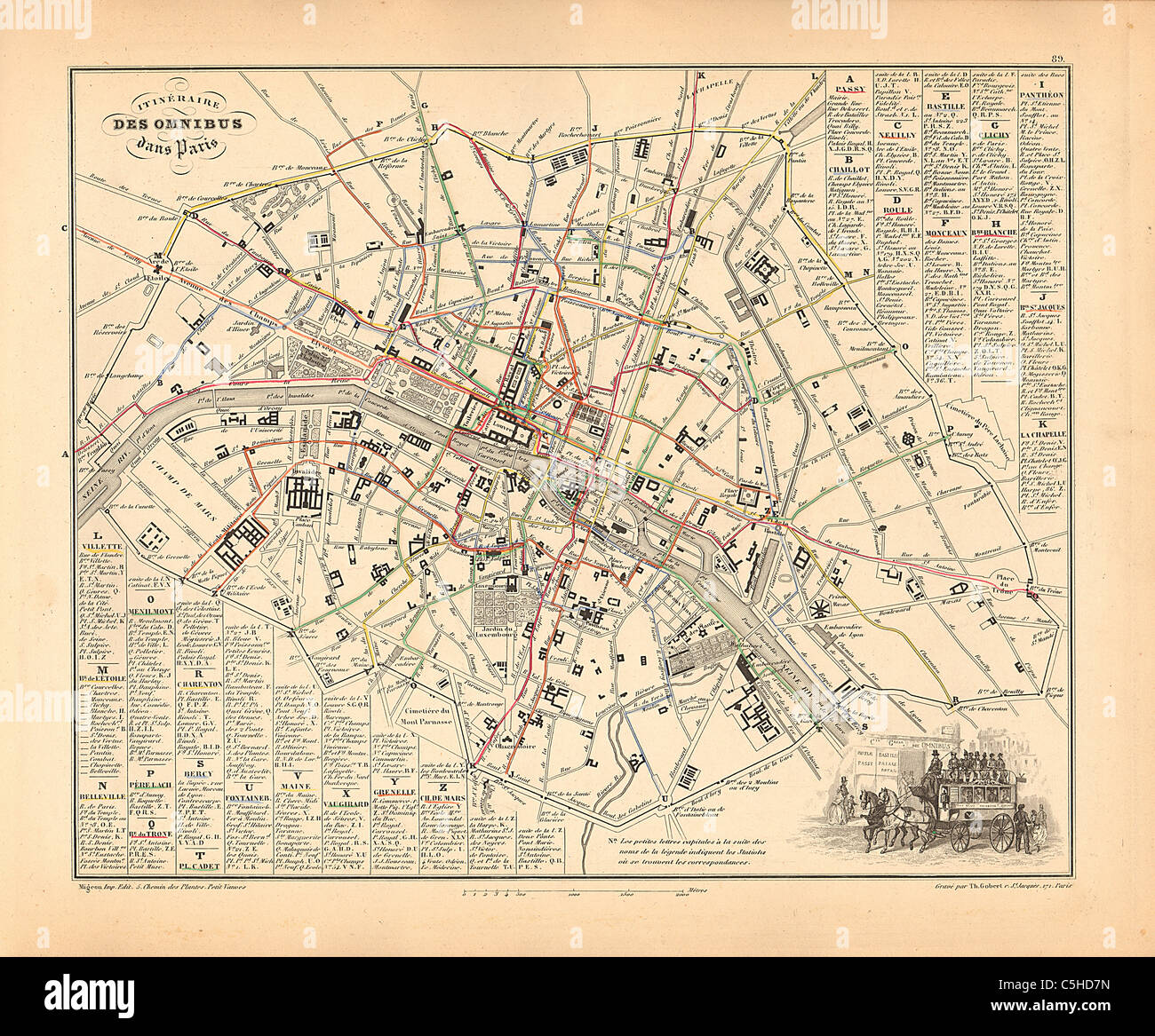 Itineraire des Omnibus dans Paris (Bus Routes) map from 1858 French Atlas 'France and its Colonies' (La France et ses Colonies) by Alexandre Vuillemin Stock Photohttps://www.alamy.com/image-license-details/?v=1https://www.alamy.com/stock-photo-itineraire-des-omnibus-dans-paris-bus-routes-map-from-1858-french-37877609.html
RFC5HD7N–Itineraire des Omnibus dans Paris (Bus Routes) map from 1858 French Atlas 'France and its Colonies' (La France et ses Colonies) by Alexandre Vuillemin
 Africa from space. Beautifully detailed plastic planet surface with mountains and blue oceans with ripples. 3D illustration. Elements of this image fu Stock Photohttps://www.alamy.com/image-license-details/?v=1https://www.alamy.com/africa-from-space-beautifully-detailed-plastic-planet-surface-with-mountains-and-blue-oceans-with-ripples-3d-illustration-elements-of-this-image-fu-image224536660.html
RFR18EPC–Africa from space. Beautifully detailed plastic planet surface with mountains and blue oceans with ripples. 3D illustration. Elements of this image fu
 Paris et son Mur d'Enceinte (Paris Wall) Map from an 1858 French Atlas 'France and its Colonies' (La France et ses Colonies) by Alexandre Vuillemin Stock Photohttps://www.alamy.com/image-license-details/?v=1https://www.alamy.com/stock-photo-paris-et-son-mur-denceinte-paris-wall-map-from-an-1858-french-atlas-38105677.html
RFC5YT51–Paris et son Mur d'Enceinte (Paris Wall) Map from an 1858 French Atlas 'France and its Colonies' (La France et ses Colonies) by Alexandre Vuillemin
 Asia from space. Beautifully detailed plastic planet surface with mountains and blue oceans with ripples. 3D illustration. Elements of this image furn Stock Photohttps://www.alamy.com/image-license-details/?v=1https://www.alamy.com/asia-from-space-beautifully-detailed-plastic-planet-surface-with-mountains-and-blue-oceans-with-ripples-3d-illustration-elements-of-this-image-furn-image224536702.html
RFR18ERX–Asia from space. Beautifully detailed plastic planet surface with mountains and blue oceans with ripples. 3D illustration. Elements of this image furn
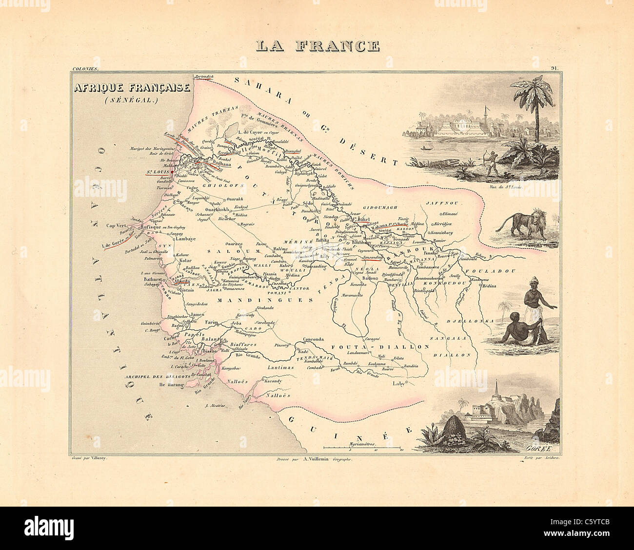 Senegambie (Senegal) - Antiquarian Map from an 1858 French Atlas 'France and its Colonies' (La France et ses Colonies ) by Alexandre Vuillemin Stock Photohttps://www.alamy.com/image-license-details/?v=1https://www.alamy.com/stock-photo-senegambie-senegal-antiquarian-map-from-an-1858-french-atlas-france-38105883.html
RFC5YTCB–Senegambie (Senegal) - Antiquarian Map from an 1858 French Atlas 'France and its Colonies' (La France et ses Colonies ) by Alexandre Vuillemin
 Europe from space. Beautifully detailed plastic planet surface with mountains and blue oceans with ripples. 3D illustration. Elements of this image fu Stock Photohttps://www.alamy.com/image-license-details/?v=1https://www.alamy.com/europe-from-space-beautifully-detailed-plastic-planet-surface-with-mountains-and-blue-oceans-with-ripples-3d-illustration-elements-of-this-image-fu-image224536716.html
RFR18ETC–Europe from space. Beautifully detailed plastic planet surface with mountains and blue oceans with ripples. 3D illustration. Elements of this image fu
 Seine et Marne Department - Antiquarian Map from an 1858 French Atlas 'France and its Colonies' (La France et ses Colonies ) by Alexandre Vuillemin Stock Photohttps://www.alamy.com/image-license-details/?v=1https://www.alamy.com/stock-photo-seine-et-marne-department-antiquarian-map-from-an-1858-french-atlas-38105836.html
RFC5YTAM–Seine et Marne Department - Antiquarian Map from an 1858 French Atlas 'France and its Colonies' (La France et ses Colonies ) by Alexandre Vuillemin
 North America from space. Beautifully detailed plastic planet surface with mountains and blue oceans with ripples. 3D illustration. Elements of this i Stock Photohttps://www.alamy.com/image-license-details/?v=1https://www.alamy.com/north-america-from-space-beautifully-detailed-plastic-planet-surface-with-mountains-and-blue-oceans-with-ripples-3d-illustration-elements-of-this-i-image224536681.html
RFR18ER5–North America from space. Beautifully detailed plastic planet surface with mountains and blue oceans with ripples. 3D illustration. Elements of this i
 Corse Department - Antiquarian Map from an 1858 French Atlas 'France and its Colonies' (La France et ses Colonies ) by Alexandre Vuillemin Stock Photohttps://www.alamy.com/image-license-details/?v=1https://www.alamy.com/stock-photo-corse-department-antiquarian-map-from-an-1858-french-atlas-france-38105267.html
RFC5YRJB–Corse Department - Antiquarian Map from an 1858 French Atlas 'France and its Colonies' (La France et ses Colonies ) by Alexandre Vuillemin
 South America from space. Beautifully detailed plastic planet surface with mountains and blue oceans with ripples. 3D illustration. Elements of this i Stock Photohttps://www.alamy.com/image-license-details/?v=1https://www.alamy.com/south-america-from-space-beautifully-detailed-plastic-planet-surface-with-mountains-and-blue-oceans-with-ripples-3d-illustration-elements-of-this-i-image224536682.html
RFR18ER6–South America from space. Beautifully detailed plastic planet surface with mountains and blue oceans with ripples. 3D illustration. Elements of this i
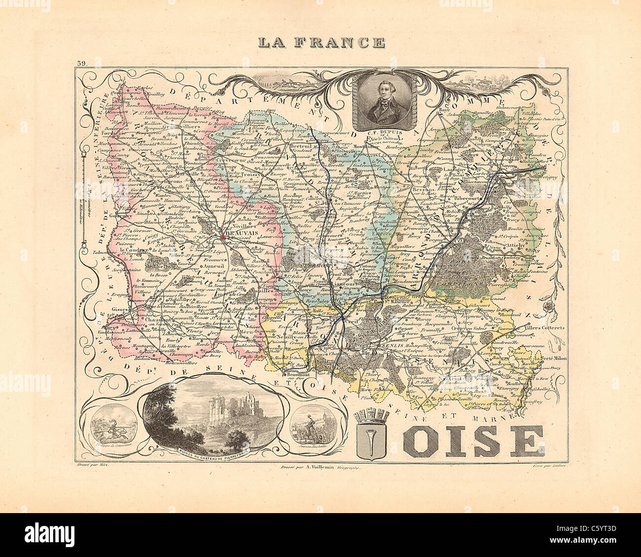 Oise Department - Antiquarian Map from an 1858 French Atlas 'France and its Colonies' (La France et ses Colonies ) by Alexandre Vuillemin Stock Photohttps://www.alamy.com/image-license-details/?v=1https://www.alamy.com/stock-photo-oise-department-antiquarian-map-from-an-1858-french-atlas-france-and-38105633.html
RFC5YT3D–Oise Department - Antiquarian Map from an 1858 French Atlas 'France and its Colonies' (La France et ses Colonies ) by Alexandre Vuillemin
 Satellite view of Africa from space at night. Beautifully detailed plastic planet surface with visible city lights. 3D illustration. Elements of this Stock Photohttps://www.alamy.com/image-license-details/?v=1https://www.alamy.com/satellite-view-of-africa-from-space-at-night-beautifully-detailed-plastic-planet-surface-with-visible-city-lights-3d-illustration-elements-of-this-image224758151.html
RFR1JH8R–Satellite view of Africa from space at night. Beautifully detailed plastic planet surface with visible city lights. 3D illustration. Elements of this
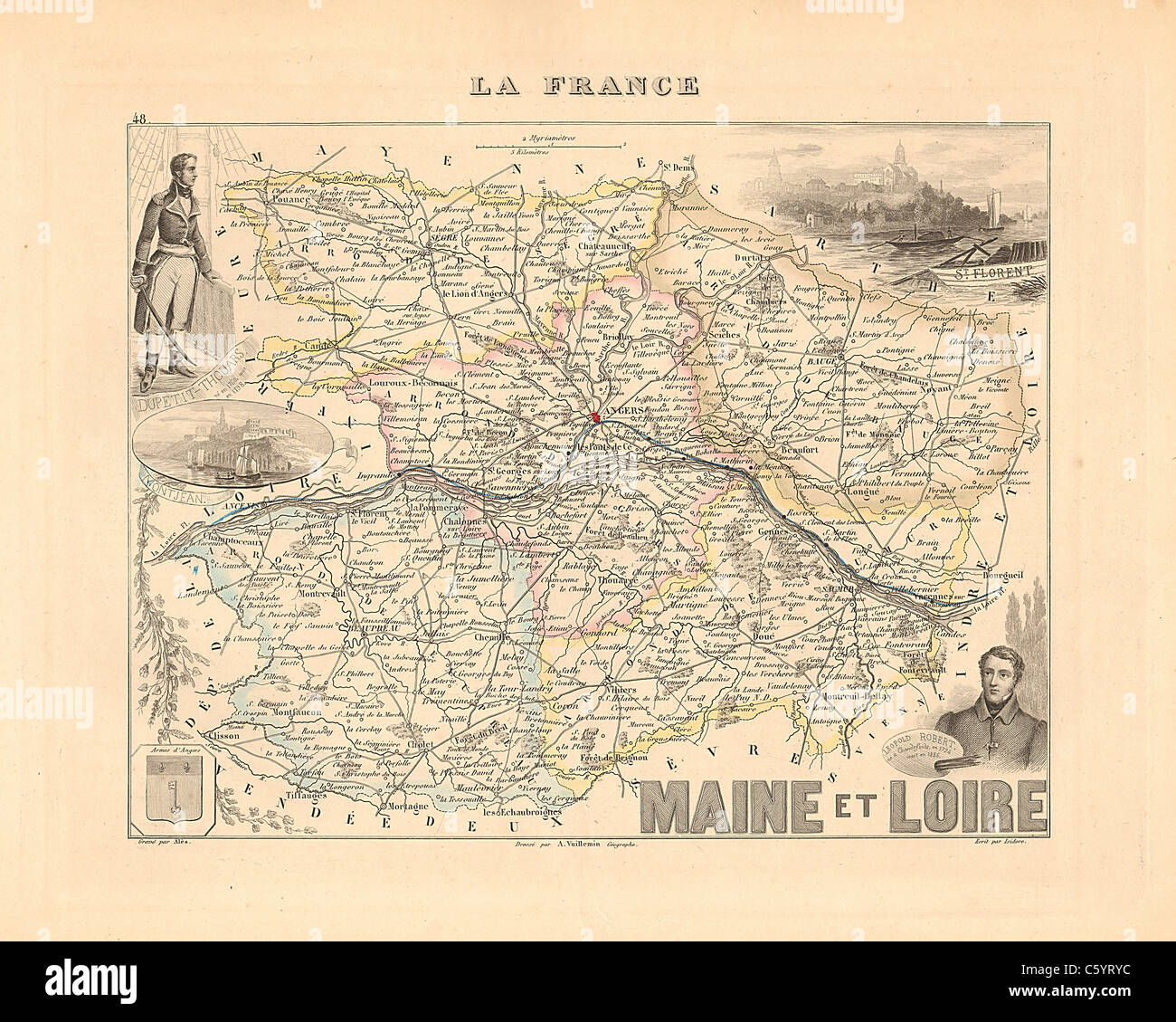 Maine et Loire Department - Antiquarian Map from an 1858 French Atlas 'France and its Colonies' (La France et ses Colonies ) by Alexandre Vuillemin Stock Photohttps://www.alamy.com/image-license-details/?v=1https://www.alamy.com/stock-photo-maine-et-loire-department-antiquarian-map-from-an-1858-french-atlas-38105520.html
RFC5YRYC–Maine et Loire Department - Antiquarian Map from an 1858 French Atlas 'France and its Colonies' (La France et ses Colonies ) by Alexandre Vuillemin
 Satellite view of Burundi from space at night. Beautifully detailed plastic planet surface with visible city lights. 3D illustration. Elements of this Stock Photohttps://www.alamy.com/image-license-details/?v=1https://www.alamy.com/satellite-view-of-burundi-from-space-at-night-beautifully-detailed-plastic-planet-surface-with-visible-city-lights-3d-illustration-elements-of-this-image230325888.html
RFRAM70G–Satellite view of Burundi from space at night. Beautifully detailed plastic planet surface with visible city lights. 3D illustration. Elements of this
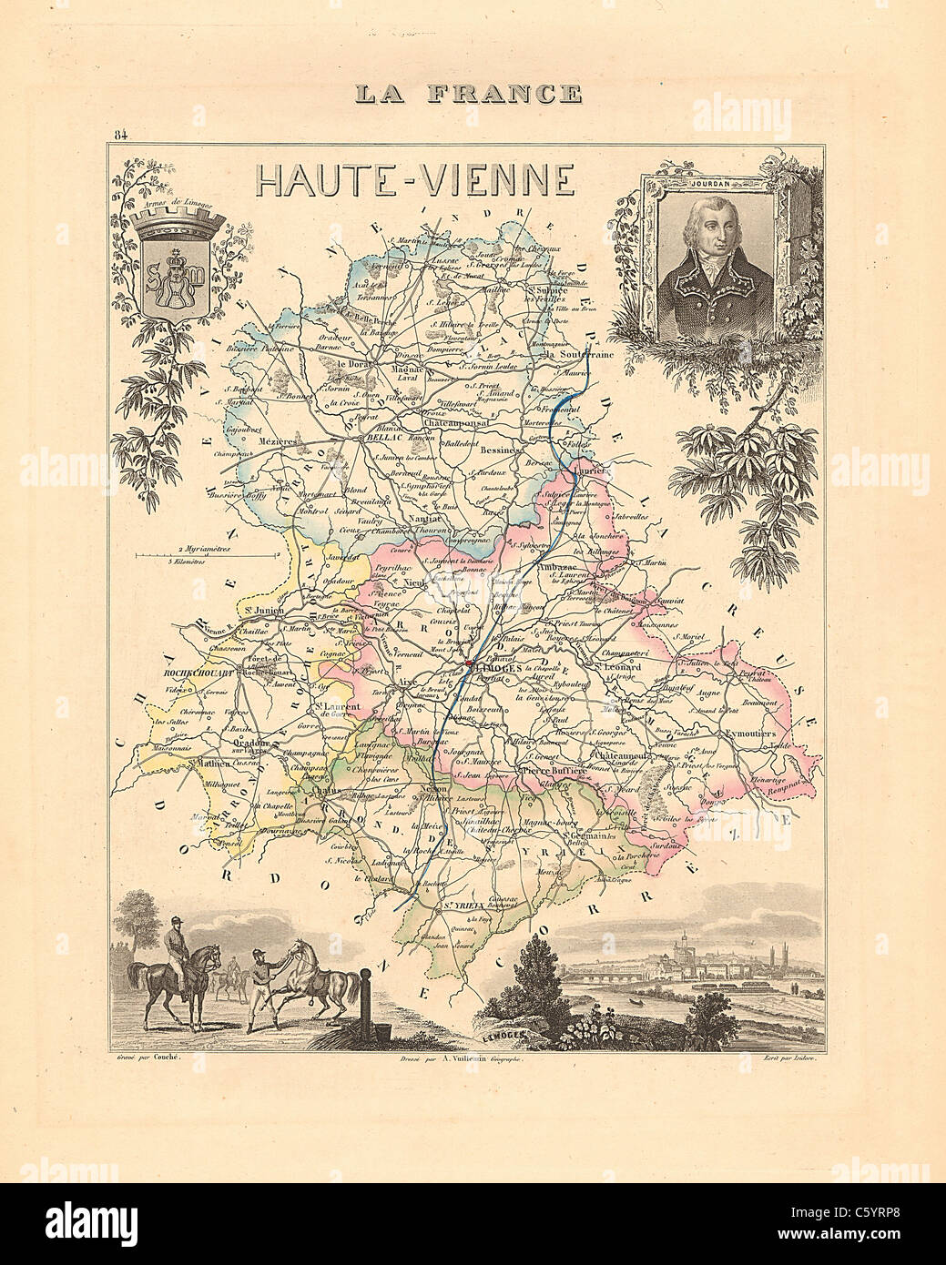 Haute Vienne Department - Antiquarian Map from an 1858 French Atlas 'France and its Colonies' (La France et ses Colonies ) by Alexandre Vuillemin Stock Photohttps://www.alamy.com/image-license-details/?v=1https://www.alamy.com/stock-photo-haute-vienne-department-antiquarian-map-from-an-1858-french-atlas-38105376.html
RFC5YRP8–Haute Vienne Department - Antiquarian Map from an 1858 French Atlas 'France and its Colonies' (La France et ses Colonies ) by Alexandre Vuillemin
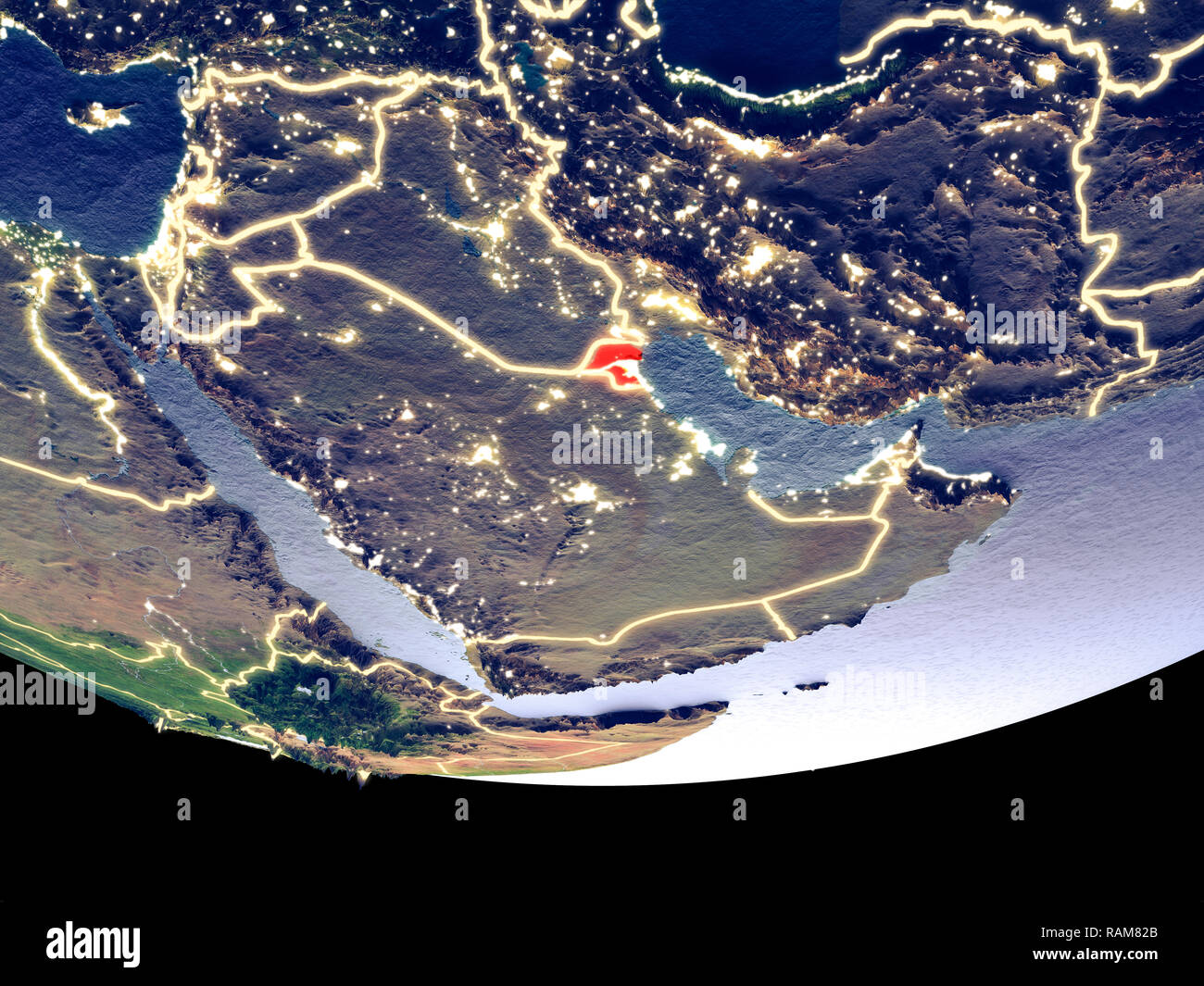 Satellite view of Kuwait from space at night. Beautifully detailed plastic planet surface with visible city lights. 3D illustration. Elements of this Stock Photohttps://www.alamy.com/image-license-details/?v=1https://www.alamy.com/satellite-view-of-kuwait-from-space-at-night-beautifully-detailed-plastic-planet-surface-with-visible-city-lights-3d-illustration-elements-of-this-image230326723.html
RFRAM82B–Satellite view of Kuwait from space at night. Beautifully detailed plastic planet surface with visible city lights. 3D illustration. Elements of this
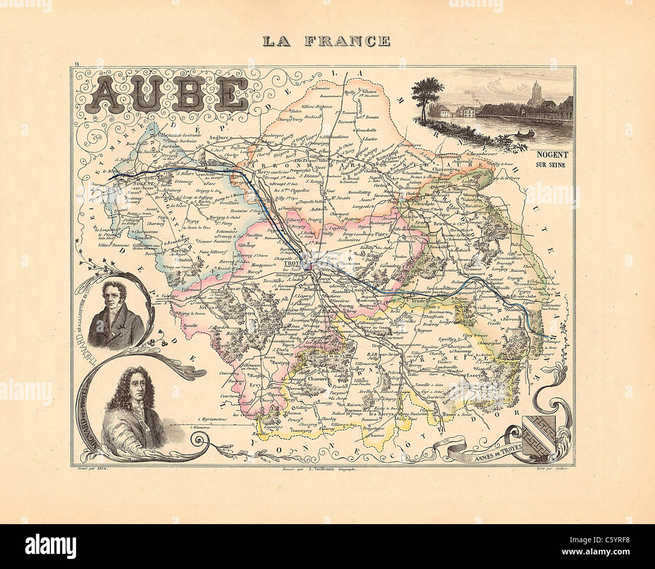 Aube Department - Antiquarian Map from an 1858 French Atlas 'France and its Colonies' (La France et ses Colonies ) by Alexandre Vuillemin Stock Photohttps://www.alamy.com/image-license-details/?v=1https://www.alamy.com/stock-photo-aube-department-antiquarian-map-from-an-1858-french-atlas-france-and-38105180.html
RFC5YRF8–Aube Department - Antiquarian Map from an 1858 French Atlas 'France and its Colonies' (La France et ses Colonies ) by Alexandre Vuillemin
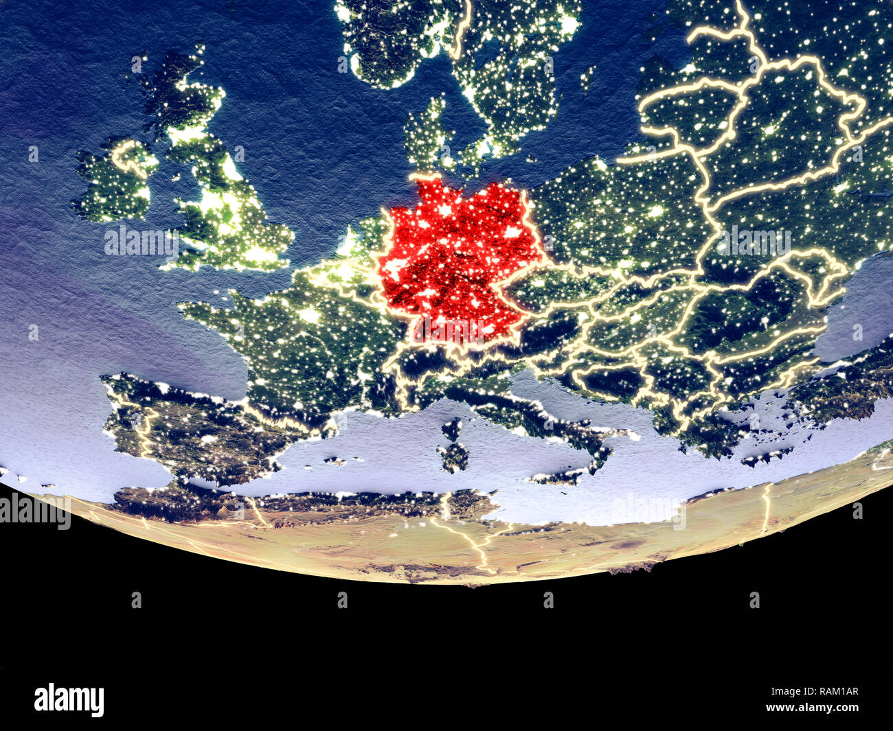 Satellite view of Germany from space at night. Beautifully detailed plastic planet surface with visible city lights. 3D illustration. Elements of this Stock Photohttps://www.alamy.com/image-license-details/?v=1https://www.alamy.com/satellite-view-of-germany-from-space-at-night-beautifully-detailed-plastic-planet-surface-with-visible-city-lights-3d-illustration-elements-of-this-image230321471.html
RFRAM1AR–Satellite view of Germany from space at night. Beautifully detailed plastic planet surface with visible city lights. 3D illustration. Elements of this
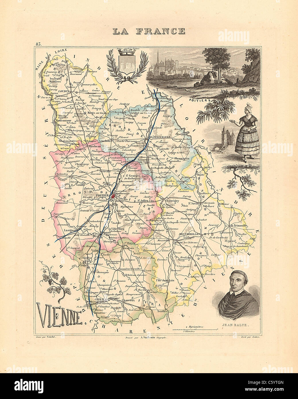 Vienne Department - Antiquarian Map from an 1858 French Atlas 'France and its Colonies' (La France et ses Colonies ) by Alexandre Vuillemin Stock Photohttps://www.alamy.com/image-license-details/?v=1https://www.alamy.com/stock-photo-vienne-department-antiquarian-map-from-an-1858-french-atlas-france-38106005.html
RFC5YTGN–Vienne Department - Antiquarian Map from an 1858 French Atlas 'France and its Colonies' (La France et ses Colonies ) by Alexandre Vuillemin
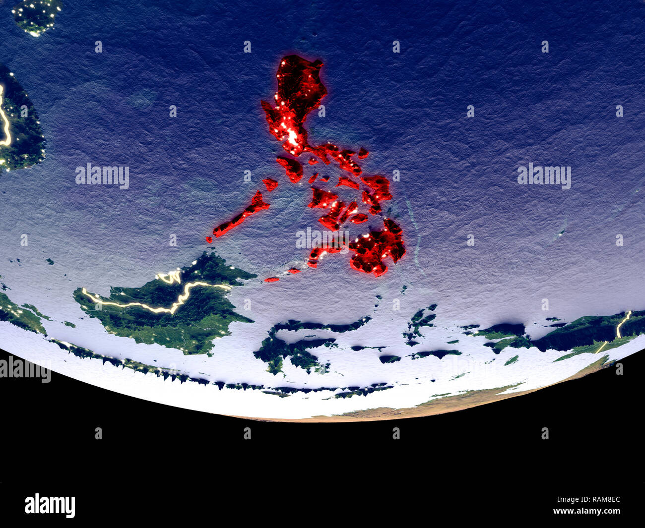 Satellite view of Philippines from space at night. Beautifully detailed plastic planet surface with visible city lights. 3D illustration. Elements of Stock Photohttps://www.alamy.com/image-license-details/?v=1https://www.alamy.com/satellite-view-of-philippines-from-space-at-night-beautifully-detailed-plastic-planet-surface-with-visible-city-lights-3d-illustration-elements-of-image230327060.html
RFRAM8EC–Satellite view of Philippines from space at night. Beautifully detailed plastic planet surface with visible city lights. 3D illustration. Elements of
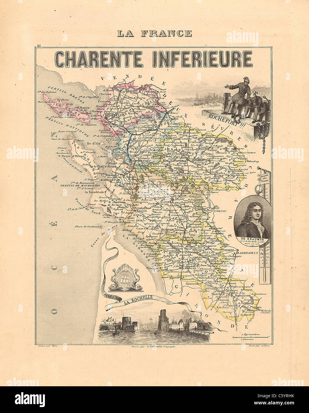 Charente Inferieure Department - Antiquarian Map from 1858 French Atlas 'France and its Colonies' (La France et ses Colonies ) by Alexandre Vuillemin Stock Photohttps://www.alamy.com/image-license-details/?v=1https://www.alamy.com/stock-photo-charente-inferieure-department-antiquarian-map-from-1858-french-atlas-38105247.html
RFC5YRHK–Charente Inferieure Department - Antiquarian Map from 1858 French Atlas 'France and its Colonies' (La France et ses Colonies ) by Alexandre Vuillemin
 Satellite view of Bhutan from space at night. Beautifully detailed plastic planet surface with visible city lights. 3D illustration. Elements of this Stock Photohttps://www.alamy.com/image-license-details/?v=1https://www.alamy.com/satellite-view-of-bhutan-from-space-at-night-beautifully-detailed-plastic-planet-surface-with-visible-city-lights-3d-illustration-elements-of-this-image230326920.html
RFRAM89C–Satellite view of Bhutan from space at night. Beautifully detailed plastic planet surface with visible city lights. 3D illustration. Elements of this
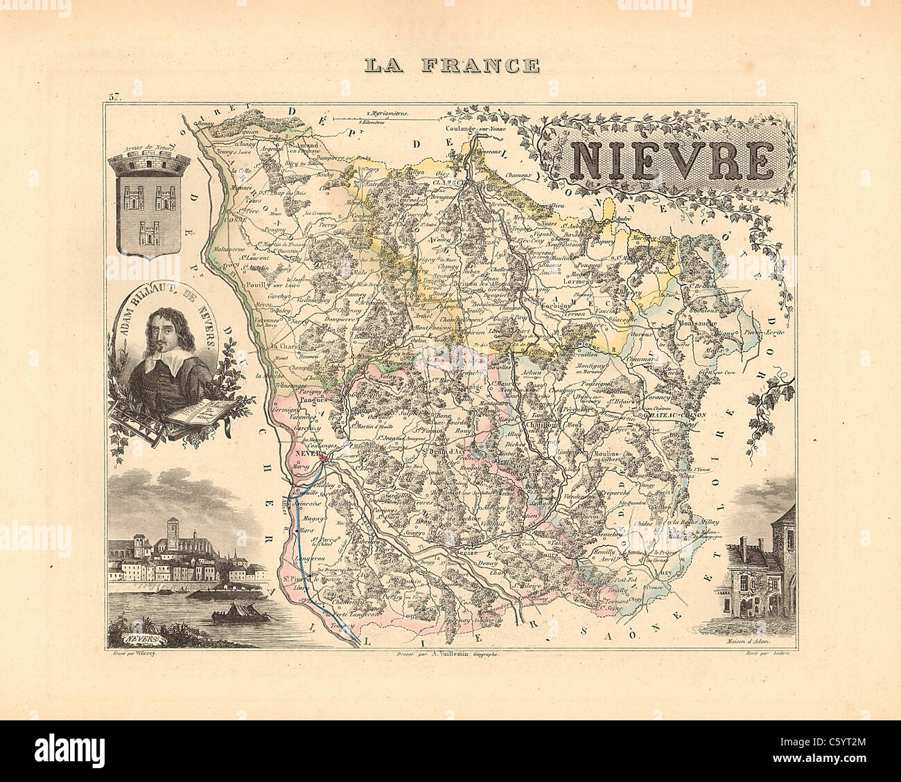 Nievre Department - Antiquarian Map from an 1858 French Atlas 'France and its Colonies' (La France et ses Colonies ) by Alexandre Vuillemin Stock Photohttps://www.alamy.com/image-license-details/?v=1https://www.alamy.com/stock-photo-nievre-department-antiquarian-map-from-an-1858-french-atlas-france-38105612.html
RFC5YT2M–Nievre Department - Antiquarian Map from an 1858 French Atlas 'France and its Colonies' (La France et ses Colonies ) by Alexandre Vuillemin
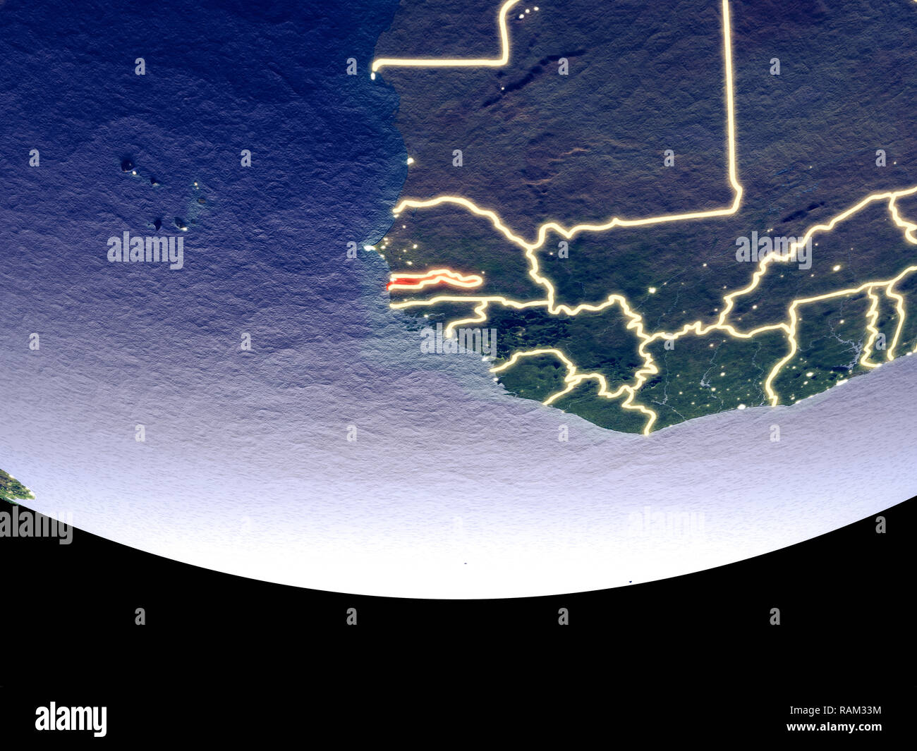 Satellite view of Gambia from space at night. Beautifully detailed plastic planet surface with visible city lights. 3D illustration. Elements of this Stock Photohttps://www.alamy.com/image-license-details/?v=1https://www.alamy.com/satellite-view-of-gambia-from-space-at-night-beautifully-detailed-plastic-planet-surface-with-visible-city-lights-3d-illustration-elements-of-this-image230322840.html
RFRAM33M–Satellite view of Gambia from space at night. Beautifully detailed plastic planet surface with visible city lights. 3D illustration. Elements of this
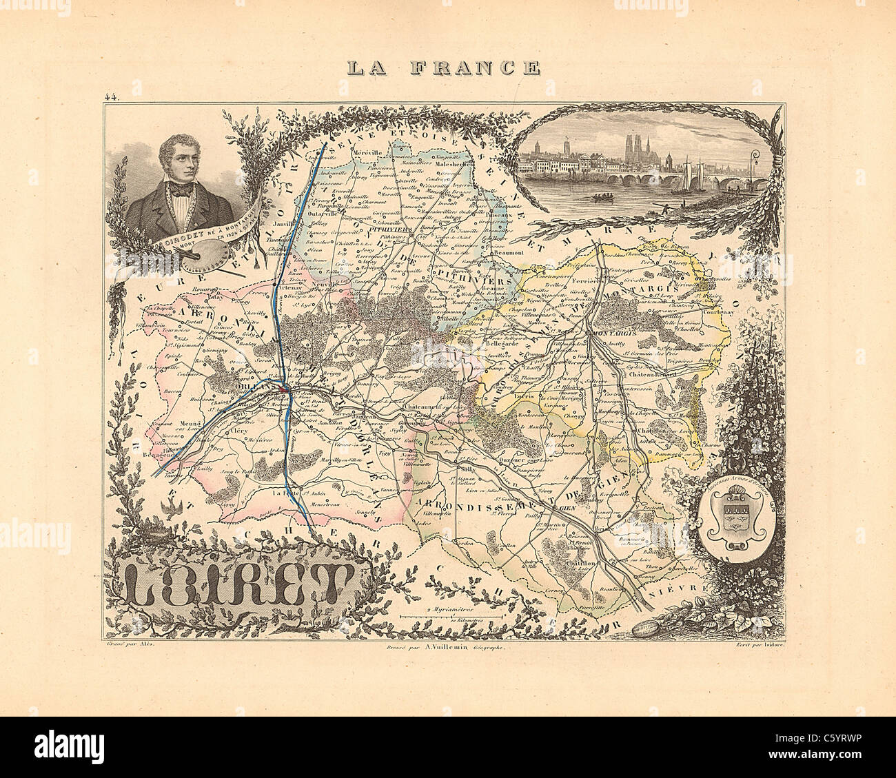 Loiret Department - Antiquarian Map from an 1858 French Atlas 'France and its Colonies' (La France et ses Colonies ) by Alexandre Vuillemin Stock Photohttps://www.alamy.com/image-license-details/?v=1https://www.alamy.com/stock-photo-loiret-department-antiquarian-map-from-an-1858-french-atlas-france-38105474.html
RFC5YRWP–Loiret Department - Antiquarian Map from an 1858 French Atlas 'France and its Colonies' (La France et ses Colonies ) by Alexandre Vuillemin
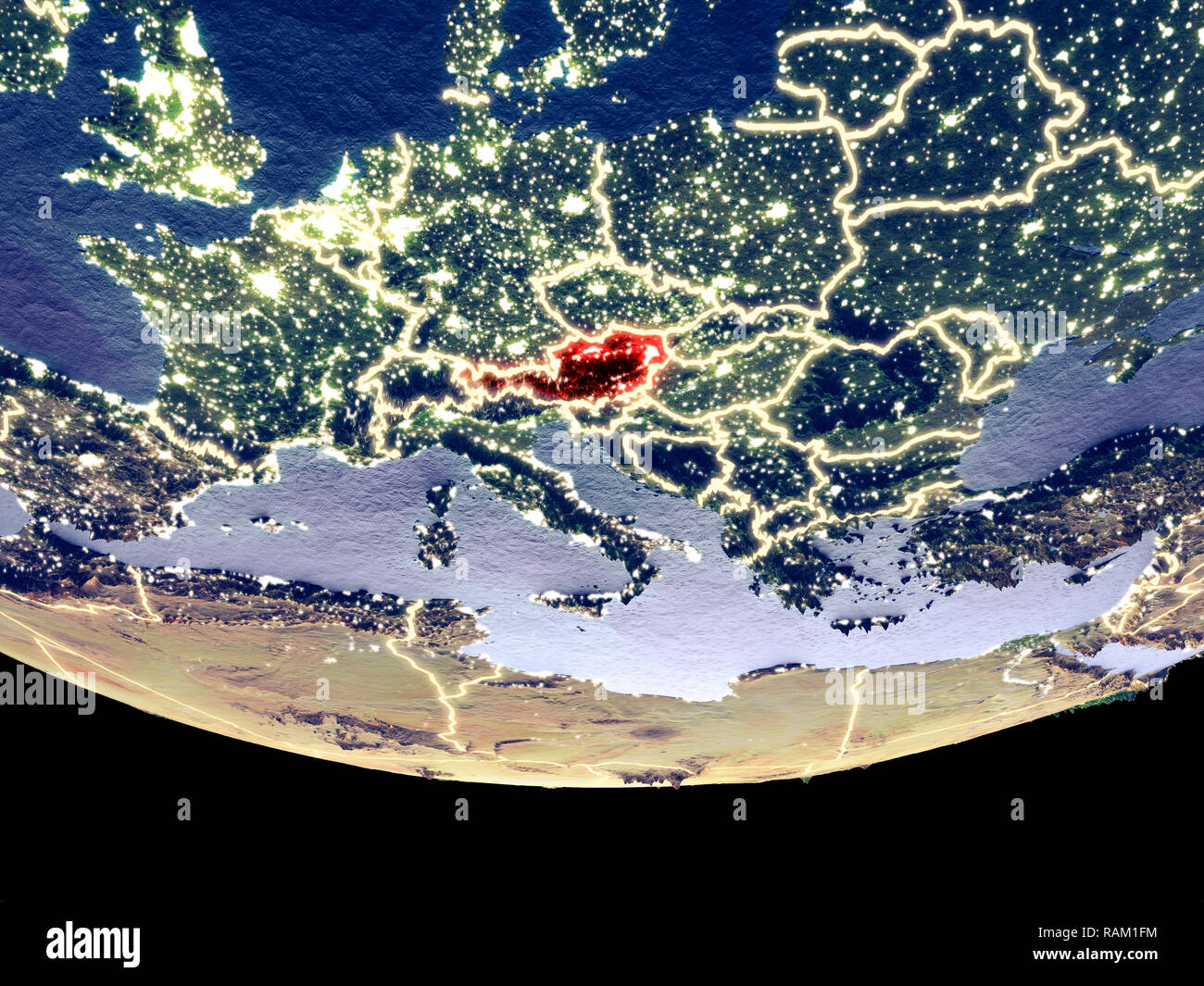 Satellite view of Austria from space at night. Beautifully detailed plastic planet surface with visible city lights. 3D illustration. Elements of this Stock Photohttps://www.alamy.com/image-license-details/?v=1https://www.alamy.com/satellite-view-of-austria-from-space-at-night-beautifully-detailed-plastic-planet-surface-with-visible-city-lights-3d-illustration-elements-of-this-image230321608.html
RFRAM1FM–Satellite view of Austria from space at night. Beautifully detailed plastic planet surface with visible city lights. 3D illustration. Elements of this
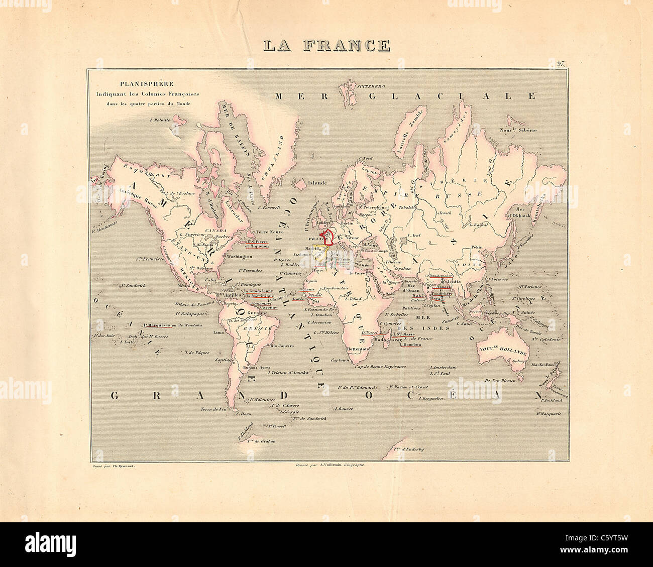 Planisphere - World - Antiquarian Map from an 1858 French Atlas 'France and its Colonies' (La France et ses Colonies ) by Alexandre Vuillemin Stock Photohttps://www.alamy.com/image-license-details/?v=1https://www.alamy.com/stock-photo-planisphere-world-antiquarian-map-from-an-1858-french-atlas-france-38105701.html
RFC5YT5W–Planisphere - World - Antiquarian Map from an 1858 French Atlas 'France and its Colonies' (La France et ses Colonies ) by Alexandre Vuillemin
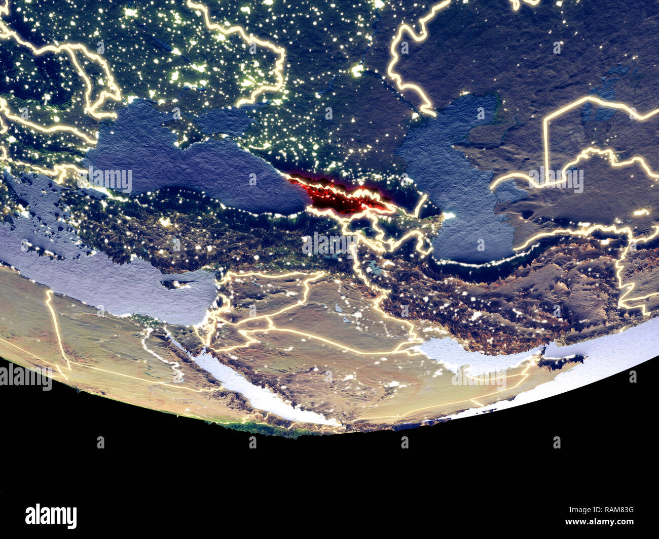 Satellite view of Georgia from space at night. Beautifully detailed plastic planet surface with visible city lights. 3D illustration. Elements of this Stock Photohttps://www.alamy.com/image-license-details/?v=1https://www.alamy.com/satellite-view-of-georgia-from-space-at-night-beautifully-detailed-plastic-planet-surface-with-visible-city-lights-3d-illustration-elements-of-this-image230326756.html
RFRAM83G–Satellite view of Georgia from space at night. Beautifully detailed plastic planet surface with visible city lights. 3D illustration. Elements of this
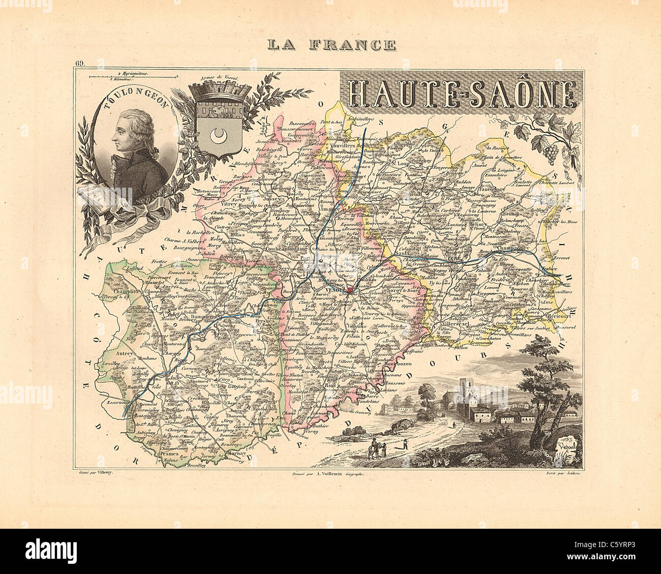 Haute Saone Department - Antiquarian Map from an 1858 French Atlas 'France and its Colonies' (La France et ses Colonies ) by Alexandre Vuillemin Stock Photohttps://www.alamy.com/image-license-details/?v=1https://www.alamy.com/stock-photo-haute-saone-department-antiquarian-map-from-an-1858-french-atlas-france-38105371.html
RFC5YRP3–Haute Saone Department - Antiquarian Map from an 1858 French Atlas 'France and its Colonies' (La France et ses Colonies ) by Alexandre Vuillemin
 Satellite view of Tunisia from space at night. Beautifully detailed plastic planet surface with visible city lights. 3D illustration. Elements of this Stock Photohttps://www.alamy.com/image-license-details/?v=1https://www.alamy.com/satellite-view-of-tunisia-from-space-at-night-beautifully-detailed-plastic-planet-surface-with-visible-city-lights-3d-illustration-elements-of-this-image230322644.html
RFRAM2TM–Satellite view of Tunisia from space at night. Beautifully detailed plastic planet surface with visible city lights. 3D illustration. Elements of this
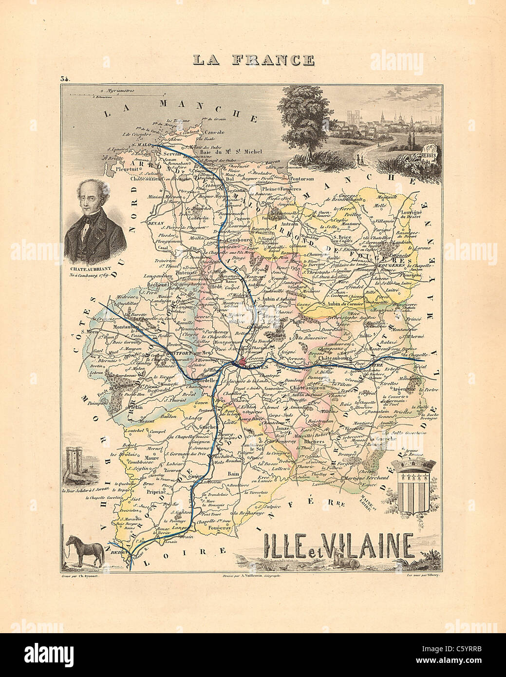 Ille et Vilaine Department - Antiquarian Map from an 1858 French Atlas 'France and its Colonies' (La France et ses Colonies ) by Alexandre Vuillemin Stock Photohttps://www.alamy.com/image-license-details/?v=1https://www.alamy.com/stock-photo-ille-et-vilaine-department-antiquarian-map-from-an-1858-french-atlas-38105407.html
RFC5YRRB–Ille et Vilaine Department - Antiquarian Map from an 1858 French Atlas 'France and its Colonies' (La France et ses Colonies ) by Alexandre Vuillemin
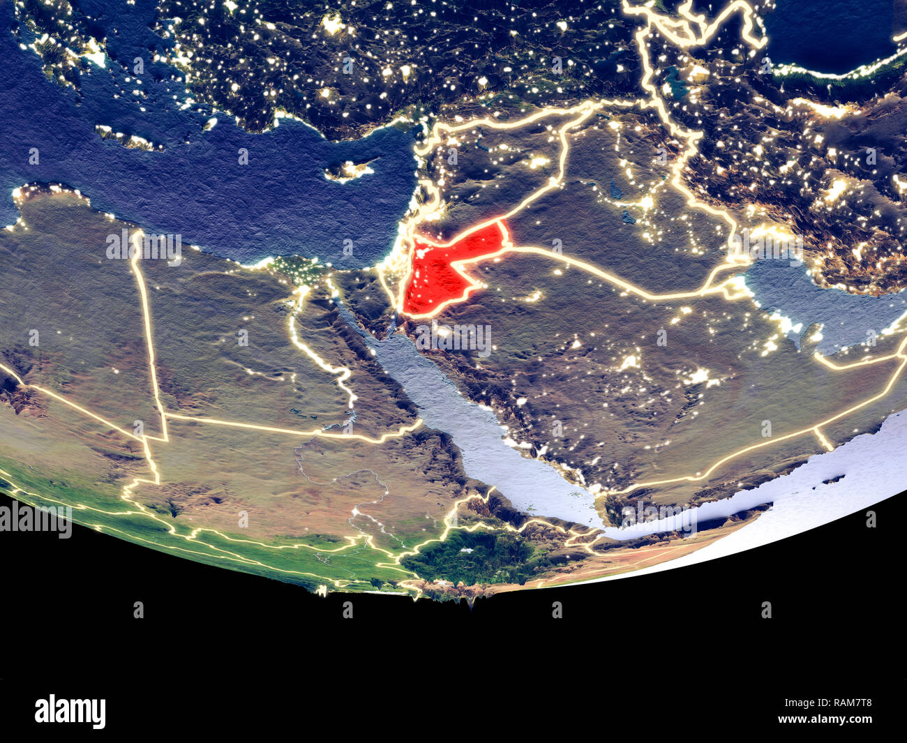 Satellite view of Jordan from space at night. Beautifully detailed plastic planet surface with visible city lights. 3D illustration. Elements of this Stock Photohttps://www.alamy.com/image-license-details/?v=1https://www.alamy.com/satellite-view-of-jordan-from-space-at-night-beautifully-detailed-plastic-planet-surface-with-visible-city-lights-3d-illustration-elements-of-this-image230326552.html
RFRAM7T8–Satellite view of Jordan from space at night. Beautifully detailed plastic planet surface with visible city lights. 3D illustration. Elements of this
 Hautes Pyrenees Department - Antiquarian Map from an 1858 French Atlas 'France and its Colonies' (La France et ses Colonies ) by Alexandre Vuillemin Stock Photohttps://www.alamy.com/image-license-details/?v=1https://www.alamy.com/stock-photo-hautes-pyrenees-department-antiquarian-map-from-an-1858-french-atlas-38105390.html
RFC5YRPP–Hautes Pyrenees Department - Antiquarian Map from an 1858 French Atlas 'France and its Colonies' (La France et ses Colonies ) by Alexandre Vuillemin
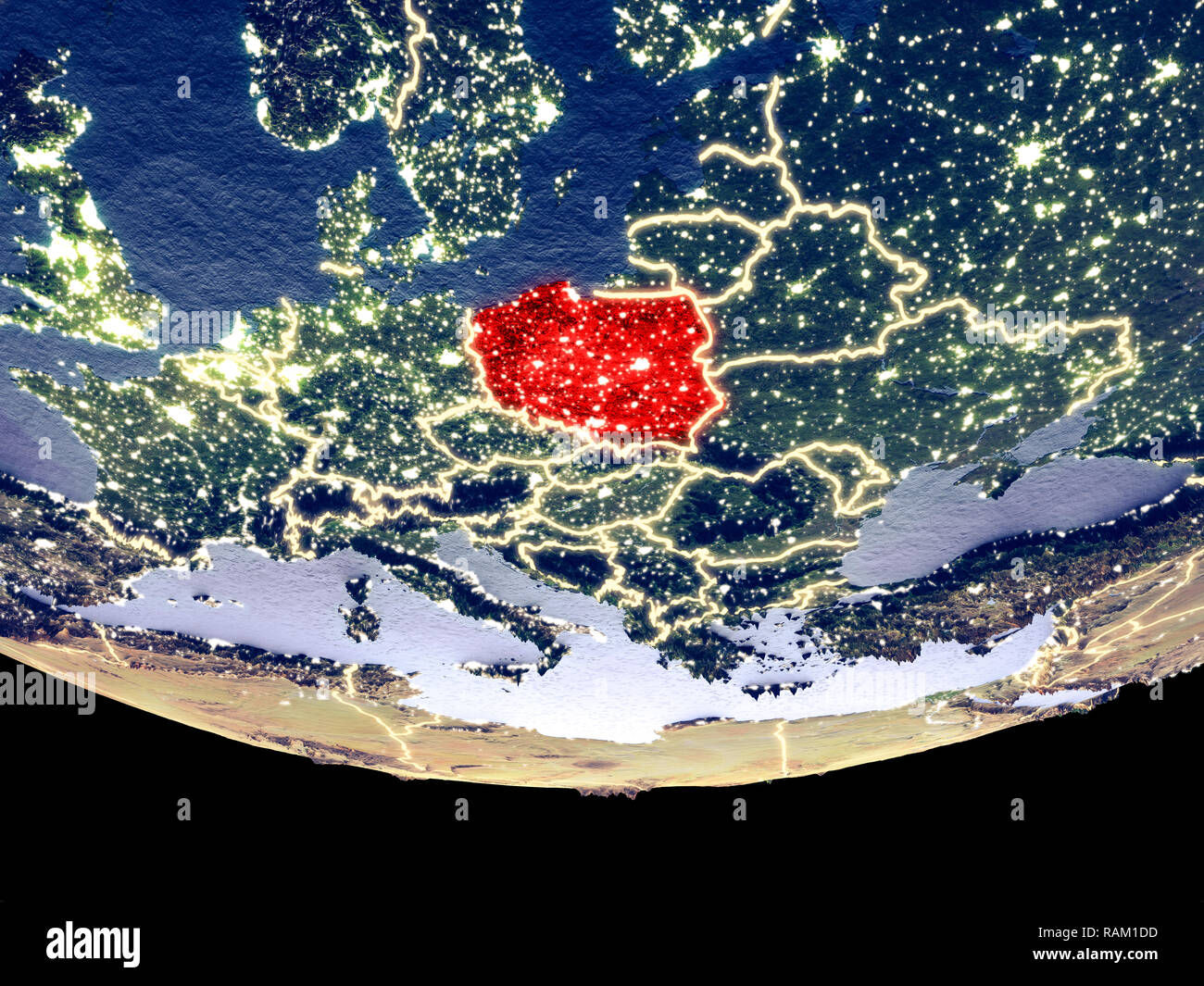 Satellite view of Poland from space at night. Beautifully detailed plastic planet surface with visible city lights. 3D illustration. Elements of this Stock Photohttps://www.alamy.com/image-license-details/?v=1https://www.alamy.com/satellite-view-of-poland-from-space-at-night-beautifully-detailed-plastic-planet-surface-with-visible-city-lights-3d-illustration-elements-of-this-image230321545.html
RFRAM1DD–Satellite view of Poland from space at night. Beautifully detailed plastic planet surface with visible city lights. 3D illustration. Elements of this
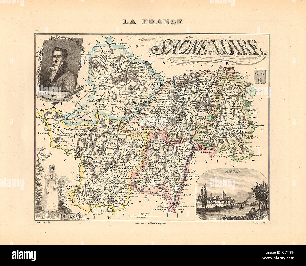 Saone et Loire Department - Antiquarian Map from an 1858 French Atlas 'France and its Colonies' (La France et ses Colonies ) by Alexandre Vuillemin Stock Photohttps://www.alamy.com/image-license-details/?v=1https://www.alamy.com/stock-photo-saone-et-loire-department-antiquarian-map-from-an-1858-french-atlas-38105777.html
RFC5YT8H–Saone et Loire Department - Antiquarian Map from an 1858 French Atlas 'France and its Colonies' (La France et ses Colonies ) by Alexandre Vuillemin
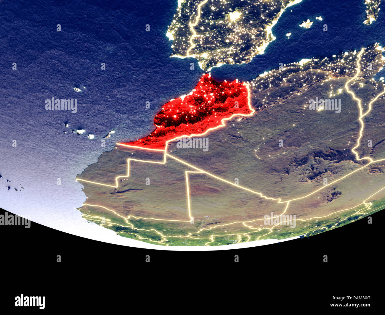 Satellite view of Morocco from space at night. Beautifully detailed plastic planet surface with visible city lights. 3D illustration. Elements of this Stock Photohttps://www.alamy.com/image-license-details/?v=1https://www.alamy.com/satellite-view-of-morocco-from-space-at-night-beautifully-detailed-plastic-planet-surface-with-visible-city-lights-3d-illustration-elements-of-this-image230322752.html
RFRAM30G–Satellite view of Morocco from space at night. Beautifully detailed plastic planet surface with visible city lights. 3D illustration. Elements of this
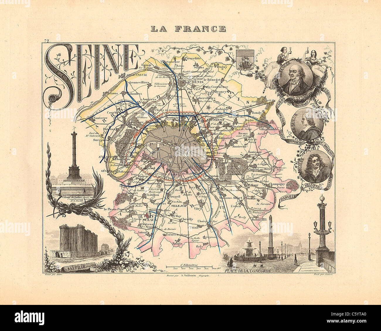 Seine (Paris) Department - Antiquarian Map from an 1858 French Atlas 'France and its Colonies' (La France et ses Colonies ) by Alexandre Vuillemin Stock Photohttps://www.alamy.com/image-license-details/?v=1https://www.alamy.com/stock-photo-seine-paris-department-antiquarian-map-from-an-1858-french-atlas-france-38105816.html
RFC5YTA0–Seine (Paris) Department - Antiquarian Map from an 1858 French Atlas 'France and its Colonies' (La France et ses Colonies ) by Alexandre Vuillemin
 Satellite view of Algeria from space at night. Beautifully detailed plastic planet surface with visible city lights. 3D illustration. Elements of this Stock Photohttps://www.alamy.com/image-license-details/?v=1https://www.alamy.com/satellite-view-of-algeria-from-space-at-night-beautifully-detailed-plastic-planet-surface-with-visible-city-lights-3d-illustration-elements-of-this-image230322681.html
RFRAM2X1–Satellite view of Algeria from space at night. Beautifully detailed plastic planet surface with visible city lights. 3D illustration. Elements of this
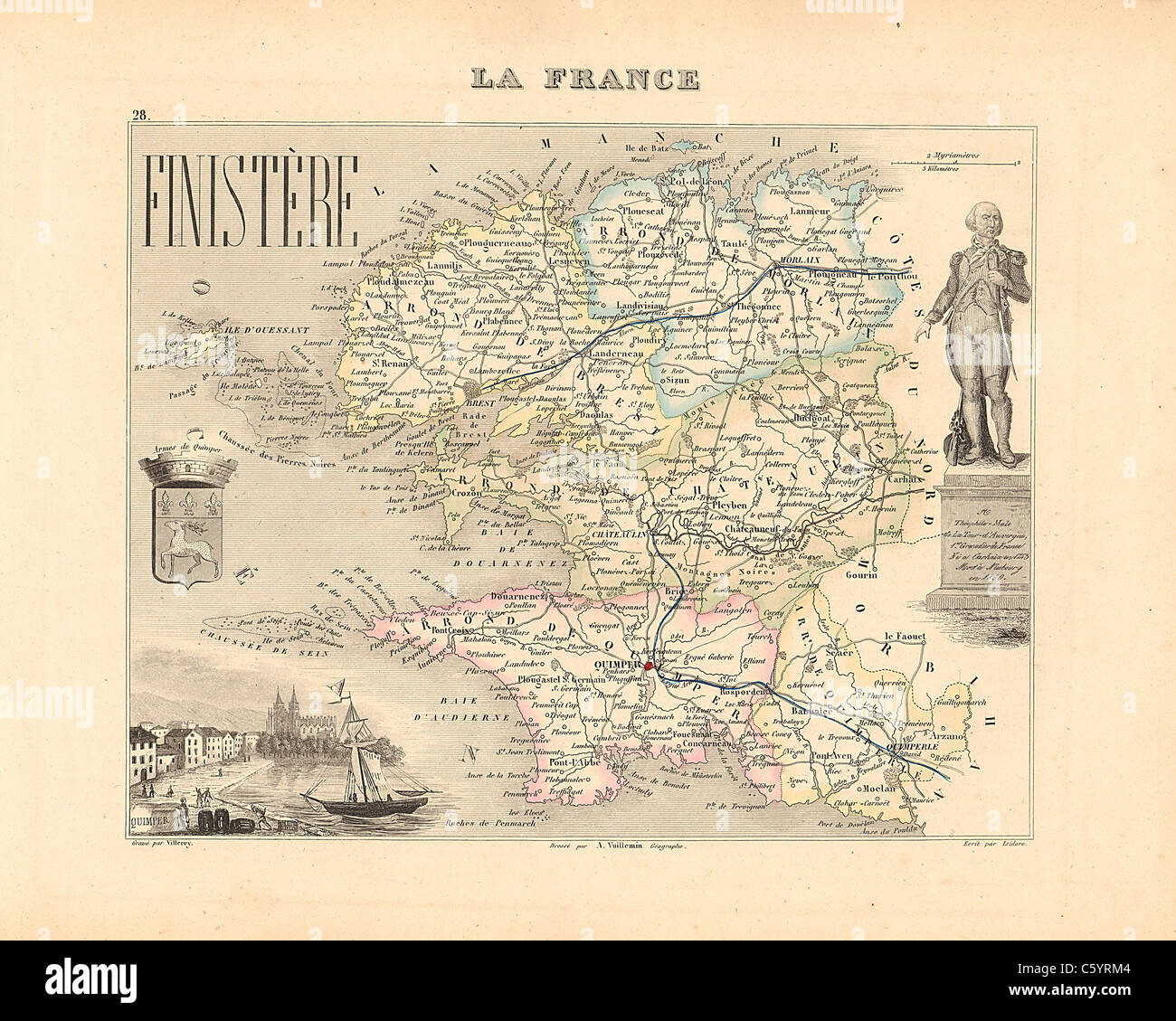 Finistere Department - Antiquarian Map from an 1858 French Atlas 'France and its Colonies' (La France et ses Colonies ) by Alexandre Vuillemin Stock Photohttps://www.alamy.com/image-license-details/?v=1https://www.alamy.com/stock-photo-finistere-department-antiquarian-map-from-an-1858-french-atlas-france-38105316.html
RFC5YRM4–Finistere Department - Antiquarian Map from an 1858 French Atlas 'France and its Colonies' (La France et ses Colonies ) by Alexandre Vuillemin
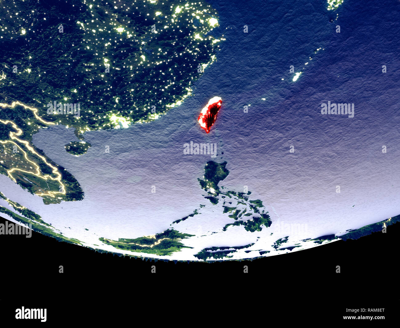 Satellite view of Taiwan from space at night. Beautifully detailed plastic planet surface with visible city lights. 3D illustration. Elements of this Stock Photohttps://www.alamy.com/image-license-details/?v=1https://www.alamy.com/satellite-view-of-taiwan-from-space-at-night-beautifully-detailed-plastic-planet-surface-with-visible-city-lights-3d-illustration-elements-of-this-image230327072.html
RFRAM8ET–Satellite view of Taiwan from space at night. Beautifully detailed plastic planet surface with visible city lights. 3D illustration. Elements of this
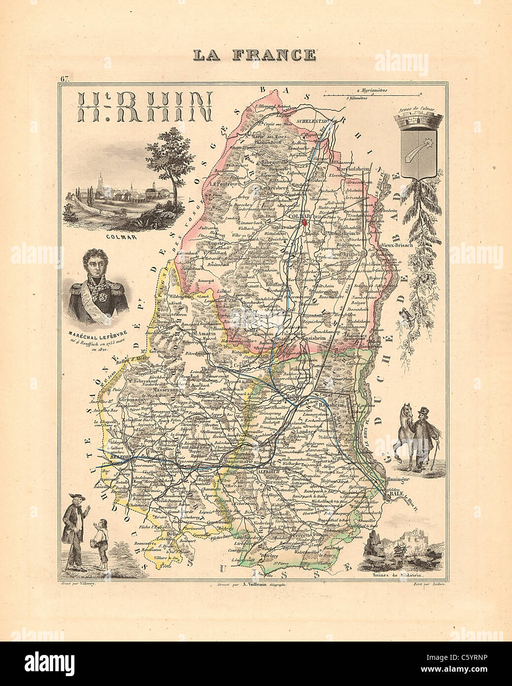 Haute Rhin Department - Antiquarian Map from an 1858 French Atlas 'France and its Colonies' (La France et ses Colonies ) by Alexandre Vuillemin Stock Photohttps://www.alamy.com/image-license-details/?v=1https://www.alamy.com/stock-photo-haute-rhin-department-antiquarian-map-from-an-1858-french-atlas-france-38105362.html
RFC5YRNP–Haute Rhin Department - Antiquarian Map from an 1858 French Atlas 'France and its Colonies' (La France et ses Colonies ) by Alexandre Vuillemin
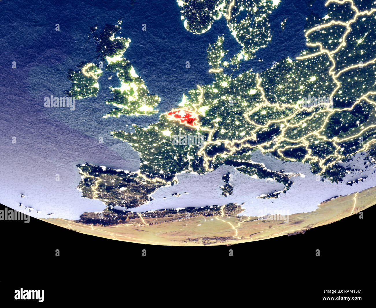 Satellite view of Belgium from space at night. Beautifully detailed plastic planet surface with visible city lights. 3D illustration. Elements of this Stock Photohttps://www.alamy.com/image-license-details/?v=1https://www.alamy.com/satellite-view-of-belgium-from-space-at-night-beautifully-detailed-plastic-planet-surface-with-visible-city-lights-3d-illustration-elements-of-this-image230321328.html
RFRAM15M–Satellite view of Belgium from space at night. Beautifully detailed plastic planet surface with visible city lights. 3D illustration. Elements of this
 Loire Inferieure Department - Antiquarian Map from an 1858 French Atlas 'France and its Colonies' (La France et ses Colonies ) by Alexandre Vuillemin Stock Photohttps://www.alamy.com/image-license-details/?v=1https://www.alamy.com/stock-photo-loire-inferieure-department-antiquarian-map-from-an-1858-french-atlas-38105457.html
RFC5YRW5–Loire Inferieure Department - Antiquarian Map from an 1858 French Atlas 'France and its Colonies' (La France et ses Colonies ) by Alexandre Vuillemin
 Satellite view of Switzerland from space at night. Beautifully detailed plastic planet surface with visible city lights. 3D illustration. Elements of Stock Photohttps://www.alamy.com/image-license-details/?v=1https://www.alamy.com/satellite-view-of-switzerland-from-space-at-night-beautifully-detailed-plastic-planet-surface-with-visible-city-lights-3d-illustration-elements-of-image230321470.html
RFRAM1AP–Satellite view of Switzerland from space at night. Beautifully detailed plastic planet surface with visible city lights. 3D illustration. Elements of
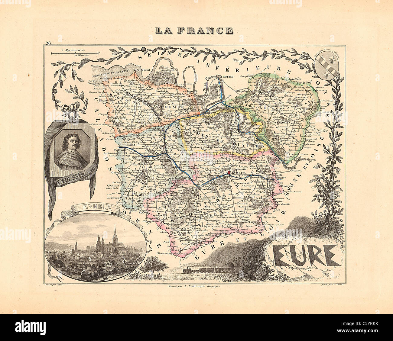 Eure Department - Antiquarian Map from an 1858 French Atlas 'France and its Colonies' (La France et ses Colonies ) by Alexandre Vuillemin Stock Photohttps://www.alamy.com/image-license-details/?v=1https://www.alamy.com/stock-photo-eure-department-antiquarian-map-from-an-1858-french-atlas-france-and-38105310.html
RFC5YRKX–Eure Department - Antiquarian Map from an 1858 French Atlas 'France and its Colonies' (La France et ses Colonies ) by Alexandre Vuillemin
 Satellite view of Nigeria from space at night. Beautifully detailed plastic planet surface with visible city lights. 3D illustration. Elements of this Stock Photohttps://www.alamy.com/image-license-details/?v=1https://www.alamy.com/satellite-view-of-nigeria-from-space-at-night-beautifully-detailed-plastic-planet-surface-with-visible-city-lights-3d-illustration-elements-of-this-image230324607.html
RFRAM5AR–Satellite view of Nigeria from space at night. Beautifully detailed plastic planet surface with visible city lights. 3D illustration. Elements of this
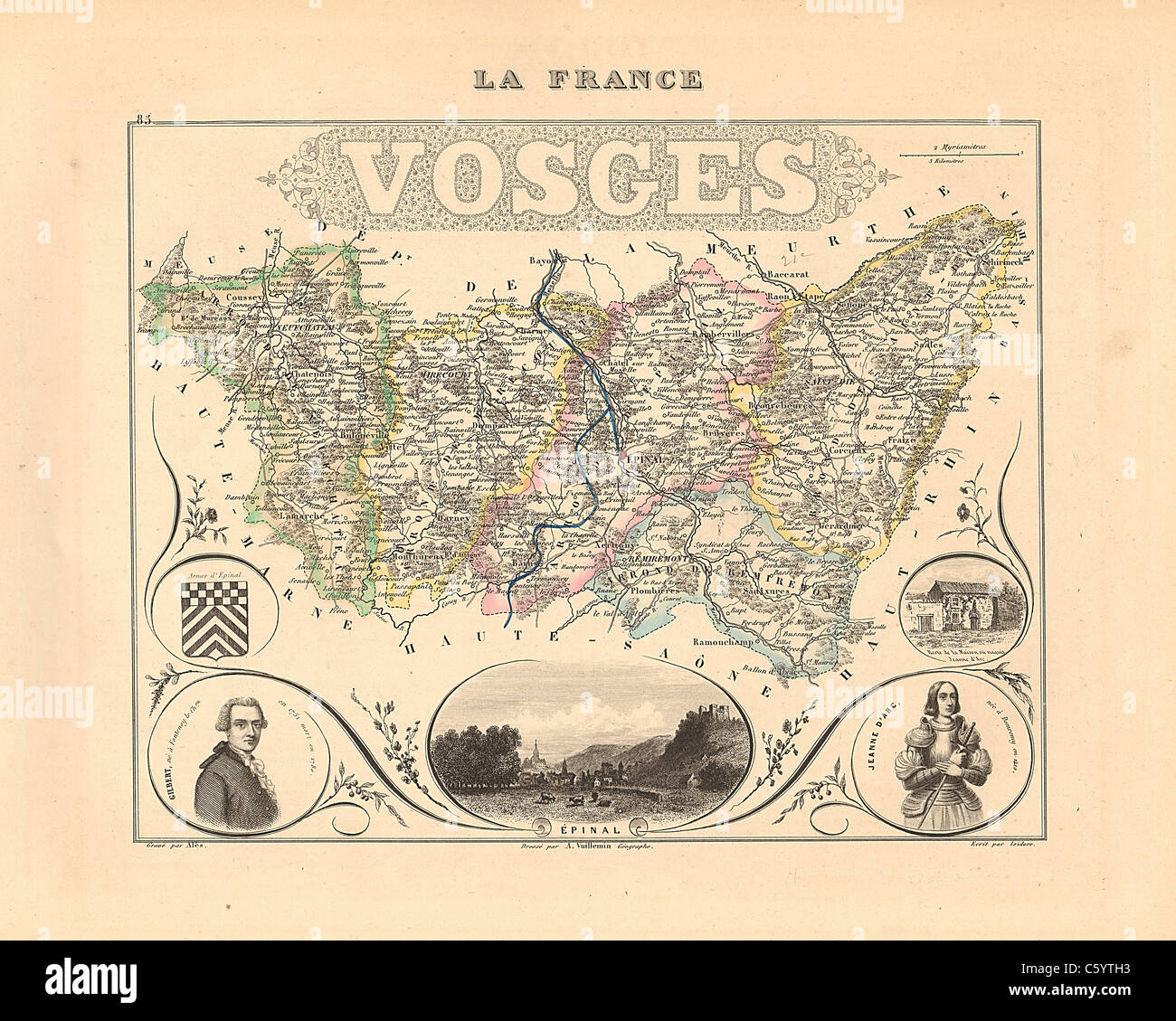 Vosges Department - Antiquarian Map from an 1858 French Atlas 'France and its Colonies' (La France et ses Colonies ) by Alexandre Vuillemin Stock Photohttps://www.alamy.com/image-license-details/?v=1https://www.alamy.com/stock-photo-vosges-department-antiquarian-map-from-an-1858-french-atlas-france-38106015.html
RFC5YTH3–Vosges Department - Antiquarian Map from an 1858 French Atlas 'France and its Colonies' (La France et ses Colonies ) by Alexandre Vuillemin
 Satellite view of Somalia from space at night. Beautifully detailed plastic planet surface with visible city lights. 3D illustration. Elements of this Stock Photohttps://www.alamy.com/image-license-details/?v=1https://www.alamy.com/satellite-view-of-somalia-from-space-at-night-beautifully-detailed-plastic-planet-surface-with-visible-city-lights-3d-illustration-elements-of-this-image230325974.html
RFRAM73J–Satellite view of Somalia from space at night. Beautifully detailed plastic planet surface with visible city lights. 3D illustration. Elements of this
 Seine Inferieure Department - Antiquarian Map from an 1858 French Atlas 'France and its Colonies' (La France et ses Colonies ) by Alexandre Vuillemin Stock Photohttps://www.alamy.com/image-license-details/?v=1https://www.alamy.com/stock-photo-seine-inferieure-department-antiquarian-map-from-an-1858-french-atlas-38105865.html
RFC5YTBN–Seine Inferieure Department - Antiquarian Map from an 1858 French Atlas 'France and its Colonies' (La France et ses Colonies ) by Alexandre Vuillemin
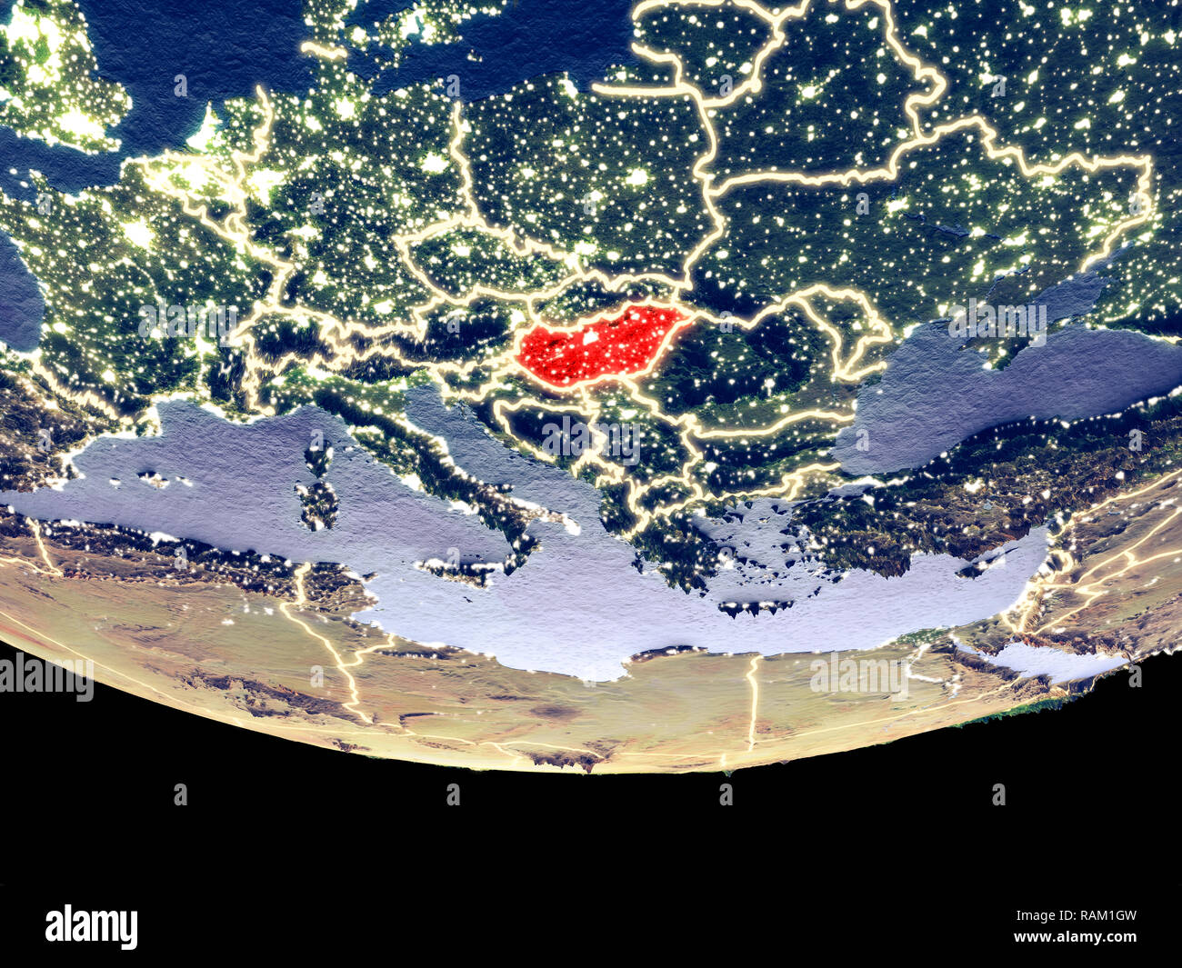 Satellite view of Hungary from space at night. Beautifully detailed plastic planet surface with visible city lights. 3D illustration. Elements of this Stock Photohttps://www.alamy.com/image-license-details/?v=1https://www.alamy.com/satellite-view-of-hungary-from-space-at-night-beautifully-detailed-plastic-planet-surface-with-visible-city-lights-3d-illustration-elements-of-this-image230321641.html
RFRAM1GW–Satellite view of Hungary from space at night. Beautifully detailed plastic planet surface with visible city lights. 3D illustration. Elements of this
 Isere Department - Antiquarian Map from an 1858 French Atlas 'France and its Colonies' (La France et ses Colonies ) by Alexandre Vuillemin Stock Photohttps://www.alamy.com/image-license-details/?v=1https://www.alamy.com/stock-photo-isere-department-antiquarian-map-from-an-1858-french-atlas-france-38105430.html
RFC5YRT6–Isere Department - Antiquarian Map from an 1858 French Atlas 'France and its Colonies' (La France et ses Colonies ) by Alexandre Vuillemin
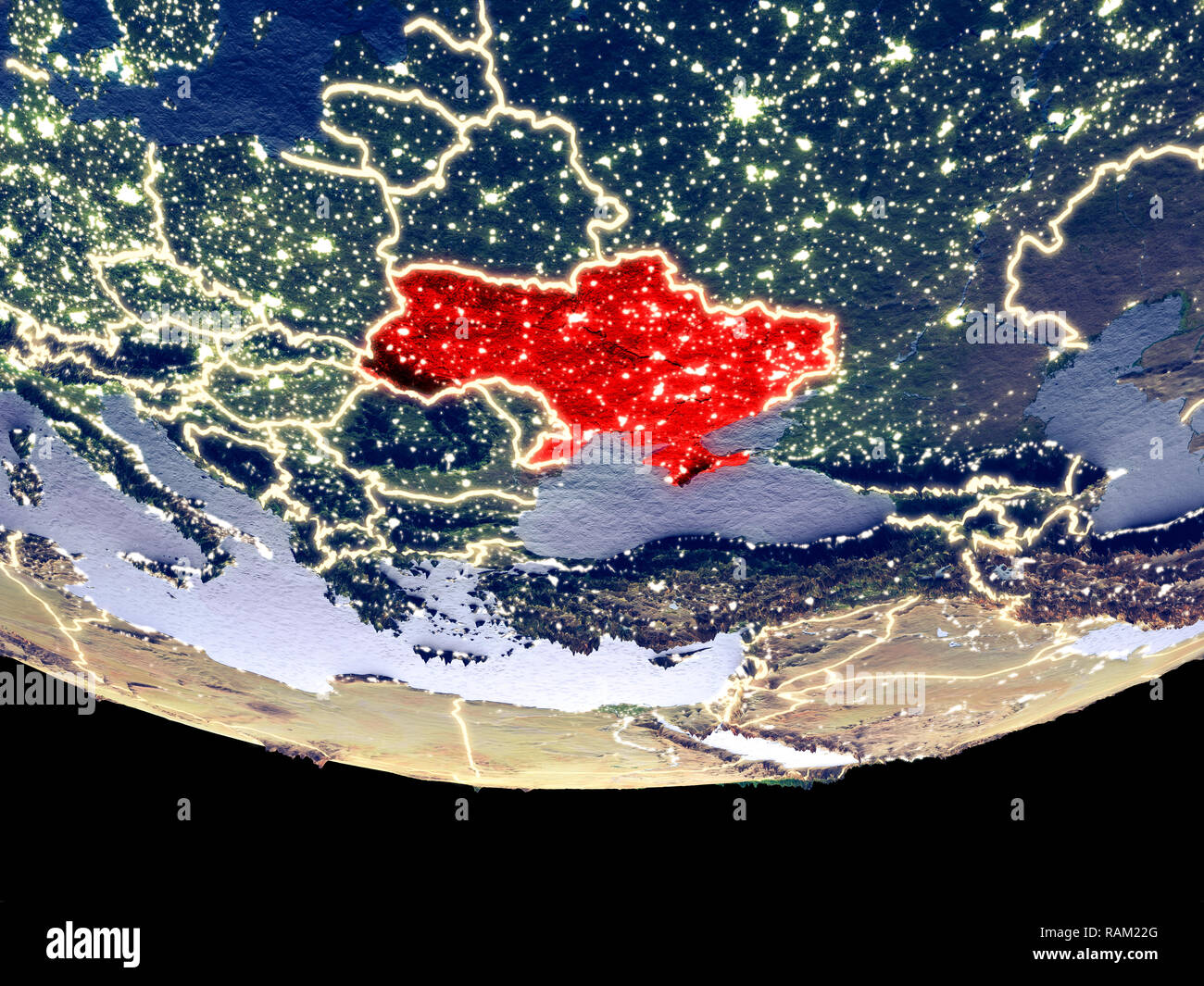 Satellite view of Ukraine from space at night. Beautifully detailed plastic planet surface with visible city lights. 3D illustration. Elements of this Stock Photohttps://www.alamy.com/image-license-details/?v=1https://www.alamy.com/satellite-view-of-ukraine-from-space-at-night-beautifully-detailed-plastic-planet-surface-with-visible-city-lights-3d-illustration-elements-of-this-image230322024.html
RFRAM22G–Satellite view of Ukraine from space at night. Beautifully detailed plastic planet surface with visible city lights. 3D illustration. Elements of this
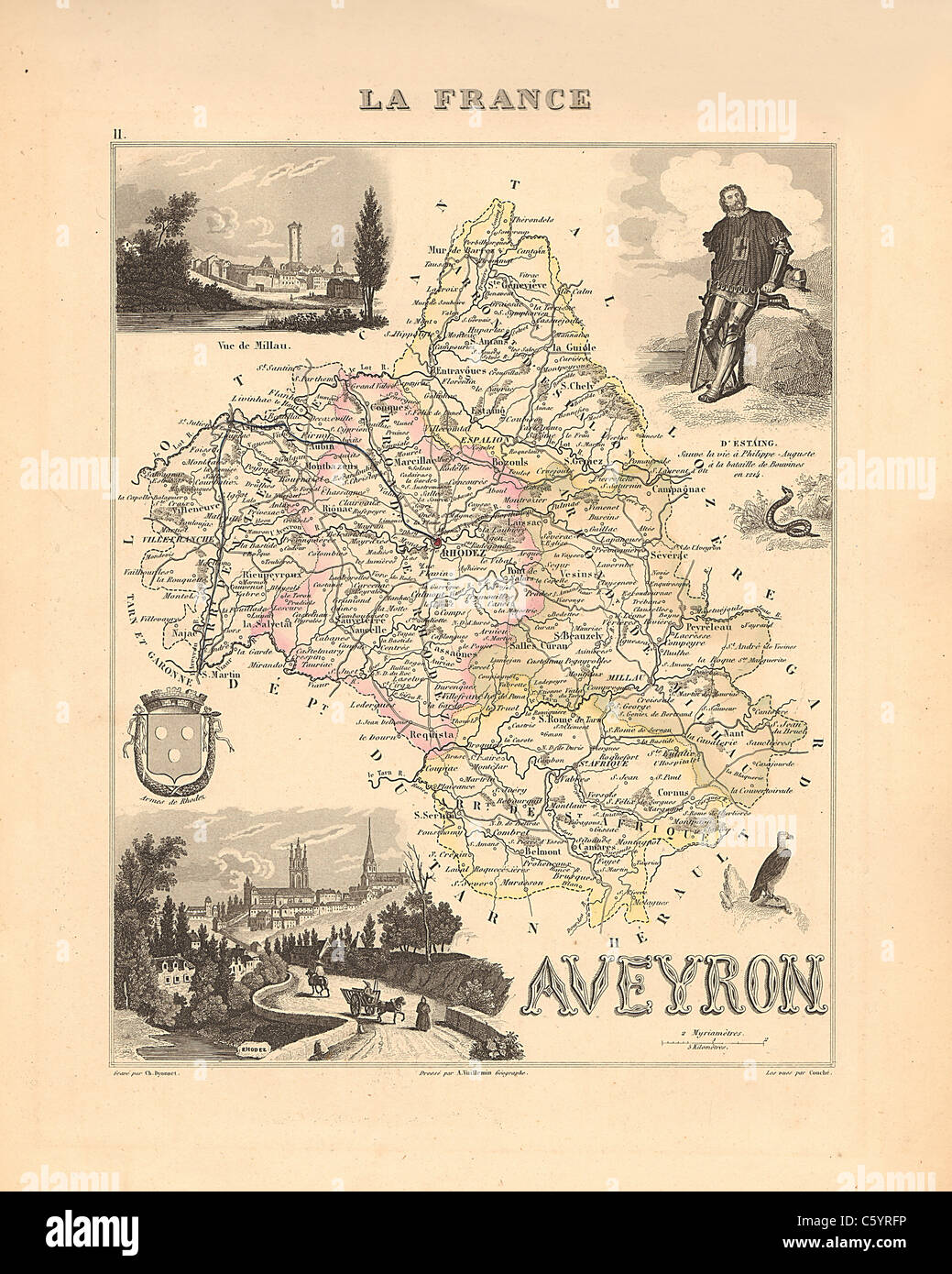 Aveyron Department - Antiquarian Map from an 1858 French Atlas 'France and its Colonies' (La France et ses Colonies ) by Alexandre Vuillemin Stock Photohttps://www.alamy.com/image-license-details/?v=1https://www.alamy.com/stock-photo-aveyron-department-antiquarian-map-from-an-1858-french-atlas-france-38105194.html
RFC5YRFP–Aveyron Department - Antiquarian Map from an 1858 French Atlas 'France and its Colonies' (La France et ses Colonies ) by Alexandre Vuillemin
 Satellite view of Eritrea from space at night. Beautifully detailed plastic planet surface with visible city lights. 3D illustration. Elements of this Stock Photohttps://www.alamy.com/image-license-details/?v=1https://www.alamy.com/satellite-view-of-eritrea-from-space-at-night-beautifully-detailed-plastic-planet-surface-with-visible-city-lights-3d-illustration-elements-of-this-image230326138.html
RFRAM79E–Satellite view of Eritrea from space at night. Beautifully detailed plastic planet surface with visible city lights. 3D illustration. Elements of this
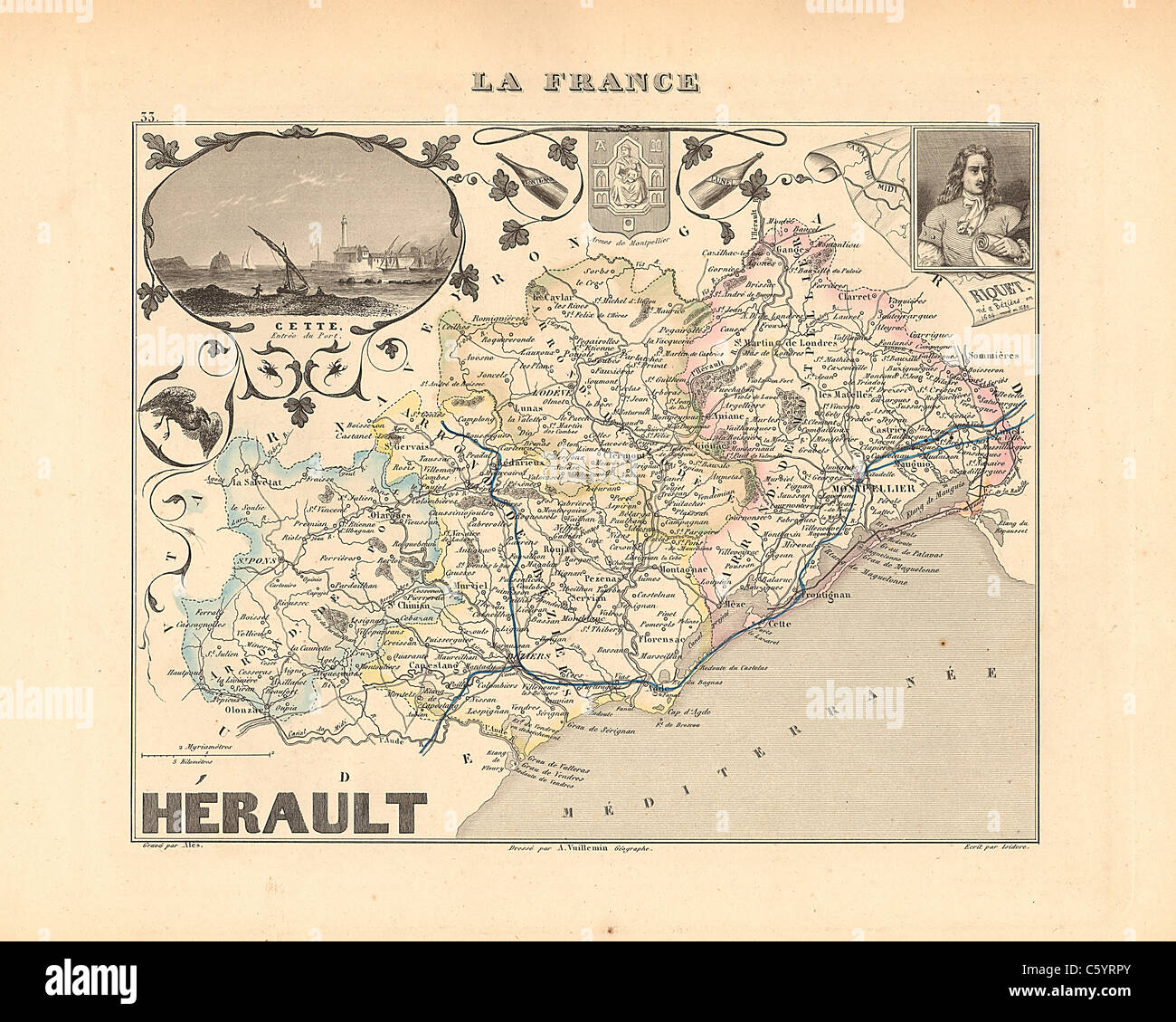 Herault Department - Antiquarian Map from an 1858 French Atlas 'France and its Colonies' (La France et ses Colonies ) by Alexandre Vuillemin Stock Photohttps://www.alamy.com/image-license-details/?v=1https://www.alamy.com/stock-photo-herault-department-antiquarian-map-from-an-1858-french-atlas-france-38105395.html
RFC5YRPY–Herault Department - Antiquarian Map from an 1858 French Atlas 'France and its Colonies' (La France et ses Colonies ) by Alexandre Vuillemin
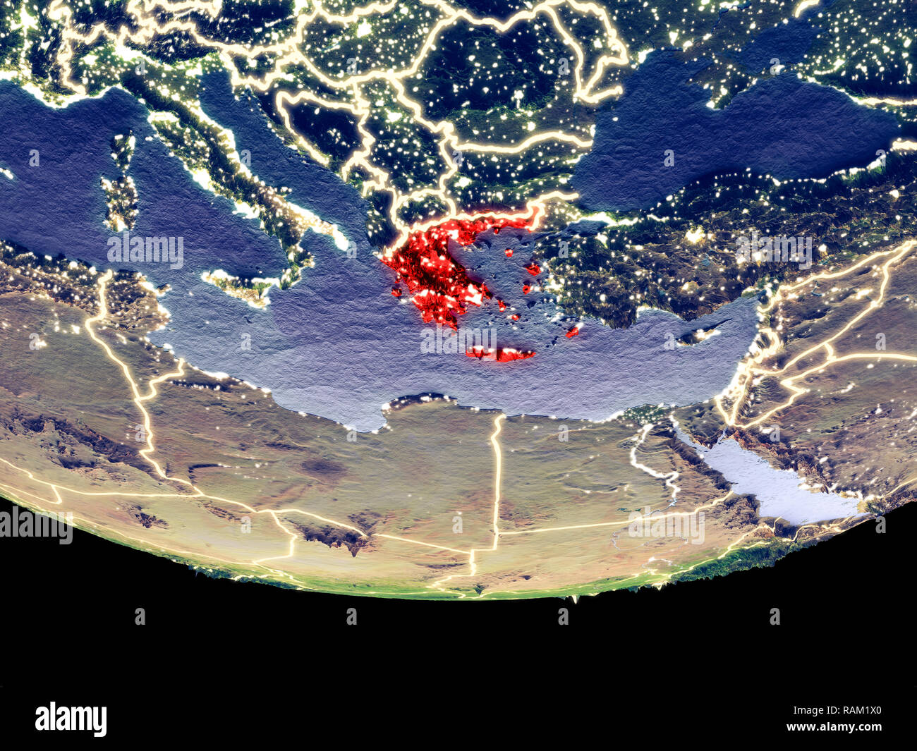 Satellite view of Greece from space at night. Beautifully detailed plastic planet surface with visible city lights. 3D illustration. Elements of this Stock Photohttps://www.alamy.com/image-license-details/?v=1https://www.alamy.com/satellite-view-of-greece-from-space-at-night-beautifully-detailed-plastic-planet-surface-with-visible-city-lights-3d-illustration-elements-of-this-image230321896.html
RFRAM1X0–Satellite view of Greece from space at night. Beautifully detailed plastic planet surface with visible city lights. 3D illustration. Elements of this
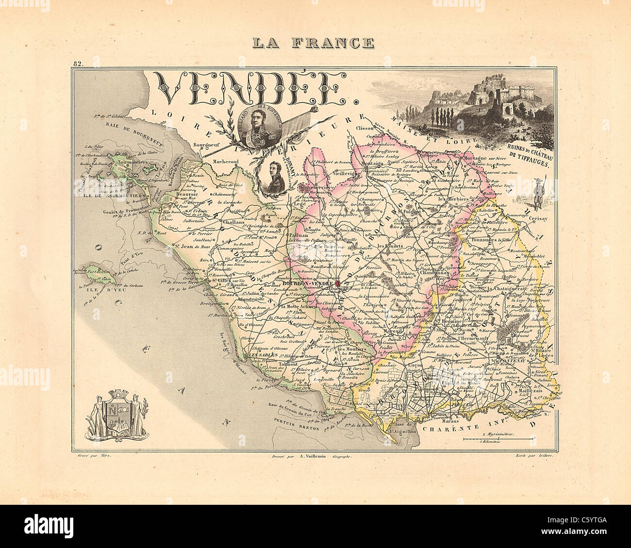 Vendee Department - Antiquarian Map from an 1858 French Atlas 'France and its Colonies' (La France et ses Colonies ) by Alexandre Vuillemin Stock Photohttps://www.alamy.com/image-license-details/?v=1https://www.alamy.com/stock-photo-vendee-department-antiquarian-map-from-an-1858-french-atlas-france-38105994.html
RFC5YTGA–Vendee Department - Antiquarian Map from an 1858 French Atlas 'France and its Colonies' (La France et ses Colonies ) by Alexandre Vuillemin
 Satellite view of Iceland from space at night. Beautifully detailed plastic planet surface with visible city lights. 3D illustration. Elements of this Stock Photohttps://www.alamy.com/image-license-details/?v=1https://www.alamy.com/satellite-view-of-iceland-from-space-at-night-beautifully-detailed-plastic-planet-surface-with-visible-city-lights-3d-illustration-elements-of-this-image230322199.html
RFRAM28R–Satellite view of Iceland from space at night. Beautifully detailed plastic planet surface with visible city lights. 3D illustration. Elements of this
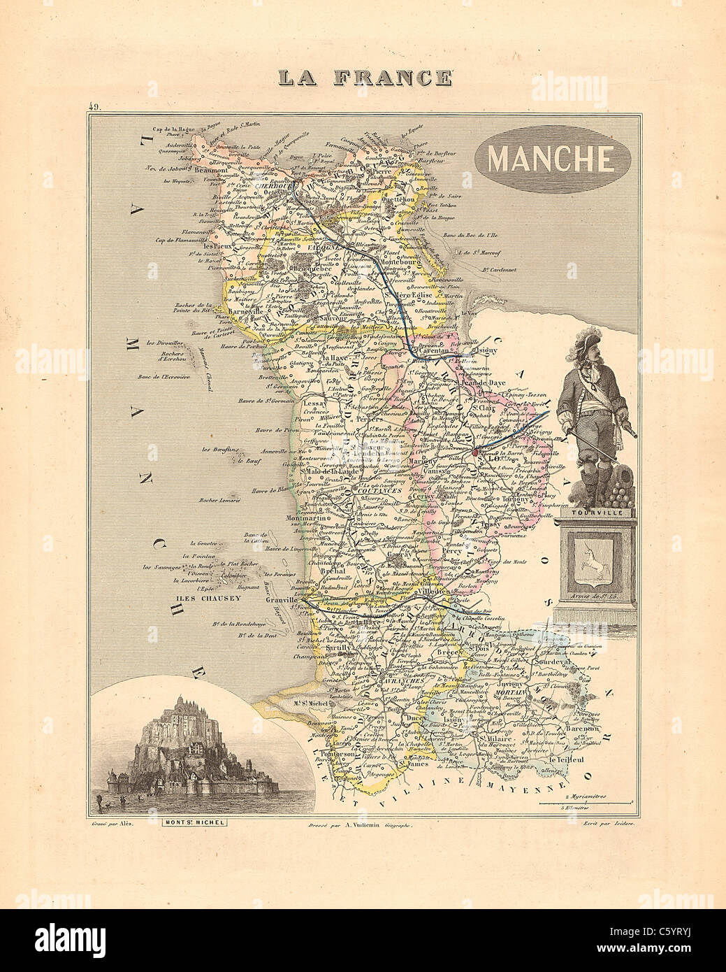 Manche Department - Antiquarian Map from an 1858 French Atlas 'France and its Colonies' (La France et ses Colonies ) by Alexandre Vuillemin Stock Photohttps://www.alamy.com/image-license-details/?v=1https://www.alamy.com/stock-photo-manche-department-antiquarian-map-from-an-1858-french-atlas-france-38105526.html
RFC5YRYJ–Manche Department - Antiquarian Map from an 1858 French Atlas 'France and its Colonies' (La France et ses Colonies ) by Alexandre Vuillemin
 Satellite view of Vietnam from space at night. Beautifully detailed plastic planet surface with visible city lights. 3D illustration. Elements of this Stock Photohttps://www.alamy.com/image-license-details/?v=1https://www.alamy.com/satellite-view-of-vietnam-from-space-at-night-beautifully-detailed-plastic-planet-surface-with-visible-city-lights-3d-illustration-elements-of-this-image230326987.html
RFRAM8BR–Satellite view of Vietnam from space at night. Beautifully detailed plastic planet surface with visible city lights. 3D illustration. Elements of this
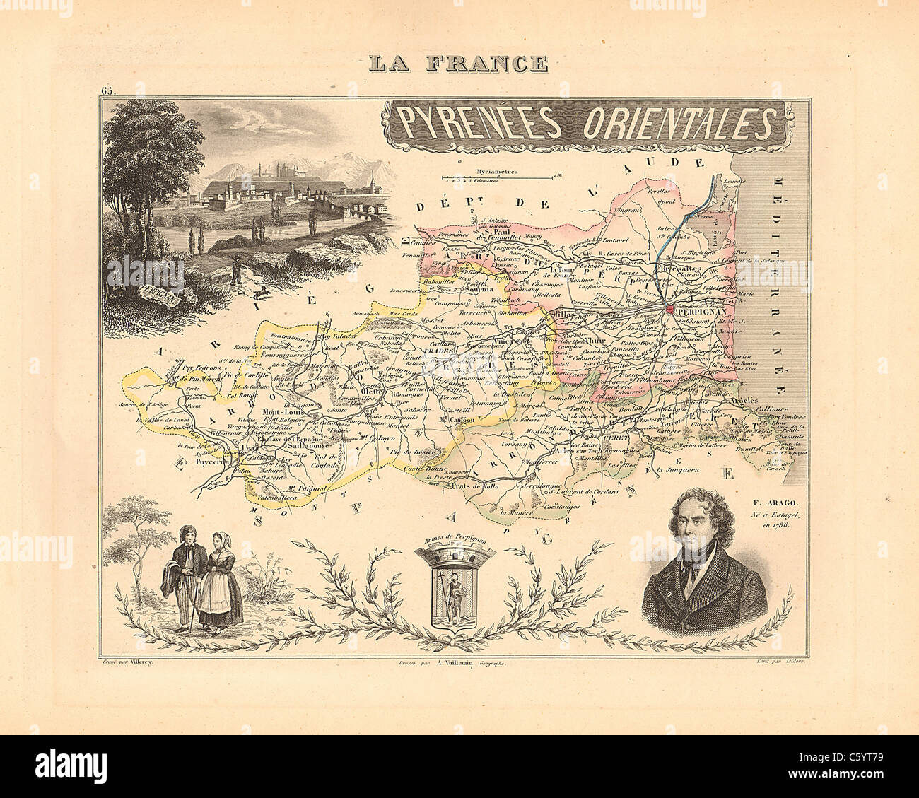 Pyrenees Orientales Department - Antiquarian Map from 1858 French Atlas 'France and its Colonies' (La France et ses Colonies ) by Alexandre Vuillemin Stock Photohttps://www.alamy.com/image-license-details/?v=1https://www.alamy.com/stock-photo-pyrenees-orientales-department-antiquarian-map-from-1858-french-atlas-38105741.html
RFC5YT79–Pyrenees Orientales Department - Antiquarian Map from 1858 French Atlas 'France and its Colonies' (La France et ses Colonies ) by Alexandre Vuillemin
 Satellite view of Turkmenistan from space at night. Beautifully detailed plastic planet surface with visible city lights. 3D illustration. Elements of Stock Photohttps://www.alamy.com/image-license-details/?v=1https://www.alamy.com/satellite-view-of-turkmenistan-from-space-at-night-beautifully-detailed-plastic-planet-surface-with-visible-city-lights-3d-illustration-elements-of-image230326809.html
RFRAM85D–Satellite view of Turkmenistan from space at night. Beautifully detailed plastic planet surface with visible city lights. 3D illustration. Elements of
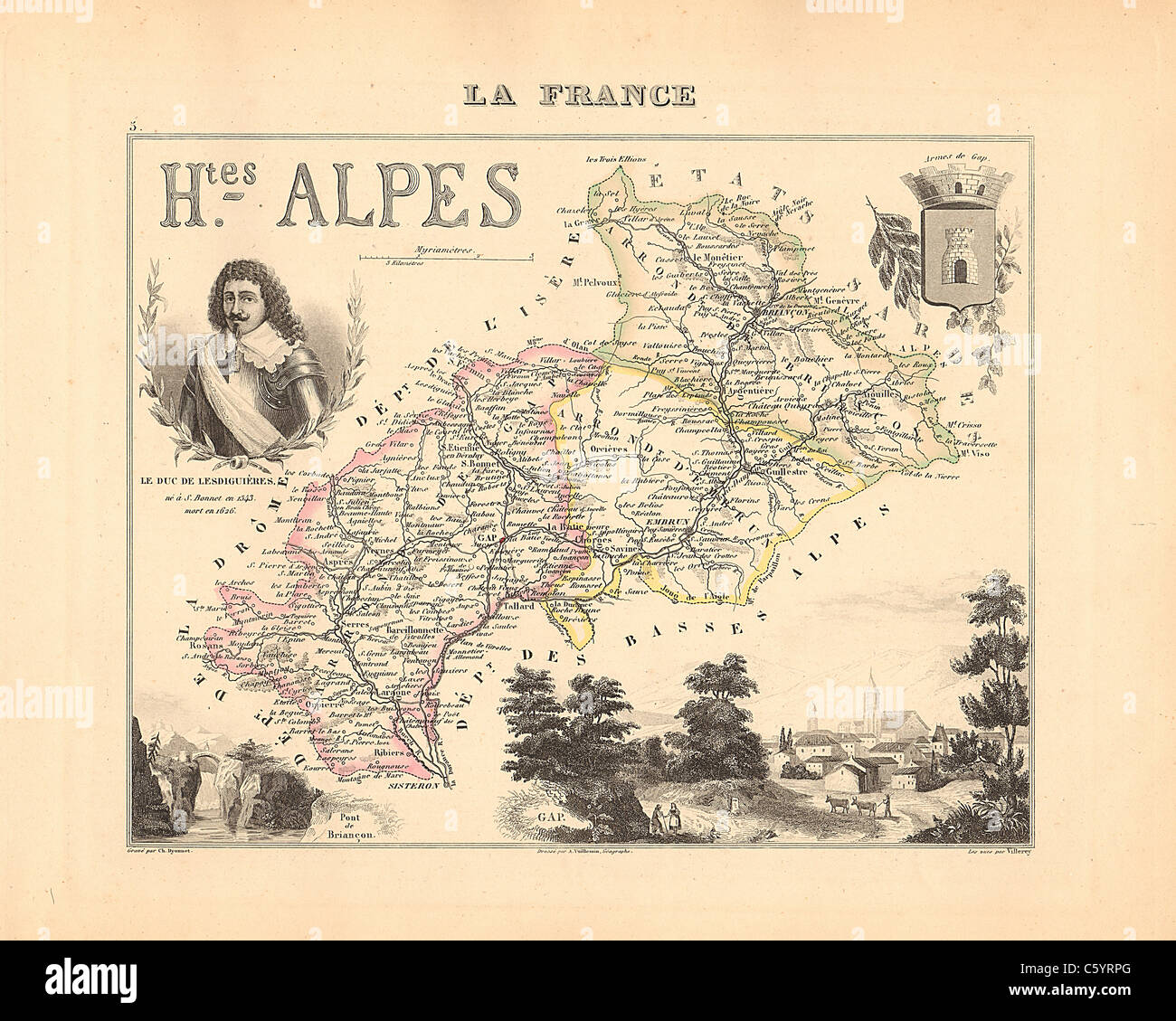 Hautes Alpes Department - Antiquarian Map from an 1858 French Atlas 'France and its Colonies' (La France et ses Colonies ) by Alexandre Vuillemin Stock Photohttps://www.alamy.com/image-license-details/?v=1https://www.alamy.com/stock-photo-hautes-alpes-department-antiquarian-map-from-an-1858-french-atlas-38105384.html
RFC5YRPG–Hautes Alpes Department - Antiquarian Map from an 1858 French Atlas 'France and its Colonies' (La France et ses Colonies ) by Alexandre Vuillemin
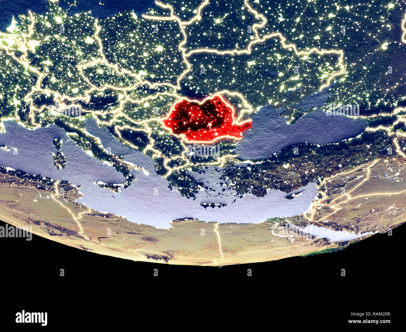 Satellite view of Romania from space at night. Beautifully detailed plastic planet surface with visible city lights. 3D illustration. Elements of this Stock Photohttps://www.alamy.com/image-license-details/?v=1https://www.alamy.com/satellite-view-of-romania-from-space-at-night-beautifully-detailed-plastic-planet-surface-with-visible-city-lights-3d-illustration-elements-of-this-image230321975.html
RFRAM20R–Satellite view of Romania from space at night. Beautifully detailed plastic planet surface with visible city lights. 3D illustration. Elements of this
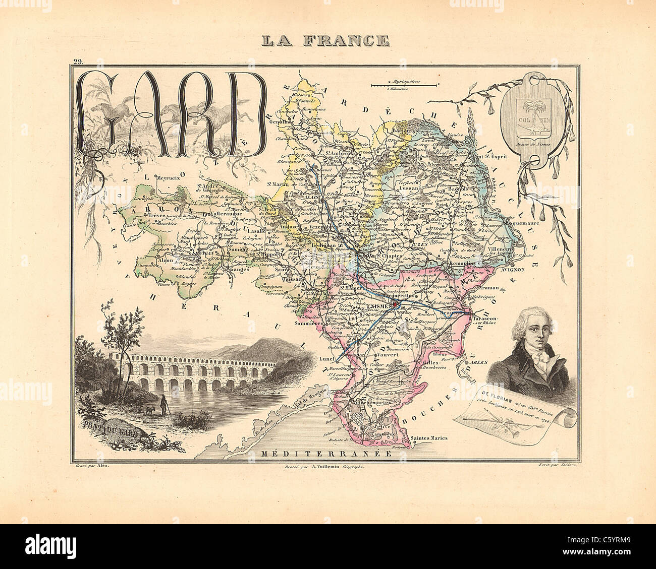 Gard Department - Antiquarian Map from an 1858 French Atlas 'France and its Colonies' (La France et ses Colonies ) by Alexandre Vuillemin Stock Photohttps://www.alamy.com/image-license-details/?v=1https://www.alamy.com/stock-photo-gard-department-antiquarian-map-from-an-1858-french-atlas-france-and-38105321.html
RFC5YRM9–Gard Department - Antiquarian Map from an 1858 French Atlas 'France and its Colonies' (La France et ses Colonies ) by Alexandre Vuillemin
 Satellite view of Europe from space at night. Beautifully detailed plastic planet surface with visible city lights. 3D illustration. Elements of this Stock Photohttps://www.alamy.com/image-license-details/?v=1https://www.alamy.com/satellite-view-of-europe-from-space-at-night-beautifully-detailed-plastic-planet-surface-with-visible-city-lights-3d-illustration-elements-of-this-image224758172.html
RFR1JH9G–Satellite view of Europe from space at night. Beautifully detailed plastic planet surface with visible city lights. 3D illustration. Elements of this
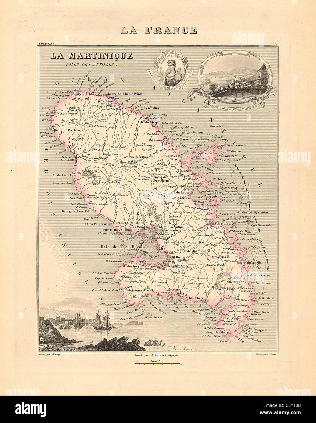 Martinique - Antiquarian Map from an 1858 French Atlas 'France and its Colonies' (La France et ses Colonies ) by Alexandre Vuillemin Stock Photohttps://www.alamy.com/image-license-details/?v=1https://www.alamy.com/stock-photo-martinique-antiquarian-map-from-an-1858-french-atlas-france-and-its-38105547.html
RFC5YT0B–Martinique - Antiquarian Map from an 1858 French Atlas 'France and its Colonies' (La France et ses Colonies ) by Alexandre Vuillemin
 Satellite view of Armenia from space at night. Beautifully detailed plastic planet surface with visible city lights. 3D illustration. Elements of this Stock Photohttps://www.alamy.com/image-license-details/?v=1https://www.alamy.com/satellite-view-of-armenia-from-space-at-night-beautifully-detailed-plastic-planet-surface-with-visible-city-lights-3d-illustration-elements-of-this-image230326776.html
RFRAM848–Satellite view of Armenia from space at night. Beautifully detailed plastic planet surface with visible city lights. 3D illustration. Elements of this
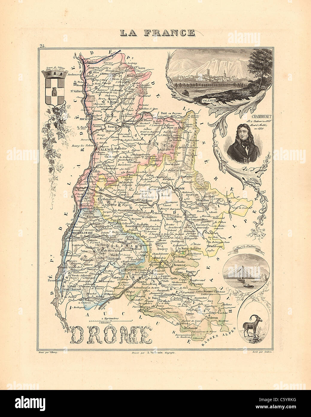 Drome Department - Antiquarian Map from an 1858 French Atlas 'France and its Colonies' (La France et ses Colonies ) by Alexandre Vuillemin Stock Photohttps://www.alamy.com/image-license-details/?v=1https://www.alamy.com/stock-photo-drome-department-antiquarian-map-from-an-1858-french-atlas-france-38105300.html
RFC5YRKG–Drome Department - Antiquarian Map from an 1858 French Atlas 'France and its Colonies' (La France et ses Colonies ) by Alexandre Vuillemin
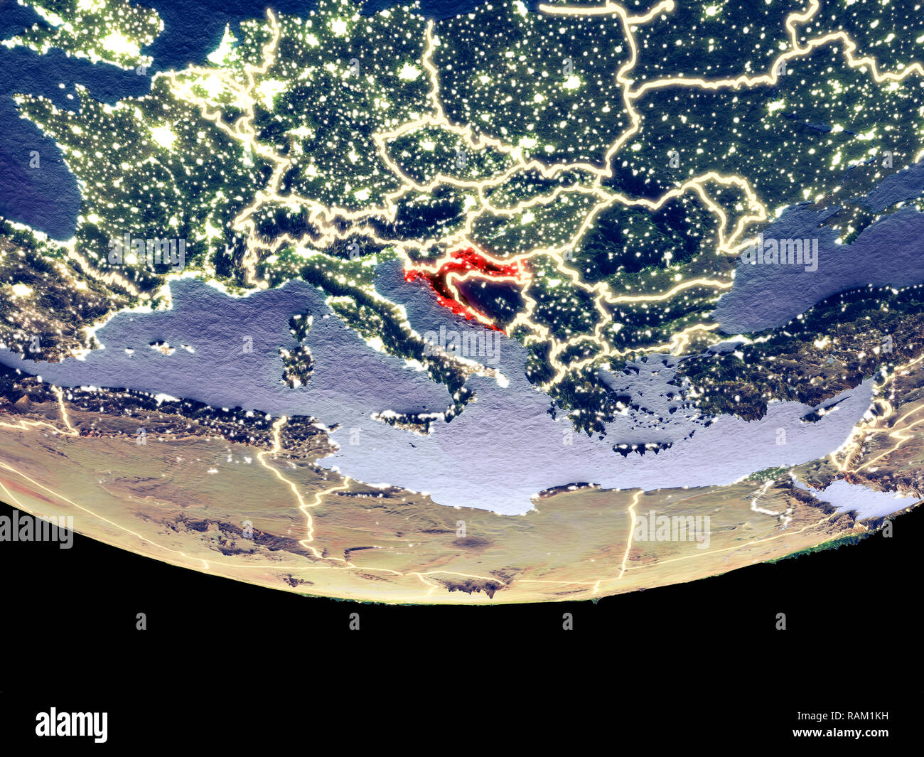 Satellite view of Croatia from space at night. Beautifully detailed plastic planet surface with visible city lights. 3D illustration. Elements of this Stock Photohttps://www.alamy.com/image-license-details/?v=1https://www.alamy.com/satellite-view-of-croatia-from-space-at-night-beautifully-detailed-plastic-planet-surface-with-visible-city-lights-3d-illustration-elements-of-this-image230321717.html
RFRAM1KH–Satellite view of Croatia from space at night. Beautifully detailed plastic planet surface with visible city lights. 3D illustration. Elements of this
 Ardennes Department - Antiquarian Map from an 1858 French Atlas 'France and its Colonies' (La France et ses Colonies ) by Alexandre Vuillemin Stock Photohttps://www.alamy.com/image-license-details/?v=1https://www.alamy.com/stock-photo-ardennes-department-antiquarian-map-from-an-1858-french-atlas-france-38105167.html
RFC5YRER–Ardennes Department - Antiquarian Map from an 1858 French Atlas 'France and its Colonies' (La France et ses Colonies ) by Alexandre Vuillemin
 Satellite view of Netherlands from space at night. Beautifully detailed plastic planet surface with visible city lights. 3D illustration. Elements of Stock Photohttps://www.alamy.com/image-license-details/?v=1https://www.alamy.com/satellite-view-of-netherlands-from-space-at-night-beautifully-detailed-plastic-planet-surface-with-visible-city-lights-3d-illustration-elements-of-image230321239.html
RFRAM12F–Satellite view of Netherlands from space at night. Beautifully detailed plastic planet surface with visible city lights. 3D illustration. Elements of
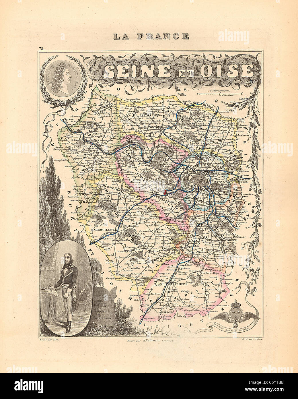 Seine et Oise Department - Antiquarian Map from an 1858 French Atlas 'France and its Colonies' (La France et ses Colonies ) by Alexandre Vuillemin Stock Photohttps://www.alamy.com/image-license-details/?v=1https://www.alamy.com/stock-photo-seine-et-oise-department-antiquarian-map-from-an-1858-french-atlas-38105855.html
RFC5YTBB–Seine et Oise Department - Antiquarian Map from an 1858 French Atlas 'France and its Colonies' (La France et ses Colonies ) by Alexandre Vuillemin
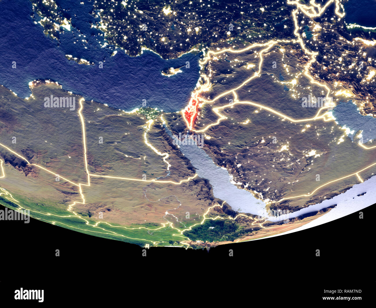 Satellite view of Israel from space at night. Beautifully detailed plastic planet surface with visible city lights. 3D illustration. Elements of this Stock Photohttps://www.alamy.com/image-license-details/?v=1https://www.alamy.com/satellite-view-of-israel-from-space-at-night-beautifully-detailed-plastic-planet-surface-with-visible-city-lights-3d-illustration-elements-of-this-image230326473.html
RFRAM7ND–Satellite view of Israel from space at night. Beautifully detailed plastic planet surface with visible city lights. 3D illustration. Elements of this
 Basses Pyrenees Department - Antiquarian Map from an 1858 French Atlas 'France and its Colonies' (La France et ses Colonies ) by Alexandre Vuillemin Stock Photohttps://www.alamy.com/image-license-details/?v=1https://www.alamy.com/stock-photo-basses-pyrenees-department-antiquarian-map-from-an-1858-french-atlas-38105214.html
RFC5YRGE–Basses Pyrenees Department - Antiquarian Map from an 1858 French Atlas 'France and its Colonies' (La France et ses Colonies ) by Alexandre Vuillemin
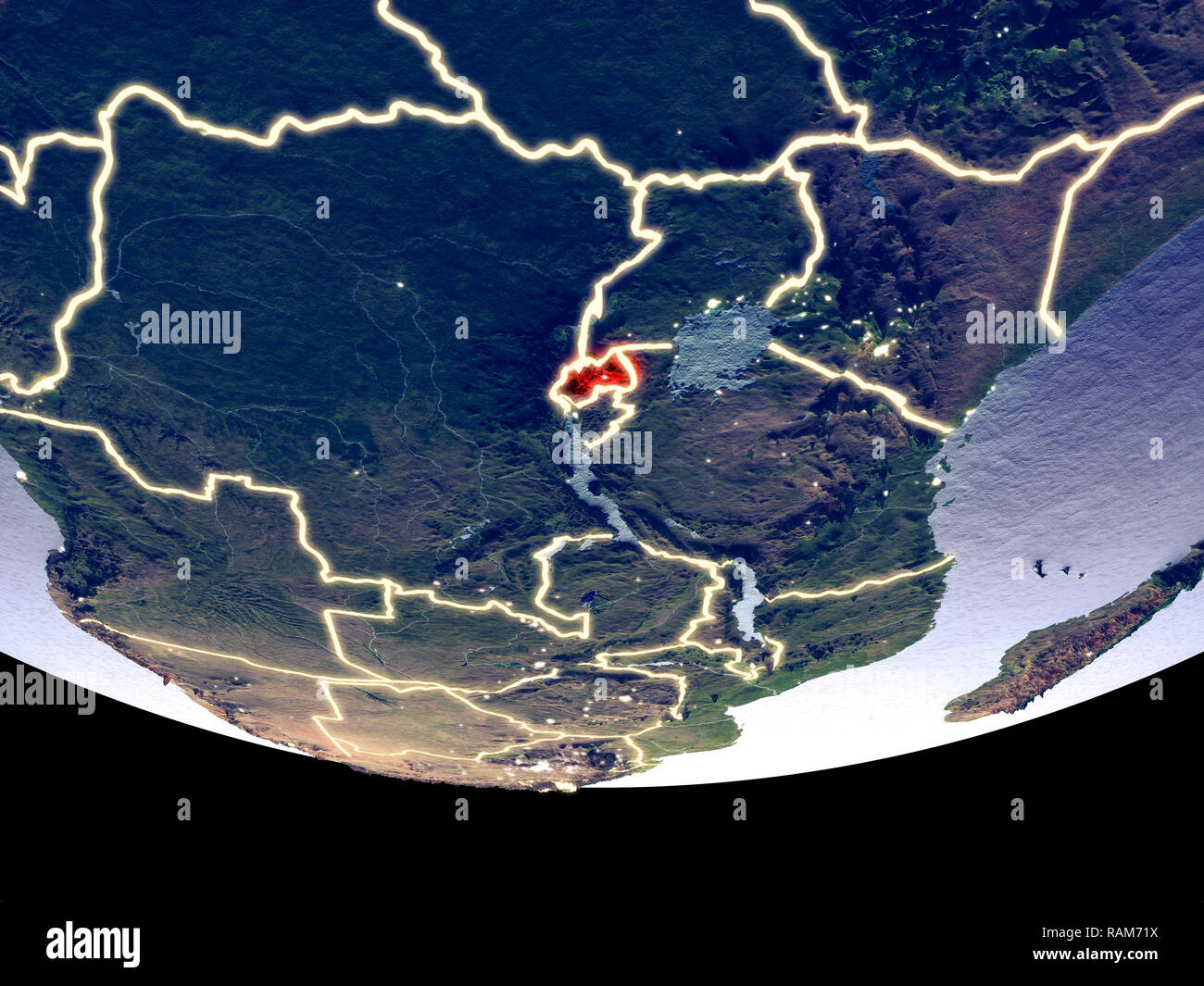 Satellite view of Rwanda from space at night. Beautifully detailed plastic planet surface with visible city lights. 3D illustration. Elements of this Stock Photohttps://www.alamy.com/image-license-details/?v=1https://www.alamy.com/satellite-view-of-rwanda-from-space-at-night-beautifully-detailed-plastic-planet-surface-with-visible-city-lights-3d-illustration-elements-of-this-image230325926.html
RFRAM71X–Satellite view of Rwanda from space at night. Beautifully detailed plastic planet surface with visible city lights. 3D illustration. Elements of this
 Moselle Department - Antiquarian Map from an 1858 French Atlas 'France and its Colonies' (La France et ses Colonies ) by Alexandre Vuillemin Stock Photohttps://www.alamy.com/image-license-details/?v=1https://www.alamy.com/stock-photo-moselle-department-antiquarian-map-from-an-1858-french-atlas-france-38105600.html
RFC5YT28–Moselle Department - Antiquarian Map from an 1858 French Atlas 'France and its Colonies' (La France et ses Colonies ) by Alexandre Vuillemin
 Satellite view of Kosovo from space at night. Beautifully detailed plastic planet surface with visible city lights. 3D illustration. Elements of this Stock Photohttps://www.alamy.com/image-license-details/?v=1https://www.alamy.com/satellite-view-of-kosovo-from-space-at-night-beautifully-detailed-plastic-planet-surface-with-visible-city-lights-3d-illustration-elements-of-this-image230321826.html
RFRAM1RE–Satellite view of Kosovo from space at night. Beautifully detailed plastic planet surface with visible city lights. 3D illustration. Elements of this
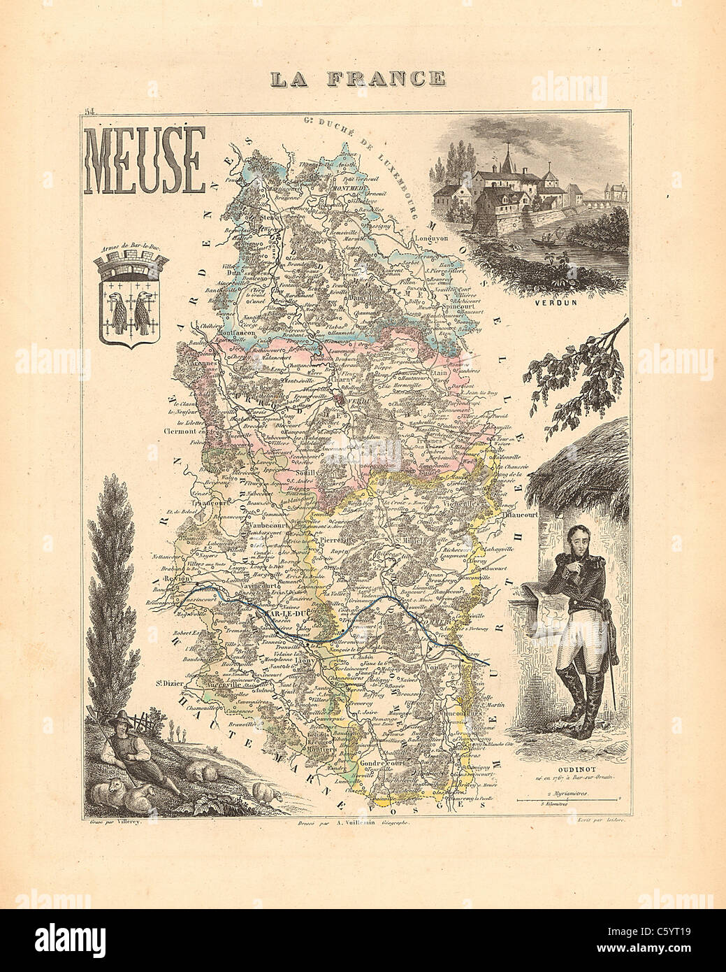 Meuse Department - Antiquarian Map from an 1858 French Atlas 'France and its Colonies' (La France et ses Colonies ) by Alexandre Vuillemin Stock Photohttps://www.alamy.com/image-license-details/?v=1https://www.alamy.com/stock-photo-meuse-department-antiquarian-map-from-an-1858-french-atlas-france-38105573.html
RFC5YT19–Meuse Department - Antiquarian Map from an 1858 French Atlas 'France and its Colonies' (La France et ses Colonies ) by Alexandre Vuillemin
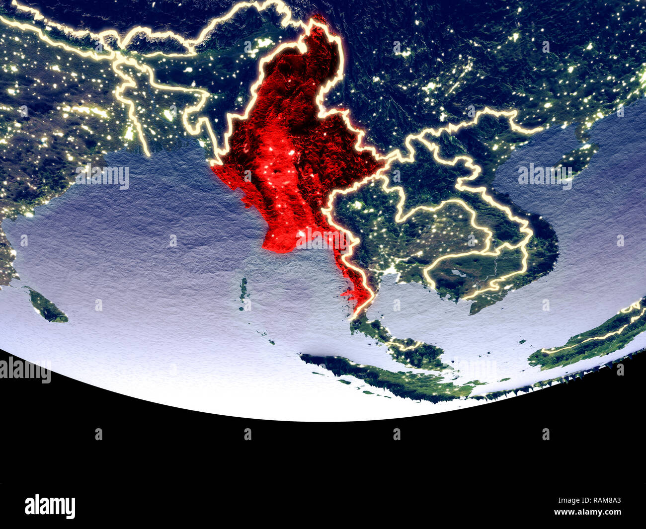 Satellite view of Myanmar from space at night. Beautifully detailed plastic planet surface with visible city lights. 3D illustration. Elements of this Stock Photohttps://www.alamy.com/image-license-details/?v=1https://www.alamy.com/satellite-view-of-myanmar-from-space-at-night-beautifully-detailed-plastic-planet-surface-with-visible-city-lights-3d-illustration-elements-of-this-image230326939.html
RFRAM8A3–Satellite view of Myanmar from space at night. Beautifully detailed plastic planet surface with visible city lights. 3D illustration. Elements of this
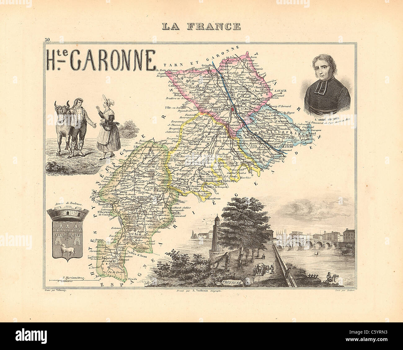 Haute Garonne Department - Antiquarian Map from an 1858 French Atlas 'France and its Colonies' (La France et ses Colonies ) by Alexandre Vuillemin Stock Photohttps://www.alamy.com/image-license-details/?v=1https://www.alamy.com/stock-photo-haute-garonne-department-antiquarian-map-from-an-1858-french-atlas-38105343.html
RFC5YRN3–Haute Garonne Department - Antiquarian Map from an 1858 French Atlas 'France and its Colonies' (La France et ses Colonies ) by Alexandre Vuillemin
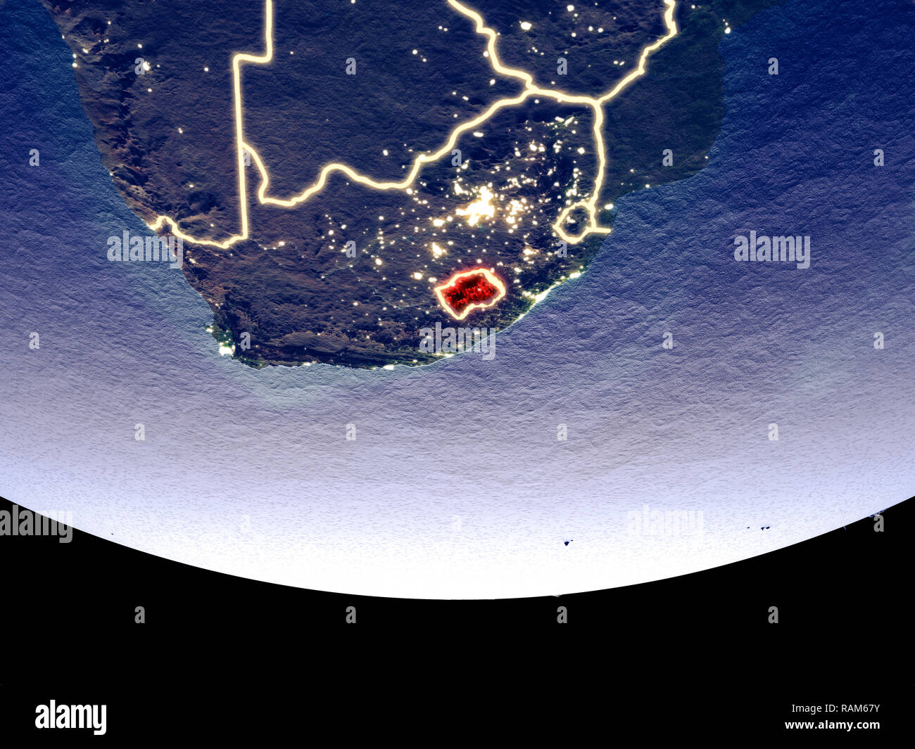 Satellite view of Lesotho from space at night. Beautifully detailed plastic planet surface with visible city lights. 3D illustration. Elements of this Stock Photohttps://www.alamy.com/image-license-details/?v=1https://www.alamy.com/satellite-view-of-lesotho-from-space-at-night-beautifully-detailed-plastic-planet-surface-with-visible-city-lights-3d-illustration-elements-of-this-image230325311.html
RFRAM67Y–Satellite view of Lesotho from space at night. Beautifully detailed plastic planet surface with visible city lights. 3D illustration. Elements of this
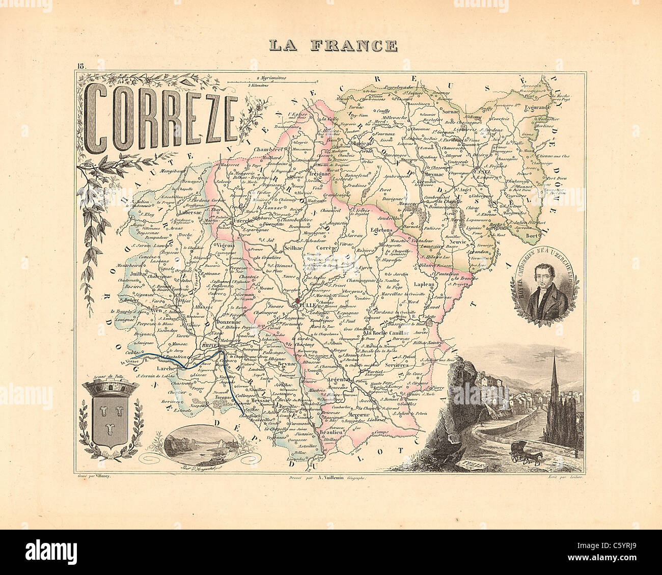 Correze Department - Antiquarian Map from an 1858 French Atlas 'France and its Colonies' (La France et ses Colonies ) by Alexandre Vuillemin Stock Photohttps://www.alamy.com/image-license-details/?v=1https://www.alamy.com/stock-photo-correze-department-antiquarian-map-from-an-1858-french-atlas-france-38105265.html
RFC5YRJ9–Correze Department - Antiquarian Map from an 1858 French Atlas 'France and its Colonies' (La France et ses Colonies ) by Alexandre Vuillemin
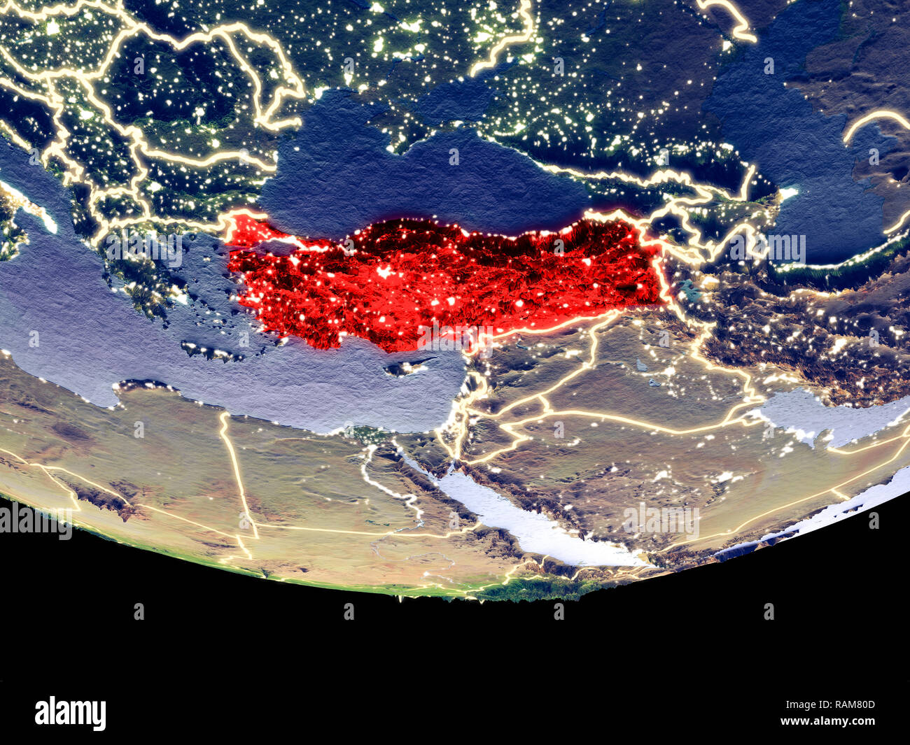 Satellite view of Turkey from space at night. Beautifully detailed plastic planet surface with visible city lights. 3D illustration. Elements of this Stock Photohttps://www.alamy.com/image-license-details/?v=1https://www.alamy.com/satellite-view-of-turkey-from-space-at-night-beautifully-detailed-plastic-planet-surface-with-visible-city-lights-3d-illustration-elements-of-this-image230326669.html
RFRAM80D–Satellite view of Turkey from space at night. Beautifully detailed plastic planet surface with visible city lights. 3D illustration. Elements of this
 Cote d'Or Department - Antiquarian Map from an 1858 French Atlas 'France and its Colonies' (La France et ses Colonies ) by Alexandre Vuillemin Stock Photohttps://www.alamy.com/image-license-details/?v=1https://www.alamy.com/stock-photo-cote-dor-department-antiquarian-map-from-an-1858-french-atlas-france-38105271.html
RFC5YRJF–Cote d'Or Department - Antiquarian Map from an 1858 French Atlas 'France and its Colonies' (La France et ses Colonies ) by Alexandre Vuillemin
 Satellite view of Estonia from space at night. Beautifully detailed plastic planet surface with visible city lights. 3D illustration. Elements of this Stock Photohttps://www.alamy.com/image-license-details/?v=1https://www.alamy.com/satellite-view-of-estonia-from-space-at-night-beautifully-detailed-plastic-planet-surface-with-visible-city-lights-3d-illustration-elements-of-this-image230322096.html
RFRAM254–Satellite view of Estonia from space at night. Beautifully detailed plastic planet surface with visible city lights. 3D illustration. Elements of this