Quick filters:
Bethlehem 1892 1892 Stock Photos and Images
 Image 7 of Sanborn Fire Insurance Map from Bethlehem, Northampton And Lehigh Counties, Pennsylvania. Jan 1892. 22 Sheet(s). Includes South Bethlehem, West Bethlehem, America, street map with a Nineteenth Century compass Stock Photohttps://www.alamy.com/image-license-details/?v=1https://www.alamy.com/image-7-of-sanborn-fire-insurance-map-from-bethlehem-northampton-and-lehigh-counties-pennsylvania-jan-1892-22-sheets-includes-south-bethlehem-west-bethlehem-america-street-map-with-a-nineteenth-century-compass-image344693362.html
RM2B0P3W6–Image 7 of Sanborn Fire Insurance Map from Bethlehem, Northampton And Lehigh Counties, Pennsylvania. Jan 1892. 22 Sheet(s). Includes South Bethlehem, West Bethlehem, America, street map with a Nineteenth Century compass
 Orth August (1828-1901), Church, Bethlehem (1892-1892): Current of the main and side facade. Tusche watercolor on paper, 64.9 x 83.5 cm (including scan edges) Stock Photohttps://www.alamy.com/image-license-details/?v=1https://www.alamy.com/orth-august-1828-1901-church-bethlehem-1892-1892-current-of-the-main-and-side-facade-tusche-watercolor-on-paper-649-x-835-cm-including-scan-edges-image477429900.html
RM2JMMPKT–Orth August (1828-1901), Church, Bethlehem (1892-1892): Current of the main and side facade. Tusche watercolor on paper, 64.9 x 83.5 cm (including scan edges)
 The French Consul arriving in Bethlehem for the Christmas celebrations. From 'Le Petit Journal', Paris, 24 December 1892. Palestine, Religiion, Christian Stock Photohttps://www.alamy.com/image-license-details/?v=1https://www.alamy.com/stock-photo-the-french-consul-arriving-in-bethlehem-for-the-christmas-celebrations-57366771.html
RMD997W7–The French Consul arriving in Bethlehem for the Christmas celebrations. From 'Le Petit Journal', Paris, 24 December 1892. Palestine, Religiion, Christian
 The French consul arrives in Bethlehem during Christmas festivities, 1892. Artist: Henri Meyer Stock Photohttps://www.alamy.com/image-license-details/?v=1https://www.alamy.com/stock-photo-the-french-consul-arrives-in-bethlehem-during-christmas-festivities-17633159.html
RMB0K77K–The French consul arrives in Bethlehem during Christmas festivities, 1892. Artist: Henri Meyer
 The Babe of Bethlehem From the book ' Young folks' Bible in words of easy reading : the sweet stories of God's word in the language of childhood and in the beautiful delineations of Christian art, the whole designed to impres the mind and heart of the youngest readers, and kindle a genuine love for the book of books ' by Pollard, Josephine, 1834-1892 Published in Chicago in 1889 Stock Photohttps://www.alamy.com/image-license-details/?v=1https://www.alamy.com/the-babe-of-bethlehem-from-the-book-young-folks-bible-in-words-of-easy-reading-the-sweet-stories-of-gods-word-in-the-language-of-childhood-and-in-the-beautiful-delineations-of-christian-art-the-whole-designed-to-impres-the-mind-and-heart-of-the-youngest-readers-and-kindle-a-genuine-love-for-the-book-of-books-by-pollard-josephine-1834-1892-published-in-chicago-in-1889-image409124164.html
RF2ENH618–The Babe of Bethlehem From the book ' Young folks' Bible in words of easy reading : the sweet stories of God's word in the language of childhood and in the beautiful delineations of Christian art, the whole designed to impres the mind and heart of the youngest readers, and kindle a genuine love for the book of books ' by Pollard, Josephine, 1834-1892 Published in Chicago in 1889
 The French Consul arriving in Bethlehem for the Christmas celebrations. From 'Le Petit Journal', Paris, 24 December 1892. Palestine, Religiion, Christian Stock Photohttps://www.alamy.com/image-license-details/?v=1https://www.alamy.com/the-french-consul-arriving-in-bethlehem-for-the-christmas-celebrations-from-le-petit-journal-paris-24-december-1892-palestine-religiion-christian-image483537407.html
RM2K2K0W3–The French Consul arriving in Bethlehem for the Christmas celebrations. From 'Le Petit Journal', Paris, 24 December 1892. Palestine, Religiion, Christian
 Sesqui-centennial, Bethania congregation, 1759-1909 . edlandand Macedonia were two of his earlier pastoralcharges. Friedberg was a larger field for him.In 1877 he became pastor at Bethania, where hecompleted his life work. After his retirementfrom active service he remained in Bethania tillhis death in 1892. He served a number of yearsin the P. E. C. In the time of his Bethania pas-torate he attended for a while to the Mt. Bethelwork. EDWARD S. CROSLAND is the only survivingminister who served in Bethania before the pres-ent pastorate. Leaving the Theological Semi-nary in Bethlehem, Pa., for a Stock Photohttps://www.alamy.com/image-license-details/?v=1https://www.alamy.com/sesqui-centennial-bethania-congregation-1759-1909-edlandand-macedonia-were-two-of-his-earlier-pastoralcharges-friedberg-was-a-larger-field-for-himin-1877-he-became-pastor-at-bethania-where-hecompleted-his-life-work-after-his-retirementfrom-active-service-he-remained-in-bethania-tillhis-death-in-1892-he-served-a-number-of-yearsin-the-p-e-c-in-the-time-of-his-bethania-pas-torate-he-attended-for-a-while-to-the-mt-bethelwork-edward-s-crosland-is-the-only-survivingminister-who-served-in-bethania-before-the-pres-ent-pastorate-leaving-the-theological-semi-nary-in-bethlehem-pa-for-a-image339276517.html
RM2AKYAJD–Sesqui-centennial, Bethania congregation, 1759-1909 . edlandand Macedonia were two of his earlier pastoralcharges. Friedberg was a larger field for him.In 1877 he became pastor at Bethania, where hecompleted his life work. After his retirementfrom active service he remained in Bethania tillhis death in 1892. He served a number of yearsin the P. E. C. In the time of his Bethania pas-torate he attended for a while to the Mt. Bethelwork. EDWARD S. CROSLAND is the only survivingminister who served in Bethania before the pres-ent pastorate. Leaving the Theological Semi-nary in Bethlehem, Pa., for a
 Image 16 of Sanborn Fire Insurance Map from Bethlehem, Northampton And Lehigh Counties, Pennsylvania. Jan 1892. 22 Sheet(s). Includes South Bethlehem, West Bethlehem, America, street map with a Nineteenth Century compass Stock Photohttps://www.alamy.com/image-license-details/?v=1https://www.alamy.com/image-16-of-sanborn-fire-insurance-map-from-bethlehem-northampton-and-lehigh-counties-pennsylvania-jan-1892-22-sheets-includes-south-bethlehem-west-bethlehem-america-street-map-with-a-nineteenth-century-compass-image344693381.html
RM2B0P3WW–Image 16 of Sanborn Fire Insurance Map from Bethlehem, Northampton And Lehigh Counties, Pennsylvania. Jan 1892. 22 Sheet(s). Includes South Bethlehem, West Bethlehem, America, street map with a Nineteenth Century compass
 Orth August (1828-1901), Church, Bethlehem (1892-1892): floor plans of the upper and lower church. Ink, ink colored and pencil watercolored on paper, 66.5 x 83.4 cm (including scan edges) Stock Photohttps://www.alamy.com/image-license-details/?v=1https://www.alamy.com/orth-august-1828-1901-church-bethlehem-1892-1892-floor-plans-of-the-upper-and-lower-church-ink-ink-colored-and-pencil-watercolored-on-paper-665-x-834-cm-including-scan-edges-image477429930.html
RM2JMMPMX–Orth August (1828-1901), Church, Bethlehem (1892-1892): floor plans of the upper and lower church. Ink, ink colored and pencil watercolored on paper, 66.5 x 83.4 cm (including scan edges)
 . Epitome: Yearbook 1896. ehigh University, 1893.University Place, South Bethlehem. Instructor in Electrical Engineering, J. Henry Klinck, M.E., M.E., Cornell University, 1894.703 Seneca Street, South Bethlehem. Instructor in Electrical Engineering,Henry Storrs Webb, B.S., B.S., Massachusetts Institute of Technology, 1892.506 Cherokee Street, South Bethlehem. • Re.sigued. P^cksB t^momhl CKuigcK. Chaplain.*Thk Rkv. Elwood Worcestkr, A.m., Ph.D., University Park. Hcting Cbaplain.Thk Rkv. Taliaferro F. Ca.skkv, A.B., Wyandotte Hotel, South Bethlehem. Orciauist.J. Frkd Wolle;, 14S Church Street, B Stock Photohttps://www.alamy.com/image-license-details/?v=1https://www.alamy.com/epitome-yearbook-1896-ehigh-university-1893university-place-south-bethlehem-instructor-in-electrical-engineering-j-henry-klinck-me-me-cornell-university-1894703-seneca-street-south-bethlehem-instructor-in-electrical-engineeringhenry-storrs-webb-bs-bs-massachusetts-institute-of-technology-1892506-cherokee-street-south-bethlehem-resigued-pcksb-tmomhl-ckuigck-chaplainthk-rkv-elwood-worcestkr-am-phd-university-park-hcting-cbaplainthk-rkv-taliaferro-f-caskkv-ab-wyandotte-hotel-south-bethlehem-orciauistj-frkd-wolle-14s-church-street-b-image336962729.html
RM2AG5YB5–. Epitome: Yearbook 1896. ehigh University, 1893.University Place, South Bethlehem. Instructor in Electrical Engineering, J. Henry Klinck, M.E., M.E., Cornell University, 1894.703 Seneca Street, South Bethlehem. Instructor in Electrical Engineering,Henry Storrs Webb, B.S., B.S., Massachusetts Institute of Technology, 1892.506 Cherokee Street, South Bethlehem. • Re.sigued. P^cksB t^momhl CKuigcK. Chaplain.*Thk Rkv. Elwood Worcestkr, A.m., Ph.D., University Park. Hcting Cbaplain.Thk Rkv. Taliaferro F. Ca.skkv, A.B., Wyandotte Hotel, South Bethlehem. Orciauist.J. Frkd Wolle;, 14S Church Street, B
 Image 17 of Sanborn Fire Insurance Map from Bethlehem, Northampton And Lehigh Counties, Pennsylvania. Jan 1892. 22 Sheet(s). Includes South Bethlehem, West Bethlehem, America, street map with a Nineteenth Century compass Stock Photohttps://www.alamy.com/image-license-details/?v=1https://www.alamy.com/image-17-of-sanborn-fire-insurance-map-from-bethlehem-northampton-and-lehigh-counties-pennsylvania-jan-1892-22-sheets-includes-south-bethlehem-west-bethlehem-america-street-map-with-a-nineteenth-century-compass-image344693384.html
RM2B0P3X0–Image 17 of Sanborn Fire Insurance Map from Bethlehem, Northampton And Lehigh Counties, Pennsylvania. Jan 1892. 22 Sheet(s). Includes South Bethlehem, West Bethlehem, America, street map with a Nineteenth Century compass
 Orth August (1828-1901), Church, Bethlehem (1892): Longitudinal section, cross-section. Ink, pencil on paper, 66.5 x 84 cm (including scan edges) Stock Photohttps://www.alamy.com/image-license-details/?v=1https://www.alamy.com/orth-august-1828-1901-church-bethlehem-1892-longitudinal-section-cross-section-ink-pencil-on-paper-665-x-84-cm-including-scan-edges-image477429928.html
RM2JMMPMT–Orth August (1828-1901), Church, Bethlehem (1892): Longitudinal section, cross-section. Ink, pencil on paper, 66.5 x 84 cm (including scan edges)
 . Routes and rates for summer tours via picturesque B. & O. 1892 . ee pages 50 to 55 for Ioute) to Ihiladeliihia. Baltimore it Ohio R. R to starting point. Transfer througb Boston, going, included. THROUGH rates. Baltimore, Md 829 lo 1 Wasbington, D. C -Sol 10 tPbiladelphia, Pa 25 lo | Form Ex. 520.—Fabyan House, N. H., and Return. (Via rail, R>oston, (oncord and Bethlehem Junction; returning via North (onway and rail.) r.altiuiore it Ohio R. R to Ihiladilphia. Rail Lines (see i)ages 50 to 55 for route) to Boston. Boston & Maine R. R to Naslnia. Concord it Montreal R. R to Bethlehem June. R Stock Photohttps://www.alamy.com/image-license-details/?v=1https://www.alamy.com/routes-and-rates-for-summer-tours-via-picturesque-b-o-1892-ee-pages-50-to-55-for-ioute-to-ihiladeliihia-baltimore-it-ohio-r-r-to-starting-point-transfer-througb-boston-going-included-through-rates-baltimore-md-829-lo-1-wasbington-d-c-sol-10-tpbiladelphia-pa-25-lo-form-ex-520fabyan-house-n-h-and-return-via-rail-rgtoston-oncord-and-bethlehem-junction-returning-via-north-onway-and-rail-raltiuiore-it-ohio-r-r-to-ihiladilphia-rail-lines-see-iages-50-to-55-for-route-to-boston-boston-maine-r-r-to-naslnia-concord-it-montreal-r-r-to-bethlehem-june-r-image375966402.html
RM2CRJMYE–. Routes and rates for summer tours via picturesque B. & O. 1892 . ee pages 50 to 55 for Ioute) to Ihiladeliihia. Baltimore it Ohio R. R to starting point. Transfer througb Boston, going, included. THROUGH rates. Baltimore, Md 829 lo 1 Wasbington, D. C -Sol 10 tPbiladelphia, Pa 25 lo | Form Ex. 520.—Fabyan House, N. H., and Return. (Via rail, R>oston, (oncord and Bethlehem Junction; returning via North (onway and rail.) r.altiuiore it Ohio R. R to Ihiladilphia. Rail Lines (see i)ages 50 to 55 for route) to Boston. Boston & Maine R. R to Naslnia. Concord it Montreal R. R to Bethlehem June. R
 Image 18 of Sanborn Fire Insurance Map from Bethlehem, Northampton And Lehigh Counties, Pennsylvania. Jan 1892. 22 Sheet(s). Includes South Bethlehem, West Bethlehem, America, street map with a Nineteenth Century compass Stock Photohttps://www.alamy.com/image-license-details/?v=1https://www.alamy.com/image-18-of-sanborn-fire-insurance-map-from-bethlehem-northampton-and-lehigh-counties-pennsylvania-jan-1892-22-sheets-includes-south-bethlehem-west-bethlehem-america-street-map-with-a-nineteenth-century-compass-image344693386.html
RM2B0P3X2–Image 18 of Sanborn Fire Insurance Map from Bethlehem, Northampton And Lehigh Counties, Pennsylvania. Jan 1892. 22 Sheet(s). Includes South Bethlehem, West Bethlehem, America, street map with a Nineteenth Century compass
 Orth August (1828-1901), church, Bethlehem (1892): floor plan, view, cut. Ink, pencil, ink colored, watercolored on paper, 83.8 x 66.9 cm (including scan edges) Stock Photohttps://www.alamy.com/image-license-details/?v=1https://www.alamy.com/orth-august-1828-1901-church-bethlehem-1892-floor-plan-view-cut-ink-pencil-ink-colored-watercolored-on-paper-838-x-669-cm-including-scan-edges-image477429870.html
RM2JMMPJP–Orth August (1828-1901), church, Bethlehem (1892): floor plan, view, cut. Ink, pencil, ink colored, watercolored on paper, 83.8 x 66.9 cm (including scan edges)
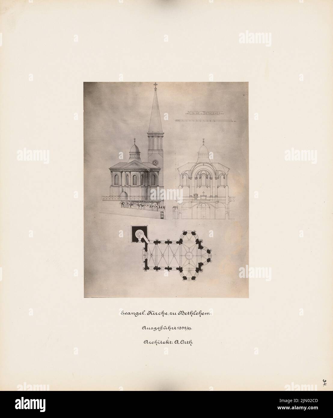 Orth August (1828-1901), Church, Bethlehem (1892-1893): View, cut, floor plan. Photo on cardboard, 39.1 x 33.3 cm (including scan edges) Orth August (1828-1901): Kirche, Bethlehem Stock Photohttps://www.alamy.com/image-license-details/?v=1https://www.alamy.com/orth-august-1828-1901-church-bethlehem-1892-1893-view-cut-floor-plan-photo-on-cardboard-391-x-333-cm-including-scan-edges-orth-august-1828-1901-kirche-bethlehem-image477589629.html
RM2JN02CD–Orth August (1828-1901), Church, Bethlehem (1892-1893): View, cut, floor plan. Photo on cardboard, 39.1 x 33.3 cm (including scan edges) Orth August (1828-1901): Kirche, Bethlehem
 . Routes and rates for summer tours via picturesque B. & O. 1892 . lIROliill KATES. Baltimore. Md .•s-2.> (HI I Washiniiton, D. C s27 00 fPhiladtlphia. Pa 21 (K» | FoK:r Ex. I>11.—Jaaiestown. N. Y. (<jHArTArijrA Lake), .vxd PETinsx. Baltimore it Ohio P. Pv to Philadeli)hia. Ihiladeliihia it Peadini;-P. P to Bethlehem. Pehi.uh Valley P. P. / to Waverly. New York, Lake Erie tt We.sttrn P. P to Salamanca. New York, Lake Erie & Western P. P to Jamestown. Retnrning, same route. THROUGH RATES. Baltimore. :srd ,sis SO I Washiniiton, D. C $20 80 tlhiiadelphia, Pa 17 (io | Form Ex. 3nO.—Mayvi Stock Photohttps://www.alamy.com/image-license-details/?v=1https://www.alamy.com/routes-and-rates-for-summer-tours-via-picturesque-b-o-1892-liroliill-kates-baltimore-md-s-2gt-hi-i-washiniiton-d-c-s27-00-fphiladtlphia-pa-21-k-fokr-ex-igt11jaaiestown-n-y-ltjhartarijra-lake-vxd-petinsx-baltimore-it-ohio-p-pv-to-philadelihia-ihiladeliihia-it-peadini-p-p-to-bethlehem-pehiuh-valley-p-p-to-waverly-new-york-lake-erie-tt-westtrn-p-p-to-salamanca-new-york-lake-erie-western-p-p-to-jamestown-retnrning-same-route-through-rates-baltimore-srd-sis-so-i-washiniiton-d-c-20-80-tlhiiadelphia-pa-17-io-form-ex-3nomayvi-image375967795.html
RM2CRJPN7–. Routes and rates for summer tours via picturesque B. & O. 1892 . lIROliill KATES. Baltimore. Md .•s-2.> (HI I Washiniiton, D. C s27 00 fPhiladtlphia. Pa 21 (K» | FoK:r Ex. I>11.—Jaaiestown. N. Y. (<jHArTArijrA Lake), .vxd PETinsx. Baltimore it Ohio P. Pv to Philadeli)hia. Ihiladeliihia it Peadini;-P. P to Bethlehem. Pehi.uh Valley P. P. / to Waverly. New York, Lake Erie tt We.sttrn P. P to Salamanca. New York, Lake Erie & Western P. P to Jamestown. Retnrning, same route. THROUGH RATES. Baltimore. :srd ,sis SO I Washiniiton, D. C $20 80 tlhiiadelphia, Pa 17 (io | Form Ex. 3nO.—Mayvi
 Image 6 of Sanborn Fire Insurance Map from Bethlehem, Northampton And Lehigh Counties, Pennsylvania. Jan 1892. 22 Sheet(s). Includes South Bethlehem, West Bethlehem, America, street map with a Nineteenth Century compass Stock Photohttps://www.alamy.com/image-license-details/?v=1https://www.alamy.com/image-6-of-sanborn-fire-insurance-map-from-bethlehem-northampton-and-lehigh-counties-pennsylvania-jan-1892-22-sheets-includes-south-bethlehem-west-bethlehem-america-street-map-with-a-nineteenth-century-compass-image344693360.html
RM2B0P3W4–Image 6 of Sanborn Fire Insurance Map from Bethlehem, Northampton And Lehigh Counties, Pennsylvania. Jan 1892. 22 Sheet(s). Includes South Bethlehem, West Bethlehem, America, street map with a Nineteenth Century compass
 Orth August (1828-1901), Evangelical Lutheran Christmas Church in Bethlehem (1892): 2 views, one of them cut partly. Photo on cardboard, 32.3 x 38.3 cm (including scan edges) Orth August (1828-1901): Evangelisch-Lutherische Weihnachtskirche, Bethlehem Stock Photohttps://www.alamy.com/image-license-details/?v=1https://www.alamy.com/orth-august-1828-1901-evangelical-lutheran-christmas-church-in-bethlehem-1892-2-views-one-of-them-cut-partly-photo-on-cardboard-323-x-383-cm-including-scan-edges-orth-august-1828-1901-evangelisch-lutherische-weihnachtskirche-bethlehem-image477589647.html
RM2JN02D3–Orth August (1828-1901), Evangelical Lutheran Christmas Church in Bethlehem (1892): 2 views, one of them cut partly. Photo on cardboard, 32.3 x 38.3 cm (including scan edges) Orth August (1828-1901): Evangelisch-Lutherische Weihnachtskirche, Bethlehem
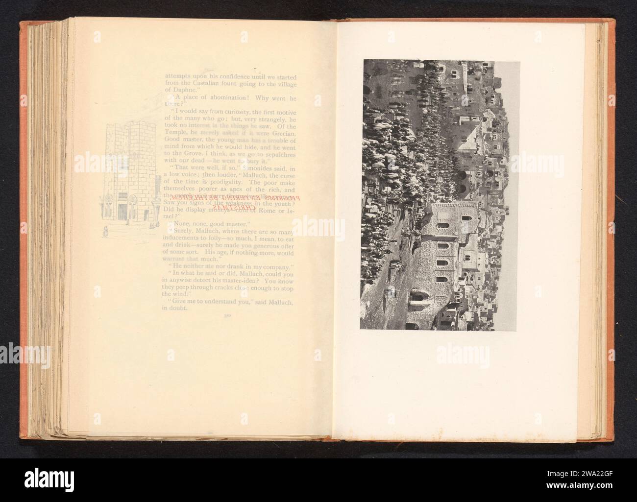 Pilgrims who walk into Bethlehem, Anonymous, c. 1882 - in or before 1892 photomechanical print Bethlehem paper pilgrim(s) Bethlehem Stock Photohttps://www.alamy.com/image-license-details/?v=1https://www.alamy.com/pilgrims-who-walk-into-bethlehem-anonymous-c-1882-in-or-before-1892-photomechanical-print-bethlehem-paper-pilgrims-bethlehem-image591345007.html
RM2WA22GF–Pilgrims who walk into Bethlehem, Anonymous, c. 1882 - in or before 1892 photomechanical print Bethlehem paper pilgrim(s) Bethlehem
 . Routes and rates for summer tours via picturesque B. & O. 1892 . inis (see i>a^es 5(1 t( i 71:^ for Ioutc) .... to Pxiston. Poston iV: Maine P. P to Nashua. Concf.ird it ISIontreal P. P to Pethleheni .Tunc. Protile & P^ranconia Notch R. P to Bethlehem. Ileturning, same route.Transfer through Boston, in both directions, included. THROUGH rates. I.altiniore, Md $23 00 I Washin-ton. D. C $25 00 tPhiladeli)hia, Pa Pi Oti | Foinr Ex. Oos.—1>ethi,eiiem, N. II., anu 11et[rx. I.altimore ct OhioP. P to Philadeli)hia. Philadelphia i*k- Reading It. P to Pound Prook. (eiitral P. P. of New Jersey t Stock Photohttps://www.alamy.com/image-license-details/?v=1https://www.alamy.com/routes-and-rates-for-summer-tours-via-picturesque-b-o-1892-inis-see-igtaes-51-t-i-71-for-ioutc-to-pxiston-poston-iv-maine-p-p-to-nashua-concfird-it-isiontreal-p-p-to-pethleheni-tunc-protile-pranconia-notch-r-p-to-bethlehem-ileturning-same-routetransfer-through-boston-in-both-directions-included-through-rates-ialtiniore-md-23-00-i-washin-ton-d-c-25-00-tphiladelihia-pa-pi-oti-foinr-ex-oos1gtethieiiem-n-ii-anu-11et-rx-ialtimore-ct-ohiop-p-to-philadelihia-philadelphia-ik-reading-it-p-to-pound-prook-eiitral-p-p-of-new-jersey-t-image375970338.html
RM2CRJX02–. Routes and rates for summer tours via picturesque B. & O. 1892 . inis (see i>a^es 5(1 t( i 71:^ for Ioutc) .... to Pxiston. Poston iV: Maine P. P to Nashua. Concf.ird it ISIontreal P. P to Pethleheni .Tunc. Protile & P^ranconia Notch R. P to Bethlehem. Ileturning, same route.Transfer through Boston, in both directions, included. THROUGH rates. I.altiniore, Md $23 00 I Washin-ton. D. C $25 00 tPhiladeli)hia, Pa Pi Oti | Foinr Ex. Oos.—1>ethi,eiiem, N. II., anu 11et[rx. I.altimore ct OhioP. P to Philadeli)hia. Philadelphia i*k- Reading It. P to Pound Prook. (eiitral P. P. of New Jersey t
 Image 3 of Sanborn Fire Insurance Map from Bethlehem, Northampton And Lehigh Counties, Pennsylvania. Jan 1892. 22 Sheet(s). Includes South Bethlehem, West Bethlehem, America, street map with a Nineteenth Century compass Stock Photohttps://www.alamy.com/image-license-details/?v=1https://www.alamy.com/image-3-of-sanborn-fire-insurance-map-from-bethlehem-northampton-and-lehigh-counties-pennsylvania-jan-1892-22-sheets-includes-south-bethlehem-west-bethlehem-america-street-map-with-a-nineteenth-century-compass-image344693354.html
RM2B0P3TX–Image 3 of Sanborn Fire Insurance Map from Bethlehem, Northampton And Lehigh Counties, Pennsylvania. Jan 1892. 22 Sheet(s). Includes South Bethlehem, West Bethlehem, America, street map with a Nineteenth Century compass
![. Routes and rates for summer tours via picturesque B. & O. 1892 . New York. New York & AIl)any Day Pine to Alliany. Delaware & Hudson E. i! to Sharon Springs. Iteturning, same roiHe. Tili;olilH KATKS. Baltimore, :Md .-sU S5 ] Wa-hiiiiiton, D. C $1(3 85 tPhiladeliiliia, Ia 10 ,s5 | SHELDRAKE, IV. Y. Form Ex. 597.—Sheldrake, N. Y., and Eeturn. Baltimore it Ohio E. E to Philadeli.hia. Pliiladelphia it Eeadinu-E. i; to Bethlehem. Lehigii alley E. E to Sheldrake. Eeturning, same route. TMHOUliH rates. Baltimore, :Md sl4 (!n I Washin-tcui, D. C $1() (iO tPUiladel|ihia, Pa 11 (iU | BOUrES AXJ) r!AT Stock Photo . Routes and rates for summer tours via picturesque B. & O. 1892 . New York. New York & AIl)any Day Pine to Alliany. Delaware & Hudson E. i! to Sharon Springs. Iteturning, same roiHe. Tili;olilH KATKS. Baltimore, :Md .-sU S5 ] Wa-hiiiiiton, D. C $1(3 85 tPhiladeliiliia, Ia 10 ,s5 | SHELDRAKE, IV. Y. Form Ex. 597.—Sheldrake, N. Y., and Eeturn. Baltimore it Ohio E. E to Philadeli.hia. Pliiladelphia it Eeadinu-E. i; to Bethlehem. Lehigii alley E. E to Sheldrake. Eeturning, same route. TMHOUliH rates. Baltimore, :Md sl4 (!n I Washin-tcui, D. C $1() (iO tPUiladel|ihia, Pa 11 (iU | BOUrES AXJ) r!AT Stock Photo](https://c8.alamy.com/comp/2CRJ4F3/routes-and-rates-for-summer-tours-via-picturesque-b-o-1892-new-york-new-york-ailany-day-pine-to-alliany-delaware-hudson-e-i!-to-sharon-springs-iteturning-same-roihe-tiliolilh-katks-baltimore-md-su-s5-wa-hiiiiiton-d-c-13-85-tphiladeliiliia-ia-10-s5-sheldrake-iv-y-form-ex-597sheldrake-n-y-and-eeturn-baltimore-it-ohio-e-e-to-philadelihia-pliiladelphia-it-eeadinu-e-i-to-bethlehem-lehigii-alley-e-e-to-sheldrake-eeturning-same-route-tmhoulih-rates-baltimore-md-sl4-!n-i-washin-tcui-d-c-1-io-tpuiladelihia-pa-11-iu-boures-axj-r!at-2CRJ4F3.jpg) . Routes and rates for summer tours via picturesque B. & O. 1892 . New York. New York & AIl)any Day Pine to Alliany. Delaware & Hudson E. i! to Sharon Springs. Iteturning, same roiHe. Tili;olilH KATKS. Baltimore, :Md .-sU S5 ] Wa-hiiiiiton, D. C $1(3 85 tPhiladeliiliia, Ia 10 ,s5 | SHELDRAKE, IV. Y. Form Ex. 597.—Sheldrake, N. Y., and Eeturn. Baltimore it Ohio E. E to Philadeli.hia. Pliiladelphia it Eeadinu-E. i; to Bethlehem. Lehigii alley E. E to Sheldrake. Eeturning, same route. TMHOUliH rates. Baltimore, :Md sl4 (!n I Washin-tcui, D. C $1() (iO tPUiladel|ihia, Pa 11 (iU | BOUrES AXJ) r!AT Stock Photohttps://www.alamy.com/image-license-details/?v=1https://www.alamy.com/routes-and-rates-for-summer-tours-via-picturesque-b-o-1892-new-york-new-york-ailany-day-pine-to-alliany-delaware-hudson-e-i!-to-sharon-springs-iteturning-same-roihe-tiliolilh-katks-baltimore-md-su-s5-wa-hiiiiiton-d-c-13-85-tphiladeliiliia-ia-10-s5-sheldrake-iv-y-form-ex-597sheldrake-n-y-and-eeturn-baltimore-it-ohio-e-e-to-philadelihia-pliiladelphia-it-eeadinu-e-i-to-bethlehem-lehigii-alley-e-e-to-sheldrake-eeturning-same-route-tmhoulih-rates-baltimore-md-sl4-!n-i-washin-tcui-d-c-1-io-tpuiladelihia-pa-11-iu-boures-axj-r!at-image375953511.html
. Routes and rates for summer tours via picturesque B. & O. 1892 . New York. New York & AIl)any Day Pine to Alliany. Delaware & Hudson E. i! to Sharon Springs. Iteturning, same roiHe. Tili;olilH KATKS. Baltimore, :Md .-sU S5 ] Wa-hiiiiiton, D. C $1(3 85 tPhiladeliiliia, Ia 10 ,s5 | SHELDRAKE, IV. Y. Form Ex. 597.—Sheldrake, N. Y., and Eeturn. Baltimore it Ohio E. E to Philadeli.hia. Pliiladelphia it Eeadinu-E. i; to Bethlehem. Lehigii alley E. E to Sheldrake. Eeturning, same route. TMHOUliH rates. Baltimore, :Md sl4 (!n I Washin-tcui, D. C $1() (iO tPUiladel|ihia, Pa 11 (iU | BOUrES AXJ) r!AT Stock Photohttps://www.alamy.com/image-license-details/?v=1https://www.alamy.com/routes-and-rates-for-summer-tours-via-picturesque-b-o-1892-new-york-new-york-ailany-day-pine-to-alliany-delaware-hudson-e-i!-to-sharon-springs-iteturning-same-roihe-tiliolilh-katks-baltimore-md-su-s5-wa-hiiiiiton-d-c-13-85-tphiladeliiliia-ia-10-s5-sheldrake-iv-y-form-ex-597sheldrake-n-y-and-eeturn-baltimore-it-ohio-e-e-to-philadelihia-pliiladelphia-it-eeadinu-e-i-to-bethlehem-lehigii-alley-e-e-to-sheldrake-eeturning-same-route-tmhoulih-rates-baltimore-md-sl4-!n-i-washin-tcui-d-c-1-io-tpuiladelihia-pa-11-iu-boures-axj-r!at-image375953511.htmlRM2CRJ4F3–. Routes and rates for summer tours via picturesque B. & O. 1892 . New York. New York & AIl)any Day Pine to Alliany. Delaware & Hudson E. i! to Sharon Springs. Iteturning, same roiHe. Tili;olilH KATKS. Baltimore, :Md .-sU S5 ] Wa-hiiiiiton, D. C $1(3 85 tPhiladeliiliia, Ia 10 ,s5 | SHELDRAKE, IV. Y. Form Ex. 597.—Sheldrake, N. Y., and Eeturn. Baltimore it Ohio E. E to Philadeli.hia. Pliiladelphia it Eeadinu-E. i; to Bethlehem. Lehigii alley E. E to Sheldrake. Eeturning, same route. TMHOUliH rates. Baltimore, :Md sl4 (!n I Washin-tcui, D. C $1() (iO tPUiladel|ihia, Pa 11 (iU | BOUrES AXJ) r!AT
 Image 8 of Sanborn Fire Insurance Map from Bethlehem, Northampton And Lehigh Counties, Pennsylvania. Jan 1892. 22 Sheet(s). Includes South Bethlehem, West Bethlehem, America, street map with a Nineteenth Century compass Stock Photohttps://www.alamy.com/image-license-details/?v=1https://www.alamy.com/image-8-of-sanborn-fire-insurance-map-from-bethlehem-northampton-and-lehigh-counties-pennsylvania-jan-1892-22-sheets-includes-south-bethlehem-west-bethlehem-america-street-map-with-a-nineteenth-century-compass-image344693364.html
RM2B0P3W8–Image 8 of Sanborn Fire Insurance Map from Bethlehem, Northampton And Lehigh Counties, Pennsylvania. Jan 1892. 22 Sheet(s). Includes South Bethlehem, West Bethlehem, America, street map with a Nineteenth Century compass
 . Routes and rates for summer tours via picturesque B. & O. 1892 . II ratios. $10 00 I Washin )n, D. ( * . §18 00 . 12 00 IForm E.y. 812.—AriURX, N. Y., and Betirn. Baltimore it Ohio R. R to Bhihidi Ipliia. Bhiladelphia it Reading!!. R to Bi thhheni. L.4ngh Valley R. R to Cavuga. New York Central it Hudson Biver 1!. K. ... to Aui)urn. L(4ugli Valley R. R to Bethlehem. Bhiladelphiait Beading B. I! to Bliiladel|.hia. Baltimore it Ohio R. R to starting point. Baltimore, Md. .tBhiladelphia, B;i THROUGH RATES. $17 40 I Washington, D. C. i:; 40 $19 40 ROUTES AXI) IIA TES EOR SUMMER TOURS. -Zi BABYLO Stock Photohttps://www.alamy.com/image-license-details/?v=1https://www.alamy.com/routes-and-rates-for-summer-tours-via-picturesque-b-o-1892-ii-ratios-10-00-i-washin-n-d-18-00-12-00-iform-ey-812ariurx-n-y-and-betirn-baltimore-it-ohio-r-r-to-bhihidi-ipliia-bhiladelphia-it-reading!!-r-to-bi-thhheni-l4ngh-valley-r-r-to-cavuga-new-york-central-it-hudson-biver-1!-k-to-auiurn-l4ugli-valley-r-r-to-bethlehem-bhiladelphiait-beading-b-i!-to-bliiladelhia-baltimore-it-ohio-r-r-to-starting-point-baltimore-md-tbhiladelphia-bi-through-rates-17-40-i-washington-d-c-i-40-19-40-routes-axi-iia-tes-eor-summer-tours-zi-babylo-image375971849.html
RM2CRJYX1–. Routes and rates for summer tours via picturesque B. & O. 1892 . II ratios. $10 00 I Washin )n, D. ( * . §18 00 . 12 00 IForm E.y. 812.—AriURX, N. Y., and Betirn. Baltimore it Ohio R. R to Bhihidi Ipliia. Bhiladelphia it Reading!!. R to Bi thhheni. L.4ngh Valley R. R to Cavuga. New York Central it Hudson Biver 1!. K. ... to Aui)urn. L(4ugli Valley R. R to Bethlehem. Bhiladelphiait Beading B. I! to Bliiladel|.hia. Baltimore it Ohio R. R to starting point. Baltimore, Md. .tBhiladelphia, B;i THROUGH RATES. $17 40 I Washington, D. C. i:; 40 $19 40 ROUTES AXI) IIA TES EOR SUMMER TOURS. -Zi BABYLO
 Image 13 of Sanborn Fire Insurance Map from Bethlehem, Northampton And Lehigh Counties, Pennsylvania. Jan 1892. 22 Sheet(s). Includes South Bethlehem, West Bethlehem, America, street map with a Nineteenth Century compass Stock Photohttps://www.alamy.com/image-license-details/?v=1https://www.alamy.com/image-13-of-sanborn-fire-insurance-map-from-bethlehem-northampton-and-lehigh-counties-pennsylvania-jan-1892-22-sheets-includes-south-bethlehem-west-bethlehem-america-street-map-with-a-nineteenth-century-compass-image344693375.html
RM2B0P3WK–Image 13 of Sanborn Fire Insurance Map from Bethlehem, Northampton And Lehigh Counties, Pennsylvania. Jan 1892. 22 Sheet(s). Includes South Bethlehem, West Bethlehem, America, street map with a Nineteenth Century compass
 . Illustrations of the British flora: a series of wood engravings, with dissections, of British plants. Botany; Botany. 1040. Gagea lutea, Ker. 1041. Oinithogalumumbellatum,L. G. fascicularis, Sal. Star of Bethlehem. Yellow G.. Please note that these images are extracted from scanned page images that may have been digitally enhanced for readability - coloration and appearance of these illustrations may not perfectly resemble the original work.. Fitch, W. H. (Walter Hood), 1817-1892; Smith, George Worthington, 1835-1917; Bentham, George, 1800-1884. Handbook of the British flora. London, L. Reev Stock Photohttps://www.alamy.com/image-license-details/?v=1https://www.alamy.com/illustrations-of-the-british-flora-a-series-of-wood-engravings-with-dissections-of-british-plants-botany-botany-1040-gagea-lutea-ker-1041-oinithogalumumbellatuml-g-fascicularis-sal-star-of-bethlehem-yellow-g-please-note-that-these-images-are-extracted-from-scanned-page-images-that-may-have-been-digitally-enhanced-for-readability-coloration-and-appearance-of-these-illustrations-may-not-perfectly-resemble-the-original-work-fitch-w-h-walter-hood-1817-1892-smith-george-worthington-1835-1917-bentham-george-1800-1884-handbook-of-the-british-flora-london-l-reev-image232266681.html
RMRDTJEH–. Illustrations of the British flora: a series of wood engravings, with dissections, of British plants. Botany; Botany. 1040. Gagea lutea, Ker. 1041. Oinithogalumumbellatum,L. G. fascicularis, Sal. Star of Bethlehem. Yellow G.. Please note that these images are extracted from scanned page images that may have been digitally enhanced for readability - coloration and appearance of these illustrations may not perfectly resemble the original work.. Fitch, W. H. (Walter Hood), 1817-1892; Smith, George Worthington, 1835-1917; Bentham, George, 1800-1884. Handbook of the British flora. London, L. Reev
 Image 2 of Sanborn Fire Insurance Map from Bethlehem, Northampton And Lehigh Counties, Pennsylvania. Jan 1892. 22 Sheet(s). Includes South Bethlehem, West Bethlehem, America, street map with a Nineteenth Century compass Stock Photohttps://www.alamy.com/image-license-details/?v=1https://www.alamy.com/image-2-of-sanborn-fire-insurance-map-from-bethlehem-northampton-and-lehigh-counties-pennsylvania-jan-1892-22-sheets-includes-south-bethlehem-west-bethlehem-america-street-map-with-a-nineteenth-century-compass-image344693352.html
RM2B0P3TT–Image 2 of Sanborn Fire Insurance Map from Bethlehem, Northampton And Lehigh Counties, Pennsylvania. Jan 1892. 22 Sheet(s). Includes South Bethlehem, West Bethlehem, America, street map with a Nineteenth Century compass
 . Illustrations of the British flora: a series of wood engravings, with dissections, of British plants. Botany; Botany. 1040. Gagea lutea, Ker. 1041. Oinithogalumumbellatum,L. G. fascicularis, Sal. Star of Bethlehem. Yellow G.. Please note that these images are extracted from scanned page images that may have been digitally enhanced for readability - coloration and appearance of these illustrations may not perfectly resemble the original work.. Fitch, W. H. (Walter Hood), 1817-1892; Smith, George Worthington, 1835-1917; Bentham, George, 1800-1884. Handbook of the British flora. London, L. Reev Stock Photohttps://www.alamy.com/image-license-details/?v=1https://www.alamy.com/illustrations-of-the-british-flora-a-series-of-wood-engravings-with-dissections-of-british-plants-botany-botany-1040-gagea-lutea-ker-1041-oinithogalumumbellatuml-g-fascicularis-sal-star-of-bethlehem-yellow-g-please-note-that-these-images-are-extracted-from-scanned-page-images-that-may-have-been-digitally-enhanced-for-readability-coloration-and-appearance-of-these-illustrations-may-not-perfectly-resemble-the-original-work-fitch-w-h-walter-hood-1817-1892-smith-george-worthington-1835-1917-bentham-george-1800-1884-handbook-of-the-british-flora-london-l-reev-image232266678.html
RMRDTJEE–. Illustrations of the British flora: a series of wood engravings, with dissections, of British plants. Botany; Botany. 1040. Gagea lutea, Ker. 1041. Oinithogalumumbellatum,L. G. fascicularis, Sal. Star of Bethlehem. Yellow G.. Please note that these images are extracted from scanned page images that may have been digitally enhanced for readability - coloration and appearance of these illustrations may not perfectly resemble the original work.. Fitch, W. H. (Walter Hood), 1817-1892; Smith, George Worthington, 1835-1917; Bentham, George, 1800-1884. Handbook of the British flora. London, L. Reev
 Image 20 of Sanborn Fire Insurance Map from Bethlehem, Northampton And Lehigh Counties, Pennsylvania. Jan 1892. 22 Sheet(s). Includes South Bethlehem, West Bethlehem, America, street map with a Nineteenth Century compass Stock Photohttps://www.alamy.com/image-license-details/?v=1https://www.alamy.com/image-20-of-sanborn-fire-insurance-map-from-bethlehem-northampton-and-lehigh-counties-pennsylvania-jan-1892-22-sheets-includes-south-bethlehem-west-bethlehem-america-street-map-with-a-nineteenth-century-compass-image344693389.html
RM2B0P3X5–Image 20 of Sanborn Fire Insurance Map from Bethlehem, Northampton And Lehigh Counties, Pennsylvania. Jan 1892. 22 Sheet(s). Includes South Bethlehem, West Bethlehem, America, street map with a Nineteenth Century compass
 . American bee journal. Bee culture; Bees. 800 AMERICAN BEE JOURNAL. stung occasionally, he thought nothing more about it until in a very short time he noticed that the pain had disappeared. That was three years ago, and he has had no trouble with rheumatism or pain in his head since then. The honey crop, the past season, was light in this part of the State. Golden- rod and some other fall flowers yielded an abundance of honey, so that the bees have gone into winter quarters in better condition than for some years. M. A. Doolittle. Bethlehem, Conn., Dec. 3, 1892. The World's Fair Women " Stock Photohttps://www.alamy.com/image-license-details/?v=1https://www.alamy.com/american-bee-journal-bee-culture-bees-800-american-bee-journal-stung-occasionally-he-thought-nothing-more-about-it-until-in-a-very-short-time-he-noticed-that-the-pain-had-disappeared-that-was-three-years-ago-and-he-has-had-no-trouble-with-rheumatism-or-pain-in-his-head-since-then-the-honey-crop-the-past-season-was-light-in-this-part-of-the-state-golden-rod-and-some-other-fall-flowers-yielded-an-abundance-of-honey-so-that-the-bees-have-gone-into-winter-quarters-in-better-condition-than-for-some-years-m-a-doolittle-bethlehem-conn-dec-3-1892-the-worlds-fair-women-quot-image237734437.html
RMRPNMKH–. American bee journal. Bee culture; Bees. 800 AMERICAN BEE JOURNAL. stung occasionally, he thought nothing more about it until in a very short time he noticed that the pain had disappeared. That was three years ago, and he has had no trouble with rheumatism or pain in his head since then. The honey crop, the past season, was light in this part of the State. Golden- rod and some other fall flowers yielded an abundance of honey, so that the bees have gone into winter quarters in better condition than for some years. M. A. Doolittle. Bethlehem, Conn., Dec. 3, 1892. The World's Fair Women "
 Image 5 of Sanborn Fire Insurance Map from Bethlehem, Northampton And Lehigh Counties, Pennsylvania. Jan 1892. 22 Sheet(s). Includes South Bethlehem, West Bethlehem, America, street map with a Nineteenth Century compass Stock Photohttps://www.alamy.com/image-license-details/?v=1https://www.alamy.com/image-5-of-sanborn-fire-insurance-map-from-bethlehem-northampton-and-lehigh-counties-pennsylvania-jan-1892-22-sheets-includes-south-bethlehem-west-bethlehem-america-street-map-with-a-nineteenth-century-compass-image344693359.html
RM2B0P3W3–Image 5 of Sanborn Fire Insurance Map from Bethlehem, Northampton And Lehigh Counties, Pennsylvania. Jan 1892. 22 Sheet(s). Includes South Bethlehem, West Bethlehem, America, street map with a Nineteenth Century compass
 Image 9 of Sanborn Fire Insurance Map from Bethlehem, Northampton And Lehigh Counties, Pennsylvania. Jan 1892. 22 Sheet(s). Includes South Bethlehem, West Bethlehem, America, street map with a Nineteenth Century compass Stock Photohttps://www.alamy.com/image-license-details/?v=1https://www.alamy.com/image-9-of-sanborn-fire-insurance-map-from-bethlehem-northampton-and-lehigh-counties-pennsylvania-jan-1892-22-sheets-includes-south-bethlehem-west-bethlehem-america-street-map-with-a-nineteenth-century-compass-image344693367.html
RM2B0P3WB–Image 9 of Sanborn Fire Insurance Map from Bethlehem, Northampton And Lehigh Counties, Pennsylvania. Jan 1892. 22 Sheet(s). Includes South Bethlehem, West Bethlehem, America, street map with a Nineteenth Century compass
 Image 11 of Sanborn Fire Insurance Map from Bethlehem, Northampton And Lehigh Counties, Pennsylvania. Jan 1892. 22 Sheet(s). Includes South Bethlehem, West Bethlehem, America, street map with a Nineteenth Century compass Stock Photohttps://www.alamy.com/image-license-details/?v=1https://www.alamy.com/image-11-of-sanborn-fire-insurance-map-from-bethlehem-northampton-and-lehigh-counties-pennsylvania-jan-1892-22-sheets-includes-south-bethlehem-west-bethlehem-america-street-map-with-a-nineteenth-century-compass-image344693369.html
RM2B0P3WD–Image 11 of Sanborn Fire Insurance Map from Bethlehem, Northampton And Lehigh Counties, Pennsylvania. Jan 1892. 22 Sheet(s). Includes South Bethlehem, West Bethlehem, America, street map with a Nineteenth Century compass
 Image 4 of Sanborn Fire Insurance Map from Bethlehem, Northampton And Lehigh Counties, Pennsylvania. Jan 1892. 22 Sheet(s). Includes South Bethlehem, West Bethlehem, America, street map with a Nineteenth Century compass Stock Photohttps://www.alamy.com/image-license-details/?v=1https://www.alamy.com/image-4-of-sanborn-fire-insurance-map-from-bethlehem-northampton-and-lehigh-counties-pennsylvania-jan-1892-22-sheets-includes-south-bethlehem-west-bethlehem-america-street-map-with-a-nineteenth-century-compass-image344693356.html
RM2B0P3W0–Image 4 of Sanborn Fire Insurance Map from Bethlehem, Northampton And Lehigh Counties, Pennsylvania. Jan 1892. 22 Sheet(s). Includes South Bethlehem, West Bethlehem, America, street map with a Nineteenth Century compass
 Image 14 of Sanborn Fire Insurance Map from Bethlehem, Northampton And Lehigh Counties, Pennsylvania. Jan 1892. 22 Sheet(s). Includes South Bethlehem, West Bethlehem, America, street map with a Nineteenth Century compass Stock Photohttps://www.alamy.com/image-license-details/?v=1https://www.alamy.com/image-14-of-sanborn-fire-insurance-map-from-bethlehem-northampton-and-lehigh-counties-pennsylvania-jan-1892-22-sheets-includes-south-bethlehem-west-bethlehem-america-street-map-with-a-nineteenth-century-compass-image344693378.html
RM2B0P3WP–Image 14 of Sanborn Fire Insurance Map from Bethlehem, Northampton And Lehigh Counties, Pennsylvania. Jan 1892. 22 Sheet(s). Includes South Bethlehem, West Bethlehem, America, street map with a Nineteenth Century compass
 Image 22 of Sanborn Fire Insurance Map from Bethlehem, Northampton And Lehigh Counties, Pennsylvania. Jan 1892. 22 Sheet(s). Includes South Bethlehem, West Bethlehem, America, street map with a Nineteenth Century compass Stock Photohttps://www.alamy.com/image-license-details/?v=1https://www.alamy.com/image-22-of-sanborn-fire-insurance-map-from-bethlehem-northampton-and-lehigh-counties-pennsylvania-jan-1892-22-sheets-includes-south-bethlehem-west-bethlehem-america-street-map-with-a-nineteenth-century-compass-image344693412.html
RM2B0P3Y0–Image 22 of Sanborn Fire Insurance Map from Bethlehem, Northampton And Lehigh Counties, Pennsylvania. Jan 1892. 22 Sheet(s). Includes South Bethlehem, West Bethlehem, America, street map with a Nineteenth Century compass
 Image 19 of Sanborn Fire Insurance Map from Bethlehem, Northampton And Lehigh Counties, Pennsylvania. Jan 1892. 22 Sheet(s). Includes South Bethlehem, West Bethlehem, America, street map with a Nineteenth Century compass Stock Photohttps://www.alamy.com/image-license-details/?v=1https://www.alamy.com/image-19-of-sanborn-fire-insurance-map-from-bethlehem-northampton-and-lehigh-counties-pennsylvania-jan-1892-22-sheets-includes-south-bethlehem-west-bethlehem-america-street-map-with-a-nineteenth-century-compass-image344693388.html
RM2B0P3X4–Image 19 of Sanborn Fire Insurance Map from Bethlehem, Northampton And Lehigh Counties, Pennsylvania. Jan 1892. 22 Sheet(s). Includes South Bethlehem, West Bethlehem, America, street map with a Nineteenth Century compass
 Image 21 of Sanborn Fire Insurance Map from Bethlehem, Northampton And Lehigh Counties, Pennsylvania. Jan 1892. 22 Sheet(s). Includes South Bethlehem, West Bethlehem, America, street map with a Nineteenth Century compass Stock Photohttps://www.alamy.com/image-license-details/?v=1https://www.alamy.com/image-21-of-sanborn-fire-insurance-map-from-bethlehem-northampton-and-lehigh-counties-pennsylvania-jan-1892-22-sheets-includes-south-bethlehem-west-bethlehem-america-street-map-with-a-nineteenth-century-compass-image344693393.html
RM2B0P3X9–Image 21 of Sanborn Fire Insurance Map from Bethlehem, Northampton And Lehigh Counties, Pennsylvania. Jan 1892. 22 Sheet(s). Includes South Bethlehem, West Bethlehem, America, street map with a Nineteenth Century compass
 Image 12 of Sanborn Fire Insurance Map from Bethlehem, Northampton And Lehigh Counties, Pennsylvania. Jan 1892. 22 Sheet(s). Includes South Bethlehem, West Bethlehem, America, street map with a Nineteenth Century compass Stock Photohttps://www.alamy.com/image-license-details/?v=1https://www.alamy.com/image-12-of-sanborn-fire-insurance-map-from-bethlehem-northampton-and-lehigh-counties-pennsylvania-jan-1892-22-sheets-includes-south-bethlehem-west-bethlehem-america-street-map-with-a-nineteenth-century-compass-image344693374.html
RM2B0P3WJ–Image 12 of Sanborn Fire Insurance Map from Bethlehem, Northampton And Lehigh Counties, Pennsylvania. Jan 1892. 22 Sheet(s). Includes South Bethlehem, West Bethlehem, America, street map with a Nineteenth Century compass
 Image 1 of Sanborn Fire Insurance Map from Bethlehem, Northampton And Lehigh Counties, Pennsylvania. Jan 1892. 22 Sheet(s). Includes South Bethlehem, West Bethlehem, America, street map with a Nineteenth Century compass Stock Photohttps://www.alamy.com/image-license-details/?v=1https://www.alamy.com/image-1-of-sanborn-fire-insurance-map-from-bethlehem-northampton-and-lehigh-counties-pennsylvania-jan-1892-22-sheets-includes-south-bethlehem-west-bethlehem-america-street-map-with-a-nineteenth-century-compass-image344693348.html
RM2B0P3TM–Image 1 of Sanborn Fire Insurance Map from Bethlehem, Northampton And Lehigh Counties, Pennsylvania. Jan 1892. 22 Sheet(s). Includes South Bethlehem, West Bethlehem, America, street map with a Nineteenth Century compass
 Image 15 of Sanborn Fire Insurance Map from Bethlehem, Northampton And Lehigh Counties, Pennsylvania. Jan 1892. 22 Sheet(s). Includes South Bethlehem, West Bethlehem, America, street map with a Nineteenth Century compass Stock Photohttps://www.alamy.com/image-license-details/?v=1https://www.alamy.com/image-15-of-sanborn-fire-insurance-map-from-bethlehem-northampton-and-lehigh-counties-pennsylvania-jan-1892-22-sheets-includes-south-bethlehem-west-bethlehem-america-street-map-with-a-nineteenth-century-compass-image344693379.html
RM2B0P3WR–Image 15 of Sanborn Fire Insurance Map from Bethlehem, Northampton And Lehigh Counties, Pennsylvania. Jan 1892. 22 Sheet(s). Includes South Bethlehem, West Bethlehem, America, street map with a Nineteenth Century compass
 Image 10 of Sanborn Fire Insurance Map from Bethlehem, Northampton And Lehigh Counties, Pennsylvania. Jan 1892. 22 Sheet(s). Includes South Bethlehem, West Bethlehem, America, street map with a Nineteenth Century compass Stock Photohttps://www.alamy.com/image-license-details/?v=1https://www.alamy.com/image-10-of-sanborn-fire-insurance-map-from-bethlehem-northampton-and-lehigh-counties-pennsylvania-jan-1892-22-sheets-includes-south-bethlehem-west-bethlehem-america-street-map-with-a-nineteenth-century-compass-image344693368.html
RM2B0P3WC–Image 10 of Sanborn Fire Insurance Map from Bethlehem, Northampton And Lehigh Counties, Pennsylvania. Jan 1892. 22 Sheet(s). Includes South Bethlehem, West Bethlehem, America, street map with a Nineteenth Century compass
 Image 8 of Sanborn Fire Insurance Map from Albany, Albany County, New York. 1892. 124 Sheet(s). Includes Coeymans, Coeymans Junction, Rensselaerville, Clarksville, Altamont, Guilderland Center, South Bethlehem. 3 skeleton maps. Bound, America, street map with a Nineteenth Century compass Stock Photohttps://www.alamy.com/image-license-details/?v=1https://www.alamy.com/image-8-of-sanborn-fire-insurance-map-from-albany-albany-county-new-york-1892-124-sheets-includes-coeymans-coeymans-junction-rensselaerville-clarksville-altamont-guilderland-center-south-bethlehem-3-skeleton-maps-bound-america-street-map-with-a-nineteenth-century-compass-image344690331.html
RM2B0P00Y–Image 8 of Sanborn Fire Insurance Map from Albany, Albany County, New York. 1892. 124 Sheet(s). Includes Coeymans, Coeymans Junction, Rensselaerville, Clarksville, Altamont, Guilderland Center, South Bethlehem. 3 skeleton maps. Bound, America, street map with a Nineteenth Century compass
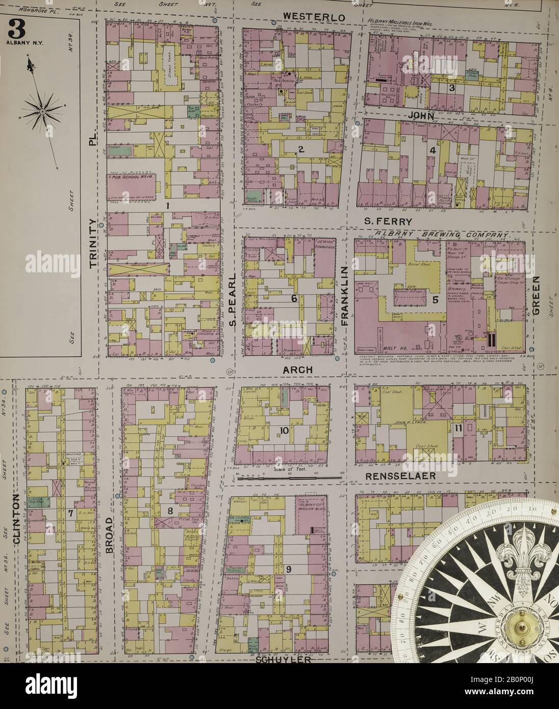 Image 4 of Sanborn Fire Insurance Map from Albany, Albany County, New York. 1892. 124 Sheet(s). Includes Coeymans, Coeymans Junction, Rensselaerville, Clarksville, Altamont, Guilderland Center, South Bethlehem. 3 skeleton maps. Bound, America, street map with a Nineteenth Century compass Stock Photohttps://www.alamy.com/image-license-details/?v=1https://www.alamy.com/image-4-of-sanborn-fire-insurance-map-from-albany-albany-county-new-york-1892-124-sheets-includes-coeymans-coeymans-junction-rensselaerville-clarksville-altamont-guilderland-center-south-bethlehem-3-skeleton-maps-bound-america-street-map-with-a-nineteenth-century-compass-image344690322.html
RM2B0P00J–Image 4 of Sanborn Fire Insurance Map from Albany, Albany County, New York. 1892. 124 Sheet(s). Includes Coeymans, Coeymans Junction, Rensselaerville, Clarksville, Altamont, Guilderland Center, South Bethlehem. 3 skeleton maps. Bound, America, street map with a Nineteenth Century compass
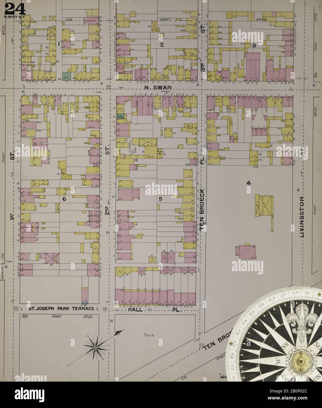 Image 28 of Sanborn Fire Insurance Map from Albany, Albany County, New York. 1892. 124 Sheet(s). Includes Coeymans, Coeymans Junction, Rensselaerville, Clarksville, Altamont, Guilderland Center, South Bethlehem. 3 skeleton maps. Bound, America, street map with a Nineteenth Century compass Stock Photohttps://www.alamy.com/image-license-details/?v=1https://www.alamy.com/image-28-of-sanborn-fire-insurance-map-from-albany-albany-county-new-york-1892-124-sheets-includes-coeymans-coeymans-junction-rensselaerville-clarksville-altamont-guilderland-center-south-bethlehem-3-skeleton-maps-bound-america-street-map-with-a-nineteenth-century-compass-image344690372.html
RM2B0P02C–Image 28 of Sanborn Fire Insurance Map from Albany, Albany County, New York. 1892. 124 Sheet(s). Includes Coeymans, Coeymans Junction, Rensselaerville, Clarksville, Altamont, Guilderland Center, South Bethlehem. 3 skeleton maps. Bound, America, street map with a Nineteenth Century compass
 Image 22 of Sanborn Fire Insurance Map from Albany, Albany County, New York. 1892. 124 Sheet(s). Includes Coeymans, Coeymans Junction, Rensselaerville, Clarksville, Altamont, Guilderland Center, South Bethlehem. 3 skeleton maps. Bound, America, street map with a Nineteenth Century compass Stock Photohttps://www.alamy.com/image-license-details/?v=1https://www.alamy.com/image-22-of-sanborn-fire-insurance-map-from-albany-albany-county-new-york-1892-124-sheets-includes-coeymans-coeymans-junction-rensselaerville-clarksville-altamont-guilderland-center-south-bethlehem-3-skeleton-maps-bound-america-street-map-with-a-nineteenth-century-compass-image344690360.html
RM2B0P020–Image 22 of Sanborn Fire Insurance Map from Albany, Albany County, New York. 1892. 124 Sheet(s). Includes Coeymans, Coeymans Junction, Rensselaerville, Clarksville, Altamont, Guilderland Center, South Bethlehem. 3 skeleton maps. Bound, America, street map with a Nineteenth Century compass
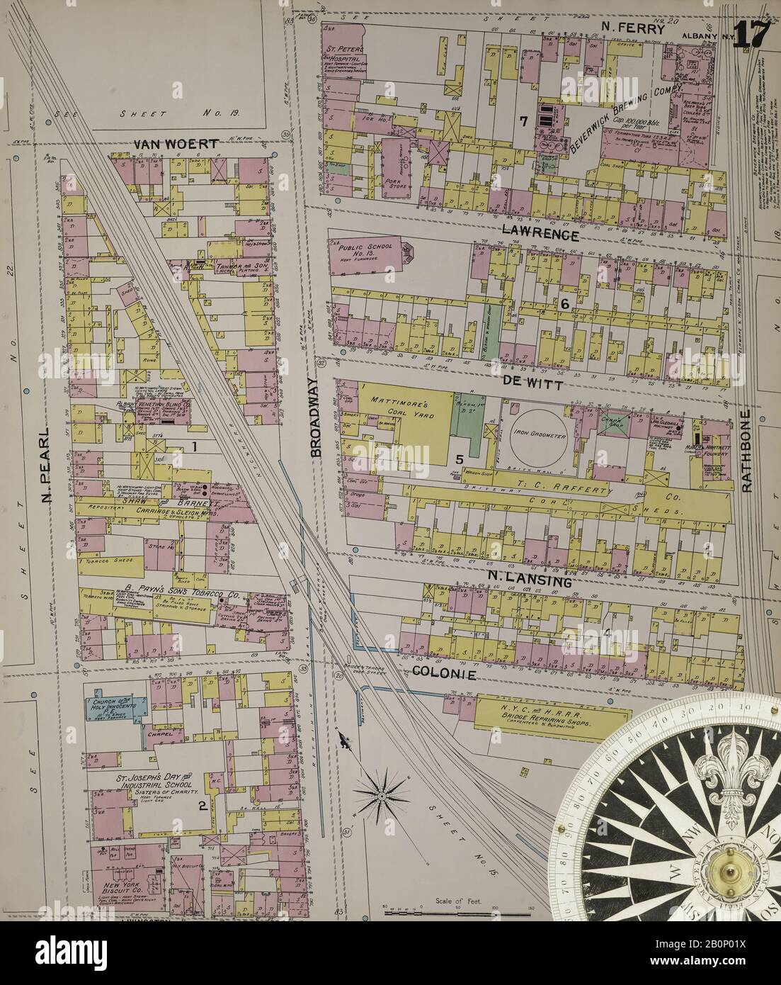 Image 21 of Sanborn Fire Insurance Map from Albany, Albany County, New York. 1892. 124 Sheet(s). Includes Coeymans, Coeymans Junction, Rensselaerville, Clarksville, Altamont, Guilderland Center, South Bethlehem. 3 skeleton maps. Bound, America, street map with a Nineteenth Century compass Stock Photohttps://www.alamy.com/image-license-details/?v=1https://www.alamy.com/image-21-of-sanborn-fire-insurance-map-from-albany-albany-county-new-york-1892-124-sheets-includes-coeymans-coeymans-junction-rensselaerville-clarksville-altamont-guilderland-center-south-bethlehem-3-skeleton-maps-bound-america-street-map-with-a-nineteenth-century-compass-image344690358.html
RM2B0P01X–Image 21 of Sanborn Fire Insurance Map from Albany, Albany County, New York. 1892. 124 Sheet(s). Includes Coeymans, Coeymans Junction, Rensselaerville, Clarksville, Altamont, Guilderland Center, South Bethlehem. 3 skeleton maps. Bound, America, street map with a Nineteenth Century compass
 Image 15 of Sanborn Fire Insurance Map from Albany, Albany County, New York. 1892. 124 Sheet(s). Includes Coeymans, Coeymans Junction, Rensselaerville, Clarksville, Altamont, Guilderland Center, South Bethlehem. 3 skeleton maps. Bound, America, street map with a Nineteenth Century compass Stock Photohttps://www.alamy.com/image-license-details/?v=1https://www.alamy.com/image-15-of-sanborn-fire-insurance-map-from-albany-albany-county-new-york-1892-124-sheets-includes-coeymans-coeymans-junction-rensselaerville-clarksville-altamont-guilderland-center-south-bethlehem-3-skeleton-maps-bound-america-street-map-with-a-nineteenth-century-compass-image344690347.html
RM2B0P01F–Image 15 of Sanborn Fire Insurance Map from Albany, Albany County, New York. 1892. 124 Sheet(s). Includes Coeymans, Coeymans Junction, Rensselaerville, Clarksville, Altamont, Guilderland Center, South Bethlehem. 3 skeleton maps. Bound, America, street map with a Nineteenth Century compass
 Image 40 of Sanborn Fire Insurance Map from Albany, Albany County, New York. 1892. 124 Sheet(s). Includes Coeymans, Coeymans Junction, Rensselaerville, Clarksville, Altamont, Guilderland Center, South Bethlehem. 3 skeleton maps. Bound, America, street map with a Nineteenth Century compass Stock Photohttps://www.alamy.com/image-license-details/?v=1https://www.alamy.com/image-40-of-sanborn-fire-insurance-map-from-albany-albany-county-new-york-1892-124-sheets-includes-coeymans-coeymans-junction-rensselaerville-clarksville-altamont-guilderland-center-south-bethlehem-3-skeleton-maps-bound-america-street-map-with-a-nineteenth-century-compass-image344690399.html
RM2B0P03B–Image 40 of Sanborn Fire Insurance Map from Albany, Albany County, New York. 1892. 124 Sheet(s). Includes Coeymans, Coeymans Junction, Rensselaerville, Clarksville, Altamont, Guilderland Center, South Bethlehem. 3 skeleton maps. Bound, America, street map with a Nineteenth Century compass
 Image 7 of Sanborn Fire Insurance Map from Albany, Albany County, New York. 1892. 124 Sheet(s). Includes Coeymans, Coeymans Junction, Rensselaerville, Clarksville, Altamont, Guilderland Center, South Bethlehem. 3 skeleton maps. Bound, America, street map with a Nineteenth Century compass Stock Photohttps://www.alamy.com/image-license-details/?v=1https://www.alamy.com/image-7-of-sanborn-fire-insurance-map-from-albany-albany-county-new-york-1892-124-sheets-includes-coeymans-coeymans-junction-rensselaerville-clarksville-altamont-guilderland-center-south-bethlehem-3-skeleton-maps-bound-america-street-map-with-a-nineteenth-century-compass-image344690329.html
RM2B0P00W–Image 7 of Sanborn Fire Insurance Map from Albany, Albany County, New York. 1892. 124 Sheet(s). Includes Coeymans, Coeymans Junction, Rensselaerville, Clarksville, Altamont, Guilderland Center, South Bethlehem. 3 skeleton maps. Bound, America, street map with a Nineteenth Century compass
 Image 37 of Sanborn Fire Insurance Map from Albany, Albany County, New York. 1892. 124 Sheet(s). Includes Coeymans, Coeymans Junction, Rensselaerville, Clarksville, Altamont, Guilderland Center, South Bethlehem. 3 skeleton maps. Bound, America, street map with a Nineteenth Century compass Stock Photohttps://www.alamy.com/image-license-details/?v=1https://www.alamy.com/image-37-of-sanborn-fire-insurance-map-from-albany-albany-county-new-york-1892-124-sheets-includes-coeymans-coeymans-junction-rensselaerville-clarksville-altamont-guilderland-center-south-bethlehem-3-skeleton-maps-bound-america-street-map-with-a-nineteenth-century-compass-image344690392.html
RM2B0P034–Image 37 of Sanborn Fire Insurance Map from Albany, Albany County, New York. 1892. 124 Sheet(s). Includes Coeymans, Coeymans Junction, Rensselaerville, Clarksville, Altamont, Guilderland Center, South Bethlehem. 3 skeleton maps. Bound, America, street map with a Nineteenth Century compass
 Image 11 of Sanborn Fire Insurance Map from Albany, Albany County, New York. 1892. 124 Sheet(s). Includes Coeymans, Coeymans Junction, Rensselaerville, Clarksville, Altamont, Guilderland Center, South Bethlehem. 3 skeleton maps. Bound, America, street map with a Nineteenth Century compass Stock Photohttps://www.alamy.com/image-license-details/?v=1https://www.alamy.com/image-11-of-sanborn-fire-insurance-map-from-albany-albany-county-new-york-1892-124-sheets-includes-coeymans-coeymans-junction-rensselaerville-clarksville-altamont-guilderland-center-south-bethlehem-3-skeleton-maps-bound-america-street-map-with-a-nineteenth-century-compass-image344690337.html
RM2B0P015–Image 11 of Sanborn Fire Insurance Map from Albany, Albany County, New York. 1892. 124 Sheet(s). Includes Coeymans, Coeymans Junction, Rensselaerville, Clarksville, Altamont, Guilderland Center, South Bethlehem. 3 skeleton maps. Bound, America, street map with a Nineteenth Century compass
 Image 33 of Sanborn Fire Insurance Map from Albany, Albany County, New York. 1892. 124 Sheet(s). Includes Coeymans, Coeymans Junction, Rensselaerville, Clarksville, Altamont, Guilderland Center, South Bethlehem. 3 skeleton maps. Bound, America, street map with a Nineteenth Century compass Stock Photohttps://www.alamy.com/image-license-details/?v=1https://www.alamy.com/image-33-of-sanborn-fire-insurance-map-from-albany-albany-county-new-york-1892-124-sheets-includes-coeymans-coeymans-junction-rensselaerville-clarksville-altamont-guilderland-center-south-bethlehem-3-skeleton-maps-bound-america-street-map-with-a-nineteenth-century-compass-image344690382.html
RM2B0P02P–Image 33 of Sanborn Fire Insurance Map from Albany, Albany County, New York. 1892. 124 Sheet(s). Includes Coeymans, Coeymans Junction, Rensselaerville, Clarksville, Altamont, Guilderland Center, South Bethlehem. 3 skeleton maps. Bound, America, street map with a Nineteenth Century compass
 Image 31 of Sanborn Fire Insurance Map from Albany, Albany County, New York. 1892. 124 Sheet(s). Includes Coeymans, Coeymans Junction, Rensselaerville, Clarksville, Altamont, Guilderland Center, South Bethlehem. 3 skeleton maps. Bound, America, street map with a Nineteenth Century compass Stock Photohttps://www.alamy.com/image-license-details/?v=1https://www.alamy.com/image-31-of-sanborn-fire-insurance-map-from-albany-albany-county-new-york-1892-124-sheets-includes-coeymans-coeymans-junction-rensselaerville-clarksville-altamont-guilderland-center-south-bethlehem-3-skeleton-maps-bound-america-street-map-with-a-nineteenth-century-compass-image344690378.html
RM2B0P02J–Image 31 of Sanborn Fire Insurance Map from Albany, Albany County, New York. 1892. 124 Sheet(s). Includes Coeymans, Coeymans Junction, Rensselaerville, Clarksville, Altamont, Guilderland Center, South Bethlehem. 3 skeleton maps. Bound, America, street map with a Nineteenth Century compass
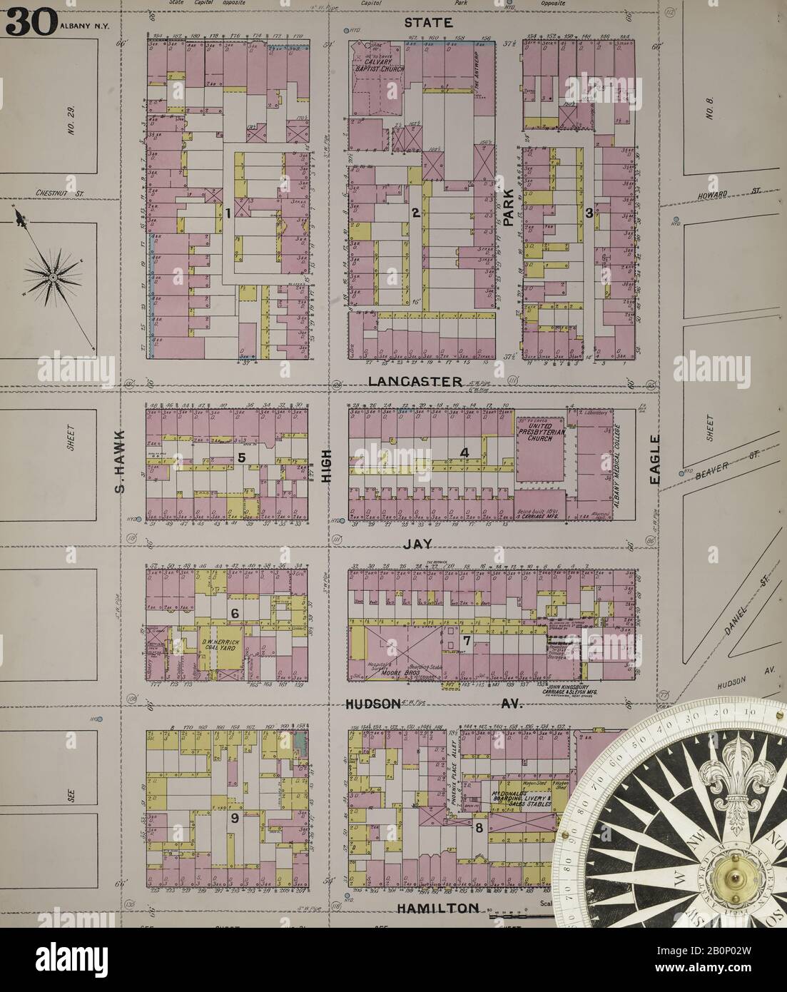 Image 34 of Sanborn Fire Insurance Map from Albany, Albany County, New York. 1892. 124 Sheet(s). Includes Coeymans, Coeymans Junction, Rensselaerville, Clarksville, Altamont, Guilderland Center, South Bethlehem. 3 skeleton maps. Bound, America, street map with a Nineteenth Century compass Stock Photohttps://www.alamy.com/image-license-details/?v=1https://www.alamy.com/image-34-of-sanborn-fire-insurance-map-from-albany-albany-county-new-york-1892-124-sheets-includes-coeymans-coeymans-junction-rensselaerville-clarksville-altamont-guilderland-center-south-bethlehem-3-skeleton-maps-bound-america-street-map-with-a-nineteenth-century-compass-image344690385.html
RM2B0P02W–Image 34 of Sanborn Fire Insurance Map from Albany, Albany County, New York. 1892. 124 Sheet(s). Includes Coeymans, Coeymans Junction, Rensselaerville, Clarksville, Altamont, Guilderland Center, South Bethlehem. 3 skeleton maps. Bound, America, street map with a Nineteenth Century compass
 Image 3 of Sanborn Fire Insurance Map from Albany, Albany County, New York. 1892. 124 Sheet(s). Includes Coeymans, Coeymans Junction, Rensselaerville, Clarksville, Altamont, Guilderland Center, South Bethlehem. 3 skeleton maps. Bound, America, street map with a Nineteenth Century compass Stock Photohttps://www.alamy.com/image-license-details/?v=1https://www.alamy.com/image-3-of-sanborn-fire-insurance-map-from-albany-albany-county-new-york-1892-124-sheets-includes-coeymans-coeymans-junction-rensselaerville-clarksville-altamont-guilderland-center-south-bethlehem-3-skeleton-maps-bound-america-street-map-with-a-nineteenth-century-compass-image344690319.html
RM2B0P00F–Image 3 of Sanborn Fire Insurance Map from Albany, Albany County, New York. 1892. 124 Sheet(s). Includes Coeymans, Coeymans Junction, Rensselaerville, Clarksville, Altamont, Guilderland Center, South Bethlehem. 3 skeleton maps. Bound, America, street map with a Nineteenth Century compass
 Image 35 of Sanborn Fire Insurance Map from Albany, Albany County, New York. 1892. 124 Sheet(s). Includes Coeymans, Coeymans Junction, Rensselaerville, Clarksville, Altamont, Guilderland Center, South Bethlehem. 3 skeleton maps. Bound, America, street map with a Nineteenth Century compass Stock Photohttps://www.alamy.com/image-license-details/?v=1https://www.alamy.com/image-35-of-sanborn-fire-insurance-map-from-albany-albany-county-new-york-1892-124-sheets-includes-coeymans-coeymans-junction-rensselaerville-clarksville-altamont-guilderland-center-south-bethlehem-3-skeleton-maps-bound-america-street-map-with-a-nineteenth-century-compass-image344690387.html
RM2B0P02Y–Image 35 of Sanborn Fire Insurance Map from Albany, Albany County, New York. 1892. 124 Sheet(s). Includes Coeymans, Coeymans Junction, Rensselaerville, Clarksville, Altamont, Guilderland Center, South Bethlehem. 3 skeleton maps. Bound, America, street map with a Nineteenth Century compass
 Image 25 of Sanborn Fire Insurance Map from Albany, Albany County, New York. 1892. 124 Sheet(s). Includes Coeymans, Coeymans Junction, Rensselaerville, Clarksville, Altamont, Guilderland Center, South Bethlehem. 3 skeleton maps. Bound, America, street map with a Nineteenth Century compass Stock Photohttps://www.alamy.com/image-license-details/?v=1https://www.alamy.com/image-25-of-sanborn-fire-insurance-map-from-albany-albany-county-new-york-1892-124-sheets-includes-coeymans-coeymans-junction-rensselaerville-clarksville-altamont-guilderland-center-south-bethlehem-3-skeleton-maps-bound-america-street-map-with-a-nineteenth-century-compass-image344690367.html
RM2B0P027–Image 25 of Sanborn Fire Insurance Map from Albany, Albany County, New York. 1892. 124 Sheet(s). Includes Coeymans, Coeymans Junction, Rensselaerville, Clarksville, Altamont, Guilderland Center, South Bethlehem. 3 skeleton maps. Bound, America, street map with a Nineteenth Century compass
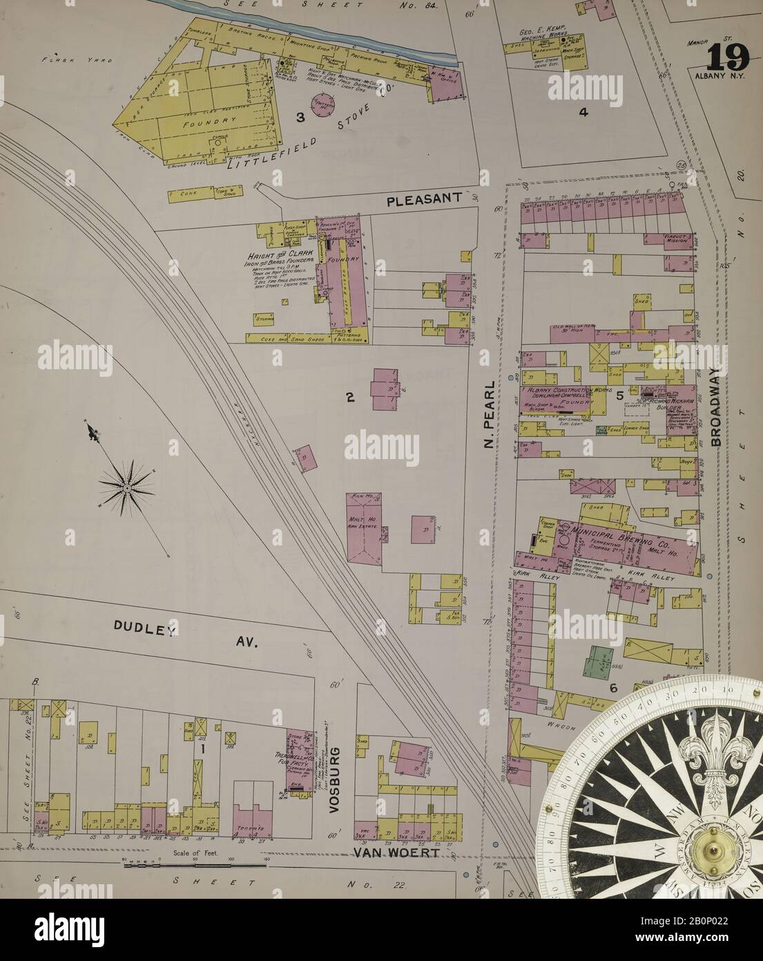 Image 23 of Sanborn Fire Insurance Map from Albany, Albany County, New York. 1892. 124 Sheet(s). Includes Coeymans, Coeymans Junction, Rensselaerville, Clarksville, Altamont, Guilderland Center, South Bethlehem. 3 skeleton maps. Bound, America, street map with a Nineteenth Century compass Stock Photohttps://www.alamy.com/image-license-details/?v=1https://www.alamy.com/image-23-of-sanborn-fire-insurance-map-from-albany-albany-county-new-york-1892-124-sheets-includes-coeymans-coeymans-junction-rensselaerville-clarksville-altamont-guilderland-center-south-bethlehem-3-skeleton-maps-bound-america-street-map-with-a-nineteenth-century-compass-image344690362.html
RM2B0P022–Image 23 of Sanborn Fire Insurance Map from Albany, Albany County, New York. 1892. 124 Sheet(s). Includes Coeymans, Coeymans Junction, Rensselaerville, Clarksville, Altamont, Guilderland Center, South Bethlehem. 3 skeleton maps. Bound, America, street map with a Nineteenth Century compass
 Image 6 of Sanborn Fire Insurance Map from Albany, Albany County, New York. 1892. 124 Sheet(s). Includes Coeymans, Coeymans Junction, Rensselaerville, Clarksville, Altamont, Guilderland Center, South Bethlehem. 3 skeleton maps. Bound, America, street map with a Nineteenth Century compass Stock Photohttps://www.alamy.com/image-license-details/?v=1https://www.alamy.com/image-6-of-sanborn-fire-insurance-map-from-albany-albany-county-new-york-1892-124-sheets-includes-coeymans-coeymans-junction-rensselaerville-clarksville-altamont-guilderland-center-south-bethlehem-3-skeleton-maps-bound-america-street-map-with-a-nineteenth-century-compass-image344690326.html
RM2B0P00P–Image 6 of Sanborn Fire Insurance Map from Albany, Albany County, New York. 1892. 124 Sheet(s). Includes Coeymans, Coeymans Junction, Rensselaerville, Clarksville, Altamont, Guilderland Center, South Bethlehem. 3 skeleton maps. Bound, America, street map with a Nineteenth Century compass
 Image 32 of Sanborn Fire Insurance Map from Albany, Albany County, New York. 1892. 124 Sheet(s). Includes Coeymans, Coeymans Junction, Rensselaerville, Clarksville, Altamont, Guilderland Center, South Bethlehem. 3 skeleton maps. Bound, America, street map with a Nineteenth Century compass Stock Photohttps://www.alamy.com/image-license-details/?v=1https://www.alamy.com/image-32-of-sanborn-fire-insurance-map-from-albany-albany-county-new-york-1892-124-sheets-includes-coeymans-coeymans-junction-rensselaerville-clarksville-altamont-guilderland-center-south-bethlehem-3-skeleton-maps-bound-america-street-map-with-a-nineteenth-century-compass-image344690381.html
RM2B0P02N–Image 32 of Sanborn Fire Insurance Map from Albany, Albany County, New York. 1892. 124 Sheet(s). Includes Coeymans, Coeymans Junction, Rensselaerville, Clarksville, Altamont, Guilderland Center, South Bethlehem. 3 skeleton maps. Bound, America, street map with a Nineteenth Century compass
 Image 24 of Sanborn Fire Insurance Map from Albany, Albany County, New York. 1892. 124 Sheet(s). Includes Coeymans, Coeymans Junction, Rensselaerville, Clarksville, Altamont, Guilderland Center, South Bethlehem. 3 skeleton maps. Bound, America, street map with a Nineteenth Century compass Stock Photohttps://www.alamy.com/image-license-details/?v=1https://www.alamy.com/image-24-of-sanborn-fire-insurance-map-from-albany-albany-county-new-york-1892-124-sheets-includes-coeymans-coeymans-junction-rensselaerville-clarksville-altamont-guilderland-center-south-bethlehem-3-skeleton-maps-bound-america-street-map-with-a-nineteenth-century-compass-image344690366.html
RM2B0P026–Image 24 of Sanborn Fire Insurance Map from Albany, Albany County, New York. 1892. 124 Sheet(s). Includes Coeymans, Coeymans Junction, Rensselaerville, Clarksville, Altamont, Guilderland Center, South Bethlehem. 3 skeleton maps. Bound, America, street map with a Nineteenth Century compass
 Image 27 of Sanborn Fire Insurance Map from Albany, Albany County, New York. 1892. 124 Sheet(s). Includes Coeymans, Coeymans Junction, Rensselaerville, Clarksville, Altamont, Guilderland Center, South Bethlehem. 3 skeleton maps. Bound, America, street map with a Nineteenth Century compass Stock Photohttps://www.alamy.com/image-license-details/?v=1https://www.alamy.com/image-27-of-sanborn-fire-insurance-map-from-albany-albany-county-new-york-1892-124-sheets-includes-coeymans-coeymans-junction-rensselaerville-clarksville-altamont-guilderland-center-south-bethlehem-3-skeleton-maps-bound-america-street-map-with-a-nineteenth-century-compass-image344690371.html
RM2B0P02B–Image 27 of Sanborn Fire Insurance Map from Albany, Albany County, New York. 1892. 124 Sheet(s). Includes Coeymans, Coeymans Junction, Rensselaerville, Clarksville, Altamont, Guilderland Center, South Bethlehem. 3 skeleton maps. Bound, America, street map with a Nineteenth Century compass
 Image 18 of Sanborn Fire Insurance Map from Albany, Albany County, New York. 1892. 124 Sheet(s). Includes Coeymans, Coeymans Junction, Rensselaerville, Clarksville, Altamont, Guilderland Center, South Bethlehem. 3 skeleton maps. Bound, America, street map with a Nineteenth Century compass Stock Photohttps://www.alamy.com/image-license-details/?v=1https://www.alamy.com/image-18-of-sanborn-fire-insurance-map-from-albany-albany-county-new-york-1892-124-sheets-includes-coeymans-coeymans-junction-rensselaerville-clarksville-altamont-guilderland-center-south-bethlehem-3-skeleton-maps-bound-america-street-map-with-a-nineteenth-century-compass-image344690352.html
RM2B0P01M–Image 18 of Sanborn Fire Insurance Map from Albany, Albany County, New York. 1892. 124 Sheet(s). Includes Coeymans, Coeymans Junction, Rensselaerville, Clarksville, Altamont, Guilderland Center, South Bethlehem. 3 skeleton maps. Bound, America, street map with a Nineteenth Century compass
 Image 20 of Sanborn Fire Insurance Map from Albany, Albany County, New York. 1892. 124 Sheet(s). Includes Coeymans, Coeymans Junction, Rensselaerville, Clarksville, Altamont, Guilderland Center, South Bethlehem. 3 skeleton maps. Bound, America, street map with a Nineteenth Century compass Stock Photohttps://www.alamy.com/image-license-details/?v=1https://www.alamy.com/image-20-of-sanborn-fire-insurance-map-from-albany-albany-county-new-york-1892-124-sheets-includes-coeymans-coeymans-junction-rensselaerville-clarksville-altamont-guilderland-center-south-bethlehem-3-skeleton-maps-bound-america-street-map-with-a-nineteenth-century-compass-image344690356.html
RM2B0P01T–Image 20 of Sanborn Fire Insurance Map from Albany, Albany County, New York. 1892. 124 Sheet(s). Includes Coeymans, Coeymans Junction, Rensselaerville, Clarksville, Altamont, Guilderland Center, South Bethlehem. 3 skeleton maps. Bound, America, street map with a Nineteenth Century compass
 Image 30 of Sanborn Fire Insurance Map from Albany, Albany County, New York. 1892. 124 Sheet(s). Includes Coeymans, Coeymans Junction, Rensselaerville, Clarksville, Altamont, Guilderland Center, South Bethlehem. 3 skeleton maps. Bound, America, street map with a Nineteenth Century compass Stock Photohttps://www.alamy.com/image-license-details/?v=1https://www.alamy.com/image-30-of-sanborn-fire-insurance-map-from-albany-albany-county-new-york-1892-124-sheets-includes-coeymans-coeymans-junction-rensselaerville-clarksville-altamont-guilderland-center-south-bethlehem-3-skeleton-maps-bound-america-street-map-with-a-nineteenth-century-compass-image344690377.html
RM2B0P02H–Image 30 of Sanborn Fire Insurance Map from Albany, Albany County, New York. 1892. 124 Sheet(s). Includes Coeymans, Coeymans Junction, Rensselaerville, Clarksville, Altamont, Guilderland Center, South Bethlehem. 3 skeleton maps. Bound, America, street map with a Nineteenth Century compass
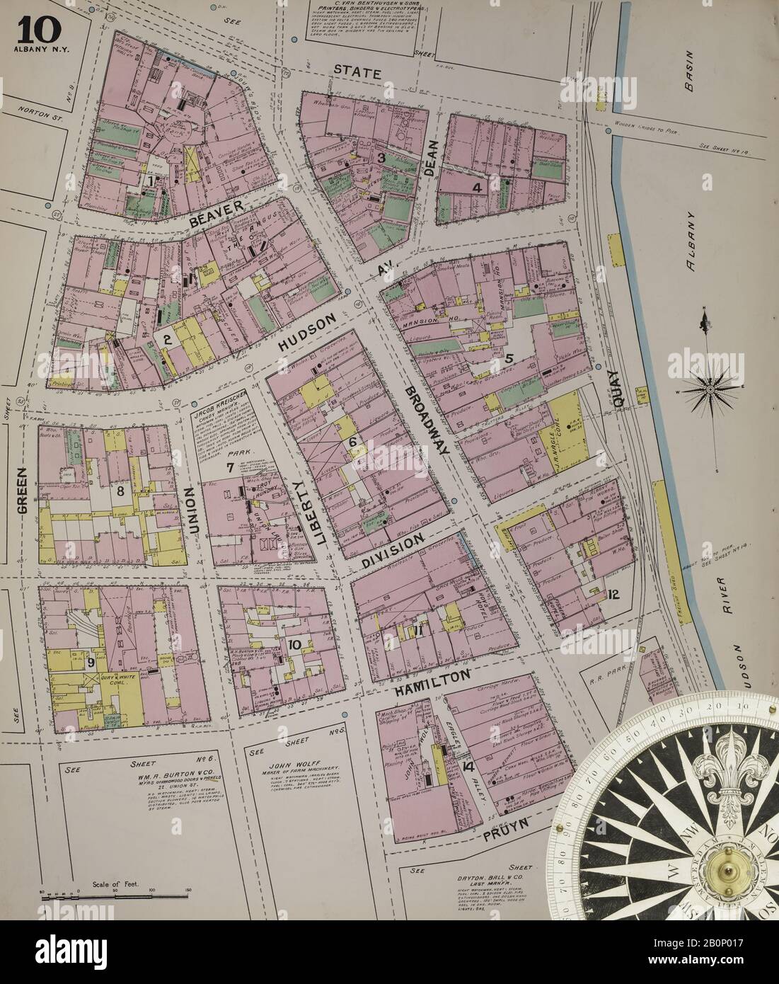 Image 12 of Sanborn Fire Insurance Map from Albany, Albany County, New York. 1892. 124 Sheet(s). Includes Coeymans, Coeymans Junction, Rensselaerville, Clarksville, Altamont, Guilderland Center, South Bethlehem. 3 skeleton maps. Bound, America, street map with a Nineteenth Century compass Stock Photohttps://www.alamy.com/image-license-details/?v=1https://www.alamy.com/image-12-of-sanborn-fire-insurance-map-from-albany-albany-county-new-york-1892-124-sheets-includes-coeymans-coeymans-junction-rensselaerville-clarksville-altamont-guilderland-center-south-bethlehem-3-skeleton-maps-bound-america-street-map-with-a-nineteenth-century-compass-image344690339.html
RM2B0P017–Image 12 of Sanborn Fire Insurance Map from Albany, Albany County, New York. 1892. 124 Sheet(s). Includes Coeymans, Coeymans Junction, Rensselaerville, Clarksville, Altamont, Guilderland Center, South Bethlehem. 3 skeleton maps. Bound, America, street map with a Nineteenth Century compass
 Image 2 of Sanborn Fire Insurance Map from Albany, Albany County, New York. 1892. 124 Sheet(s). Includes Coeymans, Coeymans Junction, Rensselaerville, Clarksville, Altamont, Guilderland Center, South Bethlehem. 3 skeleton maps. Bound, America, street map with a Nineteenth Century compass Stock Photohttps://www.alamy.com/image-license-details/?v=1https://www.alamy.com/image-2-of-sanborn-fire-insurance-map-from-albany-albany-county-new-york-1892-124-sheets-includes-coeymans-coeymans-junction-rensselaerville-clarksville-altamont-guilderland-center-south-bethlehem-3-skeleton-maps-bound-america-street-map-with-a-nineteenth-century-compass-image344690316.html
RM2B0P00C–Image 2 of Sanborn Fire Insurance Map from Albany, Albany County, New York. 1892. 124 Sheet(s). Includes Coeymans, Coeymans Junction, Rensselaerville, Clarksville, Altamont, Guilderland Center, South Bethlehem. 3 skeleton maps. Bound, America, street map with a Nineteenth Century compass
 Image 13 of Sanborn Fire Insurance Map from Albany, Albany County, New York. 1892. 124 Sheet(s). Includes Coeymans, Coeymans Junction, Rensselaerville, Clarksville, Altamont, Guilderland Center, South Bethlehem. 3 skeleton maps. Bound, America, street map with a Nineteenth Century compass Stock Photohttps://www.alamy.com/image-license-details/?v=1https://www.alamy.com/image-13-of-sanborn-fire-insurance-map-from-albany-albany-county-new-york-1892-124-sheets-includes-coeymans-coeymans-junction-rensselaerville-clarksville-altamont-guilderland-center-south-bethlehem-3-skeleton-maps-bound-america-street-map-with-a-nineteenth-century-compass-image344690342.html
RM2B0P01A–Image 13 of Sanborn Fire Insurance Map from Albany, Albany County, New York. 1892. 124 Sheet(s). Includes Coeymans, Coeymans Junction, Rensselaerville, Clarksville, Altamont, Guilderland Center, South Bethlehem. 3 skeleton maps. Bound, America, street map with a Nineteenth Century compass
 Image 1 of Sanborn Fire Insurance Map from Albany, Albany County, New York. 1892. 124 Sheet(s). Includes Coeymans, Coeymans Junction, Rensselaerville, Clarksville, Altamont, Guilderland Center, South Bethlehem. 3 skeleton maps. Bound, America, street map with a Nineteenth Century compass Stock Photohttps://www.alamy.com/image-license-details/?v=1https://www.alamy.com/image-1-of-sanborn-fire-insurance-map-from-albany-albany-county-new-york-1892-124-sheets-includes-coeymans-coeymans-junction-rensselaerville-clarksville-altamont-guilderland-center-south-bethlehem-3-skeleton-maps-bound-america-street-map-with-a-nineteenth-century-compass-image344690314.html
RM2B0P00A–Image 1 of Sanborn Fire Insurance Map from Albany, Albany County, New York. 1892. 124 Sheet(s). Includes Coeymans, Coeymans Junction, Rensselaerville, Clarksville, Altamont, Guilderland Center, South Bethlehem. 3 skeleton maps. Bound, America, street map with a Nineteenth Century compass
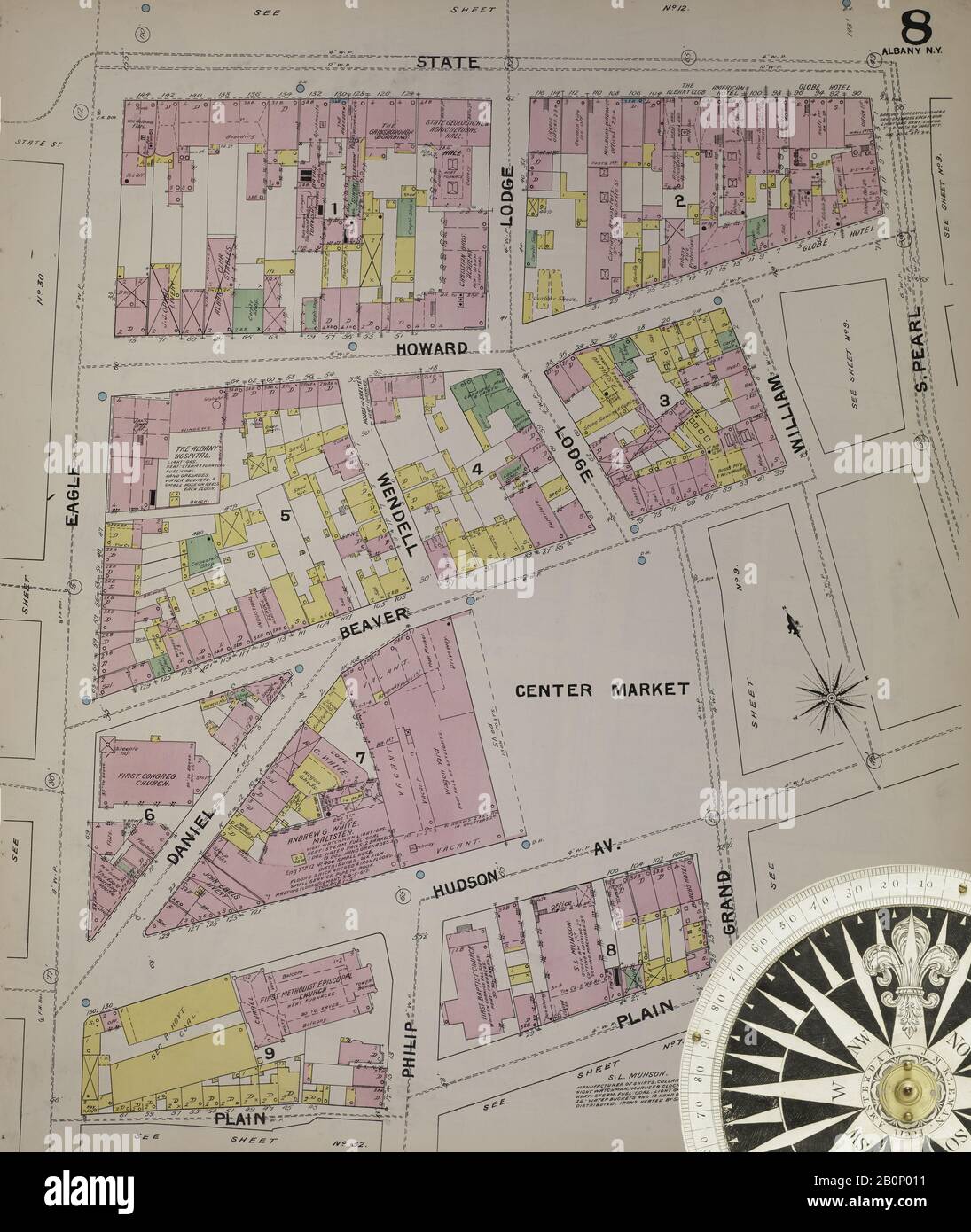 Image 9 of Sanborn Fire Insurance Map from Albany, Albany County, New York. 1892. 124 Sheet(s). Includes Coeymans, Coeymans Junction, Rensselaerville, Clarksville, Altamont, Guilderland Center, South Bethlehem. 3 skeleton maps. Bound, America, street map with a Nineteenth Century compass Stock Photohttps://www.alamy.com/image-license-details/?v=1https://www.alamy.com/image-9-of-sanborn-fire-insurance-map-from-albany-albany-county-new-york-1892-124-sheets-includes-coeymans-coeymans-junction-rensselaerville-clarksville-altamont-guilderland-center-south-bethlehem-3-skeleton-maps-bound-america-street-map-with-a-nineteenth-century-compass-image344690333.html
RM2B0P011–Image 9 of Sanborn Fire Insurance Map from Albany, Albany County, New York. 1892. 124 Sheet(s). Includes Coeymans, Coeymans Junction, Rensselaerville, Clarksville, Altamont, Guilderland Center, South Bethlehem. 3 skeleton maps. Bound, America, street map with a Nineteenth Century compass
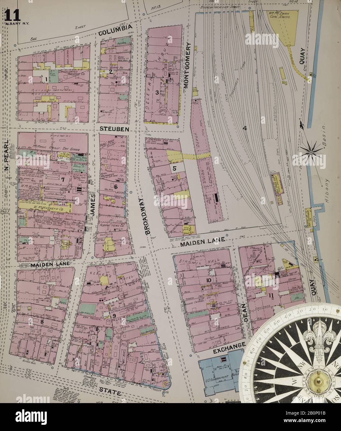 Image 14 of Sanborn Fire Insurance Map from Albany, Albany County, New York. 1892. 124 Sheet(s). Includes Coeymans, Coeymans Junction, Rensselaerville, Clarksville, Altamont, Guilderland Center, South Bethlehem. 3 skeleton maps. Bound, America, street map with a Nineteenth Century compass Stock Photohttps://www.alamy.com/image-license-details/?v=1https://www.alamy.com/image-14-of-sanborn-fire-insurance-map-from-albany-albany-county-new-york-1892-124-sheets-includes-coeymans-coeymans-junction-rensselaerville-clarksville-altamont-guilderland-center-south-bethlehem-3-skeleton-maps-bound-america-street-map-with-a-nineteenth-century-compass-image344690343.html
RM2B0P01B–Image 14 of Sanborn Fire Insurance Map from Albany, Albany County, New York. 1892. 124 Sheet(s). Includes Coeymans, Coeymans Junction, Rensselaerville, Clarksville, Altamont, Guilderland Center, South Bethlehem. 3 skeleton maps. Bound, America, street map with a Nineteenth Century compass
 Image 39 of Sanborn Fire Insurance Map from Albany, Albany County, New York. 1892. 124 Sheet(s). Includes Coeymans, Coeymans Junction, Rensselaerville, Clarksville, Altamont, Guilderland Center, South Bethlehem. 3 skeleton maps. Bound, America, street map with a Nineteenth Century compass Stock Photohttps://www.alamy.com/image-license-details/?v=1https://www.alamy.com/image-39-of-sanborn-fire-insurance-map-from-albany-albany-county-new-york-1892-124-sheets-includes-coeymans-coeymans-junction-rensselaerville-clarksville-altamont-guilderland-center-south-bethlehem-3-skeleton-maps-bound-america-street-map-with-a-nineteenth-century-compass-image344690395.html
RM2B0P037–Image 39 of Sanborn Fire Insurance Map from Albany, Albany County, New York. 1892. 124 Sheet(s). Includes Coeymans, Coeymans Junction, Rensselaerville, Clarksville, Altamont, Guilderland Center, South Bethlehem. 3 skeleton maps. Bound, America, street map with a Nineteenth Century compass
 Image 29 of Sanborn Fire Insurance Map from Albany, Albany County, New York. 1892. 124 Sheet(s). Includes Coeymans, Coeymans Junction, Rensselaerville, Clarksville, Altamont, Guilderland Center, South Bethlehem. 3 skeleton maps. Bound, America, street map with a Nineteenth Century compass Stock Photohttps://www.alamy.com/image-license-details/?v=1https://www.alamy.com/image-29-of-sanborn-fire-insurance-map-from-albany-albany-county-new-york-1892-124-sheets-includes-coeymans-coeymans-junction-rensselaerville-clarksville-altamont-guilderland-center-south-bethlehem-3-skeleton-maps-bound-america-street-map-with-a-nineteenth-century-compass-image344690375.html
RM2B0P02F–Image 29 of Sanborn Fire Insurance Map from Albany, Albany County, New York. 1892. 124 Sheet(s). Includes Coeymans, Coeymans Junction, Rensselaerville, Clarksville, Altamont, Guilderland Center, South Bethlehem. 3 skeleton maps. Bound, America, street map with a Nineteenth Century compass
 Image 36 of Sanborn Fire Insurance Map from Albany, Albany County, New York. 1892. 124 Sheet(s). Includes Coeymans, Coeymans Junction, Rensselaerville, Clarksville, Altamont, Guilderland Center, South Bethlehem. 3 skeleton maps. Bound, America, street map with a Nineteenth Century compass Stock Photohttps://www.alamy.com/image-license-details/?v=1https://www.alamy.com/image-36-of-sanborn-fire-insurance-map-from-albany-albany-county-new-york-1892-124-sheets-includes-coeymans-coeymans-junction-rensselaerville-clarksville-altamont-guilderland-center-south-bethlehem-3-skeleton-maps-bound-america-street-map-with-a-nineteenth-century-compass-image344690389.html
RM2B0P031–Image 36 of Sanborn Fire Insurance Map from Albany, Albany County, New York. 1892. 124 Sheet(s). Includes Coeymans, Coeymans Junction, Rensselaerville, Clarksville, Altamont, Guilderland Center, South Bethlehem. 3 skeleton maps. Bound, America, street map with a Nineteenth Century compass
 Image 19 of Sanborn Fire Insurance Map from Albany, Albany County, New York. 1892. 124 Sheet(s). Includes Coeymans, Coeymans Junction, Rensselaerville, Clarksville, Altamont, Guilderland Center, South Bethlehem. 3 skeleton maps. Bound, America, street map with a Nineteenth Century compass Stock Photohttps://www.alamy.com/image-license-details/?v=1https://www.alamy.com/image-19-of-sanborn-fire-insurance-map-from-albany-albany-county-new-york-1892-124-sheets-includes-coeymans-coeymans-junction-rensselaerville-clarksville-altamont-guilderland-center-south-bethlehem-3-skeleton-maps-bound-america-street-map-with-a-nineteenth-century-compass-image344690354.html
RM2B0P01P–Image 19 of Sanborn Fire Insurance Map from Albany, Albany County, New York. 1892. 124 Sheet(s). Includes Coeymans, Coeymans Junction, Rensselaerville, Clarksville, Altamont, Guilderland Center, South Bethlehem. 3 skeleton maps. Bound, America, street map with a Nineteenth Century compass
 Image 16 of Sanborn Fire Insurance Map from Albany, Albany County, New York. 1892. 124 Sheet(s). Includes Coeymans, Coeymans Junction, Rensselaerville, Clarksville, Altamont, Guilderland Center, South Bethlehem. 3 skeleton maps. Bound, America, street map with a Nineteenth Century compass Stock Photohttps://www.alamy.com/image-license-details/?v=1https://www.alamy.com/image-16-of-sanborn-fire-insurance-map-from-albany-albany-county-new-york-1892-124-sheets-includes-coeymans-coeymans-junction-rensselaerville-clarksville-altamont-guilderland-center-south-bethlehem-3-skeleton-maps-bound-america-street-map-with-a-nineteenth-century-compass-image344690348.html
RM2B0P01G–Image 16 of Sanborn Fire Insurance Map from Albany, Albany County, New York. 1892. 124 Sheet(s). Includes Coeymans, Coeymans Junction, Rensselaerville, Clarksville, Altamont, Guilderland Center, South Bethlehem. 3 skeleton maps. Bound, America, street map with a Nineteenth Century compass
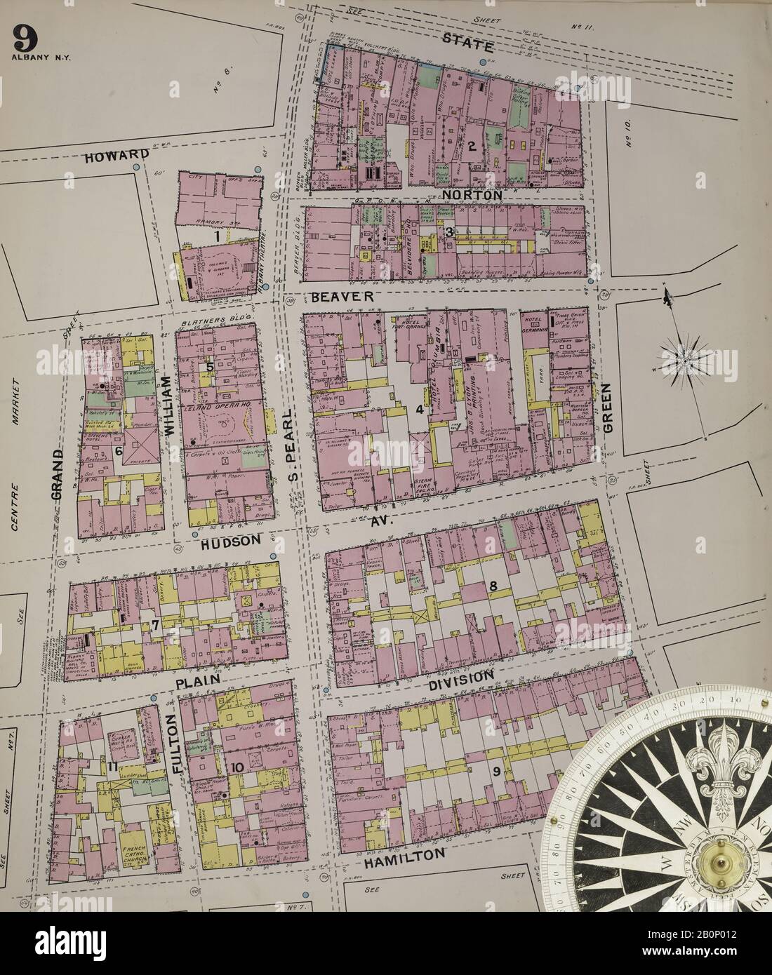 Image 10 of Sanborn Fire Insurance Map from Albany, Albany County, New York. 1892. 124 Sheet(s). Includes Coeymans, Coeymans Junction, Rensselaerville, Clarksville, Altamont, Guilderland Center, South Bethlehem. 3 skeleton maps. Bound, America, street map with a Nineteenth Century compass Stock Photohttps://www.alamy.com/image-license-details/?v=1https://www.alamy.com/image-10-of-sanborn-fire-insurance-map-from-albany-albany-county-new-york-1892-124-sheets-includes-coeymans-coeymans-junction-rensselaerville-clarksville-altamont-guilderland-center-south-bethlehem-3-skeleton-maps-bound-america-street-map-with-a-nineteenth-century-compass-image344690334.html
RM2B0P012–Image 10 of Sanborn Fire Insurance Map from Albany, Albany County, New York. 1892. 124 Sheet(s). Includes Coeymans, Coeymans Junction, Rensselaerville, Clarksville, Altamont, Guilderland Center, South Bethlehem. 3 skeleton maps. Bound, America, street map with a Nineteenth Century compass
 Image 26 of Sanborn Fire Insurance Map from Albany, Albany County, New York. 1892. 124 Sheet(s). Includes Coeymans, Coeymans Junction, Rensselaerville, Clarksville, Altamont, Guilderland Center, South Bethlehem. 3 skeleton maps. Bound, America, street map with a Nineteenth Century compass Stock Photohttps://www.alamy.com/image-license-details/?v=1https://www.alamy.com/image-26-of-sanborn-fire-insurance-map-from-albany-albany-county-new-york-1892-124-sheets-includes-coeymans-coeymans-junction-rensselaerville-clarksville-altamont-guilderland-center-south-bethlehem-3-skeleton-maps-bound-america-street-map-with-a-nineteenth-century-compass-image344690369.html
RM2B0P029–Image 26 of Sanborn Fire Insurance Map from Albany, Albany County, New York. 1892. 124 Sheet(s). Includes Coeymans, Coeymans Junction, Rensselaerville, Clarksville, Altamont, Guilderland Center, South Bethlehem. 3 skeleton maps. Bound, America, street map with a Nineteenth Century compass
 Image 38 of Sanborn Fire Insurance Map from Albany, Albany County, New York. 1892. 124 Sheet(s). Includes Coeymans, Coeymans Junction, Rensselaerville, Clarksville, Altamont, Guilderland Center, South Bethlehem. 3 skeleton maps. Bound, America, street map with a Nineteenth Century compass Stock Photohttps://www.alamy.com/image-license-details/?v=1https://www.alamy.com/image-38-of-sanborn-fire-insurance-map-from-albany-albany-county-new-york-1892-124-sheets-includes-coeymans-coeymans-junction-rensselaerville-clarksville-altamont-guilderland-center-south-bethlehem-3-skeleton-maps-bound-america-street-map-with-a-nineteenth-century-compass-image344690393.html
RM2B0P035–Image 38 of Sanborn Fire Insurance Map from Albany, Albany County, New York. 1892. 124 Sheet(s). Includes Coeymans, Coeymans Junction, Rensselaerville, Clarksville, Altamont, Guilderland Center, South Bethlehem. 3 skeleton maps. Bound, America, street map with a Nineteenth Century compass
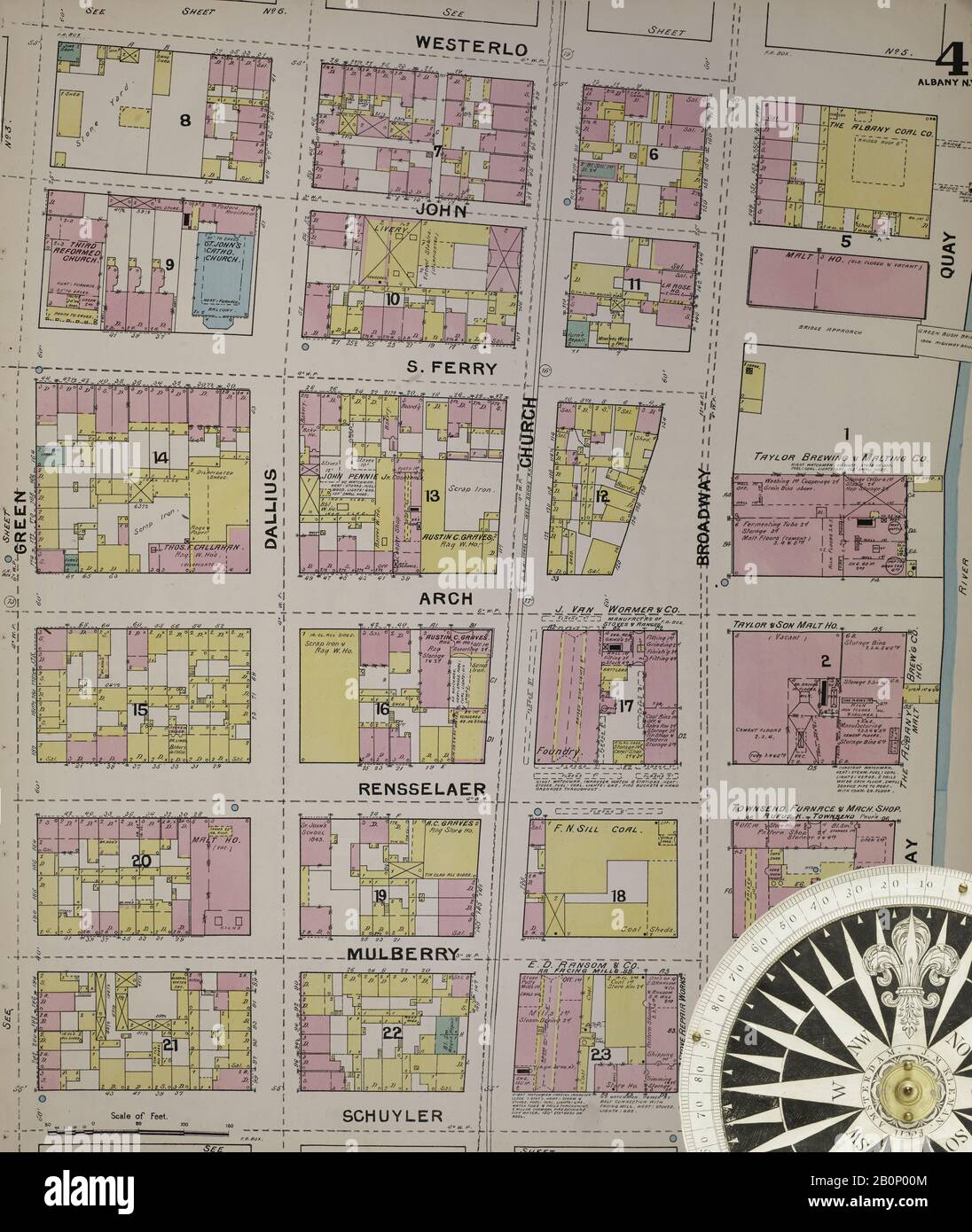 Image 5 of Sanborn Fire Insurance Map from Albany, Albany County, New York. 1892. 124 Sheet(s). Includes Coeymans, Coeymans Junction, Rensselaerville, Clarksville, Altamont, Guilderland Center, South Bethlehem. 3 skeleton maps. Bound, America, street map with a Nineteenth Century compass Stock Photohttps://www.alamy.com/image-license-details/?v=1https://www.alamy.com/image-5-of-sanborn-fire-insurance-map-from-albany-albany-county-new-york-1892-124-sheets-includes-coeymans-coeymans-junction-rensselaerville-clarksville-altamont-guilderland-center-south-bethlehem-3-skeleton-maps-bound-america-street-map-with-a-nineteenth-century-compass-image344690324.html
RM2B0P00M–Image 5 of Sanborn Fire Insurance Map from Albany, Albany County, New York. 1892. 124 Sheet(s). Includes Coeymans, Coeymans Junction, Rensselaerville, Clarksville, Altamont, Guilderland Center, South Bethlehem. 3 skeleton maps. Bound, America, street map with a Nineteenth Century compass
 Image 17 of Sanborn Fire Insurance Map from Albany, Albany County, New York. 1892. 124 Sheet(s). Includes Coeymans, Coeymans Junction, Rensselaerville, Clarksville, Altamont, Guilderland Center, South Bethlehem. 3 skeleton maps. Bound, America, street map with a Nineteenth Century compass Stock Photohttps://www.alamy.com/image-license-details/?v=1https://www.alamy.com/image-17-of-sanborn-fire-insurance-map-from-albany-albany-county-new-york-1892-124-sheets-includes-coeymans-coeymans-junction-rensselaerville-clarksville-altamont-guilderland-center-south-bethlehem-3-skeleton-maps-bound-america-street-map-with-a-nineteenth-century-compass-image344690350.html
RM2B0P01J–Image 17 of Sanborn Fire Insurance Map from Albany, Albany County, New York. 1892. 124 Sheet(s). Includes Coeymans, Coeymans Junction, Rensselaerville, Clarksville, Altamont, Guilderland Center, South Bethlehem. 3 skeleton maps. Bound, America, street map with a Nineteenth Century compass