Quick filters:
Bosworth field map Stock Photos and Images
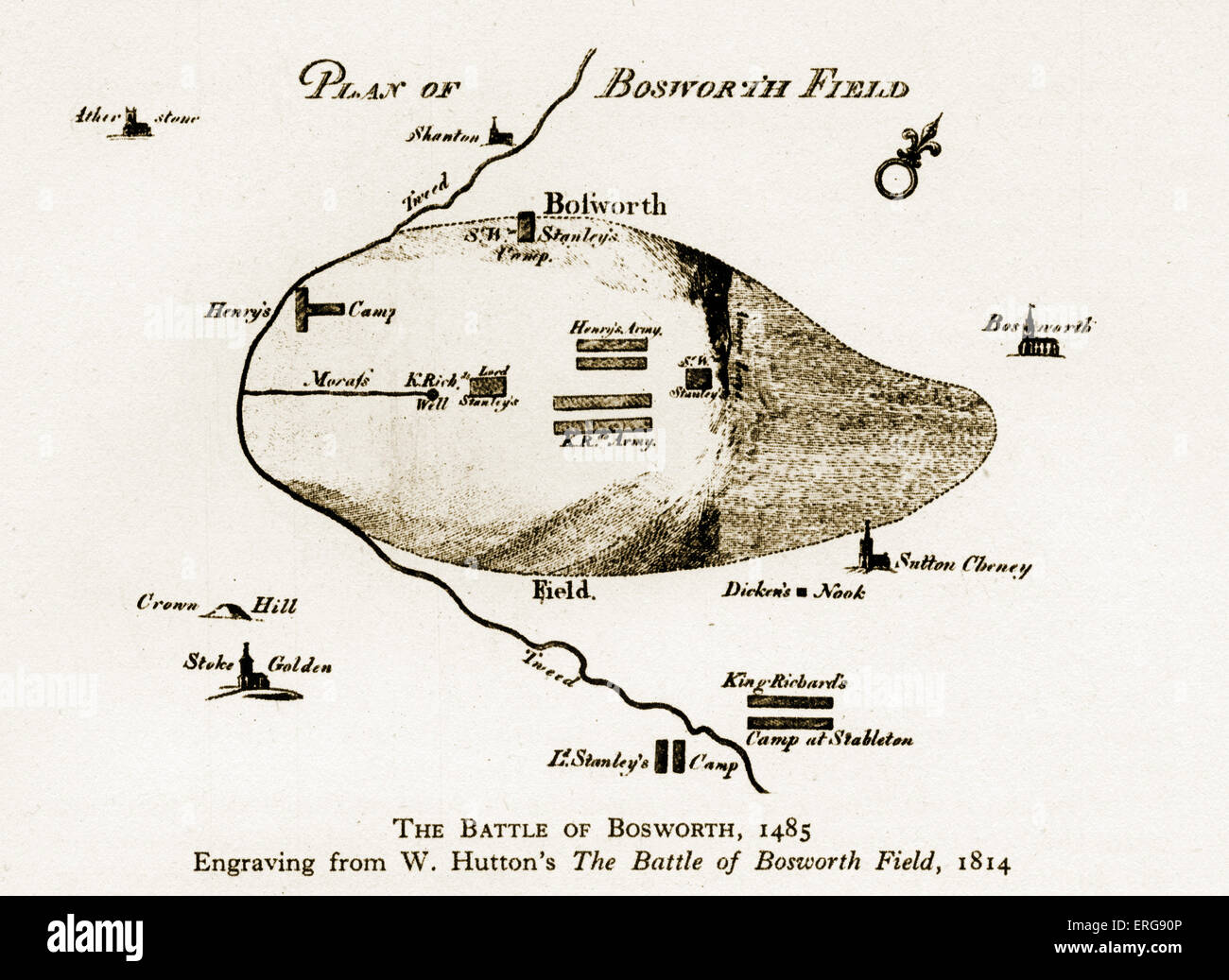 The Battle of Bosworth, 1485. Engraving from W. Hutton's 'The Battle of Bosworth Field', 1814. The Battle of Bosworth was the Stock Photohttps://www.alamy.com/image-license-details/?v=1https://www.alamy.com/stock-photo-the-battle-of-bosworth-1485-engraving-from-w-huttons-the-battle-of-83336870.html
RMERG90P–The Battle of Bosworth, 1485. Engraving from W. Hutton's 'The Battle of Bosworth Field', 1814. The Battle of Bosworth was the
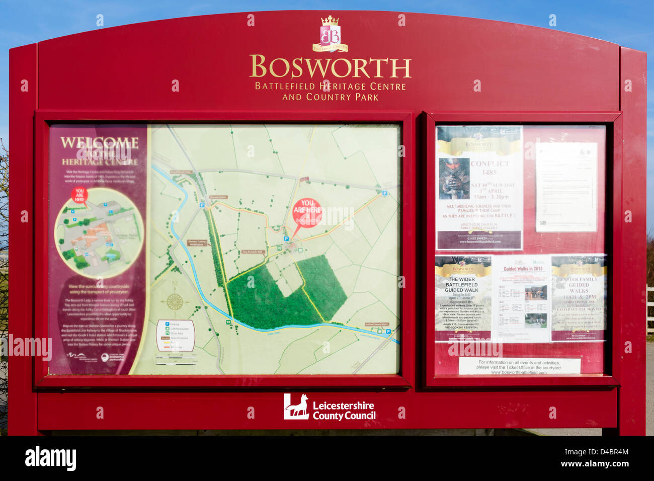 Map of the battlefield at Bosworth Field, Leicestershire, East Midlands, UK Stock Photohttps://www.alamy.com/image-license-details/?v=1https://www.alamy.com/stock-photo-map-of-the-battlefield-at-bosworth-field-leicestershire-east-midlands-54349364.html
RMD4BR4M–Map of the battlefield at Bosworth Field, Leicestershire, East Midlands, UK
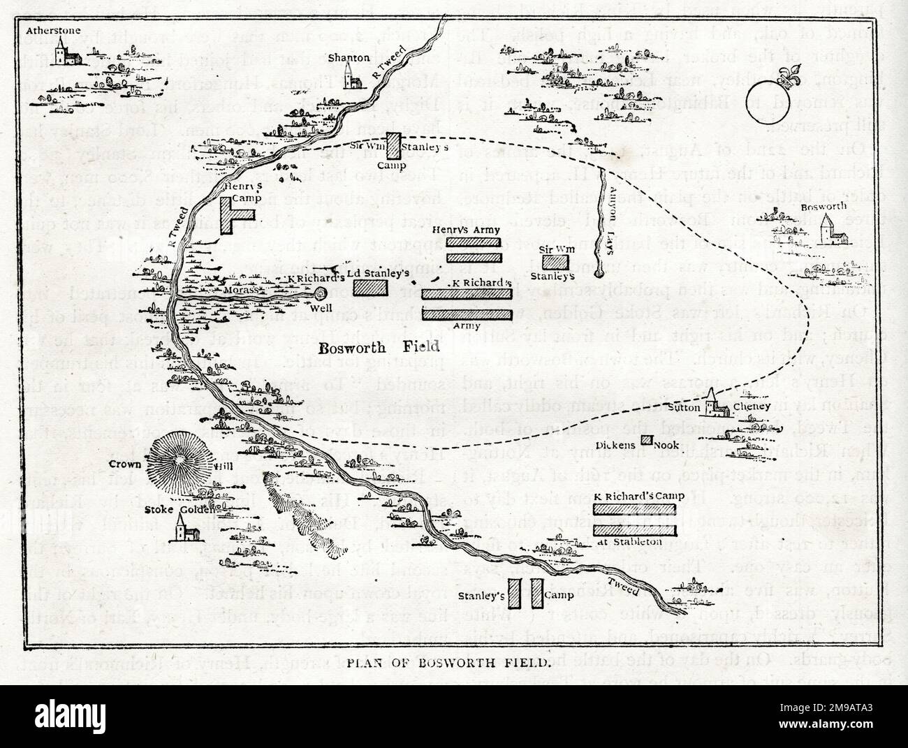 Plan of Bosworth Field, Battle of Bosworth, near Leicester, 22 August 1485, towards the end of the Wars of the Roses (1455-1487). Stock Photohttps://www.alamy.com/image-license-details/?v=1https://www.alamy.com/plan-of-bosworth-field-battle-of-bosworth-near-leicester-22-august-1485-towards-the-end-of-the-wars-of-the-roses-1455-1487-image504871195.html
RM2M9ATA3–Plan of Bosworth Field, Battle of Bosworth, near Leicester, 22 August 1485, towards the end of the Wars of the Roses (1455-1487).
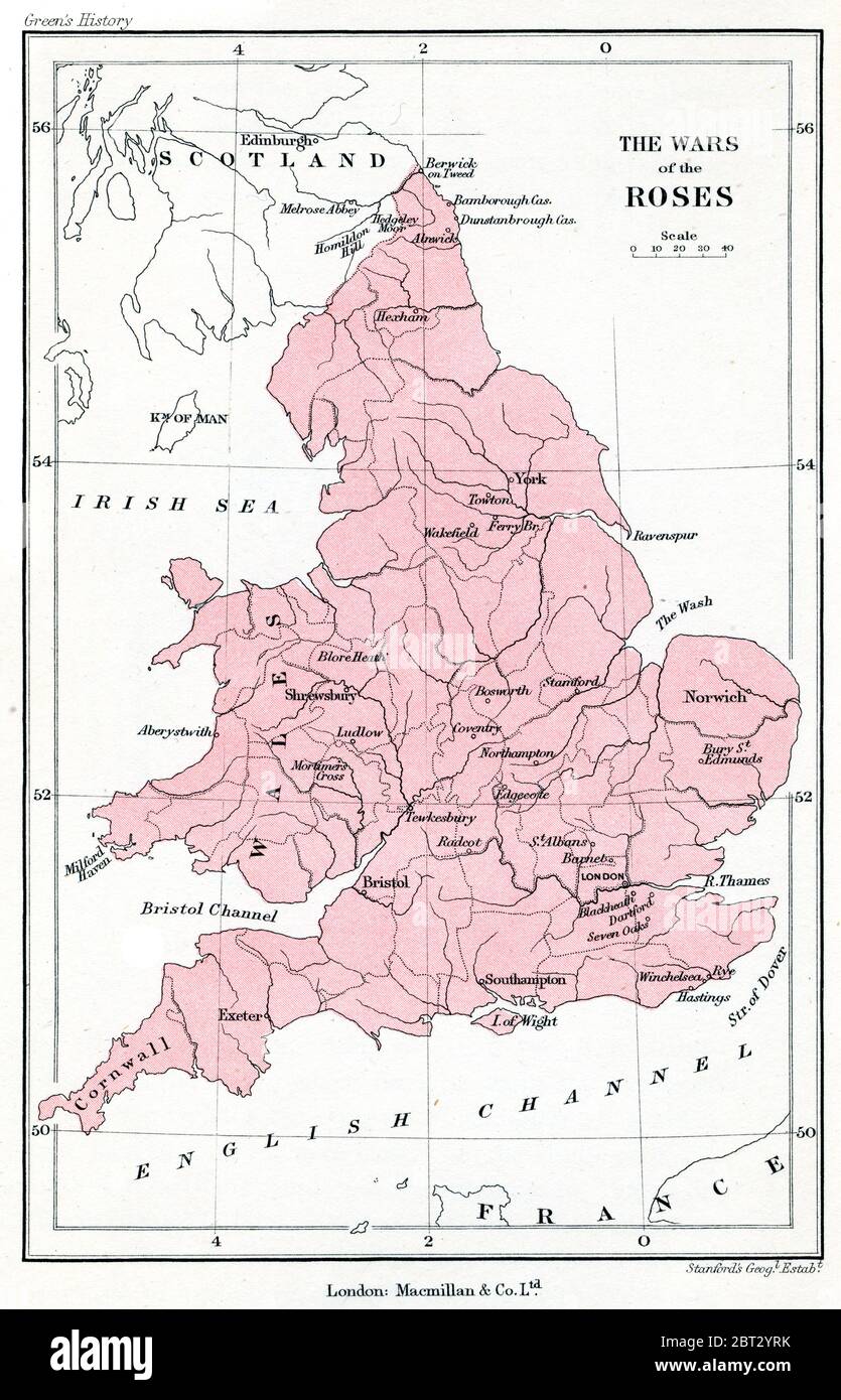 The Wars of the Roses: a map of Britain during the Wars of the Roses. The Wars of the Roses were a series of English civil wars for control of the throne of England fought between supporters of two rival cadet branches of the House of Plantagenet and the House of Lancaster between 1455 and 1487. Stock Photohttps://www.alamy.com/image-license-details/?v=1https://www.alamy.com/the-wars-of-the-roses-a-map-of-britain-during-the-wars-of-the-roses-the-wars-of-the-roses-were-a-series-of-english-civil-wars-for-control-of-the-throne-of-england-fought-between-supporters-of-two-rival-cadet-branches-of-the-house-of-plantagenet-and-the-house-of-lancaster-between-1455-and-1487-image359024839.html
RM2BT2YRK–The Wars of the Roses: a map of Britain during the Wars of the Roses. The Wars of the Roses were a series of English civil wars for control of the throne of England fought between supporters of two rival cadet branches of the House of Plantagenet and the House of Lancaster between 1455 and 1487.
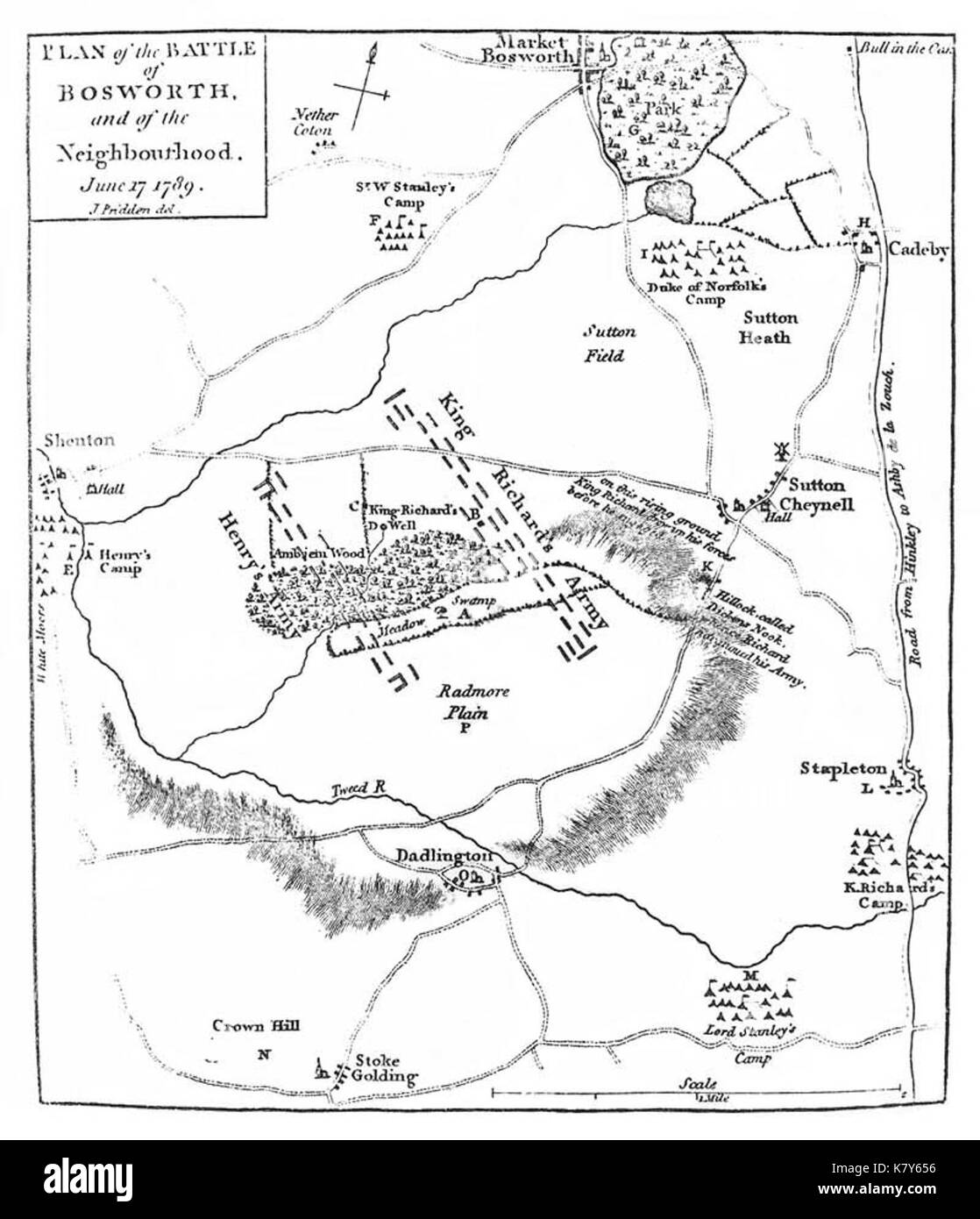 John Pridden's map of the Battle of Bosworth Field Stock Photohttps://www.alamy.com/image-license-details/?v=1https://www.alamy.com/john-priddens-map-of-the-battle-of-bosworth-field-image159793458.html
RMK7Y656–John Pridden's map of the Battle of Bosworth Field
 John Pridden's map of the Battle of Bosworth Field. Stock Photohttps://www.alamy.com/image-license-details/?v=1https://www.alamy.com/john-priddens-map-of-the-battle-of-bosworth-field-image374194702.html
RM2CMP14E–John Pridden's map of the Battle of Bosworth Field.
 Battle of Bosworth Field, Leicestershire, GB, United Kingdom, England, N 52 35' 48'', S 1 24' 21'', map, Cartascapes Map published in 2024. Explore Cartascapes, a map revealing Earth's diverse landscapes, cultures, and ecosystems. Journey through time and space, discovering the interconnectedness of our planet's past, present, and future. Stock Photohttps://www.alamy.com/image-license-details/?v=1https://www.alamy.com/battle-of-bosworth-field-leicestershire-gb-united-kingdom-england-n-52-35-48-s-1-24-21-map-cartascapes-map-published-in-2024-explore-cartascapes-a-map-revealing-earths-diverse-landscapes-cultures-and-ecosystems-journey-through-time-and-space-discovering-the-interconnectedness-of-our-planets-past-present-and-future-image604226620.html
RM2X30W64–Battle of Bosworth Field, Leicestershire, GB, United Kingdom, England, N 52 35' 48'', S 1 24' 21'', map, Cartascapes Map published in 2024. Explore Cartascapes, a map revealing Earth's diverse landscapes, cultures, and ecosystems. Journey through time and space, discovering the interconnectedness of our planet's past, present, and future.
 P31 Battle of Bosworth Field Stock Photohttps://www.alamy.com/image-license-details/?v=1https://www.alamy.com/stock-image-p31-battle-of-bosworth-field-160915392.html
RMK9P968–P31 Battle of Bosworth Field
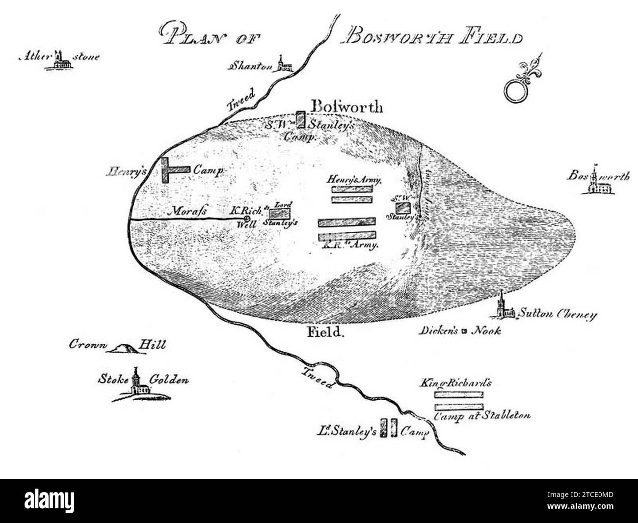 William Hutton's map of the Battle of Bosworth Field. Stock Photohttps://www.alamy.com/image-license-details/?v=1https://www.alamy.com/william-huttons-map-of-the-battle-of-bosworth-field-image575625917.html
RM2TCE0MD–William Hutton's map of the Battle of Bosworth Field.
 Abraham Cooper Bosworth Field Stock Photohttps://www.alamy.com/image-license-details/?v=1https://www.alamy.com/abraham-cooper-bosworth-field-image154722992.html
RMJYM6N4–Abraham Cooper Bosworth Field
 Image taken from page 54 of 'Report on the Kolar Gold Field and its southern extension' Image taken from page 54 of 'Report on the Kolar Stock Photohttps://www.alamy.com/image-license-details/?v=1https://www.alamy.com/stock-photo-image-taken-from-page-54-of-report-on-the-kolar-gold-field-and-its-127744923.html
RMHBR7XK–Image taken from page 54 of 'Report on the Kolar Gold Field and its southern extension' Image taken from page 54 of 'Report on the Kolar