Quick filters:
British cantonment india Stock Photos and Images
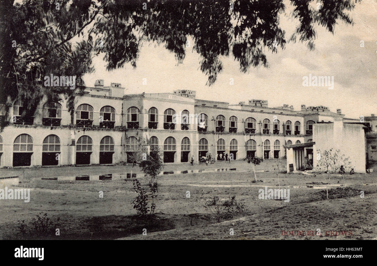 Peshawar Barracks, Peshawar Cantonment, British India Stock Photohttps://www.alamy.com/image-license-details/?v=1https://www.alamy.com/stock-photo-peshawar-barracks-peshawar-cantonment-british-india-131056376.html
RMHH63MT–Peshawar Barracks, Peshawar Cantonment, British India
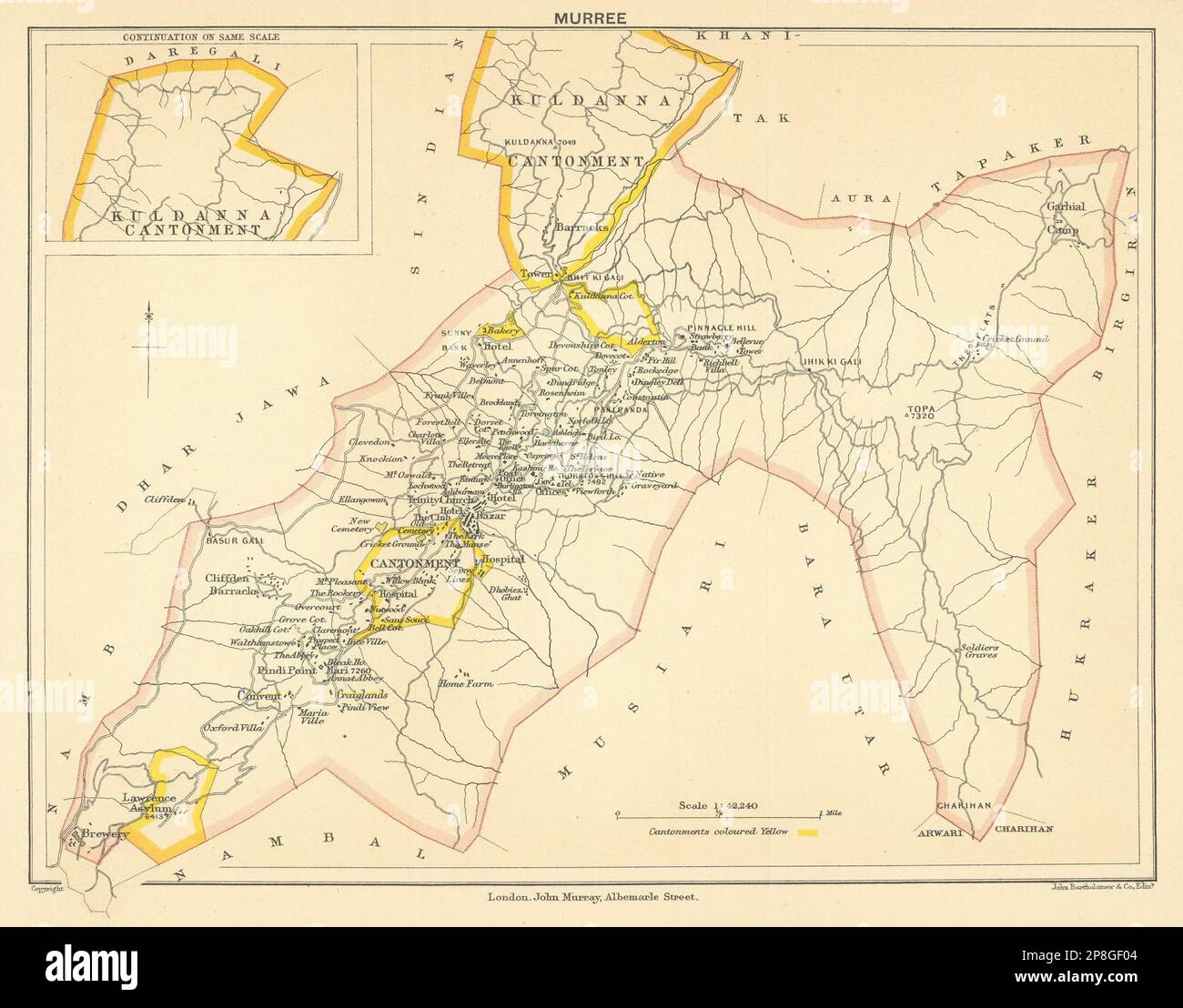 PAKISTAN. Murree Hill Station & Kuldanna Cantonment. British India 1905 map Stock Photohttps://www.alamy.com/image-license-details/?v=1https://www.alamy.com/pakistan-murree-hill-station-kuldanna-cantonment-british-india-1905-map-image538801652.html
RF2P8GF04–PAKISTAN. Murree Hill Station & Kuldanna Cantonment. British India 1905 map
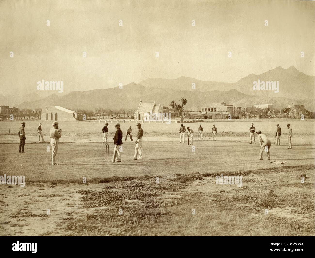 Off-duty British army officers playing cricket on the parade ground in Kohat, India, (Pakistan) c. 1862. This is certain;y one of the first, if not the first, photograph of the game being played in India Stock Photohttps://www.alamy.com/image-license-details/?v=1https://www.alamy.com/off-duty-british-army-officers-playing-cricket-on-the-parade-ground-in-kohat-india-pakistan-c-1862-this-is-certainy-one-of-the-first-if-not-the-first-photograph-of-the-game-being-played-in-india-image348463920.html
RM2B6WW80–Off-duty British army officers playing cricket on the parade ground in Kohat, India, (Pakistan) c. 1862. This is certain;y one of the first, if not the first, photograph of the game being played in India
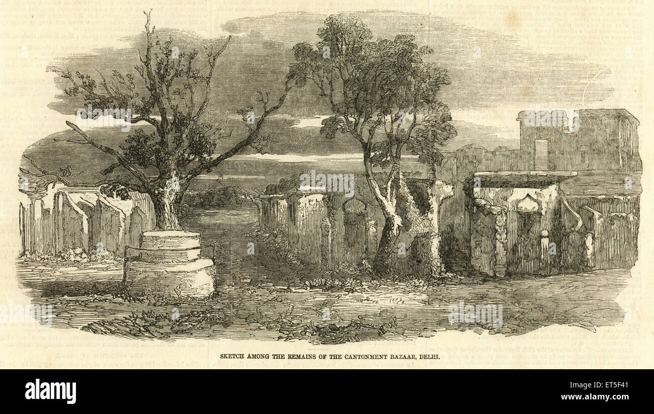 Cantonment Bazaar remains, Sadar Bazar, Delhi, India, Indian Rebellion, Mutiny views, Sepoy Mutiny, 1857, old vintage 1800s picture Stock Photohttps://www.alamy.com/image-license-details/?v=1https://www.alamy.com/stock-photo-cantonment-bazaar-remains-sadar-bazar-delhi-india-indian-rebellion-83714849.html
RMET5F41–Cantonment Bazaar remains, Sadar Bazar, Delhi, India, Indian Rebellion, Mutiny views, Sepoy Mutiny, 1857, old vintage 1800s picture
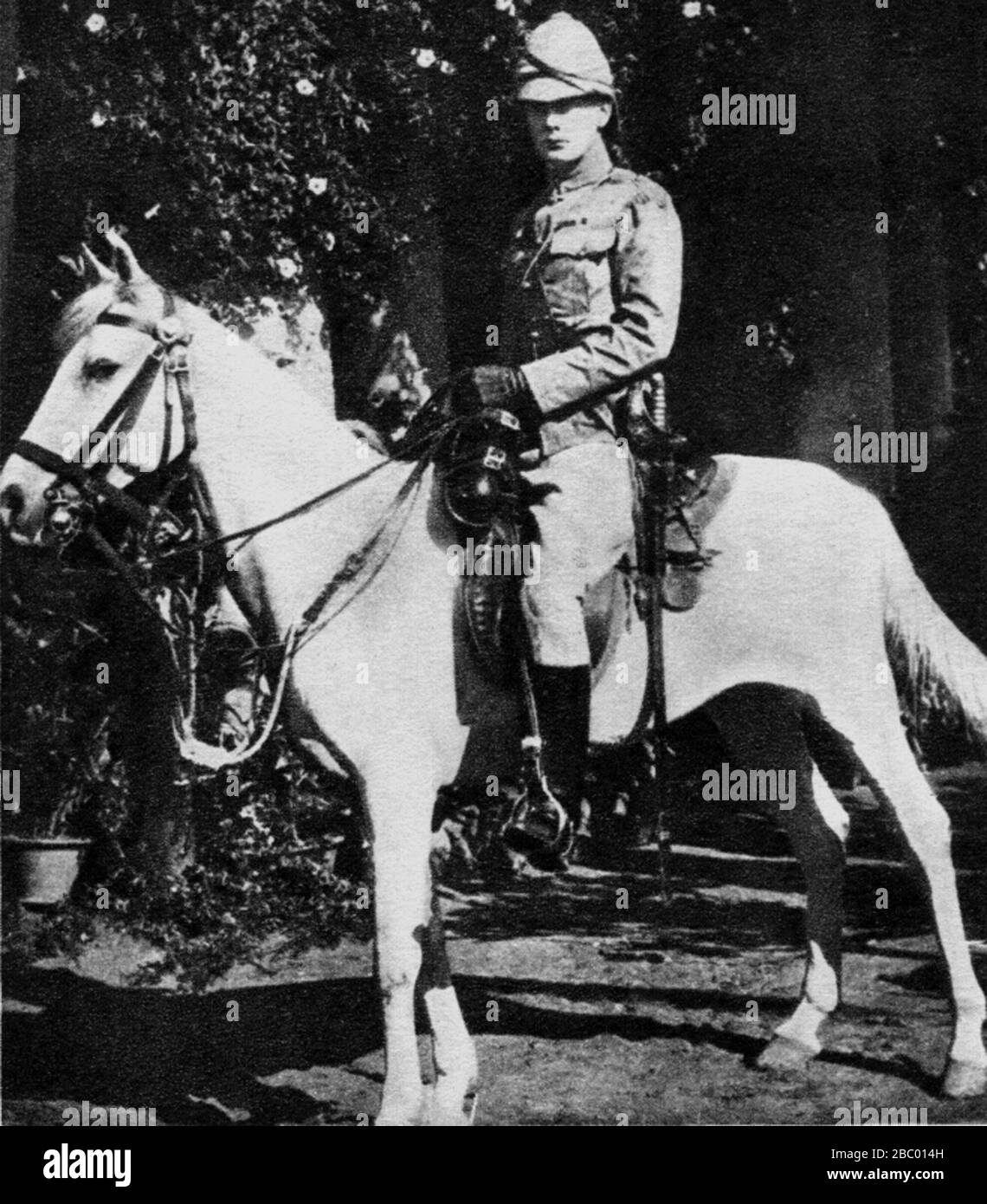 Winston Churchill in the 4th Hussars at Bangalore, India. 1896 Stock Photohttps://www.alamy.com/image-license-details/?v=1https://www.alamy.com/winston-churchill-in-the-4th-hussars-at-bangalore-india-1896-image351584145.html
RF2BC014H–Winston Churchill in the 4th Hussars at Bangalore, India. 1896
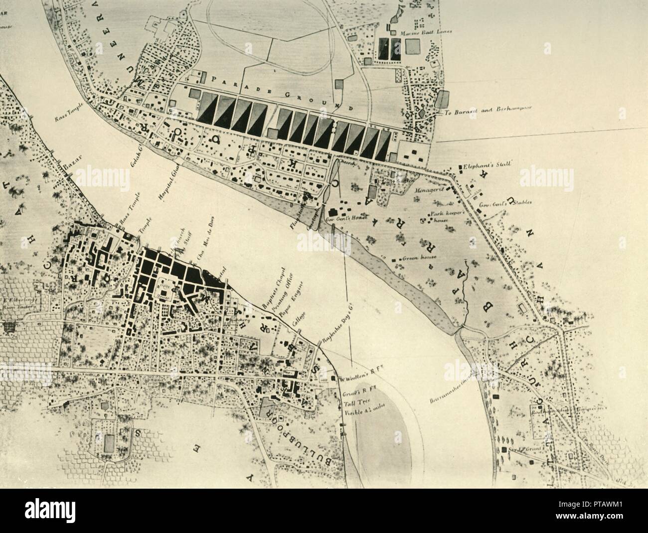 'Barrackpore Park and Cantonment, 1841', (1925). Creator: Unknown. Stock Photohttps://www.alamy.com/image-license-details/?v=1https://www.alamy.com/barrackpore-park-and-cantonment-1841-1925-creator-unknown-image221515841.html
RMPTAWM1–'Barrackpore Park and Cantonment, 1841', (1925). Creator: Unknown.
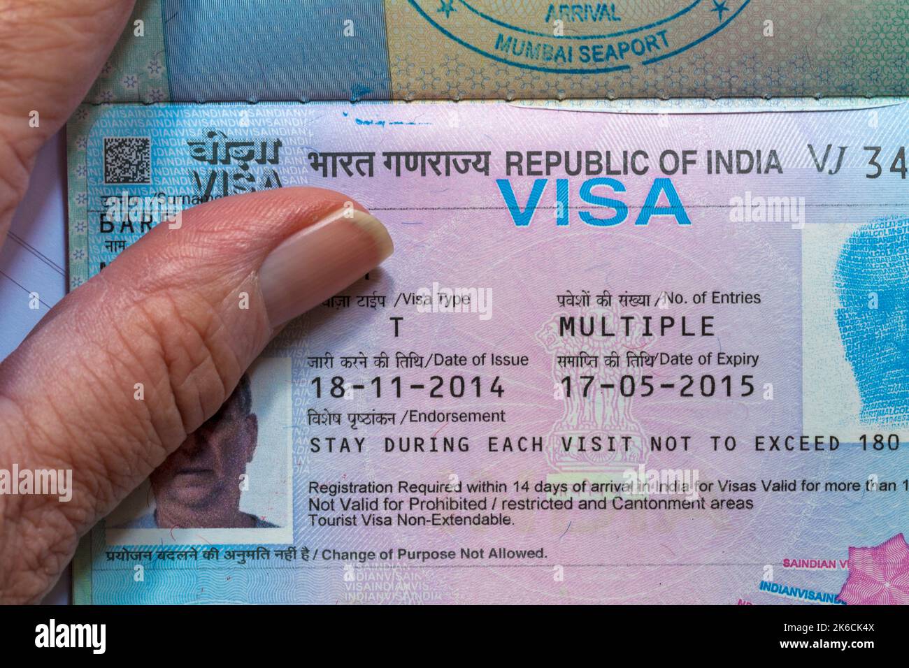 Hand holding open passport with Republic of India Visa in British passport Stock Photohttps://www.alamy.com/image-license-details/?v=1https://www.alamy.com/hand-holding-open-passport-with-republic-of-india-visa-in-british-passport-image485856698.html
RM2K6CK4X–Hand holding open passport with Republic of India Visa in British passport
![The Assembly Rooms On The Race Ground, Near Madras [Chennai] The Race Ground and the Assembly Rooms were situated south-west of Madras near the old British military cantonment. St Thomas Mount, which can be seen in the background, was a favourite place of the British to go to take the air in the evenings. The Mount is traditionally the place of St Thomas martyrdom and is crowned by a Portuguese church built in 1547. From the book ' Oriental scenery: one hundred and fifty views of the architecture, antiquities and landscape scenery of Hindoostan ' by Thomas Daniell, and William Daniell, Publis Stock Photo The Assembly Rooms On The Race Ground, Near Madras [Chennai] The Race Ground and the Assembly Rooms were situated south-west of Madras near the old British military cantonment. St Thomas Mount, which can be seen in the background, was a favourite place of the British to go to take the air in the evenings. The Mount is traditionally the place of St Thomas martyrdom and is crowned by a Portuguese church built in 1547. From the book ' Oriental scenery: one hundred and fifty views of the architecture, antiquities and landscape scenery of Hindoostan ' by Thomas Daniell, and William Daniell, Publis Stock Photo](https://c8.alamy.com/comp/2G5YNB2/the-assembly-rooms-on-the-race-ground-near-madras-chennai-the-race-ground-and-the-assembly-rooms-were-situated-south-west-of-madras-near-the-old-british-military-cantonment-st-thomas-mount-which-can-be-seen-in-the-background-was-a-favourite-place-of-the-british-to-go-to-take-the-air-in-the-evenings-the-mount-is-traditionally-the-place-of-st-thomas-martyrdom-and-is-crowned-by-a-portuguese-church-built-in-1547-from-the-book-oriental-scenery-one-hundred-and-fifty-views-of-the-architecture-antiquities-and-landscape-scenery-of-hindoostan-by-thomas-daniell-and-william-daniell-publis-2G5YNB2.jpg) The Assembly Rooms On The Race Ground, Near Madras [Chennai] The Race Ground and the Assembly Rooms were situated south-west of Madras near the old British military cantonment. St Thomas Mount, which can be seen in the background, was a favourite place of the British to go to take the air in the evenings. The Mount is traditionally the place of St Thomas martyrdom and is crowned by a Portuguese church built in 1547. From the book ' Oriental scenery: one hundred and fifty views of the architecture, antiquities and landscape scenery of Hindoostan ' by Thomas Daniell, and William Daniell, Publis Stock Photohttps://www.alamy.com/image-license-details/?v=1https://www.alamy.com/the-assembly-rooms-on-the-race-ground-near-madras-chennai-the-race-ground-and-the-assembly-rooms-were-situated-south-west-of-madras-near-the-old-british-military-cantonment-st-thomas-mount-which-can-be-seen-in-the-background-was-a-favourite-place-of-the-british-to-go-to-take-the-air-in-the-evenings-the-mount-is-traditionally-the-place-of-st-thomas-martyrdom-and-is-crowned-by-a-portuguese-church-built-in-1547-from-the-book-oriental-scenery-one-hundred-and-fifty-views-of-the-architecture-antiquities-and-landscape-scenery-of-hindoostan-by-thomas-daniell-and-william-daniell-publis-image433941958.html
The Assembly Rooms On The Race Ground, Near Madras [Chennai] The Race Ground and the Assembly Rooms were situated south-west of Madras near the old British military cantonment. St Thomas Mount, which can be seen in the background, was a favourite place of the British to go to take the air in the evenings. The Mount is traditionally the place of St Thomas martyrdom and is crowned by a Portuguese church built in 1547. From the book ' Oriental scenery: one hundred and fifty views of the architecture, antiquities and landscape scenery of Hindoostan ' by Thomas Daniell, and William Daniell, Publis Stock Photohttps://www.alamy.com/image-license-details/?v=1https://www.alamy.com/the-assembly-rooms-on-the-race-ground-near-madras-chennai-the-race-ground-and-the-assembly-rooms-were-situated-south-west-of-madras-near-the-old-british-military-cantonment-st-thomas-mount-which-can-be-seen-in-the-background-was-a-favourite-place-of-the-british-to-go-to-take-the-air-in-the-evenings-the-mount-is-traditionally-the-place-of-st-thomas-martyrdom-and-is-crowned-by-a-portuguese-church-built-in-1547-from-the-book-oriental-scenery-one-hundred-and-fifty-views-of-the-architecture-antiquities-and-landscape-scenery-of-hindoostan-by-thomas-daniell-and-william-daniell-publis-image433941958.htmlRF2G5YNB2–The Assembly Rooms On The Race Ground, Near Madras [Chennai] The Race Ground and the Assembly Rooms were situated south-west of Madras near the old British military cantonment. St Thomas Mount, which can be seen in the background, was a favourite place of the British to go to take the air in the evenings. The Mount is traditionally the place of St Thomas martyrdom and is crowned by a Portuguese church built in 1547. From the book ' Oriental scenery: one hundred and fifty views of the architecture, antiquities and landscape scenery of Hindoostan ' by Thomas Daniell, and William Daniell, Publis
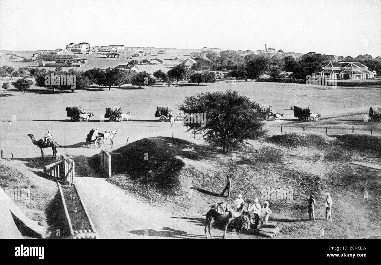 Cantonment, Mhow, Madhya Pradesh, India, early 20th century. Artist: Unknown Stock Photohttps://www.alamy.com/image-license-details/?v=1https://www.alamy.com/stock-photo-cantonment-mhow-madhya-pradesh-india-early-20th-century-artist-unknown-17642685.html
RMB0KKBW–Cantonment, Mhow, Madhya Pradesh, India, early 20th century. Artist: Unknown
 Overlooking the Bazaar, Sabathu (a cantonment town), Solan district of Himachal Pradesh. A photograph taken from overhead. From the original snapshot photograph, taken during the First World War. Sabathu is also known as Subathu. Stock Photohttps://www.alamy.com/image-license-details/?v=1https://www.alamy.com/overlooking-the-bazaar-sabathu-a-cantonment-town-solan-district-of-himachal-pradesh-a-photograph-taken-from-overhead-from-the-original-snapshot-photograph-taken-during-the-first-world-war-sabathu-is-also-known-as-subathu-image545390487.html
RM2PK8K3K–Overlooking the Bazaar, Sabathu (a cantonment town), Solan district of Himachal Pradesh. A photograph taken from overhead. From the original snapshot photograph, taken during the First World War. Sabathu is also known as Subathu.
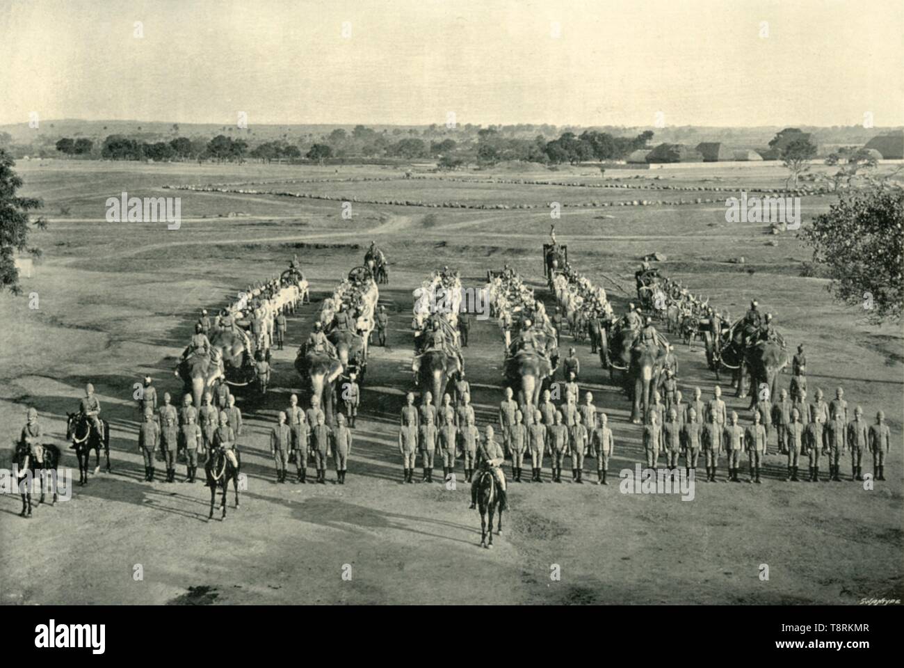 'An Elephant Battery, 'Camp of Exercise', Rawal Pindi', c1890, (1901). Creator: Raja Deen Dayal & Sons. Stock Photohttps://www.alamy.com/image-license-details/?v=1https://www.alamy.com/an-elephant-battery-camp-of-exercise-rawal-pindi-c1890-1901-creator-raja-deen-dayal-sons-image246382775.html
RMT8RKMR–'An Elephant Battery, 'Camp of Exercise', Rawal Pindi', c1890, (1901). Creator: Raja Deen Dayal & Sons.
 Earpicker. A man cleaning another man's ear. Tashrih al-aqvam, an account of origins and occupations of some of the sects, castes and tribes of India. Hansi Cantonment, Hissar District, 1825. Source: Add. 27255, f.276v. Language: Persian. Author: ANON. Stock Photohttps://www.alamy.com/image-license-details/?v=1https://www.alamy.com/earpicker-a-man-cleaning-another-mans-ear-tashrih-al-aqvam-an-account-of-origins-and-occupations-of-some-of-the-sects-castes-and-tribes-of-india-hansi-cantonment-hissar-district-1825-source-add-27255-f276v-language-persian-author-anon-image231758505.html
RMRD1E9D–Earpicker. A man cleaning another man's ear. Tashrih al-aqvam, an account of origins and occupations of some of the sects, castes and tribes of India. Hansi Cantonment, Hissar District, 1825. Source: Add. 27255, f.276v. Language: Persian. Author: ANON.
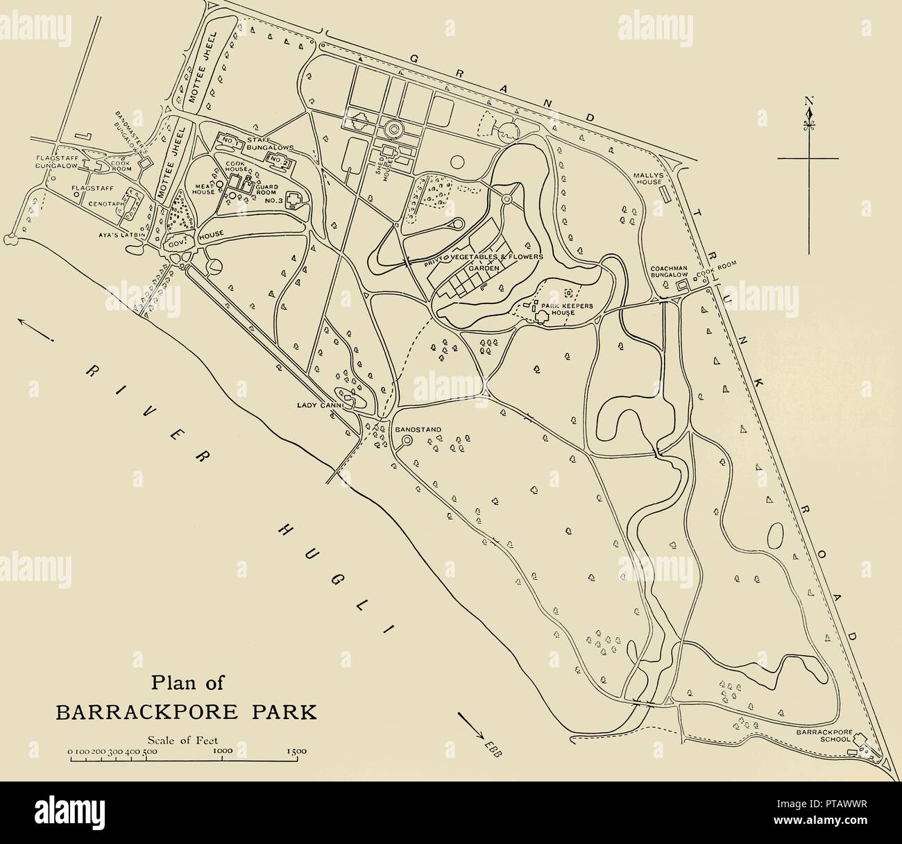 'Plan of Barrackpore Park', 1925. Creator: Unknown. Stock Photohttps://www.alamy.com/image-license-details/?v=1https://www.alamy.com/plan-of-barrackpore-park-1925-creator-unknown-image221516003.html
RMPTAWWR–'Plan of Barrackpore Park', 1925. Creator: Unknown.
 Mr. Forbes, the British builder of the Carlton La Pleasance, one of the Raj era hotels of Mussoorie. Stock Photohttps://www.alamy.com/image-license-details/?v=1https://www.alamy.com/stock-photo-mr-forbes-the-british-builder-of-the-carlton-la-pleasance-one-of-the-54690226.html
RMD4Y9XA–Mr. Forbes, the British builder of the Carlton La Pleasance, one of the Raj era hotels of Mussoorie.
 Old steam engine on display outside Agra Cantt railway Station. Agra. India. Stock Photohttps://www.alamy.com/image-license-details/?v=1https://www.alamy.com/stock-photo-old-steam-engine-on-display-outside-agra-cantt-railway-station-agra-25250334.html
RMBD271J–Old steam engine on display outside Agra Cantt railway Station. Agra. India.
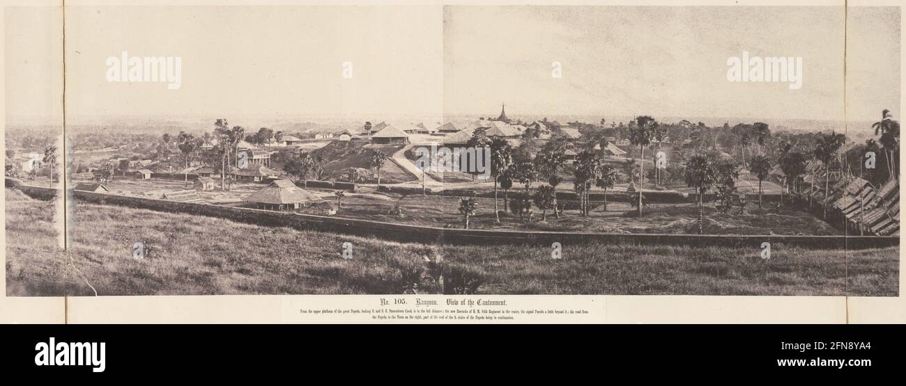 Rangoon: View of the Cantonment, November 1855. Stock Photohttps://www.alamy.com/image-license-details/?v=1https://www.alamy.com/rangoon-view-of-the-cantonment-november-1855-image426153676.html
RM2FN8YA4–Rangoon: View of the Cantonment, November 1855.
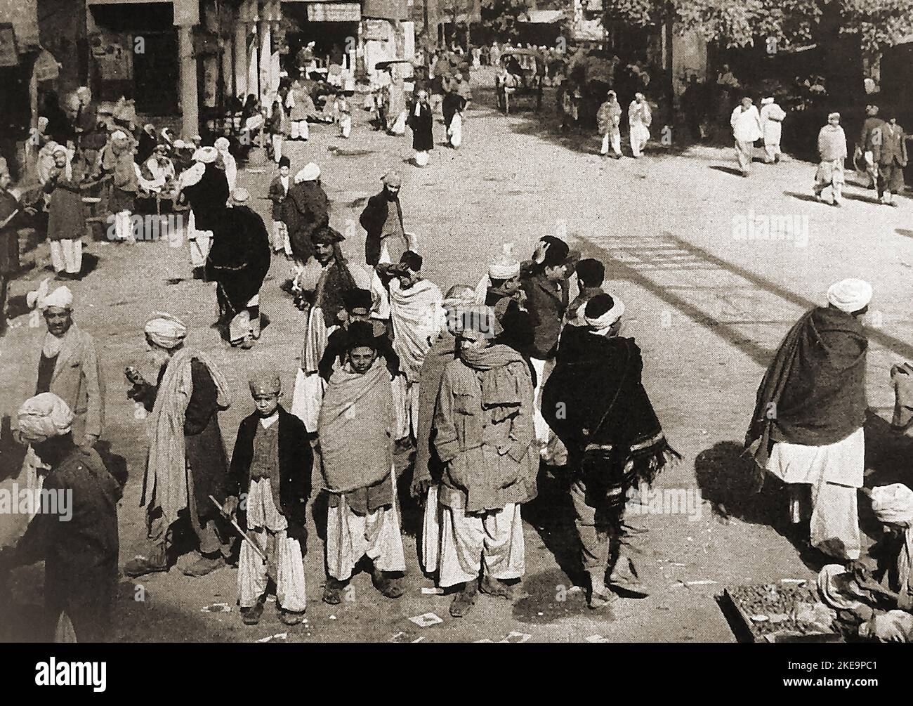 A street scene in Peshwar (Peshawar) , Pakistan circa 1940's before partition. It is known as the City of Flowers (Poshapura) , Parashawar, پېښور. , پشور; and پشاور and dates back to the 6th century or earlier. It was formerly the capital of the Indian Kushan Empire Stock Photohttps://www.alamy.com/image-license-details/?v=1https://www.alamy.com/a-street-scene-in-peshwar-peshawar-pakistan-circa-1940s-before-partition-it-is-known-as-the-city-of-flowers-poshapura-parashawar-and-and-dates-back-to-the-6th-century-or-earlier-it-was-formerly-the-capital-of-the-indian-kushan-empire-image490710641.html
RM2KE9PC1–A street scene in Peshwar (Peshawar) , Pakistan circa 1940's before partition. It is known as the City of Flowers (Poshapura) , Parashawar, پېښور. , پشور; and پشاور and dates back to the 6th century or earlier. It was formerly the capital of the Indian Kushan Empire
 India and the future . Sannyasi. B yasi. tSenares. A Barbers Shop, Benares. [To face p. 105. MANNERS people, who see their ahen rulers, when the business of running the country is over, withdraw into impregnablecaste-strongholds, with the almost openly-confessed designof washing their hands of India, and returning in spiritto their island home. The club is a far more irritatingmark of subjection than the cantonment. The better sort of British official feels the drawbacks ofthe situation acutely, and is unwearied in his efforts todiminish them. Aided sometimes (not always) by hiswomenfolk, he t Stock Photohttps://www.alamy.com/image-license-details/?v=1https://www.alamy.com/india-and-the-future-sannyasi-b-yasi-tsenares-a-barbers-shop-benares-to-face-p-105-manners-people-who-see-their-ahen-rulers-when-the-business-of-running-the-country-is-over-withdraw-into-impregnablecaste-strongholds-with-the-almost-openly-confessed-designof-washing-their-hands-of-india-and-returning-in-spiritto-their-island-home-the-club-is-a-far-more-irritatingmark-of-subjection-than-the-cantonment-the-better-sort-of-british-official-feels-the-drawbacks-ofthe-situation-acutely-and-is-unwearied-in-his-efforts-todiminish-them-aided-sometimes-not-always-by-hiswomenfolk-he-t-image342952043.html
RM2AWXPR7–India and the future . Sannyasi. B yasi. tSenares. A Barbers Shop, Benares. [To face p. 105. MANNERS people, who see their ahen rulers, when the business of running the country is over, withdraw into impregnablecaste-strongholds, with the almost openly-confessed designof washing their hands of India, and returning in spiritto their island home. The club is a far more irritatingmark of subjection than the cantonment. The better sort of British official feels the drawbacks ofthe situation acutely, and is unwearied in his efforts todiminish them. Aided sometimes (not always) by hiswomenfolk, he t
 Railway Station, Peshawar Cantonment, British India Stock Photohttps://www.alamy.com/image-license-details/?v=1https://www.alamy.com/stock-photo-railway-station-peshawar-cantonment-british-india-131056368.html
RMHH63MG–Railway Station, Peshawar Cantonment, British India
 BRITISH INDIA. Cawnpur (Kanpur) city plan showing cantonment 1905 old map Stock Photohttps://www.alamy.com/image-license-details/?v=1https://www.alamy.com/british-india-cawnpur-kanpur-city-plan-showing-cantonment-1905-old-map-image538801744.html
RF2P8GF3C–BRITISH INDIA. Cawnpur (Kanpur) city plan showing cantonment 1905 old map
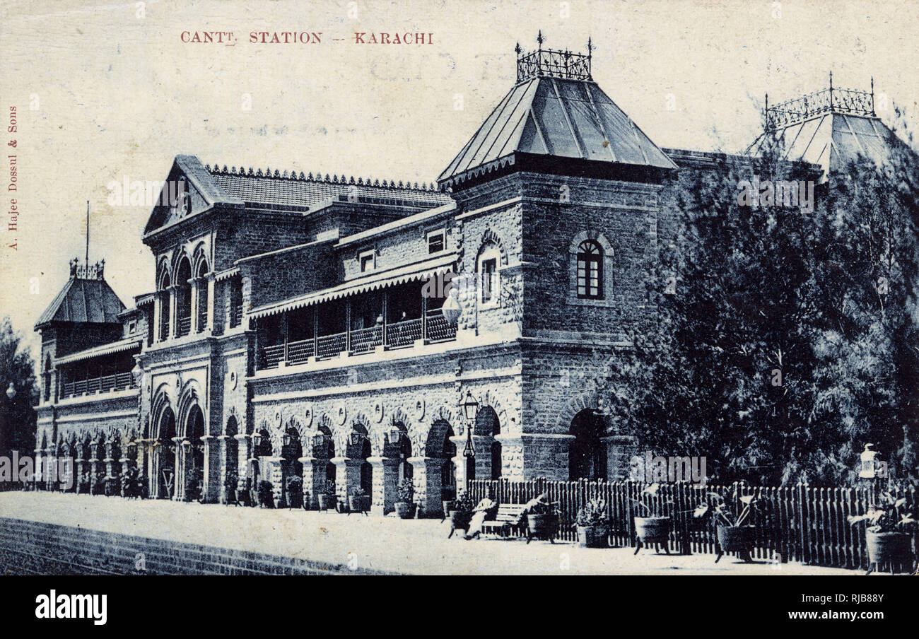 Cantonment Railway Station, Karachi, British India Stock Photohttps://www.alamy.com/image-license-details/?v=1https://www.alamy.com/cantonment-railway-station-karachi-british-india-image235046587.html
RMRJB88Y–Cantonment Railway Station, Karachi, British India
 Mhow camp, Dr. Ambedkar Nagar, cantonment, Indore, Madhya Pradesh, India, Indian Rebellion, Mutiny views, Sepoy Mutiny, old vintage 1800s picture Stock Photohttps://www.alamy.com/image-license-details/?v=1https://www.alamy.com/stock-photo-mhow-camp-dr-ambedkar-nagar-cantonment-indore-madhya-pradesh-india-83714141.html
RMET5E6N–Mhow camp, Dr. Ambedkar Nagar, cantonment, Indore, Madhya Pradesh, India, Indian Rebellion, Mutiny views, Sepoy Mutiny, old vintage 1800s picture
 Hastings Memorial, Peshawar City, British India Stock Photohttps://www.alamy.com/image-license-details/?v=1https://www.alamy.com/stock-photo-hastings-memorial-peshawar-city-british-india-131056369.html
RMHH63MH–Hastings Memorial, Peshawar City, British India
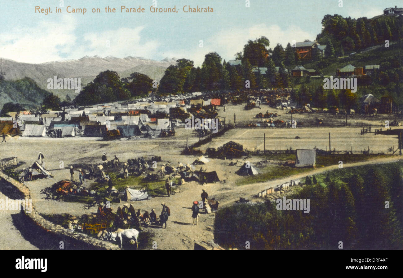 Regiment on the Parade Ground - Chakrata Stock Photohttps://www.alamy.com/image-license-details/?v=1https://www.alamy.com/regiment-on-the-parade-ground-chakrata-image66101351.html
RMDRF4XF–Regiment on the Parade Ground - Chakrata
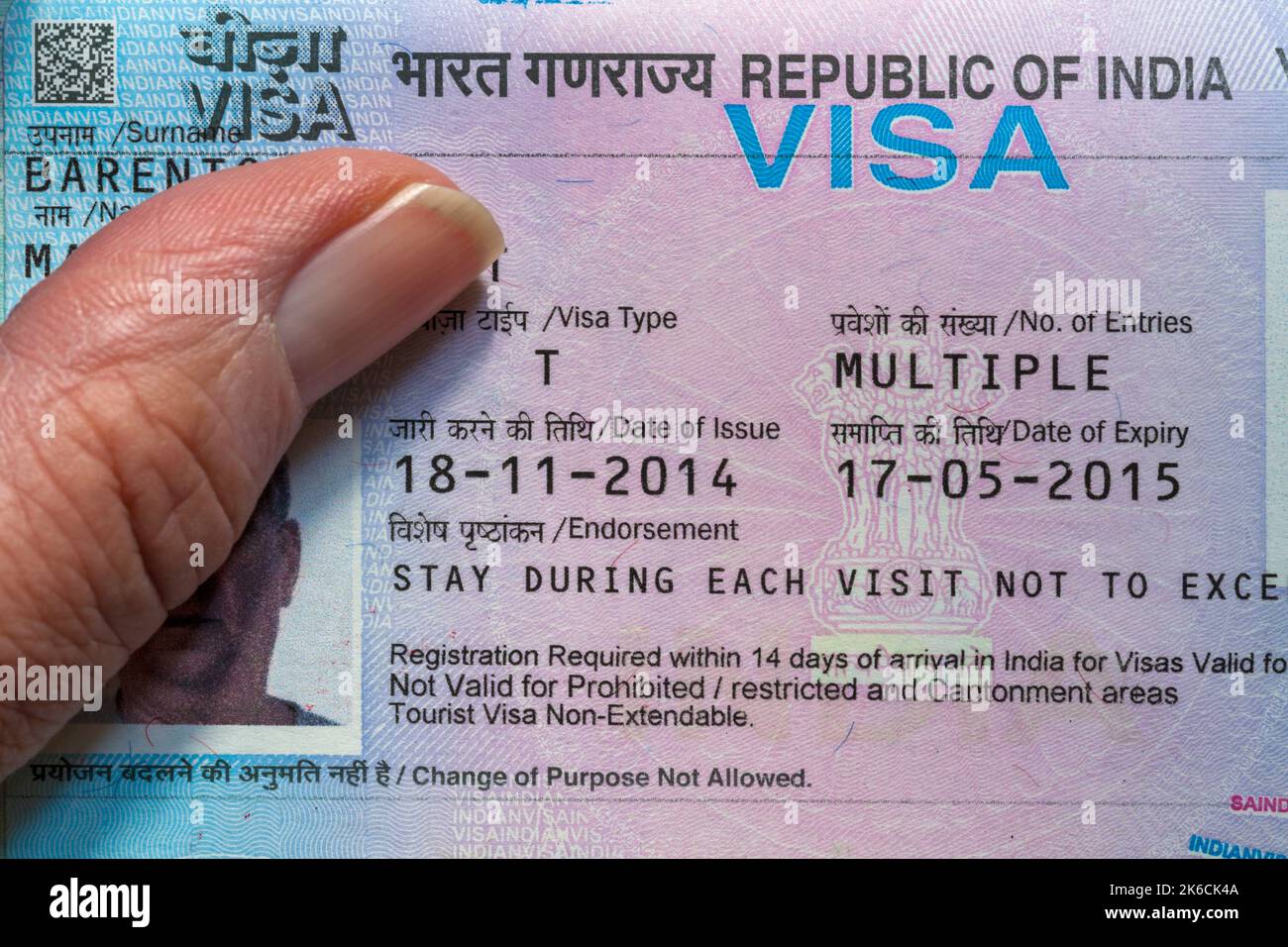 Hand holding open passport with Republic of India Visa in British passport Stock Photohttps://www.alamy.com/image-license-details/?v=1https://www.alamy.com/hand-holding-open-passport-with-republic-of-india-visa-in-british-passport-image485856682.html
RM2K6CK4A–Hand holding open passport with Republic of India Visa in British passport
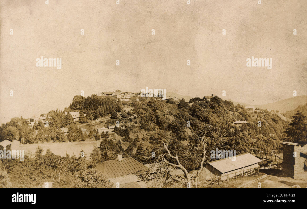 General view, Chakrata, Uttarakhand, India Stock Photohttps://www.alamy.com/image-license-details/?v=1https://www.alamy.com/stock-photo-general-view-chakrata-uttarakhand-india-131023707.html
RMHH4J23–General view, Chakrata, Uttarakhand, India
 Children in the bazaar in Dagshai, a cantonment town in the Solan district of Himachel Pradesh. From the original snapshot photograph, taken during the First World War. Dagshai is also known as Daagh-e-Shahi. Stock Photohttps://www.alamy.com/image-license-details/?v=1https://www.alamy.com/children-in-the-bazaar-in-dagshai-a-cantonment-town-in-the-solan-district-of-himachel-pradesh-from-the-original-snapshot-photograph-taken-during-the-first-world-war-dagshai-is-also-known-as-daagh-e-shahi-image545390789.html
RM2PK8KED–Children in the bazaar in Dagshai, a cantonment town in the Solan district of Himachel Pradesh. From the original snapshot photograph, taken during the First World War. Dagshai is also known as Daagh-e-Shahi.
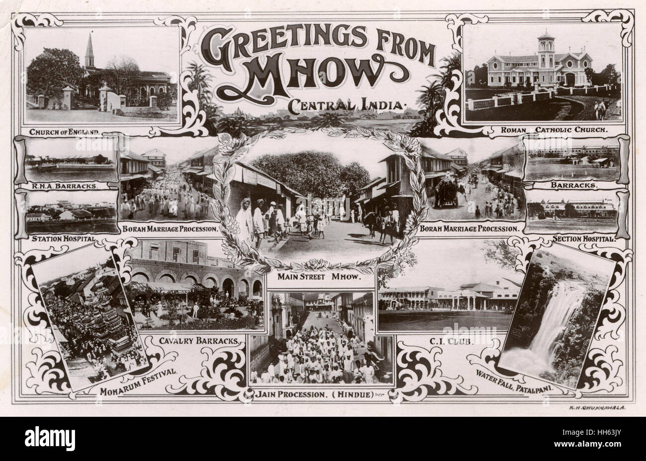 Greetings postcard, Mhow, Madhya Pradesh, India Stock Photohttps://www.alamy.com/image-license-details/?v=1https://www.alamy.com/stock-photo-greetings-postcard-mhow-madhya-pradesh-india-131056323.html
RMHH63JY–Greetings postcard, Mhow, Madhya Pradesh, India
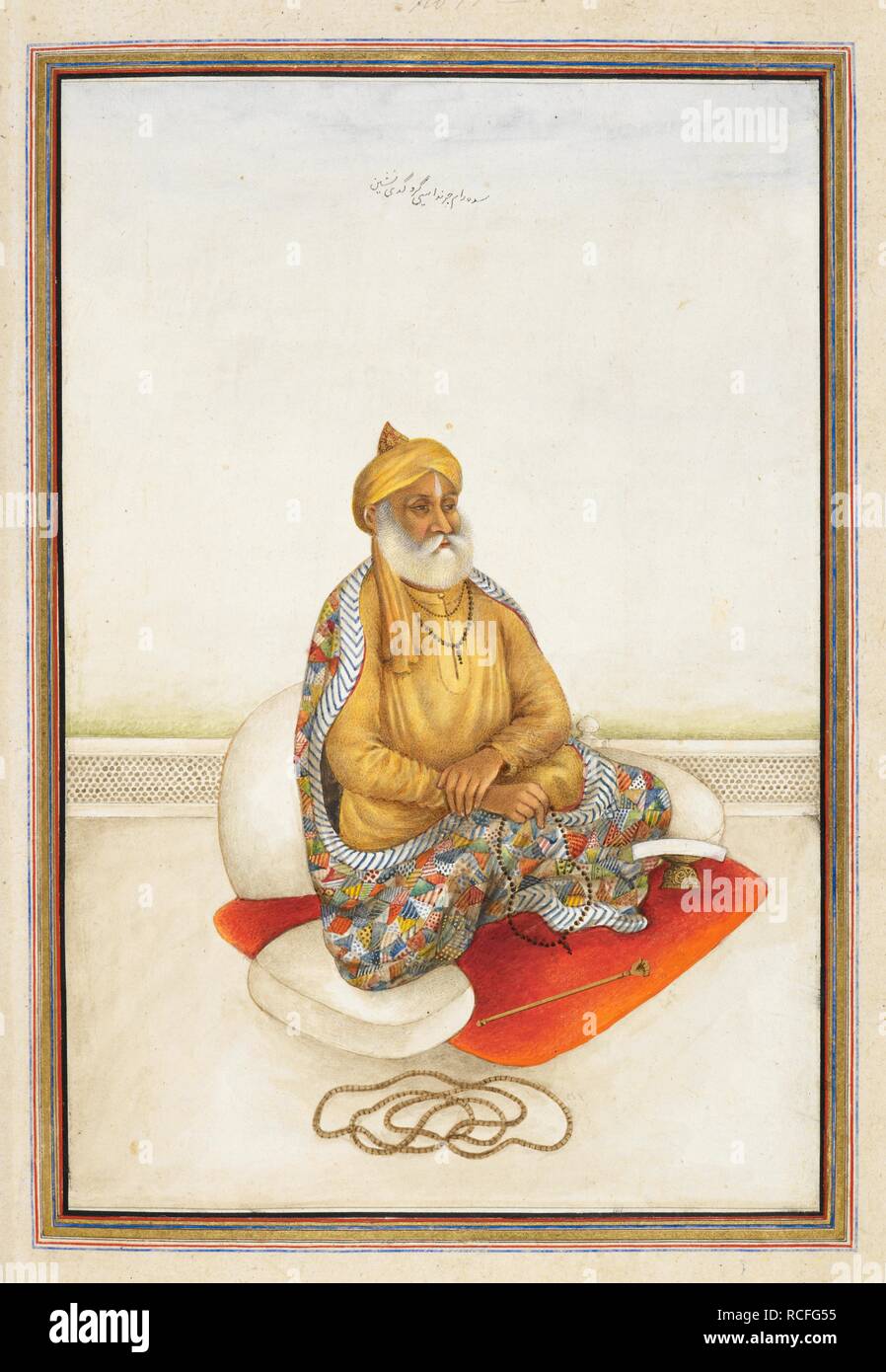 Portrait of Saddah Ram Charandasi Guru, a follower of Caran Das who founded an ascetic order of Rama worshippers at Delhi c.1730. Tashrih al-aqvam, an account of origins and occupations of some of the sects, castes and tribes of India. Hansi Cantonment, Hissar District, 1825. Source: Add. 27255, f.438v. Language: Persian. Author: ANON. Stock Photohttps://www.alamy.com/image-license-details/?v=1https://www.alamy.com/portrait-of-saddah-ram-charandasi-guru-a-follower-of-caran-das-who-founded-an-ascetic-order-of-rama-worshippers-at-delhi-c1730-tashrih-al-aqvam-an-account-of-origins-and-occupations-of-some-of-the-sects-castes-and-tribes-of-india-hansi-cantonment-hissar-district-1825-source-add-27255-f438v-language-persian-author-anon-image231452625.html
RMRCFG55–Portrait of Saddah Ram Charandasi Guru, a follower of Caran Das who founded an ascetic order of Rama worshippers at Delhi c.1730. Tashrih al-aqvam, an account of origins and occupations of some of the sects, castes and tribes of India. Hansi Cantonment, Hissar District, 1825. Source: Add. 27255, f.438v. Language: Persian. Author: ANON.
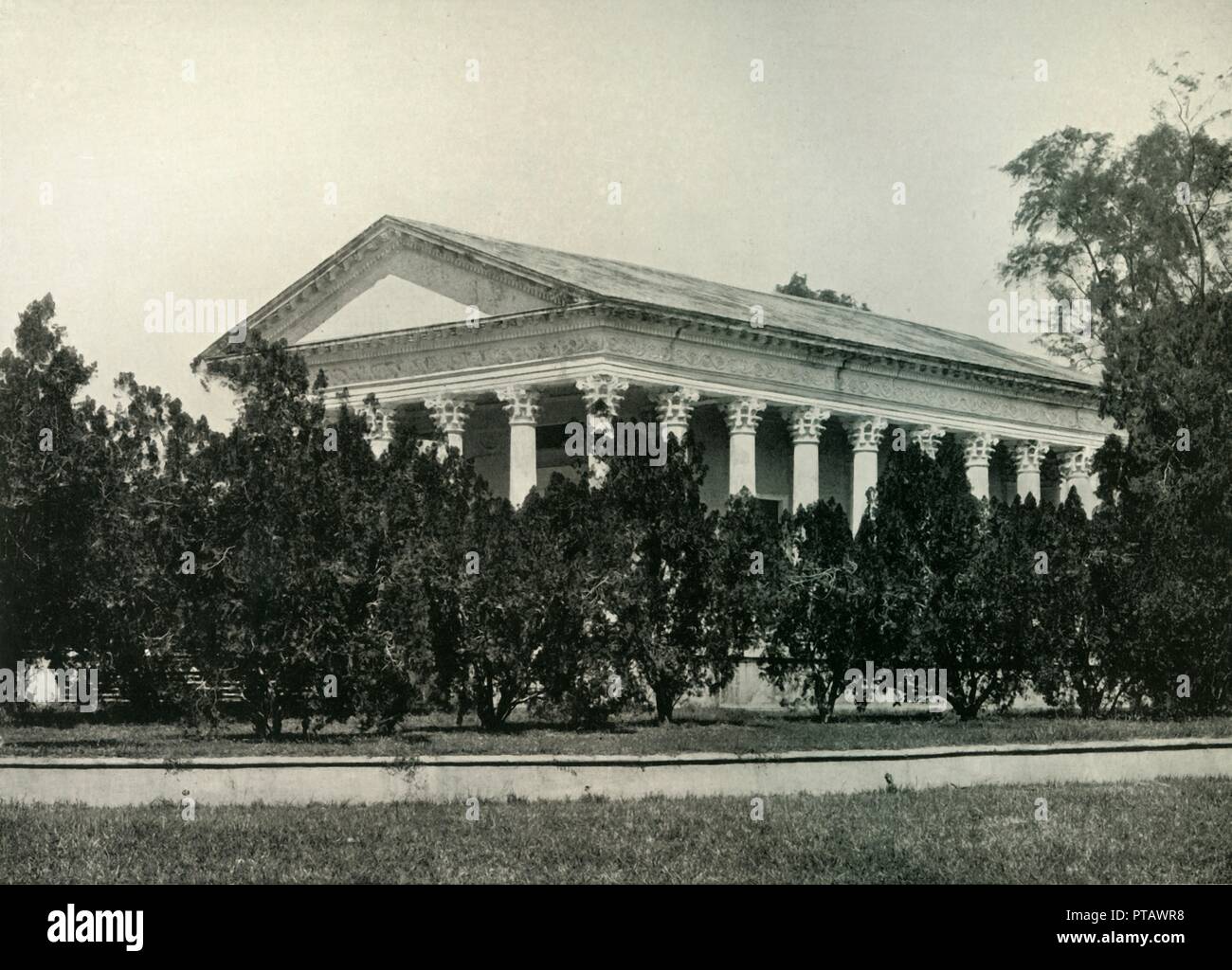 'Temple of Fame at Barrackpore', 1925. Creator: Unknown. Stock Photohttps://www.alamy.com/image-license-details/?v=1https://www.alamy.com/temple-of-fame-at-barrackpore-1925-creator-unknown-image221515932.html
RMPTAWR8–'Temple of Fame at Barrackpore', 1925. Creator: Unknown.
 Picture of grandfather of Ajit Singh who bought Carlton La Pleasance hotel from the British. Stock Photohttps://www.alamy.com/image-license-details/?v=1https://www.alamy.com/stock-photo-picture-of-grandfather-of-ajit-singh-who-bought-carlton-la-pleasance-54689808.html
RMD4Y9BC–Picture of grandfather of Ajit Singh who bought Carlton La Pleasance hotel from the British.
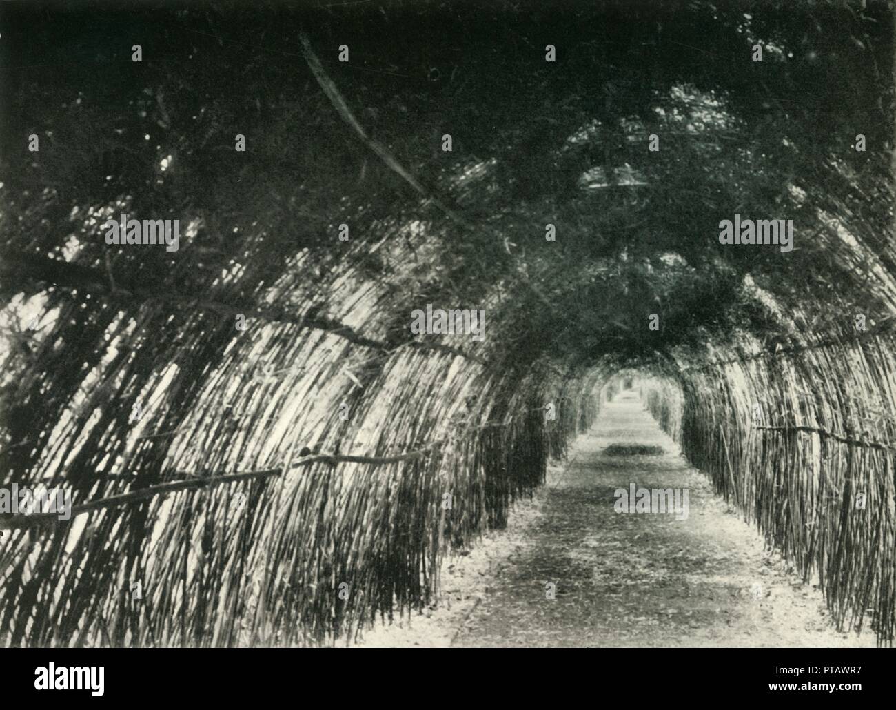 'Bamboo Avenue at Barrackpore, 1904', (1925). Creator: Unknown. Stock Photohttps://www.alamy.com/image-license-details/?v=1https://www.alamy.com/bamboo-avenue-at-barrackpore-1904-1925-creator-unknown-image221515931.html
RMPTAWR7–'Bamboo Avenue at Barrackpore, 1904', (1925). Creator: Unknown.
 The grave of Frederick Wilson, a British freebooter and hunter, at Christ Church Cemetery on Camel's Back Road in Mussoorie. Stock Photohttps://www.alamy.com/image-license-details/?v=1https://www.alamy.com/stock-photo-the-grave-of-frederick-wilson-a-british-freebooter-and-hunter-at-christ-54681032.html
RMD4XX60–The grave of Frederick Wilson, a British freebooter and hunter, at Christ Church Cemetery on Camel's Back Road in Mussoorie.
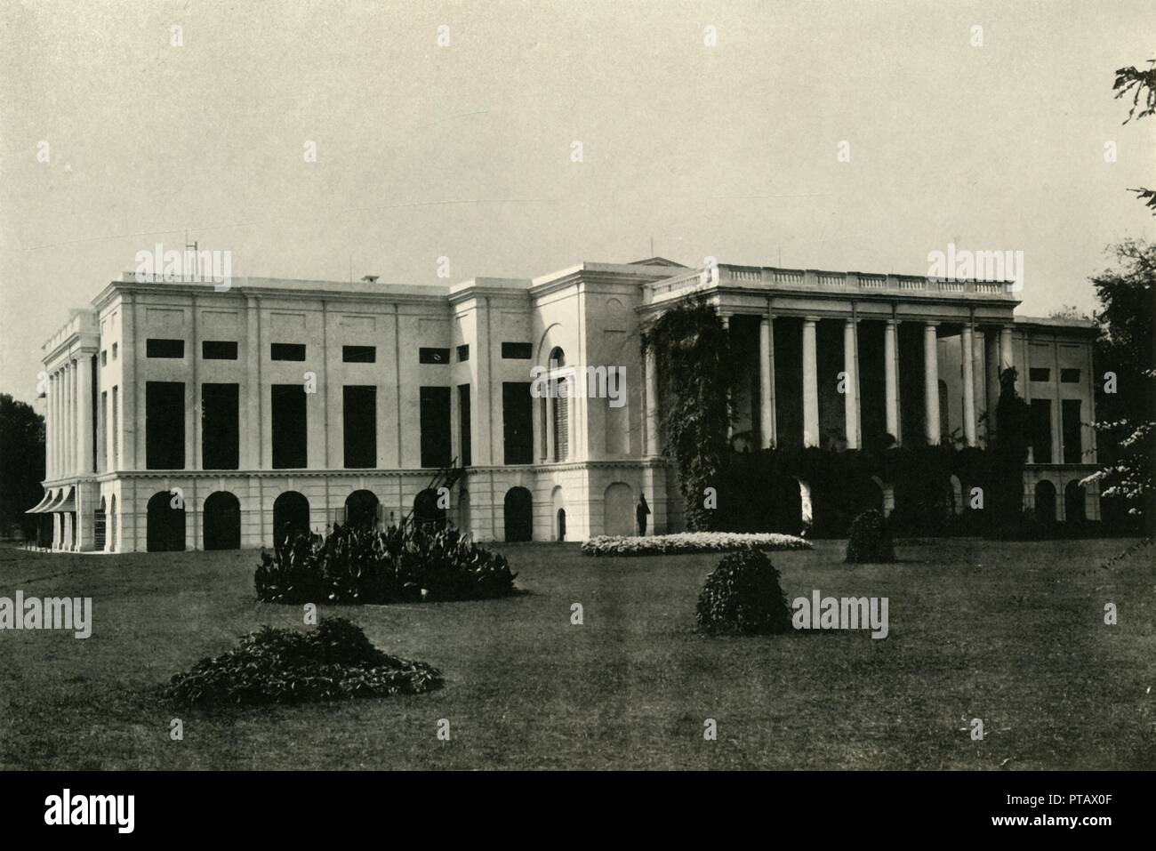 'Barrackpore House, North Front, 1903', (1925). Creator: Unknown. Stock Photohttps://www.alamy.com/image-license-details/?v=1https://www.alamy.com/barrackpore-house-north-front-1903-1925-creator-unknown-image221516079.html
RMPTAX0F–'Barrackpore House, North Front, 1903', (1925). Creator: Unknown.
 Thayet Myo: Pagoda on the South of Cantonment, August 8, 1855. Stock Photohttps://www.alamy.com/image-license-details/?v=1https://www.alamy.com/thayet-myo-pagoda-on-the-south-of-cantonment-august-8-1855-image426153646.html
RM2FN8Y92–Thayet Myo: Pagoda on the South of Cantonment, August 8, 1855.
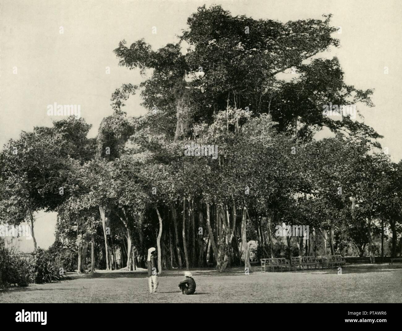 'The Banyan Tree, Barrackpore, 1870', (1925). Creator: Unknown. Stock Photohttps://www.alamy.com/image-license-details/?v=1https://www.alamy.com/the-banyan-tree-barrackpore-1870-1925-creator-unknown-image221515930.html
RMPTAWR6–'The Banyan Tree, Barrackpore, 1870', (1925). Creator: Unknown.
 The church in Madras (Volume 2): being the history of the ecclesiastical and missionary action of the East India Company in the Presidency of Madras in the seventeenth and eighteenth centuries . n signifying their approval, declared theirconviction that the debt was unknown to General Pater. As long as there were British troops in the Fort, the Chaplainlived there, and the principal services were at the garrisonChurch. At St. Marys Chapel there was regular eveningservice for the community that lived in the cantonment. After1834, when the Fort had become very insanitary and theBritish troops we Stock Photohttps://www.alamy.com/image-license-details/?v=1https://www.alamy.com/the-church-in-madras-volume-2-being-the-history-of-the-ecclesiastical-and-missionary-action-of-the-east-india-company-in-the-presidency-of-madras-in-the-seventeenth-and-eighteenth-centuries-n-signifying-their-approval-declared-theirconviction-that-the-debt-was-unknown-to-general-pater-as-long-as-there-were-british-troops-in-the-fort-the-chaplainlived-there-and-the-principal-services-were-at-the-garrisonchurch-at-st-marys-chapel-there-was-regular-eveningservice-for-the-community-that-lived-in-the-cantonment-after1834-when-the-fort-had-become-very-insanitary-and-thebritish-troops-we-image342745701.html
RM2AWHBHW–The church in Madras (Volume 2): being the history of the ecclesiastical and missionary action of the East India Company in the Presidency of Madras in the seventeenth and eighteenth centuries . n signifying their approval, declared theirconviction that the debt was unknown to General Pater. As long as there were British troops in the Fort, the Chaplainlived there, and the principal services were at the garrisonChurch. At St. Marys Chapel there was regular eveningservice for the community that lived in the cantonment. After1834, when the Fort had become very insanitary and theBritish troops we
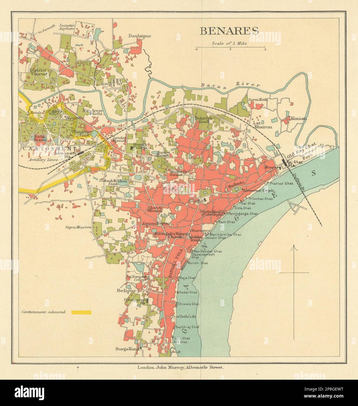 BRITISH INDIA. Benares (Varanasi) city plan.Ganges temples cantonment 1905 map Stock Photohttps://www.alamy.com/image-license-details/?v=1https://www.alamy.com/british-india-benares-varanasi-city-planganges-temples-cantonment-1905-map-image538801588.html
RF2P8GEWT–BRITISH INDIA. Benares (Varanasi) city plan.Ganges temples cantonment 1905 map
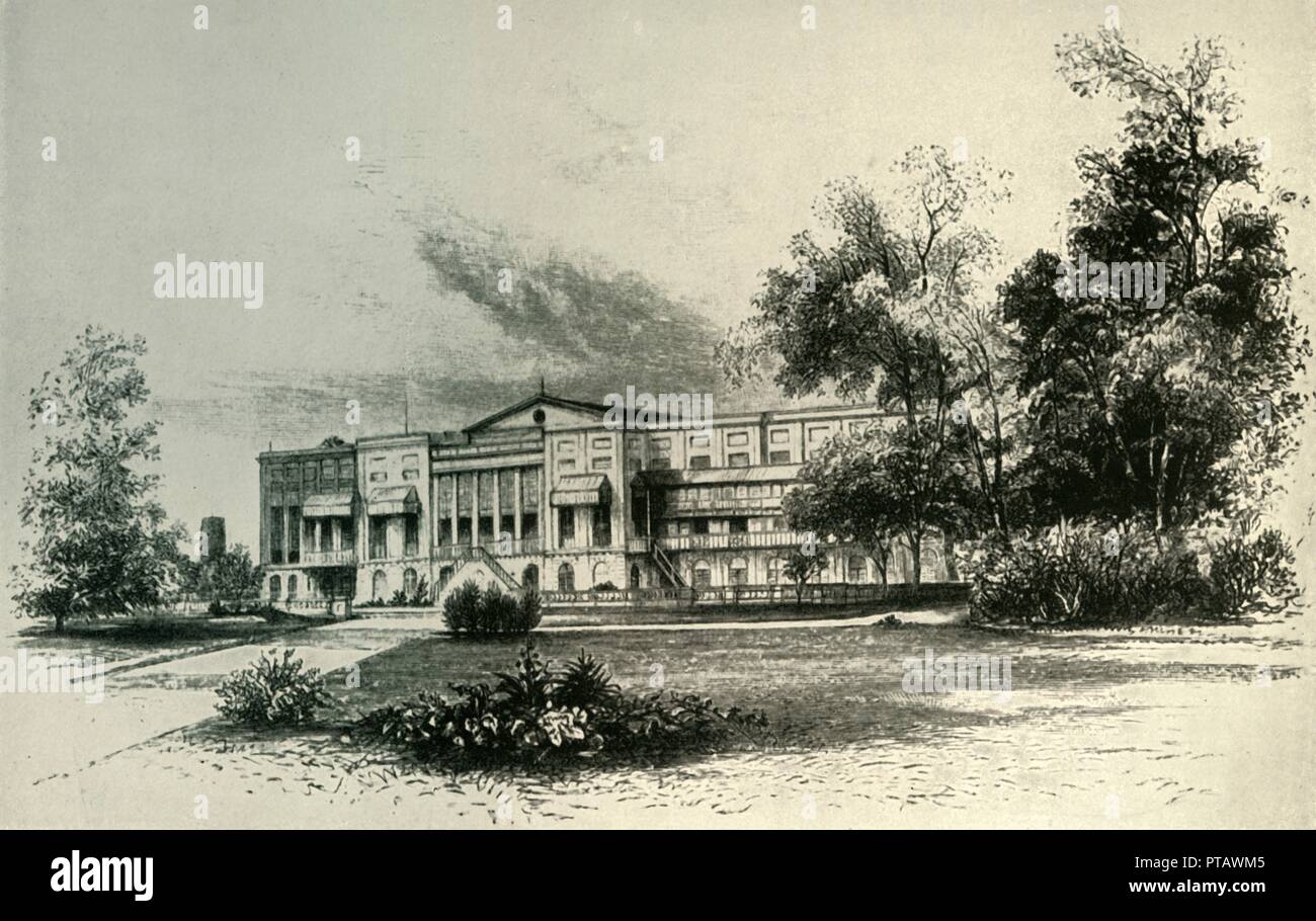 'Barrackpore House, 1856', (1925). Creator: Unknown. Stock Photohttps://www.alamy.com/image-license-details/?v=1https://www.alamy.com/barrackpore-house-1856-1925-creator-unknown-image221515845.html
RMPTAWM5–'Barrackpore House, 1856', (1925). Creator: Unknown.
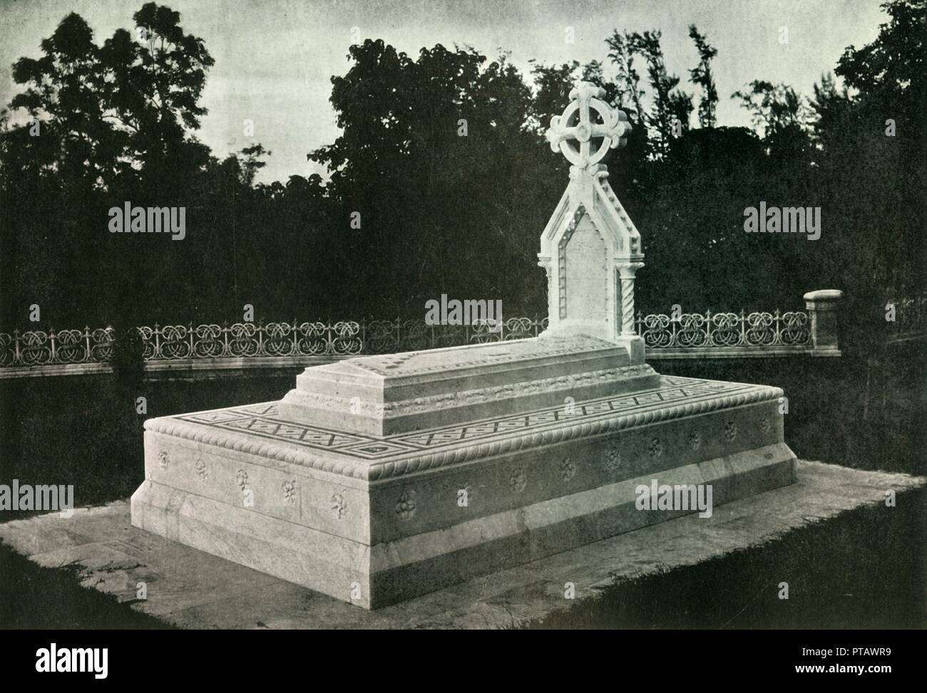 'Tomb of Lady Canning at Barrackpore', 1925. Creator: Unknown. Stock Photohttps://www.alamy.com/image-license-details/?v=1https://www.alamy.com/tomb-of-lady-canning-at-barrackpore-1925-creator-unknown-image221515933.html
RMPTAWR9–'Tomb of Lady Canning at Barrackpore', 1925. Creator: Unknown.
 'Lord Roberts's Headquarters, 'Camp of Exercise', Delhi', c1890, (1901). Creator: Raja Deen Dayal & Sons. Stock Photohttps://www.alamy.com/image-license-details/?v=1https://www.alamy.com/lord-robertss-headquarters-camp-of-exercise-delhi-c1890-1901-creator-raja-deen-dayal-sons-image246382824.html
RMT8RKPG–'Lord Roberts's Headquarters, 'Camp of Exercise', Delhi', c1890, (1901). Creator: Raja Deen Dayal & Sons.
 Trinity Church, Rangoon, British Burmah, 1869. Engraving from a photograph by Messrs. Bentley and Jackson. 'Rangoon now contains two Episcopal churches - Christ Church, in the cantonment, for the military, and Trinity Church (shown in our Engraving), for the civil community. It has also two Catholic churches; two Baptist churches, one for Europeans, the other for natives; one Armenian church; several mosques for Mussulmans; Hindoo shrines for that section of the inhabitants; two Joss-Houses for the Chinese; a synagogue for the Jews; a house dedicated to the Parsees, or fire-worshippers; and a Stock Photohttps://www.alamy.com/image-license-details/?v=1https://www.alamy.com/trinity-church-rangoon-british-burmah-1869-engraving-from-a-photograph-by-messrs-bentley-and-jackson-rangoon-now-contains-two-episcopal-churches-christ-church-in-the-cantonment-for-the-military-and-trinity-church-shown-in-our-engraving-for-the-civil-community-it-has-also-two-catholic-churches-two-baptist-churches-one-for-europeans-the-other-for-natives-one-armenian-church-several-mosques-for-mussulmans-hindoo-shrines-for-that-section-of-the-inhabitants-two-joss-houses-for-the-chinese-a-synagogue-for-the-jews-a-house-dedicated-to-the-parsees-or-fire-worshippers-and-a-image608998370.html
RM2XAP7HP–Trinity Church, Rangoon, British Burmah, 1869. Engraving from a photograph by Messrs. Bentley and Jackson. 'Rangoon now contains two Episcopal churches - Christ Church, in the cantonment, for the military, and Trinity Church (shown in our Engraving), for the civil community. It has also two Catholic churches; two Baptist churches, one for Europeans, the other for natives; one Armenian church; several mosques for Mussulmans; Hindoo shrines for that section of the inhabitants; two Joss-Houses for the Chinese; a synagogue for the Jews; a house dedicated to the Parsees, or fire-worshippers; and a
 Red Cross cart and oxen, Dagshai, a cantonment town in the Solan district of Himachel Pradesh. From the original snapshot photograph, taken during the First World War. Dagshai is also known as Daagh-e-Shahi. Stock Photohttps://www.alamy.com/image-license-details/?v=1https://www.alamy.com/red-cross-cart-and-oxen-dagshai-a-cantonment-town-in-the-solan-district-of-himachel-pradesh-from-the-original-snapshot-photograph-taken-during-the-first-world-war-dagshai-is-also-known-as-daagh-e-shahi-image545390470.html
RM2PK8K32–Red Cross cart and oxen, Dagshai, a cantonment town in the Solan district of Himachel Pradesh. From the original snapshot photograph, taken during the First World War. Dagshai is also known as Daagh-e-Shahi.
 Christmas, 1917, in Dagshai a cantonment town in the Solan district of Himachel Pradesh. From the original snapshot photograph, taken during the First World War. Dagshai is also known as Daagh-e-Shahi. Shows officers and lower ranks celebrating Christmas. Seated at tables with decorations above. Stock Photohttps://www.alamy.com/image-license-details/?v=1https://www.alamy.com/christmas-1917-in-dagshai-a-cantonment-town-in-the-solan-district-of-himachel-pradesh-from-the-original-snapshot-photograph-taken-during-the-first-world-war-dagshai-is-also-known-as-daagh-e-shahi-shows-officers-and-lower-ranks-celebrating-christmas-seated-at-tables-with-decorations-above-image545390500.html
RM2PK8K44–Christmas, 1917, in Dagshai a cantonment town in the Solan district of Himachel Pradesh. From the original snapshot photograph, taken during the First World War. Dagshai is also known as Daagh-e-Shahi. Shows officers and lower ranks celebrating Christmas. Seated at tables with decorations above.
 The shoemaker in Dagshai Bazaar, a cantonment town in the Solan district of Himachel Pradesh. From the original snapshot photograph, taken during the First World War. Dagshai is also known as Daagh-e-Shahi. The photo shows the shoemaker seated on the ground with his legs crossed, surrounded by shoes and the tools of his trade. Stock Photohttps://www.alamy.com/image-license-details/?v=1https://www.alamy.com/the-shoemaker-in-dagshai-bazaar-a-cantonment-town-in-the-solan-district-of-himachel-pradesh-from-the-original-snapshot-photograph-taken-during-the-first-world-war-dagshai-is-also-known-as-daagh-e-shahi-the-photo-shows-the-shoemaker-seated-on-the-ground-with-his-legs-crossed-surrounded-by-shoes-and-the-tools-of-his-trade-image545390801.html
RM2PK8KEW–The shoemaker in Dagshai Bazaar, a cantonment town in the Solan district of Himachel Pradesh. From the original snapshot photograph, taken during the First World War. Dagshai is also known as Daagh-e-Shahi. The photo shows the shoemaker seated on the ground with his legs crossed, surrounded by shoes and the tools of his trade.
 The grave of Frederick Wilson, a British freebooter and hunter, at Christ Church Cemetery on Camel's Back Road in Mussoorie. Stock Photohttps://www.alamy.com/image-license-details/?v=1https://www.alamy.com/stock-photo-the-grave-of-frederick-wilson-a-british-freebooter-and-hunter-at-christ-54681310.html
RMD4XXFX–The grave of Frederick Wilson, a British freebooter and hunter, at Christ Church Cemetery on Camel's Back Road in Mussoorie.
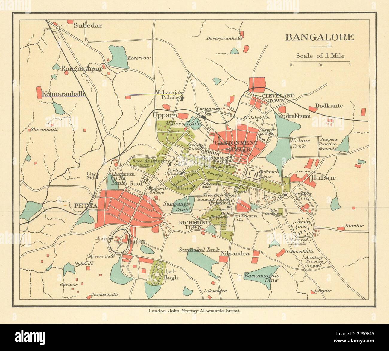 BRITISH INDIA. Bangalore (Bengaluru) city plan.Petta.Cantonment bazaar 1905 map Stock Photohttps://www.alamy.com/image-license-details/?v=1https://www.alamy.com/british-india-bangalore-bengaluru-city-planpettacantonment-bazaar-1905-map-image538801769.html
RF2P8GF49–BRITISH INDIA. Bangalore (Bengaluru) city plan.Petta.Cantonment bazaar 1905 map
!['View of Gwalior', c1891. From "Cassell's Illustrated History of India Vol. II.", by James Grant. [Cassell Petter & Galpin, London, Paris and New York] Stock Photo 'View of Gwalior', c1891. From "Cassell's Illustrated History of India Vol. II.", by James Grant. [Cassell Petter & Galpin, London, Paris and New York] Stock Photo](https://c8.alamy.com/comp/2J897WX/view-of-gwalior-c1891-from-quotcassells-illustrated-history-of-india-vol-iiquot-by-james-grant-cassell-petter-amp-galpin-london-paris-and-new-york-2J897WX.jpg) 'View of Gwalior', c1891. From "Cassell's Illustrated History of India Vol. II.", by James Grant. [Cassell Petter & Galpin, London, Paris and New York] Stock Photohttps://www.alamy.com/image-license-details/?v=1https://www.alamy.com/view-of-gwalior-c1891-from-quotcassells-illustrated-history-of-india-vol-iiquot-by-james-grant-cassell-petter-amp-galpin-london-paris-and-new-york-image469800966.html
'View of Gwalior', c1891. From "Cassell's Illustrated History of India Vol. II.", by James Grant. [Cassell Petter & Galpin, London, Paris and New York] Stock Photohttps://www.alamy.com/image-license-details/?v=1https://www.alamy.com/view-of-gwalior-c1891-from-quotcassells-illustrated-history-of-india-vol-iiquot-by-james-grant-cassell-petter-amp-galpin-london-paris-and-new-york-image469800966.htmlRM2J897WX–'View of Gwalior', c1891. From "Cassell's Illustrated History of India Vol. II.", by James Grant. [Cassell Petter & Galpin, London, Paris and New York]
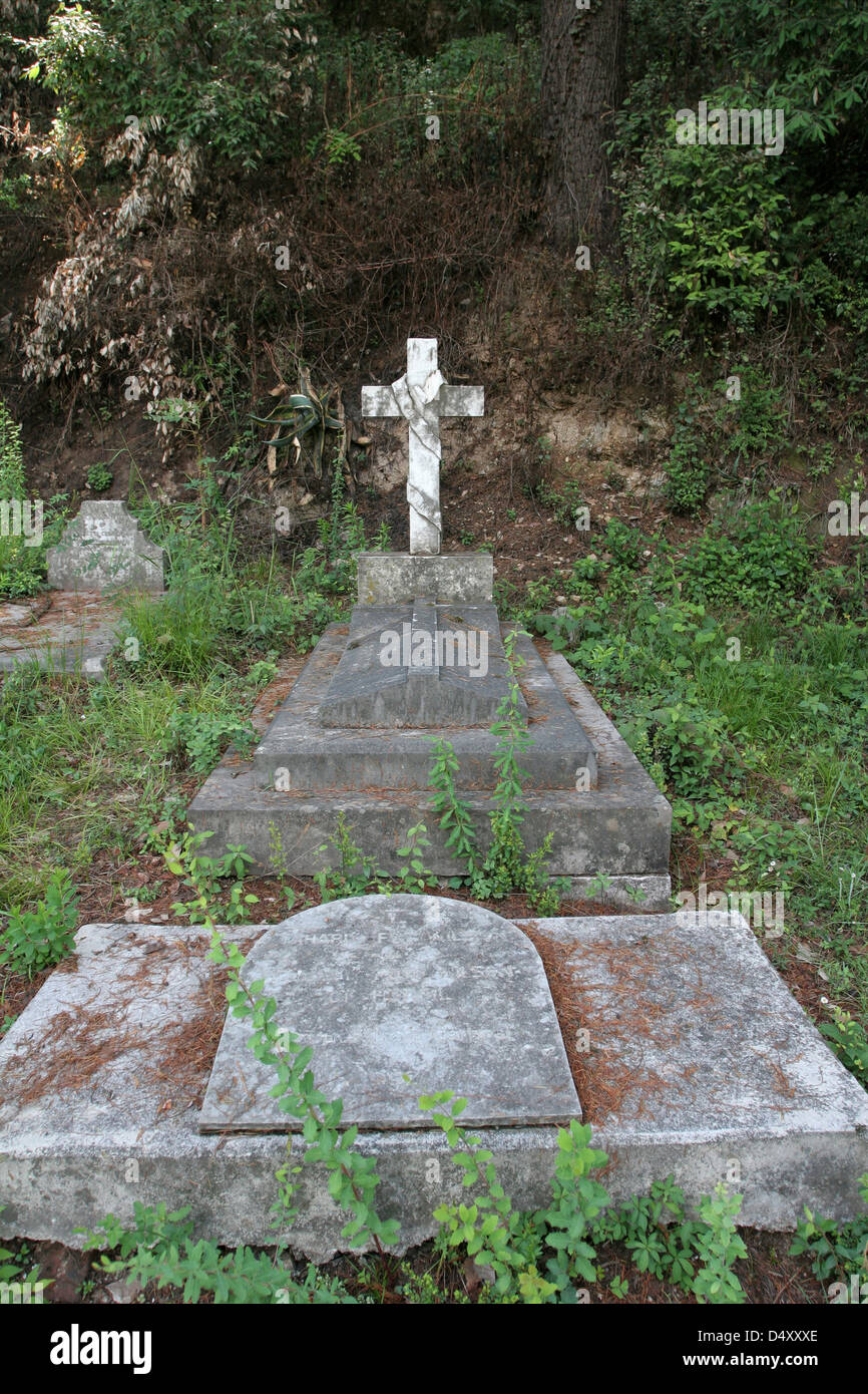 The grave of Frederick Wilson, a British freebooter and hunter, at Christ Church Cemetery on Camel's Back Road in Mussoorie. Stock Photohttps://www.alamy.com/image-license-details/?v=1https://www.alamy.com/stock-photo-the-grave-of-frederick-wilson-a-british-freebooter-and-hunter-at-christ-54681606.html
RMD4XXXE–The grave of Frederick Wilson, a British freebooter and hunter, at Christ Church Cemetery on Camel's Back Road in Mussoorie.
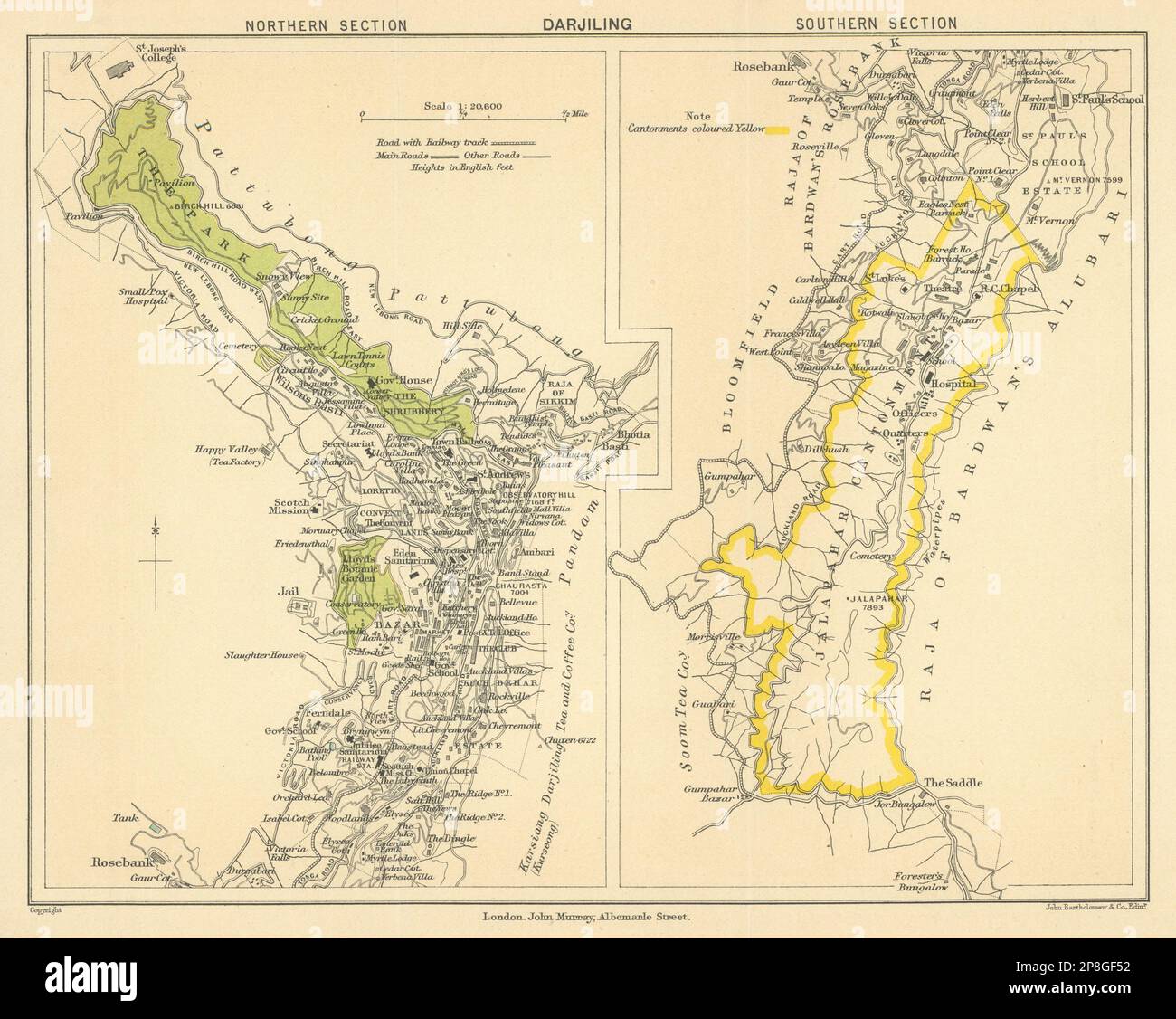 BRITISH INDIA. Darjiling (Darjeeling) town plan.Cantonment.Tea estates 1905 map Stock Photohttps://www.alamy.com/image-license-details/?v=1https://www.alamy.com/british-india-darjiling-darjeeling-town-plancantonmenttea-estates-1905-map-image538801790.html
RF2P8GF52–BRITISH INDIA. Darjiling (Darjeeling) town plan.Cantonment.Tea estates 1905 map
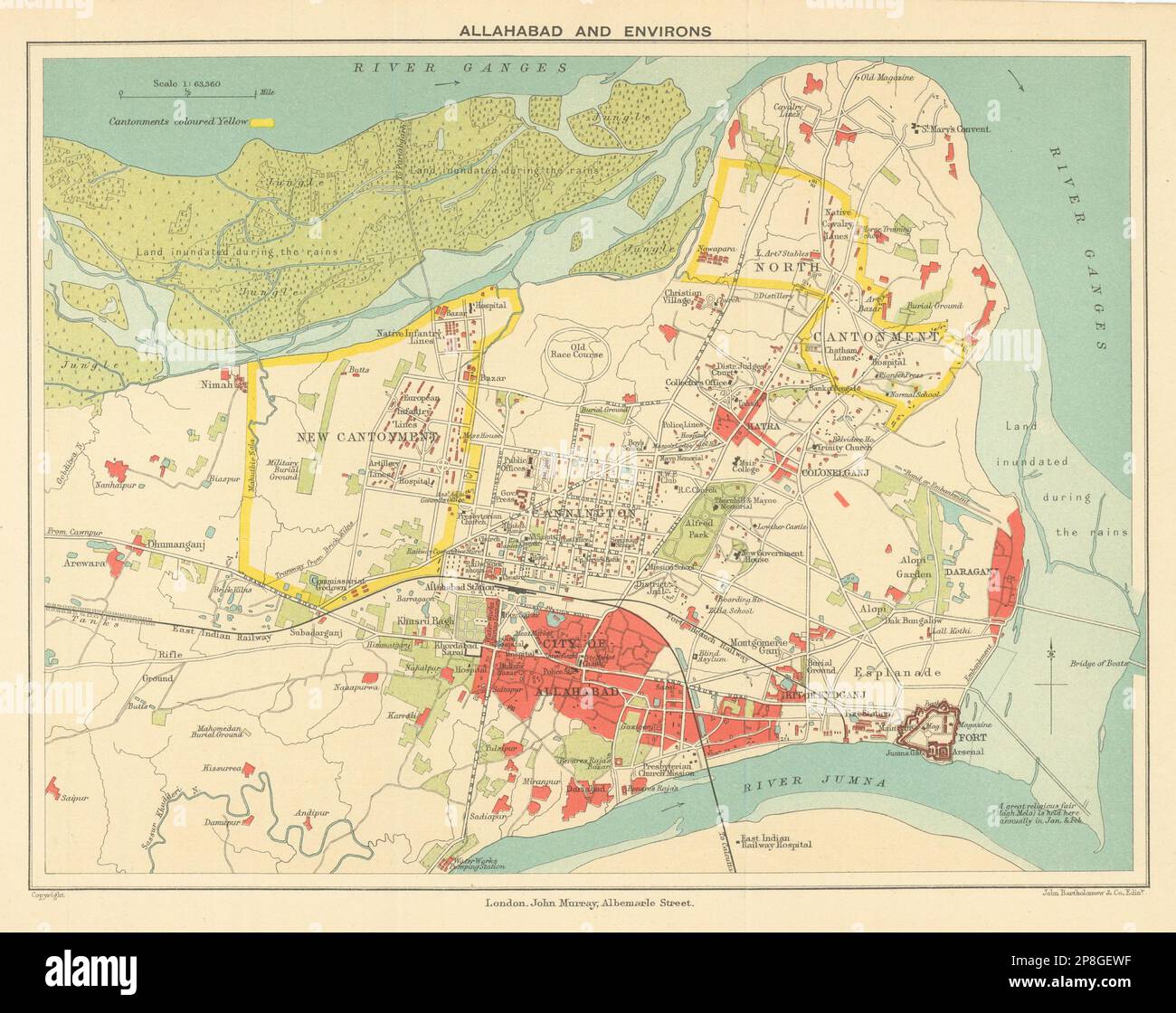 BRITISH INDIA. Allahabad (Prayag) city plan. Cantonment Ganges 1905 old map Stock Photohttps://www.alamy.com/image-license-details/?v=1https://www.alamy.com/british-india-allahabad-prayag-city-plan-cantonment-ganges-1905-old-map-image538801579.html
RF2P8GEWF–BRITISH INDIA. Allahabad (Prayag) city plan. Cantonment Ganges 1905 old map
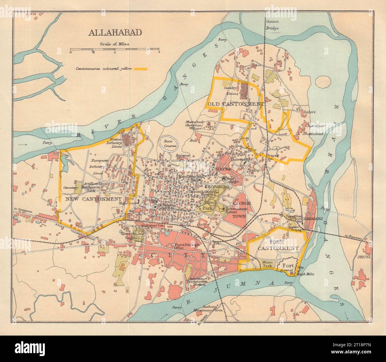 BRITISH INDIA. Allahabad (Prayag) city plan. Cantonment Ganges 1929 old map Stock Photohttps://www.alamy.com/image-license-details/?v=1https://www.alamy.com/british-india-allahabad-prayag-city-plan-cantonment-ganges-1929-old-map-image568749881.html
RF2T18P7N–BRITISH INDIA. Allahabad (Prayag) city plan. Cantonment Ganges 1929 old map
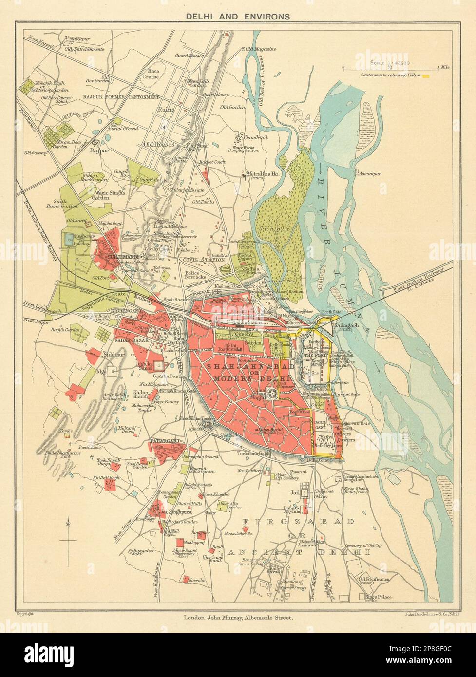 BRITISH INDIA. Delhi & environs plan. Showing cantonment & railways 1905 map Stock Photohttps://www.alamy.com/image-license-details/?v=1https://www.alamy.com/british-india-delhi-environs-plan-showing-cantonment-railways-1905-map-image538801660.html
RF2P8GF0C–BRITISH INDIA. Delhi & environs plan. Showing cantonment & railways 1905 map
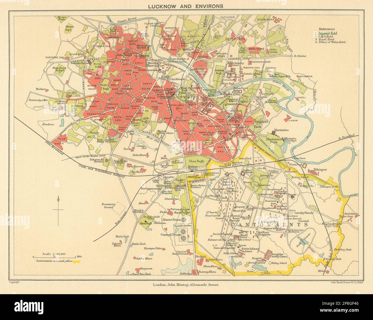 BRITISH INDIA. Lucknow city plan showing cantonment 1905 old antique map chart Stock Photohttps://www.alamy.com/image-license-details/?v=1https://www.alamy.com/british-india-lucknow-city-plan-showing-cantonment-1905-old-antique-map-chart-image538801766.html
RF2P8GF46–BRITISH INDIA. Lucknow city plan showing cantonment 1905 old antique map chart
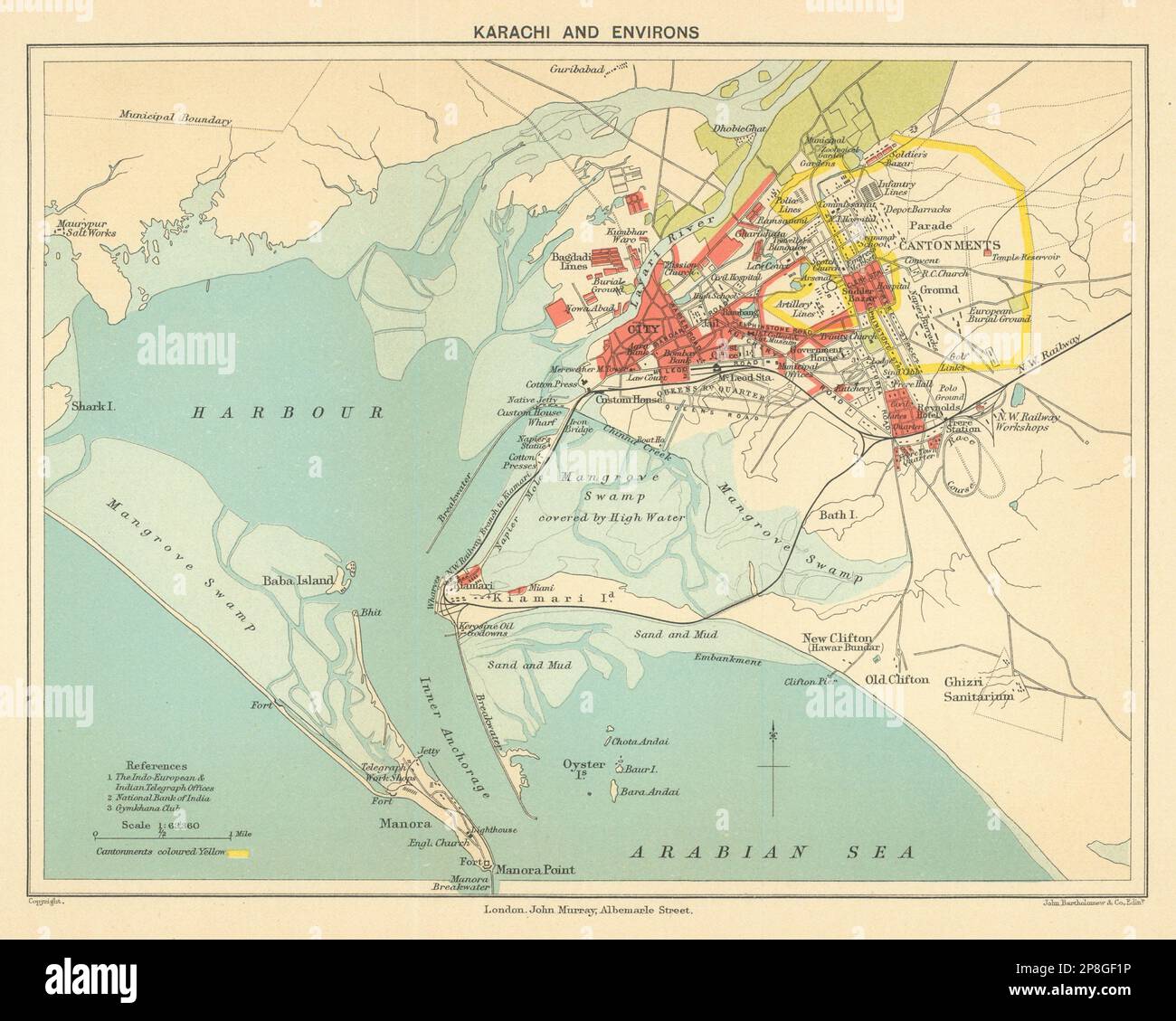 PAKISTAN. Karachi & environs city plan. Cantonment. British India 1905 old map Stock Photohttps://www.alamy.com/image-license-details/?v=1https://www.alamy.com/pakistan-karachi-environs-city-plan-cantonment-british-india-1905-old-map-image538801698.html
RF2P8GF1P–PAKISTAN. Karachi & environs city plan. Cantonment. British India 1905 old map
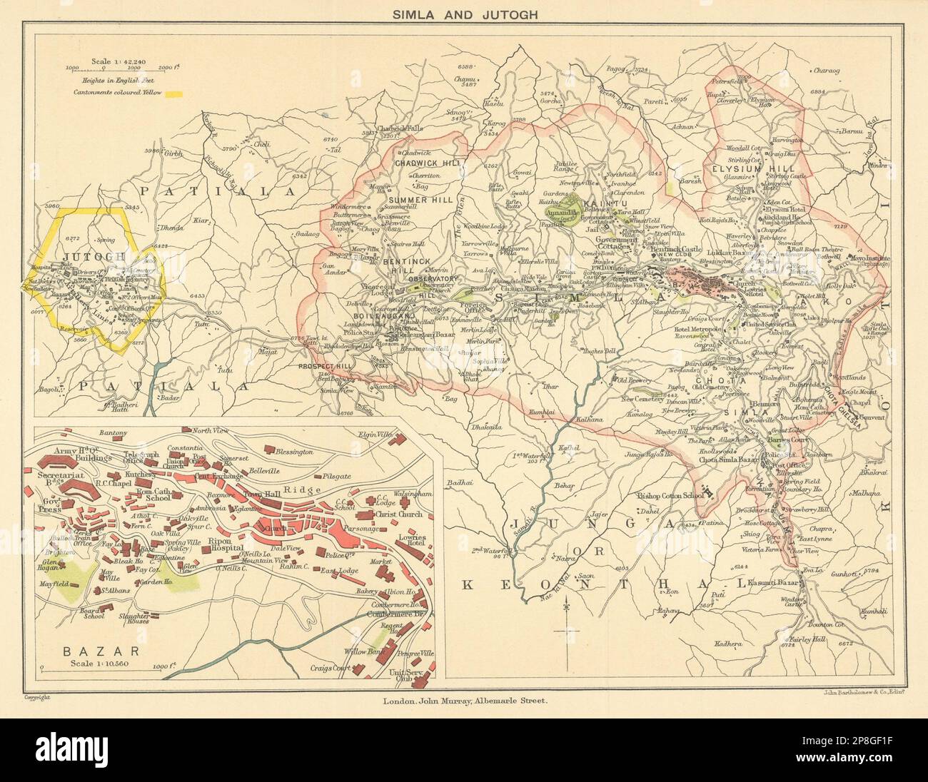 BRITISH INDIA. Simla (Shimla) & Jutogh cantonment; inset Lakkar Bazaar 1905 map Stock Photohttps://www.alamy.com/image-license-details/?v=1https://www.alamy.com/british-india-simla-shimla-jutogh-cantonment-inset-lakkar-bazaar-1905-map-image538801691.html
RF2P8GF1F–BRITISH INDIA. Simla (Shimla) & Jutogh cantonment; inset Lakkar Bazaar 1905 map
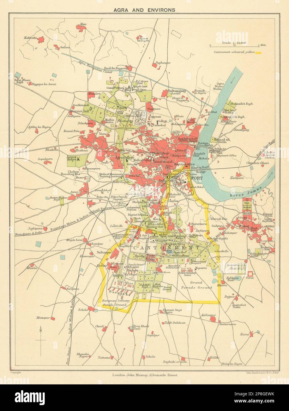 BRITISH INDIA. Agra & environs. Showing Cantonment, Fort & Taj Mahal 1905 map Stock Photohttps://www.alamy.com/image-license-details/?v=1https://www.alamy.com/british-india-agra-environs-showing-cantonment-fort-taj-mahal-1905-map-image538801583.html
RF2P8GEWK–BRITISH INDIA. Agra & environs. Showing Cantonment, Fort & Taj Mahal 1905 map
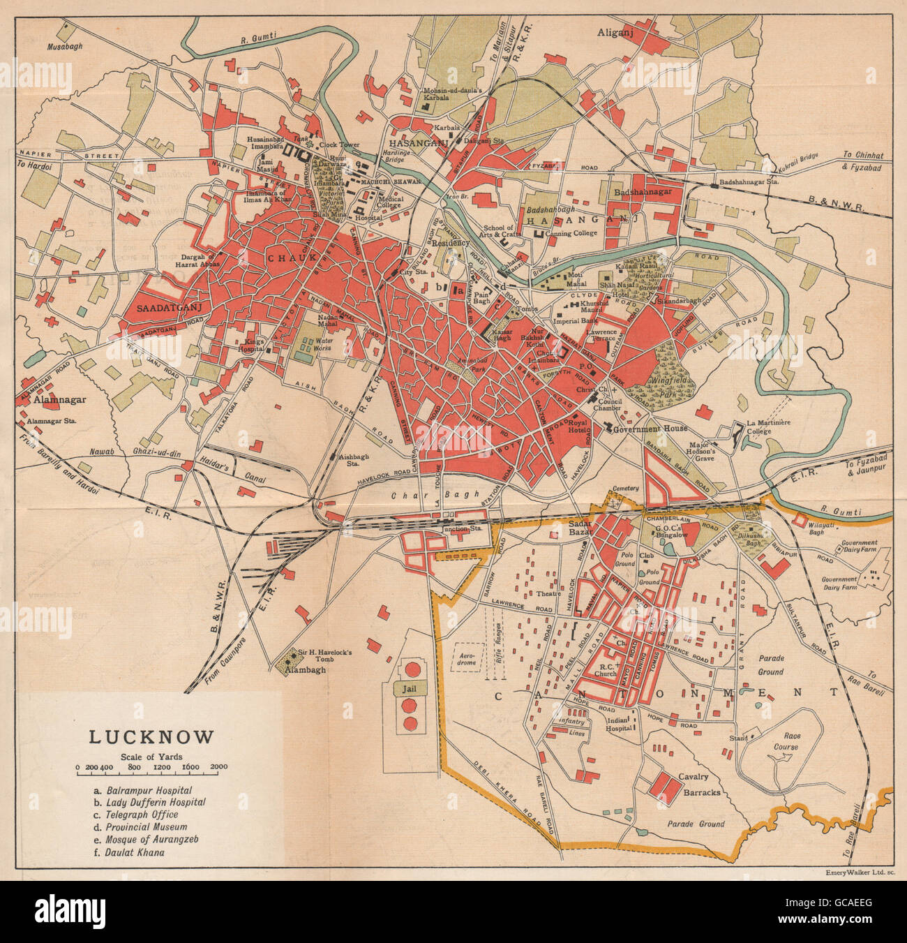 BRITISH INDIA. Lucknow city plan showing cantonment, 1929 vintage map Stock Photohttps://www.alamy.com/image-license-details/?v=1https://www.alamy.com/stock-photo-british-india-lucknow-city-plan-showing-cantonment-1929-vintage-map-110868984.html
RFGCAEEG–BRITISH INDIA. Lucknow city plan showing cantonment, 1929 vintage map
 BRITISH INDIA: Lucknow city plan showing cantonment, 1924 vintage map Stock Photohttps://www.alamy.com/image-license-details/?v=1https://www.alamy.com/stock-photo-british-india-lucknow-city-plan-showing-cantonment-1924-vintage-map-103745297.html
RFG0P055–BRITISH INDIA: Lucknow city plan showing cantonment, 1924 vintage map
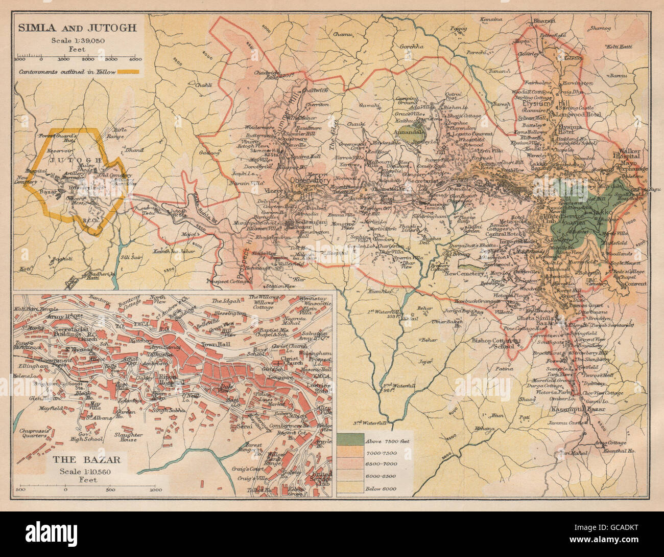 BRITISH INDIA. Simla (Shimla) & Jutogh cantonment; inset Lakkar Bazaar, 1929 map Stock Photohttps://www.alamy.com/image-license-details/?v=1https://www.alamy.com/stock-photo-british-india-simla-shimla-jutogh-cantonment-inset-lakkar-bazaar-1929-110868348.html
RFGCADKT–BRITISH INDIA. Simla (Shimla) & Jutogh cantonment; inset Lakkar Bazaar, 1929 map
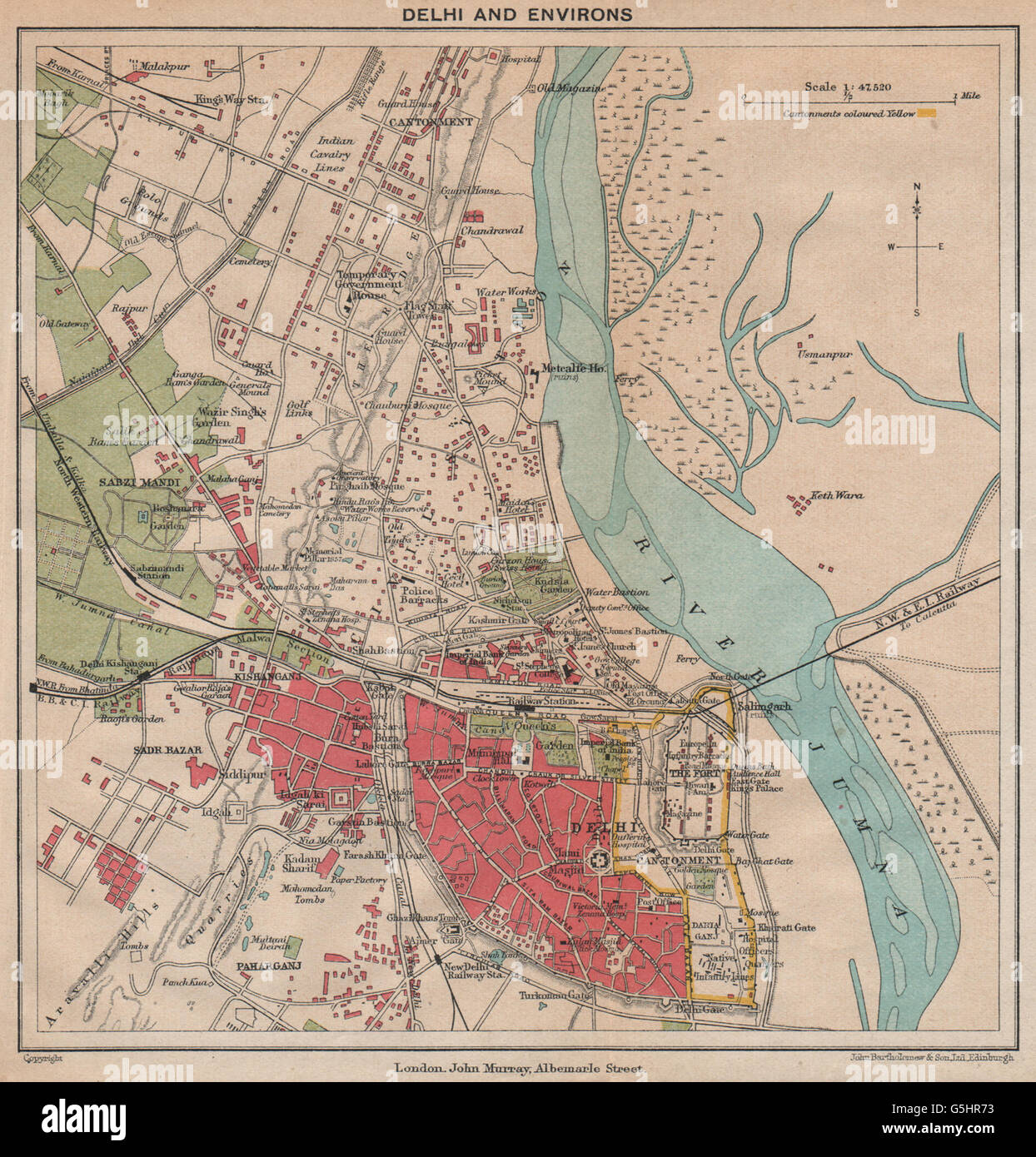 BRITISH INDIA. Delhi & environs plan. Showing cantonment & railways, 1929 map Stock Photohttps://www.alamy.com/image-license-details/?v=1https://www.alamy.com/stock-photo-british-india-delhi-environs-plan-showing-cantonment-railways-1929-106726903.html
RFG5HR73–BRITISH INDIA. Delhi & environs plan. Showing cantonment & railways, 1929 map
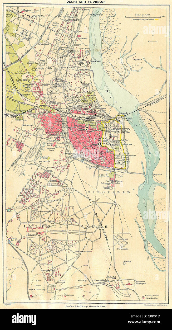 BRITISH INDIA: Delhi & environs plan. Showing cantonment & railways, 1924 map Stock Photohttps://www.alamy.com/image-license-details/?v=1https://www.alamy.com/stock-photo-british-india-delhi-environs-plan-showing-cantonment-railways-1924-103745193.html
RFG0P01D–BRITISH INDIA: Delhi & environs plan. Showing cantonment & railways, 1924 map
 BRITISH INDIA: Simla (Shimla) & Jutogh cantonment; inset Lakkar Bazaar, 1924 map Stock Photohttps://www.alamy.com/image-license-details/?v=1https://www.alamy.com/stock-photo-british-india-simla-shimla-jutogh-cantonment-inset-lakkar-bazaar-1924-103745217.html
RFG0P029–BRITISH INDIA: Simla (Shimla) & Jutogh cantonment; inset Lakkar Bazaar, 1924 map
 BRITISH INDIA. Agra & environs. Showing Cantonment, Fort & Taj Mahal, 1929 map Stock Photohttps://www.alamy.com/image-license-details/?v=1https://www.alamy.com/stock-photo-british-india-agra-environs-showing-cantonment-fort-taj-mahal-1929-106726786.html
RFG5HR2X–BRITISH INDIA. Agra & environs. Showing Cantonment, Fort & Taj Mahal, 1929 map
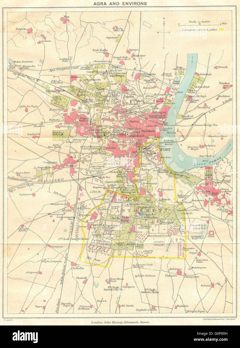 BRITISH INDIA: Agra & environs. Showing Cantonment, Fort & Taj Mahal, 1924 map Stock Photohttps://www.alamy.com/image-license-details/?v=1https://www.alamy.com/stock-photo-british-india-agra-environs-showing-cantonment-fort-taj-mahal-1924-103745169.html
RFG0P00H–BRITISH INDIA: Agra & environs. Showing Cantonment, Fort & Taj Mahal, 1924 map
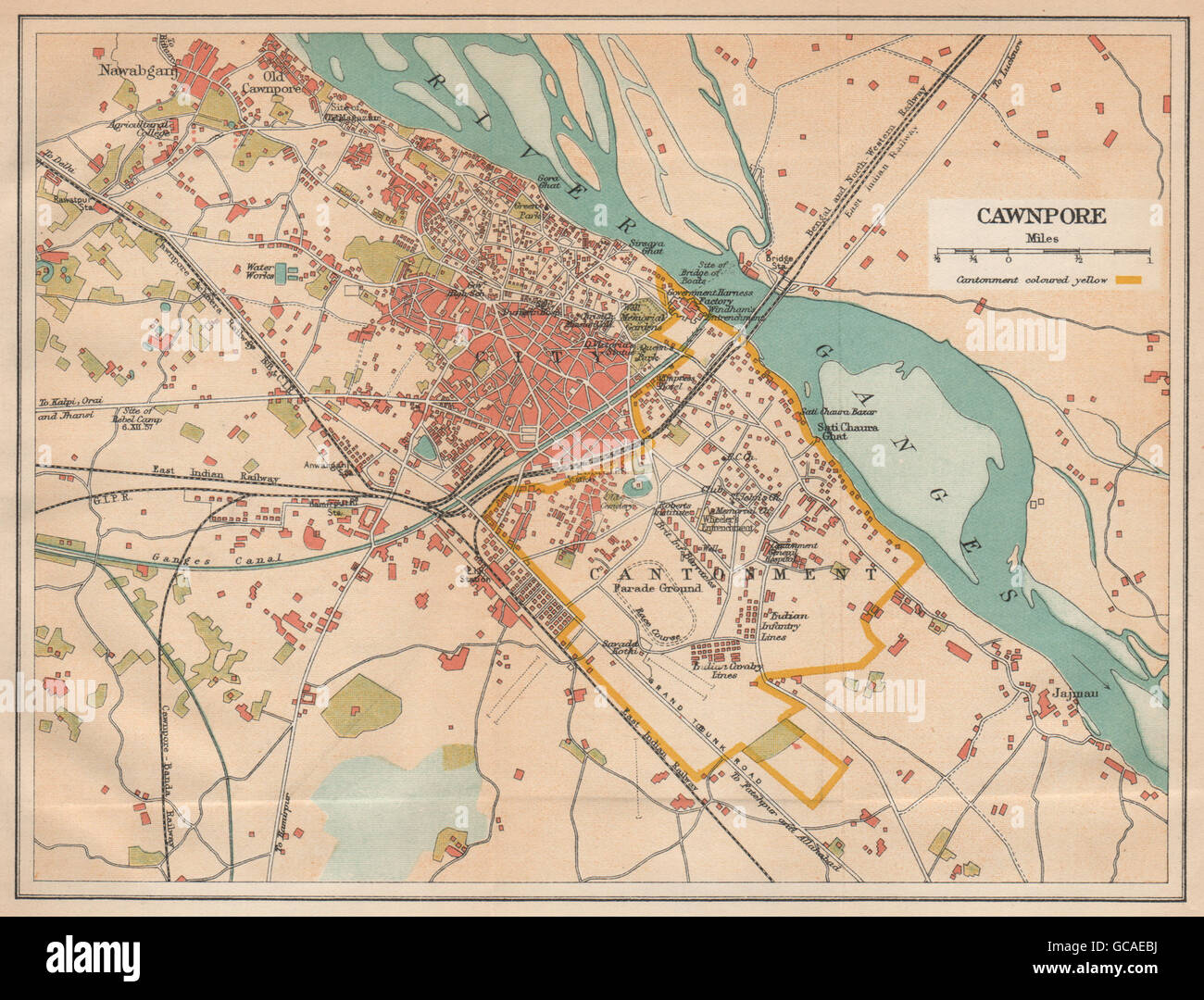 BRITISH INDIA. Cawnpore (Kanpur) city plan showing cantonment, 1929 old map Stock Photohttps://www.alamy.com/image-license-details/?v=1https://www.alamy.com/stock-photo-british-india-cawnpore-kanpur-city-plan-showing-cantonment-1929-old-110868902.html
RFGCAEBJ–BRITISH INDIA. Cawnpore (Kanpur) city plan showing cantonment, 1929 old map
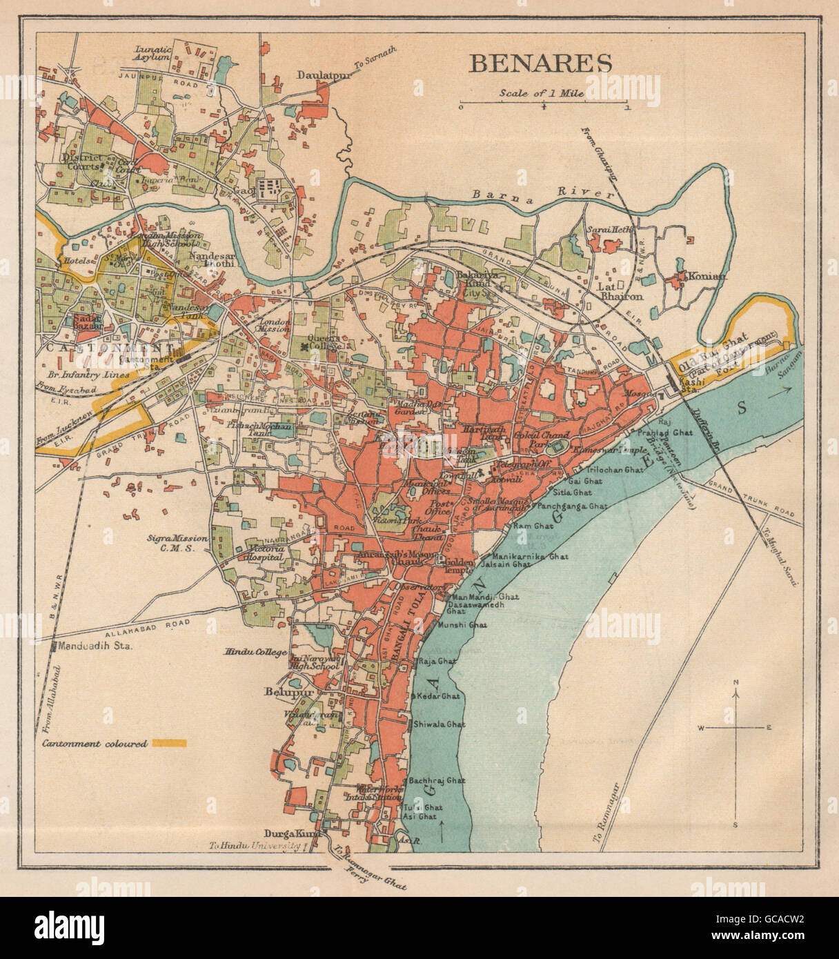 BRITISH INDIA. Benares (Varanasi) city plan.Ganges temples cantonment, 1929 map Stock Photohttps://www.alamy.com/image-license-details/?v=1https://www.alamy.com/stock-photo-british-india-benares-varanasi-city-planganges-temples-cantonment-110867710.html
RFGCACW2–BRITISH INDIA. Benares (Varanasi) city plan.Ganges temples cantonment, 1929 map
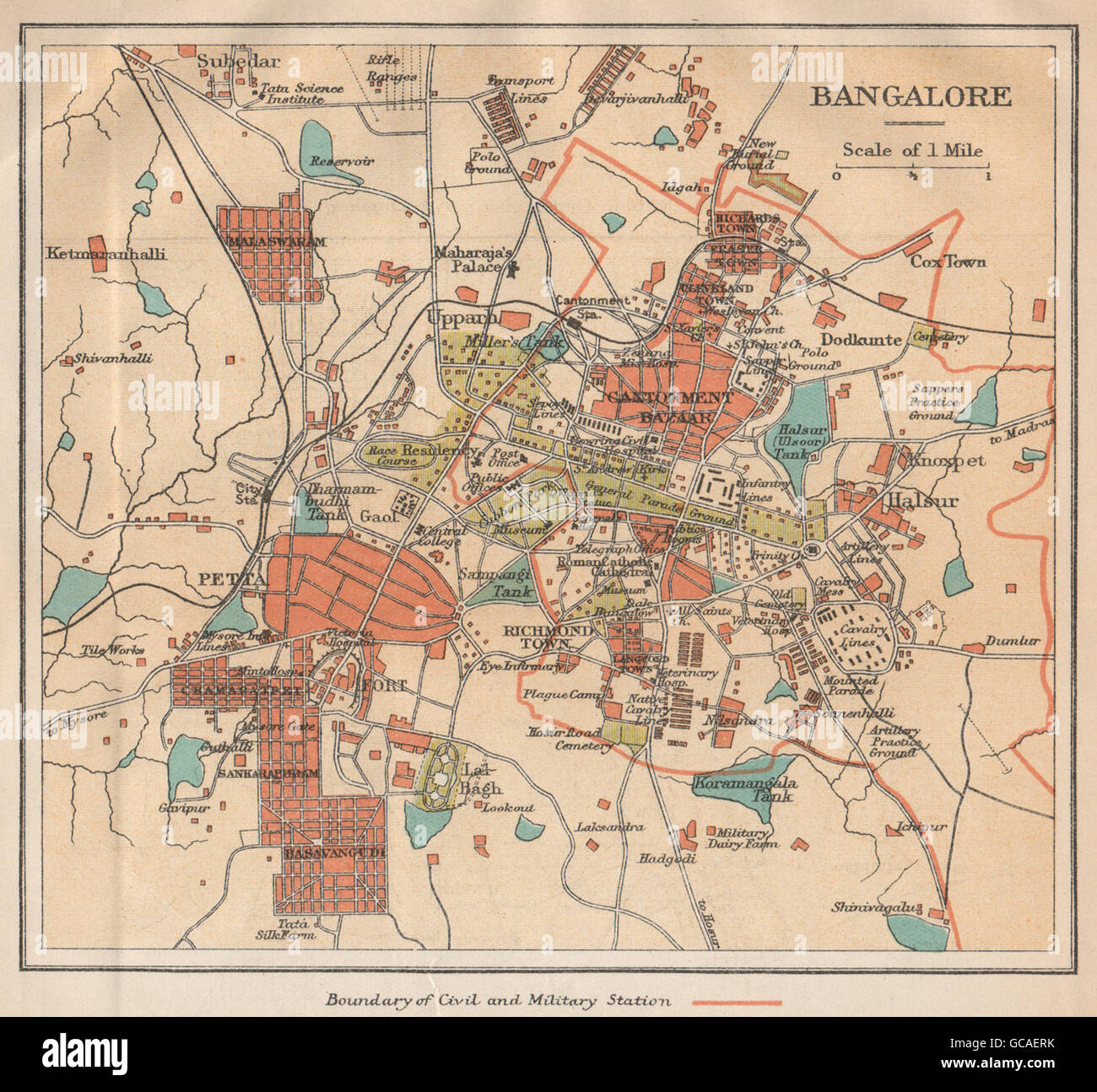 BRITISH INDIA. Bangalore (Bengaluru) city plan.Petta.Cantonment bazaar, 1929 map Stock Photohttps://www.alamy.com/image-license-details/?v=1https://www.alamy.com/stock-photo-british-india-bangalore-bengaluru-city-planpettacantonment-bazaar-110869239.html
RFGCAERK–BRITISH INDIA. Bangalore (Bengaluru) city plan.Petta.Cantonment bazaar, 1929 map
 BRITISH INDIA: Benares (Varanasi) city plan.Ganges temples cantonment, 1924 map Stock Photohttps://www.alamy.com/image-license-details/?v=1https://www.alamy.com/stock-photo-british-india-benares-varanasi-city-planganges-temples-cantonment-103745137.html
RFG0NYYD–BRITISH INDIA: Benares (Varanasi) city plan.Ganges temples cantonment, 1924 map
 BRITISH INDIA: Allahabad (Prayag) city plan. Cantonment Ganges, 1924 old map Stock Photohttps://www.alamy.com/image-license-details/?v=1https://www.alamy.com/stock-photo-british-india-allahabad-prayag-city-plan-cantonment-ganges-1924-old-103745134.html
RFG0NYYA–BRITISH INDIA: Allahabad (Prayag) city plan. Cantonment Ganges, 1924 old map
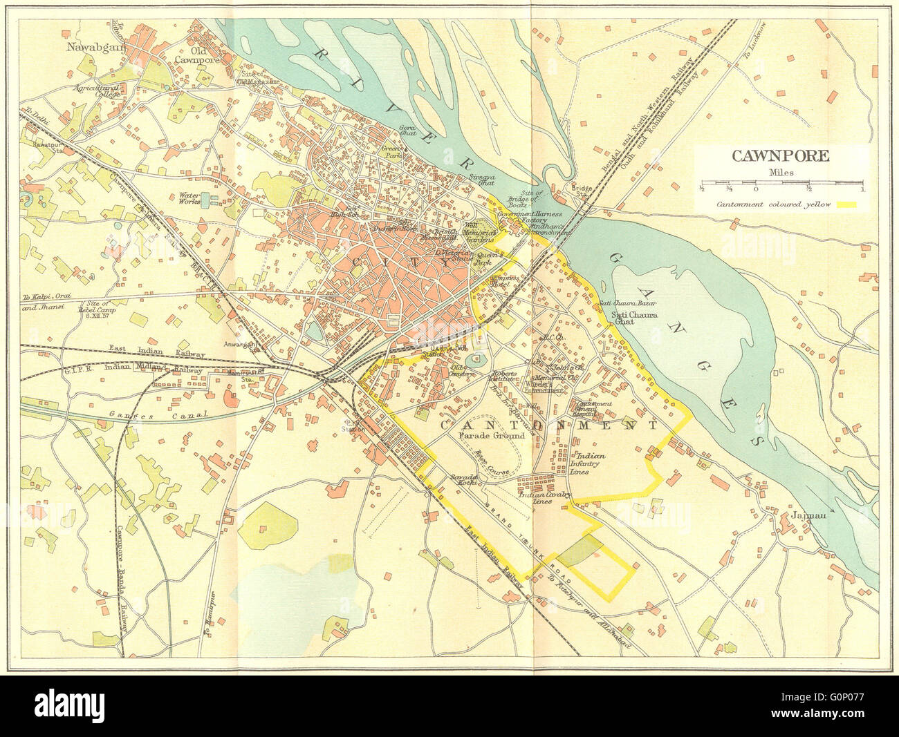 BRITISH INDIA: Cawnpore (Kanpur) city plan showing cantonment, 1924 old map Stock Photohttps://www.alamy.com/image-license-details/?v=1https://www.alamy.com/stock-photo-british-india-cawnpore-kanpur-city-plan-showing-cantonment-1924-old-103745355.html
RFG0P077–BRITISH INDIA: Cawnpore (Kanpur) city plan showing cantonment, 1924 old map
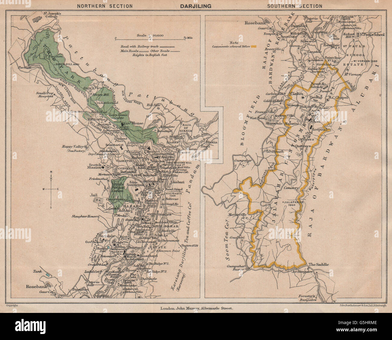 BRITISH INDIA. Darjiling (Darjeeling) town plan.Cantonment.Tea estates, 1929 map Stock Photohttps://www.alamy.com/image-license-details/?v=1https://www.alamy.com/stock-photo-british-india-darjiling-darjeeling-town-plancantonmenttea-estates-106727278.html
RFG5HRME–BRITISH INDIA. Darjiling (Darjeeling) town plan.Cantonment.Tea estates, 1929 map
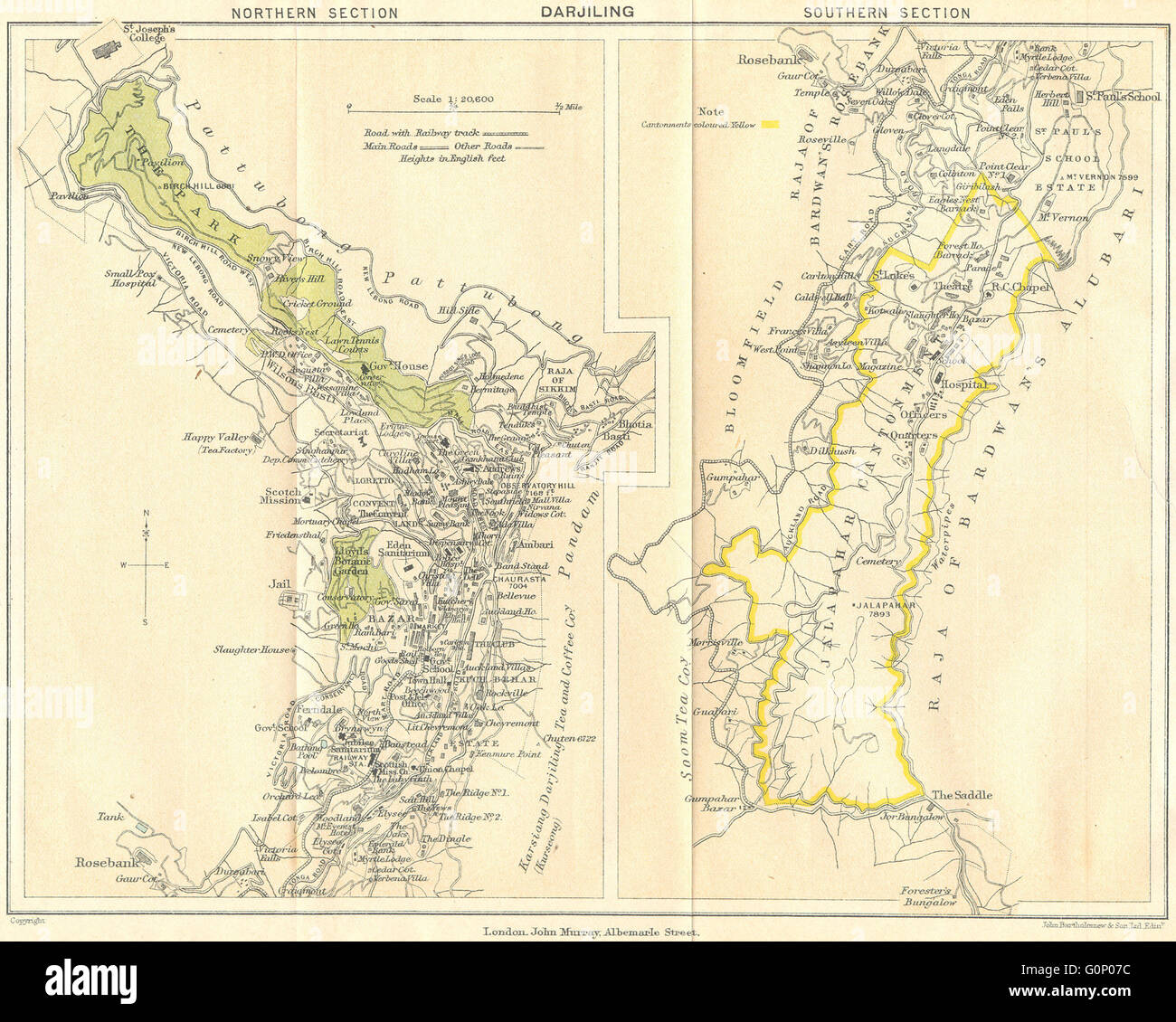 BRITISH INDIA: Darjiling (Darjeeling) town plan.Cantonment.Tea estates, 1924 map Stock Photohttps://www.alamy.com/image-license-details/?v=1https://www.alamy.com/stock-photo-british-india-darjiling-darjeeling-town-plancantonmenttea-estates-103745360.html
RFG0P07C–BRITISH INDIA: Darjiling (Darjeeling) town plan.Cantonment.Tea estates, 1924 map
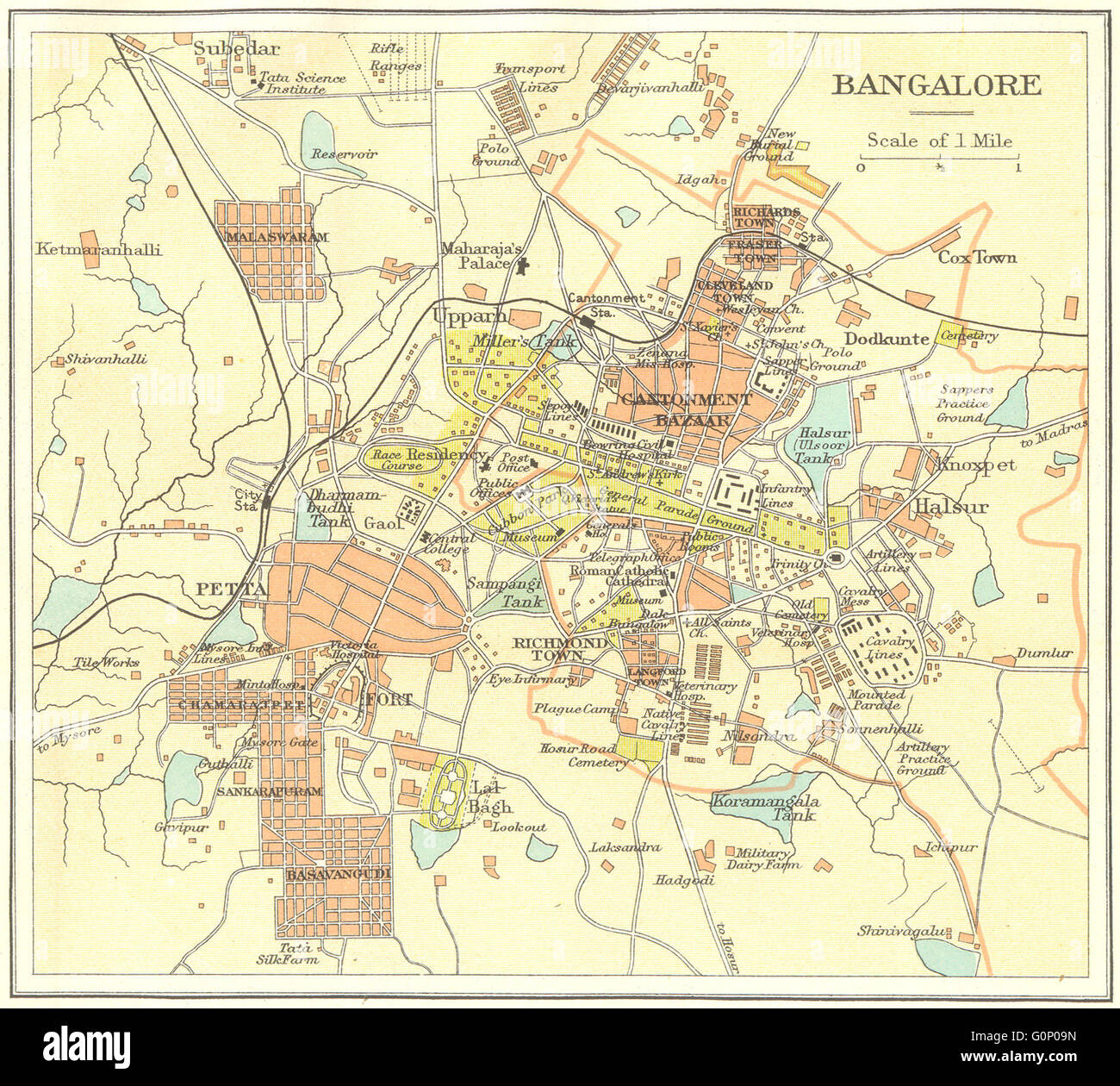 BRITISH INDIA: Bangalore (Bengaluru) city plan.Petta.Cantonment bazaar, 1924 map Stock Photohttps://www.alamy.com/image-license-details/?v=1https://www.alamy.com/stock-photo-british-india-bangalore-bengaluru-city-planpettacantonment-bazaar-103745425.html
RFG0P09N–BRITISH INDIA: Bangalore (Bengaluru) city plan.Petta.Cantonment bazaar, 1924 map
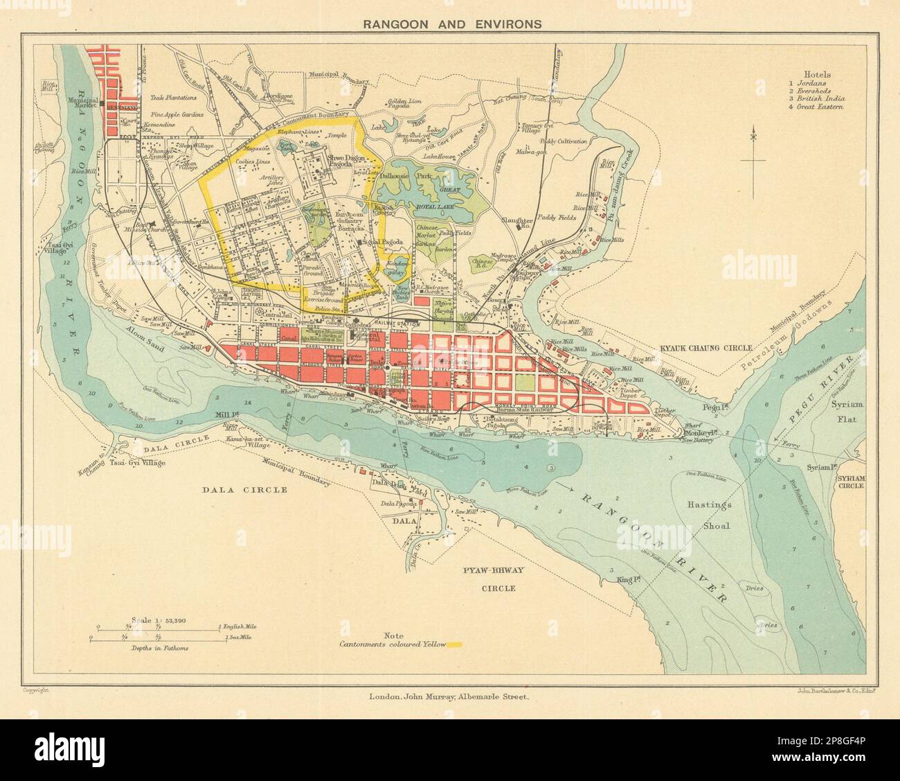 BRITISH BURMA. Rangoon (Yangon) city plan. Myanmar. Cantonment 1905 old map Stock Photohttps://www.alamy.com/image-license-details/?v=1https://www.alamy.com/british-burma-rangoon-yangon-city-plan-myanmar-cantonment-1905-old-map-image538801782.html
RF2P8GF4P–BRITISH BURMA. Rangoon (Yangon) city plan. Myanmar. Cantonment 1905 old map
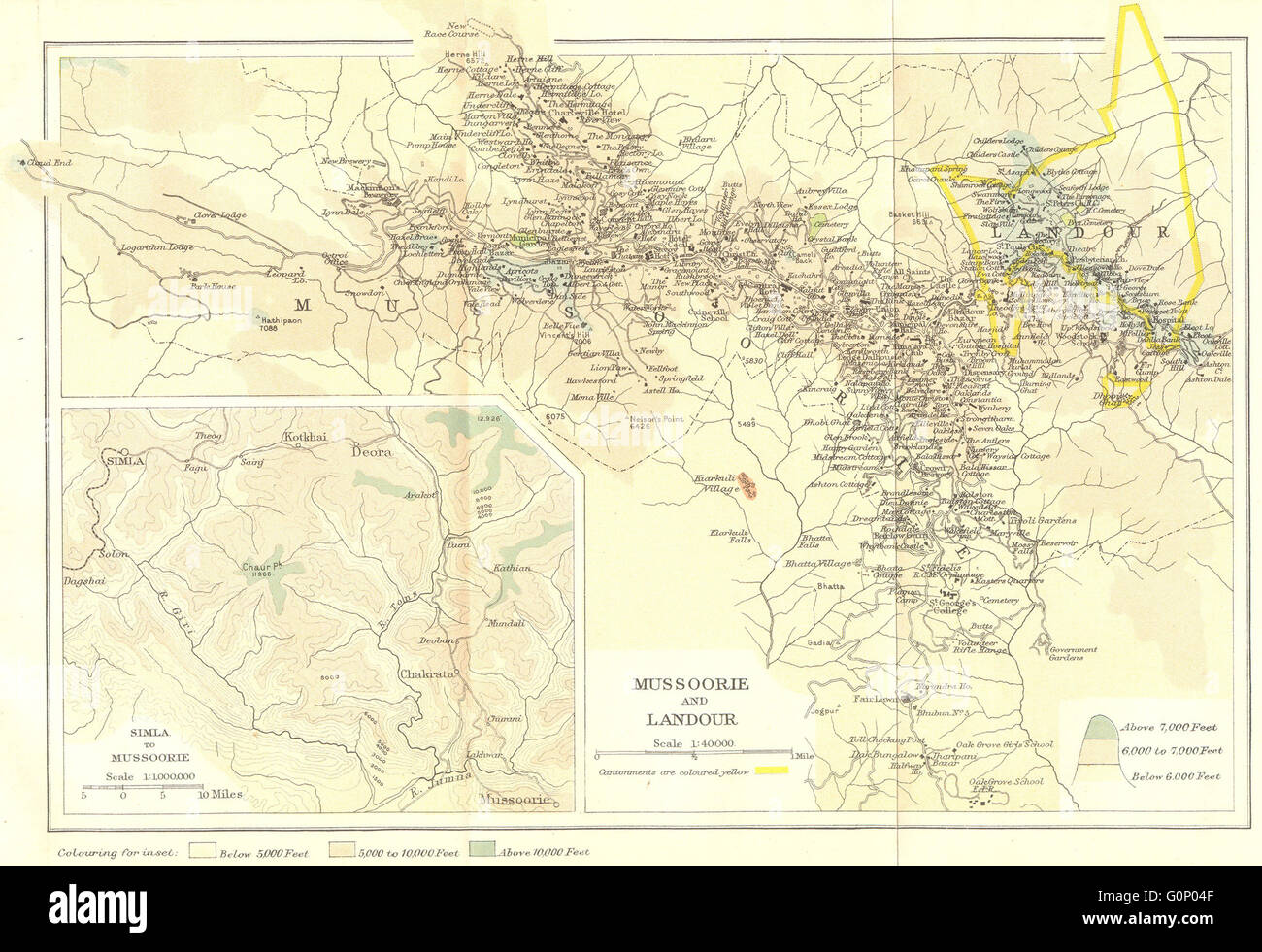 INDIA: Mussoorie hill station & Landour cantonment. Route to Simla., 1924 map Stock Photohttps://www.alamy.com/image-license-details/?v=1https://www.alamy.com/stock-photo-india-mussoorie-hill-station-landour-cantonment-route-to-simla-1924-103745279.html
RFG0P04F–INDIA: Mussoorie hill station & Landour cantonment. Route to Simla., 1924 map
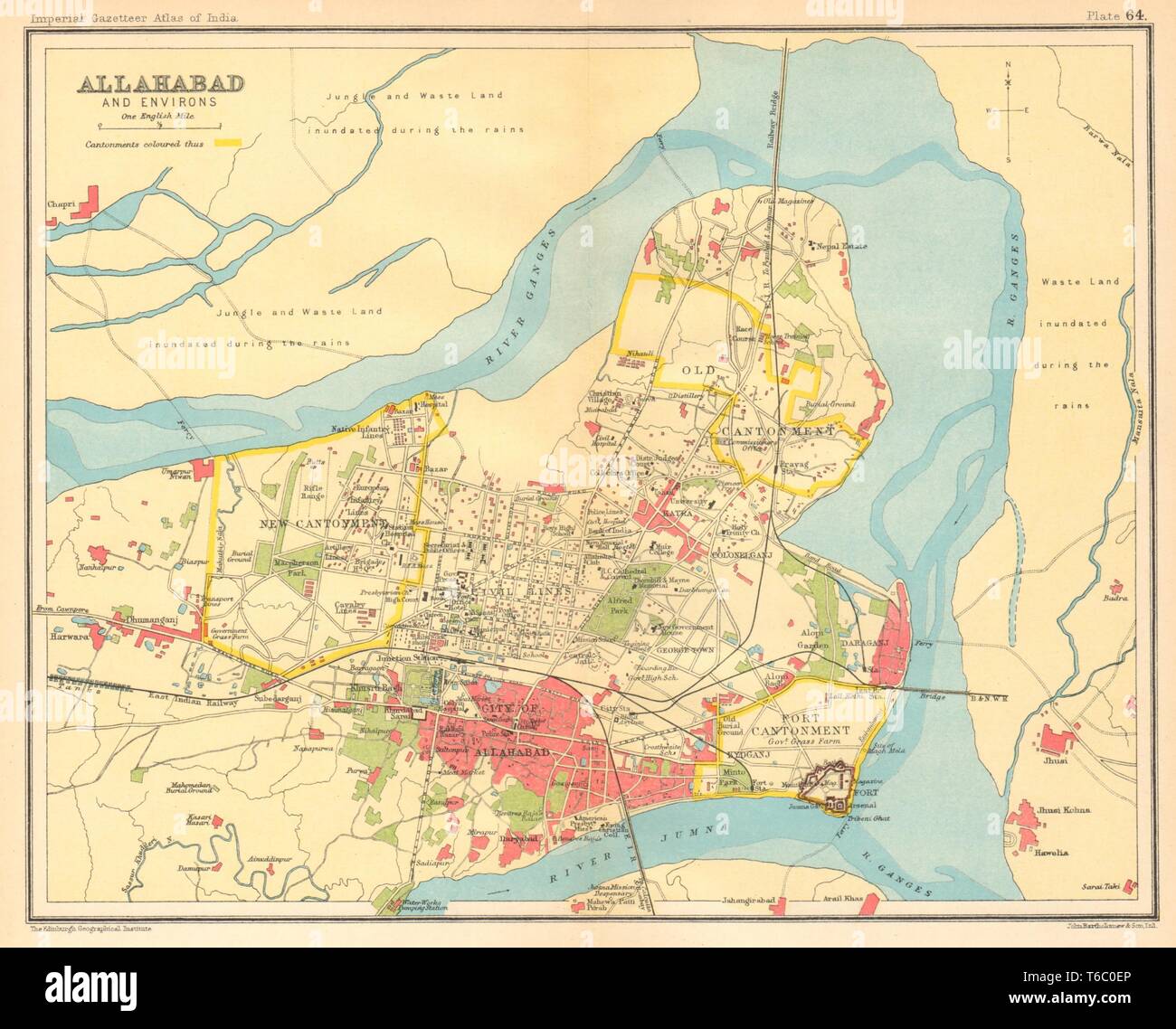 Allahabad / Prayagraj town city plan. Cantonment. British India 1931 old map Stock Photohttps://www.alamy.com/image-license-details/?v=1https://www.alamy.com/allahabad-prayagraj-town-city-plan-cantonment-british-india-1931-old-map-image244896926.html
RFT6C0EP–Allahabad / Prayagraj town city plan. Cantonment. British India 1931 old map
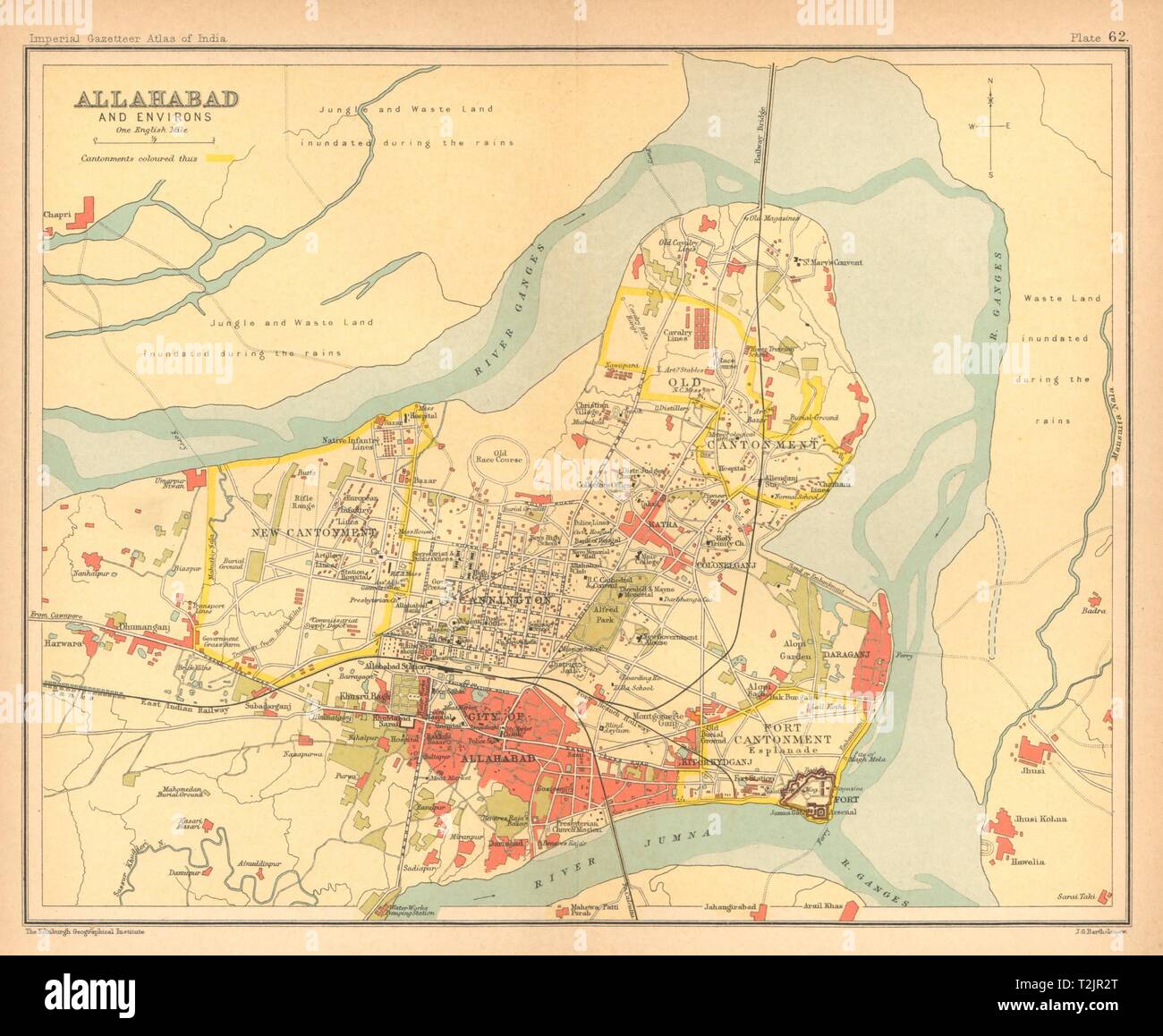 Allahabad/Prayagraj town city plan. Cantonment. British India 1909 old map Stock Photohttps://www.alamy.com/image-license-details/?v=1https://www.alamy.com/allahabadprayagraj-town-city-plan-cantonment-british-india-1909-old-map-image242587712.html
RFT2JR2T–Allahabad/Prayagraj town city plan. Cantonment. British India 1909 old map
 PAKISTAN. Karachi & environs city plan. Cantonment. British India, 1929 map Stock Photohttps://www.alamy.com/image-license-details/?v=1https://www.alamy.com/stock-photo-pakistan-karachi-environs-city-plan-cantonment-british-india-1929-106727052.html
RFG5HRCC–PAKISTAN. Karachi & environs city plan. Cantonment. British India, 1929 map
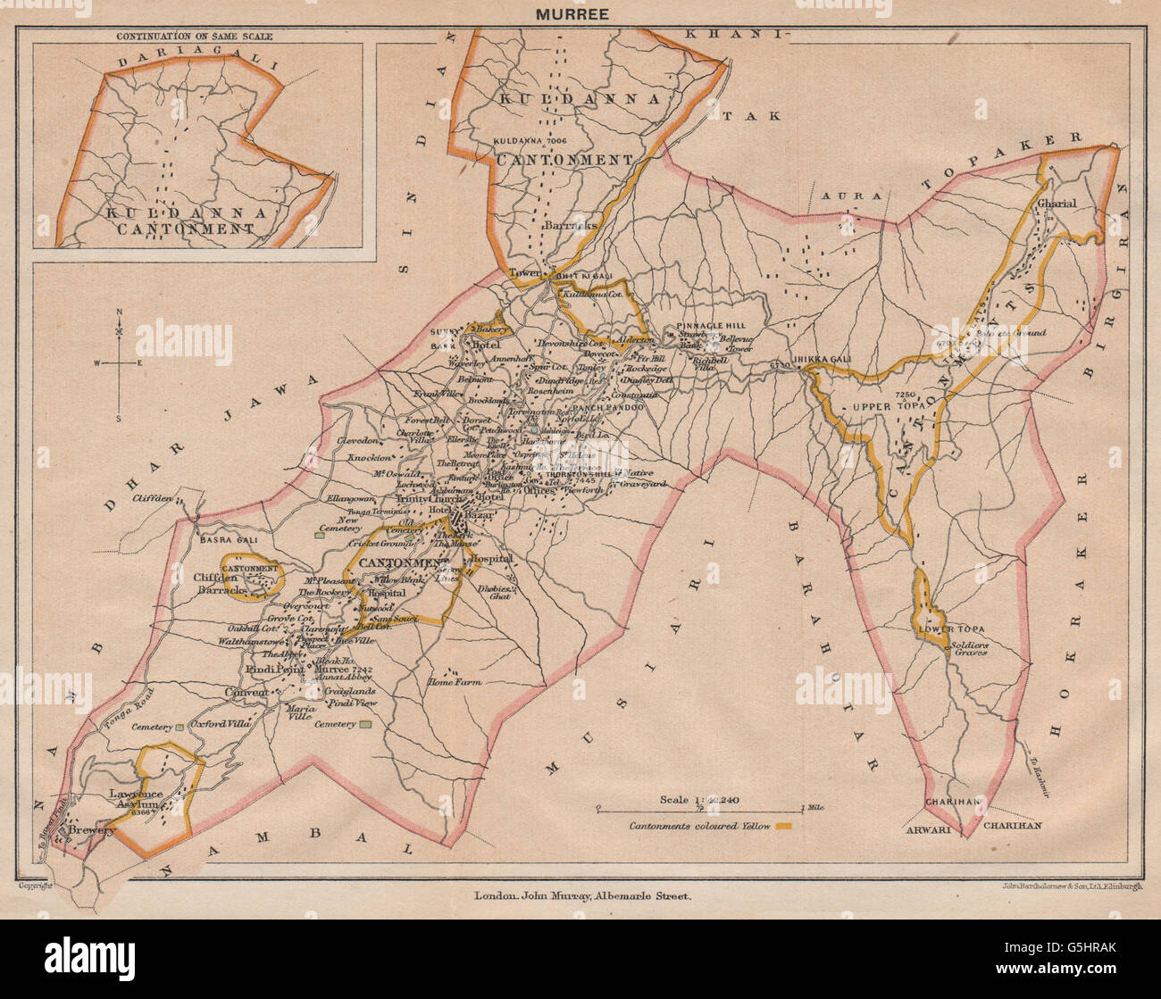 PAKISTAN. Murree Hill Station & Kuldanna Cantonment. British India, 1929 map Stock Photohttps://www.alamy.com/image-license-details/?v=1https://www.alamy.com/stock-photo-pakistan-murree-hill-station-kuldanna-cantonment-british-india-1929-106727003.html
RFG5HRAK–PAKISTAN. Murree Hill Station & Kuldanna Cantonment. British India, 1929 map
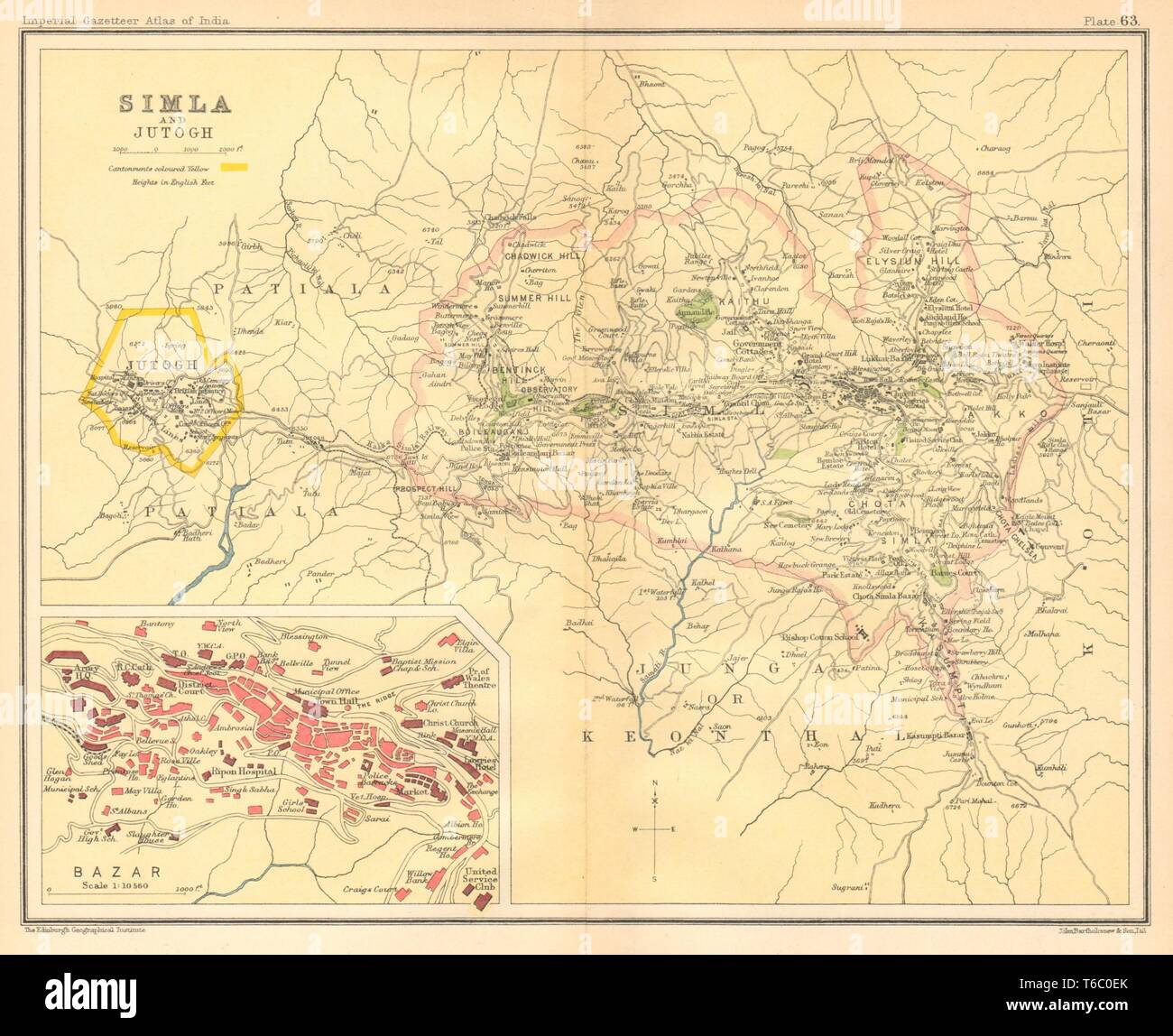 Simla / Shimla & Jutogh cantonment. Lakkar Bazaar. British India 1931 old map Stock Photohttps://www.alamy.com/image-license-details/?v=1https://www.alamy.com/simla-shimla-jutogh-cantonment-lakkar-bazaar-british-india-1931-old-map-image244896923.html
RFT6C0EK–Simla / Shimla & Jutogh cantonment. Lakkar Bazaar. British India 1931 old map
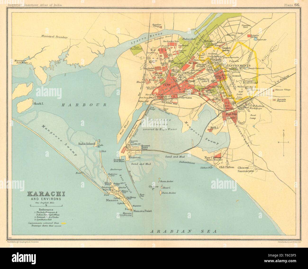 Karachi town city plan. Buildings & Cantonment. Pakistan. British India 1931 map Stock Photohttps://www.alamy.com/image-license-details/?v=1https://www.alamy.com/karachi-town-city-plan-buildings-cantonment-pakistan-british-india-1931-map-image244896937.html
RFT6C0F5–Karachi town city plan. Buildings & Cantonment. Pakistan. British India 1931 map
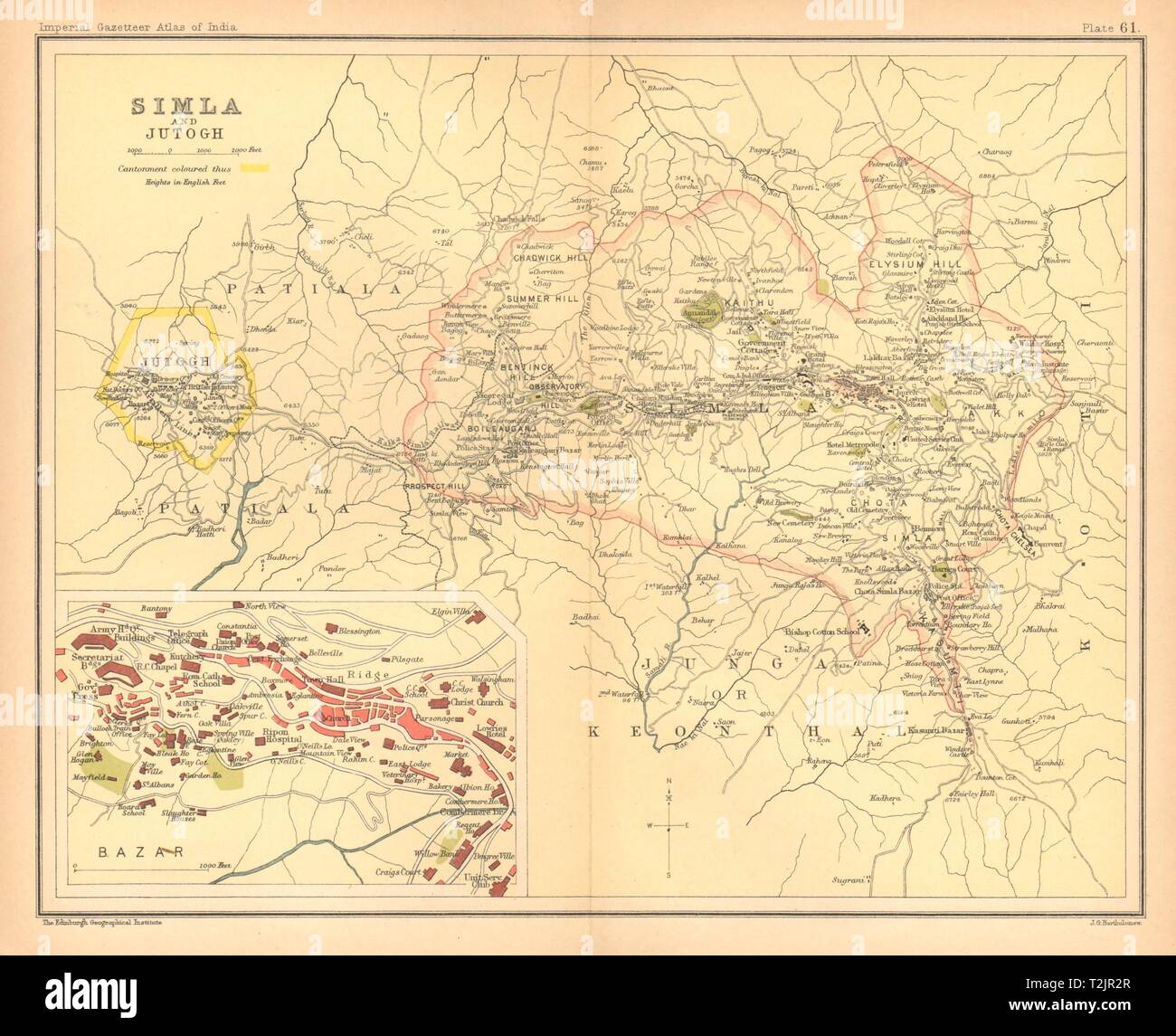 Simla/Shimla & Jutogh cantonment. Lakkar Bazaar. British India 1909 old map Stock Photohttps://www.alamy.com/image-license-details/?v=1https://www.alamy.com/simlashimla-jutogh-cantonment-lakkar-bazaar-british-india-1909-old-map-image242587711.html
RFT2JR2R–Simla/Shimla & Jutogh cantonment. Lakkar Bazaar. British India 1909 old map
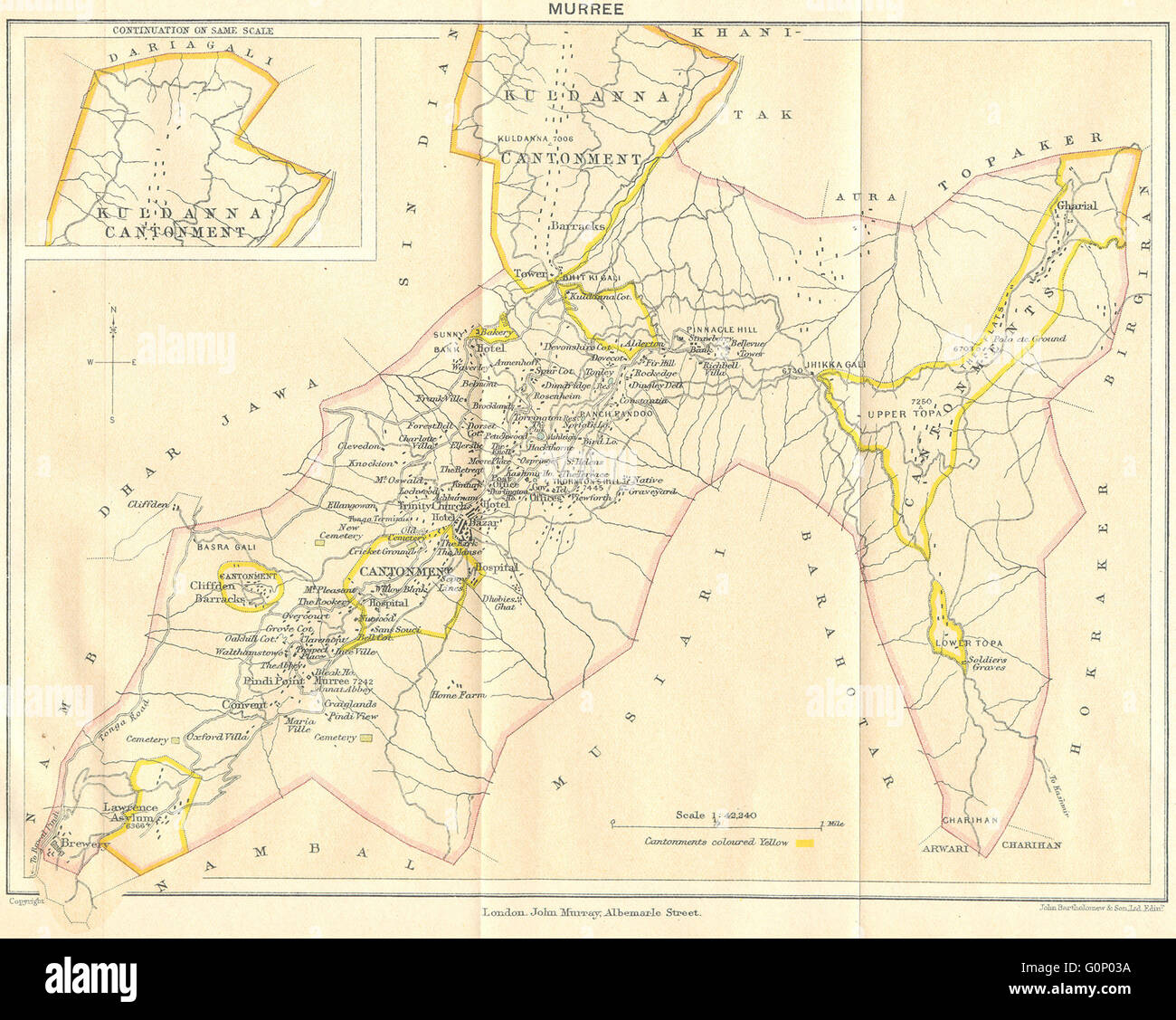 PAKISTAN: Murree Hill Station & Kuldanna Cantonment. British India, 1924 map Stock Photohttps://www.alamy.com/image-license-details/?v=1https://www.alamy.com/stock-photo-pakistan-murree-hill-station-kuldanna-cantonment-british-india-1924-103745246.html
RFG0P03A–PAKISTAN: Murree Hill Station & Kuldanna Cantonment. British India, 1924 map
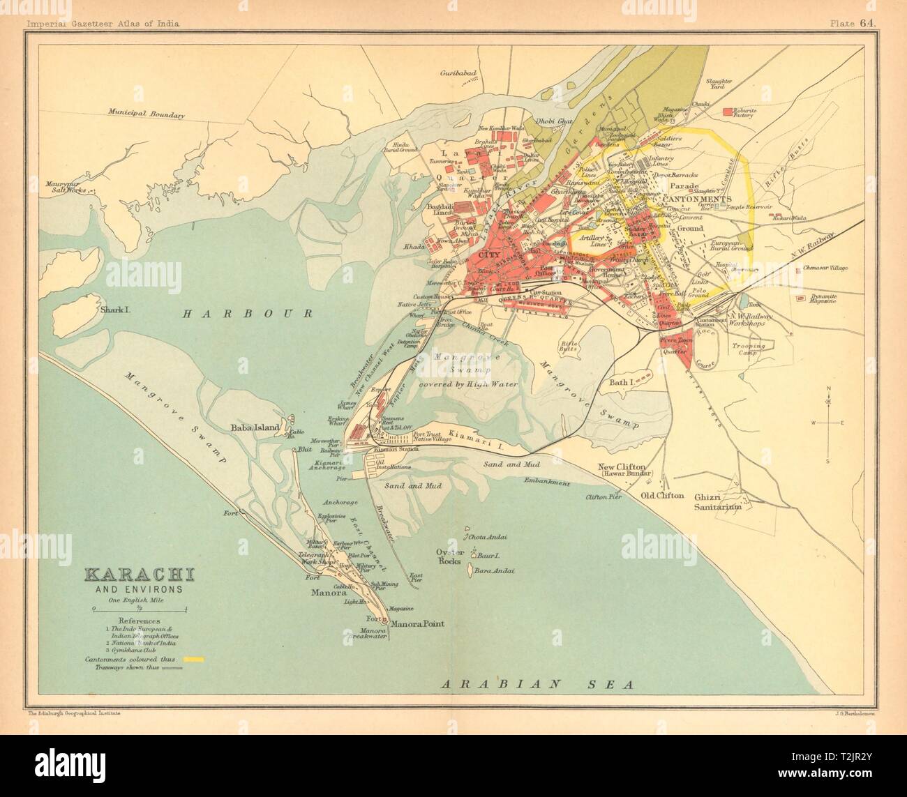 Karachi town city plan. Buildings & Cantonment. Pakistan. British India 1909 map Stock Photohttps://www.alamy.com/image-license-details/?v=1https://www.alamy.com/karachi-town-city-plan-buildings-cantonment-pakistan-british-india-1909-map-image242587715.html
RFT2JR2Y–Karachi town city plan. Buildings & Cantonment. Pakistan. British India 1909 map
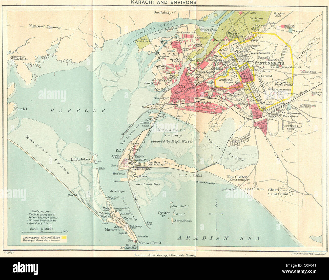 PAKISTAN: Karachi & environs city plan. Cantonment. British India, 1924 map Stock Photohttps://www.alamy.com/image-license-details/?v=1https://www.alamy.com/stock-photo-pakistan-karachi-environs-city-plan-cantonment-british-india-1924-103745265.html
RFG0P041–PAKISTAN: Karachi & environs city plan. Cantonment. British India, 1924 map
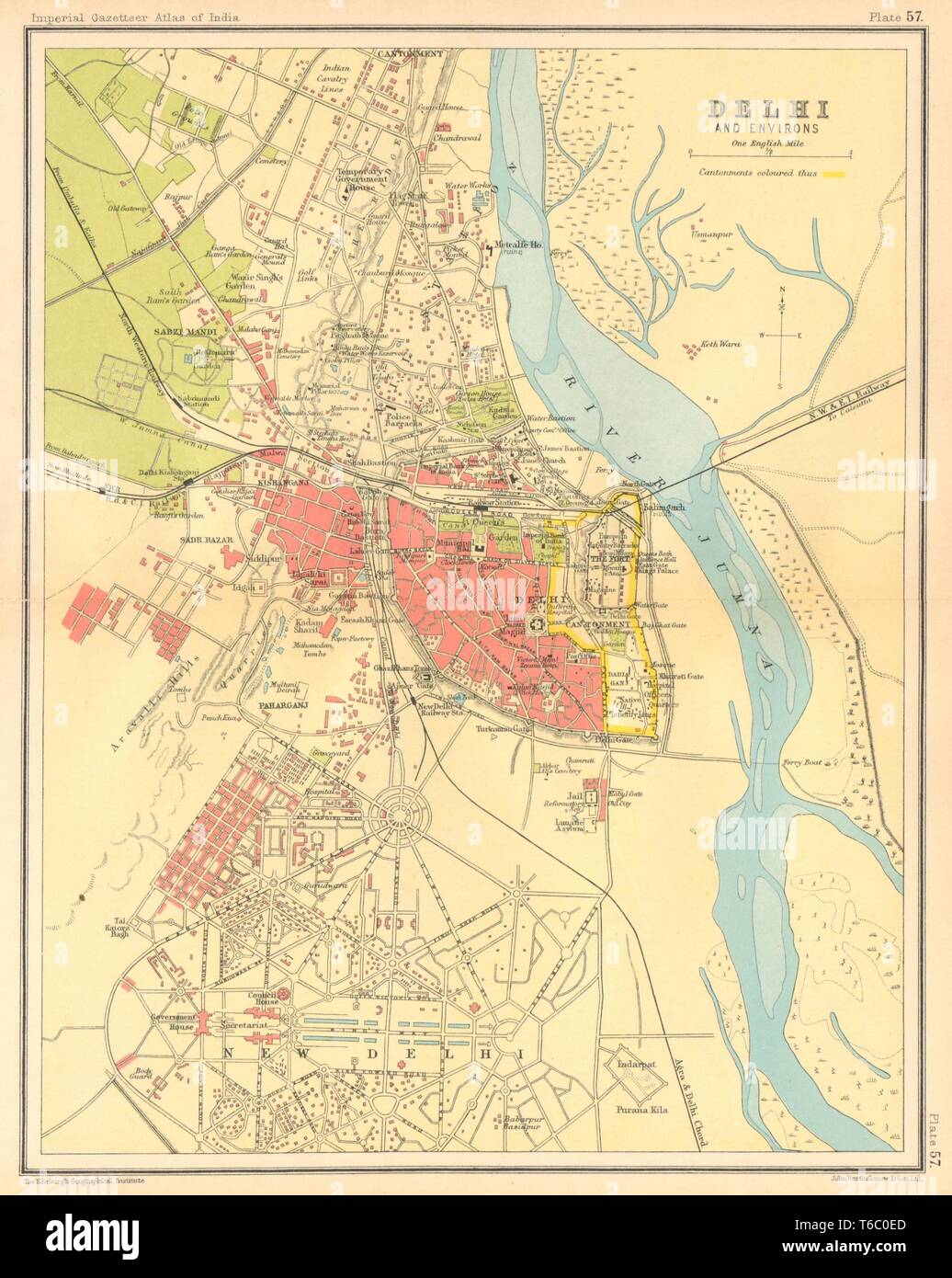 Delhi town city plan. Key buildings & Cantonment. British India 1931 old map Stock Photohttps://www.alamy.com/image-license-details/?v=1https://www.alamy.com/delhi-town-city-plan-key-buildings-cantonment-british-india-1931-old-map-image244896917.html
RFT6C0ED–Delhi town city plan. Key buildings & Cantonment. British India 1931 old map
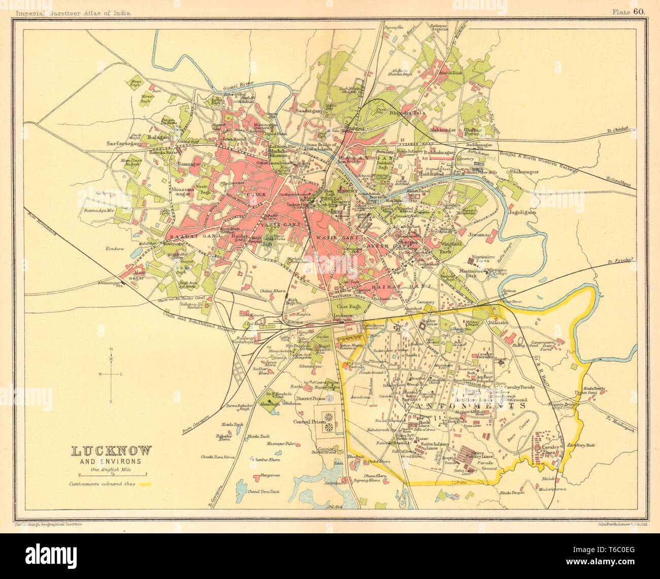 Lucknow town city plan. Cantonment & key buildings. British India 1931 old map Stock Photohttps://www.alamy.com/image-license-details/?v=1https://www.alamy.com/lucknow-town-city-plan-cantonment-key-buildings-british-india-1931-old-map-image244896920.html
RFT6C0EG–Lucknow town city plan. Cantonment & key buildings. British India 1931 old map
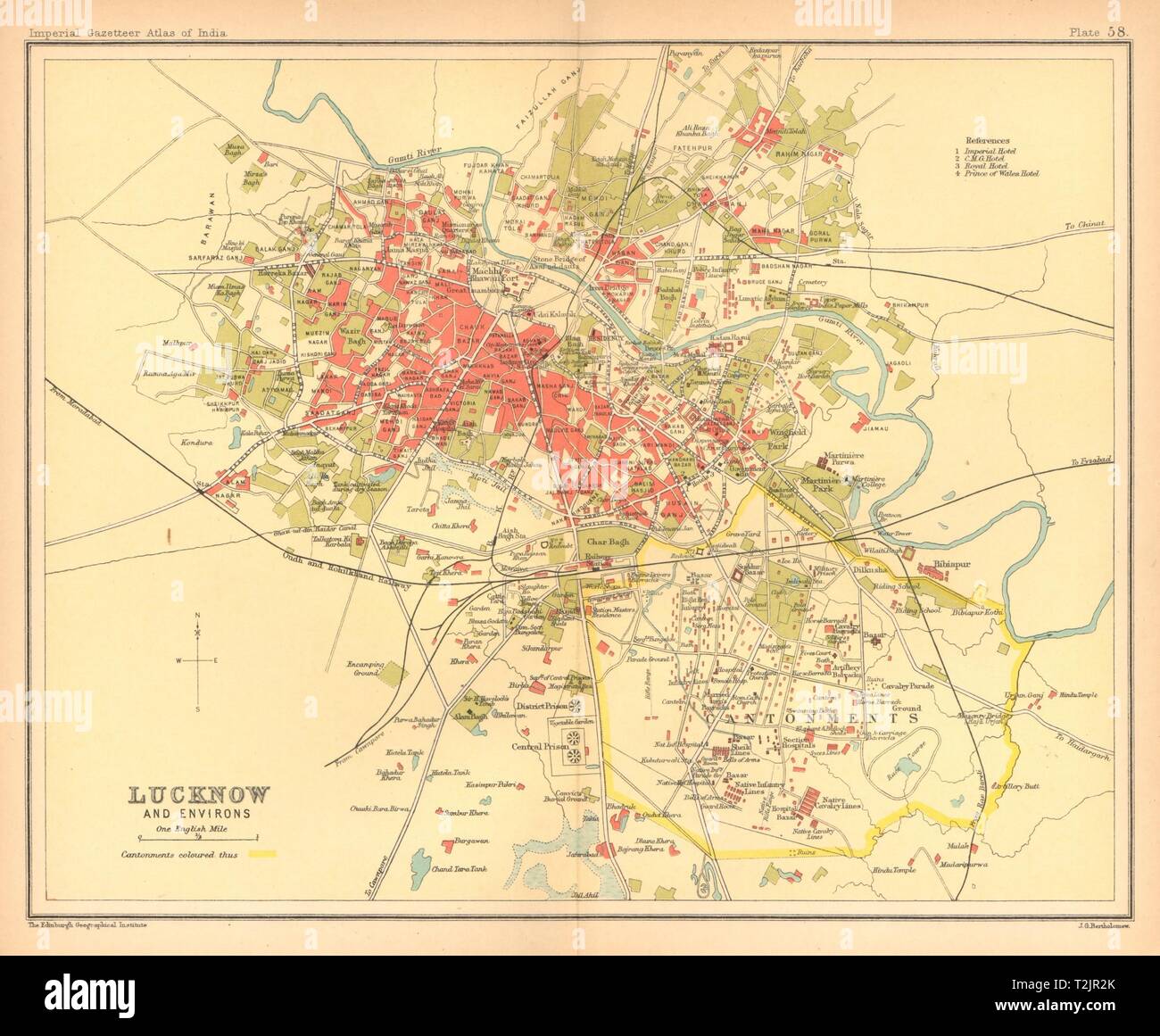 Lucknow town city plan. Cantonment & key buildings. British India 1909 old map Stock Photohttps://www.alamy.com/image-license-details/?v=1https://www.alamy.com/lucknow-town-city-plan-cantonment-key-buildings-british-india-1909-old-map-image242587707.html
RFT2JR2K–Lucknow town city plan. Cantonment & key buildings. British India 1909 old map
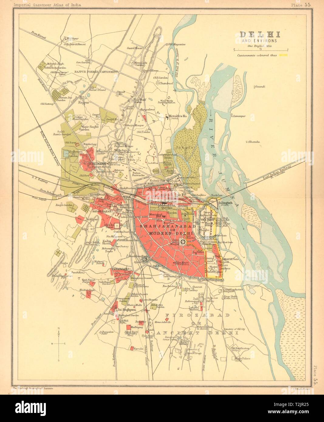 Delhi town city plan. Key buildings & Cantonment. British India 1909 old map Stock Photohttps://www.alamy.com/image-license-details/?v=1https://www.alamy.com/delhi-town-city-plan-key-buildings-cantonment-british-india-1909-old-map-image242587693.html
RFT2JR25–Delhi town city plan. Key buildings & Cantonment. British India 1909 old map
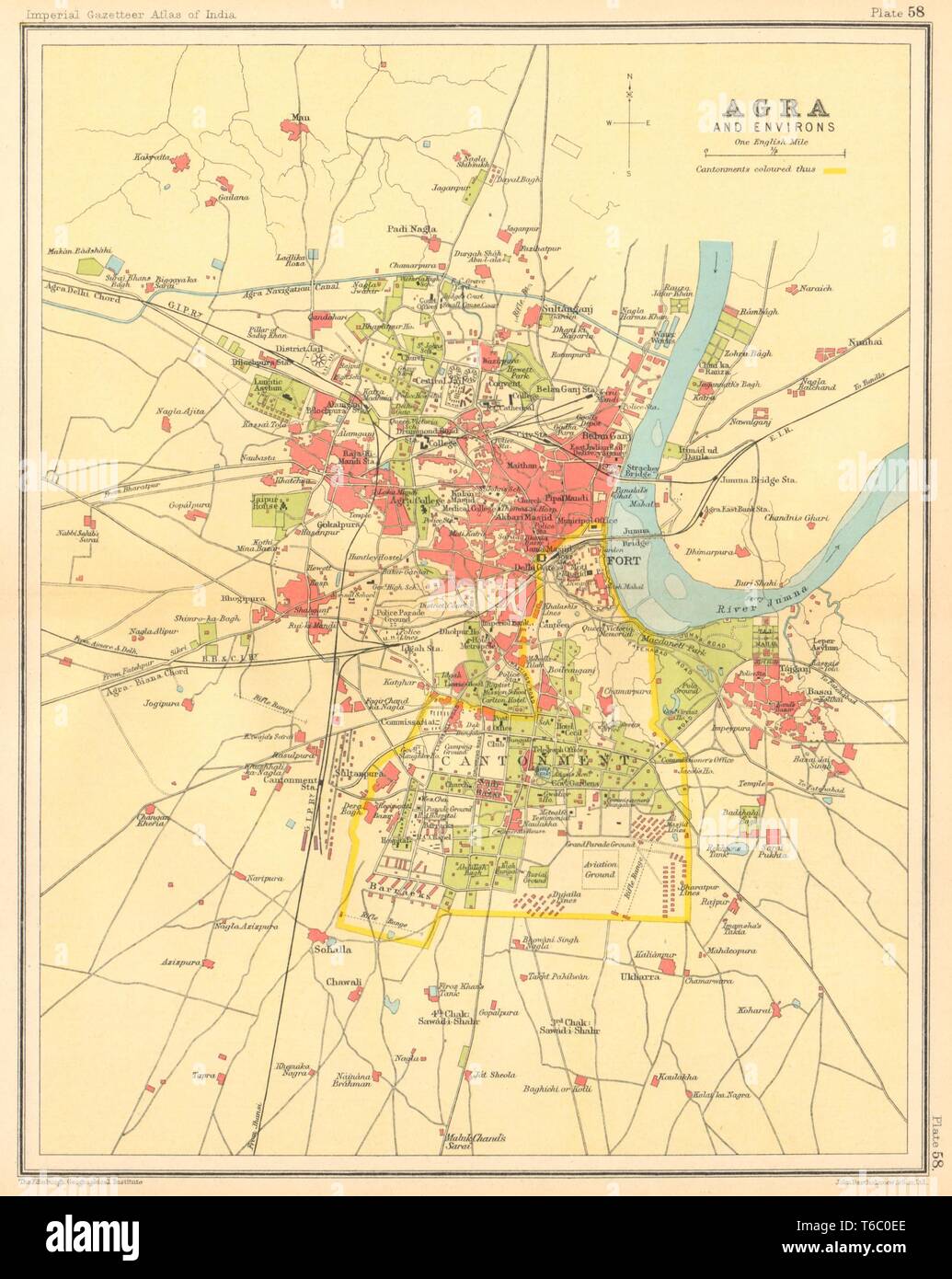 Agra town city plan. Cantonment, Fort & Taj Mahal. British India 1931 old map Stock Photohttps://www.alamy.com/image-license-details/?v=1https://www.alamy.com/agra-town-city-plan-cantonment-fort-taj-mahal-british-india-1931-old-map-image244896918.html
RFT6C0EE–Agra town city plan. Cantonment, Fort & Taj Mahal. British India 1931 old map
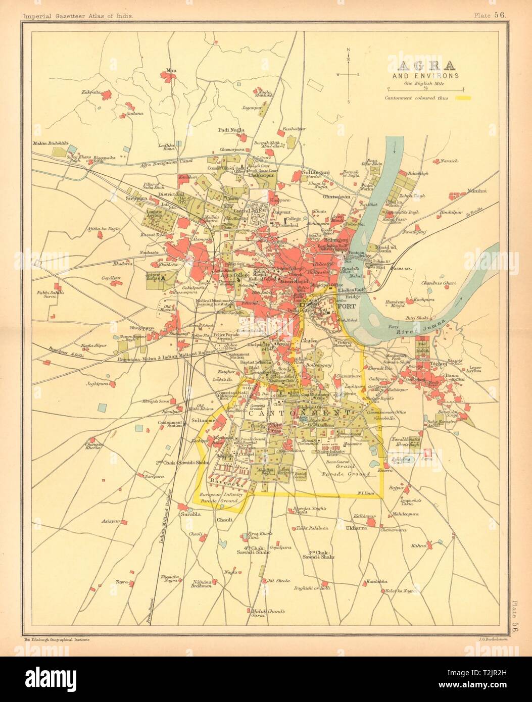 Agra town city plan. Cantonment, Fort & Taj Mahal. British India 1909 old map Stock Photohttps://www.alamy.com/image-license-details/?v=1https://www.alamy.com/agra-town-city-plan-cantonment-fort-taj-mahal-british-india-1909-old-map-image242587705.html
RFT2JR2H–Agra town city plan. Cantonment, Fort & Taj Mahal. British India 1909 old map
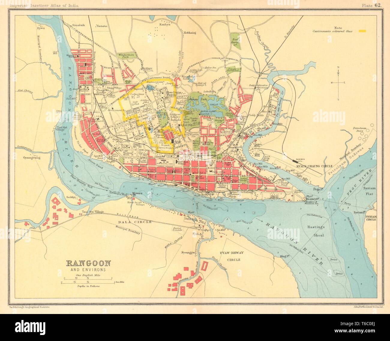 Rangoon / Yangon town city plan. Myanmar. Cantonment. British Burma 1931 map Stock Photohttps://www.alamy.com/image-license-details/?v=1https://www.alamy.com/rangoon-yangon-town-city-plan-myanmar-cantonment-british-burma-1931-map-image244896922.html
RFT6C0EJ–Rangoon / Yangon town city plan. Myanmar. Cantonment. British Burma 1931 map
 BRITISH BURMA. Rangoon (Yangon) city plan. Myanmar. Cantonment, 1929 old map Stock Photohttps://www.alamy.com/image-license-details/?v=1https://www.alamy.com/stock-photo-british-burma-rangoon-yangon-city-plan-myanmar-cantonment-1929-old-111052518.html
RFGCJTHA–BRITISH BURMA. Rangoon (Yangon) city plan. Myanmar. Cantonment, 1929 old map
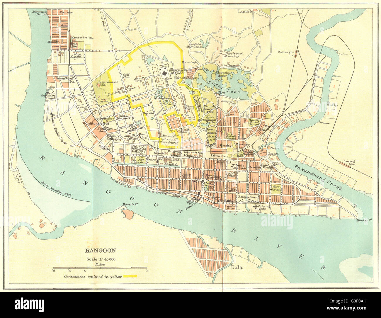 BRITISH BURMA: Rangoon (Yangon) city plan. Myanmar. Cantonment, 1924 old map Stock Photohttps://www.alamy.com/image-license-details/?v=1https://www.alamy.com/stock-photo-british-burma-rangoon-yangon-city-plan-myanmar-cantonment-1924-old-103745449.html
RFG0P0AH–BRITISH BURMA: Rangoon (Yangon) city plan. Myanmar. Cantonment, 1924 old map
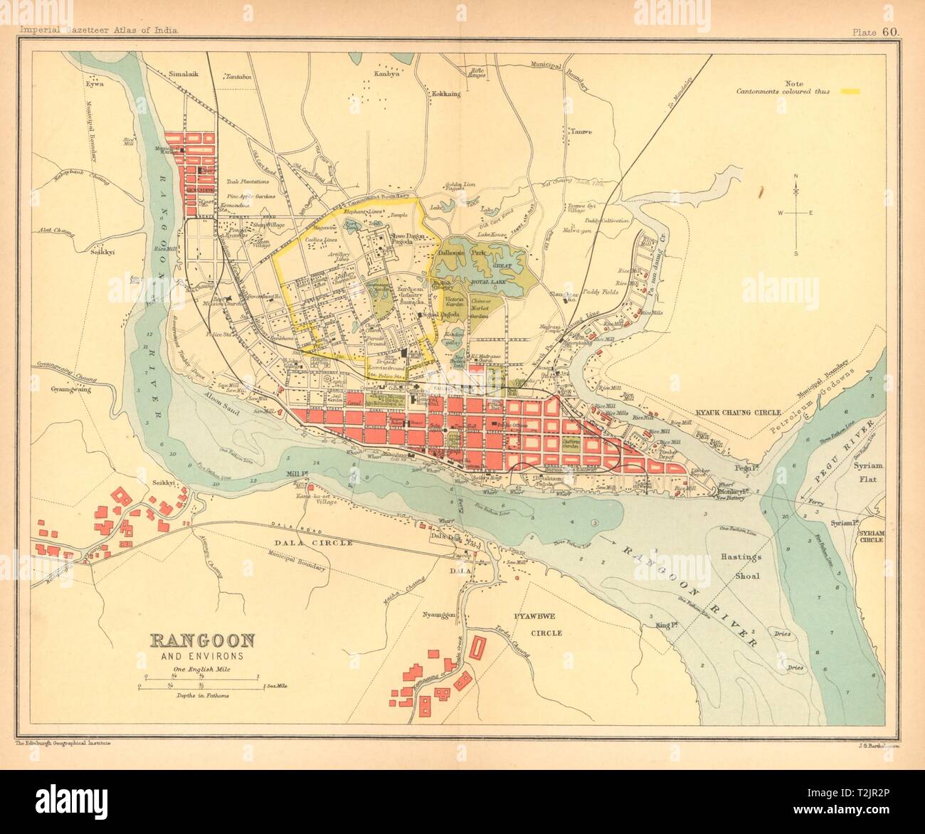 Rangoon/Yangon town city plan. Myanmar. Cantonment. British Burma 1909 old map Stock Photohttps://www.alamy.com/image-license-details/?v=1https://www.alamy.com/rangoonyangon-town-city-plan-myanmar-cantonment-british-burma-1909-old-map-image242587710.html
RFT2JR2P–Rangoon/Yangon town city plan. Myanmar. Cantonment. British Burma 1909 old map
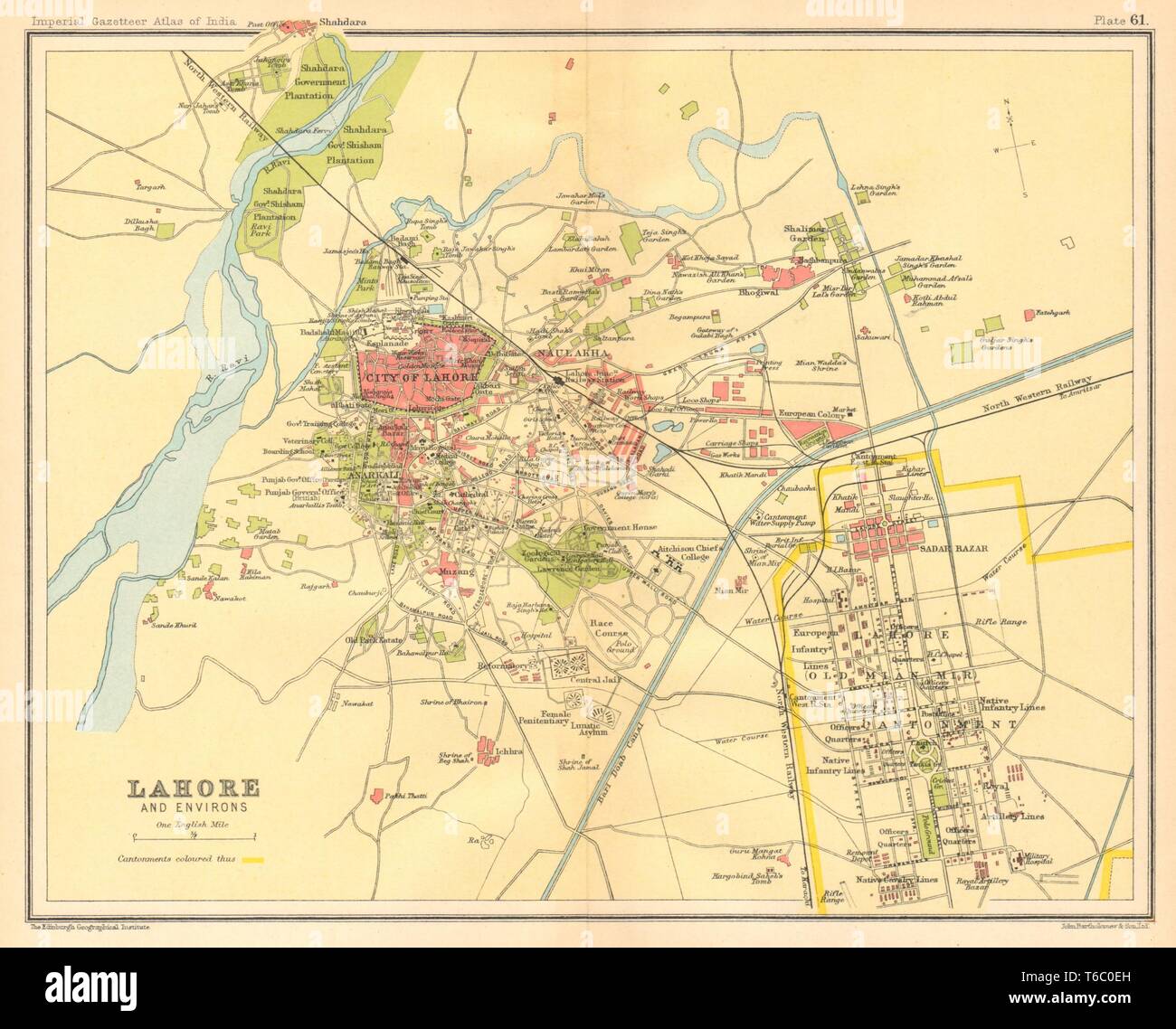 Lahore town city plan. Cantonment Key buildings. British India/Pakistan 1931 map Stock Photohttps://www.alamy.com/image-license-details/?v=1https://www.alamy.com/lahore-town-city-plan-cantonment-key-buildings-british-indiapakistan-1931-map-image244896921.html
RFT6C0EH–Lahore town city plan. Cantonment Key buildings. British India/Pakistan 1931 map
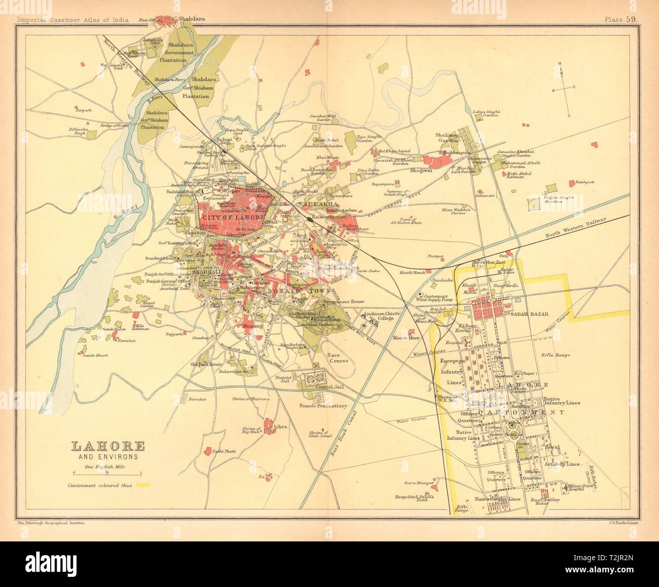 Lahore town city plan. Cantonment Key buildings. British India/Pakistan 1909 map Stock Photohttps://www.alamy.com/image-license-details/?v=1https://www.alamy.com/lahore-town-city-plan-cantonment-key-buildings-british-indiapakistan-1909-map-image242587709.html
RFT2JR2N–Lahore town city plan. Cantonment Key buildings. British India/Pakistan 1909 map
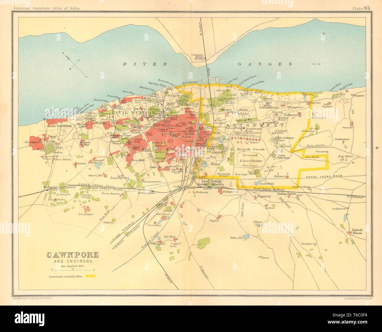 Cawnpore/Kanpur town city plan. Key buildings Cantonment. British India 1931 map Stock Photohttps://www.alamy.com/image-license-details/?v=1https://www.alamy.com/cawnporekanpur-town-city-plan-key-buildings-cantonment-british-india-1931-map-image244896936.html
RFT6C0F4–Cawnpore/Kanpur town city plan. Key buildings Cantonment. British India 1931 map
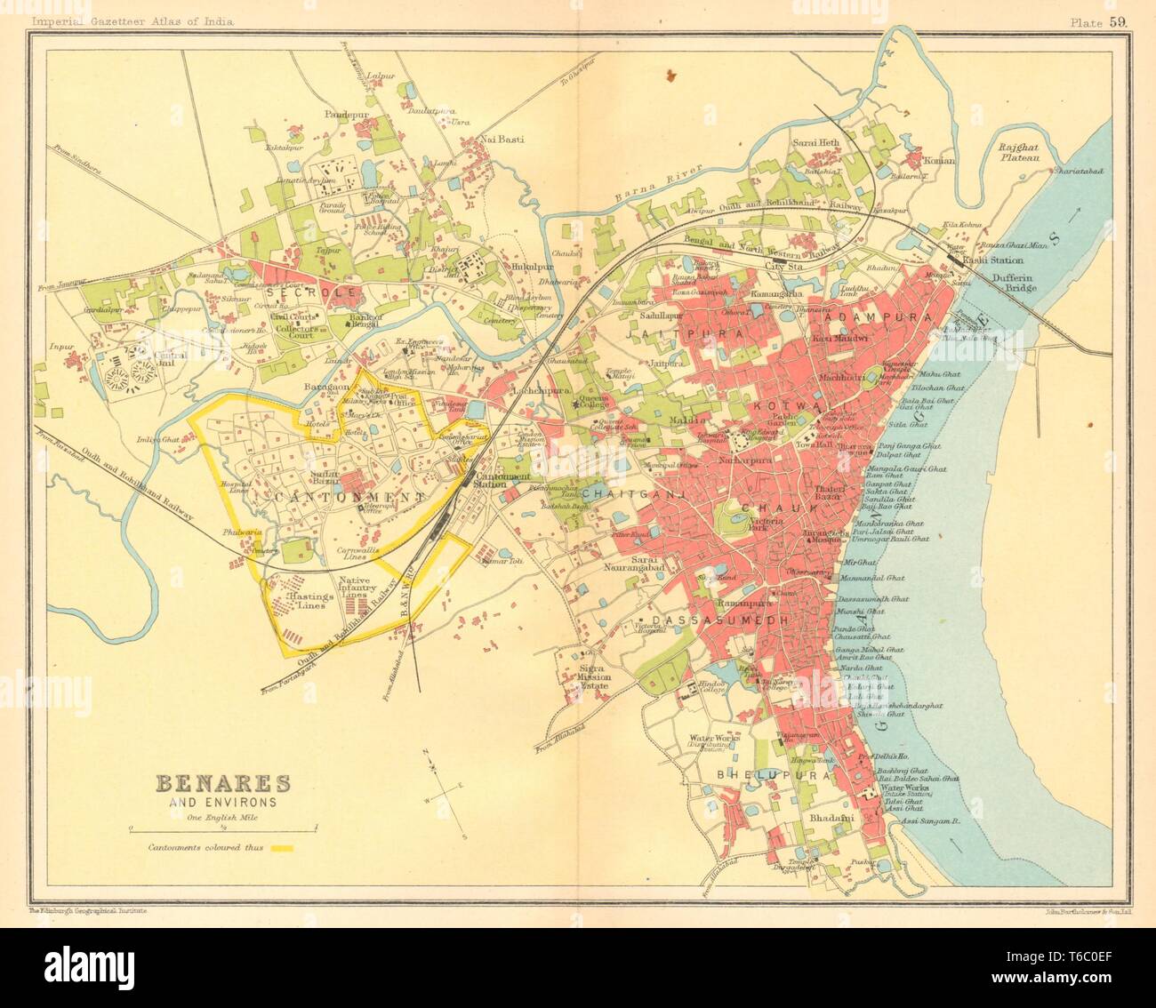 Benares/Varanasi town city plan. Ganges Ghats cantonment. British India 1931 map Stock Photohttps://www.alamy.com/image-license-details/?v=1https://www.alamy.com/benaresvaranasi-town-city-plan-ganges-ghats-cantonment-british-india-1931-map-image244896919.html
RFT6C0EF–Benares/Varanasi town city plan. Ganges Ghats cantonment. British India 1931 map