Quick filters:
Cabot map Stock Photos and Images
 Lower Cabot, Washington County, US, United States, Vermont, N 44 23' 25'', S 72 19' 57'', map, Cartascapes Map published in 2024. Explore Cartascapes, a map revealing Earth's diverse landscapes, cultures, and ecosystems. Journey through time and space, discovering the interconnectedness of our planet's past, present, and future. Stock Photohttps://www.alamy.com/image-license-details/?v=1https://www.alamy.com/lower-cabot-washington-county-us-united-states-vermont-n-44-23-25-s-72-19-57-map-cartascapes-map-published-in-2024-explore-cartascapes-a-map-revealing-earths-diverse-landscapes-cultures-and-ecosystems-journey-through-time-and-space-discovering-the-interconnectedness-of-our-planets-past-present-and-future-image621410506.html
RM2Y2YKCA–Lower Cabot, Washington County, US, United States, Vermont, N 44 23' 25'', S 72 19' 57'', map, Cartascapes Map published in 2024. Explore Cartascapes, a map revealing Earth's diverse landscapes, cultures, and ecosystems. Journey through time and space, discovering the interconnectedness of our planet's past, present, and future.
 History of the United States . terior ofthe North American continent that were similar to those already 2 The name of Cabot has never been given a place upon the map of America.Cabot is the greatest of the pioneer seamen who is not so honored. HenryHarrisse, the compiler of voluminous reports from the original records of theearliest explorers, maintains that Cabot soon reached the conclusion that thenew land was distinct from Asia. Cf. The Discovery of North America,Book V, chapter 4. 6 DISCOVERY AND EXPLORATION exploited by his countrymen in the south. Impelled, therefore, byhis desire for ga Stock Photohttps://www.alamy.com/image-license-details/?v=1https://www.alamy.com/history-of-the-united-states-terior-ofthe-north-american-continent-that-were-similar-to-those-already-2-the-name-of-cabot-has-never-been-given-a-place-upon-the-map-of-americacabot-is-the-greatest-of-the-pioneer-seamen-who-is-not-so-honored-henryharrisse-the-compiler-of-voluminous-reports-from-the-original-records-of-theearliest-explorers-maintains-that-cabot-soon-reached-the-conclusion-that-thenew-land-was-distinct-from-asia-cf-the-discovery-of-north-americabook-v-chapter-4-6-discovery-and-exploration-exploited-by-his-countrymen-in-the-south-impelled-therefore-byhis-desire-for-ga-image339388818.html
RM2AM4DW6–History of the United States . terior ofthe North American continent that were similar to those already 2 The name of Cabot has never been given a place upon the map of America.Cabot is the greatest of the pioneer seamen who is not so honored. HenryHarrisse, the compiler of voluminous reports from the original records of theearliest explorers, maintains that Cabot soon reached the conclusion that thenew land was distinct from Asia. Cf. The Discovery of North America,Book V, chapter 4. 6 DISCOVERY AND EXPLORATION exploited by his countrymen in the south. Impelled, therefore, byhis desire for ga
 Information sign on the Trans Canada trail T'Railway on Water Street in St. John's, Newfoundland & Labrador, Canada Stock Photohttps://www.alamy.com/image-license-details/?v=1https://www.alamy.com/information-sign-on-the-trans-canada-trail-trailway-on-water-street-in-st-johns-newfoundland-labrador-canada-image624334157.html
RF2Y7MTGD–Information sign on the Trans Canada trail T'Railway on Water Street in St. John's, Newfoundland & Labrador, Canada
 Newfoundland centred world sign at Signal Hill National Historic Site in St. John's, Newfoundland & Labrador, Canada Stock Photohttps://www.alamy.com/image-license-details/?v=1https://www.alamy.com/newfoundland-centred-world-sign-at-signal-hill-national-historic-site-in-st-johns-newfoundland-labrador-canada-image623835510.html
RF2Y6X4FJ–Newfoundland centred world sign at Signal Hill National Historic Site in St. John's, Newfoundland & Labrador, Canada
 Image taken from page 68 of 'John and Sebastian Cabot. A study ... Reprinted from the Narrative and Critical History of America, etc' Image taken from page 68 of 'John and Sebastian Cabot Stock Photohttps://www.alamy.com/image-license-details/?v=1https://www.alamy.com/stock-photo-image-taken-from-page-68-of-john-and-sebastian-cabot-a-study-reprinted-86537418.html
RMF0P3A2–Image taken from page 68 of 'John and Sebastian Cabot. A study ... Reprinted from the Narrative and Critical History of America, etc' Image taken from page 68 of 'John and Sebastian Cabot
 George Cabot Stock Photohttps://www.alamy.com/image-license-details/?v=1https://www.alamy.com/stock-photo-george-cabot-139862915.html
RMJ3F8G3–George Cabot
 Dry Dock 4, Progress Map for April, Holbrook, Cabot and Rollins Corporation, Contractors. Glass Plate Negatives of the Construction and Repair of Buildings, Facilities, and Vessels at the New York Navy Yard. Stock Photohttps://www.alamy.com/image-license-details/?v=1https://www.alamy.com/dry-dock-4-progress-map-for-april-holbrook-cabot-and-rollins-corporation-contractors-glass-plate-negatives-of-the-construction-and-repair-of-buildings-facilities-and-vessels-at-the-new-york-navy-yard-image556371329.html
RM2R94W8H–Dry Dock 4, Progress Map for April, Holbrook, Cabot and Rollins Corporation, Contractors. Glass Plate Negatives of the Construction and Repair of Buildings, Facilities, and Vessels at the New York Navy Yard.
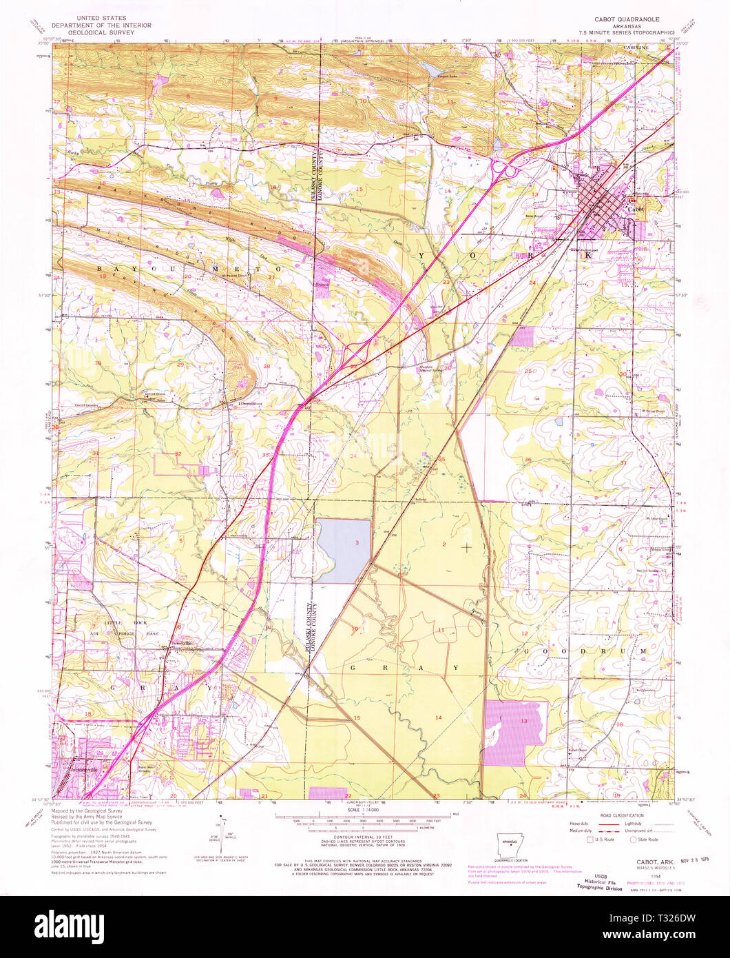 USGS TOPO Map Arkansas AR Cabot 258098 1954 24000 Restoration Stock Photohttps://www.alamy.com/image-license-details/?v=1https://www.alamy.com/usgs-topo-map-arkansas-ar-cabot-258098-1954-24000-restoration-image242838117.html
RMT326DW–USGS TOPO Map Arkansas AR Cabot 258098 1954 24000 Restoration
 Lonoke County, Arkansas (U.S. county, United States of America,USA, U.S., US) map vector illustration, scribble sketch Lonoke map Stock Vectorhttps://www.alamy.com/image-license-details/?v=1https://www.alamy.com/lonoke-county-arkansas-us-county-united-states-of-americausa-us-us-map-vector-illustration-scribble-sketch-lonoke-map-image341851650.html
RF2AT4K7E–Lonoke County, Arkansas (U.S. county, United States of America,USA, U.S., US) map vector illustration, scribble sketch Lonoke map
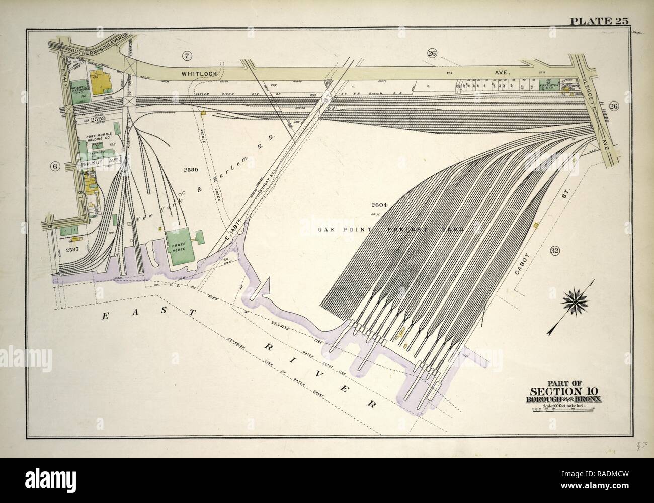 Plate 25, Part of Section 10, Borough of the Bronx. Bounded by E. 141st Street, Whitlock Avenue, Leggett Avenue reimagined Stock Photohttps://www.alamy.com/image-license-details/?v=1https://www.alamy.com/plate-25-part-of-section-10-borough-of-the-bronx-bounded-by-e-141st-street-whitlock-avenue-leggett-avenue-reimagined-image230182761.html
RFRADMCW–Plate 25, Part of Section 10, Borough of the Bronx. Bounded by E. 141st Street, Whitlock Avenue, Leggett Avenue reimagined
 Camp Cabot, Middlesex County, US, United States, Massachusetts, N 42 24' 0'', S 71 13' 55'', map, Cartascapes Map published in 2024. Explore Cartascapes, a map revealing Earth's diverse landscapes, cultures, and ecosystems. Journey through time and space, discovering the interconnectedness of our planet's past, present, and future. Stock Photohttps://www.alamy.com/image-license-details/?v=1https://www.alamy.com/camp-cabot-middlesex-county-us-united-states-massachusetts-n-42-24-0-s-71-13-55-map-cartascapes-map-published-in-2024-explore-cartascapes-a-map-revealing-earths-diverse-landscapes-cultures-and-ecosystems-journey-through-time-and-space-discovering-the-interconnectedness-of-our-planets-past-present-and-future-image621460257.html
RM2Y31XW5–Camp Cabot, Middlesex County, US, United States, Massachusetts, N 42 24' 0'', S 71 13' 55'', map, Cartascapes Map published in 2024. Explore Cartascapes, a map revealing Earth's diverse landscapes, cultures, and ecosystems. Journey through time and space, discovering the interconnectedness of our planet's past, present, and future.
 The North Carolina Presbyterian . ury.—Contents: A Crtlise onthe Norfolk Broads; The Tide of thePast; Fun on the Stump (humors ofpolitical campaigns in Kentucky); Song,by Lilla Cabot Perry; Theodosia Burr(the wreckers story); Glaves Career,with portrait and map of Glaves routeacross Africa; Glory, by Richard WatsonGilder; The Rivalries of Long and ShortCodiac; An Earlier Manner; Casa Brac-cio (conclusion); Keats in^iHampBtead;The Influence of Keats; Uarrold; Lifein the Tuilleries Under the Second Em-pire; Sonnys Schooling (page 2); Nor-dans Degeneration: Its Value and itsErrors; How Men Become Stock Photohttps://www.alamy.com/image-license-details/?v=1https://www.alamy.com/the-north-carolina-presbyterian-urycontents-a-crtlise-onthe-norfolk-broads-the-tide-of-thepast-fun-on-the-stump-humors-ofpolitical-campaigns-in-kentucky-songby-lilla-cabot-perry-theodosia-burrthe-wreckers-story-glaves-careerwith-portrait-and-map-of-glaves-routeacross-africa-glory-by-richard-watsongilder-the-rivalries-of-long-and-shortcodiac-an-earlier-manner-casa-brac-cio-conclusion-keats-inihampbteadthe-influence-of-keats-uarrold-lifein-the-tuilleries-under-the-second-em-pire-sonnys-schooling-page-2-nor-dans-degeneration-its-value-and-itserrors-how-men-become-image339218499.html
RM2AKTMJB–The North Carolina Presbyterian . ury.—Contents: A Crtlise onthe Norfolk Broads; The Tide of thePast; Fun on the Stump (humors ofpolitical campaigns in Kentucky); Song,by Lilla Cabot Perry; Theodosia Burr(the wreckers story); Glaves Career,with portrait and map of Glaves routeacross Africa; Glory, by Richard WatsonGilder; The Rivalries of Long and ShortCodiac; An Earlier Manner; Casa Brac-cio (conclusion); Keats in^iHampBtead;The Influence of Keats; Uarrold; Lifein the Tuilleries Under the Second Em-pire; Sonnys Schooling (page 2); Nor-dans Degeneration: Its Value and itsErrors; How Men Become
 Newfoundland centred world sign at Signal Hill National Historic Site in St. John's, Newfoundland & Labrador, Canada Stock Photohttps://www.alamy.com/image-license-details/?v=1https://www.alamy.com/newfoundland-centred-world-sign-at-signal-hill-national-historic-site-in-st-johns-newfoundland-labrador-canada-image623835508.html
RF2Y6X4FG–Newfoundland centred world sign at Signal Hill National Historic Site in St. John's, Newfoundland & Labrador, Canada
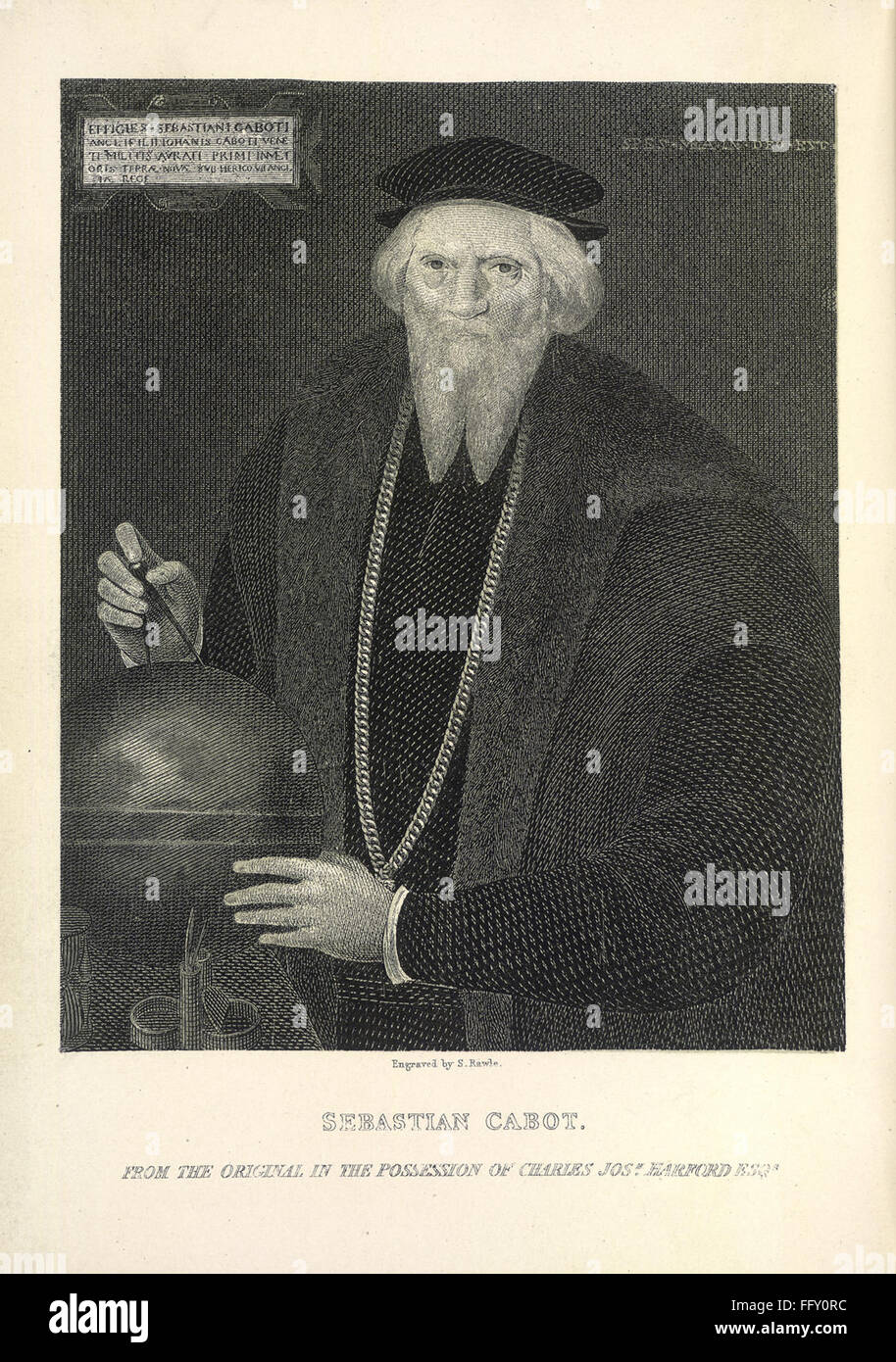 ventures, and discoveries o - caption; 'Sebastian Cabot' Stock Photohttps://www.alamy.com/image-license-details/?v=1https://www.alamy.com/stock-photo-ventures-and-discoveries-o-caption-sebastian-cabot-95865040.html
RFFFY0RC–ventures, and discoveries o - caption; 'Sebastian Cabot'
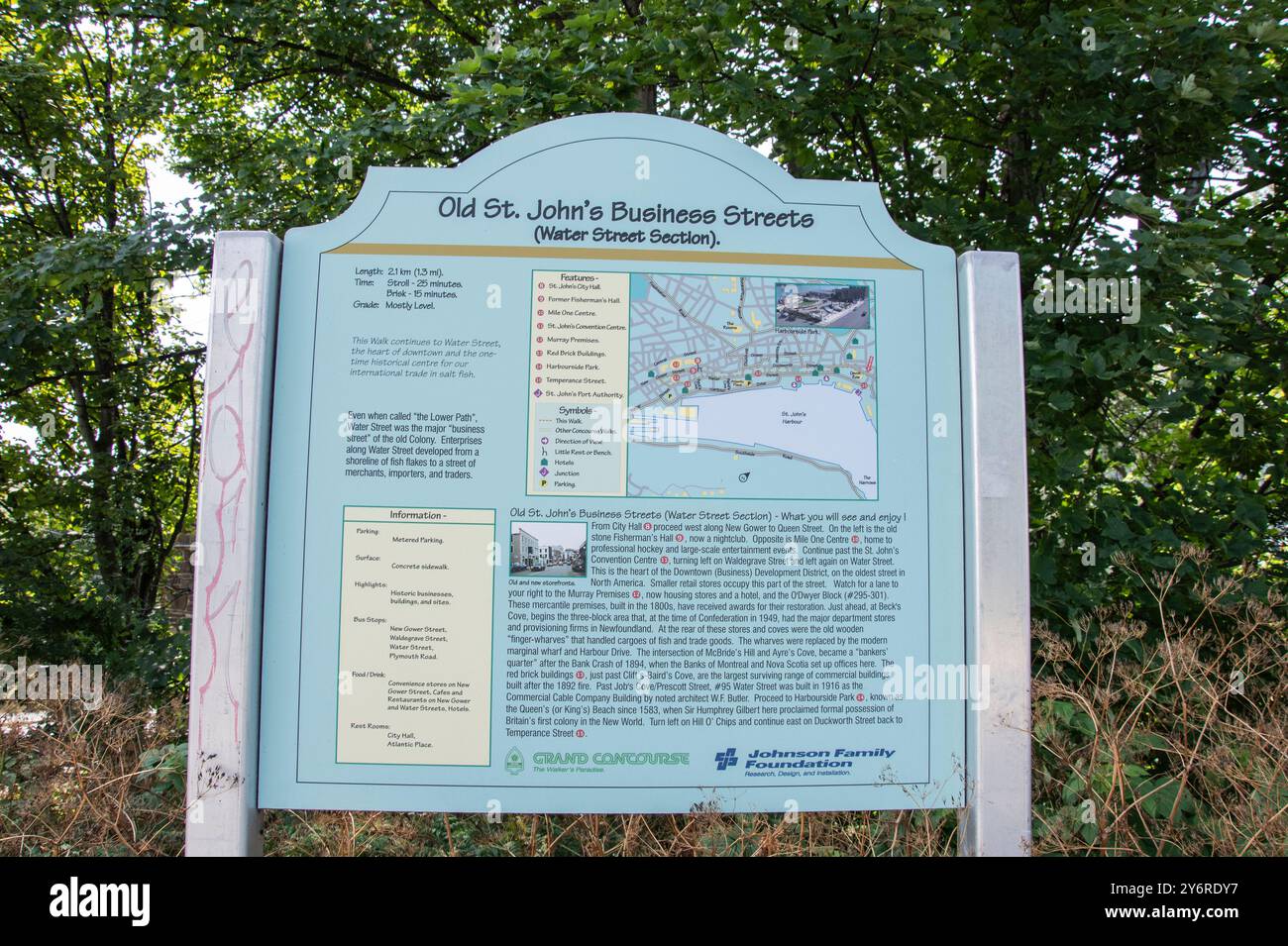 Information sign on Old St. John's Business Streets in downtown St. John's, Newfoundland & Labrador, Canada Stock Photohttps://www.alamy.com/image-license-details/?v=1https://www.alamy.com/information-sign-on-old-st-johns-business-streets-in-downtown-st-johns-newfoundland-labrador-canada-image623777035.html
RF2Y6RDY7–Information sign on Old St. John's Business Streets in downtown St. John's, Newfoundland & Labrador, Canada
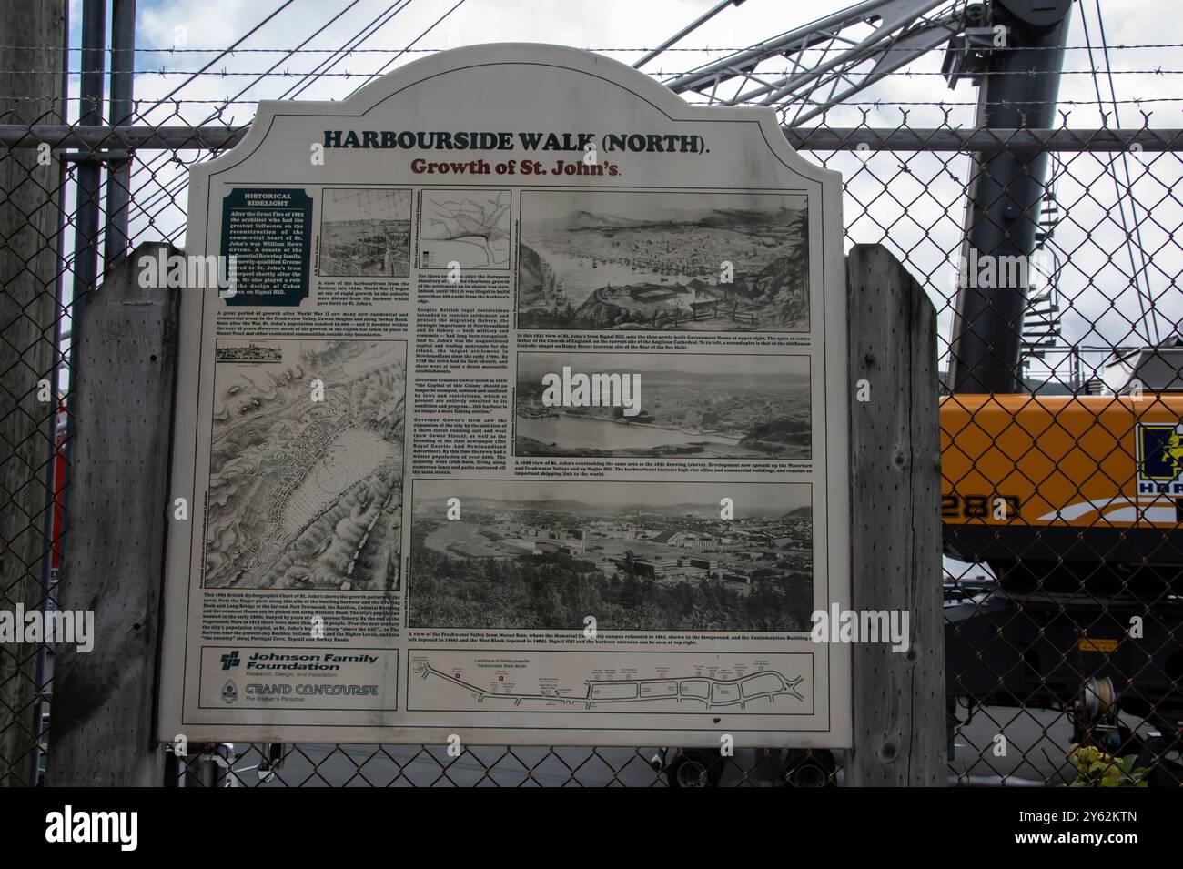 Harbourside Walk North information sign in downtown St. John's, Newfoundland & Labrador, Canada Stock Photohttps://www.alamy.com/image-license-details/?v=1https://www.alamy.com/harbourside-walk-north-information-sign-in-downtown-st-johns-newfoundland-labrador-canada-image623320677.html
RF2Y62KTN–Harbourside Walk North information sign in downtown St. John's, Newfoundland & Labrador, Canada
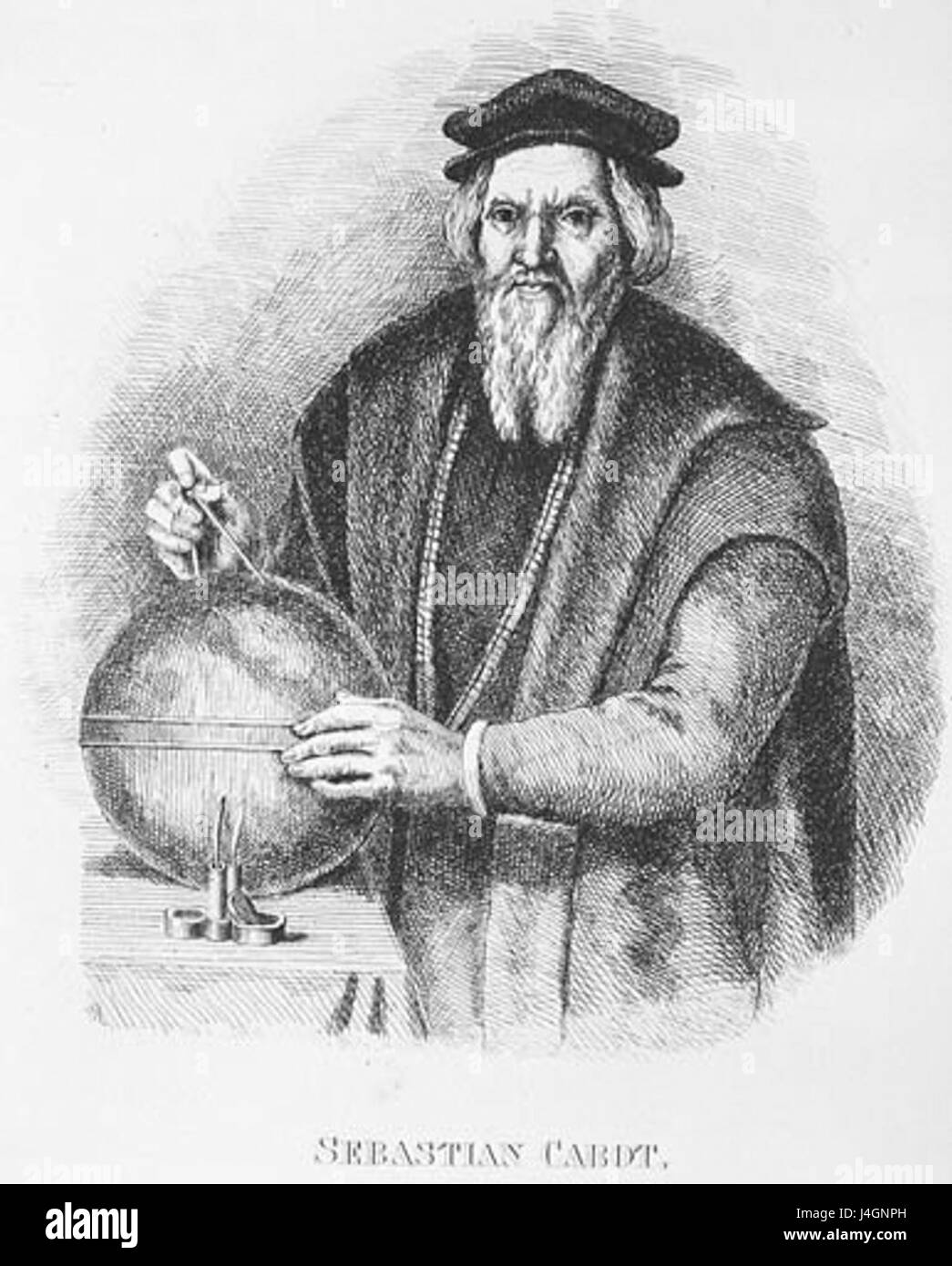 Sebastian Cabot Stock Photohttps://www.alamy.com/image-license-details/?v=1https://www.alamy.com/stock-photo-sebastian-cabot-140509897.html
RMJ4GNPH–Sebastian Cabot
 Dry Dock Number 4, Progress Map for July, The Holbrook Cabot and Rollins Corporation Contractor. Glass Plate Negatives of the Construction and Repair of Buildings, Facilities, and Vessels at the New York Navy Yard. Stock Photohttps://www.alamy.com/image-license-details/?v=1https://www.alamy.com/dry-dock-number-4-progress-map-for-july-the-holbrook-cabot-and-rollins-corporation-contractor-glass-plate-negatives-of-the-construction-and-repair-of-buildings-facilities-and-vessels-at-the-new-york-navy-yard-image556367856.html
RM2R94MTG–Dry Dock Number 4, Progress Map for July, The Holbrook Cabot and Rollins Corporation Contractor. Glass Plate Negatives of the Construction and Repair of Buildings, Facilities, and Vessels at the New York Navy Yard.
 USGS TOPO Map Arkansas AR Cabot 258096 1954 24000 Restoration Stock Photohttps://www.alamy.com/image-license-details/?v=1https://www.alamy.com/usgs-topo-map-arkansas-ar-cabot-258096-1954-24000-restoration-image242838059.html
RMT326BR–USGS TOPO Map Arkansas AR Cabot 258096 1954 24000 Restoration
 East Cabot, Washington County, US, United States, Vermont, N 44 23' 23'', S 72 15' 4'', map, Cartascapes Map published in 2024. Explore Cartascapes, a map revealing Earth's diverse landscapes, cultures, and ecosystems. Journey through time and space, discovering the interconnectedness of our planet's past, present, and future. Stock Photohttps://www.alamy.com/image-license-details/?v=1https://www.alamy.com/east-cabot-washington-county-us-united-states-vermont-n-44-23-23-s-72-15-4-map-cartascapes-map-published-in-2024-explore-cartascapes-a-map-revealing-earths-diverse-landscapes-cultures-and-ecosystems-journey-through-time-and-space-discovering-the-interconnectedness-of-our-planets-past-present-and-future-image621272797.html
RM2Y2NBP5–East Cabot, Washington County, US, United States, Vermont, N 44 23' 23'', S 72 15' 4'', map, Cartascapes Map published in 2024. Explore Cartascapes, a map revealing Earth's diverse landscapes, cultures, and ecosystems. Journey through time and space, discovering the interconnectedness of our planet's past, present, and future.
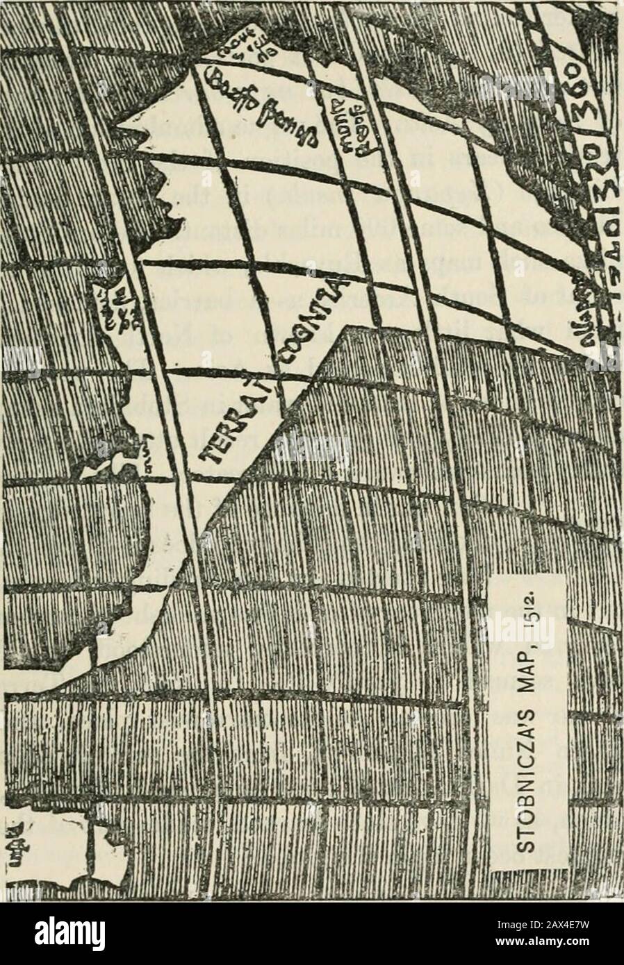 The discovery of America . MUNDUS NOV US. 179. 180 THE DISCOVERY OF AMERICA. proper to call coast-line this mere cut-off drawn instraight lines with a ruler. The interest of thiscrude map lies chiefly in its suggestion that in themakers mind the whole transatlantic coast alreadyvisited (except the Cabot portion) was conceivednot as pait of Asia, hut as a harrier in the wayof reaching Asia. The vague adumbration of thetruth appears in the position of the great islandCipango i^Zypangu insida^ in the ocean behindMexico and some 600 miles distant. Before Stob-nicza such maps as Ruyschs, which took Stock Photohttps://www.alamy.com/image-license-details/?v=1https://www.alamy.com/the-discovery-of-america-mundus-nov-us-179-180-the-discovery-of-america-proper-to-call-coast-line-this-mere-cut-off-drawn-instraight-lines-with-a-ruler-the-interest-of-thiscrude-map-lies-chiefly-in-its-suggestion-that-in-themakers-mind-the-whole-transatlantic-coast-alreadyvisited-except-the-cabot-portion-was-conceivednot-as-pait-of-asia-hut-as-a-harrier-in-the-wayof-reaching-asia-the-vague-adumbration-of-thetruth-appears-in-the-position-of-the-great-islandcipango-izypangu-insida-in-the-ocean-behindmexico-and-some-600-miles-distant-before-stob-nicza-such-maps-as-ruyschs-which-took-image343077053.html
RM2AX4E7W–The discovery of America . MUNDUS NOV US. 179. 180 THE DISCOVERY OF AMERICA. proper to call coast-line this mere cut-off drawn instraight lines with a ruler. The interest of thiscrude map lies chiefly in its suggestion that in themakers mind the whole transatlantic coast alreadyvisited (except the Cabot portion) was conceivednot as pait of Asia, hut as a harrier in the wayof reaching Asia. The vague adumbration of thetruth appears in the position of the great islandCipango i^Zypangu insida^ in the ocean behindMexico and some 600 miles distant. Before Stob-nicza such maps as Ruyschs, which took
 8 of 'John and Sebastian Cabot. A study ... Reprinted from the Narrative and Critical History of America, etc' Stock Photohttps://www.alamy.com/image-license-details/?v=1https://www.alamy.com/stock-photo-8-of-john-and-sebastian-cabot-a-study-reprinted-from-the-narrative-95842797.html
RFFFX0D1–8 of 'John and Sebastian Cabot. A study ... Reprinted from the Narrative and Critical History of America, etc'
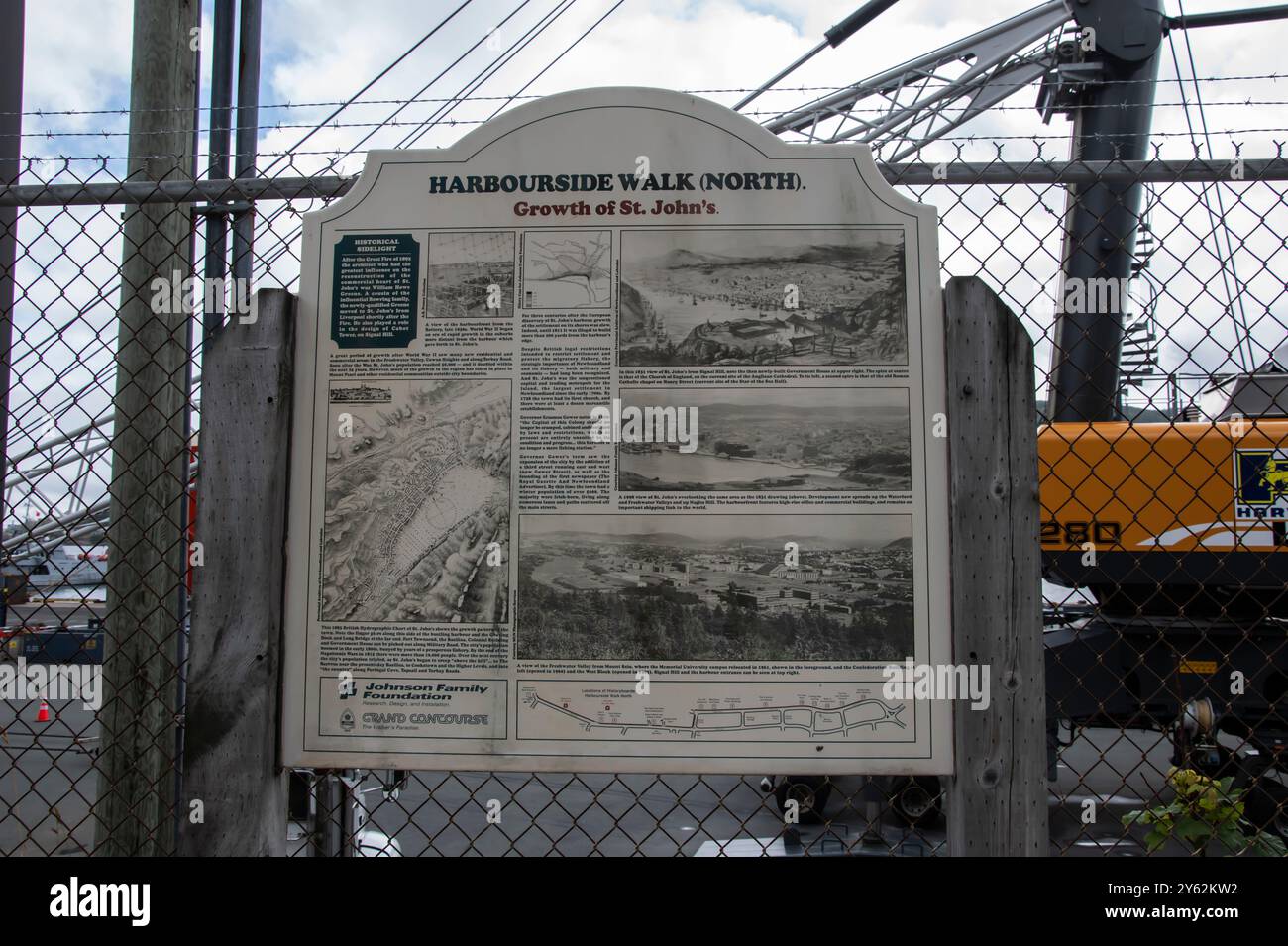 Harbourside Walk North information sign in downtown St. John's, Newfoundland & Labrador, Canada Stock Photohttps://www.alamy.com/image-license-details/?v=1https://www.alamy.com/harbourside-walk-north-information-sign-in-downtown-st-johns-newfoundland-labrador-canada-image623320686.html
RF2Y62KW2–Harbourside Walk North information sign in downtown St. John's, Newfoundland & Labrador, Canada
 John Cabot patent Stock Photohttps://www.alamy.com/image-license-details/?v=1https://www.alamy.com/stock-photo-john-cabot-patent-142886154.html
RMJ8D0MX–John Cabot patent
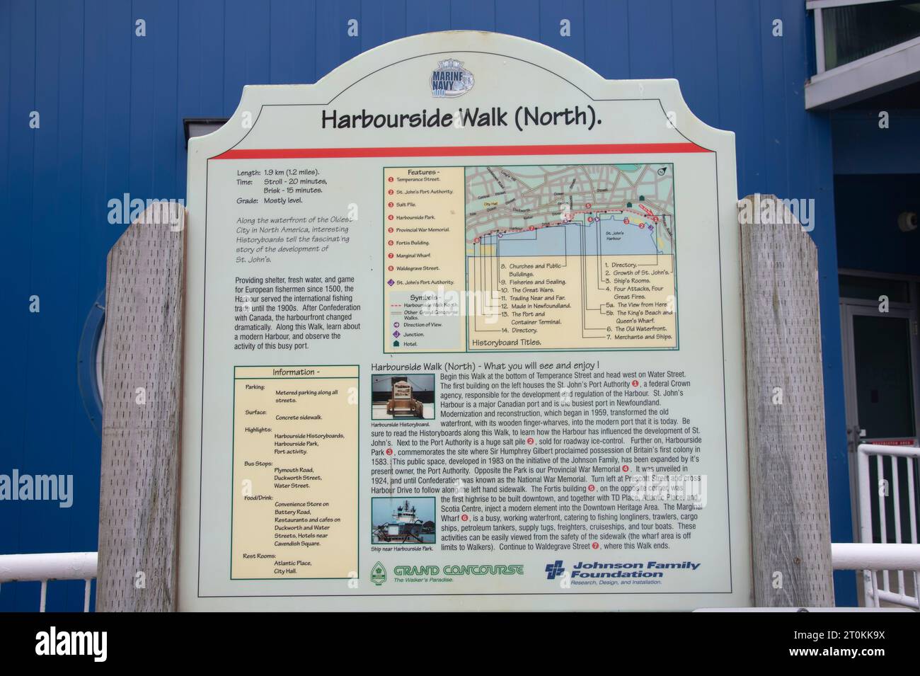 Harbourside Walk North sign in St. John's, Newfoundland & Labrador, Canada Stock Photohttps://www.alamy.com/image-license-details/?v=1https://www.alamy.com/harbourside-walk-north-sign-in-st-johns-newfoundland-labrador-canada-image568374406.html
RF2T0KK9X–Harbourside Walk North sign in St. John's, Newfoundland & Labrador, Canada
 Monthly Progress Photo of Monthly Progress Map, Contract 1457, The Holbrook, Cabot and Rollins Corporation, Contractor's. Glass Plate Negatives of the Construction and Repair of Buildings, Facilities, and Vessels at the New York Navy Yard. Stock Photohttps://www.alamy.com/image-license-details/?v=1https://www.alamy.com/monthly-progress-photo-of-monthly-progress-map-contract-1457-the-holbrook-cabot-and-rollins-corporation-contractors-glass-plate-negatives-of-the-construction-and-repair-of-buildings-facilities-and-vessels-at-the-new-york-navy-yard-image556368306.html
RM2R94NCJ–Monthly Progress Photo of Monthly Progress Map, Contract 1457, The Holbrook, Cabot and Rollins Corporation, Contractor's. Glass Plate Negatives of the Construction and Repair of Buildings, Facilities, and Vessels at the New York Navy Yard.
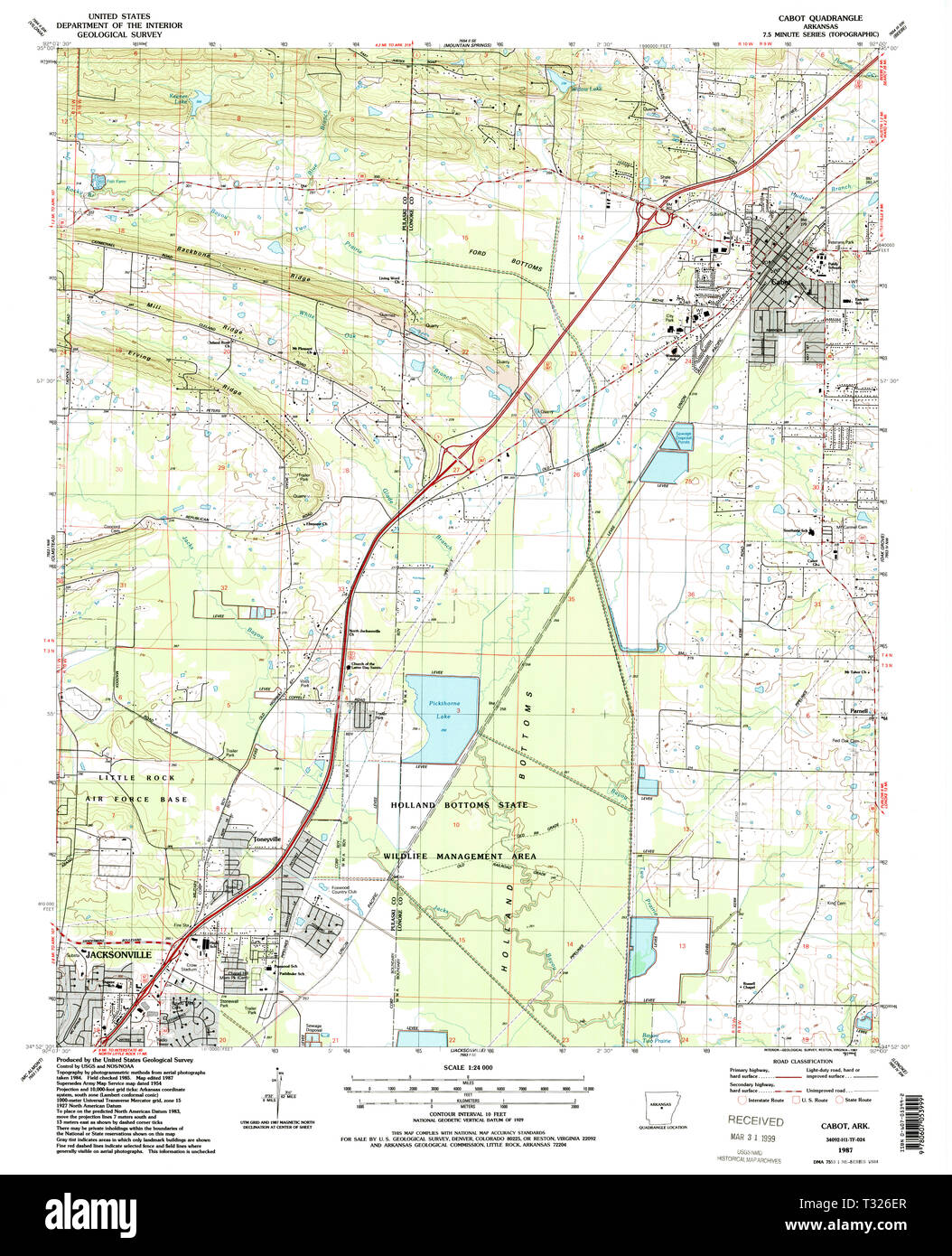 USGS TOPO Map Arkansas AR Cabot 258099 1987 24000 Restoration Stock Photohttps://www.alamy.com/image-license-details/?v=1https://www.alamy.com/usgs-topo-map-arkansas-ar-cabot-258099-1987-24000-restoration-image242838143.html
RMT326ER–USGS TOPO Map Arkansas AR Cabot 258099 1987 24000 Restoration
 USGS TOPO Map Arkansas AR Cabot 20110714 TM Inverted Restoration Stock Photohttps://www.alamy.com/image-license-details/?v=1https://www.alamy.com/usgs-topo-map-arkansas-ar-cabot-20110714-tm-inverted-restoration-image242838021.html
RMT326AD–USGS TOPO Map Arkansas AR Cabot 20110714 TM Inverted Restoration
 Cabot Station, Calhoun County, US, United States, West Virginia, N 38 55' 46'', S 81 6' 40'', map, Cartascapes Map published in 2024. Explore Cartascapes, a map revealing Earth's diverse landscapes, cultures, and ecosystems. Journey through time and space, discovering the interconnectedness of our planet's past, present, and future. Stock Photohttps://www.alamy.com/image-license-details/?v=1https://www.alamy.com/cabot-station-calhoun-county-us-united-states-west-virginia-n-38-55-46-s-81-6-40-map-cartascapes-map-published-in-2024-explore-cartascapes-a-map-revealing-earths-diverse-landscapes-cultures-and-ecosystems-journey-through-time-and-space-discovering-the-interconnectedness-of-our-planets-past-present-and-future-image621412558.html
RM2Y2YP1J–Cabot Station, Calhoun County, US, United States, West Virginia, N 38 55' 46'', S 81 6' 40'', map, Cartascapes Map published in 2024. Explore Cartascapes, a map revealing Earth's diverse landscapes, cultures, and ecosystems. Journey through time and space, discovering the interconnectedness of our planet's past, present, and future.
 USGS Topo Map Vermont VT Cabot 20120607 TM Inverted Restoration Stock Photohttps://www.alamy.com/image-license-details/?v=1https://www.alamy.com/usgs-topo-map-vermont-vt-cabot-20120607-tm-inverted-restoration-image265131106.html
RMWB9NC2–USGS Topo Map Vermont VT Cabot 20120607 TM Inverted Restoration
 USGS Topo Map Vermont VT Cabot 337355 1986 24000 Restoration Stock Photohttps://www.alamy.com/image-license-details/?v=1https://www.alamy.com/usgs-topo-map-vermont-vt-cabot-337355-1986-24000-restoration-image265131159.html
RMWB9NDY–USGS Topo Map Vermont VT Cabot 337355 1986 24000 Restoration
 The discovery of America . Sketch of part of the Cantino map, 1502. simply as Indies, here appear for the first time asAntilles (^has Antilhas). Portuguese sailors were prompt in availing them-selves of the treasures of the Newfoundland fish-eries. By 1525 a short-lived Portuguese colonyhad been established on Cape Breton island.^ But, ^ Souza, Tratado das Ilhas Novas, p. 5; Harrisse, Jean et SSiaatien Cabot, p. 76. 22 THE DISCOVERY OF AMERICA. as the name of that island reminds us, the Portu-guese had sturdy rivals in this work. As early a»1504 that spot was visited by Breton, Norman,and Basq Stock Photohttps://www.alamy.com/image-license-details/?v=1https://www.alamy.com/the-discovery-of-america-sketch-of-part-of-the-cantino-map-1502-simply-as-indies-here-appear-for-the-first-time-asantilles-has-antilhas-portuguese-sailors-were-prompt-in-availing-them-selves-of-the-treasures-of-the-newfoundland-fish-eries-by-1525-a-short-lived-portuguese-colonyhad-been-established-on-cape-breton-island-but-souza-tratado-das-ilhas-novas-p-5-harrisse-jean-et-ssiaatien-cabot-p-76-22-the-discovery-of-america-as-the-name-of-that-island-reminds-us-the-portu-guese-had-sturdy-rivals-in-this-work-as-early-a1504-that-spot-was-visited-by-breton-normanand-basq-image343083278.html
RM2AX4P66–The discovery of America . Sketch of part of the Cantino map, 1502. simply as Indies, here appear for the first time asAntilles (^has Antilhas). Portuguese sailors were prompt in availing them-selves of the treasures of the Newfoundland fish-eries. By 1525 a short-lived Portuguese colonyhad been established on Cape Breton island.^ But, ^ Souza, Tratado das Ilhas Novas, p. 5; Harrisse, Jean et SSiaatien Cabot, p. 76. 22 THE DISCOVERY OF AMERICA. as the name of that island reminds us, the Portu-guese had sturdy rivals in this work. As early a»1504 that spot was visited by Breton, Norman,and Basq
 The remarkable life, adventures, and discoveries o - caption: 'Sebastian Cabot' The remarkable life, adventures, and discoveries o - caption 'Sebastian Stock Photohttps://www.alamy.com/image-license-details/?v=1https://www.alamy.com/stock-photo-the-remarkable-life-adventures-and-discoveries-o-caption-sebastian-127788435.html
RMHBW7CK–The remarkable life, adventures, and discoveries o - caption: 'Sebastian Cabot' The remarkable life, adventures, and discoveries o - caption 'Sebastian
 John cabot 2 Stock Photohttps://www.alamy.com/image-license-details/?v=1https://www.alamy.com/stock-photo-john-cabot-2-140033280.html
RMJ3R1TG–John cabot 2
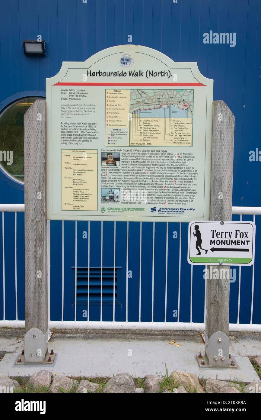 Harbourside Walk North sign in St. John's, Newfoundland & Labrador, Canada Stock Photohttps://www.alamy.com/image-license-details/?v=1https://www.alamy.com/harbourside-walk-north-sign-in-st-johns-newfoundland-labrador-canada-image568374390.html
RF2T0KK9A–Harbourside Walk North sign in St. John's, Newfoundland & Labrador, Canada
 Dry Dock 4, Monthly Progress Photo of Monthly Progress Map, The Holbrook Cabot and Rollins Corporation Contractor. Glass Plate Negatives of the Construction and Repair of Buildings, Facilities, and Vessels at the New York Navy Yard. Stock Photohttps://www.alamy.com/image-license-details/?v=1https://www.alamy.com/dry-dock-4-monthly-progress-photo-of-monthly-progress-map-the-holbrook-cabot-and-rollins-corporation-contractor-glass-plate-negatives-of-the-construction-and-repair-of-buildings-facilities-and-vessels-at-the-new-york-navy-yard-image556367919.html
RM2R94MXR–Dry Dock 4, Monthly Progress Photo of Monthly Progress Map, The Holbrook Cabot and Rollins Corporation Contractor. Glass Plate Negatives of the Construction and Repair of Buildings, Facilities, and Vessels at the New York Navy Yard.
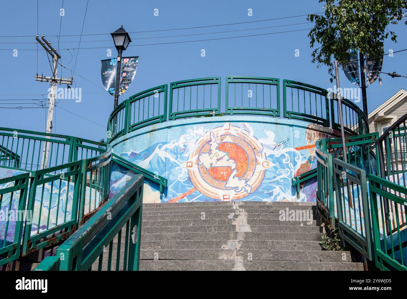 Map of Newfoundland and Labrador mural on stairs to George Street in St. John's, Newfoundland & Labrador, Canada Stock Photohttps://www.alamy.com/image-license-details/?v=1https://www.alamy.com/map-of-newfoundland-and-labrador-mural-on-stairs-to-george-street-in-st-johns-newfoundland-labrador-canada-image623824465.html
RF2Y6WJD5–Map of Newfoundland and Labrador mural on stairs to George Street in St. John's, Newfoundland & Labrador, Canada
 Cabot, Canada, Manitoba, N 49 52' 27'', W 97 35' 22'', map, Timeless Map published in 2021. Travelers, explorers and adventurers like Florence Nightingale, David Livingstone, Ernest Shackleton, Lewis and Clark and Sherlock Holmes relied on maps to plan travels to the world's most remote corners, Timeless Maps is mapping most locations on the globe, showing the achievement of great dreams Stock Photohttps://www.alamy.com/image-license-details/?v=1https://www.alamy.com/cabot-canada-manitoba-n-49-52-27-w-97-35-22-map-timeless-map-published-in-2021-travelers-explorers-and-adventurers-like-florence-nightingale-david-livingstone-ernest-shackleton-lewis-and-clark-and-sherlock-holmes-relied-on-maps-to-plan-travels-to-the-worlds-most-remote-corners-timeless-maps-is-mapping-most-locations-on-the-globe-showing-the-achievement-of-great-dreams-image457853727.html
RM2HGW12R–Cabot, Canada, Manitoba, N 49 52' 27'', W 97 35' 22'', map, Timeless Map published in 2021. Travelers, explorers and adventurers like Florence Nightingale, David Livingstone, Ernest Shackleton, Lewis and Clark and Sherlock Holmes relied on maps to plan travels to the world's most remote corners, Timeless Maps is mapping most locations on the globe, showing the achievement of great dreams
 USGS Topo Map Vermont VT Cabot 337356 1986 24000 Restoration Stock Photohttps://www.alamy.com/image-license-details/?v=1https://www.alamy.com/usgs-topo-map-vermont-vt-cabot-337356-1986-24000-restoration-image265131199.html
RMWB9NFB–USGS Topo Map Vermont VT Cabot 337356 1986 24000 Restoration
 Our great continent; sketches, picturesque and historic: within and beyond the States . stian Cabot,who discovered the coasts of Labrador and Maine in 1498, sailed along thoseof Massachusetts, and that Verazzani, an Italian in the French service, visitedthat region in 1524. The shores of Massachusetts were explored by Bartholomew Gosnold in-1602, by Samuel Champlain in 1604.. and by John Smith in 1614. Gosnold! 70 THE GREAT REPUBLIC OF THE WEST made an attempt to found a settlement on one of the Elizabeth Islands,which he had discovered. Captain Smith made a map of much of the coastof New Engl Stock Photohttps://www.alamy.com/image-license-details/?v=1https://www.alamy.com/our-great-continent-sketches-picturesque-and-historic-within-and-beyond-the-states-stian-cabotwho-discovered-the-coasts-of-labrador-and-maine-in-1498-sailed-along-thoseof-massachusetts-and-that-verazzani-an-italian-in-the-french-service-visitedthat-region-in-1524-the-shores-of-massachusetts-were-explored-by-bartholomew-gosnold-in-1602-by-samuel-champlain-in-1604-and-by-john-smith-in-1614-gosnold!-70-the-great-republic-of-the-west-made-an-attempt-to-found-a-settlement-on-one-of-the-elizabeth-islandswhich-he-had-discovered-captain-smith-made-a-map-of-much-of-the-coastof-new-engl-image340159258.html
RM2ANBGGX–Our great continent; sketches, picturesque and historic: within and beyond the States . stian Cabot,who discovered the coasts of Labrador and Maine in 1498, sailed along thoseof Massachusetts, and that Verazzani, an Italian in the French service, visitedthat region in 1524. The shores of Massachusetts were explored by Bartholomew Gosnold in-1602, by Samuel Champlain in 1604.. and by John Smith in 1614. Gosnold! 70 THE GREAT REPUBLIC OF THE WEST made an attempt to found a settlement on one of the Elizabeth Islands,which he had discovered. Captain Smith made a map of much of the coastof New Engl
 USGS TOPO Map Arkansas AR Cabot 259940 1941 31680 Inverted Restoration Stock Photohttps://www.alamy.com/image-license-details/?v=1https://www.alamy.com/usgs-topo-map-arkansas-ar-cabot-259940-1941-31680-inverted-restoration-image242838174.html
RMT326FX–USGS TOPO Map Arkansas AR Cabot 259940 1941 31680 Inverted Restoration
 USGS TOPO Map Arkansas AR Cabot 258100 1994 24000 Inverted Restoration Stock Photohttps://www.alamy.com/image-license-details/?v=1https://www.alamy.com/usgs-topo-map-arkansas-ar-cabot-258100-1994-24000-inverted-restoration-image242838165.html
RMT326FH–USGS TOPO Map Arkansas AR Cabot 258100 1994 24000 Inverted Restoration
 John and Sebastian Cabot. A study ... Reprinted from the Narrative and Critical History of America, etc Image taken from page 68 of 'John and Sebastian Cabot Stock Photohttps://www.alamy.com/image-license-details/?v=1https://www.alamy.com/stock-photo-john-and-sebastian-cabot-a-study-reprinted-from-the-narrative-and-127794507.html
RMHBWF5F–John and Sebastian Cabot. A study ... Reprinted from the Narrative and Critical History of America, etc Image taken from page 68 of 'John and Sebastian Cabot
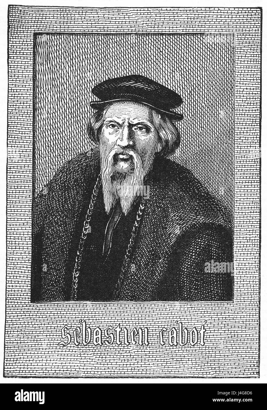 Sebastian Cabot 1882 engraving Stock Photohttps://www.alamy.com/image-license-details/?v=1https://www.alamy.com/stock-photo-sebastian-cabot-1882-engraving-140499442.html
RMJ4G8D6–Sebastian Cabot 1882 engraving
 Dry Dock Number 4, Monthly Progress Photo, Progress Map for August, Holbrook, Cabot and Rollins, Contractor. Glass Plate Negatives of the Construction and Repair of Buildings, Facilities, and Vessels at the New York Navy Yard. Stock Photohttps://www.alamy.com/image-license-details/?v=1https://www.alamy.com/dry-dock-number-4-monthly-progress-photo-progress-map-for-august-holbrook-cabot-and-rollins-contractor-glass-plate-negatives-of-the-construction-and-repair-of-buildings-facilities-and-vessels-at-the-new-york-navy-yard-image556368429.html
RM2R94NH1–Dry Dock Number 4, Monthly Progress Photo, Progress Map for August, Holbrook, Cabot and Rollins, Contractor. Glass Plate Negatives of the Construction and Repair of Buildings, Facilities, and Vessels at the New York Navy Yard.
 Map of Newfoundland and Labrador mural on stairs to George Street in St. John's, Newfoundland & Labrador, Canada Stock Photohttps://www.alamy.com/image-license-details/?v=1https://www.alamy.com/map-of-newfoundland-and-labrador-mural-on-stairs-to-george-street-in-st-johns-newfoundland-labrador-canada-image623824382.html
RF2Y6WJA6–Map of Newfoundland and Labrador mural on stairs to George Street in St. John's, Newfoundland & Labrador, Canada
 Map of Newfoundland and Labrador mural on stairs to George Street in St. John's, Newfoundland & Labrador, Canada Stock Photohttps://www.alamy.com/image-license-details/?v=1https://www.alamy.com/map-of-newfoundland-and-labrador-mural-on-stairs-to-george-street-in-st-johns-newfoundland-labrador-canada-image569034945.html
RF2T1NNTH–Map of Newfoundland and Labrador mural on stairs to George Street in St. John's, Newfoundland & Labrador, Canada
 Le Cabot, Bouches-du-Rhône, France, Provence-Alpes-Côte d'Azur, N 43 15' 31'', E 5 25' 2'', map, Timeless Map published in 2021. Travelers, explorers and adventurers like Florence Nightingale, David Livingstone, Ernest Shackleton, Lewis and Clark and Sherlock Holmes relied on maps to plan travels to the world's most remote corners, Timeless Maps is mapping most locations on the globe, showing the achievement of great dreams Stock Photohttps://www.alamy.com/image-license-details/?v=1https://www.alamy.com/le-cabot-bouches-du-rhne-france-provence-alpes-cte-dazur-n-43-15-31-e-5-25-2-map-timeless-map-published-in-2021-travelers-explorers-and-adventurers-like-florence-nightingale-david-livingstone-ernest-shackleton-lewis-and-clark-and-sherlock-holmes-relied-on-maps-to-plan-travels-to-the-worlds-most-remote-corners-timeless-maps-is-mapping-most-locations-on-the-globe-showing-the-achievement-of-great-dreams-image444938356.html
RM2GRTKBG–Le Cabot, Bouches-du-Rhône, France, Provence-Alpes-Côte d'Azur, N 43 15' 31'', E 5 25' 2'', map, Timeless Map published in 2021. Travelers, explorers and adventurers like Florence Nightingale, David Livingstone, Ernest Shackleton, Lewis and Clark and Sherlock Holmes relied on maps to plan travels to the world's most remote corners, Timeless Maps is mapping most locations on the globe, showing the achievement of great dreams
 Syllabus topics in American history for seventh and eighth grades . 13 Discovery and Exploration. Show on ilie opposite map, using different colored pencils, the voyages andexplorations of: 1, Columbus; 2, John Cabot; 3, A>rrazano: 4, Cartier; 5, HenryHudson : 6, other noteworthy explorers. (Use red for the English explorers,blue for the French, yellow for the Spanish and orange for the Dutch.) Numbereach voyage or exploration on the map and make a key below giving the nameof the explorer, the country sailed from, the land explored and the date. Notes. u... , ? V-- « / /. 15 Colonies. 1. Stock Photohttps://www.alamy.com/image-license-details/?v=1https://www.alamy.com/syllabus-topics-in-american-history-for-seventh-and-eighth-grades-13-discovery-and-exploration-show-on-ilie-opposite-map-using-different-colored-pencils-the-voyages-andexplorations-of-1-columbus-2-john-cabot-3-agtrrazano-4-cartier-5-henryhudson-6-other-noteworthy-explorers-use-red-for-the-english-explorersblue-for-the-french-yellow-for-the-spanish-and-orange-for-the-dutch-numbereach-voyage-or-exploration-on-the-map-and-make-a-key-below-giving-the-nameof-the-explorer-the-country-sailed-from-the-land-explored-and-the-date-notes-u-v-15-colonies-1-image339396224.html
RM2AM4R9M–Syllabus topics in American history for seventh and eighth grades . 13 Discovery and Exploration. Show on ilie opposite map, using different colored pencils, the voyages andexplorations of: 1, Columbus; 2, John Cabot; 3, A>rrazano: 4, Cartier; 5, HenryHudson : 6, other noteworthy explorers. (Use red for the English explorers,blue for the French, yellow for the Spanish and orange for the Dutch.) Numbereach voyage or exploration on the map and make a key below giving the nameof the explorer, the country sailed from, the land explored and the date. Notes. u... , ? V-- « / /. 15 Colonies. 1.
 USGS TOPO Map Arkansas AR Cabot 258096 1954 24000 Inverted Restoration Stock Photohttps://www.alamy.com/image-license-details/?v=1https://www.alamy.com/usgs-topo-map-arkansas-ar-cabot-258096-1954-24000-inverted-restoration-image242838052.html
RMT326BG–USGS TOPO Map Arkansas AR Cabot 258096 1954 24000 Inverted Restoration
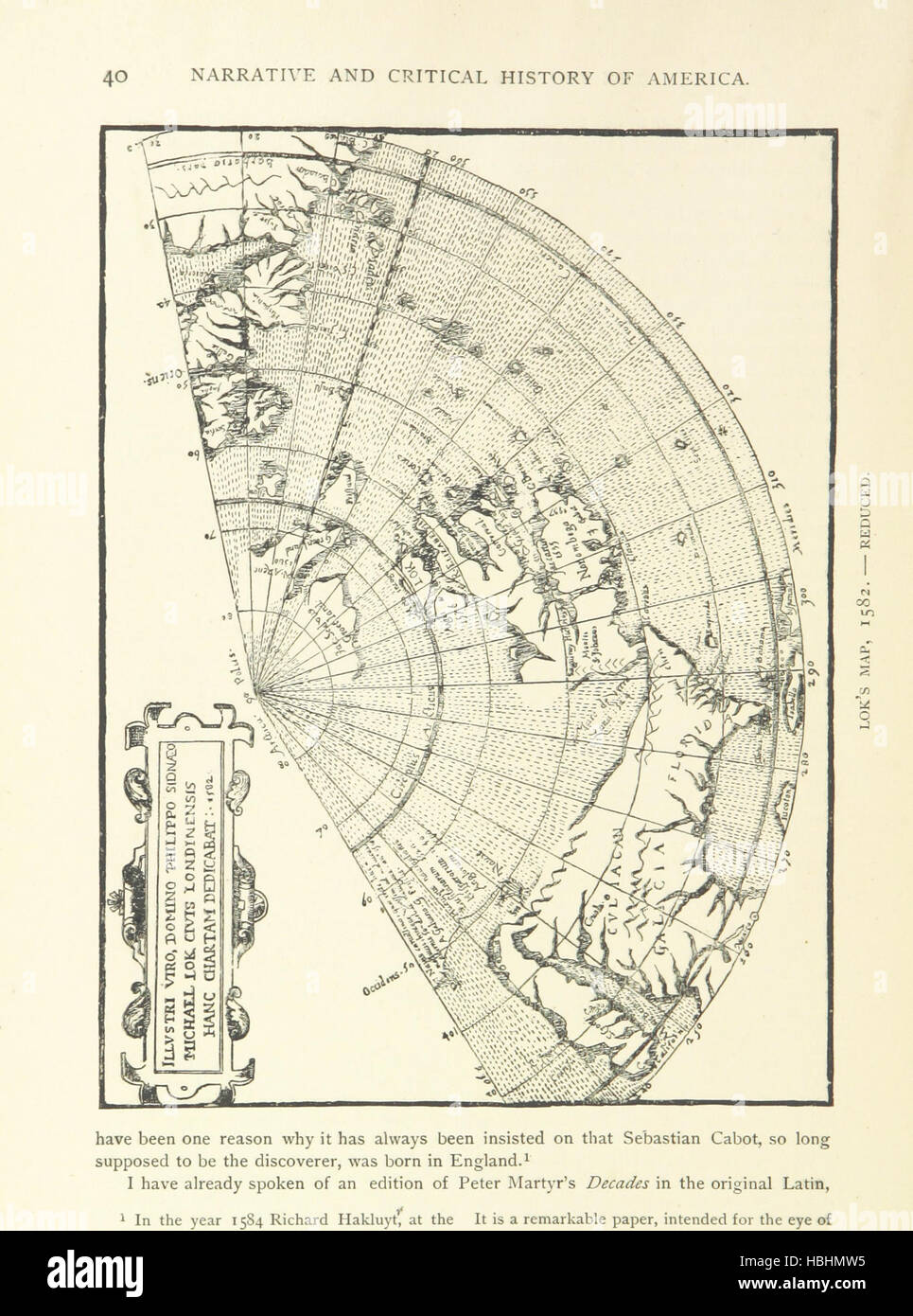 John and Sebastian Cabot. A study ... Reprinted from the Narrative and Critical History of America, etc Image taken from page 52 of 'John and Sebastian Cabot Stock Photohttps://www.alamy.com/image-license-details/?v=1https://www.alamy.com/stock-photo-john-and-sebastian-cabot-a-study-reprinted-from-the-narrative-and-127623361.html
RMHBHMW5–John and Sebastian Cabot. A study ... Reprinted from the Narrative and Critical History of America, etc Image taken from page 52 of 'John and Sebastian Cabot
 John Stevens Cabot Abbott Stock Photohttps://www.alamy.com/image-license-details/?v=1https://www.alamy.com/stock-photo-john-stevens-cabot-abbott-140060099.html
RMJ3T82B–John Stevens Cabot Abbott
 Dry Dock Number 4, Monthly Progress Map, Monthly Progress Photo, Holbrook, Cabot and Rollins, Contractors. Glass Plate Negatives of the Construction and Repair of Buildings, Facilities, and Vessels at the New York Navy Yard. Stock Photohttps://www.alamy.com/image-license-details/?v=1https://www.alamy.com/dry-dock-number-4-monthly-progress-map-monthly-progress-photo-holbrook-cabot-and-rollins-contractors-glass-plate-negatives-of-the-construction-and-repair-of-buildings-facilities-and-vessels-at-the-new-york-navy-yard-image556371885.html
RM2R94X0D–Dry Dock Number 4, Monthly Progress Map, Monthly Progress Photo, Holbrook, Cabot and Rollins, Contractors. Glass Plate Negatives of the Construction and Repair of Buildings, Facilities, and Vessels at the New York Navy Yard.
 Map of Newfoundland and Labrador mural on stairs to George Street in St. John's, Newfoundland & Labrador, Canada Stock Photohttps://www.alamy.com/image-license-details/?v=1https://www.alamy.com/map-of-newfoundland-and-labrador-mural-on-stairs-to-george-street-in-st-johns-newfoundland-labrador-canada-image569034942.html
RF2T1NNTE–Map of Newfoundland and Labrador mural on stairs to George Street in St. John's, Newfoundland & Labrador, Canada
 Cabot, Lonoke County, US, United States, Arkansas, N 34 58' 28'', S 92 0' 59'', map, Cartascapes Map published in 2024. Explore Cartascapes, a map revealing Earth's diverse landscapes, cultures, and ecosystems. Journey through time and space, discovering the interconnectedness of our planet's past, present, and future. Stock Photohttps://www.alamy.com/image-license-details/?v=1https://www.alamy.com/cabot-lonoke-county-us-united-states-arkansas-n-34-58-28-s-92-0-59-map-cartascapes-map-published-in-2024-explore-cartascapes-a-map-revealing-earths-diverse-landscapes-cultures-and-ecosystems-journey-through-time-and-space-discovering-the-interconnectedness-of-our-planets-past-present-and-future-image620674755.html
RM2Y1P4YF–Cabot, Lonoke County, US, United States, Arkansas, N 34 58' 28'', S 92 0' 59'', map, Cartascapes Map published in 2024. Explore Cartascapes, a map revealing Earth's diverse landscapes, cultures, and ecosystems. Journey through time and space, discovering the interconnectedness of our planet's past, present, and future.
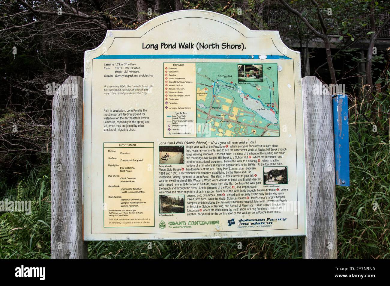 Information sign on Long Pond North Shore walk at Pippy Park in St. John's, Newfoundland & Labrador, Canada Stock Photohttps://www.alamy.com/image-license-details/?v=1https://www.alamy.com/information-sign-on-long-pond-north-shore-walk-at-pippy-park-in-st-johns-newfoundland-labrador-canada-image624344481.html
RF2Y7N9N5–Information sign on Long Pond North Shore walk at Pippy Park in St. John's, Newfoundland & Labrador, Canada
 Syllabus topics in American history for seventh and eighth grades . 11 American Indians, On the map on the opposite page outline the territory occupied by: (a)Algonquins. (b) Iroc[uois, (c) Maskoki. Draw upon the map the outlines ofNew York State. Lx)cate by crosses on the map the present Indian reservationsin New York State. Number these crosses and make a key below giving thenames of these reservations and the tribe of Indians in each. Notes.. 13 Discovery and Exploration. Show on ilie opposite map, using different colored pencils, the voyages andexplorations of: 1, Columbus; 2, John Cabot; Stock Photohttps://www.alamy.com/image-license-details/?v=1https://www.alamy.com/syllabus-topics-in-american-history-for-seventh-and-eighth-grades-11-american-indians-on-the-map-on-the-opposite-page-outline-the-territory-occupied-by-aalgonquins-b-iroc-uois-c-maskoki-draw-upon-the-map-the-outlines-ofnew-york-state-lxcate-by-crosses-on-the-map-the-present-indian-reservationsin-new-york-state-number-these-crosses-and-make-a-key-below-giving-thenames-of-these-reservations-and-the-tribe-of-indians-in-each-notes-13-discovery-and-exploration-show-on-ilie-opposite-map-using-different-colored-pencils-the-voyages-andexplorations-of-1-columbus-2-john-cabot-image339396742.html
RM2AM4T06–Syllabus topics in American history for seventh and eighth grades . 11 American Indians, On the map on the opposite page outline the territory occupied by: (a)Algonquins. (b) Iroc[uois, (c) Maskoki. Draw upon the map the outlines ofNew York State. Lx)cate by crosses on the map the present Indian reservationsin New York State. Number these crosses and make a key below giving thenames of these reservations and the tribe of Indians in each. Notes.. 13 Discovery and Exploration. Show on ilie opposite map, using different colored pencils, the voyages andexplorations of: 1, Columbus; 2, John Cabot;
 USGS TOPO Map Arkansas AR Cabot 258099 1987 24000 Inverted Restoration Stock Photohttps://www.alamy.com/image-license-details/?v=1https://www.alamy.com/usgs-topo-map-arkansas-ar-cabot-258099-1987-24000-inverted-restoration-image242838134.html
RMT326EE–USGS TOPO Map Arkansas AR Cabot 258099 1987 24000 Inverted Restoration
 Reception and dinner in honor of Henry Cabot Lodge, a great defender of the faith (1921) Stock Photohttps://www.alamy.com/image-license-details/?v=1https://www.alamy.com/stock-photo-reception-and-dinner-in-honor-of-henry-cabot-lodge-a-great-defender-114247093.html
RMGHTB99–Reception and dinner in honor of Henry Cabot Lodge, a great defender of the faith (1921)
 Lilla Cabot Perry Selfportrait Stock Photohttps://www.alamy.com/image-license-details/?v=1https://www.alamy.com/stock-photo-lilla-cabot-perry-selfportrait-140182302.html
RMJ41RXP–Lilla Cabot Perry Selfportrait
 Dry Dock Number 4, Monthly Progress Photo, Progress Map, Holbrook, Cabot and Rollins Corporation, Contractor. Glass Plate Negatives of the Construction and Repair of Buildings, Facilities, and Vessels at the New York Navy Yard. Stock Photohttps://www.alamy.com/image-license-details/?v=1https://www.alamy.com/dry-dock-number-4-monthly-progress-photo-progress-map-holbrook-cabot-and-rollins-corporation-contractor-glass-plate-negatives-of-the-construction-and-repair-of-buildings-facilities-and-vessels-at-the-new-york-navy-yard-image556371896.html
RM2R94X0T–Dry Dock Number 4, Monthly Progress Photo, Progress Map, Holbrook, Cabot and Rollins Corporation, Contractor. Glass Plate Negatives of the Construction and Repair of Buildings, Facilities, and Vessels at the New York Navy Yard.
 Cabot, Washington County, US, United States, Vermont, N 44 24' 5'', S 72 18' 44'', map, Cartascapes Map published in 2024. Explore Cartascapes, a map revealing Earth's diverse landscapes, cultures, and ecosystems. Journey through time and space, discovering the interconnectedness of our planet's past, present, and future. Stock Photohttps://www.alamy.com/image-license-details/?v=1https://www.alamy.com/cabot-washington-county-us-united-states-vermont-n-44-24-5-s-72-18-44-map-cartascapes-map-published-in-2024-explore-cartascapes-a-map-revealing-earths-diverse-landscapes-cultures-and-ecosystems-journey-through-time-and-space-discovering-the-interconnectedness-of-our-planets-past-present-and-future-image620771941.html
RM2Y1XGXD–Cabot, Washington County, US, United States, Vermont, N 44 24' 5'', S 72 18' 44'', map, Cartascapes Map published in 2024. Explore Cartascapes, a map revealing Earth's diverse landscapes, cultures, and ecosystems. Journey through time and space, discovering the interconnectedness of our planet's past, present, and future.
 Information sign on Long Pond North Shore walk at Pippy Park in St. John's, Newfoundland & Labrador, Canada Stock Photohttps://www.alamy.com/image-license-details/?v=1https://www.alamy.com/information-sign-on-long-pond-north-shore-walk-at-pippy-park-in-st-johns-newfoundland-labrador-canada-image624344460.html
RF2Y7N9MC–Information sign on Long Pond North Shore walk at Pippy Park in St. John's, Newfoundland & Labrador, Canada
 The beginner's American history . C A V, Map showing the city of Venice, Italy, whereJohn Cabot had lived. land, to let him see if he could not find a shorter way to the Indies than that of Columbus. The king gave his consent, and in the spring of 1497 John Cabot, with his son Sebastian,^ who seems to have been born in Bristol, sailed from that port. They headed their vessels toward the northwest; by going Cabot (Cabot). 2 See map on page 40. 3 Sebastian (Se-bastyan). H THE BEGINNER S AMERICAN HISTORY.. Ml J Land gy^.--,^ ^^ ; Rirst Seen in that direction they hoped to get to those parts of As Stock Photohttps://www.alamy.com/image-license-details/?v=1https://www.alamy.com/the-beginners-american-history-c-a-v-map-showing-the-city-of-venice-italy-wherejohn-cabot-had-lived-land-to-let-him-see-if-he-could-not-find-a-shorter-way-to-the-indies-than-that-of-columbus-the-king-gave-his-consent-and-in-the-spring-of-1497-john-cabot-with-his-son-sebastian-who-seems-to-have-been-born-in-bristol-sailed-from-that-port-they-headed-their-vessels-toward-the-northwest-by-going-cabot-cabot-2-see-map-on-page-40-3-sebastian-se-bastyan-h-the-beginner-s-american-history-ml-j-land-gy-rirst-seen-in-that-direction-they-hoped-to-get-to-those-parts-of-as-image342966040.html
RM2AWYCK4–The beginner's American history . C A V, Map showing the city of Venice, Italy, whereJohn Cabot had lived. land, to let him see if he could not find a shorter way to the Indies than that of Columbus. The king gave his consent, and in the spring of 1497 John Cabot, with his son Sebastian,^ who seems to have been born in Bristol, sailed from that port. They headed their vessels toward the northwest; by going Cabot (Cabot). 2 See map on page 40. 3 Sebastian (Se-bastyan). H THE BEGINNER S AMERICAN HISTORY.. Ml J Land gy^.--,^ ^^ ; Rirst Seen in that direction they hoped to get to those parts of As
 USGS TOPO Map Arkansas AR Cabot 258097 1954 24000 Inverted Restoration Stock Photohttps://www.alamy.com/image-license-details/?v=1https://www.alamy.com/usgs-topo-map-arkansas-ar-cabot-258097-1954-24000-inverted-restoration-image242838079.html
RMT326CF–USGS TOPO Map Arkansas AR Cabot 258097 1954 24000 Inverted Restoration
 Image taken from page 77 of 'Hero Tales from American History' Image taken from page 77 of 'Hero Tales from American Stock Photohttps://www.alamy.com/image-license-details/?v=1https://www.alamy.com/stock-photo-image-taken-from-page-77-of-hero-tales-from-american-history-image-127844611.html
RMHBYR2Y–Image taken from page 77 of 'Hero Tales from American History' Image taken from page 77 of 'Hero Tales from American
 Sebastian Cabot (NYPL b12349136 422749) Stock Photohttps://www.alamy.com/image-license-details/?v=1https://www.alamy.com/stock-photo-sebastian-cabot-nypl-b12349136-422749-140515433.html
RMJ4H0T9–Sebastian Cabot (NYPL b12349136 422749)
 Dry Dock Number 4, Monthly Progress Photo, Progress Map, Holbrook, Cabot and Rollins Corporation, Contractor. Glass Plate Negatives of the Construction and Repair of Buildings, Facilities, and Vessels at the New York Navy Yard. Stock Photohttps://www.alamy.com/image-license-details/?v=1https://www.alamy.com/dry-dock-number-4-monthly-progress-photo-progress-map-holbrook-cabot-and-rollins-corporation-contractor-glass-plate-negatives-of-the-construction-and-repair-of-buildings-facilities-and-vessels-at-the-new-york-navy-yard-image556371870.html
RM2R94WYX–Dry Dock Number 4, Monthly Progress Photo, Progress Map, Holbrook, Cabot and Rollins Corporation, Contractor. Glass Plate Negatives of the Construction and Repair of Buildings, Facilities, and Vessels at the New York Navy Yard.
 Cabot, Hancock County, US, United States, Kentucky, N 37 41' 19'', S 86 39' 11'', map, Cartascapes Map published in 2024. Explore Cartascapes, a map revealing Earth's diverse landscapes, cultures, and ecosystems. Journey through time and space, discovering the interconnectedness of our planet's past, present, and future. Stock Photohttps://www.alamy.com/image-license-details/?v=1https://www.alamy.com/cabot-hancock-county-us-united-states-kentucky-n-37-41-19-s-86-39-11-map-cartascapes-map-published-in-2024-explore-cartascapes-a-map-revealing-earths-diverse-landscapes-cultures-and-ecosystems-journey-through-time-and-space-discovering-the-interconnectedness-of-our-planets-past-present-and-future-image620863313.html
RM2Y22NDN–Cabot, Hancock County, US, United States, Kentucky, N 37 41' 19'', S 86 39' 11'', map, Cartascapes Map published in 2024. Explore Cartascapes, a map revealing Earth's diverse landscapes, cultures, and ecosystems. Journey through time and space, discovering the interconnectedness of our planet's past, present, and future.
 Information sign on Long Pond South Shore walk at Pippy Park in St. John's, Newfoundland & Labrador, Canada Stock Photohttps://www.alamy.com/image-license-details/?v=1https://www.alamy.com/information-sign-on-long-pond-south-shore-walk-at-pippy-park-in-st-johns-newfoundland-labrador-canada-image624344486.html
RF2Y7N9NA–Information sign on Long Pond South Shore walk at Pippy Park in St. John's, Newfoundland & Labrador, Canada
 Welcome information sign at Cape Spear Lighthouse National Historic Site in St. John's, Newfoundland & Labrador, Canada Stock Photohttps://www.alamy.com/image-license-details/?v=1https://www.alamy.com/welcome-information-sign-at-cape-spear-lighthouse-national-historic-site-in-st-johns-newfoundland-labrador-canada-image623463416.html
RF2Y695XG–Welcome information sign at Cape Spear Lighthouse National Historic Site in St. John's, Newfoundland & Labrador, Canada
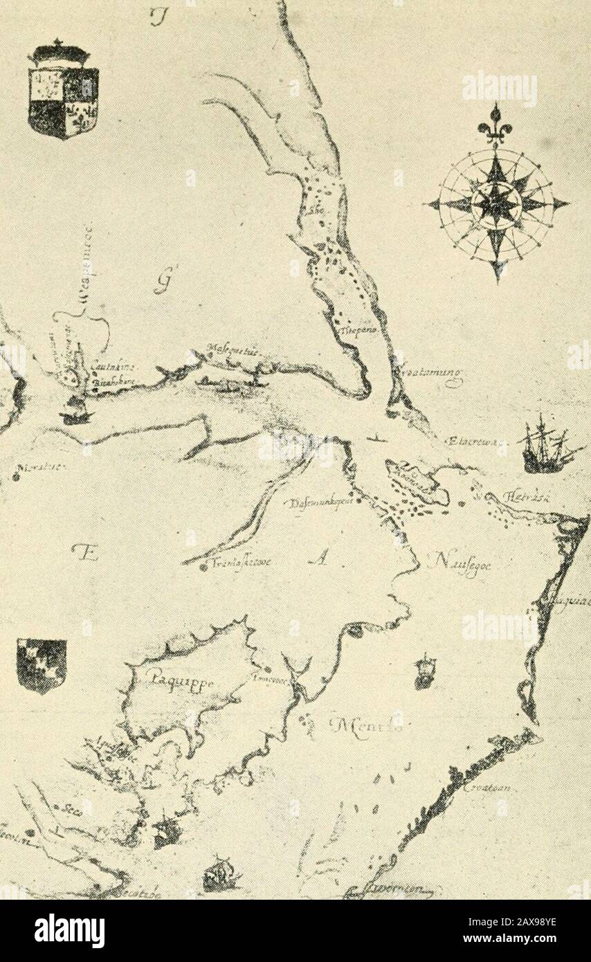 The coming of the peoples . Copyriahl 1921 by Ticenfy-Jivc Bt-oadicay Corp. SEBASTIAN CABOT SETTING OUT FROM ENGLAND TO CROSS THE ATLANTIC. X tji- JOHN WHITE S MAP OF VIRGINIA This map made by John White, Governor of Sir Walter Raleighs second colonyon Roanoke Island, is the first known map of the Virginia coast. The originalmade in 1585, is now in the British Museum. PERILOUS BEGINNINGS 23 the home-land. Yet Elizabeth was willing to lether people go. The reason was a queer one. It lay in the oneword—Sheep! During the fourteenth century, the wool tradeof England had grown enormous. One of thec Stock Photohttps://www.alamy.com/image-license-details/?v=1https://www.alamy.com/the-coming-of-the-peoples-copyriahl-1921-by-ticenfy-jivc-bt-oadicay-corp-sebastian-cabot-setting-out-from-england-to-cross-the-atlantic-x-tji-john-white-s-map-of-virginia-this-map-made-by-john-white-governor-of-sir-walter-raleighs-second-colonyon-roanoke-island-is-the-first-known-map-of-the-virginia-coast-the-originalmade-in-1585-is-now-in-the-british-museum-perilous-beginnings-23-the-home-land-yet-elizabeth-was-willing-to-lether-people-go-the-reason-was-a-queer-one-it-lay-in-the-onewordsheep!-during-the-fourteenth-century-the-wool-tradeof-england-had-grown-enormous-one-of-thec-image343182658.html
RM2AX98YE–The coming of the peoples . Copyriahl 1921 by Ticenfy-Jivc Bt-oadicay Corp. SEBASTIAN CABOT SETTING OUT FROM ENGLAND TO CROSS THE ATLANTIC. X tji- JOHN WHITE S MAP OF VIRGINIA This map made by John White, Governor of Sir Walter Raleighs second colonyon Roanoke Island, is the first known map of the Virginia coast. The originalmade in 1585, is now in the British Museum. PERILOUS BEGINNINGS 23 the home-land. Yet Elizabeth was willing to lether people go. The reason was a queer one. It lay in the oneword—Sheep! During the fourteenth century, the wool tradeof England had grown enormous. One of thec
 USGS TOPO Map Arkansas AR Cabot 258098 1954 24000 Inverted Restoration Stock Photohttps://www.alamy.com/image-license-details/?v=1https://www.alamy.com/usgs-topo-map-arkansas-ar-cabot-258098-1954-24000-inverted-restoration-image242838106.html
RMT326DE–USGS TOPO Map Arkansas AR Cabot 258098 1954 24000 Inverted Restoration
![Image taken from page 246 of 'The Story of the Revolution. [With illustrations.]' Image taken from page 246 of 'The Story of the Stock Photo Image taken from page 246 of 'The Story of the Revolution. [With illustrations.]' Image taken from page 246 of 'The Story of the Stock Photo](https://c8.alamy.com/comp/HBP3D3/image-taken-from-page-246-of-the-story-of-the-revolution-with-illustrations-HBP3D3.jpg) Image taken from page 246 of 'The Story of the Revolution. [With illustrations.]' Image taken from page 246 of 'The Story of the Stock Photohttps://www.alamy.com/image-license-details/?v=1https://www.alamy.com/stock-photo-image-taken-from-page-246-of-the-story-of-the-revolution-with-illustrations-127719455.html
Image taken from page 246 of 'The Story of the Revolution. [With illustrations.]' Image taken from page 246 of 'The Story of the Stock Photohttps://www.alamy.com/image-license-details/?v=1https://www.alamy.com/stock-photo-image-taken-from-page-246-of-the-story-of-the-revolution-with-illustrations-127719455.htmlRMHBP3D3–Image taken from page 246 of 'The Story of the Revolution. [With illustrations.]' Image taken from page 246 of 'The Story of the
 USGS Topo Map Vermont VT Cabot 337356 1986 24000 Inverted Restoration Stock Photohttps://www.alamy.com/image-license-details/?v=1https://www.alamy.com/usgs-topo-map-vermont-vt-cabot-337356-1986-24000-inverted-restoration-image265131163.html
RMWB9NE3–USGS Topo Map Vermont VT Cabot 337356 1986 24000 Inverted Restoration
 Cabot Perry - Alicia de Blanco Stock Photohttps://www.alamy.com/image-license-details/?v=1https://www.alamy.com/stock-photo-cabot-perry-alicia-de-blanco-139543786.html
RMJ30NEJ–Cabot Perry - Alicia de Blanco
 Dry Dock Number 4, Monthly Progress Photo, Monthly Progress Map, Holbrook, Cabot and Rollins Corporation, Contractor. Glass Plate Negatives of the Construction and Repair of Buildings, Facilities, and Vessels at the New York Navy Yard. Stock Photohttps://www.alamy.com/image-license-details/?v=1https://www.alamy.com/dry-dock-number-4-monthly-progress-photo-monthly-progress-map-holbrook-cabot-and-rollins-corporation-contractor-glass-plate-negatives-of-the-construction-and-repair-of-buildings-facilities-and-vessels-at-the-new-york-navy-yard-image556371878.html
RM2R94X06–Dry Dock Number 4, Monthly Progress Photo, Monthly Progress Map, Holbrook, Cabot and Rollins Corporation, Contractor. Glass Plate Negatives of the Construction and Repair of Buildings, Facilities, and Vessels at the New York Navy Yard.
 Cabot Circus, City of Bristol, GB, United Kingdom, England, N 51 27' 30'', S 2 35' 6'', map, Cartascapes Map published in 2024. Explore Cartascapes, a map revealing Earth's diverse landscapes, cultures, and ecosystems. Journey through time and space, discovering the interconnectedness of our planet's past, present, and future. Stock Photohttps://www.alamy.com/image-license-details/?v=1https://www.alamy.com/cabot-circus-city-of-bristol-gb-united-kingdom-england-n-51-27-30-s-2-35-6-map-cartascapes-map-published-in-2024-explore-cartascapes-a-map-revealing-earths-diverse-landscapes-cultures-and-ecosystems-journey-through-time-and-space-discovering-the-interconnectedness-of-our-planets-past-present-and-future-image604213442.html
RM2X308BE–Cabot Circus, City of Bristol, GB, United Kingdom, England, N 51 27' 30'', S 2 35' 6'', map, Cartascapes Map published in 2024. Explore Cartascapes, a map revealing Earth's diverse landscapes, cultures, and ecosystems. Journey through time and space, discovering the interconnectedness of our planet's past, present, and future.
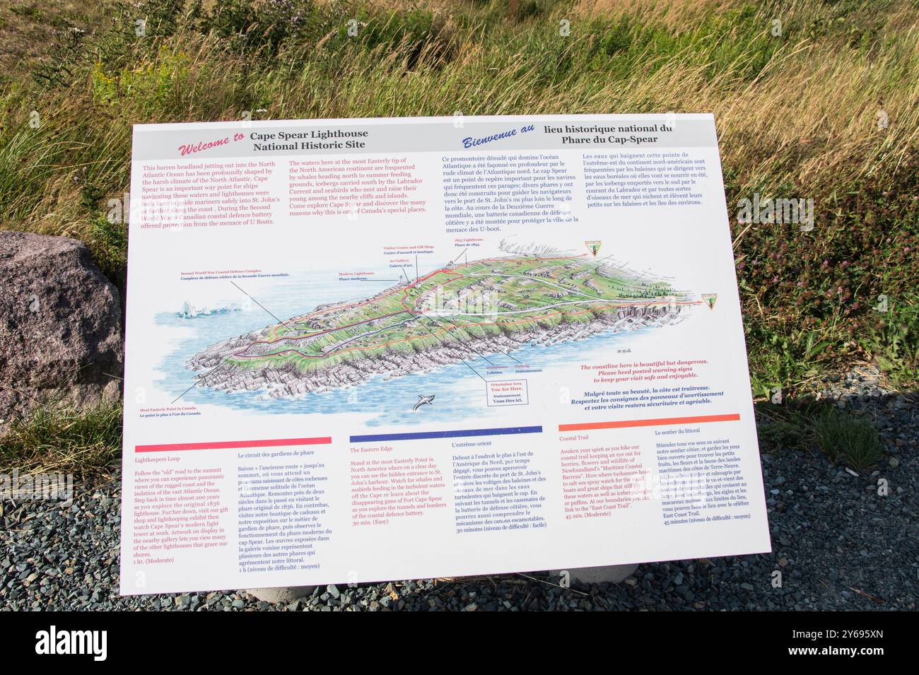 Welcome information sign at Cape Spear Lighthouse National Historic Site in St. John's, Newfoundland & Labrador, Canada Stock Photohttps://www.alamy.com/image-license-details/?v=1https://www.alamy.com/welcome-information-sign-at-cape-spear-lighthouse-national-historic-site-in-st-johns-newfoundland-labrador-canada-image623463421.html
RF2Y695XN–Welcome information sign at Cape Spear Lighthouse National Historic Site in St. John's, Newfoundland & Labrador, Canada
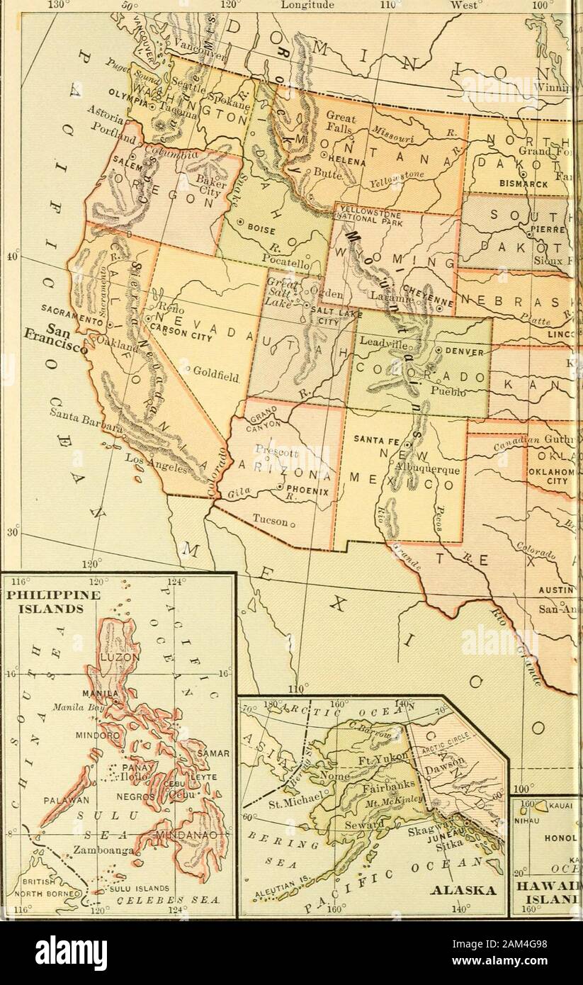 History of the United States . illiam Gilmore Simms 382 MAPS PAGE Map Showing First Voyage of Columbus and the Voyages of Cabot 3 Map Showing De Sotos Route Westward 6 New England and New Netherland 35 The Middle Colonies 41 Map Showing French, Spanish and English Claims Prior to Overthrow of the French 66 Map of the French and Indian Campaigns 71 English Territory after the French and Indian Wars 79 Boston and Vicinity 110 The New Jersey Campaign 120 Burgoynes Route 123 War Map of the South during the Revolution 133 Map Showing State Claims to Western Territory 149 New Orleans and the Creek W Stock Photohttps://www.alamy.com/image-license-details/?v=1https://www.alamy.com/history-of-the-united-states-illiam-gilmore-simms-382-maps-page-map-showing-first-voyage-of-columbus-and-the-voyages-of-cabot-3-map-showing-de-sotos-route-westward-6-new-england-and-new-netherland-35-the-middle-colonies-41-map-showing-french-spanish-and-english-claims-prior-to-overthrow-of-the-french-66-map-of-the-french-and-indian-campaigns-71-english-territory-after-the-french-and-indian-wars-79-boston-and-vicinity-110-the-new-jersey-campaign-120-burgoynes-route-123-war-map-of-the-south-during-the-revolution-133-map-showing-state-claims-to-western-territory-149-new-orleans-and-the-creek-w-image339390724.html
RM2AM4G98–History of the United States . illiam Gilmore Simms 382 MAPS PAGE Map Showing First Voyage of Columbus and the Voyages of Cabot 3 Map Showing De Sotos Route Westward 6 New England and New Netherland 35 The Middle Colonies 41 Map Showing French, Spanish and English Claims Prior to Overthrow of the French 66 Map of the French and Indian Campaigns 71 English Territory after the French and Indian Wars 79 Boston and Vicinity 110 The New Jersey Campaign 120 Burgoynes Route 123 War Map of the South during the Revolution 133 Map Showing State Claims to Western Territory 149 New Orleans and the Creek W
 Deadmans Bay Path sign at Fort Amherst in St. John's, Newfoundland & Labrador, Canada Stock Photohttps://www.alamy.com/image-license-details/?v=1https://www.alamy.com/deadmans-bay-path-sign-at-fort-amherst-in-st-johns-newfoundland-labrador-canada-image568374538.html
RF2T0KKEJ–Deadmans Bay Path sign at Fort Amherst in St. John's, Newfoundland & Labrador, Canada
![Image taken from page 342 of 'The Story of the Revolution. [With illustrations.]' Image taken from page 342 of 'The Story of the Stock Photo Image taken from page 342 of 'The Story of the Revolution. [With illustrations.]' Image taken from page 342 of 'The Story of the Stock Photo](https://c8.alamy.com/comp/HC34YC/image-taken-from-page-342-of-the-story-of-the-revolution-with-illustrations-HC34YC.jpg) Image taken from page 342 of 'The Story of the Revolution. [With illustrations.]' Image taken from page 342 of 'The Story of the Stock Photohttps://www.alamy.com/image-license-details/?v=1https://www.alamy.com/stock-photo-image-taken-from-page-342-of-the-story-of-the-revolution-with-illustrations-127918208.html
Image taken from page 342 of 'The Story of the Revolution. [With illustrations.]' Image taken from page 342 of 'The Story of the Stock Photohttps://www.alamy.com/image-license-details/?v=1https://www.alamy.com/stock-photo-image-taken-from-page-342-of-the-story-of-the-revolution-with-illustrations-127918208.htmlRMHC34YC–Image taken from page 342 of 'The Story of the Revolution. [With illustrations.]' Image taken from page 342 of 'The Story of the
 USGS Topo Map Vermont VT Cabot 337355 1986 24000 Inverted Restoration Stock Photohttps://www.alamy.com/image-license-details/?v=1https://www.alamy.com/usgs-topo-map-vermont-vt-cabot-337355-1986-24000-inverted-restoration-image265131132.html
RMWB9ND0–USGS Topo Map Vermont VT Cabot 337355 1986 24000 Inverted Restoration
 American Revolutionary War Era Maps 1750-1786 911 The Above is a plan of the town of Cabot State of Vermont Rebuild and Repair Stock Photohttps://www.alamy.com/image-license-details/?v=1https://www.alamy.com/american-revolutionary-war-era-maps-1750-1786-911-the-above-is-a-plan-of-the-town-of-cabot-state-of-vermont-rebuild-and-repair-image261969975.html
RMW65NAF–American Revolutionary War Era Maps 1750-1786 911 The Above is a plan of the town of Cabot State of Vermont Rebuild and Repair
 Sans Cabot Lutero Infierno de Quevedo Stock Photohttps://www.alamy.com/image-license-details/?v=1https://www.alamy.com/stock-photo-sans-cabot-lutero-infierno-de-quevedo-140504284.html
RMJ4GEJ4–Sans Cabot Lutero Infierno de Quevedo
 Dry Dock Number 4, Monthly Progress Photo, Progress Map for November, The Holbrook Cabot and Rollins Corporation Contractor. Glass Plate Negatives of the Construction and Repair of Buildings, Facilities, and Vessels at the New York Navy Yard. Stock Photohttps://www.alamy.com/image-license-details/?v=1https://www.alamy.com/dry-dock-number-4-monthly-progress-photo-progress-map-for-november-the-holbrook-cabot-and-rollins-corporation-contractor-glass-plate-negatives-of-the-construction-and-repair-of-buildings-facilities-and-vessels-at-the-new-york-navy-yard-image556370932.html
RM2R94TPC–Dry Dock Number 4, Monthly Progress Photo, Progress Map for November, The Holbrook Cabot and Rollins Corporation Contractor. Glass Plate Negatives of the Construction and Repair of Buildings, Facilities, and Vessels at the New York Navy Yard.
 South Cabot, Washington County, US, United States, Vermont, N 44 22' 3'', S 72 16' 32'', map, Cartascapes Map published in 2024. Explore Cartascapes, a map revealing Earth's diverse landscapes, cultures, and ecosystems. Journey through time and space, discovering the interconnectedness of our planet's past, present, and future. Stock Photohttps://www.alamy.com/image-license-details/?v=1https://www.alamy.com/south-cabot-washington-county-us-united-states-vermont-n-44-22-3-s-72-16-32-map-cartascapes-map-published-in-2024-explore-cartascapes-a-map-revealing-earths-diverse-landscapes-cultures-and-ecosystems-journey-through-time-and-space-discovering-the-interconnectedness-of-our-planets-past-present-and-future-image620855707.html
RM2Y22BP3–South Cabot, Washington County, US, United States, Vermont, N 44 22' 3'', S 72 16' 32'', map, Cartascapes Map published in 2024. Explore Cartascapes, a map revealing Earth's diverse landscapes, cultures, and ecosystems. Journey through time and space, discovering the interconnectedness of our planet's past, present, and future.
 . A larger history of the United States of America, to the close of President Jackson's administration . ribehim as a native of Bristol.He received a patent fromthe King in 1496—he andhis father and brothers—to make discoveries; butthe only engraved mapbearing his name claimsthat he had already foundNorth America two yearsbefore that date. JohnCabot, a Venetian, andSebastian Cabot, his son,discovered this region, for-merly unknown, in theyear 1494, on the 24thday of June, at the fifthhour. This date appears both in the Latin and Spanish inscriptions on the uniquecopy of this map in the Nationa Stock Photohttps://www.alamy.com/image-license-details/?v=1https://www.alamy.com/a-larger-history-of-the-united-states-of-america-to-the-close-of-president-jacksons-administration-ribehim-as-a-native-of-bristolhe-received-a-patent-fromthe-king-in-1496he-andhis-father-and-brothersto-make-discoveries-butthe-only-engraved-mapbearing-his-name-claimsthat-he-had-already-foundnorth-america-two-yearsbefore-that-date-johncabot-a-venetian-andsebastian-cabot-his-sondiscovered-this-region-for-merly-unknown-in-theyear-1494-on-the-24thday-of-june-at-the-fifthhour-this-date-appears-both-in-the-latin-and-spanish-inscriptions-on-the-uniquecopy-of-this-map-in-the-nationa-image370147522.html
RM2CE5JXA–. A larger history of the United States of America, to the close of President Jackson's administration . ribehim as a native of Bristol.He received a patent fromthe King in 1496—he andhis father and brothers—to make discoveries; butthe only engraved mapbearing his name claimsthat he had already foundNorth America two yearsbefore that date. JohnCabot, a Venetian, andSebastian Cabot, his son,discovered this region, for-merly unknown, in theyear 1494, on the 24thday of June, at the fifthhour. This date appears both in the Latin and Spanish inscriptions on the uniquecopy of this map in the Nationa
 Cuckold's Cove sign in St. John's, Newfoundland & Labrador, Canada Stock Photohttps://www.alamy.com/image-license-details/?v=1https://www.alamy.com/cuckolds-cove-sign-in-st-johns-newfoundland-labrador-canada-image568374404.html
RF2T0KK9T–Cuckold's Cove sign in St. John's, Newfoundland & Labrador, Canada
 Image taken from page 289 of 'Hero Tales from American History' Image taken from page 289 of 'Hero Tales from American Stock Photohttps://www.alamy.com/image-license-details/?v=1https://www.alamy.com/stock-photo-image-taken-from-page-289-of-hero-tales-from-american-history-image-127844597.html
RMHBYR2D–Image taken from page 289 of 'Hero Tales from American History' Image taken from page 289 of 'Hero Tales from American
 American Revolutionary War Era Maps 1750-1786 913 The Above is a plan of the town of Cabot State of Vermont Inverted Rebuild and Repair Stock Photohttps://www.alamy.com/image-license-details/?v=1https://www.alamy.com/american-revolutionary-war-era-maps-1750-1786-913-the-above-is-a-plan-of-the-town-of-cabot-state-of-vermont-inverted-rebuild-and-repair-image261970166.html
RMW65NHA–American Revolutionary War Era Maps 1750-1786 913 The Above is a plan of the town of Cabot State of Vermont Inverted Rebuild and Repair
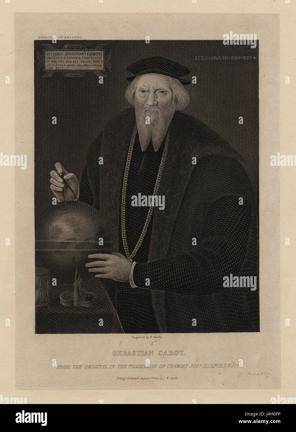 Sebastian Cabot (NYPL NYPG94 F42 419819) Stock Photohttps://www.alamy.com/image-license-details/?v=1https://www.alamy.com/stock-photo-sebastian-cabot-nypl-nypg94-f42-419819-140515194.html
RMJ4H0FP–Sebastian Cabot (NYPL NYPG94 F42 419819)
 Dry Dock Number 4, Monthly Progress Photo, Progress Map for December, Holbrook, Cabot, and Rollins Corporation, Contractor. Glass Plate Negatives of the Construction and Repair of Buildings, Facilities, and Vessels at the New York Navy Yard. Stock Photohttps://www.alamy.com/image-license-details/?v=1https://www.alamy.com/dry-dock-number-4-monthly-progress-photo-progress-map-for-december-holbrook-cabot-and-rollins-corporation-contractor-glass-plate-negatives-of-the-construction-and-repair-of-buildings-facilities-and-vessels-at-the-new-york-navy-yard-image556370909.html
RM2R94TNH–Dry Dock Number 4, Monthly Progress Photo, Progress Map for December, Holbrook, Cabot, and Rollins Corporation, Contractor. Glass Plate Negatives of the Construction and Repair of Buildings, Facilities, and Vessels at the New York Navy Yard.
 Cabot Community Mental Health Team, City of Bristol, GB, United Kingdom, England, N 51 28' 12'', S 2 36' 48'', map, Cartascapes Map published in 2024. Explore Cartascapes, a map revealing Earth's diverse landscapes, cultures, and ecosystems. Journey through time and space, discovering the interconnectedness of our planet's past, present, and future. Stock Photohttps://www.alamy.com/image-license-details/?v=1https://www.alamy.com/cabot-community-mental-health-team-city-of-bristol-gb-united-kingdom-england-n-51-28-12-s-2-36-48-map-cartascapes-map-published-in-2024-explore-cartascapes-a-map-revealing-earths-diverse-landscapes-cultures-and-ecosystems-journey-through-time-and-space-discovering-the-interconnectedness-of-our-planets-past-present-and-future-image604194542.html
RM2X2YC8E–Cabot Community Mental Health Team, City of Bristol, GB, United Kingdom, England, N 51 28' 12'', S 2 36' 48'', map, Cartascapes Map published in 2024. Explore Cartascapes, a map revealing Earth's diverse landscapes, cultures, and ecosystems. Journey through time and space, discovering the interconnectedness of our planet's past, present, and future.
 . A memoir of Jacques Cartier, sieur de Limoilou : his voyages to the St. Lawrence. A bibliography and a facsimile of the manuscript of 1534, with annotations, etc.. La Cosa—a.d. 1500 Don Pedro de Ayala, the Spanish ambassador to thecourt of Henry VII, sent to the Spanish king a map ofthe first voyage of Cabot in 1497, and there is little ^ Fide Decouverte et Evolution Cartographique, etc., Harrisse, Paris, 1900, pp. XXV, 86, 135, 218. 62 MEMOIR OF JACQUES CARTIER doubt that it was followed by a map of the second voy-age. The knowledge thus obtained resulted in thefamous planisphere of Juan de Stock Photohttps://www.alamy.com/image-license-details/?v=1https://www.alamy.com/a-memoir-of-jacques-cartier-sieur-de-limoilou-his-voyages-to-the-st-lawrence-a-bibliography-and-a-facsimile-of-the-manuscript-of-1534-with-annotations-etc-la-cosaad-1500-don-pedro-de-ayala-the-spanish-ambassador-to-thecourt-of-henry-vii-sent-to-the-spanish-king-a-map-ofthe-first-voyage-of-cabot-in-1497-and-there-is-little-fide-decouverte-et-evolution-cartographique-etc-harrisse-paris-1900-pp-xxv-86-135-218-62-memoir-of-jacques-cartier-doubt-that-it-was-followed-by-a-map-of-the-second-voy-age-the-knowledge-thus-obtained-resulted-in-thefamous-planisphere-of-juan-de-image370307542.html
RM2CECY1A–. A memoir of Jacques Cartier, sieur de Limoilou : his voyages to the St. Lawrence. A bibliography and a facsimile of the manuscript of 1534, with annotations, etc.. La Cosa—a.d. 1500 Don Pedro de Ayala, the Spanish ambassador to thecourt of Henry VII, sent to the Spanish king a map ofthe first voyage of Cabot in 1497, and there is little ^ Fide Decouverte et Evolution Cartographique, etc., Harrisse, Paris, 1900, pp. XXV, 86, 135, 218. 62 MEMOIR OF JACQUES CARTIER doubt that it was followed by a map of the second voy-age. The knowledge thus obtained resulted in thefamous planisphere of Juan de
 Image taken from page 234 of 'The Romance of Spanish History ... With illustrations' Image taken from page 234 of 'The Romance of Spanish Stock Photohttps://www.alamy.com/image-license-details/?v=1https://www.alamy.com/stock-photo-image-taken-from-page-234-of-the-romance-of-spanish-history-with-illustrations-127773143.html
RMHBTFXF–Image taken from page 234 of 'The Romance of Spanish History ... With illustrations' Image taken from page 234 of 'The Romance of Spanish
 Lilla Cabot Perry Lady With Bowl of VIolets 1910 Stock Photohttps://www.alamy.com/image-license-details/?v=1https://www.alamy.com/stock-photo-lilla-cabot-perry-lady-with-bowl-of-violets-1910-140473537.html
RMJ4F3C1–Lilla Cabot Perry Lady With Bowl of VIolets 1910
 Dry Dock Number 4, Monthly Progress Photo, Monthly Progress Map for May, Holbrook, Cabot and Rollins Corporation, Contractor. Glass Plate Negatives of the Construction and Repair of Buildings, Facilities, and Vessels at the New York Navy Yard. Stock Photohttps://www.alamy.com/image-license-details/?v=1https://www.alamy.com/dry-dock-number-4-monthly-progress-photo-monthly-progress-map-for-may-holbrook-cabot-and-rollins-corporation-contractor-glass-plate-negatives-of-the-construction-and-repair-of-buildings-facilities-and-vessels-at-the-new-york-navy-yard-image556371922.html
RM2R94X1P–Dry Dock Number 4, Monthly Progress Photo, Monthly Progress Map for May, Holbrook, Cabot and Rollins Corporation, Contractor. Glass Plate Negatives of the Construction and Repair of Buildings, Facilities, and Vessels at the New York Navy Yard.
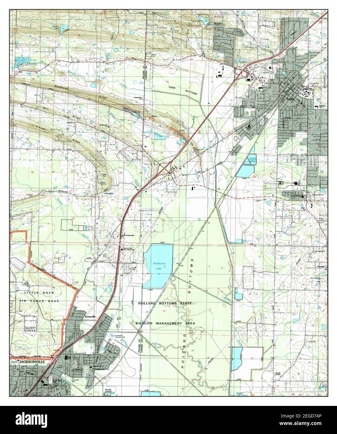 Cabot, Arkansas, map 1994, 1:24000, United States of America by Timeless Maps, data U.S. Geological Survey Stock Photohttps://www.alamy.com/image-license-details/?v=1https://www.alamy.com/cabot-arkansas-map-1994-124000-united-states-of-america-by-timeless-maps-data-us-geological-survey-image405963958.html
RM2EGD74P–Cabot, Arkansas, map 1994, 1:24000, United States of America by Timeless Maps, data U.S. Geological Survey
![. The northern coasts of America and the Hudson's Bay territories [microform]. Cabot, Sebastian, 1476?-1557; Cabot, Sebastian, 1476?-1557; Natural history; Sciences naturelles. 15G NEW TRIBE OF INDIANS. [1789.. having fallen in with one of these strangers, by a bribe of some beads prevailed upon him to delineate the circum- jacent country and the course of the unknown river upon the sand. The map proved a very rude production. He traced out a long point of land between the rivers without paying the least attention to the courses. This isthmus he represented as running into the great lake, at t Stock Photo . The northern coasts of America and the Hudson's Bay territories [microform]. Cabot, Sebastian, 1476?-1557; Cabot, Sebastian, 1476?-1557; Natural history; Sciences naturelles. 15G NEW TRIBE OF INDIANS. [1789.. having fallen in with one of these strangers, by a bribe of some beads prevailed upon him to delineate the circum- jacent country and the course of the unknown river upon the sand. The map proved a very rude production. He traced out a long point of land between the rivers without paying the least attention to the courses. This isthmus he represented as running into the great lake, at t Stock Photo](https://c8.alamy.com/comp/RERYEW/the-northern-coasts-of-america-and-the-hudsons-bay-territories-microform-cabot-sebastian-1476-1557-cabot-sebastian-1476-1557-natural-history-sciences-naturelles-15g-new-tribe-of-indians-1789-having-fallen-in-with-one-of-these-strangers-by-a-bribe-of-some-beads-prevailed-upon-him-to-delineate-the-circum-jacent-country-and-the-course-of-the-unknown-river-upon-the-sand-the-map-proved-a-very-rude-production-he-traced-out-a-long-point-of-land-between-the-rivers-without-paying-the-least-attention-to-the-courses-this-isthmus-he-represented-as-running-into-the-great-lake-at-t-RERYEW.jpg) . The northern coasts of America and the Hudson's Bay territories [microform]. Cabot, Sebastian, 1476?-1557; Cabot, Sebastian, 1476?-1557; Natural history; Sciences naturelles. 15G NEW TRIBE OF INDIANS. [1789.. having fallen in with one of these strangers, by a bribe of some beads prevailed upon him to delineate the circum- jacent country and the course of the unknown river upon the sand. The map proved a very rude production. He traced out a long point of land between the rivers without paying the least attention to the courses. This isthmus he represented as running into the great lake, at t Stock Photohttps://www.alamy.com/image-license-details/?v=1https://www.alamy.com/the-northern-coasts-of-america-and-the-hudsons-bay-territories-microform-cabot-sebastian-1476-1557-cabot-sebastian-1476-1557-natural-history-sciences-naturelles-15g-new-tribe-of-indians-1789-having-fallen-in-with-one-of-these-strangers-by-a-bribe-of-some-beads-prevailed-upon-him-to-delineate-the-circum-jacent-country-and-the-course-of-the-unknown-river-upon-the-sand-the-map-proved-a-very-rude-production-he-traced-out-a-long-point-of-land-between-the-rivers-without-paying-the-least-attention-to-the-courses-this-isthmus-he-represented-as-running-into-the-great-lake-at-t-image232866449.html
. The northern coasts of America and the Hudson's Bay territories [microform]. Cabot, Sebastian, 1476?-1557; Cabot, Sebastian, 1476?-1557; Natural history; Sciences naturelles. 15G NEW TRIBE OF INDIANS. [1789.. having fallen in with one of these strangers, by a bribe of some beads prevailed upon him to delineate the circum- jacent country and the course of the unknown river upon the sand. The map proved a very rude production. He traced out a long point of land between the rivers without paying the least attention to the courses. This isthmus he represented as running into the great lake, at t Stock Photohttps://www.alamy.com/image-license-details/?v=1https://www.alamy.com/the-northern-coasts-of-america-and-the-hudsons-bay-territories-microform-cabot-sebastian-1476-1557-cabot-sebastian-1476-1557-natural-history-sciences-naturelles-15g-new-tribe-of-indians-1789-having-fallen-in-with-one-of-these-strangers-by-a-bribe-of-some-beads-prevailed-upon-him-to-delineate-the-circum-jacent-country-and-the-course-of-the-unknown-river-upon-the-sand-the-map-proved-a-very-rude-production-he-traced-out-a-long-point-of-land-between-the-rivers-without-paying-the-least-attention-to-the-courses-this-isthmus-he-represented-as-running-into-the-great-lake-at-t-image232866449.htmlRMRERYEW–. The northern coasts of America and the Hudson's Bay territories [microform]. Cabot, Sebastian, 1476?-1557; Cabot, Sebastian, 1476?-1557; Natural history; Sciences naturelles. 15G NEW TRIBE OF INDIANS. [1789.. having fallen in with one of these strangers, by a bribe of some beads prevailed upon him to delineate the circum- jacent country and the course of the unknown river upon the sand. The map proved a very rude production. He traced out a long point of land between the rivers without paying the least attention to the courses. This isthmus he represented as running into the great lake, at t